Rs lect 1day_1
19
Dr.-Ing. Görres Grenzdörffer Remote Sensing Remote Sensing Basics 1 Universität Rostock, Professur für Geodäsie und Geoinformatik X 2006 Dr.-Ing. Görres Grenzdörffer Basics and Applications of Remote Sensing Universität Rostock, Professur für Geodäsie und Geoinformatik Schedule Lectures • Remote Sensing Basics (1st Day) • Introduction and history • The EM-spectrum • Reflectance properties of different objects • Spaceborne sensors • Satellite Remote Sensing (1st Day) • Resolution • Examples • SRTM • Change Detection • Airborne Remote Sensing (2nd Day) • (digital) photography • Lidar • Examples • Digital image Processing (2nd Day) • Pixels and mixels • Spectral bands / low level image operations • MS-classification • Object oriented classification
-
Upload
bangalore-techie -
Category
Technology
-
view
187 -
download
0
Transcript of Rs lect 1day_1
Dr.-Ing. Görres Grenzdörffer Remote Sensing
Remote Sensing Basics 1
Universität Rostock, Professur für Geodäsie und Geoinformatik X 2006
Dr.-Ing. Görres Grenzdörffer
Basics and Applications ofRemote SensingBasics and Applications ofRemote Sensing
Universität Rostock, Professur für Geodäsie und Geoinformatik
Schedule Lectures
• Remote Sensing Basics (1st Day)• Introduction and history• The EM-spectrum• Reflectance properties of different objects• Spaceborne sensors
• Satellite Remote Sensing (1st Day)• Resolution• Examples• SRTM• Change Detection
• Airborne Remote Sensing (2nd Day)• (digital) photography• Lidar• Examples
• Digital image Processing (2nd Day)• Pixels and mixels• Spectral bands / low level image operations• MS-classification• Object oriented classification
Dr.-Ing. Görres Grenzdörffer Remote Sensing
Remote Sensing Basics 2
Universität Rostock, Professur für Geodäsie und Geoinformatik
Schedule Exercises
• How to obtain satellite data via internet ? (1st Day)• Google Earth / Virtual Earth• Earthview• GLCF• Digital Globe / Space Imaging
• Change detection Satellite Remote Sensing data (1st Day)• Histogram manipulations and visual image analysis
• Exercise with ArcView 3.x (2nd Day)• Unsupervised and supervised classification of a satellite scene
Universität Rostock, Professur für Geodäsie und Geoinformatik
Content – Remote Sensing Basics
• Introduction, Definitions, History• What is Remote Sensing?, history
• Physical basics• Light, atmosphere and reflection properties of the earth surface
• Sensor systems• Earth observation satellite systems, availability, prices
• Remote sensing applications• Examples
• Basics of digital image processing / image analysis• filtering, radiometric and geometric image enhancements,
multispectral classification

Dr.-Ing. Görres Grenzdörffer Remote Sensing
Remote Sensing Basics 3
Universität Rostock, Professur für Geodäsie und Geoinformatik
Literature – selected textbooks
• Lillesand, T. M., Kiefer, R. W., Chipman, J. (2005): Remote Sensing and Image Interpretation.-5. ed.: 750 p.; John Wiley & Sons, NewYork
• Campell, J.B. (2007): Introduction to Remote Sensing.- 4Rev Ed., 546 p.; New York, London
• Jensen, J.R. (2004) Introductory Digital Image Processing, 3rd. Ed., 533 p. (Prentice Hall Series in Geographic Information Science) (Hardcover)
Universität Rostock, Professur für Geodäsie und Geoinformatik
Remote Sensing tutorials in the internet
• NASA - The remote Sensing tutorial by Dr. N.M. Short• http://rst.gsfc.nasa.gov/
• The Journalists' Guide to Remote Sensing Resources on the Internet Version 2.2• http://www.american.edu/radiowave/
• The European Earth Observation Web Site for Secondary Schools • http://www.eduspace.eurisy.org/
• Radar Remote Sensing (Epsilon nought)• http://www.epsilon.nought.de/
Dr.-Ing. Görres Grenzdörffer Remote Sensing
Remote Sensing Basics 4
Universität Rostock, Professur für Geodäsie und Geoinformatik
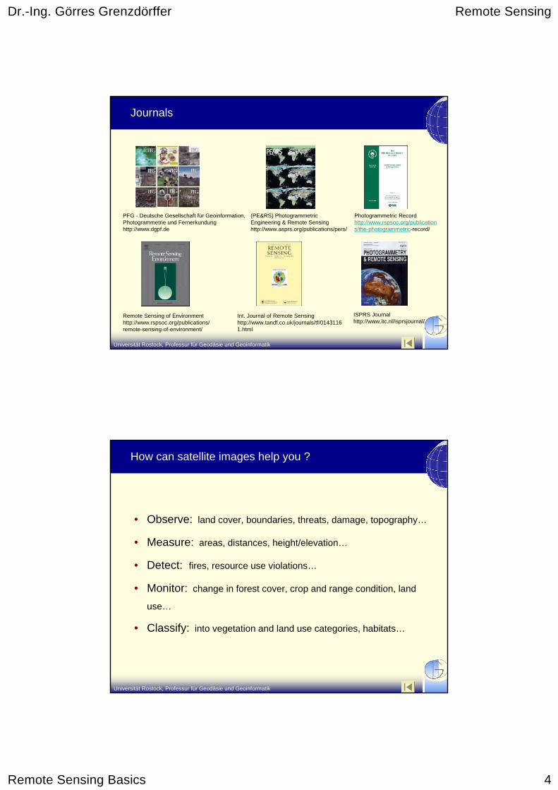
Journals
PFG - Deutsche Gesellschaft für Geoinformation, Photogrammetrie und Fernerkundunghttp://www.dgpf.de
(PE&RS) PhotogrammetricEngineering & Remote Sensinghttp://www.asprs.org/publications/pers/
Photogrammetric Recordhttp://www.rspsoc.org/publications/the-photogrammetric-record/
Remote Sensing of Environmenthttp://www.rspsoc.org/publications/remote-sensing-of-environment/
ISPRS Journalhttp://www.itc.nl/isprsjournal/
Int. Journal of Remote Sensinghttp://www.tandf.co.uk/journals/tf/01431161.html
Universität Rostock, Professur für Geodäsie und Geoinformatik
How can satellite images help you ?
• Observe: land cover, boundaries, threats, damage, topography…
• Measure: areas, distances, height/elevation…
• Detect: fires, resource use violations…
• Monitor: change in forest cover, crop and range condition, land
use…
• Classify: into vegetation and land use categories, habitats…

Dr.-Ing. Görres Grenzdörffer Remote Sensing
Remote Sensing Basics 5
Universität Rostock, Professur für Geodäsie und Geoinformatik
Why is Remote Sensing (RS) so attractive to developing countries ?
• Current Situation: Local and regional authorities commonly have no accurate and up to data spatial data (maps, cadastre etc.), which is also often controlled by the military
• Advances of RS• RS allows for cost efficient unbiased planning information on a
national / regional and local level with current data• RS is efficient in low density populated areas• A cadastre based on RS is much cheaper than terrestrial surveys• With modern data transfer technologies (DSL etc.) the data and
results may transferred faster than via common transportation routes• Problems of RS
• Data availability, skilled personnel, administrative structures …
Universität Rostock, Professur für Geodäsie und Geoinformatik
What is Remote Sensing about ?
Data Capture Data Analysis
Sensorsystems
Data products Interpretation andAnalysis
Informationproducts
User
Referenceinformation
visual
digital
Images
CD, DVD,Tapes
Earth surface
Source of energy
Atmosphere
Physical Basics
14
3
12
Dr.-Ing. Görres Grenzdörffer Remote Sensing
Remote Sensing Basics 6
Universität Rostock, Professur für Geodäsie und Geoinformatik
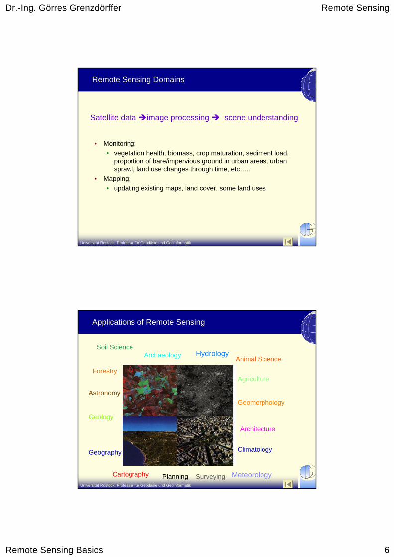
Remote Sensing Domains
• Monitoring:• vegetation health, biomass, crop maturation, sediment load,
proportion of bare/impervious ground in urban areas, urban sprawl, land use changes through time, etc…..
• Mapping:• updating existing maps, land cover, some land uses
Satellite data image processing scene understanding
Universität Rostock, Professur für Geodäsie und Geoinformatik
Applications of Remote Sensing
Hydrology
Meteorology
Climatology
Astronomy
Architecture
SurveyingCartography
Geography
Geology
Geomorphology
Soil Science
ForestryAgriculture
Animal Science
Planning
Archaeology

Dr.-Ing. Görres Grenzdörffer Remote Sensing
Remote Sensing Basics 7
Universität Rostock, Professur für Geodäsie und Geoinformatik
Spatial and temporal resolution of selected applications
There are spatial and temporal resolution considerations that must be made for certain remote sensing applications.
Universität Rostock, Professur für Geodäsie und Geoinformatik
Highlights of Satellite Earth Observation Remote Sensing
• Before 1972 - primarily aerial and satellite photographs
• 1972 - First Landsat satellite launched• 1986 - SPOT satellite launched• 1988 - Indian Remote Sensing Satellite
launched• 1995 - Radarsat launched• 1999 - IKONOS satellite launched and NASA
launched Terra satellite• 2006 – TerraSAR-X and Radarsat 2
launched• Today many new satellite instruments are
being developed and launched

Dr.-Ing. Görres Grenzdörffer Remote Sensing
Remote Sensing Basics 8
Universität Rostock, Professur für Geodäsie und Geoinformatik
Analogue satellite images during the Cold War – Corona Satellites KH 1 – KH 4
1975/12/23 1967/06/11 GSD: 0.6 – 1.2 m GSD: 6 – 10 m
• 880,000 photographic images between 1959 and 1972
• Declassified imagessince 1996
• Not georeferenced• Often with clouds• Complex geometry• Price 30 USD /
scanned Photo
http://edc.usgs.gov/products/satellite/declass1.html
Universität Rostock, Professur für Geodäsie und Geoinformatik
Electro magnetic spectrum
Photographic Images
Multi spectral scanner
Thermal scanner
X-RaysUltra-violett
NearInfrared
middle and far Infrared
Micro-waves
Radio-waves
0.01µm 0.1µm 1µm 10µm 100µm 1 mm 10mm 100mm 1 m
0.5µm 0.6µm 0.7µmVisible light
0.4µmUV IR
Human Eye
blau grün gelb rot
RADAR
1.0µm

Dr.-Ing. Görres Grenzdörffer Remote Sensing
Remote Sensing Basics 9
Universität Rostock, Professur für Geodäsie und Geoinformatik
Active and passive sensor systems
E E S/E
ActiveSystems
Passive Systems
Reflectedsolar radiation
Thermal –radiation
Reflectedartificial radiation
Photography,Multi spectralscanner
Thermal scanner RADAR, LIDAR
Universität Rostock, Professur für Geodäsie und Geoinformatik
Reflection-, scattering and absorption processes in the atmosphere and at the earth surface
Solar radiation
Scattering in theAtmosphereby aerosols
Absorption byH20, C02 and O 3
Diffuse sky radiation
Satellite sensor
Airborne-sensor
Emission from clouds, H20, C02, trace gases
Scattering in theAtmosphereby aerosols
Absorption and Emission (Heat)
diffusereflection
mirrorreflection Emission
Reflection at clouds
Heat
Atmosphere
Earth surface
Outer space

Dr.-Ing. Görres Grenzdörffer Remote Sensing
Remote Sensing Basics 10
Universität Rostock, Professur für Geodäsie und Geoinformatik
Solar energy and absorption bands of the earth atmosphere
Atmospheric windows are very important,because they define the available spectraldomains of passive optical remote sensingsensors
Solar radiation outside the atmosphere
Radiation of a black body at 5900° K
Solar radiation at sea level
Kronberg, 1984
Universität Rostock, Professur für Geodäsie und Geoinformatik
Haze Removal
• Software• ATCOR - Erdas Imagine
• AdvanDayss• Automated process• Better SNR and higher
image quality• Better visual interpretation
• Limitations and Problems• Not based on a physical
model, no radiance units• Results depend upon image
statistics
Landsat ETM, 11.04.2000, Vietnam

Dr.-Ing. Görres Grenzdörffer Remote Sensing
Remote Sensing Basics 11
Universität Rostock, Professur für Geodäsie und Geoinformatik
Original RGB-image
Atmospheric correction - a prerequisite for time series analysis
• Software• Atcor 2 (based on modtran2)
• Advances• haze removal and better SNR• compatible reflectance values to
field measurements• Multitemporal images may be
compared and analyzed correctly
• Limitations and Problems• thresholds in cloudy scenes
(>50 %)• introduction of artifacts in hazy
images• Complex and time consuming
procedure
29.5.2001
Atmospherically corrected image
Universität Rostock, Professur für Geodäsie und Geoinformatik
Atmospheric correction with ATCOR
Reference spectra and measured spectra
Spectral target definition
Definition of atmospheric conditionsand band wise calibration parameters
Dr.-Ing. Görres Grenzdörffer Remote Sensing
Remote Sensing Basics 12
Universität Rostock, Professur für Geodäsie und Geoinformatik
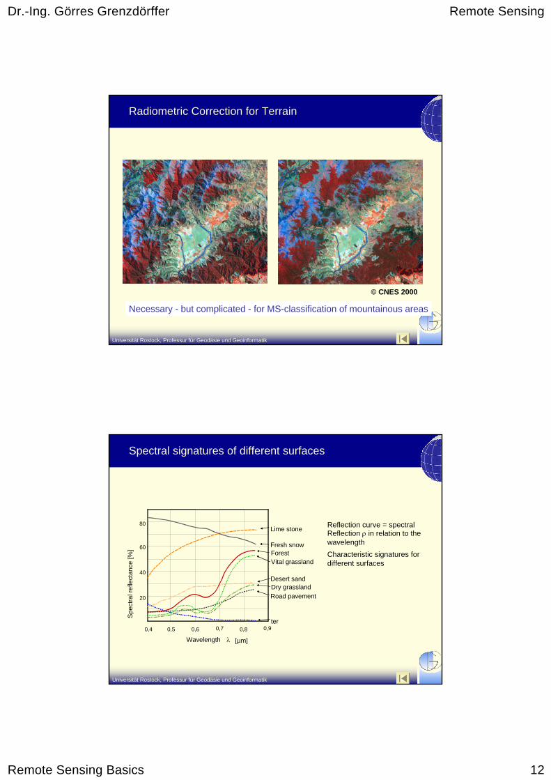
Radiometric Correction for Terrain
© CNES 2000
Necessary - but complicated - for MS-classification of mountainous areas
Universität Rostock, Professur für Geodäsie und Geoinformatik
0,4 0,5 0,6 0,7 0,8 0,9
Wavelength λ [µm]
Spe
ctra
l ref
lect
ance
[%]
20
40
60
80Lime stone
Fresh snowForestVital grassland
Desert sandDry grassland Road pavement
ter
Reflection curve = spectralReflection ρ in relation to thewavelengthCharacteristic signatures fordifferent surfaces
Spectral signatures of different surfaces

Dr.-Ing. Görres Grenzdörffer Remote Sensing
Remote Sensing Basics 13
Universität Rostock, Professur für Geodäsie und Geoinformatik
Spectral signature of a green leaf
0.4 0.6 0.8 1.0 1.2 1.4 1.6 1.8 2.0 2.2 2.4 2.60
10
20
30
40
50
60
Wavelength [µm]
Spectral
Healthy leaf
Unhealthy leaf
ChlorophyllAbsorption Water absorption
Cell structure/Leaf pigments
Reflection [%]
Water contentBoundary reflection
Reflection properties of the leaf • Leaf organs partially transparent• in the visible light chlorophyll absorption (blue, red)• in the infra red spectrum boundary reflection (cell boundaries, hollows)
Universität Rostock, Professur für Geodäsie und Geoinformatik
Wait! – It’s not that easy!
While the general patterns may or may not remain the same, the spectra of features change both over time and over distance
However, we can recognize spectral patterns for vegetated vs. non-vegetated areas, for certain classes of vegetation, and geologic and mineral properties
- depending on the sensor type!

Dr.-Ing. Görres Grenzdörffer Remote Sensing
Remote Sensing Basics 14
Universität Rostock, Professur für Geodäsie und Geoinformatik
Spectral Bands
The satellite sensor acquires the reflection spectra with several images (bands) at once, each recording a specific part of the EM-spectrum. When viewed, each individual band looks like a black and white photograph
Universität Rostock, Professur für Geodäsie und Geoinformatik
Basic characteristics of satellites operating in the optical spectrum
• Satellite orbit characteristics
• Spatial resolution
• Coverage area / swath width
• Spectral resolution
• Radiometric properties
• Pointing
• Revisit period
• Data availability
Dr.-Ing. Görres Grenzdörffer Remote Sensing
Remote Sensing Basics 15
Universität Rostock, Professur für Geodäsie und Geoinformatik
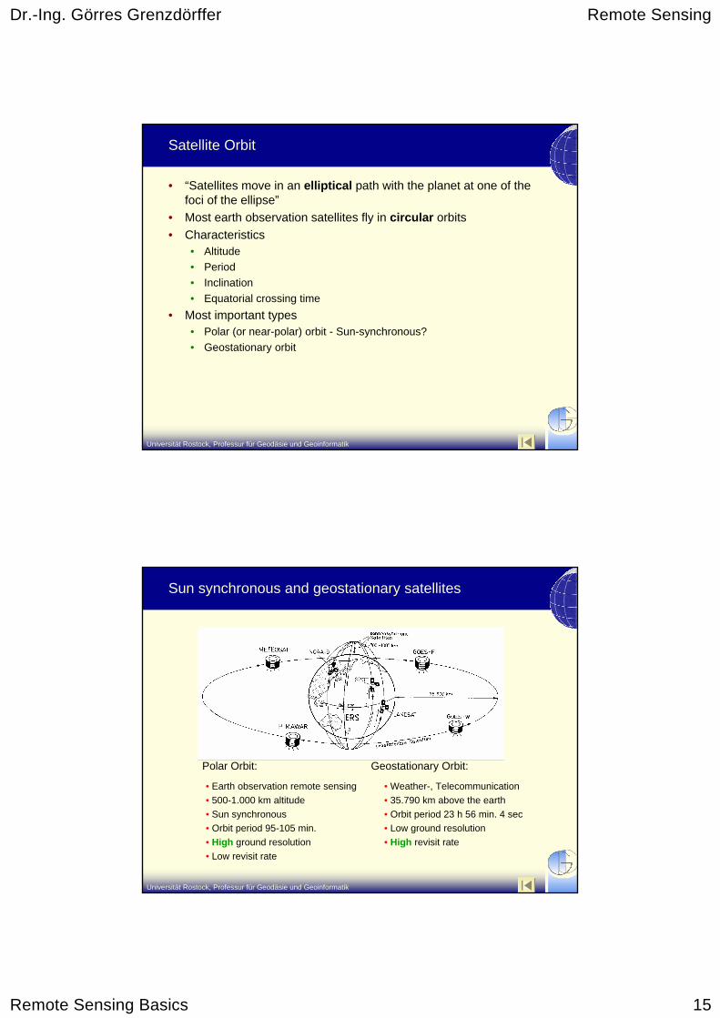
Satellite Orbit
• “Satellites move in an elliptical path with the planet at one of the foci of the ellipse”
• Most earth observation satellites fly in circular orbits • Characteristics
• Altitude• Period• Inclination• Equatorial crossing time
• Most important types• Polar (or near-polar) orbit - Sun-synchronous?• Geostationary orbit
Universität Rostock, Professur für Geodäsie und Geoinformatik
Sun synchronous and geostationary satellites
Polar Orbit:
• Earth observation remote sensing• 500-1.000 km altitude• Sun synchronous• Orbit period 95-105 min.• High ground resolution• Low revisit rate
Geostationary Orbit:
• Weather-, Telecommunication• 35.790 km above the earth• Orbit period 23 h 56 min. 4 sec• Low ground resolution• High revisit rate

Dr.-Ing. Görres Grenzdörffer Remote Sensing
Remote Sensing Basics 16
Universität Rostock, Professur für Geodäsie und Geoinformatik
Sun synchronous satellite orbit of Landsat 7
Sun-synchronous orbit:Satellite always crossed theequator at precisely the samelocal time.
Universität Rostock, Professur für Geodäsie und Geoinformatik
Swath Width and Field of View
185 km
Field of View
175kmscene
LandsatLandsat
Satellite ground tra
ck705km
Spatial Resolution
Pixel size=(30x30m)

Dr.-Ing. Görres Grenzdörffer Remote Sensing
Remote Sensing Basics 17
Universität Rostock, Professur für Geodäsie und Geoinformatik
Definition of highest – high – medium resolution EO satellites
Highest resolution
High resolution Medium resolution
Ground res. < 5 m 5 – 100 m > 100 m – 1.000 m Swath width < 20 km 20 – 200 km 200 – 2000 km Repetition rate* < 100 days 5 – 25 days 1 – 5 days Spectral bands 4 4 – 100 4 – 100 Scanner Pushbroom Pushbroom,
Whiskbroom Whiskbroom
Examples IKONOS, Quickbird, Orbview
3, EROS …
ASTER, SPOT, LAndsat, IRS
MODIS, AVHRR
* without pointing or oblique viewing
Universität Rostock, Professur für Geodäsie und Geoinformatik
Interdependence between spatial and temporal resolution of space imaging
10 m1 m 100 m 1000 m
1 M
o.15
min
1 d
2 W
o.
5000 m
Meteosat
NOAA-AVHRR
Landsat-TM
SPOTIRS-1C
IKONOS
IKONOSIRS - WiFSSPOT
Spatial resolution
Tem
pora
l res
olut
ion
10 m1 m 100 m 1000 m
1 M
o.15
min
1 d
2 W
e.
5000 m
Meteosat
NOAA-AVHRR
Landsat-TM
SPOTIRS-1C
IKONOS
IKONOS(oblique) IRS - WiFSSPOT
(oblique)

Dr.-Ing. Görres Grenzdörffer Remote Sensing
Remote Sensing Basics 18
Universität Rostock, Professur für Geodäsie und Geoinformatik
Spatial coverage of selected satellites – Example North Vietnam
3.000 km
NOAA 17, AVHRR
Landsat 7170 km
Quickbird (16 km)
Hanoi
Universität Rostock, Professur für Geodäsie und Geoinformatik
Ground resolution
Quickbird MS (2.4 m) Landsat ETM (30 m)

Dr.-Ing. Görres Grenzdörffer Remote Sensing
Remote Sensing Basics 19
Universität Rostock, Professur für Geodäsie und Geoinformatik
Continuous global capture of terrestrial environmental parameters by remote sensing
• Conditions• varying properties of
reflection of earth surface
• Clouds• Vegetation parameters, e.g.
• Vegetation and Biomass development
• Absorbed fraction of photosyntheticalactive radiation (FAPAR)
Vegetation indexEurope Juli 2001
ISIS/DLRNOAA-AVHRR9.5.2002 - 12:57 UTC ISIS/DLR
Universität Rostock, Professur für Geodäsie und Geoinformatik
MODIS Vegetation Continuous Fields – Percent tree cover
Description• Proportional estimates of cover are
developed from global training data derived using high-resolution imagery and regression analysis
• life form (proportion of woody vegetation, herbaceous vegetation, or bare ground)
• Leaf type (proportion of woody vegetation that is needleleaf or broadleaf)
• leaf longevity (proportion of woody vegetation that is evergreen or deciduous)
• Percent tree cover, generated from monthly composites of 500 meter resolution surface reflectance 8 day composites MODIS data. Clouds and cloud shadows are removed.
http://glcf.umiacs.umd.edu/data/modis/vcf/description.shtm