rpt - Niagara Region
87
NIAGARA FEASIBILITY PHASE 2 NATURAL AND SOCIAL ENVIRONMENT REPORT File No. 161110576 Prepared for: Regional Municipality of Niagara 3550 Schmon Parkway P.O Box 1042 Thorold ON L2V 4T7 Prepared by: Stantec Consulting Ltd 361 Southgate Drive Guelph ON N1E 5H9 November 2007
Transcript of rpt - Niagara Region
NIAGARA FEASIBILITY PHASE 2 NATURAL AND SOCIAL ENVIRONMENT REPORT
File No. 161110576
Prepared for: Regional Municipality of Niagara 3550 Schmon Parkway P.O Box 1042 Thorold ON L2V 4T7
Prepared by:
Stantec Consulting Ltd 361 Southgate Drive Guelph ON N1E 5H9
November 2007

NIAGARA FEASIBILITY PHASE 2 NATURAL AND SOCIAL ENVIRONMENT REPORT
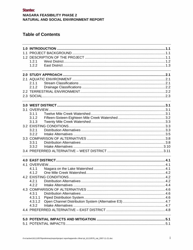
Table of Contents
1.0 INTRODUCTION ................................................................................................................1.1 1.1 PROJECT BACKGROUND ................................................................................................1.1 1.2 DESCRIPTION OF THE PROJECT ...................................................................................1.1
1.2.1 West District.........................................................................................................1.2 1.2.2 East District..........................................................................................................1.3
2.0 STUDY APPROACH ..........................................................................................................2.1 2.1 AQUATIC ENVIRONMENT ................................................................................................2.1
2.1.1 Stream Classifications .........................................................................................2.1 2.1.2 Drainage Classifications ......................................................................................2.2
2.2 TERRESTRIAL ENVIRONMENT........................................................................................2.2 2.3 SOCIAL...............................................................................................................................2.3
3.0 WEST DISTRICT ................................................................................................................3.1 3.1 OVERVIEW.........................................................................................................................3.1
3.1.1 Twelve Mile Creek Watershed .............................................................................3.1 3.1.2 Fifteen-Sixteen-Eighteen Mile Creek Watershed.................................................3.2 3.1.3 Twenty Mile Creek Watershed.............................................................................3.3
3.2 EXISTING CONDITIONS....................................................................................................3.3 3.2.1 Distribution Alternatives .......................................................................................3.3 3.2.2 Intake Alternatives ...............................................................................................3.5
3.3 COMPARISON OF ALTERNATIVES .................................................................................3.8 3.3.1 Distribution Alternatives .......................................................................................3.8 3.3.2 Intake Alternatives .............................................................................................3.10
3.4 PREFERRED ALTERNATIVE – WEST DISTRICT ..........................................................3.11
4.0 EAST DISTRICT.................................................................................................................4.1 4.1 OVERVIEW.........................................................................................................................4.1
4.1.1 Niagara on the Lake Watershed ..........................................................................4.1 4.1.2 One Mile Creek Watershed..................................................................................4.2
4.2 EXISTING CONDITIONS....................................................................................................4.2 4.2.1 Distribution Alternatives .......................................................................................4.2 4.2.2 Intake Alternatives ...............................................................................................4.4
4.3 COMPARISON OF ALTERNATIVES .................................................................................4.6 4.3.1 Distribution Alternatives .......................................................................................4.6 4.3.1.1 Piped Distribution System....................................................................................4.6 4.3.1.2 Open Channel Distribution System (Alternative E3) ............................................4.7 4.3.2 Intake Alternatives ...............................................................................................4.7
4.4 PREFERRED ALTERNATIVE – EAST DISTRICT .............................................................4.8
5.0 POTENTIAL IMPACTS AND MITIGATION .......................................................................5.1 5.1 POTENTIAL IMPACTS.......................................................................................................5.1
tf w:\active\161110576\preliminary\report\project report\appendix c\final rpt_61110576_nat_2007-11-21.doc i

NIAGARA FEASIBILITY PHASE 2 NATURAL AND SOCIAL ENVIRONMENT REPORT Table of Contents
ii tf w:\active\161110576\preliminary\report\project report\appendix c\final rpt_61110576_nat_2007-11-21.doc
5.1.1 Construction.........................................................................................................5.1 5.1.1.1 West District – Alternative W1 or W2...................................................................5.1 5.1.1.2 East District..........................................................................................................5.2 5.1.2 Operation .............................................................................................................5.3
5.2 MITIGATION.......................................................................................................................5.3 5.2.1 Surface Water Hydrology and Quality..................................................................5.3 5.2.2 Aquatic Habitat.....................................................................................................5.4 5.2.3 Provincially Significant Wetlands and Areas of Natural and Scientific Interest....5.5 5.2.4 Woodlots ..............................................................................................................5.6
5.3 EVALUATION OF IMPACT SIGNIFICANCE......................................................................5.6
6.0 REFERENCES ...................................................................................................................6.1
List of Appendices
Appendix A Figures Appendix B Tables Appendix C Field Sheet Templates Appendix D Comments and Responses
List of Figures
Figure 1 Subwatersheds and Wetlands – West Figure 2 Natural Heritage Features – West Figure 3 Social Environment Features – West Figure 4 Pipe Distribution for West District – Alternative W1 Figure 5 Pipe Distribution for West District – Alternative W2 Figure 6 Pipe Distribution for West District – Alternative W3 Figure 7 Pipe Distribution for West District – Alternative W4 Figure 8 Open Channel Network – Alternative W4 Figure 9 Subwatersheds and Wetlands – East Figure 10 Natural Heritage Features – East Figure 11 Social Environment Features – East Figure 12 Pipe Distribution for East District – Alternative E1 Figure 13 Pipe Distribution for East District – Alternative E2 Figure 14 Open Channel Network – Alternative E3

NIAGARA FEASIBILITY PHASE 2 NATURAL AND SOCIAL ENVIRONMENT REPORT Table of Contents
tf w:\active\161110576\preliminary\report\project report\appendix c\final rpt_61110576_nat_2007-11-21.doc iii
List of Tables
Table 3.1 Comparison of Distribution Alternatives – West District Table 4.1 Comparison of Distribution Alternatives – East District Table 5.1 Potential Impacts to Watercourses – Alternatives W1 and W2 Table 5.2 Potential Impacts to Watercourses – Open Channel Alternative E3
NIAGARA FEASIBILITY PHASE 2 NATURAL AND SOCIAL ENVIRONMENT REPORT Table of Contents
iv tf w:\active\161110576\preliminary\report\project report\appendix c\final rpt_61110576_nat_2007-11-21.doc
This page left blank intentionally.
NIAGARA FEASIBILITY PHASE 2 NATURAL AND SOCIAL ENVIRONMENT REPORT
1.0 Introduction
1.1 PROJECT BACKGROUND
Stantec Consulting Ltd. has been hired by the Regional Municipality of Niagara (Region) to identify options for providing raw water to fruit, grape and greenhouse growers in five municipalities: Niagara-on-the-Lake, St. Catharines, Lincoln, Grimsby and Pelham. The goal of the study is to determine an irrigation scheme that is able to meet the needs of the agricultural community in this area, while being financially feasible and environmentally sound.
Phase 1 of the irrigation study was completed in September of 2005, and contained identified solutions in terms of sources and distribution of irrigation water for the five municipalities. The Region then proceeded on to Phase 2: a more detailed approach to quantifying the various provisional estimates and assumptions made in the evaluation of the supply and distribution options laid out in the Phase 1 Final Report.
The irrigation study has been developed in accordance with the Municipal Environmental Assessment (EA) Master Planning Process (J. Kinkead Consulting, 2006). The purpose of this Natural and Social Environment Report is to identify and evaluate the potential impacts of various supply and distribution alternatives on the natural and social environments in the Town of Niagara-on-the-Lake (NOTL), Town of Lincoln, and City of St. Catharines. This report is intended to support the Municipal EA process.
1.2 DESCRIPTION OF THE PROJECT
There were two main distribution alternatives identified in the Phase 1 Final Report: pipeline distribution, and open channel distribution. A pipeline distribution system is mainly composed of buried pipelines from the source to the consumers. An open channel distribution system, for the purpose of this study, is an irrigation distribution network using portions of natural watercourses and man-made open drainage systems to convey irrigation water to the farm’s location. The designation of “open channel distribution” does not preclude the use of some pipeline in the system.
Ten different intake alternatives were identified as part of the Phase 2 Engineering Report (Stantec Consulting Ltd., June 2007). Six potential intake locations were identified in the West District, and four were identified in the East District. The various alternatives to be assessed are comprised of some combination of distribution and intake alternatives, and are described in the following sections. For details, please refer to the Phase 2 Engineering Report (Stantec Consulting Ltd., June 2007) and Figures 4-8 (West District) and Figures 12-14 (East District).
tf w:\active\161110576\preliminary\report\project report\appendix c\final rpt_61110576_nat_2007-11-21.doc 1.1
NIAGARA FEASIBILITY PHASE 2 NATURAL AND SOCIAL ENVIRONMENT REPORT Introduction November 2007
1.2 tf w:\active\161110576\preliminary\report\project report\appendix c\final rpt_61110576_nat_2007-11-21.doc
1.2.1 West District
The pipeline routes for the alternatives will follow existing roads and ditches, occurring within road allowances.
Alternative W1
Alternative W1 is comprised of an all-piped alternative with a single intake. For this alternative, the following intakes could be considered: Intake 1: Lake Ontario at Sann Road, or Intake 2: Jordan Harbour at 1st Avenue, or Intake 3: Lake Ontario at 5th St. Louth (Figure 4).
In addition to a single intake, this alternative will require two booster pumping stations to ensure that the residual pressures are within acceptable limits. The booster pumping stations are proposed at the following locations: Booster Pumping Station NO.1 Capacity = 8,073 m3/d (1480 USGPM) at Third St. Louth near Regional Rd. 81 and Booster Pumping Station NO.2 Capacity = 96,285 m3/d (17,663 USGPM) at John St. and Victoria Rd., in Vineland.
Alternative W2
Alternative W2 is also comprised of an all-piped alternative. However, water for irrigation will be drawn from two sources (Figure 5). The following intakes have been considered for this alternative:
Intake 1: Lake Ontario at Sann Road, or Intake 2: Jordan Harbour at 1st Avenue, and
Intake 3: Lake Ontario at 5th St. Louth, or Intake 4: 12 Mile Creek at CN Crossing.
The required capacity for the two intakes will be 104,120 m3/d, and 43,234 m3/d respectively.
This alternative will require two booster pumping stations to ensure that the residual pressures are within acceptable limits. The booster pumping stations are the same as Alternative W1.
Alternative W3
Alternative W3 is also an all-piped alternative. In this alternative, water for irrigation will be drawn from two sources (Figure 6). One of the sources will be different from Alternative W2. The following intakes have been considered for this alternative:
Intake 1: Lake Ontario at Sann Road, or Intake 2: Jordan Harbour at 1st Avenue, and
Intake 5: 12 Mile Creek at OPG discharge, or Intake 6: Lake Gibson/Moodie near Decew Rd
The required capacity for the two intakes will be 116,793 m3/d, and 30,562 m3/d respectively.

NIAGARA FEASIBILITY PHASE 2 NATURAL AND SOCIAL ENVIRONMENT REPORT Introduction November 2007
w:\active\161110576\preliminary\report\project report\appendix c\final rpt_61110576_nat_2007-11-21.doc 1.3
This alternative will require one booster pumping station to ensure that the residual pressures are within acceptable limits. The booster pumping station is proposed at the following location:
Booster Pumping Station NO.2 Capacity = 96,285 m3/d (17,663 USGPM) at John St. and Victoria Rd., in Vineland
Alternative W4
Alternative W4 involves servicing part of the area by an open channel network, and the remaining area by the piped network. The service area east of Sixteen Mile Creek will be serviced by the open channel network (Figure 8). The remaining area will be serviced by the piped network (Figure 7). For this alternative, water sources will be the same as Alternative W3.
The required capacity for the two intakes will be 111,503 m3/d, and 47,800 m3/d respectively. This alternative will require one booster pumping station to ensure that the residual pressures are within acceptable limits. The booster pumping station is proposed at the following location: Booster Pumping Station NO.2 Capacity=60,434 m3/d (11 ,087 USGPM) at John St. and Victoria Rd., in Vineland
1.2.2 East District
The pipeline routes for the alternatives will follow existing roads and ditches, occurring within road allowances. The East District is presently supplied with irrigation water through an open-channel network, which does not have the capacity to supply the calculated water demand (Stantec Consulting Ltd., June 2007). The three existing intakes are located at the Eastchester Pumping Station (existing capacity 21,800 m3/d (4,000 USGPM)), Queenston Pumping Station (existing capacity 27,255 m3/d (5,000 USGPM)), and Ontario Hydro Canal Pumping Station (existing capacity 22,900 m3/d (4,200 USGPM)).
Alternative E1
Alternative E1 is comprised of an all-piped alternative and utilizing three existing intakes for supplying water (Figure 12). Two of the existing three intakes will be upgraded to augment capacity to provide the irrigation water needs for the entire East District. For this alternative the intake capacities will be as follows:
Intake 2: Eastchester Pumping Station (Upgraded Capacity 43,600 m3/d (8,000 USGPM))
Intake 3: Queenston Pumping Station (Upgraded Capacity 75,345 m3/d (13,800 USGPM))
Intake 4: Ontario Hydro Canal Pumping Station (No Upgrades, Existing Capacity 22,900 m3/d (4,200 USGMP))
In addition to the intake upgrades, one new booster pumping station will be required for this alternative to ensure that the pressures are within acceptable limits. The booster pumping

NIAGARA FEASIBILITY PHASE 2 NATURAL AND SOCIAL ENVIRONMENT REPORT Introduction November 2007
1.4 tf w:\active\161110576\preliminary\report\project report\appendix c\final rpt_61110576_nat_2007-11-21.doc
station is proposed at the following location: Booster Pumping Station (Capacity = 9020 m3/d (1655 USGPM) at Concession 5 and Line 8.
Alternative E2
Alternative E2 is also comprised of an all-piped alternative. However, in addition to utilizing the three existing intakes, this alternative proposes a new intake (Figure 13). For this alternative, upgrades have been proposed for one of the three existing intakes. For this alternative, intake capacities will be as follows:
Intake 1: Lock 3 Gravity Feed (New, Proposed Capacity 42,500 m3/d (7800 USGP))
Intake 2: Eastchester Pumping Station (No Upgrades, Existing Capacity 21,800 m3/d
(4,000 USGP))
Intake 3: Queenston Pumping Station (Upgraded Capacity 54,510 m3/d (10,000 USGP))
Intake 4: Ontario Hydro Canal Pumping Station (No Upgrades, Existing Capacity 22,900 m3/d (4,200 USGP))
In addition to the intake upgrades, one booster pumping station will be required for this alternative to ensure that the pressures are within acceptable limits. The booster pumping station is the same as Alternative E1
Alternative E3
Alternative E3 is an open channel alternative, and proposes to use the existing open channels within the area with major and minor upgrades, and also proposes some new channels (Figure 14). For this alternative also, it is proposed to utilize three existing major intakes, two existing minor intakes (siphons) and propose one new intake. For this alternative, the intake capacities will be as follows:
Intake 1: Lock 3 Gravity Feed (New, Proposed Capacity 53,965 m3/d (9,900 USGPM))
Intake 2: Eastchester Pumping Station (No Upgrades, Existing Capacity 21,800 m3/d (4,000 USGP))
Intake 3: Queenston Pumping Station (Upgraded Capacity 81,765 m3/d (15,000 USGPM»
Intake 4: Ontario Hydro Canal Pumping Station (Upgraded Capacity 33,000 m3/d (6,050 USGPM))
For this alternative, Intake 2 is proposed to be relocated upstream on the Welland Canal.

NIAGARA FEASIBILITY PHASE 2 NATURAL AND SOCIAL ENVIRONMENT REPORT
2.0 Study Approach
2.1 AQUATIC ENVIRONMENT
Mapping regarding fish habitat classification in the study area was provided by the Niagara Peninsula Conservation Authority (NPCA). Watershed studies prepared by the NPCA were reviewed for background on stream and watershed characteristics.
Each of the ten intake options, as well as the proposed and existing transfer pump locations and proposed open channel options were visited between August 16, 2007 and August 21, 2007 to document their existing characteristics. Standardized information was collected concerning watercourse size, depth, general substrate characteristics, riparian vegetation and flow regime. Field sheet templates are included in Appendix C.
Stream and drainage classifications are discussed below.
2.1.1 Stream Classifications
The Ministry of Natural resources has developed a fish habitat classification system for watercourses which divides habitat into type 1, type 2 or type 3 (NPCA, 2006a; 2007a).
Type 1 habitats are considered to represent Critical Fish Habitat and are generally considered to be vital for fish populations to complete portions of their life cycle. They are generally permanent watercourses and typically include spawning and nursery habitats. Also included are migration routes, over-wintering areas, productive feeding areas and habitats occupied by sensitive species.
Type 2 habitats are considered to represent Important Fish Habitat or aquatic habitats that provide generalized habitat to support fish. This may include both permanent and intermittent watercourses having feeding areas for adult fish and unspecialized spawning habitat.
Type 3 watercourses generally are intermittent in nature and provide supporting habitat to fish communities downstream. They are generally too small to support “fishable” populations, but may provide permanent or seasonal habitat for a variety of small minnows. Type 3 habitat also includes channelized streams and artificially created watercourses (NPCA, 2006a).
tf w:\active\161110576\preliminary\report\project report\appendix c\final rpt_61110576_nat_2007-11-21.doc 2.1
NIAGARA FEASIBILITY PHASE 2 NATURAL AND SOCIAL ENVIRONMENT REPORT Study Approach November 2007
2.2 tf w:\active\161110576\preliminary\report\project report\appendix c\final rpt_61110576_nat_2007-11-21.doc
2.1.2 Drainage Classifications
There are six drain classifications for municipal drains, based on thermal regime and fish species:
- Class A: cold/cool water with no sensitive species
- Class B: warm water, sensitive species present, channelization within 10 years
- Class C: warm water, no sensitive species present
- Class D: cold/cool water, sensitive species present
- Class E: warm water, top predators present, no channelization within 10 years
- Class F: Intermittent
2.2 TERRESTRIAL ENVIRONMENT
Mapping of significant designated features was provided by the NPCA and the Regional Municipality of Niagara. The following types of features were considered:
• Provincially significant wetlands (PSWs): wetlands that have been evaluated using the Ontario Ministry of Natural Resources’ (OMNR) Wetland Evaluation System (OMNR, 1993) and have been identified as significant by the OMNR
• Locally significant wetlands (LSWs): wetlands that have been evaluated and have not been identified as provincially significant
• Areas of Natural and Scientific Interest (ANSIs): areas containing natural landscapes or features that have been identified as having life science or earth science values related to protection, scientific study, education and natural heritage appreciation. The OMNR identifies ANSIs and separates them into two types: an Earth Science ANSI has provincially or regionally significant representative geological features and a Life Science ANSI has provincially or regionally significant representative ecological features.
• Woodlots over 2 ha in size
Descriptions of designated features as well as the general locations of significant species were obtained from the OMNR’s Natural Heritage Information Centre (NHIC) database. The NPCA and Regional Municipality of Niagara provided detailed digital mapping of significant features. Watershed information was obtained from watershed plans prepared by the NPCA.

NIAGARA FEASIBILITY PHASE 2 NATURAL AND SOCIAL ENVIRONMENT REPORT Study Approach November 2007
w:\active\161110576\preliminary\report\project report\appendix c\final rpt_61110576_nat_2007-11-21.doc 2.3
Each of the ten intake options was visited on December 17, 2006 or August 17, 2007. Standardized information regarding vegetation composition, structure, sensitivity and disturbance as well as topography and stability for each of the landfall locations was recorded on a checksheet based on the Ecological Land Classification (ELC) System for Southern Ontario (Lee et al., 1998). Field sheet templates are provided in Appendix C.
The level of disturbance was qualitatively assessed as high, moderate or low based on the presence and dominance of invasive, non-native plant species, the presence of litter, other waste, trails or tracks, and degree of maintenance activities such as mowing or logging.
Species at risk are those identified by the Committee on the Status of Endangered Wildlife in Canada (COSEWIC) or the Committee on the Status of Species at Risk in Ontario (COSSARO) as endangered, threatened, or special concern. NHIC records for species at risk are mapped at the scale of a 1 km x 1 km square. Potential habitat may not be present across this entire area. Accordingly, the potential for habitat for species at risk at intake locations was assessed by examining the date of the NHIC record and reviewing the current habitat conditions for each known species.
2.3 SOCIAL
Mapping of the following types of features were provided by the Regional Municipality of Niagara:
• Bicycle trails
• Bruce Trail
• Cemeteries
• Landfills
• Mineral Resources
• Potential Resource Areas
Additionally, the number of residences and communities and the level of recreational use within the vicinity of each intake location was estimated during field visits.

NIAGARA FEASIBILITY PHASE 2 NATURAL AND SOCIAL ENVIRONMENT REPORT Study Approach November 2007
2.4 tf w:\active\161110576\preliminary\report\project report\appendix c\final rpt_61110576_nat_2007-11-21.doc
This page left blank intentionally.
NIAGARA FEASIBILITY PHASE 2 NATURAL AND SOCIAL ENVIRONMENT REPORT
3.0 West District
3.1 OVERVIEW
The study area for the West District encompasses parts of three major watersheds for which watershed plans have been completed: Twenty Mile Creek Watershed, Fifteen-Sixteen-Eighteen Mile Creek Watershed, and Twelve Mile Creek Watershed. Lands west of the Twenty Mile Creek Watershed are comprised of several smaller drainage features that drain to Lake Ontario. All significant designated features in the West District study area fall within the three major watersheds.
Subwatershed boundaries and wetlands in the West District are shown on Figure 1. Stream classification, ANSIs and woodlots are shown on Figure 2. Social features, including cemeteries, bicycle trails, the Bruce Trail, landfills and aggregate lands, are shown on Figure 3. Key natural heritage features of each of the three major watersheds are discussed in the following sections.
3.1.1 Twelve Mile Creek Watershed
The only identified cold water streams within the jurisdiction of the NPCA are the Effingham and S. John’s branches of Twelve Mile Creek, which are located in the Upper Twelve Mile Creek subwatershed (NPCA, 2007a). These support the only identified self-sustaining brook trout population in the Regional Municipality of Niagara (NPCA, 2007a). This subwatershed contains Short Hills Provincial Park and several Earth Science and Life Science ANSIs in the upper reaches. The Decew Gorge and Twelve Mile Creek Bottomlands Life Science ANSIs and the Decew Falls and Decew Falls Generating Station Earth Science ANSIs are located in the lower reaches (Figure 2), near the subwatershed boundary with Lower Twelve Mile Creek.
Lower Twelve Mile Creek has been used as a channel to transfer water discharged from the Ontario Hydro DeCew Falls Generating Station to Lake Ontario since 1898 (NPCA, 2007a). As a result, the Lower Twelve Mile Creek subwatershed experiences water fluctuations and faster flows (NPCA, 2007a). This subwatershed also contains Martindale Pond and the Martindale/Barnesdale Marsh PSW. The creek has a natural vegetation buffer along its course to Martindale Pond. Water flow diversions from the Lake Gibson system account for the majority of water flow into Martindale Pond (NPCA, 2007a).
The Decew Power Station expanded in 1904, leading to the creation of Lakes Moodie and Gibson, with an expansion in 1947 (NPCA, 2007a). The Lake Gibson/Lake Moodie wetland complex covers approximately 63 hectares, comprised of 97% marsh and 3% swamp, and is the largest wetland in the Twelve Mile Creek watershed (NPCA, 2007a). The Bruce Trail runs through this area and this area is used for hunting and canoeing (NPCA, 2007a).
tf w:\active\161110576\preliminary\report\project report\appendix c\final rpt_61110576_nat_2007-11-21.doc 3.1

NIAGARA FEASIBILITY PHASE 2 NATURAL AND SOCIAL ENVIRONMENT REPORT West District November 2007
3.2 tf w:\active\161110576\preliminary\report\project report\appendix c\final rpt_61110576_nat_2007-11-21.doc
The Richardson Creek subwatershed has been classified by the OMNR as important fish habitat (Type 2) (NPCA, 2007a). The fish species present are typical of a warm water community. Richardson Creek flows through rural and agricultural areas and a wooded and well defined valley before emptying into Martindale Pond. The length of the main channel of the creek is approximately 10.5 kilometres (NPCA, 2007a).
The Francis Creek subwatershed flows through residential areas of St. Catharines and also includes a large storm channel that has established aquatic habitat, meriting it identification as an important fishery (NPCA, 2007a). The creek flows for approximately six kilometres before meeting Richardson Creek just south of the Queen Elizabeth Way (NPCA, 2007a).
3.1.2 Fifteen-Sixteen-Eighteen Mile Creek Watershed
Fifteen, Sixteen and Eighteen Mile Creeks represent warm water fish habitat. Fish migration in this system likely occurs from Lake Ontario to the Niagara Escarpment, and the embayments at Lake Ontario may be used for spawning by white sucker and lake chub (NPCA, 2007b). Fish surveys have been conducted by the OMNR and the Department of Fisheries in Oceans in these creeks, downstream of the escarpment. The fish species found are representative of an intermediately tolerant fish community (NPCA, 2007b). Major portions of Fifteen and Sixteen Mile Creeks, and many of their tributaries, have been classified by the OMNR as critical fish habitat, and Eighteen Mile Creek has been classified as important fish habitat.
This system contains several significant natural features including two provincially significant wetlands (PSWs), and an ANSI, as discussed below.
Fifteen Mile Creek
Fifteen Mile Creek originates above the Niagara Escarpment in a predominately agricultural area (NPCA, 2007b). The creek then flows over the Niagara Escarpment and into a pond measuring 1 km in length that is separated from Lake Ontario by a vegetated sand bar. The majority of the creek is well-buffered by riparian vegetative below the escarpment (NPCA, 2007b). Fifteen Mile Creek contains a warm water fish community and has been classified as critical fish habitat (NPCA, 2007b).
The Fifteen-Sixteen Mile Creek Valleys Earth Science ANSI is present in this subwatershed and contains excellent representation of Niagara Escarpment and associated lake plain features including a major incised valley (NPCA, 2007b). Fifteen-Sixteen Mile Creek Valley Life Science ANSI is an excellent example of twin 'drowned' rivermouths, whereby the rivermouths are separated from Lake Ontario by a barrier bar. Other significant features present in the ANSI include talus slope and terrace forests, incised valleys and gorges, wetlands and bottomlands.
The Fifteen Mile Creek PSW is present near the outlet of the creek to Lake Ontario, and is considered a coastal wetland. The PSW covers 31.2 ha and is composed of both swamp and marsh communities.

NIAGARA FEASIBILITY PHASE 2 NATURAL AND SOCIAL ENVIRONMENT REPORT West District November 2007
w:\active\161110576\preliminary\report\project report\appendix c\final rpt_61110576_nat_2007-11-21.doc 3.3
Sixteen Mile Creek
As with Fifteen Mile Creek, Sixteen Mile Creek begins above the Niagara Escarpment in a predominately agricultural area and flows over the escarpment and into a 2.5 km long pond that is separated from Lake Ontario by a vegetated sand bar (NPCA, 2007b). The drainage area for this subwatershed is approximately 64 square kilometers. Most of the creek is protected below the escarpment by a vegetated buffer (NPCA 2007b). Sixteen Mile Creek contains a warm water fish community and has been classified as critical fish habitat.
The Sixteen and Seventeen Mile Creeks Terrace Valleys Wetland is a PSW encompassing 48.1 ha. This is a coastal wetland, composed of 2.7% swamp and 97.3% marsh.
Eighteen Mile Creek
Eighteen Mile Creek originates above the escarpment, and eventually outlets to Lake Ontario, draining approximately 17 square kilometers (NPCA, 2007b). The creek has a natural meandering form through forested areas, however, there are many areas without a buffer below the escarpment (NPCA, 2007b). Eighteen Mile Creek contains a warm water fish community and has been classified as important fish habitat (NPCA, 2007b).
3.1.3 Twenty Mile Creek Watershed
The 135.22 ha Jordan Station Marsh, and the entire length of Twenty Mile Creek, has been identified as a provincially significant wetland (NPCA, 2006). The marsh is known to provide fish spawning and rearing areas (NPCA, 2006).
Jordan Valley Earth and Life Science ANSI, including Jordan Harbour, contains 400 ha of Twenty Mile Creek. This ANSI provides representation of Niagara Escarpment features and river valley features of the Iroquois Lake plain such as plain, rim, cliff, slope, terrace, terrace valley and incised valley. The feature contains a large flooded river mouth lagoon, the largest lakeshore marsh on the southwest shore of Lake Ontario, good quality oak valley slope forests, and some of the largest bottomland forests on the Iroquois Lake plain occur below the escarpment in this ANSI (NPCA, 2006).
3.2 EXISTING CONDITIONS
3.2.1 Distribution Alternatives
Alternatives W1, W2 and W3 consist of a buried pipeline distribution system that will largely make use of existing road rights-of-way. Natural heritage features along these roadsides are extremely limited.

NIAGARA FEASIBILITY PHASE 2 NATURAL AND SOCIAL ENVIRONMENT REPORT West District November 2007
3.4 tf w:\active\161110576\preliminary\report\project report\appendix c\final rpt_61110576_nat_2007-11-21.doc
Alternative W4 would use closed piping west of Sixteen Mile Creek similar to the previous three options as well as open channels east of Sixteen Mile Creek that would require minor, major or new construction at the following locations:
New Work
5th Street Louth North Drain; New Work: This proposed drain would begin at the intersection of Lakeshore Road and 5th Street Louth in the south and run north-northeast toward Lake Ontario through orchard lands and a residential area.
7th Street Louth Transfer Pump #2 Drain; New Work: This proposed drain would begin at the south end of the 7th Street Louth Northern Drain and run east toward the 7th Street Transfer Pump #2. The clay soil here supports grasses, aster and willow and orchards and greenhouses can be found to the north and south of this area.
Major Work
5th Street Louth South Drain; Major Work: This grassy dry ditch runs along 5th Street Louth starting approximately 200 m north of Highway 403 in the south and ending at Lakeshore Road in the north. It is approximately 0.5 m deep and contains grasses, shrubs, sumac, grape and black walnut.
7th Street Louth Northern Drain; Major Work: This grassy dry roadside ditch runs from 3rd Avenue Louth in the north to 100 m north of the rail line to the south along 7th Street Louth. Vegetation in the ditch includes grasses, asparagus, aster, wild celery, chicory and grape. The lands adjacent to the drain are mostly orchard and vineyard with a few residences.
7th Street Louth Southern Drain; Major Work: This dry grassy swale runs from 100 m south of 5th Avenue Louth in the south to 4th Avenue in the north along 7th Street Louth through vineyards and residential lands.
11th Street Transfer Pump Drain; Major Work: This drain runs from 200 m north of the Horton Avenue road allowance at 11th Street southeast to the Horton Avenue road allowance approximately 100 m east of 11th Street. The drain measures 1.5 m wide by 0.7 m deep and is dominated by vulnerable or eroding clay. Cattail, grasses and curled dock provide some riparian cover. This drain passes through vineyard, row crop, lawn and residential lands.
5th Street Channel Drain; Major Work: This channel runs to the east of 5th Street Louth from 8th Avenue in the south to the 7th Avenue road allowance to the north. This well defined 1.5 m wide and 1 m deep drain has clay substrate with some cobble and gravel. A small pond is located on the channel near the south end. Bank vegetation includes grasses, goldenrod, thistle and apple trees. The drain flows through pastureland and residential properties in the south and vineyard and woodlot to the north.

NIAGARA FEASIBILITY PHASE 2 NATURAL AND SOCIAL ENVIRONMENT REPORT West District November 2007
w:\active\161110576\preliminary\report\project report\appendix c\final rpt_61110576_nat_2007-11-21.doc 3.5
3rd Street Drain South; Major Work: This dry ditch runs from 8th Avenue Louth in the south along 3rd Street Louth to approximately 100 m south of the 6th Avenue Louth road allowance in the north. The northern section passes through open field and vineyard where the channel is poorly defined. The central and southern sections run along the road as a grassy ditch beside vineyard.
Minor Work
11th Street Drain; Minor Work: This dry grassy ditch runs along the west side of 11th Street from 200 m north of Horton Avenue road allowance to 200 m north of 4th Avenue. The channel is 0.4 m wide and 0.1 m deep with pools up to 0.2 m deep. This ditch passes through orchard, vineyard and residential land. Grasses, raspberry, cedar, silver maple and willow provide minimal canopy cover along the drain.
9th Street Channel Drain; Minor Work: This drain runs from approximately 800 m north of Ellis Avenue in the south along 11th Street to 500 m south of St. Paul Street West to the north. This deeply cut channel is 0.5-1.5 m deep and 1.0-1.5 m wide with eroding clay and cobble banks. The central section of the drain is a grassy swale that runs through residential properties. The north end of the drain is in a forested swampy area dominated by ash and willow. To the south it passes through a 10-15 m wide roadside corridor of scrub ash, poison ivy, grape and sumac.
3rd Street Drain North; Minor Work: This open grassy swale runs from St. Paul Street West in the north to 100 m south of the 6th Avenue Louth road allowance in the south through horse pasture. The drain runs parallel to and approximately 200 m west of 3rd Street Louth.
1st Street Channel Drain; Minor Work: This dry grassy swale runs from the 6th Avenue Louth road allowance in the north to the 7th Avenue Louth road allowance in the south in a southeasterly direction. The drain falls between 1st Street Louth and 3rd Street Louth. The substrate is predominantly clay covered in grass to the north and soil planted with corn to the south.
None of the proposed new, minor or major construction channels pass through ANSIs, however the majority of these proposed irrigation channels would empty into the Richardson Creek, Fifteen Mile Creek and Sixteen Mile Creek watersheds which contain ANSIs.
3.2.2 Intake Alternatives
Intake 1W: Lake Ontario at Sann Road.
The Lake Ontario shoreline at this location was characterized by an eroding bluff approximately 4 m in height and a sandy shore protected by cobble and boulder. Attempts have been made to stabilize the bluff by pouring concrete on the exposed rocky bluff material. In-water cover was comprised of driftwood which provided approximately 10% of coverage. Abundant Cladophora,
NIAGARA FEASIBILITY PHASE 2 NATURAL AND SOCIAL ENVIRONMENT REPORT West District November 2007
3.6 tf w:\active\161110576\preliminary\report\project report\appendix c\final rpt_61110576_nat_2007-11-21.doc
a branching, green filamentous alga which can provide habitat for small fish and some spawning opportunities, covered most of the rocks.
A narrow band (<10 m wide) of mid-successional vegetation, primarily poplar and willow, occupied the upper parts of the slope and the top of slope to the road. There was evidence of extensive disturbance (litter, yard waste, trails, invasive species) in this vegetation unit.
There are no designated sensitive areas at this intake location, and the development of this intake would not require additional pipe crossings of wetlands, major watercourses or ANSIs. Although there are records of two threatened species (grey fox, unidentified species) in the vicinity of the intake (NHIC, 2005), the lack of natural habitat and high level of disturbance make it very unlikely that these species occur at the intake location.
Intake 2W: Jordan Harbour at 1st Avenue.
The Jordan Harbour Marsh, and parts of Twenty Mile Creek, has been classed as a provincially significant wetland (NPCA, 2006b). Jordan Harbour Marsh is a 135.22 ha Provincially Significant Wetland, identified for its species diversity, hydrology, social value, and large size. This coastal wetland is 100% marsh and also provides fish spawning and rearing areas. This wetland is a large flooded river mouth lagoon, is the largest lakeshore marsh on the southwest shore of Lake Ontario, and is part of the Jordan Valley ANSI (NPCA, 2006b).
Jordan Valley ANSI, including Jordan Harbour and the Twenty Mile Creek Drowned River Mouth ANSI, consists of 400 ha of Twenty Mile Creek, and is part of a 7 km corridor along Twenty Mile Creek that links the Niagara Escarpment to Lake Ontario. This Life Science and Earth Science ANSI provides representation of Niagara Escarpment features and river valley features of the Iroquois Lake plain. A large flooded river mouth lagoon, the largest lakeshore marsh on the southwest shore of Lake Ontario, good quality oak valley slope forests, and some of the largest bottomland forests on the Iroquois Lake Plain occur below the escarpment in this ANSI (NPCA, 2006b).
The shoreline at the location of the proposed intake, approximately 3-4 m in width from water to toe of bank, was composed of cobble overlying gravel and sand. Sparse Cladophora covered most of the cobble. Woody debris, boulder and cobble provided the in-water cover in the area. The shell of a mapleleaf (Quadrula quadrula) was found at this site, suggesting a population of this threatened mussel species inhabits Jordan Harbour. There are also records of threatened reptiles in the vicinity of the site and one wetland species of Special Concern, swamp rose-mallow, which could utilize the shoreline vegetation.
The shoreline was characterized by a very steep slope, approximately 12 m in height, that was stabilized by dense vegetation. Sizeable willow, black walnut and white oak trees formed the sparse canopy while the denser understorey was dominated by younger black walnut. Some litter, yard waste and invasive garlic mustard was noted immediately adjacent to the road, but the majority of the slope community appeared to be relatively undisturbed.
NIAGARA FEASIBILITY PHASE 2 NATURAL AND SOCIAL ENVIRONMENT REPORT West District November 2007
w:\active\161110576\preliminary\report\project report\appendix c\final rpt_61110576_nat_2007-11-21.doc 3.7
Intake 3W: Lake Ontario at 5th Street Louth
There does not appear to be an open road allowance with access to Lake Ontario at this proposed pumping station. The shoreline here was composed of a 3 m sandy beach stabilized with large concrete blocks over 50% of the area. Large concrete slabs to the west extended a driveway into the water and a poured concrete embankment protected the point to the east. A sloped grassy lawn covered the predominantly clay bank in the central and western areas of the upper shore while a thicket of young locust trees covered the eastern section. A minimal amount of in-water cover was provided by concrete blocks and canopy cover was absent.
There are no designated sensitive areas at this intake location, and the development of this intake would not require additional pipe crossings of wetlands, major watercourses or ANSIs. Habitat at the intake location is unsuitable for the only species at risk, Loggerhead Shrike, that was recorded in the vicinity; it was last recorded in 1954 (NHIC, 2005).
Intake 4W: 12 Mile Creek at CN Crossing
Lower Twelve Mile Creek has been used as a channel to transfer water discharged from the Ontario Hydro DeCew Falls Generating Station to Lake Ontario since 1898 (NPCA, 2006a) . As a result, water fluctuations and faster flows occur in this subwatershed (NPCA, 2006a). The creek has a natural vegetation buffer along its course to Martindale Pond.
At the proposed intake location, this section of the Twelve Mile Creek valley runs through the City of St. Catharines and was characterized by a steep, 20 m wooded slope falling to a flat open area that is narrow to the north (10m) and much wider to the south (40-50m). A roadway was located upon this flat area. The banks of Twelve Mile Creek were composed primarily of clay with isolated areas stabilized by cobble and boulder. Undercut banks, boulders and cobble provided some in-stream cover. The water in this section was fast, deep and relatively oligotrophic.
The slope supported mature black walnut, elm and Manitoba maple as well as Virginia creeper, poison ivy, rose species and grasses. Riparian vegetation near the water’s edge included willow, black walnut, witch hazel, dogwood, raspberry, Manitoba maple and grasses.
There are no designated sensitive areas at this intake location, and the development of this intake would not require additional pipe crossings of wetlands or ANSIs. One unidentified species of special concern was last noted in the vicinity of the intake in 1938 (NHIC, 2005).
Intake 5W: 12 Mile Creek at OPG Discharge
This intake is located near the Decew Falls Generating Station, which occupies the Twelve Mile Creek valley bottomlands where the watercourse has been straightened and confined at the base of Power Glen Road. This is also the location of the Decew Falls Generating Station Earth Science ANSI, representing the “type section” of a Silurian geological sequence. Twelve Mile
NIAGARA FEASIBILITY PHASE 2 NATURAL AND SOCIAL ENVIRONMENT REPORT West District November 2007
3.8 tf w:\active\161110576\preliminary\report\project report\appendix c\final rpt_61110576_nat_2007-11-21.doc
Creek Bottomlands Life Science ANSI, Decew Gorge Life Science ANSI and Short Hills Provincial Park are located upstream. There is a self-sustaining brook trout population in the Upper Twelve Mile Creek subwatershed, upstream of this proposed intake location (NPCA, 2006a).
The valley of Twelve Mile Creek at the proposed intake location was steep and supported a diverse, mature, undisturbed deciduous forest. The steep slope and high quality vegetation along this section of the valley represent a relatively sensitive terrestrial community. The banks of Twelve Mile Creek were composed primarily of clay with some stabilization by cobble and boulder in places. Undercut banks, boulders and cobble provided some in-stream cover. The water in this section was fast, deep and relatively oligotrophic.
The NHIC (2005) database contained records of three plant species at risk, red mulberry and American chestnut (both endangered) and American columbo (special concern), in the vicinity of the intake location. These species could be present in the valley slope forest.
Intake 6W: Lake Gibson/Moodie near Decew Road
A uniform, stable, artificial embankment characterized by open cultural meadow contains Lake Moodie. The adjacent lands to the north of Decew Road were manicured lawn with plantings. Queen Anne’s lace, purple loosestrife, willow, thistles, goldenrod, dogwood and red cedar grow in patches along the rocky berm. The NHIC database (2005) contained several recent records of white wood aster in the vicinity of the intake location. This is a threatened species that inhabits dry open woods as well as wood-edges and clearings, and could occur along the proposed supply pipe from this intake location.
The substrate at the shoreline is primarily cobble with some boulder and gravel. Sporadic beds of aquatic macrophytes, including Ceratophyllum, Elodea and Vallisneria provide some in-water cover.
The lands around Lake Moodie are part of the Escarpment Protection Area. Development of an intake at this location would involve pipeline crossings of Escarpment Natural Area, the upper reaches of Twelve Mile Creek, and the Twelve Mile Creek Bottomlands, Decew Falls, and Decew Gorge Life Science ANSIs.
3.3 COMPARISON OF ALTERNATIVES
3.3.1 Distribution Alternatives
3.3.1.1 Piped Distribution System
Alternatives W1, W2 and W3 (Figures 4, 5 and 6) involve essentially identical distribution systems composed of underground piping coupled with booster pumping stations. The primary differences among these three options lie in the pumping station locations. All three alternatives
NIAGARA FEASIBILITY PHASE 2 NATURAL AND SOCIAL ENVIRONMENT REPORT West District November 2007
w:\active\161110576\preliminary\report\project report\appendix c\final rpt_61110576_nat_2007-11-21.doc 3.9
require piped crossings of the Fifteen Mile Creek and Jordan Station Marsh PSWs, as well as several sections of the Fifteen Mile-Sixteen Mile Creek Valleys and the Jordan Valley Life Science ANSIs, and the Twenty Mile Creek Drowned River Mouth Earth Science ANSI.
In general, negative impacts to aquatic ecosystems associated with the piped distribution system will be limited to effects that are mitigable through standard measures. Control of silt and sediment release into the watercourse during an open cut crossing, or prevention of tunnel collapse during underground drilling are the primary concerns when considering a piped distribution system. A secondary concern, which is also mitigable, is the short-term removal (during construction) of bank vegetation causing a decrease in bank stability. Both the primary and secondary concerns are related to all watercrossing locations along the proposed route.
The increase in water available for irrigation purposes could potentially offer a positive impact by increasing groundwater recharge rates through an increase in water volume infiltrating the soil. Underground pipes provide no habitat for fish and other aquatic organisms.
Negligible terrestrial habitat is provided in the roadside ditches that will serve as the pipeline route. The underground pipes will not enhance or detract from existing terrestrial features, except where they cross significant designated features, discussed above. These effects are common to all three piped distribution system alternatives.
A piped distribution system may be preferable from an aesthetics and safety standpoint. Following construction and rehabilitation, buried pipes will not result in any visual change.
3.3.1.2 Open Channel Distribution System
Alternative W4 combines the piped distribution system with an open channel distribution system. The piped part of Alternative W4 (Figure 7) involves crossings of the Jordan Valley and Fifteen-Sixteen Mile Creek Valleys Life Science ANSIs as well as the Twenty Mile Creek Drowned River Mouth Earth Science ANSI.
With the implementation of an open channel distribution system (Figure 8), a relatively small number of new channels will be created, but the majority of capacity will come from established watercourses, that will be used as-is or modified (depending on capacity needs). The modification of ditches and drains into channels large enough to support an irrigation system can result initially in increased erosion along the modified drains and increased silt and sediment flowing downstream through the watershed. As well, direct impacts through grading and physical disturbance during construction can negatively impact existing aquatic habitat conditions through alteration of existing bed material and removal of existing aquatic vegetation. The short-term removal of bank vegetation during construction can lead to a decrease in bank stability. The potential for erosion may also be increased in the long term as more water will be added to the irrigation system, resulting in faster flows and a greater capacity to entrain sediments and wear away banks.

NIAGARA FEASIBILITY PHASE 2 NATURAL AND SOCIAL ENVIRONMENT REPORT West District November 2007
3.10 tf w:\active\161110576\preliminary\report\project report\appendix c\final rpt_61110576_nat_2007-11-21.doc
However, the most significant impacts associated with the open channel distribution alternative in the West District arise from the introduction of water into and subsequent withdrawal of water from the Richardson Creek and Sixteen Mile Creek watersheds, as well as two other smaller watersheds. Water drawn from the Lake Moodie or Twelve Mile Creek watersheds, which may have very different chemical, biological and physical properties, will be added to Richardson Creek and Sixteen Mile Creek. These creeks provide Type 2 (important) and Type 1 (critical) fish habitat, respectively.
Additional impacts associated with the operation of an open water irrigation system, which are not associated with a closed piped system, may result from the installation of pumps and the excavation or impoundment of these watercourses by landowners to create deep, open water reservoirs for irrigation. Impoundments of a watercourse result in increased water temperatures, minimize or prevent the migration of fish species, and alter flows that affect downstream channel morphology, hydrology and water quality which may modify fish habitat conditions. Negative impacts to existing Type 1 and Type 2 fish habitat would be widespread and potentially of large magnitude.
An open channel system requires more water to function than a closed piping system. In areas where water is limited, an open channel system would not be recommended. In areas where water is plentiful, as is generally the case in the Niagara Peninsula, excess water in an open channel irrigation system can provide large amounts of habitat for fish and other aquatic organisms at times of the year when natural watercourses are experiencing reduced flows or drying up.
Table 3.1 provides a comparison of the natural heritage features affected by each of the distribution alternatives in the West District.
3.3.2 Intake Alternatives
Table 3.2 provides a comparison of the six intake options. The most highly constrained intake options are Intake 2 at Jordan Harbour, and Intake 6 at Lake Moodie/Lake Gibson. These intakes should be avoided. Intake 5, in Twelve Mile Creek at the OPG discharge, is moderately constrained.
The likely population of a threatened freshwater mussel at Intake 2 in Jordan Harbour indicates a potentially sensitive area. The harbour also supports steep slopes, mature woodland and wetland vegetation that have been identified as part of an ANSI and a PSW, and may support terrestrial plant species at risk.
The proposed Intake 6 at Lake Moodie Lake would involve pipeline crossings of Escarpment Natural Area, the upper reaches of Twelve Mile Creek, and the Twelve Mile Creek Bottomlands, Decew Falls, and Decew Gorge Life Science ANSIs. Alternatives involving Intakes 2 or 6 should be avoided.

NIAGARA FEASIBILITY PHASE 2 NATURAL AND SOCIAL ENVIRONMENT REPORT West District November 2007
w:\active\161110576\preliminary\report\project report\appendix c\final rpt_61110576_nat_2007-11-21.doc 3.11
Intake 5 is located in the steep valley of Twelve Mile Creek downstream of the OPG discharge. Although development of this intake would not directly impact on significant designated features, this site exhibited a relatively sensitive terrestrial community that may support plant species at risk. This intake should be avoided, if possible.
The remaining intakes are Intakes 1, 3 and 4. Several residences are within 100 m of Intakes 1 and 3, and some of the residents along the supply pipe routes would be users of the irrigation system. Intake 4 is located in the City of St. Catharines. Development of Intake 4 would require crossing of a recreational trail and the Rykert Street Park, as well as construction of a supply pipe of more than 2 km, parts of which would traverse residential parts of the City. Development of Intake 4 would result in disturbance impacts during construction and maintenance to a large number of people who would not be users of the irrigation system. For these reasons, Intake 4 is not recommended.
3.4 PREFERRED ALTERNATIVE – WEST DISTRICT
The open channel Alternative W4 would result in large quantities of water from the Twelve Mile Creek, downstream of the OPG discharge, or from Lake Moodie, entering the Richardson Creek, Fifteen Mile Creek and Sixteen Mile Creek watersheds, which may have impacts to surface water hydrology, surface water quality and aquatic habitat downstream. Such changes to flow can lead to increased erosion and siltation downstream. Adding volumes of water that may have different chemical, physical and biological properties from those found in the receiving waters, to a natural system can have significant impacts upon both habitat and biota within a watershed.
Furthermore, the open channel segment of Alternative W4 will draw water from Intake 5 or 6, which are moderately and highly constrained, respectively. For these reasons, Alternative W4 is not recommended.
Several intake locations for the three closed pipe alternatives were eliminated based on natural heritage elements, and one was not recommended from a social impact perspective (Section 3.3.2). The remaining intake options include Intakes 1 and 3.
The resultant preferred alternatives for the West District are:
• Alternative W1 (Intake 1 or 3) (Figure 4)
• Alternative W2 (Intakes 1 and 3) (Figure 5)

NIAGARA FEASIBILITY PHASE 2 NATURAL AND SOCIAL ENVIRONMENT REPORT West District November 2007
3.12 tf w:\active\161110576\preliminary\report\project report\appendix c\final rpt_61110576_nat_2007-11-21.doc
This page left blank intentionally.
NIAGARA FEASIBILITY PHASE 2 NATURAL AND SOCIAL ENVIRONMENT REPORT
4.0 East District
4.1 OVERVIEW
The study area for the east irrigation district includes portions of the Niagara on the Lake (NOTL) Watershed (Eight Mile, Six Mile, Four Mile and Two Mile Creeks) and the One Mile Creek Watershed.
Subwatershed boundaries and wetlands in the East District are shown on Figure 9. Stream classification, ANSIs and woodlots are shown on Figure 10. Social features, including cemeteries, bicycle trails, the Bruce Trail, landfills and aggregate lands, are shown on Figure 11. Key natural heritage features of each of the major watersheds are discussed in the following sections.
4.1.1 Niagara on the Lake Watershed
The lower reaches of Eight Mile, Six Mile, Four Mile and Two Mile Creeks are classified as critical fish habitat, and the upper reaches are classified as important fish habitat (NPCA, 2007c). Many of the creeks in the NOTL watershed are now municipal drains and two reservoirs has been created on Four Mile Creek (NPCA, 2007c). Some municipal drains also serve as roadside ditches and did not originate as natural watercourses.
The area where Two Mile Creek, Three Mile Creek, and Four Mile Creek flow into Lake Ontario has been deemed the Two Mile-Four Mile Creek ANSI (NHIC, 2005). This is a 57 ha Life Science ANSI, containing well-developed flora and marshes. Additional significant features are present in this watershed, including PSW and ANSI features as described below.
The Four Mile Creek Estuary Wetland is located within the Four Mile Creek subwatershed. This wetland has been identified as a PSW, and is located partially within the Two Mile-Four Mile Creek Plain ANSI. This coastal wetland is 9 hectares in size and is composed of 18.9% swamp and 81.1% marsh. A second PSW, the Virgil Conservation Area PSW, is also present in this subwatershed. This wetland is 15 ha in size and is composed of a single marsh community.
The McNab Marsh is a Life Science ANSI which is an example of Lake Ontario Plain Marsh in the Eight Mile Creek/Airport Drain subwatershed. Locally significant forest and marsh species occur in this small ANSI (NHIC, 2005). The Eight Mile Creek Estuary Wetland is a provincially significant coastal wetland, 5.12 hectares in size. The wetland is composed of 58% swamp and 42% marsh and is located with the McNabb Marsh ANSI.
No significant natural features are found within the Six Mile Creek/Airport Drain, Routh Drain or Andre’s Drain subwatersheds.
tf w:\active\161110576\preliminary\report\project report\appendix c\final rpt_61110576_nat_2007-11-21.doc 4.1
NIAGARA FEASIBILITY PHASE 2 NATURAL AND SOCIAL ENVIRONMENT REPORT East District November 2007
4.2 tf w:\active\161110576\preliminary\report\project report\appendix c\final rpt_61110576_nat_2007-11-21.doc
4.1.2 One Mile Creek Watershed
OMNR Vineland Area has classified One Mile Creek as Type 3 fish habitat, supplying marginal fish habitat. Landsdowne Pond is considered by the OMNR to represent an important link to Lake Ontario fish populations, since it offers potential to provide nursery habitat for Lake Ontario resident species, such as white suckers.
The One Mile Creek Watershed has a drainage area of approximately 5.2 km2, (including the area of Epp Drain which is about 2 km2) (NPCA, 2005). Epp Drain diverts the majority of the headwater flows (about 30% of the drainage area) easterly to the Niagara River. Major event flows overflow the Epp Drain and spill into One Mile Creek. There are about 16 storm sewer outlets to One Mile Creek, with no stormwater management facilities within the watershed. Landsdowne Pond is a small wetland/pond at the mouth of One Mile Creek, and is separated from Lake Ontario by a barrier beach that forms and re-forms in response to wave action and creek flows (NPCA, 2005).
The Epp Drain/Niagara River subwatershed contains the Paradise Grove Plain ANSI. This Life Science ANSI is a good, small example of Lake Ontario Plain, and includes a public parkland of well-developed oaks and is reported to have several significant relict prairie and shoreline plant species. The Epp Drain flows through this ANSI before emptying into the Niagara River.
4.2 EXISTING CONDITIONS
The East District is currently serviced by a network of irrigation drains running generally south to north, transporting water from either the Welland Canal in the western sections or the Niagara River in the east. The drains in the area are either highly channelized like the Vandelaar A drain, Harrison #1 Drain and Airport #3 Drain, or follow the natural channel of existing watercourses as is the case with the Harrison #6 Drain, the Four Mile Creek #1 Drain, Bright’s Drain, the Lavigne Drain and the Airport #1 Drain.
4.2.1 Distribution Alternatives
Alternatives E1 and E2 (Figures 12 and 13) share a similar underground piping distribution layout and differ only in the proposed pumping stations used to feed the system. Both plan for pipe to run through the McNab Marsh ANSI. The piped alternatives would replace the existing open channel system.
The East District is currently serviced by a network of irrigation channels, drains and ditches fed by three intake pumps and two siphon systems. Increasing the capacity and service area of this system using Alternative E3 (Figure 14) would require modifications to existing channels in the following locations:
Vandelaar A Drain: This drain runs along Concession 1 from 100m north of Larkin Road to 100m south of East and West Line. The southern end is well defined and approximately 2m

NIAGARA FEASIBILITY PHASE 2 NATURAL AND SOCIAL ENVIRONMENT REPORT East District November 2007
w:\active\161110576\preliminary\report\project report\appendix c\final rpt_61110576_nat_2007-11-21.doc 4.3
wide and 1m deep. About 100 m north of Line 2 Road the drain turns into a shallow grassy roadside ditch. The southern end is mostly covered by ash, elm, grape and grasses. The northern sections are generally open with some grasses, cattail, phragmites and purple loostrife. The substrate in the drain is primarily soil and fine sediment with cobble in places. Vineyard can be found adjacent to the drain over the bulk of its length.
Epp Drain: This drain runs from approximately 100 m south of East and West Line generally northeast past John Street East and Queens Parade before emptying into the Niagara River near its mouth. This drain has a well defined channel approximately 2 m wide and 1 m deep and is heavily vegetated along its banks with cattail, grape and grasses. he substrate in the drain is primarily soil and fine sediment with cobble in places. Vineyard and orchards can be found along its length. The downstream section of Epp Drain passes through the Paradise Grove Plain Life Science ANSI.
Cole Drain A: This drain runs from the intersection of Line 8 Road and Grantham Road to the southwest to the Four Mile Creek Reservoir to the northeast. Between Grantham and Concession Road 7 the drain is a grassy shallow roadside ditch. The remainder of the drain is a well-defined channel 2 m wide and 1 m deep. The drain dimensions increase to 4-5 m wide and 1-2 m deep north of Line 5 road where the channel becomes more naturalized prior to emptying its waters into Four Mile Creek Reservoir. Land use along the drain is mostly vineyard with some residential areas as well. Moderately dense vegetation, including silver maple, grape, sumac goldenrod and Manitoba maple, provide good banks stability along much of the length of the drain, though the mid sections of the drain are more open. The substrate along the drain is dominated clay with some soil. Deep pools and isolated debris and vegetation provide some in-stream cover, especially to the northeast.
Airport Drain #3: This drain runs from the corner of Grantham Road (Townline Road) and Line 8 Road in the south to Eastchester Irrigation Channel to the north. The southern end is deep and with steep clay banks and boulders and cobble in the centre of the channel. The channel is approximately 3m wide and 3 m deep but becomes shallower and narrower to the north. Bank vegetation includes sumac, Queen Anne’s lace, buckthorn, jewelweed, grape and willow. The adjacent western fields contain soybeans while the eastern fields are fallow.
Airport Road Drain: This drain runs from Martin Road in the south to Eastchester Drain in the north and parallels Airport Road which runs approximately 200 m to the east of the drain. Its dimensions are approximately 3 m wide and 1 m deep. The south end is a dry silty channel with scattered cobble and the north end is dominated by clay with some silt. Phragmites, goldenrod and willow provide some cover in the south end while the channel to the north is dominated by cattails and Cladophora growing in the drain itself. The adjacent land use includes residential to the south and meadow/fallow fields and vineyards to the north.
Stewart Drain: This drain runs from Church Street in the south along the west side of Stewart Road until it empties into Lake Ontario to the north. The banks are heavily vegetated with
NIAGARA FEASIBILITY PHASE 2 NATURAL AND SOCIAL ENVIRONMENT REPORT East District November 2007
4.4 tf w:\active\161110576\preliminary\report\project report\appendix c\final rpt_61110576_nat_2007-11-21.doc
goldenrod and sumac and floating Cladophora provides in-stream cover. The channel is approximately 1.5 m wide and 1m deep with clay and silt substrate. This drain runs through orchards and vineyards as well as near a greenhouse complex to the north.
Of all the proposed modifications to the current open channel system, only the Epp drain falls within an ANSI.
Supply pipelines would also be required in three locations within the eastern district. None of these pipelines pass through ANSI’s, though the proposed supply line from the Lock 3 Intake pump passes though an area of woodlot.
4.2.2 Intake Alternatives
Intake 1E: Lock 3 Gravity Feed
The proposed intake is located on an undeveloped Seaway property that contains a diversity of plant and wildlife habitat, and that is also regularly used by hikers, anglers and off-road vehicles. The north shoreline of the Lock 3 Reservoir is stabilized primarily by cobble with the occasional boulder and sections of concrete slab to the east. Sparse Cladophora covers most of the rocks near shore. Fish habitat near the proposed pumping station site is provided by a cobble shore steeply descending to deeper water. Several Cyprinids were noted near the site.
A uniform, stable, artificial embankment approximately 5 m in height contains the Lock 3 Reservoir. The top of the berm was characterized by open cultural meadow and thicket habitat that supported a recreational trail and a variety of native and invasive alien plant species. The slope of the berm and adjacent level land at this location supported an approximately 30 m wide cultural woodland, dominated by a sparse canopy of silver maple, willow and white ash, with a denser understorey of hawthorn and buckthorn.
The source of the water in the Lock 3 Reservoir is the Welland Canal which derives its water from Lake Erie.
There are no designated sensitive areas at this intake location, and the development of this intake would not require additional pipe crossings of wetlands, major watercourses or ANSIs. Distribution pipes leading from this proposed intake would pass through several woodlots to the north of the Lock 3 Reservoir. Habitat is unsuitable for the two species of risk recorded by NHIC (2005) in the vicinity, Barn Owl (endangered, recorded in 1983), and redside dace (provincially threatened and national species of special concern, recorded in 1960).
Intake 2E: Eastchester Pumping Station
This existing pumping station is located at the top of a uniform, stable, artificial embankment that runs along the Welland Canal. A trail runs along the top of the embankment. The top and slope of the embankment supports a treed community comprised of a sparse canopy of living

NIAGARA FEASIBILITY PHASE 2 NATURAL AND SOCIAL ENVIRONMENT REPORT East District November 2007
w:\active\161110576\preliminary\report\project report\appendix c\final rpt_61110576_nat_2007-11-21.doc 4.5
and dead American elm, with a denser understorey of buckthorn, grey dogwood, chokecherry and wild grape. The vegetation has been disturbed for the installation and maintenance of the pump and pipe, and invasive alien species have taken advantage of the disturbance. The embankment slope to the south is wider and more heavily treed with willow, Manitoba maple, ash and hazel down to the water’s edge.
The water levels in this section of the canal are very dynamic with observed fluctuations of 30-40 cm taking place in the span of 60 seconds due to the functioning of the locks nearby. During the winter, the canal is also periodically lowered by several metres to perform maintenance on the locks, docks and other canal structures. The shoreline along this section is dominated by cobble with a thin layer of muck or silt covering the rocks near shore.
The source of the water at this pumping station is the Welland Canal which derives its water from Lake Erie. There are no designated sensitive areas at this intake location, and the development of this intake would not require additional pipe crossings of wetlands, major watercourses or ANSIs. No suitable habitat is present for the Barn Owl, an endangered species which was recorded in the vicinity in 1983 (NHIC, 2005).
Intake 3E: Queenston Pumping Station
The shoreline at the Queenston Pumping Station was constructed from a breakwater of boulder and cobble, in-filled with cobble, gravel and sand. The shoreline to the north and south of the pump house is primarily sand. A small creek outfall is located on the south side of the pumping station. Mature overhanging trees provide canopy cover to the north and south but the area in the immediate vicinity of the pumping station is open. Fish habitat is provided by boulder cobble and deep water and patches of Cladophora, a branching, green filamentous alga found naturally along the coastline of most of the Great Lakes, can be found on most of the rocks.
The existing pumping station was located at the base of a steep, approximately 20 m high valley slope to the Niagara River. There is a 5 m wide gap for an access road. The slope vegetation on either side of the access road was characterized by black locust, Manitoba maple and the invasive Norway maple. Disturbance in the vicinity of the access road included tree clearing and trails. Only one plant species at risk has been recorded in the 20th century: American columbo (special concern, recorded in 1911) (NHIC, 2005). Habitat is not suitable for the Barn Owl, an endangered species which was recorded in the vicinity in 1962.
The source of the water at the Queenston pumping station is the Niagara River. There are no designated sensitive areas at this intake location, and the development of this intake would not require additional pipe crossings of wetlands, major watercourses or ANSIs.
NIAGARA FEASIBILITY PHASE 2 NATURAL AND SOCIAL ENVIRONMENT REPORT East District November 2007
4.6 tf w:\active\161110576\preliminary\report\project report\appendix c\final rpt_61110576_nat_2007-11-21.doc
Intake 4E: OPG Canal
Access was restricted to the existing pumping station on OPG lands. Adjacent lands were characterized by cultural thicket habitat with willow, poplar, grey dogwood and sumac.
The shoreline here appears to be composed of a continuous band of sloped concrete which may extend well below the waterline. The source of the water at the OPG Canal pumping station is the Niagara River.
Recent observations of northern dusky salamander (endangered) and deerberry (threatened) have been recorded in the vicinity of the OPG Canal.
4.3 COMPARISON OF ALTERNATIVES
4.3.1 Distribution Alternatives
4.3.1.1 Piped Distribution System
Alternatives E1 and E2 (Figures 12 and 13) involve the replacement of the current open channel system with a piped distribution system. Both alternatives use the same distribution route, which involves crossings of the McNab Marsh Regionally Significant Life Science ANSI and the Eight Mile Creek Estuary PSW.
In the East District, the piped distribution alternative would involve the sudden and permanent removal of irrigation water from many kilometers of existing irrigation channel which currently provide fish habitat. By adopting either of the closed pipe alternatives, water will no longer be pumped into the current open channel irrigation system. Many of the channels currently provide Type 2 (important) fish habitat. This could result in the drying out of many of the drains, ditches and channels in the east district during times of low rainfall or summer drought. The resulting impact on any resident fish populations or fish habitat within the channels or downstream watersheds could be severe. Type C drains (warmwater systems) would likely revert to Type F drains (intermittent) throughout the system.
In general, other negative impacts to aquatic ecosystems associated with the piped distribution system will be limited to those effects that are mitigable through standard measures, and discussed in Section 3.3.1.1. Control of silt and sediment release into the watercourse during an open cut crossing, or prevention of tunnel collapse during underground drilling are the primary concerns when considering a piped distribution system. A secondary concern, which is also mitigable, is the short-term removal (during construction) of bank vegetation causing a decrease in bank stability. Both the primary and secondary concerns are related to all watercrossing locations along the proposed routes. The increase in water available for irrigation purposes could potentially offer a positive impact by increasing groundwater recharge rates through an increase in water volume infiltrating the soil.

NIAGARA FEASIBILITY PHASE 2 NATURAL AND SOCIAL ENVIRONMENT REPORT East District November 2007
w:\active\161110576\preliminary\report\project report\appendix c\final rpt_61110576_nat_2007-11-21.doc 4.7
Negligible terrestrial habitat is provided in the roadside ditches that will serve as the pipeline route. The underground pipes will not enhance or detract from existing terrestrial features, except where they cross significant designated features, discussed above. These effects are common to both piped distribution system alternatives.
4.3.1.2 Open Channel Distribution System (Alternative E3)
With the implementation of an open channel distribution system (Figure 14), a relatively small number of new channels will be created, but the majority of capacity will come from established watercourses, that will be used as-is or modified (depending on capacity needs). Such modifications may have short term detrimental effects due to construction activities and increased erosion and siltation, however, in the long term there would be an increase in the available habitat for fish.
Similar impacts associated with the creation of impoundments and installation of pumping equipment as those described in Section 3.3.1.2 would also apply to this alternative, although because the system is already used for irrigation, many of these alterations have already been implemented. As a result, new operational impacts would be limited because little modification of the existing conditions would be needed, following construction of the expanded system. The potential impacts of introducing water from a source with differing chemical, biological or physical properties from the receiving body are not relevant to this alternative, because water from the proposed sources is already being distributed through the current irrigation system.
Alternative E3 proposes using the creeks flowing into the Two Mile-Four Mile Creek ANSI as part of an open channel system to distribute water. This area is currently used as an open water distribution system for irrigation.
Table 4.1 provides a comparison of the natural heritage features affected by each of the distribution alternatives in the East District.
4.3.2 Intake Alternatives
Table 4.2 provides a comparison of the four intake options. There is nothing significant from a natural heritage perspective to distinguish between the three existing intake options, although Intake 3 at Queenston is located in an area with a well-developed terrestrial community that may support plant species at risk. This intake is located within the community of Queenston, but upgrades to the existing infrastructure should not create significant construction disturbance. Should the supply pipe require maintenance, however, construction would be required through road municipal allowances or easements in Queenston residential areas.
Of the four intake options, only one (Intake 1 at Lock 3) is new. Upgrades to the other three existing pumping stations will require very little in terms of additional disturbance, outside the current pumping station footprint. With all else being equal, an alternative that makes use of existing water sources is preferred to one that requires construction of a new intake.

NIAGARA FEASIBILITY PHASE 2 NATURAL AND SOCIAL ENVIRONMENT REPORT East District November 2007
4.8 tf w:\active\161110576\preliminary\report\project report\appendix c\final rpt_61110576_nat_2007-11-21.doc
4.4 PREFERRED ALTERNATIVE – EAST DISTRICT
The closed pipe alternatives E1 and E2 are not recommended as their implementation would result in decreased quantity and quality of fish habitat within the current irrigation system. Both closed pipe options would result the cessation of water flow from the three major and two minor intake stations into the drain and channel systems, which currently support Type 1 (critical) and Type 2 (important) fish habitat. Furthermore, a reduction in the water volumes entering the system upstream may lead to impacts to the the McNab Marsh, Two Mile-Four Mile Creek Plain and Paradise Grove Plain Life Science ANSIs.
As a result, the recommended alternative for the East District is the open channel Alternative E3 (Figure 14).

NIAGARA FEASIBILITY PHASE 2 NATURAL AND SOCIAL ENVIRONMENT REPORT
5.0 Potential Impacts and Mitigation
Potential impacts related to surface water, aquatic habitat and fisheries, significant wetlands, ANSIs, and woodlots as a result of the recommended alternatives are discussed, and mitigation strategies to reduce and avoid impacts are provided in the following sections.
5.1 POTENTIAL IMPACTS
5.1.1 Construction
5.1.1.1 West District – Alternative W1 or W2
The preferred alternatives for the West District involve 118 watercourse or drain crossings, four ANSI crossings, four PSW crossings and 36 woodlot crossings. The magnitude and duration of the impacts to individual streams will depend on the specific characteristics of the watercourse (flow permanence and velocity, gradient, bed substrates, bank slope and soils, slope cover and stability) and on the crossing technique utilized. Major crossings should use trenchless technology, and minor crossings should use trenchless technology or open cut method.
The majority of the woodlot crossings will not involve the removal of trees, because the pipeline route is proposed in the existing, cleared road or rail rights-of-way. Similarly, the ANSI and PSW crossings occur along the routes of current roads or railways.
Potential impacts to surface water may include the following:
• Bed and bank disturbance and downstream sediment transport during construction and removal of flow bypass barriers during open cut crossings, or during trenching and spoil storage
• Scour/erosion and associated sediment release due to undersized flumes in flow bypass barriers, or due to poorly restored bed and banks
• Local flow or channel diversions
• Sedimentation of the watercourse from inadvertent returns either to the river through the river bed or from the land during the drilling for trenchless technology method, or during the open cut method. Inadvertent returns during drilling for trenchless technology occur when a significant amount of drilling fluid returns to the surface other than at the entry or exit points due to migration of the fluid under pressure through cracks or fractures in the soil, or through release of drilling mud onto the surface and subsequent flow of this mud into the river
tf w:\active\161110576\preliminary\report\project report\appendix c\final rpt_61110576_nat_2007-11-21.doc 5.1
NIAGARA FEASIBILITY PHASE 2 NATURAL AND SOCIAL ENVIRONMENT REPORT Potential Impacts and Mitigation November 2007
5.2 tf w:\active\161110576\preliminary\report\project report\appendix c\final rpt_61110576_nat_2007-11-21.doc
• Erosion or sediment release due to inappropriate dewatering techniques
• Accidental spills due to inappropriate handling or storage of fuel, dust suppressants, lubricants or other potential contaminants and from construction vehicles working in or adjacent to the watercourse
• Removal of stabilizing vegetative cover.
The potential impacts to watercourses are summarized in Table 5.1. However, most impacts are readily mitigable (Section 5.2). Additionally, warmwater fish are less sensitive to disturbance than coldwater species, being generally more tolerant of higher temperatures, lower dissolved oxygen and higher turbidity and sediment loads. None of the streams traversed by the preferred route are cold water streams.
Temporary habitat and fish dislocation impacts can be expected to occur during construction. Timing of construction could influence the potential for interference with movement of fish species to spawn in some of the tributaries crossed by the preferred route. Similarly, baitfish movement upstream or downstream with seasonal flows in intermittent drains and tributaries could also be obstructed during construction.
Instream and overhead cover removal, substrate disturbance, and bed and bank profile disruption may also occur during construction. Habitat quality could be affected, depending on the extent of disturbance and sediment transport, and on the specific character of the downstream habitat. With improper bed and bank restoration, on-going instability, erosion and sediment generation could result.
Most tree species in swamps have shallow roots and are particularly sensitive to wind throw. Ground flora may also be sensitive to changes in temperature and moisture that can result from increases in sun and wind exposure when new forest edges are created. Aligning the distribution pipe route within existing road allowances has significantly reduced residual impacts to wetland, ANSI and woodlot vegetation communities.
5.1.1.2 East District
The preferred alternative for the East District involves the use of existing watercourses and drains as part of an open channel system. Potential impacts to surface water and aquatic habitat are summarized in Table 5.2.
It was assumed that the upgrades to the existing pumping station would have negligible levels of disturbance to the surrounding area. As a result, the upgrades were considered to have no impacts to natural heritage features.
Potential impacts arising from the installation of supply pipes are similar to those outlined above for the West District piped system.

NIAGARA FEASIBILITY PHASE 2 NATURAL AND SOCIAL ENVIRONMENT REPORT Potential Impacts and Mitigation November 2007
w:\active\161110576\preliminary\report\project report\appendix c\final rpt_61110576_nat_2007-11-21.doc 5.3
5.1.2 Operation
General impacts to watercourses and drains as a result of the operation of the irrigation system are discussed in Sections 3.3 and 4.3. Further detailed impact assessments may be required as part of the permitting phase of the project.
5.2 MITIGATION
5.2.1 Surface Water Hydrology and Quality
• Prior to commencing any instream activity, local weather stations should be consulted to determine whether any precipitation is forecast. Instream activity should be delayed until weather conditions are favourable
• If open cut is being used for a watercourse crossing, the construction should occur when the water is at its lowest flow, or if possible, when there is no flow at all
• Implementation of techniques outlined in the MNR Generic Sediment Control Plans should protect the water quality of each watercourse from significant impacts during and after construction
• In order to minimize the effects of erosion and sediment deposition while using trenchless technology, standard erosion and sediment control measures must be implemented around the drill and pipe staging areas
• Once vegetative cover is removed and soil is disturbed at the drill exit site the potential for erosion and sediment deposition increases. Topsoil stripped from the drill exit site must be stockpiled in a location designated by the Environmental Inspector. The topsoil stockpile must be located as far as possible from adjacent surface receptors such as bar ditches, municipal drains and culverts
• Prior to construction, sediment control fencing must be erected within each surface receptor situated in close proximity to the drill exit site.
• Sediment control fencing must be properly keyed-in and maintained at all locations in order to work effectively and achieve maximum sediment control. Sediment control fencing must be inspected on a daily basis for wear and tear. Damaged or worn sediment control fencing must be replaced immediately
• Equipment movement across the streams should be minimized to the extent possible
• Fuelling and lubrication of construction equipment should be carried out in a manner that minimizes the possibility of spills

NIAGARA FEASIBILITY PHASE 2 NATURAL AND SOCIAL ENVIRONMENT REPORT Potential Impacts and Mitigation November 2007
5.4 tf w:\active\161110576\preliminary\report\project report\appendix c\final rpt_61110576_nat_2007-11-21.doc
• Onsite fuel tanks and generators should be situated in a designated area that has been bermed and lined with an impermeable barrier
• Refueling of mobile construction equipment should occur a minimum of 100m from any surface receptor or body of water
• Refueling of mobile construction equipment should be monitored at all times
• All containers, hoses and nozzles should be free of leaks
• All fuel nozzles should be equipped with functional automatic shut-offs
• Fuel remaining in hoses should be returned to the fuel storage facility.
5.2.2 Aquatic Habitat
• Adherence to the MNR Generic Sediment Control Plans will protect the watercourses and associated habitat and fisheries from impacts during and after construction. A general sediment control plan for working in areas near watercourses should be developed that adheres to the MNR Generic Sediment Control Plans.
• Watercourse crossing preparations should be completed prior to commencement of instream activity. Each creek or watercourse section should be strung, welded and coated prior to trenching. In stream trenching should be followed immediately by pipe installation, backfilling and stream bank stabilization.
• Clearing of woody vegetation should be kept to the minimum necessary for construction, and vegetation should be retained in place as long as possible prior to construction.
• Silt fencing or other appropriate erosion and sediment transport control techniques should be installed prior to and immediately following clearing.
• Additional protection measures should include top-of-bank sediment barriers along watercourses around temporary topsoil and sub-soil storage piles.
• The potential of the soil to erode or slough (e.g. areas of sand, especially wet sand) should be assessed prior to construction and an appropriate setback between the drain and trench established.
• Any in-stream work should be completed by September 15 to enable seed germination and bank stabilization prior to the onset of fall rains. Siltation barriers should be retained in place and maintained until stabilizing vegetative cover is fully established.
• Reconstruction of the natural bed and bank contours should be completed carefully to ensure the preconstruction morphological character of the streams is maintained. Pre-

NIAGARA FEASIBILITY PHASE 2 NATURAL AND SOCIAL ENVIRONMENT REPORT Potential Impacts and Mitigation November 2007
w:\active\161110576\preliminary\report\project report\appendix c\final rpt_61110576_nat_2007-11-21.doc 5.5
construction profiles should be prepared if natural (e.g. pool, riffle) morphology is identified during pre-construction field assessments.
• All disturbed riparian areas, particularly valley slopes and stream and drain banks, should be re-graded and stabilized to their pre-construction configurations immediately after backfilling, and re-vegetated as soon as possible. Bank stabilization is critical on drains and streams where banks are unnaturally steep and in sandy soils, which are susceptible to erosion once cover is removed. The need for stabilizing measures such as erosion control fabric, hydroseeding, hydromulching, soil binders or pre-seeded matting to maintain banks and exposed soil initially and to expedite revegetation should be assessed prior to construction.
• Steep slopes should be restored to a stable profile and revegetated, with some form of interim stabilizing measure as noted above. Use of cross slope diversion berms, bioengineering or other appropriate techniques should be used if necessary to ensure stability, and opportunities to enhance bank habitat with native species should be entertained, if practical.
• All conditions stipulated on permits for watercourse crossings should be followed. Crossing procedures should be reviewed with the MNR and the Niagara Peninsula Conservation Authority (NPCA). Drain crossing procedures should be reviewed with the appropriate municipal drainage superintendent. Any identified concerns should be addressed.
• Watercourse crossings should be field checked prior to construction to identify any particular sensitivities (e.g. groundwater discharge, steep slopes, diverse substrates and morphology, important riparian habitat) and confirm flow characteristics.
• For open cut crossings, construction should occur during dry or low flow periods (late summer/fall)
• Open cut crossings should not commence until after June 30th to respect the full range of warm water fisheries activities.
5.2.3 Provincially Significant Wetlands and Areas of Natural and Scientific Interest
The crossings of the Jordan Station Marsh and Fifteen Mile Creek PSWs are coincident with the crossings of Jordan Valley and Fifteen-Sixteen Mile Creek Valleys Life Science ANSIs, and are restricted to existing road and rail rights-of-way. Very limited, if any, vegetation removal will be necessary. Reducing the area of temporary workspace through PSW and ANSI areas should minimize habitat disturbance and / or removal. Wherever possible, tree roots should be left in place and not grubbed except over the trench area.

NIAGARA FEASIBILITY PHASE 2 NATURAL AND SOCIAL ENVIRONMENT REPORT Potential Impacts and Mitigation November 2007
5.6 tf w:\active\161110576\preliminary\report\project report\appendix c\final rpt_61110576_nat_2007-11-21.doc
Silt barriers should be erected along all significant area edges that occur adjacent to the route. These barriers should be monitored and maintained during and following construction until soils are re-stabilized with vegetation. Any surface runoff should be directed away from the significant areas to avoid erosion or introduction of sediment.
If vegetation removal is necessary, the surface organic/wetland soil materials (30 cm), including shrub root masses, plant roots and seed banks, should be stripped off the trench area, stockpiled and replaced following construction. Small shrubs and saplings should be salvaged and replaced where feasible. Biologically appropriate seedlings and whips should be planted as part of the tree replacement program.
All fuel and chemical storage and activities with the potential for contamination should occur in properly protected and sealed areas well removed from the wetlands or ANSIs. All equipment refueling should occur at least 100m from the significant areas. In the event of an accidental spill, the MOE Spills Action Centre should be contacted and emergency spill procedures implemented immediately.
All PSWs and ANSIs should be field inspected prior to construction. Site-specific mitigation measures should be developed as appropriate if any sensitive or particularly noteworthy features are identified prior to construction, such as provincially or locally rare species.
5.2.4 Woodlots
Woodlot crossings are generally restricted to existing road and rail rights-of-way. Very limited, if any, vegetation removal will be necessary. Woodlot clearing should be avoided to the extent possible and where practical, the extent of temporary workspace should be reduced.
Prior to construction, the limits of tree clearing along woodlot edges and hedgerows should be surveyed and staked in the field. No construction disturbance, including soil stockpiling, equipment storage or equipment maintenance, should occur beyond these limits. The edges of woodlots immediately adjacent to the route should not be disturbed.
If vegetation removal is required, pre-construction surveys should be conducted to determine the presence of any provincially or locally rare species. If such species are located, management plans should be prepared prior to vegetation removal.
5.3 EVALUATION OF IMPACT SIGNIFICANCE
Provided the mitigation measures are adhered to, including completion of pre-construction assessments, impacts should be manageable and short term in duration. No significant adverse impacts upon aquatic habitat, including surface water hydrology and quality, along the preferred route are expected with proper implementation of these measures.

NIAGARA FEASIBILITY PHASE 2 NATURAL AND SOCIAL ENVIRONMENT REPORT Potential Impacts and Mitigation November 2007
w:\active\161110576\preliminary\report\project report\appendix c\final rpt_61110576_nat_2007-11-21.doc 5.7
In some areas, immature replacement riparian cover will require some time to mature. Opportunities to enhance riparian vegetation should be considered and implemented where practical.

NIAGARA FEASIBILITY PHASE 2 NATURAL AND SOCIAL ENVIRONMENT REPORT Potential Impacts and Mitigation November 2007
No significant adverse impacts on wetlands, ANSIs or woodlots along the preferred route are anticipated provided that the recommended mitigation measures are implemented.
STANTEC CONSULTING LTD
Valerie Wyatt, M.Sc. Senior Project Manager
5.8 tf w:\active\161110576\preliminary\report\project report\appendix c\final rpt_61110576_nat_2007-11-21.doc

NIAGARA FEASIBILITY PHASE 2 NATURAL AND SOCIAL ENVIRONMENT REPORT Potential Impacts and Mitigation November 2007
w:\active\161110576\preliminary\report\project report\appendix c\final rpt_61110576_nat_2007-11-21.doc 5.9
This page left blank intentionally.

NIAGARA FEASIBILITY PHASE 2 NATURAL AND SOCIAL ENVIRONMENT REPORT
6.0 References
Environment Canada. 2005. Niagara River Area of Concern. Retrieved July 24, 2007 from, http://www.on.ec.gc.ca/water/raps/niagara/intro_e.html
Lee, H. T., W. D. Bakowsky, J. Riley, J. Bowles, M. Puddister, P. Uhlig and S. McMurray. 1998. Ecological Land Classification for Southern Ontario: First Approximation and Its Application. Ontario Ministry of Natural Resources, Southcentral Science Section, Science Development and Transfer Branch. SCSS Field Guide FG-02.
J. Kinkead Consulting in association with Stantec Consulting Ltd. 2006. Draft Technical Memorandum, Task #4: Regulatory Requirements and Associated Considerations. November 15, 2006.
Natural Heritage Information Centre database. 2005. Retrieved July 24, 2007, from http://nhic.mnr.gov.on.ca/MNR/nhic/areas
Niagara Peninsula Conservation Authority. 2005. One Mile Creek Watershed Plan. Retrieved July 10, 2007, from http://www.conservation-niagara.on.ca/water_management/pdf/OneMileCreekWatershedPlan_Final.pdf
Niagara Peninsula Conservation Authority. 2006. Twenty Mile Creek Watershed Plan. Retrieved July 18, 2007 from http://www.conservation-niagara.on.ca/water_management/NOTLCreeks.htm?cfC0A80F31=D2845B93!Q09SUFxyZGliYmxleTpibHVlX2NvYXRfaXdhOlK11xynohxumGJTeR7C4tw=
Niagara Peninsula Conservation Authority. 2007a. Twelve Mile Creek Watershed Plan. Retrieved July 16, 2007, from http://www.conservation-niagara.on.ca/water_management/pdf/NPCA_12MileCreek_Final-06.pdf
Niagara Peninsula Conservation Authority. 2007b. Fifteen-Sixteen-Eighteen Mile Creek Watershed Plan.
Niagara Peninsula Conservation Authority. 2007c. About the Niagara-on-the-Lake Creeks Watershed Plan. Retrieved July 17, 2007, from http://www.conservation-niagara.on.ca/water_management/NOTLCreeks.htm
Niagara Peninsula Conservation Authority. 2007d. Watershed Characterization and Issues Identification. Retrieved July 16, 2007, from http://www.conservation-niagara.on.ca/water_management/pdf/15-16-18MileCreek-WatershedCharacterizationIssuesDraft-0607.pdf
tf w:\active\161110576\preliminary\report\project report\appendix c\final rpt_61110576_nat_2007-11-21.doc 6.1

NIAGARA FEASIBILITY PHASE 2 NATURAL AND SOCIAL ENVIRONMENT REPORT References November 2007
6.2 tf w:\active\161110576\preliminary\report\project report\appendix c\final rpt_61110576_nat_2007-11-21.doc
Ontario Ministry of Natural Resources. 1993. Ontario Wetland Evaluation System, Southern Manual, 3rd Edition. NEST Technical Manual TM-002, March 1993, revised December 2002.
Stantec Consulting Ltd. 2007. Niagara Feasibility – Phase 2 Engineering Report. Volumes I and II. Prepared for the Regional Municipality of Niagara, June 2007.

Appendix A
Figures


Appendix B
Tables


Table 3.1 Comparison of Distribution Alternatives – West District
Route Alternative W1 Alternative W2 Alternative W3 Alternative W4
# of intakes 1 2 2 2
# of new intakes 1 2 2 2
# of intake upgrades 0 0 0 0
# of existing intakes 0 0 0 0
Open channels no no no yes
existing channels N/A N/A N/A yes
new channels N/A N/A N/A yes
channel upgrades/work N/A N/A N/A yes
Water Crossings
Type 1 Habitat crossings 16 16 18 9
Type 2 Habitat crossings 55 55 55 40
Type 3 Habitat crossings 19 19 19 19
Unclassed Crossings 28 28 27 24
Land Feature Crossings
Woodlots (No.) 36 39 38 69
ANSI units (No.) 4 4 6 7
PSW units (No.) 4 4 4 3


Table 3.2. Evaluation of West District Intake Options: Natural Heritage Resources and Socio-economic Considerations
Features
Intake W1L. Ontario
at Sann Rd.
Intake W2 Jordan Harbour
Intake W3 L. Ontario
5th St. Louth
Intake W4 12 Mile Ck. at CN Crossing
Intake W5 12 Mile Ck. at
OPG Discharge
Intake W6 Lake
Gibson/Lake Moodie
NATURAL HERITAGE RESOURCES
A) Aquatic
Potential Volume Impact to Source No No No No
Presence of Notable Aquatic Habitat No Yes No No No Yes
Bank Stability Eroding Stabilized by Vegetation
Eroding Stabilized by Vegetation
Stabilized by Vegetation
Stable
Potential Habitat for Aquatic Species at Risk
No Yes No No No No
B) Terrestrial
Area of Natural and Scientific Interest (ANSI)
No Yes No No No Yes*
Presence of Evaluated Wetlands No Yes No No No No
Presence of Woodlots > 2 ha No Yes No Yes Yes Yes*
Level of Disturbance High Low High Moderate Low High
Potential Habitat for Terrestrial Species at Risk
No Yes No No Yes Yes
SOCIO-ECONOMIC CONSIDERATIONS
Residences within 100 m (No.) 2 1 3 0 0 0
Communities within 500 m (No.) 0 0 0 1 1 0
Cemeteries within 100 m (No.) 0 0 0 0 0 0
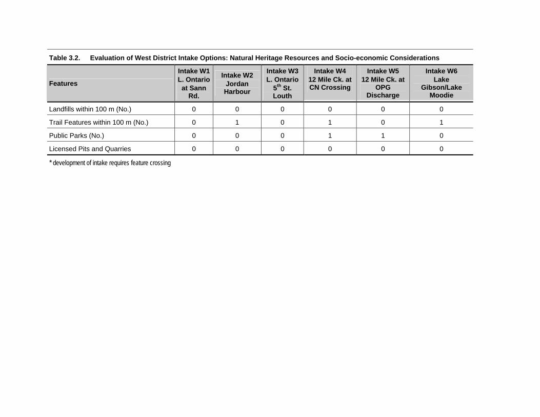
Table 3.2. Evaluation of West District Intake Options: Natural Heritage Resources and Socio-economic Considerations
Intake W1 Intake W3 Intake W4 Intake W5 Intake W6 Intake W2 Features L. Ontario
at Sann Rd.
Jordan Harbour
L. Ontario 5th St. Louth
12 Mile Ck. at CN Crossing
12 Mile Ck. at Lake OPG Gibson/Lake
Discharge Moodie
Landfills within 100 m (No.) 0 0 0 0 0 0
Trail Features within 100 m (No.) 0 1 0 1 0 1
Public Parks (No.) 0 0 0 1 1 0
Licensed Pits and Quarries 0 0 0 0 0 0
* development of intake requires feature crossing

Table 4.1 Comparison of Distribution Alternatives – East District
Route Alternative
E1 Alternative
E2 Alternative
E3
# of intakes 3 4 6
# of new intakes 0 1 1
# of intake upgrades 2 1 2
# of existing intakes 3 3 5
Open channels no no yes
existing channels N/A N/A yes
new channels N/A N/A yes
channel upgrades N/A N/A yes
Water Crossings
Type 1 Habitat 4 4 0
Type 2 Habitat 63 63 18
Type 3 Habitat 0 0 0
Unclassified 44 44 0
Land Feature Crossings
Woodlots (No.) 49 49 7
ANSI units (No.) 1 1 1
PSW units (No.) 1 1 1

Table 4.2 Evaluation of East District Intake Options: Natural Heritage Resources and Socio-Economic Considerations
Features Intake E1
Lock 3 Gravity Feed
Intake E2 Eastchester Pumping Stn
Intake E3 Queenston
Pumping Stn
Intake E4 OPG Canal
NATURAL HERITAGE RESOURCES
A) Aquatic
Potential Volume Impact to Source? No No No No
Presence of Notable Aquatic Habitat Yes No No No
Bank Stability Stable Stable Stabilized by Vegetation
Stable
Potential Habitat for Aquatic Species at Risk No No No No
B) Terrestrial
Area of Natural and Scientific Interest (ANSI) No No No No
Environmentally Sensitive Area (ESA)
Presence of Evaluated Wetlands No No No No
Presence of Woodlots > 2 ha Yes Yes Yes Yes
Level of Disturbance Moderate High Moderate n/a
Potential Habitat for Terrestrial Species at Risk No No Yes No
SOCIO-ECONOMIC CONSIDERATIONS
Residences within 100 m (No.) 0 0 1 0
Communities within 500 m (No.) 0 0 1 0
Cemeteries within 100 m (No.) 1* 0 0 0
Landfills within 100 m (No.) 0 0 0 0
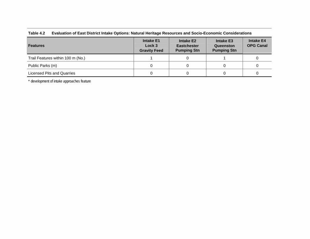
Table 4.2 Evaluation of East District Intake Options: Natural Heritage Resources and Socio-Economic Considerations
Intake E1 Intake E4 Intake E2 Intake E3 Features Lock 3
Gravity Feed Eastchester Pumping Stn
Queenston OPG Canal Pumping Stn
Trail Features within 100 m (No.) 1 0 1 0
Public Parks (m) 0 0 0 0
Licensed Pits and Quarries 0 0 0 0
* development of intake approaches feature

Table 5.1 Potential Impacts to Watercourses – Alternatives W1 and W2
Activity Type Duration (permanent, long or short)
Impact* Cause(s) Positive/Negative Magnitude*
Directional Drilling
Direct short Increase in sediment release
Removal or disturbance of stabilizing vegetative cover
negative small
Direct short Increase in sediment and drilling fluid release
Migration of drilling fluid under pressure through cracks or fractures in the substrate resulting in a blowout.
negative large
Direct short Increase in sediment release
Release of drilling mud onto the bank surface and subsequent flow into the water body.
negative large
Open Cut Crossings
Direct short Increase in sediment release
Bed and Bank disturbance during construction and removal of flow bypass barriers or during trenching.
negative large
Direct short Increased scour or erosion and sediment release
Flumes in flow bypass barriers or inadequately restored beds and banks after trenching
negative large
Direct short Increased bank erosion and sediment release
Removal of stabilizing vegetative cover.
negative large
Direct short Increased bed erosion and sediment release
Inappropriate dewatering techniques.
negative large
* The risk and impact of any of these situations occurring will be minimized if the standard DFO mitigation measures are followed.

Table 5.2 Potential Impacts to Watercourses – Open Channel Alternative E3
Activity Type Duration
(permanent, long or short)
Impact Cause(s) Positive/ Negative
Magnitude
New Works
Direct permanent increase in fish habitat area
new channel construction positive large
Direct permanent potential increase in suspended sediment concentrations in new watercourse as well as watercourses with which it converges
filling of new channel with water
negative large
Indirect permanent higher stability to flow regimes (ie more permanent watercourses)
increase in volume of water feeding downstream watercourses
positive medium
Major Works
Direct permanent increase in fish habitat area
increase in channel area and volume
positive medium
Direct short decrease in cover provided by riparian vegetation
removal of riparian vegetation during construction
negative small
Indirect permanent higher stability to flow regimes (ie more permanent watercourses)
increase in volume of water feeding downstream watercourses
positive medium
Minor Works
Direct permanent increase in fish habitat area
increase in channel area and volume
positive medium
Direct short decrease in cover provided by riparian vegetation
removal of riparian vegetation during construction
negative small
Indirect permanent higher stability to flow regimes (ie more permanent watercourses)
increase in volume of water feeding downstream watercourses
positive medium


Appendix C
Field Sheet Templates


Photo #s_____________________
Stantec Consulting - General Habitat Assessment Report Card
Stantec Project Number 161110576 Date / /
Project Niagara Irrigation Phase 2 y m d
Project Manager: Rajan Sawhney
Waterbody Intake/Station
Descriptive Location (300m zone)
UTM coordinates (NAD83) easting northing
(extremes of station) easting northing
In-water Cover:Cover Types Present (circle): undercut banks deep pool boulder cobble
Total % Cover: large organic debris small organic debris vegetation other
Cover Notes:
Topography: eroding vulnerable protected depositional
Bank Stability Notes:
Substrate/Geology: Substrate Notes:
Water Body Dimensions & MorphologyLake Marsh Bay Stream Canal Pond Drain Other (circle one)
Oligotrophic Mesotrophic Eutrophic
General Depth
Vegetation
General vegetation (within 150 meters of the site):
Adjacent Land use within 150m:
Canopy Cover: % closed % partly open % open
___________
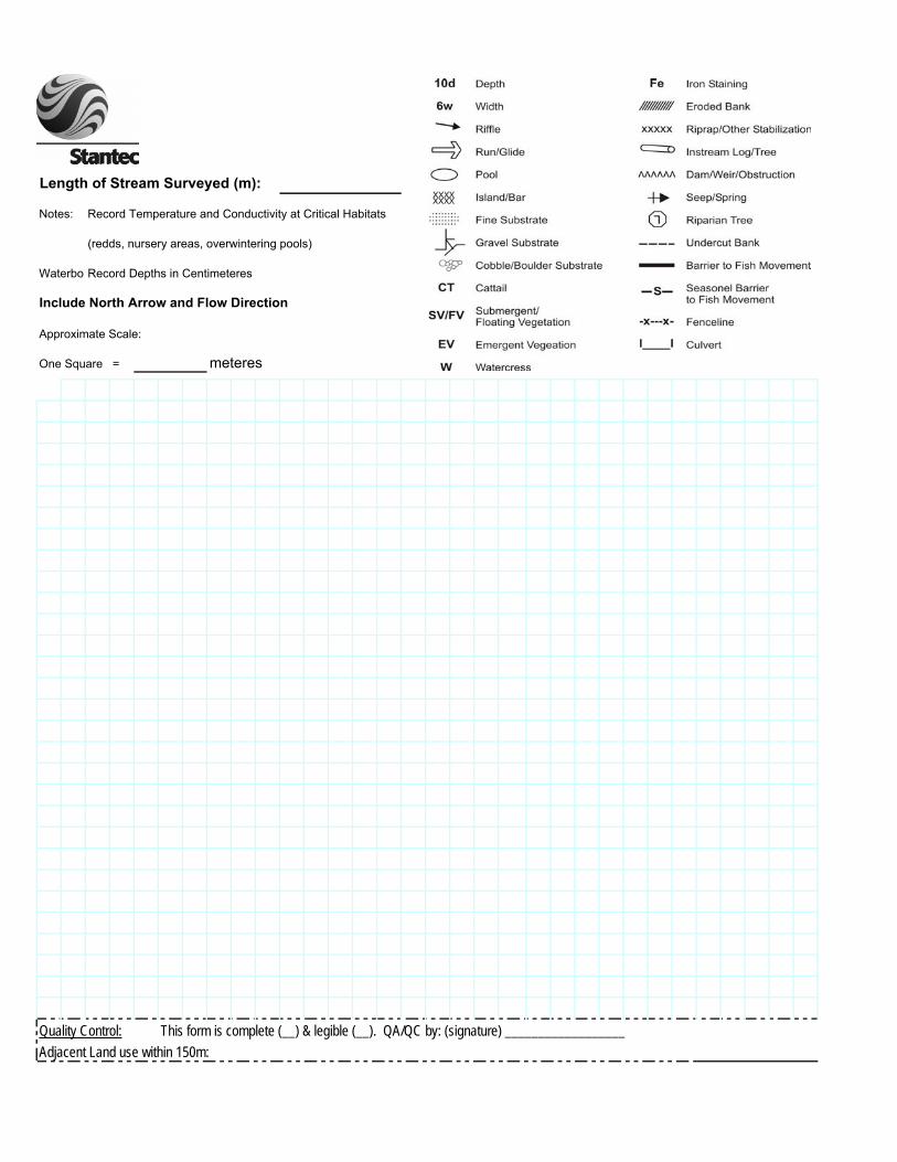
Length of Stream Surveyed (m):
Notes: Record Temperature and Conductivity at Critical Habitats
(redds, nursery areas, overwintering pools)
WaterbodRecord Depths in Centimeteres Intake or StationInclude North Arrow and Flow Direction
Approximate Scale:
One Square = meteres
Quality Control: This form is complete (__) & legible (__). QA/QC by: (signature) __________________Adjacent Land use within 150m:

Photo #s_____________________
Stantec Consulting - Focused Habitat Assessment Report Card
Stantec Project Number 161110576 Date / /
Project Niagara Irrigation Phase 2 y m d
Project Manager: Rajan Sawhney
Watercourse Intake/Station
Descriptive Location
UTM coordinates (NAD83) easting northing
In-water Cover:Cover Types Present (circle): undercut banks deep pool boulder cobble
Total % Cover: large organic debris small organic debris vegetation other
Cover Notes:
Bank Stability % eroding (bank angle > 45°, erodable soil, undercut banks or exposed soils)
% vulnerable (bank angle > 45°, no sign of recent erosion)
% protected (bank angle > 45°, non-erodable bank material)
% depositional (bank angle < 45°, fine grained sediments)
Bank Stability/Slope Notes:
Substrate: Record substrate composition as a percentage
Bedrock Silt Substrate Notes:
Boulder Clay
Cobble Muck
Gravel Marl
Sand Detritus
Stream Dimensions & MorphologyStream Stage (circle one): low flow normal flow high flowMean Stream Wet Width (m): estimated measured (circle one)
Mean Bank Full Width (m): estimated measured (circle one)
% Riffle % Pool % Run % Flat
Maximum Pool Depth (cm) estimated measured (circle one)
Vegetation
Riparian vegetation (within 25 meters of the intake/site):
Adjacent Land use (within 50 meters of the intake/site):
Canopy Cover: % closed % partly open % open
___________

Length of Stream Surveyed (m):
Notes: Record Temperature and Conductivity at Critical Habitats
(redds, nursery areas, overwintering pools)
Record Depths in Centimeteres Intake/Station Include North Arrow and Flow Direction
Approximate Scale:
meteres
Quality Control: This form is complete (__) & legible (__). QA/QC by: (signature) __________________
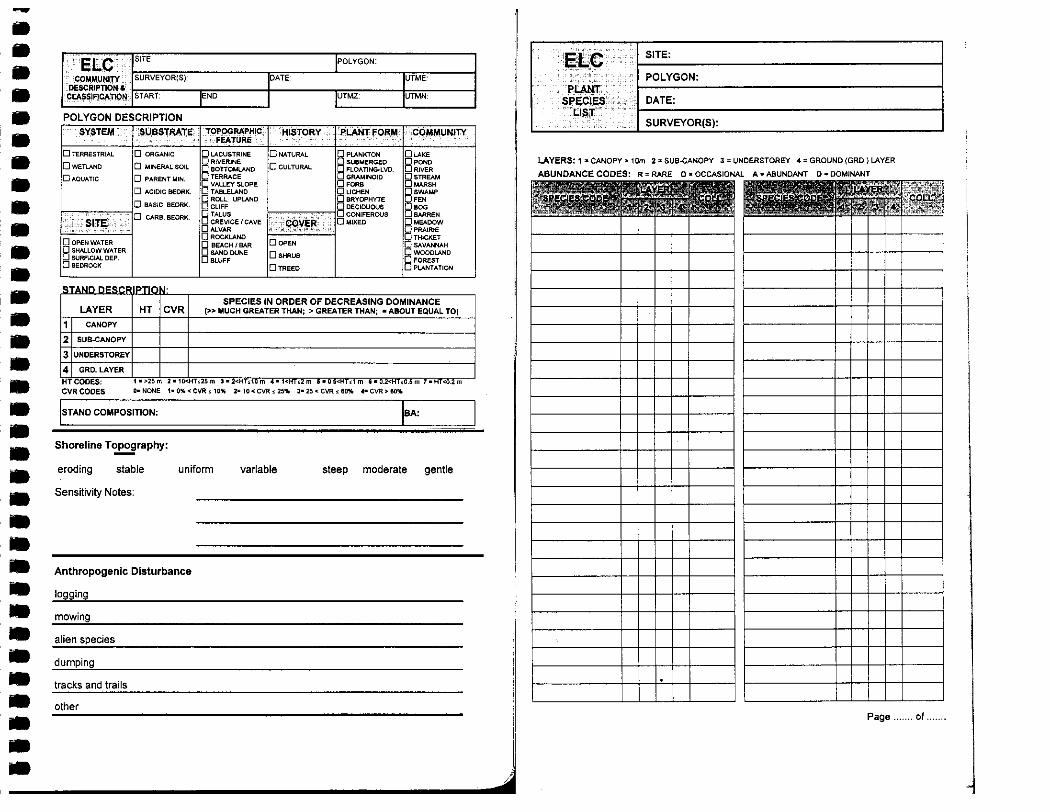

Appendix D
Comments and Responses