Review Facts for the Earth Science SOL - SHS TESTING
24
Review Facts for the Earth Science SOL A review and study guide for the Virginia End of Course Standards of Learning Assessment for Earth Science
Transcript of Review Facts for the Earth Science SOL - SHS TESTING
Review Facts for the
Earth Science SOL
A review and study guide for the
Virginia End of Course Standards of Learning Assessment for Earth Science
Name: _________________________________________________ Pd.: ________
Review Facts for the Earth Science SOL
Table of Contents
Item Page # How to Use This Booklet 1 Unit 1: Scientific Investigation 2 Unit 2: Mapping the Earth 3 Unit 3: Minerals and Rocks 3 Unit 4: Geologic Processes/Features 4 Unit 5: Freshwater/Geologic Processes 6 Unit 6: Renewable/Non-Renewable Resources 7 Unit 7: Historical Geology 7 Unit 8: Virginia Geology 8 Unit 9: Oceanography 9 Unit 10: Meteorology 10 Unit 11: Astronomy 11 Notes and Questions 13 Concept Checks – First Semester 15 Concept Checks – Second Semester 16 SOL Verbs 17 SOL Vocabulary Terms 18 Pictures and Diagrams 20 Top 10 Strategies for taking the SOL Back Cover
Date and time of your Earth Science SOL
Please study these facts well. Knowing this information will make an enormous difference in your success on the SOL. Study them often. Read over every single item at least once a day. You will get to the point where you are tired of reading it because it has become so familiar…this is a good thing! It means that you are learning it and your brain is storing it. Take the advice on page 1 seriously. Remember, what you get out of something is directly proportional to what you put into it.
I wish you success on all of your SOL’s!
Mrs. Yahn

How to Use This Booklet Your very best opportunity to pass the Earth Science SOL is the first time you attempt it. After that your
chances of success begin to decline unless you really work very hard. So read on, take the advice that follows and
let’s get past this test! This booklet is separated by individual Earth Science curriculum units. For each unit, you will find two
sections. There is a third section at the end that covers all of the units. Go through each unit individually and with a purpose. If you come up with questions that you can’t answer, go to the back of the booklet and record those
questions to be searched out later.
Begin with reviewing the facts that appear under the heading “These are the facts you should know…:”. As you review each fact, take time to honestly assess whether you are sure you know that information. If you know
it, check it off in the box at the left of each statement. The second section is a list of things that you should be able to do once you have learned all of the
requirements for a given unit. Go through each item that appears under the heading “When finished with this unit, you should be able to…:” and see if you can do exactly what each says. If you find you cannot illustrate,
diagram, label, define, explain, etc. what is asked, go back and study that element. Check it off when you can
successfully do what it asks. The third section is a concept check. This is a list of terms or concepts that are associated with a unit. It is
very important that you are completely honest about this check. If you are completely sure you understand the concept or can cleanly define the term, put a ‘’ next to it. If you are somewhat sure about it but know that you
don’t know it well, put a ‘+’ in the space next to the term, indicating that you need to know more. Finally, if you
have absolutely no idea about a term, put a ‘o’ next to it, indicating that you know nothing about this. Let these symbols help focus your study.
Don’t bother to restudy those things that you know very well. It is a waste of valuable time. Focus first on
the things with a ‘+’ and get them quickly up to speed. Sometimes all it takes is refreshing your memory. Before you change it from a ‘+’ to a ‘’, leave it, study something else and then come back to it. If you still feel like you
now have it, then you should change your ‘+’ to a ‘’.
Spend the remainder of your time working on the things that you need to learn that were marked with a ‘o’.
These are the items you need to search out, ask questions about and work hard to commit to memory quickly. Read, study, listen to explanations…what ever it takes…just learn it. The goal would be to get it to a ‘’, but if
you can get it to a ‘+’ then you have dramatically increased your chances for success.
After you have reviewed each unit and worked through the concept checks, review the most frequently used verbs in the SOLs that appears on page 17. If you need to define them, please do. Words like ‘drive’ and ‘survey’
have many meanings. Make sure you understand which definition would be used in an SOL test. For instance, the
word drive should not be described as ‘what you do with a car’. That has no relevance to an SOL. Remember that most of these words describe processes that are associated with Earth Science concepts.
Read through each of the units as many times as you need in order for these facts to become fully a part of your thinking. Read them aloud. You didn’t learn the words to your favorite songs by listening to them once. In
order to learn anything it requires repetition, practice and understanding. Ask family members to quiz you. Form
study groups with friends. Attend after school SOL review sessions. Draw pictures and label them. Read if you need to. When you come for the after school review sessions, bring the questions that you have written down and
get them answered. If you truly desire to pass the test, you need to invest your time. No one else can do this for you. You have
been given all the necessary tools. Build the knowledge base in your brain by spending time. The things you enjoy doing will still be there after the SOL…let them wait. Learn to prioritize your time. Don’t procrastinate.
Review every day as you get closer to the SOL. Challenge yourself, you’ll be surprised at how proud you will be of
yourself.
Your hard work will always pay off!
1

Unit 1: Scientific Investigation
These are the facts you should know…:
Density = mass/volume The S.I. Unit for Density is: g/cm3 or g/mL
Volume for irregular objects is found by water displacement.
Warm (air, water, magma) rises because it is less dense. Cold (air, water, magma) sinks because it is more dense.
As pressure increases so does density. Water is most dense as a liquid. Density = 1 g/mL
The same substance has the same density. As mass increases so does the volume.
A hypothesis is a prediction about a problem that can be tested. A variable is a changeable factor in an experiment.
Constants are factors that are the same. Any valid scientific theory has passed tests designed to invalidate it.
There can be more than one explanation for any phenomena. The independent variable is the factor that YOU, the experimenter changes and that data is usually plotted on
the x-axis.
The dependent variable is the factor that changes as a result of the manipulation of the Independent variable and that data is usually plotted on the y-axis.
A control is a standard for comparison. It can be thought of as the part of the experiment where there is no manipulation of the independent variable.
Kilo = 1000; Deci = 1/10 or 0.1; Centi = 1/100 or 0.01; Milli = 1/1000 or 0.001
SI Units: for length – meter (m); for volume – milliliter (mL) or cubic centimeter (cm3); for mass – gram (g); for area – square meter (m2); for temp. – Kelvin (K)
When finished with this unit, you should be able to…:
Predict future trends given scientific data in the form of diagrams, maps, tables, charts or graphs. Interpret the validity of a theory using data to support their conclusion.
Identify independent and dependent variables, as well as experimental controls given scientific designs and data.
Analyze data in the form of tables and graphs to reach conclusions and support or refute hypotheses. React to lab emergency using the proper equipment and procedures.
Identify potential safety concerns in the lab and the proper procedures for handling.
Research a scientific topic in order to form a testable hypothesis. Design a scientific investigation to test a hypothesis that identifies variables and incorporates repeated trials.
Conduct an experiment to test a hypothesis using the appropriate technology. Interpret data to reach logical conclusions.
Communicate experimental design, data interpretation, and scientific conclusions.
Apply the appropriate units of the metric system and tools when measuring various earth substances, distances and processes.
Convert the basic metric units to other commonly used units such as Kilo, centi, and milli. Calculate density given mass and volume data in the form of diagrams or data tables.
Compare and contrast the three states of matter. Identify the three states of matter as they are found on earth.
Explain how the scientific method is used to validate scientific theories.
Location and proper operation of eye wash station, emergency shower, power shut-off; and fire extinguishers. Know the major safety symbols.
Know how lab areas are organized and how all chemicals are properly labeled, stored and handled. Use scientific methodology to design and test a hypothesis.
Construct a graph, table, chart, or diagram from data.
Interpret graphs and diagrams. Discuss how water occurs on the earth as a solid (ice), a liquid, or a gas (water vapor) due to its position in the
solar system. The metric system, which is based on powers of ten, is used for making scientific measurements (not specified
in the SOL, but essential to all sciences).
2

Measure mass and volume of materials in the lab using the correct equipment.
Calculate density. Interpret data from a graph or table that shows change in mass, density, or temperature with time.
Unit 2: Mapping the Earth
These are the facts you should know…:
Latitude lines go East-West but measure North and South of the Equator. Longitude lines go North-South but measure East and West of the Prime Meridian.
When finding coordinates of a location, the latitude is first, longitude is second. The closer the contour lines, the steeper the slope.
Contour lines form V's and point upstream when there are rivers and creeks present.
The increase in elevation between two adjacent contour lines is the contour interval.
When finished with this unit, you should be able to…:
Identify the latitude and longitude of a given location on a map (world, US, state, or local), or conversely,
given the latitude and longitude coordinates, identify the correct location. Read and interpret maps, including legends and lines (e.g. contour and isobar) used on maps.
Measure the distance between two points on a map as well as determine the direction of one point in relationship to the other.
Calculate the contour interval and changes in elevation on a topographic map and compare these to another map with a different scale.
Identify topographic features on a map.
Construct a profile from a topographic map as well as determine the correct profile for a given topographic map.
Analyze GPS images for contour profiles and topographic features, and calculate directions and distances between two points on a GPS image.
Analyze aerial and satellite images of differing scales and identify earth features and landforms.
Compare topographic maps of different scales. Locate points and directions on maps and globes using latitude and longitude.
Determine distance and elevation on a map. Identify a hilltop, stream, and valley on a topographic map.
Unit 3: Minerals and Rocks
These are the facts you should know…:
A mineral is found in nature, inorganic, solid, with a definite chemical composition and structure. Mineral properties depend on their atomic structure.
Minerals may be identified by their physical properties such as hardness, color, luster, and streak.
Most rocks are made of one or more minerals. Some major rock-forming minerals are quartz, feldspar, calcite, and mica.
Ore minerals include pyrite, magnetite, hematite, galena, graphite, and sulfur. The major elements found in Earth’s crust are oxygen, silicon, aluminum, and iron. The most abundant group
of minerals is the silicates, which contain silicon and oxygen.
Igneous rocks are classified by composition and texture. Igneous Rocks are produced by the cooling of magma (cooled below Earth’s surface) or lava (cooled above
Earth’s surface). Fast cooling = Extrusive - Texture includes small, fine-grained mineral grains, glassy, air holes present.
(pumice, basalt, obsidian) Slow cooling = Intrusive- Texture includes coarse or large mineral grains. (granite)
Metamorphic formed by heat and pressure or chemical action.
Metamorphic include foliated (banded) and non-foliated. Foliated rocks have bands of different minerals. Examples are slate, schist, gneiss.
3

Non-foliated rocks have little or no banding and are relatively homogenous throughout and include marble and
quartzite. Limestone morphs into marble. Sandstone morphs into quartzite.
Sedimentary rocks form from rock fragments, organic material, or chemical precipitation. Sedimentary are found in flat layers or strata. Fossils are found in these layers.
Sedimentary subclasses include clastic, organic, and chemical.
Limestone is formed both chemically and organically. Clastic rocks are made of fragments- conglomerate, sandstone, and shale.
Non-clastic sedimentary rocks include limestone and rock salt. Coal formation from softest to hardest- Peat, Lignite, Bituminous, Anthracite.
Non-renewable resources are renewed very slowly or not at all. Non-renewable resources include coal, oil, and minerals.
In Virginia, major rock and mineral resources include coal for energy, gravel and crushed stone for road
construction, and limestone for making concrete. Nearly all fossils are found in sedimentary rocks.
Interpret the rock cycle diagram. Classify the following rock types as igneous, metamorphic, or sedimentary: pumice, obsidian, basalt, granite,
sandstone, conglomerate, shale, limestone, slate, schist, gneiss, marble, and quartzite.
When finished with this unit, you should be able to…:
Determine if a substance is a mineral based upon the given characteristics.
Identify the following minerals based on their specific chemical and physical properties (color, hardness, streak, color, luster, and breakage): quartz, feldspar, mica, calcite, bauxite, hematite, galena, halite, graphite, pyrite,
sulfur, diamond and talc and know their commercial use(s).
List ways that minerals are important to human wealth and welfare. Classify rocks into the three major groups by the processes that formed them.
Explain the rock cycle diagram and identify the processes by which all rocks are formed and how materials are recycled through time.
Identify the following rocks on the basis of mineral content and texture: Igneous – pumice, obsidian, basalt,
granite; Sedimentary – sandstone, conglomerate, shale, limestone, gypsum; Metamorphic – slate, schist, gneiss, marble, quartzite.
Distinguish between a rock and a mineral. Discuss why minerals and rocks are nonrenewable resources and are limited. Observe evidence of ancient,
often extinct life preserved in sedimentary rock.
Unit 4: Geologic Processes/Features (Plate Tectonics, Earthquakes, Volcanoes)
These are the facts you should know…:
The Earth consists of a solid Inner core (Fe & Ni), a liquid outer core (Fe & Ni), a plastic-like mantle (Si, O, Fe,
Ni) and a thin rocky crust (Si & O)
The lithosphere is made up of the crust and upper mantle. The asthenosphere is made up of the lower mantle.
Ocean crust is thinner, younger, & denser (heavier) than continental crust. Oceanic crust is made of basaltic rock.
Continental crust is thicker, older and less dense (lighter) than oceanic crust. Continental crust is made up of
granitic rock. An Ocean plate will always sink under a continental plate because it is more dense.
Convection currents move tectonic plates. Hot material rises, cools, becomes more dense and sinks. After it sinks it heat up and becomes less dense and rises.
Convergent boundaries are colliding plates which cause folded or thrust faulted mountains, subduction zones (volcanoes & trenches), & reverse faults. The force involved is compression.
Major features of convergent boundaries include collision zones (folded and thrust-faulted mountains) and
subduction zones (volcanoes and trenches). Divergent boundaries are dividing plates and cause sea-floor spreading, mid-ocean ridges, rift valleys, &
volcanoes. Normal faults are produced from this movement. The force involved is tension.
4
Major features of divergent boundaries include mid-ocean ridges, rift valleys, and fissure volcanoes.
Transform boundaries slide past each other and strike slip faults and earthquakes are produced. The force involved is shearing.
Major features of transform boundaries include strike-slip faults. Features of the seafloor that are related to plate tectonic processes include mid-ocean ridges and trenches.
Other major topographic features of the oceans are continental shelves, continental slopes, abyssal plains, and
seamounts. When rocks are compressed horizontally, their layers may be deformed into wave-like forms called folds. This
commonly occurs during continental collisions. The Appalachian Mountains are folded mountains.
When rocks are pushed up vertically, they may break along one or more faults. These are fault block mountains and may be one of two types.
Lifted mountains have 2 faults and 2 scarps. An entire block of mountain is raised due to the vertical pressure.
Tilted mountains have 1 fault and 1 scarp. Only one section of earth is raised due to the vertical pressure. Earthquake activity is associated with all plate boundaries.
A fault is a break or crack in the Earth's Crust where movement has occurred. Most active faults are located at or near plate boundaries. Earthquakes result when movement occurs along a
fault.
Three seismic stations are needed to find the epicenter of an Earthquake. P waves travel the fastest and reach the seismic station first, travel through solids and liquids, P waves slow
down and bend when they hit the liquid outer core. The force is compression and the motion is push/pull. S waves arrive at the seismic station second and do not travel through liquids. The force is shearing and the
motion is side to side. L waves are the last to arrive at the seismic station. The force is tension and the motion is undulating. These
waves are also called Raleigh waves.
Volcanic activity is associated with subduction, rifting, or sea floor spreading and hot spots. Hot Spots are not related to plate movement. They are a weak spot in the Earth’s crust through which magma
is released and volcanoes are formed. A volcano is an opening where magma is erupted onto Earth’s surface. Most volcanic activity is associated with
subduction, rifting or sea-floor spreading.
There are 3 types of volcanoes. Cinder cones form steep sided mountains and their eruptions are violent.
Shield volcanoes form low sloping and broad mountains where the eruptions are generally considered quiet and oozing.
Composite volcanoes are a combination of cinder cones and shield volcanoes in their actions. They alternately
erupt violently and quietly forming layers that show evidence of the varying eruption types. Explain how volcanic activity or meteor impacts could affect the atmosphere and life on Earth.
When finished with this unit, you should be able to…:
Model the core, mantle, and crust of Earth as a dynamic system, constantly in motion.
Compare and contrast the Law of Superposition and the Theory of Plate Tectonics.
Describe the Theory of Plate Tectonics and cite supporting evidence (continental drift and seafloor spreading). Predict change according to the plate tectonic theory using a map of the world’s ocean floor and continental
landmasses. Identify and describe the different types of plate boundaries (converging, diverging, and transform fault
boundaries) and their motions.
Interpret continental collision, faulting (earthquakes), folding (mountain building), rifting (seafloor spreading), subduction (volcanism) and convection in the mantle.
Identify the processes that form: folded mountains, volcanic mountains, island arcs, trenches, and mid-ocean ridge.
Discuss how, why and where earthquakes happen. Differentiate between the focus and epicenter of an earthquake.
Compare and contrast the Richter and Mercalli scales.
Identify the causes and effects of earthquakes. Identify the different seismic waves (primary, secondary, long) and their characteristics.
Locate the epicenter of an earthquake, given seismic wave information.
5
Interpret a seismic wave time/travel graph.
Describe how, why and where volcanoes form. Differentiate between magma and lava.
Relate the locations of plate boundaries to a map of known earthquakes and volcanic activity. Interpret illustrations or models of geologic processes (faulting, folding, volcanism and metamorphism)
Compare and contrast hypotheses, theories, and scientific laws.
Use data to support or reject a hypothesis. Explain how the scientific method is used to validate scientific theories.
Unit 5 – Freshwater / Geologic Processes and Features
These are the facts you should know…:
Weathering is the process that rocks are broken down chemically and physically by water, air, and organisms. Chemical Weathering occurs in warm, humid climates.
Mechanical Weathering occurs in cold climates--- Ice Wedging. Erosion is the process by which Earth materials are transported by moving water, ice, or wind. Gravity causes
all these to happen.
Streams and moving water are the major agents of Erosion. Deposition is the process by which Earth materials carried by wind, water, or ice settle out and are deposited.
High Erosion=high relief areas; High deposition=low relief areas Large particles settle out first. Sediment size from largest to smallest – breccia, sand, silt, clay.
As particle size increases, permeability (the ability to transport water) increases. Soil Evolution starts with the weathering of bedrock. Organic material must be present in order to have soil.
Soil is loose rock fragments and clay derived from weathered rock mixed with organic material.
Soil profile consists of 3 main horizons: A- Top Soil (most evolved), B- less humus, leaching from A, C- Weathered Rock.
Some scientist include an O- horizon which is the upper most layer consisting of the organic material. Bedrock beneath the C horizon can also be considered a part of a soil profile.
Karst topography has caves and sinkholes produced by acidic groundwater dissolving limestone.
Karst topography forms when limestone is slowly dissolved away by slightly acidic groundwater. Because limestone is abundant in the Valley and Ridge province of Virginia, karst topography is common.
Ground water layers from the surface down would include zone of aeration, water table, & zone of saturation. Permeability is a measure of the ability of a rock or sediment to transmit water or other liquids.
Porosity is the amount of space between the materials where water will move freely.
Water does not pass through impermeable materials. The cone of depression is formed when more water is removed by human use than is being replenished by
natural means. An aquifer is a layer of permeable rock that transports groundwater freely and is confined between 2
impermeable rock layers. A spring is an area where the water table reaches the land's surface.
Hydrologic cycle includes the processes of evaporation, transpiration, condensation, precipitation, and runoff.
Geologic processes, such as erosion, and human activities, such as waste disposal, can pollute water supplies.
When finished with this unit, you should be able to…:
Describe the processes of physical and chemical weathering.
Give examples of physical and chemical weathering, including oxidation, freeze-thaw, exfoliation. Identify landforms related to erosion and deposition, such as: deltas, flood plains, moraines, glacial valleys, and
sand dunes. Explain the relationship between velocity and particle size carrying ability.
Given a description, identify the processes involved in the formation of soil. Given a description of a soil layer, identify the layer.
Diagram a soil profile and label the horizons.
Describe methods of preventing soil erosion and compare their effectiveness. Identify the processes involved in the formation of karst topography and their effects, including caves,
sinkholes, stalactites, and stalagmites.
6
Give examples of karst features found in Virginia and identify the province where they are found.
Describe the characteristics of a permeable and impermeable rock and give examples of each. Interpret a simple hydrologic cycle diagram, including evaporation, condensation, precipitation, and runoff.
Diagram and label the hydrologic cycle and describe the processes involved. On a diagram, identify the groundwater zones, including zone of aeration, zone of saturation, water table, and
aquifer.
Identify human behaviors that can overuse or contaminate groundwater resources.
Unit 6: Renewable & Non-Renewable Resources
These are the facts you should know…:
Ores are useful and profitable.
Virginia resources include limestone, coal, and gravel. Renewable resources can be replaced by nature at a rate close to the rate at which they are used. Renewable
resources include vegetation, sunlight, and surface water. Non-renewable resources are renewed very slowly or not at all. Non-renewable resources include coal, oil, and
minerals.
The Earth's Water Supply is renewable but also finite. Fossil fuels are non-renewable and may cause pollution, but they are relatively cheap and easy to use.
In Virginia, major rock and mineral resources include coal for energy, gravel and crushed stone for road construction, and limestone for making concrete.
Human activities have increased the carbon dioxide content of the atmosphere. Man-made chemicals have decreased the ozone concentration in the upper atmosphere.
When finished with this unit, you should be able to…:
Classify resources as renewable or nonrenewable. Identify resources found in Virginia, including coal, gravel, crushed stone, and limestone and their uses.
Identify fuels as fossil fuels or alternative fuels.
Describe the environmental consequences of using fossil fuels, including the use and the extraction processes. List advantages and disadvantages of the use of fossil fuels versus the use of alternative fuels (nuclear,
hydroelectric, solar, geothermal) List economic reasons for using fossil fuels versus alternative fuels.
List and describe causes of air pollution, acid deposition, and depletion of the ozone layer. Discuss
environmental and economic costs related to each.
Unit 7 – Historical Geology
These are the facts you should know…:
A fossil is the remains, impressions, or other evidence of a former existence of life preserved in rock.
Nearly all fossils are found in sedimentary rock. Some ways in which fossils can be preserved are molds, casts, and original bone or shell.
In Virginia, fossils are found mainly in the Coastal Plain, Valley and Ridge, and Appalachian Plateau provinces. Most Virginia fossils are of marine organisms. This indicates that large areas of the state have been periodically
covered by seawater.
Paleozoic, Mesozoic, and Cenozoic fossils are found in Virginia. Law of Superposition states that the oldest rocks are found on the bottom of strata and the youngest on top of
strata. Law of Cross-cutting relationships states that an igneous intrusion is younger than the layers it cuts across.
Law of Horizontality states that when a rock layer is put down it is done horizontally. Any rock layer that is not horizontal has undergone some changes, like uplifting or tilting.
Unconformities are missing rock layers usually a result of erosion.
Fossils, superposition, and cross-cutting are used to determine relative ages. Relative dating places events in sequence without assigning exact numerical ages.
Absolute time places a numerical age to an event.
7

Radioactive decay or half-life is used to determine the absolute age of rocks.
Uranium dating is used to find the ages of the oldest rocks while Carbon-14 is used to find the ages of human artifacts or things that were once living.
The Earth is about 4.6 billion years old. The early atmosphere contained little oxygen and more carbon dioxide than the modern atmosphere.
Early photosynthetic life such as cyanobacteria (blue-green algae) consumed carbon dioxide and generated
oxygen. It was only after early photosynthetic life generated oxygen that animal life became possible.
When finished with this unit, you should be able to…:
Describe the processes involved in the formation of fossils and identify the different types of fossils.
Identify, on a map, the provinces in Virginia where fossils are found.
Recognize that fossils are found mostly in sedimentary rock and that Virginia fossils are mostly of marine organisms.
Identify the geologic periods that are represented by fossils found in Virginia. Sequence geologic events using principles of relative dating.
Correlate rock layers from different locations using relative dating and index fossils.
Describe the principles of relative dating, including superposition and cross-cutting relations. Describe the process of absolute dating, including radioactive decay and half-life. Give examples of radioactive
isotopes used in absolute dating. Identify periods of geologic time based on geologic events or dominant life forms.
Compare past and present composition of the Earth’s atmosphere and give reasons for changes over geologic time.
Explain how volcanic activity could affect the atmosphere and life on Earth.
Describe how life has changed and become more complex over geologic time. Interpret a simple geologic history diagram using superposition and crosscutting relations.
Compare and contrast hypotheses, theories and scientific laws. For example, students should be able to compare/contrast the Law of Superposition and the Theory of Plate Tectonics.
Unit 8 – Virginia Geology
These are the facts you should know…:
The five physiographic provinces are Coastal Plain, Piedmont, Blue Ridge, Valley and Ridge, and Appalachian
Plateau. The Coastal plain is the flattest area underlain by all types of sediments produced by the erosion of the
Appalachian mountains. Fossils are abundant here. The Piedmont is an area of rolling hills underlain by mostly ancient igneous and metamorphic rocks produced
by ancient volcanoes. The igneous rocks are the roots of volcanoes formed during an ancient episode of subduction that occurred before the formation of the Appalachian Mountains. It is separated by a fall line from
the Coastal plain.
The Blue Ridge is a high ridge separating the Piedmont from the Valley and Ridge Province. The billion-year old igneous and metamorphic rocks of the Blue Ridge are the oldest in the state. Some metamorphism of these
rocks occurred during the formation of the Appalachian Mountains. Valley and Ridge province is an area with long parallel ridges and valleys composed of folded and faulted rocks
that occurred during the collision of Africa and North America during the Paleozoic. This collision produced the
Appalachian Mountains. Karst Topography & fossils are abundant. The Appalachian Plateau has rugged, irregular topography and is underlain by ancient, flat-lying sedimentary
rocks. The area is actually a series of plateaus separated by faults. Most of Virginia’s coal resources are found in the plateau province. Fossils are present.
Renewable resources can be replaced by nature at a rate close to the rate at which they are used. Renewable resources include vegetation, sunlight, and surface water.
The three major regional watershed systems in Virginia lead to the Chesapeake Bay, the North Carolina
Sounds, and the Gulf of Mexico. Pollution and over fishing can harm or deplete valuable resources.
8
Chemical pollution and sedimentation are great threats to the chemical and biological well being of estuaries
and oceans.
When finished with this unit, you should be able to…:
Identify the five provinces of Virginia on a map.
Describe the characteristics of each province, including the major rock type and the topography. Identify past geologic and tectonic events in Virginia that resulted in formation of the provinces.
Define watershed. On a map, identify the Chesapeake Bay watershed.
Identify resources found in the Chesapeake Bay. Describe major environmental problems related to the Chesapeake Bay and identify causes and effects
(including loss of submerged aquatic vegetation, runoff, excess nutrients and algal blooms).
Categorize resources as renewable or nonrenewable. Locate the major watershed systems on a map (Chesapeake Bay, Gulf of Mexico, and North Carolina Sounds).
Identify the effects of human activity on the oceans
Unit 9 – Oceanography
These are the facts you should know…:
We have 2 high tides and 2 low tides each day.
Tides are the daily periodic rise and fall of water level caused by the gravitational pull of the sun and the moon. Currents move from cold to warm areas.
Upwelling brings cold, nutrient rich water from the bottom of ocean to the surface. This is rich in biological
activity. Estuaries are areas where salt water mixes with fresh water. It is a partially enclosed body of water with open
access to the sea or ocean. Example: Chesapeake Bay Sea level falls when glacial ice caps grow and rises when ice caps melt.
Cyanobacteria was responsible for the first oxygen on Earth. Presently blue geen agae is an important source
of atmospheric oxygen. The ocean is the largest reservoir of heat at the Earth's surface. It drives the weather of the Earth.
The stored heat in the ocean causes climate near the ocean to be milder than the climate in the interior of continents.
Most waves on the ocean surface are generated by wind.
There are large current systems in the oceans that carry warm water towards the poles and cold water towards the equator.
Estuaries, like the Chesapeake Bay, are areas where fresh and salt water mix, producing variations in salinity and high biological activity.
Major topographic features of the oceans are continental shelves, slopes, abyssal plains, and seamounts. Features of the seafloor are related to plate tectonic processes, including mid-ocean ridges and trenches.
The oceans are an important source of food and mineral resources as well as a venue for recreation and
transportation. Pollution and over-fishing can harm or deplete valuable resources.
Chemical pollution and sedimentation are great threats to the chemical and biological well being of estuaries and oceans.
When finished with this unit, you should be able to…:
Determine those chemical factors that contribute to the salinity of sea water. Explain the relationship between salinity, temperature, and density.
Identify a thermocline on a depth x temperature graph. Explain the relationship between winds and wind-driven currents.
Differentiate surface currents from deep water currents.
Define and explain tsunamis. Define the term estuary using the Chesapeake Bay as a model.
Explain how upwelling brings cold, rich water up to the surface of oceanic waters.
9
Relate tides to gravitational pull.
Show how convection currents transfer heat energy in the oceans. Explain that oceans are the largest heat reservoir on the surface of the Earth and that stored heat in the
oceans drives much of Earth’s weather. Explain that stored heat in the oceans causes climate near the ocean to be mild.
Explain the relationship between sea level and ice caps.
Identify major oceans on a map. Identify near shore ocean features such as continental shelf, slope, and rise.
Identify deep sea features such as abyssal plains, trenches, seamounts, volcanic islands, guyots, and ridges. Relate deep sea features to plate tectonic processes.
Explain the nature of oceanic food webs. Explain how oceans produce much of the Earth’s oxygen.
Explain how the ocean’s resources are finite and must be used with care.
Explain how and why the oceans are environmentally and economically important. Explain why human activities have important consequences for the ocean.
Explain how pollution and sedimentation affect the water quality in near-shore and open ocean waters. Students should be able describe the major pollutants of the Chesapeake Bay.
Unit 10 – The Atmosphere (Meteorology)
These are the facts you should know…:
The Early atmosphere was mostly CO2 and very little O2. Early photosynthetic life such as cyanobacteria (blue green algae) consumed carbon dioxide and generated
oxygen.
It was only after early photosynthetic life generated oxygen that animal life became possible. The Earth's atmosphere is 21% Oxygen, 78% Nitrogen, 1% trace gases.
The atmosphere of Venus is mostly carbon dioxide and very dense. The atmosphere of Mars is very thin and mostly carbon dioxide.
Human activities such as burning fossil fuels have increased CO2 levels.
High CO2 levels produce the Greenhouse effect. CFC's are decreasing the ozone levels of the upper atmosphere
Radiation is the transfer of energy from the sun to the Earth in the form of electromagnetic waves. This energy is reflected back to space, absorbed by the atmosphere, or mostly absorbed by Earth’s surface.
Conduction is the transfer of energy through direct contact.
Convection is the transfer of energy through the flow a heated material and is a major cause of weather in the atmosphere.
Areas near the Equator receive the most direct radiation. Clouds form when air is at or below its dew point and condensation nuclei are present.
The Coriolis Effect causes deflections of the atmosphere and oceans due to the rotation of Earth. Global wind patterns result from the uneven heating of Earth by the sun and are influenced by the Coriolis
Effect.
A psychrometer measures humidity in the air. A barometer measures air pressure. A thermometer measures air temperature. An anemometer measures wind speed.
Highs are generally cool and dry: Lows are generally warm and wet. Winds are formed due to unequal heating of the atmosphere that causes air pressure differences.
Winds move from high pressure areas to low pressure areas.
Cold fronts move quickly and produce rain at the front. Warm fronts move slow and produce miles and miles of clouds and long periods of gentle, soaking rains.
The highest pressure is found at sea level. High pressure rotates clockwise and outward.
Low pressure rotates counter-clockwise and inward. U.S. weather is dominated by prevailing Westerlies. Weather moves west to east at a general average of 25
miles per day.
Weather describes day-to-day changes in atmospheric conditions. The conditions necessary for cloud formation are: air is at or below dew point; and condensation nuclei are
present. Cloud droplets can join together to form precipitation.
10

The four major factors affecting climate are latitude, elevation, proximity to bodies of water, and position
relative to mountains. Climate describes the typical weather patterns for a given location over a period of many years.
Areas near the equator receive more of the sun’s energy per unit than areas nearer the poles. Earth’s major climatic zones are the polar, temperate, and tropical zones.
A tornado is a narrow violent funnel-shaped column of spiral winds that extends downward form the cloud
base toward Earth. A hurricane is a tropical cyclone (counterclockwise movement of air) characterized by sustained winds of 120
km/hr (75 miles/hr) or greater. Human activities have increased the carbon dioxide content of the atmosphere.
Man-made chemicals have decreased the ozone concentration in the upper atmosphere. Volcanic activity and meteorite impacts can inject large quantities of dust and gases into the atmosphere.
The ability of Earth’s atmosphere to absorb and retain heat is affected by the presence of gases like water
vapor and carbon dioxide.
When finished with this unit, you should be able to…:
Identify the atmospheric gases and list the percentages of which the atmosphere is composed.
Identify the layers of the atmosphere. Account for the differences between atmospheric layers.
Contrast Earth’s atmosphere with that of other planets. Compare and contrast the three methods of energy transfer and identify them in the processes that create
weather. Label a diagram of global wind patterns.
Read and interpret data from a thermometer, a barometer, and a psychrometer.
Read and interpret a weather map. Predict weather based on cloud type, temperature, and barometric pressure.
Identify types of severe weather. Explain the difference between high and low pressure systems
Identify the four types of fronts.
Identify air masses and their characteristics. Explain how volcanic activity or meteor impacts could affect the atmosphere and life on Earth.
Explain how biological activity, including human activities, may influence global temperature and climate. Interpret the causes of the greenhouse effect and survey the possible damage created by it.
Outline human impacts on climate.
Unit 11 – Astronomy
These are the facts you should know…: The Solar Nebulae Theory explains that the planets formed from the condensing of our sun or solar nebulae.
Our Sun's Life cycle is Nebulae, protostar, Yellow Main Sequence Star, Red Giant, white dwarf and black dwarf. Our star, the sun is a Yellow Main Sequence star and is middle aged. It should last for another 4.6 billion
years.
Black holes are a death stage of stars. We are located in the Milky Way Galaxy which is a spiral galaxy.
The 3 types of Galaxies are spiral, elliptical, and irregular. The Hubble Space telescope has improved our knowledge and understanding of the Universe.
Red Shifts indicate the Universe is expanding outward. This is used to support the Big Bang Theory.
Summer Solstice is June 21st (longest day). Winter Solstice is December 21st (shortest day). Solstice is when the sun is at its most Northern or Southern Point.
Equinoxes are when the sun is directly over the equator. Spring March 21st and Fall September 22nd (12 hours of daylight and 12 hours of night).
The Earth is closer to the sun in the winter. Earth revolves around the sun, tilted on its axis, causing seasons (equinoxes and solstices).
The Earth rotates W to E once in approximately 24 hours.
The Earth revolves CCW around the sun once in 365.25 days. The Earth is the 3rd planet from the sun.
The moon has phases because of reflected sunlight and the angle at which we view it.
11

The moon revolves around the earth creating the moon phases and eclipses.
Foucault's pendulum and Coriolis Effect prove the Earth rotates. Parallax and seasonal constellations prove the Earth's revolution.
Two types of planets-- Inner (rocky) and Outer (gaseous) – except for Pluto which is the outermost planet but appears to be rocky.
Comets orbit the sun and consist mostly of frozen gas.
Comets are known as dirty snowballs in space and originate in the Oort cloud. A comet's tail is the result of the solar wind and points away from the sun.
A comet's coma is the result of the sun's radiation. Asteroids are rocky or metallic iron objects with origins between Mars and Jupiter. They range in size from
millimeters to kilometers. They are the source of most meteorites. AU= distance between the Earth and the Sun. We measure planet distances in AU's.
A light-year is the distance light travels in one year and is the most commonly used measurement for distance
in astronomy. Apollo 11 was the 1st manned landing on the moon. Neil Armstrong was the 1st man on the moon.
The Big Bang Theory explains the origin of the Universe. The Universe began as a dense sphere that expanded and condensed into galaxies.
Solar eclipses occur when the moon blocks out sunlight from Earth's surface.
Lunar eclipses occur when Earth blocks sunlight from reaching the moon's surface. The tides are the daily, periodic rise and fall of water level caused by the gravitational pull of the sun and
moon. Areas near the equator receive more of the sun’s energy per unit area than areas nearer the poles.
Earth is the third planet from the sun and is located between the sun and the asteroid belt. It has one natural satellite, the moon.
Water vapor occurs on Earth as a solid, liquid or gas due to the Earth's position in the solar system.
The sun consists largely of hydrogen gas. The sun's energy comes from nuclear fusion of hydrogen to helium.
Moons are natural satellites of planets that vary widely in composition. A meteoroid is a smaller rocky or metallic object in space, a meteor is when that object enters Earth’s
atmosphere and a meteorite is when that object hits the Earth.
Earth’s atmosphere is 21% oxygen, 78% nitrogen and 1% trace gases. The atmosphere of Venus is mostly carbon dioxide and very dense.
The atmosphere of Mars is very thin and mostly carbon dioxide. Explain how volcanic activity or meteor impacts could affect the atmosphere and life on earth.
The Big Bang Theory states that the universe began in a very hot dense state that expanded and eventually
condensed into galaxies The solar (stellar) nebular theory explains that the planets formed through condensing of the solar nebula
material Stars form by condensation of interstellar gas.
The Hertzsprung-Russell diagram illustrates the relationship between the absolute magnitude and the surface temperature of stars. As stars evolve, their position moves on the HR diagram.
Galaxies are collections of billions of stars and there are three types: spiral, elliptical and irregular.
The solar system is located in the Milky Way galaxy. Much of our information about our galaxy and the universe comes from ground-based observations.
When finished with this unit, you should be able to…:
Explain how the space program has contributed to our understanding of the solar system. Describe how various technologies are used in the exploration of space.
Explain how the sun-earth relationship causes the seasons. Describe the processes involved in creating the moon phases.
Draw a diagram explaining how solar and lunar eclipses occur. List types of tides and give reasons for the tides.
Label a diagram of the solar system, including the locations of the planets and asteroid belt.
Describe the composition of the sun. Explain the process of fusion in the sun.
List and describe the 2 types of planets in our solar system.
12

Given a description of an object in the solar system, identify it as a planet, satellite, asteroid, comet, or
meteoroid. Explain the Big Bang Theory.
Explain the Solar (or Stellar) Nebula Theory. Describe the relationship between a star's mass and its lifetime.
Draw and label the three types of galaxy.
Identify the major groups of stars on the Hertzsprung-Russell Diagram. Explain how volcanic activity or meteor impacts could affect the atmosphere and life on Earth.
Notes and Questions
13

Notes and Questions (continued)
14
Concept Checks – First Semester
Review the list of terms below. For each one, determine how well you understand the term or the concept that it represents after having completed the review questions on the previous pages.
If you understand it thoroughly, place a check () in the space next to it. If you have heard of it but are less
certain about it, place a plus (+) in the space next to it. If you’ve never heard of it or simply can’t seem to
understand it, place an ‘o’ in the space next to it. Let the ‘o’ items help focus your studying.
Unit /+/o Concept Unit /+/o Concept Unit /+/o Concept
1 hypothesis 3 intrusive 4 lava
1 theory 3 sedimentary 4 hot spot
1 law 3 clastic 5 weathering
1 independent variable 3 non-clastic 5 deposition
1 dependent variable 3 metamorphic 5 delta
1 constant 3 foliated 5 flood plain
1 control 3 non-foliated 5 moraine
1 conclusion 3 sediment 5 velocity
1 research 3 weathering/erosion 5 particle size
1 trial 3 cementation/compaction 5 carrying ability
1 table 3 heat/pressure 5 horizon
1 graph 4 plate tectonics 5 oxidation
1 metric 4 continental drift 5 exfoliation
1 mass 4 seafloor spreading 5 ice wedging
1 volume 4 convergent boundary 5 soil profile
1 density 4 divergent boundary 5 karst
1 area 4 transform boundary 5 sinkhole
1 length 4 faulting 5 stalactite
1 temperature 4 folding 5 stalagmite
1 weight 4 subduction 5 permeable
1 solid 4 convection 5 impermeable
1 liquid 4 rifting/rift valley 5 aquifer
1 gas 4 focus 5 artesian well
1 plasma 4 epicenter 5 zone of aeration
2 map 4 earthquake 5 zone of saturation
2 longitude 4 seismic waves (P,S,L) 5 groundwater
2 latitude 4 normal fault 5 hydrologic cycle
2 legend 4 reverse fault 5 spring
2 contour 4 strike-slip fault 5 hydrolysis
2 contour interval 4 island arc 5 carbonic acid
2 map scale 4 trench 6 energy
2 compass rose 4 shield volcano 6 resource
2 topographic map 4 composite volcano 6 renewable
2 elevation 4 cinder cone volcano 6 non-renewable
2 profile 4 compression force 6 geothermal energy
2 hachure 4 tension force 6 wind energy
2 coordinates 4 shearing force 6 hydroelectric energy
3 mineral 4 Richter Scale 6 solar energy
3 color 4 Mercalli Scale 6 nuclear energy
3 hardness 4 inner core 6 peat
3 streak 4 outer core 6 lignite
3 luster 4 mantle 6 bituminous
3 cleavage 4 crust 6 anthracite
3 fracture 4 continental crust 6 coal
3 rock cycle 4 oceanic crust 6 fossil fuel
3 igneous 4 mid-ocean ridge 6 alternative fuel
3 extrusive 4 magma 6 ozone layer
15

Concept Checks – Second Semester
Review the list of terms below. For each one, determine how well you understand the term or the concept that it represents after having completed the review questions on the previous pages.
If you understand it thoroughly, place a check () in the space next to it. If you have heard of it but are less
certain about it, place a plus (+) in the space next to it. If you’ve never heard of it or simply can’t seem to
understand it, place an ‘o’ in the space next to it. Let the ‘o’ items help focus your studying.
Unit /+/o Concept Unit /+/o Concept Unit /+/o Concept
7 fossil formation 9 trench 11 chromosphere
7 fossil types 9 ocean resources 11 nebula
7 fossil location (rock) 9 human impact on
oceans
7 relative dating
7 absolute dating 10 troposphere
7 rock layer correlation 10 stratosphere
7 superposition 10 mesosphere
7 cross-cutting 10 thermosphere
7 unconformity 10 barometer
7 horizontality 10 psychrometer
7 radioactive decay 10 cP
7 half-life 10 mP
7 carbon-14 dating 10 cT
8 coastal plain 10 mT
8 piedmont 10 cold front
8 blue ridge 10 warm front
8 valley & ridge 10 occluded front
8 Appalachian plateau 10 stationary front
8 VA topography 10 air pressure
8 Chesapeake Bay 10 Coriolis Effect
8 watershed 10 hurricane
8 drainage area 10 tornado
8 estuary 10 thunderstorms
8 VA resources 10 greenhouse effect
8 Bay pollution 10 ozone
9 salinity 11 solar system
9 density 11 planet
9 thermocline 11 comet
9 wind driven current 11 asteroid
9 parts of a wave 11 meteor
9 cause of tides 11 meteorite
9 neap tide 11 solar eclipse
9 spring tide 11 lunar eclipse
9 ocean origin 11 Stellar Nebula Theory
9 tsunami 11 Big Bang Theory
9 upwelling 11 H-R Diagram
9 convection current 11 Hubble Tuning Fork
9 ocean/climate relationship
11 spiral galaxy
11 barred spiral galaxy
9 ocean as a heat
reservoir
11 elliptical galaxy
11 irregular galaxy
9 guyot 11 life cycle of stars
9 abyssal plain 11 phases of the moon
9 sea mount 11 rotation
9 continental shelf 11 revolution
9 continental slope 11 corona
9 mid ocean ridge 11 photosphere
16
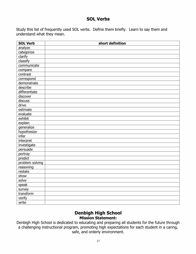
SOL Verbs
Study this list of frequently used SOL verbs. Define them briefly. Learn to say them and understand what they mean.
SOL Verb short definition
analyze
categorize
clarify
classify
communicate
compare
contrast
correspond
demonstrate
describe
differentiate
discover
discuss
drive
estimate
evaluate
exhibit
explain
generalize
hypothesize
infer
interpret
investigate
persuade
portray
predict
problem solving
reasoning
restate
show
solve
speak
survey
transform
verify
write
Denbigh High School
Mission Statement: Denbigh High School is dedicated to educating and preparing all students for the future through a challenging instructional program, promoting high expectations for each student in a caring,
safe, and orderly environment.
17
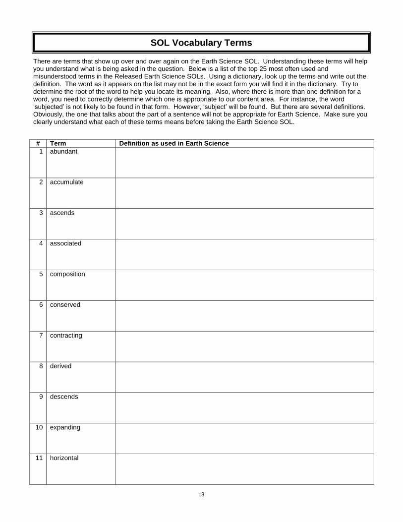
There are terms that show up over and over again on the Earth Science SOL. Understanding these terms will help you understand what is being asked in the question. Below is a list of the top 25 most often used and misunderstood terms in the Released Earth Science SOLs. Using a dictionary, look up the terms and write out the definition. The word as it appears on the list may not be in the exact form you will find it in the dictionary. Try to determine the root of the word to help you locate its meaning. Also, where there is more than one definition for a word, you need to correctly determine which one is appropriate to our content area. For instance, the word ‘subjected’ is not likely to be found in that form. However, ‘subject’ will be found. But there are several definitions. Obviously, the one that talks about the part of a sentence will not be appropriate for Earth Science. Make sure you clearly understand what each of these terms means before taking the Earth Science SOL.
# Term Definition as used in Earth Science
1 abundant
2 accumulate
3 ascends
4 associated
5 composition
6 conserved
7 contracting
8 derived
9 descends
10 expanding
11 horizontal
SOL Vocabulary Terms
18

12 hypothesis
13 observation
14 originates
15 overturned
16 periodically
17 primarily
18 relationship
19 relative
20 stationary
21 subjected
22 transform
23 underlain
24 vertical
25 vicinity
19
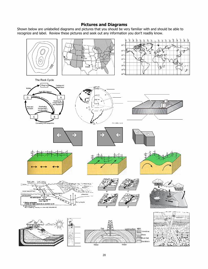
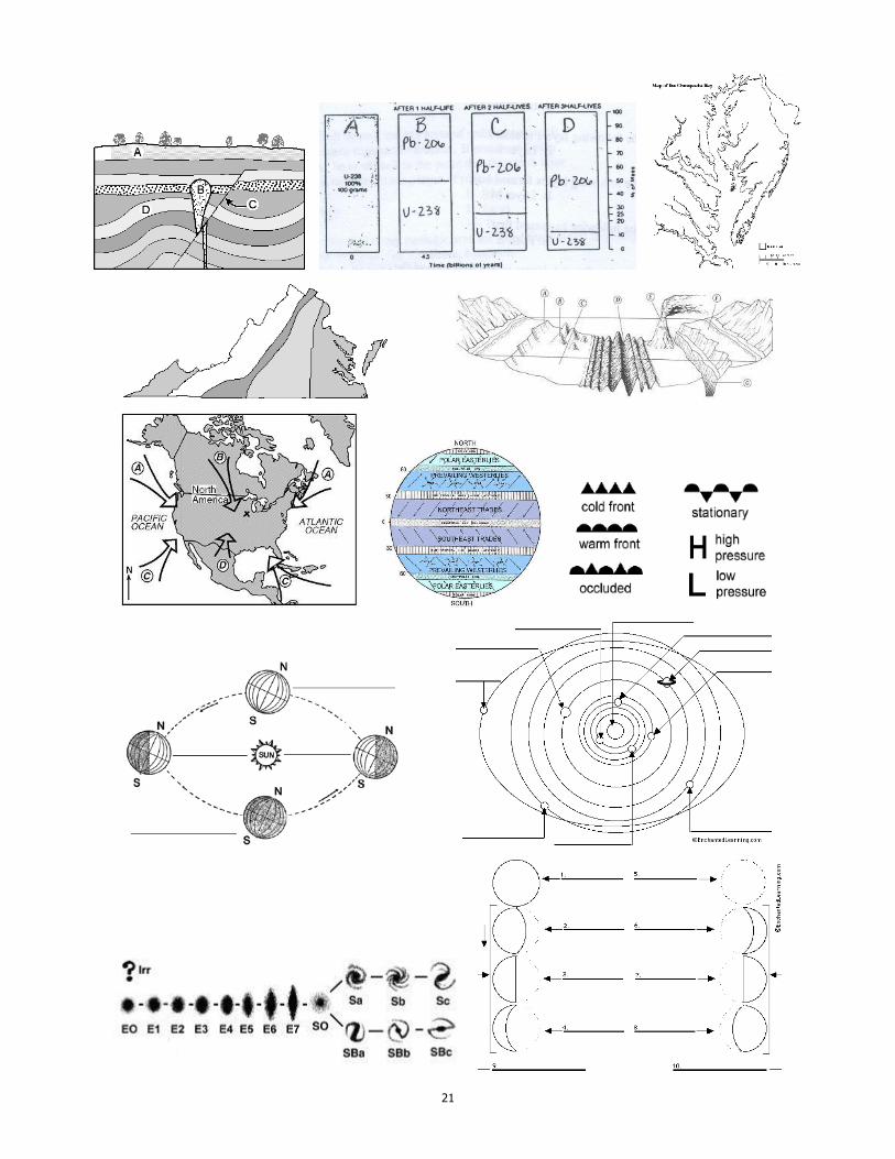
Pictures and Diagrams
Shown below are unlabelled diagrams and pictures that you should be very familiar with and should be able to
recognize and label. Review these pictures and seek out any information you don’t readily know.
20
21
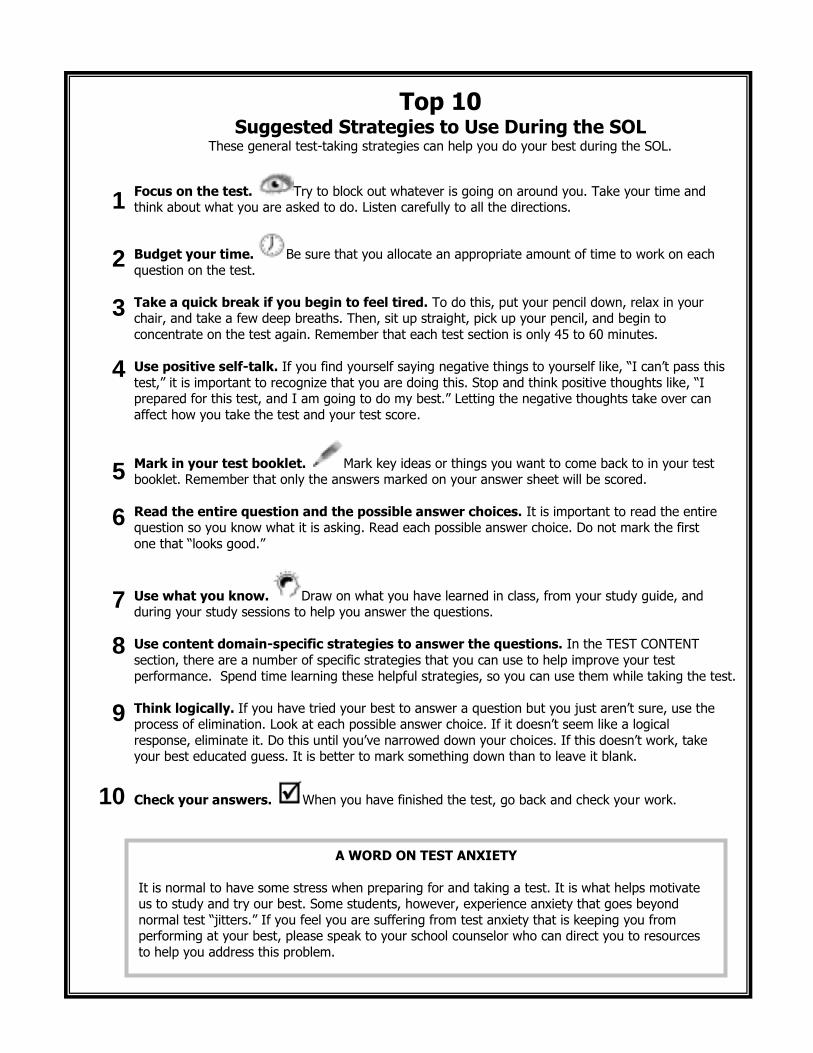
Top 10 Suggested Strategies to Use During the SOL
These general test-taking strategies can help you do your best during the SOL.
Focus on the test. Try to block out whatever is going on around you. Take your time and think about what you are asked to do. Listen carefully to all the directions.
Budget your time. Be sure that you allocate an appropriate amount of time to work on each
question on the test.
Take a quick break if you begin to feel tired. To do this, put your pencil down, relax in your chair, and take a few deep breaths. Then, sit up straight, pick up your pencil, and begin to
concentrate on the test again. Remember that each test section is only 45 to 60 minutes.
Use positive self-talk. If you find yourself saying negative things to yourself like, “I can’t pass this
test,” it is important to recognize that you are doing this. Stop and think positive thoughts like, “I prepared for this test, and I am going to do my best.” Letting the negative thoughts take over can
affect how you take the test and your test score.
Mark in your test booklet. Mark key ideas or things you want to come back to in your test booklet. Remember that only the answers marked on your answer sheet will be scored.
Read the entire question and the possible answer choices. It is important to read the entire question so you know what it is asking. Read each possible answer choice. Do not mark the first
one that “looks good.”
Use what you know. Draw on what you have learned in class, from your study guide, and during your study sessions to help you answer the questions.
Use content domain-specific strategies to answer the questions. In the TEST CONTENT
section, there are a number of specific strategies that you can use to help improve your test
performance. Spend time learning these helpful strategies, so you can use them while taking the test.
Think logically. If you have tried your best to answer a question but you just aren’t sure, use the process of elimination. Look at each possible answer choice. If it doesn’t seem like a logical
response, eliminate it. Do this until you’ve narrowed down your choices. If this doesn’t work, take your best educated guess. It is better to mark something down than to leave it blank.
Check your answers. When you have finished the test, go back and check your work.
1
2
3
4
5
6
7
8
9
10
A WORD ON TEST ANXIETY
It is normal to have some stress when preparing for and taking a test. It is what helps motivate us to study and try our best. Some students, however, experience anxiety that goes beyond
normal test “jitters.” If you feel you are suffering from test anxiety that is keeping you from performing at your best, please speak to your school counselor who can direct you to resources
to help you address this problem.