RESILIENT TRANSPORTATION SYSTEMS IN A POST-DISASTER ENVIRONMENT: A Case Study...
56
Gulf Coast Research Center for Evacuation and Transportation Resiliency LSU / UNO University Transportation Center RESILIENT TRANSPORTATION SYSTEMS IN A POST-DISASTER ENVIRONMENT: A Case Study of Opportunities Realized and Missed in the Greater New Orleans Region Final Report James R. Amdal and Stan L. Swigart Performing Organization Gulf Coast Research Center for Evacuation and Transportation Resiliency Merritt C. Becker Jr. University of New Orleans Transportation Institute New Orleans, LA Sponsoring Agency United States Department of Transportation Research and Innovative Technology Administration Washington, DC Project # 10-01 October 2010
Transcript of RESILIENT TRANSPORTATION SYSTEMS IN A POST-DISASTER ENVIRONMENT: A Case Study...

Gulf Coast Research Center for Evacuation and Transportation Resiliency
LSU / UNO University Transportation Center
RESILIENT TRANSPORTATION SYSTEMS IN A POST-DISASTER ENVIRONMENT: A Case Study of Opportunities Realized and Missed in the Greater New Orleans Region
Final Report James R. Amdal and Stan L. Swigart
Performing Organization Gulf Coast Research Center for Evacuation and Transportation Resiliency Merritt C. Becker Jr. University of New Orleans Transportation Institute New Orleans, LA
Sponsoring Agency United States Department of Transportation Research and Innovative Technology Administration
Washington, DC Project # 10-01 October 2010

GULF COAST RESEARCH CENTER FOR EVACUATION AND
TRANSPORTATION RESILIENCY The Gulf Coast Research Center for Evacuation and Transportation Resiliency is a collaborative effort between the Louisiana State University Department of Civil and Environmental Engineering and the University of New Orleans' Department of Planning and Urban Studies. The theme of the LSU-UNO
Center is focused on Evacuation and Transportation Resiliency in an effort to address the multitude of issues that impact transportation processes under emergency conditions such as evacuation and other types of major events. This area of research also addresses the need to develop and maintain the ability of transportation systems to economically, efficiently, and safely respond to the changing demands that may be placed upon them.
Research The Center focuses on addressing the multitude of issues that impact transportation processes under emergency conditions such as evacuation and other types of major events as well as the need to develop and maintain the ability of transportation systems to economically, efficiently, and safely respond to the changing conditions and demands that may be placed upon them. Work in this area includes the development of modeling and analysis techniques; innovative design and control strategies; and travel demand estimation and planning methods that can be used to predict and improve travel under periods of immediate and overwhelming demand. In addition to detailed analysis of emergency transportation processes, The Center provides support for the broader study of transportation resiliency. This includes work on the key components of redundant transportation systems, analysis of congestion in relation to resiliency, impact of climate change and peak oil, provision of transportation options, and transportation finance. The scope of the work stretches over several different modes including auto, transit, maritime, and non-motorized. Education The educational goal of the Institute is to provide undergraduate-level education to students seeking careers in areas of transportation that are critical to Louisiana and to the field of transportation in general with local, national and international applications. Courses in Transportation Planning, Policy, and Land use are offered at UNO, under the Department of Planning and Urban Studies. In addition to the program offerings at UNO, LSU offers transportation engineering courses through its Department of Civil and Environmental Engineering. The Center also provides on-going research opportunities for graduate students as well as annual scholarships.
Technology Transfer The LSU/UNO UTC conducts technology transfer activities in the following modes: 1) focused professional, specialized courses, workshops and seminars for private sector entities (business and nonprofits) and government interests, and the public on transport issues (based on the LSU-UNO activities); 2) Research symposia; transport issues (based on the LSU-UNO activities); 3) Presentations at professional organizations; 4) Publications. The Center sponsors the National Carless Evacuation Conference and has co-sponsored other national conferences on active transportation.
Disclaimer The contents of this report reflect the views of the authors, who are solely responsible for the facts and the accuracy of the material and information presented herein. This document is disseminated under the sponsorship of the U.S. Department of Transportation University Transportation Centers Program in the interest of information exchange. The U.S. Government assumes no liability for the contents or use thereof. The contents do not necessarily reflect the official views of the U.S. Government. This report does not
constitute a standard, specification, or regulation.

i
Technical Report Documentation Page 1. Report No. 10-01
2. Government Accession No.
3. Recipient’s Catalog No.
4. Title and Subtitle
RESILIENT TRANSPORTATION SYSTEMS IN A POST-DISASTER ENVIRONMENT:
5. Report Date
August 2010
Published: October 2010
A CASE STUDY OF OPPORTUNITIES REALIZED AND MISSED IN THE GREATER
NEW ORLEANS REGION
6. Performing Organization Code
7. Author(s)
James Amdal, Stan Swigart
8. Performing Organization Report No.
9. Performing Organization Name and Address
Merritt C. Becker Jr. University of New Orleans Transportation Institute
2000 Lakeshore Dr., New Orleans, LA 70148
10. Work Unit No. (TRAIS)
11. Contract or Grant No.
12. Sponsoring Agency Name and Address
Gulf Coast Research Center for Evacuation and Transportation Resiliency
Department of Planning and Urban Studies
University of New Orleans
New Orleans, LA 70148
13. Type of Report and Period Covered
Technical Report
July 2009 – August 2010
14. Sponsoring Agency Code
15. Supplementary Notes
16. Abstract
Based upon our research in Post-Katrina New Orleans, we define transportation resiliency as a system’s ability to function before, during and after
major disruptions through reliance upon multiple mobility options. The importance of a resilient transportation system becomes more apparent
during disasters where multiple options for mobility are necessary for both passenger and goods movement due to the potential loss of one or more
modes.
Post-Katrina New Orleans offers a unique opportunity to investigate pre-disaster planning and post-disaster recovery activities in a major
metropolitan city where all modes of transportation were either severely damaged or completely destroyed. In response to Hurricane Katrina, the
costliest disaster in U.S. history, new policies and programs have been adopted in New Orleans, in Louisiana, and at the federal level for disaster
preparedness and post-disaster recovery. This paper addresses how transportation systems and policies in New Orleans have evolved in the wake
of Hurricane Katrina (2005) to achieve a greater degree of resiliency and ultimately better serve the mobility needs of the community in future
disaster situations.
17. Key Words
Transportation Resiliency, Evacuation, Disaster Response
18. Distribution Statement
No restrictions. Copies available from
www.evaccenter.lsu.edu
19. Security Classification (of this report)
Unclassified
20. Security Classification (of this page)
Unclassified
21. No. of Pages
49
22. Price

ii
Acknowledgements This project was funded by the Gulf Coast Research Center for Evacuation and Transportation
Resiliency.
We would like to acknowledge the following individuals who provided valuable information and
actively participated in this process:
Port of New Orleans
Pat Gallwey, Chief Operating Officer
Deborah Keller, Director of Port Development
Cynthia Swain, Director of Administration
Paul Zimmerman, Director of Port Operations
Chris Bonura, Manager of Media Relations
Joseph Labarriere, Harbor Police Department
New Orleans Public Belt Railroad
Jim Bridger, General Manager
Tom Lobello, Chief Operating Officer
New Orleans Tours
Bob Bourg, Director of Operations
Airport Shuttle
Don Duverney, Director of Operations
Veolia Transportation – Regional Transit Authority (RTA) Justin Augustine, Chief Executive Officer
Mark Major, General Manager
Regional Planning Commission
Walter Brooks, Executive Director
Jeffrey Roesel, AICP, Director of Planning
Lynn Dupont, ASLA, Principal Planner/GIS Coordinator
Louis Armstrong New Orleans International Airport (LANOIA) Pat Malone, Deputy Director of Administration
Carol Lowe, Deputy Director of Commercial Development
Maggie Woodruff, Deputy Director of Community and Governmental Affairs
United States Coast Guard Sector New Orleans
Captain Edwin Stanton, Sector Commander
Captain Pauline Cook, Deputy Sector Commander
Amtrak
Butch Williams, Southern Division Assistant Superintendent

iii
Louisiana Department of Transportation (LA DOTD)
Michael Stack, District 2 Administrator
New Orleans Homeland Security and Emergency Preparedness (NOHSEP)
Lt. Colonel Jerry Sneed, Director
Thomas D. Ignelzi, CEM, LEM, Emergency Manager
Maritime Administration (MARAD)
James Murphy, Acting Director
New Orleans Hospitality Company
Warren Reuther, Founder
University of New Orleans, Center for Urban and Public Affairs
Billy Fields, Ph.D.

iv
Table of Contents
List of Figures and Tables ______________________________________________________________ v Executive Summary ___________________________________________________________________ 1 1.0 Introduction_____________________________________________________________________ 4 2.0 Resilient Transportation Systems: A Literature Review _________________________________ 6 3.0 Disaster Response and Recovery: Lessons Learned ___________________________________ 10
A. Key State and Regional Players: ____________________________________________________ 14 The Regional Planning Commission (RPC) __________________________________________ 14 Louisiana Department of Transportation and Development (LA DOTD) District 2 ___________ 16 The Louisiana Recovery Authority (LRA) __________________________________________ 17
B. Transportation systems in a Post-disaster Environment __________________________________ 18 City Assisted Evacuation Plan (CAEP) _____________________________________________ 18 Regional Transit Authority (RTA) _________________________________________________ 19 Charter Buses _________________________________________________________________ 19 Passenger Rail Evacuation _______________________________________________________ 20 Air Service ___________________________________________________________________ 21 Freight Rail __________________________________________________________________ 23 Maritime _____________________________________________________________________ 23 MARAD _____________________________________________________________________ 23 USCG _______________________________________________________________________ 24 Cruise Ships __________________________________________________________________ 26 Ferries and Riverboats __________________________________________________________ 26
C. Transportation Resiliency: An On-going Process _______________________________________ 26 Coordination, Communication, and Emergency Operations Systems ______________________ 27
4.0 Resilient Transportation: A Summary of Findings and Conclusions_____________________ 28 Appendix A: __________________________________________________________________ 33 New Orleans’ Transportation Infrastructure: An Overview ______________________________ 33 Regional Highway and Roadway System ___________________________________________ 33 Maritime _____________________________________________________________________ 35 Air Service ___________________________________________________________________ 35 Public Transportation ___________________________________________________________ 36 Passenger Rail ________________________________________________________________ 37 Freight Rail __________________________________________________________________ 37 Non-Motorized Transportation ___________________________________________________ 38 Appendix B: __________________________________________________________________ 40 Resilient Transportation and the Recovery Planning Processes ___________________________ 40 The Bring New Orleans Back Commission (BNOB)___________________________________ 40 The “Louisiana Speaks” Regional Planning Initiative __________________________________ 42 New Orleans Neighborhoods Rebuilding Plan (NONRP) _______________________________ 43 Unified New Orleans Plan (UNOP) ________________________________________________ 43 Office of Recovery Management’s One New Orleans Plan ______________________________ 44 New Orleans’ Master Plan and the Comprehensive Zoning Ordinance _____________________ 44
References __________________________________________________________________________ 47

v
List of Figures and Tables
Figure 1. Number of TRIS search results per year (1979 – 2009) _________________________ 6 Figure 2. Named Storms and Research on Evacuation __________________________________ 7 Figure 3. National Highway System in New Orleans __________________________________ 35 Figure 4. Class I Rail Map _______________________________________________________ 38
Table 1. Stakeholders Interviewd __________________________________________________ 10
Table 2. Summary of Pre- and Post-Disaster Policies __________________________________ 28
Table 3. Post-Katrina Recovery Planning Timeline ____________________________________ 43
Table 4. Louisiana Recovery Authority tansportation and infrastructure projects _____________ 46

1
Executive Summary
Transportation systems play a crucial role in responding to a region’s pre-disaster evacuation and
post-disaster recovery. Their ability to perform under adverse conditions in times of disaster
depends upon the resiliency of their fixed and moveable assets as well as their operational
procedures before, during and after the event. As well, planning and coordination between the
individual modes and various state and federal agencies is now recognized as a critical factor
during all phases of a disaster.
For New Orleans, Hurricane Katrina was a “game changer”. This devastating hurricane flooded
80% of the city in August, 2005 and severely impacted most transportation systems serving the
city and the region. In order to fully understand the storm’s lasting impact, the Greater New
Orleans Region was used as a case study to assess the resiliency of individual transportation
systems both Pre and Post- Katrina. Researchers assessed key transportation assets and systems
before, during and after this horrific event using key stakeholder interviews. “Lessons Learned”
and key policies in both the public and private sector post-disaster are highlighted.
Transportation leaders in both passenger and freight modes were interviewed to assess their pre-
storm preparations and their post-storm recovery efforts. Input from planning and government
officials was also used to identify policy and procedural changes that affected both evacuation
and disaster response.
In assessing New Orleans Pre-Katrina, both the public and private sectors relied on a number of
assumptions that proved ill-suited for this particular disaster.
The flood protection system was capable of withstanding the storm surge.
Evacuation to high rise hotels would provide safe haven for residents and tourists.
The carless would be transported to a city-designated “shelter of last resort”.
Movable assets would be “safely” secured on-site.
Land-based communications systems and operational centers were storm resistant.
Local and state resources for evacuation and recovery were sufficient.
In each case, these assumptions proved faulty or fatal for the citizens of New Orleans when the
levee systems failed during Katrina.
Post-Katrina, many improvements have been made to policies, procedures, and facilities within
the transportation sector that bolster the region’s resiliency to both disaster evacuation and
response.
Greater cooperation and collaboration exists in both the public and private sector.
Pre-existing agreements, Memorandums of Understanding and contracts now exist
that allow for timely and efficient utilization of needed assets by local and state
officials.

2
Metropolitan Planning Organizations are now recognized as a key resource and
facilitator to all levels of government.
Achieving transportation resiliency is an ongoing and incremental process.
The degree of resiliency varies by mode.
Overall, the communication network and its coordination between and among modes
still requires improvement.
As one transportation leader stated, “communication is our Achilles Heel”. This situation is
especially problematic among the freight transportation modes.
This research demonstrates that New Orleans is now, almost 5 years after Katrina, a more
resilient city. Both policies and procedures within the transportation network have been
improved to address disaster evacuation and response. New Orleans no longer relies solely on
the flood protection systems for its safety and security. Now evacuation plans are designed to
move people and assets out of “harm’s way” as opposed to vertical evacuation or on-site storage
of transportation assets. Air, marine, public transit and rail transportation assets proved
invaluable in Post-Katrina New Orleans and all are now being incorporated into pre-evacuation
and post-response planning and execution. This case study demonstrates the value of resiliency
as an operative framework for decision making at all levels of government and across all modes
of transportation.

3
Abstract
Based upon our research in Post-Katrina New Orleans, we define transportation resiliency as a
system’s ability to function before, during and after major disruptions through reliance upon
multiple mobility options. The importance of a resilient transportation system becomes more
apparent during disasters where multiple options for mobility are necessary for both passenger
and goods movement due to the potential loss of one or more modes.
Post-Katrina New Orleans offers a unique opportunity to investigate pre-disaster planning and
post-disaster recovery activities in a major metropolitan city where all modes of transportation
were either severely damaged or completely destroyed. In response to Hurricane Katrina, the
costliest disaster in U.S. history, new policies and programs have been adopted in New Orleans,
in Louisiana, and at the federal level for disaster preparedness and post-disaster recovery. This
paper addresses how transportation systems and policies in New Orleans have evolved in the
wake of Hurricane Katrina (2005) to achieve a greater degree of resiliency and ultimately better
serve the mobility needs of the community in future disaster situations.

4
1.0 Introduction
Under normal conditions, a transportation system provides capable mobility for passengers as
well as the movement of goods from one point to another. The significance of a system’s utility
and value in a support role become more apparent in emergency response and evacuation
situations because of the higher demand placed upon them. Equally important is a system’s
ability to support post-disaster recovery and supply efforts.
In this case, we studied the effects of the Hurricane Katrina disaster of 2005 on the New Orleans
regional transportation system. Using the Katrina experience as a point of reference, the
objective of this research is to better recognize how the New Orleans region has progressed in
terms of transportation resiliency. Pre-event planning and post-event recovery highlighted the
importance of a transportation system’s ability to withstand the stresses associated with a
catastrophe of this magnitude. In order to review the system as a whole, the study focuses on pre-
storm transportation and policy composition, the failures that resulted from the event, and what
policy changes have strengthened the post-storm transportation system. As a “snap shot” of New
Orleans in this Post-Katrina period, this research has significance for local, national and world-
wide audiences in light of our evolving “Lessons Learned”.
The report is structured to assess the state and regional authorities involved in disaster planning
and recovery and Post-Katrina transportation and communication developments. The
methodology employed for this research project was to interview the key state and regional
stakeholders within the transportation and planning communities to determine what steps are
being taken since the storm that will positively impact our transportation system. Consequently,
this project represents the first comprehensive assessment of transportation resiliency in Post-
Katrina New Orleans.
Report Structure
Section 1 - An extensive literature review of the subject, published or online, to provide a
national perspective.
Section 2 - An overview of the past policies and practices of local governments and what
changes have developed leading up to and after Katrina. The researchers interviewed
stakeholders, emergency response personnel, public and private sector transportation leaders as
well as regional, state and federal officials to formulate a “state of the city” assessment regarding
the region’s transportation resiliency. These leaders were asked: “What was done Pre-Katrina to
prepare for and to recover from disasters (natural and man-made)? What has changed? Are new
plans and agreements now in place to improve transportation resiliency in the Post-Katrina
environment?” This section also summarizes the role that various organizations played in terms
of policy changes that directly impact our transportation resiliency as well as improvements that
have resulted.

5
Section 3 - A listing of key findings that identify deficiencies, as well as progress toward
achieving a greater level of transportation system resiliency. These key research findings are
derived from numerous points made during the course of the interview process and are outlined
in Table 2.
Appendix A - An overview of New Orleans regional transportation systems.
Appendix B - A summary of the extensive Post-Katrina planning processes that have
been employed in the City of New Orleans and that portion of Louisiana affected by the
2005 hurricanes.
Key conclusions drawn from the research findings include:
Achieving transportation resiliency is an ongoing and incremental process.
Progress towards transportation resiliency within specific modes has been achieved
although the network as a whole lacks communication and coordination across
modes.
Recently executed MOUs allow for maximum utilization of federal assets to support
local resources in times of disaster.
MPOs are now recognized as a key facilitator to all levels of government for the
recovery of critical transportation infrastructure based on their political and technical
networks and their extensive regional data.

6
2.0 Resilient Transportation Systems: A Literature Review
What is resilience?
The term resilience comes from the Latin resalire, which means “to spring back, rebound” and
can be applied across many fields of study. After a thorough review of published definitions of
resilience, the following are two examples that were found to align with our research of
transportation system resiliency and its impact on a community. The Community and Regional
Resilience Institute (CARRI) defines resilience as “The capability to anticipate risk, limit impact,
and bounce back rapidly through survival, adaptability, evolution, and growth in the face of
turbulent change” (Plodinec 2009, Pg. 7). CARRI conducted a review of literature to identify
definitions of resilience of which an analysis was prepared titled, “Definitions of Resilience: An
Analysis”. Based on their analysis, CARRI developed the aforementioned definition as it relates
to community resilience.
An acknowledged expert in transportation resiliency is Dr. Pamela Murray-Tuite whose 2006
paper “A Comparison of Transportation Network Resilience under Simulated System Optimum
and User Equilibrium Conditions,” established the generalized definition for a resilient
transportation network. As stated in her paper, “resilience is a characteristic that indicates system
performance under unusual conditions, recovery speed, and the amount of outside assistance
required for restoration to its original functional state”. (Murray-Tuite 2006, Pg. 1). Although
centered on transportation resiliency, this research and that of others has focused primarily on
disruptions of a particular segment of a network, rather than a failure of multiple systems within
a network and/or their support infrastructure. We have highlighted these two definitions because
of their relation to community and transportation resiliency in a time of disaster.
The Katrina experience in New Orleans offers a departure from earlier research given the scale
and complexity of the affected area. Disruption of the various modal networks resulted largely
from the failure of the hurricane protection levee system. To date, there has been limited focus
on systemic failures affecting all modes of
transportation post-disaster. Consequently, we
have defined transportation resiliency as a
system’s ability to function before, during and
after major disruptions through reliance upon
multiple mobility options.
This literature review is primarily focused on a
unique subset of the topic - disaster evacuation
- which has been the subject of intense research
Post-Katrina within the broader
topic/concentration of transportation resiliency.
According to the Transportation Research
Board’s Research Database, between 1979 and
2009 there has been an average of one Figure 1

7
transportation resiliency report per year. Similar results were found using other databases
including Academic Search Complete.
However, for more than half of the last 30 years there simply was no research that combined
transportation and resiliency. Prior to 2000, with one exception, research focused on the
resilience of various materials to disruptions: highway stripping, asphalt blends, bridge joint
sealer and post tensioning, soil, warning surfaces, and railroad track fasteners. An anomaly,
Hansen and Sutter’s 1990 working paper, “Studies on the Loma Prieta Earthquake No. 1. The
Shake with Freight: The Impact of the Loma Prieta Earthquake on Bay Area Truckers” was the
first hint of a new area of study. It considered the cost and revenue impacts to Bay Area trucking
firms related to the roadway closures caused by the Loma Prieta Earthquake. Twenty years later,
the concept of resilient transportation is only now beginning to emerge as a specific research
concentration. During the last three years, research on transportation resiliency has substantially
increased. Between 2006, immediately after Hurricane Katrina, and the end of 2009, a total of 16
studies were completed. While several of these studies continue to consider materials, research
relative to emergency preparedness and a more holistic evaluation of the transportation network
is now being conducted. In 2009, Heaslip, Louissel, and Collura developed a framework to
quantify resiliency and applied it to the I-95 corridor.
Focusing on freight transportation in Washington State, Goodchild et al (2009) identified weak
points in the system, proposed improvements with the greatest potential to continue operations
during a system failure, identified the most important elements to keep freight moving, and
recommended investments to improve the system’s resiliency. Kenville et al (2009) developed a
resource manual to assist airport personnel in strengthening emotional and psychological skills
required to prepare for, respond to, and manage man-made or natural disasters. Sanchez-Silva
and Rosowsky (2008) argued that a network must be analyzed as a system to identify efficient
risk management strategies; the researchers modeled the Texas road network as a dynamic
structured functional unit. These studies primarily consider single modes. Exceptions include
FEMA’s 2009 “National Infrastructure
Protection Plan” and Dewar and Wach’s
“Transportation Planning, Climate Change, and
Decisionmaking Under Uncertainty” published
in 2008. Dewar and Wach reviewed the limited
treatment of uncertainty by travel forecasting
procedures and presented methods used to
account for uncertainty in other fields. The
2009 National Infrastructure Protection Plan
identifies and proposes various steps to protect
critical infrastructure and key resources in
times of uncertainty.
In recent years considerable attention has been
given to a subset of resilient transportation as a
Figure 2

8
distinct field of study; specifically, disaster readiness and response, including evacuation.
This growing body of research coincides with the increased frequency of named tropical storms.
Activity peaked immediately after the storms of 2005, when researchers in the U.S. and abroad
began to focus on the specifics of actions taken prior to Hurricanes Katrina and Rita. In 2005,
Wolshon et al argued that we have an obligation to plan for hurricane evacuation because (1)
hurricanes provide the greatest warning time of any disaster, (2) more people are impacted over a
greater area by these events, (3) historically storm surge flooding has claimed the greatest
number of lives. With advances in weather detection technology officials can now provide early
notice warnings when a tropical disturbance is forming. This provides time to move populations
and assets out of the “cone of uncertainty,” a visual aid that represents the forecasted track of the
center of the hurricane (Broad et al 2006).
Recently, two studies have been released that evaluate evacuation plans nationwide. In August
2005, Wolshon et al reviewed the evacuation plans and practices for 18 states using a survey
technique. Findings relevant to this project include: (1) most systems rely on buses to transport
low mobility and special needs groups. However, no survey respondent indicated plans to use
other forms of public transportation, such as rail, for evacuation. For cities using public
transportation (buses and para-transit vehicles), contracts were usually made with local transit
authorities, school districts, and private tour operators. (2) There still exists a need for greater
education and exchange of information across the transportation and disaster response
community in general. In 2008, the Transportation Research Board (TRB) released a
comprehensive report titled “Role of Transit in Emergency Evacuation” (White and He 2008).
Emergency response and evacuation plans for the thirty-eight largest urbanized areas in the
United States plans were reviewed. Findings relevant to this study include:
1. The majority of emergency operation plans for large urbanized areas are only
partially sufficient in describing in specific and measurable terms how a major
evacuation could be conducted successfully, and few focus on the role of transit.
2. Even among localities with evacuation plans, few have provided for a major disaster
that could involve multiple jurisdictions or multiple states in a region and necessitate
the evacuation of a large fraction of the population.
3. In those areas where transit is a full partner in local emergency evacuation plans,
transit agencies have been involved in the development of such plans and are part of
the designated emergency command structure.
4. Transit has a unique role to play in evacuating the carless and people with special
needs (e.g., the elderly, disabled populations, or people with pets) during an
emergency. However, these groups are inadequately addressed in most local
emergency evacuation plans.
5. The capacity and resilience of transit and highway systems as they affect evacuation
capability in an emergency incident are poorly addressed in current funding
programs.
Since the hurricanes of 2005, there has been increased interest in evacuation and overall
transportation resiliency; however it is unclear whether the findings and recommendations of

9
these studies are being incorporated by practitioners. While the Hurricane Gustav evacuation in
Louisiana was considered a success, there any many aspects of disaster response and recovery
that still require improvement.

10
3.0 Disaster Response and Recovery: Lessons Learned
This section outlines the policies and practices of both local governments and transportation
providers in the Pre and Post-Katrina New Orleans region. The “state of the city” relative to
transportation resiliency has been determined through extensive interviews with key
stakeholders, emergency response personnel, public and private sector transportation leaders as
well as regional, state and federal officials (Table 1). Their insight provides for the first
comprehensive assessment of Post-Katrina transportation resiliency in the New Orleans area.
Table 1 - Stakeholders interviewed Port of New Orleans Pat Gallwey - Chief Operating Officer, Deborah Keller -
Director of Port Development , Cynthia Swain - Director of
Administration, Paul Zimmerman - Director of Port
Operations, Chris Bonura - Manager of Media Relations,
Joseph Labarriere - Harbor Police Department
New Orleans Tours Bob Bourg, Director of Operations
Airport Shuttle Don Duverney, Director of Operations
Veolia Transportation – Regional Transit
Authority
Justin Augustine - Chief Executive Officer
Mark Major - General Manager
Regional Planning Commission Walter Brooks - Executive Director
Jeffrey W. Roesel, AICP - Director of Planning
Lynn Dupont, ASLA - Principal Planner/GIS
Louis Armstrong New Orleans International
Airport
Pat Malone - Deputy Director of Administration Coordinator
Carol Lowe - Deputy Director of Commercial Development
Maggie Woodruff - Deputy Director of Community and
Governmental Affairs
United States Coast Guard Sector New
Orleans
Captain Edwin M. Stanton - Sector Commander
Captain, Pauline F. Cook - Deputy Sector Commander
Amtrak Butch Williams - Southern Division Assistant Superintendent
New Orleans Public Belt Railroad Jim Bridger - General Manager
Tom Lobello - Chief Operating Officer
New Orleans Homeland Security and
Emergency Preparedness
Lt. Colonel Jerry Sneed - Director
Thomas D. Ignelzi - CEM, LEM, Emergency Manager
Louisiana Department of Transportation Michael Stack - District Administrator
United States Maritime Administration James Murphy - Acting Director
New Orleans Hospitality Company Warren Reuther – Founder
University of New Orleans, Center for Urban
and Public Affairs
Billy Fields, Ph.D.

11
Local governments frequently call for an evacuation prior to a hurricane making landfall;
however, evacuation is also used to respond to various natural disasters including earthquakes,
tsunamis, wildfires, as well as other events. In October, 2007, an estimated 513,000 people were
evacuated from homes threatened by wildfires in Southern California. Evacuations by bus, as
well as personal vehicle, were made in successive rounds as the fires spread. This is a
significantly different approach than the massive hurricane evacuations common in the Gulf
Coast.
In the past, along the Gulf Coast, vertical and horizontal evacuations worked in tandem prior to a
hurricane. Vertical evacuation would move evacuees to upper levels of buildings constructed to
resist hurricane force winds and storm surge. In 2004, New Orleans Mayor Ray Nagin urged
their use when Hurricane Ivan threatened the City (Times Picayune 2004). Prior to Hurricane
Katrina, New Orleans’ hotels were commonly used for vertical evacuation, or escaping the rising
storm surge by going to the upper stories of a building. In 2008, FEMA reported that most multi-
story engineered buildings along the Mississippi Gulf Coast survived Hurricane Katrina’s storm
surge with minimal damage (FEMA 2008). Since Katrina, vertical evacuation is now considered
to be a prospect of last resort. By using a disaster response plan consisting purely of horizontal
evacuation, New Orleans must provide an efficient and effective means to evacuate visitors and
residents without vertical evacuation as an option. This adds a complicating factor into the
overall evacuation plan for the city and the region.
For decades, the U.S. has increasingly relied on private motorized vehicles for daily
transportation. Consequently, the U.S. now depends primarily on cars for our evacuation needs.
States, regions and cities have learned to adapt ground transportation systems, particularly
interstates, to work efficiently during evacuations. A commonly used technique in the New
Orleans region is contraflow lane reversal which roughly doubles the lanes available for
evacuation traffic on controlled-access roadways. However, contraflow has not always worked
successfully. In 1999, a gigantic traffic jam backed up the highway system in North Carolina as
coastal residents fled Hurricane Floyd (Tibbets 2008). But the problems encountered during the
Hurricane Ivan evacuation caused state agencies to reassess and refine contraflow operations
(Wolshon 2006). These included the Louisiana Department of Transportation and Development
(LA DOTD) and the Louisiana State Police (LSP) who formed the Louisiana Evacuation Task
Force in October 2004 (Wolshon 2006). Informed by recent evacuations, three changes were
made to improve Louisiana's hurricane response/contraflow plan: (1) a staged evacuation plan
was implemented over a period of days starting with the lowest lying areas; (2) a contraflow
loading plan was developed with multiple interchanges and a crossover to minimize congestion
and maximize capacity; and (3) an access management plan was designed to spread demand
across highways rather than concentrating vehicles solely on freeways (Wolshon 2009). Using
contraflow, Hurricane Katrina's evacuation was one of the most successful of any major urban
area: 1.3 million people successfully evacuated the New Orleans metropolitan region prior to this
massive 2005 storm (Rowley 2006).
While contraflow obstacles were largely addressed prior to Katrina, evacuation for the carless
proved inadequate. While 10.3% of the total U.S, households surveyed by the 2000 Census had
no access to a car, in New Orleans, a significant portion of the population, 27.3%, was carless.
Vehicle access also varied relative to race and class. While 15.4% of whites did not have access

12
to a vehicle, 34.8% of blacks did not. While only 5.5% of owner occupied households did not
have access to a vehicle, 40.8% of renter occupied households did not (U.S. Census, 2000).
Prior to Hurricane Katrina, the City of New Orleans recognized that many residents did not have
a means to evacuate and made preparations for the carless. According to a July 2005 Times-
Picayune article, the Regional Transit Authority, responsible for public transportation in Orleans
Parish, was tasked with providing buses to carry passengers to the Superdome or to undisclosed
shelters on the North Shore of Lake Pontchartrain. A projected 134,000 needed evacuation
assistance. The RTA was only able to transport 22,000 to a “shelter of last resort”. In the spring
of 2004, a coalition of public officials, community organizations, faith-based groups, and the
American Red Cross launched “Operation Brother’s Keeper” to create additional private
transportation networks for carless evacuation (Schleifstein 2005). Despite this initiative, a
survey conducted in July 2005 indicated an absence of operational plans to gather carless
evacuees and move them out of New Orleans (Nolan 2005). A video was produced, titled
"Preparing for the Big One," to warn the city’s carless to find a means to evacuate and not wait
for help from the Red Cross, the City or the State. However, the video was never distributed. In
September 2005, 70,000 copies remained untouched in a Los Angeles warehouse (Riccardi and
Rainey 2005).
Approximately 100,000 New Orleans residents stayed in the city during Hurricane Katrina (BBC
News 2005). This was in excess of 20% of New Orleans’ estimated 2005 population (480,000).
Thousands of residents without access to private vehicles were left stranded in New Orleans.
Other residents, with vehicles, chose to stay. One contributing factor may have been Hurricane
Ivan's near miss in 2004, coupled with its poorly executed highway evacuation, which added to
complacency in a certain segment of the population. With years of near misses, many residents
opted not to evacuate. However, other residents that stayed simply didn't have a way to evacuate.
While the storm changed paths at the last minute and did not directly hit New Orleans, those who
remained in the City learned that while they had skirted a natural disaster, they were now in the
middle of a manmade disaster caused by failures of the storm protection system. Storm-driven
water rose above some levees while it breached others. A total of 50 breaches was reported in the
Orleans Parish flood protection system. Roughly 80% of New Orleans went under water. Many
flooded areas were historically the poorest neighborhoods and the areas that had the highest
number of carless evacuees.
The population abandoned during Hurricane Katrina resulted from several systematic failures.
The Mayor ordered an evacuation 24 hours before the storm rather than the standard of 48 hours
which eliminated a full day from the response timeline. RTA buses were also not used to carry
passengers out of the City; their agreement with the City was to transport evacuees to the
Superdome, designated a shelter of last resort. Furthermore, varying levels of government failed
to collaborate in the development or implementation of a comprehensive evacuation plan
(Nathan and Landy 2009). In 2003, the National ITS Architecture Team released "Disaster
Response and Demand User Service”. This document identified the elements of a plan that were
needed to manage disaster response and demand user services to improve the safety,
performance, and effectiveness of any disaster response (Sill 2003). Although this report
identified areas that required cross agency coordination, this study, prepared for the United
States Department of Transportation, had little impact on governmental coordination in New

13
Orleans. Those left behind during Katrina were also the result of an inability to utilize available
transportation assets for disaster response (Weinheim 2005).
Horwitz argues that the organizational challenges faced by government agencies led to many of
the failures during Katrina. In his opinion, lacking complete knowledge and faced with making
either an error of omission or an error of commission, government agencies choose inaction. An
error of omission is easier to conceal than an error of commission. Agencies can claim there was
a lack of resources or other “external” factors that prevented them from doing their job. For an
error of commission, “the visible waste would be harder to explain than the less visible
consequences of waiting to react” (Horwitz 2008, Pg 9). This may explain why many of the
transportation assets that were available during Katrina were either underutilized or not used
(Weinheim 2005). Although incremental gains had been achieved by fine-tuning highway
evacuation and contraflow procedures and practices prior to Katrina, plans for the carless
population had not been adequately addressed. In response to Post-Katrina realities, the City, the
State, and FEMA began to develop an evacuation plan that would provide multiple options for
the entire population to safely evacuate. Hurricane Katrina caused this resilient plan to be
developed and adopted.
The success of the resultant evacuation plan of New Orleans during Hurricane Gustav clearly
demonstrated improvement in communications and intergovernmental coordination /
cooperation. Nearly 98% of the population of New Orleans was evacuated prior to landfall,
according to Lt. Col. Jerry Sneed, Deputy Mayor Public Safety and Homeland Security, City of
New Orleans. Thousands of residents participated in the City-Assisted Evacuation Plan (CAEP).
Augmenting the use of personal vehicles, residents and visitors were transported by planes,
trains, and buses. While there were some problems with shelters and a delay of relief supplies,
these were relatively minor (Rowley 2008). The results of a participant survey conducted by
UNO’s Dr. John Keifer et al post-Gustav indicated that the majority of evacuees were pleased
with CAEP and planned to utilize the system again if another mandatory evacuation was issued.
As recently demonstrated by repeated wildfires in California or hurricanes striking the Southern
and Gulf Coast states, each natural disaster has a unique set of attributes associated with it: 1)
disaster responses including evacuation and asset mobilization occur pre-event; 2) resupply and
recovery activities respond to the post-event circumstances. Disaster responses are further
affected by the following: alert notification and response timeframes; affected population
demographics and profiles; diversity of responses; operational and mobilization requirements;
the availability and utilization of specific transportation systems. Communities in these areas
have adopted a variety of hazard mitigation strategies to help them prepare for these events and
minimize their impact. Low cost techniques include: the relocation of transportation assets, both
surface and marine based; moving furnishing, equipment and appliances out of ground floor
spaces; elevating electrical breakers or utility meters; buying flood insurance; installing
hurricane straps in existing structures; installing and maintaining storm shutters; creating a safe
room; inspecting structures to assess structural sufficiency and / or compliance with “best
practices” or applicable codes. Over time, many communities have adopted zoning and land use
regulations to minimize development in the most vulnerable areas; acquisitions/buyouts have
also been used to relocate citizens and businesses out of low lying areas. Some communities

14
adopt building codes specifically designed to improve the chance of buildings to withstand
hurricane force winds.
Called on to move large numbers of people and moveable assets out of harm’s way quickly and
efficiently, the performance of our transportation systems during disasters reveals their strengths
and weaknesses, both organizationally and operationally. The challenges faced during any single
disaster can provide opportunities to better prepare for future disasters or identify specific
deficiencies made evident by a particular event. Disasters can also cause cities, states or
countries to mobilize around specific issues and reprioritize projects and programs accordingly.
This has been the case for New Orleans, Louisiana, and the United States, especially since the
storms of 2005.
A. Key State and Regional Players:
Regional Planning Commission
Louisiana Department of Transportation and Development
The Louisiana Recovery Authority
Immediately after and throughout the ongoing recovery period Post-Katrina, the Regional
Planning Commission (RPC), the Louisiana Department of Transportation and Development
(LA DOTD) and the Louisiana Recovery Authority have played critical roles in the recovery of
New Orleans and the greater New Orleans region. The RPC, the region’s Metropolitan Planning
Organization (MPO), represents Orleans, Jefferson, St. Charles, St. Bernard, and Plaquemines
Parishes. LA DOTD District 2 encompasses Orleans, Jefferson, St. Charles, St. Bernard,
Lafourche, Terrebonne, Plaquemines and St. Tammany parishes. The Louisiana Recovery
Authority is the governmental entity created by Governor Kathleen Blanco to plan for the
recovery and rebuilding of the 31 parishes severely impacted by Hurricanes Katrina and Rita in
2005. These 3 entities, working in a collaborative effort, have played an instrumental role in the
development of resilient transportation in our post-K New Orleans region.
The Regional Planning Commission (RPC)
The RPC served as a unique post-storm resource based upon their political, technical and data-
source networks. They had pre-storm data that was extensively used to assess the specific
impacts of the storm: 2000 census analysis of all New Orleans neighborhoods with 75 unique
attributes; traffic counts and modeling capabilities for the region’s transportation network; GIS
and mapping abilities based on the most current aerial photography for infrastructure, land use,
utilities, and signalization systems. These resources allowed the RPC, working in tandem with
numerous governmental entities, to plan for recovery using the most accurate data as a baseline
for decision-making. The RPC acted as an advocate and liaison between the City of New
Orleans, RPC member parish governments, LRA, LA DOTD, FHWA and FEMA relative to
project selection and funding. The RPC also served as source or liaison for technical, political
and data-source entities. Given the state of the City of New Orleans’ government immediately
Post-Katrina, the RPC also served as the de facto replacement for the City Planning
Commission’s staff in the months following the storm and were also used extensively by the
Governor’s Office of Emergency Preparedness and Homeland Security for post-storm
assessments.

15
Immediately post-storm an assessment team including representatives of FHWA, LA DOTD,
local parish representatives and RPC conducted a multi-parish inspection of the regional
roadway system that included streetlights, signal poles, controllers, as well as the road condition
and the identification of roadway deterioration that was likely caused by the effects of the storm.
One of the first observations was that the floodwaters (brackish) had caused an “instantaneous
degradation of the asphalt”. Secondly, the weight of the floodwaters had caused severe
subsidence of the roadways worsening an already bad situation in many locations throughout the
city. Based upon this initial inspection and prior knowledge of roadway conditions, the RPC
developed a map of damaged roadways with a rough program estimate for repair costs. This
program was submitted to the LRA, but initially it was not funded. The RPC, working with LA
DOTD, FHWA and the LA Congressional delegation secured funding appropriated by Congress
to repair roadways that were eligible to receive Federal aid per Title 23 USC. The resultant
Submerged Roads Program has included 56 streets to date, mostly roadways that are not on the
state highway system but are nonetheless eligible for federal aid using funds allocated to FHWA
from Congress totaling $105M. An additional 28 streets are pending, and $3M of transportation
enhancement funds has also been secured. Throughout the Post-Katrina years, the RPC has led
the multi-agency effort to secure $150M in Emergency Relief funds used in combination with
formula funds attributable to the region for street repair / reconstruction / enhancement activities
in New Orleans and other selected parishes. FHWA has prepared Disaster Inspection Reports for
all qualifying roadways which, it is hoped, will form the basis for a pavement management
system for the City of New Orleans.
The RPC was also instrumental in forming a Utility Coordinating Council which successfully
worked with the LRA to secure over $15M for Sewerage and Water Board repairs in New
Orleans. The primary focus of this committee was to provide project oversight and coordination
between various utilities and related companies (e.g. Cox Communications) that have
construction projects that impact roadways. A similar group, the Permanent Pump Committee
was formed using officials from a variety of affected entities.
Working in partnership with LA DOTD, the RPC recently completed the construction of the
Regional Transportation Management Center, a $14.5M building which locates both the
Intelligent Traffic System’s program in the New Orleans area, the LA DOTD District 2 traffic
operations section, and the RPC’s office in one facility. LA DOTD personnel utilize this high
tech center to monitor 150 real-time traffic cameras deployed along the interstate system
surrounding Lake Pontchartrain. In addition this facility allows LA DOTD to provide traffic
reports, activate contraflow during emergency evacuations, program digital message boards and
use other traffic management tools that provide efficient and safe travel throughout the New
Orleans region. As a direct result of Katrina, this facility, located in the Lakeview neighborhood
of New Orleans, was redesigned so that its first floor elevation was at minimum one foot higher
than the floodwater depth during the storm. This redesign required the adjustment of both the
project budget and schedule.

16
Louisiana Department of Transportation and Development (LA DOTD) District 2
The entire area encompassed by LA DOTD District 2 suffered significant damage during
Katrina. In Orleans Parish the westbound span of the I-10 Twin Span bridge suffered severe
damage; the eastbound span had significant damage; 80% of the surface roadways in New
Orleans were flooded for over a month and several were under water for over 45 days; portions
of I-10 and I-610 were closed for weeks. The net effect in the city and surrounding parishes was
widespread damage of critical surface transportation components that required immediate action:
reconstruction; repair; replacement. As a result, projects were prioritized based on need and
funding availability. A coordinated, cooperative and creative effort between the RPC, LA
DOTD, the LRA, and federal officials was key to accessing available and potential monies from
a variety of sources. Intergovernmental relations are now greatly improved based on the post-K
experience. EPA regulations have also been streamlined to speed up the permitting process for
these projects.
Katrina created an extremely challenging situation for LA DOTD operationally as well. District
personnel had been affected by the storm and the flooding, forcing many to relocate and
reestablish their housing needs for themselves and their families. Many didn’t return to their
former posts. Pre-Katrina District 2 had 532 employees. Immediately Post-Katrina District 2 had
420, an immediate 20% reduction in staff. District 2 at this writing has 490 employees. While
the staffing is still reduced, the workload has nearly tripled. According to District 2
Administrator Mike Stack, “This requires us to do things in new ways”. To date, LA DOTD
District 2 personnel have successfully managed and administered projects created by Katrina (i.e.
new Twin Span) plus three years of projects funded by state surplus monies and most recently
Round 1 ARRA (federal stimulus) projects. LA DOTD staff also continues to assist local levee
districts with their recovery and reconstruction projects, pursuant to their mandate under state
law. In all these instances timely delivery of projects remains a high priority for LA DOTD.
Pre-Katrina, LA DOTD engineers or their consultants designed projects located inside the flood
protection system based on an assumption that this system was sufficient to withstand a 100 year
flood with isolated overtopping in specific areas. Katrina proved this assumption to be in error.
Also Pre-Katrina, outside the flood protected areas, projects were designed to withstand some
flooding (especially in low areas) but it was assumed that routine recovery options would work
post-storm. Post-Katrina, according to Mr. Stack, “We try to prepare as if nothing is safe or
secure. We realize that we will always be vulnerable”.
Projects are now designed with a new awareness of risk and resiliency; however, there has been
no new official policy or specific regulations established within LA DOTD reflecting this new
emphasis. Post-Katrina, the concept of design-build has also been selectively used to speed
project delivery (“a new tool in the toolbox”). Katrina has also reordered priorities for road
construction projects. With new sources of funds, created in response to recent storms, some
roads on the project list used Emergency Recovery monies to pay for their construction which
allowed other projects to be funded.
Further complicating the challenge for District 2 were the 38 movable bridges that provide vital
connectivity for the general population as well as the region’s work force and vital industries to
the state and the nation. As Mr. Stack noted, “If the bridges don’t function, everything freezes”.

17
During Hurricanes Gustav and Ike, 29 bridges were damaged. To compound this issue, in recent
storms some bridge operators, foreman and supervisors evacuated, leaving their bridges
unattended. To preclude this from occurring in the future, LA DOTD has a standing agreement
with the USCG for their forces to assume operational control of these vital structures in the event
of a hurricane through H8 (or 8 hours before the projected landfall). Emergency generators have
also been provided in case there is a loss of power during a storm.
Another “lesson learned” from Hurricane Katrina is whenever possible LA DOTD facilities,
equipment and personnel are relocated out of “harm’s way”. During Katrina, the LA DOTD
District 2 facilities located in New Orleans East were wiped out by the storm surge.
Consequently, before Hurricane Gustav, based on its projected path, personnel and equipment
were relocated from Bridge City (in the New Orleans area) to a safe location at the district office
in Hammond.
The Louisiana Recovery Authority (LRA)
In response to the unprecedented damage caused by Hurricanes Katrina and Rita, Governor
Kathleen Blanco, by Executive Order, formed the Louisiana Recovery Authority in October of
2005. This 33 member citizen led entity remains “the coordinating and planning body leading the
most extensive rebuilding effort in American history” (Louisiana Recovery Authority 2009).
Under their original mandate, they were designated as the administrator of all federal CDBG
funds ($10.B for Katrina / Rita recovery) allocated by Congress. The majority of these funds
($7.5B) were used to fund the Road Home program for housing recovery. LRA distributed non-
Road Home funds to support the implementation of local government’s long-term recovery and
rebuilding plans. This requirement created significant obstacles for the City of New Orleans in
their overall Post-Katrina recovery planning (See Appendix B, “Resilient Transportation and the
Recovery Planning Processes” Pgs. 51-58).
“The LRA works closely with the Governor’s Office of Homeland Security and Emergency
Preparedness (GOHSEP) and partners with state and federal agencies to oversee more than $20
billion worth of programs, speed the pace of rebuilding, remove hurdles and red tape and ensure
that Louisiana recovers safer, stronger and smarter than before” (Louisiana Recovery Authority
2009). The LRA’s scope and available resources were significantly expanded after Hurricanes
Gustav and Ike in 2008 to incorporate those parishes impacted by these storms.
Relative to infrastructure and transportation recovery, the LRA’s long term priorities for
impacted parishes include: restoration of transportation and utility systems, enhancing
evacuation capabilities, and facilitating economic recovery; to repair and prioritize all hurricane
damaged public port infrastructure. The LRA uses FEMA Public Assistance Funds for
Rebuilding to support the repair and rebuilding of roads and bridges, water control facilities,
public buildings and equipment (including utilities). The Local Government Emergency
Infrastructure Program supports match funding for FEMA’s PA and Hazard Mitigation projects
that restore critical infrastructure.
To date, in the New Orleans region, the LRA has provided significant funds for a variety of
transportation and infrastructure projects that are critical for recovery and transportation

18
resiliency. These projects are identified for parishes within the greater New Orleans region by
select categories and specific applicant (See Appendix B, Table 4).
B. Transportation systems in a Post-disaster Environment
City Assisted Evacuation Plan (CAEP)
Post-Katrina, New Orleans has implemented a comprehensive City Assisted Evacuation Plan
(CAEP). This plan serves tourists as well as the transportation-needy and is activated upon
orders from the Mayor and in concurrence with the Governor following a declared state of
emergency. According to Lt. Col. Jerry Sneed, Deputy Mayor of Public Safety and Homeland
Security for the City of New Orleans, “the plan is meant to be an evacuation method of last
resort and only for those citizens who have no other means or have physical limitations that
prohibit self evacuation”. Prior to Hurricane Gustav in 2008, 6,300 residents registered for the
CAEP. Although preregistration is not required, in the days immediately preceding the storm,
registration soared to approximately 20,000. A total of 19,000 evacuees used this service. Triage
was coordinated and sufficiently staffed and the NOUPT functioned effectively as the evacuation
nexus. Overall, the CAEP worked well. Post-Gustav, a University of New Orleans study
surveyed 684 people who participated in the CAEP. The response to CAEP was overwhelmingly
positive with residents indicating they would use the service again.
As part of CAEP, approximately fifty-eight (H-58) hours before tropical storm winds from a
Category 2 or greater are projected to reach the Louisiana Coast, tourists are instructed to leave
the city and provided free shuttle service to the Airport. Fifty-four to thirty hours (H-54 to H-30)
before winds are projected to reach the Coast, the CAEP is activated. The City has an agreement
with the RTA to shuttle residents from 17 pick-up points to a central processing area at the New
Orleans Union Passenger Terminal (NOUPT). From the NOUPT, evacuees are transferred to
charter buses or Amtrak trains. This service continues for 24 hours. Those with special medical
needs are transported to Lakefront Airport for med-evac flights out of New Orleans.
“Lessons Learned” from Katrina have been used to formulate the current CAEP. The
implementation of CAEP has also resulted in Memorandums Of Understanding (MOU) between
agencies at all levels of government and private service providers. The following points
summarize the key changes in the current CAEP.
Incorporated into the current CAEP
o Use the New Orleans Union Passenger Terminal (NOUPT) as the main staging
area for evacuation.
o MOU with the RTA provides transportation from 17 designated pickup
locations to the NOUPT.
o Contracts are in place with New Orleans Hospitality Company (NOHC) for
Airport Shuttle vans to transport tourists to the LANOIA and New Orleans
Tours to transport residents from the NOUPT to either the LANOIA or various
shelters across the Gulf Coast.
o An online/phone-based registration system (preregistration is not required).
o Public Health Department verifies the medical needy.
19
Reentry
o An agreement is in effect with nearby parishes so that a unified approach can be
used for re-entry. State and local police as well as National Guard manage
checkpoints.
o Placard System has been developed to provide businesses with priority to re-
enter the City. Re-entry can be tiered by need, zip code or other geographic
factors.
Vertical Evacuation is no longer allowed. NOHSEP’s goal is for the city to be
completely evacuated. No shelter of last resort will be provided.
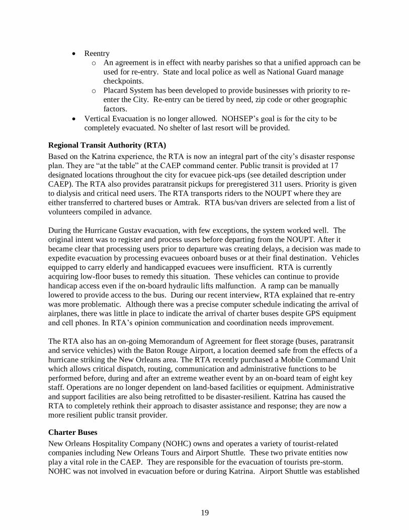
Regional Transit Authority (RTA)
Based on the Katrina experience, the RTA is now an integral part of the city’s disaster response
plan. They are “at the table” at the CAEP command center. Public transit is provided at 17
designated locations throughout the city for evacuee pick-ups (see detailed description under
CAEP). The RTA also provides paratransit pickups for preregistered 311 users. Priority is given
to dialysis and critical need users. The RTA transports riders to the NOUPT where they are
either transferred to chartered buses or Amtrak. RTA bus/van drivers are selected from a list of
volunteers compiled in advance.
During the Hurricane Gustav evacuation, with few exceptions, the system worked well. The
original intent was to register and process users before departing from the NOUPT. After it
became clear that processing users prior to departure was creating delays, a decision was made to
expedite evacuation by processing evacuees onboard buses or at their final destination. Vehicles
equipped to carry elderly and handicapped evacuees were insufficient. RTA is currently
acquiring low-floor buses to remedy this situation. These vehicles can continue to provide
handicap access even if the on-board hydraulic lifts malfunction. A ramp can be manually
lowered to provide access to the bus. During our recent interview, RTA explained that re-entry
was more problematic. Although there was a precise computer schedule indicating the arrival of
airplanes, there was little in place to indicate the arrival of charter buses despite GPS equipment
and cell phones. In RTA’s opinion communication and coordination needs improvement.
The RTA also has an on-going Memorandum of Agreement for fleet storage (buses, paratransit
and service vehicles) with the Baton Rouge Airport, a location deemed safe from the effects of a
hurricane striking the New Orleans area. The RTA recently purchased a Mobile Command Unit
which allows critical dispatch, routing, communication and administrative functions to be
performed before, during and after an extreme weather event by an on-board team of eight key
staff. Operations are no longer dependent on land-based facilities or equipment. Administrative
and support facilities are also being retrofitted to be disaster-resilient. Katrina has caused the
RTA to completely rethink their approach to disaster assistance and response; they are now a
more resilient public transit provider.
Charter Buses
New Orleans Hospitality Company (NOHC) owns and operates a variety of tourist-related
companies including New Orleans Tours and Airport Shuttle. These two private entities now
play a vital role in the CAEP. They are responsible for the evacuation of tourists pre-storm.
NOHC was not involved in evacuation before or during Katrina. Airport Shuttle was established

20
in 1991 and is the Official Ground Transportation Provider for the Louis Armstrong New
Orleans International Airport (LANOIA). According to Airport Shuttle’s website, the company
has a fleet of 60 clean burning, propane-fueled vehicles, 10 passenger vans and mini-buses.
After a storm enters the Gulf of Mexico, the Airport Shuttle contract is activated to provide free
evacuation service to the Airport. This service, primarily designed to escort tourists out of the
City well in advance of storm conditions, is available to anyone who needs transportation to the
Airport. During Gustav this operation was successfully completed in two days.
Established in 1973, New Orleans Tours is a full service charter bus company. It offers
convention and meeting shuttles as well as long distance charters. According to New Orleans
Tours’ website it has over 80 vehicles. Once the RTA transports CAEP participants to the
NOUPT, New Orleans Tours is responsible for their transportation to LANOIA and to other
locations in Louisiana and abutting states. Drivers and their families ride together and are “first
on the bus”. If needed, additional buses are brought in to complement New Orleans Tours’ local
fleet. During Gustav, both services were provided. Warren Reuther, CEO of NOHC, reported
there were no significant issues during this event. However, it was noted that the State contracts
with out-of-state coach operators to augment the local fleet. Many of these drivers are not
familiar with local conditions (roads, shelter locations, etc.) and cause undue delay, confusion, or
distress for evacuees in transit. In the future, locally-based companies and drivers should be
given preference.
Passenger Rail Evacuation
Prior to Katrina, Amtrak played no active part in evacuation assistance. Under emergency
conditions, equipment at the New Orleans Union Passenger Terminal (NOUPT) was normally
moved to McComb, Mississippi. In preparation for Hurricane Katrina, Amtrak assembled a train
set that could transport 900 evacuees to a safe haven. However, the equipment was not used.
This may have been due to a breakdown in communication or command/control. As a result,
seven locomotives and twenty cars departed NOUPT empty. Amtrak’s role dramatically
changed in the aftermath of the storm when Federal Railroad Administration officials deployed a
rescue train to New Orleans to assist in post-disaster evacuation. Amtrak assembled a train
manned by senior operating and security personnel, able to carry 650 evacuees, which arrived at
the Avondale rail yard, on the West Bank, approximately 10 miles from downtown New Orleans.
This train, operating over numerous freight tracks, was able to access Avondale although many
tracks in the region had been extensively damaged by the storm. The RTA transported
passengers from the city to Avondale for transfer to Amtrak. Ultimately, the train carried only
96 evacuees to Lafayette, Louisiana where they were again transferred to buses bound for
destinations in Texas. Amtrak remained on standby in Lafayette for 10 more days with two train
sets available for use. These were also never deployed. The failure to better utilize these assets is
documented in a 2006 federal report “Catastrophic Hurricane Evacuation Plan Evaluation: A
Report to Congress” reviewing the evacuation plans that impacted the Gulf Coast region. Trains
were available but not used due to a “lack of coordination, communication, and prior planning
among local, state, and federal officials” (Federal Highway Administration 2006) In contrast,
railroads were used to support evacuation in Texas for Hurricane Rita. An evacuation train
carried 450 people from Houston to Dallas. Train movements were coordinated by Amtrak, the
Burlington Northern Santa Fe Railroad, and the Trinity Railway Express.

21
Amtrak is now an active participant in evacuation planning for New Orleans operating in Year 2
of a 5-year agreement with FEMA. Amtrak’s evacuation plan is activated when a Category 3
storm forms in the Gulf. At H-72 Amtrak assembles trains. Qualified engineers and conductors
are flown into New Orleans to man the evacuation trains. Local personnel are dismissed and sent
home to respond to the pending storm. At H-54 the City starts to deliver evacuees to the
NOUPT, which functions as the evacuation staging area for all CAEP activities. Amtrak operates
trains between H-48 and H-2 depending upon the status of floodgates. Amtrak continues to
control the loading platforms. Presently, two trains are available with a total capacity of 950
passengers per trip. The Canadian National track is used by Amtrak for evacuation trains to
Memphis. While Amtrak plans for three trips per train for evacuation, the actual number is
dependent upon coordination with the Levee Boards and the closings of floodgates in Jefferson
and St. Charles parishes. The maximum number of evacuees that can be transported by Amtrak
is roughly 2,800.
When asked about coordination and conflict between freight and passenger rail systems, Butch
Williams, Amtrak’s Southern Division assistant superintendent, stated that the Federal Railroad
Administration has been actively involved since Hurricane Katrina in evacuation planning. Mr.
Williams noted that Amtrak can readily provide evacuation services in New Orleans because of a
unique combination of available equipment and personnel since three long distance trains
terminate in New Orleans. A coach and engine yard is located near the NOUPT to allow local
personnel to prep evacuation train sets while engineers and conductors are flown in from other
areas of the country. Other potential Amtrak evacuation points along the Gulf Coast are not as
suitable due to their lack of excess equipment.
Air Service
In the years preceding Katrina, airlines independently selected the time of their last flight before
an approaching storm. This information was provided to LANOIA’s Emergency Operations
Coordinator for dissemination to the community as it became available. An operations plan was
in place but it was flexible to allow for each storm’s specific conditions. The plan permitted
airlines to fly as long as they and the FAA Tower deemed weather conditions allowed for safe
travel. Each airline made their own decisions within these parameters, with some choosing to
cease operations sooner than others.
Immediately preceding Katrina, many airlines continued flight operations until approximately
4:00 pm, Sunday August 28th, 2005. Due to the relatively short planning window before Katrina,
approximately 400 ticketed passengers were up stranded at the Airport terminal as Katrina made
landfall. Hospitality leaders estimate an additional 10,000 visitors were unable to secure flights
and returned to shelter in downtown hotels. Post-Katrina, the Airport was used as a nexus for
evacuation and recovery operations. An old well on airport property provided potable water and
a small generator provided limited electricity. A total of 30,000 evacuees were processed
through the Airport following the storm.
Today a clearly defined plan is in place which was developed by FEMA, TSA, FAA and
LANOIA Post-Katrina. It was successfully tested during 2008. Pre-Gustav, federal agencies and
airlines allowed support staff at LANOIA (1,000) to evacuate and essential positions were
manned by LANOIA executive staff and out-of-town personnel. TSA mandates all commercial

22
operations cease at H-18. This H hour is based upon the NOAA projected time for gale force
winds to reach the coast. During Gustav, TSA and FEMA determined that flights should stop at
10:00 am, eighteen hours before tropical storm winds were projected to reach the Louisiana
Coast (H-18). However, commercial airlines and airport officials objected to what they
considered to be a pre-mature ceasing of operations. One airline indicated that they would not
operate on Sunday at all if they were told to cease flights at 10:00 a.m. FEMA and TSA relented
and allowed airlines to continue to fly until 6:00 pm (H-10). All ticketed passengers were able to
secure flights. Two last minute flights requested that the FAA Tower remain open to allow their
evacuation. The Tower complied, but this meant that operations did not actually cease until 8:00
p.m. After the storm, TSA, FEMA and FAA Tower officials met with LANOIA and airlines to
debrief and generally agreed that all went well. However, the federal agencies felt that operations
ceased too late for Gustav and pushed perilously close to bad weather conditions. They stated
that in the future, H-18 will be the time for the last commercial operation. LANOIA and airlines
argued that H-18 was too early to cease operations. This issue has yet to be resolved. A reentry
plan was not developed for Gustav. This remains an unresolved problem.
While the operations plan ran well during Gustav, LANOIA is concerned that it is too rigid.
With lower capacity (approximately 7500 fewer seats) and greater demand for seats (due to the
elimination of vertical evacuation for both tourists and residents), flexibility is needed to ensure
the maximum number of commercial operations can take place. LANOIA recognizes that a plan
with clearly defined tasks and responsibilities is important, but the plan must also provide
flexibility to maximize evacuation. LANOIA officials believe that a pre-determined H-18 does
not provide this flexibility. Officials suggest that (1) airlines be allowed to fly as long as
possible, (2) no advance time for shut down should be arbitrarily established. Another
consideration is for Federal Charter Aircraft to be provided as a backup, which could augment
the lower seat capacity. Airport officials and airlines have agreed to assist federal agencies in
phasing a collapsing of functions after H-18, to expedite the safe evacuation of federal personnel
prior to deteriorating weather conditions.
Another issue noted by LANOIA officials is the location of future processing areas for evacuees.
In the past, critical transportation needs (CTNs) and visitor evacuees were processed through the
Post Office Building on LANOIA grounds. New concourses and a Consolidated Rental Car
Facility are now scheduled for construction on this site. Although CTNs will not use LANOIA
for evacuation, alternative processing facilities for evacuees using LANOIA need to be
identified.
The Naval Air Station Joint Reserve Base New Orleans, located in Belle Chasse, LA serves as
headquarters for the Louisiana Air Force National Guard and is home to the 159th Fighter Wing.
Post-Katrina, this base was used as the principal helicopter staging area for rescue operations
throughout the region. Lakefront Airport, a small full service airfield located on the south shore
of Lake Pontchartrain, was severely damaged by floodwaters pushed ashore by Katrina.
However, during Hurricane Gustav, Medical CTN’s were processed and evacuated from this
airport using C-130s and C-40s. Hospitals first discharge selective surgery patients and then
determine who to evacuate. Patients are preregistered at other hospitals before they are
transported to Lakefront Airport.

23
Freight Rail
When a Category 1 or greater storm enters the Gulf and/or five days prior to possible landfall,
the Class 1 freight railroads begin moving all equipment out of the region. A decision to relocate
rail assets by officials with the CSX triggers a relocation of all other Class 1 rail assets. Their
ultimate destination is determined by the projected track of the storm. Remaining New Orleans
Public Belt Rail Road (NOPBRR) cars are spotted on higher elevation tracks and secured within
the City. The use of available NOPBRR tracks for car storage however precludes their use for
evacuation trains. NOPBRR locomotives are shipped out of the New Orleans area while
employees are sent home and temporary communication systems are activated. Communications
between the Class 1s, the NOPBRR and the Port of New Orleans remain problematic as does
post-disaster access for employees. According to a local railroad executive, “Communications is
our Achilles heel” (Bridger 2009). Post-Katrina, the NOBPRR has activated a comprehensive
employee contact system in case of future emergencies and established a virtual headquarters in
Omaha, Neb.
Freight rail systems played an integral role in the recovery efforts Post-Katrina transporting
heavy equipment, supplies, and relief equipment into the greater New Orleans region and along
the Gulf Coast. Trainloads of rail repair supplies such as ballast, ties, and emergency equipment
were staged outside the immediate storm area. Camp cars were put in place to support
maintenance crews. These Post-Katrina activities allowed the Class 1 railroads to reopen most of
their lines in the New Orleans area within days of Katrina’s landfall.
Maritime
The Louisiana waterway system has historically served the greater New Orleans region,
Louisiana and the U.S. heartland for the transportation of goods and people to both domestic and
international markets. As part of the Missouri-Mississippi river system, this 14,500 mile
network of inland waterways connects New Orleans and Louisiana to Southern and Midwestern
regions of the United States as well as international destinations via the Gulf of Mexico. This
maritime transportation asset proved to be a vital recovery component in the Post-Katrina
environment. The Mississippi River provided a safe harbor for vessels before and during the
storm. It also served as a safe route, once cleared for navigation, into the New Orleans region for
military equipment and personnel as well as private sector vessels deployed Post-Katrina to serve
in a variety of recovery capacities. According to Michelle Ulm, USACOE’ operations manager
of the LMR, “The channel was affected [by Katrina] down at the jetty reach, which is at the end
of the southwest pass, 22 miles from the Gulf of Mexico. Within one week after Katrina, we
[UCACOE] were able to receive bids from hopper dredge contractors. We awarded a contract
and had that part of the channel dredged out within one week. They dredged about 300,000 cubic
yards…the total recovery took about two weeks, and that included getting everything surveyed,
so there weren’t obstructions in the channel. That survey effort had to go from Baton Rouge to
the Gulf of Mexico. Katrina has had no lasting effects on the lower Mississippi” (English 2008)
The Port of New Orleans received its first Post-Katrina vessel on September 13, 2005 and
continues its reconstruction activities.
MARAD
The Maritime Administration (MARAD), part of the U.S. Department of Transportation, is
unique in its worldwide capabilities; maintaining fleets, manpower and expertise in support of

24
the U.S. military and in designated emergency operations. According to a January 18, 2010
eNews Park Forest press release, MARAD is sending five ships to assist in relief efforts in Haiti
post-earthquake. Similar MARAD assets were equally important in Post-Katrina New Orleans.
Using the Mississippi River as a safe deepwater access route to ports in the greater New Orleans
area, MARAD was able to deploy vessels from the National Defense Ready Reserve Fleet
(NDRRF) to assist in multiple recovery missions. The activation of these RRF vessels for a
domestic emergency was unprecedented. Ten vessels were ultimately activated for missions
designated by the Federal Emergency Management Agency (FEMA). Various vessel types
including training ships and self sustaining geared vessels were able to provide “safe havens” for
supplies, water, electricity, food and shelter used by first responders and recovery workers. The
NDRRF vessels Cape Knox and Cape Kennedy based in New Orleans, weathered Hurricane
Katrina berthed at the Poland Avenue Wharf and immediately post-storm were used as a base of
operations for the Port of New Orleans. Other NDRRF vessels were brought in from the East
Coast and other Gulf Ports. Their ability to off-load needed supplies and emergency personnel
vehicles without landside equipment was a unique advantage. The decision to deploy these
federal assets in response to a domestic disaster and serve in a support role allowed for
emergency services to function at maximum efficiency in a post-disaster environment. These
ships provided meals and shelter for workers, emergency response teams and longshoremen,
providing roughly 83,000 berths and 270,000 meals over a period of six months.
During Hurricane Rita, “lessons learned” from Katrina were put into action. Prior to making
landfall, MARAD ships were stationed to provide shelter for equipment and emergency
responders supporting post-storm recovery activities at strategic locations along the Gulf of
Mexico. Having the equipment and emergency personnel sheltered during the storm, allowed for
a rapid response post-event. Pre-Katrina, the primary purpose of the NDRRF was to serve as a
strategic sealift support role for combatant commanders in a warzone. Based on the experiences
of both Katrina and Rita, in 2008 MARAD signed an agreement with the U.S. Department of
Defense’s Transportation Command to use NDRRF ships to support government response to
civil contingencies and national disasters. This new agreement creates a readily available and
resilient transportation asset that can be strategically deployed to disaster stricken areas (e.g.
Haiti/2010).
USCG
The United States Coast Guard (USCG), a branch of the Department of Homeland Security,
performs three basic roles: Maritime Safety, Maritime Security, and Maritime Stewardship.
These roles are further subdivided into eleven statutory missions: Ports, Waterways and Coastal
Security; Drug Interdiction; Aids to Navigation; Search and Rescue (SAR); Living Marine
Resources (domestic fisheries); Maritime Safety; Defense Readiness; Migrant Interdiction;
Maritime Environmental Protection; Ice Operations; Law Enforcement. Captain Stanton serves
as the Captain of the Port (bounded by the Pearl River, the Gulf of Mexico, Vermillion Parish
eastern boundary and Mile Marker 311) and is responsible for the safety and security of the
maritime assets within this defined area. Given its size and the diversity of this maritime
environment, it is “physically impossible to secure these ports and waterways” according to
Captain Stanton. Limitations include specific bottlenecks: the Inner Harbor Navigational Canal
(IHNC) lock can move one vessel per hour, and the closure of the Mississippi River Gulf Outlet
(MRGO) due to Katrina. He also noted operating realities. “When a storm threatens, pilots

25
evacuate Pilot Town. This precludes the use of the Mississippi River by all vessels. In times of
emergencies (i.e. hurricanes) most vessels want to stay in port. Some go to anchorage above the
Huey P. Long Bridge but there are a limited number of locations”. In Captain Stanton’s opinion,
modifications to pilings formerly used as support structures for the Twin Spans should be
modified to provide for additional vessel mooring locations. He also suggested that tenants of
lands abutting local waterways be required in their leases to provide safe moorings adjacent to
their facilities. This is particularly important Post-Katrina since the Algiers and Harvey canals as
well as the IHNC are no longer “safe havens” for vessels. However, this situation should
radically change when the Corps has completed their 2011 Surge Protection Plan impacting all
New Orleans navigation canals.
In times of emergency, the USCG implements Sector New Orleans Hurricane Port Contingency
Plan. To secure the port, USCG activities begin 96 hours before landfall per the USACOE plan.
But an outstanding question remains unanswered: Who do you protect? USCG roles and
responsibilities have remained consistent both Pre and Post Katrina although they were
significantly impacted by the scale and intensity of Katrina, in particular their SAR and
waterway assessment and obstacle removal activities. The USCG was directed by FEMA and the
state of Louisiana to execute ESF 9 activities Post-Katrina, as defined by the Stafford Act.
Relative to waterway surveys and obstacle removal, the USCG serves as the project management
/ contracting entity for private contracts hired for individual tasks. Captain Stanton noted that
both before and after Katrina, USCG communications systems using 700 – 800 MHZ
transmission bands were redundant and therefore not an issue.
Currently the USCG is experiencing “mission creep”, a term generally used to describe an
expansion beyond the original goals and purposes for a given project. In this case, it refers to the
USCG taking on more responsibilities without the additional resources. In order to resolve this
situation, it is important that all key stakeholders “buy-in” to the process and program. In
addition, since Katrina, competing economic impacts have politicized the emergency response
and recovery discussion at all levels of government. To put this into perspective, it has been
recently estimated that the closure of the Mississippi River (Baton Rouge to the Head of Passes)
has a net impact of $275M per day. Similar economic impact studies are being prepared for other
waterways in the region.
At the February 2010 New Orleans World Trade Center Transportation Committee meeting,
Captain Cook reported that the USCG is currently working on revisions to the Regulated
Navigation Area provisions for the Inner Harbor Navigation Canal, the Algiers Canal and the
Harvey Canal based on lessons learned from recent storms which are now being incorporated
into response plans. On July 29, 2009 the Times Picayune reported that the USCG established a
“regulated navigation area” including portions of the Harvey and Algiers canals on the West
Bank and the Industrial Canal and the Mississippi River Gulf Outlet on the East Bank that would
clear vessels from these waterways (Grissett 2009).

26
Cruise Ships
Post-Katrina cruise ships were utilized as temporary housing for displaced evacuees in the
greater New Orleans area. FEMA chartered three cruise ships for six months to provide shelter
for more than 7,000 evacuees. Given the limited options for housing post storm, FEMA secured
cruise ships to provide a variety of services for evacuees, recovery personnel, and essential
workers. During most of the Spring 2006 semester, Tulane students used one of these vessels for
housing. These vessels offered a secured environment 24/7 with a full complement of support
services including dining, bathing and laundry facilities. However, a Post-Katrina review of
FEMA’s decision concluded that this option was not cost-efficient (U.S. Dept of Homeland
Security 2006). The government contract rate was 50% more than the normal rate for cruising.
Although these vessels provided evacuees with full-service accommodations, in the future, it was
determined that they would be more suitable for housing first responders and key recovery
personnel rather than evacuees.
Ferries and Riverboats
Ferries can be used as a means of evacuation in an emergency situation. This was demonstrated
by the 9/11 evacuation of Lower Manhattan following the attacks on the World Trade Center.
Between 300,000 and 500,000 people were taken off of the island by ferries and private boats.
Ferries also played an important role transporting emergency personnel and supplies to the 9/11
disaster area. However, according to local transportation and emergency response leaders in New
Orleans, ferries or riverboats would not be an effective means of evacuation. They have a
relatively limited capacity; they operate at slow speeds, and would require many hours to reach
an upriver destination with available sheltering. Multiple trips would be time consuming and
very problematic.
C. Transportation Resiliency: An On-going Process
As New Orleans evolves Post-Katrina, many projects identified in previous planning processes
have provided city officials and transportation interests with projects and priorities that are now
being implemented: the repair and reconstruction of major roadways and utilities is ongoing; the
Office of Emergency Preparedness has developed and implemented a comprehensive evacuation
program (successfully tested in 2008 during Hurricane Gustav); bikeways and enhanced
pedestrian initiatives are being incorporated into on-going public works projects. Relative to
fixed rail transit, a new passenger service linking New Orleans with Baton Rouge is currently
being investigated. Recently, the RTA submitted federal funding proposals for new streetcar
lines adjacent to Marigny, Treme, the French Quarter and the Central Business District. A new
streetcar, recently selected for a federal grant, will link the Canal Streetcar line with the New
Orleans Union Passenger Terminal. Fixed route bus and streetcar service is being provided to
repopulated portions of the city while demand-response transit (the Lil’ Easy) serves the
recovering neighborhoods of Gentilly, Lakeview and the Lower Ninth Ward. Fleet repair and
replacement is on-going while the RTA continues to enhance its operations with “green”
technology. The Port of New Orleans continues to repair and upgrade its facilities while assisting
tenants along the Inner Harbor Navigational Canal and the Mississippi River Gulf Outlet to
relocate to alternative sites. Progress is being made across modes but all decisions are now being
made within the context of our Post-Katrina environment, while recognizing our Pre-Katrina
realities.

27
Coordination, Communication, and Emergency Operations Systems
In times of disaster, reliable communication systems are of paramount importance. They need to
be resilient, multi-modal, and redundant. The coordination of activities before, during and after a
disaster, whatever its cause, depends on effective communication links between the various
subsets affected by or responding to the event. Disasters, by their very nature, are very complex
and involve multiple entities: law enforcement and military personnel; response and recovery
officials at all levels of government; elected officials; transportation sector leaders; utility
providers as well as residents and workers. Any disaster response plan must ensure that all the
relevant interests are “at the table” (either physically or virtually) while decisions are being
made. Emergency communications among and between these entities is of paramount
importance. Unfortunately, for a variety of reasons, communication systems have either proved
inadequate or unavailable in recent events. In 9/11, key emergency communication links were
insufficient to handle the situation. Katrina proved the vulnerability of land based
communication systems. In Haiti, many of these same land-based systems were destroyed by the
earthquake. Even today, transportation leaders in New Orleans admit “communications is our
Achilles heel!” (Jim Bridger, NOPBRR)
Reliable and interoperable communication systems during a disaster event are critical to a
region’s and its system’s resiliency. Equipment and systems need to be in effect within and
across agencies and modes. During Katrina, there was a breakdown in communications
primarily due to a dependence on land-based systems and cell phones. When these systems
failed, people resorted to texting each other for basic communication. During the interview
process, representatives from the Port of New Orleans, LANOIA, New Orleans Public Belt, and
Amtrak stated that they have now purchased out-of-state cell phones permanently or on a
seasonal basis. The Port has added additional phone lines to improve communications in its first
floor conference room. Amtrak now has ten satellite radios in the New Orleans Superintendant’s
office ready for the next emergency. Prior to Katrina, Amtrak’s New Orleans office had only
one satellite radio. Emergency Operation Centers are now located in New Orleans City Hall, at
the Port of New Orleans, and in Jefferson Parish to serve as information clearinghouses to not
only their stakeholders, but other government agencies and the media.

28
4.0 Resilient Transportation: A Summary of Findings and
Conclusions
Today, actions taken and decisions made assume that the hurricane protection system will fail,
and that assets and people must be moved “out of harm’s way” prior to landfall. Consequently, a
resilient transportation system is now recognized as a necessity to disaster response and
recovery. A common response from many interviewees was “plan for the worse, hope for the
best”. The following illustrates the attitudinal changes caused by the storms of 2005.
Table 2 - Summary of Pre- and Post -Disaster Policies
Pre-Katrina Post-Katrina Facility design assumed adequate flood protection All critical building systems are designed to be flood
resistant (i.e. elevated)
Allow evacuees to seek shelter in upper levels of selected
buildings
Vertical evacuation is not an option
Shelters of last resort were utilized Shelter of last resort is not an option
On site asset protection Movable asset destinations out of harms way
Limited evacuation response plan CAEP now operational
No public transit for out-of-city destinations CAEP now uses RTA, Amtrak and private carriers
Limited MOU’s New MOUs allow for maximum utilization of federal
assets
Policy making did not incorporate transportation
resiliency
Recent transportation policies and practices reflect some
level of resiliency (i.e. CAEP)
Communication systems were limited Little change, out of area cell phones provide backup
communication
Limited offsite operation centers Offsite operation centers have been established
Limited communication and coordination among transportation providers
Limited improvement
Selective use of MPO as a resource base for data and
intergovernmental networks
MPO’s prestorm data and governmental / technical
networks serve as valuable assets in a post storm
environment

29
The research and interview process revealed Post - Katrina modifications to the transportation
systems by mode listed in the below compilation. Some of these actions reflect policy changes,
while others are projects specifically designed to achieve resiliency. For simplicity, we have
underlined those actions that directly support transportation resiliency.
Roads / Bridges / Infrastructure
A prioritized roadway recovery plan based on physical assessments and roadway
classifications has been developed by the RPC as a basis for the repair /
reconstruction program.
Parishes, cities and the RPC aggressively pursue funding programs from all available
sources: FHWA, FEMA, LA DOTD, and LRA.
A prioritized roadway rebuild / repair program is underway.
Roadway construction activities are coordinated with all affected utility providers.
Resiliency concepts are incorporated into all projects (design /construction): i.e. the
Twin Spans linking Slidell to New Orleans are being rebuilt at a higher elevation to
resist storm surge.
LA DOTD’s Regional Transportation Management Center controls the ITS program
for the New Orleans region including contraflow during emergency evacuations.
LA DOTD has a MOU with USCG to provide bridge operators during times of
emergency.
Public Transit (RTA)
Fixed route service is provided to repopulated areas with demand-response service
available in recovering neighborhoods including the Lower Ninth Ward, Gentilly and
Lakeview. Paratransit service is provided city-wide.
An evacuee pick-up / delivery program is operational as part of the City Assisted
Evacuation Plan (CAEP) for the City of New Orleans.
Backup Mobile Command Center is on ready alert (on-board systems include satellite
communications, GPS tracking, dispatch and control capabilities for eight person
crew).
Equipment safe havens have been secured for “out of region” positioning and storage.
Resilient facilities are under construction: i.e. flood proofing adaptations.
Fleet / equipment replacement and upgrade program is ongoing.
Expanded public transit services are being supported: i.e. new interregional passenger
rail infrastructure; Amtrak service restoration to Florida via Sunset Limited.
NOUPT is being planned as a multi-model transportation hub to accommodate RTA
bus and streetcar, Amtrak and charter bus services.

30
Freight Rail
“Out of region” mobilization plan is operational for Class 1s. Ultimate destinations
are determined by each Class 1 based on the individual storm’s path.
NOPBRR locomotives are relocated “out of region” and other equipment is secured
“in place” during extreme weather alerts.
Virtual headquarters for NOPBRR has been established in Omaha.
Emergency communication networks are in effect for all employees.
NOPBRR participates in placard reentry program.
Passenger Rail
Amtrak agreement with FEMA provides evacuation equipment using existing train
sets and “out of region” personnel drawn from the national system.
Redundant communication systems and hardware are in place.
New Orleans Union Passenger Terminal, Amtrak’s local operating base, serves as the
city’s CAEP nexus.
Aviation
Key LANOIA administrative staff has access to limited broadband satellite
communication systems for emergency situations.
A coordinated evacuation plan has been developed in conjunction with CAEP,
FEMA, FAA and military support assets.
Facility upgrades at all regional airfields are on-going.
Maritime
The USCG Sector New Orleans implements the Hurricane Port Contingency Plan to
secure maritime assets within its jurisdiction during extreme weather events.
The USCG has established a “restricted navigation area” for New Orleans
waterways.
USCG provides search and rescue (SAR).
USCG personnel serve as project managers for waterway surveys and obstacle
removal from navigable waterways.
A Memorandum of Agreement allows MARAD to serve humanitarian missions as
required.
A virtual operations center with back-up systems is in place for the Port of New
Orleans (PNO) “out of region” (Shreveport-Bossier City).
Administrative command structures and an operational hierarchy for staff is in effect
and a hurricane response plan is operational at the PNO.
Resilient facilities are under design / development for the PNO and for other marine
operators within the New Orleans region.
Aggressive Post-Katrina business retention programs, including tenant relocations,
are being implemented by PNO.

31
Communications
Redundant / enhanced systems and equipment are in place across modes.
Communications between certain modes remains problematic.
Intelligent Transportation Systems
LA DOTD has recently developed a Regional Transportation Management Center
which provides real-time traffic monitoring via video feeds from remote camera
locations, activates contraflow during emergency evacuations and programs digital
message boards to provide efficient and safe travel throughout the New Orleans
region under all conditions. LA DOTD continues to refine the regional contraflow
plan for evacuation.
Operating Agreements
Contracts and MOU’s are in effect for both public and private sector service
providers to augment existing regional assets in times of emergency.
Emergency Preparedness
Centralized Command Structure for emergency preparedness is operational.
NOUPT serves as evacuee nexus (outbound / inbound).
The City Assisted Evacuation Plan has a bilingual outreach program which is
expanding.
Alternative Transportation
“Complete Streets” concepts have been incorporated in the recently released Master
Plan for the City of New Orleans (Draft November 2009).
Bike / Pedestrian enhancement projects are being implemented, where possible, by
both the Department of Public Works (New Orleans), the Regional Planning
Commission and LA DOTD.
Pre-Katrina, both the public and private sector in New Orleans relied on a number of
assumptions that proved ill-suited for this particular disaster: the flood protection system was
adequate; vertical evacuations for residents and tourists would provide safe havens for extended
periods of time; the carless would be transported to a city-designated shelter of last resort;
moveable assets would be secured on-site; land-based communications systems and operational
centers were storm resistant; local and state resources were sufficient for evacuation and
recovery. Each of these assumptions proved faulty or fatal for the citizens of New Orleans
when the levees failed (Table2).
In Post-Katrina New Orleans, increased levels of cooperation and collaboration exist in both the
public and private sectors. This has created an environment that fosters a more resilient
transportation network.
In recent years, transportation resiliency has become a key concept in disaster planning and post-
disaster recovery. It is an ongoing and incremental process. The concept can be applied to all
levels of a project; planning and programming, design, construction and systems operations.
System wide, achieving transportation resiliency requires continual refinements to strategic plans

32
and policies in light of changing post-disaster conditions. Although progress towards
transportation resiliency has been achieved within specific modes, the research concludes
that the network as a whole still lacks adequate communication and coordination across
modes. Coordination and communication remains especially problematic among the freight
transportation community. The best progress towards communication and coordination
between passenger modes is the Disaster Response Command Center directed by Col. Sneed,
newly appointed Deputy Mayor under Mayor Mitch Landrieu.
Pre existing agreements, such as Memorandums of Understanding and contracts, allow for
the timely and efficient utilization of needed assets by local and state officials to support
pre and post disaster activities. Recent agreements have been successfully executed between
the LA DOTD and the USCG, the City of New Orleans and passenger transportation
providers, as well as MARAD and the U.S. Department of Defense. Similar agreements
have been executed between federal, state and local governments with passenger
transportation providers.
Metropolitan Planning Organizations are now recognized as a key resource and facilitator
to all levels of government in the planning, prioritizing and funding of post-disaster
recovery projects. They serve this critical function based on their political and technical
networks, and their extensive regional data base.
Today, New Orleans is becoming a much more resilient city. Its transportation network exhibits
varying degrees of redundancy, adaptability, collaboration and cooperation between modes.
Lessons learned from Hurricane Katrina and subsequent storms demonstrate the importance of
transportation resiliency in pre disaster response and post disaster recovery. This Post-Katrina
New Orleans Case Study demonstrates the value of resiliency as an operative framework for
decision making at all levels of government and across all modes of transportation.

33
Appendix A:
New Orleans’ Transportation Infrastructure: An Overview
The New Orleans metropolitan area is composed of seven parishes in Southeastern Louisiana:
Orleans, Jefferson. St. Bernard, St. Tammany, Plaquemines, St. John and St. Charles. The
metropolitan Pre-Katrina population was in excess of 1.3 million. The greater New Orleans
region is still among the fifty most populous MSA’s in the United States (U.S. Census; American
Community Survey: New Orleans Metropolitan Statistical Area, 2009). The region is served by
interstate, regional and local surface roadways. Pre-Katrina Orleans Parish was served by the
largest public transit system in Louisiana. As well, the region continued to serve as a major
center for aviation, freight railroads, Amtrak, and the maritime industry. Each of these modes
was profoundly affected by Hurricane Katrina and they have been engaged in various recovery
efforts since the Fall of 2005. To fully understand the general context of these transportation
assets, a brief summary follows.
Regional Highway and Roadway System
The New Orleans regional highway and roadway network provides vehicular access to the entire
metropolitan area: Orleans, Jefferson, St. Tammany, Plaquemines, and St. Bernard Parishes, St.
Charles and St. John Parishes. The entire region was severely impacted by Hurricane Katrina.
Southern Plaquemines Parish (Buras), eastern St. Bernard Parish and Eastern St. Tammany
Parish were all directly impacted by the storm’s landfall. Orleans, Plaquemines and St. Bernard
Parishes were devastated by the storm surges, the failures of the hurricane protection system and
the flooding that ensued.
There are numerous highways of importance in New Orleans. In addition to I-10 and I-610, US
90B serves the West Bank of Orleans Parish and branches off to form the Pontchartrain
Expressway connecting to the Crescent City Connection, the only bridge linking both banks of
the parish. The Orleans Parish roadway infrastructure consists of the following:
105 centerline miles of state and federal highways maintained by the Louisiana
Department of Transportation and Development (LA DOTD) with state and federal
funding,
1,652 centerline miles of local streets
250 centerline miles of major arterials
1 river bridge (comprised of two spans) and 3 lake bridges
Approximately 460 signalized intersections
Source: New Orleans Master Plan, Chapter 11 - Transportation (draft November 2009)
Many surface roadways have required repair or reconstruction as a consequence of Hurricane
Katrina. Others have needed attention for many years. FEMA has assisted Orleans Parish in the
repair and reconstruction of selected portions of the surface roadway network post-storm. The
federal Submerged Roads Program is providing funds to resurface sixty miles of roadways in
New Orleans. Although the program is also intended for other member-parishes of the Regional

34
Planning Commission (the Metropolitan Planning Organization) unclogging and repairing the
center of the region has been prioritized.
Jefferson Parish
Jefferson Parish is served primarily by I-10 on the East Bank and US 90 and US 90B on the
West Bank. These roadways are congested for major portions of the day. The Louisiana
Department of Transportation and Development (LA DOTD) has been in the process of
widening portions of I-10 to relieve congestion for a number of years. LA DOTD and the Parish
are also working to widen the Huey P. Long Bridge (US 90) to the West Bank. Jefferson Parish
is served by an extensive network of surface roadways on both the East Bank and the West Bank.
The Eastbank was affected by coastal flooding and tidal surge resulting from failure of the
Hurricane Protection System during Katrina, primarily at Airline Drive (US 61) at the Orleans
Parish Line, and including the upscale Old Metairie neighborhood. Otherwise, flooding on the
East bank and West Bank of Jefferson Parish was limited to the amounts of freshwater dumped
by the rain event, and the decision by Jefferson Parish officials to evacuate the drainage pump
operators in advance of the storm.
Jefferson Parish has an ongoing maintenance and repair and database program to address the
needs of its extensive surface roadway network. The parish was able to, in a limited degree, use
these data to document damage to the roadway network and seek reimbursement from FEMA for
damage to the roadway network.
St. Tammany
St. Tammany Parish is the fastest growing parish in the state of Louisiana. The main routes in St.
Tammany include I-12 which bisects the Parish east-west; the Lake Pontchartrain Causeway; the
I-10 Twin Span Bridge which connects to Orleans Parish on its eastern boundary. Hurricane
Katrina destroyed portions of the Twin Span. The original bridge was repaired and a new bridge
is under construction. The project is scheduled for completion in 2011. Portions of St.
Tammany’s surface roadway network were flooded by Katrina’s storm surge. The Causeway
incurred minor damage.
Plaquemines Parish
The main highways in Plaquemines Parish include Belle Chasse Highway (LA 23) on the West
Bank and LA 39 on the East Bank of the Mississippi River. Both were severely damaged by
Hurricane Katrina which made landfall at Buras, LA in the south of Plaquemines Parish. The
Belle Chasse Bridge and tunnel connects LA 23 under the Gulf Intracoastal Waterway (GIWW)
to Jefferson Parish.
St. Bernard Parish
The main highways in St. Bernard Parish include Judge Perez Drive (LA 39) and St. Bernard
Highway (LA 46). Both major and minor roadways in St. Bernard were heavily damaged by
Katrina. The storm impacted 100% of the parish.

35
Source: U.S. Department of Transportation, Federal Highway Administration
Maritime
New Orleans is served by the Mississippi River, the Intracoastal Waterway System and is
connected to an extensive inland river network that accesses 37 states. This 14,500 mile
waterway system has proven to be one of the region’s most important transportation assets. The
Gulf of Mexico provides a linkage to international markets. The vital deep water ports include
Baton Rouge, South Louisiana, New Orleans, St. Bernard and Plaquemines. Taken in total, this
is the world’s largest port complex handling most of the country’s grain, as well as chemical,
energy and raw materials destined for U.S. and foreign markets. More than 6,000 ocean vessels
annually move through New Orleans on the Mississippi River. The City is also a major cruise
port hosting more than 700,000 passengers annually. The Board of Commissioners (the Dock
Board) of the Port of New Orleans (PNO) is charged with the management and administration of
the City’s maritime assets. The Port of New Orleans services roughly 2,000 vessel calls per year.
Currently the Dock Board manages 2.2 million square feet of cargo handling area and more than
six million square feet of covered storage area. Many of these facilities, including the Dock
Board’s headquarters, were extensively damaged during Hurricane Katrina. The full replacement
value of Dock Board assets impacted by Katrina totaled roughly $247 million. Over 80% of the
PNO was idled for over a month due to the impacts of Katrina.
Air Service
Air service in the New Orleans area includes the Louis Armstrong New Orleans International
Airport (LANOIA) which provides air service to 34 non-stop destinations on ten airlines and has
general aviation and air cargo facilities. LANOIA is owned by the City of New Orleans but is
Figure 3

36
physically located in Kenner, LA. In August 2005 (Pre-Katrina), there were 162 daily departures
to 42 non-stop destinations with a total seat capacity of approximately 21,000. As of December
2009, there are 122 daily departures with a total seat capacity of approximately 15,000. Katrina’s
impact is reflected in the significant loss of total seat capacity, number of daily departures and
number of non-stop destinations. LANOIA is currently at approximately 75% of its Pre-Katrina
level of commercial air service. Lakefront Airport is a small general aviation airport on the South
Shore of Lake Pontchartrain which was flooded by the storm surge and incurred significant
additional damage due to the high winds. Opened in 1934, its Art Deco terminal is currently
undergoing a $8.8M restoration. The New Orleans Naval Air Station-Joint Reserve Base, known
locally as Alvin Calendar field is located in Belle Chasse, LA. All three facilities were used
extensively both pre and Post-Katrina. Other area airports include the Hammond Northshore
Regional Airport and the Slidell Municipal Airport both of which are classified as reliever
airports in the National Plan of Integrated Airport Systems (NPIAS). The Hammond Northshore
Regional Airport is located north of Interstate 12 and is elevated at 42 feet above mean sea level.
The airport has a 6,000 foot runway capable of handling military C-130 turboprops or the Airbus
A-320s, both of which were used extensively after Katrina. Serving as a staging hub, as many as
6,000 troops arrived through Hammond during September 2005, a month when the airport
recorded 15,000 landings and takeoffs, according to airport officials. Since the storm, the airport
has grown through investments from the Louisiana National Guard, which is moving an aviation
support unit from the Lakefront Airport to the Hammond airport located further inland. The
Slidell Municipal Airport is located approximately four and one-half miles northwest of the City
of Slidell. The Airport consists of 350 acres with a 5,002' asphalt runway, and is lighted with
medium intensity runway lighting. The airport performs a vital function for both the city and
parish as a transportation hub for medical emergency evacuations as well as disaster relief and
recovery operations, although on a smaller scale.
Public Transportation
In New Orleans, public transportation is provided by the Regional Transit Authority (RTA). In
2004, the RTA reported 367 buses, 66 streetcars, and 115 demand response vehicles to the
National Transit Database. RTA’s fleet, facilities and ridership were severely impacted by
Hurricane Katrina. In testimony before a subcommittee of the U.S. House of Representatives in
October 2005, RTA General Manager William J. Deville reported that as a result of Katrina, the
RTA lost 30 streetcars, 197 buses, and an undetermined number of LIFT / paratransit vehicles.
Administrative offices in New Orleans East, the A. Phillip Randolph Bus Facility on Canal
Street, the Canal Streetcar Storage, Inspection & Service Facility and the East New Orleans Bus
Facility were all extensively damaged by high winds and floodwaters. The ridership base for the
RTA was also severely impacted. Pre-Katrina, daily ridership averaged 124,000 on the system’s
46 bus and three streetcar routes. Current daily ridership averages less than 32,000. According to
the 2007 National Transit Database entry for RTA, the Authority has 162 buses, 30 street cars,
and 35 demand response vehicles and provided approximately 27,792 average weekday unlinked
trips. Today the RTA operates during peak hours a fleet of 83 buses on 32 routes, 22 streetcars
(12 on St. Charles, eight on Canal St., two on the Riverfront) and 36 paratransit vehicles. The
RTA is currently redesigning its system to assist the city in its repopulation and recovery by
providing short-term demand response Lil’ Easy bus service to various neighborhoods
undergoing redevelopment including both Gentilly and Lakeview while maintaining its

37
traditional streetcar and bus lines in less storm-impacted areas. The Lil’ Easy service is soon to
be discontinued in Gentilly and Lakeview.
Jefferson Transit (JET) serves the urbanized area of Jefferson Parish with fixed route ADA
accessible bus service and curb-to-curb paratransit van service. JET provides service to the
Louis Armstrong New Orleans International Airport and connects with the RTA at select
locations in Kenner, Gretna and New Orleans. Both the RTA and JET are managed by Veolia
Transport. JET facilities and assets were minimally impacted by Katrina. System ridership
declined significantly, reflecting the overall diaspora of area residents similar to that experienced
by RTA in New Orleans.
Passenger Rail
Currently, passenger rail service is provided by Amtrak with “The Crescent” serving Atlanta and
New York, “The City of New Orleans” serving Memphis and Chicago and “The Sunset Limited”
serving Los Angeles. Prior to Hurricane Katrina, the Sunset Limited connected Los Angeles to
Orlando through New Orleans. Currently, service is provided three times per week from Los
Angeles to New Orleans. Post-Katrina service to Jacksonville has been discontinued. Currently,
Amtrak is evaluating three options to reinstate service east of New Orleans but no decision has
yet been made. All Amtrak trains utilize the New Orleans Union Passenger Terminal (NOUPT)
located in the Central Business District for passenger arrival and departure. Amtrak also uses
NOUPT as a crew and equipment base. Immediately Post-Katrina, portions of the NOUPT were
used as a temporary facility for the badly flooded Central Lockup. Hurricane Katrina caused
little damage to Amtrak facilities and equipment in New Orleans although there were disruptions
to normal service.
Freight Rail
New Orleans is a freight rail hub served by six Class 1 rail lines. Consequently, New Orleans
offers a unique array of railroad connections throughout the United States as well as Canada and
Mexico. The New Orleans Public Belt Railroad (NOPBRR) provides port terminal services and
is owned by the City of New Orleans. The Huey P. Long Bridge, owned by NOPBRR, provides
a key freight rail link across the Mississippi River immediately upriver of New Orleans. During
times of extreme weather events, the Class 1’s move all equipment out of the region. Car
movements are triggered by a decision made by the CSX Railroad. Cars being serviced by the
NOPBRR are stored on tracks within the City adjacent to or within Port property. Katrina caused
damage to the NOPBRR tracks but facilities and equipment incurred only minor impacts.
However, the Class 1’s suffered significant damage in New Orleans as well as in service
corridors along the entire Gulf Coast region. The CSX interchange reopened its main line and
yard into New Orleans in early 2006 and was the last Class 1 to restore service after the storm.

38
Source: New Orleans Public Belt Railroad
Non-Motorized Transportation
Orleans Parish
New Orleans’ historic neighborhoods and traditional urban form create an environment
conducive to pedestrians and cyclists. The City’s diverse neighborhoods, both historic and
contemporary, feature sidewalks, neutral grounds within selected roadways, and a wide variety
of parks and open spaces. As well, portions of the Mississippi River levee system include mixed
use paths. The Lake Pontchartrain Lakefront also offers an expansive area for walking, biking
and recreating. Currently, investments are being made in bicycle improvements along selected
corridors within the City and the region. In May 2008, the first bike lane opened on St. Claude
Avenue. Five months later the Wisner bike path was opened, connecting the Mid City
neighborhood to Lake Pontchartrain. Robert Mendoza, Director the New Orleans Department of
Public Works, has stated that more bike lanes will appear as streets are repaired. New non-
motorized transport projects are included in the RPC’s FY 2009-2012 Transportation
Improvement Plan (TIP): (1) New Basin Canal Bike Path, (2) Lafitte Corridor Greenway, (3)
Museum District Streetscape Enhancement, (4) New Orleans Bike Rack Installation, (5) SUNO
Campus Bike Path and Transportation Enhancements, and (6) South Claiborne Avenue
Figure 4

39
Streetscaping. Currently, three schools are participating in the Safe Routes to School program:
the International School of Louisiana, Esperanza School, and Arise Academy.
Jefferson Parish
Recreational pathways are located along both sides of the Mississippi River and the Lake
Pontchartrain lakefront. The RPC TIP includes future bike and pedestrian improvements as well
as transportation enhancement projects including: (1) Linear Park Bike Path, (2) Dickory
Streetscape Enhancement, (3) Jean Lafitte Downtown Sidewalk and Beautification Project, (4)
Kenner Bike/Ped Path Extension, and (5) Jefferson Lakefront Linear Park Bike/Ped Path.
St. Tammany Parish
St. Tammany has developed the only recreational trail reported by the Rail-to-Trails
Conservancy in the New Orleans Region, the Tammany Trace. St. Tammany has no pedestrian
or bicycle improvements that are “considered crucial for safe travel”. No pedestrian and bicycle
facility projects are reported for St. Tammany Parish in the FY 2009-12 RPC TIP.
Plaquemines Parish
In April 2005, the Woodland Trail and Park, which is located in Belle Chasse, in the northeastern
part of the Parish, received the William Keller Pedestrian and Bicycle Safety Award from the
National Safety Council, South Louisiana Chapter. The 2009-12 RPC TIP includes a planned
sidewalk rehabilitation program in Buras and Port Sulphur.
St. Bernard Parish
No specific pedestrian or bicycle improvements are noted. However, the 2009-12 RPC TIP
includes a Mississippi Levee Bike Path.

40
Appendix B:
Resilient Transportation and the Recovery Planning Processes
Recovery planning started in the Fall of 2005 with the Louisiana Recovery and Rebuilding
Conference, an invitee-only event sponsored by the LRA in association with the American
Institute of Architects, the American Planning Association, the National Trust for Historic
Preservation, and the American Society of Civil Engineers. America Speaks served as the
facilitator for the 650 attendees. This was just the first of many planning efforts undertaken by
the LRA, affected parishes and cities throughout coastal Louisiana since the Fall of 2005. Many
are still in various stages of implementation. The LRA and the non-profit Center for Planning
Excellence sponsored a regional planning effort for South Louisiana entitled “Louisiana Speaks”
which over an 18 month period developed a sustainable long-range regional vision and action
plan based on the input of 25,000 + individuals. Transportation systems and regional
connectivity were an integral component of the final product. At the local level (i.e. New
Orleans), engaging with officials at all levels of government and specific professionals during
numerous recovery planning processes, participants rarely addressed transportation systems or
their component parts, let alone transportation resiliency. As the following will illustrate, this is
in part due to the specific parameters of each process and the timeframe in which they occurred.
(See Table 3, Appendix B)
Post-Katrina Recovery Planning:
The Bring New Orleans Back Commission (BNOB)
Immediately following Katrina, Mayor C. Ray Nagin appointed the Bring New Orleans Back
Commission (BNOB). This 17 person blue-ribbon committee was charged with formulating a
recovery plan for the city post-disaster and to submit their “plan” within 90 days. The resultant
top-down planning process was led by the BNOB aided by out-of-town experts, local
professionals and citizen participants. The BNOB addressed the full spectrum of recovery issues.
They were organized into general working committees that deal with specific aspects of the
recovery: housing, land use, infrastructure, transportation, education, etc. Their work,

41
however, was hampered from the start because they were formulating their plan at a time when
the city’s population was only beginning to return. Many citizens were not yet back or those who
did return were traumatized by the storm’s impact and its aftermath. They were preoccupied
with their own issues and had little time to ponder the recovery of New Orleans as a functioning
city. The composition of the commission also caused distrust in certain segments of the
population. Some felt BNOB was not truly representative of the city’s pre-storm demographics.
Consequently, rightly or wrongly, the BNOB Plan was associated with an elitist top-down
process. Further complicating this 90 day process, public input was voluntary and the
participation of ordinary citizens was somewhat limited. Many considered BNOB a “closed”
process: neither participatory nor representative.
An early BNOB initiative that had significant implications for later recovery planning was the
Urban Land Institute’s (ULI) week-long recovery “charette” undertaken by a 40 person team that
assessed the state of the city Post-Katrina and proposed specific recovery initiatives. At a public
presentation in early November 2005, ULI spokesmen outlined their findings and
recommendations. Many of these became very contentious over the ensuing weeks: i.e.
concentrate resources in areas most likely to repopulate and recover; “shrink the city’s footprint”
to reflect its smaller population; redevelop flood-prone areas as open space while providing flood
mitigation; establish an “uber” authority similar to the Boston Redevelopment Authority (BRA)
to direct and coordinate recovery activities. Although these concepts were logical and based on
best-practices, they were received with skepticism and alarm in many segments of the
community. They also caused forth-coming BNOB plans to be viewed with suspicion and
distrust.
However, significant successes did result from the activities of the BNOB and specific
subcommittees. One BNOB subcommittee, chaired by Regional Transit Authority (RTA)
Chairman Jimmy Reese, was charged with infrastructure, flood protection and public
transportation. Professionals with technical expertise as well as concerned citizens participated
in issue-specific sessions. These included storm surge protection strategies; MRGO mitigation
measures; pump station location options; etc. Their primary emphasis was on flood protection
and infrastructure. Transportation systems and public transit were rarely subjects of discussion.
This was especially true for public transit, given the catastrophic damage to RTA’s operating
fleet, facilities, and the unknown state of the city’s repopulation. At one meeting, Chairman
Reese described the state of the RTA with a shrug and a rhetorical question: “Who knows?”
Transportation resiliency was never discussed.
Major accomplishments of the BNOB included the recommendations that pumping stations be
constructed at the lakefront and that the Mississippi River Gulf Outlet (MRGO) be “closed”. The
USACOE has subsequently built temporary pump stations at Lake Pontchartrain for the outfall
drainage canals and the MRGO is now closed. Another issue dealt with the roles played by the
Lake Pontchartrain seawall and Lakefront Drive as initial surge protectors. Although originally
not included in the federal designated hurricane protection system, both the seawall and roadway
were subsequently included in the overall storm protection system, which allowed federal funds
to be used for their repair and reconstruction.

42
As the overall BNOB recovery plan evolved, led by the Philadelphia-based urban planning firm
Wallace Roberts Todd, one concept used fixed-rail transit as a redevelopment framework. This
concept was formulated, in large part, by the BNOB Land Use subcommittee, chaired by local
developer Joseph Canizaro, and its members and professional advisers. Strategically deployed
investments in streetcar and light rail lines formed the basis for corridor-specific and targeted
neighborhood recovery efforts. When presented at a public forum convened in January 2006 this
concept was flatly rejected by attendees. At this point in time, citizens’ priorities were on
housing and neighborhood recovery, the restoration of basic utility services and addressing
neighborhood viability, a key component of BNOB’s plan. “We don’t need trains! We need our
houses! We need our neighborhoods back!” was a common response from the audience.
Based on the public’s reactions to the overall BNOB plan and specific recovery strategies,
Mayor Nagin quickly adopted a “market-driven” approach to recovery and redevelopment rather
than one using targeted, strategic or sustainable investments as recommended by BNOB. No
geographic limitations were placed on recovery activities. Follow-up neighborhood recovery
plans emphasizing viability, as envisioned by the BNOB, did not materialize due to FEMA’s
refusal to provide the necessary funds.
The “Louisiana Speaks” Regional Planning Initiative
In response to the 2005 hurricanes (Katrina and Rita) which severely impacted 19 parishes,
Governor Kathleen Blanco created by Executive Order the Louisiana Recovery Authority (LRA)
to plan for the recovery and rebuilding of this vital section of the state. Chaired by Dr. Norman
Francis, President of Xavier University (New Orleans) and Walter Isaacson (President of the
Aspen Institute and former Chairman and CEO of CNN), in January 2006 the LRA and the non-
profit Center for Planning Excellence launched “Louisiana Speaks”, a long-range regional vision
and action plan for South Louisiana. Calthorpe Associates led an inter-disciplinary consultant
team, in association with Duany Plater-Zyberk & Company and Urban Design Associates.
“Louisiana Speaks” supported three main goals: Recover Sustainably, Grow Smarter, and Think
Regionally. Incorporating the input of over 27,000 citizens in the nation’s most extensive public
outreach effort ever undertaken for a planning project, it was both a physical plan and a policy
framework for recovery and growth. According to the plan’s principal consultant “The final
Louisiana Speaks plan, which was adopted by the LRA in 2007, lays out a clear path towards a
more sustainable future for the 25,000 square mile South Louisiana region. It includes massive
environmental restoration and growth focused within existing cities and towns around targeted
transit and storm protection investments”. (http://www.calthorpe.com/louisiana-speaks) Key
strategies for growing smarter included “Develop and Invest Smarter by focusing investment in
existing cities and towns by building new mixed-use, walkable communities coordinated with
transportation and protection infrastructure” and “Move Louisiana forward by building efficient,
cutting-edge passenger and freight transportation networks over road, rail, air and water”. Since
its adoption many of its specific recommendations, however, have yet to be realized: the high-
speed rail link between Baton Rouge and New Orleans; a trust fund to purchase high-risk land;
the establishment of the Office of State Planning.

43
New Orleans Neighborhoods Rebuilding Plan (NONRP)
As the initial BNOB efforts were concluding, a consortium of professionals, both local and
national, led by Miami-based Lambert Advisory Services, LLC was hired by the City Council to
formulate neighborhood rebuilding plans for those portions of the city that were devastated by
the floodwaters of Katrina. The resultant New Orleans Neighborhoods Rebuilding Plan
(NONRP) was organized using planning districts developed by the City Planning Commission
(CPC) with a focus on officially designated neighborhoods. Depending upon the specific district
under study, transportation system components were addressed to varying degrees, however,
given the neighborhood focus of this effort, city-wide systems were not a priority. Relative to
transportation, the primary emphasis was on local roadway restoration / reconstruction.
Pedestrian and bicycle enhancements, as well as greenways, were also supported in conjunction
with major streetscaping and park restoration projects. Public transportation improvements
(primarily new streetcar and light rail lines) were advocated for specific corridors (Claiborne
Avenue, St. Claude Avenue, North and South Rampart Street). However, the “Lambert Plans”
focused primarily on resident-generated housing and neighborhood recovery / revitalization
priorities and policies in forty-nine of the seventy-three CPC designated neighborhoods.
Ultimately the NONRP provided a rebuilding vision for New Orleans “the way it was (pre-
storm) only better”. The NONRP was formally adopted by the City Council on October 27, 2006
as were neighborhood plans independently prepared for Broadmoor and the Lower 9th
Ward.
However, the NONRP project dealt only with flood-impacted neighborhoods, as mandated by its
funding source (CDBG) and could not address the vision or needs of flood-free neighborhoods
or city-wide systems. Total costs associated with NONRP were estimated at $4.4B. Limited in its
scope, NONRP was a partial plan rather than a city-wide plan, as required by the Louisiana
Recovery Authority (LRA), the state’s designated administrator for recovery funds.
Unified New Orleans Plan (UNOP)
To address the need for a city-wide recovery plan, a philanthropic-funded planning process, the
Unified New Orleans Plan (UNOP), was undertaken in the Fall of 2006 to address all areas of the
city, both flooded and flood-free. A major focus of UNOP was on disaster mitigation and
sustainability. Public participation and active engagement by the citizenry throughout the process
was a significant achievement which resulted in programs and policies that reflected the “will of
the people”. UNOP developed both city-wide and district-specific recovery plans for all areas of
Orleans Parish. Core principles addressed the need to rebuild New Orleans as a “safer, stronger,
smarter” city. It identified and prioritized policies and programs to rebuild the badly-damaged
City at multiple levels. It incorporated by reference all previous works undertaken by both
BNOB and NONRP for flooded neighborhoods.
Public transit and other components of the City’s transportation system as well as other city-wide
support systems were addressed to varying degrees of detail. Emphasis was given to local
roadway repair and reconstruction projects, improvements to the City’s Evacuation and
Response Plan, the integration of all modes of public transportation including bike / pedestrian
enhancements in the City’s recovery plan, the provision of financially sustainable transit service
in less populated areas, and new rail transit initiatives. Total estimated costs for all identified
projects in the plan were $14B. The City Council and the LRA both adopted UNOP in June
2007.

44
Office of Recovery Management’s One New Orleans Plan
As UNOP was being finalized Mayor Nagin, in December 2006, established the Office of
Recovery Management (ORM) under the direction of Dr. Ed Blakely, an internationally
recognized academic, urban planner and real estate consultant. In late March, 2007 Dr. Blakely
and his management team announced their rebuilding strategy, the “One New Orleans Plan”. It
designated seventeen target recovery areas (TRAs) distributed throughout the city to receive
priority funding. “Rebuild, redevelop or renew” designations were assigned to each TRA.
Strong reference was made to work previously undertaken in earlier planning processes: BNOB,
NONRP and UNOP. Total costs associated with the TRAs was estimated at $1.1 billion, of
which 60% were designated for city-wide improvements while the remaining 40% were focused
on projects located within the targeted areas. The implementation of specific projects has been
significantly impacted by the availability of funds, on-going infrastructure projects as well as the
state of the local and national economy. Many initiatives await additional funding allocations or
decision-making by the LRA, FEMA or other federal entities. Dr. Blakely resigned as “Recovery
Czar” effective July 1, 2009. Concurrent with his resignation, ORM was reorganized as the
Community Development Department under the direction of Austin Perry, deputy director of
ORM. Transportation systems have not played a significant role in the Target Recovery Areas
and continue to rely on policies and projects undertaken by individual service providers or mode
specific entities: e.g. RTA, Port of New Orleans, NOPBRR, etc.
New Orleans’ Master Plan and the Comprehensive Zoning Ordinance
Currently, the CPC is proposing a new master plan for the City. Goody-Clancy, a Boston-based
planning and architectural firm, is serving as lead consultant. Working with both local and
national consultants, this multi-disciplinary team is also responsible for the development of the
Comprehensive Zoning Ordinance, a tool that will be used to implement the goals, objectives
and strategies of the Master Plan. These two documents will serve as the blueprint for the
physical development of New Orleans for the next twenty years. As stated in the draft document,
the master plan aims to “frame a vision for the City in 2030 and to spell out the policies and
strategies needed to achieve that vision”. Based upon a positive vote by the citizens of New
Orleans on November 4, 2008, this document, when adopted by the City Council, will have the
force of law. In its final form, it will address a wide range of issues including land use, housing,
historic preservation, the environment, transportation as well as neighborhood participation.
Which specific elements of the plan will have the “force of law” remains a debatable question.
However, a number of transportation initiatives reflect priorities of previous planning processes
and accurately reflect the views of the citizenry: an overriding policy of maintaining and
repairing the existing transportation infrastructure; supporting new interregional passenger rail
systems; promoting “Transit Oriented Development” projects along specific transportation
corridors; expanding the current streetcar system; emphasizing “complete streets” that
incorporate provisions for pedestrian and bicycle enhancements where appropriate; supporting
the adoption of “green technologies”.

45
Table 3 - Post-Katrina Recovery Planning Timeline
Source: Marla Nelson, Renia Rhrenfeucht, Shirley Laska (2007). Planning, Plans, and People: Professional
Expertise, Local Knowledge, and Government Action in Post Katrina. Cityscape: A Journal of Policy Development
and Research • Volume 9, Number 3 • 2007 U.S. Department of Housing and Urban Development • Office of Policy
Development and Research
BNOB = Bring New Orleans Back. NONRP = New Orleans Neighborhoods Rebuilding Plan. ORM = Office of
Recovery Management. UNOP = Unified New Orleans Plan.

46
Fund Name Parish Type # Proj Obligated Disbursed Disb./Oblig. Projects Pct
LAPA City of New Orleans Orleans Municipality 76 $39,089,917 $21,816,458 56% 6 8%
LAPA Louis Armstrong New Orleans International Airport Orleans Other 10 $375,936 $184,421 49% 8 80%
LAPA New Orleans Public Belt Railroad Orleans Other 16 $15,253,793 $3,530,692 23% 3 19%
LAPA New Orleans Sewerage and Water Orleans Other 181 $206,425,414 $111,478,338 54% 56 31%
LAPA Orleans Levee District Orleans Other 47 $26,424,101 $12,459,056 47% 25 53%
LAPA Port of New Orleans Orleans Other 23 $7,814,274 $2,937,797 38% 11 48%
LAPA Regional Transit Authority Orleans Other 51 $115,281,652 $43,336,136 38% 25 49%
CDBG Sewerage and Water Board Orleans Municipality 1 $15,000,000 $3,781,254 25% 0 0%
LAPA City of Gretna Jefferson Municipality 6 $1,022,973 $50,587 5% 2 33%
LAPA City of Harahan Jefferson Municipality 4 $176,010 $157,377 89% 3 75%
LAPA City of Kenner Jefferson Municipality 30 $2,268,443 $1,228,987 54% 22 73%
LAPA City of Westwego Jefferson Municipality 2 $20,425 $20,425 100% 2 100%
LAPA Jefferson Parish Jefferson Parish 40 $10,905,255 $8,056,882 74% 25 63%
LAPA Town of Grand Isle Jefferson Municipality 3 $1,137,236 $391,444 34% 1 33%
LAPA Town of Jean Lafitte Jefferson Municipality 1 $2,065 $2,065 100% 1 100%
LAPA Lake Borgne Basin Levee District St. Bernard Other 1 $201,013 $120,599 60% 0 0%
LAPA St Bernard Parish St. Bernard Parish 133 $222,984,911 $122,414,570 55% 9 7%
LAPA St Bernard Port Harbor and Terminal District St. Bernard Other 5 $4,002,486 $3,985,537 100% 3 60%
LAPA City of Covington St. Tammany Municipality 6 $816,903 $694,656 85% 3 50%
LAPA City of Mandeville St. Tammany Municipality 12 $1,637,548 $1,590,211 97% 10 83%
LAPA City Of Slidell St. Tammany Municipality 15 $6,552,760 $5,023,087 77% 9 60%
LAPA East St Tammany Events Center St. Tammany Other 2 $29,786 $28,786 97% 1 50%
LAPA St Tammany Parish St. Tammany Parish 31 $818,856 $786,671 96% 29 94%
LAPA St. Tammany Sewer District Number 4 St. Tammany Other 1 $29,009 $26,192 90% 0 0%
LAPA St. Tammany Sewer District Number 2 St. Tammany Other 5 $104,425 $104,425 100% 5 100%
LAPA St. Tammany Sewer District Number 7 St. Tammany Other 7 $360,030 $332,472 92% 4 57%
LAPA St. Tammany Water Works District Number 2 St. Tammany Other 1 $38,211 $38,211 100% 1 100%
LAPA Town of Abita Springs St. Tammany Municipality 3 $33,189 $41,049 124% 3 100%
LAPA Town of Madisonville St. Tammany Municipality 3 $23,710 $27,074 114% 3 100%
LAPA Town Of Pearl River St. Tammany Municipality 5 $128,303 $126,645 99% 4 80%
LAPA Village Of Sun St. Tammany Municipality 1 $13,140 $13,140 100% 1 100%
LAPA Plaquemines Parish Plaquemines Parish 186 $36,463,002 $17,894,429 49% 128 69%
TOTAL 908 $715,434,776 $362,679,673 403
Table 4 - Louisiana Recovery Authority transportation and infrastructure projects
Source: Louisiana Recovery Authority

47
References
Broad, K., Leiserowitz, A., and Orlove, B. (2006). Hurricane Warnings: Creation,
Dissemination, and Interpretation of the Cone of Probability. Center for Research on
Environmental Decisions. Retrieved from
http://www.cred.columbia.edu/research/projects/coneprobability
Dewar, J.A., and Wachs, M. (2008). Transportation Planning, Climate Change, and
Decisionmaking Under Uncertainty. Transportation Research Board.
Retrieved from http://onlinepubs.trb.org/onlinepubs/sr/sr290DewarWachs.pdf
Skinner, R.L. (2006). Management Advisory Report on the Acquisition of Cruise Ships for
Hurricane Katrina Evacuees. Department of Homeland Security
Retrieved from http://www.dhs.gov/xoig/assets/katovrsght/OIG_GC_HQ_06-11.pdf
English, E. (2008). The Lower Mississippi River: The Flow of Trade, EconSouth Volume 10,
Number 1 First Quarter.
Retrieved from
http://www.frbatlanta.org/pubs/econsouth/econsouth_vol_10_no_1lower_mississippi_riverfl
ow_of_trade.cfm
Federal Emergency Management Agency. (2008). Guidelines for Design of Structures for
Vertical Evacuation from Tsunamis. Retrieved from http://www.fema.gov/library
Federal Emergency Management Agency. (2009). National Infrastructure Protection Plan.
Department of Homeland Security. Retrieved from
http://www.dhs.gov/xlibrary/assets/NIPP_Plan.pdf
Federal Highway Administration. (2006). Catastrophic Hurricane Evacuation Plan Evaluation: A
Report to Congress.
Retrieved from http://www.fhwa.dot.gov/reports/hurricanevacuation
Goodchild, A., Ta, C., and K. Pitera. (2009). Structuring a Definition of Resilience for the
FreightTransportation System. Transportation Research Record: Journal of the
Transportation Research Board, Issue 2097. Retrieved from
http://trb.metapress.com/content/e58h075077023285/fulltext.pdf
Governor’s Office of Homeland Security and Emergency Preparedness. (2006). State Evacuation
Timeline.
Retrieved from https://www.llis.dhs.gov/docdetails/details.do?contentID=19791
Grissett, S. (2009, August 17). Coast Guard bans barges, ships from canals if hurricane threatens
The Times Picayune
Hansen, M. and J. Sutter. (1990). The Shake with Freight: Effects of Bay Area Earthquake on
Urban Goods Movement. The University of California Transportation Center, Berkeley, CA.

48
Heaslip, K.; Louisell, W., and Collura, J. (2009). A Methodology to Evaluate Transportation
Resiliency for Regional Networks. Transportation Research Board: TRB 88th Annual
Meeting Compendium of Papers DVD.
Horwitz, S. (2008). Making Hurricane response More effective: Lessons from the private sector
and the coast guard during Katrina. Policy Comment No. 17. Mercatus Policy Series.
Retreived from: http://www.mercatus.org/PublicationDetails.aspx?id=16146
Kenville, K. A., Mcbride, R. B., Higgins, J.A., Petros, T.V., Jensen, W.C., Yurkovich, E. (2009).
Helping Airport and Air Carrier Employees Cope with Traumatic Events. Transportation
Research Board: ACRP Report 22.
Retrieved from: http://onlinepubs.trb.org/onlinepubs/acrp/acrp_rpt_022.pdf
Louisiana Recovery Authority. (2009). News and Events.
Retrieved from
http://louisianarecoveryauthority.org/index.cfm?md=newsroom&tmp=detail&articleID=581
&ssid=0
Murray-Tuite, P. M. (2006). A Comparison of Transportation Network Resilience Under
Simulated System Optimum and User Equilibrium Conditions. Winter Simulation
Conference, IEEE, pp. 1398–1405.
Nathan, R.P. and Landy, M. (2009). Who’s in Charge and Who Should be? GulfGov Reports.
Rockefeller Institute of Government. Retrieved from
http://www.rockinst.org/disaster_recovery
Nolan, B. (2005, July 8). RTA buses would be used for evacuation; But plan still falls far short
of needs. The Times Picayune
Pike, J. (2007). Spending Federal Disaster Aid. GulfGov Reports. Rockefeller Institute of
Government.
Retrieved from http://www.rockinst.org/disaster_recovery/
Plodinec, M.J. (2009). Definitions of Resilience: An Analysis. Community and Regional
Resilience Institute.
Retrieved from
http://www.resilientus.org/library/CARRI_Definitions_Dec_2009_1262802355.pdf
Riccardi, N. and Rainey, J. (2005, Sept 13). Save Yourself: New Orleans had a Plan to Warn the
Poor but it sat on a Shelf in LA.
Los Angeles Times. Retrieved from http://www.lexisnexis.com
Rowley, K. (2008). The Role of Community Rebuilding Plan in the Hurricane Recovery.
GulfGov Reports. Rockefeller Institute of Government. Retrieved from
http://www.rockinst.org/disaster_recovery/

49
Rowley, K. (2008). Three Years after Katrina Obstacles Remain. GulfGov Reports. Rockefeller
Institute of Government.
Retrieved from http://www.rockinst.org/disaster_recovery/
Rowley, Karen (2006). One Year Later. GulfGov Reports. Rockefeller Institute of Government.
Retrieved from http://www.rockinst.org/disaster_recovery/
Sanchez-Silva, M., and Rosowsky, D.V. (2008). A systems approach to risk reduction of
transportation infrastructure networks subject to multiple hazards. Texas Transportation
Institute: University Transportation Center for Mobility.
Retrieved from http://utcm.tamu.edu/publications/final_reports/Sanchez-Silva_08-01-13.pdf
Schleifstein, M. (2005). Preparing for the worst: Officials rework evacuation strategy. The
Times-Picayune
Retrieved from http://www.freerepublic.com/focus/f-news/1483848/posts
Sill, Steve. (2003). Disaster Response and Evacuation User Service. National Intelligent
Transportation Systems Architecture Team. Retrieved from
http://www.itsdocs.fhwa.dot.gov/jpodocs/repts_pr/14064.html
Tibbetts, J. H. (2008). Floyd follies: What we’ve learned. Coastal Heritage, Vol. 17, No.1, p. 3–
13.
Retrieved from www.scseagrant.org/pdf_files/ch_summer_02.pdf
White, Richard A. and Sylvia He. (2008). The Role of Transit in Emergency Evacuation.
Special Report 294. Transportation Research Board. Retrieved from:
www.onlinepubs.trb.org/Onlinepubs/sr/sr294.pdf
Wolshon, Elba Urbina, Chester Wilmot, and Marc Levitan. (1 Aug 2005). Review of Policies
and Practices for Hurricane Evacuation I: Transportation Planning, Preparedness, and
Response. Natural Hazards Review, Vol. 6, No. 3.
Retrieved from: http://cedb.asce.org/cgi/WWWdisplay.cgi?0524104
Wolshon, Brian. (2009). The Role of Transportation in Evacuation and Reentry: A Survey of
Practice. Journal of Transportation Safety & Security, Volume 1, Issue 3, September 2009,
pages 224 – 240
Wolshon Brian., A. Catarella-Michel, and L. Lambert. (2006). Louisiana Highway Evacuation
Plan for Hurricane Katrina: Proactive Management of Regional Evacuations. ASCE Journal
of Transportation Engineering, Volume 132, Issue 1, pp. 1-10.