Remembering the Early Saints in Canada: The...
10
Boatright: The Southern Alberta Historic Markers Project 199 Remembering the Early Saints in Canada: The Southern Alberta Historic Markers Project Gary L. Boatright Jr. In 1989, the Historic Sites and Monuments Board of Canada designated the community of Stirling—a quaint town of just over 1,000 people located on the plains of Southern Alberta—a National Historic Site for being “the best- preserved Canadian example of the distinctive settlement pattern known as a Mormon Agricultural Village or the Plat of Zion.” 1 Recognizing the potential the designation provided to increase the historic visibility of the area and po- tentially attract tourists, local community leaders organized a steering com- mittee to determine ways to share the rich history of the area with its citizens and those traveling through the settlements. 2 At the request of this committee, representatives from the LDS Church History Department (CHD) visited the settlements of Cardston, Magrath, Raymond, and Stirling, Alberta. Here they toured local historic sites, met with community and provincial leaders, and discussed ways the Church could sup- port local historic preservation initiatives. From these meetings the Church History Department committed to oversee two projects: (1) a modest redo of the historical exhibit in the Guest Centre at the Cardston Alberta Temple, and (2) development and installation of several historic markers in Southern Alberta. In April 2011, CHD staff installed a new exhibit in the temple Guest Centre that focused on the early settlement of the area and the history and architecture of the temple. Following the exhibit installation, CHD staff and local community leaders Scott Barton, Wade Alston, Ryan Leuzinger, Larry GARY L. BOATRIGHT JR. ([email protected]) is a historic sites curator for the LDS Church History Department. He received his BA in history and geography from Weber State University, and a master’s degree in liberal studies (museum studies emphasis) from the University of Oklahoma.
Transcript of Remembering the Early Saints in Canada: The...

Boatright: The Southern Alberta Historic Markers Project 199
Remembering the Early Saints in Canada: The Southern Alberta
Historic Markers Project
Gary L. Boatright Jr.
In 1989, the Historic Sites and Monuments Board of Canada designated the community of Stirling—a quaint town of just over 1,000 people located on the plains of Southern Alberta—a National Historic Site for being “the best-preserved Canadian example of the distinctive settlement pattern known as a Mormon Agricultural Village or the Plat of Zion.”1 Recognizing the potential the designation provided to increase the historic visibility of the area and po-tentially attract tourists, local community leaders organized a steering com-mittee to determine ways to share the rich history of the area with its citizens and those traveling through the settlements.2
At the request of this committee, representatives from the LDS Church History Department (CHD) visited the settlements of Cardston, Magrath, Raymond, and Stirling, Alberta. Here they toured local historic sites, met with community and provincial leaders, and discussed ways the Church could sup-port local historic preservation initiatives. From these meetings the Church History Department committed to oversee two projects: (1) a modest redo of the historical exhibit in the Guest Centre at the Cardston Alberta Temple, and (2) development and installation of several historic markers in Southern Alberta.
In April 2011, CHD staff installed a new exhibit in the temple Guest Centre that focused on the early settlement of the area and the history and architecture of the temple. Following the exhibit installation, CHD staff and local community leaders Scott Barton, Wade Alston, Ryan Leuzinger, Larry
GAry l. BoAtriGht Jr. ([email protected]) is a historic sites curator for the LDS Church History Department. He received his BA in history and geography from Weber State University, and a master’s degree in liberal studies (museum studies emphasis) from the University of Oklahoma.

200 Mormon Historical Studies
Map
of S
outh
ern
Alb
erta
, Can
ada,
show
ing
the
com
mun
ities
whe
re th
e L
DS
hist
oric
al m
arke
rs a
re lo
cate
d. M
ap b
y K
enne
th H
. Bar
low.

Boatright: The Southern Alberta Historic Markers Project 201
Nilsson, and Sandra Nelson held another meeting, during which CHD staff reiterated their commitment to develop markers in the area and agreed to pro-duce a companion podcast to enhance and expand the experience of those who visit the marked sites. A year later, in May 2012, the Church History Department installed four markers, one placed in each of the communities of Cardston, Magrath, Raymond, and Stirling. Unlike those previously placed by the Church, each of the southern Alberta markers included a QR code that allows visitors with smart phones or tablets to access a short video on the history of the site. Additionally, CHD staff created a website that features articles, photographs, and videos highlighting the history of the Latter-day Saints in the area.3
Considering the rapid widespread increase in the use of IPads, CHD staff refined their initial plans for a podcast and, in turn, developed an app—the first created by the department. The “Mormon Historic Sites: Alberta” app includes detailed historical information, maps, and a rich media gallery, pro-viding visitors and non-visitors an interactive approach to learning the early history of the Church in Southern Alberta.4
In association with the annual “Settler Days” celebration in Stirling, El-der Richard K. Melchin, an Area Seventy of the LDS Church, dedicated the Alberta markers in a modest ceremony held on July 21, 2012 near the Stirling marker. This event, part of the community’s own heritage celebration, marked the completion of the first project by the Church History Department to incor-porate available mobile technologies into its historic markers program.
As technology advances, becomes more mobile, and is increasingly af-fordable, the approach to interpreting historic sites will continue to expand. Historic markers will no longer stand as static elements on a landscape. Mobile technology now allows them to function as a gateway to an experience by providing detailed information and interpretation, historic imagery, and other media which visitors can access and view on site, creating an interactive and immersive experience that enriches connection to the historic place.
Below is the full text of the markers placed in Southern Alberta in May 2012.
Charles O. Card Home Historical Marker—Located at the Card Home Site, Cardston, Alberta, Canada—Written by Sandra Ailey Petree
On June 3, 1887 Zina Young Card arrived at Lee’s Creek (later Cardston) with two children, joining her husband, Charles Ora Card, and bringing the total number of settlers to 41. Living in tents, they began planting gardens, building corrals, and establishing a community.

202 Mormon Historical Studies
Card, founder of the settlement and local leader of The Church of Jesus Christ of Latter-day Saints, built this log home, originally 4.5 meters square, for his family. The Cards moved in before winter came. On Christmas Eve 1887 the tiny community held a party here, with a Christmas tree and Santa Claus; music was provided by mouth organ.
An addition to the north side of the house was completed by January 1889, and the Cards lived here for a total of 13 years. From this cabin Charles Card led the Canadian Saints, and “Aunt Zina” served as functional mother of the community.
Here new settlers found refuge; lodging was also provided for heads of state conduct-ing offi cial business and for General Authorities of the Church.
After the Cards moved in 1900, the house became home to a succession of families. For a time it was used as a school.
By 1937 the cabin had fallen into disrepair, but it was restored and preserved by the Alberta Stake Relief Society, the women’s organization of the Church. For more than a decade thereafter, social events and priesthood meetings were sometimes held here.
The structure now belongs to the city of Cardston. As a museum, it serves as a tangible reminder of both pioneer and Latter-day Saint cultural heritage.
Charles O. Card home and LDS historic marker, Cardston, Alberta, Canada, May 2012. Photograph by Gary L. Boatright.

Boatright: The Southern Alberta Historic Markers Project 203
Magrath Historical Marker—Located in the J. A. Spencer Memo-rial Irrigation Park, Magrath, Alberta, Canada—Written by Gary L. Boatright
Magrath is one of two settlements whose origins are tied to the construction of the Galt Canal. In 1898 the First Presidency of The Church of Jesus Christ of Latter-day Saints entered into a contract with the Alberta Irrigation Company, which called for the Church to provide labour to construct the Galt Canal and to develop two villages of 250 persons each.
After the contract was signed, Charles O. Card, founder of Cardston, Alberta, travelled throughout Utah encouraging Latter-day Saints to move to Southern Alberta. Through pamphlets and articles in a major Salt Lake City newspaper, Card encouraged those “Saints who desire Good Places to make Comfortable homes” to emigrate. To ensure that the Church met its contractual obligations, the First Presidency called men and their families to Canada to assist with building the canal and settling the designated communities. On April 20, 1899, Charles Heber Dudley arrived in Magrath as the fi rst permanent settler. Within a few months, a number of homes, a tithing barn, and others structures were completed.
Magrath LDS historic marker located in the J. A. Spencer Memorial Irrigation Park, Magrath, Alberta, Canada, May 2012. Photograph by Gary L. Boatright.
204 Mormon Historical Studies
The development of Magrath followed the pattern long used by Latter-day Saints in establishing a community. The village layout was based on Joseph Smith’s concept of the “plat of the City of Zion.” Unusually wide streets arranged in a grid pattern ori-ented toward the cardinal points of the compass characterize Magrath as a signifi cant example of a Latter-day Saint agricultural village.
Chapels of the Raymond Second Ward Historical Marker—Located in front of the Town Hall of Raymond, Alberta, Canada—Written by Brady G. Winslow
First Chapel
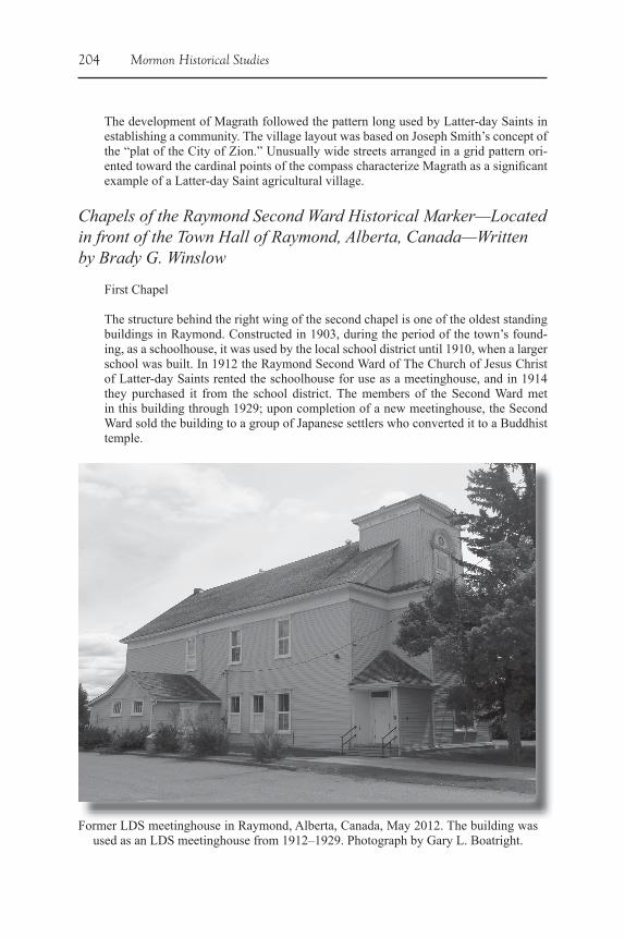
The structure behind the right wing of the second chapel is one of the oldest standing buildings in Raymond. Constructed in 1903, during the period of the town’s found-ing, as a schoolhouse, it was used by the local school district until 1910, when a larger school was built. In 1912 the Raymond Second Ward of The Church of Jesus Christ of Latter-day Saints rented the schoolhouse for use as a meetinghouse, and in 1914 they purchased it from the school district. The members of the Second Ward met in this building through 1929; upon completion of a new meetinghouse, the Second Ward sold the building to a group of Japanese settlers who converted it to a Buddhist temple.
Former LDS meetinghouse in Raymond, Alberta, Canada, May 2012. The building was used as an LDS meetinghouse from 1912–1929. Photograph by Gary L. Boatright.
Boatright: The Southern Alberta Historic Markers Project 205
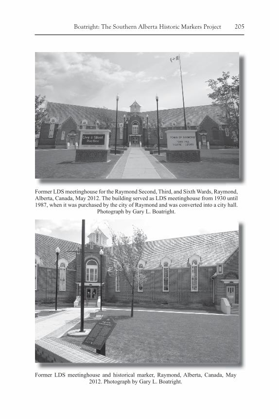
Former LDS meetinghouse for the Raymond Second, Third, and Sixth Wards, Raymond, Alberta, Canada, May 2012. The building served as LDS meetinghouse from 1930 until 1987, when it was purchased by the city of Raymond and was converted into a city hall.
Photograph by Gary L. Boatright.
Former LDS meetinghouse and historical marker, Raymond, Alberta, Canada, May 2012. Photograph by Gary L. Boatright.
206 Mormon Historical Studies
The structure stands as a monument to pioneer values of education and religion and also to the amiable diversity of the community.
Second Chapel
This distinctive three-winged chapel with central rotunda was used from 1930 to 1987 by the Raymond Second Ward and later also by the Raymond Third and Sixth Wards, three local congregations of The Church of Jesus Christ of Latter-day Saints. Designed by local architect and Second Ward member F. B. Rolfson, the building was modeled after a unique chapel built in Provo, Utah, by architects Howard W. Burton and Hyrum C. Pope, who also designed the Cardston Temple.
Constructed to replace the schoolhouse that the Second Ward had converted into a chapel and used from 1912 to 1930, ground was broken for this building on December 15, 1928. The fi rst meeting was held here in 1930, and the structure was dedicated by Rudger Clawson, Apostle, on November 5, 1939, after all debts for the construction were paid. Latter-day Saint congregations continued to use the building until October 1987, when it was sold to the town of Raymond.
Stirling Historical Marker—Located near the National Historic Site Interpretive Kiosk in Stirling, Alberta, Canada—Written by Gary L. Boatright
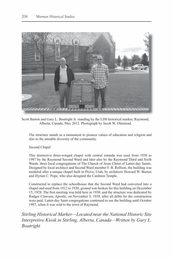
Scott Barton and Gary L. Boatright Jr. standing by the LDS historical marker, Raymond, Alberta, Canada, May 2012. Photograph by Jacob W. Olmstead.
Boatright: The Southern Alberta Historic Markers Project 207
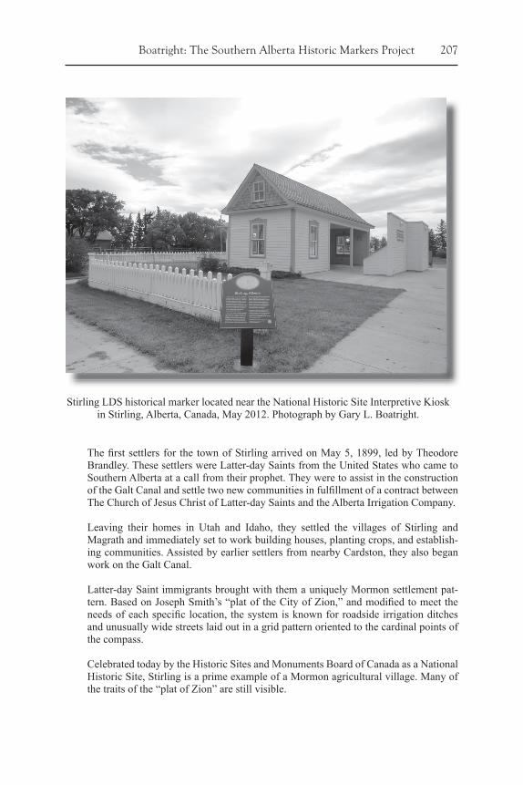
The fi rst settlers for the town of Stirling arrived on May 5, 1899, led by Theodore Brandley. These settlers were Latter-day Saints from the United States who came to Southern Alberta at a call from their prophet. They were to assist in the construction of the Galt Canal and settle two new communities in fulfi llment of a contract between The Church of Jesus Christ of Latter-day Saints and the Alberta Irrigation Company.
Leaving their homes in Utah and Idaho, they settled the villages of Stirling and Magrath and immediately set to work building houses, planting crops, and establish-ing communities. Assisted by earlier settlers from nearby Cardston, they also began work on the Galt Canal.
Latter-day Saint immigrants brought with them a uniquely Mormon settlement pat-tern. Based on Joseph Smith’s “plat of the City of Zion,” and modifi ed to meet the needs of each specifi c location, the system is known for roadside irrigation ditches and unusually wide streets laid out in a grid pattern oriented to the cardinal points of the compass.
Celebrated today by the Historic Sites and Monuments Board of Canada as a National Historic Site, Stirling is a prime example of a Mormon agricultural village. Many of the traits of the “plat of Zion” are still visible.
Stirling LDS historical marker located near the National Historic Site Interpretive Kiosk in Stirling, Alberta, Canada, May 2012. Photograph by Gary L. Boatright.
208 Mormon Historical Studies
Notes
1. Parks Canada, National Historic Sites in Alberta, Village of Stirling, http://www.pc.gc.ca/docs/r/ab/sites/stirling.aspx, accessed May 4, 2012.
2. This collaborative effort between the four communities led to the creation of the “Canada’s Mormon Trail” initiative. A website and booklet share information about the communities of Cardston, Magrath, Raymond, and Stirling, including the many national and provincial historic sites in the communities and other cultural aspects of each commu-nity, see http://themormontrail.ca
3. The website is available at https://history.lds.org4. The app is available at http://itunes.apple.com/us/app/alberta/id538096414?mt=8