Recreation Management Plans, Tables & Exhibits: lessons learned ...
41
Recreation Management Plans, Tables & Exhibits: Lessons learned through implementation
-
Upload
nguyendieu -
Category
Documents
-
view
215 -
download
0
Transcript of Recreation Management Plans, Tables & Exhibits: lessons learned ...
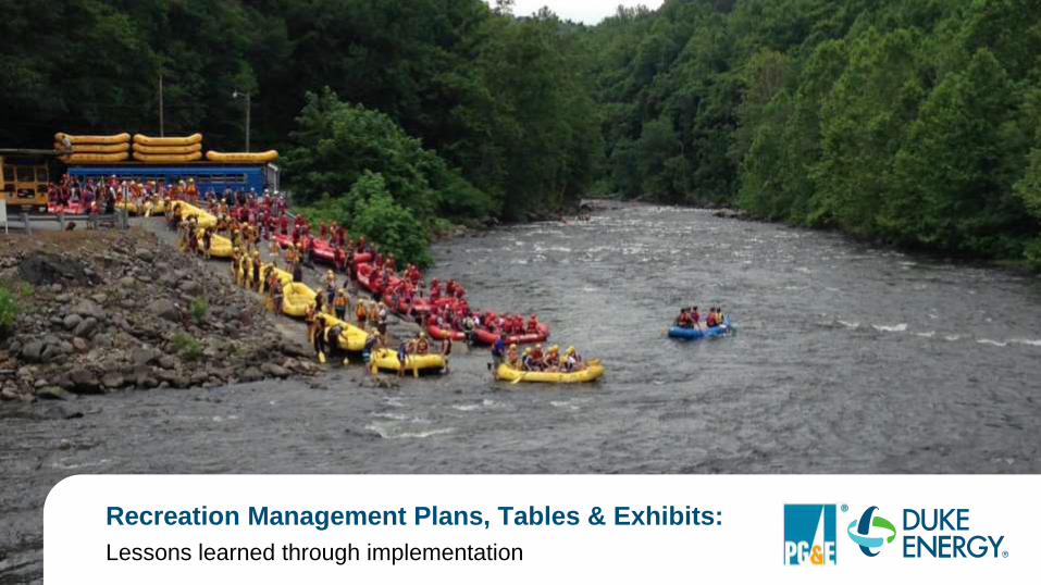
Recreation Management Plans, Tables & Exhibits:
Lessons learned through implementation
We are honored to be presenting today
2
Travis Sinclair
Project Manager | Duke EnergyJessica Albietz
License Coordinator | PG&E
Scott Magrini
Land Planner | PG&E

Quick Presentation Outline
Facilities and Amenities Tables
Then, now and Future State
How are they used and how they can help
Process Moving Forward
Exhibit Drawing Development
The Evolution: From as-built construction drawings to exhibit drawings
Lessons learned along the way
Recreation Management Plan Implementation
Lessons learned along the way
3
Recreation Facilities and Amenities Tables
4

Facilities and Amenities Tables
5
Single data
point for
entire
recreation
site
Multiple Data Points:
What points do we
include?
Facilities? What is
a “Facility”?
Amenities? What
are “Amenities”?
Do we also label
them on the
drawings?
Amenities
Tables (includes
data points)
Then Now

Keowee-Toxaway Hydroelectric Project (P-2503)
6
Lake Jocassee Lake Keowee

Then
Single Data Point Chart and Drawing
Keowee-Toxaway Hydroelectric Project (P-2503) July 19, 2010
7
Access Area Name Lake Latitude Longitude
Devils Fork State Park Jocassee 34.9533 -82.9465
Fall Creek North Keowee 34.9040 -82.9106
Crow Creek Keowee 34.8996 -82.8492
Keowee Town Keowee 34.8566 -82.9085
Mile Creek Keowee 34.8521 -82.8830
Stamp Creek Keowee 34.8279 -82.9414
Warpath Keowee 34.8114 -82.8823
High Falls Keowee 34.7950 -82.9306
Cane Creek Keowee 34.7360 -82.9856
South Cove Keowee 34.7113 -82.9667
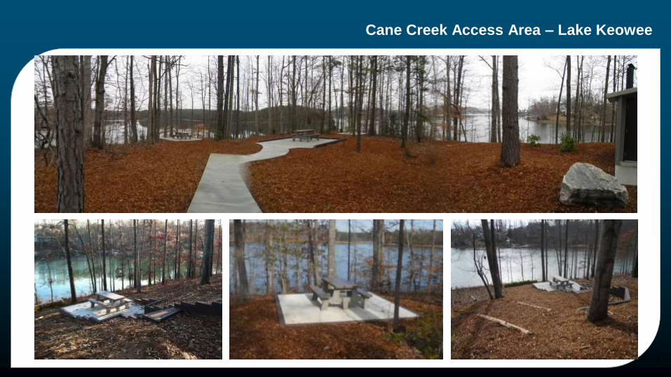
Cane Creek Access Area – Lake Keowee
8

Then - Cane Creek Access Area on Lake Keowee
Multiple points on a true as-built construction drawing
9

Now
New Facilities and Amenities Tables Definitions from Project Recreation Facilities Table and As-Built Site Plan Drawing
Guidance pages 3-4
Recreation Facility(ies): Includes both infrastructure (i.e., parking, restrooms, access path, docks, etc.) and recreation amenities (i.e., boat launching areas, picnic areas, camp sites, trails, etc.)
Recreation Infrastructure: Includes those physical elements which support recreation opportunities/experiences and are managed by the licensee.
Recreation Amenity(ies): Formerly termed “features” on the Form 80, recreation amenities are the developed elements (e.g., structures, trails, etc.) that define the spectrum of recreation opportunities at each recreation site. Use of recreation amenities is tracked through the Form 80 to understand and document recreation participation and to inform management decision-making regarding the need for existing and demand for additional recreation amenities.
10

Now
Creating New Tables (Optional Process)
Step 1: Develop the Facilities Table by listing all infrastructure, amenities & facilities and associated with the recreation sites.
Typically listed in the FERC Recreation Management Plan and License Application, License Orders or other FERC filings
Only include FERC approved Project recreation facilities
Step 2: Cross reference every element from Step 1 with FERC 80 Amenity Type.
Use Form 80 amenity terms and definitions in the recreation facilities table.
Not all elements in the Facilities Table will be listed in the Amenities Table
Step 3: Create Amenities Table11
Amenities
Table
(includes
data
points)
Facilities
Table
(text only)

Now - Cane Creek Access Area on Lake Keowee
Facilities Table
12
Lake Keowee Development
Cane Creek Access Area (1) Boat Launch Area: 24 vehicle with trailer including 2
ADA spaces, and 9 vehicle including 2 ADA spaces; two
1-lane boat ramps; trash cans; vault toilet (ADA);
lighting; courtesy dock; kiosk (FERC signage)
(2) Peninsula: Paved road from existing vehicle parking to
peninsula parking; 18 and 1 ADA vehicle parking
spaces; vault toilet (ADA); path from peninsula parking
to end of peninsula; eight (8) picnic/bank fishing sites
including 1 ADA; accessible route; kiosk (FERC
signage); lighting

Now - Cane Creek Access Area on Lake Keowee
Amenities Table
13
Project
No.
Development
Name
Recreation
Amenity Name
Recreation
Amenity Type
Amenity
StatusLatitude Longitude
FERC
Citation &
Date
Notes
2503 Lake Keowee
Cane Creek
Access Area Boat
Launch
Boat
launching
area
Constructed 34.7359 -82.9855
132 FERC 
62,045
07/19/2010
Two 1-lane boat
ramps
2503 Lake Keowee
Cane Creek
Access Area
Peninsula
Picnic area Constructed 34.7337 -82.9812
132 FERC 
62,045
07/19/2010
8 picnic/bank fishing
sites including an
ADA

Exhibit Drawing Development
14

Pit River, Shasta County, California
15
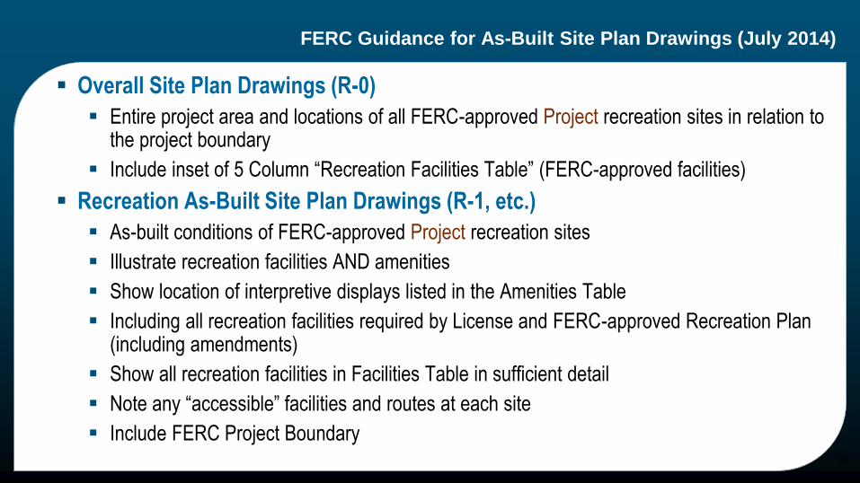
FERC Guidance for As-Built Site Plan Drawings (July 2014)
Overall Site Plan Drawings (R-0)
Entire project area and locations of all FERC-approved Project recreation sites in relation to the project boundary
Include inset of 5 Column “Recreation Facilities Table” (FERC-approved facilities)
Recreation As-Built Site Plan Drawings (R-1, etc.)
As-built conditions of FERC-approved Project recreation sites
Illustrate recreation facilities AND amenities
Show location of interpretive displays listed in the Amenities Table
Including all recreation facilities required by License and FERC-approved Recreation Plan (including amendments)
Show all recreation facilities in Facilities Table in sufficient detail
Note any “accessible” facilities and routes at each site
Include FERC Project Boundary16
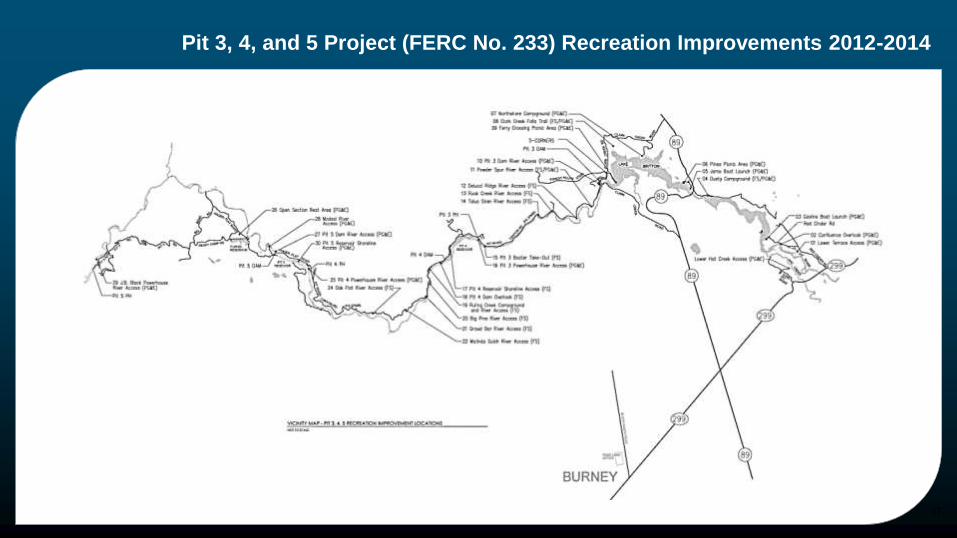
Pit 3, 4, and 5 Project (FERC No. 233) Recreation Improvements 2012-2014
17
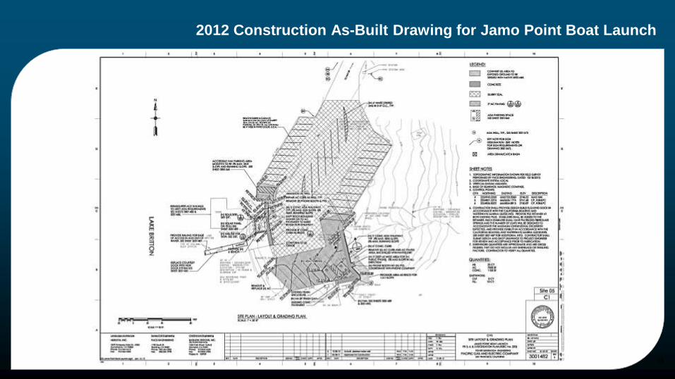
2012 Construction As-Built Drawing for Jamo Point Boat Launch
18

2012 Construction As-Built Drawing for Jamo Point Boat Launch
19
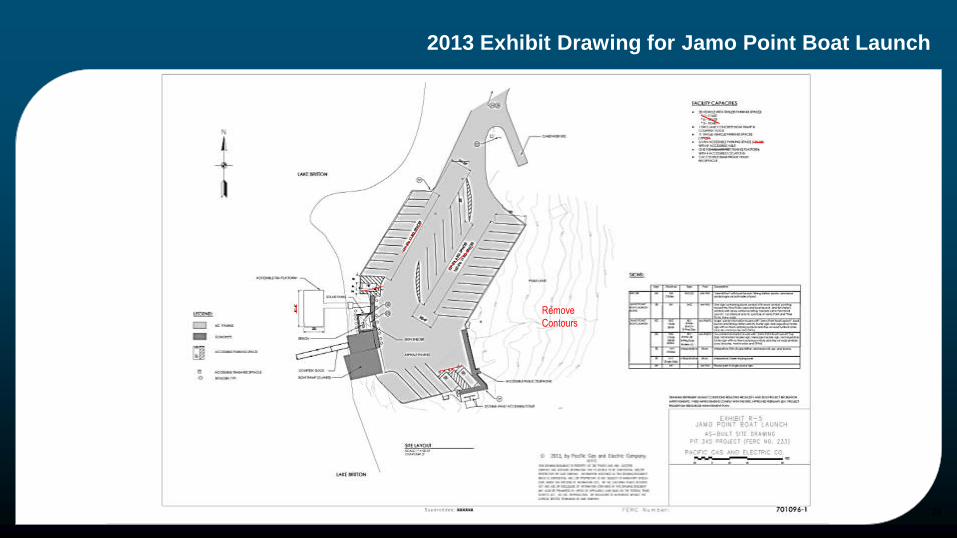
2013 Exhibit Drawing for Jamo Point Boat Launch
20
Remove
Contours

2013 Exhibit Drawing for Jamo Point Boat Launch
21
Remove
Contours
Remove
dimensions

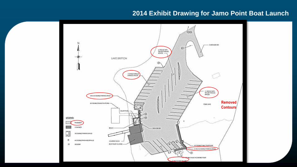
2014 Exhibit Drawing for Jamo Point Boat Launch
22
Removed
Contours
2014 Exhibit Drawing for Jamo Point Boat Launch
23
Removed
Contours

2012 Construction As-Built Drawing for Ruling Creek Campground
24
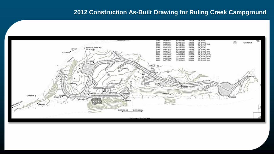
2012 Construction As-Built Drawing for Ruling Creek Campground
25
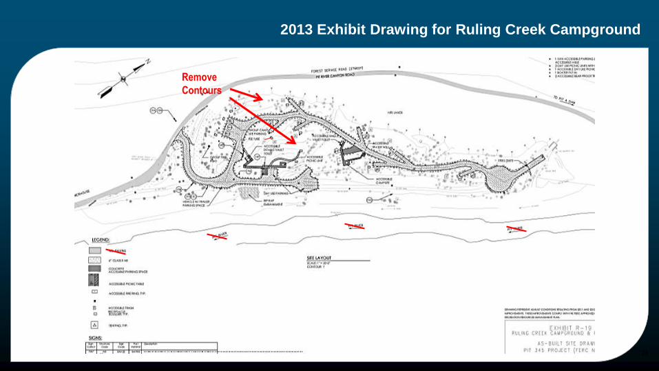
2013 Exhibit Drawing for Ruling Creek Campground
26
Remove
Contours
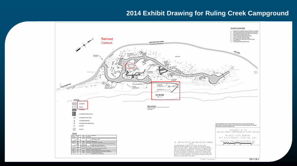
2014 Exhibit Drawing for Ruling Creek Campground
27
Removed
Contours
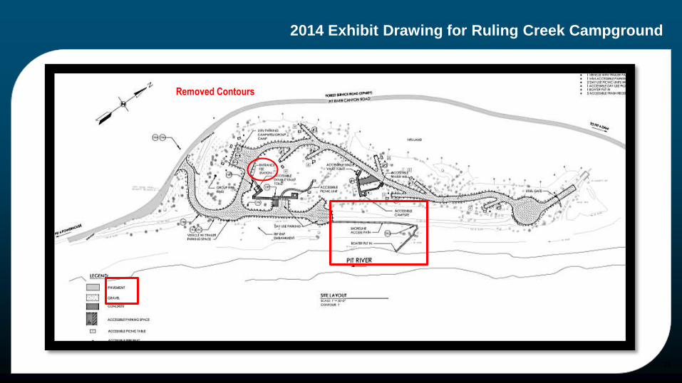
2014 Exhibit Drawing for Ruling Creek Campground
28
Removed Contours

Lessons learned about Exhibit Drawings
Lessons Learned
Simplify as-built construction drawings
only include required infrastructure and amenities facilities– No extra boulders, structures, signs
Contours & vegetation can be distracting
Scale can cause problem depicting project boundary– can use inset or additional pages: R-1a, R-1b
Good Idea: design plans can be geo-referenced into GIS or CAD to incorporate Project boundary
Review Exhibit G drawings for consistency
if as-built locations of recreation sites fully or partially fall outside of Project boundary
29

Disclaimer
Note: FERC Project Boundary and Access Area Location are shown as reference only. For exact location see Exhibit G Drawings.
30

Guidelines
Guidelines
Do not need to meet the requirements of 18CFR 4.39 (guidelines for as-built drawings)
Do need to:
Title block showing: Project Name, Number and Drawing Name “As-Built” in title
North Arrow and Scale (graphic and written)
Legible to minimum 11x17 size
Draw accurately to scale so size of facilities are proportional to each other
Include Facilities Table on drawing R-0 (use R-0a, R-Ob as necessary)
FERC approval
File electronically, when FERC approves, will refer to as Exhibit Rs and assign drawing number
31
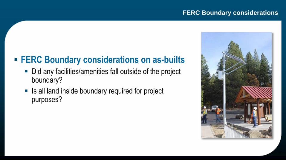
FERC Boundary considerations
FERC Boundary considerations on as-builts
Did any facilities/amenities fall outside of the project boundary?
Is all land inside boundary required for project purposes?
32

FERC Boundary Modifications & Exhibit G Revisions?
33
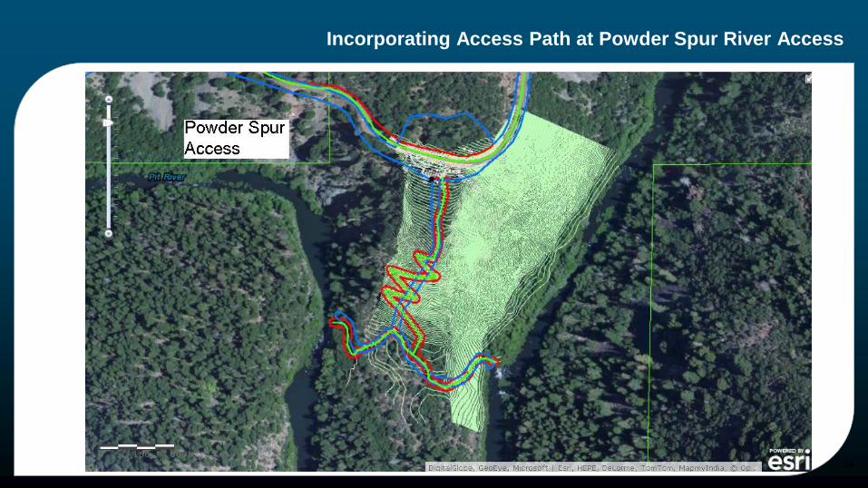
Incorporating Access Path at Powder Spur River Access
34
Recreation Management Plan Implementation
35

Implementation of Recreation Management Plans
Pit 3, 4 & 5 FERC License (Fully Implemented)
Constructed 20 new recreation facilities
Improved 9 other recreation facilities including 6 campgrounds
Sign Plan (Public Safety, Recreation & Interpretive)
Approx. 30 more Plans included
Project Patrol (year round)
Covers approx. 50 river miles
Took over all agency facilities
36

Implementation of Recreation Management Plans
Challenges of Implementation
4e Conditions
Installation of new wells
Managing new Campgrounds and Day Use Areas
Maintaining miles of new roads
Building new Facilities
Cultural Resources
Whitewater Releases
New shower building installed without proper training to operate and maintain
37
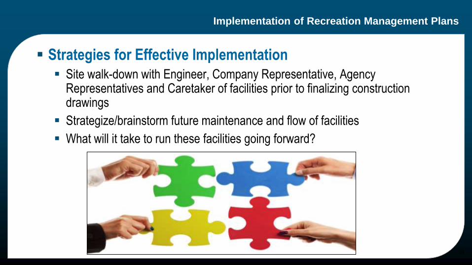
Implementation of Recreation Management Plans
Strategies for Effective Implementation
Site walk-down with Engineer, Company Representative, Agency Representatives and Caretaker of facilities prior to finalizing construction drawings
Strategize/brainstorm future maintenance and flow of facilities
What will it take to run these facilities going forward?
38
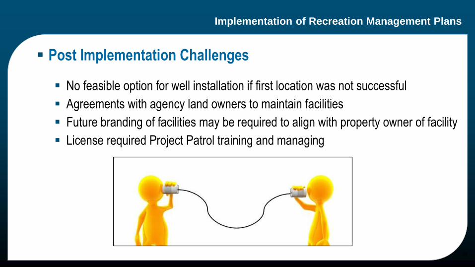
Implementation of Recreation Management Plans
Post Implementation Challenges
No feasible option for well installation if first location was not successful
Agreements with agency land owners to maintain facilities
Future branding of facilities may be required to align with property owner of facility
License required Project Patrol training and managing
39
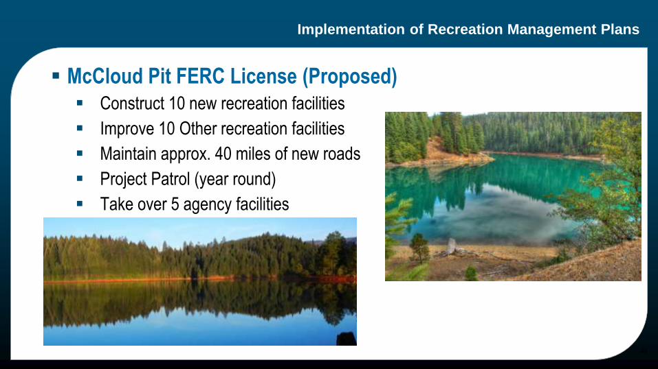
Implementation of Recreation Management Plans
McCloud Pit FERC License (Proposed)
Construct 10 new recreation facilities
Improve 10 Other recreation facilities
Maintain approx. 40 miles of new roads
Project Patrol (year round)
Take over 5 agency facilities
40

&
41