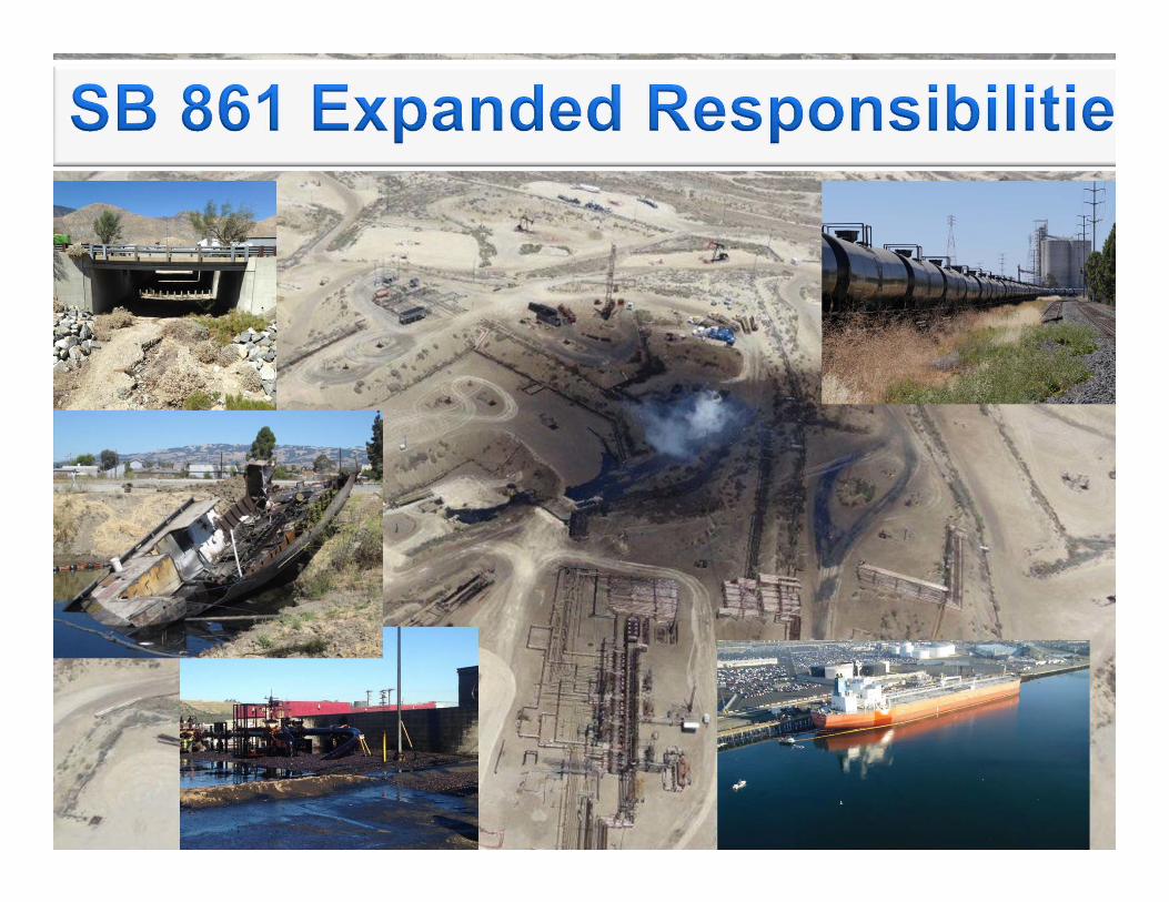
Prevention OSPR Expansion into Statewide Oil Spill ... · OSPR Expansion into Statewide Oil Spill...
30
OSPR Expansion into Statewide Oil Spill Preparedness and Response Prevention Response Preparedness
Transcript of Prevention OSPR Expansion into Statewide Oil Spill ... · OSPR Expansion into Statewide Oil Spill...
OSPR Expansion into Statewide Oil
Spill Preparedness and Response
Prevention
Response Preparedness
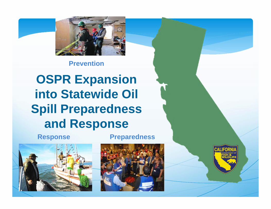
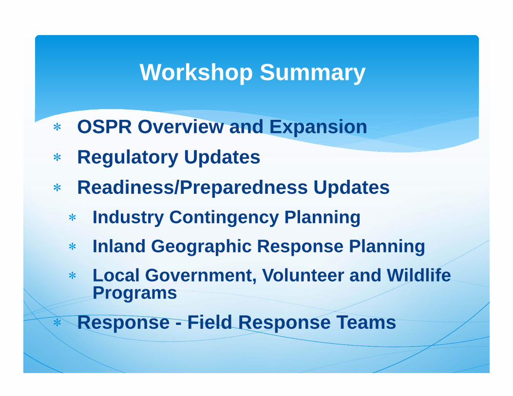
OSPR Overview and Expansion
Regulatory Updates
Readiness/Preparedness Updates Industry Contingency Planning
Inland Geographic Response Planning
Response - Field Response Teams
Workshop Outline

Events Leading to theCreation of OSPR
March 24, 1989T/V Exxon Valdez
February 7, 1990T/V American Trader
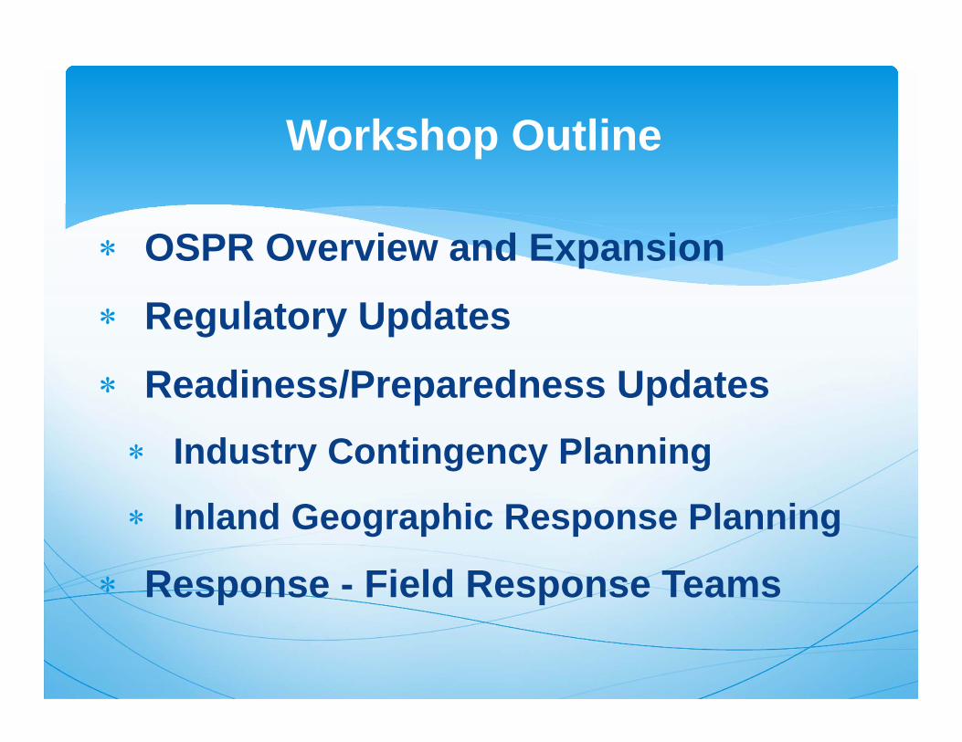
• Created OSPR within CDFW
• Established the OSPR Administrator
• Designated Governor as Administrator appointing authority with Senate approval
Lempert-Keene-Seastrand Oil Spill Prevention and Response Act
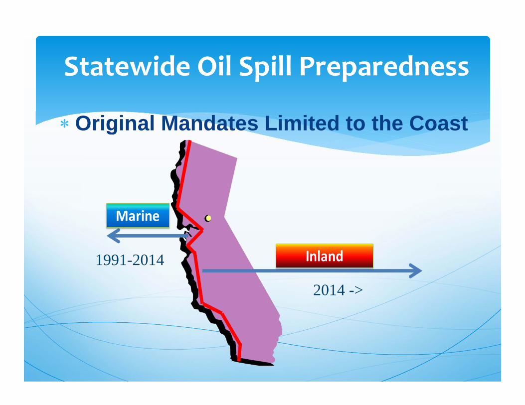
Statewide Oil Spill Preparedness
6
Original Mandates Limited to the Coast
1991-2014
2014 ->
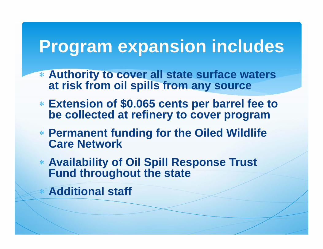
Authority to cover all state surface waters at risk from oil spills from any source
Extension of $0.065 cents per barrel fee to be collected at refinery to cover program
Permanent funding for the Oiled Wildlife Care Network
Availability of Oil Spill Response Trust Fund throughout the state
Additional staff
Program expansion includes
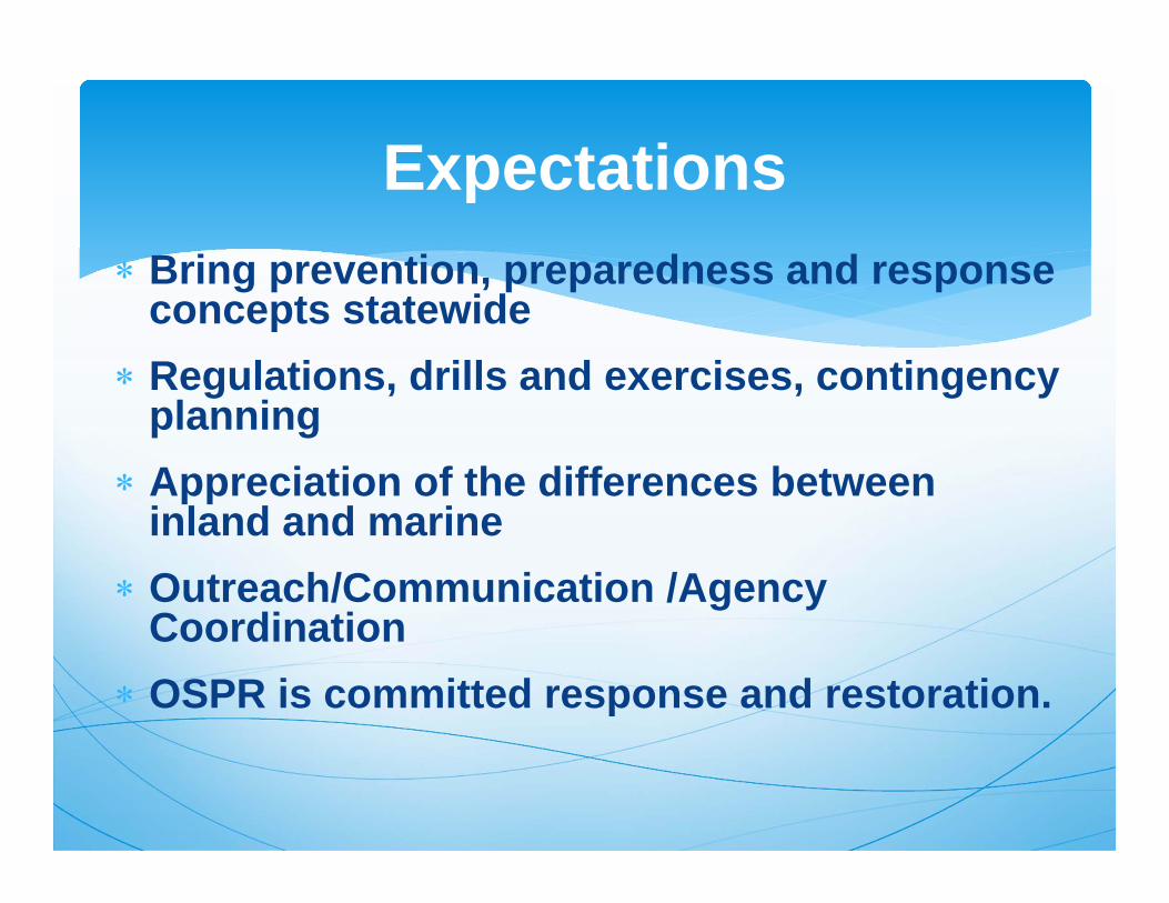
Bring prevention, preparedness and response concepts statewide
Regulations, drills and exercises, contingency planning
Appreciation of the differences between inland and marine
Outreach/Communication /Agency Coordination
OSPR is committed response and restoration.
Expectations
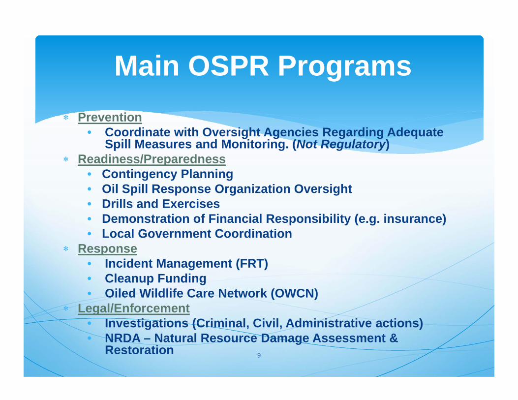
Main OSPR Programs Prevention
• Coordinate with Oversight Agencies Regarding Adequate Spill Measures and Monitoring. (Not Regulatory)
Readiness/Preparedness• Contingency Planning • Oil Spill Response Organization Oversight• Drills and Exercises• Demonstration of Financial Responsibility (e.g. insurance)• Local Government Coordination
Response• Incident Management (FRT)• Cleanup Funding• Oiled Wildlife Care Network (OWCN)
Legal/Enforcement• Investigations (Criminal, Civil, Administrative actions)• NRDA – Natural Resource Damage Assessment &
Restoration 9

Emergency regulations adopted Sept 2015 Contingency Plan, Drills and Exercises, and
Certificates of Financial ResponsibilityExtension of the ER RegulationsFormal Rulemaking expected mid-
September - October 2016. 45 day comment period before the end of the
calendar year
Regulatory UpdateInland Regulations
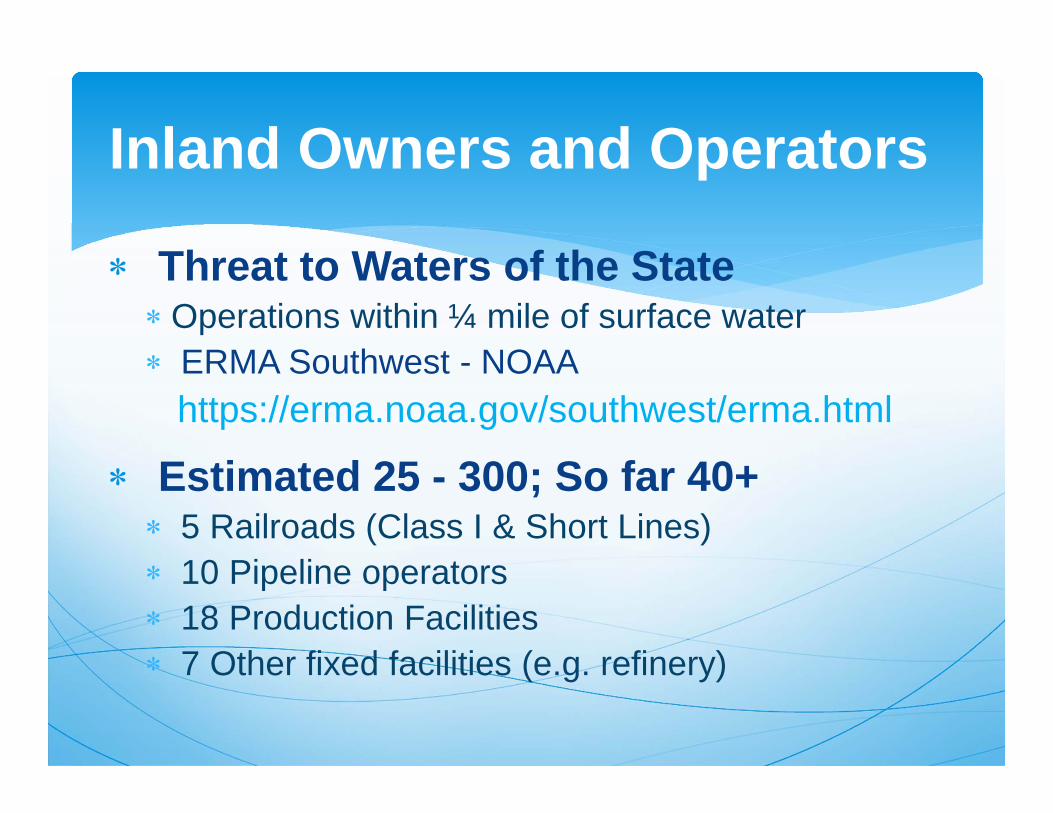
Threat to Waters of the StateOperations within ¼ mile of surface water ERMA Southwest - NOAA
https://erma.noaa.gov/southwest/erma.html
Estimated 25 - 300; So far 40+ 5 Railroads (Class I & Short Lines) 10 Pipeline operators 18 Production Facilities 7 Other fixed facilities (e.g. refinery)
Inland Owners and Operators
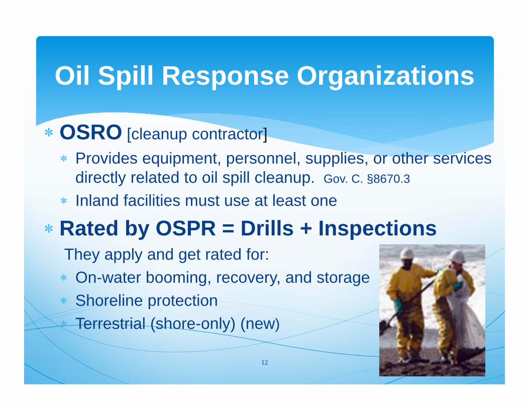
Oil Spill Response Organizations
OSRO [cleanup contractor] Provides equipment, personnel, supplies, or other services
directly related to oil spill cleanup. Gov. C. §8670.3
Inland facilities must use at least one
Rated by OSPR = Drills + InspectionsThey apply and get rated for: On-water booming, recovery, and storage Shoreline protection Terrestrial (shore-only) (new)
12
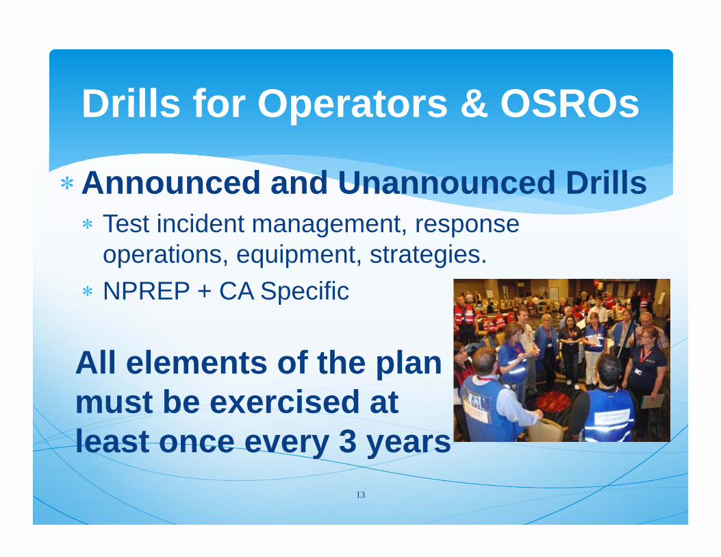
Drills for Operators & OSROs
Announced and Unannounced Drills Test incident management, response
operations, equipment, strategies. NPREP + CA Specific
13
All elements of the plan must be exercised at least once every 3 years
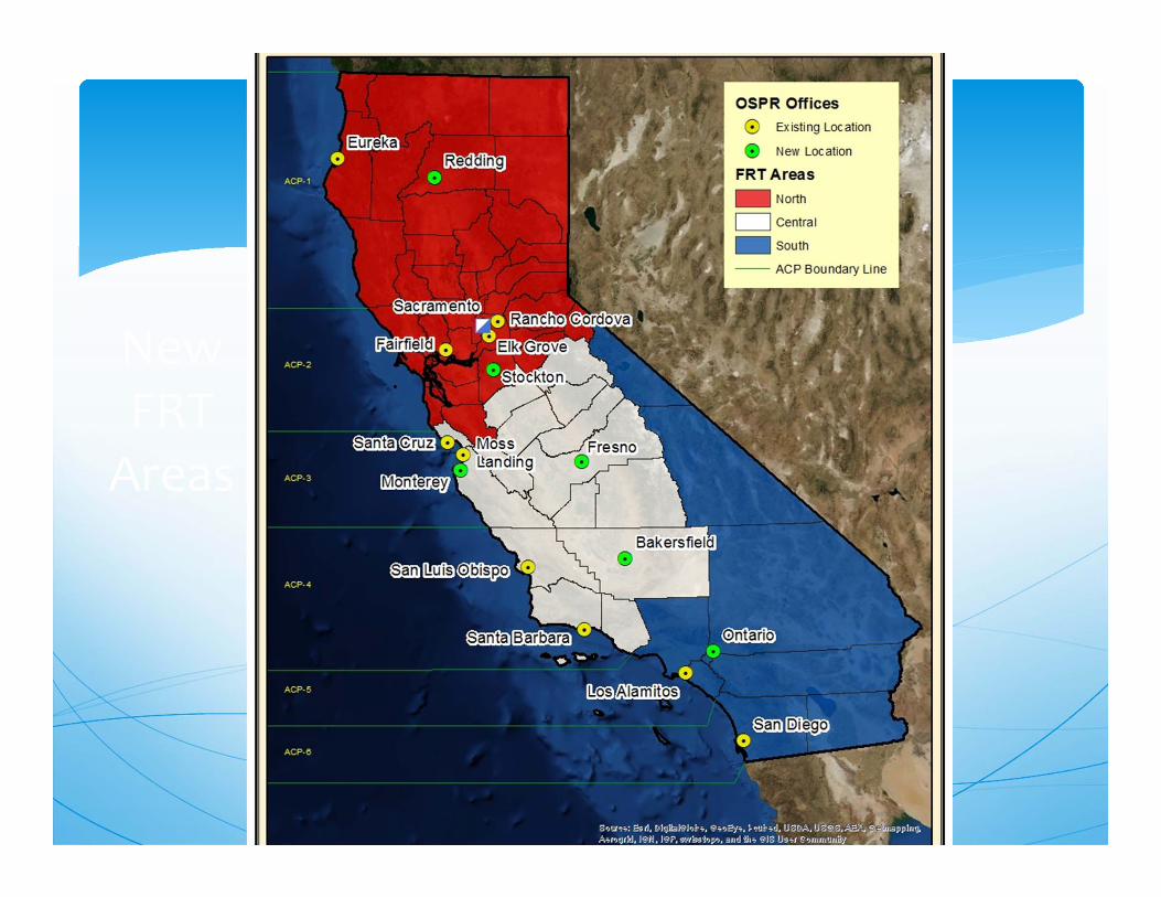
New FRT Areas
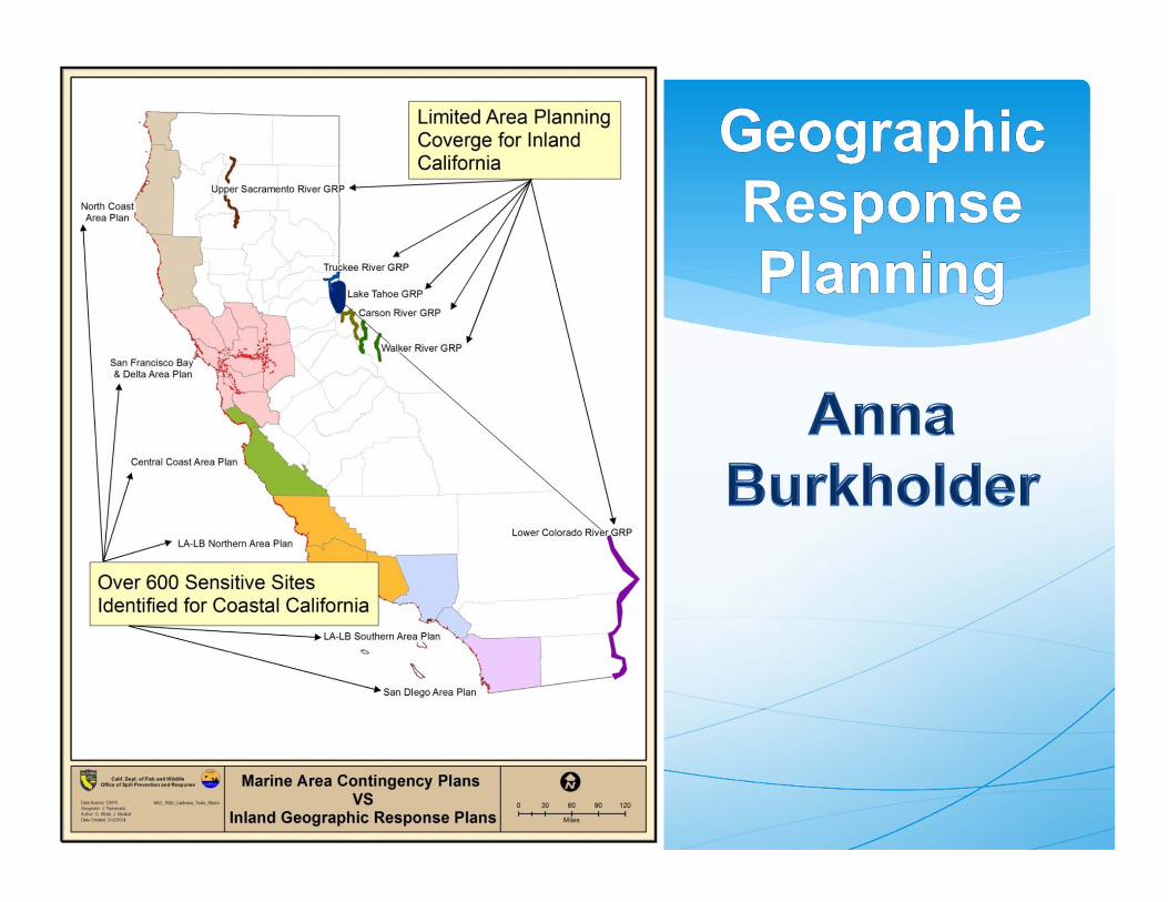
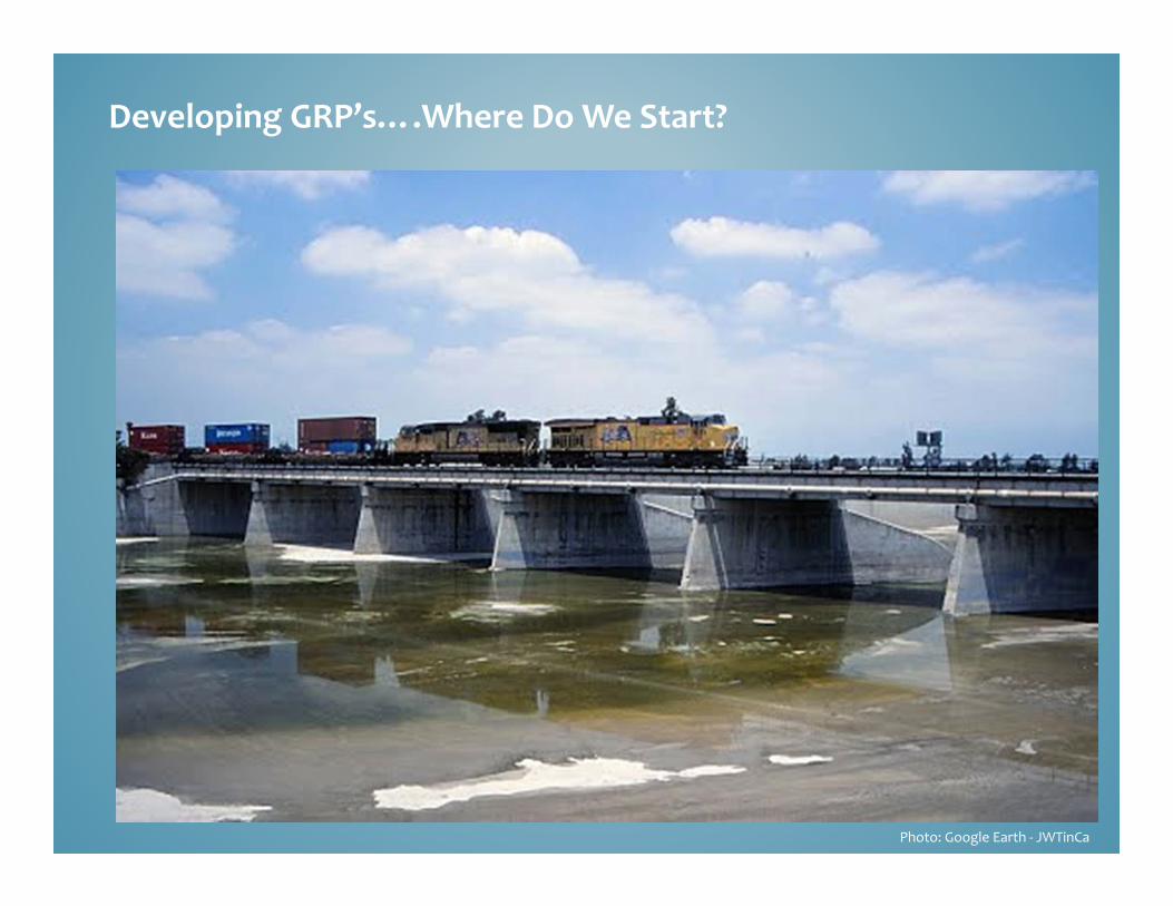
Photo: Google Earth ‐ JWTinCa
Developing GRP’s….Where Do We Start?
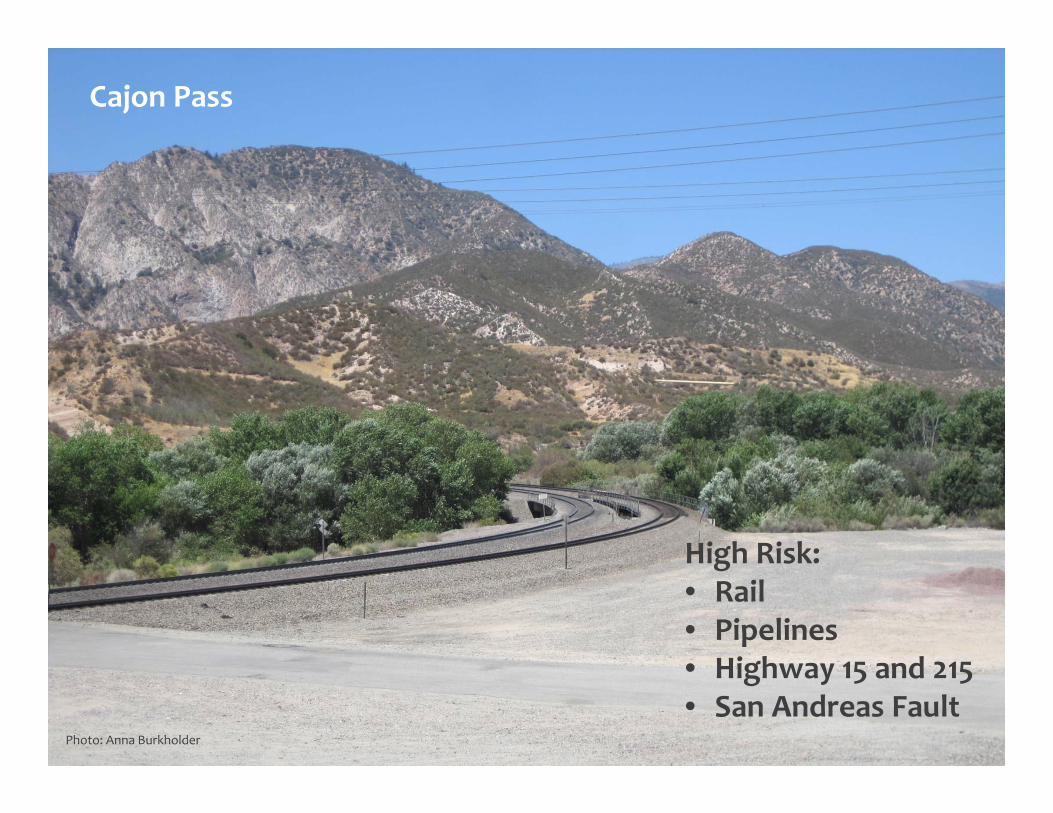
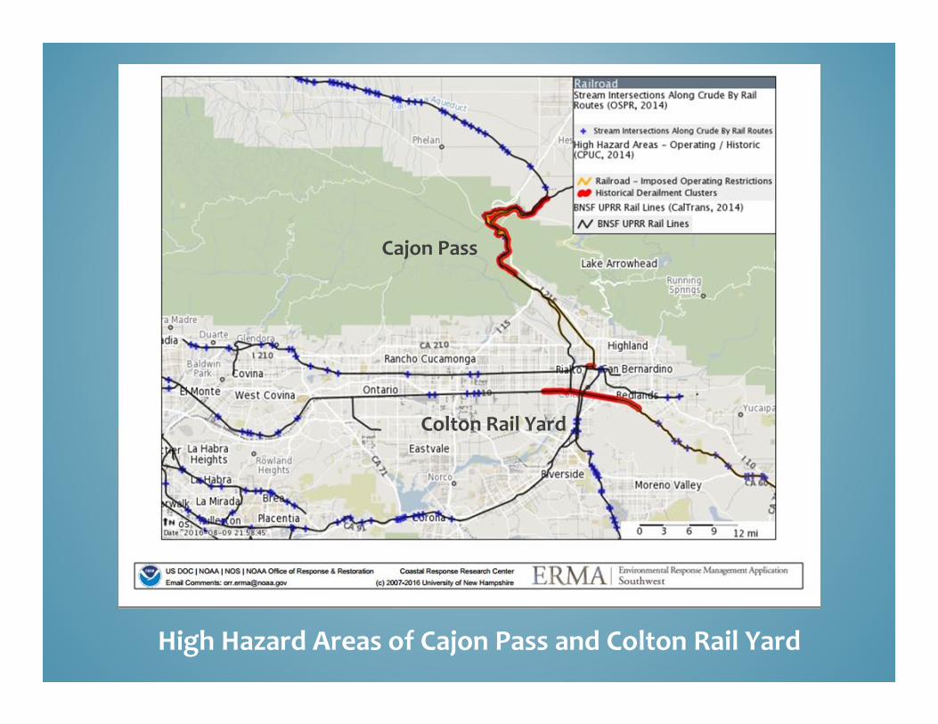
Cajon Pass
High Risk:• Rail• Pipelines• Highway 15 and 215• San Andreas Fault
Photo: Anna Burkholder
Cajon Pass
Colton Rail Yard
High Hazard Areas of Cajon Pass and Colton Rail Yard
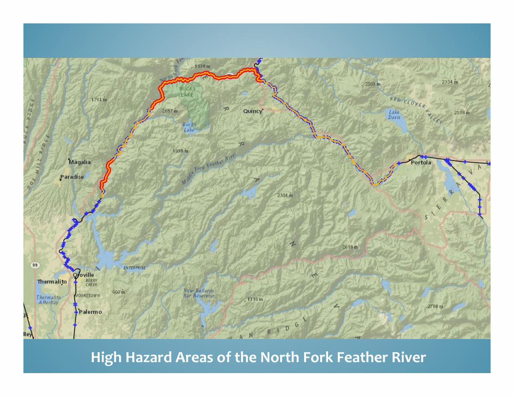
High Hazard Areas of the North Fork Feather River
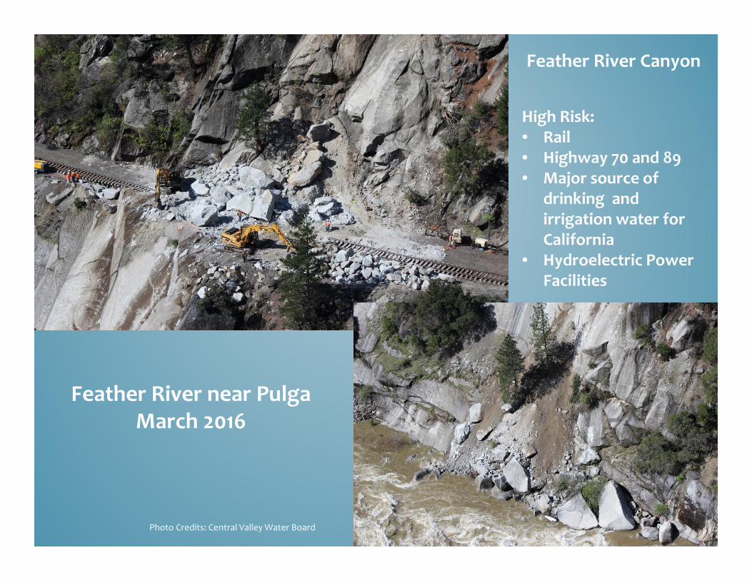
Feather River near PulgaMarch 2016
Feather River Canyon
High Risk:• Rail• Highway 70 and 89• Major source of
drinking and irrigation water for California
• Hydroelectric Power Facilities
Photo Credits: Central Valley Water Board
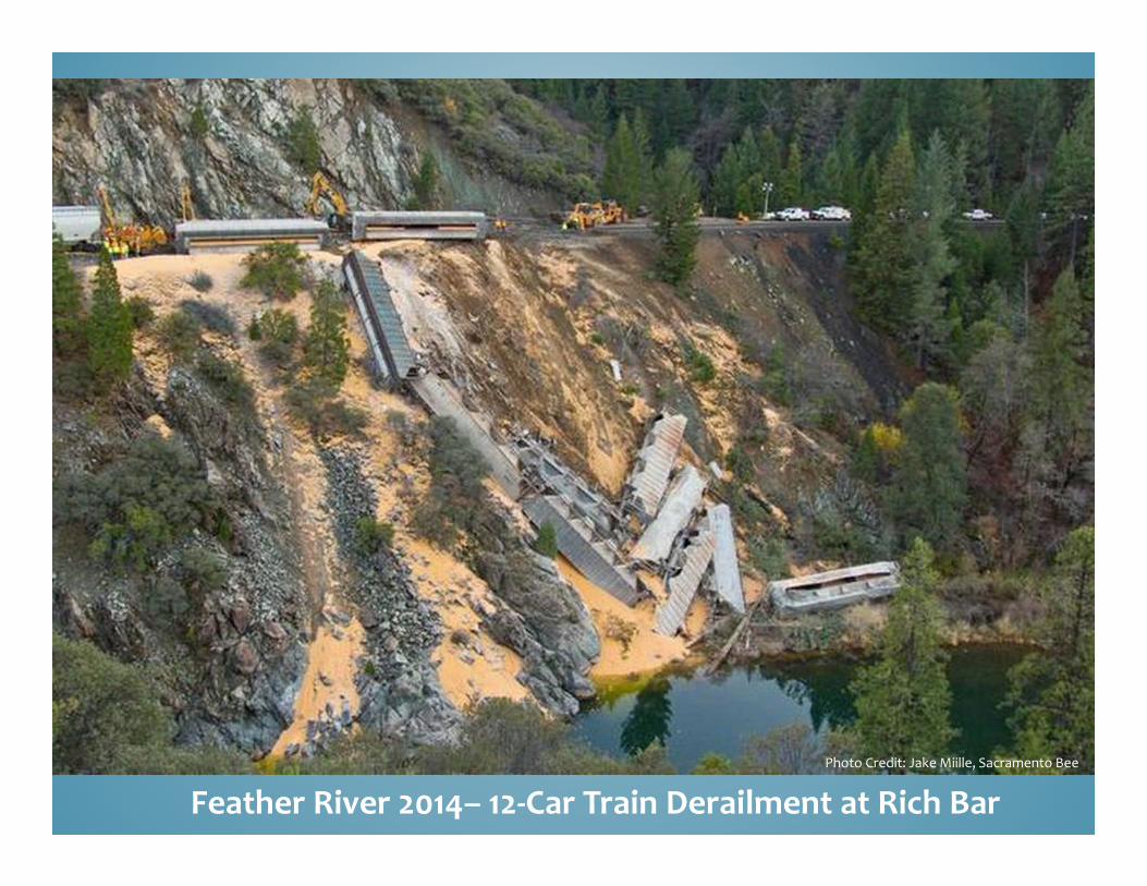
Feather River 2014– 12‐Car Train Derailment at Rich BarPhoto Credit: Jake Miille, Sacramento Bee
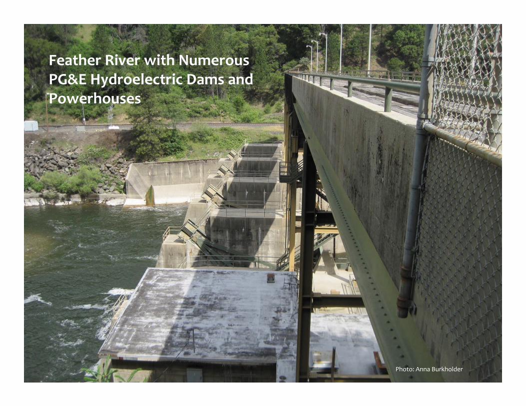
Feather River with Numerous PG&E Hydroelectric Dams and Powerhouses
Photo: Anna Burkholder
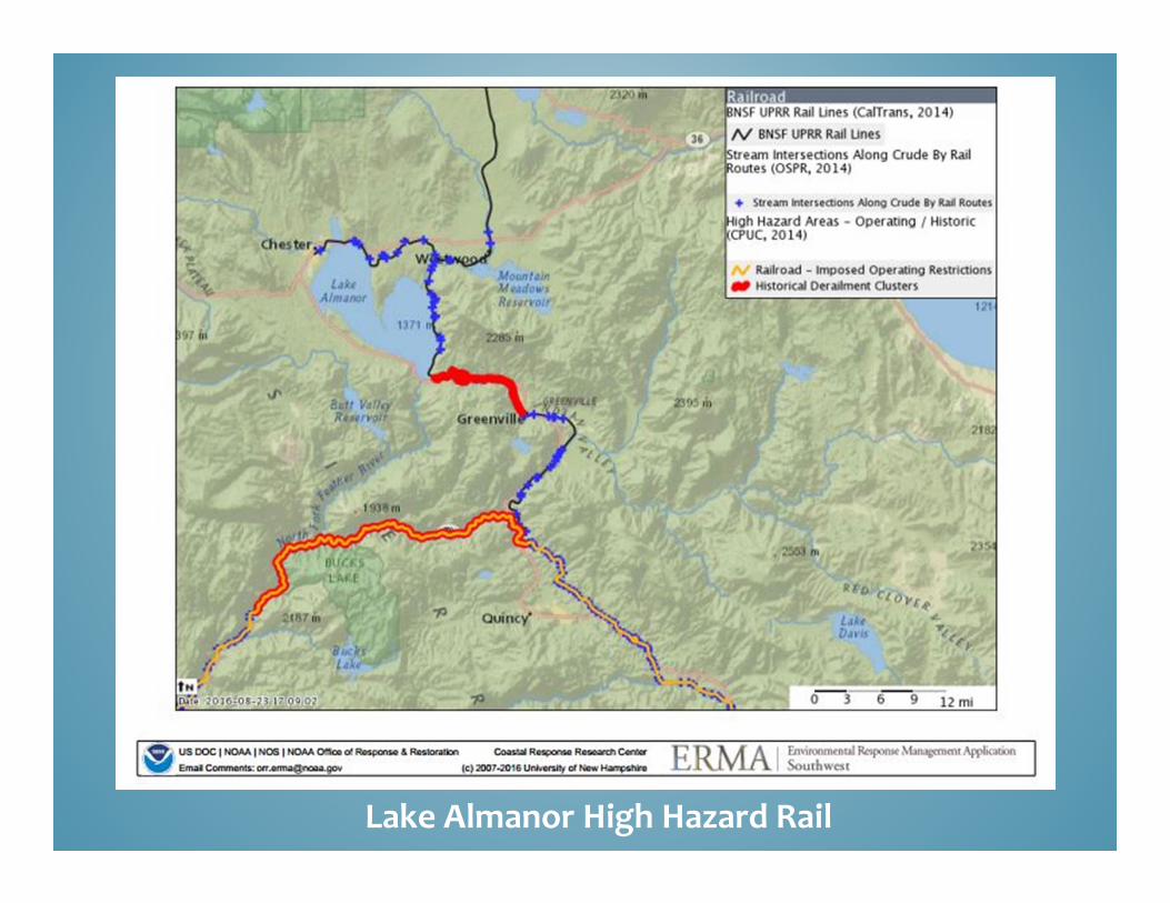
Lake Almanor High Hazard Rail
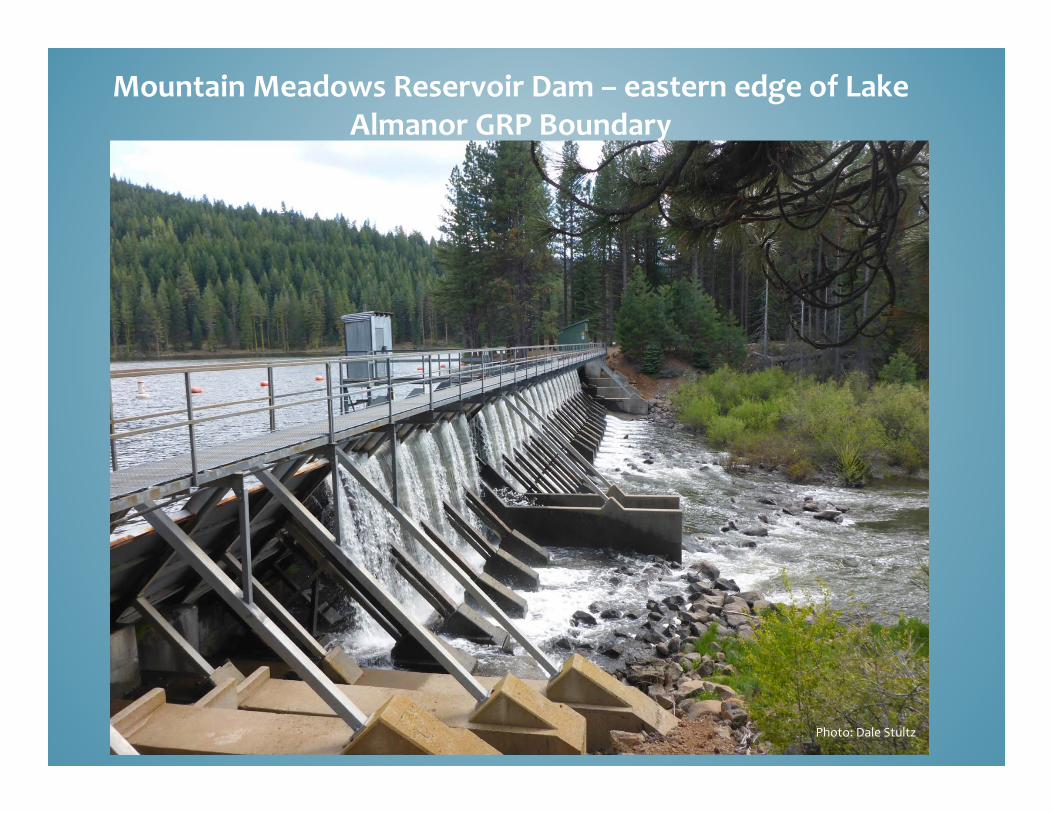
Mountain Meadows Reservoir Dam – eastern edge of Lake Almanor GRP Boundary
Photo: Dale Stultz
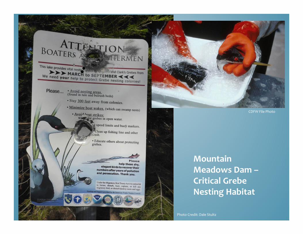
Mountain Meadows Dam –Critical Grebe Nesting Habitat
CDFW File Photo
Photo Credit: Dale Stultz
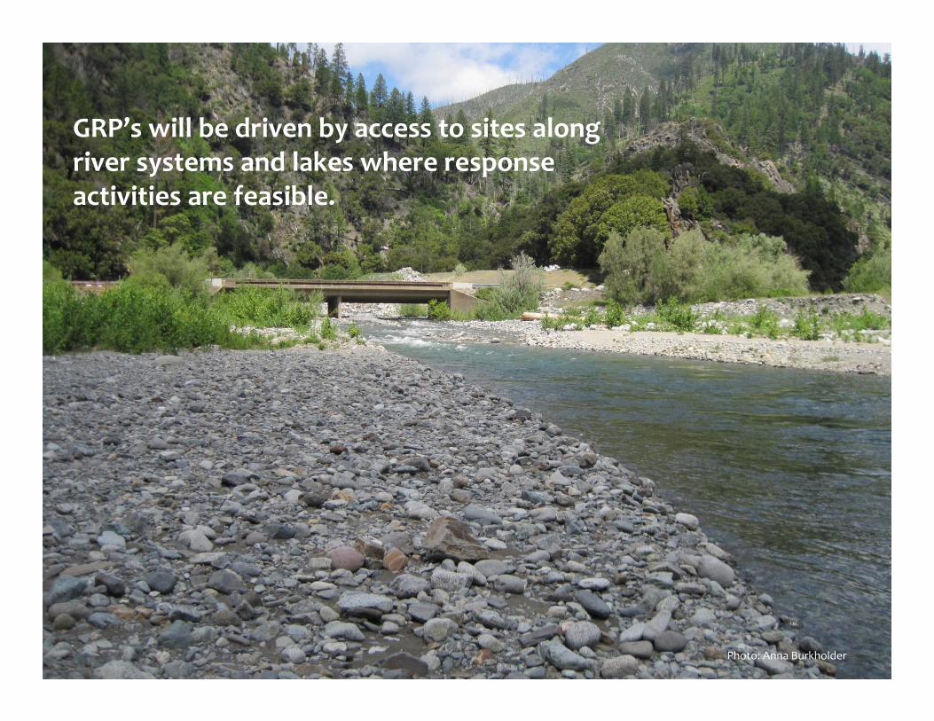
GRP’s will be driven by access to sites along river systems and lakes where response activities are feasible.
Photo: Anna Burkholder
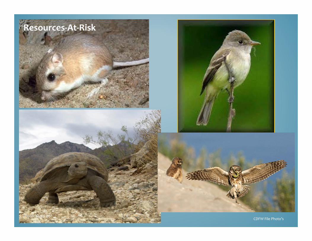
Resources‐At‐Risk
CDFW File Photo’sPhoto: azgfd.gov
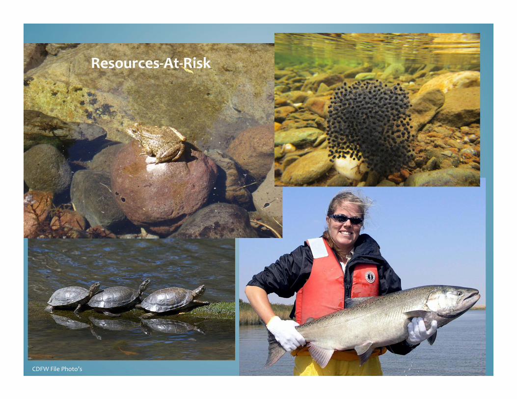
Resources‐At‐Risk
CDFW File Photo’s
OSPR Overview and Expansion Regulatory Updates Readiness/Preparedness Updates Industry Contingency Planning Inland Geographic Response Planning Local Government, Volunteer and Wildlife
Programs Response - Field Response Teams
Workshop Summary

QUESTIONS