Planning Applications Report - Bolton Council
127
Planning Applications Report Planning and Highways Committee 30 March 2006 Bolton Council Development | Regeneration | Planning | Control
Transcript of Planning Applications Report - Bolton Council

Planning Applications Report
Planning and Highways Committee
30 March 2006
Bolton Council
Development | Regeneration | Planning | Control

Bolton Council has approved a Guide to Good Practice for Members and Officers Involved in the Planning Process. Appendix 1 of the Guide sets down guidance on what should be included in Officer Reports to Committee on planning applications. This Report is written in accordance with that guidance. Copies of the Guide to Good Practice are available from the Development and Regeneration Department, Town Hall, Bolton. Bolton Council also has a Code of Practice for publicising planning applications and other submissions for approval. As part of this Code, neighbour notification letters will have been sent to all owners and occupiers whose premises adjoin the site of these applications. In residential areas, or in areas where there are dwellings in the vicinity of these sites, letters will also have been sent to all owners and occupiers of residential land or premises, which directly overlook a proposed development. The plans in this report have been annotated with the symbol ● to show where a letter of objection has been received from an owner or occupier of a property shown on the Report Plan. The plans in this report have been annotated with the symbol % to show where a letter of support has been received from an owner or occupier of a property shown on the Report Plan. The plans in the report are for location only and are not to scale. The application site will generally be in the centre of the plan edged with a bold line. The plans in this Report are reproduced from the Ordnance Survey Map with permission of the Controller of HMSO. ©Crown Copyright. Unauthorised reproduction infringes Crown Copyright and may lead to prosecution or civil proceedings. Bolton Council Licence No. 100019389/2005 The following abbreviations are used within this report: - UDP The adopted Unitary Development Plan 2005 RSS Regional Spatial Strategy for the North West of England PCPN A Bolton Council Planning Control Policy Note PPG Office of the Deputy Prime Minister Planning Policy Guidance Note MPG SPG
Office of the Deputy Prime Minister Minerals Planning Guidance Note Bolton Council Supplementary Planning Guidance
PPS Office of the Deputy Prime Minister Planning Policy Statement TPO Tree Preservation Order EA Environment Agency SBI SSSI
Site of Biological Importance Site of Special Scientific Interest
GMEU The Greater Manchester Ecology Unit The background documents for this Report are the respective Planning Application Folders. These can be inspected by initially contacting Valerie Walsh :- Telephone (01204) 336065 or [email protected]
2

INDEX Ref. No Page Item Ward Location 73444/06 5 1 BRAD LAND SOUTH OF BRADSHAW BUILDERS,
FIRWOOD INDUSTRIAL ESTATE, THICKETFORD ROAD
73319/06 19 2 BRCR 46 SAXBY AVENUE, TURTON, BOLTON, BL7 9NX 73379/06 25 3 BRCR DAYSPRING, SHADY LANE, TURTON, BOLTON,
BL7 9AF 73553/06 31 4 BRCR DAYSPRINGS SHADY LANE BROMLEY CROSS
BOLTON 73360/06 37 5 BRCR LAND ADJ 2 CHERRY TREE WAY, BOLTON 73314/06 47 6 CROM PAVEMENT AT TONGE CRICKET CLUB,
CROMPTON WAY, BOLTON. 73317/06 57 7 HOBL LAND AT DARK LANE, BLACKROD, BOLTON. 73270/06 69 8 HOBL 20 LATHAM ROAD, BLACKROD, BOLTON, BL6 5EL 72789/05 75 9 HOBL LOSTOCK HALL FARM, OX HEY LANE, HORWICH,
BOLTON, BL6 4BS 73135/06 97 10 HULT 31 REYNOLDS DRIVE, WESTHOUGHTON,
BOLTON, BL5 1HE 73363/06 105 11 WNCM LAND AT CHEQUERBENT ROUNDABOUT,
WESTHOUGHTON. 73362/06 119 12 WNCM DROP IN CENTRE, 6 BOLTON ROAD,
WESTHOUGHTON, BOLTON, BL5 3DG The Bolton (Scout Hut at Land off St. Helens Road) Tree Preservation Order 2006. The Bolton (504/514 Chorley New Road No.2) Tree Preservation Order 2006.
3

4

Date of Meeting: 30 March 2006 Item Number: 1 Application Reference: 73444/06 Type of Application: Full Planning Application Registration Date: 13/02/2006 Decision Due By: 10/04/2006 Responsible
Officer: Kathryn Boggiano
Location: LAND SOUTH OF BRADSHAW BUILDERS, FIRWOOD
INDUSTRIAL ESTATE, THICKETFORD ROAD Proposal: RETENTION OF USE OF LAND AS IMPROVED ACCESS &
TURNING CIRCLE & PARKING. Ward: Bradshaw Applicant: Mr D Crompton Agent : G.D.Kelly Officers Report Proposal The proposal is for the extension of the car parking and turning area by hardsurfacing a section of the adjacent field measuring 16 metres by 45 metres. This area will accommodate a larger turning circle and parking for 4 heavy goods vehicles. Site CharacteristicsThe application site lies directly to the south of the access road on the south western section of the industrial estate and is within Green Belt, the Firwood Fold Site of Biological Importance and a Landscape Character Area. A line of trees which were adjacent to the access road which performed the function of a landscape screen to the main industrial area, have been removed and the area has been hardsurfaced with the top soil having been used to form mounds around the site. To the south of the site is a large field which also forms part of the SBI. This field has been subject to vandalism by motorcyclists and gypsies in the past. Land which is used for grazing horses is to the south of this field. To the west of the application site are a number of historical lodges. The Firwood Works is a well established industrial estate, and designated as a Major Developed Site in the Green Belt, however, the application site falls outside of this designation. Policy
5

Unitary Development Plan 2005: D1, D2 & D3 Design and Landscaping; A5 Roads, Paths, Servicing and Car Parking; A6 Maximum Car Parking Standards; G1, G2, G5 and G6 Green Belt; N1 & N3 Nature Conservation; R5 Landscape Character Areas. Planning Control Policy Notes: No.1 Car and Cycle Parking Standards; No.17 Nature Conservation; No.21 Highways Considerations. History A planning application for the erection of industrial units (access only) on the field to the south of the industrial estate (ref: 68532/04) was refused by the Meeting of the Planning Committee in September 2004 for the following reasons:
"The proposed development by virtue of its siting, size and design represents inappropriate development within the Green Belt and is contrary to Policies CE11 and CE11/1 of the 1995 Unitary Development Plan and Policy G1 of the 2001 Second Deposit Version Unitary Development Plan." "The proposed development, by virtue of its size and siting, would result in an unacceptable adverse impact on the Firwood Fold Site of Biological Importance and is contrary to Policy CE16/1 of the 1995 Unitary Development Plan, Policy N1/3 of the Second Deposit Unitary Development Plan and Planning Control Policy Note No.17 "Nature Conservation"." "The proposed development represents the introduction of a non conforming use within a predominantly residential area which will lead to increased activity in and around the application premises to the detriment of amenity to nearby residential properties, and is contrary to Policy H3/3 of the Unitary Development Plan." "Insufficient information has been provided by the applicant to enable the transport impacts of the proposal to be properly judged against the policies of Bolton's Unitary Development Plan. The site is within an area liable to flood, and the proposed development would be at risk from flooding and could unacceptably increase the risk of flooding elsewhere and is contrary to Policy CE17 of the 1995 Unitary Development Plan and Policy EM10 and EM11 of the 2001 Second Deposit Version Unitary Development Plan."
A subsequent appeal was dismissed by the Planning Inspectorate.
6

A planning application for 2 full size football pitches, a building to house changing facilities and car parking was refused by the Council in April 2000 (ref: 58246/00) for the following reason:
"The proposed development would have an adverse impact upon the Site of Biological Importance and on the character and setting of the River Valley and is contrary to Policies CE10, CE11, CE11/1, CE13/1, CE16/1, CE16/2, CE17/4, CE17/10, CE17/13 and R4/1 of the Unitary Development Plan and Policies G1, G2, R5, N1, N3, N5 of the Second Deposit Version of the Unitary Development Plan."
Two planning applications for football pitches, a floodlit all weather training area, a building to house changing facilities and car parking area were withdrawn by the Applicants in April 2000 and June 1998 (refs: 56275/00 and 52620/98). A planning application for the erection of offices, canteen and toilets (siting and means of access only) was approved with conditions (ref: 56391/00) in May 2000. This outline application included the extension of the car parking area and a turning circle however the applicant did not subsequently submit a reserved matters application and the offices, canteen and toilets have not been implemented. Car parking and a turning circle have been implemented. It is understood that this work was undertaken after Autumn 2000 (based on the Council's aerial photos which were taken in Autumn 2000). A planning application for an access road was withdrawn by the Applicant in September 1991 (ref: 39260/91). Technical ConsultationsBolton Council - Highway Engineers:- have commented that the existing turning area, without the extension, will accommodate a maximum legal articulated vehicle. If there is congestion, then perhaps consideration should be given to widening the access road. If the level of traffic suggested by the Applicant justifies the extension to the service area, then the access from Thicketford Road is obviously sub-standard and should be improved to allow 2 way traffic along its length. RepresentationsLetters:- one letter has been received from the resident of 161 Thicketford Road which raises an objection over the quality of the construction work and the possibility of contamination as a result of the materials used, (which they state as including old electrical metal piping, electrical cables and sockets). The poor quality of the construction work could result in the foundations subsiding due to the weight of vehicles, and contaminants could be washed into the field in the future. The objector also states that the aesthetic appearance of the earthworks is poor. A letter of objection has also been received from the Council for the Rural Protection of England, which raises the following objections: • the alien hard-standing and surrounding banking damages the openness of this part
of the Green Belt;
7

• the development is contrary to Green Belt policy and would set a dangerous precedent;
• additional hard surfaces will generate additional vehicle trips and result in more noise from the industrial estate to the detriment of the amenity of surrounding neighbours;
• the design, materials and area of the parking/turning circle damages the landscape character of the area and the visual amenity;
• the proposal would be of harm to the SBI, which is an established wildlife corridor and a designated river valley;
• the proposal would result in more water surface run off and result in more flooding in the field;
• the area would be further misused by motorcycles; Elected Members:- Councillor Sherrington has requested that this application be determined by Committee. Analysis Section 38 of the Planning and Compulsory Purchase Act 2004 requires applications to be determined in accordance with policies in the Development Plan unless material considerations indicate otherwise. Applications which are not in accordance with Development Plan policies should be refused unless material considerations justify granting permission. Similarly, proposals which accord with Development Plan policies should be approved unless there are material considerations which would justify a refusal of permission. It is therefore necessary to decide whether this proposal is in accordance with the Development Plan and then take account of other material considerations. The main impacts of the proposal are:- * impact on Green Belt; * impact on the Site of Biological Importance; * impact on the Landscape Character Area. Impact on Green Belt Policy G2 of the UDP will not permit inappropriate development within the Green Belt. Inappropriate development includes any development which does not maintain the openness of land or which conflicts with the purposes of including land within the Green belt and the erection of new buildings except for: i) agriculture and forestry; ii) essential facilities for outdoor sport and outdoor recreation, for cemeteries and for other uses which preserve the openness of the Green Belt; iii) the limited extension or alteration of existing dwellings or business premises or their replacement where the new building is not materially larger than that which it replaces; and iv) development proposals which accord with policies G4, G5 and G6.
8

In all cases, development should not prejudice the purposes and visual amenities of the Green Belt by reason of its scale, design and siting. Policy G5 of the UDP outlines the Councils planning policy with regard to infilling at Major Developed Sites within the Green Belt. The Firwood Works is identified as one of these major sites which is suitable for limited infilling, allowing certain categories of development, however, the application site falls outside of this site. Although the proposal does not constitute any new buildings, is it still considered that the proposal is not consistent with those types of development which may be acceptable within the Green Belt, and which are defined within paragraphs (i), (ii) and (iii) of Policy G2 of the UDP. It is also considered that the proposal would be contrary to Policy G5 as although the existing car park and turning area falls within the Major Developed Site (MDS), the application site is outside of that boundary and therefore is not appropriate development within the Green Belt. Policy G2 of the UDP states that the Council will permit development proposals which fail to meet the criteria defined within the policy, only in 'very special circumstances', and that it is the responsibility of the Applicant to prove that such circumstances exist. The Applicant has submitted a Justification Statement along with the application which states the following: • "Planning approval was received for a service road and turning circle 25m diameter.
This was granted as the internal estate road serving a number of premises had become inadequate (not wide enough for turning etc);
• This service road had been successful until recently when heavy goods vehicles were
permitted to increased in size from 32 tonnes to 44 tonnes (in line with EU regulations) Many suppliers are now using large HGVs, (tractor and trailer), which have a longer length;
• Recently severe congestion, damage to metal fences and vehicles and some disputes
have occurred. Sometimes these vehicles arrive in convoys. Some firms have withdrawn their deliveries as a result of the delays;
• As a result of the congestion HGVs have been using the estate road lay-bys to park
which has caused more congestion and has also delayed smaller vehicles such as vans which cannot get past the waiting HGVs;
• To overcome these problems an area of land adjoining the turning circle area has
been levelled, hardcore laid, and a waiting area and turning circle of 30m has been provided. 30m is the preferred space size for large HGVs.
9
• The extra land required is a small section of the Green Belt and the Site of Biological Importance and the loss of such a small area is in the Applicant's view insignificant and justified by the benefit obtained by the provision of the improved access."
The main justification provided by the Applicant is that the current access and vehicle manoeuvring arrangements are inadequate for the 44 tonne HGVs to effectively gain access to the site, and this has therefore resulted in congestion and damage to fences and vehicles. The Council's Highway Officer's have commented that the existing turning circle will accommodate the legal maximum size of articulated vehicles. The Applicant has therefore not justified the need for a larger turning area. The access roads serving the industrial estate are narrow, and the Council's Highway Officers have commented that if there is congestion then perhaps consideration should be given to instead widening the access road, and if the level of traffic suggested by the Applicant justifies the extension to the service area, then the access from Thicketford Road is obviously sub-standard and should be improved to allow 2 way traffic along its length. The Applicant has not provided any data on the number of heavy goods vehicles accessing the site, or on the levels of congestion. It is therefore considered that there are no special circumstances to permit this development within the Green Belt. A line of trees are adjacent to the south side of the access road. These trees effectively screen the access road and the industrial buildings from the open land to the south. A number of these trees have been removed as part of the development and the top soil has been left in piles at the edge of the development site. The car parking area and vehicles can now be clearly seen from the open land to the south. Although this could be mitigated to a certain extent through future landscaping, it is still considered that the proposal would have a detrimental impact on visual amenity and in any event is essentially in conflict with the Development Plan policies on Green Belt and consequently National Green Belt policy. The proposal detracts from the openness of the Green Belt and is in conflict with the purposes of including land within the Green Belt. Impact on the Site of Biological Importance The application site forms the southern half of the Firwood Fold, Grade B Site of Biological Importance (SBI). In the 1998 SBI report the Greater Manchester Ecology Unit described the site as being species rich unimproved neutral grassland, which is a rare habitat in Greater Manchester. The site is a rich habitat for butterflies and mammals recorded on the site include rabbit and brown hare. Policy N1 and N3 of the UDP is aimed at protecting such sites from development that would harm that status. The proposal results in a hard development within the SBI, it is therefore considered that the proposal would adversely affect the natural environment and the biodiversity of the site and surrounding area, and would have a direct adverse impact on the SBI. The reasons justifying the proposal, put forward by the Applicant do not outweigh the need to safeguard the site. The Greater Manchester Ecological Unit has been consulted and their comments will be reported at the meeting.
10
11
Impact on the Landscape Character Area The application site falls within a Landscape Character Area - "Wooded Rural Valley". The site therefore is protected by Policy R5 of the UDP, which states that the Council will permit development within the Landscape Character Areas which make a positive contribution to or strengthens the character of the landscape. Development which adversely affects the character of the landscape should not be permitted. It is considered that the proposal has a detrimental impact on the character of the landscape, and as such is contrary to Policy R5 of the UDP. Conclusion The proposal is not considered to be appropriate for the Green Belt, and the Applicant has failed to demonstrate exceptional circumstances to justify the development. The proposal would be of detriment to the Green Belt and would prejudice the purposes of including land within the Green Belt. As such the proposal is contrary to Policy G2 and G5 of the UDP. It is also considered that the proposal would be of harm to the SBI and is thus contrary to Policy N3 of the UDP. and is in conflict with the Landscape Character Area Policy R5 of the UDP. Members are also requested to note that if this application is to be refused by the Committee, the Council will be taking the necessary enforcement action to ensure the application site is restored to its previous condition. Recommendation: Refuse Recommended Conditions and/or Reasons
1. The proposed development by virtue of its siting, size and design represents inappropriate development within the Green Belt and the Applicant has provided no very special circumstances to outweigh the harm caused and the proposal is contrary to Policies G1 and G2 of the Unitary Development Plan.
2. The proposed development, would result in an unacceptable adverse impact on the Firwood Fold
Site of Biological Importance by reason of damage caused to the natural environment by the construction of the hard surfaces parking and turning area. The proposal is therefore contrary to Policy N3 of the Unitary Development Plan and Planning Control Policy Note No.17 "Nature Conservation".
3. The proposed development, by virtue of its design and appearance, would result in an unacceptable
adverse impact on the Landscape Character Area, and is contrary to Policy R5 of the Unitary Development Plan.

12

13

14 14

15

16

17
18

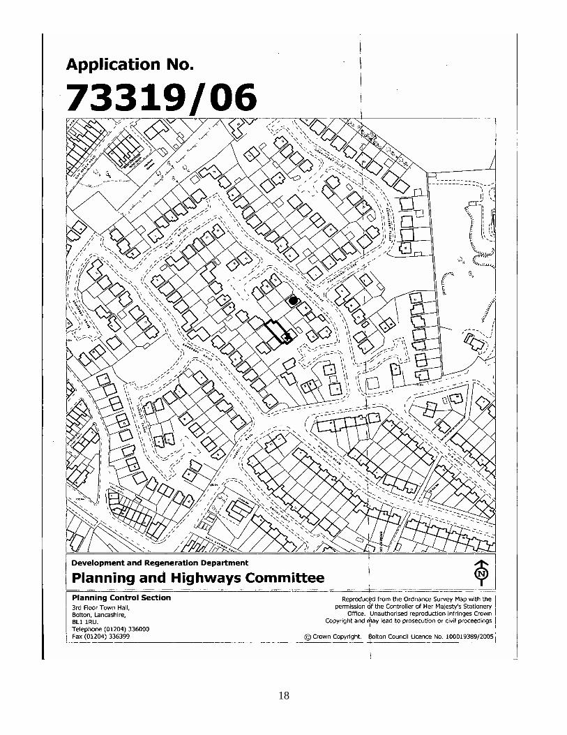
Date of Meeting: 30 March 2006 Item Number: 2 Application Reference: 73319/06 Type of Application: Full Planning Application Registration Date: 31/01/2006 Decision Due By: 28/03/2006 Responsible
Officer: Pat Naylor
Location: 46 SAXBY AVENUE, TURTON, BOLTON, BL7 9NX Proposal: INSTALLATION OF DORMER WINDOWS AT REAR. Ward: Bromley Cross Applicant: Mr & Mrs Rushton Agent : Design A Loft Officers Report Proposal The proposal is to erect two pitched roof dormers on the rear elevation to provide an additional bedroom and bathroom. These dormers would be clad in roof tiles to match the existing tiles. Site Characteristics This is a semi-detached property sited on a lower ground level to the adjacent property and built on a modern residential estate within a small residential cul-de-sac. Although the dormers are to be sited at the rear of the property they would be visible from numerous view points, particularly from the cul-de-sac to the north west (Saxby Avenue). Policy UDP Policy D2 Design and the Built Environment. PCPN3 House Extensions History A identical planning application for the installation of dormer windows to the rear was refused in September 2005 (71814/05). Representations Letters:- one letter has been received from 36 Saxby Avenue objecting to the proposal on the grounds that the proposed dormers would be intrusive, and would result in the loss of privacy and loss of views.
19

Elected Members:- Councillor A Wilkinson has requested that this application be presented to Members. Analysis Section 38 of the Planning and Compulsory Purchase Act 2004 requires applications to be determined in accordance with policies in the Development Plan unless material considerations indicate otherwise. Applications which are not in accordance with Development Plan policies should be refused unless material considerations justify granting permission. Similarly, proposals which accord with Development Plan policies should be approved unless there are material considerations which would justify a refusal of permission. It is therefore necessary to decide whether this proposal is in accordance with the Development Plan and then take account of other material considerations. The main impacts of the proposal are: * Impact on the character of the area. Impact on the character of the area. Policy D2 of the UDP states that proposals should be in keeping with the character of the area and compatible with their surroundings. PCPN3 on House Extensions states that dormers on prominent elevations will normally be refused. In terms of the size of the proposed dormers, they do not exceed two thirds of the roof space and therefore accord with this element of PCPN3 on House Extensions. However, the proposed dormers are to be sited in a high visibility location and would be a strident feature from vantage points to the north east (side) and north west (rear). In this prominent location dormer windows are considered to present an alien feature in the streetscene given the higher ground level of the property and the direct overlooking into the cul-de-sac to the north west. The objector raises concerns regarding loss of views, intrusion and loss of privacy, however whilst loss of view is not a planning consideration, the loss of privacy and intrusion are relevant. The objector's dwelling is located to the north east and approximately 21 metres from the nearest points of the dwellings. The erection of the two dormers comply with the policy distance required under PCPN3 on House Extensions and do not directly overlook the objector's property or garden. Conclusion It is considered that the proposed dormers would create a strident feature in the street scene and would affect the character of the area. They would also imbalance the adjoining semi detached property. The proposed two dormers are contrary to policy and it is recommended that they be refused.
20

Recommendation: Refuse Recommended Conditions and/or Reasons
1. The proposed dormers would, by virtue of their design, height and siting be detrimental to the character and appearance of the area and are contrary to Policy D2 of Bolton's Unitary Development Plan and Planning Control Policy Note No.3 - "House Extensions".
21

22

23

24

Date of Meeting: 30 March 2006 Item Number: 3 Application Reference: 73379/06 Type of Application: TPO Application Registration Date: 07/02/2006 Decision Due By: 04/04/2006 Responsible
Officer: Jeanette Isherwood
Location: DAYSPRING, SHADY LANE, TURTON, BOLTON, BL7 9AF Proposal: FELLING OF ONE OAK TREE. Ward: Bromley Cross Applicant: Mr A Fisher Agent : Arbconsulting Officers Report Proposal The application seeks to fell a mature Oak tree, stating that it represents a risk to the property. The application is presented to Committee as the applicant is a Bolton Council Chief Officer. Site Characteristics The tree is situated within a woodland tree belt that runs along the frontage with Shady Lane. The tree is situated to the north of the property ‘Dayspring’ and the canopy overhangs the property by 1 – 2 metres. Policy Unitary Development Plan Policies: N7 Trees, Woodland and Hedgerows; N8 Protected Trees. Technical Consultations See analysis. Representations Letters:- three letters of objection have been received from various neighbours. The main objections being:- 1. The tree appears to be perfectly healthy. 2. A programme of damage limitation and conservation should be applied to the site to preserve the remaining trees. 3. The felling of the tree would be vandalising the environment further.
25

26

Analysis Section 38 of the Planning and Compulsory Purchase Act 2004 requires applications to be determined in accordance with policies in the Development Plan unless material considerations indicate otherwise. Applications which are not in accordance with Development Plan policies should be refused unless material considerations justify granting permission. Similarly, proposals which accord with Development Plan policies should be approved unless there are material considerations which would justify a refusal of permission. It is therefore necessary to decide whether this proposal is in accordance with the Development Plan and then take account of other material considerations. The Councils Tree & Woodland Officer undertook a ground inspection of the tree. The tree is a Turkey Oak (Quercus cerris) and not an English Oak as stated in the arboricultural report attached to the application. The tree is typical of the species growing in a woodland setting such as this. The canopy spread is greater to the south of the tree, due to the presence of other trees nearby. The tree has a height of 18 metres and a crown spread of 10 metres with a stem diameter of 450 mm. The tree growth appears normal for this species and there is no sign of lack of vigour. There is evidence of some internal shakes within the trunk, which is evident from the bark formations. This is not considered to be severe and does not significantly affect the structural integrity of the tree. The lowest limb on the tree has a defect near the union with the main trunk. It is considered that some minor pruning of secondary branches on the lowest limb to reduce the stresses on the union would be sufficient to rectify this weakness. There was no evidence of any other significant defects within the tree that warrant its removal. The Council's Tree and Woodland Officer would consider that the tree within the application, forms an important integral part of the woodland and the amenity of the area, and the loss of the tree is considered to be unacceptable. The proposal is therefore contrary to UDP policiy N8. Conclusion The works specified within the application are in excess of good arboricultural practice and are therefore contrary to policy, the application should therefore be refused. Recommendation: Refuse Recommended Conditions and/or Reasons
1. The tree is a healthy specimen, and its removal would be contrary to Policy N8 of Bolton's Unitary Development Plan in that it would result in unacceptable tree loss, to the detriment of the character, appearance and amenity of the surrounding area.
27

28

29

30

Date of Meeting: 30 March 2006 Item Number: 4 Application Reference: 73553/06 Type of Application: TPO Application Registration Date: 27/02/2006 Decision Due By: 24/04/2006 Responsible
Officer: Pat Naylor
Location: DAYSPRINGS SHADY LANE BROMLEY CROSS BOLTON Proposal: FELLING OF ONE SYCAMORE TREE Ward: Bromley Cross Applicant: Mr A Fisher Agent : ARB Consulting Officers Report Proposal The application seeks to fell a sycamore tree stating that an approval has already been granted to remove an adjacent Oak tree which would have influenced the growth pattern of the Sycamore tree. The Sycamore tree has evidence of stem and crown wounds and no subordinate branching below 9 metres. The removal of the Oak tree would therefore alter the wind loading on the tree and would deem it impossible to determine its safe useful life once the Oak has been removed. It is considered to be prudent to remove the Sycamore tree and replant with a replacement. The tree is referred to T8 on the TPO. The application is presented to Committee as the applicant is a Bolton Council Chief Officer. Site Characteristics The tree is situated within a woodland tree belt that runs along the frontage with Shady Lane. Policy Unitary Development Plan Policies: N7 Trees, Woodland and Hedgerows; N8 Protected Trees. Technical Consultations See analysis.
31

Representations etters:- two letters have been received from nearby neighbours. Their main concerns
. Other protected trees have already been felled. nsp to determine its true health and if the tree is uld .
naly
Lare:- 12. The CTW&O should ielled, a replacement sho
ect the tree be enforcedf
A sis Section y Purchase Act 2004 requires applications to
de an s in the Development Plan unless material nsid te othe
pplications which are not in accordance with Development Plan policies should be fused unless material considerations justify granting permission.
milar ls which a s should be approved nless aterial co usal of permission.
is therefore necessary to decide whether this proposal is in accordance with the evelopment Plan and then take account of other material considerations.
nc nd Officer undertook a ground inspection of the Sycamore ee. The tree has a height of 18 metres and a stem diameter of 0.47 metres. There is a
the trunk of the tree at a height of 1 metre above ground level. The ound is 45 cms. by 10 cms in size and is callousing over.
exposed by the removal of the recently storm amaged Oak there is no indication that the tree is at risk of failure. The tree is still
O would consider that the tree within the application forms an important part of f the woodland and the removal of this tree will weaken the tree
sion
38 of the Planning and Compulsorbe termined in accord ce with policieco erations indica rwise.
Are Si ly, proposa
here are mccord with Development Plan policiesiderations which would justify a refu t n
ItD The Cou ils Tree & Woodlatrminor wound onw The tree has a high canopy, which starts at a height of approximately 10 metres. The canopy is typical of a woodland tree such as this. Lower limbs have been shaded out over time by the surrounding trees. There is little low branch growth on the open aspect of the tree due to a tree that was recently removed to the south-east of this tree. There is no evidence of limb failure in the tree and the branch structure within the canopy appears sound. There is one minor piece of deadwood within the canopy that could be removed if required. Whilst the tree will be slightly more dprotected by adjoining trees both to the east and west.
he CATthe structural integrity obelt along the frontage with Shady Lane. It is considered that the loss of the tree to be unacceptable. Conclu
ecommendation: Refuse
d Conditions and/or Reasons
The works specified within the application are in excess of good arboricultural practice and are therefore contrary to policy, the application should therefore be refused. R Recommende
32

1. The tree is a healthy specimen, and its removal would be contrary to Policy N8 of Bolton's Unitary
Development Plan in that it would result in unacceptable tree loss, to the detriment of the character, appearance and amenity of the surrounding area.
33

34

35

36

Date of Meeting: 30 March 2006 Item Number: 5 Application Reference: 73360/06 Type of Application: Outline Planning Permission Registration Date: 02/02/2006 Decision Due By: 30/03/2006 Responsible
Officer: Jodie Turton
Location: LAND ADJ 2 CHERRY TREE WAY, BOLTON Proposal: OUTLINE APPLICATION FOR DEMOLITION OF THE EXISTING
GARAGE AND ERECTION OF TWO 2 STOREY DETACHED DWELLINGS WITH INTEGRAL GARAGES (SITING & MEANS OF ACCESS DETAILS ONLY).
Ward: Bromley Cross Applicant: LTW Developments Agent : Officers Report Proposal This is an outline application proposing the erection of two detached dwellings, to determine siting and means of access details only. The proposed houses are two-storey detached dwellings, with integral garages and driveways to the front, accessed from Oaks Lane and private gardens to the rear. Site Characteristics The site was previously occupied by the garden of 23 Oaks Lane and 2 Cherry Tree Way, the gardens to both of these properties have been reduced to create a new site on which the two houses are proposed. The garage to 23 Oaks Lane has been demolished and as part of this scheme the garage to 2 Cherry Tree Way will also be demolished. Oaks Lane is a narrow residential road, which has a largely rural feel. Residential properties flank the road to the north and Canon Slade School to the south. The road is characterised by large detached properties set back from the road of a variety of styles and designs, with significant mature landscaping and off road parking. Cherry Tree Way is more suburban in character, with large semi detached properties set back from the road, with large gardens to the rear and off road parking to the front. Policy PPS1 Delivering Sustainable Development

PPG3 Housing PG13 Transport
DP policy: D2 Design; A5 Impact on the Highway; A6 Car Parking Standards; H3 ousing Development; H5 Housing Density; D3 Landscaping.
PN2PN2PN2
Histor
P UH PC Space Around Dwellings PC 1 Highway Considera
mtions
PC 7 Housing Develop ent
y Outline planning permission was refused in February 2006 for the demolition of the xisting house at 2 Cherry Tree Way and the erection of a three storey apartment ildin g twelve d) (73097/06)
utline ermissiondetached houses (siting, de(72632/05)
annin ission was g ection of a single detached dwelling with tegral garage in July 2005 (71258/05)
for the erection of a single detached dwelling with garage in May 2005 (70526/05)
ultations
ebu g comprisin two-bedroom apartments (all matters reserve O planning p was refused in February 2006 for the erection of four semi-
sign, external appearance and means of access details only)
Pl g perm ranted for the erin Planning permission was refused detached Technical Cons
uncil - Highway Engineers:- raise no objections. Bolton Co Bolton Council - Environmental Health Officers:- raise no objections. United Utilities:- raise no objections.
epresentationsR Letters:- seventeen leto the proposal and one
tters of representation have been received, sixteen in objection
ffic would impact ccess for emergency vehicles.
in support. Objections were raised on the following grounds: • Oaks Lane is becoming increasingly congested with traffic attending school and
parents parking to collect children, additional houses would exacerbate this problem; • The proposal would result in a cramped form of development, out of character with
the area; • The corner/junction of Oaks Lane and Cherry Tree Way is dangerous due to limited
road visibility; • The proposed houses sit forward of the building line with 23 Oaks Lane; • The development will result in vehicles reversing out onto Oaks Lane; • Capacity of local services and facilities; • There are enough houses in the area;
Oaks Lane provides emergency access to the railway, increased tra• on a
38

Analysis Section 38 of the Planning and Compulsory Purchase Act 2004 requires applications to e determined in accordance with policies in the Development Plan unless material
pplications which are not in accordance with Development Plan policies should be tions justify granting permission.
rd with Development Plan policies should be approved nless there are material considerations which would justify a refusal of permission.
he
he main impacts of the proposal are:-
the highway impact on the character of the area and residential amenity
bconsiderations indicate otherwise. Arefused unless material considera Similarly, proposals which accou It is therefore necessary to decide whether this proposal is in accordance with tDevelopment Plan and then take account of other material considerations. T * impact on urban regeneration * impact on * Impact on Urban Regeneration National policy on residential development is contained in PPG3. In order to promote
for s and urban areas. It is important that new
ousing is located where it is accessible to jobs, shops and services by modes of . The inefficient use of land should be avoided and to this
d. PPG3 also promotes uality in new residential development, and explains that proposals should make more
ew housing ould not be viewed in isolation, but its design and layout must be informed by the
together with PCPN27 are reflective of the ntemporary approach to sustainable housing developments and the approach is
contained in PPG3.
s been
dem
the principle of residential development has already been established (71258/05). The
dev
more sustainable patterns of development, PPG3 makes it clear that the focusadditional housing should be existing townhtransport other than the carend maximum use should be made of previously developed lanqefficient use of land without compromising the quality of the environment. Nshwider context. Policies H3 and H5 coconsistent with that The dwellings proposed would be located on previously developed land, which wapreviously garden area to 23 Oaks Lane and 2 Cherry Tree Way. The garages have
olished and the site cleared of trees, the site is now a vacant plot. A planning permission exists on the site for the erection of a single detached dwelling and therefore
scheme therefore meets policy requirements in that it proposes the use of previouslyeloped land.
Impact on the Highway PPG13 provides national policy guidance on transport and highway issues, with regard to
ll aims of PPG3 in encouraging sustainable v
dw
housing development this supports the overade elopment and reducing reliance on the car. PPG3 encourages 1.5 parking spaces per
elling.
39

UDP policy A5 seeks to ensure that development does not impact detrimentally upon the
oad flanked by Canon Slade School to the south and sidential properties to the north. There are no parking restrictions along Oaks Lane
nds, it can therefore,
t times, become quite congested. It also provides access to Cherry Tree Way and
order to ensure that the proposed development does not contribute further to the
rate integral arages with access from Oaks Lane, as well as space for the parking of a vehicle on the
e 6.0 metres in length in line with the Council's ighway Engineers recommendation to ensure adequate space for the parking of a
ents of PCPN21 and UDP olicies A5 and A6.
highway, supported by PCPN21. UDP policy A6 provides guidance on parking standards. Oaks Lane is a narrow residential rreand the road is often used for parking for the school both by students and by parentscollecting children and also for the gated access to the school grouaresidential estate off this. Incongested nature of Oaks Lane, the scheme proposes 2 parking spaces per dwelling,above the 1.5 spaces required by PPPG3. The houses are to incorpogindividual driveways. The driveways arHcar/access to the garage. The proposal is therefore considered to meet policy requiremp Impact on the Character of the Area and Residential Amenity National policy guidance contained in PPG3 encourages high quality design in new housing development. PPS1 encourages high quality and inclusive design in new development that functions well and adds to the overall character and quality of the area. UDP policy D2 seeks to ensure that development is of a high quality, is in keeping with the character of the surrounding area and does not impact detrimentally upon residential amenity. UDP policies H3 and H5 detail guidance on determining housing applications. UDP policy H3 outlines the principle issues when considering the appropriateness and quality of new housing developments. As this is an outline application for siting and means of access only, design details have
en set back from the road to be in line with the single storey element f the adjacent property at 23 Oaks Lane, 1.0 metre forward of the main body of the
red to be acceptable, meeting the space around dwellings
. The site layout has provided sufficient space for landscaping to the front arden area, and to ensure that appropriate levels of landscaping and screening to
not been included in the submission. However, from the siting and layout of the site it is still possible to ascertain the suitability of the proposal in relation to impact on the character of the area. The area itself is characterised by larger semi-detached and detached properties set back from the road, most notably on Oaks Lane where there is a largely rural feel with mature landscaping to the front garden areas. The proposed detached properties are to be set back from the road by a distance of 6.0 metres. The properties have beohouse. This is considerequirements of PCPN2. Due to the curve of the road and the variety of styles and ages of houses along Oaks Lane, there is not a strong building line, however the appearance of the area is characterised by houses positioned back from the road with space for landscapingg
40

contribute to the rural character of Oaks Lane landscaping will be a condition of planning permission. The footprints of the two proposed dwellings are of a similar size to that of the four semi-detached houses refused by the Planning and Highways Committee on 2nd February 2006 (72632/06). Despite this similarity, the current proposal offers significant advantages over the previously refused scheme. The four houses previously proposed offered a cramped form of development with small rear gardens, four driveways off Oaks Lane, with little space for landscaping and the houses were sited significantly
rward of the adjacent property at 23 Oaks Lane. In contrast the current proposal
CPN2 outlines distances which should be complied with between dwellings to maintain
se requirements. The application scheme also meets PCPN2 quirements in terms of private useable garden space to the rear of the dwelling.
sion
foprovides adequate space for landscaping, only two driveways are required to serve the individual dwellings, the rear garden areas are of ample size and the properties maintain a stronger building line with 23 Oaks Lane. The proposed development is at a density of 40 dwellings per hectare, which meets the requirements of PPG3 and UDP policy H5 and is considered acceptable for this location. Pprivacy and to respect the character and amenity of the surrounding area, the proposed scheme meets there The scheme is considered to meet policy requirements in terms of impact on the character of the area and residential amenity. Conclu
e proposed scheme meets policy requirements. Two detached dwellings in this
ee an of
e
Thlocation would be in keeping with the character of the area, there is adequate space for landscaping to the frontage onto Oaks Lane to soften the appearance of the development. Two parking spaces will be provided, including an integral garage and the proposal is not considered to have a detrimental impact upon highway safety. The proposal is therefore recommended for approval. Recommendation: Approve subject to conditions Recommended Conditions and/or Reasons
1. Application for the approval of Reserved Matters must be made not later than the expiration of thryears beginning with the date of this permission and the development must be begun not later ththe expiration of two years from the final approval of the reserved matters or, in the case approval on different dates, the final approval of the last such matter to be approved. Reason
Required to be imposed pursuant to section 92 of the Town and Country Planning Act 1990 as amended by Section 51 of the Planning and Compulsory Purchase Act 2004.
2. Approval of the following details (hereinafter referred to as "The Reserved Matters") shall b
41

obtained from the Local Planning Authority in writing before any development commences:- Design:
ng an of
f the trunks of all the trees. These landscaping proposals months of the occupation of any of the buildings or the
ils ny
next planting season with others of a similar size and species; unless the Local Planning Authority gives
The application is for outline planning permission and these matters were reserved by the applicant
(including plans, levels and elevations of all buildings and any other structures); External Appearance: (including the colour and type of facing materials to be used for external walls and roof(s)); Landscaping: (including walls/fencing, hard and soft landscaping and final levels); Landscaping proposals submitted as a "Reserved Matter" shall include the location of any existitrees and hedgerows on or overhanging the site plotted from an accurate site survey with indication of which trees and hedgerows it is intended to retain, such details to include the extentspread of the branches and the position oas approved shall be carried out within 6completion of the development, whichever is the sooner, or in accordance with the phasing detaincluded as part of the scheme and subsequently approved by the Local Planning Authority; atrees and shrubs that die or are removed within five years of planting shall be replaced in the
written consent to any variation. Reason
for subsequent approval.
3. The submission of an application for an approval of Reserved Matters shall show full details of existing and proposed ground levels within the site and on land adjoining the site by means of spot
ts and cross-sections; the proposed siting and finished floor levels of all buildings and heighstructures; and the proposed site layout and phasing of development. Reason To ensure that the development safeguards the character of the localtiy and the privacy and outloof nearby residents.
ok
4. Based on the results of the approved desktop study where contamination is suspected the developer cal Planning Authority prior to
cement tigation should be carried out in accordance with the approved sampling and analytical strategy to assess the extent of any likely
logy should be designed utilising the British Standard BS10175: 2001.
(i) the Health and Safety of site workers and nearby persons
(iii) landscaping schemes
shall submit a sampling and the commen
analytical strategy for approval by the Loof any on-site investigation. A site inves
contamination of the site. The methodo
The site investigation shall address: - 1) the nature, degree and distribution of contamination and underground gases on the site 2) its implications on:-
(ii) building structures and services
(iv) final end users of the site
42

(v) the environmental pollution of ground water
ation is found, the t details of a site
dial measures for the approval of the Local Planning Authority.
ority for pproval. Within the site investigation report it must identify any remedial measures required to deal
rds identified. This should be carried out using the most appropriate risk assessment tc) and any remedial measures
f the site and eliminate risk to people and buildings due to ntaminated land.
5.
Should the desktop study indicate no issues, but during development contamineveloper shall contact the Local Planning Authority promptly, and submid
investigation and reme On completion of a site investigation a report shall be submitted to the Local Planning Authawith any hazamethodology for the purpose (e.g. CLEA or the SNIFFER method erequired shall be implemented by the developer prior to the occupation of the site. A validation report is required prior to the discharge of this condition confirming that all remedial action required to make the site safe for use has been completed. It is recommended that a copy of the validation certificate showing safe for end use also be supplied to the purchasers of the properties to assist in conveyancing in later years. Reason To ensure the safe development oco
The development hereby approved/permitted shall not be brought into use unless and until that part
rs at all times the premises are in use.
6.
of the site to be used by vehicles has been laid out, drained and surfaced in accordance with detailsto be submitted to and approved by the Local Planning Authority and shall thereafter be made available for the parking of ca Reason To encourage drivers to make use of the parking and circulation area(s) provided.
The intearking
gral garage(s) hereby approved/permitted shall be made available at all times for the of a motor vehicle.
age spaces would be likely to lead to an increase in on-street parking to the general
7.
o ensure that the development safeguards the character and visual appearance of the locality.
p Reason The loss of gardetriment of highway safety.
The dwellings hereby approved/permitted shall not be greater than two-storeys in height. Reason T
43

44

45

46

Date of Meeting: 30 March 2006 Item Number: 6 Application Reference: 73314/06 Type of Application: Prior Notification (all) Registration Date: 03/02/2006 Decision Due By: 31/03/2006 Responsible
Officer: Andrew Lancashire
Location: PAVEMENT AT TONGE CRICKET CLUB, CROMPTON WAY,
BOLTON. Proposal: PRIOR NOTIFICATION TO ERECT A 15 METRE HIGH
MONOPOLE TELECOMMUNICATIONS COLUMN, TOGETHER WITH 3 NO. ANTENNAS AND ASSOCIATED EQUIPMENT CABINETS AT BASE.
Ward: Crompton Applicant: T-Mobile (UK) Ltd. Agent : Daly International (UK) Ltd. Officers Report Proposal This is an application for Prior Approval. The proposal comprises the erection of a 'flexicell' monopole 14.7 metres high together with telecommunications equipment comprising of three antennas and three associated equipment cabinets. The flexicell and associated cabinets are to be located on the pavement adjacent to Shell petrol station on Crompton Way and directly in front of Tonge Cricket Club. The flexicell has been designed and selected to blend in with the existing street scene. The column and cabinets are to be painted grey to match existing street furniture. The proposed equipment will provide 3rd and 2nd Generation coverage to the residential areas of Crompton, Bradshaw, Hall i’th’ Wood and the commercial area around Tonge Moor Road/Crompton Way. The three equipment cabinets are necessary to accommodate 3G and 2G apparatus. Site Characteristics This is a proposed new telecommunications site. The application site is on Crompton Way close to the commercial local town centre of Astley Bridge.

Situated on the public highway outside Shell and Tonge Cricket Club, the existing street scene comprises a variety of street furniture, from a free standing illuminated totem
dvertising hoarding.
e is e (Kwik Save) and a public house (the Castle). e n Way (A58) with the junction of Tonge Moor
oad ( fic hotspots in Bolton.
rwoo le Hill Primary School are located 125 metres and 300 metres spec m the
olicy
pole, floodlights, lampposts and a 48 sheet a Directly opposite the sithe site is located on th
a food storbusy CromptoT
R A676) and is considered to be one of the traf Fi d School and Castre tively away fro application site.
P PG8 (revised) Telecommunications.
DP p es D6 and A5 Roa
PCPN25 T unication Technical Consultations
P U olici d Network.
elecomm s.
olton Council - Highway Engineers:- the cabinets are overly large and will cause ob to pedestrians using the footway. A solution would be to move the
roposal off the highway by siting the equipment cabinet within the cricket ground or ithin the landscaped strip.
o h Officers:- raise no objections.
pylons have not been fully considered for as alternative locations elopment. Technically the maps provided do show a need in the area and it
B an structionpw Bolton C uncil - Environmental Healt
CS:- state that two Efor this devis clear that more sites will be required. Consultation A site notice was posted on site on 8th March 2006 The following were consulted:- 07-549, 560 Tonge Moor Road
ations
5Service Station Castle PH Kwik Save Cricket Club The application site is located 125 metres and 300 metres respectively away from Firwood School and Castle Hill Primary School. The Schools have been consulted by the applicant prior to the submission of the application. Represent
ave been received which raise the following issues:
fic and pedestrians, The proliferation of further structures in the area would amount to excessive clutter.
Letters: - two letters h • The sitting of the cabinet and mast would be a hazard to traf•
48
Analysis PPG8 states that applications for Prior Approval must be considered on siting and ppearance grounds only. Policies in the Development Plan relating to siting and
ply with the rovision of the Development Plan in terms of siting and appearance should be granted
imilarly applications which are unacceptable in siting and appearance terms, and which trary to the provisions of the Development Plan in terms of siting and
pproval.
ether this application is acceptable in terms of ting and appearance, with due regard being had to relevant Development Plan policies,
is to facilitate the growth of new and existing
aappearance are relevant. Applications which are acceptable in siting and appearance terms and compPrior Approval. Sare conappearance, should be refused Prior A It is therefore necessary to decide whsiand determine the accordingly. The Government's policy telecommunications systems whilst keeping the environmental impact to a minimum. Consideration of Alternative Sites and Mast Sharing PPG8 and UDP policy D6 place strong emphases on the use and reuse of existing sites,
particular the use of existing masts, buildings and other structures. The Government cal Planning
uthority and interested third parties regarding the consideration of alternative sites.
clear and specific reasoning, having borne in ind the technical constraints of the Operators.
s a list of these sites and reasons
ve Supermarket – The supermarket does not deal with telecoms erators. ton Castle public house – Discounted because there is an electricity pylon
the building. The pylon would mean that the required height could not be achieved.
sidential property. This location has no scope to house any of the equipment cabinets. This option was therefore
he applicant was advised during pre application discussions that it would be preferable l a
inencourages applicants to hold pre-application discussions on with the LoA The lack of consideration of alternative sites can be a reason to refuse applications, but the Local Planning Authority must givem The applicants have considered 4 options. Below igiven for not choosing that site.
• Kwik Saop
• Bolover
• Existing Lattice tower on Tonge Cricket Club - Current site provider does not want any more telecoms on the tower.
• Existing Pylon – Located in the rear of a re
discounted. Tto ocate a mast on an existing pylon structure. The applicant has stated that there arenumber of pylons in the area that were discounted due to the site provider not being
49

willing to accommodate antennas upon the pylons. No further details have been claim, nor has each pylon been individually assessed for its
uld also be made of existing buildings and other structures, ch as electricity pylons, to site new antennas. Local planning authorities may
pylons are located within 250metres of the proposal site; 1 of these is located to the
the ownership of St Aidans Church and e Primary Care Trust.
PPG8 guidance and is also contrary to Council policy D6 nd PCPN25.
provided to justify thissuitability. PPG8 states that use shosureasonably expect applicants for new masts to show evidence that they have explored the possibility of erecting antennas on an existing building, mast or other structure. 4rear of a residential property (5 The Close) and is unsuitable. Two other pylons located at St Aidans Church are within a mixed commercial and residential area. The land on which the structures stand are believed to be inth Without priority given to existing structures, it is considered that the proposed sequential test has not satisfied a Technical Justification PPG8 states that Operators may be expected to demonstrate the need for the proposal.
is justified in terms of operational
ea pproximately covering the residential areas of Crompton, Bradshaw, Hall i’th’ Wood and
UDP policy D6 requires that the size of the mast efficiency, structural capacity and its relative importance in the network. The applicant has supplied existing and proposed Cell Coverage Diagrams. The proposed equipment will improve 3rd and 2nd Generation services for T-Mobile UK LTD, an arathe commercial area around Tonge Moor Road/Crompton Way. Design and Visual Amenity Issues UDP policy D6 requires that the siting, scale and external appearance of the apparatus,
isual intrusion and, if applicable, the appearance of ructures on which they are mounted.
The des al amenity of the proposed telecommunications mast is considered to b cthe fronilluminated free standing sign, steel mesh fencing and an advertising hoarding, line the paveme The othan thdevelop e viewed in conjunction with other nearby street furniture and any isual impact would be absorbed by its setting.
and any associated landscaping, have been designed to minimise, eliminate or mitigate negative impact on amenity, vst
ign and visue a ceptable. The proposed location of the mast is positioned on the pavement at
t of Tonge Cricket Club. Various other street furniture including street lamps, an
nt to heights between 11 metres and 5 metres.
pr posed flexicell monopole, a slimline lamppost design, will sit higher at 15 metres e existing lamppost and advertisements, however it is considered that the ment would b
v Whilst the two associated equipment cabinets, to be sited to the rear of the pavement are large in size, their appearance would be acceptable due to the commercial nature of
50

the area. Both the equipment cabinets and flexicell will be painted grey to match the existing lampposts and street furniture. Impact on the Highway
he application site comprises the pavement directly in front of Tonge Cricket Club and
cing them out on to the road. The equipment cabinets and mast ill reduce the usable size of the footpath from 3.1m to 1.5m and is considered to be
of obstruction could be worsened especially when their cabinet doors are pen, and on match days for the Cricket Club when there are more pedestrian
olicy A5 of the DP.
UDP policy A5 and PCPN21 seek to ensure that development proposals do not adversely affect the safety of highway users, including pedestrians, as well as the safe and efficient circulation of vehicles. Tclose to the junctions of Crompton Way and Tonge Moor Road. The Council's Highway Engineers have objected to the proposal on the grounds that the location of the three equipment cabinets on the footway will cause an obstruction to pedestrians, possibly forwunacceptable for pedestrian safety at this busy traffic spot. This problem omovements. It is therefore considered that the proposal would result in a detrimental impact on the safety of highway users, including pedestrians thereby being contrary to pU Health Considerations The Central Government view is that if the output levels of the proposed equipment are below the guidelines recommended by the International Commission on Non-Ionizing adiation Protection, there should be no need for further consideration on health R
grounds. PPG8 advises that Operators should provide Local Planning Authorities with ICNIRP compliance statements. The applicant has provided an ICNIRP compliance statement for this application. Conclusion On the basis of the information provided it is considered that the applicant has not justified why several alternative, and more acceptable structures have not been considered for installing telecommunications antennae. Existing pylon structures should be considered before the proliferation of new sites. The proposed location of the mast and especially the three equipment cabinets are considered to pose a particular threat to highway safety, including pedestrians. The proposal is therefore considered to be contrary to policy requirements.
51

52

Recommendation: Refuse Recommended Conditions and/or Reasons
1. The proposed development by virtue of its size, width and siting would adversely affect the safety of highway users, including pedestrians, and as such is contrary to Policies D6 and A5 of the Bolton Unitary Development Plan 2005 and Planning Policy Control Notes No.21 "Highway Considerations" and No.25 "Telecommunications".
2. The applicant has not fully justified identification of the proposed site with regard to the discounting
of existing structures within close proximity of the search area thereby being contrary to guidance contained in PPG8 - Telecommunications, UDP policy D6 and PCPN 25 - Telecommunications.
53


55

56

Date of Meeting: 30 March 2006 Item Number: 7 Application Reference: 73317/06 Type of Application: Full Planning Application Registration Date: 31/01/2006 Decision Due By: 28/03/2006 Responsible
Officer: Jon Berry
Location: LAND AT DARK LANE, BLACKROD, BOLTON. Proposal: ERECTION OF STABLES WITH SAND PADDOCK. Ward: Horwich and Blackrod Applicant: D Bremner Agent : Hindley Design Limited Officers Report Proposal The proposal is for the erection of a new building containing 3 stable units, a store room and a tack room. Each stable would measure 4 metres x 4 metres in footprint and 4.4 metres in height (as measured to the roof ridgeline). The proposed materials are rendered concrete blockwork and Marley Modern grey tiles. The building would be positioned immediately adjacent to the boundary with Dark Lane to the rear of the existing hedgerow. The sand paddock would measure 20 metres x 40 metres and would be set further into the field to the west of the building. This would be cut into the slope of the land. Access to the site would be taken via the existing entrance and a replacement gate would be set in 6 metres from the highway. An area of hardstandings would surround the building. The existing footpath running through the field would be re-aligned to the south to follow its original route and a new stile would be created for members of the public. The application is supported by the inclusion of passports for the horses which would occupy the stables. Site Characteristics The land is located to the west of Dark Lane adjacent to the point where the road bends round from Blackrod to the east towards Chorley and Adlington to the north-west. The application site consists of rolling open green fields and this area is designated as Green Belt. The land is presently used for the grazing of horses.
57

The land slopes away from Dark Lane and t open countryside offers substantial views
ewing spot marked by an off-street p bench.
ru h the application site.
rows d to the south.
olicy
he into the distance. There is a public vi arking bay and a There is a public footpath nning throug C haw Farm and Crowshaw House stan P
Green BePPG 2 lts; PPS 7 Sustainable Development in Rural Areas
DP Policies R2 Protected Open Land, R5 Landscape Character, G1 and G2 Green Belt, 1 and and A5 R
PN 2 s Conside
istor
UD D2 Design oads, Paths, Car Parking and Servicing, PC 1 Highway rations and PCPN 28 Equestrian Development. H y A planning application for the erection of stables with a sand paddock was withdrawn by
ber 2005 (72044/05).
echnical Consultations
the Applicant in Septem T
- Highway Engineers:- advise that right turns into Dark Lane are because of restricted forward visibility due to hedges on land opposite the
osition of a number of planning conditions to secure satisfactory
Bolton Councilhazardous application site and therefore consider that a planning condition should be imposed to restrict the development to private use by the Applicant. The Engineers also recommend that the proposed hedging adjacent to the entrance gate should be splayed to ease manoeuvres into the access and this can also be conditioned. Bolton Council - Environmental Health Officers:- have no objections but recommend the impstorage of manure and bedding and no on site fires, to restrict the use to the stabling of horses only and to ensure that a site investigation is carried out to eliminate risks of land contamination and gas migration. Representations Letters:- 9 letters have been received from local residents raising objections to the application on the following grounds: * loss of beauty spot and open views
ld be retained in present position ently grazed on the land
* road safety problems near to site * other stable developments in Blackrod have been unsympathetic * footpath shou* horses have only rec* potential for building to be converted into a house * odours and hygiene problems associated with the storage of manure * there are existing stable facilities in the vicinity * the development is likely to attract vandalism
58

* there are few open walking areas remaining in Blackrod
- a petition of 21 signatures has been received raising objections to the roposal on the following grounds:
road safety problems near to site
the materials are for a permanent building which could be used for in the future
field odours from the storage of manure
f views there is no means of protection for users of the public footpath from horses
own Council:- Blackrod Town Council raises objections due to the visual impact on cape and has requested a site visit by Members of the Planning and Highways
nalysis
* the Applicant does not own the land across which access would be taken Petitions:p ** loss of views across the countryside * alternative purposes* the building should be positioned at the opposite side of the** this type of building spoils the appearance of the village * the hedgerow at the boundary would also result in the loss o* Tthe landsCommittee prior to determination of the application. A
nd Compulsory Purchase Act 2004 requires applications to
imilarly, proposals which accord with Development Plan policies should be approved
he main impacts of the proposal are:-
impact on the amenities of local residents
pact pe
Section 38 of the Planning abe determined in accordance with policies in the Development Plan unless material considerations indicate otherwise. Applications which are not in accordance with Development Plan policies should be refused unless material considerations justify granting permission. Sunless there are material considerations which would justify a refusal of permission. It is therefore necessary to decide whether this proposal is in accordance with the Development Plan and then take account of other material considerations. T * impact on the Green Belt and the landscape * impact on road safety * Im on the Green Belt and the landsca
nt urban sprawl ortant attribute of Green Belts is
ir o n Belt should not be injured by pos e Green Belt which, although y w t be visually
trime .
PPG 2 advises that the fundamental aim of Green Belt Policy is to preveby keeping the land permanently open; the most impthe penness. The visual amenities of the Greepro als for development within or conspicuous from ththe ould not prejudice the purposes of including land in Green Belts, mighde ntal by reason of their siting, materials or design
59

UDP Policies G1 and G2 follow the thrust of this guidance and seek to maintain the ted, by
rotecting the land from inappropriate development.
opment in open countryside and protect these areas om impacts on nature conservation interest, landscape character and visual intrusion d Po Landscape Character Areas from development,
nd its distinctiveness.
CPN 2 tes that small scale stable accommodation for n Belt.
e lan genuine requirement for res and can
size ecessary for the horses that would occupy the building and are therefore of sufficiently
t not be intrusive in the landscape nd should, wherever possible, be positioned in a well screened or unobtrusive location.
own Council and a number of local residents have raised objection to the
les to be sited at the opposite side of the field to the est.
rk Lane, this would ecessitate the creation of increased hardstandings to extend the vehicular access which
as
art of the landscaping scheme. This would provide a degree of screening and views
development mains open.
addition, local residents are concerned that the building will be a permanent structure e in the future. However, the proposed
kwork walls with tiled roofing and these materials are
onstrate that the development will be cut
pact on highway safety
openness of the Green Belt and support the purposes for which it was designap UDP Policy R2 aims to restrict develfran licy R5 aims to protect the defined which would adversely affect the landscape a P 8 Equestrian Developments indicahorses which is genuinely needed is appropriate development in the Gree Th d is currently used for grazing purposes and there is a stables in this location. The area of the application site is some 1.02 hectaaccommodate 3 horses. The stables have been designed to be the minimum nlimited size and scale. It is the Council's policy that proposed buildings musaBlackrod Tproposed siting of the stable block which would interfere with views from importantpublic vantage points along Dark Lane across the open countryside. They consider thatit would be preferable for the stabw However, if the building was set further into the field from Danin itself would damage the landscape. The building in the location proposed in theapplication would be set immediately behind an existing hedge which be reinforcedpacross the land from Dark Lane would still be possible to the north and south of thebuilding. It is also considered important that the countryside beyond the re Inthat could be put forward for alternative usmaterials are rendered blocconfirmed as being acceptable in PCPN 28. The proposed levels and cross-sections deminto the existing slope. The fencing at the boundaries would be of post and rail style which would be in keeping with the character and appearance of the area. The proposal is therefore considered to conform with PPG2, PPS7, UDP Policies G1, G2, R2 and R5 and PCPN 28. Im
60

UDP Policy A5 requires suitable access arrangements to be made to be made for proposed sites so that no hazard is caused to users of the highway. The site has an existing field gate onto Dark Lane and this can be used by agricultural
y the proposal would ot prejudice road safety, providing it is restricted to private use by the Applicant. A
vehicles such as tractors at present. This would be set back into the field by 6 metres to enable vehicles associated with the development to be accommodated off the highway whilst visitors open and close the gate. The Council's Highway Engineers consider that the number and type of vehicle movements likely to be generated bnplanning condition can be attached to this effect and visibility can also be improved at the access point by splaying the hedging. The proposal therefore accords with UDP Policy A5. Impact on the amenities of local residents UDP Policy EM2 protects existing land uses from unacceptable impacts, such as pollution, arising from incompatible new development.
he proposal is therefore considered to conform with UDP Policy EM2.
The building has been sited at more than 50 metres from the nearest dwelling to avoid impacts on residential amenity from smells, noise and nuisance. This is considerably in excess of the 30 metre distance recommended in PCPN 28. A number of residents are concerned about the potential odours arising from the storage of manure but the Council's Environmental Health Officers consider that this can be adequately controlled via a planning condition. T Other matters The residents of Crowshaw House have disputed the right of the Applicant to access the site from the proposed entrance point due to land ownership. However, the Applicant contests this assertion and wishes to proceed with the application. This therefore remains a legal issue and is not a material planning consideration.
The application proposes moving the existing access to the public footpath and its alignment within the field. The Council's Footpath Officers have confirmed this realignment to be acceptable. The present line is not the route as shown on the Definitive Map. The path would be secured by ranch style fencing to protect members of the public. Conclusion The principle of the development is acceptable as an essential facility and the location of the stables is considered to minimise the impact on the countryside. The existing access oint would be set back and the application site is a sufficient distance away from the
roposal is therefore considered to conform with PPG2, PPS 7, DP Policies A5, EM2, G1, G2, R2 and R5 and PCPN 28.
Approve subject to conditions
pnearest residential properties to ensure no unacceptable impacts in terms of odours, noise and nuisance. The pU Recommendation:
61

Recommended Conditions and/or Reasons
1. The development hereby permitted shall be begun before the expiration of 3 years from the datethis permission. Reason Required to be imposed pursuant to section 91 of the Town and Country Planning Act 1990 as amended by Section 51 of the Planning and Compulsory Purchase Act 2004.
2. No development shall be commenced u
of
ntil samples of the facing materials to be used for the approved in writing by the Local Planning
3. No development shall commence unless and until full details of paddock fencing to the menage he rst .
enity, pleasant features and visual appearance of the area.
ries to the site shall be as are approved shall be
implemented in full before the development is first occupied or brought into use and retained ter.
e ch e
ils ny
nting season with others of similar size and species.
on
nd ng ht
external walls and roofs have been submitted to and Authority.
Reason To ensure the development safeguards the character and visual appearance of the locality.
and/or field boundary have been submitted to and approved by the Local Planning Authority. Tpaddock fencing shall be erected, in accordance with the approved details, before the menage is fibrought into use and retained thereafter unless otherwise agreed with the Local Planning Authority Reason To safeguard the am
4. Before development commences details of the treatment to all bounda
submitted to and approved by the Local Planning Authority. Such details
thereaf Reason To ensure adequate standards of privacy are obtained and to enhance the setting of the development within the landscape character of the locality.
5. Trees and shrubs shall be planted on the site in accordance with a landscape scheme to b
submitted to and approved by the Local Planning Authority before development is started. Suscheme shall be carried out within 6 months of the occupation of any of the buildings or thcompletion of the new development, whichever is the sooner, or in accordance with phasing detaincluded as part of the scheme and subsequently approved by the Local Planning Authority; atrees and shrubs that die or are removed within five years of planting shall be replaced in the next pla
Reas To soften the development proposed and to enhance and improve the setting of the development within the landscape of the surrounding locality.
6. No development shall commence unless and until full details of a scheme for the storage a
containment of manure has been submitted to and approved in writing by the Local PlanniAuthority and the approved scheme shall be implemented prior to the development being brouginto use and retained thereafter.
Reason
62

aracteristics of the area for the benefit of neighbouring
To safeguard the amenity of and existing chresidents.
7. There shall be no external illumination or floodlighting of any kind on any part of the application site,
buildings or columns without the prior written consent of the Local Planning Authority. Reason
o safeguard the amenity, pleasant features and visual appearance of the area.
8.
T
The menage hereby approved/permitted shall be permanently removed and the land reinstated in accordance with a scheme to be approved by the Local Planning Authority when it is no longer
uard the amenity of and existing characteristics of the area for the benefit of neighbouring sidents.
Any structure or jumps stationed in the open shall be removed when not in use.
10.
required for the purposes of keeping horses. Reason To safegre
9. Reason To prevent clutter in the countryside.
The premises shall be used for private purposes only and for no other purposes including commercial
11. lopment shall commence unless and until full details of the proposed hedging at the
oundary with Dark Lane, as indicated on the approved plans, including dimension, volume and e approved
riting by the Local Planning Authority.
12.
livery stables.
Reason To safeguard the amenity of and existing characteristics of the area for the benefit of neighbouring residents.
No devebspecies, have been submitted to and approved by the Local Planning Authority, and thdetails shall be implemented in full and retained thereafter unless otherwise agreed in w
Reason To safeguard the amenity, pleasant features and visual appearance of the area.
The development hereby approved/permitted shall not be brought into use unless and until a visibility splay measuring 2.5 metres by 2.5 metres is provided at the junction of the site access with
ark Lane, and subsequently maintained free of all obstructions between the height of 1 metre and (as measured above carriageway level).
To ensure traffic leaving the site has adequate visibility onto the highway.
D2 metres Reason
63

64

13. Prior to the commencement of development, the developer shall carry out a desktop study to
investigate the likelihood of contamination of the site and this desktop study shall be submitted for the approval of the Local Planning Authority. Based on the results of the approved desktop study where contamination is suspected the developer shall submit a sampling and analytical strategy for approval by the Local Planning Authority prior to the commencement of any on-site investigation. A site investigation should be carried out in accordance with the approved sampling and analytical strategy to assess the extent of any likely contamination of the site. The methodology should be designed utilising the British Standard BS10175: 2001.
The site investigation shall address: - 1) the nature, degree and distribution of contamination and underground gases on the site 2) its implications on:- (i) the Health and Safety of site workers and nearby persons (ii) building structures and services (iii) landscaping schemes (iv) final end users of the site (v) the environmental pollution of ground water
Should the desktop study indicate no issues, but during development contamination is found, the developer shall contact the Local Planning Authority promptly, and submit details of a site investigation and remedial measures for the approval of the Local Planning Authority. On completion of a site investigation a report shall be submitted to the Local Planning Authority for approval. Within the site investigation report it must identify any remedial measures required to deal with any hazards identified. This should be carried out using the most appropriate risk assessmentmethodology for the purpose (e.g. CLEA or the SNIFFER method etc) and any remedial measures required shall be implemented by the developer prior to the occupation of the site.
A validation report is required prior to the discharge of this condition confirming that all remedial action required to make the site safe for use has been completed. It is recommended that a copy of the validation certificate showing safe for end use also be supplied to the purchasers of the properties to assist in conveyancing in later years. Reason To ensure the safe development of the site and eliminate risk to people and buildings due to contaminated land.
14. No waste materials shall be burnt on the site.
Reason For avoidance of doubt.
65

66


68

Date of Meeting: 30 March 2006 Item Number: 8 Application Reference: 73270/06 Type of Application: Full Planning Application Registration Date: 25/01/2006 Decision Due By: 22/03/2006 Responsible
Officer: Sara Flanagan
Location: 20 LATHAM ROAD, BLACKROD, BOLTON, BL6 5EL Proposal: DEMOLITION OF EXISTING GARAGE AND ERECTION OF A
TWO STOREY EXTENSION AT SIDE. Ward: Horwich and Blackrod Applicant: Mr & Mrs Roberts Agent : Higson Building Contractor Officers Report Site Characteristics This semi detached property has an existing attached garage at the side. The adjacent property at 2 St. Katherine's Drive is at a slightly high ground level. Policy UDP policies D2 Design PCPN3 House extensions Representations Letters:-one objection has been received on the grounds of loss of light and the proposal being imposing when viewed from the rear windows Town Council:-Blackrod Town Council asked that this application was dealt with by Members of the Planning and Highways Committee and a site visit carried out. Analysis Section 38 of the Planning and Compulsory Purchase Act 2004 requires applications to be determined in accordance with policies in the Development Plan unless material considerations indicate otherwise. Applications which are not in accordance with Development Plan policies should be refused unless material considerations justify granting permission.
69

Similarly, proposals which accord with Development Plan policies should be approved nless there are material considerations which would justify a refusal of permission.
is therefore necessary to decide whether this proposal is in accordance with the en t of other material considerations.
he pr the side of the property, on the orth ar elevation of the property to the north west St. n commended distance within PCPN3. There is a rage western arage of 2 St Katherine's Drive which would
screen nd floor portion of the extension.
here would be parking for at least one car at the front.
is c hat the p yle o ing dwell ble w ll complies with the
ecom tion: Approve subject to conditions
/or Reasons
lopment hereby permitted shall be begun before the expiration of 3 years from the date of this permission.
Planning Act 1990 as amended by Section 51 of the Planning and Compulsory Purchase Act 2004.
be used in the construction of the external surfaces of the extension hereby ch the colour, texture and size of those of the existing building, and shall be
ng and safeguards the character
u ItDevelopment Plan and th take accoun T oposed two storey extension would be sited atn western elevation, 13.5m from the reon Katherine's Drive, i line with the rega in the north
the grou corner of the g
T Itst
onsidered tf the exist
roposal is well designed and in keeping with the scale anding and the distance between main windows and the new
ncil's approved policy. ga a Cou R menda Recommended Conditions and
1. The deve
Reason Required to be imposed pursuant to section 91 of the Town and Country
2. The materials to
permitted shall matretained thereafter. Reason To ensure the development fits in visually with the existing buildiand visual appearance of the locality.
70

3. Notwithstanding the provisions of the Town and Country Planning (General Permitted Deve
Order 1995 (or any Order amending or replacing that Order) unless otherwise agreed in writing withlopment)
rth
own oors or other
openings (if any) be enlarged or altered.
the Local Planning Authority no windows, doors or other openings shall be formed in the nowestern elevation of the development hereby approved/permitted other than those sh(indicated) on the approved drawings (if any) nor shall those existing windows, d
Reason To ensure adequate standards of privacy are obtained.
71

72
73

74
Date of Meeting: 30 March 2006 Item Number: 9 Application Reference: 72789/05 Type of Application: Full Planning Application Registration Date: 12/12/2005 Decision Due By: 06/02/2006 Responsible
Officer: Peter Ashby
Location: LOSTOCK HALL FARM, OX HEY LANE, HORWICH, BOLTON, BL6
4BS Proposal: ERECTION OF A SPORTS PAVILION WITH CHANGING
FACILITIES LAYOUT OF PLAYING FIELDS AND CAR PARKING AREA (55 SPACES) AND THE ERECTION OF A GROUNDS MAINTENANCE BUILDING
Ward: Horwich and Blackrod Applicant: BOLTON WANDERERS FC Agent : KSS DESIGN GROUP Officers Report Proposal The application proposes the change of use of land and the laying out of 13 football pitches, one of which has an artificial surface together with the erection of a single storey pavilion building 55 metres in length by 20 metres wide to accommodate 10 changing rooms and ancillary accommodation together with a grounds maintenance building some 10 metres by 14 metres in size The two buildings are to be located alongside the boundary hedge with Mill Lane. A 55 space car park is proposed together with a groundsman's building some 10 metres by 15 metres in size in the south-eastern corner of the site. The pavilion is to be clad in timber with a sedum roof. Access to the site is shown to be taken from Hall Lane. Site Characteristics The application site is on agricultural land within open countryside comprising rolling grassland which slopes from north to south. It is located to the east of Ox Hey Lane and Mill Lane to the east of the former BAe site and to the south of the rear gardens of properties facing Chorley New Road. Further to the east is a United Utilities water treatment works. The site is bounded to the south by a recently surfaced footway/cycleway beyond which further grassland slopes gently down into the Middlebrook Valley. It is bounded to the west by a substantial hedgerow and another
75

hedgerow crosses the centre of the site. The area as a whole is poorly drained with a high water table.
ill Lane, which runs to the west of the site is a single track road bounded on both sides t g o the small complex of residential development a . The hedges provide a strong visual barrier
twe
all L t Lostock Lane is an adopted highway which com faced, inding at its eastern end where is routed
throug plex of farm buildings at Lostock House.
olicy
Mby substantial hedges. Ientred on Lostock Hall
ives access tnd Gatehousec
be en the open fields and the industrial site. H ane which runs to he east from be es poorly sur
h the comnarrow and w
P
G2 G ; PPG17 Ponser tion; PPG 24 Plann d Noise.
UDP Po ountrysidGreen Belts, N1, N3 Na nd Hedgerows, EM2, EM3 Inco Water Run Off, D1, D2 Design,
3 La scaping, O1 Open Space and Recreation, O7 Public Rights of Way, A5, A6 oads, nd Car Parkin
CPN 1 Car and Cycle Parking Standards, PCPN 5 Noise Control, PCPN 7 Trees: pments, PCPN17 Nature Conservation, PCPN 21
C
PP reen Belts lanning for Open Space, Sport and Recreation, PPG 9 Nature g anC va in
licies R1 C e and Rural Economy, R5 Landscape Character Areas,G1, G2
ture Conservation, N5 Landscape Areas, N7 Trees ampatible Uses, EM10 Surface
D ndR Paths a g. PProtection and Planting in New DeveloHighways onsiderations.
istoryH Under application 62283/02 planning permission was granted on the 16th January 2003
) The residential development of an existing car park area and bowling green. The on land currently occupied by
in outline with means of access shown on land within the former BAe site and adjacent farmland for the following development:- a) A football academy comprising an extension to the existing training building on
land used as playing fields to form an indoor football school. The application plan indicated a 50 space car park within this part of the site with additional parking to the east of Mill Lane.
bdisplaced car parking was shown to be relocatedbuildings to the south of the existing industrial complex on the north side of Hall Lane.
c) The development of the existing playing fields for light industrial (B1) and warehouse (B8) uses.
Full planning permission was granted for:- a) The change of use of the existing training building to a football school.
76

b) The layout of 13 playing fields, one artificial, on agricultural land to the east of the former BAe site together with a car park with 104 spaces and the fencing of the artificial pitch and training pitches.
Lostock Lane which was to run etween the industrial buildings and the Sports Club playing fields before crossing Mill
he full planning permission was granted subject to conditions which required:
ted.
arried out
rovided for the parking and turning of coaches.
mphibian proof fencing should be provided in accordance with the
Planning Committee requested that a Liaison ommittee be set up so that local residents would be informed about further
elop Under 2004 fo e within which reserved matters could be submitted and the dev lopment commenced pursuant to the outline planning permission granted under
Reservcurrent r consideration.
c) The layout of access roads.
The highway details involved a single access from bLane to access the car parking area. A spur from this road was shown to run to the north, crossing Ox Hey Lane to provide an access to the Greenhalgh's Bakery site. T * full details of the levels, surfaces, means of enclosure, boundary treatments, landscaping and drainage should be submit * the playing fields should not be illuminated by any form of floodlighting. * full details of the access roads should be submitted. * a noise survey should be c * no playing surface should be less than 80 metres from any dwelling house * facilities should be p * arecommendations of the ecological report. When the application was determined theCdev ments on the site.
application 68157/04 planning permission was granted on the 2nd September r an extension of the time
application 62283/02.
ed matters application 72337/05 for the erection of 140 residential properties is ly unde
Technical Consultations Council - Highway Bolton Engineers:- initially concerns were raised that the only
means f access to this development would be Ox Hey Lane which is sub-standard in Although it was suggested that the facilities
ould be accessed via Hall Lane which is narrow and unmade for much of its length no rov preferred
route. Ideally a Prohibition of Driving order would be promoted on Ox Hey Lane to
oterms of width, junction radii and visibility.wimp ements were indicated; Ox Hey Lane would therefore have been the
77

ensure access via Hall Lane but private rights preclude this. Improving Hall Lane and g Ox Hey Lane to remain open would have encouraged increased traffic onto this nd in its original form the application wa
allowinroute a s unacceptable.
FC of their use of the site and the current proposal is
all Lane will be hard surfaced through the ‘farm yard’ and the highway will be realigned be one-
ay. To prevent rat-running from Ox Hey Lane to Lostock Lane, retractable bollards will
ut BMBC should have overall control of e transponders and the ability to withdraw the use of this route.
ane has condition attached which requires improvements to the visibility at this junction.
bjec on is raised.
olton Council - Environmental Health Officers:- raise no objection in principle but ot be
tilised outside of 0900 and 2000 hours daily with no deliveries except between 0900 days.
etails should be shown, more information is roofing treatment and full details of boundary hedges is required. Full
ice - Crime Prevention Officers:- consideration should be iven to secure boundaries, methods of securing the building and the provision of CCTV
BW have submitted a clarificationnow to use Hall Lane primarily for use by mini-buses which will ferry students from the Reebok site to the Academy. BWFC suggest that access via Ox Hey Lane will be prevented by the use of ‘Residents Only’ signs and BWFC would include this restriction in their ‘Parent Contract’.
Hsuch that there is forward visibility around the barn. The route will effectivelywbe installed and a Prohibition of Driving Order will be required (which BWFC have agreed to fund). BWFC will have control of the bollards bth
An earlier permission for development at the junction of Hall Lane and Lostock La
Su t to these matters being conditioned no highway objecti
Bwish to control any floodlighting on the site and consider that the site should nuand 1800 hours Monday to Friday and no deliveries on Sunadys or Bank Holi Bolton Council - Landscape Architects:- the application should address views into the site, landscaping, lighting and levels drequired on thedetails of the sedum roof and proposals for its maintenance should be submitted. Greater Manchester Polgand lighting. Representations Letters:- 64 standard letters have been received from local residents together with 14
dividual letters. Objections are:-
nd the erection of buildings, high fences and floodlights
ane is unacceptable
in * loss of Green Belt land a * access from Ox Hey L * the reduction in spaces on the car park will put pressure on local roads * a haven for wildlife will be threatened * there should be no lighting of the site
78

* the scheme will attract undesirables * the pavilion is of excessive size and unnecessary
representative from the Lostock Sports Club when
?
the sh. It is not
erefore possible to erect permanent physical barriers to traffic on these roads.
Hall
been the reaction from Greenhalgh's Bakery to the proposed ccess road?
ed on the original permission that they would use the new road if no
ouncil has to stop them utilising it. The applicants at is time have not pursued the matter with Greenhalghs although the conditions of the tline
bakery traffic utilising residential roads
rvey, articularly timing. What have the applicants got planned to address this
lthough the ecological survey on the original planning permission was not carried out at op Manchester Ecological Unit was able to
Town Council:- The views of Horwich Town Council will be reported at the meeting. On the 10th January 2006 a meeting of the Liaison Group was held between the applicants for this scheme and those for application 72237/05 , Council Officers, ward Councillors, 6 local residents and a the proposals were outlined by the applicants and questions answered. The questions raised by the Lostock Residents Association are detailed below. Matters appertaining to this application are asterisked and residents further observations are in italics.
*1.Will condition 19 of the outline planning permission requiring a scheme to be submitted to prevent vehicles using Ox Hey Lane be observed
Mill Lane and Oxhey Lane are public highways and it is not possible to erect physical barriers to prevent access without a Prohibition Of Driving Order and residents atGatehouse have a right of way which they are not willing to relinquith
The concerns are that if Hall Lane is improved there will be a rat run via Oxhey Lane which would bypass the Chorley New Road/De Havilland Way traffic lights and that football traffic would utilise Oxhey Lane.
hrough traffic could be prevented by imposing a Prohibition of Driving Order on TLane with rights of access only for BWFC and the road could be gated or bollarded.
BWFC have given full details of the means by which they intend to utilise the pitches which will involve the use of Hall Lane only. "Residents Only" signs would be erected on Oxhey Lane.
Residents remain concerned that the original BAe route should be provided and that traffic will use Ox Hey Lane to access Chorley New Road.
2.What hasa
Greenhalghs indicatcosts were incurred by themselves; they would, however, still have their existing access and there are no powers that the Cthou approval do seek to ensure the delivery of the bakery access road.
Residents wish to ultimately see restrictions on once the new access road is provided.
*3.There were significant problems highlighted in the ecological supdeficiency?
Athe timum time of the year, the Greater
79

confirm that the site had little ecological value and recommended that any approval was ditio ecological work and are applying to DEFRA
r a licence in respect of works which will affect a great crested newt habitat. It is
.How is it intended to protect the new cycle way from traffic in order it
expect this to be addressed in the housing application.
eeks to
Primary has apparently become buoyant
s been carried out in 2007.
tion for the
* jacent to other playing field developments,
con ned. BWFC have carried out further fointended to replicate any planning conditions.
Condition 35 on the original permission relating to newt fencing is supported.
4might might maintain the prospect of becoming part of the Sustainable Transport Network (SUSTRANS)?
The cycleway, which was not in existence at the time of the original application will be affected by the Greenhalghs access road and by any additional use of Oxhey Lane and Mill Lane. Conditions of the extant outline planning permission and any permission granted for the pavilion will ensure the safety of cyclists.
Residents
*5.What are the applicant's plans for the Training School and Indoor Playing Area, approved under application 62283/02?
BWFC indicated that it was still their intention to deliver the academy and full community use in the medium term and that discussions were proceeding with First Industrial.
This application has no impact on the original proposal for the academy and sachieve the playing field element of the original scheme as soon as possible.
6.In view of the serious lack of surplus places in local primary schools, particularly now Chorley New Road in this respect, how is it expected to provide places for primary age children in the area ?
The Councils Childrens Services Department have indicated that there will be no surplus spaces in local schools in the primary sector and some capacity in the secondary sector. A commuted sum is required which will be allocated when a review of primary education in the area ha
Residents still consider that there will be a serious lack of school places in the area.
*7.Given the proximity of suitable buildings on the brown field site, is it acceptable to approve changing rooms and car parking on Green Belt land?
The approved application indicated a greater number of parking spaces in the Green Belt. The provision of changing rooms in connection with the playing fields is an appropriate Green Belt use. BWFC did indicate that the pavilion was a temporary solution and their aspiration was to achieve the full academy development.
Residents still feel strongly that it is not essential to have a Green Belt locapavilion given the alternatives available.
8.Residents who currently live adwithin the Bolton boundary, report problems with vandalism, noise and security. What provision is being made by developers to design out these problems.
These matters were conditioned on the extant planning permission and details have yet to be submitted. The playing field layout is substantially the same as that previously
80

approved and these matters can be conditioned again. At present a secure boundary fence is contemplated with infra red security lighting and patrols.
Residents would like to discuss these issues further.
*9.Curre n the surfaces is p ition 26. H
survey indicate will be the impact on traffic density fro Havilland
ess to the site was not prescriptive
o
ning their own ecological survey.
* ate
ly
A
nt floodlighti g of playing rohibited by condow is it intended to enforce this condition in the future?
The planning condition will be reimposed although there is a right of appeal. The Council as landowner could also impose restrictions.
Noted.
10.A traffic survey has to be provided as a condition of the development. Assuming First Industrial succeed in their aim to put around 400 houses on the sports fields and car park, what does the traffic
m both schemes on Chorley New Road, DeWay and the A6 roundabout?
There is no condition on the outline approval for any further traffic survey and the outline planning permission which approved the accwith regard to the extent of the various land uses that were permitted.
The Council's aspiration remains for a significant industrial development to be carriedut on the site and this is being pursued in discussions with the applicants.
The residents would wish to see any new traffic survey.
*11.A number of residents have reported seeing great crested newts in the area of this development. What provision have the developers made to protect this protected species?
It was acknowledged in the ecological survey that the site could be a foraging area for great crested newts and the previous permission was appropriately conditioned. The condition will be replicated.
Noted, residents are considering commissio
12.What provision is being made in the development to provide adequdrainage?
This was again conditioned on the previous approval and BWFC are activeinvestigating measures to resolve this matter. The Council will take specialist drainage and ecological advice when details are submitted. No comment at this time.
nalysis ection 38 of the Planning and CompulsoS ry Purchase Act 2004 requires applications to
considerations justify granting permission.
be determined in accordance with policies in the Development Plan unless material considerations indicate otherwise. Applications which are not in accordance with Development Plan policies should be refused unless material
81

Similarly, proposals which accord with Development Plan policies should be approved unless there are material considerations which would justify a refusal of permission. It is ther re ne wheth r this proposal is in accordance with the
* impact on the provision of sporting facilities * t on the Green Belt
efo cessary to decide eDevelopment Plan and then take account of other material considerations. The main impacts of the proposal are:-
impac* impact on landscape character and visual amenity * impact on nature conservation * impact on residential amenity * impact on highway safety Impact on the provision of sporting facilities PPG 17 Planning for Open Space, Sport and Recreation and UDP Policy O1 seek to promote the development of sporting facilities. Sport England supported the original
T field element of the original
continue to operate a full
ies to improve the provision of sporting facilities.
can be resolved via conditions which will require landscaping and a secure
development of the football academy and the new playing fields and saw community benefits in the proposal. his application seeks to bring forward the playing
composite application as soon as possible as it is presently not possible to secure the planned access through the industrial site or the academy building. Full community use therefore cannot be achieved until the improved access and facilities have been made available. It should be noted, however, that BWFC willacademy/training facility at the first team training ground in Euxton at least until such time as the original full scheme facilities can be provided at Lostock. The scheme therefore complies with polic
UDP Policy O7 seeks to protect public rights of way. The layout of the pitches alongside the footway/cycleway to the south of the site is the same as that previously approved and impacts boundary. Impact on the Green Belt The site lies within the Green Belt. Policy in PPG2 Green Belts and UDP policies G1 and G2 indica nal uses and ancillary development which preserve the penness of the Green Belt constitutes appropriate development. However, development
udices the visual amenity of the Green Belt should not be permitted. Any
ed in 2002 accepted the principle of the area being id out with playing fields and the disposition of the fields has been changed to reflect
subject to conditions
lating to the provision of drainage, landscape and boundary treatments.
te that recreatioowhich prejancillary buidings should be small scale and essential. The full planning permission grantlathe formerly approved layout. The proposal is therefore appropriate development in theGreen Belt and planning permission can be granted, as before, re
82

The application, as before, proposes an intensive use of the site with a dense layout ofplaying fields. Clearly, these will not harm openness so long as there are no floodligh
ting
lumns or high fences and although there will be goalposts, these are likely to be
can remove ermitted development for fences although the dense layout of pitches may lead to
that there will be a need for a secure boundary nd this can be secured by condition.
corporated a 104 space car park and in this respect the lesser impact upon the Green Belt.
be acceptable subject to satisfactory
he proposed pavilion and groundsmans building are located close to the western edge cation. The pavilion will accommodate 10
f their eventual intent to provide the full academy facilities on e former BAe site.
pact on landscape character and visual amenity
cotransient features. The applicant does not require floodlighting and this will be coveredby a condition of the planning permission; similarly another condition ppressure for ball stop fencing. It is likelya The previous permission inpresent proposal for a 55 space car park will have aThis ancillary development is considered tolandscaping. Tof the site and are in the least intrusive lochanging rooms and ancillary office, storage and medical facilities. These facilities are the minimum requirements of the Football Association Premier League for an academy operation. The applicants have indicated that they would accept a temporary permission for the pavilion in view oth It is considered that given the number of pitches that have been permitted on the site and the present inability to bring forward any building to the west of Mill Lane, the pavilion constitutes necessary appropriate development in the Green Belt. A condition has been imposed requiring the details of the groundsman's building to be submitted. Im
his application for playing fields must be seen in the context of the valid planning f pitches on this site. This allowed an intense development in
s in the case of the former application a condition requiring the landscaping of the site
Both Green Belt policies and policies R1 and R5 of the SDVUDP seek to prevent harm to the visual amenities of the area and ensure that its landscape character is not harmed. Policies N5 and N7 seek to ensure the retention of hedgerows and trees. Tpermission for the layout oopen countryside which permitted a significant visual change notwithstanding the fact that the existing and proposed vegetation will help to integrate the scheme into the landscape and that it will be viewed against the backdrop of the Mill Lane hedges and the residential development on the higher land to the north. Awill be imposed. Previous indicative proposals showed that the land between the pitches and the rear gardens of the properties fronting Chorley New Road would be heavily planted; this will provide a visual barrier and a buffer against noise from the pitches. Whilst the outlook from these properties will no longer be over open land it is not considered that a view of the planting will be detrimental.
83

The levels changes proposed will, as was the case on the original application, have a significant effect on the landscape which will be mitigated if landscaping reinforces the hedges bounding and subdividing the site. UDP policies D1 and D2 encourage good design. The single storey pavilion is of an attractive appearance and is constructed of timber with a natural vegetated roof; the siting of the groundsmans building will not impact upon the openness of the area and further details of its design and external appearance will be the subject of a planning
dition. Both buildings will be seen against a backdrop of the boundary hedges and
erent from the layout previously approved and that the design and siting f the new buildings and car park accords with policies which seek to protect the
conindustrial buildings to the west. It is therefore considered that the visual impacts of the playing fields will not be materially diffolandscape. Impact on nature conservation PPG9 Nature Conservation and policies N1 and N3 of the SDVUDP seek to ensure that the development will not harm the nature conservation interest of the area. The land to the south of the application site is a known habitat of the Great Crested Newt and a Site of Biological Importance.
s not directly arm the newt habitat. The Greater Manchester Ecological Units' views were that the
phase. Any permission could be suitably conditioned. Details of newt proof cing have been approved and it has now been installed.
e to the South f the site. A water retention feature is shown on the site and a condition has been
licies.
The Ecological Survey submitted with application 62283/02 indicated that the application site itself had little ecological importance and that its use as playing fields would not significantly harm the boundary hedges. The development, moreover, doehscheme would be acceptable subject to the use of amphibian proof fencing during the constructionfen The application details are, as before, deficient on details of how the alterations to ground levels and any new drainage regime including methods of dealing with potentially toxic run off will impact upon the Sites of Biological Importancoimposed which may result in the need to reduce the numbers of playing fields if it is found that there is a need for additional on site attenuation. The layout of playing fields will not have any additional impacts on nature conservation over and above those which were apparent when the application was previously considered. There is therefore no conflict with the relevant po Impact on residential amenity PPG24 Planning and Noise and policies EM2 and EM3 of the SDVUDP seek to minimise the conflict between potentially conflicting uses. Notwithstanding the objections from residents that there will be noise nuisance from the playing fields the minimum distance to existing dwellings on Chorley New Road and Ox Hey Lane is in excess of 80 metres and there is space for substantial landscaping. Environmental Health Officers who are
84

concerned about potential noise nuisance recommend the imposition of conditions limiting the hours of use of the pitches to 2000 hours daily. Floodlighting of the site was precluded by reason of a condition on the original permission and this will be reimposed. Any security lighting should be activated by the use of on site sensors rather than continual illumination. Impact on local highways UDP policy A5 states that development proposals should make adequate provision for access parking and servicing and not adversely affect the safety of other highway users.
this context the main issue in the determination of the application is the access to the
full planning permission for the development of the showed access to the laying fields to be taken from Lostock Lane via the BAe site with a 104 space car park
subject to a condition that there should be no access
pitches. Unfortunately it cannot be provided at present.
ed to park and meet at the
eak times utilising elivery vehicle turning areas, etc.
that BWFC will utilise Hall Lane as the sole access to the
Insite. Policy A6 requires that development should be provided with car parking based on the Council's maximum standards. The previouspto the east of Mill Lane; it wasfrom any part of the development to Ox Hey Lane and details of the means of preventing such access were to be submitted to the Council. It is incontrovertible that this previously approved access would reduce the likelihood of any use of Ox Hey Lane to access the pavilion and Mill Lane is a narrow hedged road which gives access to the residential properties around Lostock Gatehouse; it is used as a cycleway and residents have expressed concerns that vehicles will access Chorley New Road either via Ox Hey Lane which is narrow and substandard in terms of its width, junction radii and visibility, or through the other residential streets which give access to Chorley New Road. It is not an appropriate access to the site and residents are rightly concerned that it will be used as an access to the facility. In order to address these concerns the applicants have submitted full details of the times within which they will use the facility; a maximum number of 56 players and 24 staff and officials is anticipated on the "home" side at any one time.
“Away” teams arriving by coach or other vehicle larger than a minibus would be directed to car-parking at the Reebok Stadium, and shuttled to the Lostock Facility by minibus. Both “home” and “away” cars would also be heavily encouragStadium, and then be shuttled by BWFC minibus to the Facility to minimise congestion.
A total of 55 formal car park spaces have been provided within the planning application scheme. Some “parking overspill” would be available on site at pd
The applicants have indicated facility, save for occasional larger delivery vehicles. The utilisation of Hall Lane only will be appended to any operating terms and conditions appertaining to BWFC staff, visitors, students and guardians. At likely peak times, BWFC will encourage students, visitors and parents to utilise the Reebok Stadium car parks and then access the Facility via a BWFC minibus.
85

It should be noted that it is not possible to impose a total Prohibition of Driving Order on Mill Lane as affected residents have indicated that they would not lightly give up their xisting rights of access. The applicant has therefore proposed the erection, at its own
ough the ‘farm yard’ and the is forward visibility around the barn; a
ck Lane will be provided. When it is constructed nditions of the original permission will apply and the Council will seek a Prohibition of
alue Added to and by the Development
ereasonable cost, of “residents’ access only” signs on Oxhey Lane to discourage its use for facility-related vehicle movements.
It is proposed that Hall Lane will be hard surfaced thrhighway will be realigned such that there Prohibition of Driving Order will be required for the installation of retractable bollards. BWFC will have control of the bollards but the Council should have overall control of the transponders and the ability to withdraw the use of this route if it is abused.
The Hall Lane solution is short term and the applicants intend that the original route through the BAE site from LostocoDriving Order on Ox Hey Lane and the relocation of the retractable bollards. Control of these will then pass to the residents of ‘The Gatehouse’ colony. BWFC will be required to pay a commuted sum for the future maintenance of the bollards in whatever location.
The Council's Highway Engineers consider that if these measures and safeguards are implemented Hall Lane could serve the proposed development. There will, however, be a reliance on BWFC operating the site in accordance with the details submitted. V Officers have negotiated with the applicants to acheive a better siting fort the pavilion and addressed the concerns of residents with regard to the proposed access to Hall Lane. The scheme will allow the playing fields to be progressed as part of the academy scheme and increase the development and presence of BWFC in the town. Conclusion There is a valid full planning permission for the playing fields in the Green Belt and the
yout of the pitches is substantially the same as that previously approved. Relevant
nd at present and
laconditions are replicated. BWFC cannot deliver the academy proposal on the First Industrial lathe pavilion is the minimum size necessary for them to facilitate use of the playing fields. There is no policy objection to this facility. Access via Hall Lane is proposed and conditions are recommended which will prevent the creation of a through route. The applicant's proposed use of the site should not involve use of Oxhey Lane. The proposal will be a step on the way to delivering the academy scheme and it is therefore recommended that permission be granted subject to conditions. Recommendation: Approve subject to conditions Recommended Conditions and/or Reasons
1. The development hereby permitted shall be begun before the expiration of 3 years from the date of this permission.
86

Reason Required to be imposed pursuant to section 91 of the Town and Country Planning Act 1990 as amended by Section 51 of the Planning and Compulsory Purchase Act 2004.
2. No development of the groundsman's building shall be commenced until full details of all elevatio
which shall include the type and colour of facing materials to be used for the external walls anroof(s) have been submitted to and approved in writing by the Local Planning Authority. Reason To ensure the development safeguards the character and visual appearance of the locality.
ns d
n er nd he
4. No development of the pavilion shall be commenced until full details of the type and colour of facing roof(s) have been submitted to and approved in
ith .
to commencement of development of the pavilion a scheme indicating the provision to be made ed ed
plemented in full before the development hereby approved/permitted is first brought into use and thereafter retained unless otherwise agreed in writing with the Local Planning
he
ll prior to the first occupation of the building. No external lighting shall be installed other than that approved pursuant
g Authority.
Reason
To ensure the development safeguards the character and visual appearance of the locality.
e Local Planning Authority.
3. The permission hereby granted for the pavilion shall expire on the 31st December 2016. The pavilio
shall either be removed within 6 months of alternative changing rooms being provided on the formBAe site or at the expiration of this planning permission whichever shall be the sooner and the lareinstated in accordance with a scheme which shall be submitted to and approved in writing by tLocal Planning Authority. Reason In the interests of the visual amenities of the Green Belt
materials to be used for the external walls and writing by the Local Planning Authority. A working detail of the sedum roof shall be provided wdetails of its future maintenance which shall be carried out in accordance with the approved details Reason To ensure the development safeguards the character and visual appearance of the locality.
5. Prior
for disabled people to gain access to the pavilion including level or ramped access with associathandrails, shall be submitted to and approved by the Local Planning Authority. The approvscheme shall be im
Authority. Reason To ensure persons with disabilities are able to use the building(s) pursuant to the provisions of the Chronically Sick and Disabled Persons Act 1970.
6. Before the development of the pavilion hereby permitted is first commenced full details of t
security measures to be utilised on the pavilion shall be submitted to and approved in writing by the Local Planning Authority. The approved details shall be implemented in fu
to this condition unless o
therwise approved in writing by the Local Plannin
7. Prior to the commencement of development, the developer shall carry out a desktop study to
investigate the likelihood of contamination of the site and this desktop study shall be submitted for the approval of th
87

Based on
all sub the results of the approved desktop study where contamination is suspected the developer mit a sampling and analytical strategy for approval by the Local Planning Authority prior to
ut in
British Standard
ature, degree and distribution of contamination and underground gases on the site
(iv) final end users of the site
water
. Within the site investigation report it must identify any remedial measures required to deal hazards identified. This should be carried out using the most appropriate risk assessment
easures
eason
re the safe development of the site and eliminate risk to people and buildings due to
8.
shthe commencement of any on-site investigation. A site investigation should be carried oaccordance with the approved sampling and analytical strategy to assess the extent of any likely contamination of the site. The methodology should be designed utilising the BS10175: 2001.
The site investigation shall address: - 1) the n 2) its implications on:- (i) the Health and Safety of site workers and nearby persons (ii) building structures and services (iii) landscaping schemes (v) the environmental pollution of ground
Should the desktop study indicate no issues, but during development contamination is found, the developer shall contact the Local Planning Authority promptly, and submit details of a site investigation and remedial measures for the approval of the Local Planning Authority.
n completion of a site investigation a report shall be submitted to the Local Planning Authority forOapproval
ith anywmethodology for the purpose (e.g. CLEA or the SNIFFER method etc) and any remedial mrequired shall be implemented by the developer prior to the occupation of the site.
A validation report is required prior to the discharge of this condition confirming that all remedial action required to make the site safe for use has been completed. It is recommended that a copy of the validation certificate showing safe for end use also be supplied to the purchasers of the properties to assist in conveyancing in later years. R o ensuT
contaminated land.
The development hereby approved/permitted shall not be brought into use unless and until that part
rage drivers to make use of the parking and circulation area(s) provided.
9. shall be
of the site to be used by vehicles has been laid out, drained and surfaced in accordance with details to be submitted to and approved by the Local Planning Authority and it shall thereafter be made available for the parking of cars at all times the premises are in use. Reason To encou
Before development commences details of the treatment to all boundaries to the site submitted to and approved by the Local Planning Authority. Such details as are approved shall beimplemented in full before the development is first occupied or brought into use and retained thereafter.
88
Reason
10.
ign and in a position to be agreed by the Local Planning Authority, prior to the perations. Thereafter, no excavation or other building or
e and no plant, machinery or materials (including excavated aterial) shall be placed, deposited, stored or stacked within any such fence during the construction
t amenity value to the
11.
To enhance the setting of the development within the landscape character of the locality.
No development shall take place unless and until the existing hedgerow(s) and trees within the site which is/are to be retained as shown on the approved plan have been fenced off using timber fencing of a descommencement of building or engineering oengineering operations shall take placmperiod. Reason In order to avoid damage to hedgerow(s) within the site which are of importanarea.
Trees and shrubs shall be planted on the accurately plot the existing hedges and t
site in accordance with a landscape scheme (which shall rees on the site) to be submitted to and approved by the
ted. Such scheme shall be carried out within 6 th ildings or the completion of the new development,
chever is t as part of the scheme and eque tly trees and shrubs that die or are
12.
torm water and
approved works shall be retained
e the development safeguards the visual amenities of the locality.
13.
14. between 0900 and 1800 hours
to Friday.
t shall be brought into use until such details as approved are implemented in full. Such orks to be retained thereafter.
Local Planning Authority before development is starmonths of e occupation of any of the buwhi he sooner, or in accordance with phasing details included subs approved by the Local Planning Authority; anynremoved within five years of planting shall be replaced in the next planting season with others of similar size and species. The submitted scheme shall identify all hedgerows on the site. Reason To soften the development proposed and to enhance and improve the setting of the development within the landscape of the surrounding locality.
The development hereby permitted shall not be commenced until detailed plans showing the levels, surfaces, means of enclosure, boundary treatments and drainage (including a ssurface water regulation system) for the playing fields and car parking area have been submitted to and approved in writing by the Local Planning Authority. The playing fields shall not be brought into use until the approved details have been implemented in full. The thereafter. Reason To ensur
The playing fields shall not be utilised except between 0900 to 2000 hours daily. Reason To protect the amenities of nearby residents.
o deliveries shall be taken at or dispatched from the site except NMonday Reason To protect the amenities of nearby residents
15. No development shall be commenced unless and until full details of the highway works for the
realignment and making up of Hall Lane from the limit of existing surfacing to the junction with Mill Lane have been submitted to and approved by the Local Planning Authority, and none of the developmenw
89

Reason
In the interests of highway safety.
Access to the site shall be as detailed in the document titled Clarification of Anticipated BWFC Use /12/05.
ordance with a scheme that shall be submitted to and approved in writing by the Local Planning Authority. The bollards shall be retained thereafter unless otherwise agreed in writing by
eason
terests of wildlife conservation.
18.
ct the visual amenities of the Green Belt.
19. 0 metres from any dwelling house.
nities of nearby residents
16. Notwithstanding the provisions of the Town and Country Planning (General Permitted Development)
Order 1995 (or any Order revoking or re-enacting that Order) *There shall be no means of vehicular access to the development hereby permitted/approved other than from Hall Lane. *dated 20 *Prior to the development being brought into use retractable bollards shall be installed on Hall Lane in acc
the Local Planning Authority. *Prior to the development being brought into use "residents only" signs shall be erected on Mill Lane in accordance with a scheme that shall be submitted to and approved in writing by the Local Planning Authority. *Once the access from Lostock Lane via the former BAe site has been provided there shall be no access to the site taken from Hall Lane. R In the interests of highway safety.
17. No tree or hedgerow works shall take place during the bird nesting season from March to August. If
tree felling is proposed a detailed survey for bat roosting sites shall be carried out and submitted to and approved by the Local Planning Authority prior to the works being carried out. The works shall only proceed in accordance with the recommendations of the survey report. Reason In the in
The playing surfaces shall not be illuminated by any form of floodlighting.
Reason To prote
No playing surface shall be located less than 8
Reason o protect the ameT
90

20. e commencement of any development a plan shall be submitted to and approved in writing
y the Local Planning Authority showing the erection of amphibian fencing which shall be erected accordance with the recommendations of the ecological survey
submitted with application 62283/02.
Before thbalong the boundaries of the site in
Reason In the interests of wildlife conservation
91

92

93

94

95

96

Date of Meeting: 30 March 2006 Item Number: 10 Application Reference: 73135/06 Type of Application: Full Planning Application Registration Date: 16/01/2006 Decision Due By: 13/03/2006 Responsible
Officer: Pat Naylor
Location: 31 REYNOLDS DRIVE, WESTHOUGHTON, BOLTON, BL5 1HE Proposal: REPLACEMENT OF 1.8 METRE HIGH TIMBER FENCE ALONG
FRONT BOUNDARY OF DWELLING WITH A CURVED FENCE OF BETWEEN 1 AND 1.5 METRES IN HEIGHT WITH POSTS TO A HEIGHT OF 1.5 METRES.
Ward: Hulton Applicant: Miss J Higson Agent : MPSL Planning & Design Officers Report Proposal The original proposal was to retain a 1.8 metre high close boarded fence across the front boundary and a return into the side garden with double gates. The application has since been amended to reduce the height and change the design of the fence to inverted curved topped timber panels at 1 metre high at the centre of the panel rising to 1.5 metre high posts. Site Characteristics This is a detached bungalow sited adjacent to a footpath and is sited close to a head of a 'T' junction with Thirlemere Road. The surrounding properties have either low boundary walls, soft low landscaping or are open plan. Policy UDP (2005) D1/D2 Design and the Built Environment A5 Roads, paths, servicing and car parking Planning Control Policy Note: No. 3 House Extensions No. 21 Highways Considerations
97

Bolton Council- Highway Engineers:- states that the proposal will obstruct visibility for pedestrians at the junction of the footpath and Reynolds Drive.
epresentations R
bje en received objecting on the grounds of: pi rea.
ImpaEnco r
etiti tion ha ved containing 44 signatures objecting on the ground Impact on the visual amenity of the area. Out of character with other frontages on the estate. Enco er inappro
lecte s:- Councto Members.
naly
Letters:- 10 letters of o Too high and not in kee
ction have beng with the a*
* irs the visual amenity of the area. * uragement of simila developments. P ons:-one peti
s of: s been recei
*** urage furth priate developments of a similar nature. E d Member illor Morgan has requested that this application be presented
A sis ction he Planning ulsory Purchase Act 2004 requires applications to
e determined in accordance with policies in the Development Plan unless material nsiderations indicate otherwise.
ns ance with Development Plan policies should be aterial considerations justify granting permission.
roposals which accord with Development Plan policies should be approved
e retention of the fence is:
Se 38 of t and Compbco Applicatio which are not in accordrefused unless m Similarly, punless there are material considerations which would justify a refusal of permission. It is therefore necessary to decide whether this proposal is in accordance with the Development Plan and then take account of other material considerations. he main impacts of thT
* Impact on the character of the area; * Impact on pedestrian safety.
pact on the character of the area.Im Policies D2 of the UDP and PCPN 3 require new developments to be in character with
wellings and surrounding properties.
cross the front boundary was considered en the prominent siting in relation to the
t boundary treatments to the neighbouring properties are ents in the form of dwarf walls and landscaping. The
ss the proposal and ideally reduce the height of the ge of the property.
the existing d The retention of the fence at 1.8 metres high aot to be in keeping with the street scene givn
road junction and that the fronreatmgenerally kept to low t
applicants were asked to reassence to 1 metre along the frontafe
98
The application was subsequently amended reducing the height of the fence to a minimum of 1 metre high rising to 1.5 metre high posts. This amended height was to pply to the fence across the front boundary and the first return panel in the side
long the side boundary adjacent to the footpath would be retained g the
s that the proposal is still not in harmony dwarf wall which remains to the front of 31
1 metre high with straight tops. This was declined by the applicant.
is considered to be acceptable as bouring boundary
eatments. In addition, the applicant has consented to planting landscaping behind the
pact on pedestrian safety
agarden. The fence aat 1.8 metres in height. To date five further letters have been received regardinamended scheme. They object on the groundwith the rest of the estate or the existingReynolds Drive. In view of the further objections, a further amendment was requested to erect the fence and posts at Notwithstanding the above, the amended fence height it has been reduced in height to be more in keeping with the neightrfence to soften the visual appearance. Im
N 21 seek to ensure that new developments should not
landscaping. This is considered to be permitted evelopment but does restrict the visibility of pedestrians when walking along the
is therefore considered in view of this, that the retention of the fence adjacent to the
ong e front boundary would allow for some direct views from the footpath to Reynolds
onclusion
Policy A5 of the UDP and PCPadversely affect the safety of highway users including pedestrians. The occupiers of No.27 Reynolds Drive have erected a 1.8 metre high boundary fence adjacent to thefootpath, together with high treedfootpath towards Reynolds Drive. Itfootpath at 31 Reynolds Drive is consistent with regards to height and siting and thesubsequent security required. In addition, it is considered that the curved fence althDrive. C
al with the amended height has been duced to a more acceptable height and together with the proposed landscaping, is
th the street scene. On balance the amended proval.
subject to conditions
Whilst the fence is not 1 metre overall, the proposreconsidered to be more in keeping wiproposal is recommended for ap Recommendation: Approve Recommended Conditions and/or Reasons
1. The development hereby permitted shall be begun before the expiration of 3 years from the datethis permission. Reason Required to be imposed pursuant to section 91 of the
of
Town and Country Planning Act 1990 as amended by Section 51 of the Planning and Compulsory Purchase Act 2004.
99

100
2. The fence herby approved shall be stained with a dark colour in accordance with a colour scheme to
be submitted to and approved in writing by the Local Planning Authority and subsequently the approved colour scheme to be retained thereafter. Reason To safeguard the visual appearance of the area.
3. The existing timber fence at 1.8 metres high along the site frontage and the first return panel into
the side garden shall be removed within 28 days from the date of this decision. Reason To safeguard the visual appearance of the area.
4. Trees and shrubs shall be planted on the site in accordance with a landscape scheme to be
submitted to and approved by the Local Planning Authority before development is started. Such scheme shall be carried out within 6 months of the erection of the fence; any trees and shrubs that die or are removed within five years of planting shall be replaced in the next planting season withothers of similar size and species. Reason To soften the development proposed and to enhance and improve the setting of the development within the landscape of the surrounding locality.
101

102

103

104

Date of Meeting: 30 March 2006 Item Number: 11 Application Reference: 73363/06 Type of Application: Outline Planning Permission Registration Date: 20/02/2006 Decision Due By: 17/04/2006 Responsible
Officer: Catherine Tetlow
Location: LAND AT CHEQUERBENT ROUNDABOUT, WESTHOUGHTON. Proposal: OUTLINE APPLICATION FOR ERECTION OF A RESTAURANT
(CLASS A3) (SITING,DESIGN,MEANS OF ACCESS,EXTERNAL APPEARANCE DETAILS ONLY).
Ward: Westhoughton North Applicant: Mr A Malik Agent : Chorlton Planning Ltd Officers Report Proposal The proposal is an outline application with details of the siting, design, external appearance and means of access of a two storey restaurant, submitted for approval. Access would be taken via the existing link onto the main A6 Manchester Road, with an in/out arrangement via the old section of Manchester Road which forms a cul de sac extending along the southern boundary of the site. The hours of operation would be 11.00 to 23.30 Sunday to Thursday and 11.00 to 24.00 Friday and Saturday (these hours have been amended from what was originally on the application form i.e. 11.00 - 24.00 Sunday to Thursday and 11.00 - 01.00 Friday and Saturday). Site Characteristics The site is a roughly triangular parcel of land adjacent to the A6 and Chequerbent roundabout. There are residential properties to the south west on Manchester Road and to the south on Park Road. Chequerbent roundabout lies to the east and open land to the north beyond the A6. The site lies within the urban area of Westhoughton. Policy UDP: D2 Design; A5 Roads, Paths, Servicing and Car Parking; A6 Car Parking Standards; Appendix 7 Car Parking Standards; S7 Hot Food Takeways and Restaurants. PCPN 9 - The Location of Restaurants, Cafes, Public Houses, Bars, and Hot Food Takeaways in Urban Areas. PCPN21 - Highways Considerations
105

History
the erection of a two storey resxternal appearance and landscaping was refused in October 2004 on the grounds of
nd eration (69010/04). This application is currently
n out h single storey restaurant (siting and means of cess Se
An outline application for the erection of a two storey restaurant (siting and means of ccess) was refused in May 2001 on the grounds of overdevelopment of the site, safety f pedestrians using footpath 141, impact on visibility in relation to the roundabout, bsta s and ma
echn ltations
A reserved matters application for taurant (design, einsufficient car parking ahe subject of an appeal.
hours of opt A line application for t e erection of aac ) was approved in ptember 2001.
aosu ndard acces noeuvring space, and insufficient car parking (58791/01). T ical Consu Bolton Council - Highw
rren standards, this is considered to be inadequate in this relatively remote location here may overspil the detriment of residential amenity.
olton Council - Environmental Health Officers:- no objection subject to peration and fume extraction.
s
ay Engineers:- whilst the parking provision may meet cu t w parking l onto adjacent roads to Bconditions on hours of o Representation
tters of objection have been received on the following grounds: Letters:- four le * impact on residential amenity arising from noise, disturbance and smells * parking problems and traffic congestion * loss of outlook * pedestrian safety Petitions:- a petition of 21 names from addresses on Park Road has been received objecting on the following grounds: increase in traffic and parking problems *
* smells * impact on residential amenity and potential problems such as vermin. Westhoughton Town Council:- object to the proposal.
nalysisA Section 38 of the Planning and Compulsory Purchase Act 2004 requires applications to be determined in accordance with policies in the Development Plan unless material considerations indicate otherwise. Applications which are not in accordance with Development Plan policies should be refused unless material considerations justify granting permission.
106

Similarly, proposals which accord with Development Plan policies should be approved aterial considerations which would justify a refusal of permission.
he main impacts of the proposal are:-
impact on residential amenity
unless there are m It is therefore necessary to decide whether this proposal is in accordance with the Development Plan and then take account of other material considerations. T * impact on highway safety and car parking** impact on urban design Impact on highway safety and car parking UDP Policies A5 and A6 deal with access and car parking arrangements. The Council's Highway Engineers do not raise objection to the means of access or
hilst the current application does not differ significantly from the previous application
of the level of parking proposed.
rking standards as set out at Appendix 7 of the UDP state that for a d. The
roposed public floor area of the premises would be approximately 170 sq m. This osing 33
is basis it is considered that the view of the s on the level of parking provided cannot be supported.
he layout of the site shows the definitive line of public footpath 141. The Council's
. This is not a significant issue as the right of way cross the site would be retained in any event.
residential amenity
general layout of the site. However, they do have concerns about the provision of car parking. W(69010/04) refused on the grounds of lack of car parking provision, the adoption of the parking standards in the UDP requires a re-assessment The Council's car parestaurant use, 1 space per 7 sq m of public floor area should be providepwould generate a maximum requirement of 24 spaces. The applicant is propspaces which exceeds the standard. On thHighway Engineer THighway Engineers have indicated that they have no objection to the footpath being aligned with the edge of the buildinga Impact on
living conditions f nearby residents and the operation of neighbouring uses.
he previous application (69010/04) proposed hours of operation of 11.00 to 24.00 Thursday and 11.00 to 01.00 Friday and Saturday, which were considered
Council's Environmental Health Officers.
indows). In any
vent, the properties are approximately 25m from the proposed building at an oblique
UDP Policy S7 and PCPN9 address the effects of restaurant uses on the o TSunday tounacceptable. The hours of operation proposed in the current application are 11.00 to23.30 Sunday to Thursday and 11.00 to 24.00 Friday and Saturday and no objection tothese hours has been raised by the The design of the building would have no main windows on the elevation facing existingproperties on Manchester Road (these are kitchen, store and toilet we
107

angle. There will therefore be no loss of privacy or outlook in relation to the position ofthe building. The closest property on Park Road has a gable elevation facing the site
pproximately 20m away. Again, there is no direct overlooking relationship as regards
is considered that subject to conditions controlling hours of operation, fume extraction nt will not cause an unacceptable impact on
sidential amenity.
athis property. Itand storage of refuse the developmere Impact on urban design UDP Policy D2 addresses matters relating to the layout, height, massing and rchitectural style of developments.
rance elevation cing north. This elevation features a strong vertical emphasis with the use of almost
e extent of brickwork and thereby the perceived massing of the building. The allow pitch of the roof (approximately 8.5m to the ridge) also reduces the height and
ntains a range of residential and commercial properties of varying age and style. It is
a The application shows a two storey building with the main front entfafull height windows either side of the doorway and a canopy above the central windows at first floor level. The extensive use of fenestration to the front and eastern elevations reduces thshmassing of the building. The area does not feature a consistent architectural form and Manchester Road itself coconsidered that the development is compatible with its surroundings and is of an acceptable design. Conclusion In view of the planning history (in particular the resolution of reasons for refusal in the previous application 69010/04), and the merits of the application, it is considered that
is application should be approved.
ee an
reserved matters or, in the case of approval on different dates, the final approval of the last such matter to be approved.
2. e
th Recommendation: Approve subject to conditions Recommended Conditions and/or Reasons
1. Application for the approval of Reserved Matters must be made not later than the expiration of thryears beginning with the date of this permission and the development must be begun not later ththe expiration of two years from the final approval of the
Reason
Required to be imposed pursuant to section 92 of the Town and Country Planning Act 1990 as amended by Section 51 of the Planning and Compulsory Purchase Act 2004.
Approval of the following details (hereinafter referred to as "The Reserved Matters") shall bobtained from the Local Planning Authority in writing before any development commences:- Landscaping:
108

(including walls/fencing, hard and soft landscaping and final levels); Landscaping proposals submitted as a "Reserved Matter" shall include the location of any existitrees and hedgerows on or overhanging the site plotted from an accurate site survey with indicatspread of the
ng an
ion of which trees and hedgerows it is intended to retain, such details to include the extent of branches and the position of the trunks of all the trees. These landscaping proposals
he ils ny
ubs that die or are removed within five years of planting shall be replaced in the next planting season with others of a similar size and species; unless the Local Planning Authority gives
any variation.
he ng
To ensure the development safeguards the character and visual appearance of the locality.
as approved shall be carried out within 6 months of the occupation of any of the buildings or tcompletion of the development, whichever is the sooner, or in accordance with the phasing detaincluded as part of the scheme and subsequently approved by the Local Planning Authority; atrees and shr
written consent to Reason
The application is for outline planning permission and these matters were reserved by the applicantfor subsequent approval.
3. No development shall be commenced until samples of the facing materials to be used for t
external walls and roof(s) have been submitted to and approved in writing by the Local PlanniAuthority. Reason
4. The development hereby approved/permitted shall not be brought into use unless and until
detailed specification for all doors and windows has been submitted to and approved by the LocPlanning Authority. The development shall be completed in accordance with the approved detailwhich shall t
a al s,
hereafter be retained.
on
/permitted shall not be brought into use unless and until details of facilities for the storage of refuse and waste materials have been submitted to and approved by the
g Autho with the approved scheme. The approved facility shall be retained thereafter unless otherwise agreed in writing with the Local
Reason
6. mitted to and
pproved by the Local Planning Authority. The lighting in the scheme should be erected, directed lded so as to avoid nuisance to residential accommodation in close proximity. The lighting
should be designed to provide a standard maintained illumination (LUX) as measured at the nearest rable
other than as approved by the Local Planning Authority.
he amenity and character of the area and to safeguard the living conditions of nearby
Reas To ensure the development safeguards the character and visual appearance of the locality.
5. The development hereby approved
Local Plannin rity and completed entirely in accordance
Planning Authority.
To safeguard the character and visual appearance of the area and to safeguard the living conditions of any nearby residents particularly with regard to odours and/or disturbance.
Before development commences details of all external lighting equipment shall be subaand shie
residential properties affected, of between 5 and 20 LUX with the lower level being the prefeone. No other lighting equipment may then be used within the development
Reason To safeguard tresidents.
109

7. The development hereby approved/permitted shall not be brought into use unless and until the
means of vehicular access from Manchester Road has been constructed and laid out entirely in accordance with the approved plans. Reason In the interests of highway safety.
8. The development hereby approved/permitted shall not be brought into use unless and until that part
of the site to be used by vehicles has been laid out, drained and surfaced in accordance with details to be submitted to and approved by the Local Planning Authority and shall thereafter be made vailable for the parking of cars at all times the premises are in use.
eason
eason
To ensure adequate standards of privacy are obtained and to enhance the setting of the
10.
11.
a R To encourage drivers to make use of the parking and circulation area(s) provided.
9. Before development commences details of the treatment to all boundaries to the site shall be
submitted to and approved by the Local Planning Authority. Such details as are approved shall be implemented in full before the development is first occupied or brought into use and retained
ereafter.th R
development within the landscape character of the locality.
The premises shall be used for A3 purposes only and for no other purposes. There shall be no takeaway facility at the premises. Reason For the avoidance of doubt as to what is permitted.
The premises shall not be open to customers except between the hours of 11.00 and 23.30 Sunday to Thursday and between the hours of 11.00 and 24.00 Friday and Saturday. Reason To safeguard the amenity and character of the area and to safeguard the living conditions of nearby
sidents particularly with regard to noise and/or disturbance.
12. e hours of 09.00 and 18.00 Mondays to Saturdays, and 09.00 and 13.00 on Sunday. There shall be no deliveries on Bank
13. efore the commencement of the use hereby approved/permitted, a scheme showing details of the
f extraction and filtration of cooking odours, and methods employed to prevent noise isturbance shall be submitted to and approved by the Local Planning Authority. The approved
re
No deliveries shall be taken at or dispatched from the site except between th
Holidays. Reason To safeguard the amenity and character of the area and to safeguard the living conditions of nearby residents particularly with regard to noise and/or disturbance.
Bmeans odscheme shall be implemented in full before the use is first commenced and retained thereafter at all times.
110

eighbouring residents particularly with regard to the effects of dours.
14. rior to the commencement of development, the developer shall carry out a desktop study to
ination of the site and this desktop study shall be submitted for the approval of the Local Planning Authority.
tion should be carried out in ccordance with the approved sampling and analytical strategy to assess the extent of any likely
ation of the site. The methodology should be designed utilising the British Standard S10175: 2001.
The site investigation shall address: -
cations on:-
(i) the Health and Safety of site workers and nearby persons
(v) the environmental pollution of ground water
uring development contamination is found, the ority promptly, and submit details of a site
vestigation and remedial measures for the approval of the Local Planning Authority.
sures required to deal ith any hazards identified. This should be carried out using the most appropriate risk assessment
logy for the purpose (e.g. CLEA or the SNIFFER method etc) and any remedial measures quired shall be implemented by the developer prior to the occupation of the site.
condition confirming that all remedial action required to make the site safe for use has been completed.
hasers of the properties to assist in conveyancing in later years.
Reason To safeguard the living conditions of no
Pinvestigate the likelihood of contam
Based on the results of the approved desktop study where contamination is suspected the developer shall submit a sampling and analytical strategy for approval by the Local Planning Authority prior to the commencement of any on-site investigation. A site investigaacontaminB
1) the nature, degree and distribution of contamination and underground gases on the site 2) its impli (ii) building structures and services (iii) landscaping schemes (iv) final end users of the site
Should the desktop study indicate no issues, but developer shall contact the Local Planning Authd
in On completion of a site investigation a report shall be submitted to the Local Planning Authority for approval. Within the site investigation report it must identify any remedial meawmethodore
A validation report is required prior to the discharge of this
It is recommended that a copy of the validation certificate showing safe for end use also be supplied to the purc Reason To ensure the safe development of the site and eliminate risk to people and buildings due to contaminated land.
111

112

15. Before development commences, details for the provision of wheel cleaning facilities shall be
submitted to and agreed in writing with the Local Planning Authority. Such facilities shall be made available, employed and maintained at all times during the development to prevent the deposit of any detritus on the public highway. Any detritus deposited on the highway shall be removed immediately and in any event at the end of each working day. Reason In the interests of the character of the area and highway safety.
113
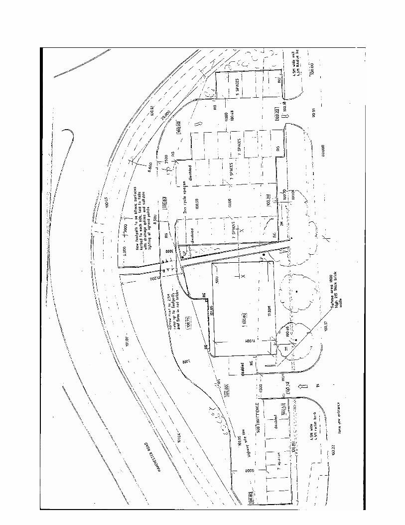

115

116

117

118

Date of Meeting: 30 March 2006 Item Number: 12 Application Reference: 73362/06 Type of Application: Full Planning Application Registration Date: 02/02/2006 Decision Due By: 30/03/2006 Responsible
Officer: Catherine Tetlow
Location: DROP IN CENTRE, 6 BOLTON ROAD, WESTHOUGHTON,
BOLTON, BL5 3DG Proposal: REFURBISHMENT OF EXISTING TERRACED PROPERTY, NEW
ENTRANCE AT REAR OF PROPERTY AND PROVISION OF TOILET FOR PEOPLE WITH DISABILITIES.
Ward: Westhoughton North Applicant: Bolton MB Council Agent : Aedas Building Surveying Officers Report Proposal The application details external alterations to an existing youth drop in centre. The existing rear access to the premises is via a single storey lean-to store. This is to be converted to a disabled toilet and the door to the rear yard bricked up. A new level access rear door would be created where there is currently a window. At the first floor a small bathroom window is to be bricked up. The alterations will provide compliance with Part M of the Building Regulations relating to accessibility. Site Characteristics The site is a terraced property. To the north is an informal parking area and to the south an adjoining terrace occupied by a hairdressing business. To the rear is a residential terrace at right angles to the premises. Policy UDP: D2 Design History A full planning application for the installation of shutters to the ground floor windows and doors was approved in August 1998 (53105/98). A full planning application for the change of use from a dwelling to a youth drop in centre was approved in December 1997 (51681/97).
119

A full planning application for the change of use from a dwelling to hairdressers was
ns
refused in August 1995 (47360/95). Technical Consultatio
a :- no objection.
olton Officers:- no objection.
epre
Bolton Council - Highw y Engineers B Council - Environmental Health R sentations
s:- two leLetter tters of objection have been received.
ne letter submitted on behalf of the occupiers of 2 Bolton Road relates mainly to land ners fers to us ed
ithin e red edge of the has since been corrected. The objector so qu y a disabl
for the C to questiacceptability of the scheme
lette een received he rear of the site. This appears to uestion the appearance of the entrance and requests lowering of the rear fence. owever, the existing fence is of an acceptable height and is separated from the
y.
Council:- did not reach a view and referred the application for Bolton Council.
Oow hip and re e of the back alley which was initially incorrectly record
development. This w th al estions wh
ouncil ed access is to be provided at the rear. On this point it is not on the motives of the Applicant, but rather assess the as submitted.
A r has b from 1 Park Road, to tqHobjector's property by a back alle Westhoughton Townetermination byd
Analysis Section 38 of the Planning and Compulsory Purchase Act 2004 requires applications to be determined in accordance with policies in the Development Plan unless material considerations indicate otherwise. Applications which are not in accordance with Development Plan policies should be
fused unless material considerations justify granting permisre sion.
er this proposal is in accordance with the ment Plan and then take account of other material considerations.
the proposal is:
Similarly, proposals which accord with Development Plan policies should be approved unless there are material considerations which would justify a refusal of permission.
is therefore necessary to decide whethItDevelop he main impact ofT
Impact on the character and appearance of the area UDP Policy D2 deals with matters relating to design in terms of appearance, layout,
inimising of crime and accessibility. m
120

The alterations proposed to the property are of a minor nature. It is considered that
o comply with Policy D2.
onclusion
they will have no impact on the amenity of neighbouring residents and will not be readily visible from public viewpoints. The proposal is considered t C
for approval.
Approve subject to conditions
ecommended Conditions and/or Reasons
The application conforms with policy and is accordingly recommended Recommendation: R
1. The development hereby permitted shall be begun before the expiration of 3 years from the date this permission. Reason
of
Required to be imposed pursuant to section 91 of the Town and Country Planning Act 1990 as amended by Section 51 of the Planning and Compulsory Purchase Act 2004.
2. The materials to be used in the construction of the external surfaces of the alterations here
permitted shall match the colour, texture and size of those of the existing building, and shall bretained thereafter.
by e
ts in visually with the existing building and safeguards the character and visual appearance of the locality.
Reason To ensure the development fi
121


123

124

Revocation of the Bolton (504/514 Chorley New Road) Tree Preservation Order 2005 and the confirmation of the Bolton (504/514 Chorley New Road No.2) Tree Preservation Order 2006 The Bolton (504/514 Chorley New Road) TPO 2005 was made as an emergency order as the CT&WO was unable to ascertain the true number of trees on the site at the time due to the felling operations that were being undertaken. The order was therefore made to prevent any further tree losses taking place. The Tree Preservation Order – A Guide to the Law and Good Practice sets out that the use of the woodland classification is unlikely to be appropriate in gardens but it was considered the quickest way to protect the trees that were left. The new Bolton (504/514 Chorley New Road No.2) TPO 2006 has group orders to protect the trees along the frontage of both 504 and 514 Chorley New Road, Bolton I would note that there has been a considerable amount of support from local residents who are concerned about further tree losses on the site. It is therefore recommended the Bolton (504/514 Chorley New Road) TPO 2005 be revoked and the Bolton (504/514 Chorley New Road No.2) TPO 2006 be confirmed
125
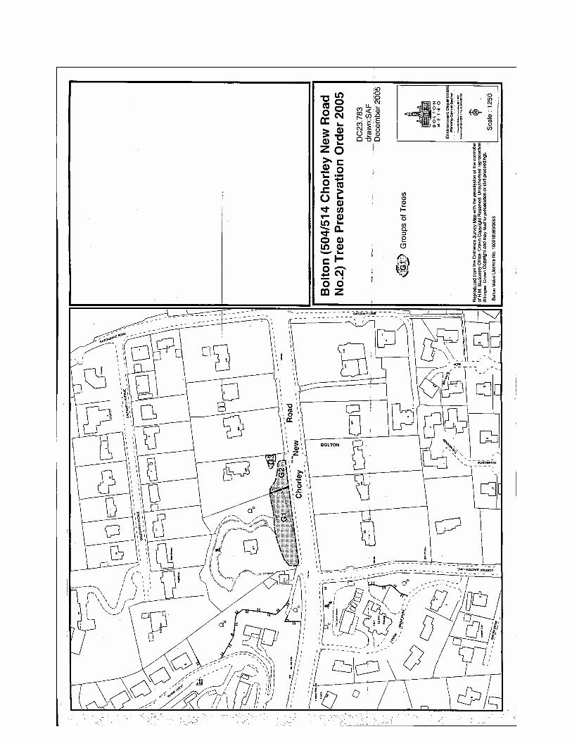

CONFIRMATION OF THE BOLTON (SCOUT HUT AT LAND OFF ST HELENS ROAD) TREE PRESERVATION ORDER 2006. The Bolton (Scout Hut at Land off St Helen’s Rd) Tree Preservation Order 2006 was made to protect two groups of trees within the immediate area in the interest of public amenity. One letter of objection has been received from Smith’s Gore, acting on behalf of Hulton Park Estate. Their main objections being:- 1. Given the location of the land and the nature of the surrounding uses the trees are
only visible from a limited number of residential properties. The trees are only visible from certain specific areas and from vehicles travelling on a short length of Manchester Road and St Helen’s Road. Given the extent of visibility it is difficult to appreciate the contribution the trees make to public amenity.
2. The trees are of mixed species including non native species and there is quite different to that of mature trees or established woodlands found on the Hulton Park Estate.
3. The Order was not served, personally, on adjacent landowners. ANALYSIS 1. It is considered that the trees are visible to many members of the general public
that live and walk in the surrounding area, such as the residents in Stonebeck Court, Burnleigh Court and within the properties of 975-995 Manchester Road. In addition the trees are adjacent to the well used Conservative Club and bowling green off St Helens Road.
2. In relation to the trees being non-native species proportion of non-native species is small in relation to the native species on site. In addition it is considered that a tree is worthy of preservation based upon its amenity value and not on its species. Indeed if non-native species were not given protection throughout the Borough then a large percentage of the total tree stock would be at great risk.
3. It is normal practice for the order to be posted on the site. RECOMMENDATION The Bolton (Scout Hut at Land off St Helen’s Road) Tree Preservation Order 2006 be confirmed.
127