INTRODUCTION PLAN UPDATE FOR 2020.docx · Web viewTown of Waterville Comprehensive Plan POLICY ED...
153
Town of Waterville Comprehensive Plan INTRODUCTION AND BACKGROUND INTRODUCTION This update of the Town’s Comprehensive Plan builds upon t T he choices presently confronting the community has made Waterville in relation to growth and development. could alter the area's character and quality of life. The is Comprehensive Plan is a method of deciding between the choices, and of bringing about the kinds of changes Waterville area residents desire. The Plan rests on the belief that it is wise to look around, learn from the past, attempt to foresee changes, and take charge of the future. It covers decisions regarding different aspects of growth that are best made in common. These decisions include the following planning concerns: the overall land use pattern, how to serve the area with adequate housing and community facilities (such as streets, sewer and water), and how to protect natural resources. Within this guide there is still room for individual discretion. The comprehensive plan will guides the zoning ordinance, subdivision ordinance, capital improvement and budgeting, and other legal actions that shape the physical community. Those legal instruments are required to implement this plan and must not be inconsistent with it. AUTHORITY TO PREPARE A PLAN The Growth Management Act (GMA) is the enabling legislation that renders this Comprehensive Plan a legally recognized document by the State of Washington; however, it is a policy document only. The policies are required by GMA to be implemented through the use of such regulatory tools as zoning and subdivision ordinances, as well as other innovative techniques. These regulations must be developed and maintained in accordance with the goals and policies of this Comprehensive plan, as set forth in the Growth Management Act of 1990, as amended. October 2018 DRAFT Page 1 of 153
Transcript of INTRODUCTION PLAN UPDATE FOR 2020.docx · Web viewTown of Waterville Comprehensive Plan POLICY ED...

Town of Waterville Comprehensive Plan
INTRODUCTION AND BACKGROUND
INTRODUCTIONThis update of the Town’s Comprehensive Plan builds upon tThe choices presently confronting the community has made Waterville in relation to growth and development.could alter the area's character and quality of life. Theis Comprehensive Plan is a method of deciding between the choices, and of bringing about the kinds of changes Waterville area residents desire. The Plan rests on the belief that it is wise to look around, learn from the past, attempt to foresee changes, and take charge of the future. It covers decisions regarding different aspects of growth that are best made in common. These decisions include the following planning concerns: the overall land use pattern, how to serve the area with adequate housing and community facilities (such as streets, sewer and water), and how to protect natural resources. Within this guide there is still room for individual discretion.
The comprehensive plan will guides the zoning ordinance, subdivision ordinance, capital improvement and budgeting, and other legal actions that shape the physical community. Those legal instruments are required to implement this plan and must not be inconsistent with it.
AUTHORITY TO PREPARE A PLANThe Growth Management Act (GMA) is the enabling legislation that renders this Comprehensive Plan a legally recognized document by the State of Washington; however, it is a policy document only. The policies are required by GMA to be implemented through the use of such regulatory tools as zoning and subdivision ordinances, as well as other innovative techniques. These regulations must be developed and maintained in accordance with the goals and policies of this Comprehensive plan, as set forth in the Growth Management Act of 1990, as amended.
A POLICY PLANA comprehensive plan is a policy document prepared by the Planning and Zoning Committee, and Town Staff under direction of citizens of the community, members of local agencies and businesses, and the Town Council. Essentially, it is used asas the Plan is a guide for desired future development which and presents long range objectives and goals for all activities that affect growth and development in the community. The plan allows the community to compare how an area appears now against what it could look like in the future, and what the costs of providing services to the anticipated growth will be. The plan is not a technical document, but rather a guide for the Town Council in its decisions regarding long-range development of the community, which are reviewed against the comprehensive plan to insure consistency with the plan. The purpose of the plan is to bring about coordinated land utilization in accordance with future requirements, while at the same time protecting identified resource lands and critical areas. Also, it is intended to insure efficient expenditure of public funds and to promote the general health, welfare, convenience, safety and prosperity of the area.
October 2018 DRAFT Page 1 of 109

Town of Waterville Comprehensive Plan
PURPOSE AND SCOPEThe comprehensive plan for the Town of Waterville and its Urban Growth Area consists of goals and policies which relate to the physical, economic, social and aesthetic development of the area. The area included in this plan encompasses primarily the existing Town limits, with additional lands that are currently characterized by urban development and/or are provided with services by the Town. Located northeast of the largest urban area in Douglas County (East Wenatchee), Waterville is situated on the plateau and serves as the County seat. This plan hopes to create a balance among the interests of the community and to serve those needs on a long-term approach. The plan seeks to:
Promote development of compatible land uses.Guide development so that one use will not preclude a more desirable use.Keep public service costs down through well planned development.Encourage a quality environment. Encourage the preservation and conservation of resource lands and critical areas.Anticipate long-range problems/possibilities as well as deal with current short-range concerns. Aid decision makers by bringing together professional and technical knowledge.
GOALS OF THE GROWTH MANAGEMENT ACTIn 1990 the State Legislature realized the necessity for planning ahead, and enacted legislation (Growth Management Act, RCW 36.70A) that granted local governments the authority to plan for the future development of their particular jurisdiction. The primary emphasis of GMA is coordinated, cooperative planning efforts, with substantial, continuous input from all sectors of the population that will help balance the scales between economic development and environmental preservation. It also became a responsibility of local governments to follow through with the citizens' vision for their community by implementing the direction laid out in the comprehensive plan.
The following 14 goals are those broad issues that the State legislature charged local government to address, as they pertain to the particular community:
URBAN GROWTH...Encourage development in urban areas where adequate public facilities and services exist or can be provided in an efficient manner.
REDUCE SPRAWL...Reduce the inappropriate conversion of undeveloped land into sprawling, low-density development.
TRANSPORTATION...Encourage efficient multimodal transportation systems that are based on regional priorities and coordinated with county and Town comprehensive plans.
HOUSING...Encourage the availability of affordable housing to all economic segments of the population of this state, promote a variety of residential densities and housing types, and encourage preservation of existing housing stock.
October 2018 DRAFT Page 2 of 109

Town of Waterville Comprehensive Plan
PERMITS...Applications for both state and local government permits should be processed in a timely manner to ensure predictability.
ENVIRONMENT...Protect the environment and enhance the state's high quality of life, including air and water quality, and the availability of water.
ECONOMIC DEVELOPMENT...Encourage economic development throughout the state that is consistent with adopted comprehensive plans, promote opportunity for all citizens of this state, especially for unemployed and for disadvantaged persons, and encourage growth in areas experiencing insufficient economic growth, all within the capacities of the state's natural resources, public services, and public facilities.
PROPERTY RIGHTS...Private property shall not be taken for public use without just compensation having been made. The property rights of landowners shall be protected from arbitrary and discriminatory actions.
NATURAL RESOURCE INDUSTRIES...Maintain and enhance natural resource-based industries, including productive timber, agricultural, and fisheries industries. Encourage the conservation of productive forest lands and productive agricultural lands and discourage incompatible uses.
OPEN SPACE AND RECREATION...Encourage the retention of open space and development of recreational opportunities, conserve fish and wildlife habitat, increase access to natural resource lands and water, and develop parks.
CITIZEN PARTICIPATION AND COORDINATION...Encourage the involvement of citizens in the planning process and ensure coordination between communities and jurisdictions to reconcile conflicts.
PUBLIC FACILITIES AND SERVICES...Ensure that those public facilities and services necessary to support development shall be adequate to serve the development at the time the development is available for occupancy and use without decreasing current service levels below locally established minimum standards.
HISTORIC PRESERVATION...ldentify and encourage the preservation of lands, sites, and structures, that have historical or archaeological significance.
SHORELINES...For shorelines of the state, the goals and policies of the Shoreline Management Act (RCW 90.58.020) are added as one of the goals of the GMA (RCW36.70A.020).
On the pages that follow are listed Tthe primary goals and policies of the citizens of Waterville that help defininge their priorities in dealing with each of the overall Goals of the GMA followse issues. This Plan successfully expresses the vision of the future held by the people of Waterville, within the parameters and goals of GMA.
October 2018 DRAFT Page 3 of 109

Town of Waterville Comprehensive Plan
SCOPE AND ORGANIZATIONThis Comprehensive Plan is composed of five (5) required elements and four six (46) additional elements, as provided for in the Growth Management Act, and two process/strategy sections, all of which must be closely interrelated to serve as a satisfactory guide for future development:
The Land Use ElementThe Housing ElementThe Utilities ElementThe Capital Facilities ElementThe Transportation ElementThe Environment & Critical Areas Conservation Element
The Historic Preservation Element The Economic Development ElementThe Essential Public Facilities Element
Citizens Participation ElementThe Comprehensive Plan Amendment ProcessThe Implementation Strategy
PLAN DEVELOPMENT AND PUBLIC PARTICIPATIONAs stated previously, this the Town of Waterville Ccomprehensive Pplan was initially developed as part of the Growth Management Act planning program initiated by Douglas County and its communities. In October of 1990 Douglas County opted into the GMA, allowing for a head start on the planning effort which would have been mandated in April of 1991 due to a 22% increase in population between 1981 and 1991. It was agreed by the County and Cities that the County Planning staff would be responsible for ensuring all requirements of the GMA were met for all of the communities.
In the fall of 1991, an intensive "Visioning" effort was carried out involving a tabloid and survey, advertised meetings, and a display booth at the North Central Washington District Fair. The goal of these meetings was to educate the citizens of Douglas County as to the requirements and benefits of the Growth Management Act, and to allow the planning staff to see and understand the vision these people had for both their community and the County as a whole. This contact with the people of Douglas County continued through additional tabloids and display booths at the Fair, meetings with Town and Town Councils and special interest groups such as the Mansfield Grange, and training programs such as the Planning Association of Washington Planning Short Course.
After completing the immediate tasks of designating, classifying and regulating resource lands and critical areas, work began on the comprehensive plans. To manage the size and scope of the County, it was separated into 4 geographic areas called Planning Units. Each Planning Unit was assigned a County staff planner who was responsible for ensuring the GMA requirements in that area were completed. Waterville is located in Planning Unit 2 along with the unincorporated community of
October 2018 DRAFT Page 4 of 109

Town of Waterville Comprehensive Plan
Orondo and the surrounding rural area. Through the County's GMA Regional Council, a citizen committee was appointed, consisting of people from all parts of Planning Unit #2, including 5 people from Waterville.
Beginning in October of 1992, this committee began meeting on a monthly basis at open, advertised public meetings. Their first tasks involved getting acquainted with not only each other but also with the GMA and its requirements. There was much discussion on growth in the county: how much would there would be? How should it be dealt with? What does the future hold for Waterville? After developing some broad goal and policy statements for all of the elements, the focus of this committee shifted away from the unincorporated areas and turned more specifically toward each community. It was then decided that the people on the committee from Waterville would begin meeting regularly with their Planning and Zoning Committee to complete the community's plan. This initial effort culminated with the adoption of the first Waterville Urban Area Comprehensive Plan by the Waterville Town Council in May of 1996.The Waterville Planning and Zoning Committee has met monthly since mid-2001 to discuss theComprehensive Plan.
In 2002, the Town received a grant from the Washington State Office of Community Development to conduct a complete review and update process for both the comprehensive plan and the development regulations implementing the comprehensive plan. As part of thatis grant process, there washave been areviews and updates of background information and maps, as well as goals, policies and implementation strategies. The results of all this the time and work was the 2006 update to theis a Comprehensive Plan and implementation regulations. The plan and regulations (with some additional amendments in 2015, 2016 and 2017) have proven for the Town of Waterville that are very well suited to the community's needs: simple and concise, yet complete to assist them in the orderly development of their community.
RELATIONSHIP TO COUNTY COMPREHENSIVE PLANOne of the primary goals of the Growth Management Act (GMA) is to increase cooperation between jurisdictions and to assure consistency in the Comprehensive Plans from jurisdiction to jurisdiction and from region to region. The effort to accomplish consistency between the Cities in Douglas County and the County Plan itself was begun early in the GMA planning process by establishing a GMA Regional Council made up of elected Town/Town Council and County Commission members. This coordinating body was responsible for the formation and adoption ofCounty-wide planning policies, appointing citizens to represent all types of County interests to Planning Unit Advisory Committees, and the formation of Essential Public Facilities policies and siting criteria.
In recent subsequent years, the Regional Council has expanded its scope beyond dealing with only GMA-related issues to include activities related to the distribution of the rural sales and use tax dollars ("distressed counties' funds"), prioritization of infrastructure projects related to economic development that are forwarded for inclusion on the state-wide WACERT list (Washington Community Economic Revitalization Team) hazard mitigation planning and distribution of low-income housing dollars collected on recorded documents.
October 2018 DRAFT Page 5 of 109

Town of Waterville Comprehensive Plan
GMA-related issues continue to be a significant task for this group, including developing revisions in 2001 to the county-wide planning policies found in the Douglas County Regional Policy Plan, allocating updated population projections and coordinating the review of urban growth area amendments.
The Waterville Urban Area Comprehensive Plan is related to the County's comprehensive plan through provisions that encourage:
1. urban development within the growth area established for Waterville;2. the responsible provision of urban services for the projected growth over the 20-year planning
period; and 3. the reduction of urban sprawl into the adjacent agricultural lands immediately outside the
adopted Urban Growth Area. Other issues which were considered on a more regional basis were resource lands that may extend from the surrounding unincorporated area into the Urban Growth Area, and geological hazard areas and other sensitive areas that cross jurisdictional boundaries.
It is intended that this updated Plan and the adopted County wide plan will be consistent with and complementary to each other. Each of the communities' plans has beenis incorporated into the County's comprehensive plan as an addendum to provide a clearing house and a compilation of all the planning documents adopted to implement the Growth Management Act.
As implementation moves aheadcontinues, amendments to the communities' comprehensive plans will be submitted to the County to be included in the County Comprehensive Plan, thus providing a consistent process to assure the relationships are maintained through the planning period and beyond. This should assure the citizens of Douglas County a complete picture of how the County is expected to develop over the planning period.
October 2018 DRAFT Page 6 of 109
Kurt Danison, 05/16/17,
Can Royal provide an update on this group and their activities?

Town of Waterville Comprehensive Plan
BACKGROUND
LAND USEWaterville is primarily a farming community located in the west central portion of Douglas County, along with being the County Seat. Within the town limits there are approximately 555 397acres comprised of 709 parcels or , of which 371 are platted lots with the remaining 184 acres taken up by right-of-way. In general, the Town is situated on a gently rolling basalt plateau surrounded by dryland wheat fields. It is a community that is principally dependent on this surrounding agricultural activity for its base economyeconomic base.
The Existing Land Use Map (See Map 1 in Map Appendix), as well as Table 1, illustrate the distribution of land uses throughout the community based on the DORCODE (See Appendix A) assigned by the Douglas County Assessor in compliance with WAC 458-53-030.
The "Residential" category includes DORCODEs 11 through 19. DORCODE 11 represents single-family dwelling units, 12 represents 2–4 dwelling units, 13 five or more dwelling units, 14 condominiums, 15 manufactured home parks, 16 motels/hotel, 17 institutional housing, and 19 seasonal or vacation homes. However, it is important to note that a number of the parcels designated for commercial uses are actually being utilized exclusively for residential purposes, including single and multi-family uses. Table 1 includes DORCODEs 11 and 19 as Single-Family Residential, 12, 13 and 17 as Multi-Family residential, 15 as Manufactured Home Parks, and 18 as Residential Other, a category that represents residential uses of commercial structures and structures accessory to residential uses and includes 16 as Commercial uses.
The DORCODE system uses numbers 21 through 39 for various manufacturing-oriented land uses. Parcels with these DORCODEs are listed as Manufacturing in Table 1. DORCODEs 41 through 49 include land uses related to transportation, communication and utilities and are listed in Table 1 as Utilities. There are currently no lands being used for industrial activities within the Waterville Urban Growth Area.
Commercial uses include DORCODEs 50 through 59 which represent “trade” oriented land uses and DORCODEs 61 through 69 “services” oriented land uses. Table 1 includes all uses codes with 50 through 69 and 16 as Commercial. The data in Table 1 under the heading of Commercial, only includes non-publically owned parcels. Parcels owned by public entities with these DORCODEs are included under the Public heading. The commercial lands are located primarily along the Highway 173 corridor running through the community, including two "pockets" of concentrated commercial uses connected by a few, sporadically located commercial activities. This corridor connecting the two commercial areas is where a majority of the commercial lands being used exclusively for residential purposes are located.
October 2018 DRAFT Page 7 of 109

Town of Waterville Comprehensive Plan
The next series of DORCODEs, 71 through 79 represent cultural, entertainment and recreational land uses and are applied to both public and private uses. The data in Table 1 under the heading of Cultural, only includes non-publically owned parcels. Parcels owned by public entities with these DORCODEs are included under the Public heading.
The final two series of DORCODEs include 81 through 89, resource production and extraction and 91 through 99, undeveloped. Table 1 includes parcels with DORCODEs 81 through 89 under the Agriculture heading and 91 through 99 as Undeveloped. The data in Table 1 under the Agriculture and Undeveloped headings only include non-publically owned parcels. Parcels owned by public entities with these DORCODEs are included under the Public heading.
Included in the "Public" classification are all of the parks, schools, play fields, water, and federal, state, county, port, fair, hospital and Town-owned facilities and land, except road rights-of-way, including parcels with DORCODEs showing residential, commercial or other uses.
TABLE 1. EXISTING LAND USE – 2014OVERALL (TOWN and UGA) TOWN UGA
Current Land Use Type
Parc
els
% o
f Tot
al P
arce
ls
Calc
ulat
ed A
cres
% o
f Tot
al A
cres
Parc
els
% o
f Tot
al P
arce
ls
Calc
ulat
ed A
cres
% o
f Tot
al A
cres
Parc
els
% o
f Tot
al P
arce
ls
Calc
ulat
ed A
cres
% o
f Tot
al A
cres
Single-Family Residential 532 73.58% 209.86 39.07% 531 74.89% 207.86 52.39% 1 7.14% 2.00 1.43%Multi-Family Residential 10 1.38% 2.65 0.49% 10 1.41% 2.65 0.67% 0 0.00% 0.00 0.00%Residential - Other 36 4.98% 18.79 3.50% 36 5.08% 18.79 4.74% 0 0.00% 0.00 0.00%Utilities 3 0.41% 3.39 0.63% 3 0.42% 3.39 0.85% 0 0.00% 0.00 0.00%Commercial 38 5.26% 20.42 3.80% 38 5.36% 20.42 5.15% 0 0.00% 0.00 0.00%Cultural 8 1.11% 2.21 0.41% 8 1.13% 2.21 0.56% 0 0.00% 0.00 0.00%Agriculture 25 3.46% 149.99 27.93% 15 2.12% 30.85 7.78% 10 71.43% 119.14 84.89%Undeveloped 17 2.35% 27.43 5.11% 17 2.40% 27.43 6.91% 0 0.00% 0.00 0.00%Public Use 54 7.47% 102.36 19.06% 51 7.19% 83.15 20.96% 3 21.43% 19.21 13.68%TOTAL (Parcels, Acres)
723 100.00% 537.10 100.00% 709 100.00% 396.75 100.00% 14 100.00% 140.35 100.00%
Table #1 demonstrates the distribution of land uses throughout the community, based on a visual land use inventory conducted during the summer of 2002 by Alliance Consulting Group, Inc. This inventory is an update of the initial land use inventories conducted by Douglas County, in cooperation with the
October 2018 DRAFT Page 8 of 109

Town of Waterville Comprehensive Plan
Waterville School District, in the early- and mid- 1 990's. One primary function of the update conducted by ACG was to include the areas identified as being within the Town's existing UGA but outside of the corporate Town limits. The original inventory only considered properties within the Town's limits. Because the acreage sizes in the inventory are based on the County Assessor's parcel records, each category in the table was adjusted to account for right-of-way within the community by adding 15% to the total acres,
When considered together, the "Single-Family Residential", "Manufactured HomeOther Residential" and "Multi-Family Residential" categories account for the total acreage229.3 acres in the community taken up by residential uses, which is approximately 18! acres or 57.836% of the land in the Town Limits. The majority of commercial uses are concentrated in the downtown commercial core, along US 2 and , although there are scattered in the northern portion of the communitycommercial activities throughout the community, usually conducted out of a private residence. Included in the "Public" classification are all of the parks, municipal properties of the State, County, Port, Fair and Town, school facilities, and any other publicly owned and used properties. Of this category which totals 83.15 acres or 20.96% of the total, the NCW Fairgrounds and associated parking areas constitute approximately 33 acres, while the Waterville school facilities encompass nearly 9 acres.
The "Quasi-Public" category includes properties that are owned by community and/or religious entities including churches, the Masonic Hall, the Senior Center, etc. The "Industrial" category primarily consists of the ag-related industrial activities located in the north-central part of the community, although the recently opened plastics company is also included in these figures. "Agriculture" covers acreage that is in active crop production including any fallow ground, or that has an agricultural structure on it as the primary use. The "vacantundeveloped" lands inventory includes properties that are undeveloped as well as those that may be used as fenced pasture areas.
TABLE 2002 EXISTING LAND USE (Adjusted to include ROW)Land Use Acres % of Total Housing Units
Single Family 158 29 352Manufactured Home 33 6 83Multi Family 4 56Commercial 21 4 10Industrial 13 2Quasi-Public 5 5Public 144 27Agriculture 59Vacant 105 19
Totals 542 1 00% 507
The following assumptions regarding growth and development were developed during the comprehensive planning process, based partially on the existing pattern and distribution of land uses, projected population growth and public facilities and utilities that are available.
October 2018 DRAFT Page 9 of 109

Town of Waterville Comprehensive Plan
1. Only average economic conditions were considered, as opposed to trying to predict the timing of any potential business cycles.
[2.] General lifestyles and living patterns will continue for the anticipated planning horizon of 20+ years, to the year 20222037.
2.[3.] Because of the advent of telecommunications and computer technology, the accessibility of the community to larger urban areas through a public transit system (LINK), the lower cost of living (particularly housing costs), and the perceived higher quality of life in Waterville, growth is expected to slightly exceed historical trends.
3.[4.] Overall density within the community is expected to remain consistent with existing densities.
[5.] Household size is expected to remain consistent with the existing figure of 2.673 51 (20100 US Census).
4.[6.] The majority of future residential development will take place within the existing Town limits through infill of existing platted lots which are either vacant or in agricultural use.
5.[7.] The existing ratio of single-family units to multi-family units is expected to remain consistent with the existing figure of approximately 85% single-family (including manufactured homes) and multi-family.
6.[8.] It is expected that land in agricultural production within the Town Limits will be some of the last areas to develop because of the current profit being made off of the land.
POPULATIONThe official 2000 2016 population estimate for Waterville is 1,181, an increase of 3.04% over the 2010US Census count for Waterville of 1,145, which was 1,163, updownfrom 1,163995counted in the 1990 2000 Census. Of the 2010at population, 556 573 are male and 607 565 are female. The age brackets with the highest population are the 35 50 to 5444 with 104 people and 45 55 to 54 59 groups, each with 17491, while the smallest age bracket is the 85+ with 3 129 people. The median age in Waterville is shown by the 2000 2010 US Census to be 39.640.9 years, with 828 429 people 18 years or older.
Expected population growth for the Waterville urban growth area is shown in Table #2 below. The Growth Management Act requires that the designated urban growth area must include areas and densities sufficient to accommodate the urban growth projected to occur in the community for the next 20 years. The OFM establishes the projections for the overall County, and through the Regional Council coordination process, those numbers are divided among the communities and unincorporated areas of the County. The numbers provided in Table #2 reflect the outcome of a coordinated process between the cities/towns and the county during 2001 and 20022016 where the 20100 US Census and the updated OFM high range projections were allocated to the urban and rural areas of the County.
Population analysis and forecasting was conducted using various methods. The guiding principles for allocating future population were historical growth trends, adopted county-wide planning policies in the "Douglas County Regional Policy Plan" and the supply of vacant, buildable land in each community. The technical methods used were both trend extrapolation and shares of the overall county
October 2018 DRAFT Page 10 of 109

Town of Waterville Comprehensive Plan
population, adjusted for availability of land for development. A considerable amount of qualitative information and future assumptions on the economy, demographics and land capacity were brought into the urban area forecasting.
TABLE 2. POPULATION PROJECTIONS – 2015 through 20401
2010–2030 Douglas County Population Projection
2015 Population Projection
2020 Population Projection
2025 Populatio
n Projection
2030 Population Projection
2035Population Projection
2040 Populatio
n Projectio
nDouglas County Total
39,990 43,883 46,807 49,632 51,779 54,449
Rural Areas 7,471 7,968 8,466 8,964 9,462Urban Areas 33,725 35,993 38,260 40,527 42,795East Wenatchee
28,212 30,203 32,193 34,184 36,175
Bridgeport 2,596 2,762 2,928 3,094 3,260Coulee Dam 190 193 195 198 201Mansfield 336 340 344 349 353Rock Island 1,212 1,218 1,350 1,420 1,489Waterville 1,180 1,214 1,249 1,283 1,318
TABLE WATERVILLE POPULATION PROJECTIONS - 2022
2000Census
2005Projection
2010Projection
2015Projection
2022Projection
County Total 32,603 37,915 43,227 48,539 53,850
Rural Areas 6,502 7,582 8,663 9,744 1 0,824
WatervilleUGA
1,163 I ,282 I ,401 I ,520 I ,639
Bridgeport UGA 2,093 2,33 1 2,569 2,807 3,046
Mansfield UGA 329 356 383 41 1 438
Rock Island UGA I ,065 I ,243 I ,599 I ,777
GEWA UGA 21,304 24969 28,634 32,299 35,964
Coulee Dam 125 134 144 153 162
HOUSINGBased on the visual land use inventory described above the total number of housing units inWaterville is approximately 507578, which compares to only 4821 units identified in the 20100 US Census. In Table #3 below, a breakdown of these units is shown. Under the "Multi Family" category are
1 - Source – Douglas County 12/17
October 2018 DRAFT Page 11 of 109
Kurt Danison, 06/07/17,
How many residential utility connections?

Town of Waterville Comprehensive Plan
included the duplex and apartment buildings located in Waterville. The "Accessory Units" are those units that are associated with some other primary use of the property, usually commercial. At the time of the land use inventory update, it was difficult to determine how many units were noticeably vacant. However, the 20100 US Census identified a vacancy rate of 3.82.4% for homeowner-occupied units and 14.93.1% for renter-occupied units.
It appears that there is a good ratio between single family and multi-family development, and it will be important to maintain that ratio by encouraging additional multi-family units to be built, particularly those in a moderate rental rate (please see Table #4, below). Quality apartments with 2 to 4 units renting for around $400.00 per month would probably have little trouble maintaining full occupancy.
TABLE #3. EXISTING HOUSING UNIT TYPESTYPE NUMBER PERCENT
Single Family 352 70
Accessory Unit 16 3
Multi Family 56
Manufactured Home
Totals
83507
16
100%
TABLE #4 EXISTING SINGLE FAMILY/MULTI FAMILY RATIO
HOUSING TYPE NUMBER OF UNITS PERCENT OF TOTAL
Single Family Residential l 435 85.8%
Multi Family Residential 72
TOTAL 507
Includes 352 single-family and 83 manufactured homes 2
Includes 56 multi-family and 16 accessory units.
The land use inventory conducted in 1995 involved giving each housing unit a condition rating to help determine the quality of the existing housing stock. Based on a quick visual assessment, a unit was given either a Good, Fair, or Poor designation:
Good —
October 2018 DRAFT Page 12 of 109

Town of Waterville Comprehensive Plan
Fair Poor
No visible foundation cracks or roof sages, no peeling paint, well maintained. No visible foundation cracks or roof sages, some peeling paint, a few minor maintenance problems.Cracks in the foundation, sagging roof or porch, exposed wiring and/or plumbing,major costs to repair.
Although this same condition rating was not part of the updated land use inventory in 2002, it is safe to assume that the conditions in 1995 are still relevant, primarily because the overall condition of the housing in Waterville seemed to be good, with very few units in need of major repairs, as seen in Table #5 below. This seems to indicate that the existing housing stock is capable of continuing as a viable option, and any housing shortages will need to be addressed primarily through new construction.
TABLE #5. EXISTING HOUSING CONDITIONS
CONDITION NUMBER PERCENT
Good 299 73
Fair 97 23
Poor 15 4%
Totals 41 1 100%
Source: Douglas County Land Services Department, Land Use Inventory Update, July 1995
The relationship between the population projections, land use designations and assumptions and projected housing units can be seen in Appendix A B at the end of this document.
CAPITAL FACILITIES & UTILITIESWaterville is a Fourth-Class Town with a mayor-council form of government, as well as a Planning Commission. Meeting dates for the Council are the first and third Monday of every month, while the Planning & Zoning Committee (Planning Commission) meets the second Tuesday, as needed. There is also a Tree Board that meets on the second Monday of every other month. In addition to the five-member council and mayor and the five-member Planning and Zoning Committee, there is a Town Clerk/Treasurer and Deputy Clerk/Treasurer who serve as clerks for the Council and P & Z Committee, as well as all managing the accounts payable and receivable for all utilities that are part of the Town's public facilities. There is also an occasional receptionist to assist the Clerks' in their clerical functions. There is a Utility Superintendent who supervises a staff of 2 with duties ranging from maintenance of the sewer, and water and park systems, to street maintenance activities such as snowplowing and pavement management work. The community contracts with a part-time private individual for
October 2018 DRAFT Page 13 of 109

Town of Waterville Comprehensive Plan
administering and enforcing building permits, with legal and other professional services, such as planning and engineering, being provided as-needed by other private firms.
Waterville provides water and sewer service to their residents. The water system consists of 7 wells and a series of water lines from 412" to 124", with the majority of lines being 6" and 8". The sewer system utilizes 8" and 10" lines leading to 2 lagoons equipped with aerators and irrigation. Power is provided to the community by the Douglas County Public Utility District (PUD). Waterville owns theTown Hall and shop buildings, as well as 2 parks, including an ice-skating rink and swimming pool. The Town supports a branch of the North Central Regional Library that provides service to many residents of the "Upper County". The community participates in the Douglas County Solid Waste Advisory Committee (SWAC), and garbage pickup is provided through a contract with Consolidated Disposal, Inc of Ephrata. The Town has constructed a recycling center through a grant from the SWAC. This center is currently open 4 hours a week and is operated by volunteers for the benefit of the Town. Emergency services are primarily provided through contracts with the Douglas County Fire District #1 and the Douglas County Sheriff’s Department, both of which operate out of facilities located within the Town limits. The Waterville Ambulance is staffed by volunteer EMT's and is operated through the Waterville clinic, also known as Douglas County Hospital District #2. Telephone service is provided by Verizon and cable television reception is provided by Millenium Digital. A more detailed inventory and discussion ofWaterville's capital facilities and services is contained in the Capital Facilities Plan and Capital Facilities Element of this plan.
TRANSPORTATIONWaterville not only has a series of local access and collector streets, but also a Federal Highway (US 2) that bisects the community. In general, all of the local streets are improved with either asphalt or gravel surfacing. There is an airport in the northeast portion of Town that serves primarily private aircraft, including agricultural crop dusters. There is no rail service to the community, so truck traffic is the primary source for transporting commodities and goods into and out of Town. There is a more detailed discussion of the circulation system serving the community contained in the Capital Facilities Plan and Capital Facilities and Transportation Elements of this comprehensive plan.
ECONOMIC BASEIn the Waterville area the primary, base economy is agriculture, primarily row crop production and livestock. The agricultural service industries and businesses in the immediate vicinity provide numerous jobs in the community, while actual agricultural workers living in the community and working in the surrounding areas is difficult to determine. However, because it is the County seat as well as being somewhat centrally located to many outlying areas, government services are also a significant factor in the economy of Waterville. The Washington State Department of Transportation, Douglas County and the Waterville School District are among the largest employers in the area.
The following list is a directory of businesses located within the community, as of June 2003.
October 2018 DRAFT Page 14 of 109
Kurt Danison, 07/12/17,
Marty – section needs review and updating, highlighted areas specifically.

Town of Waterville Comprehensive Plan
Central Business District:AB Dorsey & SonCaptain Hood WoodCarol Cowling, CPACentral Washington Grain GrowersCordell, Neher and CompanyCornerstone Care CenterCutting Edge MillworkDarla's Styling SalonDeb's Massage TherapyDon's Small Engine RepairDorsey & Sutor Insurance Douglas County Hospital District #2Waterville Ambulance ServiceWaterville ClinicDouglas County Historical Society Thrift ShopEastmont PharmacyEtta'sHarrison/Napa Auto Parts SupplyHighway 2 BrewHunter Law Office Johnson, Gaukroger & CrosslandJuxaposed Kenner Automotive
Knemeyer's SaloonKopeys Restaurant
Kopey's LaundromatKopey's Waterville AutoKopeVs Waterville Auto CourtMid State BankMitchell's Pharmacy, Hardware & FloralNifty TheaterProuty's RepairSterling Savings Banl<The Rocl<ing "B" RestaurantThomsen InsuranceVFH DistributingVan Go Painting Waterville Family GroceryWaterville Historic HotelWaterville Min Storages Yesteryear Antiques and Furniture Restoration
Residential Zones:Waterville Funeral Home
Light Industrial Zones:
Bainbridge ManufacturingBarnes Welding & Machine
Central Washington Grain Growers ElevatorsCustom MufflerJohnson Air Service & Charter Superior SandblastingWaterville PartsWestern Farm Service
Highway Commercial Zone:Whitley Fuel
Home Occupations:Avon (Terry Conners)
[C] and CChristina Avey (Cleaning Service)Christy's Child Care Club Paradise[D] & C ConstructionDan Craig, CPRElaine Logan (Day Care)Golden Bean Coffee RoasterKathy's Day CareKenner's Auto RepairKimmie's Day CareL & R ServicesLeslie'sLittle Lady, Little Lad Mary Kay Cosmetics (Cindy Koenig) NW Gun & Mercantile Co.Off the Wahl Productions One Way Construction Patrick's Candy Co.Reno's ConstructionRiver's Photography StudioShedd ConstructionSherri Littrell (Piano Lessons)Signs EtceteraSilver Linings
Sue Finkbeiner-Creative MemoryTies That Bind QuiltingWaterville Day CareWishbone Catering Service
October 2018 DRAFT Page 15 of 109

Town of Waterville Comprehensive Plan
LAND USE ELEMENT
INTRODUCTIONThe Land Use Element of a comprehensive plan is intended to promote orderly community growth by providing for planned land use areas that consider environmental, economic and human factors. The Plan is designed to meet both the present and future needs of the community, and to serve as a guide to decision makers when presented with options for developing and redeveloping Waterville's Urban Growth Area (UGA). This Element also helps retain the basic form and pattern of the community while creating opportunities for an orderly expansion. As a portion of the Waterville Comprehensive Plan, the Land Use Element includes the Town of Waterville's twenty-year vision for land use for the planning period from 2002 2017 through 20222037.
In general, the Comprehensive Plan Land Use Designations Map (Map 2 in the Map Appendix) included with this element shows the locations of the different land use categories, as well as the boundary which defines the UGA. These designations are intentionally non-specific in order to account for site and project specific flexibility. They are a graphic expression of the goals and policies within this document, and were based on number of factors, including:
The unique physical factors and social/economic characteristics in the area The type of existing development Existing zoning regulations Ownership patterns The condition of existing structures Plans previously adopted by the Town that affect land use (i.e. the Resource Lands and Critical
Areas Policy Plan and Ordinance 92-5 13)
Within the Public Designation the Waterville Airport serves an important transportation, safety, and employment function. The protection of these facilities is important to the economic and social needs of Waterville and the surrounding communities. The State is interested in the preservation, safety, capacity and environmental protection of airports as they face conflicting land uses and increasing capacity demands; therefore, airports are defined by the state as Essential Public Facilities (EPF) and may not prohibit the siting, expansion, or continuation of any EPF.
Waterville's airport is within the Town limits. It is classified as a "short general aviation runway" because it is less the 4,000 feet. It is home to II single engine aircraft and supports 58% transient and 42% local aviation. Douglas County Port District owns and operates the airport services. The Port is currently working with David Ketchum, a consultant, from Airside to develop plans to outline current use and future services. A draft plan is expect to be available by June 2006. Goals and policies within the Comprehensive Plan were developed with the intent to protect the airport and surrounding area from incompatible uses.
October 2018 DRAFT Page 16 of 109

Town of Waterville Comprehensive Plan
LAND USE REQUIREMENTS
Jurisdictions are required to discourage incompatible development adjacent to the airport. Compatible land uses are determined by examining the size and use of the current airport facilities, any planned expansion area, and applying state guidelines.Issues that need to be reviewed are:
Height Hazards- Federal Aviation Regulation (FAR) Part 77 defines potential aeronautical hazards for different surfaces around the airport. Once these surfaces are identified height restrictions must be established in the development regulations.
Safety- Safety zones are identified by the historic number of accidents occurring within five miles of general aviation airports. It is used to appropriately address land use activities on the ground.
Noise (optional) - Noise zones protect from high or prolonged exposure to excessive noise. Any noise level over 65 DNL should be addressed using FAR Part 150. Over-flight noise under the airport traffic pattern is also a potential concern. Noise can be addressed through the location of noise sensitive uses and/or building construction standards.
The Land Use Designations Map (Map 2 in the Map Appendix) and the goals and policies are meant to be used to evaluate individual land use proposals, as well as being a guide for both public and private actions affecting the growth and development in the community. The Land Use Designations Map is not a zoning map. It is intended to indicate the type of future development that is desired for an area, while at the same time allowing flexibility for previously approved development. It is important to keep in mind that this plan addresses a twenty-year time period. Any changes that result from the policies in this plan will likely take place slowly, over time, and will result in incremental changes as opposed to drastic changes overnight. Table #6 3shows the amount of area estimated to be within each of the different land use categories that are shown on the Land Use Designations Map and described in the policies of this element.
TABLE #63. FUTURE LAND USE DESIGNATIONS - ACREAGE
LAND USE DESIGNATION ACRES 0/0 OF TOTALSingle Family Residential 371 49%
Multi Family Residential 95
Central Business 24
Highway Commercial 1 5
Tourist Commercial 45
Public 126
October 2018 DRAFT Page 17 of 109

Town of Waterville Comprehensive Plan
LAND USE DESIGNATION ACRES % OF TOTALIndustrial 80
TOTAL 756 100%
Town UGA
Comprehensive Plan Land Use Designation Parcels Acres
% of Total
Parcels
% of Total Acres Parcels Acres
% of Total
Parcels
% of Total Acres
Single-Family Residential 420 191.71 59.3% 49.7% 5 55.91 35.7% 39.8%Multi-Family Residential 140 45.64 19.8% 11.8% 3 14.44 21.4% 10.3%Central Business 70 12.81 9.9% 3.3% 0 0.00 0.0% 0.0%Highway Commercial 1 4.98 0.1% 1.3% 0 0.00 0.0% 0.0%Tourist Commercial 21 19.16 3.0% 5.0% 2 12.11 14.3% 8.6%Public 41 81.55 5.8% 21.1% 3 19.21 21.4% 13.7%Industrial 15 29.92 2.1% 7.8% 1 38.68 7.1% 27.6%
TOTAL 708385.7
7 100.0% 100.0% 14140.3
5 100.0% 100.0%
ESSENTIAL PUBLIC FACILITIESWithin the Public land use designation, the Waterville Airport serves an important transportation, safety, and employment function. The protection of these facilities is important to the economic and social needs of Waterville and the surrounding communities. The State is interested in the preservation, safety, capacity and environmental protection of airports as they face conflicting land uses and increasing capacity demands; therefore, airports are defined by the state as Essential Public Facilities (EPF) and may not prohibit the siting, expansion, or continuation of any EPF.
Waterville's airport is located on a 20 acre parcel within the Town limits just over one mile from downtown. It is classified as a "short general aviation runway" because it is less the 4,000 feet. It is home to II single engine aircraft and supports 58% transient and 42% local aviation. Douglas County Port District owns and operates the airport services. The Port is currently working with David Ketchum, a consultant, from Airside to develop plans to outline current use and future services. A draft plan is expected to be available by June 2006.Goals and policies within the Comprehensive Plan were developed with the intent to protect the airport and surrounding area from incompatible uses.
AIRPORT LAND USE REQUIREMENTS
October 2018 DRAFT Page 18 of 109
Kurt Danison, 07/12/17,
Erica – any way to get current information, is there a more current plan?

Town of Waterville Comprehensive Plan
Jurisdictions are required to discourage incompatible development adjacent to the airport. Compatible land uses are determined by examining the size and use of the current airport facilities, any planned expansion area, and applying state guidelines. Issues that need to be reviewed areinclude:
Height Hazards - Federal Aviation Regulation (FAR) Part 77 defines potential aeronautical hazards for different surfaces around the airport. Once these surfaces are identified height restrictions must be established in the development regulations.
Safety - Safety zones are identified by the historic number of accidents occurring within five miles of general aviation airports. It is used to appropriately address land use activities on the ground.
Noise (optional) - Noise zones protect from high or prolonged exposure to excessive noise. Any noise level over 65 DNL should be addressed using FAR Part 150. Over-flight noise under the airport traffic pattern is also a potential concern. Noise can be addressed through the location of noise sensitive uses and/or building construction standards.
LAND USE GOALS AND POLICIES
GOAL LU 1Balance the utilization of land to provide for viable uses which do not unduly interfere
with adjacent land uses
POLICY LU 1.1: The following land use categories and their generalized characteristics and densities are to be implemented through the zoning ordinance and other implementing regulations, as necessary:
Single-Family Residential- Is to be characterized by low-density residential uses, particularly single-family homes and duplex units, and home occupations with appropriate standards which will maintain the quality residential environment of Waterville. The maximum density allowed is 5 units per acre. Site-specific planned developments may be allowed which exceed the maximum density, provided appropriate performance standards are applied through a public review process which maintains the character of the surrounding neighborhood.
Multi-Family Residential -Is to be characterized by higher density residential uses, including a mix and variety of single family, duplex and apartment units, manufactured home parks, as well as some limited, low-intensity commercial development which does not generate high traffic volumes nor detract from the residential character of the area, such as home occupations, professional or personal service businesses, mini day care facilities or long-term residential care facilities. The maximum density allowed is 10 units per acre. Site specific planned developments may be allowed which exceed the maximum density, provided appropriate standards are applied through a public review process which maintains the character of the surrounding neighborhood.
October 2018 DRAFT Page 19 of 109

Town of Waterville Comprehensive Plan
Central Business District - Provides the majority of commercial space within the community for present and future commercial activities. It is characterized by a concentration of general commercial uses, most commonly of a retail and/or services nature, such as lodging, eating and drinking establishments, offices, clothing or variety stores and grocery and hardware stores.
Highway Commercial District- Is to be characterized by those commercial uses that cater to the traveling public such as gas/service stations, motels, mini-marts, restaurants, etc.
Tourist Commercial District- Is to be characterized by a mix of residential as well as commercial recreational activities that cater to both the residents of the community and to tourists and travelers. Uses may include single family residences, multi-family apartments, motels/hotels, eating and drinking establishments, RV parks and campgrounds, golf driving ranges, etc.
Industrial District- Provides an area for existing and future industrial or commercial/industrial uses, such as farm implement dealers, chemical/fertilizer companies, manufacturing, etc. to operate without negatively impacting less intense uses.
Public District- Is designed to maintain and enhance publicly held properties such as schools, parks, fairgrounds and municipal buildings and facilities.
October 2018 DRAFT Page 20 of 109

Town of Waterville Comprehensive Plan
RESIDENTIALGOAL LU 2
Maintain a sufficient number and variety of safe, aesthetically pleasing housing units by encouraging new and by enhancing/refurbishing existing housing in a
variety of neighborhoods that are served by adequate public facilities and utilities for people of all income levels, and that does not adversely affect the
surrounding agricultural area
POLICY LU 2.1: The communityies will continue itstheir primary role in the conservation of housing by publicly investing in the public infrastructure servicing the area, such as storm drainage, water/sewer systems, street paving, and recreation, and will provide zoning to help prevent incompatible land uses and depreciation of property values.
Rationale:Preservation of property values can be maintained by providing predictability in what is going to happen in surrounding areas. Zoning is one tool that addresses that issue. The Town has a program to improve infrastructure that should be continued within the Capital Facilities Plan.
POLICY LU 2.2: Encourage residential development to locate within the urban growth area, consistent the with the comprehensive plan.
Rationale:Within Urban Growth Areas there will be sufficient urban-type services either already available, or at least planned for, which can handle urban densities.
POLICY LU 2.23: Encourage residential growth to occur in areas where public utilities exist or may be provided at reasonable costs.
Rationale: Development in areas where services can be easily provided will keep the costs down, making housing more affordable and keeping public expenditures to a minimum.
POLICY LU 2.34: Development proposals and public projects within the Urban Growth Area will be jointly reviewed by the county and municipality, with final approvals continuing to reside with the county for areas outside of corporate limits.
POLICY LU 2.45: Prior to annexation of new areas for residential purposes, encourage redevelopment and in-fill of within the existing corporate boundaries.
POLICY LU 2.56: Encourage the construction of housing on vacant property within the Town and the redevelopment of underdeveloped property within residential areas to minimize urban sprawl and associated public service costs.
October 2018 DRAFT Page 21 of 109

Town of Waterville Comprehensive Plan
Rationale: Redevelopment and in-fill of existing areas helps to lower the cost of development and provide more efficient use of existing public utilities by cutting down on the cost of providing these services. In-fill also eliminates a significant number of vacant lots that may cause fire hazards or collect junk materials that may be a detriment to surrounding property values.
POLICY LU 2.67: Within the single-family residential district, allow only residential development, with the exception of home occupations, subject to the appropriate hearing procedures.
Rationale: To help preserve and enhance the quality of life in Waterville, it is important to take all possible steps to avoid incompatible uses within residential districts. By prohibiting higher intensity uses, such as commercial or industrial, in residential areas numerous conflicts should be avoided.
POLICY LU 2.78: Provide for multi-family uses near business centerscommercial areas that are adequately serviced by multi-modal transportation systems and utilities.
Rationale: Multi-family developments should serve as a buffer between business centerscommercial areas and residential neighborhoods where the largest number of residents are closest to shopping and transit to decrease motorized traffic and encourage other modes of transportation.
POLICY LU 2.9: Manufactured home parks requiring urban services/facilities should be located within urban growth areas.
Rationale: Manufactured home parks generally maintain densities that are more characteristic of urban areas than rural ones. Consequently, they need to be serviced by urban facilities and services which are to be provided only within Urban Growth Boundaries.
POLICY LU 2.810: Provide for auxiliary apartmentsaccessory dwelling units in residential zones as long as the unit maintains the appropriate for the residential character and quality living environment of the neighborhood.
Rationale: Auxiliary apartmentsAccessory dwelling units can increase density without having a high impact to a neighborhood. It also allows for the owner to either supplement their income or to house a relative, such as an elderly parent.
POLICY LU 2.91 1: Disperse Allow family and mini day care facilities throughout residential areaszones.
Rationale: It is increasingly necessary for households to have two incomes in order to maintain their standard of living, thereby creating a need for adequate day care facilities. Because of the convenience to working families and depending on the density of an area, day care
October 2018 DRAFT Page 22 of 109

Town of Waterville Comprehensive Plan
facilitiesfamily and mini-day care centers are appropriate in residential areas and should be allowed accordingly.
POLICY LU 2.102: Require the construction of sound, safe and sanitary dwelling units.
Rationale:To ensure the public health, safety and welfare are served by requiring that all dwelling units shall at a minimum meet all Uniformcurrent Building, Plumbing and Electrical Codes.
POLICY LU 2.113: Maintain high standards for residential development, construction and maintenance. Such standards shall include a diverse choice of housing types, quantities and designs.
POLICY LU 2.124: Provide innovative and flexible development and design opportunities by establishing a process for and encouraging planned developments.
Rationale: High standards for all development will help provide long-term stability to the community by ensuring the continuance of a durable housing stock. However, such standards are not meant to preclude the development of housing units to serve all income levels and special needs populations because of higher cost. Planned developments can provide flexibility which allows the municipality to encourage the maximum use of new concepts in land development that might otherwise be inhibited by the strict application of the zoning ordinance. It can also encourage the enhancement of the natural characteristics of the land, help create permanent open space, and help utilize the public facilities requires of residential developments more efficiently.
POLICY LU 2.135: Establish criteria for housing and home sites that enhance the compatibility of residential developments.
POLICY LU 2.146: Multi-family residential housing should be subject to design criteria that relate to density, structure bulk, size and design, landscaping and neighborhood compatibility.
Rationale: Criteria helps assure that the uses and/or types of development which may have the potential to be inconsistent with residential neighborhoods are either precluded from a zoning district or are conducted in such a way as to be compatible. Construction and lot maintenance standards within the different zoning categories will reduce the chance of incompatible adjacent development or vacant lot neglect.
POLICY LU 2.157: Promote the retro-fitting and weatherization of existing housing for improved energy efficiency.
Rationale: It is important to recognize that energy efficient homes are essential, and that there is some responsibility on the part of the public sector to continue the existing programs already available to homeowners.
October 2018 DRAFT Page 23 of 109

Town of Waterville Comprehensive Plan
POLICY LU 2.168: Develop incentives that work to preserve and protect historic sites and buildings.
Rationale: Part of the quality of life of the area is expressed and promoted in the history behind the community. By preserving historic sites and buildings not only is this quality maintained, the long-term viability of the community is enhanced.
POLICY LU 2.179: Provide appropriate measures to regulate the keeping of livestock and animals other than domestic pets, including performance standards for maintenance of pastures, shelters, and feeding areas.
Rationale: While domestic pets are generally not a problem within residential areas, other types of animals and livestock can be considered incompatible with residential uses and create conflicts. By considering the existing densities of residential areas and regulating the keeping and maintenance of these animals accordingly, most of the conflicts can be mitigated.
POLICY LU 2.1820: Encourage owners of vacant parcels within residential districts to maintain said their parcels in a manner which does not promote or create fire hazards, and which does not detract from the quality of the neighborhood.
Rationale: Because of the arid climate, vacant lots that are overgrown with weeds and brush, and buildings that are left in a dangerous state of disrepair, cause a significant fire hazard and dangerous potential accident situations, and may be a detriment to surrounding property values.
POLICY LU 2.1921: Building heights for all types of structures will be limited to what is appropriate in residential areas.
Rationale: Many existing and future development sites have views of surrounding areas. While the Town may not be able to maintain totally unobstructed views, a consistent standard should be set in all zoning districts to preserve to the extent possible, the view amenity.
October 2018 DRAFT Page 24 of 109

Town of Waterville Comprehensive Plan
COMMERCIALGOAL LU 3
Preserve and maintain a commercial areas that will provide the goods and services needed in the community
POLICY LU 3.1: Promote the historic image of the Central Business District as a location for family-oriented business, cultural and recreation activities.
Rationale: By promoting the downtown as a center for community needs and services a strong sense of community will evolve, encouraging local shopping and serve to strengthen the high quality of life enjoyed by Waterville residents.
POLICY LU 3.2: Actively support commercial development measures that serve to revitalize and promote the growth of existing commercial locations.
POLICY LU 3.3: Promote continued use, development, revitalization and historic preservation within established commercial areas, particularly the downtown business area.
POLICY LU 3.4: Support continued participation in the “Main Street Program” to provide access to technical assistance and financial resources.
Rationale: Existing commercialThe downtown business areas represents a substantial public and private investment in buildings and infrastructure support. Maintaining and enhancing the vitality of downtownthese areas would serves to reduce the costs associated with development of new commercial areas. Additionally, the downtown core is a major financial and professional center with historic significance that has a major role in promoting a sense of community. This character should be retained. To promote the efficient use of utilities, existing traffic patterns and continuity of the commercial areasdowntown, incentives should be provided to maintain,upgrade and expand existing commercial areashistoric structures and uses. Commercial identity should be encouraged to be maintained and character of the area revitalized to keep the existing commercial areasdowntown vibrant.
POLICY LU 3.4: Promote improvement of the area economy through diversification of available goods, services and jobs.
POLICY LU 3S: Encourage business districts in scale with the needs of the population throughout the town.
Rationale: The stability of a community can be directly tied to the viability of its commercial areas. By encouraging an inviting aesthetically pleasing commercial environment through design criteria, that stability is strengthened. The future of Waterville and the quality of life its residents enjoy can be enhanced and expressed through a quality commercial district.
October 2018 DRAFT Page 25 of 109

Town of Waterville Comprehensive Plan
POLICY LU 3.6: The expansion of commercial uses will should occur adjacent to existing similarly developed areas in conformance with the comprehensive plan and in a manner sensitive to less intensive land uses, such as residential neighborhoods.
Rationale: Additional commercial development will be necessary to support population growth and accommodate economic diversification. This development should occur within and adjacent to existing commercial activities where infrastructure support is available or can be conveniently and efficiently extended and should mitigate potential adverse impacts on adjoining uses of differing intensity.
POLICY LU 3.7: Encourage that businesses that will, through excellence of design and the nature of the use, provide long term benefits to the people of Waterville.
POLICY LU 3.8: Commercial land will should be developed in a manner which is complimentary and compatible with adjacent land uses and the surrounding environment.
Rationale: By making adjacent land uses complimentary and compatible, the continuation of commercial uses is ensured, less resistance to additional growth will be expressed, and both land uses can co-exist without undue hardship to either.
POLICY LU 3.9: Support commercial areas with adequate streets, parking and utilities and access to public transit.
POLICY LU 3.10: Require commercial development in the Highway and Tourist Commercial Districts to provide adequate off-street parking, appropriate landscaping, and setbacks and buffers from adjoining residential zones.
POLICY LU 3.11: Promote development in the Central Business District that is compatible with the existing characteristics such as common-wall construction, no front yard setbacks and off-street parking that is located behind the buildings.
Rationale: Commercial activities are intensive land uses generating traffic volumes and service needs greater than those in residential areas. Commercial areas should be accessed by major or secondary arterials, provide adequate parking and pedestrian access, and be supported by a full range of utilities including sanitary and storm sewage collection and disposal and water quantities adequate to provide required fire flows.
POLICY LU 3.12: Encourage adequate motorized and non-motorized circulation patterns in commercial areas and provide linkages to other land use activities where practical.
POLICY LU 3.13: Recognize pedestrian needs in commercial areas by promoting a “Complete Streets” approach for a more pleasant and comfortable environment through including drought tolerant landscaping, buffering vehicular traffic, and pedestrian amenities.
October 2018 DRAFT Page 26 of 109

Town of Waterville Comprehensive Plan
Rationale: To maximize the efficient utilization of commercial development by consumers, the atmosphere should be as inviting as possible, and ease in moving from one place to another is essential. The circulation patterns for not only motorized traffic, but also pedestrian and transit traffic, must provide linkages between commercial and residential uses, and within each area as well. This is particularly important to maintaining the viability of each existing area until such a time as they can be connected to become one. Attractive, vibrant commercial areas will encourage additional merchants to locate close by, enhancing the commercial coreactivities.
POLICY LU 3.14: Maintain existing zoning for commercial uses and protect it from conversion to other uses.
POLICY LU 3.15: Prohibit the further conversion of existing commercial structures into residential uses and limit new residential development in the commercial districts to caretaker's residences dwellings that are not located on the commercial street frontage.
Rationale: By maintaining existing commercially zoned areas and limiting residential uses on commercial frontages, Waterville will encourage a strong downtown and promote shopping locally.
POLICY LU 3.16: Allow the continued use and expansion of existing residential propertiesy within the commercial designations, under specified regulations.
INDUSTRIALGOAL LU 4
Promote industrial development that contributes to the economic diversification, growth and stability of the community without degrading its
natural systems or residential living environment
POLICY LU 4.1: Identify Llands best suited for industrial activity should be designated through the development and application of location and design criteria.
Rationale: To facilitate industrial development, lands must be designated as appropriate for intensive activities including but not limited to manufacturing, wholesaling and repair. As with any use, not all areas are suitable for industrial development. This policy recognizes that some areas not now designated for industrial use may be more appropriate than those presently designated and an inventory and evaluation should be undertaken to determine needs and suitability. Locational criteria should consider present uses of the land as well as existing and developing uses of surrounding lands; the availability and suitability of land in the immediate
October 2018 DRAFT Page 27 of 109

Town of Waterville Comprehensive Plan
vicinity beyond the study area boundary; the adequacy of the transportation network and supporting utilities; physical constraints; ownership patterns; and community appearance.
POLICY LU 4.2: Promote and enhance community characteristics to assist in planning industrial development.
Rationale: In the process of industrial site selection a major emphasis is placed on the characteristics of the community including appearance, environmental quality, and opportunities for housing, recreation, and education. Maintaining a high standard for each of these factors will enhance the ability of the area to attract new industries.
POLICY LU 4.3: Encourage the continued development of light industries that are agriculturally related.
Rationale: Currently, agriculture is a major industry of the area. Emphasis should be given to maintain, enhance and enlarge that industry, including low water demand processing and, packing facilities, storage and shipment of agricultural commodities.
POLICY LU 4.4: Encourage clean industrial development which is compatible with the quality of the town and natural environment (air, water, noise, visual).
Rationale: Industrial development should be compatible with the quality of the environment enjoyed by area residents. [n development and operational phases industrial activities should be sensitive to the expectations of the community.
POLICY LU 4.5: Encourage small, light industries to locate in Waterville.
Rationale: Small clean industrial developments that are compatible with and do not detract from the quality of life enjoyed by the area residents are encouraged to locate in the Town of Waterville to help increase economic diversification, create jobs and promote economic stability.
POLICY LU 4.6: Encourage industrial development to locate in industrial/ business park areas adjacent to major street arterials, preferably on lands not suited for agricultural or residential uses.
Rationale: Ensure that industrial development adjacent to other land uses is compatible and will not detract from the environmental quality and sensitivity of the area. Location requirements would be based on a set of criteria that provide ease of access, adequate utilities and compatibility with adjacent land uses.
POLICY LU 4.7: Encourage, whenever possible, the extension of support facilities, infrastructure and services for industrial activity.
October 2018 DRAFT Page 28 of 109

Town of Waterville Comprehensive Plan
Rationale: To encourage industrial development, generally a full range of utilities is necessary. Integrated capital improvement programs should be reviewed to assure timely provision of those services.
POLICY LU 4.8: Encourage variety and innovative design in industrial site development and encourage an attractive and high-quality environment for industrial activities through good landscaping, buffering, parking and building design where land uses of distinct character or intensity adjoin.
Rationale: Through well designated sites, encouraging ement of firms to locate will be easier and promote development. Including provisions for landscaping, adequate parking and innovative building designs will decrease conflicts in land use and make industrial areas inviting to locate.
POLICY LU 4.9: Actively support economic development measures that serve to revitalize and promote the growth of existing industrial locations.
Rationale: By revitalizing existing industrial areas, efficient use of existing infrastructure can be utilized. This should promote additional expansion by attracting new business maximizing land use potential.
AGRICULTUREGOAL LU 5
Preserve and encourage agricultural land uses outside of the Urban Growth Area as a viable land use and a significant economic activity in the area.
POLICY LU 5.1: Maintain agricultural support and processing services.
Rationale: Locations of agricultural support activities should be located as conveniently as possible to the commercial farmer. By strategically locating industrial sites for such uses as storage facilities and repair businesses, the producers can be more efficient.
POLICY LU 5.2: Waterville will Ssupport land owners in developing land consistent with local land use policies.
Rationale: Within the Urban Growth Boundary, when it is demonstrated that a need exists for more land for urban development, it will be appropriate for agricultural lands to be converted
to urban land uses. At that time, the Town will support and encourage land owners in those areas that want to develop the land according to the designations of the comprehensive plan.
October 2018 DRAFT Page 29 of 109

Town of Waterville Comprehensive Plan
POLICY LU 5.3: Farm practices on non-commercial farms within or adjacent to the Urban Growth Area will be consistent with local agricultural husbandrybest management practices for the industry.
Rationale: Many residents with small acreage within or on the outskirts of town conduct agricultural activities, either for their own pleasure or to supplement their income. These uses are appropriate and should be allowed to continue provided they utilize best management practices so as not to disrupt the residential neighborhoods or larger commercial operations nearby particularly in regard to pest and disease control.
POLICY LU 5.4: Ensure that public service facility expansions and non-agricultural development do not impair agricultural viability, either through increased assessment costs or adjoining development. Agricultural lands should be assessed based on the present use of the land.
Rationale: The availability of public services and facilities will promote the development of non-agricultural uses, which in turn raises the assessment of property taxes. Until it is demonstrated that the existing agricultural lands are needed for other types of development, careful review and development of appropriate utility expansions into only residentially designated areas will help preserve the agricultural areas [and keep the land from becoming unkempt vacant lots].
POLICY LU 5.5: Clustering of commercial and residential development on adjacent non-agricultural land is encouraged near the Urban Growth Area fringe. The open space in clustered development should buffer adjacent agricultural land from development.
Rationale: Open space buffers will separate land uses. It canwill help alleviate issues associated with incompatible land uses such as spray drift, noise, dust, etc, and residential uses.
POLICY LU 5.6: Waterville will should encourage the control of noxious weeds in all affected areas.
Rationale: Noxious weeds pose a threat not only to an agriculturist's productivity, but if left unattended, to grow and dry out on vacant property they can also creatinge a dangerous fire hazard.
POLICY LU 5.7: All development permits, including short and long plats, issued for development activities on or within 500 feet of a designated agricultural area should contain notice, such as a note placed on the face of the plat and the title report [or on the development permit], stating that the property is in an area that may be subject to a variety of activities associated with best management of agricultural lands, such as spray drift, noise, odors, early and late hours of operation, etc.
Rationale: Making potential property owners aware of both the existence of agricultural designations and the town's support for those activities associated with them will reduce the
October 2018 DRAFT Page 30 of 109

Town of Waterville Comprehensive Plan
number of conflicts, both physical and legal, that result when these uses are in close proximity to one another.
PUBLICDistrictGOAL LU 6
Preserve and acquire land useful for public proposes in a timely and cost-effective manner
POLICY LU 6.1: Acknowledge and allow Essential Public Facilities (EPF) within the community.
POLICY LU 6.2: Support the airport and future airport expansion through land use and economic considerations.
POLICY LU 6.23: Acknowledge the airport as an essential public facility which allows for special consideration of placement and expansion. (Additional Policies in Transportation Element)
October 2018 DRAFT Page 31 of 109

Town of Waterville Comprehensive Plan
HOUSING ELEMENT
INTRODUCTIONThe appeal of a community can be attributed to many factors; however, the quality of its housing stock is probably the best indicator of its viability in the long run. It is necessary therefore, to have an adequate stock of housing for all income types, while still recognizing the vitality and character of established residential neighborhoods. It is the intent of this comprehensive plan to provide for alternative housing types and the provision of affordable housing opportunities. The goals and policies contained in this section are designed to maintain the current quality of existing housing developments as well as assuring that any new development is compatible with the character of the Town of Watervillecommunity.
GOAL & POLICIESGOAL H 1
Encourage housing development for all income levels by defining the different types of housing and densities allowed, and by providing a balance
of those types throughout the community
POLICY H 1.1: Allow Encouragethe construction of affordable housing.
POLICY H 1.2: Encourage a diversification of housing types and densities that can satisfy various lifestyles and economic capabilities.
Rationale: All segments of a community's population must have adequate shelter, and by encouraging a diversification of safe, sanitary housing types, these segments can choose which one best suits their lifestyle and budget capabilities without having to compromise their safety and that of other families.
POLICY H 1.3: Support and encourage the retention and rehabilitation of existing housing units, thereby more efficiently utilizing the older housing stock.
Rationale: Utilizing the older housing stock should preserve existing neighborhoods, as well as providing housing at a cost somewhat lower than that of new construction.
POLICY H 1.4: Recognize that manufactured/modular/factory-built homes are a viable housing option. Residential districts will allow for manufactured/modular/factory-built home placements under specific conditions.
October 2018 DRAFT Page 32 of 109

Town of Waterville Comprehensive Plan
Rationale: Manufactured/modular/factory-built homes will continue to be affordable option for people wanting to purchase instead of rent their housing accommodations. They will continue to be an important element of the Town's development, and appropriate standards should be established to assure their compatibility with existing residential development.
POLICY H 1.5: Develop incentives that promote the construction of affordable housing to meet the needs of all segments of the population, particularly those in a moderate-income range.
Rationale: It is important to recognize that there are some segments of the community who are in a low and/or fixed income situation whose needs should be met, as well as those in the moderate-income range; but it is also important to provide incentives that make quality low and moderate and low-income housing unit construction feasible and/or lucrative for the developer.
POLICY H 1.6: Recognize and accommodate special needs populations, such as those requiring group home and/or foster care facilities, nursing home care, congregate care, emergency shelter, or supervised environments within the development codes.
Rationale: These populations are an increasing portion of each community's demographic "make-up". Their needs can be met within existing residential neighborhoods provided development criteria is established which protects adjacent properties' quality of life and associated values.
POLICY H 1.7: Disperse publicly assisted housing, group homes, and quasi-residential uses such as day care centers, throughout the area, including existing residential neighborhoods.
Rationale: It is important to recognize that these uses and activities are needed within every community. By dispersing them throughout the community, they are not only more accessible to more people and areas, but there is also provided an opportunity for these special needs populations to be integrated into the mainstream, every day functioning of the community.
POLICY H 1.8: Long-term residential foster care for youths and the elderly should be provided for in all density designations.
Rationale: Foster care that provides nurturing and sustenance to both youthful and elderly clients within a "family" setting is appropriate in all density designations and should be allowed, according to the intensity of use, within the different zoning classifications.
October 2018 DRAFT Page 33 of 109

Town of Waterville Comprehensive Plan
UTILITIES ELEMENT
INTRODUCTIONFor the purposes of this Comprehensive Plan, utilities will include power, telecommunications and cable/television service. All of these are similar in that they are delivered on a parcel-by-parcel basis and generally entail the payment of a monthly bill to the purveyor. They are generally provided by both public and private entities. The intent of the following goal and policies is to provide direction to decision makers involved in the process of planning for and expanding these utilities. The general theme is to l) encourage the provision of these services at levels appropriate to the intensity and density of development in an area; and, 2) encourage coordinated planning efforts between the different agencies and purveyors to more efficiently provide these services.
GOAL AND POLICIESGOAL U 1
Coordinate the timing, location and extension of utilities with other improvements necessary for development in a safe, efficient and cost-
effective manner
POLICY U 1.1: Promote the planned development and phasing of utility and public facility construction consistent with capital improvement programs.
Rationale: Implement capital improvement programs to ensure utilities and capital facilities are provided in a timely, coordinated and cost-effective fashion.
POLICY U 1.2: Ensure that utilities planning and programs are consistent with the comprehensive plan.
Rationale: Urban service delivery and construction of capital facilitiesutilities is directly related to the growth and development of the study areacommunity.
POLICY U 1.3: Require new development to bear the cost of on-site utilities.
Rationale: New developmentThe primary beneficiaries of a project should bears the cost of utility construction necessary for such development.
POLICY U 1.4: Insure the adequate sizing of utility trunk lines and main lines consistent with utility plan recommendations and that development bear its share of the cost of such construction.
Rationale: Development pays its own way. Costs incurred by development are not borne by all rate payers but rather by those who benefit from development. Where utility extensions are made consistent with utility plan recommendations and the cost of installation is borne solely
October 2018 DRAFT Page 34 of 109

Town of Waterville Comprehensive Plan
by the developer, a system should be established to allow cost recovery by the developer through the transfer of connection fees paid over a period of time for use of the utility extension.
POLICY U 1.5: When conducting utility system planning activities, ensure that an ongoing analysis of overall system physical condition is completed.
Rationale: This policy promotes maintenance of older utility infrastructure to ensure proper long-term function and to avoid unanticipated replacement costs.
POLICY U 1.6: Encourage proposed utility installations and system upgrades or repairs to be developed in a manner sensitive to the environment and surrounding land use.
Rationale: The current practice of underground utilities and reclamation following installation along shorelines and in hillside areas should be continued.
POLICY U 1.7: Promote utility extensions to those areas needing services within the Urban Growth Area.
Rationale: This policy promotes extension based on need and is not limited to new projects. Older areas deficient in utility systems or areas that might be environmentally sensitive should be served as soon as possible.
POLICY U 1.8: Promote the coordinated development, review, update and implementation of Town, county, private and public utility capital improvement programssystems.
Rationale: Capital improvementUtility planning and coordination of such plans allows for the coordination of scheduling and location of utilities which can result in savings, such as, planning utility line construction to coincide with street improvements. This policy stresses coordination among the various entities involved in such planning.
POLICY U 1.9: Insure that development takes into accountconsiders the timely provision of adequate and efficient utility systems.
Rationale: Utility systems meeting the needs of development should be available when development takes place.
POLICY U 1.10: Encourage development of vacant properties within the Urban Growth Boundary and adjacent to utility systems.
Rationale: Development of land already provided with utilities and infrastructure reduces the cost of development. This policy is not directed at agricultural land or other economically productive property, but rather, focuses on vacant, unused land that has been "passed over" becoming a vacant "island" surrounded by urban development. This policy would promote
October 2018 DRAFT Page 35 of 109

Town of Waterville Comprehensive Plan
development of these parcels resulting in maximum use of utilities and efficient utilization of limited developable urban land.
POLICY U 1.11: Periodically evaluate all utility systems with the goal of providing full commercial capacities. Any deficiencies that fall below minimum adopted level of service standards shall be included in the capital facilities financing plan.
POLICY U 1.12: All new development should make timely provisions for adequate utility systems.
Rationale: New developments should not be approved unless they have adequate utility support to meet the new demands for service. New service demands should not strain existing systems to the point that existing users lose their basic level of service.
POLICY U 1.13: Ensure that utilities meet the projected and desired land use patterns of the Comprehensive Plan.
Rationale: Utility availability plays a vital role in the growth and development of the community. The growth-inducing nature of utilities can become a powerful engine to implement the projections of the Comprehensive Plan.
October 2018 DRAFT Page 36 of 109

Town of Waterville Comprehensive Plan
CAPITAL FACILITIES ELEMENTINTRODUCTIONThe Capital Facilities Element (CFE), which provides the basis for the Capital Facilities Plan (CFP), is one of the elements of Waterville's comprehensive plan required by Washington's Growth Management Act (GMA). Capital facilities and services are those things necessary to maintain the livelihood of a community. These services are, in general, provided by local government agencies and are available to all citizens of the community. Capital facilities play a large role in determining what kind, where, when and how much development will occur.
The CFP, a stand-alone planning document rooted in this Element of the Comprehensive Plan, is a 6-year plan for capital improvements that supports the Town's current and future population and economy. Funding for capital improvements can be obtained from several sources including grants, loans, and current expense budgets. One of the principle criteria's for identifying needed capital improvements is an evaluation of need, which should be done using the Decision Checklist (Table #8). In order to measure current facilities and the impacts of future development, Level of Service (LOS) need to be adopted for each facility. Once adopted the LOS is a standard to measure impacts. The transportation element of this plan has adopted LOS standards.
The purpose of the Capital Facilities Element is to provide the goals and policies and related foundations (e.g. Decision Checklist and LOS standards) for the CFP which is to uses the sound fiscal policies to provide adequate public facilities consistent with the Land Use Element and concurrent with, or prior to, the impacts of development.
Why Plan for Capital Facilities?
There are at least three reasons to plan for capital facilities: l) growth management, 2) quality of life and 3) eligibility for grants and loans.
The Capital Ffacilities Element plans are is required in a comprehensive plan to provide guidance for:
l. ProvideCcapital improvements needed facilities for land development that is envisioned or authorized by the land use element of the comprehensive plan.
[2.] MaintainMaintenance of the quality of life for existing and future development by establishing and maintaining standards for the level of service of capital facilities.
[3.] Coordinatione and provide consistency among the many plans for capital improvements, including:
a. Other elements of the comprehensive plan (i.e., transportation and utilities elements);
October 2018 DRAFT Page 37 of 109

Town of Waterville Comprehensive Plan
b. Master plans and other studies of the local government;c. The plans for capital facilities of state and/or regional significance;d. The plans of other adjacent local governments; and e. The plans of special districts.
2.[4.] Insure the timely provision of adequate facilities as required in the GMA.
3.[5.] Document all capital projects and their financing (including projects to be financed by impact fees and/or real estate excise taxes that are authorized by GMA).
The CFP is the Capital Facilities Eelement and the CFP that expands upon it that makes the rest of the comprehensive plan real. By establishing levels of service as the basis for providing capital facilities and for achieving concurrency, the CFP Capital Facilities Element determines the quality of life in the community. The requirement to fully finance the CFP capital improvements needed to implement the comprehensive plan (or else revise the land use plan) provides a reality check on the vision set forth in the comprehensive plan. The capacity of capital facilities that are provided in the CFP affect the size and configuration of the urban growth area.
The following goal and policy statements will provide the Town of Waterville a guideline for implementing this element through their Capital Facilities Plan. These policies should be used to provide consistent and logical decisions during the twenty-year planning period.
GOAL AND POLICIESGOAL CF 1
Ensure that capital facilities are located, designed, and maintained to accommodate the changing needs of the area
POLICY CF 1.1: Encourage the location and expansion of capital facilities in accordance with growth, development and the comprehensive plan.
Rationale: Capital Facilitiesy planning is most beneficial to the community and most economical when the needs of the area are determined in order to establish facilities in the most appropriate location. Timing of expanding, improving and replacing infrastructure needs to be incorporated with projected growth to maximize the Town's ability to dedicate financial resources for utilities.
POLICY CF 1.2: Ensure that the location and design of capital facilities creates minimal adverse impacts on surrounding land use.
Rationale: To effectively support the study areacommunity’s population, capital facilities including but not limited to, schools, churches, medical centers and governmental uses may be located in areas that are otherwise residential in character and may create conflicts in use and
October 2018 DRAFT Page 38 of 109

Town of Waterville Comprehensive Plan
intensity. The location and design of new structures and the expansion of existing facilities must address the mitigation of potentially adverse impacts of noise, traffic, aesthetics, water supply, police and fire protection, sewage disposal, drainage, light and glare that may be disruptive to surrounding activities.
POLICY CF 1.3: Encourage the use of water conservation practices for all new building construction.
Rationale: By making use of the new water conservation practices and devices for new building construction, water supplies will be maintained by helping to protect groundwater resources.
POLICY CF 1.4: Allow storm water retention areas to be used as partial fulfillment of open space requirements.
Rationale: By allowing storm water detention areas to be used as partial fulfillment of open space requirements the same benefits will be supplied to the development without over burdening the developer. This will also potentially reduce public expenditures for clean-up after storm events by providing adequate areas for storm water to be stored.
POLICY CF 1.5: Work toward the placement and/or expansion of educational facilities within the Town service area locations that require minimal extensions of municipal services.
Rationale: The placement locationof educational facilities in locations that require only minimal extensions of municipal services will help facilitate efforts to keep costs down while achieving high benefits.
POLICY CF 1.6: Encourage the continued use of the neighborhood school concept as a focal point for educational and community facilities.
Rationale: By encouraging the continued use of schools for education and community facilities a strong sense of community is maintained and capital expenditures are reduced by utilizing existing facilities.
POLICY CF 1.7: Capital facilities should provide facilities such as multi-purposerooms, resource rooms and recreational facilities that can be operated for various community uses.
Rationale: Facility expenditures and operating costs can be reduced by sharing existing facilities, not only in building costs but also maintenance of infrastructure and emergency services.
POLICY CF I.8: Promote the continuation ofongoing multi-jurisdictional coordination in services and facilitiesy planning.
October 2018 DRAFT Page 39 of 109

Town of Waterville Comprehensive Plan
Rationale: With coordination and cooperation between the respective agencies during the planning phase of providing and maintaining public services and facilities, such as schools, public safety, [solid waste,] etc., efficiency can be increased and duplication reduced.
POLICY CF 1.9: Require that developers participate in the provision of capital facilities and services prior to the phased schedule of the Capital Improvement Facilities Plan if the development is consistent with other goals and policies related to growth and impacts to community services can be fully mitigated.
Rationale: Should development require that services be available in an area not designated for such in the Capital Improvement Plan until a later date, the developer will bear the cost of providing those services, not the public at the expense of areas previously slated in the CIP for improvement.
POLICY CF 1.10: Develop a Capital Facilities Plan that includes information developed in the community planning process that will provide phased and orderly development of public services and facilities within the defined Urban Growth Boundary.
Rationale: By developing this a Capital Facilities Plan, orderly and efficient extension of services can be planned and budgeted. Thus developments/areas can be serviced in a timely manner.
POLICY CF 1.11: Use the phasing schedule for capital facilities and services defined in the Capital Facilities Plan as a basis for land use, development approval and annexation decision.
Rationale: Consistency in growth issues can best be tied to the financial commitments of the Capital Facilities Plan when analyzing changes to land use, development approval and annexations.
POLICY CF 1.12: Promote the consideration of energy efficiency in capital facility structures remodeling and construction.
Rationale: Since maintenance costs are a large portion of the operating budgets for many facilities, the reduction of energy usage can save money and thereby increase available funds for service functions.
POLICY CF 1.13: Assure an adequate water supply and distribution system for fire protection.
Rationale: Development should be served by adequate water supply and distribution concurrently with that development as it is essential for proper protection of health, safety and welfare.
POLICY CF 1.14: Provide fire and police services and facilities adequate to ensure the safety and protection of citizens and property.
October 2018 DRAFT Page 40 of 109

Town of Waterville Comprehensive Plan
Rationale:Safety and low crime rate are important to the high quality of life Waterville residents are accustomed to. Safety and protection should be guaranteed to all residents therefore, proper analysis of life safety provisions must be incorporated in decisions regarding capital expenditure impacts in budget considerations.
POLICY CF 1.15: Promote multi-jurisdictional cooperation for utility planning and implementation including solid waste concerns.
Rationale:Provide a coordinated and comprehensive approach to utility planning to conserve time and money and to provide services in a timely manner.Recognize that the Douglas County Solid Waste Management Planning format is a cost effective means to address regional solid waste problems.
POLICY CF 1.16: Promote the control or diversion of storm or excess waters in a cost-effective manner by use of on-site diversions, curbs and gutters, collection systems, use of natural watercourses or other means. Impose the cost of the chosen methods upon those who benefit.
POLICY CF 1.17: Develop and implement land use standards to maintain natural watercourses. Require future developments to provide adequate control of excess water to protect adjacent property from storm water run-off.
Rationale: A multitude of actions may mitigate storm water damage in a cost-effective manner, which may or may not include a major new storm water system. Evaluations of costs and benefits should include the cost savings of being able to fill in vacant area currently served by water and sewer services and roads if the areas are adequately protected, instead of directing development to occur where no current services are provided.
POLICY CF 1.18: Recognize and respond to the need for flood control in both new developments and on an area wide basis.
Rationale: Mitigation of flood hazards would protect life and property by reducing exposure and potential damage and would result in a savings to individuals and the public.
POLICY CF 1.19: Provide public facilities and services at levels of serve appropriate to the specific area. Where it becomes apparent that probable funding for required capital facility projects falls short, the Town should consider reassessing the land use element.
FINANCING
There are numerous potential financing options the Town of Waterville will need to consider to implement the Capital Facilities Plan. The plan presumes that funding for needed capital improvements will be obtained from a variety of sources, including private, local, state and federal agencies.October 2018 DRAFT Page 41 of 109

Town of Waterville Comprehensive Plan
Local FundingLocal funding for projects will come primarily from the Town of Waterville's General Fund, or from specific reserves built from utility rate revenues. The Town may also need to consider bonds, levies and other revenue sources as needed for specific projects. The Town's ability to finance identified improvements through many funding sources, will depend partly on its current indebtedness. Revising the rate structures for utilities will also help provide the revenue needed to generate local match for state and/or federal dollars.
State/Federal Funding
Funding from the following sources, as well as others, may be available to provide portions of the funding necessary to implement improvements contemplated in this plan. Timely and up-front contact with the appropriate agencies should be made early in the planning process for a project. This is to determine the applicability of the proposed funding source. This plan has been prepared with the understanding that the Town will most likely be unable to finance significant infrastructure improvements without state and/or federal assistance. To obtain this type of funding it is important for the community to attempt to fund projects on its own to document the need for this assistance, as well as demonstrating an ability to at least generate some revenues for local matching funds.
AMENDMENT PROCESS
Because the CFP is not intended to be a static and unchanging document, amendments to it should occur on an annual basis in response to changing conditions within the community. The most appropriate time for it to be amended is during the Town's annual budget process, however should the need arise it can be changed at any point in time. Amendments can be in many forms, such as the addition of projects which arise as result of unique opportunities or the unexpected availability of special funding; or deleting projects that are deemed unnecessary. The amendments can be proposed by individual citizens, Town staff, the Planning Commission or Town Council, but amendments must be formally adopted by the Town Council through the same process as the initial CFP.
Each year during the budget process the Town Council should adopt a new capital budget based on their updates to the CFP. Ideally, the Council will move each year's scheduled projects ahead by one year, while also adding projects that should be completed within 5 years. This would move the second year's projects into the priority position for the coming year's budget. Regardless of the list of projects, the CFP should have an annual capital budget as well as a schedule of projects that extends over a 5 year period at a minimum,Because there will almost always be more projects than available funding, a rating system is proposed that projects can be evaluated against in determining their priority. A project's status should be based on a combination of things, primarily the goals and policies of the comprehensive plan, identified deficiencies in the existing systems, citizen input, and the feasibility of obtaining funding. The following criteria and rating system is intended to provide at least a beginning quantification of these factors which can be used to initiate discussions on a project's merits.
October 2018 DRAFT Page 42 of 109
Kurt Danison, 07/14/17,
Move to stand-alone CFP

Town of Waterville Comprehensive Plan
DECISION CHECKLISTThe decision checklist on the following pages provide a template for establishing the relative priority of capital facilities projects. It is important to note that projects funded through water, sewer or other similar funds should only be prioritized against projects funded through the same source. The same is true for acquisitions or projects funded through the current expense fund.
October 2018 DRAFT Page 43 of 109

Town of Waterville Comprehensive Plan
TABLE 4 - DECISION CHECKLISTKey/Rating Criteria ExplanationLife, Health
& Safety5
Is the proposed improvement needed to protect public health, safety and welfare?
This criterion should be considered one of the most important since one of the basic functions of government is to protect the public health, safety and welfare.
Legal Mandate5
Is the proposed improvement required to comply with a legal mandate?
Compliance with legal mandates is often a prerequisite to obtaining state or federal funding assistance needed for utility improvements and failure to comply can result in severe penalties to the Town.
Tax Base4
Does the proposed improvement contribute to or directly improve the community's tax base?
It is important to judge a proposed improvement's impact on the local tax base. For example, an improvement which extends water service to an area outside the corporate limits in most circumstances does little to improve the Town's tax base while upgrading services to an area within the corporate limits that would allow for more commercial or industrial development would.
Funding Available
4
Is funding available? It is important to separate improvements that have an identifiable and available source of funding from those that require applications for funding, bond issues or other financing mechanisms that may or may not be approved. For example, an improvement which could be directly budgeted out of the Town Current Expense or General Fund would rate higher than one which required a lengthy grant or loan application and approval process.
Revenue Generation
4
Is the proposed improvement part of a service that generates revenue?
Improvements to revenue-generating utilities (water and wastewater) are better able to pay for themselves or at least generate matching dollars for loans/grants.
Consistency3
Is the proposed improvement consistent with the elements of the comprehensive plan, including the goals and policies of the capital facilities element?
Planned improvements, particularly utility upgrades and expansions, must be consistent with the comprehensive plan. The issue of consistency also comes into play if the Town seeks outside funding for all or parts of planned improvements.
Maintenance4
Does the proposed improvement have a clearly identified source of revenue for ongoing maintenance and operation?
It is important to provide an opportunity to incorporate a project's long-term maintenance needs into the prioritization process. A project with high maintenance costs and no identified funding source for maintenance would rate low, while a project with a clear source of maintenance funds would rate high.
Cost Effective Service
4
Will the proposed improvement result in cost There should be some consideration of the proposed improvement's long-term impact on the Town's financial situation. For example, an improvement which corrects an existing maintenance problem or a project which results in an
October 2018 DRAFT Page 44 of 109

Town of Waterville Comprehensive Plan
effective service delivery? improvement with low maintenance requirements should rate better than an improvement which does not correct an existing maintenance or will result in higher maintenance costs.
Coordination4
Is the proposed improvement a part of another project?
This criterion gives projects that, considered alone would not rate well, a chance to be given a higher priority because it is part of another improvement. For example, a street is scheduled for an overlay and there are water and/or sewer lines under the street that are not planned to be upgraded for several more years. These water and/or sewer lines should be upgraded prior to the street overlay and thus become part of that project.
Partnership3
Does the proposed improvement create opportunities for public/private partnerships, intergovernmental cooperation or further existing commitments to private or public parties?
Improvements that involve other private or public entities are important. For example, a developer is extending a Town water main to serve a new private development in an area that is presently undeserved. The partnership in this instance could be that the Town would participate in increasing the size of the line over that required for the new development as a means of improving service to existing customers.
Level of Service
3
Will the proposed improvement enhance the provision of that service for existing residents?
This criterion is used to determine a project's impact on the current residents of Waterville.
Forecast Demand
2
Is the proposed improvement needed to help meet forecasted demand?
This criterion is used to determine a project's impact on forecasted demand.
October 2018 DRAFT Page 45 of 109

Town of Waterville Comprehensive Plan
Booster Pump Station: Located near Birch St. & Edison Avenue, it serves 4 residential customers and the size and condition are unknown.
Water Supply EvaluationThe Town has experienced severe water shortages due to insufficient and apparent declining water supply capacities. On several occasions, during the peak summer demand period, the combined water sources were unable to keep up with system demands. The water storage reservoirs were entirely depleted and emergency rationing of water was implemented.In the 1991 Water System Preliminary Engineering Report and Capital Improvements Plan, groundwater resources available in the area were inventoried and potential water supply options evaluated. The scope of work included
Inventory of each well source and compiling all existing date, operational information, equipment, and water quality data for each source.
Identification of present and potential problems and deficiencies for each source related to well construction, water quality, sand pumping, declining water levels, well maintenance and aquifer depletion.
Identification of well improvement and rehabilitation options, costs, risks, and additional investigations.
In 2006/07, the Town is expecting funding to complete several projects bring the water supply to a more appropriate level. The proposed project is to include: ( l ) design and construction of one well, with pump, pump station, and transmission mains (T-mains); (2) Potential design and construction of one additional well site, including pump, pump station, and T-mains; dependent upon capacity achieved by well described above and/or evaluation of results of investigation and rehabilitation attempts taking place during preconstruction, as needed to reach 500 gallon per minute (gpm) desired total capacity; (3) Development of well site at location determined by a successful test well to be drilled during preconstruction. Development will include construction of a production well (unless the test well can be used as a production well), pump, pump station, T-mains; (4) Related construction activities, including construction engineering and inspection. Until these changes are complete the 1991 well inventory remains accurate. The following paragraphs are summaries for each water supply and for potential new water supplies as compiled from the referenced report.
October 2018 DRAFT Page 46 of 109
Kurt Danison, 07/17/17,
Move to Capital Facilities Plan

Town of Waterville Comprehensive Plan
WATER SYSTEM
General InformationThe Town of Waterville is presently supplied water from six wells, three of which are located within the corporate Town limits, with the other three located just outside of the corporate limits. Of these wells, #5 is located to the south, #7 is located northeast of Town and #8 is located to the northwest of Town. The water system maps are on file at the Waterville Town Hall.Water storage is provided by four water reservoirs that are located in and around the Town limits of Waterville. Two of the water reservoirs were constructed in 1941 and have a capacity of 300,000 gallons each. They are underground reinforced concrete storage reservoirs, located in a field northwest of the Town corporate limits. The two reservoirs that are located in the northeastern portion of Waterville have a storage capacity of 235,000 gallons each and are constructed above ground.The water distribution system consists of 6-inch through 12-inch diameter lines. The original distribution pipelines were reportedly installed in the 1800's of wood construction. These lines were subsequently replaced in the 1920's and 1930's with steel pipelines. Portions of the steel lines have been replaced and added to through the years. The present system consists of steel, asbestos cement (AC) and PVC pipe materials. An inventory of the existing distribution system is contained in the Capital Facilities Plan summarized below:.Sizes: 1 2" diameter 320 L.F.
1 0" diameter 4,450 L,F.8" diameter 7,780 L.F.6" diameter 48 620 L.F.
. . = 1 1.5 miles49 fire hydrants (36 @ 4"; 13 @ 6")
October 2018 DRAFT Page 47 of 109
Materials: A.C. 3 1,160 L.F. or
OD Steel 23,400 L.F. or PVC 6 290 L.F. or I I
O/O 60,850 L.F.
Valves & Hydrants: 1 67 valves
Kurt Danison, 10/27/17,
Needs input from Marty

Town of Waterville Comprehensive Plan
Anticipated future improvement to include removing existing 90 feet of 8 inch casing; ream to 12 inch and provide surface seal. Potential risk of loosing well during surface seal operation.
Well #3 - Northwest Well Second most important supply well for the Town Depth = 616 feet (8" - 12" - 16"); Capacity = 135 gpm Nitrates reported 6.4 mg/L (MCL = 10.0 mg/L) No improvements recommended at this time Recommended quarterly monitoring for nitrates, iron and manganese Monitor water level,
flow rate and quantity pumped Potential future problems: possible increased nitrates; decreasing well performance. Solutions:
install well seal; blending with other sources; or abandon well. Recommended consideration of Well #3 for redevelopment "test case" to attempt to increase
capacity: Conduct pump test "as is"; -Redevelop using surfactants, mechanical action, and possibly acid; Conduct pump test to quantify results; Low risk of damaging well
Well - Baseball Field Low capacity well e Depth = 750 feet; 16 inch diameter from 0 to 40 feet, 12 inch diameter
from +2 to 285 feet; capacity = 35 gpm Well #4B was drilled to replace the previous Well #4.
Well #5 - Hinderer's Pasture Depth = 375 feet in 1969 and deepened to 615 feet in 1973 (diameter = 6" to 8") Capacity is at 200 gpm or less Main problem is sand production which is detrimental to pumps and metering equipment.
However, the Town has found that by reducing the pumping rate they were able to eliminate the sand problem. Well is only pumped at 200 gpm to keep from pumping sand.
Recommend: Do pump test "as is" condition; If well is capable of 350 gpm, then drill new, larger diameter, property constructed and gravel packed well adjacent to existing well; If not 350 gpm, consider continued use of well with present sand condition; Use during peak summer demand periods.
Well #6 - Fairgrounds Well (North of #1) Emergency status, nitrates at 10+ ppm
Low capacity, good water quality Depth = 346 feet; 8 inch diameter; capacity = 60 gpm Main problem is declining performance. Possible solution, redevelopment using surfactant and
acid Monitor water level, flow rate and quantity pumped Recommend no action at this time; dependent on results of other work Has been moved to emergency status and is connected to the water system at this time.
Well #7 — Airport Well Depth = 1,086 feet; 100 gpm, loss of water in this well lowers pumping capabilities Cased 12 inch diameter to 410 feet, 10 inch diameter Need to rehabilitate
Well #8 Good capacity Depth = 33 1 feet; 400 gpm, drought years reduces pumping to 280 gpm
October 2018 DRAFT Page 48 of 109

Town of Waterville Comprehensive Plan
Cased 12 inch diameter O to 152 feet, 10 inch diameter to 294 feet, 9 inch diameter to 33 1 feet; 9 inch stainless steel screen from 295 feet to 325 feet
SEWER COLLECTION AND TREATMENT SYSTEM
General InformationThe Town of Waterville's wastewater collection system is located entirely within the corporate limits, with the wastewater treatment portion of the system located approximately I mile south of town within the Corbaley Creek drainage area. At the presenttime, the Waterville Wastewater Collection System has approximately 425 residential connections and 88 commercial connections. The original design of the sewer system was estimated to accommodate a population of 1,150 residents, which Waterville was forecasted to reach by the year 2000. With the current population of 1,175 residents, improvement to the wastewater system will need to be conducted to adequately serve the present population and future growth of the Town of Waterville. Details on the existing system along with planned improvements are contained in the Capital Facilities Plan.The entire sewer system is comprised of five different components that work together in caring and treating the Town's wastewater products:
Collection System Parshall Flume
Treatment Lagoons Irrigation Pump Station Irrigation Sprayfield System
COLLECTION SYSTEMThe collection system carries the wastewater from the waste generating source to the sewage lagoons for treatment. The collection system is made up of three types of sewer lines. The first is the laterals,
which carry the effluent to pump station source main. The pump station source main then pumps the effluent to gravity main, which in turn carries the effluent to the treatment facilities. The collection system currently contains approximately 44,650 feet of laterals that consist of line sizes that vary from 6 inches to 12 inches. (Please see sewer collection system map located at the end of this chapter.)
The majority of the sewer collection system was constructed in two phases. The sewers east of Chelan Avenue were constructed in the early 1940's and the sewers west of Chelan Street were constructed in the mid 1950's. The construction materials of these sewer lines were vitrified clay pipes with cement joints and concrete pipes with cement and oakum joints.
There is one small lift station on Jefferson Street that was installed in 1955. The station has two pumps that operate at 200 gpm. This station was fully rebuilt and updated.
October 2018 DRAFT Page 49 of 109
Kurt Danison, 07/18/17,
Need Marty to review and provided updated information

Town of Waterville Comprehensive Plan
The main sewer lines located in the two major drainage's east and west of Chelan Avenue consist of gravity lines that converge into a single gravity sewer trunk at a point approximately 1/2 mile south of the Town limits, with the exception of the aforementioned force main. This gravity trunk continues for approximately 1/2 mile to the sewage treatment plant. (See below, T.V. and cleaned)
Parshall Flume
The Parshall Flume is a monitoring point that is located between the gravity trunk main and the sewage treatment ponds. The parshall flume will enable the operator to monitor the inflow to the treatment lagoon and make projections as to the amounts of water which will be available for disposal on the irrigation sprayfield. By comparing the inflow to the treatment lagoon, evaporation data, and the flow from the irrigation pump station, the operator is able to determine the seepage rates from the lagoons. A new flow recorder was installed in October 2002.
Treatment Lagoons
The Waterville treatment lagoon was constructed in 1954 within the Corbely Creek drainage. The 10 acre, single cell lagoon was initially designed to accommodate 1,000 people and treat approximately 1 50,000 gallons of effluent per day. However, this lagoon was unable to treat the excessive flows that occurred between the months of February and June. To alleviate this, a storage lagoon was constructed in 1980. This was to supplement the storage capacity of the treatment lagoon. The new 6.5 acre lagoon was constructed directly east of the treatment lagoon and was designed to store approximately 12.7 million gallons of effluent during the high flow months. (See below, monitoring wells installed.)
Irrigation Pump Station
The irrigation pump station, which is located at the southeast corner of the treatment lagoon dike, lifts the wastewater from the lagoon to be applied to the irrigation sprayfield for livestock grazing or seed crop production. The pump stations include a 75 horsepower pump capable of delivering a flow rate of 500 gpm. The pump station is also equipped with a gage board to monitor the level of the treatment lagoon.
Irrigation Sprayfield
The sprayfield is located on the hilltop southeast of the storage lagoon and is presently a cultivated field supporting a crop of spring wheat. The sprayfield has been recently expanded to 38 acres from the original 18 acre field. The irrigation system is a wheel line system that extends the full width of the field. The Town expanded the sprayfield by 40 acres in 2002, added one new wheel line and updated three other wheel lines with new mowers and 7" wheels.
October 2018 DRAFT Page 50 of 109
Kurt Danison, 07/18/17,
Moved to Capital Facilities Plan

Town of Waterville Comprehensive Plan
PUBLIC WORKS EQUIPMENTCurrently, the Town of Waterville employs three public works employees on a fulltime basis. The titles of these positions are as follows: Town Superintendent, Street/Utilities Foreman, Park/Pool Maintenance and a Utilities Maintenance Position.
The Town's current policy on upgrading and replacing maintenance equipment consists of replacing any particular piece of Town-owned equipment once repairs of that equipment reaches 30% of the equipment's worth in any one year. This policy keeps equipment that is dependable and cost effective in service and removes that equipment which can become financially burdensome to the Town.
After discussions with Town personnel, there does not appear to be any need for new equipment purchases. However, the Town should maintain its present policy of upgrading their maintenance equipment in order to maintain dependable and cost-effective service to the citizens of Waterville.
Details on the Town’s equipment and related items are contained in the Capital Facilities Plan.
The following, is a list of the existing maintenance equipment owned by the Town ofWaterville:
Pick-Ups#102 - 1992 Chevy Fleetside
#103 - 1994 Ford F1501996 Ford F350 4x4
Dump Trucks#202 - 1972 Ford F600
#203 - 1985 Ford L900#204 - 1936 Chevy Fire Truck
October 2018 DRAFT Page 51 of 109

Town of Waterville Comprehensive Plan
Tractors#901 - Allis Chamers (w/sweeper)#902 - 1991 Park Tractor (w/blade & mower)Ladder Trucl<s Sweeper#301 - 1963 GMC #501 - 1986 Mobil
Backhoe Loader#601 - 1978 Case 580 #701 - 1968 Caterpillar 950
936-E Front Loader
Grader Sewer Jet#801 - 1967 Gallion T-500 #1000 - 1985 FMC Bean Pumping &
Spraying Equipment
Fork Lift#3000 - 1946 Toyota G20
Other- Monitor, printer, cash register, carpet
TRANSPORTATION SYSTEMThe existing circulation pattern in Waterville is oriented around State Highway 2, which bisects the town from the southwest to the northeast through the downtown commercial core. The state highway travels along Central Avenue, taking a right on to Locust Street, turning left on Chelan Avenue and then turns right onto Popular Street as it runs out of town to the East.
The network of secondary roads follows the section and quarter section lines of the township grid. The streets are spaced between 250 and 550 feet apart in both directions, with alleys occurring in half intervals. Established rights-of-way for most streets are between 80 and 100 feet, with the majority being 80 feet in width. This may allow for a great deal of flexibility in vehicular circulation but is not an efficient use of land. 28% of the land area in Waterville is taken up by streets and alleys, compared to the average 20% criteria used in land subdivisions. The street generally consists of 30 feet of bituminous surfacing with 2-foot shoulders on either side. Table #9 is a detailed inventory of the existing circulation system in Waterville. (Please see the Map 3 Ttransportation Ssystem and Functional Classifications map at the end of the Transportation Element.in the Map Appendix)
The Town of Waterville is provided public transit by LINK, which operates a scheduled bus service on a four-trips per day schedule Monday through Saturday with the last bus leaving Waterville around 6:30 PM. Link also provides early morning and late evening express routes for area commuters. This service provides Waterville a valuable link to the Greater Wenatchee Valley as more residents are able to commute for work, shopping, other necessary activities that otherwise might not be feasible.
October 2018 DRAFT Page 52 of 109

Town of Waterville Comprehensive Plan
For additional details on the Town’s transportation system see the Transportation Element of this plan and Capital Facilities Plan.
TABLE #9: WATERVILLE STREET PROFILESTREET NAME R-O-W
WIDTHLENGTH SURFACE CONDITION
East/West StreetsAlder 80 Feet Not BuiltAsh 80 Feet 4,600 L.F. ACP GoodBeech 75 Feet 1,550 L.F. Bituminous FairBirch 75/80 Feet 4,650 L.F. Bituminous FairElm 70 Feet 2,450 L.F. Bituminous FairFirst 80 Feet 3,250 L.F. Bituminous PoorFourth 40/80 Feet Not BuiltLocust 80/100 Feet 5,250 L.F. ACP GoodMaple 75 Feet I ,550 L.F. Bituminous FairPine 80 Feet 600 L.F. DirÜGravel FairPoplar 80 Feet 5,250 L.F. Bituminous FairSecond 80 Feet 3,000 L.F. Bituminous FairThird 80 Feet 3,000 L.F. Bituminous FairWalnut 80/100 Feet 3,250 L.F. Bituminous FairWillow 80 Feet Not BuiltNorth/South StreetsAdams 70 Feet 3,900 L.F. ACP GoodBaker 80 Feet 2,550 L.F. Bituminous GoodCentral 100 Feet 3,400 L.F. Bituminous GoodChelan 100 Feet 3,900 L.F. Bituminous GoodColumbia 80 Feet 3,900 L.F. ACP GoodEdison 30 Feet Not BuiltFranklin 80 Feet 2,300 L.F. Bituminous GoodGreen 80 Feet ,700 L.F. BituminousHarrison 80 Feet 950 L.F. Bituminous Goodackson 40 Feet 3,900 L.F. BITUM./DIRT Fairackson 80 Feet Not Builtefferson 80 Feet 1,900 L.F. BituminousMarion 80 Feet Not BuiltMonroe 80 Feet 3,200 L.F. ACP GoodRainer 80 Feet 3,950 L.F. Bituminous GoodWarren 80 Feet 700 L.F. Bituminous Poor
October 2018 DRAFT Page 53 of 109

Town of Waterville Comprehensive Plan
TOTAL 79,320 L.F.
ELECTRICAL SYSTEMAll public electric power is provided by the Douglas County Public Utility District #1 (PUD), a special purpose public agency which is governed by an elected board of Commissioners. The PUD, as a public utility, is required to provide service to everyone in its service area. According to the PUD, there is ample capacity to meet existing demand for both the incorporated areas of the County as well as the rural areas. The Town of Waterville sold their system to Douglas County PUD in August of 1997. The Town felt they could not compete in a deregulated market. The system was in dire need of repair and certified operators and electricians were difficult to hire. This combined with the fact that electric rates decreased approximately $0.01 per kWh made franchising the electric system the most prudent course for the community.
PARKSThe Town of Waterville currently provides two public parks located towards the center of the community, with the school grounds also providing for the general public recreational use. The Douglas County Fairgrounds are also located within the town and also provide a range of recreation and/or entertainment opportunities. These facilitiesparks all provide several different types of recreational opportunities for the citizens of Waterville. A map and inventory of existing parks is found in the Parks and Recreation Element and the Capital Facilities Plan provides a list of planned park improvements.The following is a list of the current park facilities within the Town of Waterville:
l . Pioneer Park - 2.5 acres
*Small soccer field *Playground equipment
*Horse-shoe pits *Tennis court
*Picnic shelter *Bar-b-que pit
*Picnic tables2. Pool/Park - 1.5 acres
*Restrooms
*Outdoor swimming pool *Outdoor basketball courts
*Playground equipment
*BMX track
*Picnic tables
3. Waterville School Grounds - 3 acre (approximate) *Football/Soccer field *Baseball/Softball field*Playground equipmentAlthough With 7 acres of parks, the Town has is a very good ratio of recreational facilities per capita, however, the locations of these parks are clustered in the same part of the community. The two parks
October 2018 DRAFT Page 54 of 109
Kurt Danison, 07/18/17,
Move to Transportation Element or Capital Facilities Plan

Town of Waterville Comprehensive Plan
and the school grounds are all located within a seven-hundred-foot radius of one another in the south-central part of the Town.
EDUCATIONAL FACILITIESThe Town of Waterville's public education is served by the Waterville School District.The district operates a kindergarten through twelfth grade school system with a current enrollment of 336 students. According to School District officials, the school system will grow approximately eight to twelve students per year within the next ten years. At this time, there is enough classroom space to adequately house the growing student population for the ensuing twenty-year growth period.
Waterville School District officials do have some concern over providing adequate athletic facilities for students and the general population in the future. Currently, the school district is finishing a remodeling project on the gymnasium that expands its current size to provide a better facility for physical education classes and sporting events. However, improvements to the football and baseball fields are also needed.
To achieve these improvements in a cost-effective manner the Town and the School District should work to co-fund the improvements for equal benefits for both entities. These fields can serve dual purposes including little league, youth soccer and other similar functions for the Town as well as outdoor recreational classes and sporting events for the School District.
FIRE PROTECTION AND EMERGENCY MEDICAL SERVICESCurrently, fire services are provided through a contract with Douglas County Fire District #1. The response times are more than adequate with the fire station located on Chelan Avenue adjacent to the downtown commercial core. Emergency medical services are provided through Waterville Ambulance which operates through the Douglas County Hospital District #2.
POLICE PROTECTIONPolice protection is currently provided through a contract with the Douglas CountySheriff’s office. The Town of Waterville receives the same police coverage as Douglas County in whole. The Sheriff’s Department routinely patrols the community and at this time police response times are adequate.
There are some concerns of inadequate crime prevention in the Town of Waterville. This can be improved by promoting crime prevention and neighborhood watch groups, as well as encourage citizens to participate in a citizen crime prevention patrol unit. The Douglas County Sheriff’s Office can help in organizing these volunteer programs and training the volunteers in how to patrol and how to educate the public in crime prevention.
October 2018 DRAFT Page 55 of 109
Kurt Danison, 07/18/17,
Would be good to have school district review and provide comments

Town of Waterville Comprehensive Plan
SOLID WASTE AND RECYCLING FACILITIESThe Town of Waterville has recently completed its Solid Waste and Recycling Plan in conjunction
with Douglas County and the Solid Waste Advisory Committee. Through this plan, Waterville has constructed a recycling center that is located north of the community. The Town will sponsor community cleanup days throughout the year that will allow residents to drop off materials such as white goods and other awkward recyclables as an alternative to the high costs of hauling these materials to the East Wenatchee area.
Normal solid waste services for Waterville will be provided by Consolidated Disposal of Ephrata. The services that are provided are by contracts with private landowners for solid waste pick up and disposal.
In 2002, a junk/abandoned vehicle clean-up was sponsored by the Town through the efforts of Douglas County Solid Waste. The Town will attempt to offer this service on a biannual basis in the future.
SUMMARY OF PROPOSED IMPROVEMENTS
Water System
The Water System Preliminary Engineering Report and Capital Improvements Plan, that was prepared in June of 1991 by Varela & Associates, Inc. in association with Golder Associates, shows a very detailed study of the existing capacity of the Waterville water system. This study also shows a detailed account of both long and short term improvements that should be completed to accommodate the future growth of Waterville. The Town of Waterville has made the recommended improvements and now should monitor the improvements to ensure that the water system is providing adequate service to the Town throughout the twenty-year planning period.
The Town will need to acquire more water in the future to support growth. Water quality and quantity are lacking in several wells. If trend continues supply will not be adequate for population now service without severe reductions in usage.
Waste Water Treatment and Collection System
The Waterville Sewage Collection System is near capacity in the winter months. At this point, expansion of the treatment ponds is imperative for the Town of Waterville if it wants to continue to grow in a responsible manner. A consultant has been obtained to begin preliminary work in developing a sewage treatment plan that will accommodate the growth for at least the next twenty years. Septic systems should continue to be allowed until such time expansion of the treatment plant is feasible, but the septic systems should be encouraged to hook up to sewer at such time it is available.
In 1997 & 1998, the Town undertook a comprehensive sewer plan and treatment facility engineering study to review, update and modify the Operation & Maintenance Manual and Sprayfield Management Plan. This was funded through a Department of Ecology Referendum 26 Centennial Clean Water Fund grant of $37,000 and Department of
October 2018 DRAFT Page 56 of 109
Kurt Danison, 07/18/17,
Needs review and updating

Town of Waterville Comprehensive Plan
Ecology State Revolving Loan Fund loan for $45,000 which is now aid in full. The actual construction phase, which was concluded as of June 30, 2002, included sprayfield irrigation equipment upgrade, installing two groundwater monitoring wells and water quality testing at the lagoon, cleaning, T.V. inspection of the collection system and developing a priority sewer Operating & Maintenance Manual. This was also funded by a DOE grant/loan in the amount of $62,3 16.83. This will be paid in full in 2007.
Additional treatment lagoons are expected to be researched over the next 6- I O years, as funding is available.
Public Works Equipment
The Town needs to replace a snowplow in the near future with a one ton truck with snow plowing capabilities equipped with a dump bed for gravel and sand.
Transportation System
The primary transportation improvements consist of repair and maintenance of existing roads (i.e. "sealcoating"). A detailed list of the scheduled road maintenance and improvements needed within the Town of Waterville are listed on the six year transportation improvement program that is adopted annually by Waterville. The six year transportation improvement program is on file at the Waterville Town Hall for
Parks
As the population grows in the ensuing twenty year planning horizon, the community of Waterville should look into and invest in additional land for development into parks and recreation. The area of the community that should be targeted for an additional park should be in the northwest portion. The future park can be as small as 1/4 acre in size providing playground equipment, shade trees and benches. It should also be encouraged that a trail system that is pedestrian friendly (i.e. tree-scaped sidewalks) be incorporated to connect the parks and the school grounds. This can achieve a route for school aged children to safely walk to school as well as a path for exercise and convenience serving the older population of Waterville.
TABLE CAPITAL FACILITIES SIX-YEAR PROJECT LIST - 2007 THROUGH 2012Department Time
FrameEstimated
CostPotential Funding
Water-Sewer System ProjectsLoop two (2) Dead end 8" main line on Second & Third Streets
2006-2007 $45,000 Water-Sewer Cumulative Reserve
Investigate, test, analyze and rehabilitate 2007-2008 $350,000 Public Works Trust
October 2018 DRAFT Page 57 of 109

Town of Waterville Comprehensive Plan
Department TimeFrame
Estimated Cost
Potential Funding
Wells & 7 Loan/Water-SewerCumulative Reserve Fund
Replace aging sewer lines on Chelan Street (1 000' of 10" line)
2008 $ O,OOO Water-Sewer Cumulative Reserve / Ref. 26 / SRF
Test drill one well with associated costs of engineering, hydrologist, evaluation, RIO acquisition
2007 $250,000 PWTF/SRF/D.O.E.
Construct three (3) new sewer lagoons 201 1 D.O.E./PWTF/SRF/RECD
Camera, smoke test and clean sewer main lines
2007 $30,000 Water-Sewer ReserveFund/Water-Sewer Fund
Street ProjectsPavement Management Program 2006-2009 $20,000 Street Fund / SCP Grants
Reconstruct Storm Sewer System 2009-2010 $500,000 DOE SRF / Ref. 26 / Street Fund
Overlay various streets as identified in theTown's Comprehensive Six-year Street Plan
2006-2007 $300,000 TIB PavementPreservation/Street
Fund/CityTown Wide Cum. Res.
Parks/Pool ProjectsInstall Underground Sprinkler System at Pool/Park
2006 $10,000 Park & Pool Capital Outlay / Capital Improvement Fund
Construct four (4) Picnic Tables for Pool & Park
2007 $800 Park & Pool Capital Outlay
Replace park Lawn Tractor 2007 $12,000 Capital Imp Reserve &Citywide Cum Reserve
Resurface Basketball Court 2006 $ 7,500 Citywide Cum Reserve & private grants
Replace lifeguard chair 2008 $ 1,900 Private grant & park/pool fund
Public Works EquipmentReplace Backhoe 2006 $60,000 Streets/Capital ImprovLine striper for crosswalks 2007 $5,000 Streets /Capital Improv
Replace Snow Plow 2007 $45,000 Streets Fund/Citywide Res.
Public Buildings/Town Hall EquipmentOverlay East Approach to Shop 2008 $10,000 Current Expense Fund
Update Computer Software w/ Receipting System
2006 $7,000 Current Expense Fund
October 2018 DRAFT Page 58 of 109

Town of Waterville Comprehensive Plan
Replace Town Hall carpet 2006 $ 16,000 Citywide Cum Reserve
Public Safety Projects
October 2018 DRAFT Page 59 of 109

Town of Waterville Comprehensive Plan
Department TimeFrame
Estimated Cost
Potential Funding
Purchase Portable generator for water well pumps in case of a power outage
2007 $10,000
Solid Waste ProjectsAdd Restroom to Recycle Center 2007 $ I O,OOO DOE Grant / capital
Improvement ReserveExtend roof and enclose on one side a 40' X20' Addition to North side of RecycleCenter for added storage
2007 $45,000 DOE Grant / CapitalImprovement Reserve
Capital Facilities Twenty Year Project List
Sewer System ProjectsWastewater Facilities PlanLagoon realignmentReplace aging sewer lines throughout the entire sewer system with 10" mains
Water System ProjectsUpdate Water Comprehensive Plan pursuant to RCW time lineAll projects identified in the Water Plan Ion exchange for nitrate removal — Well #2
StreetsReconstruct East Birch Street from Central to Jefferson replacing sidewalks, curb, gutters and storm drainageReconstruct West First Street from Chelan to Jackson
ParksRepaint poolRepair, replace and upgrade the pool mechanical roomCover swimming pool for winter use Replace underwater pool lightsRepair concrete cracks in/around pool area
Public Works EquipmentReplace snow plow
Public Buildings / Town Hall EquipmentAdd addition to south end of Town HallPave adjacent parking lot on east side of Town Hall
The capital facilities 6-year financial analysis is attached to the comprehensive plan as Appendix B.
October 2018 DRAFT Page 60 of 109
Kurt Danison, 07/18/17,
Move to CFP

Town of Waterville Comprehensive Plan
TRANSPORTATION ELEMENT
INTRODUCTIONThis Transportation Element has been developed to address the motorized and nonmotorized transportation needs of Waterville using a complete streets approach, and it represents the community's policy plan for the next twenty years.
This element contains the Town's plan to provide transportation service in a timely manner. The existing levels of service provided throughout the community will be maintained through upkeep of the existing circulation system and expansion of transportation services where needed. The process of establishing LOS standards requires the Town to make quality of service decisions explicit. As specified in the Growth Management Act new developments will be prohibited unless transportation improvements or strategies to accommodate the impacts of development are made concurrent with the development. Such improvements and strategies will be in place or financially planned for within six years of development use.
The type and availability of transportation resources are major factors in the development of land use patterns, while conversely, the way land is used greatly influences the need and location for new transportation. The relationship between transportation and land use is one of continuous interaction and their planning must be coordinated. The future Land Use Designations Map (Map 2 in the Map Appendix), the Land Use Element and the Transportation Element are highly dependent on each other and need to be carefully coordinated.
STREET DEFINITIONSFederal and State transportation agencies have adopted a “functional classification” system for categorizing roadways, and in the interest of maintaining consistency, Waterville uses these categories in addition to its own categories of “local” roadways beyond the Local Access functional classification defined by the federal and state governments to describe the vehicular transportation system. Where appropriate, roadways should be considered for reclassification in order to ensure consistency between this element and county, regional, or state transportation plans. Six functional classifications are applied in Waterville. Fourare consistent with the classifications used by federal and state governments and two are “local” designations that refine the Local Access classification applied by the federal and state government. The functional classifications used in this element are:
1. Other Principle Arterial – These roadways link major centers of population, provide a high degree of mobility and can also provide mobility through rural areas. Unlike their access-controlled counterparts, abutting land uses can be served directly. Forms of access for Other Principal Arterial roadways include driveways to specific parcels and at-grade intersections with other roadways. For the most part, roadways that fall into the top three functional classification categories (Interstate, Other Freeways & Expressways and Other Principal Arterials) provide similar service in both urban
October 2018 DRAFT Page 61 of 109

Town of Waterville Comprehensive Plan
and rural areas. The primary difference is that there are usually multiple Arterial routes serving a particular urban area, radiating out from the urban center to serve the surrounding region. In contrast, an expanse of a rural area of equal size would be served by a single Arterial.U.S. 2 is the only Other Principle Arterial designatedin Waterville and is comprised of portions of Central Avenue, Locust Street, Chelan Avenue and and Poplar Street
2. Major Collector (Rural Major Collector) – These routes should provide service to the county seat if not on an arterial route, to larger towns not directly served by the higher systems, and to other traffic generators of equivalent inter-county importance, such as consolidated schools, shipping points, county parks, important agricultural areas, etc. In addition, these routes should link larger towns and /or cities with routes of higher classification, and should serve the more important inter-county corridors. Chelan Avenue in the only designated Major Collector in Waterville.
3. Minor Collector (Rural Minor Collector) – These routes should be spaced at intervals, consistent with population density, collection traffic from local roads bring all developed areas within a reasonable distance of a collector road. In addition, these routes should provide service to the remaining smaller communities, and link the locally important traffic generators with their rural hinterland. Minor collectors in Waterville include Columbia Street, Third Avenue between Columbia and Chelan, Birch Avenue between Central and Monroe and Monroe Avenue between Birch and the north Town Limits. The Waterville Airport Road, which lies just outside the Town Limits and UGA is also designatedas a Minor Collector.
4. Local Major Collector – These routes provide services from higher classified roads and to other traffic generators, such as schools, shipping points, commercial areas, developed residential areas, parks, important agricultural areas, etc. Local Major collectors in Waterville include:Elm Street between Central and Chelan Avenues;Third, Walnut and Locust Streets between Chelan and Monroe Avenues;Locust Street between Central and Columbia Avenues; Popular Street between Chelan and Columbia Avenues; and, Central Avenue between Locust and Third Avenues.
5. Local Minor Collector – These routes should be spaced at intervals, consistent with population density, collect traffic from local access roads and bring all developed areas within a reasonable distance of minor collectors and local and major collectors. Local Minor collectors in Waterville include: Baker Avenue between Popular and Birch Streets; Birch Street between Monroe and Jefferson Avenues; and, Jefferson Avenue between Birch and Poplar Streets.
6. Local Access (Rural Unclassified) – Streets not selected for inclusion in the arterial or collector classes. These streets allow access to individual homes, shops, and similar traffic destinations. Direct access to abutting land is essential, for all traffic originates from or is destined to abutting land. Through traffic should be discouraged by appropriate geometric design and /or traffic control devices. The remainder of Waterville’s streets that are not classified above are designated as local access.
Map 3 – Transportation System and Functional Classifications is included in the Map Appendix
October 2018 DRAFT Page 62 of 109

Town of Waterville Comprehensive Plan
FORECASTINGForecasting traffic patterns related to land use and population growth is an important tool to most communities. The Town recognizes the importance of informed and thoughtful development and its many impacts on transportation. Currently there is no data regarding road counts except on U.S. 2, to base a forecasted travel model on. When funding is available the Town will seek to expand the transportation plan to include: Travel demand analysis, land use impacts, traffic counts, and forecasting, when development or population increase warrant.
Some data is currently available. The Washington State Department of Transportation maintains traffic counts on Hwy U.S. 2. By using WSDOT calculation methods based on Federal Functional Class of 002 we can determine an estimate future Average Daily Traffic. The formula is:
Future Count = Current Count * (l + ((future year — current count year) * growth factor))
TABLE 4- Traffic Forecasts
Waterville, Douglas County includes SRU.S.-2, MP 148.81 to MP 150.26, FederalFunctional Class of 002.
20042015AADT
20172037AADT
SR-U.S. 2/Elm St,/Rd 2 NWeast west of Columbia Ave. S 18361900 2337
U.S. 2 east of Columbia Ave. S 1800
Waterville, Douglas County includes SR-2, MP 148.81 to MP 150.26, Federal Functional Class of 02.
2004 2017SR-2U.S. 2/Chelan Ave. south of Poplar St.
19921600 2536
SR-2/Poplar St. east of Chelan Ave. 11321100 1441
SR-2/Poplar St. east of Jefferson St. N 1067950 1358
ESTIMATED TRAVELOne way of projecting traffic increase is by examining land use changes. Different land uses create additional transportation uses and traffic flow patterns. For example, residential uses (related to population increases) create additional transportation needs while commercial uses generally change flow patterns and number of trips made on related roads. However, there is currently little change in land use or increase in population. If the trend continues impact on the town road ways, traffic patterns, and estimated travel time will be minimal.
October 2018 DRAFT Page 63 of 109

Town of Waterville Comprehensive Plan
LEVEL OF SERVICE (LOS)The levels of service standards adopted in this plan will be maintained through upkeep of the existing circulation system, expansion of transportation services, and/or traffic demand management strategies. The town has adopted the Link (A-F) LOS standards for its roadways. These standards are regionally coordinated through the North Central Regional Transportation Planning OrganizationChelan-Douglas Transportation Council Certification process.
LOS standards provide measurable criteria to judge the adequacy of service. Future transit facilities should be linked to established LOS standards. There are defined as follows:
LINK LOSA- Primarily free-flow traffic operations at average travel speeds. Vehicles are completely unimpeded in their ability to maneuver within the traffic stream. Stopped delays at intersections are minimal.
LINK LOSB- Reasonably unimpeded traffic flow operations at average travel speeds. The ability to maneuver within the traffic stream is only slightly restricted and stopped delays are not bothersome. Drivers are not generally subjected to appreciable tensions.
LINK LOSC- Stable traffic flow operations. However, ability to maneuver and change lanes may be more restricted than in LOS B, and longer queues and /or adverse signal coordination may contribute to lower average travel speeds. Motorists will experience appreciable tension while driving.
LINK LOSD- Small increases in traffic flow may cause substantial increases in approach delays and, hence, decreases in speed. This may be due to adverse signal progression, inappropriate signal timing, high volumes, or some combination of these factors.
LINK LOSE- Significant delays in traffic flow operations and lower operating speeds. Conditions are caused by some combination or adverse progression, high signal density, extensive queuing at critical intersections, and inappropriate signal timing.
LINK LOSF- Traffic flow operations at extremely low speeds. Intersection congestion is likely at critical signalized locations, with high approach delays resulting. Adverse signal progression is frequently a contributor to this condition.
TRANSPORTATION DEMAND MANAGEMENT (TDM) STRATEGIESTDM strategies are a proven way to reduce traffic congestion in communities of all sizes. Individuals within the community currently work together to help provide ride or car sharing as needed. Additional TDM's that may work in Waterville include:
a. Public education and promotionb. Custom Transit Servicesc. Non-motorized Moded. Support Park & Ride Lots
October 2018 DRAFT Page 64 of 109

Town of Waterville Comprehensive Plan
AIRPORTThe Waterville Municipal Airport is located on a 20acre tract of land NortheastE of downtown Waterville. The Airport serves both local and transient general aviation operations, as well as commercial part 135 Air taxi and scenic flying for hire operations. The Airport is also used as a staging site for aero-medical and wild land firefighting operations. Work is in progress to enhance these operations and provide better coordination and facilities for medical flights. Long range planning for the Airport is conducted through the Airport Layout Plan (ALP) which is hereby incorporated by reference as part of the comprehensive Plan. The ALP must be updated every ten years in order to comply with Federal Aviation Administration requirements.
The Airport Improvement Club, Airport Board and Airport Manager are working on improving the facility and increasing the Airport’s benefit to the Town. Improvements such as on-site public facilities including restrooms, fueling, lounge, camping area, flight school, maintenance facility, and extension of Town water system are among the current objectives. Improvements to the Airport will increase the use of the airport and the Town of Waterville as a recreational destination and increase its functionality as a transportation link for the support of commerce. Local events such as fairs, art, and music festivals, fundraisers and local aircraft familiarization rides for the local community should also be encouraged. Coordination with other groups such as the Chamber of Commerce, arts community, community center and local schools should be supported and encouraged. The connection to the Town and local appeal would also be greatly enhanced by the addition of bike and/or pedestrian access routes and public transport from the airport into town.
PUBLIC TRANSPORTATIONPublic transportation in Waterville in available through LINK.
PEDESTRIAN & BIKE (NON-MOTORIZEDTRANSPORTATION)The benefits of walking and bicycling go beyond an individual's enjoyment and health benefits; having fewer vehicles on the road will result in less pollution and a healthier environment. There is also a positive economic impact seen in increased property values and marketability for property located near trails and open space (Economic Impacts of Protecting Rivers, Trails and Greenway Corridors). Beyond property values businesses located in pedestrian friendly downtowns or centers encourage visitors to stop and shop. Additionally, the town benefits from the lower cost and maintenance of bicycle and pedestrian facilities. Detailed dDesign standards for pedestrian and bicycles are available through the WSDOT.
Add inventory map of Bikelanes, sidewalks, trails and crosswalksSee Map 4- Non-Motorized Transportation System in the Map Appendix.
GOAL AND POLICIES
GOAL T 1
October 2018 DRAFT Page 65 of 109
Kurt Danison, 09/20/17,
Can someone update?

Town of Waterville Comprehensive Plan
Provide and maintain a multimodal transportation system that safely, effectively and efficiently serves the movement of goods, services and
people of the area. Emphasis should be placed on implementing a complete streets program, improving existing transportation networks and providing all weather transportation surfaces for farm to market
movement of goods, commerce, emergency services and public transit.
POLICY 1.1: Federal, State and County roads that help transport people and goods into the communities should be improved to adequately handle circulation, either through design, load capacities and weight limits, or through total re-alignment.
POLICY T 1.2: Support expansion of public transit service to and within Waterville and to surrounding communities and employment centersthe East Wenatchee/Wenatchee area.
POLICY T 1.3: Provide for an intermodal transportation infrastructure that ensures adequate and safe access to property via a variety of travel modes; and adopt levels of service for said infrastructure that reflects the preference and needs of the community.
POLICY T 1.4: Encourage the development of a road classification system as a means of providing for the orderly and efficient flow of vehicular traffic, and as an aide in continuous evaluation and modification of the circulation systems in response to the current needs and desires of the public.
Rationale: It is important to the vitality of a community to have a transportation infrastructure that at least addresses the minimum requirements of that community, including the provision of alternate modes of travel. A classification system helps in identifying existing and future travel needs within the area, while a level of service standard establishes the communities' wishes regarding the performance of that system. These two organizational tools aide in monitoring and measuring the circulation system, and provide a consistent data base from which decisions can be made regarding expansions, improvements, etc.
POLICY T 1.5: Economic and residential growth decisions should be tied to the ability of the existing transportation system to accommodate the increased demand, or new transportation facilities should be provided concurrently with the proposed development.
POLICY T 1.6: During the review of land use proposals, provisions for adequate walkways non-motorized access and rights-of-way, as well as a full range of improvements to serve the area, should be considered and appropriate installations madeimprovements constructed.
POLICY T 1.7: Ensure that any transportation improvements or strategies required to mitigate impacts are constructed or financed concurrent with development.
October 2018 DRAFT Page 66 of 109

Town of Waterville Comprehensive Plan
POLICY T 1.8: The cost of on-site transportation improvements or site preparation for developments, such as road access and improvements, sidewalks, curbs and gutters and/or bike lanes, should be the responsibility of private enterprise whenever possible.
POLICY T 1.9: Develop an incentive program to reward developments for significant contributions to maintaining the operation of the existing motorized and non-motorized circulation system(s).
Rationale: The orderly growth and expansion of a community depends on the logical, adequate provision of transportation corridors, at or prior to further development. To foster this development, it is necessary to evaluate each development on a site-specific basis, as well as on an area-wide basis, prior to granting approval of said, development. Because the primary beneficiary of the needed improvements is the development, it is appropriate that the development bear the cost of the improvements. However, to ensure that this cost doesn't prohibit new development, incentive programs should be developed that provide flexibility and bonuses to those projects that significantly improve the existing systems.
POLICY T 1.10: Coordinate with all service providers the location of major utility and transportation corridors and the construction of roadway improvements.
POLICY T 1.11: Coordinate planning, expansion, location, construction, and operations of major utility and transportation corridors, as well as improvements to existing facilities, between all service purveyors.
POLICY T 1.12: Work with other area jurisdictions to plan and coordinate joint road projects, and to develop a funding base to support transportation projects of mutual benefit.
Rationale: Coordination helps support and complement the transportation functions of the State, Counties, neighboring cities, LINK, and other entities responsible for transportation facilities and services. The increased communication that results from cooperative planning for new systems as well as improvements to existing ones promotes efficiency and decreases public expenditures. It also expands the funding base for mutual projects by combining the resources of the different agencies into one effort.
POLICY T 1.13: Design transportation facilities within the Urban Growth Area to minimize adverse environmental impacts resulting from both their construction and operation; and ensure that said facilities are compatible with and minimize potential conflicts between adjacent land uses.
POLICY T 1.14: Streets and roads should be well-designed and should consider terrain as well as connections to existing street systems and/or adjacent sites.
POLICY T 1.15: Ensure that the circulation system is safe and convenient to special mobility needs.
October 2018 DRAFT Page 67 of 109

Town of Waterville Comprehensive Plan
POLICY T 1.16: Control the location and spacing of commercial driveways and the design of parking lots to avoid traffic and pedestrian conflicts and confusing circulation patterns.
POLICY 1.17: Promote safety by encouraging street design that incorporates complete streets concepts and provides adequate sight distance, channelization, separation of vehicles and pedestrian/non-motorized traffic, and avoids difficult turning and merging patterns.
Rationale: Careful consideration of environmental and natural factors, the existing system, and adequate safety features provides a comprehensive look at the impacts of needed transportation facilities. This all-encompassing review helps decision makers reach the most agreeable decision for all interested agencies and individuals regarding the location of these facilities.
POLICY T 1.18: Provide a safe, coordinated system of bikeways, walkways, and trails, including through-routes, to meet existing and anticipated needs for non-motorized traffic.
POLICY T 1.19: Encourage accommodations for transit, such as providing park-andride facilities, shelters, benches, and turnout lanes, particularly when high levels of ridership are evident.
POLICY T 1.20: Encourage the development of beautification programs along major and minor arterials, including Town, county and state routes, to promote the quality of the area.
Rationale: The above policies reflect the desire of the citizens of Waterville to expand and enhance their existing circulation system. By making the existing facilities more aesthetically pleasing, and by providing multi-modal alternatives, the overall viability and appeal of the Waterville area is supported and enhanced.
POLICY T 1.21: The following road classification system, and subsequent street designations as seen on the Transportation System & Street Classifications Map, are adopted to aide in the evaluation and provision of orderly and efficient traffic flow:
Arterial Streets...are designed to carry a high proportion of the total urban area traffic, and usually either serves traffic going from the central business district to outlying residential areas, or traffic entering and leaving the urban area. They also provide a connection to collector streets, and provide intra-community continuity while maintaining identifiable neighborhoods.
Collector Streets...are designed to provide access service and traffic circulation within residential neighborhoods and commercial/industrial areas. They differ from the above arterials in that they may penetrate residential neighborhoods, distributing traffic from arterials to the ultimate destination or vice-versa.
Local Streets...have a primary function of providing access to abutting land and to collector and arterial streets. They offer the lowest level of mobility and through traffic in residential neighborhoods should be deliberately discouraged.
October 2018 DRAFT Page 68 of 109

Town of Waterville Comprehensive Plan
POLICY T 1.22: The Town will coordinate with the North Central Washington Regional Transportation Planning Organization (RTPO)Chelan-Douglas Transportation Council (MPO/RTPO) to ensure consistency and compatibility between County and Town transportation plans.
POLICY T 1.23: Provide for the continued support and expansion of the Waterville Airport as a vital part of the Waterville area and protect the airport from incompatible and encroaching land uses and ensuring the public health, safety, and welfare of the community. Coordinate with the Washington State Department of Transportation Aviation Division in future airport planning and implementation activities.
POLICY T 1.24: Minimize residential land uses to avoid conflicts with air traffic within the approach, clear zone and noise contour areas surrounding the airport.
Rationale: Both for safety of residents near the airport, and to protect the operations of the airport, surrounding land uses need to be restricted to very low densities. If conflicting land uses such as residential is allowed, the potential for public expenditure to purchase conflicting uses is increased.
POLICY T 1.25: Encourage adoption of an airport impact zone which would encourage land uses compatible with airport operations.
Rationale: The identification of areas to be protected and implementing ordinances to provide necessary safeguards for the airport would ensure the continuation and growth for the airport. Without special regulations, the potential for expansion would be limited.
POLICY T 1.26: Encourage cooperation among the affected jurisdictions when reviewing any land use developments within or near the airport.
Rationale: To most efficiently use the public land at the airport, all interested agencies should work together to be sure the operation of the airport and airport lands are coordinated. Efficient expansions of services would then happen in a timely fashion.
POLICY T 1.27: Coordinate the Town's planning efforts with on-going state-wide and regional transportation planning efforts by identifying these facilities and recognizing the established levels of service.
POLICY T 1.28: U.S. 2 is recognized as a "Highway of Statewide Significance. The level of service (LOS) is established by the Washington State Department of Transportation. This facility is shown on the Transportation Map included in this Comprehensive Plan.
POLICY T 1.29: The level of service standard for all roads is LOS C.
October 2018 DRAFT Page 69 of 109

Town of Waterville Comprehensive Plan
POLICY T 1.30: Development that decreases the adopted LOS will be prohibited unless transportation improvements or strategies, such as TDMs, to accommodate the impacts of development are made concurrent with the development.
POLICY T 1.31: Bicyclist and pedestrian facilities should be considered in street and subdivision standards, parking standards, parking lot design (allowing protected access to storefronts), and other related standards.
POLICY T 1.32: Support a pedestrian friendly community by seeking funding for sidewalks or pedestrian trails, and encouraging development to include pedestrian friendly design, such as lighting, trees and low shrubs.
POLICY T I .33: Encourage development to increase connections within the community by adding trails and sidewalks.
POLICY T 1.34: Promote current trail use and the development of new trails within the town and neighboring jurisdictions.
POLICY T 1.35: Coordinate trail development with neighboring jurisdictions and interested parties to support regional trails.
POLICY T 1.36: Ensure that the circulation system is safe and convenient to special mobility needs.
RECOMMENDED DESIGN STANDARDS
Motorized TransportationTables 6 and 7 on the next pages describe the design standards for roadways by functional classification. Map 3 in the Map Appendix illustrates Waterville’s vehicle transportation system according to functional classifications.
Non-Motorized TransportationThe Pedestrian Facilities Guidebook for the state of Washington identifies a need to increase the level of pedestrian facilities that serve communities. The guidebook also notes that pedestrian travel increases where pedestrian facilities are available. The “Washington State Bicycle Facilities and Pedestrian Walkways Plan” and AASHTO Guide for the Development of Bicycle Facilities also provide valuable references for non-motorized improvements. An increase in pedestrian and non-motorized routes in Waterville would lead to improved safety, as well as contribute substantially to the health of residents and the economic well-being of the area. Table 85 provides a summary of recommended standards for Waterville.
October 2018 DRAFT Page 70 of 109

Town of Waterville Comprehensive Plan
Table 56– Design Standards – State and Federal Classified Roads
Functional Classification
Right-of-Way Width
Roadway Width Access Conditions Design and Location Features
Other Principle Arterial
84 ft.
4 lanes desirable; 2 lanes acceptable with 12 ft. lanes and minimum 4 ft. shoulders.
Intersection at grade with direct access to adjacent property.
Generally located to continue access from the County’s arterial system into the Town, providing access to major developments. Surfacing should be asphalt, concrete, or a mixture of the two. Provisions should be made for pedestrian and bicycle access along the route.
Major Collector 60 – 80 ft.
2 lanes, 10 – 12 ft. wide and 2 parking lanes 8 ft. wide.
Intersection at grade with direct access to adjacent property.
Generally located to provide access to the community’s major developments, schools, parks, and shopping areas. Surfacing should be asphalt, concrete, or a mixture of the two. Provisions should be made for pedestrians and bicycle access along the route.
Minor Collector 60 – 66 ft.
2 lanes, 10 – 12 ft. wide and 2 parking lanes 8 ft. wide.
Intersection at grade with direct access to adjacent property.
Located so as to channel traffic between residential areas and higher traffic areas such as downtown and arterials. Surfacing should be asphalt, concrete, or a mixture of the two. Provisions should be made for pedestrian and bicycle access along the route.
October 2018 DRAFT Page 71 of 109

Town of Waterville Comprehensive Plan
Table 67 – Design Standards – Locally Classified Roads
Functional Classification
Right-of-Way Width
Roadway Width Access Conditions Design and Location Features
Local Major Collector 60 – 80’
2 travel lanes, minimum 1 parking lane and provisions for storm water collection/retention and pedestrians/bicyclists
Intersection at grade with direct access to adjacent property.
Generally located to provide access to the community’s major developments, schools, parks, and shopping areas. Surfacing should be asphalt, concrete, or a mixture of the two. Provisions should be made for pedestrians and bicycle access along the route.
Local Minor Collector 60’
2 travel lanes, minimum 1 parking lane and provisions for storm water collection/retention and pedestrians/bicyclists
Intersection at grade with direct access to adjacent property.
Located so as to channel traffic between residential areas and higher traffic areas such as downtown and arterials. Surfacing should be asphalt, concrete, or a mixture of the two. Provisions should be made for pedestrian and bicycle access along the route.
Local Access
40 – 50’ Over 500’ long: 2 travel lanes, 2 parking lanes and provisions for storm water collection/retention and pedestrians/bicyclists. Less than 500 ft. long and not extendable: 2 travel lanes and 1 parking lane and provisions for storm water collection/retention and pedestrians/bicyclists.
Intersection at grade with direct access to adjacent property.
Traffic control measures as warranted to provide adequate sight distance and safety. Should be designed and located to prevent continuous or unobstructed flow of traffic through residential areas. Provisions should be made for pedestrian and bicycle access along the route.
October 2018 DRAFT Page 72 of 109

Town of Waterville Comprehensive Plan
Table B.67 - Recommended Dimensions for Sidewalks and WalkwaysArterial Major
CollectorMinor
CollectorLocal Major
Collector
Local Minor
Collector
Local Access
Sidewalk Widths
6 ft2 6 ft 5 ft 5 ft3 5 ft3 5 ft3
Walkways or Shared Use Pathways4
6 ft with grade
separation
6 ft with grade
separation
6 ft with grade
separation
5 ft with clear
delineation
5 ft with clear
delineation
5 ft with clear
delineation
Bikelanes 5 ft 5 ft 5 ft 5 ft 5 ft 5 ft
2 - except in Central Business District – 12’ minimum.3 - Walkways or Shared Use Pathways may be substituted for sidewalks.4 - Walkways or Shared Use Pathways are facilities designed to accommodate both pedestrians and bicyclists on a hard-surfaced path/trail that may or may not be grade separated from the adjoining roadway.October 2018 DRAFT Page 73 of 109

Town of Waterville Comprehensive Plan
ENVIRONMENT AND CRITICAL AREAS ELEMENT
INTRODUCTIONThe Environment and Critical Areas Element emphasizes maintaining our natural environment and protecting people's lives and properties through responsible land use management. The prevention of environmental problems is stressed in order to avoid long-term costs associated with correcting these problems.
The quality of life of different communities is directly related to the quality of environmental factors, such as air and water quality and the natural resources base of the area. Many times, the subtle and prolonged degradation of these things can undermine the community's appeal and viability. The following goals and policies are intended to provide some measure of guide protection to of the environmental elements that contribute to the quality of life in Waterville without being prohibitive as to development potential and private property rights. In reviewing and updating these goals and policies, the best available science was considered in order to protect the functions and values of critical areas.
CRITICAL AREAS GOALS & POLICIESGOAL CA 1
Preserve and protect the quality of the area's natural features while maintaining a harmonious relationship between the
manmade community and the natural environment and critical areas.
POLICY CA 1.1 Use best available science, including knowledge about soils, hydrology, and fish and wildlife habitat, in designating and developing policies and development regulations (site planning, setbacks, buffers, erosion control) to protect the functions and values of critical areas and promote development that is compatible with the natural environment.
POLICY CA 1.2: Protect environmentally sensitive natural areas and the functions they perform by the careful and considerate regulation of development.
POLICY CA 1.2: Coordinate conservation strategies and efforts with appropriate state and federal agencies and private conservation organizations to take advantage of both technical and financial assistance and to avoid duplication of efforts.
POLICY CA 1.3: Encourage an understanding of the value of clean water and air and how protection of natural resources and critical areas contribute to a safer and healthier community.Encourage the development of an education program that promotes Waterville's value of conservation areas and that promotes private stewardship of these lands.
October 2018 DRAFT Page 74 of 109

Town of Waterville Comprehensive Plan
POLICY CA 1.4: Promote the recycling of all usable materials and alternative disposal methods.
POLICY CA 1.5: Review all development within critical areas for environmental impacts, and grant approval only when other reasonable alternatives cannot be found and impacts to significant and natural features are minimized.
POLICY CA 1.5: Assure the reclamation of land for redevelopment after the completion of gravel and mineral extraction and discourage new extractions from taking place within the Urban Growth Area.
Rationale: The above policies express the desire of the citizens of Waterville to recognize the importance of our natural resource and conservation areas. By coordinating the conservation efforts, as well as educating each other on the value of these lands, the possibility for compromise when potential conflicts arise is strengthened. Through these joint efforts to conserve resources, the positive results can be more readily measured, thereby encouraging continued undertakings.
POLICY CA 1.6: Agricultural and uses and activities, including commercial and hobby farms and suppliers, are encouraged to incorporate best management practices concerning animal keeping, animal waste disposal, fertilizer,use, pesticide and herbicidestorage and use, water use and stream corridor management.
POLICY CA 1.7: Encourage Fertilizer and pesticide best management practices in the storage and application of fertilizers, pesticides and herbicides atschools, parks, and other non-residential facilities that maintain large landscaped areas should be evaluated in relation to best management practices as recommended by the Cooperative Extension Service, or a licensed chemical applicator.
POLICY CA 1.8: Incorporate considerations for surface water runoff, flood plain issues and maintaining water quality during the design and construction of new developments, including roads and utility corridors.
POLICY CA 1.9: Require compliance with the International Building Code and Eastern Washington Storm Water Management Manual (as amended) for all new and substantially improvement developments.
Rationale: Best management practices for fertilizer, and pesticide and herbicide applications as well as for animal waste disposal and stormwater runoff are necessary to protect against ground water contamination. These techniques are not only necessary for agricultural activities, but also for other facilities that utilize possible contaminants in larger quantities than those typical to residential areas.
POLICY CA 1.8: Recognize the importance of mineral resource areas that provide vitally needed construction materials for all types of developments.
October 2018 DRAFT Page 75 of 109

Town of Waterville Comprehensive Plan
Rationale:Sand and gravel operations are essential to the Town of Waterville from the standpoint of providing vitally important construction materials.Economic development in the Waterville area is dependent on the increase in not only business and job opportunities and access to regional markets, but also in the available stock of housing in the area. Residential, commercial and industrial construction, as well as road construction and repair, depend on a stable, low-cost source of sand and gravel.
CRITICAL AREASThe GMA states that local governments must classify, designate and regulate to protect critical areas, which include:
1. Wetlands2. Areas with a critical recharging effect on aquifers used for potable water3. Fish and wildlife habitat conservation areas4. Frequently flooded areas5. Geologically hazardous areas
Below are the criteria used to make determinations of critical areas and corresponding goals and policies. Any maps and text are for reference and illustration purposes; the actual characteristics and values of a particular site will be determined by procedures adopted by the Town such as, on-site review and as relevant scientific evaluation(s)(see Appendix C for soil report)
WETLANDSWetlands serve a multitude of functions that are crucial to human well-being and ecosystem balance. Because of their interconnectedness with the geology, climate, aquifers and a myriad of other factors in a given area, they are a dynamic feature of the natural environment. Some of these functions include floodwater retention, sediment entrapment, water purification, groundwater recharge, maintenance of stream flows, shoreline stabilization, habitat for fish and wildlife, grazing areas for livestock, recreation, aesthetic values and education and research opportunities. It is the intent of these policies to provide the maximum protection reasonable from the encroachment of changes in land use that would diminish the wetlands' diversity of values or degrade their quality.
The wetlands analysis was completed by reviewing maps and data from the NationalWetlands Inventory (USFWS), and the Douglas County Soil Survey (USDA). TheNational Wetland Inventory indicates that there are 4 acres of wetlands that cross the UGA
boundary on the northeast. There are three other areas indicated just outside of the UGA. In addition, there are hydric/hydrologic soils that can be used to improve the defined outline of wetland areas. The partially hydric soil indicated by the hydrologic soil classification, provided by NRCS, enhance the defined area of wetlands. A hydric soil is a soil that formed under conditions of saturation, flooding, or ponding long enough during the growing season to develop anaerobic conditions. Hydric soils along with vegetation and wetland hydrology are used to define wetlands. Hydrologic soil classification D indicates "a very slow infiltration rate (high runoff potential) when thoroughly wet." (NRCS).
October 2018 DRAFT Page 76 of 109

Town of Waterville Comprehensive Plan
Within Waterville's UGA boundary there are four identified wetlands and several areas with hydrologic and hydric soils, see the Wetland Map.Wetlands are best identified and delineated using the methodology described in the "Washington State Wetlands Identification and Delineation Manual" for Eastern Washington, published by the Department of Ecology.
WETLANDS GOALS AND POLICIESGOAL CA 2
Wetlands will be protected using guidance from the Department of Ecology and WDFW
POLICY CA 2.1: Wetlands will be identified and rated according to the Washington State Department of Ecology Wetland Delineation Manual.
POLICY CA 2.2: When classifying a wetland area, historical information about the area in question, as well as the dynamic nature of wetlands, should be recognized and considered.
POLICY CA 2.3 :Based on their category, wetlands will be protected as much as reasonable from alterations due to land use changes that may create adverse impacts to the wetland.
POLICY CA 2.4: Whenever feasible, innovative techniques that enhance a wetland will be encouraged during development review processes.
POLICY CA 2.5: Coordinate wetland preservation strategies and efforts with appropriate local, state and federal agencies and private conservation organizations to take advantage of both technical and financial assistance, and to avoid duplication of efforts.
POLICY CA 2.6: Activities or uses that would strip the shoreline of vegetative cover, cause substantial erosion or sedimentation or adversely affect aquatic life should be prohibited.
POLICY CA 2.7:Recognize that wetlands are dynamic areas that respond to natural forces with consequences to other natural areas, fish and wildlife and property owners.
POLICY CA 2.8: Provide reasonable protection from encroachment of changes in land use that would diminish the diversity of values or degrade the quality of wetlands located in the urban area.
Rationale: There are some wetland areas immediately outside of the UGA and surrounding the Town's well on the northeast edge of Town. Future development in this area willshould be limited because of the existing public ownership, however, as it may occur, potential negative impacts will be mitigated. For the majority of the Waterville area where there are no identified wetlands, it is possible that development could negatively impact the quality of any intermittent wetland areas. It is important to, at a minimum, recognize wetlands as an important resource, and mitigate, when feasible, significant impacts from new development. Any wetlands that are
October 2018 DRAFT Page 77 of 109

Town of Waterville Comprehensive Plan
identified in the future will be delineated and rated according to the Wetlands Rating System for Eastern Washington, as amended.
CLASSIFICATIONWetlands shall be identified and delineated by a qualified wetland professional in accordance with the Washington State Wetlands Identification and Delineation Manual (Ecology Publication #96-94, or as revised and approved by Ecology). Wetland delineations are valid for five years and performed using the Federal Manual for Identifying and Delineating Jurisdictional Wetlands (1987, as amended); and the US Army Corps of Engineers (2006). Regional Supplement to the 1987 Delineation Manual: Arid West Region.
Wetlands shall be rated according to the Washington Department of Ecology wetland rating system, as set forth in the Washington State Wetland Rating System for Eastern Washington (Ecology Publication #04-06-015, or as revised and approved by Ecology).
Wetlands in Waterville shall be classified into the following categories according to the manual referenced above:
Category I Category I wetlands are: a. alkali wetlands; orb. wetlands that are identified by scientists of the Washington Natural Heritage Program/DNR as
high-quality wetlands; orc. bogs; d. mature and old-growth forested wetlands over ¼ acre with slow-growing trees; e. forests with stands of aspen; wetlands that perform many functions very well. (scores of 70
points or more)
These wetlands are those that:a. represent a unique or rare wetland type; orb. are more sensitive to disturbance than most wetlands; or c. are relatively undisturbed and contain ecological attributes that are impossible to replace
within a human lifetime; or d. provide a high level of function.
We do not wish to risk any degradation to these wetlands. Generally, these wetlands are not common and make up a small percentage of the wetlands in Eastern Washington. Category I wetlands include alkali wetlands, bogs, Natural Heritage wetlands, mature and old-growth forested wetlands with slow growing trees, and wetlands that perform many functions well, as measured by the rating system.
Category IICategory II wetlands are:a. Forested wetlands in the floodplains of rivers;b. Mature and old-growth forested wetlands over ¼ acre with fast growing trees;c. Vernal pools; or
October 2018 DRAFT Page 78 of 109

Town of Waterville Comprehensive Plan
d. Wetlands that perform functions well.(scores between 51-69 points).
These wetlands are difficult, though not impossible, to replace. They provide high levels of some functions. These wetlands occur more commonly than Category I wetlands, but still need a high level of protection.
Category III Category III wetlands are:a. Vernal pools that are isolated; orb. Wetlands with a moderate level of functions (scores between 30-50 points).
Wetlands scoring between 30 and 50 points generally have been disturbed in some ways and are often less diverse or more isolated from other natural resources in the landscape that Category II wetlands.
Category IV Category IV wetlands have the lowest levels of functions (scores fewer than 30 points) and are often heavily disturbed. These are wetlands that we should be able to replace, and in some cases, improve. These wetlands may provide some important functions and also need to be protected.
Level l : Critical Wetlands - Are wetlands that would be significantly disrupted by development in the immediate vicinity. These areas will be left undisturbed, unless the development proposal involves appropriate enhancement measures, as determined on a site specific basis. These wetlands will include those determined to be Category I or Category Il wetlands according to the "Washington State Wetland Rating System of Eastern Washington"Level 2: Awareness Wetlands — Are wetland areas that provide significant functions in the area which may not be adequately replicated through creation or restoration and which provide significant habitat values. They will be afforded the maximum amount of protection possible through appropriate development techniques such as buffering, limiting access, enhancing, etc. Ata minimum, the developers and users of property within an Awareness area will be provided brochures which indicate techniques for protecting and co-existing with wetland areas. These wetlands will include those determined to be Category Ill or Category IV wetlands according to the "Washington State Wetland Rating System of Eastern Washington".DesignationFor development proposals which encompass wetland areas as shown on the reference maps, there will be a site-specific review process required to determine if a wetland(s) is a Level I - Critical or Level 2 Awareness wetland, based on the criteria listed above.
CriteriaThe following criteria are the minimum requirements to be considered when reviewing an application for development in areas potentially containing wetlands. When determining the applicability and degree with which these criteria are applied to projects, sound, scientific conclusions will be used. It is also intended that these criteria be included in the development of regulations designed to implement this comprehensive plan.
October 2018 DRAFT Page 79 of 109

Town of Waterville Comprehensive Plan
To ensure long-term success of a project containing a wetland, a comprehensive wetland mitigation plan will be submitted to the Town for its approval. Such plans will provide for sufficient monitoring and contingencies to ensure natural wetland persistence.
Proposals for restoration, creation or enhancement of wetlands will be coordinated with appropriate resource agencies providing recommendations to promote adequate design.
Activities or uses that would strip the shoreline of vegetative cover, cause substantial erosion or sedimentation, or significantly, adversely affect aquatic life will be prohibited.
On-site replacement of wetlands will be provided whenever practical. Where on-site replacement is not feasible or practical due to characteristics of the existing location, replacement will occur within the same watershed and proximity. If necessary, wetlands artificially created voluntarily may be used.
A wetland buffer area of adequate width will be maintained between wetlands and adjacent new development to protect the functions and integrity of the wetland. The ultimate width of the established buffer will be based on the function and sensitivity of the wetland, the characteristics of the existing buffer, the potential impacts associated with the adjacent and proposed land use, as well as other existing regulations which may control the proposed activity.
Wetland buffers will be retained in their natural conditions unless a portion of a wetland buffer is proposed to be used in a way that will not have an adverse impact on the wetland, or adequate mitigation cannot or will not be provided.
The integrity of the wetland will be maintained as a function of the buffer. Construction of structural shoreline stabilization and flood control works will be minimized.
Wetland alteration Wilf not cause significant adverse impacts to wetland ecosystems or surrounding areas, unless the impacts are unavoidable and necessary to the feasibility ofthe project. In such cases the resultant impacts will be offset through the deliberate restoration, creation, or enhancement of wetlands or other mitigation acceptable to the Town.
Encourage appropriate agencies to develop brochures that help to educate the citizens on the importance of wetland areas, and which provide information and techniques on how people can protect and co-exist with wetlands.
POLICY CA 2.1: Provide reasonable protection from encroachment of changes in land use that would diminish the diversity of values or degrade the quality of wetlands located in the urban area.
Rationale: There are some wetland areas immediately outside of the UGA and surrounding the Town's well on the northeast edge of Town. Future development in this area will be limited because of the existing public ownership, however, as it may occur, potential negative impacts will be mitigated. For the majority of the Waterville area where there are no identified wetlands, it is possible that development could negatively impact the quality of any intermittent wetland areas. It is important to, ata minimum, recognize wetlands as an important resource, and mitigate, when feasible, significant impacts from new development. Any wetlands that are identified in the future will be delineated and rated according to the Wetlands Rating System for Eastern Washington, as amended.
October 2018 DRAFT Page 80 of 109
Kurt Danison, 12/19/17,
Move to regulations
Town of Waterville Comprehensive Plan
DESIGNATIONThe wetlands analysis was completed and updated by reviewing maps and data from the National Wetlands Inventory (USFWS), and the Douglas County Soil Survey (USDA). The National Wetland Inventory indicates that there are 4 acres of wetlands that cross the UGA boundary on the northeast.
There are three other areas indicated just outside of the UGA. In addition, there are hydric/hydrologic soils that can be used to improve the defined outline of wetland areas. The partially hydric soil indicated by the hydrologic soil classification, provided by NRCS, enhance the defined area of wetlands. A hydric soil is a soil that formed under conditions of saturation, flooding, or ponding long enough during the growing season to develop anaerobic conditions. Hydric soils along with vegetation and wetland hydrology are used to define wetlands. Hydrologic soil classification D indicates "a very slow infiltration rate (high runoff potential) when thoroughly wet." (NRCS).Within Waterville's corporate limits and UGA boundary there are four identified wetlands and several areas with hydrologic and hydric soils, see the Map 5 Wetlands in the Map Appendix.
AQUIFER RECHARGE AREASCritical Aquifer recharge areas (CARA) are those areas where surface water feeds directly into potable groundwater. Groundwater is an essential natural resource that the residents of the Town depend on as an important source of drinking water. Because remediation of contaminated groundwater is very costly, protecting and sustaining it has become of primary importance in recent years. One way to assure this resource is adequately maintained is to protect areas that provide a critical recharging effect to that groundwater resource. The Town maintains a "Well-head Protection" plan as part of its water planning document. Within the Town and its urban growth area, the exact nature of the aquifer(s) and their recharge areas is not fully understood. It is the intent of these policies to recognize the importance of protecting aquifer recharge areas. Because of the inter-relatedness of the aquifers, population increases and environmental concerns, it is necessary to protect all of the critical aquifer recharge areas as they become known.
AQUIFER RECHARGE AREAS GOALS AND POLICIES
GOAL CA 3Protect the public health, safety and welfare of Waterville
residents by providing protection of potable water sources, primarily through monitoring and control of areas demonstrated
to be critical aquifers and/or which play a crucial role in recharging groundwater sources.
October 2018 DRAFT Page 81 of 109

Town of Waterville Comprehensive Plan
POLICY CA 3.1: Identify, map, and maintain critical ground water and/or aquifer recharge supply areas and areas with a high groundwater table or unconfined aquifers used for potable water. At a mMinimumally, recognize the wellhead protection areas identified in the Town's Water System Plan as designated aquifer recharge areas.
POLICY CA 3.2: The installation of underground fuel or storage tanks within a known critical recharge area should be prohibited. Installation in any other areas should be subject to applicable federal, state and local regulations.The Town should prohibit the installation of underground fuel or storage tanks within critical recharge areas unless appropriate protection measures and groundwater monitoring provisions are provided assure continued acceptable groundwater quality. All state, local and federal regulations will apply.
POLICY CA 3.2:Identify critical aquifer recharge areas during the development review process and mitigate negative impacts. Standards should be developed that consider the recharge limiting effects of impermeable surfaces or other factors that might adversely affect ground water quality or quantity.
POLICY CA 3.3:Minimize the potential for contamination of ground water sources from residential, commercial and industrial activities.
POLICY CA 3.4: The Town should prohibit the disposal of hazardous materials within an Aquifer Recharge Area.Prohibit the disposal of hazardous materials within a designated Aquifer Recharge Area. It is the responsibility of the developer(s) to prove that their proposal would not adversely affect the recharge of an aquifer.
Rationale: Contamination of potable water sources is becoming an increasing problem in many areas, primarily from on-site septic systems, underground fuel/storage tanks, and hazardous waste disposal methods. Identifying the critical aquifers and their recharge areas can help in developing appropriate, site specific requirements for maintaining the supply areas, and can help reduce the possibility of costly cleanup projects.
POLICY CA 3.5: Encourage the establishment of land use intensity limitations, particularly residential, in accordance with the availability of sanitary sewers. Cluster development is also encouraged.
POLICY CA 3.5: Development which could substantially and negatively impact the quality of an aquifer should be prohibited.
POLICY CA 3.7:All existing and proposed developments within the Town limits should be required to connect to the Town's sanitary sewer system.
Rationale: Upon completion of the study and subsequent upgrade of the sewage treatment facility, all proposed developments that are either within the Town limits or above a critical aquifer recharge area will be required to connect to the Town's sanitary sewer system. On a
October 2018 DRAFT Page 82 of 109

Town of Waterville Comprehensive Plan
temporary basis, developments may be allowed to use on-site disposal and treatment provided they are not located above an aquifer recharge area, and with the encouragement to install dryline sewer connections for future use. These and other existing facilities currently utilizing on-site sewage treatment systems will be required to connect to the Town's sanitary sewer system when their system fails, and they are encouraged to connect prior to that when feasible.
POLICY CA 3.8: Within Aquifer Recharge Areas, subdivisions, short plats and other divisions of land should be evaluated for their impacts on groundwater quality.
POLICY CA 3.9: Establish a standard for development that protects ground water aquifers from pollution caused by failed septic systems, industrial, agricultural or commercial activities or improper disposal of chemicals or hazardous wastes.
POLICY CA 3.10: It is the responsibility of the developer(s) to prove that their proposal would not adversely affect the recharge of an aquifer.
Rationale: The provision of sanitary, public sewer systems, as opposed to individual, on-site septic systems, can greatly reduce the possibilities of contaminating critical aquifers and their recharge areas. Therefore, the progression of development into undeveloped areas should be coordinated with and timed such that the provision of public, sanitary sewer systems is possible.
CLASSIFICATIONThe USGS defines the underlying "Columbia Plateau basin-fill aquifers" as unconsolidated sand a gravel aquifer. Furthermore, Waterville is within the Central Columbia Plateau- Yakima Basin (CCYK) aquifer study area. These study areas cover the entire areacommunity and UGA.
Aquifer recharge areas will beare rated according to the vulnerability of the aquifer, with vulnerability being the combined effect of susceptibility to contamination and the contamination loading potential. The categories of vulnerability shall beare: High, Medium and Low, with high vulnerability being characterized by a combination of land uses that contribute to contamination that may degrade ground water, and hydrogeologic conditions that facilitate that degradation. Hydrogeologic susceptibility will beis characterized by looking at the following attributes:
1. Depth to ground water; 2.[1.] Aquifer properties such as hydraulic conductivity and gradients; 3.[2.] Soil (texture, permeability, and contaminant attenuation properties); 4.[3.] Characteristics of the vadose zone including permeability and attenuation properties;5.[4.] Other relevant factors.
Contamination loading potential can be evaluated by considering the following:1. General land use;2. Waste disposal sites;3. Agriculture activities;4. Well logs and water quality test results; and
October 2018 DRAFT Page 83 of 109

Town of Waterville Comprehensive Plan
5. Other information about the potential for contamination.
A potential area of concern are soils with a high (quick) permeability; where potential pollutants could reach an aquifer before being "cleansed" by the natural filtration process of traveling through soil layers or wetland actions. Soil types within Waterville do not indicate the presence of rapid or very rapid soils.
Classification of Aquifer Recharge Areas are based on the process of determining vulnerability and such areas classified as follows:
Level 1: High Aquifer Recharge Areas shall be those areas found to have a High vulnerability rating.
Level 2: Medium Aquifer Recharge Areas shall be those areas found to have a Medium vulnerability rating.
Level 3: Low Aquifer Recharge Areas shall be those areas found to have a Low vulnerability rating.
Classification of Aquifer Recharge Areas shall be as followed, based on the process of determining vulnerability:Level l : Critical Aquifer Recharge Areas shall be those areas found to have a High vulnerability rating.Level 2: Awareness Aquifer Recharge Areas shall be those areas found to have a Medium vulnerability rating.
DESIGNATIONBecause there is insufficient scientific data at this time to determine with any precision and/or certainty the location of areas having a critical recharging effect on aquifers used for potable water, specific designations have not been made. As part of the Town's Comprehensive Water System Plan there are designated well-head protection areas for the Town's water sources that are designated aquifer recharge areas. As areas are determined to be either a Level I: Critical, or Level 2: Medium, or Level 3: Low Awareness Aquifer Recharge Area, they will be included on a map or maps that are maintained by the Town. Such areas include:
W ell-head protection areas identified in the Town’s Comprehensive Water System Plan pursuant to State statute and the Federal Safe Drinking Water Act (See Map 6 in the Map Appendix);
Sole source aquifer recharge areas designated pursuant to the Federal Safe Drinking Water Act; Areas established for special protection pursuant to the Washington State groundwater
management program; and, Aquifer recharge areas mapped and identified by a qualified ground water scientist.
CriteriaThe following criteria are the minimum requirements to be considered when reviewing an application for development in areas potentially containing a critical aquifer or its recharge area.
October 2018 DRAFT Page 84 of 109

Town of Waterville Comprehensive Plan
An analysis of the potential nitrate loading to the groundwater may be required to assess the impact on groundwater quality.
Alternative site designs, phased development and/or groundwater quality monitoring may be required to reduce contaminant loading where site conditions indicate that the proposed action will potentially degrade groundwater quality.
Open space may be required on development proposals overlying areas that are highly susceptible to contamination of groundwater resources.
When wells are required to be abandoned, the applicant shall ensure that they are abandoned according to the state Department of Ecology requirements.
FREQUENTLY FLOODED AND NATURAL DRAINAGE AREASThe Town of Waterville has areas within the community that are subject to periodic flooding, particularly from spring runoff. Through a reference map (See Map 7 in the Map Appendix), this Comprehensive Plan attempts to provide information to the residents of the community as to the location of these potential flood hazards. This map is not intended to represent an engineered study of the precise location of these areas. However, the community has chosen to identify them in order to begin to alleviate the potential for public and private costs associated with flooding situations.
Potential protection measures will be developed in the implementation ordinances of the community, with the Frequently Flooded and Natural Drainage Areas Reference Map serving as the guide for either requiring the application of these measures or requiring that an engineering report be completed by the applicant for a project to determine the exact nature of the potential flood hazard area. This map should be updated as any engineering reports are completed, and at such time as flooding occurs which can be documented.
Frequently Flooded Areas are defined as those areas that have a one percent or greater chance of flooding in any given year. These areas may include, but are not limited to, streams (including intermittent ones), rivers, lakes, wetlands and the like.
Flooding is the temporary covering of the soil surface by flowing water from any source, such as streams overflowing their banks, runoff from adjacent or surrounding slopes, inflow from high tides, or any combination of sources. The best guide for frequently flooded areas is the Federal Insurance Rate Map often called FIRM data; it indicates no frequently flooded areas within the UGA boundary. Flooding Frequency Classes (complied by US Dept of Agriculture Natural Resources Conservation Service) are based on the interpretation of soil properties and other evidence gathered during soil survey field work. Flooding frequency class is the number of times flooding occurs over a period of time and expressed as a class. While there are several classes only two occur in Waterville (see Flood Map 7 in the Map Appendix). They are:
OCCASIONAL, 67.5 acres, indicates flooding is expected infrequently under usual weather conditions, 5 to 50 percent chance of flooding in any year or 5 to 50 times in 100 years.
October 2018 DRAFT Page 85 of 109
Kurt Danison, 12/19/17,
Move to regulations

Town of Waterville Comprehensive Plan
FREQUENT, 9.1 acres, indicates flooding is likely to occur often under usual weather conditions, more than 50 percent chance of flooding in any year or more than 50 times in 1 00 years, but less than 50 percent chance of flooding in all months in any year.
FREQUENTLY FLOODED GOALS AND POLICIESGOAL CA 4
Protect the frequently flooded areas known to be critical parts of the natural drainage system by limiting and controlling potential
alterations and/or obstructions to those areas.
POLICY CA 4.1: Allocate frequently flooded areas to the uses for which they are best suited and discourage obstructions to flood-flows and uses which pollute or deteriorate natural waters and water courses. This includes, but is not limited to, filling, dumping, storage of materials, structures, buildings, and any other works which, when acting alone or in combination with other existing or future uses, would cause damaging flood heights and velocities by obstructing flows.
POLICY CA 4.2: Promote the preservation of the remaining, significant natural drainage areas that are an important part of the storm water drainage system, particularly those areas identified in the Capital Facilities Plan.
POLICY CA 4.3: Discourage land use practices that may impede the flow of flood water or cause danger to life or property. This includes, but is not limited to, filling, dumping, storage of materials, structures, buildings, and any other works which, when acting alone or in combination with other existing or future uses, would cause damaging flood heights and velocities by obstructing flows.
POLICY CA 4.4: Prevent the development of structures in areas unfit for human usage by reason of danger from flooding, unsanitary conditions, or other hazards. Utilize the Uniform currently adopted Building Code provisions addressing hydro testing soils to determine foundation and structure design requirements where structures are proposed in areas known to be occasionally inundated for a brief period of time.
POLICY CA 4.5: Reduce danger to health by protecting surface and ground water supplies from the impairment which results from incompatible land uses and by providing safe and sanitary drainage.
POLICY CA 4.6: Avoid fast runoff of surface waters from developed areas to prevent pollution materials such as motor oils, paper, sand, salt and other debris, garbage, and foreign materials from being carried directly into the nearest public waters.
Rationale: Areas with a history of flooding are important to preserve not only for their benefits to the overall stormwater drainage system, but also to prevent large public and private expenditures associated with damage from flood waters. Because of their interconnectedness
October 2018 DRAFT Page 86 of 109

Town of Waterville Comprehensive Plan
with the overall hydrological system, it is also very important to ensure against contamination of these areas through proper management of surface water and storm water runoff. The policies above demonstrate that Waterville recognizes the importance of preserving these frequently flooded areas, and utilizing them, in their natural state, as part of their overall stormwater drainage system.
CLASSIFICATIONThe classification system for frequently flooded areas shall be as follows:
Level lFrequent: Critical Frequent Flood Areas are those areas defined and designated as floodways, channel of a stream, plus any adjacent floodplain areas, that must be kept free of encroachment in order that the base flood be carried without substantial increases in flood heights, where development shall be prohibited.
Level 2Occasional: Awareness Occasional Flood Areas are those areas defined as the special flood hazard areas, within which development shall be subject to increased construction standards that are the most current according to the Federal Emergency Management Agency and/or the Department of Ecology. Based on scientific and engineering reports, if impacts from development cannot be mitigated, development within Level 2: AwarenessOccasional Flood Areas may be prohibited.
DESIGNATIONThere has been no flood hazard map prepared for Waterville by the Federal Emergency Management Agency, however, Map 7 provides flood hazards identified using soil type as the indicator.
EROSION & GEOLOGICALLY HAZARDOUS AREASGeologically hazardous areas are defined as "areas that, because of their susceptibility to erosion, sliding, earthquake or other geologic events, are not suited to the siting of commercial, residential or industrial development consistent with public health or safety concerns". In some cases, the risk to development from geological hazards can be reduced or mitigated to acceptable levels by engineering design or modified construction practices. However, when the risks cannot be sufficiently mitigated, development needs to be prohibited.
EROSION HAZARD AREASErosion within the area is generally related to hydrologic and geologic characteristics, vegetative conditions, wind and human land use. By minimizing the negative impacts of human land use on these areas, the damage to the natural environment as well as to human-built systems is reduced. The two major factors for erosion are related to wind and water activity.
LANDSLIDE HAZARD AREAS (STEEP SLOPES)Landslide hazard areas are those areas that are subject to potential slope failure. These include slopes of 15% or greater that are underlain by weak, fine grained unconsolidated sediments, jointed or bedded bedrock, or landslide deposits, including the top and toe of such areas. It is necessary to
October 2018 DRAFT Page 87 of 109
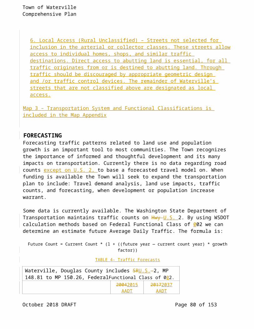
Town of Waterville Comprehensive Plan
protect the public from damage due to development on, or adjacent to, landslides; to preserve the scenic quality and natural character of Town's hillsides; and to protect water quality.The National Natural Resource Conservation Service’s Web Soil Survey (see Steep Slopes Map 8 in the Map Appendix) indicates slopes with a 2315% slope or greater in two small areas; one in the northwest corner and one in the southeast corner of the UGA.
SEISMIC HAZARD AREASEarthquakes cannot be eliminated. Earthquake point (an historical point of seismic activity) is located within close proximity of the UGA, however predictable hazards to life and property resulting from earthquakes and the associated ground shaking, differential settlement, and/or soil liquefaction, see Liquefaction Seismic Hazard Map 9 in the Map Appendix.
MINE HAZARD AREASMine hazard areas are defined as "areas directly underlain by, adjacent to, or affected by mine workings such as adits, tunnels, drifts, or air shafts." Mine hazards may also include steep and unstable slopes created by open mines. There has been little or no historical subsurface mining within the Town and its UGA that could have left areas honeycombed with abandoned mine tunnels. Similarly, any open mining is required to have both an approved erosion control plan and an approved reclamation plan that will address steep and unstable slopes.
VOLCANIC HAZARD AREASVolcanic hazard areas are defined as "areas subject to pyroclastic flows, lava flows, and inundation by debris flows, mudflows, or related flooding resulting from volcanic activity." Because there is no valley or river flowing through the community which heads on or near a volcano, there would be no significant damage to people and/or property expected from debris flows, mudflows or related flooding resulting from volcanic activity. If there were to be a significant ash fall east of Glacier Peakthe Cascades Volcanos, small debris flows would be possible in the rivers and valleys that flow into the Columbia River. The Town is also far enough distant from the nearest volcano (Glacier Peak) to virtually eliminate the hazards of damage to people and/or property resulting from pyroclastic flows, or lateral blasts.
Volcanic hazards are limited in most Central Washington communities; however, significant ash fall may be possible but does not affect land use activity or planning.
SOIL HAZARD AREASThe National Natural Resource Conservation Service has identified soils with severe building limitations, for houses with full basements, based on soil types/properties [WAC 365-190080(4)(d)(i)(A)]. There are several such soils with in the Town and UGA. (see Geologic Soil Hazards Map10 in the Map Appendix).Soil hazards are identified by the NRCS for soils with severe building limitations, for houses with full basements, based on soil types/properties [WAC 365-190-080(4)(d)(i)(A)]. Waterville has 163 124.65 acres (72.55 inside Town Limits, 52.10 in the UGA) acres in Very Limited soils- in its ability to have a basement, and 396 403.16 acres (346.47 inside Town Limits, 57.69 in the UGA) in
October 2018 DRAFT Page 88 of 109

Town of Waterville Comprehensive Plan
Some What limited soils, see Basement Map 10 Building Limitations Hazard Map. NRCS adds this clarification:
“The ratings are based on soil properties, site features, and observed performance of the soils. A high-water table, flooding, shrinking and swelling, and organic layers can cause the movement of footings. A high-water table, depth to bedrock or to a cemented pan, large stones, slope, and flooding affect the ease of excavation and construction. Landscaping and grading that require cuts and fills of more than 5 or 6 feet are not considered.”
The intent of the following goals and policies is to reduce the threat posed to the health and safety of citizens in areas of significant geologic hazard by providing guidance for reviewing a development proposal that may be near a geologic hazard. In addition to having general statements that are applicable to all types of hazard areas, needed protection elements for each different hazard type are also included to aid in understanding their differences and providing specific measures to reduce the hazard.
GEOLOGICALLY HAZARDOUS AREAS GOALS AND POLICIESGOAL CA 5
Implement appropriate measures to either avoid or mitigate significant risks that are posed by geologic hazard areas to public
and private property and to public health and safety.
POLICY CA 5.1: At such time there is a seismic hazard identified and mapped in the Town or its urban growth area, any application for development in or near that area must show its location in relation to the hazard area, and/or it should be designed so that it will be as safe from any earthquake damage as a similar development which is not located in a seismic hazard area.
POLICY CA 5.2: The Town should approve, condition, or deny development and/or redevelopment proposals, as appropriate, based on the degree to which significant risks posed by geologic hazard areas to public and private property and to public health and safety can be avoided or mitigated.
POLICY CA 5.3: Minimize the negative impacts of wind and water erosion resulting from development and construction on erosion hazard areas.
POLICY CA 5.4: On lands being used for agricultural purposes, encourage the use of conservation techniques to reduce the amount of wind erosion.
POLICY CA 5.5: Grading and clearing for both private developments and public facilities/services should be limited to the minimum necessary to accomplish engineering design, with reclamation of disturbed areas being a top priority at the completion of the construction project.
October 2018 DRAFT Page 89 of 109

Town of Waterville Comprehensive Plan
POLICY CA 5.6: An erosion control plan should be submitted by the applicant for a development, prior to approval of the proposal. Further, to minimize blowing soil during development, appropriate water and/or mulch material should be applied to any areas without a vegetative cover.
Rationale: Because of the nature of the soils in the Waterville area, erosion can be a significant problem, particularly wind erosion when clearing and grading take place. By requiring an erosion control plan prior to development, the Town will have some means to monitor and respond to dust complaints during construction, and the applicant will be apprised of possible techniques available for lessening wind and water erosion problems.
POLICY CA 5.7: Reduce the threat posed to the health and safety of citizens when commercial, residential, or industrial development is sited in areas of significant geologic hazard, including but not limited to landslide, seismic, mine and volcanic hazard areas.
POLICY CA 5.8: All proposed development projects should be evaluated to determine whether the project is proposed to be located in a Geologic Hazard Area, its potential impacts on the hazard area, and the potential impact of geologic hazards on the proposed project.
POLICY CA 5.9: All proposed development projects located within a Geologic Hazard Area, or which have the potential to adversely affect the stability of one of these areas, should be required to conduct a technical study by a qualified consultant to evaluate the actual presence of geologic conditions giving rise to the geologic hazard.
POLICY CA 5.10: Any new residential subdivision or short plat that is determined to be in a Geologically Hazardous Area should have a note placed on the face of the plat and on the title report stating that the hazard is present.
Rationale: Although there are no defined geologic hazards known to be within the Waterville area, there is always a possibility that further study and investigation may reveal the presence of one. These policies strive to protect the health and safety of the residents of Waterville, should a hazard be found to be present, by requiring development projects to first consider the possibility of the hazard existing, then to provide protection from and knowledge of the hazard to prospective buyers.
CLASSIFICATIONClassification and rating of these areas will be based upon the risk to development in geologically hazardous areas. The categories of risk shall be (1) Known or Suspected Risk; (2) No Risk; and (3) Risk Unknown, meaning data is not available to determine the presence or absence of a geological hazard. The classification system for geologically hazardous areas shall be as follows:
Known or suspected risk: shall be those areas with a known or suspected risk. Detailed studies and reports will be required to determine whether or not development will be allowed, and if so, what mitigation measures will be required.
October 2018 DRAFT Page 90 of 109

Town of Waterville Comprehensive Plan
No risk: shall be those areas with a no known or suspected risk.
Risk Unknown: shall be those areas that have an unknown risk.
Detailed studies and reports may be necessary to determine the existence of a geologically hazardous area, and if so, whether or not development will be allowed and what mitigation measures might be necessary where development may occur.meaning data is not available to determine the presence or absence of a geological hazard.
The classification system for geologically hazardous areas shall be as follows:Level l : Critical Hazard Area shall be those areas with a known or suspected risk. Detailed studies and reports will be required to determine whether or not development will be allowed, and if so, what mitigation measures will be required.Level 2: Awareness Hazard Areas shall be those areas that have an unknown risk. Detailed studies and reports may be necessary to determine the existence of a geologically hazardous area, and if so, whether or not development will be allowed and what mitigation measures might be necessary where development may occur.
CriteriaThe following criteria are the minimum requirements to be considered when reviewing an application for development in areas potentially containing a geologic hazard area. It is intended that these criteria be included in the development of regulations designed to implement this comprehensive plan. Development projects will be evaluated to determine: ( I ) whether the project is proposed to be
located in a geologic hazard area, (2) the project's potential impact on geologic hazard areas, and (3) the potential impact of geologic hazards on the proposed project.
Applications for development within or in close proximity of a geologically hazardous area will include preliminary information to assist the Town in determining the need for any specialized reports from a geologist or geotechnical engineer. Review criteria will be established to assist staff in making said determination.
An erosion control plan will be submitted by the applicant of a development where grading and filling is proposed, and shall be approved as part of the overall review and approval process.
All proposed development projects located within a geologic hazard area, or which have the potential to adversely affect the stability of one of these areas, will be required to provide studies performed by qualified consultants describing the existing nature of the hazard and necessary safety precautions.
Projects proposed within geologic hazard areas will be required to submit a letter from the geotechnical engineer and/or geologist who prepared the required technical study, stating that the risk of damage from the project, both on-site and off-site, is minimal; the proposal will not increase the risk of occurrence of the hazard; and the proposal has incorporated measures to eliminate or reduce the risk of damage due to the hazard.
October 2018 DRAFT Page 91 of 109

Town of Waterville Comprehensive Plan
Development proposals that involve altering land in areas identified, through the review process, as landslide hazard areas or their buffers must demonstrate the status of landslide hazards in
the area and whether the project can be as safely developed as if it were not in a landslide hazard area.
Any new residential land division that is determined to be in a geologically hazardous area will have a note placed on the face of the plat and on the title report stating that the hazard is present. Said, note will be approved by the Town Attorney.
Clearing, grading or filling of sloped sites will have an approved erosion control plan that meets established requirements.
All authorized clearing for roads, utilities, etc. should be limited to the minimum necessary to accomplish engineering design. Alterations should meet the following requirements:
l . Clearing, grading or filling of sloped sites containing erosion hazard areas should be limited by weather conditions and an approved erosion control plan.
[2.] All clearing shall be marked in the field for inspection and approval prior to alteration of the site.
[3.] The face of cut and fill on slopes shall be prepared and maintained to control against erosion.
The following protection elements should be applied during Town review of proposed development projects within Geologically Hazardous Areas:
Construction methods should be utilized which minimize risks to structures and which do not increase the risk to the site, or to adjacent properties and their structures, from the geologic hazard.
[2.] Site planning shall minimize disruption of existing topography and natural vegetation, and shall incorporate opportunities for phased clearing.
[3.] Impervious surface coverage shall be minimized.[4.] Disturbed areas shall be replanted as soon as feasible, in accordance with an approved re-
vegetation plan, where appropriate.[5.] Clearing and grading schedule shall consider limitations based on seasonal weather
conditions.[6.] Temporary erosion and sedimentation controls shall be utilized.[7.] Conceptual and detailed drainage plans shall be prepared for projects affecting large areas
of geologic hazard, with stormwater detention standards based upon the technical studies required under this document.
[8.] Any limitations to site disturbance, such as clearing restrictions, imposed as a condition of development approval shall be marked in the field and approved by the Town prior to undertaking the project.
[9.] A monitoring program shall be prepared for construction activities occurring in critical geologic hazard areas.
[10.] Development shall not increase instability or create a hazard to the site or adjacent properties, or result in a significant increase in sedimentation or erosion.
I l. Discourage excessive grading of property being developed as a building site for residential, commercial, or industrial uses.
October 2018 DRAFT Page 92 of 109
Kurt Danison, 12/21/17,
Move to regulations

Town of Waterville Comprehensive Plan
FISH AND WILDLIFE CONSERVATION AREASThe Central Washington area is fortunate to have natural resources encompassing a large variety of environments. As demonstrated in national studies, many people participate in recreational activities that involve wildlife, including hunting, fishing, photography of wildlife, bird watching and feeding, among other things.
Recreationally-oriented tourist activities may provide a possible avenue for economic development in the area, capitalizing on these numerous natural resources. To that extent, as well as for the inherent importance of wildlife and the natural environment to the quality of life, it is the intent of these policies to recognize the importance of protecting fish and wildlife habitat conservation areas.
Washington Department of Fish and Wildlife "Priority Habitats and Species List" indicates that there are no priority habitat species within Waterville and it's UGA. However, nearby Badger Mountain has priority species use, such as mule deer and several species of grouse. Additionally, the general lack of data does not limit designating areas of protection based on local data and scientific research.
FISH AND WILDLIFE HABITAT GOALS AND POLICIESGOAL CA 6
Protect fish and wildlife habitat areas as an important natural resource for the Town, particularly in regard to their economic,
aesthetic and quality of life values.
POLICY CA 6.1: Use the Washington Department of Fish and Wildlife's Priority Habitat and Species maps to identify and map critical wildlife habitat conservation areas within the Town’s urban growth area, and encourage the preservation of blocks of habitat and the connections between them.
POLICY CA 6.2: Protect fish and wildlife habitat areas, as they may be defined in the future, as an important natural resource.
POLICY CA 6.3: Consider the impacts of new development on the quality of land, wildlife and vegetative resources as part of its environmental review process.critical areas and SEPA review process and require any appropriate mitigation measures. Such mitigation may involve the retention and/or enhancement of habitats.
POLICY CA 6.4: Land uses adjacent to naturally occurring habitat areas will not negatively impact the habitat areas. If a change in land use occurs, adequate buffers and greenery linkages, determined using the best available science, will be provided to the habitat -areas.
POLICY CA 6.5: Recognize the importance of protecting wildlife habitat conservation areas, and encourage the protection and enhancement of these areas.
October 2018 DRAFT Page 93 of 109

Town of Waterville Comprehensive Plan
POLICY CA 6.6: Identify and map critical wildlife habitat conservation areas within the area between the Town limits and the Urban Growth Boundary.
POLICY CA 6.7: The Town encourages the preservation of blocks of habitat and the connections between them.
Rationale: By defining habitat areas in the portions of the community not already developed, the Town recognizes the importance of this resource, and can inform prospective developers where potential habitat areas may be located. This allows the community and developers the opportunity to provide some consideration and mitigation of these areas during the planning stages of new developments.
CLASSIFICATIONThe following classification system will be used to assist in designating critical fish and wildlife species and their associated habitat:
Aquatic Habitat Conservation Areas. With this classification, the Town recognizes the importance of areas covered with water for providing habitat for aquatic species as well as waterfowl and other wildlife.
Riparian Habitat Conservation Areas . With this classification, the Town recognizes that riparian habitat within Waterville and its urban growth area is likely to coincide with shoreline areas, flood hazard areas, wetlands and aquifer recharge areas. Riparian areas typically offer relatively contiguous habitat that is essential to a diverse array of fish and wildlife species. Best available science suggests that these areas are especially sensitive to pressures from urban development, and that they provide important habitat functions and values for anadromous fish.
Riparian Habitat Conservation Areas are defined as public or privately-owned lands adjacent to drainages that contain riparian vegetation.
October 2018 DRAFT Page 94 of 109

Town of Waterville Comprehensive Plan
Upland Habitat Conservation Areas. With this classification, the Town recognizes that those upland areas within the defined Town limits and urban growth boundary, which are not otherwise designated as aquifer recharge areas, wetlands, or geologically hazardous areas, are frequently the most suited for human development. This classification is intended to consider that upland habitats that support federal or state identified endangered, threatened or sensitive species, or any habitats which are identified as providing a high level of functions and values must be protected to the extent possible. However, in considering Best Available Science, this classification also is intended to ensure that development is not subject to burdensome regulation in those areas most suited to support it. Such areas shall include all portions of the Town and urban growth area where a development pattern is already established such that connectivity of native habitat has already been broken and protection of identified habitat areas is unlikely to provide particular benefit to any of the priority species identified by WDFW.
Level l : Critical Fish and Wildlife Areas - Winter ranges, migration routes, nesting sites, perches or any areas, that, if disturbed, would have a significant negative impact on the continuation of a species, particularly state and/or federal threatened or endangered species. This also includes critical habitat areas, which are, in and of themselves, crucial to the continuation and support of one or more species. These areas will not be disturbed, and appropriate protection measures, including buffering, replacement, enhancement, etc., will be determined and implemented on a site specific basis at the time of application for development. A site review will help determine if the habitat is or is not critical and/or if the habitat.can be successfully enhanced/replaced in a different location.Level 2: Awareness Fish and Wildlife Areas - Influence areas surrounding or adjacent to Level I areas that, if disturbed, could impact the Level I area to a certain degree. Level 2 areas also include habitat areas that, if disturbed, would have a significant negative impact on the continuation of a state and/or federal candidate or sensitive species. The applicant is made aware of the existence of nearby critical habitat or species, and the area will automatically require a site review to determine the extent and importance of the habitat. Development in these areas may be subject to conditions such as buffering, screening, enhancement, etc.
CRITERIAThe following criteria are the minimum requirements to be considered when reviewing an application for development in areas potentially containing fish and/or wildlife habitat conservation areas. It is also intended that these criteria be included in the development of regulations designed to implement this comprehensive plan.
Whenever possible, the maximum amount of vegetation will be maintained in its natural state and wilt be disturbed only as minimally necessary for the development. Riparian vegetation will not be removed unless there are no other alternatives available. When it is necessary, only those areas of vegetation that are absolutely unavoidable may be cleared, but must be re-vegetated with natural riparian vegetation as soon as possible.Re- vegetation of disturbed areas which re-establishes desirable native plants and/or plants that enhance applicable fish and wildlife populations will be, at a minimum, encouraged, as specified in the
October 2018 DRAFT Page 95 of 109

Town of Waterville Comprehensive Plan
conditions for approval of the development. Said, revegetation will be maintained in good growing conditions, as well as being kept free of noxious weeds. When appropriate, fencing standards that protect wildlife, as well as providing for the operation and
protection of a particular land use, may be part of the conditions placed on approval of a development application. Said, standards will be agreed to by the applicant and the Town, with recommendations from the WDFW.
Access restrictions may be necessary which protect fish and wildlife habitat conservation areas, particularly during critical times of the year. The access restrictions will be agreed to by the applicant and the Town, with recommendations from the WDFW.
Particularly in instances where a development proposal involves more intense uses, all or part of the required open space (common and/or private) will be dedicated to fish and wildlife habitat conservation, based on the extent and importance of the habitat. The extent and location of said open space will be agreed to by the applicant and the Town, with recommendations from the WDFW.
In certain instances it may be necessary to provide vegetation screenings and to provide controls on domestic animals (particularly dogs) to protect the function of critical habitat areas by reducing the potential for harassment from people and/or domesticated animals.
Develop brochures, in cooperation with WDFW, which help to educate the citizens on the importance of different species and habitats; and which provide information and techniques on how people can co-exist with those species and habitats.
DESIGNATIONFish and wildlife conservation areas are designated under the Washington Department of Fish and Wildlife Priority Habitat and Species Program. Priority habitats are considered to be priorities for conservation and management. Priority species require protective measures for their perpetuation due to their population status, sensitivity to habitat alteration, and/or recreational, commercial, or tribal importance. Priority Habitat and Species maps based on WDFW data depict habitat conservation areas (see Map 11 in the Map Appendix). However, it must be noted that populations and habitat systems are dynamic in nature. Therefore, site review should be used to verify the presence of a given habitat or species.
WATERVILLE WATERSHED MANAGEMENT AND STEWARDSHIP PLANThe Town of Waterville owns 180 acres of timbered land located 5 miles south of Waterville, which also contains the Town's watershed. The timber stand consists primarily of Ponderosa Pine, with some Douglas Fir interspersed. Because of its importance to the community, the Town has developed a management and stewardship plan which seeks to accomplish the following mission by the stated objectives:
The Town of Waterville hereby commits resources to manage this forest unit in a manner which allows economic utilization for the community while maintaining the forest structure, species composition, wildlife habitat, biodiversity, scenic and recreational values and watershed protection.
October 2018 DRAFT Page 96 of 109
Kurt Danison, 12/22/17,
Move to regulations

Town of Waterville Comprehensive Plan
ObjectivesThe health of the stand will be maintained by the following means:
Select cut or thinning sales to remove diseased or insect trees; Thinning of naturally regenerated seedlings for proper spacing to promote optimum growth; Periodic monitoring for insects and disease; Selection of healthy, compatible seedlings for regeneration; and Reduction of ground fuels to decrease severity of damage due to possible wild fire Care and
maintenance of planted seedlings to insure higher survival rate and more vigorous growth.
The diversity of the stand will be accomplished by the following means:
Introduction of new species, size and location of planted seedlings Recognize importance of natural habitat and retain needed cover and where possible improve
forage and cover conditions Retention of some dead trees for cavity nesting birds and animals Removal of hazard
trees when found.
ConclusionIt is important to realize that this plan is only the first of many steps in the management of this stand.
The timber sale in 1993 harvested 775 MBF of mature and overstocked timber (55-60% of the stand). Remaining is 500 — 600 MBF of healthy overstory trees with a spacing of 80 — 120 trees/acre. New trees and other vegetation (grass and shrubs) are established in the openings created.A goal of this plan is to help provide for future revenues for the community and at the same time do so in a responsible manner.
The recent 1993 timber sale provideds an excellent opportunity for implementation of some common sense management principles used to maintain the viability of the remaining trees, and to encourage vigorous growth of a new generation of trees through natural and artificial regeneration.
A stewardship policy will addresses the health of the stand in respect to the growth and diversity of plants and animals living in and adjacent to it and the conditions necessary to maintain their habitat consistent with their needs and with respect to the management plan for future timber harvests.
Adjacent land owners areshould be encouraged to formulate and implement their own plans because the insect, disease and wild fire issues recognize no boundaries and will adversely affect us allthe community and the health of the forest as a whole. Through cooperation with the other land owners, we the Town should be able to put in place a comprehensive plan that will benefit all concerned.
Wildlife: In the unit there are deer, chipmunks, squirrels, and grouse. The recent wet springs have negatively affected the hatch of the grouse. The number of deer present in the unit or passing through daily is between 50 — 100. The number of other small animals and birds are plentiful.
October 2018 DRAFT Page 97 of 109

Town of Waterville Comprehensive Plan
ECONOMIC DEVELOPMENT ELEMENT INTRODUCTIONUnder the Growth Management Act (GMA), all elements of the plan should be undertaken with the goal of economic development in mind. This Economic Development Element encourages development that is consistent with the objectives, principles and standards of the comprehensive plan. It promotes the cultivation of additional economic opportunities for citizens of the Waterville area, and encourages growth within the capacity of natural resources and public services, utilities and facilities to sustain it. Economic development is not a spontaneous event, nor does it stand alone as an isolated discipline. Today, economic development is part of the larger area of community development. Economic development can create opportunities for recreation, housing and public facilities and services. Further, the economic health of the community fosters a climate where historic preservation and environmental protection are valued.
GOAL AND POLICIESGOAL ED 1:
Establish a multi-use land development strategy to attract and support local economic growth while enhancing, maintaining and protecting the integrity of the community, residential neighborhoods and the natural
environment.
POLICY ED 1.1: Recognize future potential for future development of economic resources while still maintaining the viability of the existing resources.
POLICY ED 1.2: Encourage coordination among the Town, and area banks, Port District, non-profit funding entities, realtors and traditional lending institutions to form a database of information including land inventories, development processes, funding, technical assistance, loans and grants, and venture capital sources.
POLICY ED 1.3: Provide guidelines and a framework for development which recognizes that the quality of the environment makes an important contribution to economic value.
Rationale: By recognizing the potential for future economic development and providing a guide and framework within which development will be considered, the Town will be providing predictability to all types of industry considering Mansfield Waterville for a location.
POLICY ED 1.4: Encourage the location of needed businesses and desired industriesy that provide familywage jobs for local residentsand will diversify and vitalize the local economy and create supportive conditions where rural economies can prosper.
October 2018 DRAFT Page 98 of 109

Town of Waterville Comprehensive Plan
POLICY ED 1.5: Actively support efforts to promote trade and tourism by participating in local and regional economic development programs. Continue to support the efforts and promoting the high quality of life in the Town of Waterville through the followingthe North Central Washington Economic Development District, Port of Douglas County, Douglas PUD, the local Chamber of Commerce, service clubs, community groups and other organizations: Waterville Chamber of Commerce, Waterville Tree Board, Waterville Takes Action, Badger Mountain Masonic Lodge #57, Douglas County Historical Society,Waterville Philomathic Club, PEO Chapter Z, Harmony chapter #56 OES, Waterville Rebekah Lodge, Lion's Club, Eagles Club & Auxillary, Friends of the Library and Waterville Together for Drug-Free Youth.POLICY ED 1.6: Pursue an active and aggressive recruitment program to induce a variety of commercial and industrial enterprises to settle in the area.
POLICY ED I .7: Attract new commerce and industry which have employment that proved livable wages and produce disposable incomes that will diversify and vitalize the local economy and create supportive conditions where rural economies can prosper.
POLICY ED 1.78: Promote the improvements and growth of tourism-related businesses and services, particularly for outdoor recreational-type uses that capitalize on the four seasons andnatural amenities of the area, while still recognizing the importance of diversification to the stability of the economy of the community.
Rationale: The Ccompetition for new types of industry, as well as expansion of the agricultural industry, can be very intense. It is therefore very important to Waterville to be involved in economic development at a regional level to stay current economic activities in the region, on who has expressed an interest in the region and regional tourism promotion efforts. Outside of the agricultural industry, tourism is the most likely area of economic development available to Waterville. However, it should be recognized that the tourist industry can, at times, be unstable and unpredictable. Additionally, the overuse of an amenity can sometimes destroy the very qualities that make it a desirable thing. Given these factors, other types of industry should be actively pursued when the opportunity arises.
POLICY ED 1.89: Develop and maintain an attractive and high-quality environment for economic activities through historic preservation, good design, landscaping, efficient and inexpensive utilities and control of impacts which detract from the environment or which create hazards. The possibility of creating a "theme" for the downtown area should be actively pursued.
POLICY ED 1.109: Create and encourage partnerships between government, and business and industry to deal with business issues at all levels and sizes.
POLICY ED 101.1: The Town and County should work together to improve communication in the area of permits, signage, zoning and the processing of paperwork.
POLICY ED 1.112: Establish standards for site planning and design that provide for efficient and safe function while contributing to an aesthetically pleasing development.
October 2018 DRAFT Page 99 of 109
Kurt Danison, 04/16/18,
Is this something the Town has the capacity for or is there another organization performing this function

Town of Waterville Comprehensive Plan
Policy ED 1.123: A variety of buffering techniques, including landscaping, fencing, and berming, should be employed to protect the integrity of areas of less intensive land uses.
Rationale: Industrial and commercial development tswhich are designed in an aesthetically pleasing, high quality environments manner will have a tendency to attract further developments. By assuring this high quality through design standards, Waterville will be creating an environment that will help it compete more aggressively with other communities that may be under consideration by a company for location. This quality design will also lessen any impacts that may be associated with existing, adjacent land uses.
POLICY ED 1.134: Allocate land for commercial and industrial uses based on appropriate site characteristics, market demand, community need, adequacy of utilities, facilities and services, and proximity to housing, consistent with the Comprehensive Plan.
POLICY ED 1.145: Assure that adequate infrastructure is provided to accommodate economic growth.
POLICY ED 1.156: Special dDevelopment permit review and approval should be required for all commercial and industrial development to promote uniformity and consistency within the community, and to assure adequate infrastructure availability.
Rationale: Prior to Aallocationing of land for commercial and industrial uses, requires extensive review and study takes place as to what makes an area appropriate for certain uses. By providing this initial research, and by developing a review process that reflects and considers all the important factors involved in the research, the potential development is provided some measure of predictability. If a developer knows what to expect as far as land and utility availability and permitting processes, Waterville will be more appealing than a community without those things.
POLICY ED 1.167: Commercial and industrial development should be designed to enhance vehicular circulation and pedestrian safety to provide a quality living environment for the shoppercustomers, employees and nearby residents.
POLICY ED 1.178: Continue the revitalization of Waterville's pedestrian friendly CentralBusiness Districtdowntown and coordinate with commercial development in outlying areas.
POLICY ED 1.189: Interior and exterior parking lots should be landscaped to break up large expanses of paved areas, reduce thermal heating by shading pavement, and reduce negative visual impacts.
POLICY ED 1.2019: Orient new buildings to encourage pedestrian circulation, enhance the appearance of buildings, and provide unified design elements to offset architectural styles.
October 2018 DRAFT Page 100 of 109

Town of Waterville Comprehensive Plan
POLICY ED 1.201: Interior and exterior parking lots should be landscaped in order to breakup large expanses of paved areas, reduce thermal heating by shading pavement, and reduce negative visual impacts.
POLICY ED 1.21: Coordinate economic development activities with the existing business owners’ interests to enhance the community’s base of commerce and to gain the greatest benefit from local resources
Rationale: Because of the need for energy conservation measures throughout the United States, the trend toward more transit and pedestrian-oriented activities has increased. To remain competitive in the search for new industry, this trend should be recognized and accommodated. Waterville is still of a size to be able to promote efficient pedestrian and transit circulation, as well as encouraging strategically placed, aesthetically pleasing parking facilities to service the traveling public.
October 2018 DRAFT Page 101 of 109

Town of Waterville Comprehensive Plan
ESSENTIAL PUBLIC FACILITIES ELEMENTINTRODUCTIONThe Growth Management Act (GMA) states that the comprehensive plan for each county and Town planning under the Act shall include a process for identifying and siting essential public facilities. Such facilities are typically difficult to site and the GMA further indicates that no local comprehensive plan or development regulations may preclude the siting of essential public facilities. For Douglas County and the Communities within it, the decision was made by the Regional Council to address the issue of siting essential public facilities in a County-wide, coordinated effort.
Essential public facilities (EPF) of a countywide or a statewide nature are those that have inherent characteristics that make them difficult to site. These characteristics may include facility size, land consumption uses, traffic impacts, noise, odor, safety concerns and utility needs. As a result of these characteristics, many EPF are considered "locally unwanted land uses" or LULU's, while still other types of EPF may be desirable.
Multiple permit processes are acknowledged as being confusing to applicants for EPF and to citizens that have an interest in the siting process. It is the desire of the county and the cities/towns that plans and regulations address EPF in a consistent and coordinated manner. Therefore, this comprehensive plan and the subsequent implementing development regulations establish the following policies that are consistent with the Douglas County Regional Policy Plan adopted by Douglas County and ratified by each community.
GOALS AND POLICIESGOAL EPS 1
Protect the ability to site these facilities in or near the community as important part of the economic and social needs of Waterville and the
surrounding communities.
POLICY EPF 1.1: The Town ofWaterviIIerecognizes the following as essential public facilities:
Airports; state education facilities; state or regional transportation facilities; state and local correction facilities; solid waste handling facilities; secure community transition facilities; in-patient facilities including substance abuse facilities, mental health facilities, and group
homes.
POLICY EPF I.2: The Town of Waterville comprehensive plan and development regulations will not preclude the siting of essential public facilities.
October 2018 DRAFT Page 102 of 109

Town of Waterville Comprehensive Plan
POLICY EPF 1.3: The Town of Waterville recognizes the following criteria as applicable to the siting of essential public facilities:
EPF shall be served by a full range of services necessary to support the use; EPF located outside of an urban growth area must be self-contained or shall have extended
services in a manner that does not promote additional development or premature conversion of lands to other uses;
State-mandated siting criteria be incorporated where applicable; EPF shall not be located on resource lands or critical areas if incompatible.
POLICY EPF 1.4: A single local decision-making processes for EPF environmental review and permitting should be established where practical. To that end, Waterville supports the development of cooperative agreements among the county, cities, towns and the health district, the central components of which are the incorporation of standards from the various agencies with jurisdiction and one decision-making process.
POLICY EPF 1.5: It is acknowledged that the county, cities and towns do not have authority over activities within the jurisdiction of the Washington State Energy Facility Siting Evaluation Council. However, the siting of major energy facilities in Waterville that are designed to extract, store, transport, process or refine fossil fuels should not be permitted without extensive preliminary environmental and public review. Nuclear power generating facilities should also be prohibited from locating in Waterville until all environmental risks associated with the production, storage, disposal, and long-term liability of radioactive or hazardous wastes can be eliminated.
Rationale: Siting issues for all energy facilities that should be reviewed include but are not limited to:
placement of short-term construction employees; placement of long-term employee; types of facilities necessary, directing impacts towards enhancement of existing
facilities; utilization of best available contract technology to preserve physical and social
environmental quality.
POLICY EPF 1.6: Waterville supports the role of the Regional Council to periodically monitor the establishment of essential public facilities to assure that jurisdictions are not receiving a disproportionate share of EPF.
October 2018 DRAFT Page 103 of 109

Town of Waterville Comprehensive Plan
CITIZEN PARTICIPATION ELEMENT
INTRODUCTIONBecause of the dynamic nature of growth and change in a developing community, it is imperative that the comprehensive plan as well as its implementing ordinances/regulations be continuously evaluated and reviewed for their applicability. As situations and technology change, the comprehensive plan needs to be able to accommodate those changes, as determined by the citizen process.
On the other side, however, it is important to maintain the integrity of the comprehensive plan as well as the citizen process involved in its development. The Growth Management Act requires, at section 36.70A.130 RCW, that each Town and county "establish procedures whereby proposed amendments or revisions of the comprehensive plan are considered by the governing body ... no more frequently than once every year." This allows for the accumulative effects of all proposed amendments to be considered at one time, providing an overall picture of benefits and/or impacts of the changes. There is an opportunity provided in GMA for cities and counties to amend or revise the comprehensive plan whenever an emergency exists.
Public participation was included to a great extent in the initial preparation of the entire plan. It is a document that has been developed by and for the citizens of the Waterville area. It was the intent that this not only meet the requirements and goals of the Growth Management Act, but more importantly it would be a pro-active, workable plan that truly reflects the desires of the community. The Plan needs to remain a reflection of the community's desires over time, including the continuous involvement of the residents in this on-going process of long-range planning. The following goal and policies are intended to guide the comprehensive plan amendment process to ensure the continued involvement of any and all residents of Waterville who wish to be a part of it.
GOAL AND POLICIESGOAL CPE 1:
Ensure that continued public participation is utilized in decision making that directly affects policy related to the comprehensive plan or the
implementation of that plan.
POLICY CPE 1.1: Encourage citizens of all ages to attend meetings/hearings, and to comment on all issues of concern.
POLICY CPE 1.2: Encourage all citizens to participate on volunteer boards, such as special committees or task forces and/or the planning commission.
October 2018 DRAFT Page 104 of 109

Town of Waterville Comprehensive Plan
POLICY CPE 1.3: Support volunteer committees that strive to improve the town and/or the quality of life in the area of Waterville (i.e. citizens advisory committees, the downtown revitalization committee, etc.).
POLICY CPE 1.4: Maintain the existing systemUse print, radio, mailings and the internet for notifying residents of upcoming meetings, hearings, etc.
POLICY CPE 1.5: Post notices pertaining to upcoming meetings and their agendas at Town Hall and on the Town’s website on at least a monthly basis or more frequently as appropriate in public buildings within the Urban Growth Boundary.
POLICY CPE 1 06: Consider placing a suggestion box in the Town Hall and on the Town’s website.
October 2018 DRAFT Page 105 of 109

Town of Waterville Comprehensive Plan
COMPREHENSIVE PLAN AMENDMENTS
PROCESS AND TIME FRAMESIt is the intent of the comprehensive plan to establish an annual review process that allows not only for proposed land use changes to be considered at one time, but also to include revisions to any capital projects as well. Along with any specific land use designation changes, whether sponsored by the Town or by individuals, the amendments will include, at a minimum, the revisions to the Six Year Street Program and the project schedule for the Capital Facilities Plan of the Town. While these processes have been available for public scrutiny before, including them in the comprehensive plan and its review process will make them more visible and accessible for comment by the public.
To maintain the successful citizen participation process established during the development of this comprehensive plan, the process for amending the plan will closely resemble that effort. In general, the Planning and Zoning Commission (Planning Commission) will hold meetings and/or workshops to initially review the proposed amendments. The Planning and Zoning Commission will then hold at least one public hearing on the amendments before forwarding a recommendation to the Town Council. Individual requests and Town sponsored amendments must be applied for at Town Hall by September I of each year. The month of September and early October will be used as staff review, and the Planning and Zoning Commission will hold its first public meeting or hearing at its first meeting in October. If needed the Planning and Zoning Commission will hold subsequent meetings/hearings within a timeframe to allow the Town Council to hear and act on the amendment requests before the end of the year.
October 2018 DRAFT Page 106 of 109

Town of Waterville Comprehensive Plan
IMPLEMENTATION STRATEGY
INTRODUCTIONThe Comprehensive Plan is an expression of how the Town should grow and develop and serves as a guide for future development and redevelopment. Therefore, the goals and policies of the Plan are general guidelines, not regulations. The Growth Management Act of 1990, as amended, states at Section 36.70A.120, "each county and Town that is required or chooses to plan under RCW 36.70A.040 shall enact development regulations that are consistent with and implement the comprehensive plan." The following ordinances, codes and programs have been developed, will be amended, or will be prepared as the primary means to implement the goals and policies of this Comprehensive Plan.
ZONINGZoning (Title 17 Waterville Municpal Code) is the most important legal tool which can be used tofor implementation of the Comprehensive Plan. The basic purpose of zoning is to promote the Town's public health, safety, and welfare. , and to assist in the implementation of the comprehensive plan. In a zoning ordinance the Town is divided into zoning districts, with types of uses, permit requirements and other land use regulations defined for each district. The most basic regulations pertain to:
The height and bulk of buildings; The percentage of the lot which may be occupied and the size of required yards; The density of population; The use of buildings and land for residential, commercial, industrial, and other purposes.
It is also possible to develop performance standards and criteria to further define the characteristics of the different zoning categories, such as:
Building materials and construction standards or attributes; The ability and/or criteria for keeping both domestic pets and livestock; and Any buffering, landscaping, parking or other similar standards.
SUBDIVISIONSubdivision regulations (Title 16 WMC) are intended to regulate the manner in which land may be divided and prepared for development. They apply whenever land is divided for purposes of sale, lease or transfer. State law specifies that any subdivision of land which results in the creation of a parcel of less than 5 acres in size must comply, at a minimum, with state subdivision requirements, as well as with any local subdivision regulations.
There are two basic forms of subdivision including long plats, which contain 5 or more lots, and short plats, which contain four or fewer lots5. Regulations pertaining to both types of subdivisions are
5 - RCW 58.17 permits local governments to raise the number of lots permitted under a short plat up to 9.
October 2018 DRAFT Page 107 of 109

Town of Waterville Comprehensive Plan
adopted and enforced at the local level in accordance with provisions and statutory authority contained in RCW 58.17state law.
The regulations specify methods of subdivision procedures for the developer and the Town, minimum improvements (streets, utilities, etc. Chapter 16.12 WMC) to be provided by the developer, and design standards for streets, tots, and blocks (Title 19 WMC). Subdivision regulations are intended to encourage the orderly development and redevelopment of large tracts within and around the community.
PLANNED DEVELOPMENTSPlanned development regulations (Chapter 17.38 WMC) are intended to provide an alternative method for land development which:
Encourages flexibility in the design of land use activities so that they are conducive to a more creative approach to development which will result in a more efficient, aesthetic and environmentally responsive use of the land;
Permits creativity in the design and placement of buildings, use of required open spaces, provisions of on-site circulation facilities, off-street parking, and other site design elements that better utilize the potential of special features such as geography, topography, vegetation, drainage, and property size and shape;
Facilitates the provision of economical and adequate public improvements such as sewer, water, and streets; and
Minimizes and/or mitigates the impacts of development on valuable natural resources and unique cultural, historic, or natural features such as agricultural lands, steep slopes and floodplain and shoreline areas.
Planned development regulations (Chapter 17.38 WMC)may be are incorporated into the Town's zoning ordinance or developed as a separate ordinance. It is also possible for the Town to use the planned development process for certain uses which, due to their nature, may be more appropriately reviewed under such regulations.
BINDING SITE PLANThe binding site plan (Chapter 16.24 WMC) is another different method of dividing property for commercial and industrial purposes, and in some cases for residential uses such as manufactured home and recreational vehicle parks where the individual parcels are not to be sold. This method for regulating development is intended to provide a flexible alternative to landowners and developers and requires that a specific site plan be developed which shows the layout of streets and roads and the location of utilities required to serve the property. The binding site plan is a legally enforceable document which, when required, can be amended to reflect changing conditions. The plan also must be reviewed to ensure that the cost of providing basic services and the maintenance of those services does not represent an unreasonable burden on the residents of the Town.
October 2018 DRAFT Page 108 of 109

Town of Waterville Comprehensive Plan
STATE ENVIRONMENTAL POLICY ACT (SEPA)SEPA (RCW 43.21C.120) directs decision makers to consider the environmental consequences of their actions. The SEPA process (Chapter 18.02 WMC) starts when someone submits a permit application to the Town, or when the Town proposes to take some official action. An Environmental Checklist is used to determine whether the project or action is significant enough to require an environmental impact statement (EIS), While an EIS is commonly not required, certain conditions may be included in a determination of non-significance that are intended to minimize environmental impacts. Regardless, a threshold determination must be made on all permit applications unless they are specifically exempted by SEPA.
CRITICAL AREAS ORDINANCEThe Growth Management Act of 1990 (RCW 36.70A - amended 1991) requires that Cities and Counties use the best available science to classify, designate and protect critical areas such as wetlands, aquifer recharge areas, frequently flooded areas, geologically hazardous areas, and fish and wildlife habitat conservation areas. One avenue for protection is a critical areas ordinance (Chapter 18.04 WMC) which is consistent with the comprehensive plan. This ordinance may preclude any development that is incompatible with the critical areas, but usually it will provide for mitigation measures to be applied to alleviate the negative impacts of development on a critical area.
October 2018 DRAFT Page 109 of 109