Physical Public Benefits Tab Attachment 1: Ecosystem ... Ecosystem Priorities.pdf · status: final...
61
STATUS: FINAL PREPARER: J HERRIN PHASE: 1 VERSION: A PURPOSE: BENEFITS CALCULATION A2 CHECKER: DATE: 2017 AUGUST CAVEAT: QA/QC: REF/FILE #: WSIP APPLICATION NOTES: PAGE: 1 OF 61 Physical Public Benefits Tab Attachment 1: Ecosystem Priorities Worksheets
Transcript of Physical Public Benefits Tab Attachment 1: Ecosystem ... Ecosystem Priorities.pdf · status: final...

STATUS: FINAL PREPARER: J HERRIN PHASE: 1 VERSION: A PURPOSE: BENEFITS CALCULATION A2 CHECKER: DATE: 2017 AUGUST CAVEAT: QA/QC: REF/FILE #: WSIP APPLICATION NOTES: PAGE: 1 OF 61
Physical Public Benefits Tab
Attachment 1: Ecosystem Priorities Worksheets

STATUS: FINAL PREPARER: J HERRIN PHASE: 1 VERSION: A PURPOSE: PHYSICAL PUBLIC BENEFITS CHECKER: N PONFERRADA DATE: 2017 AUGUST CAVEAT: QA/QC: REF/FILE #: WSIP APPLICATION NOTES: ECOSYSTEM PRIORITIES A1 PAGE: 2 OF 61
Table of Contents
Attachment 1: Ecosystem Priorities Worksheets ................................................................................. 1 General Information ........................................................................................................................ 5 Ecosystem Priority 1......................................................................................................................... 9 Ecosystem Priority 2....................................................................................................................... 15 Ecosystem Priority 3....................................................................................................................... 20 Ecosystem Priority 4....................................................................................................................... 25 Ecosystem Priority 5....................................................................................................................... 31 Ecosystem Priority 10 .................................................................................................................... 36 Ecosystem Priority 11 .................................................................................................................... 40 Ecosystem Priority 14 .................................................................................................................... 45 Ecosystem Priority 15 .................................................................................................................... 53 Ecosystem Priority 16 .................................................................................................................... 56

STATUS: FINAL PREPARER: J HERRIN PHASE: 1 VERSION: A PURPOSE: PHYSICAL PUBLIC BENEFITS CHECKER: N PONFERRADA DATE: 2017 AUGUST CAVEAT: QA/QC: REF/FILE #: WSIP APPLICATION NOTES: ECOSYSTEM PRIORITIES A1 PAGE: 3 OF 61
Acronyms and Abbreviations
°F Farheinheit
af acre feet
CDFA California Department of Food an Agriculture
CDFW California Department of Fish and Wildlife
cfs cubic feet per second
CVP Central Valley Project
CVPIA Central Valley Project Improvement Act
DPM Delta Passage Modeling
DPS distinct population segment
EFH Essential Fish Habitat
EIR Environmental Impact Report
EIS Environmental Impact Statement
ESU evolutionarily significant unit
ft2 square feet
IEP Interagency Ecological Program
NMFS National Marine Fisheries Service
NOAA National Oceanic and Atmospheric Administration
NRCS Natural Resources Conservation Service
NWRs National Wildlife Refuges
O&M Operations and Maintenance
PPIC Public Policy Institute of California
RM River Mile
RWSP Refuge Water Supply Program
SWP State Water Project
TAF thousand acre feet
TMDLs Total Maximum Daily Loads
USACE U.S. Fish and Wildlife Service
USBR U.S. Bureau of Reclamation
USDA U.S. Department of Agriculture
USFWS U.S. Fish and Wildlife Service
USRDOM Upper Sacramento River Daily Operations Model
USRWQM Upper Sacramento River Water Quality Model

STATUS: FINAL PREPARER: J HERRIN PHASE: 1 VERSION: A PURPOSE: PHYSICAL PUBLIC BENEFITS CHECKER: N PONFERRADA DATE: 2017 AUGUST CAVEAT: QA/QC: REF/FILE #: WSIP APPLICATION NOTES: ECOSYSTEM PRIORITIES A1 PAGE: 4 OF 61
WHEP Waterbird Habitat Enhancement Program
WUA Weighted Usable Area

STATUS: FINAL PREPARER: J HERRIN PHASE: 1 VERSION: A PURPOSE: PHYSICAL PUBLIC BENEFITS CHECKER: N PONFERRADA DATE: 2017 AUGUST CAVEAT: QA/QC: REF/FILE #: WSIP APPLICATION NOTES: ECOSYSTEM PRIORITIES A1 PAGE: 5 OF 61
General Information General Info: Ecosystem Priorities and Relative Environmental Value Criteria
Ecosystem Priorities
P 1 Provide cold water at times and locations to increase the survival of salmonid eggs and fry.
P 2 Provide flows to improve habitat conditions for in-river rearing and downstream migration of juvenile salmonids.
P 3 Maintain flows and appropriate ramping rates at times and locations that will minimize dewatering of salmonid redds and prevent stranding of juvenile salmonids in side channel habitat
P 4 Improve ecosystem water quality
P 5 Provide flows that increase dissolved oxygen and lower water temperatures to support anadromous fish passage
P 6 Increase attraction flows during upstream migration to reduce straying of anadromous species into non-natal tributaries
P 7 Increase Delta outflow to provide low salinity habitat for Delta smelt, longfin smelt, and other estuarine fishes in the Delta, Suisun Bay, and Suisun Marsh
P 8 Maintain or restore groundwater and surface water interconnection to support instream benefits and groundwater dependent ecosystems.
P 9 Enhance flow regimes or groundwater conditions to improve the quantity and quality of riparian and floodplain habitats for aquatic and terrestrial species.
P 10 Enhance the frequency, magnitude, and duration of floodplain inundation to enhance primary and secondary productivity and the growth and survival of fish
P 11 Enhance the temporal and spatial distribution and diversity of habitats to support all life stages of fish and wildlife species
P 12 Enhance access to fish spawning, rearing, and holding habitat by eliminating barriers to migration
P 13 Remediate unscreened or poorly screened diversions to reduce entrainment of fish
P 14 Provide water to enhance seasonal wetlands, permanent wetlands, and riparian habitat for aquatic and terrestrial species on State and Federal wildlife refuges and on other public and private lands
P 15 Develop and implement invasive species management plans utilizing techniques that are supported by best available science to enhance habitat and increase the survival of native species
P 16 Enhance habitat for native species that have commercial, recreational, scientific, or educational uses
Relative Environmental Value Criteria (REVs)
REV 1 Number of different ecosystem priorities, for which corresponding public benefits are, provided by the project.
REV 2 Magnitude of ecosystem improvements.
REV 3 Spatial and temporal scale of ecosystem improvements.
REV 4 Inclusion of an adaptive management and monitoring program that includes measurable objectives, performance measures, thresholds, and triggers for managing ecosystem benefits.
REV 5 Immediacy of ecosystem improvement actions and realization of benefits
REV 6 Duration of ecosystem improvements.
REV 7 Consistency with species recovery plans and strategies, initiatives, and conservation plans
REV 8 Location of ecosystem improvements and connectivity to areas already being protected or managed for conservation values
REV 9 Efficient use of water to achieve multiple ecosystem benefits
REV 10 Resilience of ecosystem improvements to the effects of changing environmental conditions, including hydrologic variability and climate change.
Project Information
Project Name
Sites Reservoir Project
STATUS: FINAL PREPARER: J HERRIN PHASE: 1 VERSION: A PURPOSE: PHYSICAL PUBLIC BENEFITS CHECKER: N PONFERRADA DATE: 2017 AUGUST CAVEAT: QA/QC: REF/FILE #: WSIP APPLICATION NOTES: ECOSYSTEM PRIORITIES A1 PAGE: 6 OF 61
General Info: Ecosystem Priorities and Relative Environmental Value Criteria
Project Description (Summary)
The Sites Reservoir Project is composed of a new off-stream reservoir, new diversion, pumping and conveyance facilities and modification to existing facilities and operations to increase the flexibility and reliability of the California water management system. Sites Reservoir, located approximately 10 miles west of the town of Maxwell, would be filled by diversion of water from the Sacramento River from the existing diversions facilities in Red Bluff and Hamilton City, and the new diversion near Delevan when Sacramento River flows that originate from unregulated tributaries to the Sacramento River downstream from Keswick Dam meet specific regulatory and water rights criteria. The operation of Sites Reservoir Project would allow for the development and administration of an ecosystem enhancement storage account (EESA) that could be managed by the State to provide water for ecosystem and water quality purposes of its choosing. As described elsewhere in this application, such an account could provide a pool of dedicated storage to manage in cooperation with existing operations to improve coldwater conservation storage, stabilize river flows during critical fisheries periods, increase flows through certain watercourses and/or facilities (such as, Yolo Bypass), increase availability of wetlands in wildlife refuges, and/or enhance habitat conditions or other ecosystem enhancement actions. Sites Reservoir Project is most beneficial when it is operated in cooperation with CVP and SWP operations to coordinate releases from Shasta Lake, Lake Oroville, and Folsom Lake. Releases from Sites Reservoir would allow the preservation of storage in these other reservoirs while still meeting requirements for minimum instream flow objectives, Sacramento River temperature requirements, and Delta salinity control assigned to the CVP and SWP. Through the use of water stored in Sites Reservoir in substitution for releases from these other reservoirs, storage could be conserved in Shasta Lake, Lake Oroville, and Folsom Lake to significantly increase operational flexibility to improve river water temperatures for fish survival, and Delta ecosystem food-web enhancement. The Sites Reservoir would also provide independent flood control and recreation benefits.
Identify the current conditions date (i.e., year) that will be used within the application.
2015 using CALSIM model furnished by the CWC
Ecosystem improvement application instructions:
To complete the ecosystem improvement section of the Water Storage Investment Program application review the 16 ecosystem priorities listed above, determine which priorities will be addressed by your project’s ecosystem improvements, and answer all questions for each priority you will address. In addition to answering the priority-specific questions, answer the general questions listed on this worksheet which apply to all priorities addressed by your project. The final relative environmental value of each project will be based on a technical review of each ecosystem priority using relative environmental criteria (REV) 2-10 and the total number of priorities claimed by a project (REV 1).
For the purpose of this application the Current Conditions date will be based on the existing conditions of an applicant’s CEQA document. If specific data requested in this application is not available in the CEQA document, the applicant will use the demarcation date of the existing conditions in the CEQA document. An applicant must use the demarcation date of the existing conditions from their CEQA document consistently within the application when identifying current conditions.
REV 1: Number of ecosystem priorities targeted by the project
Briefly explain which ecosystem priorities will be met by this project.
Ecosystem priorities 1, 2, 3, 4, 5, 10, 11, 14, 15, and 16
REV 4: Inclusion of an adaptive management and monitoring program that includes measurable objectives, performance measures, thresholds, and triggers to achieve ecosystem benefits.
Describe the process through which an adaptive management and monitoring program will be developed for approval by the responsible agency.
The adaptive management program would be developed by the Sites Project Authority in partnership with the National Marine Fisheries Service (NMFS), U.S. Fish and Wildlife Service (USFWS), California Department of Fish and Game (CDFW) as well as concerned and knowledgeable non-governmental organizations. Specific adaptive management investigations will be developed to build on the best available science on the range of issues listed above. Adaptive management would be implemented within a framework that is transparent, collaborative, and responsive to changes in scientific understanding. The Sites Project monitoring plan will be developed in coordination with other similar efforts in the Sacramento River watershed, including studies by the Interagency Ecological Program and ongoing studies by USFW, NMFS and CDFW in the Sacramento River Watershed. Design and implementation of Sites Project monitoring will also be coordinated with ongoing and proposed survey and monitoring efforts along the Sacramento River and within the Delta to share and build on available data.

STATUS: FINAL PREPARER: J HERRIN PHASE: 1 VERSION: A PURPOSE: PHYSICAL PUBLIC BENEFITS CHECKER: N PONFERRADA DATE: 2017 AUGUST CAVEAT: QA/QC: REF/FILE #: WSIP APPLICATION NOTES: ECOSYSTEM PRIORITIES A1 PAGE: 7 OF 61
General Info: Ecosystem Priorities and Relative Environmental Value Criteria
Describe the framework you will use to develop measurable objectives, performance measures, thresholds, and triggers for your adaptive management and monitoring program.
Monitoring efforts would be guided by the specific Sites Project objectives and desired outcomes for ecosystem priorities. The Project’s objectives are to meet its primary goal to improve environmental conditions in the Sacramento River and Delta system and improve water supply reliability in the State water supply system. What is measured (indicator), how well it is measured, and how often it is measured are design features that would be defined by the members of the development team who are a part of the Water Operations Committee (refer to Operations Plan). Examples of measurable objectives and performance measures for selected ecosystem priorities are provided under Sites_A2 Operations under the BENEFIT CALCULATION, MONETIZATION, AND RESILIENCY TAB. Performance measures would be elements of a monitoring framework which would provide data to assess progress towards achieving Sites project objectives and ecosystem priorities, and which would inform adaptive management decision-making for operations. The proposed operations prioritize certain ecosystem priorities listed for the Water Storage Investment Program. Key scientific information for further monitoring and adaptive management activities related to those prioritized operations is:
• Quantification of the improvement in temperature for salmonids above that which would have been available absent Sites.
• Benefits provided by river flow stabilization using Sites Reservoir Project water
• The amount of productivity increase in the Cache Slough area and increases in Delta smelt abundance in this area and Lower Sacramento River
• The amount of additional water provided to Level 4 refuges.
How will operational decisions be made if physical parameters and biological responses fall outside the range of anticipated benefits?
The Authority Board of Directors holds the final decision-making authority for all actions pertaining to the Sites Reservoir Project. The Authority Board has, and expects to continue to delegated certain responsibilities to standing committees that do (or will) report to the Board. This Adaptive Management Plan, and its annual updates, will be approved by the Board following public comment. Recognizing the many sources of uncertainty in predicting future environmental conditions, particularly in light of climate change and sea level rise, and knowledge gaps regarding factors controlling fish population dynamics and abundance, an adaptive management approach will be required to make informed decisions about operation management for the Sites Project. The adaptive management concept will be implemented to reduce operational uncertainty, enhance scientific knowledge, comply with the permit requirements of the Sites Project, and improve project performance in a constantly changing natural system. As with other adaptive management plans associated with major water management facilities in California, adaptive management will provide recommended operations intended to test operational hypotheses and provide input to the periodic operational reviews of the Sites Project, and will be developed with the best available science in collaboration with CDFW, NMFS, USFWS, and others. It is expected that all agencies and organizations participating in the Sites Reservoir Project will adopt an adaptive management approach to reduce operational uncertainty associated with the operation of the Sites Project. At this time the participating agencies include the Authority, Reclamation, and the California Resources Agency (as the coordinating agency for the State with regard to WSIP participation). As the Site Project proceeds through WSIP, water right acquisition, and permitting processes, it is anticipated that other agencies (including DWR, CDFW, NMFS and USFWS) will be active participants in the adaptive management process. Together, this adaptive management organization will identify investments in related research, monitoring and other endeavors to support the Sites Project. Additional groups may be added to the adaptive management organization to support the decision-making process.
What funding sources and financial commitments do you intend to utilize for the formation and implementation of an adaptive management and monitoring program over the duration of the claimed benefits?
Funding sources include revenue generated from water delivery contracts to all who contract and receive water from the Sites Project. The formation and implementation of an adaptive management and monitoring program is one of several administrative requirements of the Sites Reservoir Project. The Sites Project is founded on a beneficiary pays basis. Funding sources to support the ESSA deliveries could include funds generated from recaptured water used for environmental benefits when those environmental services are complete. A portion of water released from Shasta to provide Proposition-1 eligible benefits could be recaptured (when Delta outflow is greater than 5,000 cfs and all other operational conditions are met), stored in Sites (or directly delivered downstream to a water user) and later released for non-Proposition-1 eligible benefits (i.e.; water supply) to raise funds to cover O,M&R costs. Other potential funding sources for ESSA deliveries include revenue from hydropower generation associated with releases of water for Proposition-1 eligible environmental purposes (such
STATUS: FINAL PREPARER: J HERRIN PHASE: 1 VERSION: A PURPOSE: PHYSICAL PUBLIC BENEFITS CHECKER: N PONFERRADA DATE: 2017 AUGUST CAVEAT: QA/QC: REF/FILE #: WSIP APPLICATION NOTES: ECOSYSTEM PRIORITIES A1 PAGE: 8 OF 61
General Info: Ecosystem Priorities and Relative Environmental Value Criteria
as releases to the Yolo Bypass).
Explain what environmental uncertainties are relevant to your claimed benefit(s) and will be included in your adaptive management and monitoring program (i.e. climate change, sea level rise, earthquakes, variation in snow pack, forest fires, landslides/erosion etc.).
Uncertainties are described in detail under the Sites_A12 Uncertainty under the BENEFIT CALCULATION, MONETIZATION, AND RESILIENCY TAB. The WSIP model for project performance included specific climate change and sea level rise assumptions. These assumptions are detailed in Sites_A1 Modeling under the BENEFIT CALCULATION, MONETIZATION, AND RESILIENCY TAB. Earthquake, forest fire, landslides/erosion are not expected to have significant effects on the project benefits. The benefits described for the Sites Project are generally not subject to other environmental uncertainties (earthquakes, variation in snow pack, forest fires, landslides/erosion, land subsidence).
REV 9: Efficient use of water to achieve multiple ecosystem benefits
Will the same unit of water benefit multiple priorities? If so, explain which priorities will benefit, and the anticipated differences in project water availability between priorities.
Water stored in Shasta Lake or Lake Oroville for coldwater purposes is released over time for flow augmentation to benefit redds and juvenile salmonids. This water addresses multiple ecosystem priorities to provide an interrelated benefit to anadromous fish. Some of the water released from Shasta Lake for environmental benefits can be recaptured downstream and used again to provide further environmental benefits. It is intended that this water (after it has been used to provide at least one Proposition-1 eligible benefit) be recaptured and used to provide funding for the O&M share for public benefits.
How will hydrologic connections among priorities be measured and guaranteed?
The Sites Project operations will be based on operations agreements with Reclamation and DWR for the use and coordinated operations of facilities and on detailed written agreements with project participants for Proposition 1-eligible public benefits and non- Proposition 1-eligible benefits (generally water supply augmentation contracts). These agreements will define the amount of Sites Reservoir storage allocated to the organization seeking the specific benefits, the associated deliveries, and the cost associated with those deliveries. Water delivery contracts will also define the delivery request process, facilities repayment and OM&R charges (pro-rated by acre-foot of delivery). Since the WSIP contributions would cover facilities construction cost, costs associated with Proposition-1 eligible public benefit water delivery contracts would not include facilities repayment costs. Hydrologic connection to the Sacramento River will be maintained by the Tehama Colusa Canal, Glenn-Colusa Canal and the new Delevan pipeline and other new Project facilities (e.g.; turnout to the Colusa Basin Drain). The connection to each of the existing facilities would be part of the operation agreement described above (see Sites_A2 Operations under the BENEFIT CALCULATION, MONETIZATION, AND RESILIENCY TAB).

STATUS: FINAL PREPARER: J HERRIN PHASE: 1 VERSION: A PURPOSE: PHYSICAL PUBLIC BENEFITS CHECKER: N PONFERRADA DATE: 2017 AUGUST CAVEAT: QA/QC: REF/FILE #: WSIP APPLICATION NOTES: ECOSYSTEM PRIORITIES A1 PAGE: 9 OF 61
Ecosystem Priority 1 Priority 1: Provide cold water at times and locations to increase the survival of salmonid eggs and fry.
Species Information
What salmonid species are you targeting?
Winter-run Chinook Salmon (Oncorhynchus tshawytscha; Sacramento River evolutionarily significant unit [ESU]); Spring-run Chinook Salmon (O. tshawytscha; Central Valley ESU); Fall-run and late Fall-run Chinook Salmon (O. tshawytscha; Central Valley ESU); Steelhead (O. mykiss; Central Valley distinct population segment [DPS]); and resident native Rainbow Trout (O. mykiss).
Additional locations in the application, supporting documentation or attachments (document name, page number, table number, other) where the temperature needs of each species are described.
Draft EIR/EIS (https://www.sitesproject.org/information/DraftEIR-EIS) Appendix 12A: Aquatic Species Life Histories:
• Sacramento River Winter-run Chinook salmon: page numbers: 12A-2 to 12A-9 Status, adult migration and holding, spawning and egg incubation, juvenile rearing and migration, and Delta and estuarine rearing; Table 12A-1 Life stage occurrence in the Sacramento River and Table 12A-2 Migration and timing at monitoring stations on the Sacramento River; Figure 12A-1 Current and historical distribution, and critical habitat designation.
• Central Valley Spring-run Chinook salmon: page numbers: 12A-9 to 12A-14 Status, adult migration and holding, spawning and egg incubation, juvenile rearing and migration, and Delta and estuarine rearing; Table 12A-1 Life stage occurrence in the Sacramento River and Table 12A-2 Migration and timing at monitoring stations on the Sacramento River; Figure 12A-2 Current and historical distribution, and critical habitat designation.
• Central Valley fall-run and Late fall-run Chinook salmon: page numbers: 12A-15 to 12A-18 Status, adult migration and holding, spawning and egg incubation, juvenile rearing and migration, and Delta and estuarine rearing; Table 12A-1 Life stage occurrence in the Sacramento River and Table 12A-2 Migration and timing at monitoring stations on the Sacramento River; Figure 12A-3 Current and historical distribution.
• Central Valley steelhead: page numbers: 12A-19 to 12A-24 Status, adult migration and holding, spawning and egg incubation, juvenile rearing and migration, and Delta and estuarine rearing; Table 12A-1 Life stage occurrence in the Sacramento River; Figure 12A-4 Current and historical distribution, and critical habitat designation.
The Draft EIR/EIS has a different without Project condition and operation than was used for Water Storage Investment Program (WSIP); however, there is discussion in the Draft EIR/EIS Appendix 12C: Fisheries Impacts Summary concerning thermal and flow-related benefits to fish: Sacramento River Winter-run Chinook salmon, pages 12C-116 to 12C-117; Spring-run Chinook salmon, pages 12C-117 to 12C-118; Fall-run Chinook salmon, pages 12C-118 to 12C-119; Late fall-run Chinook salmon, pages 12C-119 to 12C-120; and Steelhead, pages 12C-120 to 12C-121.
REV 2: Magnitude of ecosystem improvements
What is the expected magnitude of the ecosystem improvement that will address this priority? Magnitude should be expressed as: a) the change from current conditions without the project to current conditions with the project, and b) the change from 2030 conditions without the project to 2030 conditions with the project. How did you estimate this value?
If the ecosystem improvement will benefit multiple salmonid species or runs, provide the magnitude of the ecosystem improvement for each species or run separately.
Temperature improvements are the result of the conservation of water (primarily in Shasta Lake) facilitated by cooperative operations with Sites Reservoir. Under current conditions, end-of-September carryover storage in Shasta is increased by 4.7% on average and up to 16.3% in Critical water years. Temperature improvements were estimated using Upper Sacramento River HEC5 model, the American River CE QUAL-W2 Model and SALMOD results (see Sites_A6D Modeling Results Compendium under the ELIGIBILITY AND GENERAL PROJECT INFORMATION TAB).
The Project would increase coldwater pool conservation in Shasta Lake, Lake Oroville, and Folsom Lake and improve temperatures in the Sacramento and American Rivers during certain months at specific compliance points, particularly in Below Normal, Dry, and Critical water years. The areas of temperature improvement for these waterways are shown on Figures A2-1 and A2-2 in Sites_A2 Ecosystem Documentation under the PHYSICAL PUBLIC BENEFITS TAB.
Approximately 59 river miles of the Sacramento River would be improved with the implementation of the Sites Reservoir Project downstream from Keswick Dam (River Mile [RM] 302.0) to the Red Bluff Pumping Plant (RM 243.0; Figure 1). Sites Project operations emphasize providing Sacramento River cold water releases during the months of July through September

STATUS: FINAL PREPARER: J HERRIN PHASE: 1 VERSION: A PURPOSE: PHYSICAL PUBLIC BENEFITS CHECKER: N PONFERRADA DATE: 2017 AUGUST CAVEAT: QA/QC: REF/FILE #: WSIP APPLICATION NOTES: ECOSYSTEM PRIORITIES A1 PAGE: 10 OF 61
Priority 1: Provide cold water at times and locations to increase the survival of salmonid eggs and fry.
when it’s most difficult to achieve temperatures targets.
Temperature modeling results for current and 2030 conditions are provided Table A2-1 in Sites_A2 Ecosystem Documentation under the PHYSICAL PUBLIC BENEFITS TAB. The temperature reduction with the Project at Bend Bridge is 0.6oF in July through September for Critical water years in 2030, but improves to 1.4oF in 2070. The reason these results fluctuate is primarily due to an increase in Shasta storage assumed in the 2070 WSIP model than to the effects of climate change (there is no indication that Reclamation will actually operate Shasta differently in 2070). This suggests that the temperature reduction benefits are relatively sustainable in this portion of the Sacramento River.
Fall-run, late fall-run, and winter-run Chinook salmon would greatly benefit from more suitable water temperatures in the Sacramento River below Keswick Dam and at Bonnyview Bridge, specifically during the egg incubation period in the month of September in critical water years.
Additional locations in the application, supporting documentation or attachments (document name, page number, table number, other) where the magnitude of the ecosystem improvement is described and quantified.
“Sacramento River Flows for Temperature Control,” page 4 of the Performance Scorecard in Sites_A6D Modeling Results Compendium under the ELIGIBILITY AND GENERAL PROJECT INFORMATION TAB
REV 3: Spatial and temporal scale of ecosystem improvements.
What is the geographical extent (e.g., river miles, acres) of the ecosystem improvement that will address this priority?
The spawning distribution of winter-run Chinook Salmon in the mainstem Sacramento River defines the spatial distribution of incubating eggs, alevins, and swim-up fry. Historical spawning data indicate that winter-run spawning occurred from Keswick Dam (RM 302.0) downstream to the site of Red Bluff Diversion Dam (RM 243.0), a distance of 59 river miles. More recent data, however, indicate that the spawning distribution has substantially changed. Aerial redd survey data on winter-run Chinook Salmon in-river spawning from 2003 to 2015 indicate that virtually all spawning occurs from Keswick Dam downstream to Clear Creek (RM 289.3), a short distance of only 12.7 miles (U.S. Bureau of Reclamation 2016, page 7). Over the 12-year monitoring period, 88.7 percent of redds were observed upstream of the State Route 44 Bridge (RM 296.5), only 5.5 miles downstream of Keswick Dam, and 11.3 percent were observed between the State Route 44 Bridge and Clear Creek. No redds were observed downstream of Clear Creek.
These data indicate that approximately 12.7 miles (rounded to 13 miles) of the Sacramento River downstream of Keswick Dam are used by winter-run Chinook Salmon for spawning and most spawning is concentrated in the uppermost approximately 5.5 miles (rounded to 6 miles) of the river downstream of Keswick Dam. Therefore, cold water is required for successful egg incubation and alevin rearing in approximately 13 miles of the Sacramento River downstream of Keswick Dam. Water temperatures with and without the Project were modeled and analyzed for this 13-mile river reach.
Egg incubation typically occurs between late April and mid-October and alevin rearing in spawning redds occurs between mid-June through November for winter-run Chinook Salmon (Draft EIR/EIS, Appendix 12A, Table 12A-1, page 12A-3; National Marine Fisheries Service 2014, page 15). Incubation of pre-emergent fry (alevins) occurs from mid-June through November. The upper limit of the optimal range for water temperature during egg incubation is 56°F and for pre-emergent fry is 58°F. At higher water temperatures, mortality of eggs and alevins begins to increase (Draft EIR/EIS, Appendix 12D, Table 12D-2, page 12D-5; Vogel 2015, Table 3, page 10).
Mean monthly modeled water temperatures in 2030 with and without the Project, using data from an 82-year simulation period, were examined within the mainstem Sacramento River from April through October for different water year types for various locations within the 26-mile reach downstream of Keswick Dam to the Balls Ferry (RM 276), given the optimum water temperature of 56°F for eggs and 58°F for alevins (CH2MHill River Temperature and Modeling Summary Tables and Bar Charts 2030). Note that the water temperature model used was the Upper Sacramento River HEC5 model. The estimated percent reduction in mortality due to thermal benefits of the Project to salmonid eggs and fry are reported and discussed in Sites_A2 Ecosystem Documentation.
Additional locations in the application, supporting documentation or attachments (document name, page number, figure name or number, other) where the geographical extent of the ecosystem improvement is documented or mapped.
“Sacramento River Flows for Temperature Control,” page 4 of the Performance Scorecard in Sites_A6D Modeling Results Compendium under the ELIGIBILITY AND GENERAL PROJECT INFORMATION TAB; Ecosystem Priority 1 in Sites_A2 Ecosystem Documentation under the PHYSICAL PUBLIC BENEFITS TAB
When during the year will the project provide cold water for salmonid eggs and fry? How is the amount of cold water provided

STATUS: FINAL PREPARER: J HERRIN PHASE: 1 VERSION: A PURPOSE: PHYSICAL PUBLIC BENEFITS CHECKER: N PONFERRADA DATE: 2017 AUGUST CAVEAT: QA/QC: REF/FILE #: WSIP APPLICATION NOTES: ECOSYSTEM PRIORITIES A1 PAGE: 11 OF 61
Priority 1: Provide cold water at times and locations to increase the survival of salmonid eggs and fry.
to salmonid eggs and fry likely to vary with hydrologic conditions (i.e., among water year types) a) under current conditions with and without the project, and b) in 2030 with and without the project?
If the ecosystem improvement will benefit multiple salmonid species or runs, provide the timing of ecosystem improvements for each species or run separately.
For the mainstem Sacramento River from Keswick Dam to Balls Ferry, the Project in 2030 will reduce the percentage of winter-run Chinook salmon egg and fry mortality in September and October of critically dry water years from 7 to 25 percent. The greatest temperature improvements to increase survival of salmonid eggs and fry will occur in dry and critical years, specifically. Temperature conditions are relatively unchanged in wet and above normal precipitation years.
Additional locations in the application, supporting documentation or attachments (document name, page number, table number, other) where the timing of ecosystem improvements that address this priority are described and quantified.
Ecosystem Priority 1 in Sites_A2 Ecosystem Documentation under the PHYSICAL PUBLIC BENEFITS TAB
Bell, M. C. 1991. Fisheries handbook of engineering requirements and biological criteria. Third edition. U.S., Army Corps of Engineers, Office of the Chief of Engineers, Fish Passage Development and Evaluation Program, North Pacific Division, Portland Oregon.
Carter, K. 2005. The Effects of Temperature on Steelhead Trout, Coho Salmon, and Chinook salmon Biology and Function by Life Stage. Implications for Klamath Basin TMDLs. California Regional Water Quality Control Board, North Coast Region August 2005. Available online at : http://www.swrcb.ca.gov/northcoast/water_issues/programs/tmdls/shasta_river/060707/28appendixaetheeffectsoftemperatureonsteelheadtroutcohosalmonandchinooksalmonbiologyandfunction.pdf
CDFW (California Department of Fish and Wildlife). 1998. A Status Review of the Spring-run Chinook salmon (Oncorhynchus tshawytscha) in the Sacramento River Drainage. Report to the Fish and Game Commission. Candidate Species Status Report 98-01. June 1998. Available online at: http://www.swrcb.ca.gov/waterrights/water_issues/programs/bay_delta/deltaflow/docs/exhibits/nmfs/spprt_docs/nmfs_exh4_dfg_report_98_1.pdf
CDFW (California Department of Fish and Wildlife). 2004. Sacramento River Spring-run Chinook Salmon. 2002-2003 Biennial Report, Prepared for the Fish and Game Commission by CDFW Habitat Conservation Division, Native Anadromous Fish and Watershed Branch, June 2004. Available online at: https://nrm.dfg.ca.gov/FileHandler.ashx?DocumentID=3502&inline
CDFW (California Department of Fish and Wildlife). 2015. Chinook Salmon Populations of the Upper Sacramento River Basin in 2015. Red Bluff Fisheries Office Technical Report No. 03-2016. Available online at: http://www.calfish.org/ProgramsData/ConservationandManagement/CDFWUpperSacRiverBasinSalmonidMonitoring.aspx
CDFW (California Department of Fish and Wildlife). 2017. GrandTab: California Central Valley Chinook Population Database Report. CDFW, Fisheries Branch, Anadromous Resources Assessment, California Central Valley, Sacramento and San Joaquin River Systems, Chinook Salmon Escapement, Hatcheries and Natural Areas. Available online at: https://nrm.dfg.ca.gov/FileHandler.ashx?DocumentID=84381&inline=1
CDFW (California Department of Fish and Wildlife). 2017. Central Valley Steelhead Monitoring. Information about the monitoring can be found at: https://www.wildlife.ca.gov/Drought/Projects/Central-Valley-Steelhead
McEwan, D. and T. A. Jackson. 1996. Steelhead Restoration and management Plan for California. State of California, The Resources Agency Department of Fish and Game. Available online at: https://nrm.dfg.ca.gov/FileHandler.ashx?DocumentID=3490
Moyle, P. B. 2002. Salmon and Trout, Salmonidae – Chinook Salmon (Oncorhynchus tshawytscha) in Inland Fishes of California University of California Press, Berkeley California.
REV 4: Inclusion of an adaptive management and monitoring program that includes measurable objectives, performance measures, thresholds, and triggers to achieve ecosystem benefits.
Provide additional information on how this ecosystem improvement will be incorporated into the adaptive management and monitoring program. If available, provide examples of objectives, performance measures, thresholds, or triggers that could be used to manage benefits associated with this priority.
After completion of Sites Reservoir, winter-run, spring-run, fall-run, and late fall-run Chinook salmon and steelhead are expected to begin rebuilding with the assumption that the environment stays constant.
Measurable objectives include temperatures in the upper reaches of the Sacramento River. Temperature data could be

STATUS: FINAL PREPARER: J HERRIN PHASE: 1 VERSION: A PURPOSE: PHYSICAL PUBLIC BENEFITS CHECKER: N PONFERRADA DATE: 2017 AUGUST CAVEAT: QA/QC: REF/FILE #: WSIP APPLICATION NOTES: ECOSYSTEM PRIORITIES A1 PAGE: 12 OF 61
Priority 1: Provide cold water at times and locations to increase the survival of salmonid eggs and fry.
provided through monitoring programs (e.g., Mainstem Sacramento River Mark-recapture Program, Upper Sacramento River Tributary Escapement Monitoring, Sacramento River Tributary Mark-Recapture Monitoring, Hatchery Broodstock and Angler Harvest Sampling) currently proposed by the California Department of Fish and Wildlife in the Sacramento River as well as existing Delta monitoring programs (e.g., Interagency Ecological Program, Delta Juvenile Fish Monitoring Program, Anadromous Fish Restoration Program). The Sites Project adaptive management program will leverage existing data and collaborate with established monitoring programs, where possible, to secure monitoring results to inform operational decisions. Performance measures will include the development of carryover storage targets, flow release schedules, and real-time adjustment of temperature control points.
REV 5: Immediacy of ecosystem improvement actions and realization of benefits
Immediacy of ecosystem improvement: Number of months from grant encumbrance until the proposed ecosystem improvement is completed (i.e., the expected timeframe until the improvement is implemented or construction is completed).
Initial benefits are expected in year 2028 (6 years after investment encumbrance for construction) at a lower level than when the Project is complete. Full benefits are expected in 2030 (8 years after investment encumbrance).
Additional locations in the application, supporting documentation or attachments (document name, page number, table number, other) where the immediacy timeframe is described and quantified.
Sites_A3 Schedule under the FEASIBILITY AND IMPLEMENTATION RISK TAB.
Realization of ecosystem improvement: Number of months from the time the ecosystem improvement is completed (i.e. project is implemented or construction is complete), until the benefit associated with this priority can be observed (i.e. when measurable improvements can be observed and quantified)
Providing cooler water temperatures for steelhead spawning and improvements in all four runs of Chinook salmon in the Sacramento River could potentially be quantified approximately three to four years later (2033 to 2034) when 2030 cohort return to spawn. Improvement should be readily apparent by 2036 to 2038.
Additional locations in the application, supporting documentation or attachments (document name, page number, table number, other) where the realization timeframe is described and quantified.
NA
REV 6: Duration of ecosystem improvements
How long (number of years) after realization (as calculated under REV 5 above) is the ecosystem improvement expected to address this priority? Maximum is 100 years. Explain how this value was determined and whether the magnitude of the ecosystem improvement is anticipated to change over time.
Anticipated duration is 100 years. The magnitude is expected to change over time. The flows that will result in cooler water temperatures were determined using CALSIM modeling and HEC5 temperature model results provided for years 2030 and 2070.
Additional locations in the application, supporting documentation or attachments (document name, page number, table number, other) where the duration of the ecosystem improvement is described and quantified.
Sites_A5 Documentation under the BENEFIT CALCULATION, MONETIZATION, AND RESILIENCY TAB
REV 7: Consistency with species recovery plans and strategies, initiatives, and conservation plans
Does the ecosystem improvement meet any goals or objectives established in existing species recovery plans, initiatives, or conservation plans including but not limited to the National Oceanic and Atmospheric Administration (NOAA) Fisheries Recovery Plan for Sacramento River winter-run Chinook salmon, Central Valley spring-run Chinook salmon, and Central Valley steelhead; State Wildlife Action Plan; Central Valley Joint Venture Implementation Plan, San Joaquin County Multi-Species Habitat Conservation Plan and Open Space Plan, Draft Solano Multi-Species Habitat Conservation Plan, East Contra Costa County Habitat Conservation Plan/Natural Community Conservation Plan, Draft Recovery Plan for the Giant Garter Snake, and California Water Action Plan? If so which goals, objectives, or actions will be met? Why?
The Project will address the following recovery plan action directly: Action SAR 1.4 Develop and implement a river flow management plan for the Sacramento River downstream of Shasta and Keswick dams that considers the effects of climate change and balances beneficial uses with the flow and water temperature needs of winter-run Chinook salmon, spring-run
STATUS: FINAL PREPARER: J HERRIN PHASE: 1 VERSION: A PURPOSE: PHYSICAL PUBLIC BENEFITS CHECKER: N PONFERRADA DATE: 2017 AUGUST CAVEAT: QA/QC: REF/FILE #: WSIP APPLICATION NOTES: ECOSYSTEM PRIORITIES A1 PAGE: 13 OF 61
Priority 1: Provide cold water at times and locations to increase the survival of salmonid eggs and fry.
Chinook salmon, and steelhead.
The ecosystem improvement is also consistent with three of the proposed actions listed in the Sacramento Valley Salmon Resiliency Strategy. These actions are: (1) increase productivity by improving spawning and incubation conditions (habitat and water quality); (2) increase productivity by increasing juvenile salmonid survival; and (3) support the full range of juvenile and adult migration conditions to maintain life history diversity. The Project will meet these actions by providing a more suitable temperature regime as well as increased flows and management of intake diversions to benefit salmonids in the Sacramento River below Keswick Dam. The Project will also enhance and improve the quality of Essential Fish Habitat (EFH) for Pacific Coast Salmon (all four runs of Chinook included; however steelhead is not part of EFH).
Additional locations in the application, supporting documentation or attachments (page number, table number, other) where the consistency with goals, objectives, or actions from recovery plans, initiative, or conservation plans are discussed.
Ecosystem Priority 1 in Sites_A2 Ecosystem Documentation under the PHYSICAL PUBLIC BENEFITS TAB
REV 8: Location of ecosystem improvements and connectivity to areas already being protected or managed for conservation values
Provide a map that shows the extent of the ecosystem improvement that will be address by this priority (e.g., river miles that meet the temperature benefits). Provide additional instructions or clarification to reviewers who will be viewing this map (i.e., describe the color and/or label that identifies the spatial extent of the ecosystem improvement). If available, also submit supporting electronic files such as a .kmz file or ArcGIS layer associated with the maps provided.
Figures A2-1 and A2-2 in Sites_A2 Ecosystem Documentation under the PHYSICAL PUBLIC BENEFITS TAB show the area of temperature improvement for the Sacramento River and the American River, respectively.
Explain why this location was selected. How is the location beneficial to the targeted species in the context of local environmental conditions and the target species' needs?
Locations are downstream from dams that have known salmonid populations downstream (Shasta, Oroville, and Folsom). Water from Sites Reservoir can be exchanged to develop more cold water storage behind these reservoirs. Downstream from each of these dams are salmonid species natal habitat.
Is the ecosystem improvement location adjacent to, or near, other areas already being protected or managed for conservation values? Explain the proximity of the ecosystem improvement to other areas already being protected or managed for conservation values and any hydrologic connectivity that may occur between these locations.
The Project-related ecosystem improvements are adjacent or hydrologically-connected to Turtle Bay Exploration Park East – Bechelli and Anderson River Park.
Additional locations in the application, supporting documentation or attachments (document name, page number, figure name or number, other) that describe and quantify the spatial extent of the ecosystem improvement, the proximity of the ecosystem improvement to other areas already being protected or managed for conservation value, and the degree to which hydrologic connections (if any) occur between the ecosystem improvement and areas already being protected or managed for conservation value.
NA
REV 9: Efficient use of water to achieve multiple ecosystem benefits
How will water provided to address this priority be managed? Explain design efficiencies and operational strategies intended to maximize the efficiency of water allocated to ecosystem improvements that address this priority.
Water released for this priority will be subsequently contributed to Delta outflow requirements or will be recaptured using the Delevan Intake Pumping Plant and re-stored in Sites Ecosystem Enhancement Storage Account (EESA) storage. The re-stored water could also be marketed to provide funds for operation and maintenance associated with the public benefits.
Additional locations in the application, supporting documentation or attachments (document name, page number, figure name or number, other) that describe the design efficiencies and operational strategies used to maximize water efficiency under this priority.
NA

STATUS: FINAL PREPARER: J HERRIN PHASE: 1 VERSION: A PURPOSE: PHYSICAL PUBLIC BENEFITS CHECKER: N PONFERRADA DATE: 2017 AUGUST CAVEAT: QA/QC: REF/FILE #: WSIP APPLICATION NOTES: ECOSYSTEM PRIORITIES A1 PAGE: 14 OF 61
Priority 1: Provide cold water at times and locations to increase the survival of salmonid eggs and fry.
REV 10: Resilience of ecosystem improvements to the effects of changing environmental conditions, including hydrologic variability and climate change.
Which environmental uncertainties associated with this priority were considered in the project siting, design, and operation? How were these uncertainties incorporated into project siting, design, or operation? Examples of environmental uncertainties include, but are not limited to: sea level rise, temperature changes, changes in precipitation, landslides, erosion, earthquakes, wildfires, drought events, and flooding events.
The primary uncertainty is climate change. Results for years 2030 and 2070 were developed using the California Water Commission climate assumptions.
Additional locations in the application, supporting documentation or attachments (document name, page number, figure name or number, other) that describe and quantify the environmental uncertainties considered in the project siting, design, and operation.
Draft EIR/EIS – posted at (https://www.sitesproject.org/information/DraftEIR-EIS)
Null, S. E., and J. H. Viers. 2013. In bad waters: Water year classification in nonstationary climates, Water Resources Research, 49, doi:10.1002/wrcr.20097.

STATUS: FINAL PREPARER: J HERRIN PHASE: 1 VERSION: A PURPOSE: PHYSICAL PUBLIC BENEFITS CHECKER: N PONFERRADA DATE: 2017 AUGUST CAVEAT: QA/QC: REF/FILE #: WSIP APPLICATION NOTES: ECOSYSTEM PRIORITIES A1 PAGE: 15 OF 61
Ecosystem Priority 2
Priority 2: Provide flows to improve habitat conditions for in-river rearing and downstream migration of juvenile salmonids.
Species Information
What salmonid species are you targeting?
Winter-run Chinook salmon (Oncorhynchus tshawytscha; Sacramento River evolutionarily significant unit [ESU]); Spring-run Chinook salmon (O. tshawytscha; Central Valley ESU); Fall-run and Late fall-run Chinook salmon (O. tshawytscha; Central Valley ESU); steelhead (O. mykiss; Central Valley distinct population segment); and resident native rainbow trout (O. mykiss).
Additional locations in the application, supporting documentation or attachments (document name, page number, table number, other) where the flow related habitat needs of each species are described.
Draft EIR/EIS – posted at (https://www.sitesproject.org/information/DraftEIR-EIS) Appendix 12A: Aquatic Species Life Histories:
• Sacramento River Winter-run Chinook salmon: page numbers: 12A-2 to 12A-9 Status, adult migration and holding, spawning and egg incubation, juvenile rearing and migration, and Delta and estuarine rearing; Table 12A-1 Life stage occurrence in the Sacramento River and Table 12A-2 Migration and timing at monitoring stations on the Sacramento River; Figure 12A-1 Current and historical distribution, and critical habitat designation.
• Central Valley Spring-run Chinook salmon: page numbers: 12A-9 to 12A-14 Status, adult migration and holding, spawning and egg incubation, juvenile rearing and migration, and Delta and estuarine rearing; Table 12A-1 Life stage occurrence in the Sacramento River and Table 12A-2 Migration and timing at monitoring stations on the Sacramento River; Figure 12A-2 Current and historical distribution, and critical habitat designation.
• Central Valley Fall-run and Late fall-run Chinook salmon: page numbers: 12A-15 to 12A-18 Status, adult migration and holding, spawning and egg incubation, juvenile rearing and migration, and Delta and estuarine rearing; Table 12A-1 Life stage occurrence in the Sacramento River and Table 12A-2 Migration and timing at monitoring stations on the Sacramento River; Figure 12A-3 Current and historical distribution.
• Central Valley steelhead: page numbers: 12A-19 to 12A-24 Status, adult migration and holding, spawning and egg incubation, juvenile rearing and migration, and Delta and estuarine rearing; Table 12A-1 Life stage occurrence in the Sacramento River; Figure 12A-4 Current and historical distribution, and critical habitat designation.
The Draft EIR/EIS has a different without Project conditions and operation than was used for WSIP; however, there is discussion in the Draft EIR/EIS Appendix 12C: Fisheries Impacts Summary concerning thermal and flow-related benefits to fish: Sacramento River Winter-run Chinook salmon, pages 12C-116 to 12C-117; Spring-run Chinook salmon, pages 12C-117 to 12C-118; Fall-run Chinook salmon, pages 12C-118 to 12C-119; Late fall-run Chinook salmon, pages 12C-119 to 12C-120; and Steelhead, pages 12C-120 to 12C-121.
REV 2: Magnitude of ecosystem improvements
What is the expected magnitude of the ecosystem improvement that will address this priority? Magnitude should be expressed as: a) the change from current conditions without the project to current conditions with the project, and b) the change from 2030 conditions without the project to 2030 conditions with the project. How did you estimate this value?
If the ecosystem improvement will benefit multiple salmonid species or runs, provide the magnitude of the ecosystem improvement for each species or run separately.
Water conserved in Shasta Lake would be released to augment flows in the Sacramento River between Keswick Dam and the Red Bluff Pumping Plant. More suitable flow would result in improved conditions for rearing juvenile salmonid species, particularly Fall-run and Late fall-run Chinook salmon. The increase in flows downstream from Keswick Dam (November through February) over the without Project conditions range from an average of 338 cubic feet per second (cfs) under current conditions to 209 cfs in 2030 to 93 cfs in 2070. The greatest benefits occur during dry years (Table A2-4 in Sites_A2 Ecosystem Documentation under the PHYSICAL PUBLIC BENEFITS TAB). This flow augmentation was estimated using the WSIP-provided CALSIM model. SALMOD results show principal benefits to Fall and Late-fall run Chinook salmon (Table A2-5 in Sites_A2 Ecosystem Documentation under the PHYSICAL PUBLIC BENEFITS TAB). Although not included in the SALMOD model runs, juvenile winter-run Chinook salmon also rear in and migrate through the Sacramento River system between July and March (Draft EIR/EIS: Appendix 12A: Aquatic Species Life Histories: Table 12A-1 Life stage occurrence in the Sacramento River) and would therefore benefit from the flow augmentation associated with the Project.
Additional locations in the application, supporting documentation or attachments (document name, page number, table

STATUS: FINAL PREPARER: J HERRIN PHASE: 1 VERSION: A PURPOSE: PHYSICAL PUBLIC BENEFITS CHECKER: N PONFERRADA DATE: 2017 AUGUST CAVEAT: QA/QC: REF/FILE #: WSIP APPLICATION NOTES: ECOSYSTEM PRIORITIES A1 PAGE: 16 OF 61
Priority 2: Provide flows to improve habitat conditions for in-river rearing and downstream migration of juvenile salmonids.
number, other) where the magnitude of the ecosystem improvement is described and quantified.
Ecosystem Priority 2 in Sites_A2 Ecosystem Documentation under the PHYSICAL PUBLIC BENEFITS TAB; Sites_A6D Modeling Results Compendium under the ELIGIBILITY AND GENERAL PROJECT INFORMATION TAB; Stabilize Sacramento River Fall Flows and Mitigation Measure Fish-1 in the Draft EIR/EIS Appendix 12C: Fisheries Impacts Summary.
REV 3: Spatial and temporal scale of ecosystem improvements.
What is the geographical extent (e.g., river miles, acres) of the ecosystem improvement that will address this priority?
Approximately 59 river-miles (RM) of the Sacramento River from Keswick Dam (RM 302.0) down to Red Bluff (RM 243.0) was modeled for current (2015) and 2030 conditions using SALMOD with and without the Project to identify and predict spatial and temporal improvements to habitat that can be quantified for suitability for in-river rearing and downstream migration of salmonids. The benefit to salmonid redds would occur in the uppermost part of mainstem Sacramento River since greater than 90 percent of spawning (specifically winter-run Chinook Salmon) occurs approximately 10.2 river miles between Keswick Dam and Bonnyview Bridge. There could be additional benefits to salmonids that may occur downstream of Red Bluff but this was not modeled; similarly, benefits are also expected in the Feather River downstream from Oroville Dam but this was also not modeled.
Additional locations in the application, supporting documentation or attachments (document name, page number, figure name or number, other) where the geographical extent of the ecosystem improvement is documented or mapped.
Ecosystem Priority 2 in Sites_A2 Ecosystem Documentation under the PHYSICAL PUBLIC BENEFITS TAB; Increased Juvenile Production Compared to Without Project (SALMOD 2030)
When during the year will the project provide flows to improve habitat conditions for in-river rearing and downstream migration of juvenile salmonids? How are flows likely to vary with hydrologic conditions (i.e., among water year types) a) under current conditions with and without the project, and b) in 2030 with and without the project?
If the ecosystem improvement will benefit multiple salmonid species or runs, provide the timing of ecosystem improvements for each species or run separately.
Improved flows below Keswick Dam are provided from November through March with the greatest increase in November through February. Improved flows and additional water would improve habitat conditions for in-river rearing of Fall- and Late fall-runs of juvenile Chinook salmon and steelhead. Table A2-4 in Sites_A2 Ecosystem Documentation under the PHYSICAL PUBLIC BENEFITS TAB shows how flows would vary with water year types.
Additional locations in the application, supporting documentation or attachments (document name, page number, table number, other) where the timing of ecosystem improvements that address this priority are described and quantified.
Ecosystem Priority 2 in Sites_A2 Ecosystem Documentation under the PHYSICAL PUBLIC BENEFITS TAB
REV 4: Inclusion of an adaptive management and monitoring program that includes measurable objectives, performance measures, thresholds, and triggers to achieve ecosystem benefits.
Provide additional information on how this ecosystem improvement will be incorporated into the adaptive management and monitoring program. If available, provide examples of objectives, performance measures, thresholds, or triggers that could be used to manage benefits associated with this priority.
Chinook salmon are anadromous species that spend the majority of their adult life in the ocean before returning to their natal streams in 2 to 5 years (typical average of returning adult is 3 years). Monitoring for 12 years is recommended to assess increase in spawning by quantifying increasing trends of the first four consecutive cohorts. Monitoring would begin immediately after completion of Sites Reservoir. Winter-run, Spring-run, Fall-run, and Late fall-run Chinook salmon and steelhead are expected to begin rebuilding with the assumption that the environment stays constant.
Measurable objectives include flows delivered and outmigrant numbers. These objectives could be monitored using programs currently proposed by the California Department of Fish and Wildlife (e.g., Mainstem Sacramento River Mark-recapture Program, Upper Sacramento River Tributary Escapement Monitoring, Sacramento River Tributary Mark-Recapture Monitoring, Hatchery Broodstock and Angler Harvest Sampling). Existing Delta monitoring programs (e.g., Interagency Ecological Program, Delta Juvenile Fish Monitoring Program, Anadromous Fish Restoration Program) can also be incorporated in the adaptive management program for the Project. Performance measures include the timing of water releases from Shasta, Oroville, and Folsom to maximize benefits of the Project to salmonid fish species. The Sites Project adaptive management program will leverage existing data and collaborate with established monitoring programs, where possible, to secure monitoring results to

STATUS: FINAL PREPARER: J HERRIN PHASE: 1 VERSION: A PURPOSE: PHYSICAL PUBLIC BENEFITS CHECKER: N PONFERRADA DATE: 2017 AUGUST CAVEAT: QA/QC: REF/FILE #: WSIP APPLICATION NOTES: ECOSYSTEM PRIORITIES A1 PAGE: 17 OF 61
Priority 2: Provide flows to improve habitat conditions for in-river rearing and downstream migration of juvenile salmonids.
inform operational decisions. Performance measures will include the development flow release schedules and real-time adjustment of flow control points.
REV 5: Immediacy of ecosystem improvement actions and realization of benefits
Immediacy of ecosystem improvement: Number of months from grant encumbrance until the proposed ecosystem improvement is completed (i.e., the expected timeframe until the improvement is implemented or construction is completed).
Initial benefits are expected in year 2028 (6 years after grant encumbrance for construction) at a lower level than when the Project is complete. Full benefits are expected in 2030 (8 years after grant encumbrance).
Additional locations in the application, supporting documentation or attachments (document name, page number, table number, other) where the immediacy timeframe is described and quantified.
Sites_A3 Schedule under the FEASIBILITY AND IMPLEMENTATION RISK TAB.
Realization of ecosystem improvement: Number of months from the time the ecosystem improvement is completed (i.e. project is implemented or construction is complete), until the benefit associated with this priority can be observed (i.e. when measurable improvements can be observed and quantified)
Providing cooler water temperatures for steelhead spawning, improvements in Fall- and Late fall-runs of Chinook salmon in the Sacramento River could potentially be quantified approximately three to four years later (2033 to 2034) when 2030 cohort return to spawn. Improvement should be readily apparent by 2036 to 2038.
Additional locations in the application, supporting documentation or attachments (document name, page number, table number, other) where the realization timeframe is described and quantified.
NA
REV 6: Duration of ecosystem improvements
How long (number of years) after realization (as calculated under REV 5 above) is the ecosystem improvement expected to address this priority? Maximum is 100 years. Explain how this value was determined and whether the magnitude of the ecosystem improvement is anticipated to change over time.
Anticipated duration is 100 years. The magnitude of flow augmentation is expected to change over time. The flows were determined using CALSIM modeling. Compared to current conditions, the long-term average flow will increase by 228 thousand acre feet (TAF) by 2030 and by 157 TAF by 2070.
Additional locations in the application, supporting documentation or attachments (document name, page number, table number, other) where the duration of the ecosystem improvement is described and quantified.
Sites_A5 Documentation under the BENEFIT CALCULATION, MONETIZATION, AND RESILIENCY TAB.
REV 7: Consistency with species recovery plans and strategies, initiatives, and conservation plans
Does the ecosystem improvement meet any goals or objectives established in existing species recovery plans, initiatives, or conservation plans including but not limited to the NOAA Fisheries Recovery Plan for Sacramento River winter-run Chinook salmon, Central Valley spring-run Chinook salmon, and Central Valley steelhead; State Wildlife Action Plan; Central Valley Joint Venture Implementation Plan, San Joaquin County Multi-Species Habitat Conservation Plan and Open Space Plan, Draft Solano Multi-Species Habitat Conservation Plan, East Contra Costa County Habitat Conservation Plan/Natural Community Conservation Plan, Draft Recovery Plan for the Giant Garter Snake, and California Water Action Plan? If so which goals, objectives, or actions will be met? Why?
The Project will address the following recovery plan action directly: Action SAR 1.4 Develop and implement a river flow management plan for the Sacramento River downstream of Shasta and Keswick dams that considers the effects of climate change and balances beneficial uses with the flow and water temperature needs of winter-run Chinook salmon, spring-run Chinook salmon, and steelhead.
The ecosystem improvement is also consistent with three of the proposed actions listed in the Sacramento Valley Salmon Resiliency Strategy. These actions are: (1) increase productivity by improving spawning and incubation conditions (habitat and water quality); (2) increase productivity by increasing juvenile salmonid survival; and (3) support the full range of juvenile and adult migration conditions to maintain life history diversity. The Project will meet these actions by providing increased flows
STATUS: FINAL PREPARER: J HERRIN PHASE: 1 VERSION: A PURPOSE: PHYSICAL PUBLIC BENEFITS CHECKER: N PONFERRADA DATE: 2017 AUGUST CAVEAT: QA/QC: REF/FILE #: WSIP APPLICATION NOTES: ECOSYSTEM PRIORITIES A1 PAGE: 18 OF 61
Priority 2: Provide flows to improve habitat conditions for in-river rearing and downstream migration of juvenile salmonids.
and management of intake diversions to benefit salmonids in the Sacramento River below Keswick Dam. The Project will also enhance and improve the quality of Essential Fish Habitat (EFH) for Pacific Coast Salmon (all four runs of Chinook included; however steelhead is not part of EFH).
Additional locations in the application, supporting documentation or attachments (page number, table number, other) where the consistency with goals, objectives, or actions from recovery plans, initiative, or conservation plans are discussed.
Ecosystem Priority 1 in Sites_A2 Ecosystem Documentation under the PHYSICAL PUBLIC BENEFITS TAB
NMFS. 2014. California Central Valley Salmon & Steelhead Recovery Plan. Available online at: http://www.westcoast.fisheries.noaa.gov/protected_species/salmon_steelhead/recovery_planning_and_implementation/california_central_valley/california_central_valley_recovery_plan_documents.html
58 FR 33212. Endangered and Threatened Species: Winter-run Chinook Salmon. Final Rule, Vol. 58, No. 114. Federal Register 33212. Wednesday, June 16, 1993, Rules and Regulations. Available online at: http://ecos.fws.gov/docs/federal_register/fr2311.pdf
70 FR 52488. Endangered and Threatened Species: Designation of Critical Habitat for Seven Evolutionarily Significant Units of Pacific Salmon and Steelhead in California. Final Rule, Vol. 70, No. 170. Federal Register 52488. Friday, September 2, 2005, Rules and Regulations. Available online at: http://www.fws.gov/carlsbad/SpeciesStatusList/CH/20050902_fch_SCSH.pdf
REV 8: Location of ecosystem improvements and connectivity to areas already being protected or managed for conservation values
Provide a map that shows the extent of the ecosystem improvement that will address this priority (e.g. river miles that meet the temperature benefits). Provide additional instructions or clarification to reviewers who will be viewing this map (i.e. describe the color and/or label that identifies the spatial extent of the ecosystem improvement). If available, also submit supporting electronic files such as a .kmz file or ArcGIS layer associated with the maps provided.
Figures A2-1 and A2-2 in Sites_A2 Ecosystem Documentation under the PHYSICAL PUBLIC BENEFITS TAB show the area of temperature improvement for the Sacramento River and the American River, respectively.
Explain why this location was selected. How is the location beneficial to the targeted species in the context of local environmental conditions and the target species' needs?
Locations are downstream from dams that have known salmonid populations downstream (Shasta, Oroville, and Folsom). Water from Sites Reservoir can be exchanged to develop more storage behind these reservoirs. Downstream from each of these dams are salmonid species natal habitat.
Is the ecosystem improvement location adjacent to, or near, other areas already being protected or managed for conservation values? Explain the proximity of the ecosystem improvement to other areas already being protected or managed for conservation values and any hydrologic connectivity that may occur between these locations.
Rivers below Dams (Keswick, Oroville, Folsom) are managed to maintain habitat for fish populations. Water from the Sites Project can be exchanged with water in the reservoir to enhance the reservoir operators’ ability to provide quality habitat.
Location of the ecosystem improvement are adjacent to conservation areas or are hydrologically connected to Sacramento River Wildlife Area, Nimbus and American River Hatcheries, American River Parkway, and Colusa-Sacramento River State Recreation Area.
Are the flows provided physically accessible by the targeted species in all year types? If not, explain barriers that may exist between the targeted species and ecosystem improvements.
Flows would be physically accessible in all water year types (greater in above normal, below normal, and dry years). There would be no barriers between the targeted species and ecosystem improvements.
Additional locations in the application, supporting documentation or attachments (document name, page number, figure name or number, other) that describe and quantify the spatial extent of the ecosystem improvement, the proximity of the ecosystem improvement to other areas already being protected or managed for conservation value, and the degree to which hydrologic connections (if any) occur between the ecosystem improvement and areas already being protected or managed for conservation value.
Draft EIR/EIS Appendix 12A; Ecosystem Priority 2 in Sites_A2 Ecosystem Documentation under the PHYSICAL PUBLIC BENEFITS
STATUS: FINAL PREPARER: J HERRIN PHASE: 1 VERSION: A PURPOSE: PHYSICAL PUBLIC BENEFITS CHECKER: N PONFERRADA DATE: 2017 AUGUST CAVEAT: QA/QC: REF/FILE #: WSIP APPLICATION NOTES: ECOSYSTEM PRIORITIES A1 PAGE: 19 OF 61
Priority 2: Provide flows to improve habitat conditions for in-river rearing and downstream migration of juvenile salmonids.
TAB
REV 9: Efficient use of water to achieve multiple ecosystem benefits
How will water provided to address this priority be managed? Explain design efficiencies and operational strategies intended to maximize the efficiency of water allocated to ecosystem improvements that address this priority.
Water released for this purpose will be subsequently released as Delta outflow or be recaptured using the Delevan Intake Pumping Plant and stored in Sites Ecosystem Enhancement Storage Account (EESA) storage. It could also be marketed to cover long-term operations and maintenance costs associated with public benefits.
Additional locations in the application, supporting documentation or attachments (document name, page number, figure name or number, other) that describe the design efficiencies and operational strategies used to maximize water efficiency under this priority.
NA
REV 10: Resilience of ecosystem improvements to the effects of changing environmental conditions, including hydrologic variability and climate change.
Which environmental uncertainties associated with this priority were considered in the project siting, design, and operation? How were these uncertainties incorporated into project siting, design, or operation? Examples of environmental uncertainties include, but are not limited to: sea level rise, temperature changes, changes in precipitation, landslides, erosion, earthquakes, wildfires, drought events, and flooding events.
The primary uncertainty is climate change. Results for years 2030 and 2070 were developed using the California Water Commission climate assumptions.
Additional locations in the application, supporting documentation or attachments (document name, page number, figure name or number, other) that describe and quantify the environmental uncertainties considered in the project siting, design, and operation.
Draft EIR/EIS – posted at (https://www.sitesproject.org/information/DraftEIR-EIS)
Null, S. E., and J. H. Viers. 2013. In bad waters: Water year classification in nonstationary climates, Water Resources Research, 49, doi:10.1002/wrcr.20097.

STATUS: FINAL PREPARER: J HERRIN PHASE: 1 VERSION: A PURPOSE: PHYSICAL PUBLIC BENEFITS CHECKER: N PONFERRADA DATE: 2017 AUGUST CAVEAT: QA/QC: REF/FILE #: WSIP APPLICATION NOTES: ECOSYSTEM PRIORITIES A1 PAGE: 20 OF 61
Ecosystem Priority 3
Priority 3: Maintain flows and appropriate ramping rates at times and locations that will minimize dewatering of salmonid redds and prevent stranding of juvenile salmonids in side channel habitat
Species Information
What salmonid species are you targeting?
Winter-run Chinook salmon (O. tshawytscha; Sacramento River evolutionarily significant unit [ESU]); Spring-run Chinook salmon (O. tshawytscha; Central Valley ESU); Fall-run and Late fall-run Chinook salmon (O. tshawytscha; Central Valley ESU); steelhead (O. mykiss; Central Valley distinct population segment); and resident native rainbow trout (O. mykiss).
Exact location (document name, page number, table number, other) where the flow and ramping rates needed for this species are described.
Draft EIR/EIS (https://www.sitesproject.org/information/DraftEIR-EIS) Appendix 12A: Aquatic Species Life Histories:
• Sacramento River Winter-run Chinook salmon: page numbers: 12A-2 to 12A-9 Status, adult migration and holding, spawning and egg incubation, juvenile rearing and migration, and Delta and estuarine rearing; Table 12A-1 Life stage occurrence in the Sacramento River and Table 12A-2 Migration and timing at monitoring stations on the Sacramento River; Figure 12A-1 Current and historical distribution, and critical habitat designation.
• Central Valley Spring-run Chinook salmon: page numbers: 12A-9 to 12A-14 Status, adult migration and holding, spawning and egg incubation, juvenile rearing and migration, and Delta and estuarine rearing; Table 12A-1 Life stage occurrence in the Sacramento River and Table 12A-2 Migration and timing at monitoring stations on the Sacramento River; Figure 12A-2 Current and historical distribution, and critical habitat designation.
• Central Valley Fall-run and Late fall-run Chinook salmon: page numbers: 12A-15 to 12A-18 Status, adult migration and holding, spawning and egg incubation, juvenile rearing and migration, and Delta and estuarine rearing; Table 12A-1 Life stage occurrence in the Sacramento River and Table 12A-2 Migration and timing at monitoring stations on the Sacramento River; Figure 12A-3 Current and historical distribution.
• Central Valley steelhead: page numbers: 12A-19 to 12A-24 Status, adult migration and holding, spawning and egg incubation, juvenile rearing and migration, and Delta and estuarine rearing; Table 12A-1 Life stage occurrence in the Sacramento River; Figure 12A-4 Current and historical distribution, and critical habitat designation.
The Draft EIR/EIS has a different without Project condition and operation than was used for Water Storage Investment Program (WSIP); however, there is discussion in the Draft EIR/EIS Appendix 12C: Fisheries Impacts Summary concerning thermal and flow-related benefits to fish: Sacramento River Winter-run Chinook salmon, pages 12C-116 to 12C-117; Spring-run Chinook salmon, pages 12C-117 to 12C-118; Fall-run Chinook salmon, pages 12C-118 to 12C-119; Late fall-run Chinook salmon, pages 12C-119 to 12C-120; and Steelhead, pages 12C-120 to 12C-121.
REV 2: Magnitude of ecosystem improvements
What is the expected magnitude of the ecosystem improvement that will address this priority? Magnitude should be expressed as: a) the change from current conditions without the project to current conditions with the project, and b) the change from 2030 conditions without the project to 2030 conditions with the project. How did you estimate this value?
If the ecosystem improvement will benefit multiple salmonid species or runs, provide the magnitude of the ecosystem improvement for each species or run separately.
Flow releases of coldwater stored in Shasta Reservoir would provide an overall benefit to Chinook salmon eggs in redds and juveniles rearing in side channel habitats in the Sacramento River between Keswick Dam and Battle Creek. These increased flow releases will be beneficial during egg incubation by preventing dewatering of redds and juvenile stranding while rearing in side channel habitats.
Water conserved in Shasta Lake (by exchange for deliveries made from water stored in Sites Reservoir) would be released to augment flows in the Sacramento River between Keswick Dam and the Red Bluff Pumping Plant. More suitable flow would result in improved conditions for rearing juvenile salmonid species, particularly Fall-run and Late fall-run Chinook salmon. The increase in flows downstream from Keswick Dam (November through February) over the without Project conditions range from an average of 338 cubic feet per second (cfs) under current conditions to 209 cfs in 2030 to 93 cfs in 2070. The greatest benefits occur during dry years (Table A2-4 in Sites_A2 Ecosystem Documentation under the PHYSICAL PUBLIC BENEFITS TAB). This flow augmentation was estimated using the WSIP provided CALSIM model. SALMOD results show principal benefits to Fall and Late-fall run Chinook salmon (Table A2-5 in Sites_A2 Ecosystem Documentation under the PHYSICAL PUBLIC BENEFITS TAB).
STATUS: FINAL PREPARER: J HERRIN PHASE: 1 VERSION: A PURPOSE: PHYSICAL PUBLIC BENEFITS CHECKER: N PONFERRADA DATE: 2017 AUGUST CAVEAT: QA/QC: REF/FILE #: WSIP APPLICATION NOTES: ECOSYSTEM PRIORITIES A1 PAGE: 21 OF 61
Priority 3: Maintain flows and appropriate ramping rates at times and locations that will minimize dewatering of salmonid redds and prevent stranding of juvenile salmonids in side channel habitat
Although not included in the SALMOD model runs, juvenile winter-run Chinook salmon also rear in and migrate through the Sacramento River system between July and March (Draft EIR/EIS: Appendix 12A: Aquatic Species Life Histories: Table 12A-1 Life stage occurrence in the Sacramento River) and would therefore benefit from the flow augmentation associated with the Project.
Similar to Shasta Reservoir operations, water conserved in Lake Oroville and Folsom Lake by exchange for deliveries from Sites Reservoir will also be released to benefit side channel habitat conditions for juvenile salmon in the Feather and American rivers.
Additional locations in the application, supporting documentation or attachments (document name, page number, table number, other) where the magnitude of the ecosystem improvement is described and quantified.
Ecosystem Priority 2 in Sites_A2 Ecosystem Documentation under the PHYSICAL PUBLIC BENEFITS TAB
REV 3: Spatial and temporal scale of ecosystem improvements.
What is the geographical extent (e.g. river miles, acres) of the ecosystem improvement that will address this priority?
Approximately 59 river-miles (RM) of the Sacramento River from Keswick Dam (RM 302.0) down to Red Bluff (RM 243.0) was modeled for current (2015) and 2030 conditions using SALMOD with and without the Project to identify and predict spatial and temporal improvements to habitat that can be quantified for suitability for in-river rearing and downstream migration of salmonids. The benefit to salmonid redds would occur in the uppermost part of mainstem Sacramento River since greater than 90 percent of spawning (specifically winter-run Chinook Salmon) occurs approximately 10.2 river miles between Keswick Dam and Bonnyview Bridge. There could potentially be additional benefits to salmonids that may occur downstream of Red Bluff but this was not modeled; similarly, benefits are also expected in the Feather River downstream from Oroville Dam but this was also not modeled.
Additional locations in the application, supporting documentation or attachments (document name, page number, figure name or number, other) where the geographical extent of the ecosystem improvement is documented or mapped.
Ecosystem Priority 2 in Sites_A2 Ecosystem Documentation under the PHYSICAL PUBLIC BENEFITS TAB
When during the year will the project maintain flows and appropriate ramping rates to minimize dewatering of salmonid redds and prevent stranding of juvenile salmonids in side channel habitat? How are flows and ramping rates likely to vary with hydrological conditions (i.e., among water year types) a) under current conditions with and without the project, and b) in 2030 with and without the project?
If the ecosystem improvement will benefit multiple salmonid species or runs, provide the timing of ecosystem improvements for each species or run separately.
Improved flows below Keswick Dam are provided from November through March with the greatest increase in November through February. The average flows for dry years are higher than the long-term average, with increases of 9% under current conditions and 11.9% in 2030. These improved flows and additional water in 2030 would provide the greatest value by preventing redd dewatering during egg incubation of Fall-run, Late-fall-run, and Spring-run Chinook salmon and steelhead; and prevention of side channel ponding that could potentially strand all four runs of juvenile Chinook salmon and steelhead.
Additional locations in the application, supporting documentation or attachments (document name, page number, table number, other) where the timing of ecosystem improvements that address this priority are described and quantified.
Ecosystem Priority 2 in Sites_A2 Ecosystem Documentation under the PHYSICAL PUBLIC BENEFITS TAB
REV 4: Inclusion of an adaptive management and monitoring program that includes measurable objectives, performance measures, thresholds, and triggers to achieve ecosystem benefits.
Provide additional information on how this ecosystem improvement will be incorporated into the adaptive management and monitoring program. If available, provide examples of objectives, performance measures, thresholds, or triggers that could be used to manage benefits associated with this priority.
Chinook salmon are anadromous species that spend the majority of their adult life in the ocean before returning to their natal streams in 2 to 5 years (typical average of returning adult is 3 years). Monitoring for 12 years is recommended to assess increase in spawning by quantifying increasing trends of the first four consecutive cohorts. Monitoring would begin immediately after completion of Sites Reservoir. Winter-run, Spring-run, Fall-run, and Late fall-run Chinook salmon and

STATUS: FINAL PREPARER: J HERRIN PHASE: 1 VERSION: A PURPOSE: PHYSICAL PUBLIC BENEFITS CHECKER: N PONFERRADA DATE: 2017 AUGUST CAVEAT: QA/QC: REF/FILE #: WSIP APPLICATION NOTES: ECOSYSTEM PRIORITIES A1 PAGE: 22 OF 61
Priority 3: Maintain flows and appropriate ramping rates at times and locations that will minimize dewatering of salmonid redds and prevent stranding of juvenile salmonids in side channel habitat
steelhead are expected to begin rebuilding with the assumption that the environment stays constant.
Measurable objectives include flows delivered in the Upper Reaches of the Sacramento River. This objective could be monitored using programs currently proposed by the California Department of Fish and Wildlife (e.g., Mainstem Sacramento River Mark-recapture Program, Upper Sacramento River Tributary Escapement Monitoring, Sacramento River Tributary Mark-Recapture Monitoring, Hatchery Broodstock and Angler Harvest Sampling). Existing Delta monitoring programs (e.g., Interagency Ecological Program, Delta Juvenile Fish Monitoring Program, Anadromous Fish Restoration Program) can also be incorporated in the adaptive management program for the Project. Performance measures include the timing water releases from Shasta, Oroville, and Folsom to maximize benefits of the Project to salmonid fish species.
REV 5: Immediacy of ecosystem improvement actions and realization of benefits
Immediacy of ecosystem improvement: Number of months from grant encumbrance until the proposed ecosystem improvement is completed (i.e. the expected timeframe until the improvement is implemented or construction is completed).
Initial benefits are expected in year 2028 (6 years after grant encumbrance for construction) at a lower level than when the Project is complete. Full benefits are expected in 2030 (8 years after grant encumbrance).
Additional locations in the application, supporting documentation or attachments (document name, page number, table number, other) where the immediacy timeframe is described and quantified.
Sites_A3 Schedule under the FEASIBILITY AND IMPLEMENTATION RISK TAB.
Realization of ecosystem improvement: Number of months from the time the ecosystem improvement is completed (i.e. project is implemented or construction is complete), until the benefit associated with this priority can be observed (i.e. when measurable improvements can be observed and quantified)
Ecosystem improvement would occur after the first full spawning season (2030). The improvement in returning adult population of all four runs of Chinook salmon and steelhead would be seen approximately three to four years later (2033 to 2034) when 2030 cohort return to spawn.
Additional locations in the application, supporting documentation or attachments (document name, page number, table number, other) where the realization timeframe is described and quantified.
NA
REV 6: Duration of ecosystem improvements
How long (number of years) after realization (as calculated under REV 5 above) is the ecosystem improvement expected to address this priority? Maximum is 100 years. Explain how this value was determined and whether the magnitude of the ecosystem improvement is anticipated to change over time.
Anticipated duration is 100 years. The magnitude of flow augmentation is expected to change over time. The flows were determined using CALSIM modeling. Compared to current conditions, the long-term average flow will increase by 228 thousand acre feet (TAF) by 2030 and by 157 TAF by 2070.
Additional locations in the application, supporting documentation or attachments (document name, page number, table number, other) where the duration of the ecosystem improvement is described and quantified.
Sites_A5 Documentation under the BENEFIT CALCULATION, MONETIZATION, AND RESILIENCY TAB
REV 7: Consistency with species recovery plans and strategies, initiatives, and conservation plans
Does the ecosystem improvement meet any goals or objectives established in existing species recovery plans, initiatives, or conservation plans including but not limited to the NOAA Fisheries Recovery Plan for Sacramento River winter-run Chinook salmon, Central Valley spring-run Chinook salmon, and Central Valley steelhead; State Wildlife Action Plan; Central Valley Joint Venture Implementation Plan, San Joaquin County Multi-Species Habitat Conservation Plan and Open Space Plan, Draft Solano Multi-Species Habitat Conservation Plan, East Contra Costa County Habitat Conservation Plan/Natural Community Conservation Plan, Draft Recovery Plan for the Giant Garter Snake, and California Water Action Plan? If so which goals, objectives, or actions will be met? Why?
The Project will address the following recovery plan action directly: Action SAR 1.4 Develop and implement a river flow

STATUS: FINAL PREPARER: J HERRIN PHASE: 1 VERSION: A PURPOSE: PHYSICAL PUBLIC BENEFITS CHECKER: N PONFERRADA DATE: 2017 AUGUST CAVEAT: QA/QC: REF/FILE #: WSIP APPLICATION NOTES: ECOSYSTEM PRIORITIES A1 PAGE: 23 OF 61
Priority 3: Maintain flows and appropriate ramping rates at times and locations that will minimize dewatering of salmonid redds and prevent stranding of juvenile salmonids in side channel habitat
management plan for the Sacramento River downstream of Shasta and Keswick dams that considers the effects of climate change and balances beneficial uses with the flow and water temperature needs of winter-run Chinook salmon, spring-run Chinook salmon, and steelhead.
The ecosystem improvement is also consistent with three of the proposed actions listed in the Sacramento Valley Salmon Resiliency Strategy. These actions are: (1) increase productivity by improving spawning and incubation conditions (habitat and water quality); (2) increase productivity by increasing juvenile salmonid survival; and (3) support the full range of juvenile and adult migration conditions to maintain life history diversity. The Project will meet these actions by providing increased flows and management of intake diversions to benefit salmonids in the Sacramento River below Keswick Dam. The Project will also enhance and improve the quality of Essential Fish Habitat (EFH) for Pacific Coast Salmon (all four runs of Chinook included; however steelhead is not part of EFH).
Additional locations in the application, supporting documentation or attachments (page number, table number, other) where the consistency with goals, objectives, or actions from recovery plans, initiative, or conservation plans are discussed.
Ecosystem Priority 1 in Sites_A2 Ecosystem Documentation under the PHYSICAL PUBLIC BENEFITS TAB
NMFS. 2014a. California Central Valley Salmon & Steelhead Recovery Plan. Available online at: http://www.westcoast.fisheries.noaa.gov/protected_species/salmon_steelhead/recovery_planning_and_implementation/california_central_valley/california_central_valley_recovery_plan_documents.html
58 FR 33212. Endangered and Threatened Species: Winter-run Chinook Salmon. Final Rule, Vol. 58, No. 114. Federal Register 33212. Wednesday, June 16, 1993, Rules and Regulations. Available online at: http://ecos.fws.gov/docs/federal_register/fr2311.pdf
70 FR 52488. Endangered and Threatened Species: Designation of Critical Habitat for Seven Evolutionarily Significant Units of Pacific Salmon and Steelhead in California. Final Rule, Vol. 70, No. 170. Federal Register 52488. Friday, September 2, 2005, Rules and Regulations. Available online at: http://www.fws.gov/carlsbad/SpeciesStatusList/CH/20050902_fch_SCSH.pdf
REV 8: Location of ecosystem improvements and connectivity to areas already being protected or managed for conservation values
Provide a map that shows the extent of the ecosystem improvement that will address this priority (e.g. river miles that meet the temperature benefits). Provide additional instructions or clarification to reviewers who will be viewing this map (i.e. describe the color and/or label that identifies the spatial extent of the ecosystem improvement). If available, also submit supporting electronic files such as a .kmz file or ArcGIS layer associated with the maps provided.
Figures A2-1 and A2-2 in Sites_A2 Ecosystem Documentation under the PHYSICAL PUBLIC BENEFITS TAB show the area of temperature improvement for the Sacramento River and the American River, respectively.
Explain why this location was selected. How is the location beneficial to the targeted species in the context of local environmental conditions and the target species' needs?
Locations are downstream from dams that have known salmonid populations downstream (Shasta, Oroville, and Folsom). Water from Sites Reservoir can be exchanged to develop more storage behind these reservoirs. Downstream from each of these dams are salmonid species natal habitat.
Is the ecosystem improvement location adjacent to, or near, other areas already being protected or managed for conservation values? Explain the proximity of the ecosystem improvement to other areas already being protected or managed for conservation values and any hydrologic connectivity that may occur between these locations.
Rivers below Dams (Keswick, Oroville, Folsom) are managed to maintain habitat for fish populations. Water from the Sites Project can be exchanged with water in the reservoir to enhance the reservoir operators’ ability to provide quality habitat.
Locations of the ecosystem improvements are adjacent to conservation areas or are hydrologically connected to Sacramento River Wildlife Area, Nimbus and American River Hatcheries, and Colusa-Sacramento River State Recreation Area.
Are the flows provided physically accessible by the targeted species in all year types? If not, explain barriers that may exist between the targeted species and ecosystem improvements.
The augmented flows provided by the Project would be physically accessible in all water year types (greater in above normal, below normal, and dry years). There would be no barriers between the targeted species and ecosystem improvements.

STATUS: FINAL PREPARER: J HERRIN PHASE: 1 VERSION: A PURPOSE: PHYSICAL PUBLIC BENEFITS CHECKER: N PONFERRADA DATE: 2017 AUGUST CAVEAT: QA/QC: REF/FILE #: WSIP APPLICATION NOTES: ECOSYSTEM PRIORITIES A1 PAGE: 24 OF 61
Priority 3: Maintain flows and appropriate ramping rates at times and locations that will minimize dewatering of salmonid redds and prevent stranding of juvenile salmonids in side channel habitat
Additional locations in the application, supporting documentation or attachments (document name, page number, figure name or number, other) that describe and quantify the spatial extent of the ecosystem improvement, the proximity of the ecosystem improvement to other areas already being protected or managed for conservation value, and the degree to which hydrologic connections (if any) occur between the ecosystem improvement and areas already being protected or managed for conservation value.
Draft EIR/EIS Appendix 12A; Ecosystem Priority 2 in Sites_A2 Ecosystem Documentation under the PHYSICAL PUBLIC BENEFITS TAB
REV 9: Efficient use of water to achieve multiple ecosystem benefits
How will water provided to address this priority be managed? Explain design efficiencies and operational strategies intended to maximize the efficiency of water allocated to ecosystem improvements that address this priority.
Water released for this purpose will be subsequently released as Delta outflow or will be recaptured using the Delevan Intake Pumping and stored in Ecosystem Enhancement Storage Account (EESA) storage in Sites. It could also be marketed to cover long-term operations and maintenance costs associated with public benefits.
Additional locations in the application, supporting documentation or attachments (document name, page number, figure name or number, other) that describe the design efficiencies and operational strategies used to maximize water efficiency under this priority.
NA
REV 10: Resilience of ecosystem improvements to the effects of changing environmental conditions, including hydrologic variability and climate change.
Which environmental uncertainties associated with this priority were considered in the project siting, design, and operation? How were these uncertainties incorporated into project siting, design, or operation? Examples of environmental uncertainties include, but are not limited to: sea level rise, temperature changes, changes in precipitation, landslides, erosion, earthquakes, wildfires, drought events, and flooding events.
The primary uncertainty is climate change. Results for years 2030 and 2070 were developed using the California Water Commission climate assumptions.
Additional locations in the application, supporting documentation or attachments (document name, page number, figure name or number, other) that describe and quantify the environmental uncertainties considered in the project siting, design, and operation.
Draft EIR/EIS – posted at (https://www.sitesproject.org/information/DraftEIR-EIS)
Null, S. E., and J. H. Viers. 2013. In bad waters: Water year classification in nonstationary climates, Water Resources Research, 49, doi:10.1002/wrcr.20097.

STATUS: FINAL PREPARER: J HERRIN PHASE: 1 VERSION: A PURPOSE: PHYSICAL PUBLIC BENEFITS CHECKER: N PONFERRADA DATE: 2017 AUGUST CAVEAT: QA/QC: REF/FILE #: WSIP APPLICATION NOTES: ECOSYSTEM PRIORITIES A1 PAGE: 25 OF 61
Ecosystem Priority 4
Priority 4: Improve ecosystem water quality
Constituent Information
What ecosystem water quality constituent(s) are you targeting?
Temperature: A physical water quality parameter important to survival of salmonid species. See Sites_A1 Water Quality Priority 1 under the PHYSICAL PUBLIC BENEFITS TAB for additional information on water quality targets for temperature.
Summarize how the proposed actions will improve the ecosystem water quality in relation to the target constituent.
The proposed action will provide more suitable temperatures during rearing and spawning months for targeted fish species in the mainstem of the Sacramento River below Keswick Dam by increasing storage and preserving the coldwater pool at Shasta Lake. For a summary of the benefits to salmonid eggs and fry due to thermal improvements of this project, see Table A2-3 in Ecosystem Priority 1 in Sites_A2 Ecosystem Documentation under the PHYSICAL PUBLIC BENEFITS TAB.
Does the proposed ecosystem water quality improvement benefit habitats or species life stages? How?
The proposed ecosystem water quality improvement (i.e., temperature) increases the quality of habitat for winter-run Chinook Salmon spawning adults to yield an increased percentage of egg and fry survival below Keswick Dam as described in Ecosystem Priority 1.
Additional locations in the application, supporting documentation or attachments (document name, page number, table number, other) where the chemistry, toxicity, and negative effects constituents are described (i.e. Material Safety Data Sheets).
EIR/EIS Appendix 12C: Fisheries Impact Summary; Figures A2-1 and A2-2 in Ecosystem Priority 1 in Sites_A2 Ecosystem Documentation under the PHYSICAL PUBLIC BENEFITS TAB; Sites_A1 Water Quality Priority 1 under the PHYSICAL PUBLIC BENEFITS TAB; Sites_A6D Modeling Results Compendium under the ELIGIBILITY AND GENERAL PROJECT INFORMATION TAB
REV 2: Magnitude of ecosystem improvements
What is the expected magnitude of the ecosystem improvement that will address this priority? Magnitude should be expressed as: a) the change from current conditions without the project to current conditions with the project, and b) the change from 2030 conditions without the project to 2030 conditions with the project. How did you estimate this value?
If the project intends to benefit multiple constituents, the magnitude of the change in each constituent needs to be provided.
Temperature improvements are the result of the conservation of water (primarily in Shasta Lake). Under current conditions, end-of-September carryover storage in Shasta is increased by 4.7% on average and up to 16.3% in critical years. Temperature improvements were estimated using the Upper Sacramento River HEC5Q model and the American River CE QUAL-W2 Model (see Sites_A6D Modeling Results Compendium under the ELIGIBILITY AND GENERAL PROJECT INFORMATION TAB).
The project would increase coldwater pool conservation in Shasta Lake, Lake Oroville, and Folsom Lake and improve temperatures in the Sacramento and American Rivers during certain months at specific compliance points, particularly in Below Normal, Dry, and Critical water years. The areas of temperature improvement for these waterways are shown on Figures A2-1 and A2-2 in Sites_A2 Ecosystem Documentation under the PHYSICAL PUBLIC BENEFITS TAB.
Approximately 59 river miles of the Sacramento River would be improved with the implementation of the Sites Reservoir Project downstream from Keswick Dam (River Mile 302) to the Red Bluff Pumping Plant (River Mile 243). Figure A2-1 in Sites_A2 Ecosystem Documentation under the PHYSICAL PUBLIC BENEFITS TAB shows the improvement area for the Sacramento River. Sites Project operations emphasize providing Sacramento River cold water releases during the months of July through September when it’s most difficult to achieve temperatures targets.
Temperature modeling results show improvement for current conditions and 2030 (see Table A2-1 in Sites_A2 Ecosystem Documentation under the PHYSICAL PUBLIC BENEFITS TAB).
The temperature reduction with the Project at Bend Bridge is 0.6oF in July through September for critical years) in 2030, but improves to 1.4oF in 2070. The reason these results fluctuate is more due to an increase in Shasta storage assumed in the 2030 WSIP model than to the effects of climate change (there is no indication that Reclamation will actually operate Shasta differently in 2030). This suggests that the temperature reduction benefits are relatively sustainable in this portion of the Sacramento River.
Fall-run, late fall-run, and winter-run Chinook salmon would greatly benefit from more suitable water temperatures in the

STATUS: FINAL PREPARER: J HERRIN PHASE: 1 VERSION: A PURPOSE: PHYSICAL PUBLIC BENEFITS CHECKER: N PONFERRADA DATE: 2017 AUGUST CAVEAT: QA/QC: REF/FILE #: WSIP APPLICATION NOTES: ECOSYSTEM PRIORITIES A1 PAGE: 26 OF 61
Priority 4: Improve ecosystem water quality
Sacramento River below Keswick Dam and at Bonnyview Bridge specifically during egg incubation period in the month of September in critical years.
Additional locations in the application, supporting documentation or attachments (document name, page number, table number, other) where the magnitude of the ecosystem improvement is described and quantified.
Sites_A6D Modeling Results Compendium under the ELIGIBILITY AND GENERAL PROJECT INFORMATION TAB REV 3: Spatial and temporal scale of ecosystem improvements.
What is the geographical extent (e.g. river miles, acres) of the ecosystem improvement that will address this priority?
The spawning distribution of winter-run Chinook Salmon in the mainstem Sacramento River defines the spatial distribution of incubating eggs, alevins, and swim-up fry. Historical spawning data indicate that winter-run spawning occurred from Keswick Dam (River Mile [RM] 302.0) downstream to the site of Red Bluff Diversion Dam (RM 243.0), a distance of 59 miles. More recent data, however, indicate that the spawning distribution has substantially changed. Aerial redd survey data on winter-run Chinook Salmon in-river spawning from 2003 to 2015 indicate that virtually all spawning occurs from Keswick Dam downstream to Clear Creek (RM 289.3), a short distance of only 12.7 miles (U.S. Bureau of Reclamation 2016, page 7). Over the 12-year monitoring period 88.7 percent of redds were observed upstream of the State Route 44 Bridge (RM 296.5), only 5.5 miles downstream of Keswick Dam, and 11.3 percent were observed between the State Route 44 Bridge and Clear Creek. No redds were observed downstream of Clear Creek.
These data indicate that approximately 12.7 miles (rounded to 13 miles) of the Sacramento River downstream of Keswick Dam are used by winter-run for spawning and most spawning is concentrated in the uppermost approximately 5.5 miles (rounded to 6 miles) of the river downstream of Keswick Dam. Therefore, cold water is required for successful egg incubation and alevin rearing in approximately 13 miles of the Sacramento River downstream of Keswick Dam. Water temperatures with and without the proposed project can be modeled and analyzed for this 13-mile river reach.
Egg incubation typically occurs between late April and mid-October and alevin rearing in spawning redds occurs between mid-June through November for winter run (Draft EIR/EIS, Appendix 12A, Table 12A-1, page 12A-3; National Marine Fisheries Service 2014, page 15). Incubation of pre-emergent fry (alevins) occurs from mid-June through November. The upper limit of the optimal range for water temperature during egg incubation is 56°F and for pre-emergent fry is 58°F. At higher water temperatures mortality of eggs and alevins begins to increase (Draft EIR/EIS, Appendix 12D, Table 12D-2, page 12D-5; Vogel 2015, Table 3, page 10).
Mean monthly modeled water temperatures in 2030 with and without the project, using data from an 82-year simulation period, were examined within the mainstem Sacramento River from April through November for different water year types for various locations within the 26-mile reach downstream of Keswick Dam to the Balls Ferry (RM 276), given the optimum water temperature of 56°F for eggs and 58°F for alevins (CH2MHill River Temperature and Modeling Summary Tables and Bar Charts 2030).
Additional locations in the application, supporting documentation or attachments (document name, page number, figure name or number, other) where the geographical extent of the ecosystem improvement is documented or mapped.
Figures A2-1 and A2-2 in Sites_A2 Ecosystem Documentation under the PHYSICAL PUBLIC BENEFITS TAB show the area of temperature improvement for the Sacramento River and the American River, respectively and River Temperature Modeling Summary Tables and Bar Charts
When during the year will ecosystem water quality improvements be provided? How is ecosystem water quality likely to vary with hydrologic conditions (i.e. among water year types) a) under current conditions with and without the project, and b) in 2030 with and without the project?
If the project intends to benefit multiple constituents, provide the timing of water quality improvements for each constituent separately.
For the mainstem Sacramento River from Keswick Dam to Clear Creek, the proposed project in 2030 will reduce the percentage of winter-run Chinook salmon egg and fry mortality in September and October of critically dry water years from 7 to 25 percent depending on location.
Additional locations in the application, supporting documentation or attachments (document name, page number, table number, other) where the timing of ecosystem water quality improvements are documented.
EIR/EIS Appendix 12C: Fisheries Impact Summary
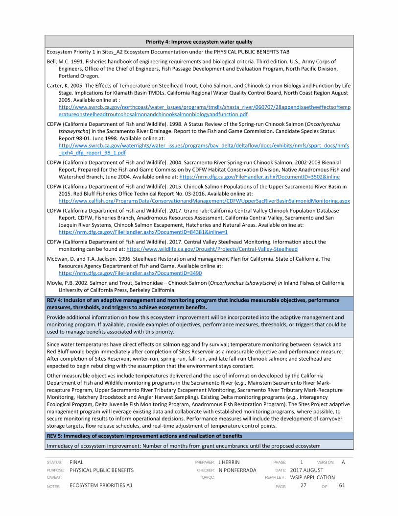
STATUS: FINAL PREPARER: J HERRIN PHASE: 1 VERSION: A PURPOSE: PHYSICAL PUBLIC BENEFITS CHECKER: N PONFERRADA DATE: 2017 AUGUST CAVEAT: QA/QC: REF/FILE #: WSIP APPLICATION NOTES: ECOSYSTEM PRIORITIES A1 PAGE: 27 OF 61
Priority 4: Improve ecosystem water quality
Ecosystem Priority 1 in Sites_A2 Ecosystem Documentation under the PHYSICAL PUBLIC BENEFITS TAB
Bell, M.C. 1991. Fisheries handbook of engineering requirements and biological criteria. Third edition. U.S., Army Corps of Engineers, Office of the Chief of Engineers, Fish Passage Development and Evaluation Program, North Pacific Division, Portland Oregon.
Carter, K. 2005. The Effects of Temperature on Steelhead Trout, Coho Salmon, and Chinook salmon Biology and Function by Life Stage. Implications for Klamath Basin TMDLs. California Regional Water Quality Control Board, North Coast Region August 2005. Available online at : http://www.swrcb.ca.gov/northcoast/water_issues/programs/tmdls/shasta_river/060707/28appendixaetheeffectsoftemperatureonsteelheadtroutcohosalmonandchinooksalmonbiologyandfunction.pdf
CDFW (California Department of Fish and Wildlife). 1998. A Status Review of the Spring-run Chinook Salmon (Oncorhynchus tshawytscha) in the Sacramento River Drainage. Report to the Fish and Game Commission. Candidate Species Status Report 98-01. June 1998. Available online at: http://www.swrcb.ca.gov/waterrights/water_issues/programs/bay_delta/deltaflow/docs/exhibits/nmfs/spprt_docs/nmfs_exh4_dfg_report_98_1.pdf
CDFW (California Department of Fish and Wildlife). 2004. Sacramento River Spring-run Chinook Salmon. 2002-2003 Biennial Report, Prepared for the Fish and Game Commission by CDFW Habitat Conservation Division, Native Anadromous Fish and Watershed Branch, June 2004. Available online at: https://nrm.dfg.ca.gov/FileHandler.ashx?DocumentID=3502&inline
CDFW (California Department of Fish and Wildlife). 2015. Chinook Salmon Populations of the Upper Sacramento River Basin in 2015. Red Bluff Fisheries Office Technical Report No. 03-2016. Available online at: http://www.calfish.org/ProgramsData/ConservationandManagement/CDFWUpperSacRiverBasinSalmonidMonitoring.aspx
CDFW (California Department of Fish and Wildlife). 2017. GrandTab: California Central Valley Chinook Population Database Report. CDFW, Fisheries Branch, Anadromous Resources Assessment, California Central Valley, Sacramento and San Joaquin River Systems, Chinook Salmon Escapement, Hatcheries and Natural Areas. Available online at: https://nrm.dfg.ca.gov/FileHandler.ashx?DocumentID=84381&inline=1
CDFW (California Department of Fish and Wildlife). 2017. Central Valley Steelhead Monitoring. Information about the monitoring can be found at: https://www.wildlife.ca.gov/Drought/Projects/Central-Valley-Steelhead
McEwan, D. and T.A. Jackson. 1996. Steelhead Restoration and management Plan for California. State of California, The Resources Agency Department of Fish and Game. Available online at: https://nrm.dfg.ca.gov/FileHandler.ashx?DocumentID=3490
Moyle, P.B. 2002. Salmon and Trout, Salmonidae – Chinook Salmon (Oncorhynchus tshawytscha) in Inland Fishes of California University of California Press, Berkeley California.
REV 4: Inclusion of an adaptive management and monitoring program that includes measurable objectives, performance measures, thresholds, and triggers to achieve ecosystem benefits.
Provide additional information on how this ecosystem improvement will be incorporated into the adaptive management and monitoring program. If available, provide examples of objectives, performance measures, thresholds, or triggers that could be used to manage benefits associated with this priority.
Since water temperatures have direct effects on salmon egg and fry survival; temperature monitoring between Keswick and Red Bluff would begin immediately after completion of Sites Reservoir as a measurable objective and performance measure. After completion of Sites Reservoir, winter-run, spring-run, fall-run, and late fall-run Chinook salmon; and steelhead are expected to begin rebuilding with the assumption that the environment stays constant.
Other measurable objectives include temperatures delivered and the use of information developed by the California Department of Fish and Wildlife monitoring programs in the Sacramento River (e.g., Mainstem Sacramento River Mark-recapture Program, Upper Sacramento River Tributary Escapement Monitoring, Sacramento River Tributary Mark-Recapture Monitoring, Hatchery Broodstock and Angler Harvest Sampling). Existing Delta monitoring programs (e.g., Interagency Ecological Program, Delta Juvenile Fish Monitoring Program, Anadromous Fish Restoration Program). The Sites Project adaptive management program will leverage existing data and collaborate with established monitoring programs, where possible, to secure monitoring results to inform operational decisions. Performance measures will include the development of carryover storage targets, flow release schedules, and real-time adjustment of temperature control points.
REV 5: Immediacy of ecosystem improvement actions and realization of benefits
Immediacy of ecosystem improvement: Number of months from grant encumbrance until the proposed ecosystem

STATUS: FINAL PREPARER: J HERRIN PHASE: 1 VERSION: A PURPOSE: PHYSICAL PUBLIC BENEFITS CHECKER: N PONFERRADA DATE: 2017 AUGUST CAVEAT: QA/QC: REF/FILE #: WSIP APPLICATION NOTES: ECOSYSTEM PRIORITIES A1 PAGE: 28 OF 61
Priority 4: Improve ecosystem water quality
improvement is completed (i.e. the expected timeframe until the improvement is implemented or construction is completed).
Initial benefits are expected in year 2028 (6 years after investment encumbrance for construction) at a lower level than when the project is complete. Full benefits are expected in 2030 (8 years after investment encumbrance).
Additional locations in the application, supporting documentation or attachments (document name, page number, table number, other) where the immediacy timeframe is described and quantified.
Sites_A3 Schedule under the FEASIBILITY AND IMPLEMENTATION RISK TAB.
Realization of ecosystem improvement: Number of months from the time the ecosystem improvement is completed (i.e. project is implemented or construction is complete), until the benefit associated with this priority can be observed (i.e. when measurable improvements can be observed and quantified)
NA
Additional locations in the application, supporting documentation or attachments (document name, page number, table number, other) where the realization timeframe is described and quantified.
NA
REV 6: Duration of ecosystem improvements
How long (number of years) after realization (as calculated under REV 5 above) is the ecosystem improvement expected to address this priority? Maximum is 100 years. Explain how this value was determined and whether the magnitude of the ecosystem improvement is anticipated to change over time.
Anticipated duration is 100 years. The magnitude is expected to change over time. The flows were determined using CALSIM modeling and results are provided for years 2030 and 2070.
Additional locations in the application, supporting documentation or attachments (document name, page number, table number, other) where the duration of the ecosystem improvement is described and quantified.
Sites_A5 Documentation under the BENEFIT CALCULATION, MONETIZATION, AND RESILIENCY TAB
REV 7: Consistency with species recovery plans and strategies, initiatives, and conservation plans
Does the ecosystem improvement meet any goals or objectives established in existing species recovery plans, initiatives, or conservation plans including but not limited to the NOAA Fisheries Recovery Plan for Sacramento River winter-run Chinook salmon, Central Valley spring-run Chinook salmon, and Central Valley steelhead; State Wildlife Action Plan; Central Valley Joint Venture Implementation Plan, San Joaquin County Multi-Species Habitat Conservation Plan and Open Space Plan, Draft Solano Multi-Species Habitat Conservation Plan, East Contra Costa County Habitat Conservation Plan/Natural Community Conservation Plan, Draft Recovery Plan for the Giant Garter Snake, and California Water Action Plan? If so which goals, objectives, or actions will be met? Why?
It addresses the following recovery plan action directly: Action SAR 1.4 Develop and implement a river flow management plan for the Sacramento River downstream of Shasta and Keswick dams that considers the effects of climate change and balances beneficial uses with the flow and water temperature needs of winter-run Chinook salmon, spring-run Chinook salmon, and steelhead.
The ecosystem improvement is also consistent with three of the proposed actions listed in the Sacramento Valley Salmon Resiliency Strategy. These actions are: (1) increase productivity by improving spawning and incubation conditions (habitat and water quality); (2) increase productivity by increasing juvenile salmonid survival; and (3) support the full range of juvenile and adult migration conditions to maintain life history diversity. The project will meet these actions by providing increased flows and management of intake diversions to benefit salmonids in the Sacramento River below Keswick Dam. The project will also enhance and improve the quality of Essential Fish Habitat (EFH) for Pacific Coast Salmon (all four runs of Chinook included; however steelhead is not part of EFH).
Additional locations in the application, supporting documentation or attachments (page number, table number, other) where the consistency with goals, objectives, or actions from recovery plans, initiative, or conservation plans are discussed.
Ecosystem Priority 1 in Sites_A2 Ecosystem Documentation under the PHYSICAL PUBLIC BENEFITS TAB

STATUS: FINAL PREPARER: J HERRIN PHASE: 1 VERSION: A PURPOSE: PHYSICAL PUBLIC BENEFITS CHECKER: N PONFERRADA DATE: 2017 AUGUST CAVEAT: QA/QC: REF/FILE #: WSIP APPLICATION NOTES: ECOSYSTEM PRIORITIES A1 PAGE: 29 OF 61
Priority 4: Improve ecosystem water quality
REV 8: Location of ecosystem improvements and connectivity to areas already being protected or managed for conservation values
Provide a map that shows the extent of the ecosystem improvement that will address this priority (e.g. river miles that meet the temperature benefits). Provide additional instructions or clarification to reviewers who will be viewing this map (i.e. describe the color and/or label that identifies the spatial extent of the ecosystem improvement). If available, also submit supporting electronic files such as a .kmz file or ArcGIS layer associated with the maps provided.
Figures A2-1 and A2-2 in Sites_A2 Ecosystem Documentation under the PHYSICAL PUBLIC BENEFITS TAB show the area of temperature improvement for the Sacramento River and the American River, respectively.
Explain why this location was selected in the context of local environmental conditions and the target constituent(s). Why was this location selected over other potential locations?
Locations are downstream from dams that have known salmonid populations downstream (Shasta, Oroville, and Folsom). Water from Sites Reservoir can be exchanged to develop more storage behind these reservoirs. Downstream from each of these dams are salmonid species natal habitat.
Is the ecosystem water quality improvement location adjacent to, or near, other areas already being protected or managed for conservation values? Explain the proximity of the ecosystem water quality improvement to other areas already being protected or managed for conservation values and any hydrologic connectivity that may occur between these locations.
The Project-related ecosystem improvements are adjacent or hydrologically-connected to Turtle Bay Exploration Park East – Bechelli and Anderson River Park. Location of the ecosystem improvement are adjacent to conservation areas or are hydrologically connected to Sacramento River Wildlife Area, Nimbus and American River Hatcheries, American River Parkway Effie Yeaw Nature Center, and Colusa-Sacramento River State Recreation Area.
Additional locations in the application (document name, page number, figure name or number, other) that describe the extent of the ecosystem water quality improvements, the proximity of claimed improvements to other areas already being protected or managed for conservation value, and the degree to which hydrologic connections (if any) occur between claimed improvements and areas already being protected or managed for conservation value.
NA
REV 9: Efficient use of water to achieve multiple ecosystem benefits
If applicable, how will water provided to address this priority be managed? Explain design efficiencies and operational strategies intended to maximize the efficiency of water allocated to ecosystem improvements that address this priority.
Water released for this purpose will be subsequently released out the Delta or will be recaptured using the Delevan Intake Pumping Plant and stored in Sites EESA storage. It could also be marketed to provide funds for operation and maintenance associated with the public benefits.
Additional locations in the application, supporting documentation or attachments (document name, page number, figure name or number, other) that describe the design efficiencies and operational strategies used to maximize water efficiency under this priority.
Ecosystem Priority 1 in Sites_A2_Ecosystem Documentation under the PHYSICAL PUBLIC BENEFITS TAB
REV 10: Resilience of ecosystem improvements to the effects of changing environmental conditions, including hydrologic variability and climate change.
Which environmental uncertainties associated with this priority were considered in the project siting, design, and operation? How were these uncertainties incorporated into project siting, design, or operation? Examples of environmental uncertainties include, but are not limited to: sea level rise, temperature changes, changes in precipitation, landslides, erosion, earthquakes, wildfires, drought events, and flooding events.
The primary uncertainty is climate change. Results for years 2030 and 2070 using the California Water Commission climate assumptions.
Additional locations in the application, supporting documentation or attachments (document name, page number, figure name or number, other) that describe and quantify the environmental uncertainties considered in the project siting, design, and

STATUS: FINAL PREPARER: J HERRIN PHASE: 1 VERSION: A PURPOSE: PHYSICAL PUBLIC BENEFITS CHECKER: N PONFERRADA DATE: 2017 AUGUST CAVEAT: QA/QC: REF/FILE #: WSIP APPLICATION NOTES: ECOSYSTEM PRIORITIES A1 PAGE: 30 OF 61
Priority 4: Improve ecosystem water quality
operation.
Draft EIR/EIS – posted at (https://www.sitesproject.org/information/DraftEIR-EIS)
Null, S. E., and J. H. Viers. 2013. In bad waters: Water year classification in nonstationary climates, Water Resources Research, 49, doi:10.1002/wrcr.20097.

STATUS: FINAL PREPARER: J HERRIN PHASE: 1 VERSION: A PURPOSE: PHYSICAL PUBLIC BENEFITS CHECKER: N PONFERRADA DATE: 2017 AUGUST CAVEAT: QA/QC: REF/FILE #: WSIP APPLICATION NOTES: ECOSYSTEM PRIORITIES A1 PAGE: 31 OF 61
Ecosystem Priority 5
Priority 5: Provide flows that increase dissolved oxygen and lower water temperatures to support anadromous fish passage
Species Information
What anadromous fish species are you targeting?
Winter-run Chinook salmon (O. tshawytscha; Sacramento River evolutionarily significant unit [ESU]); Spring-run Chinook salmon (O. tshawytscha; Central Valley ESU); Fall-run and Late fall-run Chinook salmon (O. tshawytscha; Central Valley ESU); steelhead (O. mykiss; Central Valley distinct population segment); resident native rainbow trout (O. mykiss), and other California native fish species.
Additional locations in the application, supporting documentation or attachments (document name, page number, table number, other) where the flow and dissolved oxygen needs of this species are described.
Draft EIR/EIS (http://www.sitesproject.org/information/DraftEIR-EIS) Appendix 12A: Aquatic Species Life Histories:
• Sacramento River Winter-run Chinook salmon: page numbers: 12A-2 to 12A-9 Status, adult migration and holding, spawning and egg incubation, juvenile rearing and migration, and Delta and estuarine rearing; Table 12A-1 Life stage occurrence in the Sacramento River and Table 12A-2 Migration and timing at monitoring stations on the Sacramento River; Figure 12A-1 Current and historical distribution, and critical habitat designation.
• Central Valley Spring-run Chinook salmon: page numbers: 12A-9 to 12A-14 Status, adult migration and holding, spawning and egg incubation, juvenile rearing and migration, and Delta and estuarine rearing; Table 12A-1 Life stage occurrence in the Sacramento River and Table 12A-2 Migration and timing at monitoring stations on the Sacramento River; Figure 12A-2 Current and historical distribution, and critical habitat designation.
• Central Valley Fall-run and Late fall-run Chinook salmon: page numbers: 12A-15 to 12A-18 Status, adult migration and holding, spawning and egg incubation, juvenile rearing and migration, and Delta and estuarine rearing; Table 12A-1 Life stage occurrence in the Sacramento River and Table 12A-2 Migration and timing at monitoring stations on the Sacramento River; Figure 12A-3 Current and historical distribution.
• Central Valley steelhead: page numbers: 12A-19 to 12A-24 Status, adult migration and holding, spawning and egg incubation, juvenile rearing and migration, and Delta and estuarine rearing; Table 12A-1 Life stage occurrence in the Sacramento River; Figure 12A-4 Current and historical distribution, and critical habitat designation.
The Draft EIR/EIS has a different without Project conditions and operation than was used for WSIP; however, there is discussion in the Draft EIR/EIS Appendix 12C: Fisheries Impacts Summary concerning thermal and flow-related benefits to fish: Sacramento River Winter-run Chinook salmon, pages 12C-116 to 12C-117; Spring-run Chinook salmon, pages 12C-117 to 12C-118; Fall-run Chinook salmon, pages 12C-118 to 12C-119; Late fall-run Chinook salmon, pages 12C-119 to 12C-120; and Steelhead, pages 12C-120 to 12C-121.
REV 2: Magnitude of ecosystem improvements
What is the expected magnitude of the ecosystem improvement that will address this priority? Magnitude should be expressed as: a) the change from current conditions without the project to current conditions with the project, and b) the change from 2030 conditions without the project to 2030 conditions with the project. How did you estimate this value?
If the project will benefit multiple anadromous fish species, the magnitude of the ecosystem improvement for each species needs to be provided.
Temperature improvements were estimated using Upper Sacramento River HEC5Q model and the American RiverCE QUAL-W2 Model, Long-term average temperatures generally dropped from 0.1oF to 0.5oF between Keswick Dam and Bend Bridge.
The proposed project’s improved flow management will promote more suitable water temperatures and provide an increased dissolved oxygen levels for rearing juvenile Winter-run, Fall-run, and Late fall-run Chinook salmon in the mainstem of the Sacramento River below Keswick Dam by increasing the coldwater pool at Shasta Lake.
Additional locations in the application, supporting documentation or attachments (document name, page number, table number, other) where the magnitude of the ecosystem improvement is described and quantified.
Ecosystem Priority 1 in Sites_A2 Ecosystem Documentation under the PHYSICAL PUBLIC BENEFITS TAB

STATUS: FINAL PREPARER: J HERRIN PHASE: 1 VERSION: A PURPOSE: PHYSICAL PUBLIC BENEFITS CHECKER: N PONFERRADA DATE: 2017 AUGUST CAVEAT: QA/QC: REF/FILE #: WSIP APPLICATION NOTES: ECOSYSTEM PRIORITIES A1 PAGE: 32 OF 61
Priority 5: Provide flows that increase dissolved oxygen and lower water temperatures to support anadromous fish passage
REV 3: Spatial and temporal scale of ecosystem improvements.
What is the geographical extent (e.g., river miles, acres) of the ecosystem improvement that will address this priority?
An approximately 59 river-miles (RM) of the Sacramento River from Keswick Dam (RM 302.0) down to Red Bluff (RM 243.0) was modeled for current (2015) and 2030 conditions using SALMOD with and without the project to identify and predict spatial and temporal improvements to habitat that can be quantified for suitability for in-river rearing and downstream migration of salmonids. The benefit to salmonid redds would occur in the uppermost part of mainstem Sacramento River since greater than 90 percent of spawning (specifically winter-run Chinook Salmon) occurs approximately 10.2 river miles between Keswick Dam and Bonnyview Bridge. There could potentially be additional benefits to salmonids that may occur downstream of Red Bluff but this was not modeled; similarly, benefits are also expected in the Feather River downstream from Oroville Dam but this was also not modeled.
Additional locations in the application, supporting documentation or attachments (document name, page number, figure name or number, other) where the geographical extent of the ecosystem improvement is documented or mapped.
Ecosystem Priority 1 and 2 in Sites_A2 Ecosystem Documentation under the PHYSICAL PUBLIC BENEFITS TAB
When during the year will flows that increase dissolved oxygen and lower water temperatures to support anadromous fish passage be provided? How are dissolved oxygen and water temperature likely to vary with hydrologic conditions (i.e. among water year types) a) under current conditions with and without the project, and b) in 2030 with and without the project?
If the ecosystem improvement will benefit multiple anadromous species, provide the timing of ecosystem improvements for each species separately.
Chemical composition of water varies greatly depending on season, time of day, location and depth (Dowling and Wiley 1986). Dissolved oxygen in streams is closely correlated with temperature fluctuations and varying flow conditions. Studies of large rivers and small streams show that high temperature and slow flowing water holds less oxygen. Based on results of these studies, the Project’s improved flow management will promote more suitable water temperatures and provide increased dissolved oxygen levels for rearing juvenile Winter-run, Fall-run, and Late fall-run Chinook salmon in the mainstem of the Sacramento River below Keswick Dam by releasing the increased coldwater from Shasta Lake in the mainstem Sacramento River used by spawning winter-run Chinook Salmon from Keswick Dam to Clear Creek. By 2030, the Project will increase flows from October through March with the greatest increase in the fall. The average flows for dry years are higher than the long-term average, with increases of 9% under current conditions and 11.9% in 2030.
Dowling, D.C. and M.J. Wiley. 1986. The effects of dissolved oxygen, temperature, and low stream flow on fishes: A literature review. Aquatic Biological Section Technical Report. Springfield City Water, Light, and Power Company.
Additional locations in the application (document name, page number, table number, other) where the timing of flow releases associated with this benefit are documented.
Draft EIR/EIS Appendix 12C: Fisheries Impacts Summary
REV 4: Inclusion of an adaptive management and monitoring program that includes measurable objectives, performance measures, thresholds, and triggers to achieve ecosystem benefits.
Provide additional information on how this ecosystem improvement will be incorporated into the adaptive management and monitoring program. If available, provide examples of objectives, performance measures, thresholds, or triggers that could be used to manage benefits associated with this priority.
After completion of Sites Reservoir, Winter-run, Spring-run, Fall-run, and Late fall-run Chinook salmon and steelhead are expected to begin rebuilding with the assumption that the environment stays constant.
Measurable objectives include reduced temperatures, increased dissolved oxygen levels, and increased numbers of eggs and rearing juveniles in the Upper Reaches of the Sacramento River. Temperature and dissolved oxygen level data from monitoring programs (e.g., Mainstem Sacramento River Mark-recapture Program, Upper Sacramento River Tributary Escapement Monitoring, Sacramento River Tributary Mark-Recapture Monitoring, Hatchery Broodstock and Angler Harvest Sampling) currently proposed by the California Department of Fish and Wildlife in the Sacramento River as well as existing Delta monitoring programs (e.g., Interagency Ecological Program, Delta Juvenile Fish Monitoring Program, Anadromous Fish Restoration Program) can also be incorporated in the adaptive management program for the Project. Performance measures include the timing water releases from Shasta, Oroville, and Folsom to maximize benefits of the project to salmonid fish species.

STATUS: FINAL PREPARER: J HERRIN PHASE: 1 VERSION: A PURPOSE: PHYSICAL PUBLIC BENEFITS CHECKER: N PONFERRADA DATE: 2017 AUGUST CAVEAT: QA/QC: REF/FILE #: WSIP APPLICATION NOTES: ECOSYSTEM PRIORITIES A1 PAGE: 33 OF 61
Priority 5: Provide flows that increase dissolved oxygen and lower water temperatures to support anadromous fish passage
REV 5: Immediacy of ecosystem improvement actions and realization of benefits
Immediacy of ecosystem improvement: Number of months from grant encumbrance until the proposed ecosystem improvement is completed (i.e. the expected timeframe until the improvement is implemented or construction is completed).
Initial benefits are expected in year 2028 (6 years after grant encumbrance for construction) at a lower level than when the project is complete. Full benefits are expected in 2030 (8 years after grant encumbrance).
Additional locations in the application, supporting documentation or attachments (document name, page number, table number, other) where the immediacy timeframe is described and quantified.
Sites_A3 Schedule under the FEASIBILITY AND IMPLEMENTATION RISK TAB.
Realization of ecosystem improvement: Number of months from the time the ecosystem improvement is completed (i.e. project is implemented or construction is complete), until the benefit associated with this priority can be observed (i.e. when measurable improvements can be observed and quantified)
After the first full spawning season (2030), a quantifiable improvement in the Sacramento River from Keswick to Battle Creek would benefit all four runs of Chinook salmon and steelhead approximately three to four years later (2033 to 2034) when the 2030 cohort returns to spawn.
Additional locations in the application, supporting documentation or attachments (document name, page number, table number, other) where the realization timeframe is described and quantified.
NA
REV 6: Duration of ecosystem improvements
How long (number of years) after realization (as calculated under REV 5 above) is the ecosystem improvement expected to address this priority? Maximum is 100 years. Explain how this value was determined and whether the magnitude of the ecosystem improvement is anticipated to change over time.
Anticipated duration is 100 years. The magnitude of flow augmentation is expected to change over time. The flows were determined using CALSIM modeling and Upper Sacramento River HEC5 temperature model. Compared to current conditions, the long-term average flow will increase by 228 thousand acre feet (TAF) by 2030 and by 157 TAF by 2070.
Additional locations in the application, supporting documentation or attachments (document name, page number, table number, other) where the duration of the ecosystem improvement is described and quantified.
Sites_A5 Documentation under the BENEFIT CALCULATION, MONETIZATION, AND RESILIENCY TAB
REV 7: Consistency with species recovery plans and strategies, initiatives, and conservation plans
Does the ecosystem improvement meet any goals or objectives established in existing species recovery plans, initiatives, or conservation plans including but not limited to the NOAA Fisheries Recovery Plan for Sacramento River winter-run Chinook salmon, Central Valley spring-run Chinook salmon, and Central Valley steelhead; State Wildlife Action Plan; Central Valley Joint Venture Implementation Plan, San Joaquin County Multi-Species Habitat Conservation Plan and Open Space Plan, Draft Solano Multi-Species Habitat Conservation Plan, East Contra Costa County Habitat Conservation Plan/Natural Community Conservation Plan, Draft Recovery Plan for the Giant Garter Snake, and California Water Action Plan? If so which goals, objectives, or actions will be met? Why?
The Project will address the following recovery plan action directly: Action SAR 1.4 Develop and implement a river flow management plan for the Sacramento River downstream of Shasta and Keswick dams that considers the effects of climate change and balances beneficial uses with the flow and water temperature needs of winter-run Chinook salmon, spring-run Chinook salmon, and steelhead.
The ecosystem improvement is also consistent with three of the proposed actions listed in the Sacramento Valley Salmon Resiliency Strategy. These actions are:
• increase productivity by improving spawning and incubation conditions (habitat and water quality)
• increase productivity by increasing juvenile salmonid survival
• support the full range of juvenile and adult migration conditions to maintain life history diversity.

STATUS: FINAL PREPARER: J HERRIN PHASE: 1 VERSION: A PURPOSE: PHYSICAL PUBLIC BENEFITS CHECKER: N PONFERRADA DATE: 2017 AUGUST CAVEAT: QA/QC: REF/FILE #: WSIP APPLICATION NOTES: ECOSYSTEM PRIORITIES A1 PAGE: 34 OF 61
Priority 5: Provide flows that increase dissolved oxygen and lower water temperatures to support anadromous fish passage
The Project will meet these actions by providing increased flows and management of intake diversions to benefit salmonids in the Sacramento River below Keswick Dam. The Project will also enhance and improve the quality of Essential Fish Habitat (EFH) for Pacific Coast Salmon (all four runs of Chinook).
Additional locations in the application, supporting documentation or attachments (page number, table number, other) where the consistency with goals, objectives, or actions from recovery plans, initiative, or conservation plans are discussed.
Ecosystem Priority 1 in Sites_A2 Ecosystem Documentation under the PHYSICAL PUBLIC BENEFITS TAB
NMFS. 2014a. California Central Valley Salmon & Steelhead Recovery Plan. Available online at: http://www.westcoast.fisheries.noaa.gov/protected_species/salmon_steelhead/recovery_planning_and_implementation/california_central_valley/california_central_valley_recovery_plan_documents.html
58 FR 33212. Endangered and Threatened Species: Winter-run Chinook Salmon. Final Rule, Vol. 58, No. 114. Federal Register 33212. Wednesday, June 16, 1993, Rules and Regulations. Available online at: http://ecos.fws.gov/docs/federal_register/fr2311.pdf
70 FR 52488. Endangered and Threatened Species: Designation of Critical Habitat for Seven Evolutionarily Significant Units of Pacific Salmon and Steelhead in California. Final Rule, Vol. 70, No. 170. Federal Register 52488. Friday, September 2, 2005, Rules and Regulations. Available online at: http://www.fws.gov/carlsbad/SpeciesStatusList/CH/20050902_fch_SCSH.pdf
REV 8: Location of ecosystem improvements and connectivity to areas already being protected or managed for conservation values
Provide a map that shows the extent of the ecosystem improvement that will address this priority (e.g. river miles that meet the temperature benefits). Provide additional instructions or clarification to reviewers who will be viewing this map (i.e. describe the color and/or label that identifies the spatial extent of the ecosystem improvement). If available, also submit supporting electronic files such as a .kmz file or ArcGIS layer associated with the maps provided.
Figures A2-1 and A2-2 in Sites_A2 Ecosystem Documentation under the PHYSICAL PUBLIC BENEFITS TAB show the area of temperature improvement for the Sacramento River and the American River, respectively.
Explain why this location was selected. How is the location beneficial to the targeted species in the context of local environmental conditions and the target species' needs?
Locations are downstream from dams that have known salmonid populations downstream (Shasta, Oroville, and Folsom). Water from Sites Reservoir can be exchanged to develop more storage behind these reservoirs. Downstream from each of these dams are salmonid species natal habitat.
Does the improvement location occur adjacent to or near any other areas already being protected or managed for conservation values? Explain the proximity of improvements to other areas already being protected or managed for conservation values and the distance between them and your claimed improvements. Explain any hydrologic connectivity that may occur between these locations (if any).
Location of the ecosystem improvement are adjacent to conservation areas or are hydrologically connected to Sacramento River Wildlife Area, Nimbus and American River Hatcheries, American River Parkway, Stone Lakes National Wildlife Refuge, Vic Fazio Yolo Wildlife Area, Bidwell-Sacramento River State Park, Colusa-Sacramento River State Recreation Area, Brannan Island State Recreation Area and Delta Meadows.
Will flows provided allow full passage to the targeted species in all year types?
Flows would be physically accessible in all water year types (greater in above normal, below normal, and dry years). There would be no barriers between the targeted species and ecosystem improvements.
Additional locations in the application (document name, page number, figure name or number, other) that describe the extent of the flow benefits, the proximity of claimed improvements to other areas already being protected or managed for conservation value, and the degree to which hydrologic connections (if any) occur between claimed improvements and areas already being protected or managed for conservation value.
Draft EIR/EIS Appendix 12A; Ecosystem Priority 2 in Sites_A2 Ecosystem Documentation under the PHYSICAL PUBLIC BENEFITS TAB
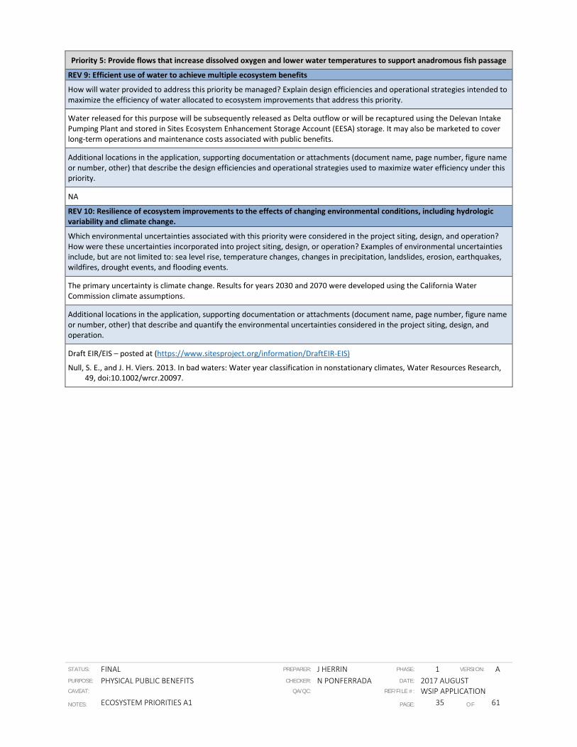
STATUS: FINAL PREPARER: J HERRIN PHASE: 1 VERSION: A PURPOSE: PHYSICAL PUBLIC BENEFITS CHECKER: N PONFERRADA DATE: 2017 AUGUST CAVEAT: QA/QC: REF/FILE #: WSIP APPLICATION NOTES: ECOSYSTEM PRIORITIES A1 PAGE: 35 OF 61
Priority 5: Provide flows that increase dissolved oxygen and lower water temperatures to support anadromous fish passage
REV 9: Efficient use of water to achieve multiple ecosystem benefits
How will water provided to address this priority be managed? Explain design efficiencies and operational strategies intended to maximize the efficiency of water allocated to ecosystem improvements that address this priority.
Water released for this purpose will be subsequently released as Delta outflow or will be recaptured using the Delevan Intake Pumping Plant and stored in Sites Ecosystem Enhancement Storage Account (EESA) storage. It may also be marketed to cover long-term operations and maintenance costs associated with public benefits.
Additional locations in the application, supporting documentation or attachments (document name, page number, figure name or number, other) that describe the design efficiencies and operational strategies used to maximize water efficiency under this priority.
NA
REV 10: Resilience of ecosystem improvements to the effects of changing environmental conditions, including hydrologic variability and climate change.
Which environmental uncertainties associated with this priority were considered in the project siting, design, and operation? How were these uncertainties incorporated into project siting, design, or operation? Examples of environmental uncertainties include, but are not limited to: sea level rise, temperature changes, changes in precipitation, landslides, erosion, earthquakes, wildfires, drought events, and flooding events.
The primary uncertainty is climate change. Results for years 2030 and 2070 were developed using the California Water Commission climate assumptions.
Additional locations in the application, supporting documentation or attachments (document name, page number, figure name or number, other) that describe and quantify the environmental uncertainties considered in the project siting, design, and operation.
Draft EIR/EIS – posted at (https://www.sitesproject.org/information/DraftEIR-EIS)
Null, S. E., and J. H. Viers. 2013. In bad waters: Water year classification in nonstationary climates, Water Resources Research, 49, doi:10.1002/wrcr.20097.
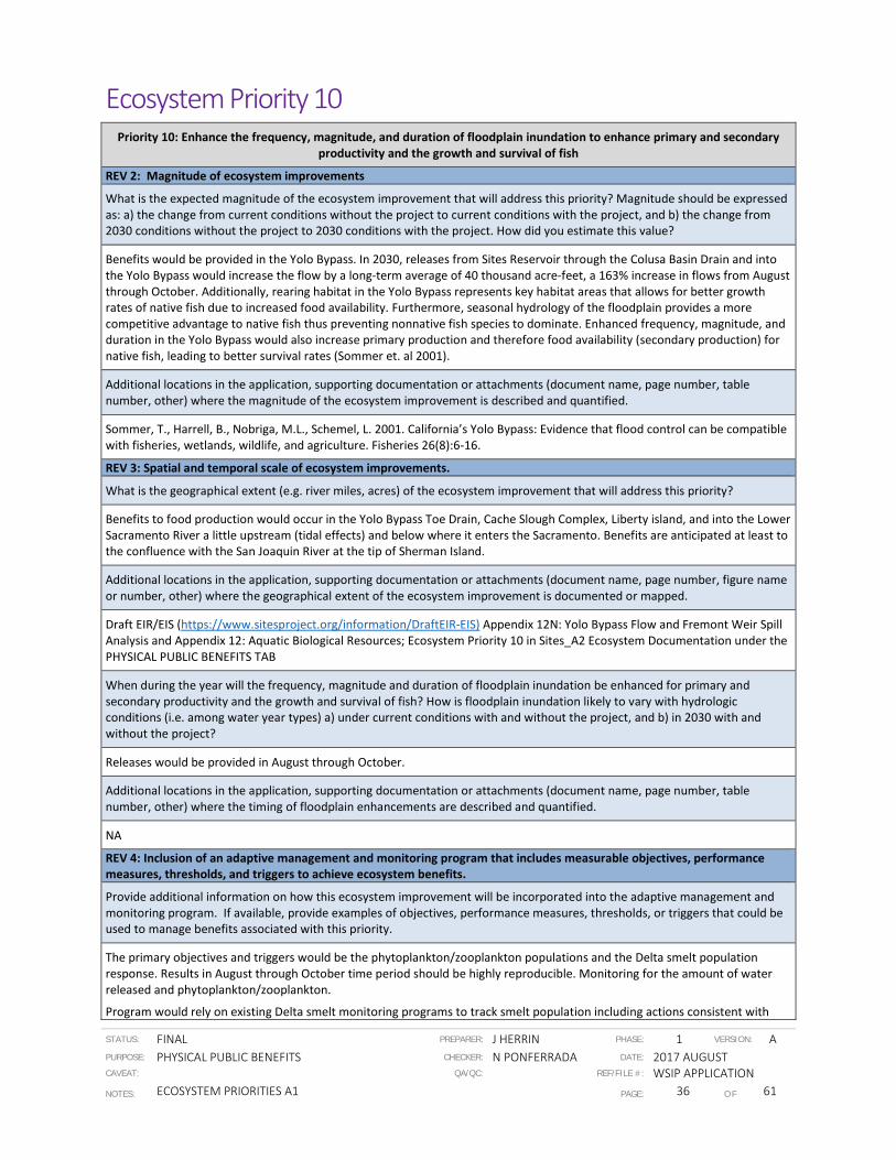
STATUS: FINAL PREPARER: J HERRIN PHASE: 1 VERSION: A PURPOSE: PHYSICAL PUBLIC BENEFITS CHECKER: N PONFERRADA DATE: 2017 AUGUST CAVEAT: QA/QC: REF/FILE #: WSIP APPLICATION NOTES: ECOSYSTEM PRIORITIES A1 PAGE: 36 OF 61
Ecosystem Priority 10
Priority 10: Enhance the frequency, magnitude, and duration of floodplain inundation to enhance primary and secondary productivity and the growth and survival of fish
REV 2: Magnitude of ecosystem improvements
What is the expected magnitude of the ecosystem improvement that will address this priority? Magnitude should be expressed as: a) the change from current conditions without the project to current conditions with the project, and b) the change from 2030 conditions without the project to 2030 conditions with the project. How did you estimate this value?
Benefits would be provided in the Yolo Bypass. In 2030, releases from Sites Reservoir through the Colusa Basin Drain and into the Yolo Bypass would increase the flow by a long-term average of 40 thousand acre-feet, a 163% increase in flows from August through October. Additionally, rearing habitat in the Yolo Bypass represents key habitat areas that allows for better growth rates of native fish due to increased food availability. Furthermore, seasonal hydrology of the floodplain provides a more competitive advantage to native fish thus preventing nonnative fish species to dominate. Enhanced frequency, magnitude, and duration in the Yolo Bypass would also increase primary production and therefore food availability (secondary production) for native fish, leading to better survival rates (Sommer et. al 2001).
Additional locations in the application, supporting documentation or attachments (document name, page number, table number, other) where the magnitude of the ecosystem improvement is described and quantified.
Sommer, T., Harrell, B., Nobriga, M.L., Schemel, L. 2001. California’s Yolo Bypass: Evidence that flood control can be compatible with fisheries, wetlands, wildlife, and agriculture. Fisheries 26(8):6-16.
REV 3: Spatial and temporal scale of ecosystem improvements.
What is the geographical extent (e.g. river miles, acres) of the ecosystem improvement that will address this priority?
Benefits to food production would occur in the Yolo Bypass Toe Drain, Cache Slough Complex, Liberty island, and into the Lower Sacramento River a little upstream (tidal effects) and below where it enters the Sacramento. Benefits are anticipated at least to the confluence with the San Joaquin River at the tip of Sherman Island.
Additional locations in the application, supporting documentation or attachments (document name, page number, figure name or number, other) where the geographical extent of the ecosystem improvement is documented or mapped.
Draft EIR/EIS (https://www.sitesproject.org/information/DraftEIR-EIS) Appendix 12N: Yolo Bypass Flow and Fremont Weir Spill Analysis and Appendix 12: Aquatic Biological Resources; Ecosystem Priority 10 in Sites_A2 Ecosystem Documentation under the PHYSICAL PUBLIC BENEFITS TAB
When during the year will the frequency, magnitude and duration of floodplain inundation be enhanced for primary and secondary productivity and the growth and survival of fish? How is floodplain inundation likely to vary with hydrologic conditions (i.e. among water year types) a) under current conditions with and without the project, and b) in 2030 with and without the project?
Releases would be provided in August through October.
Additional locations in the application, supporting documentation or attachments (document name, page number, table number, other) where the timing of floodplain enhancements are described and quantified.
NA
REV 4: Inclusion of an adaptive management and monitoring program that includes measurable objectives, performance measures, thresholds, and triggers to achieve ecosystem benefits.
Provide additional information on how this ecosystem improvement will be incorporated into the adaptive management and monitoring program. If available, provide examples of objectives, performance measures, thresholds, or triggers that could be used to manage benefits associated with this priority.
The primary objectives and triggers would be the phytoplankton/zooplankton populations and the Delta smelt population response. Results in August through October time period should be highly reproducible. Monitoring for the amount of water released and phytoplankton/zooplankton.
Program would rely on existing Delta smelt monitoring programs to track smelt population including actions consistent with

STATUS: FINAL PREPARER: J HERRIN PHASE: 1 VERSION: A PURPOSE: PHYSICAL PUBLIC BENEFITS CHECKER: N PONFERRADA DATE: 2017 AUGUST CAVEAT: QA/QC: REF/FILE #: WSIP APPLICATION NOTES: ECOSYSTEM PRIORITIES A1 PAGE: 37 OF 61
Priority 10: Enhance the frequency, magnitude, and duration of floodplain inundation to enhance primary and secondary productivity and the growth and survival of fish
Delta Smelt Resiliency Strategy (California Natural Resources Agency, July, 2016) as well as adaptive measures would include changes in the timing of releases, the duration and magnitude of the pulse, and the magnitude of the pulse (in cfs).
REV 5: Immediacy of ecosystem improvement actions and realization of benefits
Immediacy of ecosystem improvement: Number of months from grant encumbrance until the proposed ecosystem improvement is completed (i.e. the expected timeframe until the improvement is implemented or construction is completed).
Improvement is expected to begin in 2026 with initial pulse through the Colusa Basin Drain (48 months after grant encumbrance). Full scale operations expected in 2030.
Additional locations in the application, supporting documentation or attachments (document name, page number, table number, other) where the immediacy timeframe is described and quantified.
Sites_A3 Schedule under the FEASIBILITY AND IMPLEMENTATION RISK TAB.
Realization of ecosystem improvement: Number of months from the time the ecosystem improvement is completed (i.e. project is implemented or construction is complete), until the benefit associated with this priority can be observed (i.e. when measurable improvements can be observed and quantified)
Full realization of phytoplankton and zooplankton population improvements are anticipated in 2030, and then 2031 for improvements of Delta smelt population because of their annual life history strategy.
Additional locations in the application, supporting documentation or attachments (document name, page number, table number, other) where the realization timeframe is described and quantified.
Ecosystem Priority 10 in Sites_A2 Ecosystem Documentation under the PHYSICAL PUBLIC BENEFITS TAB
REV 6: Duration of ecosystem improvements
How long (number of years) after realization (as calculated under REV 5 above) is the ecosystem improvement expected to address this priority? Maximum is 100 years. Explain how this value was determined and whether the magnitude of the ecosystem improvement is anticipated to change over time.
The duration of the improvement is expected to be 90 years (Operations and Maintenance period for the project per the planning horizon used in the application).
Additional locations in the application, supporting documentation or attachments (document name, page number, table number, other) where the duration of the ecosystem improvement is described and quantified.
NA
REV 7: Consistency with species recovery plans and strategies, initiatives, and conservation plans
Does the ecosystem improvement meet any goals or objectives established in existing species recovery plans, initiatives, or conservation plans including but not limited to the NOAA Fisheries Recovery Plan for Sacramento River winter-run Chinook salmon, Central Valley spring-run Chinook salmon, and Central Valley steelhead; State Wildlife Action Plan; Central Valley Joint Venture Implementation Plan, San Joaquin County Multi-Species Habitat Conservation Plan and Open Space Plan, Draft Solano Multi-Species Habitat Conservation Plan, East Contra Costa County Habitat Conservation Plan/Natural Community Conservation Plan, Draft Recovery Plan for the Giant Garter Snake, and California Water Action Plan? If so which goals, objectives, or actions will be met? Why?
Action is consistent with Delta Smelt Resiliency Strategy (California Natural Resources Agency, July, 2016), specifically the north Delta foodweb adaptive management projects juvenile and sub-adult Delta Smelt and their habitats including food availability and quantity.
Additional locations in the application, supporting documentation or attachments (page number, table number, other) where the consistency with goals, objectives, or actions from recovery plans, initiative, or conservation plans are discussed.
California Natural Resources. 2016. Delta Smelt Resiliency Strategy. July 2016.
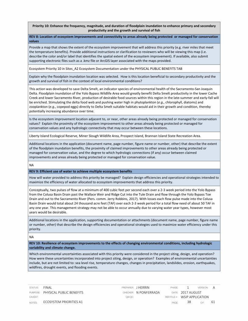
STATUS: FINAL PREPARER: J HERRIN PHASE: 1 VERSION: A PURPOSE: PHYSICAL PUBLIC BENEFITS CHECKER: N PONFERRADA DATE: 2017 AUGUST CAVEAT: QA/QC: REF/FILE #: WSIP APPLICATION NOTES: ECOSYSTEM PRIORITIES A1 PAGE: 38 OF 61
Priority 10: Enhance the frequency, magnitude, and duration of floodplain inundation to enhance primary and secondary productivity and the growth and survival of fish
REV 8: Location of ecosystem improvements and connectivity to areas already being protected or managed for conservation values
Provide a map that shows the extent of the ecosystem improvement that will address this priority (e.g. river miles that meet the temperature benefits). Provide additional instructions or clarification to reviewers who will be viewing this map (i.e. describe the color and/or label that identifies the spatial extent of the ecosystem improvement). If available, also submit supporting electronic files such as a .kmz file or ArcGIS layer associated with the maps provided.
Ecosystem Priority 10 in Sites_A2 Ecosystem Documentation under the PHYSICAL PUBLIC BENEFITS TAB
Explain why the floodplain inundation location was selected. How is this location beneficial to secondary productivity and the growth and survival of fish in the context of local environmental conditions?
This action was developed to save Delta Smelt, an indicator species of environmental health of the Sacramento-San Joaquin Delta. Floodplain inundation of the Yolo Bypass Wildlife Area would greatly benefit Delta Smelt productivity in the lower Cache Creek and lower Sacramento River, production of desirable food sources within this region in the late-summer and early-fall will be enriched. Stimulating the delta food web and pushing water high in phytoplankton (e.g., chlorophyll, diatoms) and zooplankton (e.g., copepod eggs) directly to Delta Smelt suitable habitats would aid in their growth and condition, thereby potentially increasing abundance over time.
Is the ecosystem improvement location adjacent to, or near, other areas already being protected or managed for conservation values? Explain the proximity of the ecosystem improvement to other areas already being protected or managed for conservation values and any hydrologic connectivity that may occur between these locations.
Liberty Island Ecological Reserve, Miner Slough Wildlife Area, Prospect Island, Brannan Island State Recreation Area.
Additional locations in the application (document name, page number, figure name or number, other) that describe the extent of the floodplain inundation benefits, the proximity of claimed improvements to other areas already being protected or managed for conservation value, and the degree to which hydrologic connections (if any) occur between claimed improvements and areas already being protected or managed for conservation value.
NA
REV 9: Efficient use of water to achieve multiple ecosystem benefits
How will water provided to address this priority be managed? Explain design efficiencies and operational strategies intended to maximize the efficiency of water allocated to ecosystem improvements that address this priority.
Conceptually, two pulses of flow at a minimum of 400 cubic feet per second each over a 2-3 week period into the Yolo Bypass from the Colusa Basin Drain past the Wallace Weir and Ridge Cut into the Tule Drain and flow through the Yolo Bypass Toe Drain and out to the Sacramento River (Pers. comm. Jerry Robbins, 2017). With losses each flow pulse made into the Colusa Basin Drain would total about 24 thousand acre feet (TAF) over each 2-3 week period for a total flow need of about 50 TAF in any one year. This management strategy may not be able to occur annually due to varying water year types, however most years would be desirable.
Additional locations in the application, supporting documentation or attachments (document name, page number, figure name or number, other) that describe the design efficiencies and operational strategies used to maximize water efficiency under this priority.
NA
REV 10: Resilience of ecosystem improvements to the effects of changing environmental conditions, including hydrologic variability and climate change.
Which environmental uncertainties associated with this priority were considered in the project siting, design, and operation? How were these uncertainties incorporated into project siting, design, or operation? Examples of environmental uncertainties include, but are not limited to: sea level rise, temperature changes, changes in precipitation, landslides, erosion, earthquakes, wildfires, drought events, and flooding events.
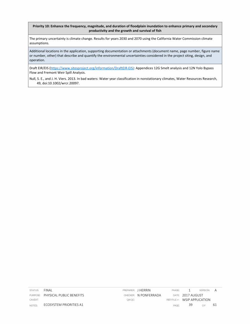
STATUS: FINAL PREPARER: J HERRIN PHASE: 1 VERSION: A PURPOSE: PHYSICAL PUBLIC BENEFITS CHECKER: N PONFERRADA DATE: 2017 AUGUST CAVEAT: QA/QC: REF/FILE #: WSIP APPLICATION NOTES: ECOSYSTEM PRIORITIES A1 PAGE: 39 OF 61
Priority 10: Enhance the frequency, magnitude, and duration of floodplain inundation to enhance primary and secondary productivity and the growth and survival of fish
The primary uncertainty is climate change. Results for years 2030 and 2070 using the California Water Commission climate assumptions.
Additional locations in the application, supporting documentation or attachments (document name, page number, figure name or number, other) that describe and quantify the environmental uncertainties considered in the project siting, design, and operation.
Draft EIR/EIS (https://www.sitesproject.org/information/DraftEIR-EIS): Appendices 12G Smelt analysis and 12N Yolo Bypass Flow and Fremont Weir Spill Analysis.
Null, S. E., and J. H. Viers. 2013. In bad waters: Water year classification in nonstationary climates, Water Resources Research, 49, doi:10.1002/wrcr.20097.

STATUS: FINAL PREPARER: J HERRIN PHASE: 1 VERSION: A PURPOSE: PHYSICAL PUBLIC BENEFITS CHECKER: N PONFERRADA DATE: 2017 AUGUST CAVEAT: QA/QC: REF/FILE #: WSIP APPLICATION NOTES: ECOSYSTEM PRIORITIES A1 PAGE: 40 OF 61
Ecosystem Priority 11
Priority 11: Enhance the temporal and spatial distribution and diversity of habitats to support all life stages of fish and wildlife species
REV 2: Magnitude of ecosystem improvements
What is the expected magnitude of the ecosystem improvement that will address this priority? Magnitude should be expressed as: a) the change from current conditions without the project to current conditions with the project, and b) the change from 2030 conditions without the project to 2030 conditions with the project. How did you estimate this value?
Magnitude of temporal and spatial distribution and diversity of habitats will support native fishes in the Sacramento River and Yolo Bypass as described in sections below and throughout this worksheet:
In the Sacramento River, temperature improvements were estimated using Upper Sacramento River HEC5Q model and the American River CE QUAL-W2 Model Sites Reservoir would provide a 4.4% (372 cubic feet per second [cfs ]) long term average increase in flows in the Sacramento River at the point of diversion near Colusa that will provide habitat diversity to support fish south of the spawning area. Model results using different water year types show that there is a 7.4% (376 cfs) increase in flows in below normal years and 9% (343 cfs) increase in flows in dry years. In 2030, there is a 2.5% (228 cfs) long term average increase in flows and an 11.9% (474 cfs) increase in dry year flows. These increased flows would provide beneficial results such as a more suitable water temperature for egg incubation and fry (alevin) rearing would lead to higher survival rates of eggs and fry. Typically development of flow management standards include establishment of suitable water temperatures for fish; therefore, flow releases are managed and adjusted to improve conditions for salmon and steelhead by maintaining sufficiently low water temperatures suitable for egg incubation and fry development.
Fall-run, late fall-run and winter-run Chinook salmon would greatly benefit from more flows and suitable water temperatures in the Sacramento River below Keswick Dam and at Bonnyview Bridge specifically during egg incubation period in the month of September in critical years. Spatial and temporal distribution of habitats in the Yolo Bypass in 2030 will be enhanced from 163% increase in average flows from August through October totaling 40 thousand acre-feet. Additionally, rearing habitat in the Yolo Bypass represents key habitat areas that allows for better growth rates of native fish due to increased food availability. Furthermore, seasonal hydrology of the floodplain provides a more competitive advantage to native fish thus preventing nonnative fish species to dominate. Enhanced frequency, magnitude, and duration in the Yolo Bypass would also increase primary production and therefore food availability (secondary production) for native fish, leading to better survival rates (Sommer et. al 2001).
Additional locations in the application, supporting documentation or attachments (document name, page number, table number, other) where the magnitude of the ecosystem improvement is described and quantified.
Sommer, T., Harrell, B., Nobriga, M. L., Schemel, L. 2001. California’s Yolo Bypass: Evidence that flood control can be compatible with fisheries, wetlands, wildlife, and agriculture. Fisheries 26(8):6-16.
REV 3: Spatial and temporal scale of ecosystem improvements.
What is the geographical extent (e.g., river miles, acres) of the ecosystem improvement that will address this priority?
The spawning distribution of winter-run Chinook Salmon in the mainstem Sacramento River defines the spatial distribution of incubating eggs, alevins, and swim-up fry. Historical spawning data indicate that winter-run spawning occurred from Keswick Dam (River Mile [RM] 302.0) downstream to the site of Red Bluff Diversion Dam (RM 243.0), a distance of 59 miles. More recent data, however, indicate that the spawning distribution has substantially changed. Aerial redd survey data on winter-run Chinook Salmon in-river spawning from 2003 to 2015 indicate that virtually all spawning occurs from Keswick Dam downstream to Clear Creek (RM 289.3), a short distance of only 12.7 miles (U.S. Bureau of Reclamation 2016 , page 7). Over the 12-year monitoring period 88.7 percent of redds were observed upstream of the State Route 44 Bridge (RM 296.5), only 5.5 miles downstream of Keswick Dam, and 11.3 percent were observed between the State Route 44 Bridge and Clear Creek. No redds were observed downstream of Clear Creek.
These data indicate that approximately 12.7 miles (rounded to 13 miles) of the Sacramento River downstream of Keswick Dam are used by winter-run for spawning and most spawning is concentrated in the uppermost approximately 5.5 miles (rounded to 6 miles) of the river downstream of Keswick Dam. Therefore, cold water is required for successful egg incubation and alevin rearing in approximately 13 miles of the Sacramento River downstream of Keswick Dam. Water temperatures with and without the proposed project can be modeled and analyzed for this 13-mile river reach.
Mean monthly modeled water temperatures in 2030 with and without the project, using data from an 82-year simulation period, were examined within the mainstem Sacramento River from April through November for different water year types for various locations within the 26-mile reach downstream of Keswick Dam to the Balls Ferry Bridge (RM 276.2), given the optimum

STATUS: FINAL PREPARER: J HERRIN PHASE: 1 VERSION: A PURPOSE: PHYSICAL PUBLIC BENEFITS CHECKER: N PONFERRADA DATE: 2017 AUGUST CAVEAT: QA/QC: REF/FILE #: WSIP APPLICATION NOTES: ECOSYSTEM PRIORITIES A1 PAGE: 41 OF 61
Priority 11: Enhance the temporal and spatial distribution and diversity of habitats to support all life stages of fish and wildlife species
water temperature of 56°F for eggs and 58°F for alevins (CH2MHill River Temperature and Modeling Summary Tables and Bar Charts 2030). Note that the water temperature models used were the Upper Sacramento River HEC5 Model. This model has a calculation uncertainty (i.e., precision) of 0.5°F for mean monthly water temperature estimates. In the present analysis, decimals of a degree Fahrenheit are rounded up or down to whole degrees Fahrenheit to match the presentation of results from Richardson and Harrison (1990) presented in Vogel (2015).
In the Yolo Bypass Toe Drain, enhancement of frequency, magnitude, and duration of habitat would occur. Benefits to food production would occur in the Cache Slough Complex and into the Lower Sacramento River a little upstream (tidal effects) and below where it enters the Sacramento River. Benefits are anticipated at least to the confluence with the San Joaquin River at the tip of Sherman Island.
Additional locations in the application, supporting documentation or attachments (document name, page number, figure name or number, other) where the geographical extent of the ecosystem improvement is documented or mapped.
Figure A2-1 in Ecosystem Priority 1 in Sites_A2 Ecosystem Documentation under the PHYSICAL PUBLIC BENEFITS TAB; Ecosystem Priority 10 under the PHYSICAL PUBLIC BENEFITS TAB
When during the year will the spatial distribution and diversity of habitats be enhanced to support life stages of fish and wildlife species? How is the temporal and spatial distribution and diversity of habitats likely to vary with hydrologic conditions (i.e. among water year types) a) under current conditions with and without the project, and b) in 2030 with and without the project?
For the mainstem Sacramento River from Keswick Dam to Clear Creek, the proposed project in 2030 will reduce the percentage of winter-run Chinook salmon egg and fry mortality in September and October of critically dry water years from 7 to 25 percent. The greatest temperature improvements to increase survival of salmonid eggs and fry will occur in dry and critical years, specifically. Temperature conditions are relatively unchanged in wet and above normal precipitation years.
Over the long term, average flows in the Yolo Bypass from August to October would increase compared to long term conditions without the project, this is due to flow releases from Sites Reservoir.
Additional locations in the application, supporting documentation or attachments (document name, page number, table number, other) where the timing of habitat enhancements are described and quantified.
Ecosystem Priority 1 in Sites_A2 Ecosystem Documentation under the PHYSICAL PUBLIC BENEFITS TAB
REV 4: Inclusion of an adaptive management and monitoring program that includes measurable objectives, performance measures, thresholds, and triggers to achieve ecosystem benefits.
Provide additional information on how this ecosystem improvement will be incorporated into the adaptive management and monitoring program. If available, provide examples of objectives, performance measures, thresholds, or triggers that could be used to manage benefits associated with this priority.
After completion of Sites Reservoir, winter-run, spring-run, fall-run, and late fall-run Chinook salmon; and steelhead are expected to begin rebuilding in the Sacramento River with the assumption that the environment stays constant.
Measurable objectives include temperatures produced in the Upper Reaches of the Sacramento River. Temperature data from monitoring programs (e.g., Mainstem Sacramento River Mark-recapture Program, Upper Sacramento River Tributary Escapement Monitoring, Sacramento River Tributary Mark-Recapture Monitoring, Hatchery Broodstock and Angler Harvest Sampling) currently proposed by the California Department of Fish and Wildlife in the Sacramento River as well as existing Delta monitoring programs (e.g., Interagency Ecological Program, Delta Juvenile Fish Monitoring Program, Anadromous Fish Restoration Program) can also be incorporated in the adaptive management program for Sites. Performance measures include the timing of coldwater releases from Shasta, Oroville, and Folsom to maximize benefits of the project to salmonid fish species.
In the Yolo Bypass, the primary objectives and triggers would be the phytoplankton/zooplankton populations. Results in August through October time period should be highly reproducible. Monitoring for the amount of water released, nutrients, and phytoplankton/zooplankton as well as Delta smelt population.
The Program will rely on existing Delta smelt monitoring programs to track smelt population including actions consistent with Delta Smelt Resiliency Strategy (California Natural Resources Agency, July, 2016) as well as adaptive measures that would include changes in the timing of releases, the duration and magnitude of the pulse (in cfs) to enhance overall habitat.
REV 5: Immediacy of ecosystem improvement actions and realization of benefits
Immediacy of ecosystem improvement: Number of months from grant encumbrance until the proposed ecosystem

STATUS: FINAL PREPARER: J HERRIN PHASE: 1 VERSION: A PURPOSE: PHYSICAL PUBLIC BENEFITS CHECKER: N PONFERRADA DATE: 2017 AUGUST CAVEAT: QA/QC: REF/FILE #: WSIP APPLICATION NOTES: ECOSYSTEM PRIORITIES A1 PAGE: 42 OF 61
Priority 11: Enhance the temporal and spatial distribution and diversity of habitats to support all life stages of fish and wildlife species
improvement is completed (i.e., the expected timeframe until the improvement is implemented or construction is completed).
Initial benefits in the Sacramento River are expected in year 2028 (6 years after investment encumbrance for construction) at a lower level than when the project is complete. Full benefits are expected in 2030 (8 years after investment encumbrance).
Improvement in the Yolo Bypass is expected to begin in 2026 with initial pulse through the Colusa Basin Drain (48 months after grant encumbrance). Full scale operations expected in 2030.
Additional locations in the application, supporting documentation or attachments (document name, page number, table number, other) where the immediacy timeframe is described and quantified.
Sites_A3 Schedule under the FEASIBILITY AND IMPLEMENTATION RISK TAB.
Realization of ecosystem improvement: Number of months from the time the ecosystem improvement is completed (i.e. project is implemented or construction is complete), until the benefit associated with this priority can be observed (i.e. when measurable improvements can be observed and quantified)
In the Yolo Bypass, full realization of phytoplankton and zooplankton population improvements are anticipated in 2030, and 2031 for improvements of Delta smelt population because of their annual life history strategy.
Additional locations in the application, supporting documentation or attachments (document name, page number, table number, other) where the realization timeframe is described and quantified.
Ecosystem Priority 1 in Sites_A2 Ecosystem Documentation under the PHYSICAL PUBLIC BENEFITS TAB
REV 6: Duration of ecosystem improvements
How long (number of years) after realization (as calculated under REV 5 above) is the ecosystem improvement expected to address this priority? Maximum is 100 years. Explain how this value was determined and whether the magnitude of the ecosystem improvement is anticipated to change over time.
Anticipated duration is 100 years in the Sacramento River system. The magnitude is expected to change over time. The flows were determined using CALSIM modeling and results are provided for years 2030 and 2070. In the Yolo Bypass, the duration of the improvement is expected to be 90 years (Operations & Maintenance [O&M] period for the project per the planning horizon used in the application).
Additional locations in the application, supporting documentation or attachments (document name, page number, table number, other) where the duration of the ecosystem improvement is described and quantified.
Sites_A5 Documentation under the BENEFIT CALCULATION, MONETIZATION, AND RESILIENCY TAB
REV 7: Consistency with species recovery plans and strategies, initiatives, and conservation plans
Does the ecosystem improvement meet any goals or objectives established in existing species recovery plans, initiatives, or conservation plans including but not limited to the National Oceanic and Atmospheric Administration (NOAA) Fisheries Recovery Plan for Sacramento River winter-run Chinook salmon, Central Valley spring-run Chinook salmon, and Central Valley steelhead; State Wildlife Action Plan; Central Valley Joint Venture Implementation Plan, San Joaquin County Multi-Species Habitat Conservation Plan and Open Space Plan, Draft Solano Multi-Species Habitat Conservation Plan, East Contra Costa County Habitat Conservation Plan/Natural Community Conservation Plan, Draft Recovery Plan for the Giant Garter Snake, and California Water Action Plan? If so which goals, objectives, or actions will be met? Why?
The ecosystem improvement in the Sacramento River is consistent with two recovery actions of NOAA Fisheries Recovery Plan for Winter-run Chinook salmon, Spring-run Chinook salmon, and Central Valley steelhead in the mainstem Sacramento River (NMFS 2014). The actions in the NOAA Fisheries that will be met are: (1) to develop and apply alternative diversion technologies that reduce entrainment, and (2) evaluate and reduce stranding of juvenile chinook salmon in the channels from Keswick Dam to Colusa, due to flow reductions from Keswick Reservoir, by increasing or stabilizing releases from the reservoir. The ecosystem improvement is also consistent with three of the proposed actions listed in the Sacramento Valley Salmon Resiliency Strategy. These actions are: (1) increase productivity by improving spawning and incubation conditions (habitat and water quality); (2) increase productivity by increasing juvenile salmonid survival; and (3) support the full range of juvenile and adult migration conditions to maintain life history diversity. The project will meet these actions by providing increased flows and management of intake diversions to benefit salmonids in the Sacramento River below Keswick Dam. The project will also enhance and improve the quality of Essential Fish Habitat (EFH) for Pacific Coast Salmon (all four runs of Chinook included;

STATUS: FINAL PREPARER: J HERRIN PHASE: 1 VERSION: A PURPOSE: PHYSICAL PUBLIC BENEFITS CHECKER: N PONFERRADA DATE: 2017 AUGUST CAVEAT: QA/QC: REF/FILE #: WSIP APPLICATION NOTES: ECOSYSTEM PRIORITIES A1 PAGE: 43 OF 61
Priority 11: Enhance the temporal and spatial distribution and diversity of habitats to support all life stages of fish and wildlife species
however steelhead is not part of EFH).
In the Yolo Bypass, the action is consistent with Delta Smelt Resiliency Strategy (California Natural Resources Agency, July, 2016), specifically the north Delta foodweb adaptive management projects juvenile and sub-adult Delta Smelt and their habitats including food availability and quantity.
Additional locations in the application, supporting documentation or attachments (page number, table number, other) where the consistency with goals, objectives, or actions from recovery plans, initiative, or conservation plans are discussed.
Ecosystem Priority 1 in Sites_A2 Ecosystem Documentation under the PHYSICAL PUBLIC BENEFITS TAB
California Natural Resources. 2016. Delta Smelt Resiliency Strategy. July 2016.
REV 8: Location of ecosystem improvements and connectivity to areas already being protected or managed for conservation values
Provide a map that shows the extent of the ecosystem improvement that will address this priority (e.g., river miles that meet the temperature benefits). Provide additional instructions or clarification to reviewers who will be viewing this map (i.e., describe the color and/or label that identifies the spatial extent of the ecosystem improvement). If available, also submit supporting electronic files such as a .kmz file or ArcGIS layer associated with the maps provided.
Figures A2-1 and A2-2 in Ecosystem Priority 1 in Sites_A2 Ecosystem Documentation under the PHYSICAL PUBLIC BENEFITS TAB
Explain why this location was selected. How is this location beneficial to life stages of fish and wildlife species in the context of local environmental conditions?
Locations are downstream from dams that have known salmonid populations downstream (Shasta, Oroville, and Folsom). Water from Sites Reservoir can be exchanged to develop more storage behind these reservoirs. Downstream from each of these dams are salmonid species natal habitat.
Yolo Bypass was selected to save Delta Smelt, an indicator species of environmental health of the Sacramento-San Joaquin Delta. Additional pulse flows in the Yolo Bypass Wildlife Area would greatly benefit Delta Smelt productivity in the lower Cache Creek and lower Sacramento River, production of desirable food sources within this region in the late-summer and early-fall will be enriched. Stimulating the delta food web and pushing water high in phytoplankton (e.g., chlorophyll, diatoms) and zooplankton (e.g., copepod eggs) directly to Delta Smelt suitable habitats would aid in their growth and condition, thereby potentially increasing abundance over time.
Is the ecosystem improvement location adjacent to, or near, other areas already being protected or managed for conservation values? Explain the proximity of the ecosystem improvement to other areas already being protected or managed for conservation values and any hydrologic connectivity that may occur between these locations.
Location of the ecosystem improvement are adjacent to conservation areas or are hydrologically connected to Sacramento River Wildlife Area, Nimbus and American River Hatcheries, American River Parkway Effie Yeaw Nature Center, Folsom lake State Recreation Area, Mather Regional Park, Isenberg Crane Service, Cosumnes River Preserve, Stone Lakes National Wildlife Refuge, Laguna Creek Parkway, Vic Fazio Yolo Wildlife Area, Grizzly Island Wildlife Area, Gray Lodge Wildlife Area, Bobelaine Audubon Sanctuary, Bidwell Mansion State Historic Park, Butte City project, Clay Pit State Vehicular Recreation Area, Lake Oroville State Recreation Area, Bidwell-Sacramento River State Park, Colusa-Sacramento River State Recreation Area, Brannan Island State Recreation Area, and Delta Meadows.
Additional locations in the application, supporting documentation or attachments (document name, page number, table number, other) that describe and quantify the extent of habitat benefits, the proximity of claimed improvements to other areas already being protected or managed for conservation value, and the degree to which hydrologic connections (if any) occur between claimed improvements and areas already being protected or managed for conservation value.
NA
REV 9: Efficient use of water to achieve multiple ecosystem benefits
If applicable, how will water provided to address this priority be managed? Explain design efficiencies and operational strategies intended to maximize the efficiency of water allocated to ecosystem improvements that address this priority.
Water released for this purpose will be subsequently released as Delta outflow or will be recaptured using the Delevan Intake Pumping Plant and stored in Sites EESA storage.
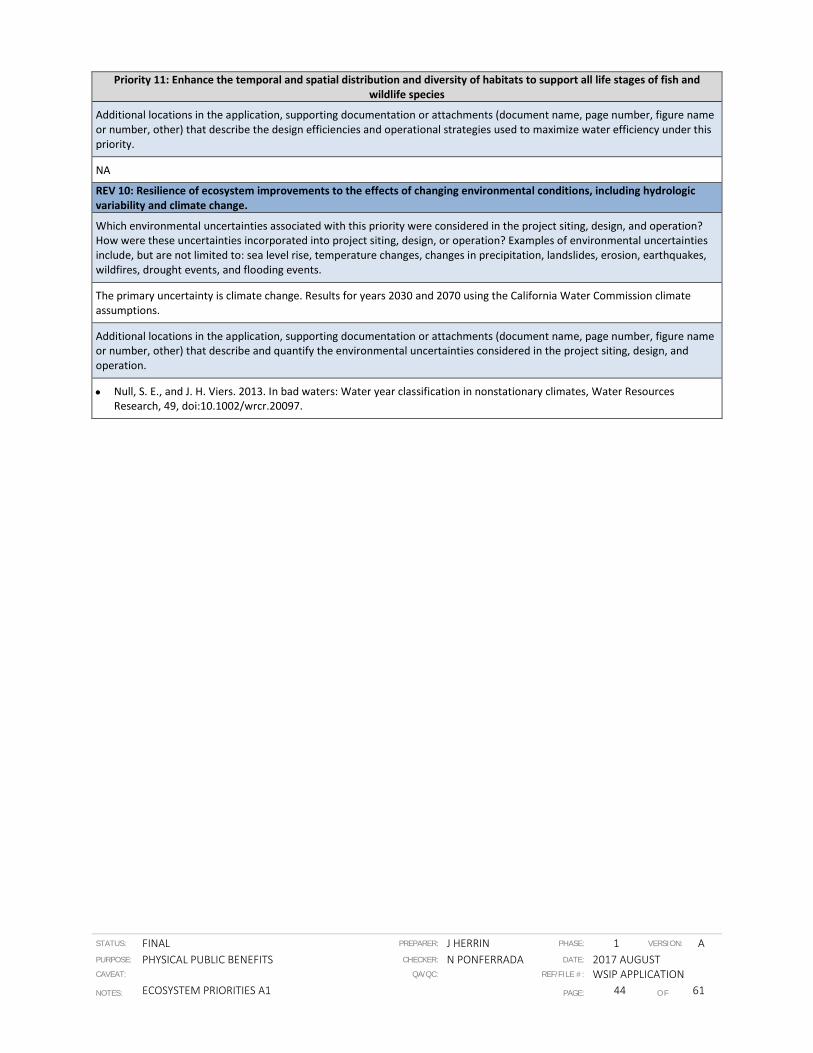
STATUS: FINAL PREPARER: J HERRIN PHASE: 1 VERSION: A PURPOSE: PHYSICAL PUBLIC BENEFITS CHECKER: N PONFERRADA DATE: 2017 AUGUST CAVEAT: QA/QC: REF/FILE #: WSIP APPLICATION NOTES: ECOSYSTEM PRIORITIES A1 PAGE: 44 OF 61
Priority 11: Enhance the temporal and spatial distribution and diversity of habitats to support all life stages of fish and wildlife species
Additional locations in the application, supporting documentation or attachments (document name, page number, figure name or number, other) that describe the design efficiencies and operational strategies used to maximize water efficiency under this priority.
NA
REV 10: Resilience of ecosystem improvements to the effects of changing environmental conditions, including hydrologic variability and climate change.
Which environmental uncertainties associated with this priority were considered in the project siting, design, and operation? How were these uncertainties incorporated into project siting, design, or operation? Examples of environmental uncertainties include, but are not limited to: sea level rise, temperature changes, changes in precipitation, landslides, erosion, earthquakes, wildfires, drought events, and flooding events.
The primary uncertainty is climate change. Results for years 2030 and 2070 using the California Water Commission climate assumptions.
Additional locations in the application, supporting documentation or attachments (document name, page number, figure name or number, other) that describe and quantify the environmental uncertainties considered in the project siting, design, and operation.
• Null, S. E., and J. H. Viers. 2013. In bad waters: Water year classification in nonstationary climates, Water Resources Research, 49, doi:10.1002/wrcr.20097.

STATUS: FINAL PREPARER: J HERRIN PHASE: 1 VERSION: A PURPOSE: PHYSICAL PUBLIC BENEFITS CHECKER: N PONFERRADA DATE: 2017 AUGUST CAVEAT: QA/QC: REF/FILE #: WSIP APPLICATION NOTES: ECOSYSTEM PRIORITIES A1 PAGE: 45 OF 61
Ecosystem Priority 14
Priority 14: Provide water to enhance seasonal wetlands, permanent wetlands, and riparian habitat for aquatic and terrestrial species on State and Federal wildlife refuges and on other public and private lands
REV 2: Magnitude of ecosystem improvements
What is the expected magnitude of the ecosystem improvement that will address this priority? Magnitude should be expressed as: a) the change from current conditions without the project to current conditions with the project, and b) the change from 2030 conditions without the project to 2030 conditions with the project. How did you estimate this value?
The Sites Project will provide ecosystem benefits to terrestrial species using State and Federal wildlife refuges and private ricelands of the Central Valley. These benefits are described below.
Refuges
Under current conditions, dry and critically dry years pose significant challenges to managing habitat for terrestrial wildlife dependent on wetlands and riparian habitat in Central Valley refuges within the Central Valley Project Improvement Act (CVPIA) Refuge Water Supply Program (RWSP) The RWSP wetland habitat areas include 12 federal National Wildlife Refuges (NWRs), six State Wildlife Areas, and one privately managed refuge (CDFW 2017). These 19 refuges in the RWSP currently receive approximately 433 thousand acre feet (TAF) Level 2 water supplies, and incremental Level 4 water supplies of an additional 133 TAF (CDFW 2017). From 2005 – 2014 only 43% of Incremental Level 4 allocations were acquired and delivered each year to refuges (CDFW 2017).
Refuges of the Sacramento NWR Complex, including the Sacramento, Colusa, and Delevan NWRs, provide critical managed wetland habitat for many water-dependent wildlife species (USFWS 2009). Drought contingency actions for the Sacramento, Colusa and Delevan NWRs during dry and critically dry years vary depending on the severity of the reduced water allocations, as well as the timing within the water year when the cutback is finalized (USFWS 2011a, 2011b, 2011c). If water allocations are reduced to 25% of normal deliveries at Sacramento, Colusa and Delevan NWRs during dry or critically dry years, the drought contingency plans for all three refuges call for adjustments to wetland management practices, with the substantial impacts on wetland habitat and wetland dependent species (USFWS 2011a, 2011b, 2011c). Attachment A provides details on the impacts of reduced water deliveries on habitat and wildlife at these refuges.
The project would provide additional water in dry and critically dry years to avoid these adverse impacts to seasonal and permanent wetlands and to wetland-dependent wildlife on refuges. The amount of water allocated to the Sacramento, Colusa, and Delevan NWRs and the other refuges in the RWSP is uncertain, but as shown in Sites_A2 Ecosystem Documentation under the PHYSICAL PUBLIC BENEFITS TAB, additional Level 2 and Level 4 water would be available with the highest deliveries in wet, above normal, and below normal years. Attachment 2 summarizes CalSim II Model Runs conducted on June 21, 2017 and shows the net increase in water supply available for all refuges with implementation of the project, and describes how refuges in in the Mendota Pool and the Tulare Basin could also benefit from additional deliveries from the Sites Project.
Deliveries of additional Level 2 and Level 4 water during dry and critically dry years would avoid loss of up to 10,867 acres of wetland habitat on the Sacramento, Colusa, and Delevan NWRs, and the other direct and indirect impacts of reduced water availability described above.
Ricelands
Surface water delivered by the Central Valley Project (CVP) and State Water Project (SWP) provide much of the water for rice and other agricultural uses, and for management of wetlands in the Central Valley; water supply shortages from the CVP and SWP during dry and critically dry years negatively affect waterfowl and waterbird habitats, reduce food resources, and lower the carrying capacity of the Central Valley for wintering waterfowl (Petrie et al. 2016). Attachment A provides additional information about the value of ricelands to waterfowl and waterbirds.
Decisions by rice producers about how many acres to plant in rice are complex and based on a number of variables, but in dry and critical years more water would likely increase acreage of rice planted (Buttner 2017 personal communication). In the drought year of 2014, rice acreage in California was reduced by 133,000 acres, falling 24% from an average of 567,000 acres in 2010–13 to just 434,000 acres in 2014 (PPIC 2015, U.S. Department of Agriculture (USDA), National Agricultural Statistics Service, California Acreage Reports), reducing the acreage of foraging habitat for wintering waterfowl.
The Sites Project would provide additional water in dry and critically dry years to reduce adverse impacts to waterfowl and other waterbirds dependent associated with reduced acreage of ricelands. As shown in Sites_A2 Ecosystem Documentation under the PHYSICAL PUBLIC BENEFITS TAB, additional water would be available to support rice plantings in dry and critically dry years with implementation of the project.
Deliveries of additional agricultural water to rice producers during dry and critically dry years could avoid reductions in acreage of ricelands in the Central Valley. The extent of the increase would depend on many factors, but in dry and critically dry years

STATUS: FINAL PREPARER: J HERRIN PHASE: 1 VERSION: A PURPOSE: PHYSICAL PUBLIC BENEFITS CHECKER: N PONFERRADA DATE: 2017 AUGUST CAVEAT: QA/QC: REF/FILE #: WSIP APPLICATION NOTES: ECOSYSTEM PRIORITIES A1 PAGE: 46 OF 61
Priority 14: Provide water to enhance seasonal wetlands, permanent wetlands, and riparian habitat for aquatic and terrestrial species on State and Federal wildlife refuges and on other public and private lands
could exceed 100,000 acres, based on the decrease in acreage of rice during the drought year of 2014.
Additional locations in the application, supporting documentation or attachments (document name, page number, table number, other) where the magnitude of the ecosystem improvement is described and quantified.
• CalSim II Model Runs for WSIP 2030 Sites Reservoir Regional_Deliveries_WSIP_2030_With_Project_vs_Without_Project. Updated June 21, 2017
• CDFW 2017. Refuge Water Supply Program Overview. Available at: https://www.wildlife.ca.gov/Conservation/Watersheds/Refuge-Water/Overview. Accessed June 29, 2017
• USFWS 2009. Sacramento, Delevan, Colusa, and Sutter National Wildlife Refuges. Final Comprehensive Conservation Plan and Environmental Assessment. Vol. 1
• USFWS 2011a. Sacramento National Wildlife Refuge Water Management Plan
• USFWS 2011b. Colusa National Wildlife Refuge Water Management Plan
• USFWS 2011c. Delevan National Wildlife Refuge Water Management Plan
• US Department of Agriculture, National Agricultural Statistics Service, California Acreage Reports. USDA Cropland Database https://watershed.ucdavis.edu/files/biblio/Final_Drought%20Report_08182015_Full_Report_WithAppendices.pdf page 13, page 28
• Migratory Bird Partnership 2014 – Waterbird Habitat Enhancement Program, Figure 2, page 6
REV 3: Spatial and temporal scale of ecosystem improvements.
What is the geographical extent (e.g., river miles, acres) of the ecosystem improvement that will address this priority?
Refuges
• Sacramento National Wildlife Refuge - 10,819 acres
• Colusa National Wildlife Refuge - 4,686 acres
• Delevan National Wildlife Refuge - 5,877 acres.
Ricelands
• In 2015 421,000 acres or rice were harvested in California (CDFA 2016), most of which occurred in the Sacramento Valley, with Colusa, Sutter, Butte, and Glenn as the primary rice-producing counties in the state (Geisseler & Horwath 2013). https://www.cdfa.ca.gov/statistics/PDFs/2016Report.pdf.
Additional locations in the application, supporting documentation or attachments (document name, page number, figure name or number, other) where the geographical extent of the ecosystem improvement is documented or mapped.
Refuges
USFWS 2009
• Overview map of refuges, page 1
• Table 4. Acreage and habitats of Sacramento National Refuge Complex, page 51
• Figure 6. Sacramento Refuge Habitat Management, page 52
• Figure 7. Delevan Refuge Habitat Management, page 53
• Figure 8. Colusa Refuge Habitat Management, page 54
Ricelands
• CDFA 2016, p. 13
• Geisseler & Horwath 2013 Fig 2. Page 2
• Migratory Bird Partnership 2014 – Waterbird Habitat Enhancement Program, Figure 2, page 6
When during the year will water be provided for seasonal wetlands, permanent wetlands, and riparian habitat? How are seasonal wetlands, permanent wetlands, and riparian habitat likely to vary with hydrologic conditions (i.e. among water year types) a) under current conditions with and without the project, and b) in 2030 with and without the project?
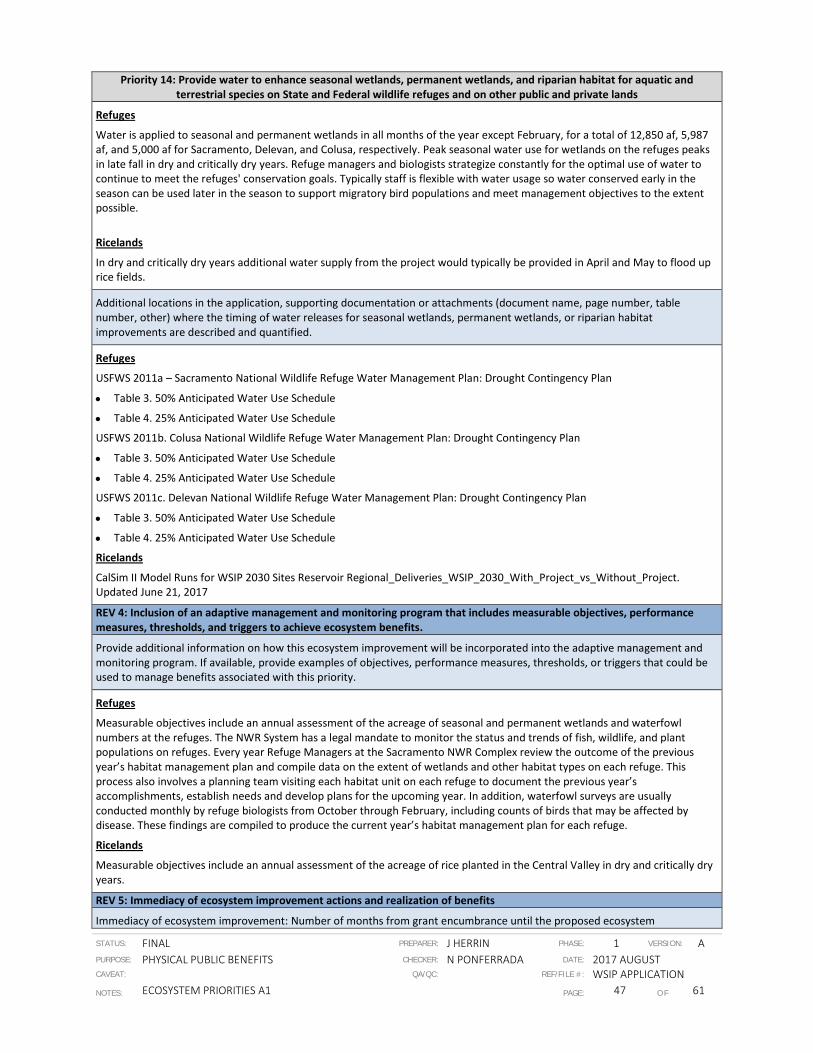
STATUS: FINAL PREPARER: J HERRIN PHASE: 1 VERSION: A PURPOSE: PHYSICAL PUBLIC BENEFITS CHECKER: N PONFERRADA DATE: 2017 AUGUST CAVEAT: QA/QC: REF/FILE #: WSIP APPLICATION NOTES: ECOSYSTEM PRIORITIES A1 PAGE: 47 OF 61
Priority 14: Provide water to enhance seasonal wetlands, permanent wetlands, and riparian habitat for aquatic and terrestrial species on State and Federal wildlife refuges and on other public and private lands
Refuges
Water is applied to seasonal and permanent wetlands in all months of the year except February, for a total of 12,850 af, 5,987 af, and 5,000 af for Sacramento, Delevan, and Colusa, respectively. Peak seasonal water use for wetlands on the refuges peaks in late fall in dry and critically dry years. Refuge managers and biologists strategize constantly for the optimal use of water to continue to meet the refuges' conservation goals. Typically staff is flexible with water usage so water conserved early in the season can be used later in the season to support migratory bird populations and meet management objectives to the extent possible.
Ricelands
In dry and critically dry years additional water supply from the project would typically be provided in April and May to flood up rice fields.
Additional locations in the application, supporting documentation or attachments (document name, page number, table number, other) where the timing of water releases for seasonal wetlands, permanent wetlands, or riparian habitat improvements are described and quantified.
Refuges
USFWS 2011a – Sacramento National Wildlife Refuge Water Management Plan: Drought Contingency Plan
• Table 3. 50% Anticipated Water Use Schedule
• Table 4. 25% Anticipated Water Use Schedule
USFWS 2011b. Colusa National Wildlife Refuge Water Management Plan: Drought Contingency Plan
• Table 3. 50% Anticipated Water Use Schedule
• Table 4. 25% Anticipated Water Use Schedule
USFWS 2011c. Delevan National Wildlife Refuge Water Management Plan: Drought Contingency Plan
• Table 3. 50% Anticipated Water Use Schedule
• Table 4. 25% Anticipated Water Use Schedule
Ricelands
CalSim II Model Runs for WSIP 2030 Sites Reservoir Regional_Deliveries_WSIP_2030_With_Project_vs_Without_Project. Updated June 21, 2017
REV 4: Inclusion of an adaptive management and monitoring program that includes measurable objectives, performance measures, thresholds, and triggers to achieve ecosystem benefits.
Provide additional information on how this ecosystem improvement will be incorporated into the adaptive management and monitoring program. If available, provide examples of objectives, performance measures, thresholds, or triggers that could be used to manage benefits associated with this priority.
Refuges
Measurable objectives include an annual assessment of the acreage of seasonal and permanent wetlands and waterfowl numbers at the refuges. The NWR System has a legal mandate to monitor the status and trends of fish, wildlife, and plant populations on refuges. Every year Refuge Managers at the Sacramento NWR Complex review the outcome of the previous year’s habitat management plan and compile data on the extent of wetlands and other habitat types on each refuge. This process also involves a planning team visiting each habitat unit on each refuge to document the previous year’s accomplishments, establish needs and develop plans for the upcoming year. In addition, waterfowl surveys are usually conducted monthly by refuge biologists from October through February, including counts of birds that may be affected by disease. These findings are compiled to produce the current year’s habitat management plan for each refuge.
Ricelands
Measurable objectives include an annual assessment of the acreage of rice planted in the Central Valley in dry and critically dry years.
REV 5: Immediacy of ecosystem improvement actions and realization of benefits
Immediacy of ecosystem improvement: Number of months from grant encumbrance until the proposed ecosystem

STATUS: FINAL PREPARER: J HERRIN PHASE: 1 VERSION: A PURPOSE: PHYSICAL PUBLIC BENEFITS CHECKER: N PONFERRADA DATE: 2017 AUGUST CAVEAT: QA/QC: REF/FILE #: WSIP APPLICATION NOTES: ECOSYSTEM PRIORITIES A1 PAGE: 48 OF 61
Priority 14: Provide water to enhance seasonal wetlands, permanent wetlands, and riparian habitat for aquatic and terrestrial species on State and Federal wildlife refuges and on other public and private lands
improvement is completed (i.e., the expected timeframe until the improvement is implemented or construction is completed).
Initial benefits are expected during dry and critically dry years starting in year 2028 (6 years after grant encumbrance for construction). Full benefits are expected in 2030 (8 years after grant encumbrance).
Additional locations in the application, supporting documentation or attachments (document name, page number, table number, other) where the immediacy timeframe is described and quantified.
Sites_A3 Schedule under the FEASIBILITY AND IMPLEMENTATION RISK TAB
Realization of ecosystem improvement: Number of months from the time the ecosystem improvement is completed (i.e. project is implemented or construction is complete), until the benefit associated with this priority can be observed (i.e. when measurable improvements can be observed and quantified)
Benefits of additional water supply will be observed and quantified during dry and critically dry years.
Additional locations in the application, supporting documentation or attachments (document name, page number, table number, other) where the realization timeframe is described and quantified.
• CalSim II Model Runs for WSIP 2030 Sites Reservoir Regional_Deliveries_WSIP_2030_With_Project_vs_Without_Project. Updated June 21, 2017
• CDFW 2017. Refuge Water Supply Program Overview. Available at: https://www.wildlife.ca.gov/Conservation/Watersheds/Refuge-Water/Overview. Accessed June 29, 2017
• USFWS 2009. Sacramento, Delevan, Colusa, and Sutter National Wildlife Refuges. Final Comprehensive Conservation Plan and Environmental Assessment. Vol. 1
• USFWS 2011a. Sacramento National Wildlife Refuge Water Management Plan
• USFWS 2011b. Colusa National Wildlife Refuge Water Management Plan
• USFWS 2011c. Delevan National Wildlife Refuge Water Management Plan
REV 6: Duration of ecosystem improvements
How long (number of years) after realization (as calculated under REV 5 above) is the ecosystem improvement expected to address this priority? Maximum is 100 years. Explain how this value was determined and whether the magnitude of the ecosystem improvement is anticipated to change over time.
Refuges
Benefits of additional water supply for wetlands and wildlife dependent on wetlands will be observed for the duration of the Sacramento, Colusa, and Delevan NWRs’s existence in dry and critically dry years.
Ricelands
Benefits of additional water supply for ricelands, and the waterbirds and waterfowl dependent on them, would be observed for the duration of the project as long as rice production occurs in the Central Valley.
Additional locations in the application, supporting documentation or attachments (document name, page number, table number, other) where the duration of the ecosystem improvement is described and quantified.
• CalSim II Model Runs for WSIP 2030 Sites Reservoir Regional_Deliveries_WSIP_2030_With_Project_vs_Without_Project. Updated June 21, 2017
• CDFW 2017. Refuge Water Supply Program Overview. Available at: https://www.wildlife.ca.gov/Conservation/Watersheds/Refuge-Water/Overview. Accessed June 29, 2017
• USFWS 2009. Sacramento, Delevan, Colusa, and Sutter National Wildlife Refuges. Final Comprehensive Conservation Plan and Environmental Assessment. Vol. 1
• USFWS 2011a. Sacramento National Wildlife Refuge Water Management Plan
• USFWS 2011b. Colusa National Wildlife Refuge Water Management Plan
• USFWS 2011c. Delevan National Wildlife Refuge Water Management Plan
REV 7: Consistency with species recovery plans and strategies, initiatives, and conservation plans

STATUS: FINAL PREPARER: J HERRIN PHASE: 1 VERSION: A PURPOSE: PHYSICAL PUBLIC BENEFITS CHECKER: N PONFERRADA DATE: 2017 AUGUST CAVEAT: QA/QC: REF/FILE #: WSIP APPLICATION NOTES: ECOSYSTEM PRIORITIES A1 PAGE: 49 OF 61
Priority 14: Provide water to enhance seasonal wetlands, permanent wetlands, and riparian habitat for aquatic and terrestrial species on State and Federal wildlife refuges and on other public and private lands
Does the ecosystem improvement meet any goals or objectives established in existing species recovery plans, initiatives, or conservation plans including but not limited to the National Oceanic and Atmospheric Administration (NOAA) Fisheries Recovery Plan for Sacramento River winter-run Chinook salmon, Central Valley spring-run Chinook salmon, and Central Valley steelhead; State Wildlife Action Plan; Central Valley Joint Venture Implementation Plan, San Joaquin County Multi-Species Habitat Conservation Plan and Open Space Plan, Draft Solano Multi-Species Habitat Conservation Plan, East Contra Costa County Habitat Conservation Plan/Natural Community Conservation Plan, Draft Recovery Plan for the Giant Garter Snake, and California Water Action Plan? If so which goals, objectives, or actions will be met? Why?
Improving water supply to refuges during dry years to enhance habitat and support waterfowl, shorebirds, and other wildlife dependent on seasonal and permanent wetlands is consistent with goals and objectives described in the following conservation plans
• Migratory Habitat Enhancement Plan - 2014
• North American Waterfowl Management Plan - 2012
• U.S. Shorebird Conservation Plan – 2001
• Central Valley Joint Venture Implementation Plan – Conserving Bird Habitat
• California Wildlife Action Plan
Improving water supply to refuges during dry years is also consistent with recovery goals described in
• Draft Recovery Plan for the Giant Garter Snake
• Conservation Plan for the Tricolored Blackbird
Additional locations in the application, supporting documentation or attachments (page number, table number, other) where the consistency with goals, objectives, or actions from recovery plans, initiative, or conservation plans are discussed.
Refuges
Improving water supply to refuges during dry years is also consistent with conservation and recovery goals described in
• North American Waterfowl Management Plan - 2012 (page 2)
• U.S. Shorebird Conservation Plan – 2001 (page 30)
• Central Valley Joint Venture Implementation Plan – Conserving Bird Habitat (Chapter 10)
• California Wildlife Action Plan (Executive Summary page 2)
• Draft Recovery Plan for the Giant Garter Snake (page 9)
• Conservation Plan for the Tricolored Blackbird (page 11)
Ricelands
Improving water supply to ricelands during dry years is also consistent with conservation and recovery goals described in
• Migratory Habitat Enhancement Plan 2014 – (Figure 2, page 6)
• North American Waterfowl Management Plan – 2012 (page 2)
• U.S. Shorebird Conservation Plan – 2001 (page 30)
• Central Valley Joint Venture Implementation Plan – Conserving Bird Habitat (Chapter 10)
• California Wildlife Action Plan (Executive Summary page 2)
• Draft Recovery Plan for the Giant Garter Snake (page 40)
• Conservation Plan for the Tricolored Blackbird (page 27)
REV 8: Location of ecosystem improvements and connectivity to areas already being protected or managed for conservation values
Provide a map that shows the extent of the ecosystem improvement that will address this priority (e.g., river miles that meet the temperature benefits). Provide additional instructions or clarification to reviewers who will be viewing this map (i.e., describe the color and/or label that identifies the spatial extent of the ecosystem improvement). If available, also submit supporting electronic files such as a .kmz file or ArcGIS layer associated with the maps provided.
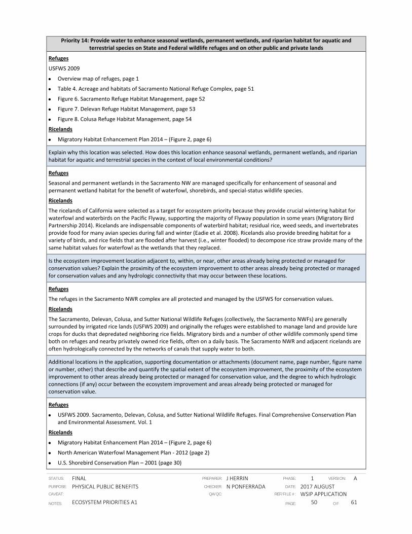
STATUS: FINAL PREPARER: J HERRIN PHASE: 1 VERSION: A PURPOSE: PHYSICAL PUBLIC BENEFITS CHECKER: N PONFERRADA DATE: 2017 AUGUST CAVEAT: QA/QC: REF/FILE #: WSIP APPLICATION NOTES: ECOSYSTEM PRIORITIES A1 PAGE: 50 OF 61
Priority 14: Provide water to enhance seasonal wetlands, permanent wetlands, and riparian habitat for aquatic and terrestrial species on State and Federal wildlife refuges and on other public and private lands
Refuges
USFWS 2009
• Overview map of refuges, page 1
• Table 4. Acreage and habitats of Sacramento National Refuge Complex, page 51
• Figure 6. Sacramento Refuge Habitat Management, page 52
• Figure 7. Delevan Refuge Habitat Management, page 53
• Figure 8. Colusa Refuge Habitat Management, page 54
Ricelands
• Migratory Habitat Enhancement Plan 2014 – (Figure 2, page 6)
Explain why this location was selected. How does this location enhance seasonal wetlands, permanent wetlands, and riparian habitat for aquatic and terrestrial species in the context of local environmental conditions?
Refuges
Seasonal and permanent wetlands in the Sacramento NW are managed specifically for enhancement of seasonal and permanent wetland habitat for the benefit of waterfowl, shorebirds, and special-status wildlife species.
Ricelands
The ricelands of California were selected as a target for ecosystem priority because they provide crucial wintering habitat for waterfowl and waterbirds on the Pacific Flyway, supporting the majority of Flyway population in some years (Migratory Bird Partnership 2014). Ricelands are indispensable components of waterbird habitat; residual rice, weed seeds, and invertebrates provide food for many avian species during fall and winter (Eadie et al. 2008). Ricelands also provide breeding habitat for a variety of birds, and rice fields that are flooded after harvest (i.e., winter flooded) to decompose rice straw provide many of the same habitat values for waterfowl as the wetlands that they replaced.
Is the ecosystem improvement location adjacent to, within, or near, other areas already being protected or managed for conservation values? Explain the proximity of the ecosystem improvement to other areas already being protected or managed for conservation values and any hydrologic connectivity that may occur between these locations.
Refuges
The refuges in the Sacramento NWR complex are all protected and managed by the USFWS for conservation values.
Ricelands
The Sacramento, Delevan, Colusa, and Sutter National Wildlife Refuges (collectively, the Sacramento NWFs) are generally surrounded by irrigated rice lands (USFWS 2009) and originally the refuges were established to manage land and provide lure crops for ducks that depredated neighboring rice fields. Migratory birds and a number of other wildlife commonly spend time both on refuges and nearby privately owned rice fields, often on a daily basis. The Sacramento NWR and adjacent ricelands are often hydrologically connected by the networks of canals that supply water to both.
Additional locations in the application, supporting documentation or attachments (document name, page number, figure name or number, other) that describe and quantify the spatial extent of the ecosystem improvement, the proximity of the ecosystem improvement to other areas already being protected or managed for conservation value, and the degree to which hydrologic connections (if any) occur between the ecosystem improvement and areas already being protected or managed for conservation value.
Refuges
• USFWS 2009. Sacramento, Delevan, Colusa, and Sutter National Wildlife Refuges. Final Comprehensive Conservation Plan and Environmental Assessment. Vol. 1
Ricelands
• Migratory Habitat Enhancement Plan 2014 – (Figure 2, page 6)
• North American Waterfowl Management Plan - 2012 (page 2)
• U.S. Shorebird Conservation Plan – 2001 (page 30)

STATUS: FINAL PREPARER: J HERRIN PHASE: 1 VERSION: A PURPOSE: PHYSICAL PUBLIC BENEFITS CHECKER: N PONFERRADA DATE: 2017 AUGUST CAVEAT: QA/QC: REF/FILE #: WSIP APPLICATION NOTES: ECOSYSTEM PRIORITIES A1 PAGE: 51 OF 61
Priority 14: Provide water to enhance seasonal wetlands, permanent wetlands, and riparian habitat for aquatic and terrestrial species on State and Federal wildlife refuges and on other public and private lands
• Central Valley Joint Venture Implementation Plan – Conserving Bird Habitat (Chapter 10)
• California Wildlife Action Plan (Executive Summary page 2)
• Draft Recovery Plan for the Giant Garter Snake (page 40)
• Conservation Plan for the Tricolored Blackbird (page 27)
REV 9: Efficient use of water to achieve multiple ecosystem benefits
How will water provided to address this priority be managed? Explain design efficiencies and operational strategies intended to maximize the efficiency of water allocated to ecosystem improvements that address this priority.
Refuges
Refuge managers and biologists strategize constantly for the optimal use of water to continue to meet the refuges' conservation goals. Typically staff is flexible with water usage so water conserved early in the season can be used later in the season to support migratory bird populations and meet management objectives to the extent possible.
Ricelands
Funding and agreements to foster ecosystem and wildlife benefits of ricelands is currently available through the US Department of Agriculture’s Natural Resources Conservation Service (NRCS) Waterbird Habitat Enhancement Program (WHEP). The goal of WHEP is to enhance habitat on 100,000 acres of California ricelands, and has been supported by $10 million of federal funds (Migratory Bird Conservation Partnership 2014). The WHEP has successfully enrolled nearly 20 percent of California’s 550,000 acres of rice in bird-friendly farming practices. WHEP relies on short-term funding sources, and to secure a more sustainable funding source, the California Rice Commission, Audubon California, Point Blue Conservation Science and The Nature Conservancy are working with NRCS and other parties to develop sustainable conservation programs to continue to incentive the kind of bird-friendly farming practices such as those supported by WHEP.
Additional locations in the application, supporting documentation or attachments (document name, page number, figure name or number, other) that describe the design efficiencies and operational strategies used to maximize water efficiency under this priority.
Refuges
• USFWS 2009. Sacramento, Delevan, Colusa, and Sutter National Wildlife Refuges. Final Comprehensive Conservation Plan and Environmental Assessment. Vol. 1
• USFWS 2011a. Sacramento National Wildlife Refuge Water Management Plan
• USFWS 2011b. Colusa National Wildlife Refuge Water Management Plan
• USFWS 2011c. Delevan National Wildlife Refuge Water Management Plan
Ricelands
• Migratory Habitat Enhancement Plan 2014 – (pages 1 - 6)
REV 10: Resilience of ecosystem improvements to the effects of changing environmental conditions, including hydrologic variability and climate change.
Which environmental uncertainties associated with this priority were considered in the project siting, design, and operation? How were these uncertainties incorporated into project siting, design, or operation? Examples of environmental uncertainties include, but are not limited to: sea level rise, temperature changes, changes in precipitation, landslides, erosion, earthquakes, wildfires, drought events, and flooding events.
Climate change and associated increased frequency of dry and critically dry years is the primary source of uncertainty. Long term modeling of climate change suggests that 34–38% of years may be classified as dry and critically dry years in the Sacramento Valley, and 66–69% may be classified as dry and critically dry years in the San Joaquin Valley by the end of the 21st century (Null and Viers 2013).
Additional locations in the application, supporting documentation or attachments (document name, page number, figure name or number, other) that describe and quantify the environmental uncertainties considered in the project siting, design, and operation.
• Null, S. E., and J. H. Viers (2013), In bad waters: Water year classification in nonstationary climates, Water Resources

STATUS: FINAL PREPARER: J HERRIN PHASE: 1 VERSION: A PURPOSE: PHYSICAL PUBLIC BENEFITS CHECKER: N PONFERRADA DATE: 2017 AUGUST CAVEAT: QA/QC: REF/FILE #: WSIP APPLICATION NOTES: ECOSYSTEM PRIORITIES A1 PAGE: 52 OF 61
Priority 14: Provide water to enhance seasonal wetlands, permanent wetlands, and riparian habitat for aquatic and terrestrial species on State and Federal wildlife refuges and on other public and private lands
Research, 49, doi:10.1002/wrcr.20097.

STATUS: FINAL PREPARER: J HERRIN PHASE: 1 VERSION: A PURPOSE: PHYSICAL PUBLIC BENEFITS CHECKER: N PONFERRADA DATE: 2017 AUGUST CAVEAT: QA/QC: REF/FILE #: WSIP APPLICATION NOTES: ECOSYSTEM PRIORITIES A1 PAGE: 53 OF 61
Ecosystem Priority 15
Priority 15: Develop and implement invasive species management plans utilizing techniques that are supported by best available science to enhance habitat and increase the survival of native species
Species Information
What invasive species are you targeting?
Yellow star thistle (Centaurea solstitialis)
Additional locations in the application, supporting documentation or attachments (document name, page number, table number, other) where the biology of the invasive species and their impacts on native fish and wildlife are described and quantified.
Ecosystem Priority 15 in Sites_A2 Ecosystem Documentation under the PHYSICAL PUBLIC BENEFITS TAB
REV 2: Magnitude of ecosystem improvements
When implemented what is the expected magnitude of habitat enhancement and increased survival of native species? Magnitude should be expressed as: a) the change from current conditions without the project to current conditions with the project, and b) the change from 2030 conditions without the project to 2030 conditions with the project. How did you estimate this value?
If the project intends to target multiple invasive species, the magnitude of the ecosystem improvement for each species needs to be provided.
The approximate acreage of the valley extending from Golden Gate Dam to Funks Reservoir was determined. Except for vegetation on the shore of Funks Creek, this area is covered in star thistle. Habitat enhancement would be accomplished between 2028 and 2030. Once the habitat is established it will be maintained for the 100 year planning horizon.
The restoration of native prairie would increase the value to native species, including providing forage habitat for golden eagles.
Additional locations in the application, supporting documentation or attachments (document name, page number, table number, other) where the magnitude of the ecosystem improvement is described and quantified.
Ecosystem Priority 15 in Sites_A2 Ecosystem Documentation under the PHYSICAL PUBLIC BENEFITS TAB
REV 3: Spatial and temporal scale of ecosystem improvements.
What is the geographical extent (e.g., river miles, acres) of the ecosystem improvement that will address this priority?
90 Acres
Additional locations in the application, supporting documentation or attachments (document name, page number, figure name or number, other) where the geographical extent of the ecosystem improvement is documented or mapped.
Ecosystem Priority 15 in Sites_A2 Ecosystem Documentation under the PHYSICAL PUBLIC BENEFITS TAB
When during the year will the project manage invasive species for the benefit of native species? How is the distribution of invasive species likely to vary with hydrologic conditions (i.e., among water year types) a) under current conditions with and without the project, and b) in 2030 with and without the project?
If the project intends to target multiple invasive species, provide the timing of management actions for each invasive species separately.
Year round improvement regardless of hydrologic conditions.
Additional locations in the application, supporting documentation or attachments (document name, page number, table number, other) where the timing of ecosystem improvements that address this priority are described and quantified.
Ecosystem Priority 15 in Sites_A2 Ecosystem Documentation under the PHYSICAL PUBLIC BENEFITS TAB
REV 4: Inclusion of an adaptive management and monitoring program that includes measurable objectives, performance measures, thresholds, and triggers to achieve ecosystem benefits.
Provide additional information on how this ecosystem improvement will be incorporated into the adaptive management and monitoring program. If available, provide examples of objectives, performance measures, thresholds, or triggers that could be
STATUS: FINAL PREPARER: J HERRIN PHASE: 1 VERSION: A PURPOSE: PHYSICAL PUBLIC BENEFITS CHECKER: N PONFERRADA DATE: 2017 AUGUST CAVEAT: QA/QC: REF/FILE #: WSIP APPLICATION NOTES: ECOSYSTEM PRIORITIES A1 PAGE: 54 OF 61
Priority 15: Develop and implement invasive species management plans utilizing techniques that are supported by best available science to enhance habitat and increase the survival of native species
used to manage benefits associated with this priority.
The restored area will be surveyed monthly during the initial establishment of native prairie and then surveyed annually. Adaptive management will consist of removing any invasive plants and reseeding with native species.
REV 5: Immediacy of ecosystem improvement actions and realization of benefits
Immediacy of ecosystem improvement: Number of months from grant encumbrance until the proposed ecosystem improvement is completed (i.e., the expected timeframe until the improvement is implemented or construction is completed).
Approximately 108 months.
Additional locations in the application, supporting documentation or attachments (document name, page number, table number, other) where the immediacy timeframe is described and quantified.
Ecosystem Priority 15 in Sites_A2 Ecosystem Documentation under the PHYSICAL PUBLIC BENEFITS TAB
Realization of ecosystem improvement: Number of months from the time the ecosystem improvement is completed (i.e. project is implemented or construction is complete), until the benefit associated with this priority can be observed (i.e. when measurable improvements can be observed and quantified)
Once the area is reseeded the benefit is immediate.
Additional locations in the application, supporting documentation or attachments (document name, page number, table number, other) where the realization timeframe is described and quantified.
Ecosystem Priority 15 in Sites_A2 Ecosystem Documentation under the PHYSICAL PUBLIC BENEFITS TAB
REV 6: Duration of ecosystem improvements
How long (number of years) after realization (as calculated under REV 5 above) is the ecosystem improvement expected to address this priority? Maximum is 100 years. Explain how this value was determined and whether the magnitude of the ecosystem improvement is anticipated to change over time.
100 years. The Authority has budgeted mitigation funds that can be used for this purpose. Future funding may also be obtained through grants.
Additional locations in the application, supporting documentation or attachments (document name, page number, table number, other) where the duration of the ecosystem improvement is described and quantified.
Ecosystem Priority 15 in Sites_A2 Ecosystem Documentation under the PHYSICAL PUBLIC BENEFITS TAB
REV 7: Consistency with species recovery plans and strategies, initiatives, and conservation plans
Does the ecosystem improvement meet any goals or objectives established in existing species recovery plans, initiatives, or conservation plans including but not limited to the National Oceanic and Atmospheric Administration (NOAA) Fisheries Recovery Plan for Sacramento River winter-run Chinook salmon, Central Valley spring-run Chinook salmon, and Central Valley steelhead; State Wildlife Action Plan; Central Valley Joint Venture Implementation Plan, San Joaquin County Multi-Species Habitat Conservation Plan and Open Space Plan, Draft Solano Multi-Species Habitat Conservation Plan, East Contra Costa County Habitat Conservation Plan/Natural Community Conservation Plan, Draft Recovery Plan for the Giant Garter Snake, and California Water Action Plan? If so which goals, objectives, or actions will be met? Why?
No
Additional locations in the application, supporting documentation or attachments (page number, table number, other) where the consistency with goals, objectives, or actions from recovery plans, initiative, or conservation plans are discussed.
NA
REV 8: Location of ecosystem improvements and connectivity to areas already being protected or managed for conservation values
Provide a map that shows the extent of the ecosystem improvement that will address this priority (e.g., river miles that meet the temperature benefits). Provide additional instructions or clarification to reviewers who will be viewing this map (i.e., describe the

STATUS: FINAL PREPARER: J HERRIN PHASE: 1 VERSION: A PURPOSE: PHYSICAL PUBLIC BENEFITS CHECKER: N PONFERRADA DATE: 2017 AUGUST CAVEAT: QA/QC: REF/FILE #: WSIP APPLICATION NOTES: ECOSYSTEM PRIORITIES A1 PAGE: 55 OF 61
Priority 15: Develop and implement invasive species management plans utilizing techniques that are supported by best available science to enhance habitat and increase the survival of native species
color and/or label that identifies the spatial extent of the ecosystem improvement). If available, also submit supporting electronic files such as a .kmz file or ArcGIS layer associated with the maps provided.
The map is provided in Ecosystem Priority 15 in Sites_A2 Ecosystem Documentation under the PHYSICAL PUBLIC BENEFITS TAB
Explain why the location of invasive species management was selected. How is the location beneficial to the survival of native species in the context of local environmental conditions and species' needs?
The location is on property that will be acquired for construction of project facilities and will remain in the control of the Authority. The property is currently overrun with yellow star thistle.
Is the ecosystem improvement location adjacent to, or near, other areas already being protected or managed for conservation values? Explain the proximity of the ecosystem improvement to other areas already being protected or managed for conservation values and any hydrologic connectivity that may occur between these locations.
This area is near the proposed Stone Corral recreation area that will be managed for conservation values; however, the area to be restored as prairie will not be accessible to the general public.
Additional locations in the application, supporting documentation or attachments (document name, page number, table number, other) where the timing of ecosystem improvements that address this priority are described and quantified.
Ecosystem Priority 15 in Sites_A2 Ecosystem Documentation under the PHYSICAL PUBLIC BENEFITS TAB
REV 9: Efficient use of water to achieve multiple ecosystem benefits
If applicable, how will water be efficiently managed to implement invasive species management?
Water for establishing native vegetation will most likely be taken from Holthouse Reservoir, a project facility.
Additional locations in the application, supporting documentation or attachments (document name, page number, figure name or number, other) that describe the design efficiencies and operational strategies used to maximize water efficiency under this priority.
NA
REV 10: Resilience of ecosystem improvements to the effects of changing environmental conditions, including hydrologic variability and climate change.
Which environmental uncertainties associated with this priority were considered in the project siting, design, and operation? How were these uncertainties incorporated into project siting, design, or operation? Examples of environmental uncertainties include, but are not limited to: sea level rise, temperature changes, changes in precipitation, landslides, erosion, earthquakes, wildfires, drought events, and flooding events.
Affects choice of native species for re-seeding.
Additional locations in the application, supporting documentation or attachments (document name, page number, figure name or number, other) that describe and quantify the environmental uncertainties considered in the project siting, design, and operation.
Ecosystem Priority 15 in Sites_A2 Ecosystem Documentation under the PHYSICAL PUBLIC BENEFITS TAB

STATUS: FINAL PREPARER: J HERRIN PHASE: 1 VERSION: A PURPOSE: PHYSICAL PUBLIC BENEFITS CHECKER: N PONFERRADA DATE: 2017 AUGUST CAVEAT: QA/QC: REF/FILE #: WSIP APPLICATION NOTES: ECOSYSTEM PRIORITIES A1 PAGE: 56 OF 61
Ecosystem Priority 16
Priority 16: Enhance habitat for native species that have commercial, recreational, scientific, or educational uses
REV 2: Magnitude of ecosystem improvements
What is the expected magnitude of the ecosystem improvement that will address this priority? Magnitude should be expressed as: a) the change from current conditions without the project to current conditions with the project, and b) the change from 2030 conditions without the project to 2030 conditions with the project. How did you estimate this value?
Under current conditions, dry and critically dry years pose significant challenges to managing habitat for terrestrial wildlife dependent on wetlands and riparian habitat in Central Valley refuges within the Central Valley Project Improvement Act (CVPIA) Refuge Water Supply Program (RWSP) The RWSP wetland habitat areas include 12 federal National Wildlife Refuges (NWRs), six State Wildlife Areas, and one privately managed refuge (CDFW 2017). These 19 refuges in the RWSP currently receive approximately 433 thousand acre feet (TAF) Level 2 water supplies, and incremental Level 4 water supplies of an additional 133 TAF (CDFW 2017). From 2005 – 2014 only 43% of Incremental Level 4 allocations were acquired and delivered each year to refuges (CDFW 2017).
Refuges of the Sacramento NWR Complex , including the Sacramento, Colusa, and Delevan NWRs, provide critical managed wetland habitat for many water-dependent wildlife species, including snow geese, northern pintail, white-faced ibis, sandhill crane, and giant-garter snake (USFWS 2009). Drought contingency actions for the Sacramento, Colusa and Delevan NWRs during dry and critically dry years vary depending on the severity of the reduced water allocations, as well as the timing within the water year when the cutback is finalized (USFWS 2011a, 2011b, 2011c). If water allocations are reduced to 25% of normal deliveries at Sacramento, Colusa and Delevan NWRs during dry or critically dry years, the drought contingency plans for all three refuges call for adjustments to wetland management practices, with the following impacts on wetland habitat and wetland dependent species (USFWS 2011a, 2011b, 2011c):
For 50% of normal deliveries, wetland acreage at the three refuges would be reduced by 30–50%. Composite acreages of seasonal and permanent wetlands at all three refuges totals 15,525 acres (based on 2010 data), which includes 13,722 acres of seasonal wetlands (timothy grass and water grass) and 1,803 acres of permanent and semi-permanent wetland/brood ponds. A 30–50% reduction for permanent and seasonal wetlands would amount to a loss of 4,658 to7,762 acres. For 25% of normal deliveries, total wetland acreage at the three refuges would be reduced by 60–70%, amounting to loss of 9,315 to 10,867 acres. In addition to the direct loss of wetlands, longer term impacts would also occur to future wetland habitat quality throughout the refuges. Loss of permanent pond acreage would be 80% for both the 50% and 25% reductions of normal deliveries. Other impacts on habitat and wildlife of reductions to 50 to 25% of normal deliveries include:
• Very early spring draw-downs of wetlands which severely limits shorebird habitat and results in poor germination for important wildlife and waterfowl plants.
• Loss of permanent pond acreage adversely affects habitat for special-status species such as giant garter snakes, tricolored blackbirds, western pond turtles, and for duck broods.
• Complete elimination of irrigation for annual food plants and control of invasive species such as cocklebur, resulting in increased mowing/diesel fuel consumption to mitigate.
• Flood-ups delayed on remaining acreage, resulting in widespread crop depredation in nearby agricultural lands.
• Extreme waterfowl crowding and disease risk (avian botulism (Type C) and avian cholera).
• Reduced public use on all refuge habitats reduced (or eliminated for 25% of water delivery scenario) other than having the Sacramento NWR visitor center open, and visitor use would decrease to a fraction of normal.
The project would provide additional water, with the highest deliveries in wet, above normal, and below normal years to reduce adverse impacts to seasonal and permanent wetlands and to wetland-dependent wildlife on refuges. The amount of water allocated to the Sacramento, Colusa, and Delevan NWRs and the other refuges in the RWSP is uncertain, but as shown in Sites_A2 Ecosystem Documentation under the PHYSICAL PUBLIC BENEFITS TAB, additional Level 2 and Level 4 water would be available in dry and critically dry years. Sites_A2 Ecosystem Documentation under the PHYSICAL PUBLIC BENEFITS TAB summarizes CalSim II Model Runs conducted on June 21, 2017 and shows the net increase in water supply available for all refuges with implementation of the project.
Deliveries of additional Level 2 and Level 4 water during dry and critically dry years would avoid loss of up to 10,867 acres of wetland habitat on the Sacramento, Colusa, and Delevan NWRs, and the other direct and indirect impacts of reduced water availability described above.
Sites_A2 Ecosystem Documentation under the PHYSICAL PUBLIC BENEFITS TAB lists the native species that occur on the Sacramento NWR Complex refuges and which have commercial, recreational, scientific, or educational uses and values, and

STATUS: FINAL PREPARER: J HERRIN PHASE: 1 VERSION: A PURPOSE: PHYSICAL PUBLIC BENEFITS CHECKER: N PONFERRADA DATE: 2017 AUGUST CAVEAT: QA/QC: REF/FILE #: WSIP APPLICATION NOTES: ECOSYSTEM PRIORITIES A1 PAGE: 57 OF 61
Priority 16: Enhance habitat for native species that have commercial, recreational, scientific, or educational uses
would benefit from implementation of the project.
Additional locations in the application, supporting documentation or attachments (document name, page number, table number, other) where the magnitude of the ecosystem improvement is described and quantified.
CalSim II Model Runs for WSIP 2030 Sites Reservoir Regional_Deliveries_WSIP_2030_With_Project_vs_Without_Project. Updated June 21, 2017
CDFW 2017. Refuge Water Supply Program Overview. Available at: https://www.wildlife.ca.gov/Conservation/Watersheds/Refuge-Water/Overview. Accessed June 29, 2017
USFWS 2009. Sacramento, Delevan, Colusa, and Sutter National Wildlife Refuges. Final Comprehensive Conservation Plan and Environmental Assessment. Vol. 1
USFWS 2011a. Sacramento National Wildlife Refuge Water Management Plan
USFWS 2011b. Colusa National Wildlife Refuge Water Management Plan
USFWS 2011c. Delevan National Wildlife Refuge Water Management Plan
REV 3: Spatial and temporal scale of ecosystem improvements.
What is the geographical extent (e.g., river miles, acres) of the ecosystem improvement that will address this priority?
• Sacramento National Wildlife Refuge - 10,819 acres
• Colusa National Wildlife Refuge - 4,686 acres
• Delevan National Wildlife Refuge - 5,877 acres.
Additional locations in the application, supporting documentation or attachments (document name, page number, figure name or number, other) where the geographical extent of the ecosystem improvement is documented or mapped.
USFWS 2009
• Overview map of refuges, page 1
• Table 4. Acreage and habitats of Sacramento National Refuge Complex, page 51
• Figure 6. Sacramento Refuge Habitat Management, page 52
• Figure 7. Delevan Refuge Habitat Management, page 53
• Figure 8. Colusa Refuge Habitat Management, page 54
When during the year will the project enhance habitat for native species that have commercial, recreational, scientific or educational uses? How is habitat for native species likely to vary with hydrologic conditions (i.e., among water year types) a) under current conditions with and without the project, and b) in 2030 with and without the project?
In dry years, with 25% of water allocations, water is applied to seasonal and permanent wetlands in all months of the year except February, for a total of 12,850 acre feet (af), 5,987 af, and 5,000 af for Sacramento, Delevan, and Colusa, respectively. Peak seasonal water use for wetlands on the refuges peaks in late fall in dry and critically dry years. Refuge managers and biologists strategize constantly for the optimal use of water to continue to meet the refuges' conservation goals. Typically staff is flexible with water usage so water conserved early in the season can be used later in the season to support migratory bird populations and meet management objectives to the extent possible.
Additional locations in the application, supporting documentation or attachments (document name, page number, table number, other) where the magnitude of the ecosystem improvement is described and quantified.
USFWS 2011a – Sacramento National Wildlife Refuge Water Management Plan: Drought Contingency Plan
• Table 3. 50% Anticipated Water Use Schedule
• Table 4. 25% Anticipated Water Use Schedule
USFWS 2011b. Colusa National Wildlife Refuge Water Management Plan: Drought Contingency Plan
• Table 3. 50% Anticipated Water Use Schedule
• Table 4. 25% Anticipated Water Use Schedule

STATUS: FINAL PREPARER: J HERRIN PHASE: 1 VERSION: A PURPOSE: PHYSICAL PUBLIC BENEFITS CHECKER: N PONFERRADA DATE: 2017 AUGUST CAVEAT: QA/QC: REF/FILE #: WSIP APPLICATION NOTES: ECOSYSTEM PRIORITIES A1 PAGE: 58 OF 61
Priority 16: Enhance habitat for native species that have commercial, recreational, scientific, or educational uses
USFWS 2011c. Delevan National Wildlife Refuge Water Management Plan: Drought Contingency Plan
• Table 3. 50% Anticipated Water Use Schedule
• Table 4. 25% Anticipated Water Use Schedule
REV 4: Inclusion of an adaptive management and monitoring program that includes measurable objectives, performance measures, thresholds, and triggers to achieve ecosystem benefits.
Provide additional information on how this ecosystem improvement will be incorporated into the adaptive management and monitoring program. If available, provide examples of objectives, performance measures, thresholds, or triggers that could be used to manage benefits associated with this priority.
Every year Refuge Managers at the Sacramento NWR Complex review the outcome of the previous year’s habitat management plan, a process that involves a planning team visiting each habitat unit on each refuge to document the previous year’s accomplishments, establish needs and develop plans for the upcoming year. These findings are compiled to produce the current year’s habitat management plan for each refuge. Waterfowl surveys are usually conducted monthly by refuge biologists from October through February.
REV 5: Immediacy of ecosystem improvement actions and realization of benefits
Immediacy of ecosystem improvement: Number of months from grant encumbrance until the proposed ecosystem improvement is completed (i.e., the expected timeframe until the improvement is implemented or construction is completed).
Initial benefits are expected during dry and critically dry years starting in year 2028 (6 years after grant encumbrance for construction). Full benefits are expected in 2030 (8 years after grant encumbrance).
Additional locations in the application, supporting documentation or attachments (document name, page number, table number, other) where the immediacy timeframe is described and quantified.
Sites_A3 Schedule under the FEASIBILITY AND IMPLEMENTATION RISK TAB
Realization of ecosystem improvement: Number of months from the time the ecosystem improvement is completed (i.e., project is implemented or construction is complete), until the benefit associated with this priority can be observed (i.e., when measurable improvements can be observed and quantified)
Benefits of additional water supply will be observed and quantified during dry and critically dry years.
Additional locations in the application, supporting documentation or attachments (document name, page number, table number, other) where the realization timeframe is described and quantified.
CalSim II Model Runs for WSIP 2030 Sites Reservoir Regional_Deliveries_WSIP_2030_With_Project_vs_Without_Project. Updated June 21, 2017
CDFW 2017. Refuge Water Supply Program Overview. Available at: https://www.wildlife.ca.gov/Conservation/Watersheds/Refuge-Water/Overview. Accessed June 29, 2017
USFWS 2009. Sacramento, Delevan, Colusa, and Sutter National Wildlife Refuges. Final Comprehensive Conservation Plan and Environmental Assessment. Vol. 1
USFWS 2011a. Sacramento National Wildlife Refuge Water Management Plan
USFWS 2011b. Colusa National Wildlife Refuge Water Management Plan
USFWS 2011c. Delevan National Wildlife Refuge Water Management Plan
REV 6: Duration of ecosystem improvements
How long (number of years) after realization (as calculated under REV 5 above) is the ecosystem improvement expected to address this priority? Maximum is 100 years. Explain how this value was determined and whether the magnitude of the ecosystem improvement is anticipated to change over time.
Benefits of additional water supply for wetlands and wildlife dependent on wetlands will be observed for the duration of the refuge’s existence in dry and critically dry years.
Additional locations in the application, supporting documentation or attachments (document name, page number, table number, other) where the duration of the ecosystem improvement is described and quantified.

STATUS: FINAL PREPARER: J HERRIN PHASE: 1 VERSION: A PURPOSE: PHYSICAL PUBLIC BENEFITS CHECKER: N PONFERRADA DATE: 2017 AUGUST CAVEAT: QA/QC: REF/FILE #: WSIP APPLICATION NOTES: ECOSYSTEM PRIORITIES A1 PAGE: 59 OF 61
Priority 16: Enhance habitat for native species that have commercial, recreational, scientific, or educational uses
CalSim II Model Runs for WSIP 2030 Sites Reservoir Regional_Deliveries_WSIP_2030_With_Project_vs_Without_Project. Updated June 21, 2017
CDFW 2017. Refuge Water Supply Program Overview. Available at: https://www.wildlife.ca.gov/Conservation/Watersheds/Refuge-Water/Overview. Accessed June 29, 2017
USFWS 2009. Sacramento, Delevan, Colusa, and Sutter National Wildlife Refuges. Final Comprehensive Conservation Plan and Environmental Assessment. Vol. 1
USFWS 2011a. Sacramento National Wildlife Refuge Water Management Plan
USFWS 2011b. Colusa National Wildlife Refuge Water Management Plan
USFWS 2011c. Delevan National Wildlife Refuge Water Management Plan
REV 7: Consistency with species recovery plans and strategies, initiatives, and conservation plans
Does the ecosystem improvement meet any goals or objectives established in existing species recovery plans, initiatives, or conservation plans including but not limited to the National Oceanic and Atmospheric Administration (NOAA) Fisheries Recovery Plan for Sacramento River winter-run Chinook salmon, Central Valley spring-run Chinook salmon, and Central Valley steelhead; State Wildlife Action Plan; Central Valley Joint Venture Implementation Plan, San Joaquin County Multi-Species Habitat Conservation Plan and Open Space Plan, Draft Solano Multi-Species Habitat Conservation Plan, East Contra Costa County Habitat Conservation Plan/Natural Community Conservation Plan, Draft Recovery Plan for the Giant Garter Snake, and California Water Action Plan? If so which goals, objectives, or actions will be met? Why?
Improving water supply to refuges during dry years to support waterfowl, shorebirds, and other wildlife dependent on seasonal and permanent wetlands is consistent with goals and objectives described in the following conservation plans
• North American Waterfowl Management Plan
• U.S. Shorebird Conservation Plan
• North American Waterbird Conservation Plan
• Central Valley Joint Venture Implementation Plan – Conserving Bird Habitat
Improving water supply to refuges during dry years is also consistent with recovery goals described in
• Draft Recovery Plan for the Giant Garter Snake
• Conservation Plan for the Tricolored Blackbird
Additional locations in the application, supporting documentation or attachments (page number, table number, other) where the consistency with goals, objectives, or actions from recovery plans, initiative, or conservation plans are discussed.
• North American Waterfowl Management Plan - 2012 (page 2)
• U.S. Shorebird Conservation Plan – 2001 (page 30)
• Central Valley Joint Venture Implementation Plan – Conserving Bird Habitat (Chapter 10)
• California Wildlife Action Plan (Executive Summary page 2)
• Draft Recovery Plan for the Giant Garter Snake (page 9)
• Conservation Plan for the Tricolored Blackbird (page 11)
REV 8: Location of ecosystem improvements and connectivity to areas already being protected or managed for conservation values
Provide a map that shows the extent of the ecosystem improvement that will address this priority (e.g., river miles that meet the temperature benefits). Provide additional instructions or clarification to reviewers who will be viewing this map (i.e., describe the color and/or label that identifies the spatial extent of the ecosystem improvement). If available, also submit supporting electronic files such as a .kmz file or ArcGIS layer associated with the maps provided.
USFWS 2009
• Overview map of refuges, page 1
• Table 4. Acreage and habitats of Sacramento National Refuge Complex, page 51
• Figure 6. Sacramento Refuge Habitat Management, page 52

STATUS: FINAL PREPARER: J HERRIN PHASE: 1 VERSION: A PURPOSE: PHYSICAL PUBLIC BENEFITS CHECKER: N PONFERRADA DATE: 2017 AUGUST CAVEAT: QA/QC: REF/FILE #: WSIP APPLICATION NOTES: ECOSYSTEM PRIORITIES A1 PAGE: 60 OF 61
Priority 16: Enhance habitat for native species that have commercial, recreational, scientific, or educational uses
• Figure 7. Delevan Refuge Habitat Management, page 53
• Figure 8. Colusa Refuge Habitat Management, page 54
Explain why this location was selected. How is the location of enhanced habitat beneficial in the context of local environmental conditions?
Seasonal and permanent wetlands in the Sacramento NW are managed specifically for enhancement of seasonal and permanent wetland habitat for the benefit of native species that have commercial, recreational, scientific, or educational uses, including waterfowl, shorebirds, and special-status wildlife species.
Is the ecosystem improvement location adjacent to, or near, other areas already being protected or managed for conservation values? Explain the proximity of the ecosystem improvement to other areas already being protected or managed for conservation values and any hydrologic connectivity that may occur between these locations.
Seasonal and permanent wetlands in the Sacramento NWR are managed specifically for the benefit of native species that have commercial, recreational, scientific, or educational uses enhancement of seasonal and permanent wetland habitat for the benefit of waterfowl, shorebirds, and special-status wildlife species.
Additional locations in the application, supporting documentation or attachments (document name, page number, figure name or number, other) that describe and quantify the spatial extent of the ecosystem improvement, the proximity of the ecosystem improvement to other areas already being protected or managed for conservation value, and the degree to which hydrologic connections (if any) occur between the ecosystem improvement and areas already being protected or managed for conservation value.
• USFWS 2009. Sacramento, Delevan, Colusa, and Sutter National Wildlife Refuges. Final Comprehensive Conservation Plan and Environmental Assessment. Vol. 1
REV 9: Efficient use of water to achieve multiple ecosystem benefits
If applicable, how will water provided to address this priority be managed? Explain design efficiencies and operational strategies intended to maximize the efficiency of water allocated to ecosystem improvements that address this priority.
Refuge managers and biologists strategize constantly for the optimal use of water to continue to meet the refuges’ conservation goals. Typically staff is flexible with water usage so water conserved early in the season can be used later in the season to support migratory bird populations and meet management objectives to the extent possible.
Additional locations in the application, supporting documentation or attachments (document name, page number, figure name or number, other) that describe the design efficiencies and operational strategies used to maximize water efficiency under this priority.
USFWS 2009. Sacramento, Delevan, Colusa, and Sutter National Wildlife Refuges. Final Comprehensive Conservation Plan and Environmental Assessment. Vol. 1
USFWS 2011a. Sacramento National Wildlife Refuge Water Management Plan
USFWS 2011b. Colusa National Wildlife Refuge Water Management Plan
USFWS 2011c. Delevan National Wildlife Refuge Water Management Plan
REV 10: Resilience of ecosystem improvements to the effects of changing environmental conditions, including hydrologic variability and climate change.
Which environmental uncertainties associated with this priority were considered in the project siting, design, and operation? How were these uncertainties incorporated into project siting, design, or operation? Examples of environmental uncertainties include, but are not limited to: sea level rise, temperature changes, changes in precipitation, landslides, erosion, earthquakes, wildfires, drought events, and flooding events.
Climate change and associated increased frequency of dry and critically dry years is the primary source of uncertainty. Long term modeling of climate change suggests that 34–38% of years may be classified as dry and critically dry years in the Sacramento Valley, and 66–69% may be classified as dry and critically dry years in the San Joaquin Valley by the end of the 21st century (Null and Viers 2013).
Additional locations in the application, supporting documentation or attachments (document name, page number, figure name
STATUS: FINAL PREPARER: J HERRIN PHASE: 1 VERSION: A PURPOSE: PHYSICAL PUBLIC BENEFITS CHECKER: N PONFERRADA DATE: 2017 AUGUST CAVEAT: QA/QC: REF/FILE #: WSIP APPLICATION NOTES: ECOSYSTEM PRIORITIES A1 PAGE: 61 OF 61
Priority 16: Enhance habitat for native species that have commercial, recreational, scientific, or educational uses
or number, other) that describe and quantify the environmental uncertainties considered in the project siting, design, and operation.
Null, S. E., and J. H. Viers (2013), In bad waters: Water year classification in nonstationary climates, Water Resources Research, 49, doi:10.1002/wrcr.20097.