TRANSPORTATION SYSTEM OPERATIONS AND ... System Operations and Management 4-3 • Use ITS, new...
37
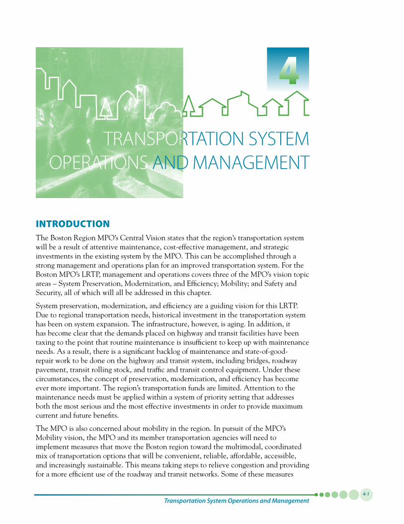
TRANSPORTATION SYSTEM OPERATIONS AND MANAGEMENT Transportation System Operations and Management 4-1 1 INTRODUCTION The Boston Region MPO’s Central Vision states that the region’s transportation system will be a result of attentive maintenance, cost-effective management, and strategic investments in the existing system by the MPO. This can be accomplished through a strong management and operations plan for an improved transportation system. For the Boston MPO’s LRTP, management and operations covers three of the MPO’s vision topic areas – System Preservation, Modernization, and Efficiency; Mobility; and Safety and Security, all of which will all be addressed in this chapter. System preservation, modernization, and efficiency are a guiding vision for this LRTP. Due to regional transportation needs, historical investment in the transportation system has been on system expansion. The infrastructure, however, is aging. In addition, it has become clear that the demands placed on highway and transit facilities have been taxing to the point that routine maintenance is insufficient to keep up with maintenance needs. As a result, there is a significant backlog of maintenance and state-of-good- repair work to be done on the highway and transit system, including bridges, roadway pavement, transit rolling stock, and traffic and transit control equipment. Under these circumstances, the concept of preservation, modernization, and efficiency has become ever more important. The region’s transportation funds are limited. Attention to the maintenance needs must be applied within a system of priority setting that addresses both the most serious and the most effective investments in order to provide maximum current and future benefits. The MPO is also concerned about mobility in the region. In pursuit of the MPO’s Mobility vision, the MPO and its member transportation agencies will need to implement measures that move the Boston region toward the multimodal, coordinated mix of transportation options that will be convenient, reliable, affordable, accessible, and increasingly sustainable. This means taking steps to relieve congestion and providing for a more efficient use of the roadway and transit networks. Some of these measures
Transcript of TRANSPORTATION SYSTEM OPERATIONS AND ... System Operations and Management 4-3 • Use ITS, new...
TRANSPORTATION SYSTEM OPERATIONS AND MANAGEMENT
Transportation System Operations and Management4-1
1
INTRODUCTION The Boston Region MPO’s Central Vision states that the region’s transportation system will be a result of attentive maintenance, cost-effective management, and strategic investments in the existing system by the MPO. This can be accomplished through a strong management and operations plan for an improved transportation system. For the Boston MPO’s LRTP, management and operations covers three of the MPO’s vision topic areas – System Preservation, Modernization, and Efficiency; Mobility; and Safety and Security, all of which will all be addressed in this chapter.
System preservation, modernization, and efficiency are a guiding vision for this LRTP. Due to regional transportation needs, historical investment in the transportation system has been on system expansion. The infrastructure, however, is aging. In addition, it has become clear that the demands placed on highway and transit facilities have been taxing to the point that routine maintenance is insufficient to keep up with maintenance needs. As a result, there is a significant backlog of maintenance and state-of-good-repair work to be done on the highway and transit system, including bridges, roadway pavement, transit rolling stock, and traffic and transit control equipment. Under these circumstances, the concept of preservation, modernization, and efficiency has become ever more important. The region’s transportation funds are limited. Attention to the maintenance needs must be applied within a system of priority setting that addresses both the most serious and the most effective investments in order to provide maximum current and future benefits.
The MPO is also concerned about mobility in the region. In pursuit of the MPO’s Mobility vision, the MPO and its member transportation agencies will need to implement measures that move the Boston region toward the multimodal, coordinated mix of transportation options that will be convenient, reliable, affordable, accessible, and increasingly sustainable. This means taking steps to relieve congestion and providing for a more efficient use of the roadway and transit networks. Some of these measures
Paths to a Sustainable Region: Volume I4-2
fall under the broad categories of transportation systems management (TSM) and transportation demand management (TDM). TSM includes strategies for extracting additional capacity out of existing roadway and transit infrastructure by increasing efficiency. One of the main purposes of TDM measures is to reduce the number of single-occupant vehicles as a way to reduce congestion. Existing TSM and TDM programs and strategies are described in this chapter.
The MPO strives to support projects that will improve safety and security for all users of the transportation system – motorists, transit riders, bicyclists, pedestrians, and persons using other nonmotorized modes – and reduce the number and severity of crashes. It also seeks to protect and maintain the viability of transportation infrastructure that is important for conducting emergency response and for enabling the evacuation of populations that may be necessary in response to natural disasters or disasters caused by human activity. The MPO recognizes that the transit and highway systems play a vital role in moving people safely in the region – including in times of crisis – and that investments in state-of-the-practice intelligent transportation systems (ITS), communication systems, and other elements of the infrastructure are important for providing dependable and safe transportation.
The following sections provide further detail on these three topic areas. They identify the MPO’s visions and policies, and discuss MPO actions to move the transportation system toward these goals. Finally, a section on the development of performance measures outlines the next steps that the MPO will take to track how the region is moving toward its visions.
SYSTEM PRESERVATION, MODERNIZATION, AND EFFICIENCY The Boston Region MPO’s Vision for System Preservation, Modernization, and EfficiencyVision: The aspirational end state of this vision is a regional transportation system that will be maintained to a state of good repair and will operate with maximum efficiency. It will be reliable and modern and will provide improved mobility regionwide. Automobile dependency will be reduced, and the transit system will serve more people. Modernization of the existing system will provide access and accessibility for all; additions to the transportation system will also be fully accessible for persons of all abilities.
Efficiencies and operational improvements will come through ongoing system preservation, use of intelligent transportation systems (ITS) and other technologies, management and operations strategies, and a balanced program of strategic investments. Innovative approaches will reduce auto dependency and actively promote other modes of transportation.
Expansion of the system will come through strategic investments, based on regional needs assessments.
Policies: To accomplish this, the MPO will put a priority on programs, services, and projects that:
• Developlow-coststrategiesandpursuealternativefundingsourcesandmechanisms
The MPO strives to support
projects that will improve safety
and security for all users of the transportation
system... and reduce the
number and severity of
crashes.
Transportation System Operations and Management4-3
• UseITS,newtechnologies,transportation systems management, and management and operations; embrace technology before expansion
• Bringallelementsofthetransportationnetwork into a state of good repair and maintain them at that level; set funding levels to make this possible
• Maintainbridges,roads,andtheexistingtransit system
• SupporttheincreaseofChapter90(described below) funding so that local road maintenance can remain focused on that program
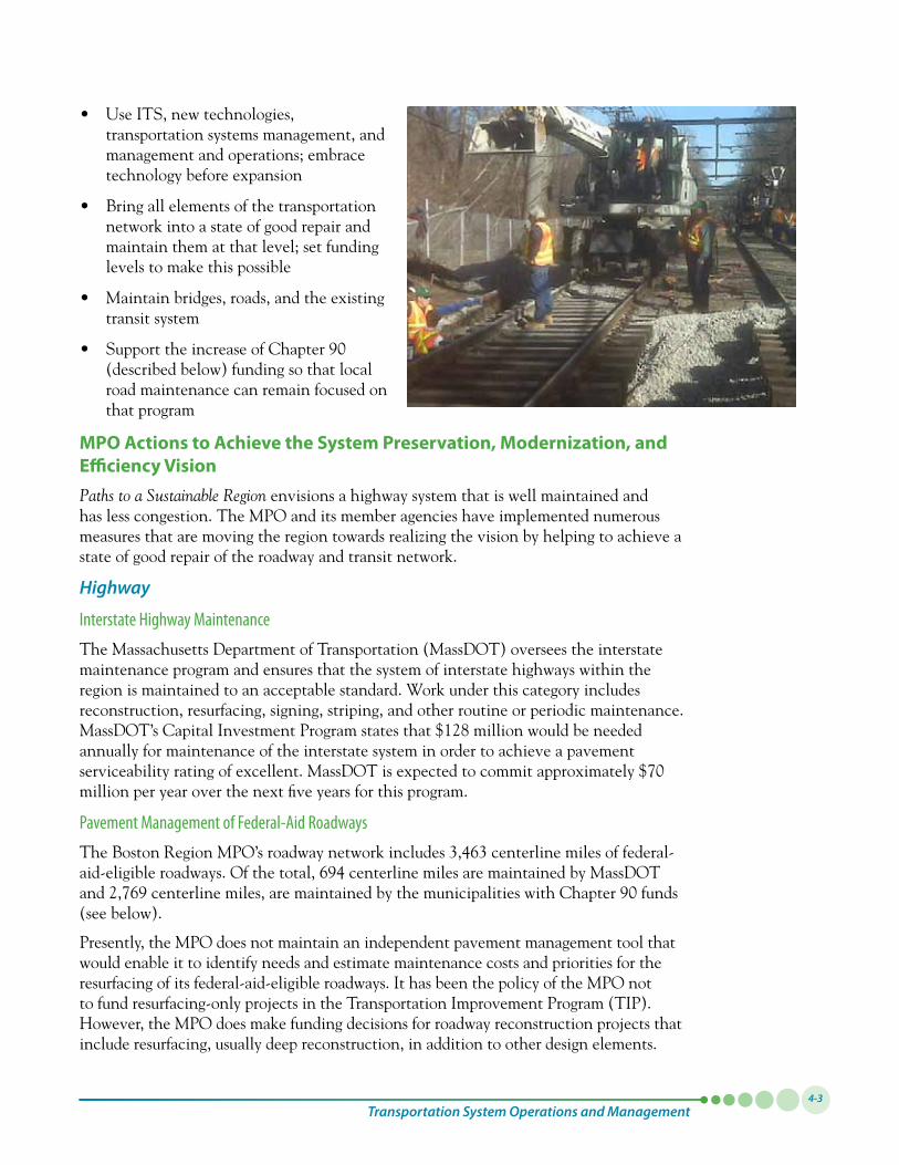
MPO Actions to Achieve the System Preservation, Modernization, and Efficiency VisionPaths to a Sustainable Region envisions a highway system that is well maintained and has less congestion. The MPO and its member agencies have implemented numerous measures that are moving the region towards realizing the vision by helping to achieve a state of good repair of the roadway and transit network.
Highway
Interstate Highway Maintenance
The Massachusetts Department of Transportation (MassDOT) oversees the interstate maintenance program and ensures that the system of interstate highways within the region is maintained to an acceptable standard. Work under this category includes reconstruction, resurfacing, signing, striping, and other routine or periodic maintenance. MassDOT’s Capital Investment Program states that $128 million would be needed annually for maintenance of the interstate system in order to achieve a pavement serviceabilityratingofexcellent.MassDOTisexpectedtocommitapproximately$70million per year over the next five years for this program.
Pavement Management of Federal-Aid Roadways
The Boston Region MPO’s roadway network includes 3,463 centerline miles of federal-aid-eligibleroadways.Ofthetotal,694centerlinemilesaremaintainedbyMassDOTand2,769centerlinemiles,aremaintainedbythemunicipalitieswithChapter90funds(see below).
Presently, the MPO does not maintain an independent pavement management tool that would enable it to identify needs and estimate maintenance costs and priorities for the resurfacing of its federal-aid-eligible roadways. It has been the policy of the MPO not to fund resurfacing-only projects in the Transportation Improvement Program (TIP). However, the MPO does make funding decisions for roadway reconstruction projects that include resurfacing, usually deep reconstruction, in addition to other design elements.
Paths to a Sustainable Region: Volume I4-4
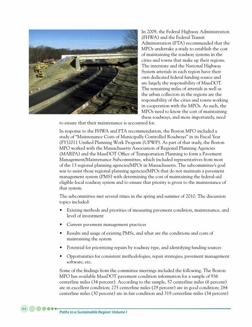
In2009,theFederalHighwayAdministration(FHWA) and the Federal Transit Administration (FTA) recommended that the MPOs undertake a study to establish the cost of maintaining the roadway systems in the cities and towns that make up their regions. The interstate and the National Highway System arterials in each region have their own dedicated federal funding source and are largely the responsibility of MassDOT. The remaining miles of arterials as well as the urban collectors in the regions are the responsibility of the cities and towns working in cooperation with the MPOs. As such, the MPOs need to know the cost of maintaining these roadways, and more importantly, need
to ensure that their maintenance is accounted for.
In response to the FHWA and FTA recommendation, the Boston MPO included a study of “Maintenance Costs of Municipally Controlled Roadways” in its Fiscal Year (FY)2011UnifiedPlanningWorkProgram(UPWP).Aspartofthatstudy,theBostonMPO worked with the Massachusetts Association of Regional Planning Agencies (MARPA) and the MassDOT Office of Transportation Planning to form a Pavement Management/Maintenance Subcommittee, which included representatives from most of the 13 regional planning agencies/MPOs in Massachusetts. The subcommittee’s goal was to assist those regional planning agencies/MPOs that do not maintain a pavement management system (PMS) with determining the cost of maintaining the federal-aid eligible-local roadway system and to ensure that priority is given to the maintenance of that system.
Thesubcommitteemetseveraltimesinthespringandsummerof2010.Thediscussiontopics included:
• Existingmethodsandprioritiesofmeasuringpavementcondition,maintenance,andlevel of investment
• Currentpavementmanagementpractices
• ResultsandusageofexistingPMSs,andwhataretheconditionsandcostsofmaintaining the system
• Potentialforprioritizingrepairsbyroadwaytype,andidentifyingfundingsources
• Opportunitiesforconsistentmethodologies,repairstrategies,pavementmanagementsoftware, etc.
Some of the findings from the committee meetings included the following. The Boston MPOhasavailableMassDOTpavementconditioninformationforasampleof936centerline miles (34 percent). According to the sample, 57 centerline miles (6 percent) areinexcellentcondition;275centerlinemiles(29percent)areingoodcondition;284centerlinemiles(30percent)areinfairconditionand319centerlinemiles(34percent)
Transportation System Operations and Management4-5
are in poor condition. Since this sample likely pertains to pavement information for roadways approximating the function and maintenance standard of MassDOT-maintained roadways, it is unlikely that it closely represents the pavement conditions of the municipality-maintained roadways in the MPO. Based on a recent staff analysis, the actualconditiondistributionmaybecloserto20percentexcellent,29percentgood,25percent fair, and 26 percent poor.
Recently, the MPO has taken two actions toward estimating maintenance costs for the 2,769centerlinemilesofthefederal-aid-eligibleroadnetworkintheMPO:first,staffwasaskedtomakeanestimateofthemaintenanceneedsforfederalfiscalyears2010to2014byapplyingvariousassumptionsfromneighboringregionalplanningagenciesthat maintain a PMS (a rough estimate was calculated that would bring the condition of all roadways to excellent condition); second, the MPO initiated a study to help set the parameters for the establishment of a pavement management system for the Boston Region MPO.
Following the results of the study, the MPO will be considering how to monitor pavementconditionsforthefederal-aidsystem.ThroughfundinginitsFY2012UPWP,the MPO will develop a PMS that would set goals for percentages of roadway within each of the above-mentioned condition categories. These goals will likely be based on cost-effectiveness, safety, and the needs of a preventive maintenance program. Various pavement management scenarios would then be developed and discussed to guide spending for resurfacing in the region.
Chapter 90 Program
TheChapter90program(namedforChapter90oftheMassachusettsGeneralLaws),which is administered by MassDOT, contributes to the Commonwealth’s strategy of preserving existing transportation facilities. This program supports the construction and maintenance of roadways classified as local; that work is performed by the cities and towns of the commonwealth.
Typically,themajorityofChapter90allocations(60percent)areusedforroadresurfacing, with another 32 percent for reconstruction. The remaining funding goes toward engineering and equipment. These funds are reimbursed to communities based on certified expenditure reports submitted to MassDOT. This program helps communities maintain and preserve locally owned roadways.
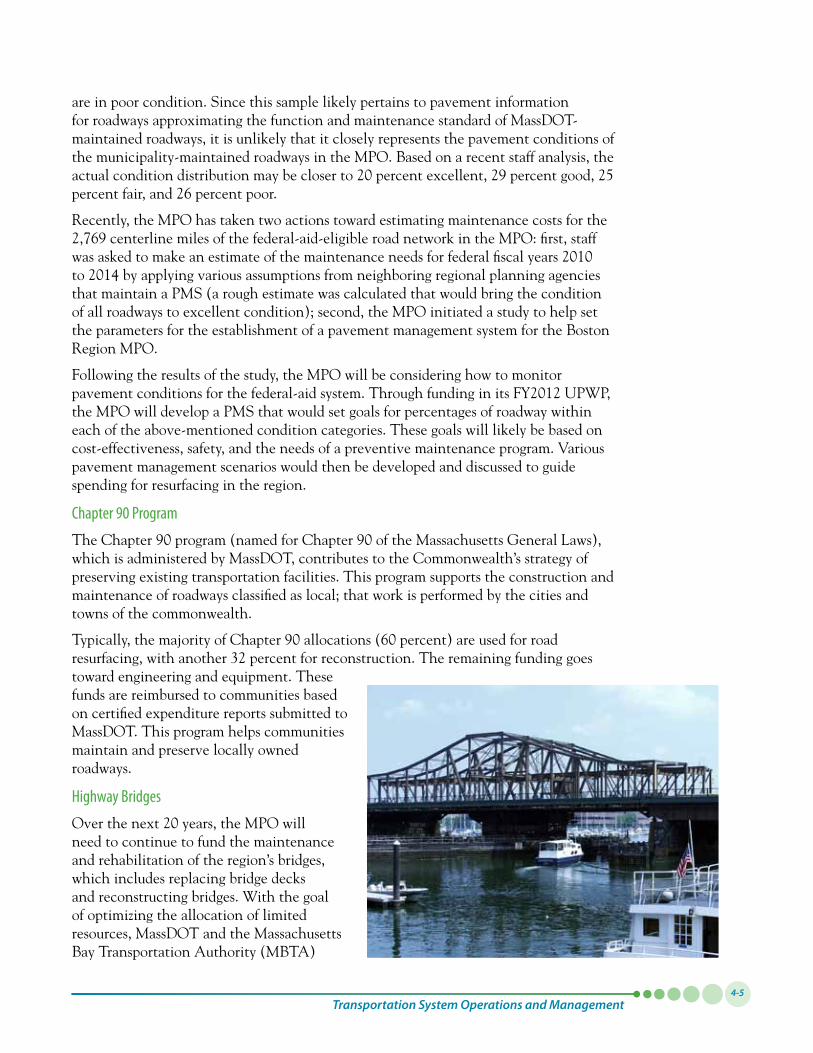
Highway Bridges
Overthenext20years,theMPOwillneed to continue to fund the maintenance and rehabilitation of the region’s bridges, which includes replacing bridge decks and reconstructing bridges. With the goal of optimizing the allocation of limited resources, MassDOT and the Massachusetts Bay Transportation Authority (MBTA)
Paths to a Sustainable Region: Volume I4-6
implemented PONTIS, a bridge management software tool for recording, organizing, and analyzing bridge inventory and inspection data. PONTIS is used to guide the statewide bridge program, which prioritizes resources for preservation, as well as for repair and replacement.
The statewide Accelerated Bridge Program (ABP) is designed to invest on bridge reconstruction that has an urgent construction schedule. This program will spend nearly $3 billion over eight years to reduce the number of structurally deficient bridges in the statesystem.AccordingtoMassDOT,asofFebruary2011,ABPhadadvertised132constructionprojectswithacombinedconstructionbudgetvaluedat$795.9million.In this program, bridges are given priority based on a variety of factors, including cost savings from early action on bridge repairs.
One important asset management initiative is the municipal bridge maintenance agreements between MassDOT and many local communities. Under these agreements, MassDOT reconstructs bridges under local jurisdiction. In return for bridge reconstruction, municipalities agree to be responsible for maintenance and repair of minor deficiencies of the new bridge. The preservation agreements specify the types of maintenance required and provide for routine inspections by MassDOT. Together with the bridge evaluation criteria, these preservation agreements are an important part of a unified system for prioritizing and addressing the needs of all bridges, regardless of ownership.
Another issue that the MPO is aware of concerns the Department of Conservation and Recreation (DCR) facilities in the Boston Region MPO area. With the creation of MassDOT, some of these assets are being addressed, such as the Longfellow Bridge. The MPO will continue to work with other stakeholders on addressing the needs of the DCR transportation system.
TransitThe MBTA is working to ensure that its assets are managed, maintained, and operated to preserve their useful life, thereby reducing the need for more costly, capital-intensive replacements or solutions. Various initiatives have been implemented to support these efforts, which are described below:
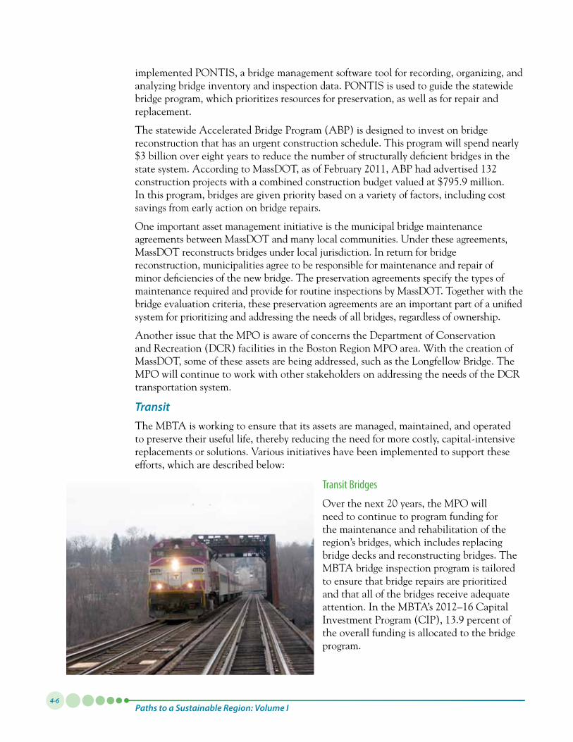
Transit Bridges
Overthenext20years,theMPOwillneed to continue to program funding for the maintenance and rehabilitation of the region’s bridges, which includes replacing bridge decks and reconstructing bridges. The MBTA bridge inspection program is tailored to ensure that bridge repairs are prioritized and that all of the bridges receive adequate attention.IntheMBTA’s2012–16CapitalInvestmentProgram(CIP),13.9percentofthe overall funding is allocated to the bridge program.
Transportation System Operations and Management4-7
Vehicles
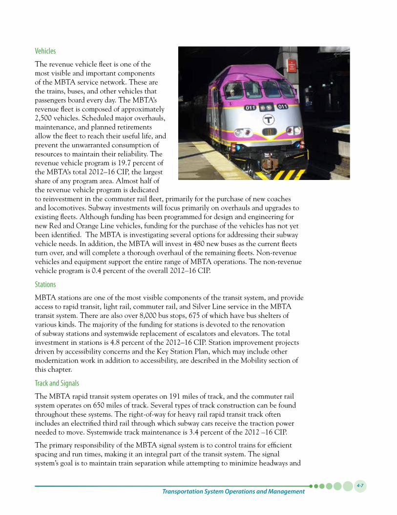
The revenue vehicle fleet is one of the most visible and important components of the MBTA service network. These are the trains, buses, and other vehicles that passengers board every day. The MBTA’s revenue fleet is composed of approximately 2,500vehicles.Scheduledmajoroverhauls,maintenance, and planned retirements allow the fleet to reach their useful life, and prevent the unwarranted consumption of resources to maintain their reliability. The revenuevehicleprogramis19.7percentoftheMBTA’stotal2012–16CIP,thelargestshare of any program area. Almost half of the revenue vehicle program is dedicated to reinvestment in the commuter rail fleet, primarily for the purchase of new coaches and locomotives. Subway investments will focus primarily on overhauls and upgrades to existing fleets. Although funding has been programmed for design and engineering for new Red and Orange Line vehicles, funding for the purchase of the vehicles has not yet been identified. The MBTA is investigating several options for addressing their subway vehicleneeds.Inaddition,theMBTAwillinvestin480newbusesasthecurrentfleetsturn over, and will complete a thorough overhaul of the remaining fleets. Non-revenue vehicles and equipment support the entire range of MBTA operations. The non-revenue vehicleprogramis0.4percentoftheoverall2012–16CIP.
Stations
MBTA stations are one of the most visible components of the transit system, and provide access to rapid transit, light rail, commuter rail, and Silver Line service in the MBTA transitsystem.Therearealsoover8,000busstops,675ofwhichhavebussheltersofvarious kinds. The majority of the funding for stations is devoted to the renovation of subway stations and systemwide replacement of escalators and elevators. The total investmentinstationsis4.8percentofthe2012–16CIP.Stationimprovementprojectsdriven by accessibility concerns and the Key Station Plan, which may include other modernization work in addition to accessibility, are described in the Mobility section of this chapter.
Track and Signals
TheMBTArapidtransitsystemoperateson191milesoftrack,andthecommuterrailsystemoperateson650milesoftrack.Severaltypesoftrackconstructioncanbefoundthroughout these systems. The right-of-way for heavy rail rapid transit track often includes an electrified third rail through which subway cars receive the traction power neededtomove.Systemwidetrackmaintenanceis3.4percentofthe2012–16CIP.
The primary responsibility of the MBTA signal system is to control trains for efficient spacing and run times, making it an integral part of the transit system. The signal system’s goal is to maintain train separation while attempting to minimize headways and
Paths to a Sustainable Region: Volume I4-8
run times. Because the signal systems are crucial for supporting the safe and efficient operationoftrainssystemwide,3.9percentofthetotalcapitalprograminthe2012–16CIP is allocated to the signal program.
Communications
The MBTA Communications Department’s responsibilities include maintaining an inventory of equipment and overseeing contract services for the Wide Area Network, two-way radio systems, microwave links, emergency intercoms, public address systems, light-emitting-diode (LED) message signs, fire alarm systems, security systems, and the supervisory control and data acquisition system. The department manages the MBTA’s Operations Control Center (OCC), which consists of technology that allows for real-time monitoring and supervisory control of the signal and communication systems for the rapid transit and bus systems. Current investments include completion of the system radio project, which will upgrade the MBTA’s radio communication with new state-of-the-art digitaltechnology.Thecommunicationsprogramis0.2percentofthe2012–16CIP.
Maintenance Facilities (Yards and Shops)
Maintenance facilities, or yards and shops, are the sites for regularly scheduled maintenance and emergency repairs on all MBTA vehicles. Each facility generally includes a building with a mechanical plant and shop equipment. The arrival of large fleets of vehicles equipped with new technologies will place additional demands on the personnel and facilities that maintain, repair, refuel, and service the vehicles. Additional fueling and engineequipmentdesignedforCNGbuses,along with maintenance and support equipment foradditional60-footarticulatedbuses,willbeneeded.Low-floortechnologiesonGreenLine subway cars and new bus fleets also have special maintenance needs. As a result of the higher infrastructure costs of special facilities forCNGbuses,alargeportionofthefundingformaintenancefacilitiesinthe2012–16CIPis
devotedtonewconstructionorrenovationofexistingbusfacilitiestoserveCNGbuses.Thetotalmaintenancefacilitiesprogramis1.4percentofthe2012–16CIP.
Supporting Infrastructure
Supporting infrastructure includes facilities and power. Facilities include administrative buildings, vent buildings, storage buildings, noise walls, retaining walls, culverts, parking garages and parking lots, layover facilities, and fencing (which prevents trespassers from gaining access to tracks and fast-moving trains). The facilities program represents 2.8 percentofthetotal2012–16CIPspending.
While power for the MBTA’s network is supplied by an outside utility, the MBTA transforms and distributes electricity over its own system to power the entire network
Transportation System Operations and Management4-9
of subway, trackless trolley, and light-rail lines. The capital equipment in this power program is essential to operations: it supplies electricity to subway trains and trolleys for the traction power they need to move; to the signal systems for the power needed to control the trains; and to stations to operate their lights, elevators, and escalators, and other equipment. The MBTA’s power program, arguably one of the least visible elements to passengers, is one of the most complex, important, far-reaching, and expensive systems for the MBTA to maintain. As such, investment in power programs is 6.4 percent of the 2012–16CIP.
FreightThe MPO and the Commonwealth must continue to work to manage, maintain, and operate the transportation system in a way that preserves the freight system’s useful life. The MPO will continue to consider truck freight movements in the prioritization of system preservation projects included in the TIP. Various issues that must also be addressed to achieve a state of good repair are described below:
Weight-Restricted Roadway Bridges
Posted bridges have signs at both ends informing drivers of the bridge’s vehicle weight restrictions. A bridge is posted if it is either designated as “functionally obsolete” because it has not been designed to support modern trucks, or it is designated as “structurally deficient” due to significant deterioration of the bridge deck, supports, or other major components. Some posted bridges can be repaired or rehabilitated to meet such standards; others must undergo costly replacement. Trucks exceeding a bridge’s weight restrictions must find alternate routes, increasing the trip distance and travel time.
Weight-Restricted Rail
Rail lines are rated by the maximum weight of a rail car that can be accommodated ontherailline.Therailindustrystandardis286,000poundsforanindividualrailcar.However,mostofthetracksintheBostonregionarelimitedto263,000-poundrailcars. This restriction increases the cost for shippers and can delay shipments, since the rail cars might need to be reconfigured before entering tracks rated below the industry standard.
MuchoftherailnetworkinEasternMassachusettsislimitedto263,000-poundrailcarsasamatterofpolicy.Aswasstatedinthe2010StateFreightPlan,trackconveyedbyprivaterailroadstotheMBTAinthe1970swastransferredwiththe263,000-poundrailcar limit, and the MBTA is only required to maintain the rail to levels it was deeded atthattime.TheMBTAhasrebuiltmuchofthetrack,however,the263,000-poundweight limit remains. Due to financial constraint, it was not a priority of the MBTA to increase the weight limit, which could increase maintenance costs. The State Freight Plan states that the increase in maintenance costs could be addressed through new levels of fees for the freight carriers.
Dredging
One of the most important issues for the Port of Boston is the need to dredge the channels to deeper depths in order to accommodate ships of deeper draft. The channel intothePortofBostonwasdredgedfrom35to40feetatlowtide,with45feetatthe
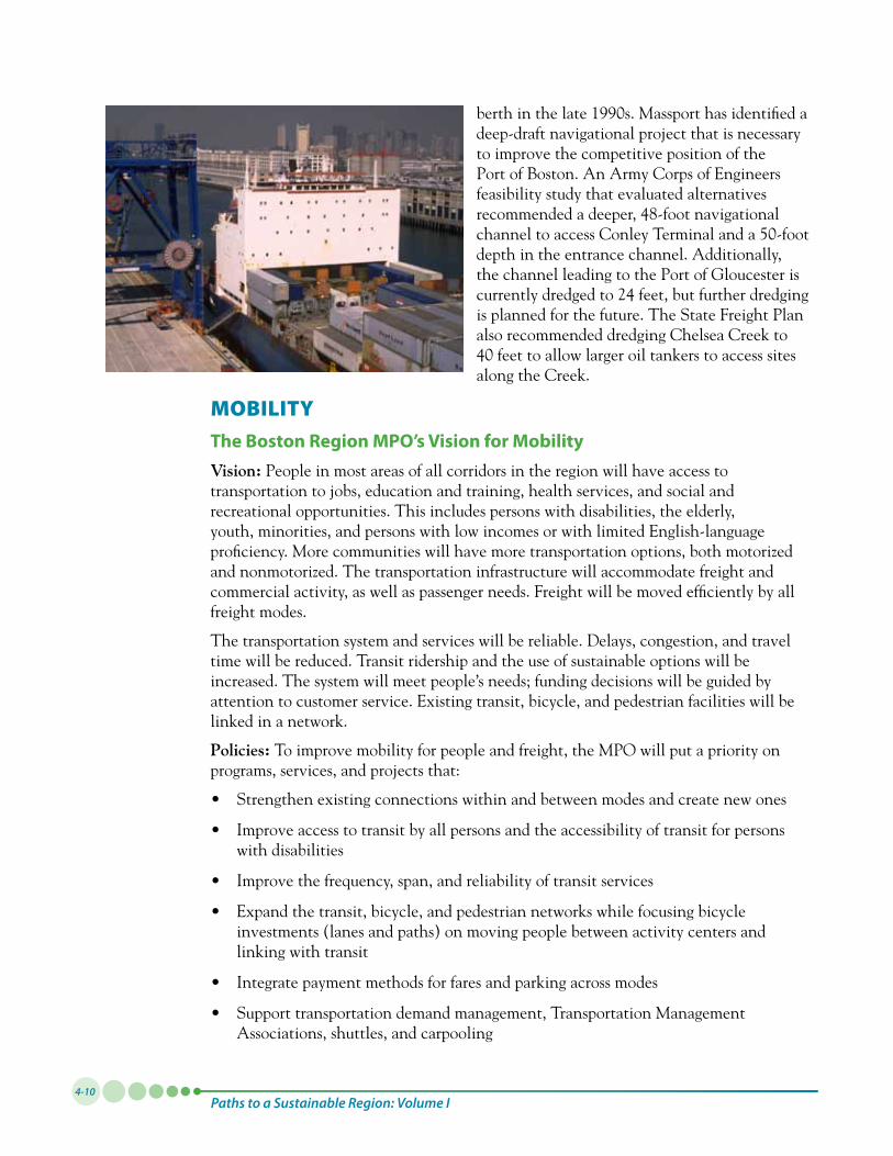
Paths to a Sustainable Region: Volume I4-10
berthinthelate1990s.Massporthasidentifiedadeep-draft navigational project that is necessary to improve the competitive position of the Port of Boston. An Army Corps of Engineers feasibility study that evaluated alternatives recommended a deeper, 48-foot navigational channeltoaccessConleyTerminalanda50-footdepth in the entrance channel. Additionally, thechannelleadingtothePortofGloucesteriscurrently dredged to 24 feet, but further dredging is planned for the future. The State Freight Plan also recommended dredging Chelsea Creek to 40feettoallowlargeroiltankerstoaccesssitesalong the Creek.
MOBILITYThe Boston Region MPO’s Vision for MobilityVision: People in most areas of all corridors in the region will have access to transportation to jobs, education and training, health services, and social and recreational opportunities. This includes persons with disabilities, the elderly, youth, minorities, and persons with low incomes or with limited English-language proficiency. More communities will have more transportation options, both motorized and nonmotorized. The transportation infrastructure will accommodate freight and commercial activity, as well as passenger needs. Freight will be moved efficiently by all freight modes.
The transportation system and services will be reliable. Delays, congestion, and travel time will be reduced. Transit ridership and the use of sustainable options will be increased. The system will meet people’s needs; funding decisions will be guided by attention to customer service. Existing transit, bicycle, and pedestrian facilities will be linked in a network.
Policies: To improve mobility for people and freight, the MPO will put a priority on programs, services, and projects that:
• Strengthenexistingconnectionswithinandbetweenmodesandcreatenewones
• Improveaccesstotransitbyallpersonsandtheaccessibilityoftransitforpersonswith disabilities
• Improvethefrequency,span,andreliabilityoftransitservices
• Expandthetransit,bicycle,andpedestriannetworkswhilefocusingbicycleinvestments (lanes and paths) on moving people between activity centers and linking with transit
• Integratepaymentmethodsforfaresandparkingacrossmodes
• Supporttransportationdemandmanagement,TransportationManagementAssociations, shuttles, and carpooling
Transportation System Operations and Management4-11
• Addresscapacityconstraintsandbottlenecksintheexistingroadwaysystemusinglow-cost approaches (transportation system management strategies, management and operations strategies, ITS, and new technologies) before expansion
MPO Actions to Achieve the Mobility Vision
HighwayThe MPO and its member agencies have implemented numerous measures that are moving the region toward realizing the vision by helping to relieve congestion and allowing for a more efficient use of the roadway and transit network.
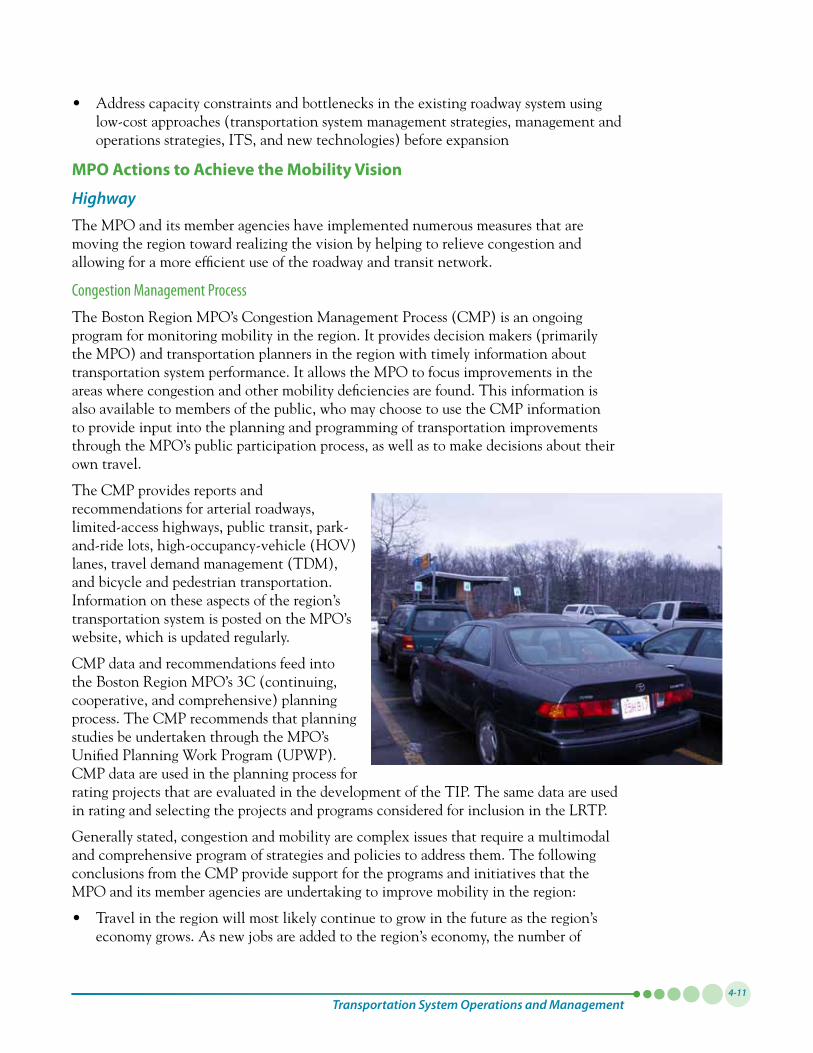
Congestion Management Process
The Boston Region MPO’s Congestion Management Process (CMP) is an ongoing program for monitoring mobility in the region. It provides decision makers (primarily the MPO) and transportation planners in the region with timely information about transportation system performance. It allows the MPO to focus improvements in the areas where congestion and other mobility deficiencies are found. This information is also available to members of the public, who may choose to use the CMP information to provide input into the planning and programming of transportation improvements through the MPO’s public participation process, as well as to make decisions about their own travel.
The CMP provides reports and recommendations for arterial roadways, limited-access highways, public transit, park-and-ride lots, high-occupancy-vehicle (HOV) lanes, travel demand management (TDM), and bicycle and pedestrian transportation. Information on these aspects of the region’s transportation system is posted on the MPO’s website, which is updated regularly.
CMP data and recommendations feed into the Boston Region MPO’s 3C (continuing, cooperative, and comprehensive) planning process. The CMP recommends that planning studies be undertaken through the MPO’s Unified Planning Work Program (UPWP). CMP data are used in the planning process for rating projects that are evaluated in the development of the TIP. The same data are used in rating and selecting the projects and programs considered for inclusion in the LRTP.
Generallystated,congestionandmobilityarecomplexissuesthatrequireamultimodaland comprehensive program of strategies and policies to address them. The following conclusions from the CMP provide support for the programs and initiatives that the MPO and its member agencies are undertaking to improve mobility in the region:
• Travelintheregionwillmostlikelycontinuetogrowinthefutureastheregion’seconomy grows. As new jobs are added to the region’s economy, the number of
Paths to a Sustainable Region: Volume I4-12
vehicle-miles traveled (VMT) and traffic delay are also expected to grow. Since building new capacity is not always possible or desirable, it is important to maximize the capacity of the existing infrastructure. Mitigating the effects of crashes and other roadway events (incident management) and improving the system’s operational efficiency for all roadway users, including bus riders, are the two key areas where this strategy reduces congestion.
• Traveldemandmanagementcanbepartoftheintegratedsolutionofreducingcongestion and improving mobility. Though the impact on congestion of TDM measures, such as ridesharing, shifting the time of travel, and telecommuting, is limited, these measures can improve mobility for certain travel markets and help reduce VMT as part of the mix of solutions.
• Regulatorypoliciesformanagingurbangrowthanddesigncanreducecongestion.Development is occurring more quickly in outlying communities in the region than in the inner core. This development pattern results in more dispersed trips, with fewer commuters traveling into a single central business district. “Smart growth” practices, transit-oriented development, and funding incentives help to reduce VMT and delays by increasing development densities and promoting sustainable development.
• Addressingsafetycanhavesecondarybeneficialeffectsoncongestion.Safetyand congestion are interrelated: addressing safety can have beneficial effects on congestion, and, likewise, reducing congestion can reduce the number and severity of crashes. For more information on strategies for improving safety, see the Safety and Security section of this chapter.
Transportation Systems Management
In many cases, both highway and transit strategies can be implemented without expanding physical capacity. The CMP recommendations included several operational efficiency strategies for extracting additional capacity out of existing roadway and highway infrastructure. These strategies include intelligent transportation systems, incident management, traffic-signal coordination and prioritization, bottleneck removal, and high-occupancy-vehicle (HOV) lanes. The programs for improving roadway are discussed below.
Intelligent Transportation
Intelligent transportation systems (ITS) involve the integration of technology into the management of the operation of transportation facilities, with the goals of increasing operational efficiency and capacity, improving safety, reducing environmental costs, and improving mobility. The MPO has participated in the development of ITS activities since1992.TheBostonMetropolitanareawasoneofthefirstareasinthecountrytocomplete a metropolitan area Early Deployment Planning Program for ITS, sponsored by theFederalHighwayAdministration(FHWA),in1993.
MassDOTdevelopedaregionalITSarchitectureformetropolitanBostonin2005,withamorerecentupdatein2011,whichconformstotheNationalITSArchitecture,as federally required. The architecture guides the coordination and integration of ITS projects in the region to help transportation agencies eliminate duplication, reduce design
Transportation System Operations and Management4-13
costs and project development time, facilitate efficient system expansion, improve safety and security, facilitate deployment of new technologies, and lower system life cycle costs.
In2010,MassDOTdevelopedadraftITSStrategicPlan,andMassDOT,withitspartnerstate transportation agencies, developed a Regional Transportation Operations Strategy for the Boston metropolitan region. The Boston Region MPO participated in the latter as a stakeholder. These documents contain information about the status of implementing ITS projects in the region and what the priorities are for additional implementation.
MassDOT and the City of Boston currently monitor road conditions and traffic flow on major highways and intersections using fixed equipment such as loop detectors and wireless communications. The Central Artery/Tunnel Operations Control Center is thelargestofitskind,featuringover400camerasformonitoringroads,1,200roadsensorsfordetectingstoppedtraffic,120carbonmonoxidesensors,computer-controlledventilation buildings, and a radio frequency able to interrupt radio broadcasts and dispatch emergency information. MassDOT operates numerous variable-message signs. MassDOT’s Regional Operations Center dispatches emergency Commerce CaresVan patrolvans,afleetofmorethan20vehiclesthatprovidesroadsideassistancetostrandedmotorists, thereby improving highway safety and reducing congestion. Coordination with the MBTA’s existing automatic vehicle location (AVL) capability is planned. The City of Boston’s Traffic Management Center allows for real-time monitoring of traffic and incident management, and coordination of emergency-response providers.
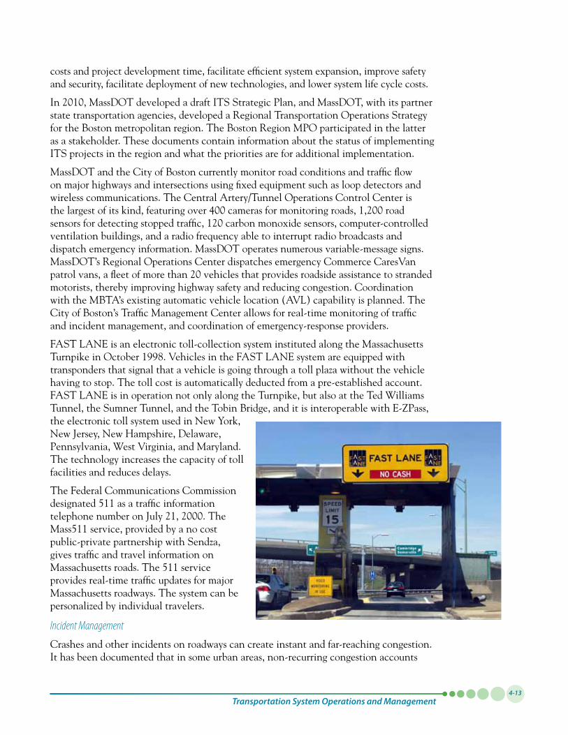
FAST LANE is an electronic toll-collection system instituted along the Massachusetts TurnpikeinOctober1998.VehiclesintheFASTLANEsystemareequippedwithtransponders that signal that a vehicle is going through a toll plaza without the vehicle having to stop. The toll cost is automatically deducted from a pre-established account. FAST LANE is in operation not only along the Turnpike, but also at the Ted Williams Tunnel, the Sumner Tunnel, and the Tobin Bridge, and it is interoperable with E-ZPass, the electronic toll system used in New York, New Jersey, New Hampshire, Delaware, Pennsylvania, West Virginia, and Maryland. The technology increases the capacity of toll facilities and reduces delays.
The Federal Communications Commission designated 511 as a traffic information telephonenumberonJuly21,2000.TheMass511 service, provided by a no cost public-private partnership with Sendza, gives traffic and travel information on Massachusetts roads. The 511 service provides real-time traffic updates for major Massachusetts roadways. The system can be personalized by individual travelers.
Incident Management
Crashes and other incidents on roadways can create instant and far-reaching congestion. It has been documented that in some urban areas, non-recurring congestion accounts
Paths to a Sustainable Region: Volume I4-14
forupto60percentofthetotalcongestion.TheCommonwealthofMassachusettsoutlines an incident management program in its Regional ITS Architecture for MetropolitanBostonreportandthetwodraftdocumentsproducedin2010referencedabove (the ITS Strategic Plan and the Regional Transportation Operations Strategy for the Boston metropolitan region). The program, which includes MassDOT’s Commerce CaresVan patrol vans and numerous surveillance and detection equipment installed along highways, promotes the sharing between agencies of information and data about emergencies in order to facilitate the access of emergency vehicles and to reduce the congestion resulting from an incident.
Traffic Signal Coordination
Traffic signals that are not coordinated can significantly reduce mobility, even when the roadways are not at capacity. Traffic signal coordination allows for the smooth flow of traffic through consecutive, closely spaced traffic signals. It is a relatively inexpensive way to increase capacity for vehicles on roadways without lane additions. MassDOT, the City of Boston, and various municipalities already operate signal-coordination and closed-loop traffic signal systems. The MPO supports the monitoring of existing coordination plans and studying the region’s roadways to determine which additional locations could benefit from signal coordination. Inventories in the CMP revealed that many MPO arterials could benefit from traffic signal coordination. If traffic-signal timing is rarely reviewed, it can result in outdated timing patterns that do not reflect current traffic and pedestrian needs. Signals that lack coordination or are inadequately coordinated force motorists to stop at multiple adjacent signals, resulting in significant travel delays. As part of a program of periodic reviews of corridor signal-timing plans for improved operations and coordination, the MPO is currently studying arterial traffic-signal improvements and coordination. Priority is being given to high-volume and high-crash-rate arterials.
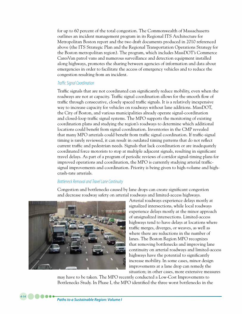
Bottleneck Removal and Travel Lane Continuity
Congestion and bottlenecks caused by lane drops can create significant congestion and decrease roadway safety on arterial roadways and limited-access highways.
Arterial roadways experience delays mostly at signalized intersections, while local roadways experience delays mostly at the minor approach of unsignalized intersections. Limited-access highways tend to have delays at locations where traffic merges, diverges, or weaves, as well as where there are reductions in the number of lanes. The Boston Region MPO recognizes that removing bottlenecks and improving lane continuity on arterial roadways and limited-access highways have the potential to significantly increase mobility. In some cases, minor design improvements at a lane drop can remedy the situation; in other cases, more extensive measures
may have to be taken. The MPO recently conducted a Low-Cost Improvements to Bottlenecks Study. In Phase I, the MPO identified the three worst bottlenecks in the
Transportation System Operations and Management4-15
region and studied low-cost countermeasures. In a second phase of the study, the MPO will identify two more bottlenecks that are among the worst in the region and identify low-cost countermeasures.
Transportation Demand Management
Transportation demand management (TDM) includes programs and strategies that provide alternatives to single-occupant-vehicle travel on roadways. These include shuttle services in areas underserved by transit; ridesharing; and high-occupancy-vehicle (HOV) lanes to encourage carpooling. In providing alternate modes of travel, these programs and strategies aim to reduce congestion without adding physical capacity to the existing roadway and highway system.
Transportation Management Associations
Transportation Management Associations (TMAs) are nonprofit coalitions of local businesses dedicated to reducing traffic congestion and pollution and improving commutingoptionsfortheiremployees.Thereare10TMAsthatservecommunitiesin the Boston region, and several support shuttle services that connect employment locations with MBTA rapid transit or commuter rail stations. While some of these services are only available to employees of the member companies, others are open to the general public.
MassRIDES and Ridesharing
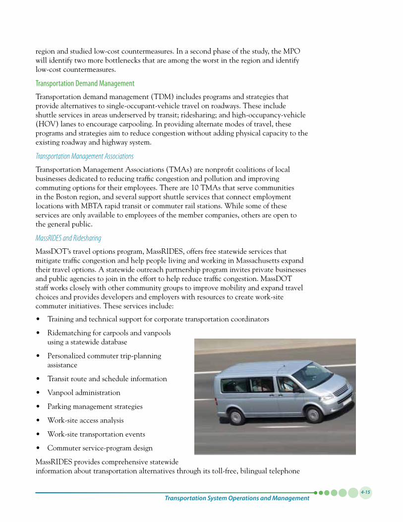
MassDOT’s travel options program, MassRIDES, offers free statewide services that mitigate traffic congestion and help people living and working in Massachusetts expand their travel options. A statewide outreach partnership program invites private businesses and public agencies to join in the effort to help reduce traffic congestion. MassDOT staff works closely with other community groups to improve mobility and expand travel choices and provides developers and employers with resources to create work-site commuter initiatives. These services include:
• Trainingandtechnicalsupportforcorporatetransportationcoordinators
• Ridematchingforcarpoolsandvanpoolsusing a statewide database
• Personalizedcommutertrip-planningassistance
• Transitrouteandscheduleinformation
• Vanpooladministration
• Parkingmanagementstrategies
• Work-siteaccessanalysis
• Work-sitetransportationevents
• Commuterservice-programdesign
MassRIDES provides comprehensive statewide information about transportation alternatives through its toll-free, bilingual telephone
Paths to a Sustainable Region: Volume I4-16
line and its information center on the Web. Massachusetts commuters can access the statewide computerized ridematching database to obtain information on carpools, vanpools, and transit alternatives that match their commute.
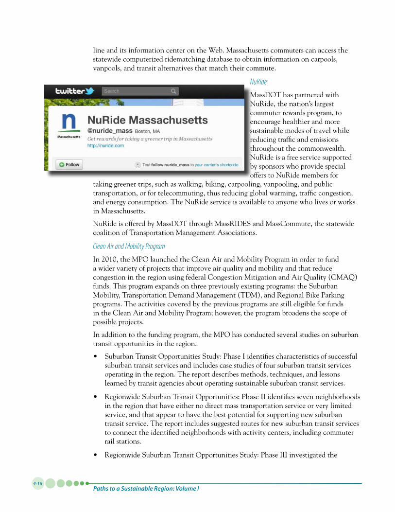
NuRide
MassDOT has partnered with NuRide, the nation’s largest commuter rewards program, to encourage healthier and more sustainable modes of travel while reducing traffic and emissions throughout the commonwealth. NuRide is a free service supported by sponsors who provide special offers to NuRide members for
taking greener trips, such as walking, biking, carpooling, vanpooling, and public transportation, or for telecommuting, thus reducing global warming, traffic congestion, and energy consumption. The NuRide service is available to anyone who lives or works in Massachusetts.
NuRide is offered by MassDOT through MassRIDES and MassCommute, the statewide coalition of Transportation Management Associations.
Clean Air and Mobility Program
In2010,theMPOlaunchedtheCleanAirandMobilityPrograminordertofunda wider variety of projects that improve air quality and mobility and that reduce congestion in the region using federal Congestion Mitigation and Air Quality (CMAQ) funds. This program expands on three previously existing programs: the Suburban Mobility, Transportation Demand Management (TDM), and Regional Bike Parking programs. The activities covered by the previous programs are still eligible for funds in the Clean Air and Mobility Program; however, the program broadens the scope of possible projects.
In addition to the funding program, the MPO has conducted several studies on suburban transit opportunities in the region.
• SuburbanTransitOpportunitiesStudy:PhaseIidentifiescharacteristicsofsuccessfulsuburban transit services and includes case studies of four suburban transit services operating in the region. The report describes methods, techniques, and lessons learned by transit agencies about operating sustainable suburban transit services.
• RegionwideSuburbanTransitOpportunities:PhaseIIidentifiessevenneighborhoodsin the region that have either no direct mass transportation service or very limited service, and that appear to have the best potential for supporting new suburban transit service. The report includes suggested routes for new suburban transit services to connect the identified neighborhoods with activity centers, including commuter rail stations.
• RegionwideSuburbanTransitOpportunitiesStudy:PhaseIIIinvestigatedthe
Transportation System Operations and Management4-17
potential for demand-responsive service as a way to improve suburban mobility and accessibility.
Safe Routes to School
MassDOT’s Safe Routes to School program in Massachusetts aims to increase physical activity and safety for children, and to decrease traffic congestion and air pollution. The program focuses on educating elementary school students, parents, and community members on the value of walking, bicycling, carpooling, using public transit, and taking school buses for traveling to and from school. Additionally, schools can partner with the program to directly implement programs and engineer solutions to accomplish the program’s objectives. The Safe Routes to School program in Massachusetts is administered by MassRIDES and is funded through the Federal Highway Administration in accordance with the provisions of SAFETEA-LU, the federal surface transportation legislation.
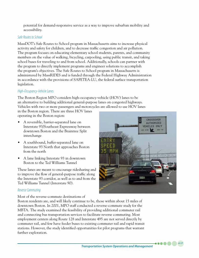
High-Occupancy-Vehicle Lanes
The Boston Region MPO considers high-occupancy-vehicle (HOV) lanes to be an alternative to building additional general-purpose lanes on congested highways. Vehicles with two or more passengers and motorcycles are allowed to use HOV lanes in the Boston region. There are three HOV lanes operating in the Boston region:
• Areversible,barrier-separatedlaneonInterstate93/SoutheastExpresswaybetweendowntown Boston and the Braintree Split interchange
• Asouthbound,buffer-separatedlaneonInterstate93NorththatapproachesBostonfrom the north
• AlanelinkingIntestate93indowntownBoston to the Ted Williams Tunnel
These lanes are meant to encourage ridesharing and to improve the flow of general-purpose traffic along theInterstate93corridor,aswellastoandfromtheTedWilliamsTunnel(Interstate90).
Reverse Commuting
Most of the reverse-commute destinations of Boston residents are, and will likely continue to be, those within about 15 miles of downtownBoston.In2001,MPOstaffconductedareverse-commutestudyfortheMBTA. The study examined the feasibility of providing additional commuter rail and connecting bus transportation services to facilitate reverse commuting. Most employmentcentersalongRoute128andInterstate495arenotserveddirectlybycommuter rail, and few have feeder buses to existing commuter rail and rapid transit stations. However, the study identified opportunities for pilot programs that warrant further exploration.
Paths to a Sustainable Region: Volume I4-18
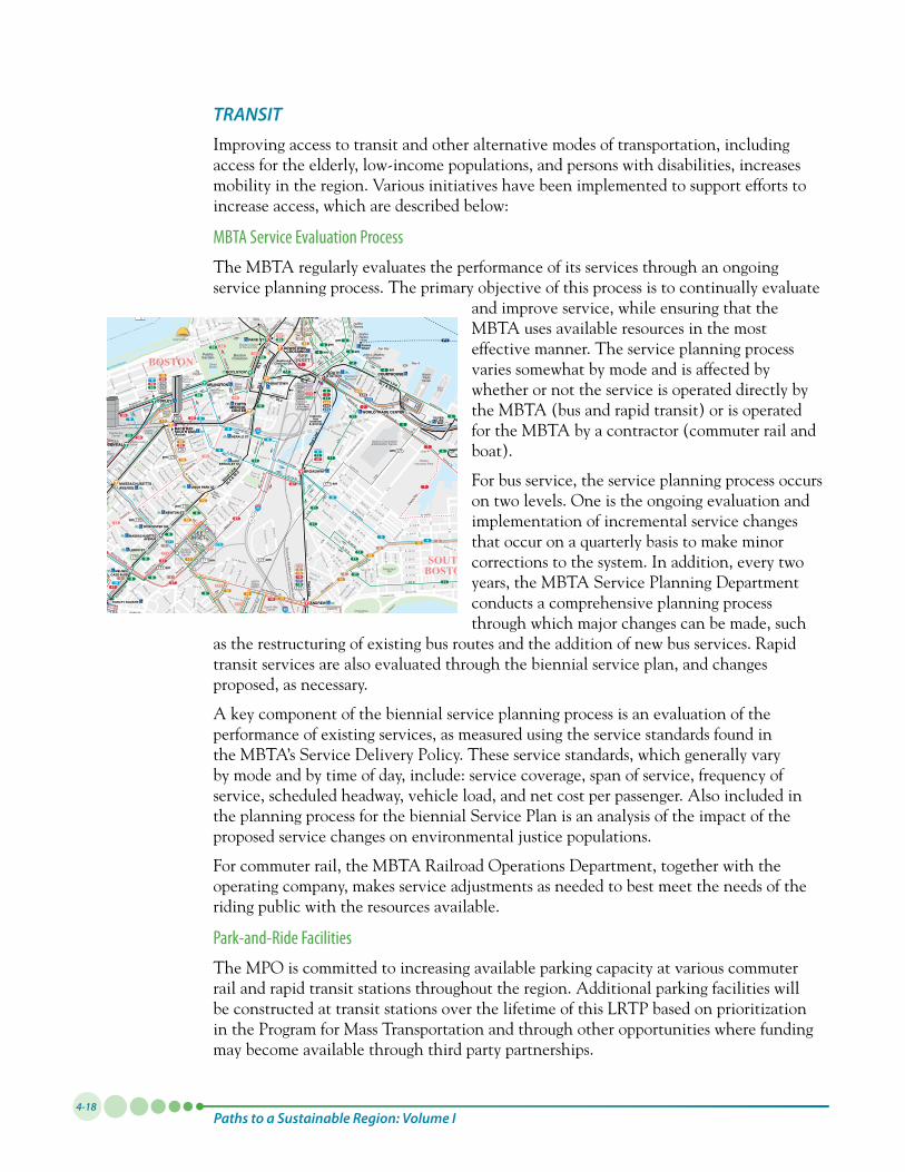
TRANSITImproving access to transit and other alternative modes of transportation, including access for the elderly, low-income populations, and persons with disabilities, increases mobility in the region. Various initiatives have been implemented to support efforts to increase access, which are described below:
MBTA Service Evaluation Process
The MBTA regularly evaluates the performance of its services through an ongoing service planning process. The primary objective of this process is to continually evaluate
and improve service, while ensuring that the MBTA uses available resources in the most effective manner. The service planning process varies somewhat by mode and is affected by whether or not the service is operated directly by the MBTA (bus and rapid transit) or is operated for the MBTA by a contractor (commuter rail and boat).
For bus service, the service planning process occurs on two levels. One is the ongoing evaluation and implementation of incremental service changes that occur on a quarterly basis to make minor corrections to the system. In addition, every two years, the MBTA Service Planning Department conducts a comprehensive planning process through which major changes can be made, such
as the restructuring of existing bus routes and the addition of new bus services. Rapid transit services are also evaluated through the biennial service plan, and changes proposed, as necessary.
A key component of the biennial service planning process is an evaluation of the performance of existing services, as measured using the service standards found in the MBTA’s Service Delivery Policy. These service standards, which generally vary by mode and by time of day, include: service coverage, span of service, frequency of service, scheduled headway, vehicle load, and net cost per passenger. Also included in the planning process for the biennial Service Plan is an analysis of the impact of the proposed service changes on environmental justice populations.
For commuter rail, the MBTA Railroad Operations Department, together with the operating company, makes service adjustments as needed to best meet the needs of the riding public with the resources available.
Park-and-Ride Facilities
The MPO is committed to increasing available parking capacity at various commuter rail and rapid transit stations throughout the region. Additional parking facilities will be constructed at transit stations over the lifetime of this LRTP based on prioritization in the Program for Mass Transportation and through other opportunities where funding may become available through third party partnerships.
BROOKLINE
CAMBRIDGE
CHARLESTOWN
EASTBOSTON
BOSTON
CHELSEA
SOUTHBOSTON
EVERETT
Worcester/Framingham Commuter Rail
Fitchburg Commuter Rail
PublicGarden Boston
Common
LoganInternational
Airport
City Point
Intercitybus
terminal& Amtrak
McCormack Housing
Bedford &Chauncy Sts.
SOMERVILLE
Long Wharf to Charlestown Navy Yard
pm
am
am
pm
am
am
am
am
am
am
am
A
B
C
E
B
C E
A
RowesWharf
CentralWharf
LongWharf
CharlestownNavy Yard
LoganAirport
A B C E
am
pm
am
pm
am
39
CT2
CT1CT1
CT1
39
2328
6065
64
CT1
168
8 16
555
847
14
112
1111
5
18
16 17
11
45
19
44
154514
42
41
14
1
47
43
8 10
47
98
55
9392
55
57
325326
352
355
426
83
64
70A70
7173 69
92
87
85
72
7478
8088
80
80 89 10190
95
92
104105
109
93 111
117116
9092
95
9677
576065
8
1CT155
1CT139
1CT1
5CT3
10161718
911
CT147
1 8391
666869
1
7778
75
717273
8696
8396
77
808788
69
9293
4
3955
9
814
1 1923
1545
42
41 47
4466
39
899091
869395101
92105109
104
116117120121
120121
553554556558
47
170
68
74
112
459
448449
10
4
354
428
455
442441434
4
9
7
6470A70
66
66
CT1
1847
47
810
10
1010
10
1011
10 9
5
5
5
1
57
57
847
847
CT247
8
66
66
66
66
39
39
39
39
39
9
47
47
11
11
9
9
11
11
9
2223
15424445
2866
8
6065
60
65
65
60
60
60 1441
CT2
CT2
8
47 10
10
8
CT247
CT2
4747
47
47
CT2
CT2
64
64
6470A 70
7070A
64
91
91
91
87
85
85
85
85
91
91
83
83
83
83
83
83
87
87
69
69
68
64
6470
70A
9677
89 101
90
90
90
88 90
88
80
93
93
92
92
93
111
111
112
112
120
120
120
121
121
120
120
399
55
10
43
43
43
43
55
55
3910
4355
11
4
4
9392
4
11
11
7
55
22
CT3
111
CT3
CT3
86 86
86
75
170
170
170
170
170
170
MISMIS
MIS
114
114
MIS
11
7
CT2
CT2
CT2
CT2
CT2
CT2
86
CT3
CT3
Massport Logan Airport Shuttles
1
16
86
41
424
171
171
171
171
171
171
171
171
171
8
171
170
170
6869
92
8
F4
F2
F1
F2
CT1
CT1
CT1
CT1
171
22
47
8391
9183
47
70A70
64
70A70
47
11
4
4
19
19
19
19
19
19
19
CT2
CT3
502
10
CT3
CT3
503
28
555
CT38
CT2 192223
15 47
4445
43
28
93924
171
1-800-23-LOGAN www.massport.com
171
CT3
64
4
4
4
4
4
4
4
9293
MIS
111
111
MIS
1
450
555
500501504505
459
SheratonCommander
New EnglandBaptistHospital
East
StPilgrim St
Sidney
St
Landsdowne St
Museu
m Way North Point Blvd
BROOKLINE VILLAGE
TUFTSMEDICALCENTER
TUFTSMEDICALCENTER
FENWAY
HYNESCONVENTIONCENTER
RUGGLES
WORLD TRADE CENTER
WORCESTER SQ
BACK BAYSOUTH ENDAmtrak
LENOX ST
MASSACHUSETTSAVENUE
UNION PARK ST
MELNEACASS BLVD
NEWTON ST
ST. MARY'S ST
MAVERICK
NORTH STATION
STATE
DOWNTOWNCROSSING
ARLINGTON
COPLEY
PRUDENTIAL
ROXBURYCROSSING
MAVERICK
AIRPORT
WOOD ISLAND
STATE
*BOWDOIN
GOVERNMENTCENTER
SOUTHSTATION
PARK ST
BOYLSTON*
CHINATOWNARLINGTON
BACK BAYSOUTH ENDAmtrak
COPLEY
PRUDENTIAL
MASSACHUSETTSAVENUE
ROXBURYCROSSING
KENMORE
ANDREW
BROADWAY
DOWNTOWNCROSSING
CHARLES/MGH
CENTRAL
HARVARD
PORTER
SULLIVAN SQUARE
COMMUNITYCOLLEGE
LECHMERE
SCIENCE PARK
NORTH STATION
MUSEUM OF FINE ARTS
LONGWOODMEDICAL AREA
FENWOOD RDMISSION PARK
RIVERWAY
BACK OFTHE HILL
HEATH ST
BRIGHAMCIRCLE
BROOKLINE VILLAGE
LONGWOOD
ST. MARY'S ST
HAWES ST
KENT ST
COOLIDGECORNER
SUMMIT AVE
BLANDFORD ST
BU WEST
ST. PAUL ST
PLEASANT ST
BABCOCK ST
PACKARDS
CORNER
ST. PAUL ST“D
” Bran
ch
“C” Branch
“B” Branch
“B” Branch
“E” Branch
Green Line
Green Line
Gre
en L
ine
Green Line
Oran
ge L
ine
Orange
Line
Orange Line
Ora
nge
Line
Blue Line
Blue
Lin
e
Red Line
Red
Line
Red Line
Red Line
HERALD ST
EASTBERKELEY ST
UNION PARK ST
NEWTON ST
MASSACHUSETTSAVENUE
LENOX ST
MELNEACASS BLVD
DUDLEY SQUARE
WORCESTER SQ
UniversityPark
1 mile
COURTHOUSECOURTHOUSE
WORLD TRADE CENTERSILVER
LINEWAY
WORCESTERSQUARE
STATE
KENDALL/MIT
711
4355
000000000
7
= Bus route terminal= Station entrance
= Bus stop
* *
Express bus to/from Walthamvia Masspike and Rt. 128
Express bus to/from Walthamvia Masspike and Rt. 128
Terminal
Terminal
Terminal
Express buspoints west
via Masspike
YAWKEY
10
93
Church St.
AQUARIUM
MBTA Commuter Ferry-Rowes Wharf to Hingham Shipyard
Ted
Willi
ams T
unne
l
N. Washington St. Bridge
Charles River Dam
Longfellow Bridge
Harvard Bridge
B.U
. Brid
ge
Western Ave. Bridge
River St. Bridge
Larz
Ande
rson B
ridge
MBTA Commuter Ferry-Long Wharf to: Hull, Quincy Fore River Shipyard
Massachusetts Ave.Garden St.
JFK
St.
Brattle St.
Mt. Auburn St.
Story St.
Hilliard
St.
Mason St.
Brattle St.
Cambridge St.
Upper tunnel
Massachusetts Ave.
RED LINE
Church St.
E. Concord St.E. Newton St.
Stoughton St.
Massachusetts Ave.
Harriso
n Ave
.
James S
t.
Albany
St.
E. Springfield
St.
= Rush hour
RED LINE
= Off-peak
P
DOWNTOWNCROSSING
Western Ave.
Cambridge St.
500
CENTRAL
DOWNTOWNCROSSING
P
P
P
PP
P
P
SEEINSET
SEEINSET
SYMPHONY
Beacon St.Hove
y Ave
.
Trow
brid
ge S
t.
Sum
ner R
d.
Irvin
g St
.
Line St.
Ash
St
Cambridge St.
Kinnaird St.
Flagg St.
Hingham St.Western Ave.
How
ard St.
Holyo
ke S
t.
Mt. Auburn St.
Winthrop St.
JFK
St.
South St.
Mt. Auburn St.
Bennett St. Duns
ter S
t.
Harvard St.
Massachusetts Ave.
DeW
olfe
St.
Grant St.
Bank
s St
.
Plym
pton
St.
hens
St.
At
Franklin St.
Putnam Ave.
Green St.
Trow
bridg
e St
.El
lery S
t.
Qui
ncy
St.
Linde
n St
.
Broadway
War
e St
.
Pres
cott
St.
Felto
n St
.
Inm
an S
t.
Hanco
ck S
t.
Massachusetts Ave.
Clinton
St.
Bige
low S
t.
Kinnaird St.
Soden St.
Jay St.
River St.
Faye
tte S
t.
Maple
Ave.
Lee S
t.
Centre St.
Hanco
ck S
t.
Dana
St.
Chatham St.
West St.
Ellsw
orth
Ave.
Eller
y St.
Dana
St.
Marie St.
High
land A
ve.
Leon
ard
St.
Berkeley St.
Concord Ave.
Linnaean St.
Brattle St.
Garden St.
Irving St.
Harris St.
Hurlbut St.
Bowdoin St.
Gray St.
Eustis St.
Sacramento St.
Mellen St.
Everett St.
Wendell St.
Mas
sach
uset
ts A
ve.
Waterhouse St.Follen St.
Mason St.
Chauncy St.
Garden St.
Martin St.
Shepard
Walker St.
Avon St.
St.
Langdon St.
Oxford St.
Francis Ave.
Gorham St.
Crescent St.
HammondMuseum Rd.
rver St.
Ca
Forest St.
Garfield St.
Prentiss St.
LancasterWashington Ave.
Bates St.
Avon Hill St.
St.
Oxford St.
Ibbe
tson
St.
Somerville Ave.
Beacon St.
Lorin
g St
.
Dane Ave.
Magnus St.
Waldo A
ve.
Dane St.
Magnolia St.
Kirkland St.
Robe
rts R
d.
Holden
Scot
t St.
Farrar St. St.
Hanson St.
Washington St.
Properzi Way
St.Bryant
Park St.
Harrison
Dane
St.
Prop
erzi
Way
Somerville Ave.
Park
St.
Gra
nite
St.
Avon St.Summer St.Harv
ard
St.
Sprin
g St
.
Pitman St.
Sprin
g St
.
Atherton St.
Cent
ral S
t.
Laur
el St
.
NORTHEASTERN
BU CENTRAL
BU EAST
SYMPHONY
Upland Rd.
Arlington St.
Bellevue Ave.
Walnut Ave.
Mt. Vernon St.
Vincent St.M
t. Pleasant
Lowe
ll St.
Craig
ie St
.
Summer St.
Belm
ont S
t.
Lake St.
Wee
ks B
ridge
Pede
strian
s only
Lowe
ll St.
Porte
r St.
Linde
n Ave
.
Ceda
r St.Ch
erry
St.
Hanc
ock S
t.
Burn
side A
ve
Ashla
nd S
t.
Elm St.
Summer St.Brastow Ave.
Crown St.
Croc
ker S
t.
Wald
en S
t.
Richdale Ave.
Divinity Ave.
SEEINSET
SEEINSET
SEEINSET
SEEINSET
CT3
Mission Hill Link bus617-232-1139
LEGEND
Downtown Boston
Boston University Medical Area
Parking available at stationAccessible station
Divided highway Tunnel
TOWN
Central Square, Cambridge
Ferry
This map was prepared for the MBTA by the Central TransportationPlanning Staff © 2011. All Rights Reserved. No portion of this mapcan be reproduced without the permission of the MBTA. Cartographyby Kenneth A. Dumas, CTPS.
9
57
1110
Bus routes at majorconnection points
39
7
000 000 000 000000 000 000 000
000
Red Line and stationOrange Line and stationBlue Line and stationGreen Line and stationStreet intersection stop
Commuter Rail and station
Bus Routes
Express route
Crosstown or Massport Shuttle (airport only)bus stop. Bus picks up & dischargespassengers at these stops only.
Colors are randomly assignedDashed lines are route variations
Non-MBTA route/shuttle000
171
Silver Line and station
000
*Boylston: Accessible for Silver Line only.*Bowdoin: Open 5:15 AM to 6:30 PM weekdays only.
Seap
ort L
n
Herald St.
New Chardon
Bow
doin
St.
Commonwealth Ave.
Tremont St.
Albany
St.
Plympton St.
Shawmut Ave.
Dwight St.Milford St.
E. Berkeley St.Hanson St.
Waltham St.
Shaw
mut
Ave
.
Harri
son
Ave.
Warren Ave.
W. Dedham St.
Pilsud
ski W
ay
Harb
or S
t.
Thom
son
Pl
Farn
swor
th S
t.
Water St.
Commer
cial S
t.Fulto
n St.
Hanov
er St
.
N. Bennett St.
Prince St.
H St.
Tope
ka S
t.Cu
mm
ings S
t.
Old H
arbor St.Alger St.
Gates St.
Mercer St.
E. 7th St.Atkin
son
St.
Patters
on W
ay.
Southampton St.
Newm
arke
t Sq.
Moo
re S
t.
Newmarket Sq.Newmarket Sq.
Ellery St.
Bost
on S
t.
Dorcheste
r St.
Preble St.
O'Connor W
ay
E. 7th St.
E. 8th St.E. 9th St.
Columbia Rd.
G St.
Marine Rd. L St.
E. 8th St.
William J. Day Blvd.
M St.
Dry Dock Ave.
Northern Ave.
Fruit St.
Appleton St.Chandler St.
E. Canton St.
Columbu
s Ave
.
W. Cedar St.
Phillips St.
Char
les
St.
Harriso
n Ave
.
Newbury St.
Marlborough St.Beacon St.
Massachusetts Ave.
W. Springfield St.
Braddock Pk.
Tremont St.
Northampton St.Camden St.
Albemarle St.
Huntin
gton A
ve.
Belvidere St.
Boylston St.
Black-wood St.
Durham St. W. Newton St.
St. Boto
lph St.
Cumberland
Greenwich Pk.
W. Rutland Sq.
W. Brookline St.
W. Newton St.
Harriso
n Ave
.
Worcester St.
Newlan
d St.Rutland St.
Massachusetts Ave.
Shawmut
Ave.
W. Concord St.
E. Concord St.
E. Newton St.
Columbu
s A
ve.
Montgomery St.
Lawrence St.
W. Canton St.
Dartmouth St.
W. Canton St.
Yarmouth St.Holyoke St.
Upton St.
Gray St.
Tremont St.
Clarendon St.
Dartmouth St.
James J. Storrow Dr.
Fairfield St.
Gloucester St.
Hereford St.
Exeter St.
Brimm
er St.
Clarendon St.
Berkeley St.
Arlington St.
Isabella St.
St. James Ave.
Stuart St.
Berkeley St.
Arlington St.
Mug
ar W
ay
Byron St.
Salem
St.
D St.
Necco St.
Melcher St.
A St
.
W. 5th St.
F St.
Atlantic
W. 4th St.
E. Dedham St.Wareham St.
Malden St.
Union Park St.
Randolph St.
Marginal Rd.
B St.
W. 4th St.
Old Colony Ave.
Damrell St.
D St.
Dorchester Ave.
Baxter St.
Herald St.
Flaherty Way
W. 9th St.
Thayer St.
E St.
W. 8th St.
W. 7th St.
Traveller St.
W. 6th St.
Alba
ny S
t.Bristol St.
A St.
Foun
dry
St.
Silver St.
Mt. Washington Ave
Midw
ay S
t.B S
t.
W. 3rd St.
W. 2nd St.
New Sudbury
Trem
ont S
t.
Stuart St.
Charles St.
Was
hingto
n St.
Trem
ont S
t.
Boylston St.
Harri
son
Ave.
Tyle
r St.
Joy St.Joy St.
Revere St.
Irvin
g St
.
Anderson St.
Chestnut St.Mt. Vernon St.
Blossom St.
N. G
rove
St.
Cambridge St.
Myrtle St.
Grove St.
Garden St.
Walnut St.
Pinckney St.
Beacon St.
Hancock St.
Park St.
Congress St.
Huds
on S
t.
Kneeland St.
High S
t.
Atlantic Ave.
Necc
o St
.
Blackstone St.
Dev
onsh
ire S
t.
School St.
India St.
march St.
BatteryBroad St.
Oliver St.
Franklin St.
Milk St.
Pearl St.
State St.
North
St.
D St.
Papp
as W
ay
E. 2nd St.
E. 6th St.
W. 1st St.
Bolton St.W. Broadway
Tudor St.
Bowen St.
Gold St.
Silver St.
Athens St.
W. 2nd St.W. 3rd St.
Dorchester St.
W. 4th St.
E St.
Telegraph St.
F St.
G St.
E. 1st St.
Dorche
ster S
t.
E. 3rd St.
E. 4th ST
E. 5th St.
Linden St.
Atlantic St.
D St.
Binford St.
Wormwood St.
C St.
W. 1st St.
Cypher St.
E St.
Emerson St.
I St.
H St.
L St.
K St.K St.
Massport Haul Rd.
Summer St.
St.
Chan
nel
Seaport Blvd.
Congress St.
Northern Ave.
Slee
per S
t.
Stilli
ngs S
t.
Summer St.
Battery St.
Martha Rd.
Blossom St.
Friend St.
Hull St.
Charter St.
Commercial St.
Clark St.Prince St.Fleet St.
Com
mercial St.
O St.
E. 1st St.
E. Broadway
E. 2nd St.
O St.
M St.
N St.
N St.
Swallow St.
P St.P St.
Farragut Rd.
E. 3rd St.
E. 4th St.
E. 5th St.
E. 6th St.
Black Falcon Ave.
Tide
St.
Union Pk.
I St.
Devine Way
South Bay Ave.
Widett Ct.
Foodmart Rd.
Bradsto
n
Canal St.
St. A
lphon
sus S
t.
Gurney St.
Scho
ol St
.
Hawt
horn
e Rd
.
Vining
St.
Deaconess Rd.
Colchester St.
Chilto
n St
.
Euston St.
Windom
St.
Hamm
ond St.
Vine St.
Read
ing S
t.
Eustis St.
Ham
pden
St.
Lambe
rt Ave
.
Huntington Ave.
Rive
rdal
e Pk
wy.
Lawn St.
Parker Hill Ave.
Iroquois St.
Darli
ng S
t.
Sachem St.
Broo
kline
Ave.
Mountfort St.
Park Dr.
Rive
rway
Pilgri
mRd.
Thayer St.
Station St. Pearl St.
Miss
ion
St.
Cameron St.
Rice Rd.
Elm
St.Cypr
ess S
t.
Walnut St.
High
St.
Franklin St.
Irving St.
Cumberland Ave.
Glen
Rd.
Junip
er S
t.
S. Huntington Ave.
Jam
aicaw
ay
Park
er H
ill A
ve.
Heath St.
Wai
t St.
Eldora St.
Suns
et S
t.
Hillside St.
Fraw
ley
St.
Hague St.
Osborne Rd.Abbottsford Rd.
Gorham Ave.
Stanton Rd.
Rotte
rdam
St.
Seattle St.
Babcock St. Esse
x St
.
Pres
cott
St.
Washington St.
Linden St.
Kent St.
Rive
rway
Newall Rd.
Kent
St.
Neth
erla
nds
Rd.
Riverw
ay
Fenwood Rd.
Francis St.
Binne
y St.
Longwood Ave.
Ivy St.
Churchill St.
Hawes St.
Monmouth St.
Amory St. Beacon St.
Kent St.
Chatham St.
Beech Rd.
Borland St.
Carlton St.
Buswell St.
Massachusetts TurnpikeAdams St.
Elba St.
Copley St.
Win
slow
Rd.
Winslow Rd.
Babc
ock
St.
Alco
rn S
t.
Gardner St.
Ashford St.
Commonwealth Ave.
Dummer St.
Egmont St.
Hagu
e St
.
Almy St.
Mountfort St.Worthington Rd.
N. H
arva
rd S
t.
Melnea Cass Blvd.
Station St.Calu
met
St.
Peirson St.
Rusfield St.
Proctor St.
Dudley St.
Fisher Ave.
Pont
iac S
t.
Wensley St.
Lawn St.
Osw
ald
St.
Pequot St.
New
Colu
mbu
s Ave
.Cedar St.Park
er S
t.
Calumet St.
Roxbury St.
Dorr St.
Malcolm X.
Centre St.
Cedar St. High
land
St.
Highland St.Linwood St.Milmont St.
Lambert St.
Norfolk St.
Webber St.
Ruggles St.
Was
hing
ton
St.
Eustis St.Washin
gton S
t.
Dudley St.
Harriso
n Ave.
Dea
rbor
n St
.
Cleveland St.
Melnea Cass Blvd
.
Howard St.
George St.
Norfolk Ave.
Yeoman St.
Albany St.
Randall St.
Adams S
t.
Dudley St. Magazine St.
Island St.
Farnham St.Kemble St.
Allerton St.
Ger
ard
St.
St. Stephen St.
Haviland St.
Cabo
t St.
Beacon St.
Ward St.
Lansdowne St.
Park Dr.
Huntington Ave.
Whit
ney S
t.
Tremont St.
Ave.
Lou
is Pa
steur
Horadan Way
Fenway
McGreevery Way
Park Dr.
Peterborough St.
Aberdeen
St.
Miner St.
Fenway
Queensberry St.Boylston St.
Van Ness St.
Yawkey Way
Broo
kline
Ave.
Jersey St.
Kilmarnock St.
Forsyth St.
Fenway
Ruggles St.
Huntington Ave.
Whittier St.
Fenw
ay
Ipswich
St.
Park Dr.
Boylston St.
Gainsborough St.
Hem
enwa
y St.
SymphonyRd.
Westland Ave.
Burbank St.
Norway St.
Cummington St.
Deerfield St.
Cha
rlesg
ate
E.
Washin
gton S
t.
Columbus Ave.
Davenport St.
Benton St.
War
wick S
t.
Ruggles St.
Lenox St.
Edgerly Rd.
Aubu
rn S
t.
Russell St.
Baldw
in St
.
Brigh
ton
St.
Pacific St.
Broo
kline
St.
Warren St.
Fran
klin
St.
Highland Ave.
Gree
nville
St.
Colum
bia S
t. South St.
Webster Ave
Bishop R. Allen Dr.
Conco
rd Ave
.Pa
rker
St.
Virginia St.
Amesbury St.
Wav
erly S
t.
Auburn St.William St.
Cottage St.
Blackstone St.
Mem
orial Dr.
Chestnut St.
Broo
kline
St.
Kelly Rd.Chalk St.
Pearl S
t.
Henry St.
Magaz
ine S
t.
Granite St.
Tufts St.
Putnam Ave.
Fairmount St.Prince St.
Pleasa
nt St.
Allston St.Hamilton St.
Erie St.
Acorn
St.
Peter
s St.
Sidne
y St.
Magaz
ine S
t.
Upton St.
Oak S
t.Ch
appie
St.
Bunker Hill St.
Gal
ileo
WayGreen St.
Portl
and
St.
Smar
t St.
Memorial Dr.
Amherst Alley
Audry St.
Vassar St.Albany S
t.
Emily St.
Tudor St.
Pearl S
t.
Sidney
St.
Landsdowne St.Cross St.
State St.
Main St.
Osb
orn
St.
Ames St.
Memorial Dr.Amherst St.
Main St.
Cros
s St.
Rush
St.
Poplar St.
Fulke
rson
St.
Perry St.
McG
rath Hwy.
Pros
pect
St.
Newton St.
Trem
ont S
t.
Harvard St.
Hampshire St.
Win
dsor
St.
Mur
dock
St.
Antri
m S
t.
BroadwayPros
pect
St.
Harvard St.
Amor
y St.Inm
an S
t.
Colu
mbi
a
School St.
Pine
St.
Cher
ry S
t.
Norfo
lk St
.El
m S
t.
Washington St.
Marion St.
Rose St.
Parkdale St.
Oak St.
Bolto
n St
.
Adrian St.
Oak
St.
Houghton St.
Concord Ave.
Berk
shireW
inds
or S
t.
York St.Plymouth St.Bristol St.
Bristol S
t.
Market St.
Unio
n St
.
Willo
w St
.
Clark S
t.
Dickinson St.
Binney St.
Broadway
Merriam
St.
Charlestown St.
Linden St.Allen St.
Webster Ave.
Elm
St.
Norfo
lk St
.
Linwood St.
Somerville Ave.
Willo
w St
. Porter St.
Hard
ing
St.
Hunt
ing
St.
Warren
Ave.
Somerville Ave.
Grand View Ave.Pleasant Ave.Summit Ave.
Aldersey St.
Berkeley St.
Scho
ol St
.Qu
incy S
t.
Preston Rd.
Summer St.
Vina
l Ave
.
Putn
am S
t.
Pres
cott
St.
Chur
ch S
t.
Highland Ave.Oxford St.
Medford St.
Madison St.
Scho
ol St
.
McG
rath
Hwy
.
Pearl St.Wal
nut S
t.
Prospect Hill Ave.
Gilman St.
Boston St.
Ham
let S
t.
Munroe St.
Bonn
er A
ve.
Waln
ut S
t.
Flint St.Oliver St.
Tufts St.
Cross
St.
Joy St.
Boston St.
Wigg
leswo
rth S
t.
Bonair St.
Wes
ley S
t.
Inner Belt Rd.
8th
St.
7th
St.
Scia
rapp
a St
.
3rd
St.
Rogers St.
Charles St.
Hurley St.
Spring St.
6th
St.
5th
St.
5th
St.
Linskey Way
Otis St.
Thorndike St.
2nd
St.
3rd
St.
Binney St.
Inner Belt Rd.
Cambridge St.
Lam
bert
St.
Gore St.
CambridgesideWay
Land
Blvd
.Ca
mbridg
e Pkw
y.
1st S
t.
Msgr. O'Brien Hwy.
Gilmor
e Br.
Florence St.
Washington St.
New Washington St.
Myrtle St.
Webster St.
Cutte
r St.
Glen
St.
Pearl St.
Gle
n St
.
Mt.
Vern
on S
t.
Pinc
kney
St.
Roland St.
Rush
St.
Alfo
rd S
t.
Spice St.
Rutherford Ave.Main St.
Arlington Ave.
5th Ave
.
13th St.
Bartlett St.
Rutherford Ave.
Sullivan St.
Salem St.
Main St.
Schoo
l St.
Union St.Austin St.
Summer St.
Tren
ton S
t.Co
ncor
d St
.Bartlett St.
High St.
Mon
umen
t Ave
.Wint
hrop S
t.
Main St.
Pear
l St.
5th St.
Vine St.
Tufts
St.
Lexin
gton
St.
Bunker Hill St.
Tremont St.Prospect St.
Chestnut St.
Core
y St
.
Mt. Vernon St.
9th St.
8th St.
3rd Ave
.Ch
elsea
St.
Decatu
r St.
Medford St.
Eden
St.
St. M
artin
St.
N. M
ead
St.
Belm
ont S
t.
Term
inal S
t.
Cook
St.
Allst
on S
t.M
ystic
St.
Elm
St.
Polk
St. Medford St.
16th St.
Frank
fort S
t.
Putnam St.
Border St.
Brooks St.
Sumner St.
New
St.
Meridian St.
Bremen
St.Orle
ans S
t.
Webster St.
Brem
en S
t.Cl
yde S
t.
Marginal St.
Havre
St. Gove St.
Everett St.
Orlea
ns S
t.
Cotta
ge S
t.
Saratoga St.Princeton St.
Lexington St.
Trenton St.
Liver
pool
St.
Bord
er S
t.
Porter St.
Chelse
a St.
Paris S
t.Lond
on St.
Bennington St.
Marion St.
Havre
St.
Monmouth St.White St.
Condor St.
Eagle St.
Falcon St.
Nay St.
Brooks St.
Coleridge St.
Love
ll St.
Sumner St.
Genev
a St.
Cottag
e St.
Webster St.
Everett St.
Jeffr
ies S
t.Lamso
n St
.
Putnam St.
Bremen
St. Prescott St.
Frank
fort S
t.
Chelse
a St.
Prescott St.
Glendon St.E. Eagle St.
Shelby St.
Chaucer St.
Bennington St.
Bremen
St.
Byron St.
Cowper St.Homer St.
Horace St.
Byron St.
Wordsworth St.
Addison St.
Wordsworth St.
Saratoga St.
Maverick St.
Marginal St.Suffolk St.
Congress St.
Maverick St.Essex St.
High
land
St.
Willo
w St
.
McArdle Bridge
Broadway
Aspinwall Ave.
Brook St.
Linden Pl.
Bowker St.
Harri
son
St.
Toxt
et S
t.
Perry
St.
St. P
aul S
t. Francis St.
Longwood Ave.Stearns Rd.
Kent Sq.
Sewall Ave.
Harv
ard
St.
Park
St.
Marion St.
Auburn St.
Harris St.
Vernon St.
Harvard Ave.
Beacon St.
Harvard St.Centre St.Winchester St.
Manchester Rd.
Babc
ock
St.
Sted
man S
t.Beals
St.
Naple
s St.
Fulle
r St.
Freeman St.
Plea
sant
St.
St. P
aul S
t.Brow
ne S
t.
Still
St.
Browne St.
Parkman St.
Green
St.
Powell St.
James St.
Dwight St.
Thatcher St.
Chaun
cy S
t.
Washin
gton S
t.King
ston S
t.
Otis S
t.De
vons
hire
St.Ar
ch S
t.
Summer St.
Ave. De Lafayette
Bedford St.
Dev
onsh
ire S
t. Federal St.
Franklin St.
Arch
St.
Franklin St.
Cypress St.
Northern Ave.
Msgr O'Brien Hwy.
Otis St.Everett Ave.
Broadway
Beac
ham
St.
Dorra
nce S
t.
Nor
th S
t.
Charles St.
Central Ave.
Watts St.
Cottage St.
Bellingham St.
Shaw
mut St
.
Park St.
McGra
th Hw
y.
Minnes
ota Av
e.
Cros
s St. E
ast
Wisc
onsin
Ave.
Michiga
n Ave
.Illi
nois
Ave.
Indian
a Ave
.
Garfie
ld Av
e.
Kens
ington
Ave..
BroadwayWaln
ut S
t.
Brad
ley S
t.
Mar
shall
St.
Medford St. Scho
ol St
.
Dartm
outh
St.
Thur
ston
St.
Syca
mor
e St.
Cent
ral S
t.
Montrose St.
Richdale Ave.
Hudson St.
Albion St.
Mystic Ave.
Chestnut St.
Highland Rd.Kenney St.
Arcola St.
Nira Ave.
Grotto Glen Rd.
S. H
untin
gton
Ave
.
Minden St.Roundhill St.
Minden St.
Park
er S
t.
Fort Ave.
St. James St.Akron St. Warren St.
Moreland St.
Cleveland St.
Mt. Pleasant Ave.
Woodward Ave.
Clarence St.Langdon St
Cedric St.
Bellflower St.
Howell St.
Washburn
Logan Way
Dennis O'Callaghan Way
Federal St.
Bedford St.
Boylston St. (Route 9)
South
Boston
Hau
l Rd.
Silver LineSL1 & SL2
W. Brookline St.
Pembroke St.
Msgr.ReynoldsWay
Claremont
Pk.
Wellington
St.
Aquad
illa St.
Rutland
Sq.
Chelse
a St.
Congress St.
B St
.
Bosto
n Wha
rf Rd
.
E. S
ervic
e Rd
.
Pear
l St.
Broadway Bridge
Sprin
gfie
ld S
t.
S. W
hitne
y St.
Silver
Line
SL4 &
SL5
Cedar St.
Paul Dudley White Bikepath
Paul Dudley White Bikepath
Paul Dudley WhiteBikepath
Paul Dudley White Bikepath
Pierre
Lalle
ment B
ikepa
th (S
W C
orrido
r Park
)
Seap
ort L
n
Fargo St.
3rd
St.
Medford St
Erie St.
Nashua St
Harborside Dr
Winter St.
Temple Pl
Chau
ncy S
t.
Was
hing
ton
St.
Terminal St
Portl
and
St.
Albany St.
SL4
SL4
SL5
SL5
Blvd.
Highland Ave.
ciatio
n Rd.
Annun-Ave.
Tech
Sq.
SCALE1 inch = 1/3 of a mile
0
1
1
1
1
11
1
N
000000
6869
186
86 66
8666
168
69
1
11
1
64
64
64
64
500501504505
553554556558
9293
11
7
CT38
1047
CT1CT38
1047
CT3
CT3
8
47
47
4710
CT1
CT1
CT1CT3
810
810
47
810
71 73
72 7477 78
9675
72/75
CT1
1 1
1
Thomas P.
O'Neill Jr. Tunnel
77
RED LINE
ORANGE
LINE
SILV
ERLIN
E
72/75
72/75
HAYMARKETHAYMARKET
Pine
St
Pearl
St
Auburn St
Pros
pect
Washington St
Colu
mbi
a St
Massachusetts Ave
Franklin St
Bishop Allen Dr
Norfo
lk St
Green St
Dougla
ss
Magaz
ine S
t
93
1
3
93
1
3
931
1
1
1A
1A
93
93
90
90
90
Interstate93
U.S. route1
State route3
90
448
459
448449459
449459
448449459
448449
459
448449
Harvard Square, Cambridge
= Access to bus tunnels*
L
Rock
port
/New
bury
port
Com
mut
er R
ail
Lowell Commuter Rail
Hav
erhi
ll C
omm
uter
Rai
l
Lowell Commuter Rail
Fitchburg Commuter Rail
Fair
mou
nt C
omm
uter
Rai
l
Plymouth/M
iddleboro Com
muter R
ail
Attleb
oro/
Stou
ghto
n, Nee
dham,
Fran
klin
, Com
mute
r Rail
For specific times and schedules call617-222-3200, (TTY) 617-222-5146
Bicycle rack at stationPedal & Park
Airport Station–Terminals and
CambridgeSide ShuttleKendall/MIT–
CambridgeSide Galleria617-621-8666
www.cambridgesidegalleria.com/info/services.cfm
South Bay Center Shuttle Andrew–South Bay Center
781-994-5551
66
EZ
EZ
EZ
64CT2
6885EZ
EZ
EZ
EZ
EZRide ShuttleCambridge–North Station
617-8EZInfowww.charlesrivertma.org
EZ
Airport Station–Terminals and
Water Shuttle Dock–Harborside Dr.–Allterminals. Airport Station (7 am to 11 am)
All terminals only
All Terminals–North Cargo Area–Satellite Parking
EZ
11
6622 55
88
Airport Station–Terminals , , , and(substitute for Rts. 22 and 33 during non-peak hours: 4 am-11 am & 10 pm-1 am)
11
6633 55
88
11
6633 55
88
66
66
5522 33
66
11
66
22
55
8888
33
EZ
EZ
EZ
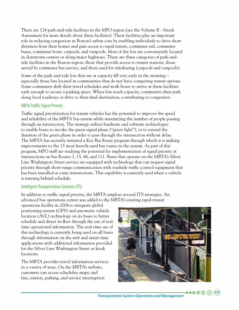
Transportation System Operations and Management4-19
There are 124 park-and-ride facilities in the MPO region (see the Volume II - Needs Assessment for more details about these facilities). These facilities play an important role in reducing congestion in Boston’s urban core by enabling individuals to drive short distances from their homes and gain access to rapid transit, commuter rail, commuter buses, commuter boats, carpools, and vanpools. Most of the lots are conveniently located in downtown centers or along major highways. There are three categories of park-and-ride facilities in the Boston region: those that provide access to transit stations, those served by commuter bus service, and those used for ridesharing (carpools and vanpools).
Some of the park-and-ride lots that are at capacity fill very early in the morning – especially those lots located in communities that do not have competing transit options. Some commuters shift their travel schedules and work hours to arrive at these facilities early enough to secure a parking space. When lots reach capacity, commuters often park along local roadways or drive to their final destination, contributing to congestion.
MBTA Traffic Signal Priority
Traffic signal prioritization for transit vehicles has the potential to improve the speed and reliability of the MBTA bus system while maximizing the number of people passing through an intersection. The strategy utilizes hardware and software technologies to enable buses to invoke the green signal phase (“green light”), or to extend the duration of the green phase in order to pass through the intersection without delay. The MBTA has recently initiated a Key Bus Route program through which it is making improvements to the 15 most heavily used bus routes in the system. As part of this program, MPO staff are studying the potential for implementation of signal priority at intersections on bus Routes 1, 15, 66, and 111. Buses that operate on the MBTA’s Silver Line Washington Street service are equipped with technology that can request signal priority through short-range communication with roadside traffic-control equipment that has been installed at some intersections. This capability is currently used when a vehicle is running behind schedule.
Intelligent Transportation Systems (ITS)
In addition to traffic signal priority, the MBTA employs several ITS strategies. An advanced bus operations center was added to the MBTA’s existing rapid-transit operationsfacilityin2004tointegrateglobalpositioningsystem(GPS)andautomaticvehiclelocation (AVL) technology on its buses to better schedule and direct its fleet through the use of real-time operational information. The real-time use of this technology is currently being used on all buses through information on the web and smart-time applications with additional information provided for the Silver Line Washington Street at kiosk locations.
The MBTA provides travel information services in a variety of ways. On the MBTA’s website, customers can access schedules; maps; and fare, station, parking, and service interruption

Paths to a Sustainable Region: Volume I4-20
information for all bus, rail, and boat services. Service interruption information includes the operational status of elevators and escalators in MBTA stations. Kiosks at bus stops on Washington Street in Boston inform passengers about Silver Line bus arrivals, and an automated, prerecorded message plays in all rapid transit stations when a train is about to arrive. Interactive travel-information kiosks at the South Station Transportation Center provide a direct link to the MBTA’s website, where customers can access schedule information for all services. Information is also provided through electronic boards on commuter rail platforms. Some rapid transit trains now have LED screens with scrolling information on upcoming stops, in addition to audible information.
The MBTA has enhanced its customer-service information system by tying it directly to the software used by the scheduling department. This system now allows customers to access next-trip information for all routes over the phone or on the MBTA’s website. As part of this system, a trip-planning tool available to customers on the Web generates origin-destination routing suggestions without the aid of a customer-service agent.
Developers have recently built many Web, cell phone, and smartphone applications that give information about the MBTA system. Some applications are free; others have to be purchased. The applications include:
• Deliveringreal-timebusandsubwayarrivalinformation
• Displayingreal-timepositiondatafortheOrange,Red,andBluelines
• Providingbusarrivaltimesataparticularstop
• Findinganearbybusroute
• Givingautomatedemailandtextmessageremindersforagivenbusroute
Bicycle Access on the MBTA
Rapid transit customers are allowed to take bicycles aboard Orange, Red, and Blue Line trains (up to two bicycles per car) during all hours except peak hours, which are7:00AMto10:00AMand4:00PMto7:00PM.BicyclesarenotallowedontheGreenLine,MattapanHigh-Speed Line, or Silver Line. However, folding bicycles are allowed on all MBTA vehicles, including the subway,GreenLine,commuterrail,andferriesandbuses,at any time, when folded.
Bike “Pedal & Park” facilities (which are enclosed and equipped with video cameras and controlled door access for safety and security) are now located at Alewife and Forest Hills stations, and others are being planned. Bike CharlieCards, which are provided for free, provide access totheselockedfacilities.Over95percentofMBTAstationsnowhavebicycleracks,and50coveredbikeportswillbeinstalledbythesummerof2011toprovideprotection from the elements. The MBTA has also installedbikeracksonover70percentofitsbuses.
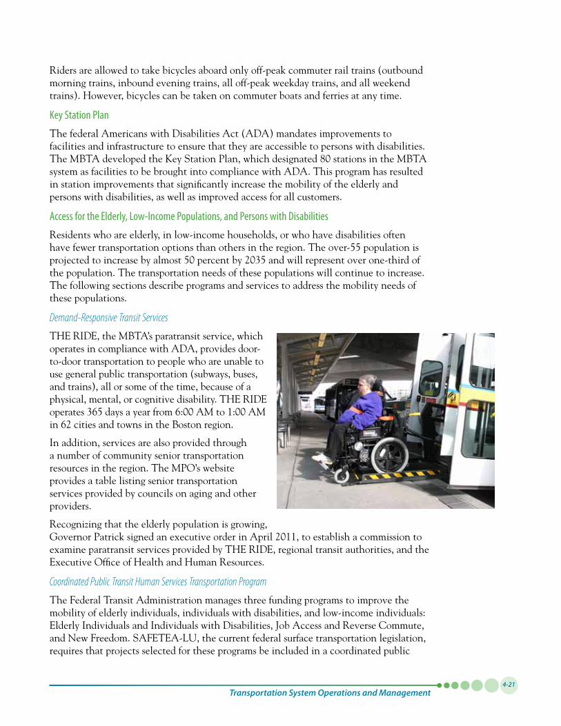
Transportation System Operations and Management4-21
Riders are allowed to take bicycles aboard only off-peak commuter rail trains (outbound morning trains, inbound evening trains, all off-peak weekday trains, and all weekend trains). However, bicycles can be taken on commuter boats and ferries at any time.
Key Station Plan
The federal Americans with Disabilities Act (ADA) mandates improvements to facilities and infrastructure to ensure that they are accessible to persons with disabilities. TheMBTAdevelopedtheKeyStationPlan,whichdesignated80stationsintheMBTAsystem as facilities to be brought into compliance with ADA. This program has resulted in station improvements that significantly increase the mobility of the elderly and persons with disabilities, as well as improved access for all customers.
Access for the Elderly, Low-Income Populations, and Persons with Disabilities
Residents who are elderly, in low-income households, or who have disabilities often have fewer transportation options than others in the region. The over-55 population is projectedtoincreasebyalmost50percentby2035andwillrepresentoverone-thirdofthe population. The transportation needs of these populations will continue to increase. The following sections describe programs and services to address the mobility needs of these populations.
Demand-Responsive Transit Services
THE RIDE, the MBTA’s paratransit service, which operates in compliance with ADA, provides door-to-door transportation to people who are unable to use general public transportation (subways, buses, and trains), all or some of the time, because of a physical, mental, or cognitive disability. THE RIDE operates365daysayearfrom6:00AMto1:00AMin 62 cities and towns in the Boston region.
In addition, services are also provided through a number of community senior transportation resources in the region. The MPO’s website provides a table listing senior transportation services provided by councils on aging and other providers.
Recognizing that the elderly population is growing, GovernorPatricksignedanexecutiveorderinApril2011,toestablishacommissiontoexamine paratransit services provided by THE RIDE, regional transit authorities, and the Executive Office of Health and Human Resources.
Coordinated Public Transit Human Services Transportation Program
The Federal Transit Administration manages three funding programs to improve the mobility of elderly individuals, individuals with disabilities, and low-income individuals: Elderly Individuals and Individuals with Disabilities, Job Access and Reverse Commute, and New Freedom. SAFETEA-LU, the current federal surface transportation legislation, requires that projects selected for these programs be included in a coordinated public
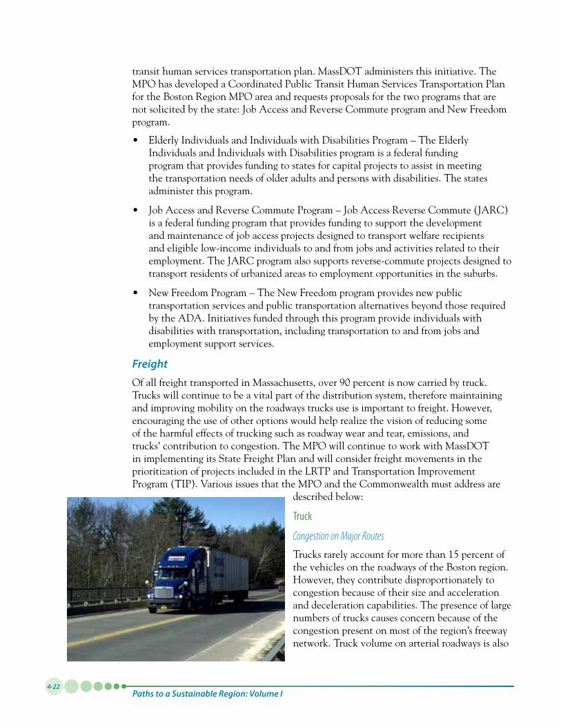
Paths to a Sustainable Region: Volume I4-22
transit human services transportation plan. MassDOT administers this initiative. The MPO has developed a Coordinated Public Transit Human Services Transportation Plan for the Boston Region MPO area and requests proposals for the two programs that are not solicited by the state: Job Access and Reverse Commute program and New Freedom program.
• ElderlyIndividualsandIndividualswithDisabilitiesProgram–TheElderlyIndividuals and Individuals with Disabilities program is a federal funding program that provides funding to states for capital projects to assist in meeting the transportation needs of older adults and persons with disabilities. The states administer this program.
• JobAccessandReverseCommuteProgram–JobAccessReverseCommute(JARC)is a federal funding program that provides funding to support the development and maintenance of job access projects designed to transport welfare recipients and eligible low-income individuals to and from jobs and activities related to their employment. The JARC program also supports reverse-commute projects designed to transport residents of urbanized areas to employment opportunities in the suburbs.
• NewFreedomProgram–TheNewFreedomprogramprovidesnewpublictransportation services and public transportation alternatives beyond those required by the ADA. Initiatives funded through this program provide individuals with disabilities with transportation, including transportation to and from jobs and employment support services.
FreightOfallfreighttransportedinMassachusetts,over90percentisnowcarriedbytruck.Trucks will continue to be a vital part of the distribution system, therefore maintaining and improving mobility on the roadways trucks use is important to freight. However, encouraging the use of other options would help realize the vision of reducing some of the harmful effects of trucking such as roadway wear and tear, emissions, and trucks’ contribution to congestion. The MPO will continue to work with MassDOT in implementing its State Freight Plan and will consider freight movements in the prioritization of projects included in the LRTP and Transportation Improvement Program (TIP). Various issues that the MPO and the Commonwealth must address are
described below:
Truck
Congestion on Major Routes
Trucks rarely account for more than 15 percent of the vehicles on the roadways of the Boston region. However, they contribute disproportionately to congestion because of their size and acceleration and deceleration capabilities. The presence of large numbers of trucks causes concern because of the congestion present on most of the region’s freeway network. Truck volume on arterial roadways is also
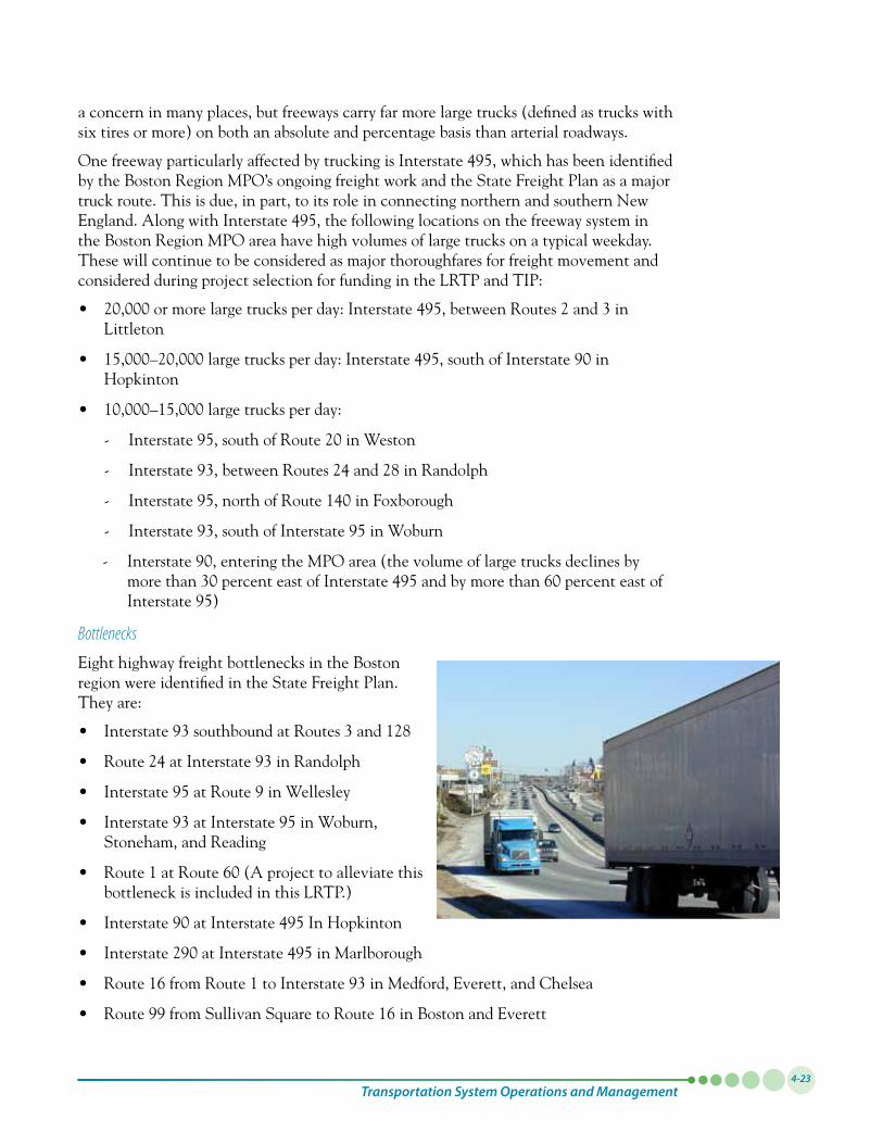
Transportation System Operations and Management4-23
a concern in many places, but freeways carry far more large trucks (defined as trucks with six tires or more) on both an absolute and percentage basis than arterial roadways.
OnefreewayparticularlyaffectedbytruckingisInterstate495,whichhasbeenidentifiedby the Boston Region MPO’s ongoing freight work and the State Freight Plan as a major truck route. This is due, in part, to its role in connecting northern and southern New England.AlongwithInterstate495,thefollowinglocationsonthefreewaysysteminthe Boston Region MPO area have high volumes of large trucks on a typical weekday. These will continue to be considered as major thoroughfares for freight movement and considered during project selection for funding in the LRTP and TIP:
• 20,000ormorelargetrucksperday:Interstate495,betweenRoutes2and3inLittleton
• 15,000–20,000largetrucksperday:Interstate495,southofInterstate90inHopkinton
• 10,000–15,000largetrucksperday:
- Interstate95,southofRoute20inWeston
- Interstate93,betweenRoutes24and28inRandolph
- Interstate95,northofRoute140inFoxborough
- Interstate93,southofInterstate95inWoburn
- Interstate90,enteringtheMPOarea(thevolumeoflargetrucksdeclinesbymorethan30percenteastofInterstate495andbymorethan60percenteastofInterstate95)
Bottlenecks
Eight highway freight bottlenecks in the Boston region were identified in the State Freight Plan. They are:
• Interstate93southboundatRoutes3and128
• Route24atInterstate93inRandolph
• Interstate95atRoute9inWellesley
• Interstate93atInterstate95inWoburn,Stoneham, and Reading
• Route1atRoute60(Aprojecttoalleviatethisbottleneck is included in this LRTP.)
• Interstate90atInterstate495InHopkinton
• Interstate290atInterstate495inMarlborough
• Route16fromRoute1toInterstate93inMedford,Everett,andChelsea
• Route99fromSullivanSquaretoRoute16inBostonandEverett
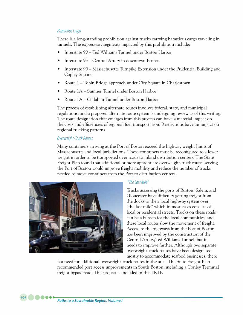
Paths to a Sustainable Region: Volume I4-24
Hazardous Cargo
There is a long-standing prohibition against trucks carrying hazardous cargo traveling in tunnels. The expressway segments impacted by this prohibition include:
• Interstate90–TedWilliamsTunnelunderBostonHarbor
• Interstate93–CentralArteryindowntownBoston
• Interstate90–MassachusettsTurnpikeExtensionunderthePrudentialBuildingandCopley Square
• Route1–TobinBridgeapproachunderCitySquareinCharlestown
• Route1A–SumnerTunnelunderBostonHarbor
• Route1A–CallahanTunnelunderBostonHarbor
The process of establishing alternate routes involves federal, state, and municipal regulations, and a proposed alternate route system is undergoing review as of this writing. The route designation that emerges from this process can have a material impact on the costs and efficiencies of regional fuel transportation. Restrictions have an impact on regional trucking patterns.
Overweight-Truck Routes
Many containers arriving at the Port of Boston exceed the highway weight limits of Massachusetts and local jurisdictions. These containers must be reconfigured to a lower weight in order to be transported over roads to inland distribution centers. The State Freight Plan found that additional or more appropriate overweight-truck routes serving the Port of Boston would improve freight mobility and reduce the number of trucks needed to move containers from the Port to distribution centers.
“The Last Mile”
Trucks accessing the ports of Boston, Salem, and Gloucesterhavedifficultygettingfreightfromthe docks to their local highway system over “the last mile” which in most cases consists of local or residential streets. Trucks on these roads can be a burden for the local communities, and these local routes slow the movement of freight. Access to the highways from the Port of Boston has been improved by the construction of the Central Artery/Ted Williams Tunnel, but it needs to improve further. Although two separate overweight-truck routes have been designated, mostly to accommodate seafood businesses, there
is a need for additional overweight-truck routes in the area. The State Freight Plan recommended port access improvements in South Boston, including a Conley Terminal freight bypass road. This project is included in this LRTP.
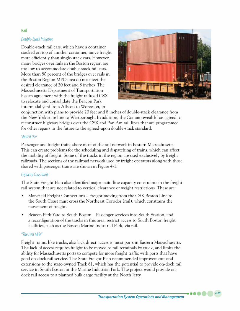
Transportation System Operations and Management4-25
Rail
Double-Stack Initiative
Double-stack rail cars, which have a container stacked on top of another container, move freight more efficiently than single-stack cars. However, many bridges over rails in the Boston region are too low to accommodate double-stack rail cars. Morethan80percentofthebridgesoverrailsinthe Boston Region MPO area do not meet the desiredclearanceof20feetand8inches.TheMassachusetts Department of Transportation has an agreement with the freight railroad CSX to relocate and consolidate the Beacon Park intermodal yard from Allston to Worcester, in conjunctionwithplanstoprovide20feetand8inchesofdouble-stackclearancefromthe New York state line to Westborough. In addition, the Commonwealth has agreed to reconstruct highway bridges over the CSX and Pan Am rail lines that are programmed for other repairs in the future to the agreed-upon double-stack standard.
Shared Use
Passenger and freight trains share most of the rail network in Eastern Massachusetts. This can create problems for the scheduling and dispatching of trains, which can affect the mobility of freight. Some of the tracks in the region are used exclusively by freight railroads. The sections of the railroad network used by freight operators along with those shared with passenger trains are shown in Figure 4-1.
Capacity Constraint
The State Freight Plan also identified major main line capacity constraints in the freight rail system that are not related to vertical clearance or weight restrictions. These are:
• MansfieldFreightConnections–FreightmovingfromtheCSXBostonLinetothe South Coast must cross the Northeast Corridor (rail), which constrains the movement of freight.
• BeaconParkYardtoSouthBoston–PassengerservicesintoSouthStation,anda reconfiguration of the tracks in this area, restrict access to South Boston freight facilities, such as the Boston Marine Industrial Park, via rail.
“The Last Mile”
Freight trains, like trucks, also lack direct access to most ports in Eastern Massachusetts. The lack of access requires freight to be moved to rail terminals by truck, and limits the ability for Massachusetts ports to compete for more freight traffic with ports that have good on-dock rail service. The State Freight Plan recommended improvements and extensions to the state-owned Track 61, which has the potential to provide on-dock rail service in South Boston at the Marine Industrial Park. The project would provide on-dock rail access to a planned bulk cargo facility at the North Jetty.
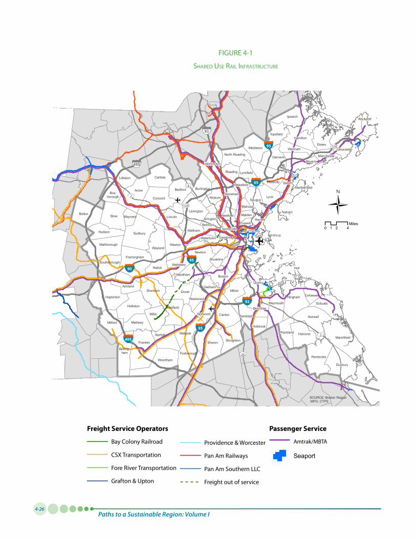
Paths to a Sustainable Region: Volume I4-26
Milton
Chelsea
RevereMedford
Nahant
Be lmon t
Somerville
Cambridge
Brookline
Newton
Wa tert own
Melrose
Winthrop
MaldenAr lingto n
Everett
Pembroke
Weymouth
Hanover
Norwell
CohassetHingham
Quincy
Wilmington
Essex
Rockport
Milton
Salem
SherbornDedham
Saugus
Manchester
Randolph
Danvers
MarshfieldRockland
Duxbury
Needham
Natick
Stoneham
Middleton
Newton
Weston
Lincoln
Beverly
TopsfieldHamilton
Gloucester
Wayland
Waltham
Woburn
Bedford
Peabody
Wellesley
Scituate
Lynnfield
Lynn
Braintree
Burlington
Medfield
Wenham
Wakefield
Holbrook
Concord
Ipswich
Canton
Sharon
Norwood
Lexington
Dover
Walpole
Stoughton
Westwood
Reading
Holliston
Hopkinton
StowBolton
Milford
Hudson
Wrentham
Carlisle
Belling-ham
Framingham
Marlborough
Ashland
Southborough
Maynard
Foxborough
Medway
Sudbury
Franklin
Norfolk
Millis
Acton
Newbury
Littleton
Box-borough
Marblehead
Hull
Arlington
Belmont
Watertown
Boston
North Reading
3
3
24
North Reading
2
128
128
95
93
495
95
95
495
93
90
95
FIGURE 4-1Rail Infrastructure
0 2 41Miles
Freight Service Operators
Bay Colony Railroad
CSX Transportation
Fore River Transportation
Grafton & Upton
Providence & Worcester
Pan Am Railways
Pan Am Southern LLC
Freight out of service
Passenger Service
Amtrak/MBTA
Seaport
SOURCE: Boston Region MPO, CTPS
FIGURE 4-1
ShaREd USE RaIl InFRaStRUctURE
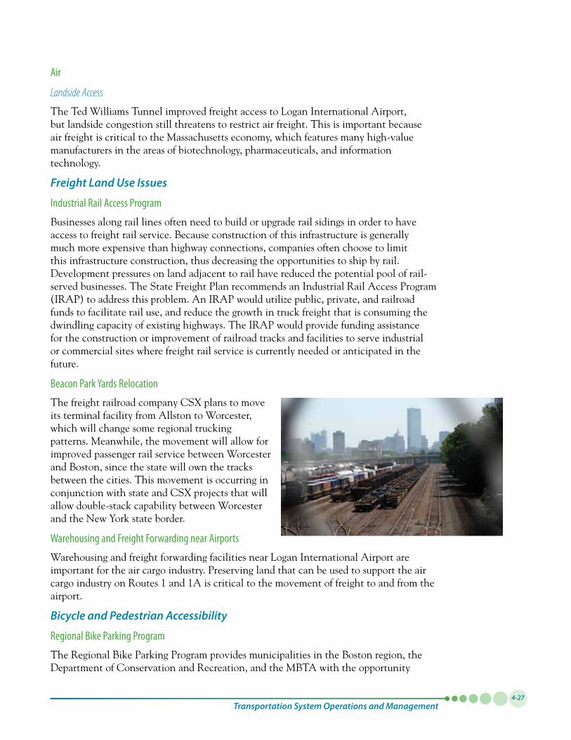
Transportation System Operations and Management4-27
Air
Landside Access
The Ted Williams Tunnel improved freight access to Logan International Airport, but landside congestion still threatens to restrict air freight. This is important because air freight is critical to the Massachusetts economy, which features many high-value manufacturers in the areas of biotechnology, pharmaceuticals, and information technology.
Freight Land Use Issues
Industrial Rail Access Program
Businesses along rail lines often need to build or upgrade rail sidings in order to have access to freight rail service. Because construction of this infrastructure is generally much more expensive than highway connections, companies often choose to limit this infrastructure construction, thus decreasing the opportunities to ship by rail. Development pressures on land adjacent to rail have reduced the potential pool of rail-served businesses. The State Freight Plan recommends an Industrial Rail Access Program (IRAP) to address this problem. An IRAP would utilize public, private, and railroad funds to facilitate rail use, and reduce the growth in truck freight that is consuming the dwindling capacity of existing highways. The IRAP would provide funding assistance for the construction or improvement of railroad tracks and facilities to serve industrial or commercial sites where freight rail service is currently needed or anticipated in the future.
Beacon Park Yards Relocation
The freight railroad company CSX plans to move its terminal facility from Allston to Worcester, which will change some regional trucking patterns. Meanwhile, the movement will allow for improved passenger rail service between Worcester and Boston, since the state will own the tracks between the cities. This movement is occurring in conjunction with state and CSX projects that will allow double-stack capability between Worcester and the New York state border.
Warehousing and Freight Forwarding near Airports
Warehousing and freight forwarding facilities near Logan International Airport are important for the air cargo industry. Preserving land that can be used to support the air cargo industry on Routes 1 and 1A is critical to the movement of freight to and from the airport.
Bicycle and Pedestrian Accessibility
Regional Bike Parking Program
The Regional Bike Parking Program provides municipalities in the Boston region, the Department of Conservation and Recreation, and the MBTA with the opportunity
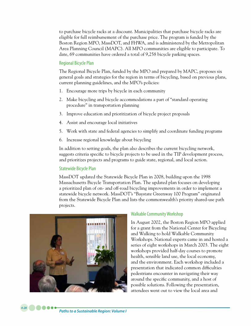
Paths to a Sustainable Region: Volume I4-28
to purchase bicycle racks at a discount. Municipalities that purchase bicycle racks are eligible for full reimbursement of the purchase price. The program is funded by the Boston Region MPO, MassDOT, and FHWA, and is administered by the Metropolitan Area Planning Council (MAPC). All MPO communities are eligible to participate. To date,69communitieshaveorderedatotalof9,258bicycleparkingspaces.
Regional Bicycle Plan
The Regional Bicycle Plan, funded by the MPO and prepared by MAPC, proposes six general goals and strategies for the region in terms of bicycling, based on previous plans, current planning guidelines, and the MPO’s policies:
1. Encourage more trips by bicycle in each community
2. Make bicycling and bicycle accommodations a part of “standard operating procedure” in transportation planning
3. Improve education and prioritization of bicycle project proposals
4. Assist and encourage local initiatives
5. Work with state and federal agencies to simplify and coordinate funding programs
6. Increase regional knowledge about bicycling
In addition to setting goals, the plan also describes the current bicycling network, suggests criteria specific to bicycle projects to be used in the TIP development process, and prioritizes projects and programs to guide state, regional, and local action.
Statewide Bicycle Plan
MassDOTupdatedtheStatewideBicyclePlanin2008,buildinguponthe1998Massachusetts Bicycle Transportation Plan. The updated plan focuses on developing a prioritized plan of on- and off-road bicycling improvements in order to implement a statewidebicyclenetwork.MassDOT’s“BaystateGreenway100Program”originatedfrom the Statewide Bicycle Plan and lists the commonwealth’s priority shared-use path projects.
Walkable Community Workshop
InAugust2002,theBostonRegionMPOappliedfor a grant from the National Center for Bicycling and Walking to hold Walkable Community Workshops. National experts came in and hosted a seriesofeightworkshopsinMarch2003.Theeightworkshops provided half-day courses to promote health, sensible land use, the local economy, and the environment. Each workshop included a presentation that indicated common difficulties pedestrians encounter in navigating their way around the specific community, and a host of possible solutions. Following the presentation, attendees went out to view the local area and
Transportation System Operations and Management4-29
returned to discuss problems encountered, possible solutions, and implementation strategies.
These workshops have become an ongoing program for the Boston Region MPO. Recently, the Walkable Community Workshop program has been incorporated into a new Livability Program established by the MPO (see Chapter 5 for more details). As part of the workshops, additional elements of livability have been included to address bicycling, transit, land use, parking, the environment, health, and economic development issues.
SAFETY AND SECURITYThe MPO strives to support projects that will improve safety for all users of the transportation system – motorists, transit riders, freight operators, bicyclists, and pedestrians – and reduce the number and severity of collisions. In the Boston region, the major problems associated with providing a safe and secure roadway system have to do with eliminating highway bottlenecks and the associated congestion that increases the likelihood of collisions occurring, addressing unsafe roadway conditions, and improving the system for moving freight in the region by addressing the need to add truck-stop rest facilities, designate haul roads to remove trucks from local streets, and improve safety at rail crossings. Improving safety and security on the transit system requires addressing the pressing need to bring the transit system into a state of good repair, reduce gaps in service, solve infrastructure constraints that limit the capacity of the transit system, and install collision-avoidance systems.
The MPO also seeks to protect and maintain the viability of transportation infrastructure that is important for conducting emergency response and for enabling the evacuation of populations that may be necessary in response to natural or disasters caused by human action. The MPO recognizes that the transit and highway systems play a vital role in moving people and goods safely in the region – including in times of crisis – and that investments in state-of-the-practice ITS and communication systems are important for providing dependable service.
The Boston Region MPO’s Vision for Safety and SecurityVision: All modes of the transportation network, passenger and freight, will provide transportation that is safe, personally and operationally, to the maximum feasible degree. The number and severity of crashes will have been reduced. State-of-the practice ITS measures and surveillance communication systems will have been deployed on the transit system to minimize vulnerability to security breaches. Transit malfunctions will have been reduced. Steps will have been taken to protect the viability of transportation infrastructure critical to emergency response and evacuations necessitated by natural hazards and threats and hazards caused by human action.
Policies: To provide for maximum transportation safety and to support security in the region, the MPO will put a priority on programs, services, and projects that:
• Implementactionsstemmingfromall-hazardsplanning
• Maintainthetransportationsysteminastateofgoodrepair
The MPO recognizes that the transit and highway systems play a vital role in moving people and goods safely in the region.
Paths to a Sustainable Region: Volume I4-30
• Usestate-of-the-practicesafetyelements;addressroadwaysafetydeficiencies(aftersafety audits) in order to reduce crashes; and address transit safety (this will include following federal mandates)
• SupportincidentmanagementprogramsandITS
• Protectcriticaltransportationinfrastructurefrombothnaturalhazardsandhuman threats; address transit security vulnerabilities; upgrade key transportation infrastructure to a “hardened” design standard
• Improvesafetyforpedestriansandcyclists;ensurethatsafetyprovisionsareincorporated into shared-use corridors
• Reducetheseverityofcrashes,especiallyviameasuresthatimprovesafetyforall
• Promotesafetythroughsupportingthereductionofbasespeedlimits(inmunicipalities) to 25 miles per hour and through education about and enforcement of rules of the road, for all modes that use the roadways
• Improvethetransportationinfrastructuretobettersupportemergencyresponseandevacuations
All-hazards planning will continue, with MPO participation, and the MPO will take appropriate action on the recommendations of that work.
MPO Actions to Achieve the Safety and Security VisionAs it strives to attain these visions, the MPO supports projects and programs that enhance safe and secure travel for all users of the transportation systems—motorists and nonmotorists – and participates in regional planning for safety and security initiatives.
Highway
Improving Highway Safety
The MPO works to improve highway safety by identifying high-crash locations, conducting safety analyses and audits of problematic locations, providing technical assistance to communities, and implementing safety projects. Its work supports state and federal initiatives aimed at reducing crashes.
Through its CMP, the MPO identifies roadway locations in the region that are in need of infrastructure improvements. The CMP is a tool that allows for prioritizing safety needs at intersections and for determining operational strategies that can be used to address safety problems at intersections and on arterials. The locations in the region that experience the most severe crashes are identified by using the Equivalent Property Damage Only (EPDO) index, which measures the amount of fatalities, injuries, and property damage that occur on roadways.
Each year, the MPO conducts safety-related studies, funded through its Unified Planning Work Program, which produce recommendations for addressing safety problems in the study areas. The MPO staff also conducts road safety audits with MassDOT and municipal stakeholders to identify measures that can be taken to improve specific safety problems. Technical assistance is provided to municipalities that wish to remedy these problems.
Transportation System Operations and Management4-31
Transportation safety projects are implemented through the MPO’s TIP. When selecting projects to receive federal funding, the MPO assesses whether proposed project designs would address safety needs (including the needs of bicyclists and pedestrians) and reduce crashes. Projects that receive funding through the federal Highway Safety Improvement Program (HSIP) are programmed in the TIP.
The MPO’s safety work supports the goals and objectives of the Massachusetts Strategic Highway Safety Plan (SHSP), which seeks to reduce traffic-related fatalities and injuries. The MPO’s safety work coincides with several emphasis areas defined in the SHSP. These emphasis areas include a focus on reducing traffic-related fatalities and injuries (specifically from intersection and lane-departure crashes), expediting safety-related infrastructure projects, reducing risks to bicyclists and pedestrians, and improving data systems of traffic records.
The MPO also participates in state-sponsored initiatives focused on improving transportation operations strategies, ITS systems, traffic incident management procedures, and the quality, completeness, and accessibility of traffic data.
Protecting the Transportation System
The operability of a region’s highway and transit systems is vital for the ability to respond to emergencies and for the well-being of people who depend upon those systems to travel to safety in times of emergency, whether due to natural disasters, intentional attacks, or other disruptions.
As it strives to make investments that protect the region’s critical transportation infrastructure, the MPO participates in all-hazards planning, the federal guidelines outlined by the U.S. Department of Homeland Security for planning for and responding to threats to the public and to the nation’s infrastructure. In line with this guidance, the MPO considers security concerns to include both natural and human threats that warrant action to protect life, property, the environment, and public health or safety, and to minimize disruptions of government, social, or economic activities.
The MPO evaluates proposed transportation projects, prior to selecting projects to receive federal funding, to determine whether they would enhance the security of the transportation system. The evaluation considers the impact a project would have in terms of enhancing the ability of a facility to withstand and function in extreme weather conditions and the function it would serve in an emergency, such as in providing a means of evacuation and facilitating the movement of emergency responders.
ThroughitsUPWP,theMPOconductsaGIS-mappingprogramtoidentifytransportation infrastructure that may be susceptible to extreme weather and other natural disasters—including flooding, hurricane storm surges, earthquakes, and potential sea-level rise—and to document the location of evacuation routes and emergency support locations for which good access must be maintained.
A key component of transportation security involves enhancing and maintaining the ITS systems that keep the transit and highway systems functioning efficiently and that help preserve public safety on the system. These systems provide functions ranging from traffic signalization to interagency communications to surveillance. The MPO recognizes the importance of these systems for improving safety and security on roads and rail, and
The MPO evaluates proposed transportation projects, to determine whether they would enhance the security of the transportation system.
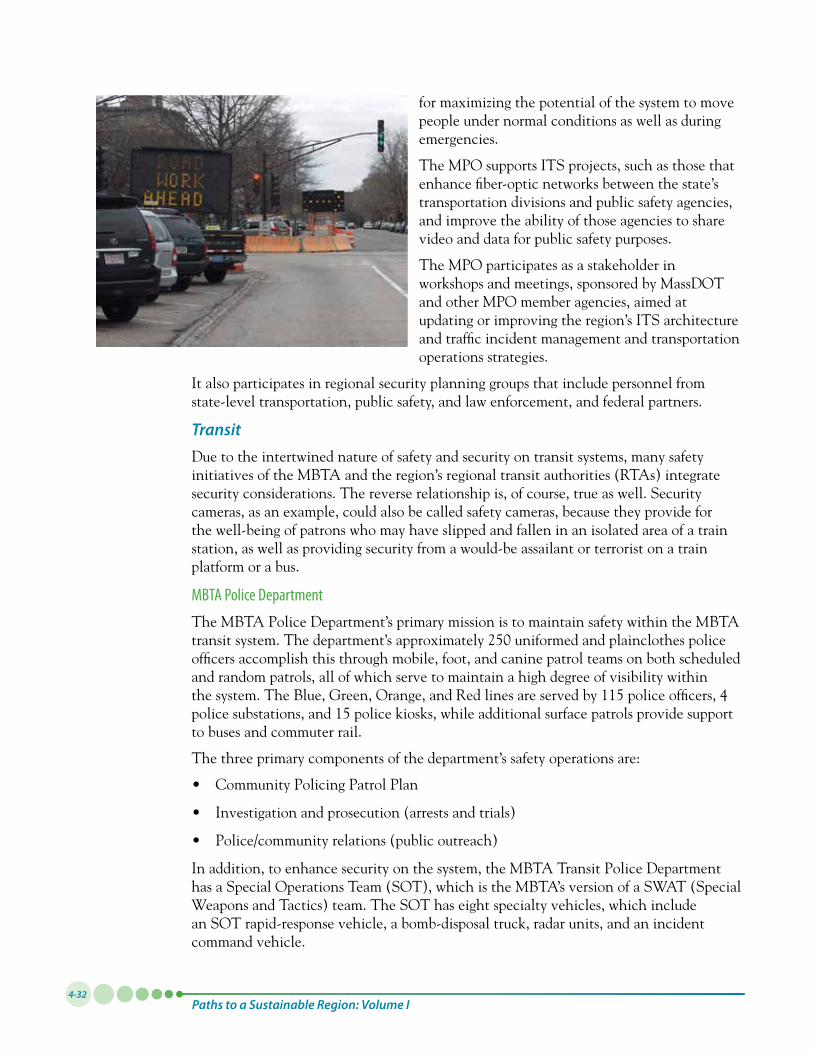
Paths to a Sustainable Region: Volume I4-32
for maximizing the potential of the system to move people under normal conditions as well as during emergencies.
The MPO supports ITS projects, such as those that enhance fiber-optic networks between the state’s transportation divisions and public safety agencies, and improve the ability of those agencies to share video and data for public safety purposes.
The MPO participates as a stakeholder in workshops and meetings, sponsored by MassDOT and other MPO member agencies, aimed at updating or improving the region’s ITS architecture and traffic incident management and transportation operations strategies.
It also participates in regional security planning groups that include personnel from state-level transportation, public safety, and law enforcement, and federal partners.
TransitDue to the intertwined nature of safety and security on transit systems, many safety initiatives of the MBTA and the region’s regional transit authorities (RTAs) integrate security considerations. The reverse relationship is, of course, true as well. Security cameras, as an example, could also be called safety cameras, because they provide for the well-being of patrons who may have slipped and fallen in an isolated area of a train station, as well as providing security from a would-be assailant or terrorist on a train platform or a bus.
MBTA Police Department
The MBTA Police Department’s primary mission is to maintain safety within the MBTA transitsystem.Thedepartment’sapproximately250uniformedandplainclothespoliceofficers accomplish this through mobile, foot, and canine patrol teams on both scheduled and random patrols, all of which serve to maintain a high degree of visibility within thesystem.TheBlue,Green,Orange,andRedlinesareservedby115policeofficers,4police substations, and 15 police kiosks, while additional surface patrols provide support to buses and commuter rail.
The three primary components of the department’s safety operations are:
• CommunityPolicingPatrolPlan
• Investigationandprosecution(arrestsandtrials)
• Police/communityrelations(publicoutreach)
In addition, to enhance security on the system, the MBTA Transit Police Department has a Special Operations Team (SOT), which is the MBTA’s version of a SWAT (Special Weapons and Tactics) team. The SOT has eight specialty vehicles, which include an SOT rapid-response vehicle, a bomb-disposal truck, radar units, and an incident command vehicle.
Transportation System Operations and Management4-33
MBTA Safety Department
The primary role of the MBTA Safety Department is to ensure the safety of the MBTA’s employees, its customers, and members of the general public throughout the MBTA system. In order to accomplish this, the MBTA Safety Department designs, implements, supports, and monitors safe work practices for and among its employees, whether they are working in MBTA vehicles and facilities or on other MBTA property and rights-of-way. These safe practices are outlined in the MBTA’s System Safety Program Plan and in its Safety Policies and Procedures Manual.
Examples of the types of activities conducted by the MBTA Safety Department include:
• Right-of-waysafetytraining
• Incidenttracking
• OperationLifesaver
• Safetyaudits
• Safetyhazardcorrection
• Safetydrills
Secure Stations Initiative
In accordance with the State Homeland Security Strategy, the MBTA is improving its communications and security systems to enhance safety and security systemwide. The transit system is equipped with a wide range of infrastructure to collect and disseminate information in the event of an emergency:
• Wide-scaledeploymentofclosed-circuittelevision(CCTV)systems
• Publicaddress(PA)andsignagesystems
• Securityintrusiondetectionandalarmsystems
• Firealarmsystems
• Police/publiccallboxes
• SilverLinePhaseIISecurityProgram
All new construction, particularly station reconstruction and maintenance facility upgrade projects, involves the complete overhaul or reinstallation of security and fire alarm systems, police call boxes, and communications and public address systems.
The rapid transit stations’ public-address systems currently provide travel information. A recorded security message educates transit passengers about their role in maintaining system security; passengers are urged, “If you see something, say something.”
Communications Interoperability
One of the issues facing the MBTA in its emergency-response planning is that of interoperability. Interoperability is defined as the ability of radio equipment belonging to one organization’s first responders in an emergency to communicate with that of another organization’s first responders. Currently, radio coverage inside MBTA subway system
The MBTA is improving its communications and security systems to enhance safety and security systemwide.
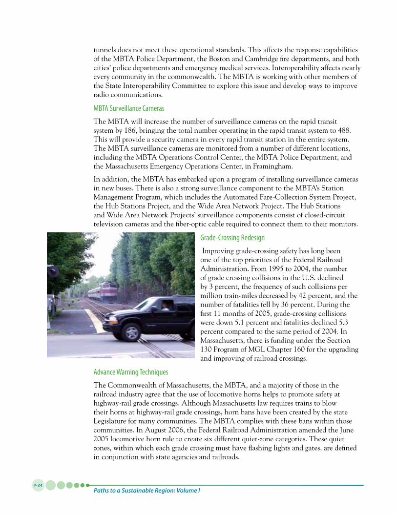
Paths to a Sustainable Region: Volume I4-34
tunnels does not meet these operational standards. This affects the response capabilities of the MBTA Police Department, the Boston and Cambridge fire departments, and both cities’ police departments and emergency medical services. Interoperability affects nearly every community in the commonwealth. The MBTA is working with other members of the State Interoperability Committee to explore this issue and develop ways to improve radio communications.
MBTA Surveillance Cameras
The MBTA will increase the number of surveillance cameras on the rapid transit system by 186, bringing the total number operating in the rapid transit system to 488. This will provide a security camera in every rapid transit station in the entire system. The MBTA surveillance cameras are monitored from a number of different locations, including the MBTA Operations Control Center, the MBTA Police Department, and the Massachusetts Emergency Operations Center, in Framingham.
In addition, the MBTA has embarked upon a program of installing surveillance cameras in new buses. There is also a strong surveillance component to the MBTA’s Station Management Program, which includes the Automated Fare-Collection System Project, the Hub Stations Project, and the Wide Area Network Project. The Hub Stations and Wide Area Network Projects’ surveillance components consist of closed-circuit television cameras and the fiber-optic cable required to connect them to their monitors.
Grade-Crossing Redesign
Improving grade-crossing safety has long been one of the top priorities of the Federal Railroad Administration.From1995to2004,thenumberof grade crossing collisions in the U.S. declined by 3 percent, the frequency of such collisions per million train-miles decreased by 42 percent, and the number of fatalities fell by 36 percent. During the first11monthsof2005,grade-crossingcollisionswere down 5.1 percent and fatalities declined 5.3 percentcomparedtothesameperiodof2004.InMassachusetts, there is funding under the Section 130ProgramofMGLChapter160fortheupgradingand improving of railroad crossings.
Advance Warning Techniques
The Commonwealth of Massachusetts, the MBTA, and a majority of those in the railroad industry agree that the use of locomotive horns helps to promote safety at highway-rail grade crossings. Although Massachusetts law requires trains to blow their horns at highway-rail grade crossings, horn bans have been created by the state Legislature for many communities. The MBTA complies with these bans within those communities.InAugust2006,theFederalRailroadAdministrationamendedtheJune2005locomotivehornruletocreatesixdifferentquiet-zonecategories.Thesequietzones, within which each grade crossing must have flashing lights and gates, are defined in conjunction with state agencies and railroads.
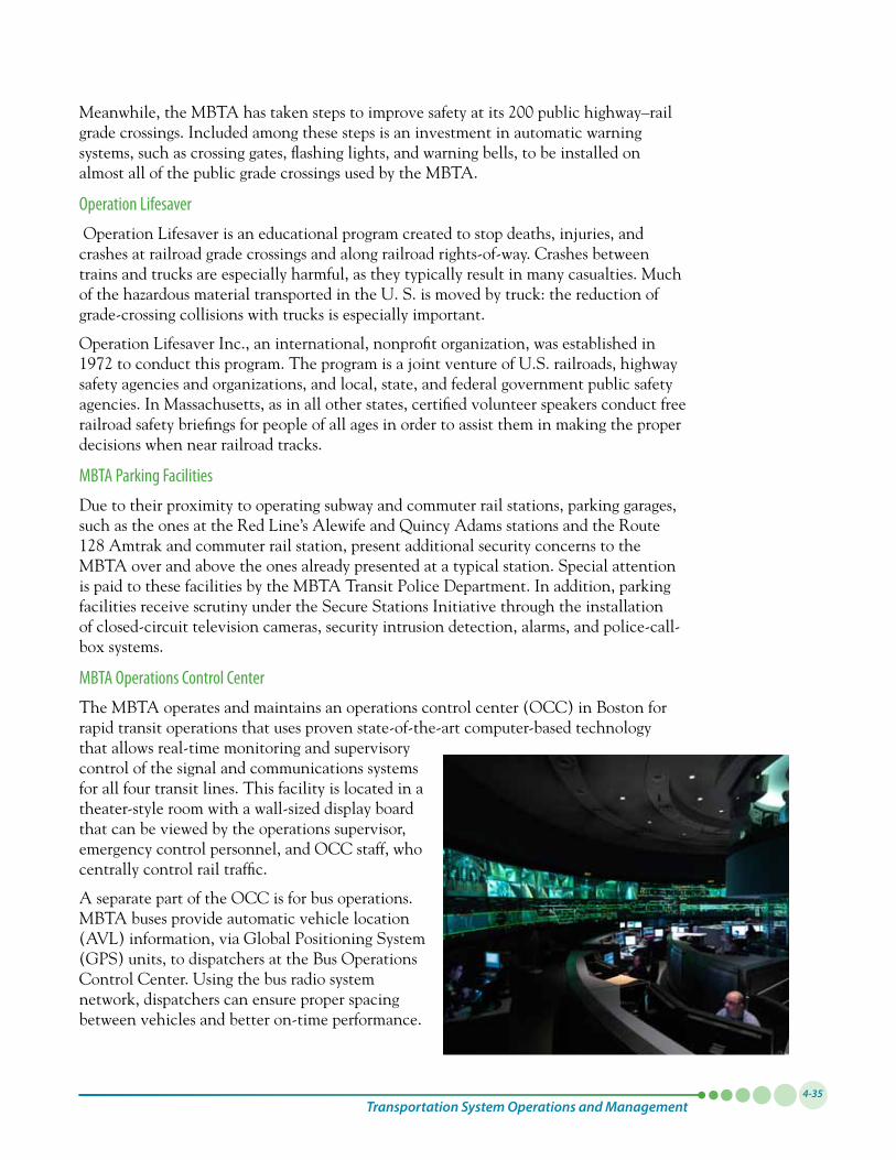
Transportation System Operations and Management4-35
Meanwhile,theMBTAhastakenstepstoimprovesafetyatits200publichighway–railgrade crossings. Included among these steps is an investment in automatic warning systems, such as crossing gates, flashing lights, and warning bells, to be installed on almost all of the public grade crossings used by the MBTA.
Operation Lifesaver
Operation Lifesaver is an educational program created to stop deaths, injuries, and crashes at railroad grade crossings and along railroad rights-of-way. Crashes between trains and trucks are especially harmful, as they typically result in many casualties. Much of the hazardous material transported in the U. S. is moved by truck: the reduction of grade-crossing collisions with trucks is especially important.
Operation Lifesaver Inc., an international, nonprofit organization, was established in 1972toconductthisprogram.TheprogramisajointventureofU.S.railroads,highwaysafety agencies and organizations, and local, state, and federal government public safety agencies. In Massachusetts, as in all other states, certified volunteer speakers conduct free railroad safety briefings for people of all ages in order to assist them in making the proper decisions when near railroad tracks.
MBTA Parking Facilities
Due to their proximity to operating subway and commuter rail stations, parking garages, such as the ones at the Red Line’s Alewife and Quincy Adams stations and the Route 128 Amtrak and commuter rail station, present additional security concerns to the MBTA over and above the ones already presented at a typical station. Special attention is paid to these facilities by the MBTA Transit Police Department. In addition, parking facilities receive scrutiny under the Secure Stations Initiative through the installation of closed-circuit television cameras, security intrusion detection, alarms, and police-call-box systems.
MBTA Operations Control Center
The MBTA operates and maintains an operations control center (OCC) in Boston for rapid transit operations that uses proven state-of-the-art computer-based technology that allows real-time monitoring and supervisory control of the signal and communications systems for all four transit lines. This facility is located in a theater-style room with a wall-sized display board that can be viewed by the operations supervisor, emergency control personnel, and OCC staff, who centrally control rail traffic.
A separate part of the OCC is for bus operations. MBTA buses provide automatic vehicle location (AVL)information,viaGlobalPositioningSystem(GPS)units,todispatchersattheBusOperationsControl Center. Using the bus radio system network, dispatchers can ensure proper spacing between vehicles and better on-time performance.
Paths to a Sustainable Region: Volume I4-36
The OCC interfaces and shares information with the Highway Division’s Traffic Operations Center, the Central Artery/Tunnel Project’s Operations Control Center, the Boston Transportation Department’s Traffic Management Center, the Massachusetts Interagency Video Information System, and the Commonwealth Fusion Center.
Amtrak Police
Amtrak provides regional transit security and law enforcement through the Amtrak Police. The Amtrak Police’s 342 police officers, most of whom are stationed within the Northeast Corridor, Amtrak’s busiest corridor, provide security at Boston’s South and Back Bay stations and Westwood’s Route 128 Station. The Amtrak Police are also responsibleforsecurityon300trainsperdayservingapproximately540stationsandoperatingonmorethan22,000milesofrailin46states.
Regional Transit Security Working Group
Any transit agency wishing to receive funding through the federal Transit Security GrantProgramisrequiredtoparticipateinaRegionalTransitSecurityWorkingGroup(RTSWG).TheprimarypurposeoftheRTSWGistodevelopaRegionalTransitSecurity Strategy, the development of which is also required to receive funding under theTransitSecurityGrantProgram.Inearly2007,theUnitedStatesDepartmentofHomeland Security granted the MBTA $24.37 million, the largest award the MBTA has ever received, to enhance the security of its trains and buses. The MBTA will use the money to improve video surveillance, start a pilot program to expand its biological, nuclear, radiological, and explosive-material detection systems, and add additional surveillance cameras.
TheExecutiveOfficeofPublicSafetychairstheRTSWG,andtheMBTAandtheMPOare members. The MPO brings a regional-planning perspective to the work of the group and will also be called upon to participate in the funding of regional transit-security initiatives and processes.
NEXT STEPS – THE DEVELOPMENT OF PERFORMANCE MEASURESManagement and Operations initiatives at the federal, state, regional, and local levels have increased the efficient and safe transportation options in the Boston region by promoting initiatives and actions that continue to improve the performance and safety of the existing transportation system, as well as increasing service and access.
To ensure that the MPO continues to move towards the visions outlined in Paths to a Sustainable Region, it is necessary to develop performance measures. The Needs Assessment documents the existing condition of the transportation system, and it may be utilized as a baseline for initial performance measures. The development of performance measures is likely to include some measures that do not have the necessary data for analysis. Addressing these gaps will require future data collection and analysis at the municipal, corridor, and regionwide level. These activities can become components of the ongoing Congestion Management Process or future Unified Planning Work Program studies. The MPO’s performance measures will not adhere to defined targets, but they will have the potential to effectively communicate the needs of the region and reinforce the value of investment decisions.
The MPO’s performance
measures will have the potential to
effectively communicate
the needs of the region
and reinforce the value of investment
decisions.

Transportation System Operations and Management4-37
Some of the management and operations performance measures that may be utilized to track infrastructure improvements and performance of the system include:
SUMMARYThe MPO is committed to employing management and operations improvements that will lead to increased mobility, safety, and security. An integral vision of Paths to a Sustainable Region is to succeed at preserving, modernizing, and improving the operational efficiency of the transportation system. Investments with this focus will help theMPOachieveitsvisionfor2035.
Goal Factor PerFormance measures
Achieve efficiency through ITS and management & operations, and via implementation of technology and state of good repair, before expansion
Improved incident management (highway and transit)
Decrease in incident detection time
Decrease in incident clearance time
Achievement of state of good repair
Increase in the % of miles of federal-aid roadway that are in fair or better pavement condition
Decrease in the % of bridges which are "structurally deficient"
Decrease in the % of bridges which are "functionally obsolete"
Reduction in the MBTA backlog of state-of-good-repair projects
Integrated corridor management
Number of intersections with LOS D or better
Increase in the % of bus trips by route with % of trips on time greater than X
Increase in the number of bus routes with traffic signal priority systems
Increase in the number of transit stations that have been treated for pedestrian and bicycle access
Enhanced traveler information
Increase in the number of 511 calls
Increase in the number of visits to MPO and MassDOT websites
Improve mobility in the region for all modes
Strengthened connections between modes; closing of gaps in the existing system
Investment in those projects which close gaps
Improved access to transit
Improvement in the bicycle and pedestrian network within 1/2 mile of transit stations
Increase in the number of parking spaces provided at transit stations
Improved transportation accessibility
Increase in the number of ADA-compliant stations
Increase in the number of ADA-compliant intersections
Increased transit frequency
Reduction in the mean miles between breakdowns (MMBB)
Improved transit reliability
Reduction in the mean miles between breakdowns (MMBB)
Reduction in the mean miles between failures (MMBF)
Improve the safety and security of transportation-related projects throughout the region
Improved safety at the region’s intersections
Reduction in the number of accidents in the region
Reduction in the average crash rate in the region
Improved transit safety in the region
Reduction in the mean miles between breakdowns (MMBB)