Pauline Riordan, Dublin City Council, Local Authority View & Introduction to Workshop
PAS Local Planning Authority
Workshop Planning Applications for Shale Gas & Oil
Wednesday 16th March, Manchester
Friday 18th March, Leeds
Wednesday 23rd March, London
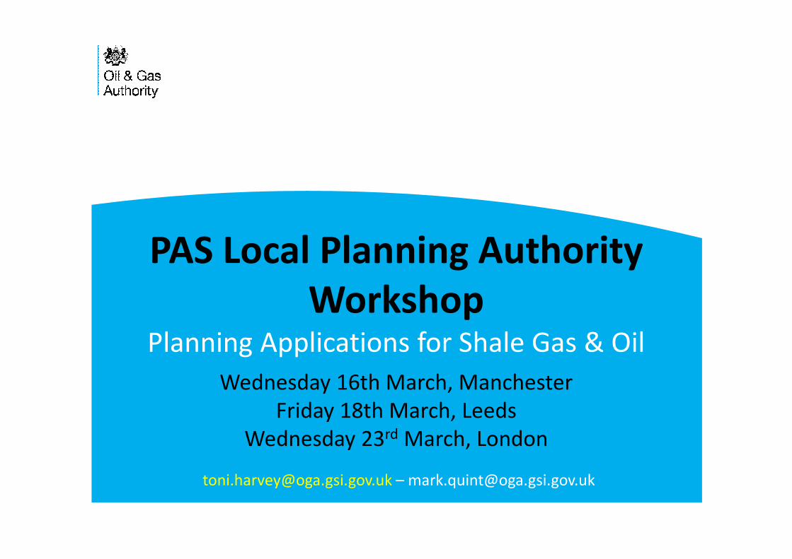
Onshore oil and gas
Role of OGA with other regulators
New Licensing
Regulating seismicity
Hydraulic Fracture Plan
3
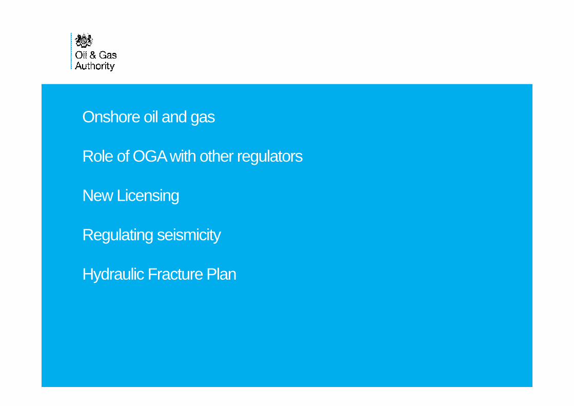
Over 2,100 wells drilled
Producing fields
• 30 Oil fields
• 8 Gas fields
• 2 Coalbed Methane fields
2014 Onshore Production
• 943,400 cubic meters oil
• 47 million cubic meters gas
UK Onshore Oil and Gas
Weald Basin
Wessex Basin
Cleveland
Basin
Cheshire
Basin East Midlands
Bowland
Basin
Midland Valley of
Scotland
S Wales

UK Onshore Geophysical Library
www.ukogl.org.uk
4
5
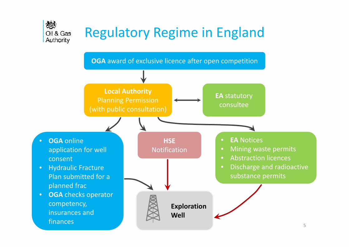
Regulatory Regime in England
OGA award of exclusive licence after open competition
• EA Notices
• Mining waste permits
• Abstraction licences
• Discharge and radioactive
substance permits
• OGA online
application for well
consent
• Hydraulic Fracture
Plan submitted for a
planned frac
• OGA checks operator
competency,
insurances and
finances
HSE
Notification
EA statutory
consultee
Local Authority
Planning Permission
(with public consultation)
Exploration
Well

Petroleum Exploration and Development
Licence (PEDL)
• A PEDL grants exclusive rights “to search and bore for and get petroleum”
in all the various stages of oil and gas exploration, appraisal; production
and eventually abandonment of the wells.
• Licences do not give permission for operations, only grant exclusivity to
licensees within a defined area.
• Drilling, fraccing or production require local planning permission, Access
agreement(s) with relevant landowner(s), Environment Agency permits,
HSE scrutiny and DECC well consent before any operations can commence
• PEDL licence covers conventional oil and gas, tight gas, coalbed methane
(CBM), mine vent gas, oil shale and shale gas. A PEDL licence does not
allow for underground coal gasification (UCG) or CO2 sequestration.
6
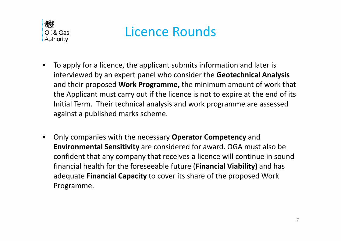
• To apply for a licence, the applicant submits information and later is
interviewed by an expert panel who consider the Geotechnical Analysis
and their proposed Work Programme, the minimum amount of work that
the Applicant must carry out if the licence is not to expire at the end of its
Initial Term. Their technical analysis and work programme are assessed
against a published marks scheme.
• Only companies with the necessary Operator Competency and
Environmental Sensitivity are considered for award. OGA must also be
confident that any company that receives a licence will continue in sound
financial health for the foreseeable future (Financial Viability) and has
adequate Financial Capacity to cover its share of the proposed Work
Programme.
7
Licence Rounds

14th Round
8
Total Work Programme:
• 58 Drill or Drop wells
• 40 Firm vertical wells
• 14 Firm hydraulically fractured
horizontal wells
• Over 2,100 km of 2D
• Over 2,000 km2 of 3D
No offers in Scotland or Wales
9
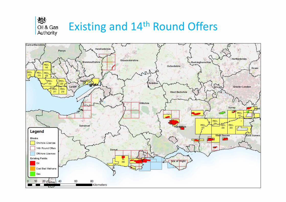
Existing and 14th Round Offers
Cuadrilla PEDL165
• Shale drilling
• 3D seismic
• Planning at 2 sites
IGAS
• CBM drilling
• 3D seismic
14th Rnd Offers
• 7 Firm wells bid
• 2D and 3D seismic
10
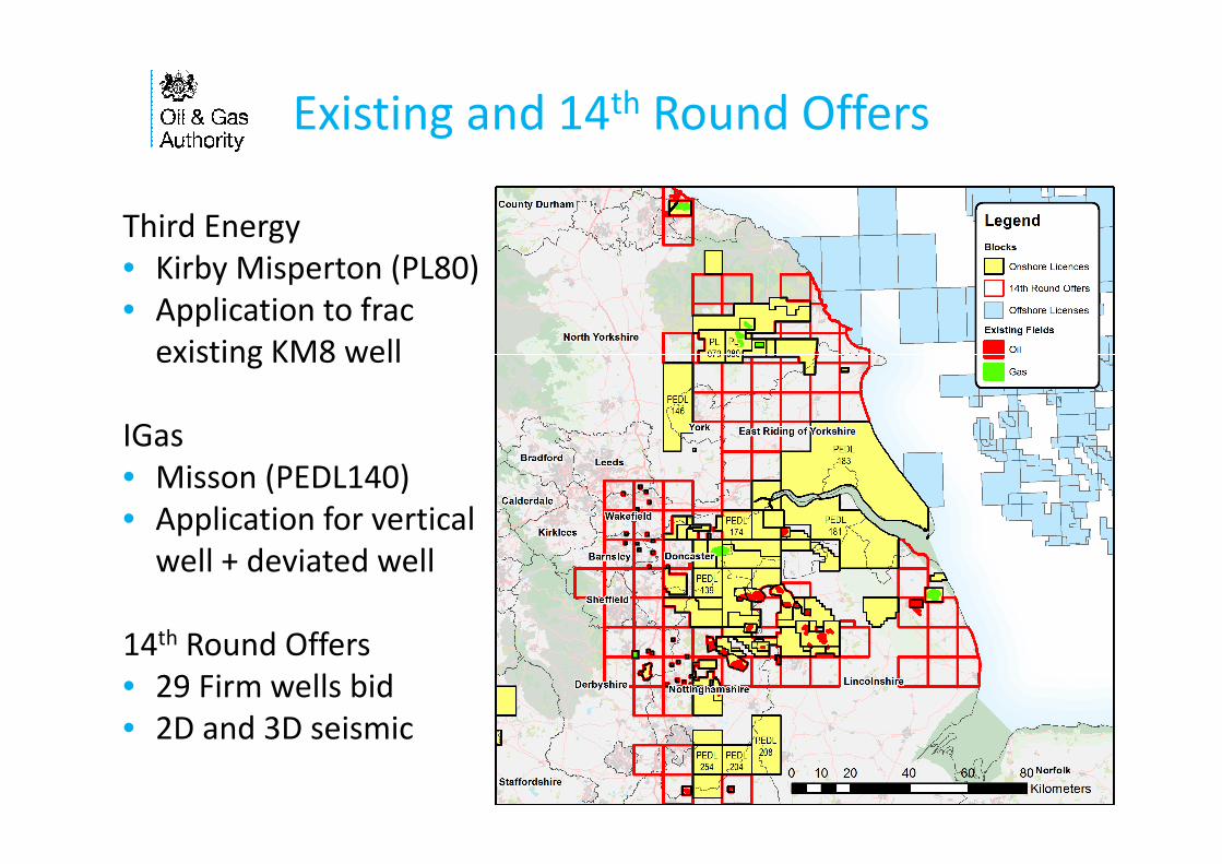
Existing and 14th Round Offers
Third Energy
• Kirby Misperton (PL80)
• Application to frac
existing KM8 well
IGas
• Misson (PEDL140)
• Application for vertical
well + deviated well
14th Round Offers
• 29 Firm wells bid
• 2D and 3D seismic
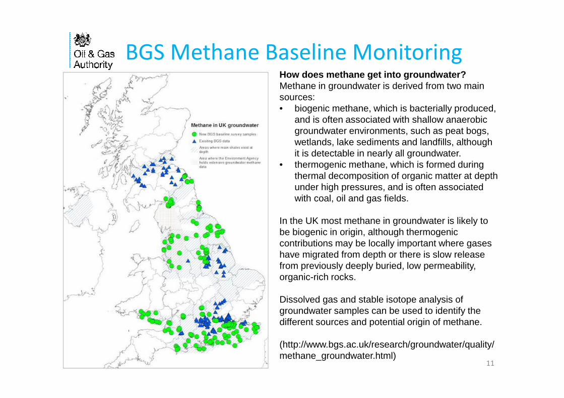
BGS Methane Baseline Monitoring
11
How does methane get into groundwater?Methane in groundwater is derived from two main sources:• biogenic methane, which is bacterially produced,
and is often associated with shallow anaerobic groundwater environments, such as peat bogs, wetlands, lake sediments and landfills, although it is detectable in nearly all groundwater.
• thermogenic methane, which is formed during thermal decomposition of organic matter at depth under high pressures, and is often associated with coal, oil and gas fields.
In the UK most methane in groundwater is likely to be biogenic in origin, although thermogeniccontributions may be locally important where gases have migrated from depth or there is slow release from previously deeply buried, low permeability, organic-rich rocks.
Dissolved gas and stable isotope analysis of groundwater samples can be used to identify the different sources and potential origin of methane.
(http://www.bgs.ac.uk/research/groundwater/quality/methane_groundwater.html)

Frac-induced seismicity and the
Hydraulic Fracture Plan (HFP)
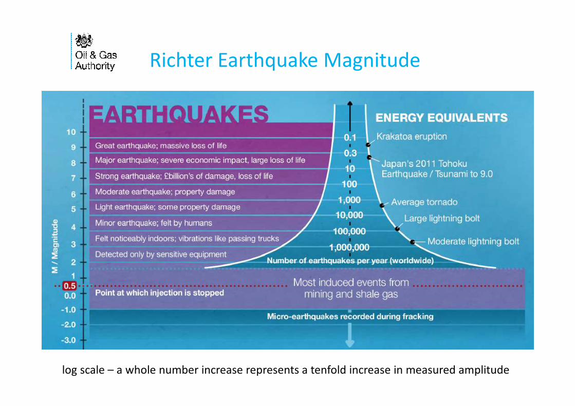
Richter Earthquake Magnitude
13log scale – a whole number increase represents a tenfold increase in measured amplitude
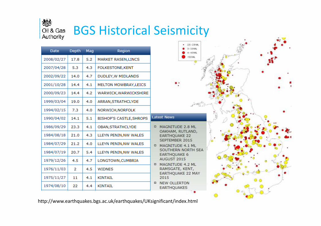
BGS Historical Seismicity
http://www.earthquakes.bgs.ac.uk/earthquakes/UKsignificant/index.html

Frac-induced seismicity
15
From Styles et al 2015,
Schatzalp Workshop
(after Impact of Hydraulic
Fracture Job Parameters on
Seismicity, Warpinski et al, 2012)

Hydraulic Fracture Plan
1) A depth structure map showing
mapped faults near the well
and along the well path, with a
summary assessment of faulting
and formation stresses in the
area and the risk that
operations could reactivate
existing faults.
2) Information on the local
background seismicity and
assessment of the risk of
induced seismicity.
3) Summary of the planned
operation, including perforation
stages, pumping pressures and
volumes and predicted extent
at each stage.
Not to scale

credit: AAPG.org
Stimulated Rock Volume
4) Proposed method for
monitoring fracture
height to identify where
the fractures are within
the target formation and
ensure that they are not
near the EA permitted
boundary
Hydraulic Fracture Plan
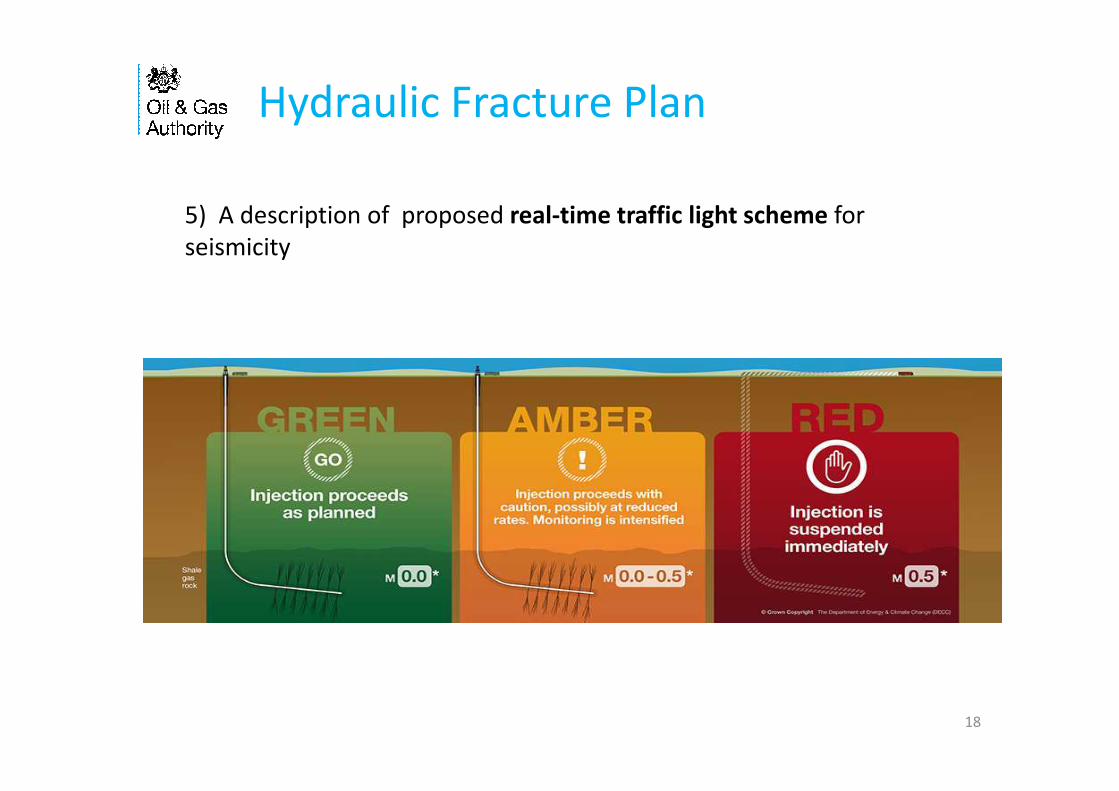
18
5) A description of proposed real-time traffic light scheme for
seismicity

• Long history of onshore oil and gas
• OGA role
• PEDL award only grants exclusivity no consent
• Hydraulic Fracture Plan
• Reduce risk of induced seismic events using Traffic Light
System
19

Thanks!
20