NPS Form 10-900 OMB No. - PR.gov en el... · NPS Form 10-900 United States Department of the ......
36
OMB No. JAN - 6 2017 E EG Eil \l nt¿l7 NPS Form 10-900 United States Department of the lnterior National Park Service National Register of Historic Places Registration Fo 1. Name of Property Historic name Vivero de Peces de Maricao Other names/site num ber Fish Hatchery, Criadero de Peces, Criadero Insular de Peces Name of related multiple property listing New Deal Era Constructions in the Forest Reserves of Puerto Rico1933- 1942 (AMENDMENT) (Enter "N/4" if property is not part of a multiple property listing) 2. Location Street & Number SR-401 Km 1.7 Maricao Afuera Ward City or town Maricao Not for publication [] vicinity [X] State Puerto Rico County Maricao As the designated authority under the National Historic Preservation Act, as amended, I hereby certify that this [X] nomination [] request for determination of eliCibility meets the documentation standards for registering properties in the National Register of Historic Places and meets the procedural and professional requirements set forth in 36 CFR Part 60. ln my opinion, the property [X] meets [] Ooes not meet the National Register Criteria. I recommend that this property be considered significant at the following level(s) of significance: [] national [X] statewide [] local Appl e National Register C lxl A ilB Ic t] D , Esq., SH o t?, Signature of certifying official/Title: Puerto Rico State Historic Preservation Office Date State or Federal agency/bureau or Tribal Government 3. State/Federal Agency Certification ln my opinion, the property [] meets [] ¿oes not meet the National Register criteria Signature of Commenting Official Date T¡tIE State of Federal agency/bureau or Tribal Government 4. National Park Service Certification l, here ertify that this property is: tered in the National Register I determined eligible for the National Register. I determined not eligible for the National Register I removed from the National Register. ,) )l TotT I other, (explain): re Keeper Date of Actíon
Transcript of NPS Form 10-900 OMB No. - PR.gov en el... · NPS Form 10-900 United States Department of the ......

OMB No.
JAN - 6 2017
EEG Eil \l nt¿l7NPS Form 10-900
United States Department of the lnteriorNational Park Service
National Register of Historic Places Registration Fo1. Name of Property
Historic name Vivero de Peces de Maricao
Other names/site num ber Fish Hatchery, Criadero de Peces, Criadero Insular de Peces
Name of related multiple property listingNew Deal Era Constructions in the Forest Reserves of Puerto Rico1933-1942 (AMENDMENT)(Enter "N/4" if property is not part of a multiple property listing)
2. Location
Street & Number SR-401 Km 1.7 Maricao Afuera Ward
City or town Maricao
Not for publication [] vicinity [X]
State Puerto Rico County Maricao
As the designated authority under the National Historic Preservation Act, as amended, I hereby certify that this
[X] nomination [] request for determination of eliCibility meets the documentation standards for registering properties in
the National Register of Historic Places and meets the procedural and professional requirements set forth in 36 CFR Part 60.
ln my opinion, the property [X] meets [] Ooes not meet the National Register Criteria. I recommend that this property be
considered significant at the following level(s) of significance: [] national [X] statewide [] local
Appl e National Register C lxl A ilB Ic t] D
, Esq., SH o t?,Signature of certifying official/Title:
Puerto Rico State Historic Preservation Office
Date
State or Federal agency/bureau or Tribal Government
3. State/Federal Agency Certification
ln my opinion, the property [] meets [] ¿oes not meet the National Register criteria
Signature of Commenting Official Date
T¡tIE State of Federal agency/bureau or Tribal Government
4. National Park Service Certificationl, here ertify that this property is:
tered in the National Register
I determined eligible for the National Register.
I determined not eligible for the National Register
I removed from the National Register.
,) )l TotT
I other, (explain):
re Keeper Date of Actíon

United States Department of the Interior
National Park Service / National Register of Historic Places Registration Form NPS Form 10-900 OMB No. 1024-0018
Vivero de Peces de Maricao Maricao, Puerto Rico Name of Property County and State
2
Historic Functions (Enter categories from instructions.) Current Functions (Enter categories from instructions.)
Agriculture/ fishing facility Agriculture/ fishing facility
Education/research facility Education/research facility
7. Description
Architectural Classification (Enter categories from instructions.)
No Style
Materials (enter categories from instructions.)
Principal exterior materials of the property: Stone and Concrete
5. Classification
Ownership of Property (Check as many boxes as apply) Category of Property (Check only one box)
[] Private [] Building(s)
[] Public-local [x] District
[x] Public-state [] Site
[] Public-federal [] Structure
[] Object
Number of Resources within Property (Do not include previously listed resources in the count.)
Contributing Noncontributing
1 5 Buildings
0 0 Sites
16 5 Structures
1 0 Objects
18 10 Total
Number of contributing resources previously listed in the National Register N/A
6. Function or Use

United States Department of the Interior
National Park Service / National Register of Historic Places Registration Form NPS Form 10-900 OMB No. 1024-0018
Vivero de Peces de Maricao Maricao, Puerto Rico Name of Property County and State
3
Description
Summary Paragraph (Briefly describe the general characteristics of the property, such as its location, type, style, method of
construction, setting, size, and significant features. Indicate whether the property has historic integrity.)
The Vivero de Peces de Maricao is a 3.32 acre fish hatchery district located at kilometer 1.7 of PR-410
in the Maricao Afuera Ward. The property lies approximately 1.2 kilometers to the southwest of the
Maricao urban area. The fish hatchery, part of the Maricao State Forest, was established on three
segments of land along the meander of the Maricao River enclosed by heavily forested Hills. The Vivero
de Peces de Maricao includes the approximately 4.0 acres of the original insular fish hatchery developed
by Civilian Conservation Corps from 1937-1942 for the Insular Forest Service. The district is made up
of six buildings (administration, laboratories, storage and rest rooms), twenty-two structures (spawning
ponds, holding tanks, grow-out ponds, parking) and one object (marker). The resources were built using
stone and concrete as construction materials. After its opening on January 1938, the Vivero de Peces de
Maricao has been in continued use as a fish hatchery. In 1940, The Government of Puerto Rico added
2.75 acres to the fish hatchery. By 1942, the fish hatchery was expanded and the construction of four
large grow-out ponds for breeding fish and sixteen smaller ponds for breeding of crustacean was
completed. At a later date, another grow-out pond was added in the northern segment, west of the
original ponds. In 1998/2000, constructions were undertaken in the fish hatchery to repair damages
caused by the Hurricane Georges and increase fish production. In this period three original grow-ponds
were redesigned and two new grow-out ponds, restroom building, storage building, gabions, and one
concrete bridge were built. At a later date, a visitor parking was built on a lot across the Maricao River.
This visitors parking is not included within the district’s boundaries. Today the property is administered
by the Puerto Rico Department of Natural and Environmental Resources. This district retains integrity
of location, setting, workmanship, materials, feeling and association.
Narrative Description (Describe the historic and current physical appearance and condition of the property. Describe
contributing and noncontributing resources if applicable.)
The Vivero de Peces de Maricao (Fish Hatchery of Maricao) is an insular fish hatchery, at an elevation
of 457.2 meters (1,500 feet) above sea level, located along the Maricao River basin approximately 1.2
kilometers southwest of the town of Maricao. The Vivero de Peces de Maricao is made up of three
segments north and south of the Maricao River and a dam located up stream (to the West). The insular
fish hatchery is reached by travelling southwest from the town on State Road PR-410 until reaching a
gate on kilometer 1.7. This gate gives access to the fish Hatchery’s Visitors Parking that is located in a
low and flat area north of the Maricao River.
On the southwest corner of the Visitors Parking, a small concrete bridge crosses the Maricao River
reaching the main southern area of the Vivero de Peces de Maricao. The main area is located in narrow a
strip of land south of the Maricao River and north of hills. This area has twenty-two of the twenty-eight
resources of this district: five buildings (Restroom, Administration building, Quarantine Lab,
Temperature & Photoperiod Lab and Nursery), sixteen structures (stairway, water channels, old storm
water aqueduct, one ornamental pond, three oval spawning ponds, one raceway tanks, three nursery
tanks or gazebos, three holding tanks, one large oval grow-out pond and two bridges), and one object

United States Department of the Interior
National Park Service / National Register of Historic Places Registration Form NPS Form 10-900 OMB No. 1024-0018
Vivero de Peces de Maricao Maricao, Puerto Rico Name of Property County and State
4
(marker). The fish hatchery has a system of sluices and channels that move water by gravity to all ponds
and tanks, not having to depend on an external piped water supply. It takes in water from a dam (built in
the 1998-2000 expansion) located upstream at the Maricao River which passes through the property.
The entrance of the main area is identified by a pedestal with two shield shaped entrance signs to the
south of the eastern bridge that reads: Departamento Servicio Forestal, PR, Entrada Bosque Insular de
Maricao (Department of Insular Forest Entrance to Insular Forest of Maricao). A service road splits in
two – one segment to the east leading to the small public restrooms building and a grow-out pond, and
another leading to a second bridge upriver to the west.
In the eastern segment, an ornamental block fence that runs south from the chain link fence in the north
serves as a border for the grow-out pond (CC1), see figure 1. The fence opens in two places: in the
center to provide access to the pond’s western pier and in south to the restroom building.
Figure 1. Drawing showing the southern segment of the Maricao Fish Hatchery. Prepared by Jorge Ortiz Colom in July 2015
for Cafiesencia. Modified by PRSHPO in 2016.
The restroom building is a front gabled one story concrete edifice with separate bathroom facilities for
men and women. The grow-out pond is oval shaped and is the largest structure in the southern area. This
pond has two small piers (east and west) and is delimited to the north by a chain link fence and enclosed
in the south by a concrete fence built at the base of a Hill.
A concrete sidewalk, starting in front of the restroom building, progresses westward the central and
western segments of the main area. In the central segment, the sidewalk and service road run parallel
crossing north of various structures (spawning ponds CR2 & CR3, water channel, storm water drainage
and a concrete stairway) and south of the spawning pond (CR1).
As the service road progresses westward, the ground slopes slightly when passing the second largest
spawning pond (CR3) close to the western bridge’s landing. Visually, this landing and the northern
section seems to be at the same height as the raceway tank (T1-T24). A grass covered artificial earthen

United States Department of the Interior
National Park Service / National Register of Historic Places Registration Form NPS Form 10-900 OMB No. 1024-0018
Vivero de Peces de Maricao Maricao, Puerto Rico Name of Property County and State
5
mound was built along the northern area beyond this bridge landing, running parallel to the river bed, to
protect two holding tanks (T29 and T26-28) and the gazebos (G1-G3) against flood waters. Near the
gazebos, a one story, rectangular concrete building is used as the hatchery’s nursery. This bridge leads to
the northern section of the fish hatchery.
Moving eastward, on the sidewalk from the nursery building is the holding tank (T25) and raceway tank
(T1-T24) found in a slightly elevated area. Prior to reaching the raceway tank the sidewalk forks: one
route turning east toward the laboratories and the administration building; the other one turning north
connecting with the original sidewalk.
Ascending on this sidewalk, to the south and east of the raceway tank, is a small square concrete
building used as Temperature and Photoperiod Lab (B3). The sidewalk further slopes until reaching a
level area where the Administration Building (B1) and the Quarantine Lab (B2) are located. This area is
the highest point of the fish hatchery.
The Administration building was built of reinforced concrete walls with perforated openings for doors
and windows. Wherever beams were used, they were of the haunched type1 (Spanish vigas acarteladas)
demonstrating a very conservative view of the structural possibilities and freedom of concrete
construction. This building has a flat concrete roof with parapets. A roof extends east covering the open
space between the Administration and the Quarantine Lab. This lab is one story, concrete, flat roof
building with a rectangular plan.
A concrete stairway was built after the 1970s in level area facing the Administration building’s northern
façade. This stairway descends until reaching a small grassy open area between two spawning ponds
(CR2 and CR3). Close to the stairway, on its western side, is an original (1938) storm drainage system,
today partially covered by the roots of a tree and vegetation, which are still in use. Behind both buildings
a concrete drain runs towards a channel which collects storm waters.
Figure 2. Aerial view that shows the road, spawning, holding tanks,
concrete bridge and one of the grow-out pond.
1 It means that the beam widens in an angle shortly before reaching the supports. The triangular widening is usually called
the “haunch”. This detail was widely used in early concrete work in Europe and America.

United States Department of the Interior
National Park Service / National Register of Historic Places Registration Form NPS Form 10-900 OMB No. 1024-0018
Vivero de Peces de Maricao Maricao, Puerto Rico Name of Property County and State
6
Ponds, tanks and water channels
The fish ponds have geometric shapes: rectangles, chamfered rectangles (lozenges) and ovals. Only the
larger pond (CC1) in the southern area shows some kind of organic form as the 30.5-meter-long (100-
foot-long) oval tends to be somewhat irregular, in part defined by the contour of the hill to the south.
The organization of the ponds and tanks is basically determined by the functional needs of the facility:
breeding takes place in the smaller tanks upstream and finally fingerlings are placed in the three larger,
excavated-in-the-earth ponds downstream. Sluices and ditches are arranged for the effective use of water
collected by the upstream dam and this water descends by gravity and usually on the surface. This way,
the fundamental role of fresh water in the hatchery operations is emphasized.
At strategic points where the ditches join, metal gates are manipulated to selectively move water to
specific ponds and tanks. Over this network of water channels, there is superimposed another of mostly
concrete sidewalks that communicate between ponds, tanks and buildings. Steps and ramps are used
liberally considering the inclines of the terrain. The main building – caretaker’s lodgings and office –
has a commanding view of the whole installation.
In terms of earth movement, the hatchery was graded to form the level surfaces in which the fishponds
were established, and provide adequate level changes to facilitate the movement of water that was
dammed upstream in the Maricao River. Grass was liberally used to landscape the spaces between the
ponds and buildings in the Hatchery.
Landscaping
The landscaping treatment in the fish hatchery is conceived as a “soft” landscape that, although fully
designed, changes angles with the vistas to the river, trying hard to look more like a timeless, organically
evolved-one of the continuing type.2 Local and exotic vegetation is used quite liberally for esthetic
effect. Some details like the zigzag sluice and another stepped one go past the hatchery’s only
ornamental pond. They were contrived for a “romantic” image and as an attempt to break up the rigidity
of the utilitarian, “functionally” designed concrete tanks. The “primeval”, surrounding forest and the
strategic location of the entry to the hatchery at a point where the river bends and the mountains close in,
gives a sense of enclosure and detachment to the Hatchery, which is expressed as a secluded, Shangri-La
type enclave, where nature is hegemonic.
2 This analysis is based on the categories originally developed by various landscape experts and cultural geographers such
as Carl O. Sauer, and the terms used here derive from those adopted by the United Nations’ Educational, Scientific and
Cultural Organization (UNESCO) in their classification of World Heritage Landscapes, in turn also adopted by the NPS in
their Cultural Landscape Preservation documentation.

United States Department of the Interior
National Park Service / National Register of Historic Places Registration Form NPS Form 10-900 OMB No. 1024-0018
Vivero de Peces de Maricao Maricao, Puerto Rico Name of Property County and State
7
Figure 3. Vivero de Peces Maricao district boundaries that include northern and southern segments.
The hatchery’s other five large oval shaped grow-out ponds and the equipment building are located on a
strip of land on the north of the Maricao River. Access to this area is by way of a concrete second
bridge. Two service roads serve to encompass the grow-out ponds and join where equipment storage
building is located. Between these grow-out ponds, there are service roads that are used for maintenance
of these structures. The equipment building is a large one story, rectangular concrete construction used
for equipment and supplies.
CONTRIBUTING RESOURCES
Entrance Bridge (Contributing)
This small concrete vehicular beam one spans bridge crosses the Maricao River and serves as the main
access to the fish hatchery. The Civilian Conservation Corps completed its construction by 1938.
Pictures 1 and 2. View of the Visitors Parking, as seen from the Hatchery and photo of the old bridge taken from the Maricao
river basin.

United States Department of the Interior
National Park Service / National Register of Historic Places Registration Form NPS Form 10-900 OMB No. 1024-0018
Vivero de Peces de Maricao Maricao, Puerto Rico Name of Property County and State
8
Entrance Insular Forest of Maricao – Pedestal [Marker] (Contributing)
A historic object located close to the entrance bridge. This 1938 stepped pedestal with stone facing has
two stone shield plaques identifying the entrance to the facility. These signs are mounted two sides of
the pedestal, facing northeast towards the bridge entrance and west toward the service roadway.
Pictures 3, 4 and 5. View of the pedestal at the entrance to the facility, close up of its plaque
and photo that shows the pedestal location in relation to the hatchery’s service roadway.
Charca de Reproducción # 1 [CR1] (Contributing)
An oval shaped, shallow, dirt floor, spawning pool built by the Civilian Conservation Corps in 1937-
1938. This pool is located north of the fish hatchery’s service road. Bluegills are bred in this spawning
pool.
Picture 6. View of spawning pool CR1. This is the smallest pools in the hatchery.

United States Department of the Interior
National Park Service / National Register of Historic Places Registration Form NPS Form 10-900 OMB No. 1024-0018
Vivero de Peces de Maricao Maricao, Puerto Rico Name of Property County and State
9
Charca de Reproducción #2 [CR2] (Contributing)
An oval shaped, shallow, dirt floor, spawning pool built by the Civilian Conservation Corps in 1937-
1938. This pool, located south of the service road, is the largest of the three spawning pools built for the
fish hatchery. Tilapias are bred in this pond.
Picture 7. Spawning Pool CR2 with restroom building in background (to the right).
Water Channels (Contributing)
This system of channels that connects the ponds and tanks in the southern segment of the district is part
of the original system designed for the fish hatchery in 1937-1938. Later in 1998/2000 it was affected by
the intervention. However, it seems that the concrete water ways and sluice system connecting the
spawning pools and holding tanks (CR1, CR3, T1-24, T29, T25, T26-28, G1, G2 and G3) conforms to
original design and retains integrity.
Pictures 8, 9, and 10. Showing the waterways and their sluiceways in ponds.
Charca de Reproducción # 3 [CR3] (Contributing)
This structure, known as Charca de Reproducción 3, was one of two original spawning ponds built in
1937-1938 by the Civilian Conservation Corps. This spawning pond has dirt floor, which is better suited
than concrete surface, for egg laying by the fish. Bass are bred in this pond.

United States Department of the Interior
National Park Service / National Register of Historic Places Registration Form NPS Form 10-900 OMB No. 1024-0018
Vivero de Peces de Maricao Maricao, Puerto Rico Name of Property County and State
10
Pictures 11 and 12. View of the pool (CR3) is undergoing its weekly maintenance. First photo looking
approximately west. Second photo looking approximately east.
Tanque # 1-24 [T1-24] (Contributing)
Tank 1 through Tank 24, also known as fish battery, built by 1937-1938 by the Civilian Conservation
Corps. It is made up of 24 pools in which water is fed through gravity.
Pictures 13 and 14. General view of the old fish battery (T1-T24) and a close up of one of the pools.
Tanque #29 [T29] (Contributing)
This chamfered rectangle shaped holding tank was constructed in 1937-1938 by the CCC.
Picture 15 and 16. First photo shows part of water channel holding tank (T29) in the foreground. Second photo is taken from
sidewalk to the left of the holding tank looking west, while in the background T26-T28 and Gazebo 2.

United States Department of the Interior
National Park Service / National Register of Historic Places Registration Form NPS Form 10-900 OMB No. 1024-0018
Vivero de Peces de Maricao Maricao, Puerto Rico Name of Property County and State
11
Tanque #26 - 28 [T26 – T28] (Contributing)
This retention tank is rectangular shaped and is divided into three long pools. This tank currently is used
for the “tilapia” production. Built in 1937-38 by the CCC.
Picture 17. View of the retention tank’s (T26-T28) three pools. Photo taken from the Gazebo area looking east.
Gazebo 1 [G1], Gazebo 2 [G2] and Gazebo 3 [G3] (Contributing)
The Gazebo was previously used as a 1938 circular tank, with diameter of 6.096 meters, which used to
have a rotating mechanism that provide exercise for the small fishes. Today the circular tank has been
modified to house seven large blue colored plastic drums. They are presently experimentation tanks used
by the nursery.
Pictures 18 and 19. First photo is taken from retention tanks (T26-T28) looking southwest.
The second photo shows Gazebo 2 (G2) looking east.
Tanque #25 [T25](Contributing)
This “guitar” shaped concrete holding tank, measuring 18.288 meters long by 6.096 meters wide, is used
today as a retention tank for large fishes. This structure was built by the CCC in 1937-1938. The
structure suffered minor damage when a tree fell on its western end (see Picture 21).
United States Department of the Interior
National Park Service / National Register of Historic Places Registration Form NPS Form 10-900 OMB No. 1024-0018
Vivero de Peces de Maricao Maricao, Puerto Rico Name of Property County and State
12
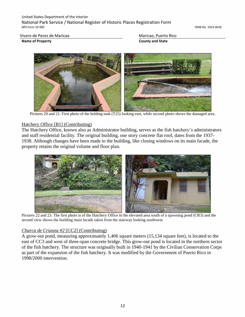
Pictures 20 and 21. First photo of the holding tank (T25) looking east, while second photo shows the damaged area.
Hatchery Office [B1] (Contributing)
The Hatchery Office, known also as Administrator building, serves as the fish hatchery’s administrators
and staff residential facility. The original building, one story concrete flat roof, dates from the 1937-
1938. Although changes have been made to the building, like closing windows on its main facade, the
property retains the original volume and floor plan.
Pictures 22 and 23. The first photo is of the Hatchery Office in the elevated area south of a spawning pond (CR3) and the
second view shows the building main facade taken from the stairway looking southwest.
Charca de Crianza #2 [CC2] (Contributing)
A grow-out pond, measuring approximately 1,406 square meters (15,134 square feet), is located to the
east of CC3 and west of three-span concrete bridge. This grow-out pond is located in the northern sector
of the fish hatchery. The structure was originally built in 1940-1941 by the Civilian Conservation Corps
as part of the expansion of the fish hatchery. It was modified by the Government of Puerto Rico in
1998/2000 intervention.

United States Department of the Interior
National Park Service / National Register of Historic Places Registration Form NPS Form 10-900 OMB No. 1024-0018
Vivero de Peces de Maricao Maricao, Puerto Rico Name of Property County and State
13
Pictures 24 and 25. First photo of grow-out pond #2 (CC2) looking southeast with Nursery, Gazebo area and
concrete bridge in the back ground. In the second photo shows the pond in foreground, looking northeast.
Charca de Crianza #3 [CC3] (Contributing)
A grow-out pond, measuring approximately 1,509 square meters (16,238 square feet), located in the
northern sector of the fish hatchery. This structure was originally built in 1940-1941 by the Civilian
Conservation Corps as part of the expansion of the fish hatchery. The structure was modified by the
Government of Puerto Rico in 1998/2000 intervention.
Picture 26. View of the grow-out pond #3 (CC3) looking southwest.
Charca de Crianza #4 [CC4] (Contributing)
This is the largest grow-out pond in the hatchery. This pond, measuring approximately 2,400 square
meters (25,829 square feet), is located between CC3 (east) and CC5 (west) in the northern sector of the
fish hatchery. This structure was originally built in 1940-1941 by the Civilian Conservation Corps as
part of the expansion of the fish hatchery. The structure was modified by the Government of Puerto Rico
in 1998/2000 intervention.

United States Department of the Interior
National Park Service / National Register of Historic Places Registration Form NPS Form 10-900 OMB No. 1024-0018
Vivero de Peces de Maricao Maricao, Puerto Rico Name of Property County and State
14
Picture 27, 28 and 29. Views of the grow-out pond #4 (CC4) emptied for routine maintenance. The photos were taken from
the interior service road, close up of its fish kettle and from the exterior service road (close to the river bed).
Charca de Crianza #5 [CC5] (Contributing)
A grow-out pond, measuring approximately 1,449 square meters (15,594 square feet), located between
CC4 (east) and CC6 (west) in the northern sector of the fish hatchery. This structure was originally built
in 1940-1941 by the Civilian Conservation Corps as part of the expansion of the fish hatchery. The
structure was modified by the Government of Puerto Rico in 1998/2000 intervention. However,
although its shape might have been altered, it continues to serve in its historic function.
Picture 30. View of the grow-out pond #5 looking northwest.
In the background are grow-out pond #6 and the Equipment building.
NON- CONTRIBUTING RESOURCES
Charca de Crianza #1 [CC1] (Non-Contributing)
A large, about eight feet deep, grow-out pond, that measures 925 square meters (9,959 square feet),
located at the east end of the southern area of the fish hatchery. This grow-out pond was built by the
Department of Natural and Environmental Resources at an unknown date prior to 1996. The structure
surface is covered in an impermeable membrane and is controlled from its fish kettle. Currently bluegills
are bred in this grow-out pond.

United States Department of the Interior
National Park Service / National Register of Historic Places Registration Form NPS Form 10-900 OMB No. 1024-0018
Vivero de Peces de Maricao Maricao, Puerto Rico Name of Property County and State
15
Pictures 31 and 32. Grow-out pond CC1. First picture looking west, while second picture looking east.
Restroom building in the background to the left of the CC1 (Picture 31).
Restrooms [B5] (Non-Contributing)
A one floor concrete rectangular plan with a small two room public bathroom built in the 1970s to
accommodate influx of visitors to the fish hatchery.
Staircase (Non-Contributing)
A concrete staircase built to provide access to the administration area from the spawning pool (hatching
office) area. This stairway, made up of 30 steps, was probably built as part of a recent construction.
Pictures 33. Concrete stairway and spawning pool CR3 with
Administration building in the foreground a top of the hill.
Ornamental Pond (Non-Contributing)
The small ornamental pond located close to the sidewalk junction, leading to the runway tanks, is an
oval shaped structure that serves exclusively as a decorative function. There is no known date of its
construction.
United States Department of the Interior
National Park Service / National Register of Historic Places Registration Form NPS Form 10-900 OMB No. 1024-0018
Vivero de Peces de Maricao Maricao, Puerto Rico Name of Property County and State
16
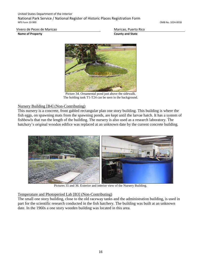
Picture 34. Ornamental pond just above the sidewalk.
The holding tank T1-T24 can be seen in the background.
Nursery Building [B4] (Non-Contributing)
This nursery is a concrete, front gabled rectangular plan one story building. This building is where the
fish eggs, on spawning mats from the spawning ponds, are kept until the larvae hatch. It has a system of
fishbowls that run the length of the building. The nursery is also used as a research laboratory. The
hatchery’s original wooden edifice was replaced at an unknown date by the current concrete building.
Pictures 35 and 36. Exterior and interior view of the Nursery Building.
Temperature and Photoperiod Lab [B3] (Non-Contributing)
The small one story building, close to the old raceway tanks and the administration building, is used in
part for the scientific research conducted in the fish hatchery. The building was built at an unknown
date. In the 1960s a one story wooden building was located in this area.

United States Department of the Interior
National Park Service / National Register of Historic Places Registration Form NPS Form 10-900 OMB No. 1024-0018
Vivero de Peces de Maricao Maricao, Puerto Rico Name of Property County and State
17
Pictures 37 and 38. View of the Temperature and Photoperiod Lab located on an incline close to the Hatchery Office. The
first view, looking east shows the T1-T24 pond to the left, the lab and the Hatchery Office to the right. The second photo
shows the laboratory looking northwest.
Quarantine Lab [B2] (Non-Contributing)
The Quarantine Lab is a one story, rectangular plan concrete building built at an unknown date. The
facilities are joined to the administration building by a wooden roof. The building is used for diseased
fish, to prevent the spread of contagion among the fish population. There are fish tanks (from 6-8) that
run with their own water filtration system.
Picture 39. View of the Quarantine Lab looking southeast.
Bridge over the Maricao River – upriver (Non-Contributing)
The three span concrete bridge was built as part of the 1998/2000 improvements to the hatchery. This
structure was designed, with the capacity to withstand one hundred year flooding, by Engineer Casiano
Ancalloe, for the Department of Natural and Environmental Resources. The original 1941 bridge was
destroyed in the 1998 flooding.

United States Department of the Interior
National Park Service / National Register of Historic Places Registration Form NPS Form 10-900 OMB No. 1024-0018
Vivero de Peces de Maricao Maricao, Puerto Rico Name of Property County and State
18
Picture 40. Three span concrete bridge over the Maricao River.
Charca de Crianza #6 [CC6] (Non-Contributing)
A grow-out pond, measuring approximately 1,382 square meters (14,877 square feet), located between
CC5 (east) and the Equipment Building (west) in the northern sector of the fish hatchery. This structure
was built at an unknown date.
Picture 41 and 42. View of the grow-out pond #6 looking southeast (#41) and looking northwest (#42). In the first picture has
a close up view of the impermeable membrane used to cover the bottom and sides of the pond. In the background of second
picture is the Equipment Storage Building.
Equipment Storage Building [#14] (Non-Contributing)
The one story rectangular concrete building was built by the Department of Natural and Environmental
Resources as the improvements to the fish hatchery in the 1998/2000 intervention. Currently there is an
intervention underway for reuse.
Integrity of the property
The original resources in the southern part of the district have, with the exception of the gazebo and
nursery, retained a high level of integrity of location, design, setting, materials, workmanship, feeling
and association. In the northern area, modifications have been made to the original four grow-out
ponds. However, these ponds have continued its historic function as part of the fish hatchery.

United States Department of the Interior
National Park Service / National Register of Historic Places Registration Form NPS Form 10-900 OMB No. 1024-0018
Vivero de Peces de Maricao Maricao, Puerto Rico Name of Property County and State
19
8. Statement of Significance
Applicable National Register Criteria (Mark “X” in one or more boxes for the criteria qualifying the property for National Register listing.)
X A Property is associated with events that have made a significant contribution to the broad patterns of our history.
B Property is associated with the lives of persons significant in our past.
C Property embodies the distinctive characteristics of a type, period, or method of construction or represents the work of a master, or possesses high artistic values, or represents a significant and distinguishable entity whose components lack individual distinction.
D Property has yielded, or is likely to yield information important in prehistory or history.
Criteria Considerations (Mark “X” in all the boxes that apply.)
Property is:
A Owned by a religious institution or used for religious purposes.
B Removed from its original location.
C A birthplace or a grave.
D A cemetery.
E A reconstructed building, object, or structure.
F A commemorative property.
G Less than 50 years of age or achieved significance within the past 50 years.
Areas of Significance (Enter categories from instructions.)
Entertainment/Recreation
Period of Significance
1938-1966
Significant Dates
1938, 1942
Significant Person (Complete if Criterion B is marked above.)
N/A
Cultural Affiliation
Architect/Builder
Civilian Conservation Corps

United States Department of the Interior
National Park Service / National Register of Historic Places Registration Form NPS Form 10-900 OMB No. 1024-0018
Vivero de Peces de Maricao Maricao, Puerto Rico Name of Property County and State
20
Statement of Significance Summary Paragraph (Provide a summary paragraph that includes level of significance,
applicable criteria, justification for the period of significance, and any applicable criteria considerations.)
El Vivero de Peces de Maricao (Maricao Fish Hatchery), has statewide significance under Criterion A in
the area of entertainment/ recreation. This district is significant because it represents the introduction of
recreation fishing or sport fishing in Puerto Rico. As the first freshwater fish breeding facility, built by
the Civilian Conservation Corps in Puerto Rico, it provided in the first eight years a place to raise and
nurture rainbow trout, primarily from fry to yearling, brought as eggs from the United States prior to
their insertion to Puerto Rico’s rivers, lakes and reservoirs. The facility, which opened in 1938 and
expanded in 1942, has been in continued use as an insular fish hatchery for seventy-eight years. The
period of significance ends in 1966, using the National Register cut-off 50 year date.
Narrative Statement of Significance (Provide at least one paragraph for each area of significance.)
The Insular irrigations and electrification projects in the early decades of the 20th century in the north
and south of Puerto Rico decreased the population of fresh water fish. Also, the newly created reservoir
offered the opportunity to bring establish new fish species to the Island. As a result, Dr. Samuel F.
Hildebrand, ichthyologist of the Fishing Bureau of the Department of Commerce, visited Puerto Rico in
early 1934 for two months,3 to determine the possibilities for the pisciculture4 development in lakes,
rivers and reservoirs in Puerto Rico. In his preliminary study, Dr. Hildebrand indicated there was
sufficient presence of crustaceans, aquatic plants, small fishes and mollusks in the Island’s lakes and
rivers to sustain the introduction of fresh water fish species (blue-gill sunfish, bull-head catfish and
rainbow trout) and that the water temperature did not increase beyond 85o F. As result of this study5, live
fish and rainbow trout eggs were imported to the island in 1934. Since the eggs could not be planted
directly on the lakes or rivers, William R. Barbour6, Supervisor of the Luquillo National Forest, as an
emergency measure, built facilities (an incubator, two circular pools and a propagation pool) in the Río
La Mina area to help the fish propagation program. In these facilities the eggs were hatched and the
hatchlings (also known as fry) were kept in tanks until they grew to three to six inches long when they
were released into the rivers of the National Forest. In 1935, the Puerto Rico Department of Agriculture
and Commerce reported of the planned construction of a fish hatchery for trout and warm water fishes in
the vicinity to the town of Maricao7. This fish hatchery would allow the hatching and production of fresh
and warm water fish for rivers, lakes and reservoirs in the western and central areas of the Island8.
3 Dr. Hildebrand visited Puerto Rico from January 28 to March 18, 1934. Copei, Vol. 1935, No. 2 (July 16, 1935), 49. 4 Pisciculture – the breeding, rearing, and transplantation of fish by artificial means. www.dictionary.com 5 A result of this study was the creation of the Ornithology and Pisciculture Division within the PR Department of
Agriculture and Commerce. 6 A part of an agreement between the Insular and Federal Government in 1918 the head of the Supervisor of the Luquillo
National Forest was also chief of the Insular Forest Service. 7 Informe anual del Departamento de Agricultura y Comercio, Ejercicio 1934-35 (San Juan: Negociado de Materiales,
Imprenta y Transporte, 1935), 57, 214. 8 The Maricao Fish Hatchery, in its first year of service, was provided with a shipment of Luquillo National Forest fish
hatchery’s largest and best developed rainbow trout hatchlings, while Federal Experimental Station at Mayagüez provided
500 bluegill sunfish and 500 bullhead catfish. Informe anual del Comisionado de Agricultura y Comercio, Ejercicio 1936-37
(San Juan: Negociado de Materiales, Imprenta y Transporte, 1938), 177, 178.

United States Department of the Interior
National Park Service / National Register of Historic Places Registration Form NPS Form 10-900 OMB No. 1024-0018
Vivero de Peces de Maricao Maricao, Puerto Rico Name of Property County and State
21
The construction of the Vivero de Peces de Maricao started in 1937, in a 1.9 acre property two
kilometers to the southwest of the town of Maricao. The fish hatchery was built by the Civilian
Conservation Corps, as part of their program to introduce recreational activities in the Island’s forest
reserves. The property at that time consisted of an incubation hut, three circular concrete ponds, a pool
for spawning, and two pools for nurturing warm water fish, a tank repository and a watchman residence.
The hatchery was designed to nurture both warm and cold water fishes. One of the conditions for
selection of the site was that annually the water’s temperature remained between 64o and 70o F9, which
was ideal for trout nurturing. A roadway was built from the town of Maricao to provide access to the
hatchery. The hatchery was completed in early January 1938. It was the first modern construction of its
type south of the United States of America10. On January 12, 1938, the first shipment from US Bureau
of Fisheries in Washington, D.C. arrived at the hatchery. This shipment consisted of: 250,000 rainbow
trout eggs (Salmo irideus), a shipment of live bluegill sunfish (Lepomis incisor) and catfish (Ameiurus).
Out of this egg shipment, 206,167 or 82.6% were successfully hatched11.
Figures 4 and 5. Views of the entrance to the fish hatchery at Maricao and Spawning Pond (CR3). Album de Oro (1938).
9 Rafael Sacarello, “El Departamento de Agricultura esta Poblando de Peces las Aguas Dulces de Puerto Rico”, Revista de
Agricultura de Puerto Rico, Marzo de 1939 (San Juan: Negociado de Materiales, Imprenta y Transporte, 1939), 32. 10 This was the opinion of Luis C. Bonnet, Chief of the Division of Ornithology and Pisciculture, PR Department of
Agriculture and Commerce. Informe Anual del Comisionado de Agricultura y Comercio, Ejercicio 1937-38, (San Juan:
Negociado de Materiales, Imprenta y Transporte, 1939), 58. 11 Informe Anual del Comisionado de Agricultura y Comercio, Ejercicio 1937-38, (San Juan: Negociado de Materiales,
Imprenta y Transporte, 1939), 58.

United States Department of the Interior
National Park Service / National Register of Historic Places Registration Form NPS Form 10-900 OMB No. 1024-0018
Vivero de Peces de Maricao Maricao, Puerto Rico Name of Property County and State
22
Figure 6. Blanton Winship, Governor of Puerto Rico, accompanied by E. W. Fentress person
in charge of the fish hatchery. Revista de Agricultura y Comercio de Puerto Rico. Marzo 1939
Figures 7 and 8. View of fish battery and in second photo the nursery building and round ponds. Album de Oro (1938).
United States Department of the Interior
National Park Service / National Register of Historic Places Registration Form NPS Form 10-900 OMB No. 1024-0018
Vivero de Peces de Maricao Maricao, Puerto Rico Name of Property County and State
23
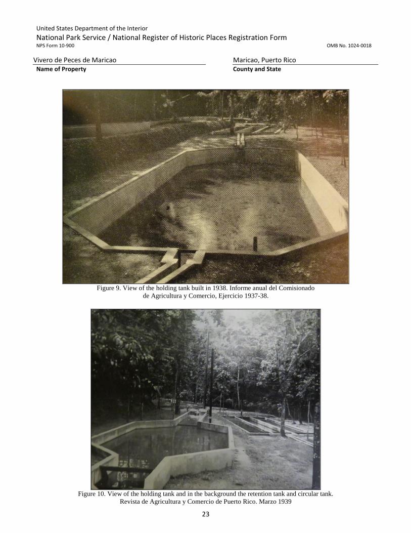
Figure 9. View of the holding tank built in 1938. Informe anual del Comisionado
de Agricultura y Comercio, Ejercicio 1937-38.
Figure 10. View of the holding tank and in the background the retention tank and circular tank.
Revista de Agricultura y Comercio de Puerto Rico. Marzo 1939

United States Department of the Interior
National Park Service / National Register of Historic Places Registration Form NPS Form 10-900 OMB No. 1024-0018
Vivero de Peces de Maricao Maricao, Puerto Rico Name of Property County and State
24
With the outbreak of war in Europe (September 1, 1939), there was the need of intensifying the
production of warm and cold water fishes in the Island to prevent locally foodstuff shortages.
At no time has there been such intensive interest in commercial fisheries and the decision to spend
money to get the business started is closely related to the development of war in Europe. During the
World War there were times when stocks of staple foods were all but exhausted in Puerto Rico. Ships
that had been regularly supplying the island, were transferred to carry war cargos and schedules were
frequently disrupted. Virtually all of the Puerto Rico’s food reaches the island in the United States
ships and is derived from mainland United States. Any diversion of foreign shipping, however, places
a heavier demand upon American bottoms and the higher rates paid for wartime cargoes places
available shipping at premium12.
In the 1939-1940 fiscal year, the Puerto Rican Legislature approved $3,000 to expand, repair and buy
equipment for the fish hatchery. The funds were for the construction of five nurturing ponds for warm
water fishes, twenty small nurturing ponds for daphnia, a garage and a dam. By June 1940, the Vivero de
Peces of Maricao held approximately 150,000 fishes of three species (rainbow trout, bluegill sunfish and
catfish). During this fiscal year the hatchery released 63,775 rainbow trout and 26,157 bluegill sunfish to
Puerto Rico’s lakes and rivers13. The following year, the amount of fishes released decreased to 3,419
rainbow trout, 41,631 bluegill sunfish and 1,997 catfish. The Insular Legislature approved $5,000 to
start the program for the construction of other pools in rural farms for fish nurturing on the Island. These
pools would in turn be supplied by the fish hatchery14.
In the first months of 1942, the Department of Agriculture and Commerce of Puerto Rico reported the
acquisition of a 2.75 acre plot near the hatchery and the completion of four nurturing ponds for warm
water fishes, seventeen ponds for nurturing daphnia, a dam and a bridge. General repairs on the other
ponds was also carried out. With this expansion of the facilities it was expected that the annual
production would be duplicated15.
However, the fish hatchery’s location astride a river could also have drawbacks since it could be
susceptible to loss of production due to flooding. The first flooding occurred during fiscal year 1945-46
when the Insular Forest Service reported the loss of 98% of its catfish (commonly known as barbudas)
and 80% of the bluegill (commonly known as chopa) by flooding. In order to deal with this situation,
arrangements were made with US Fish and Wildlife to obtain more specimens and the propagation and
12 “Danger of War Time Shortage Intensifies Commercial Fisheries Research. Fresh Water Fish are now Available in Island
Rivers”, Revista de Agricultura, Industria y Comercio de Puerto Rico, Junio 1940, 317. 13 Informe anual del Comisionado de Agricultura y Comercio al Honorable Gobernador de Puerto Rico Año Fiscal 1939-40.
(San Juan: Negociado de Materiales, Imprenta y Transporte, 1940), 125 14 Informe anual del Comisionado de Agricultura y Comercio al Honorable Gobernador de Puerto Rico Año Fiscal 1940-41
(San Juan: Negociado de Materiales, Imprenta y Transporte, 1941) ,123. 15 Informe anual del Comisionado de Agricultura y Comercio al Honorable Gobernador de Puerto Rico Año Fiscal 1941-42.
(San Juan: Negociado de Materiales, Imprenta y Transporte, 1943), 135.

United States Department of the Interior
National Park Service / National Register of Historic Places Registration Form NPS Form 10-900 OMB No. 1024-0018
Vivero de Peces de Maricao Maricao, Puerto Rico Name of Property County and State
25
distribution of fishes was reorganized. It was at this time that a new species, bass (commonly known as
lobina), was introduced to establish a natural balance between the catfish and bluegill population16.
In 1946, as the failure to successfully establish a lasting trout population, the focus of the fish production
changed to warm water fish. This in turn “initiated the development of recreation facilities in Puerto
Rico’s reservoirs”.
In a report to the Puerto Rico Commissioner of Agriculture and Commerce, Hildebrand (1934)
recommended the importation and introduction of rainbow trout and brown trout for stocking in the
coolwater streams. These actions provided the impetus for the construction of the Maricao Fish
Hatchery, which began producing fingerlings for release in 1938. Trout production was the primarily
objective of the hatchery until 1942, when it became apparent that introduced fingerling trout failed
to establish sustainable population because natural reproduction was not occurring. During the short-
lived coldwater phase of fish propagation, the hatchery also produced some warmwater species, such
as bluegill and brown bullhead, which were introduced primarily in new and existing reservoirs.
Channel catfish Ictalurus punctatus were also imported from the United States and released into
Cidra, Dos Bocas and Loiza reservoirs….Bluegill and catfishes (most likely channel catfish) were the
only species produced and released for 3 years following the cessation of propagation, but in 1946,
the emphasis of the hatchery shifted in earnest to producing warmwater species17.
The next fiscal year (1947-48), the Insular Forest service carried out the second expansion of the
facilities at the fish hatchery. A battery of eleven pools for fry nurturing was built. Five of the ponds are
fourteen feet long, four feet wide and nine inches in depth. The remaining ponds, although of the same
type, are smaller in size. Earth is used as surface for these ponds. Observations made at the hatchery had
indicated that newly hatched (frey) mortality rate was lower in earthen structures rather than concrete
structures.
16 Informe anual del Comisionado de Agricultura y Comercio, para el año fiscal 1945-46. (San Juan: Administración General
de Servicios, División de Imprenta, 1947), 21. 17 J. Wesley Neal, Richard L. Noble, María de Lourdes Olmeda and Craig G. Lilyestrom. Management of Tropical
Freshwater Fisheries with Stocking: The Past, Present and Future of Propagated Fishes in Puerto Rico. American Fisheries
Society Symposium 44:197-206, 2004.

United States Department of the Interior
National Park Service / National Register of Historic Places Registration Form NPS Form 10-900 OMB No. 1024-0018
Vivero de Peces de Maricao Maricao, Puerto Rico Name of Property County and State
26
Figure 11. View of the Maricao Fish Hatchery’s four grow-out ponds built in 1947. Cuadrángulo Maricao,
Serie de 3 ¾ minutos (USGS Maricao Quadrangle Map, 3 ¾ minutes series), 1947.
Figure 12. View of Vivero de Peces Maricao, 1953 by Antonio Antiles,
Colección de Fotos del Periódico El Mundo. http://bibliotecadigital.uprrp.edu

United States Department of the Interior
National Park Service / National Register of Historic Places Registration Form NPS Form 10-900 OMB No. 1024-0018
Vivero de Peces de Maricao Maricao, Puerto Rico Name of Property County and State
27
In 1996, the Marine Division of the Department of Natural and Environmental Resources prepared a
project to improve, with minimal impact of the existing structures, the conditions of the Maricao Fish
Hatchery18. However, the work on the facilities was interrupted by the strong winds and torrential rain of
Hurricane Georges, which crossed the Island between September 21 and 22, 1998. The fish hatchery’s
facilities and production suffered,
The hatchery was heavily damaged by flooding and high winds associated with Hurricane Georges in
1998, after which it underwent a major reconstruction, renovation and upgrade. This renovation
increased production capacity and eliminated the threat of flooding, and limited dry-season water
supply, which constrained fingerling production in the previous facility19.
Research / Conservation
Maricao’s fish hatchery was devised as a facility originally conceived for the possible acclimation of
game fish from southern North American rivers. Local river fish species were judged too insufficient for
populating rivers and reservoirs and it was believed that some types of trout, bass, catfish and other
similar species could be successfully transplanted into the Highland lakes of a tropical island. The
hatchery, thus, was to serve as a monitoring installation for this acclimation process. Through the years
it was found that some species – specifically the bass and the catfish – could prosper and adjustments in
the mix of available fish were made. As new reservoirs were built in several mountains for different
purposes, the installation kept on growing and other fish species like the tilapias were experimented
with. Some types of native fishes have also been bred here.
The internal organization of the ponds and tanks of the hatchery was made in order to improve the
quality of fish breeding and to undergo research on species behavior in climatic and geographical
conditions that were not previously tested for many of the imported species.
The main purpose of the hatchery was to stock up lakes and rivers for recreational fishing that could be
part of the overall experience of consumption of the forest as a foil for the regimentation of urban life.
However, those in charge of the project understood that the availability of freshwater fish, easier to catch
than marine species, could improve nutrition in the countryside. Many artificial lakes and rivers not
linked with the forest conservation areas benefited from the fish grown in this hatchery, and in many
places installations have been built for the enjoyment of citizens living close to these bodies of water.
The stocking up of fish brought from this hatchery had a modest effect on dietary patterns of inland
families, since fishing, more so with line and cord, was an unfamiliar activity for most country and
mountain peasants. Edible protein could be Harvested from the rivers, but mostly made up of manually-
gathered native crustaceans like camarones de río (shrimps), guábaras (prawns) or buruquenas (river
crabs). Most had some access to locally grown meat or poultry and most dishes were made with this
kind of ingredients – or with imported, salted meats and (marine) fishes that were generally available on
18 SHPO Maricao 12-23-96-02. The project, by C-A Engineering, included a set of drawings prepared by Casiano Ancalle,
which showed the location and shape of the structures of the fish hatchery. 19 Ibid.

United States Department of the Interior
National Park Service / National Register of Historic Places Registration Form NPS Form 10-900 OMB No. 1024-0018
Vivero de Peces de Maricao Maricao, Puerto Rico Name of Property County and State
28
country stores. Nevertheless, the possibility of lake and river fishing opened up another available option
for the common man’s diet in Puerto Rico.
Recreational fishing facilitated by the existence of hatchery-grown fish has been a substantial activity,
mostly in accessible artificial lakes. The advent in the last quarter-century of tilapias (many of which
have been grown in the newer, larger ponds in Maricao) has had a more evident effect in the availability
of fish in the Puerto Rican diet, as this species lends well to dense aqua cultural processes. However, the
final impact of the original introduced species - like bass and catfish - on Puerto Rican dietary Habits
needs further study.
The Maricao fish hatchery is the first freshwater fish breeding facility built in Puerto Rico with a
purpose of stocking rivers and reservoirs with species appropriate for recreational and subsistence
fishing. It was the first scientific research facility for any kind of aquatic species in the island. Therefore,
it is related with a moment in history in which the expansion of available knowledge about plant and
animal behavior could be systematized in specific practices, at least as interpreted by American
agricultural authorities. This signified a leap in the “scientific management” of undomesticated nature,
which until then, even with the availability of well-trained naturalists, was largely managed empirically
and traditionally. The design and layout of the hatchery, even if sensitive to its dense and complex
natural location, is dictated in the final analysis by the rationality of science and the “best practices”
known at the time for fish breeding. This is the main justification for the application of Criterion A.

United States Department of the Interior
National Park Service / National Register of Historic Places Registration Form NPS Form 10-900 OMB No. 1024-0018
Vivero de Peces de Maricao Maricao, Puerto Rico Name of Property County and State
29
Primary Referencies
Archivo General de Puerto Rico. Fondo: Obras públicas. Serie: Propiedad pública. Sub serie: Maricao,
1891-1939. Hilera 124; caja 150.
Archivo General de Puerto Rico. Fondo: Gobernadores. Sub serie: Municipalidades, Maricao (1938-
1952).
Departamento de Agricultura y Comercio. Informe anual del comisionado de agricultura y comercio,
ejercicio 1937-38. San Juan: Negociado de Materiales, Imprenta, y Transporte, 1939.
Hadley, W. E. "Reporte trimestral del Servicio Forestal Insular." Revista de Agricultura de Puerto Rico,
no. 29 (julio-septiembre 1937).
Iñigo Agostini, Félix. Archivo del Centro Interdisciplinario de Estudios del Litoral. Universidad de
Puerto Rico, Mayagüez, (January 25, 1989).
Rodríguez, Rafael. Entrevistas Audiovisual para Documental Bosque Maricao (2015).
Secondary References
Bird, Esteban A. Fishing off Puerto Rico. New York: Barnes, 1960.
Departamento de Recursos Naturales y Ambientales. "Bosque Estatal de Maricao." Hojas de nuestro
ambiente. no. 031. Puerto Rico: Estado Libre Asociado, Agosto 2008.
9. Major Bibliographic References
Bibliography (Insert bibliography here – cite the books, articles and other sources used in preparing this form.)

United States Department of the Interior
National Park Service / National Register of Historic Places Registration Form NPS Form 10-900 OMB No. 1024-0018
Vivero de Peces de Maricao Maricao, Puerto Rico Name of Property County and State
30
--------. Historia del vivero de peces de Maricao. 2006-2012.
http://www.drna.gobierno.pr/oficinas/arn/recursosvivientes/negociado-de-pesca-y-vida-
silvestre/division-de-recursos-marinos-1/proyectos/vivero-de-peces-de-maricao/historia-del-
vivero-de-peces-de-maricao/ (accessed July 15, 2015).
Dominguez Cristobal, Carlos M. Panorama histórico forestal de Puerto Rico. San Juan, Puerto Rico:
Editorial de la Universidad de Puerto Rico, 2000.
Evans, Willis A., and Orthello L. Wallis. Fishes of Yosemite National Park (1941, 1948). Rainbow
Trout. Salmo gairdnerii irideus Gibbons. 1997-2013.
Http://www.yosemite.ca.us/library/fishes/rainbow_trout.Html (accessed May 4, 2015).
Hildebrand, Samuel Frederick. "An Annotated List of Fishes of the Fresh Waters of Puerto Rico."
Copeia (American Society of Ichthyologists and Herpetologists (ASIH) 1935, no. 2 (Jul 1935):
49-56.
Iñigo Agostini, Félix. "Desarrollo pesquero en Puerto Rico." Revista de Agricultura de Puerto Rico 56,
no. 1 (1973): 83-108.
Jarvis, Norman. The fisheries of Porto Rico. Investigation Report #13. WasHington D.C.: Department of
Comerce, Bureau of FisHeries Publication, 1932.
National Park Service. "New Deal Constructions in the Forest Reserves of Puerto Rico 1933 - 1942.
National Park Service Multiple Property Listing." National Register of Historic Places. 2007.
Sacarello, Rafael. “El Departamento de Agricultura esta Poblando de Peces las Aguas Dulces de Puerto
Rico.” Revista de Agricultura de Puerto Rico (Marzo de 1939): 29-38. San Juan: Negociado de
Materiales, Imprenta, y Transporte, 1939.
Urry, John. The Tourist Gaze: Travel and Leisure in Contemporary Societies. Londres: Sage, 1990.
Wesley Neal, L., Richard L. Noble, María de Lourdes Olmeda and Craig Lilyestrom. “Management of
Tropical Freshwater Fisheries with Stocking: The Past, Present, and Future of Propagated
Fisheries in Puerto Rico” in American Fisheries Society Symposium 44:197-206, 2004, 197-206.
Zehr, Douglas. "The rhythms of bass." The San Juan Star, February 12, 1995: 3-6.
Previous documentation on file (NPS): Primary location of additional data:
preliminary determination of individual listing (36 CFR 67 has been requested) X State Historic Preservation Office
previously listed in the National Register X Other State agency
previously determined eligible by the National Register Federal agency
designated a National Historic Landmark Local government
recorded by Historic American Buildings Survey # X University
United States Department of the Interior
National Park Service / National Register of Historic Places Registration Form NPS Form 10-900 OMB No. 1024-0018
Vivero de Peces de Maricao Maricao, Puerto Rico Name of Property County and State
31
recorded by Historic American Engineering Record # Other (Name of repository)
recorded by Historic American Landscape Survey #
Historic Resources Survey Number (if assigned):
Verbal Boundary Description (Describe the boundaries of the property.)
See maps.
10. Geographical Data
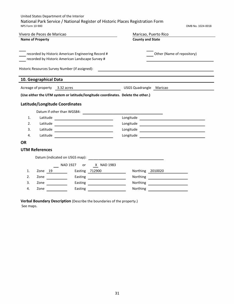
Acreage of property 3.32 acres USGS Quadrangle Maricao
(Use either the UTM system or latitude/longitude coordinates. Delete the other.)
Latitude/Longitude Coordinates
Datum if other than WGS84:
1. Latitude Longitude
2. Latitude Longitude
3. Latitude Longitude
4. Latitude Longitude
OR
UTM References
Datum (indicated on USGS map):
NAD 1927 or X NAD 1983
1. Zone 19 Easting 712900 Northing 2010020
2. Zone Easting Northing
3. Zone Easting Northing
4. Zone Easting Northing

United States Department of the Interior
National Park Service / National Register of Historic Places Registration Form NPS Form 10-900 OMB No. 1024-0018
Vivero de Peces de Maricao Maricao, Puerto Rico Name of Property County and State
32

United States Department of the Interior
National Park Service / National Register of Historic Places Registration Form NPS Form 10-900 OMB No. 1024-0018
Vivero de Peces de Maricao Maricao, Puerto Rico Name of Property County and State
33

United States Department of the Interior
National Park Service / National Register of Historic Places Registration Form NPS Form 10-900 OMB No. 1024-0018
Vivero de Peces de Maricao Maricao, Puerto Rico Name of Property County and State
34
Boundary Justification (Explain why the boundaries were selected.)
The property’s boundaries encompass the area linked with the Maricao Fish Hatchery’s development
from 1938-1942. This area includes structures (bridges, spawning pool, holding tanks, retention tanks
and water channels), buildings and objects (pedestal) associated with the fresh water fish production for
the rivers, lakes and reservoir in Puerto Rico.
11. Form Prepared By
name/title Manuel Valdés Pizzini, PhD, Anthropologist, Jorge Ortiz Colom, Architect, Carlos Carrero Morales, PhD, José Daniel Cuevas, Lisette Fas Quiñones/ Revised and edited José E. Marull del Río, PRSHPO
organization Cafi Cultura Puertorriqueña Inc. (Cafiesencia) date December 27, 2016
street & number 22 San Isidro Street telephone (787) 309-6017
city or town Sabana Grande state Puerto Rico zip code 00637
email [email protected]
Additional Documentation Submit the following items with the completed form:
Maps: A USGS map or equivalent (7.5 or 15 minute series) indicating the property's location.
Sketch map for historic districts and properties having large acreage or numerous resources. Key all photographs to map.
Additional items: (Check with the SHPO for any additional items.)
Photographs Submit clear and descriptive photographs. The size of each image must be 1600x1200 pixels (minimum), 3000x2000 preferred, at 300 ppi (pixels per inch) or larger. Key all photographs to the sketch map. Each photograph must be numbered and that number must correspond to the photograph number on the photo log. For simplicity, the name of the photographer, photo date, etc. may be listed once on the photograph log and doesn’t need to be labeled on every photograph. Photo Log
Name of Property Vivero de Peces de Maricao
City or Vicinity Maricao County Maricao State Puerto Rico
Photographer
Lisette Fas Quiñones (#6, #11, #13,#14,#17), Jorge Ortiz Colom (#2, #3, #23), José E. Marull del Río (#1, #4, #5, #7-#10, #12, #15, #16, #18-#22, #24-#42) Date Photographed
Lisette Fas Quiñones (2014 & 2015), Jorge Ortiz Colom (2015) and José E. Marull del Río (2016)
Description of Photograph(s) and number, include description of view indicating direction of camera. 1. View of the roadway over the old bridge over the Maricao River as seen from the southern segment of the Fish
Hatchery. Looking approximately north.

United States Department of the Interior
National Park Service / National Register of Historic Places Registration Form NPS Form 10-900 OMB No. 1024-0018
Vivero de Peces de Maricao Maricao, Puerto Rico Name of Property County and State
35
2. View of the Hatchery’s old bridge as seen from the riverbed. A chain link fence (to the right) is part of the Fish Hatchery. Looking approximately northwest.
3. View of the Pedestal at the entrance of the Fish Hatchery. Corner view that shows the two stone shield plaques. Looking approximately southeast.
4. Close up view of one of the stone shield plaques. Looking approximately south. 5. View of the pedestal and service road taken from the roadway that leads to grow-out pond #1 (CC1). Looking
approximately northwest. 6. View of spawning pool #1 taken from the service roadway. Looking approximately northwest. 7. View of spawning pool #2 taken from the sidewalk. Looking approximately southeast. 8. View of the water channels where they connect with the spawning pond #3. Base of the stairway leading to the
Administration building can be seen on the upper right side of the picture. Looking approximately south. 9. Detail of the outflow gate of T29 pond. Looking approximately west. 10. Sluice detail showing water flow between tanks. Looking approximately east. 11. General View of empty original left side spawning pool #3, looking approximately northwest. 12. General View of empty spawning pool #2, looking approximately southeast. 13. Overall view of the original cement battery with 24 pools. Looking approximately north. 14. Close up of one of the pools of the original cement battery. Looking approximately southeast. 15. View of original basin 1 & 2. Looking approximately west. 16. View of the T29 in foreground, in the background T26-T28 and gazebos (G2 and G3). Looking approximately west. 17. View of retention tank (T26-T28) showing its three pools. Looking approximately east. 18. Partial view of retention tanks in foreground and in back ground Gazebo #2, #3 and #1. Looking approximately
southwest. 19. View of Gazebo #2, looking approximately east. 20. View of Holding Tank T25, looking approximately east. 21. Close up of the damaged area in holding tank T25. Looking approximately north. 22. General view of the Administration building as seen from the sidewalk to the north of spawning pool #3. Looking
approximately south. 23. View of the Hatchery Office’s main façade. Looking approximately southwest. 24. View of grow-out pond #2. In the background the Nursery building, gazebo area and concrete bridge. Looking
approximately southeast. 25. Close up of grow-out pond #2, looking approximately east. 26. General view of grow-out pond #3 (to the right) that shows part of pond #2 (to the left), looking southwest. 27. View of grow-out pond #4 empty of water during routine maintenance. Looking approximately west. 28. Close up of the kettle of grow-out pond #4. Looking approximately east. 29. Partial view of grow-out pond #4. Photo taken from the exterior service road (closer to the river bed). Looking
approximately northwest. 30. General view of grow-out pond #5, looking approximately northwest. 31. View of grow-out pond #1, looking approximately northwest. 32. Ground level view of the kettle of grow-out pond #1. Looking approximately east. 33. General view of concrete stairway. Partial view of spawning pond (to the right). Looking approximately south. 34. View of the Ornamental pond. Looking approximately southeast. 35. General view of the Nursery building as seen from the northern segment of the fish hatchery. Can appreciate the
flood control work completed after the 1998 flooding. Looking approximately southwest. 36. Interior view of the tanks used in the Nursery building. Looking approximately west. 37. General view of the raceway tanks (T1-T24) and the Temperature and Photoperiod Lab. In the background (to the
right) behind the lab is the Hatchery Office. Looking approximately east. 38. Close up view of the Temperature and Photoperiod Lab. Looking approximately northwest. 39. View of Quarantine Lab, looking southeast. 40. View of three span concrete bridge over the Maricao River that serves as access to the holding tanks #2-#6 and
equipment building in the northern segment of the district. Looking southeast.
United States Department of the Interior
National Park Service / National Register of Historic Places Registration Form NPS Form 10-900 OMB No. 1024-0018
Vivero de Peces de Maricao Maricao, Puerto Rico Name of Property County and State
36
41. Close up view of grow-out pond #6. The impermeable membrane used on the pond. Looking approximately southeast.
42. General View of grow-out pond #6 and Equipment building. Looking northwest. Paperwork Reduction Act Statement: This information is being collected for applications to the National Register of Historic Places to nominate properties for listing or determine eligibility for listing, to list properties, and to amend existing listings. Response to this request is required to obtain a benefit in accordance with the National Historic Preservation Act, as amended (16 U.S.C.460 et seq.). Estimated Burden Statement: Public reporting burden for this form is estimated to average 100 hours per response including time for reviewing instructions, gathering and maintaining data, and completing and reviewing the form. Direct comments regarding this burden estimate or any aspect of this form to the Office of Planning and Performance Management. U.S. Dept. of the Interior, 1849 C. Street, NW, Washington, DC.