NEWS Issue 187 - URISA GIS... · Issue 187 January/February ... By Nancy Tosta, URISA President...
13
Sharing information technology solutions to urban and regional challenges since 1963. Issue 187 January/February 2002 Urban and Regional Information Systems Association NEWS NEWS The URISA History Project By Nancy Tosta, URISA President 1999-2000, Ross & Associates continued on page 8 This year URISA is celebrating it’s 40 th Birthday! Well, actually, some would say we are only 39, or 36, or even as young as 33! This is not just self-con- sciousness about our age, but genuine confusion depending on the yardstick you use to measure. But that is the fun of history, right? It’s all in the eye of the beholder. Regardless of whether we truly are 40 (and given we chose to honor our 30 th year in 1992, there is a trend going on here) we are initiat- ing a “History Project” and would like to solicit your assistance. Last year the Board asked me, as outgoing President, to take on the responsibility of doing something to commemorate URISA’s wisdom, contributions, and impact over the last forty years. ESRI generously donated some funding, and many others have offered assistance and ideas to begin to form the basis of a plan for accom- plishing this task. The goals are to capture key ideas and materials in electronic form to make them more accessible and to make it possible to update our inventory as we continue to create history. We need your assistance in the actual implementa- tion of these goals. First, as you have seen or soon will see in the Annual Conference Call for Papers, the theme of the Conference focuses on where we’ve come from and a specific track is planned that will look at what’s been accomplished over the last forty years. I encourage you to think about how you might participate in this effort. Our goal is not to rest on our laurels and bemoan the loss of the good old days, but to examine what we were thinking back then to understand what progress we’ve actually made, to consider where some of the seeds of good things we do today were planted and germinated and what helped them grow, and to examine the coincidences and linkages that often play an unplanned role in the outcomes of our endeavors. Consider submitting a proposal in response to the Call. Some of you have actually participated in URISA events for 20, 30 or 40 years. I ask that you take a look at a paper or presentation you may have made in those days of yore and consider updating it, examining the assumptions you made about where things were headed and see if you were right. Or consider addressing how your interaction with URISA influenced your thinking or the direction you or your career took in life. Or tackle some of the issues we continue to face today with the wisdom of having been around that block again and again. For those of you without the years of URISA history, please consider selecting a topic that might once have been of key interest (e.g., USAC, New Haven Census Use Study, data sales) and talk about what’s changed now, what relevance, if any, the work has to the present, or what might have made those early debates and activities more effective. If you don’t have access to old journals or early URISA materials, please contact me or URISA Headquar- ters and we’ll try to assist. I have always thought that an interesting study would be to examine the cities selected as part of HUD’s USAC project to see if they are in any better/different shape than cities that were not recipients of such concentrated investments in information infrastruc- ture. If you don’t know what I’m talking about, then the history track will be a good place for you to consider spending your time at the conference! We will electronically encode this conference track. As a second component of this project, we are attempting to capture much of the relevant URISA history and create a website that will help to provide access to materials. I was recently provided an opportunity to examine some of URISA’s founder’s, Edgar Horwood, files at the University of Washington archives. (Thanks to long time URISIAN Judy Clark!). The more than 60 boxes of papers, teachings, maps, and photos hold a phenomenal wealth of insight and information. For example, here’s an excerpt from a paper that Horwood wrote in 1973 looking at the formation and history of URISA. I apologize for the length, but believe it’s useful to understand his thinking, and certainly has relevance today. Looking Back Moving Forward URISA’s 40 th Annual Conference October 26-30, 2002 Chicago, Illinois
-
Upload
duongxuyen -
Category
Documents
-
view
223 -
download
1
Transcript of NEWS Issue 187 - URISA GIS... · Issue 187 January/February ... By Nancy Tosta, URISA President...

Sha r i ng i n fo rma t i on t e chno logyso lu t i on s t o u rban and
reg iona l cha l l enge s s i n ce 1963 .
Issue 187
January/February 2002
U r b a n a n d R e g i o n a l I n f o r m a t i o n S y s t e m s A s s o c i a t i o nN E W SN E W S
The URISA History ProjectBy Nancy Tosta, URISA President 1999-2000, Ross & Associates
continued on page 8
This year URISA is celebrating it’s 40th
Birthday! Well, actually, some wouldsay we are only 39, or 36, or even asyoung as 33! This is not just self-con-sciousness about our age, but genuineconfusion depending on the yardstickyou use to measure. But that is the funof history, right? It’s all in the eye ofthe beholder. Regardless of whetherwe truly are 40 (and given we choseto honor our 30th year in 1992, there isa trend going on here) we are initiat-ing a “History Project” and would liketo solicit your assistance.
Last year the Board asked me, asoutgoing President, to take on theresponsibility of doing something tocommemorate URISA’s wisdom,contributions, and impact over the lastforty years. ESRI generously donatedsome funding, and many others haveoffered assistance and ideas to beginto form the basis of a plan for accom-plishing this task. The goals are tocapture key ideas and materials inelectronic form to make them moreaccessible and to make it possible toupdate our inventory as we continueto create history. We need yourassistance in the actual implementa-tion of these goals.
First, as you have seen or soon willsee in the Annual Conference Call forPapers, the theme of the Conferencefocuses on where we’ve come fromand a specific track is planned that willlook at what’s been accomplished overthe last forty years. I encourage you tothink about how you might participatein this effort. Our goal is not to rest onour laurels and bemoan the loss of the
good old days, but to examine whatwe were thinking back then tounderstand what progress we’veactually made, to consider where someof the seeds of good things we dotoday were planted and germinatedand what helped them grow, and toexamine the coincidences and linkagesthat often play an unplanned role inthe outcomes of our endeavors.Consider submitting a proposal inresponse to the Call.
Some of you have actuallyparticipated in URISA events for 20, 30or 40 years. I ask that you take a lookat a paper or presentation you mayhave made in those days of yore andconsider updating it, examining theassumptions you made about wherethings were headed and see if youwere right. Or consider addressinghow your interaction with URISAinfluenced your thinking or thedirection you or your career took inlife. Or tackle some of the issues wecontinue to face today with thewisdom of having been around thatblock again and again.
For those of you without the yearsof URISA history, please considerselecting a topic that might once havebeen of key interest (e.g., USAC, NewHaven Census Use Study, data sales)
and talk about what’s changed now,what relevance, if any, the work has tothe present, or what might have madethose early debates and activities moreeffective. If you don’t have access toold journals or early URISA materials,please contact me or URISA Headquar-ters and we’ll try to assist. I havealways thought that an interestingstudy would be to examine the citiesselected as part of HUD’s USAC projectto see if they are in any better/differentshape than cities that were notrecipients of such concentratedinvestments in information infrastruc-ture. If you don’t know what I’mtalking about, then the history trackwill be a good place for you toconsider spending your time at theconference! We will electronicallyencode this conference track.
As a second component of thisproject, we are attempting to capturemuch of the relevant URISA historyand create a website that will help toprovide access to materials. I wasrecently provided an opportunity toexamine some of URISA’s founder’s,Edgar Horwood, files at the Universityof Washington archives. (Thanks tolong time URISIAN Judy Clark!). Themore than 60 boxes of papers,teachings, maps, and photos hold aphenomenal wealth of insight andinformation. For example, here’s anexcerpt from a paper that Horwoodwrote in 1973 looking at the formationand history of URISA. I apologize forthe length, but believe it’s useful tounderstand his thinking, and certainlyhas relevance today.
Looking Back Moving Forward
URISA’s 40th Annual ConferenceOctober 26-30, 2002Chicago, Illinois

2 January/February 2002 • URISA News
Important URISADates to Remember
April 1, 2002Deadline to submit abstracts forURISA 2002 and Street Smart andAddress Savvy
April 7-10, 2002Integrating GIS & CAMA ConferenceReno, Nevada
June 19–21, 2002IT/GIS in Public WorksPittsburgh, Pennsylvania
August 11-13, 2002Street Smart & Address SavvyConferencePortland, Oregon
October 26-30, 2002URISA’s 40th Annual ConferenceChicago, Illinois
URISA Headquarters1460 Renaissance Drive, Suite 305Park Ridge, IL 60068Phone: 847-824-6300Fax: [email protected]://www.urisa.org
URISA StaffBill GentesExecutive [email protected]
Wendy FrancisURISA NEWS Production [email protected]
Daniel ParrURISA NEWS [email protected]
Article submissions, calendar itemsand industry news should be sent tothe attention of Wendy Francis.
The Urban and Regional InformationSystems Association (URISA) is the premierprofessional association for those involvedin improving our urban and regionalenvironments through the effective use ofinformation technology. Professionals inplanning, economic development,information systems, emergency services,natural resources, public works,transportation, and other departmentswithin state and local government havedepended on URISA for professionaldevelopment and educational needs since1963. Through its international, nationaland local chapter operations, URISAserves nearly 8,000 professionals.
About
URISA BoardPresidentPeirce [email protected]
President-ElectMartha [email protected]
Past-PresidentLyna [email protected]
TreasurerCindy [email protected]
SecretaryDianne [email protected]
Board of DirectorsDavid [email protected]
Bruce [email protected]
Susan [email protected]
Zorica [email protected]
Anne [email protected]
Hilary [email protected]
Have you visited the URISA Website lately?
www.urisa.org
IN THIS ISSUE3 Why Internships?
4 Looking Ahead to 2002
5 GeoAuditing: The Nexus of Financial and Geo-
graphic Systems or The Biggest Dollar Return Yet!
7 Welcome New Corporate Members
9 Industry News
10 Travel Notes

January/February 2002 • URISA News 3
Internships are a valuable commodityfor both the intern and the employer.As interns and former interns at theChester County, Pennsylvania GIS De-partment, we greatly value the experi-ence we have gained. URISA offers anexcellent platform to discuss and pro-mote internships. We highly recom-mend that students participate in andthat employers institute such pro-grams.
Internships are priceless for anycollege student concerned about his/her future in the field. They offer awealth of real world knowledgeunparalleled in the classroom, whilestill applying and building on class-room skills. An internship provideshands-on experience with software,hardware, and real world situationsthat simply cannot be duplicated in acollegiate atmosphere. Internshipsallow students to view the numerousaspects of GIS and the opportunity tofind where their specific interests lie,therefore, allowing for a redefinition ofcoursework in order to suit newinterests. Interns find themselves aspart of a team completing a projectrather than a member of a class in thelaboratory.
Internships are a chance to gainacademic credit while possibly earningmoney and gaining an easy “A”. Theyoffer an opportunity to build yourresume, making you more qualified forany future job positions. If you don’tcontinue working for your internshipemployer, internships do offer numer-ous networking opportunities that maylead to other full time positions aftergraduation. Organizations such asURISA also offer networking while alsokeeping you abreast of the latest GISinnovations. Finally, internshipsprovide the student with an introduc-tion to the professional workplaceenvironment.
Internships present opportunitiesfor the employer as well. Students
Why Internships?By Bryan Pittman, Erick Marklund, and Angela Robertson; Chester County, PA GIS Department
supply a fresh outlook on the industry;they have cutting edge ideas and areeager to learn. They give the employera chance to mold possiblefuture employees. Internsare great employees forcompleting miscellaneoustasks, such as data entryand repetitive projects. Asthe student gains experi-ence he or she maycontribute to specializedprojects as well. It is alsonoteworthy that mostinterns are willing to workfor a fraction of the cost ofa full time employee. Organizationshiring interns give themselves thechance to preview what skills up andcoming college students are learningin the classroom, and in turn whatthey may contribute to the future ofthe employer’s workplace. Throughviewing internships in this way,employers can determine what theyshould be looking for in prospectivehires.
To make sure you get the most ofyour internship, do your research.Make sure your prospective employerhas tasks ready for you to complete, soask! Find out what your day-to-daywork will involve. Talk to formerinterns; find out what their experienceswere like. Make sure your internship
will provide the opportunities you arelooking for. You do not want to spendthis valuable time only completing
data entry and gruntwork. While you shouldexpect this as part of thejob, it should not be youronly responsibility.
Employers interestedin finding an internshould contact localcolleges or universitygeography departments.Most will happily postfliers or announce theposition to faculty who
will, in turn, notify interested students.Considerations may also be taken toplace an ad on the Internet, much likea full-time position.
Internships are of immeasurablevalue. A definite must for every collegestudent and a must have for everyemployer. They present both theintern and the employer the occasionto assess exactly what is, and whatisn’t, of value in a prospective employ-ment situation. Internships have, inour case, helped benefit both em-ployer and intern. Hopefully anincreased amount of participation insuch programs will result from ourpositive experience. Interns can andwill play an integral role in the growthof URISA.
The three interns whoauthored this articleare among the first totake advantage ofURISA’s reducedmembership duesrates for students. Welook forward to along relationship witheach one of them.
Goal: 50 newstudent members
Currently: 19 newstudent members
New StudentMembersWanted
Tell astudentabout URISA

4 January/February 2002 • URISA News
Executive Director’s Column
Looking Ahead to 2002by Bill Gentes, URISA Executive Director
Bill Gentes
The year ahead for URISA is an inter-esting one to say the least. We have achallenging program of events, serv-ing member needs and making URISAmore relevant to your needs as amember. Some of the program high-lights for the year are listed below.� GIS/CAMA Conference in April� Public Works Conference in July� Public Privacy in GIS Conference
in July� Street Smart Conference in
August� URISA Annual Conference in
October
In addition URISA will be celebrat-ing its 40th annual conference inChicago this year with a special trackrelating to the history of URISA,looking back at key moments in ourhistory.
Updates on Major URISA ProjectsThe URISA staff is working on a fewmajor projects for our members overthe next year. Among them are certifi-cation, the 2002-2003 Salary Surveyand a chapter initiative.
CertificationThe URISA Certification Committeeworked very hard over the last fewyears to develop a program that meetsthe needs of the entire GIS commu-nity. I would invite you to go towww.urisa.org to look at the proposaland comment. The proposal is therefor that exact reason. In addition Iwould also encourage you to vote onour survey with a simple yes or noabout certification (the current tally is353 yes and 115 no’s, or 75% yes 25%no).
2002-2003 Salary SurveyThis June we will be starting to gatherdata for our biennial salary surveywhich gathers data about all types ofGIS jobs across all spectrums of our in-
dustry. The last one was hugely popu-lar and gave numerous GIS Depart-ments across the country theammunition to correct salary imbal-ances and fairly pay GIS professionalswhat they are worth.
URISA Chapter InitiativeOne of my chief goals as URISA Execu-tive Director is to get closer to ourchapters. To me, getting closer meansattending chapter conferences when-ever possible, helping chapters outwith any question they have regardingnon-profit questions, and of course of-fering URISA’s professional staff as re-sources to the chapters. We currentlyhelp 10 of our 24 chapters with directassistance and the rest indirectly.
I am planning on attending anumber of chapter conferences in thenext few months, including theCalifornia Chapter conference,Washington, Oregon, and the FloridaChapter conference. We will havesomeone from URISA at theMidAmerica GIS Symposium, the GITAConference, the GIS-T Conference,Indiana State GIS Conference, theIMAGIN (Michigan) Annual Confer-ence, and at the Wisconsin LandInformation Association’s event.
Apply for a URISA 2002 ESIG™ Award!
If so, that achievement should be recognized
and shared with your peers. Nominate your
organization for a prestigious URISA Exemplary
Systems in Government (ESIG™) Award. Or
convince a colleague to participate!
Has your organization improved the delivery
and quality of government services through
the application of information technology?
Visit www.urisa.org for moreinformation or see February’sMarketplace.

January/February 2002 • URISA News 5
President’s ColumnNot So Miscellaneous Ramblings —GeoAuditing: The Nexus of Financial and GeographicSystems or The Biggest Dollar Return Yet!by Peirce Eichelberger, GIS Manager, Chester County, PA; [email protected]
PeirceEichelberger
What would you think if I told you thatthe greatest revenue return on GISimplementation will be in agenciesthat you have not worked with yet? Inlate 1993 as I was wrapping up mytime with Orlando/Orange County, FLone of the Internal Auditors had askedfor help in processing some Cable TVcustomer data to verify franchise fees.The auditors worked for our electedComptroller who was not a direct GISmember agency or other direct partici-pant, nor had they funded any GIS ac-tivities. The audit staff had the abilityto request digital data from an auditsource. The auditor had asked, “Couldwe match the records against the GISto determine record accuracy?”. Wesaid that it would be easy to do someaddress processing using the audit fileand the GIS’ single line, street map da-tabase with address ranges.
Auditors, since about the 1930’s,had begun to use statistical samplingmethods to review every 100th record,or so, for accuracy. This was done tominimize the amount of recordchecking needed. The most recentaudit of the cable customers wascompleted using the traditionalsampling techniques and had “re-turned” about $2,000 to the County.By using the GIS we were able toprocess all of the Cable TV customersrecords, not just a sample. In fact,because of the computer processing itnow makes sense to process all therecords. If you think just governmenthas bad records......think again. Byprocessing the address fields of thecustomer service location against theGIS, we found many interesting things— some customers were not evenidentified in the proper County, muchless in unincorporated Orange Countyversus a municipality. Because ofcontinued confusion about mailing/postal cities versus proper jurisdiction
locales many records had impropertaxing jurisdictions identified. All toooften we accept the mailing address asproperly locating a property, an eventor a customer location. In only ninemonths from the last traditional audit,this audit of the smallest CATVcompany in Orange County returned$63,000, with about a week’s worth ofaddress matching work!
It didn’t take much for theauditors to get “GIS enabled”. Manysubsequent audits have returnedhundred of thousands of dollars fromsimple address processing against theGIS. A cellular telephone auditreturned $650,000, a resort tax auditof condominium properties showedrevenues $700,000 ahead of their best
projections. With auditing and datacorrections, remember that the returnis higher for subsequent years as well.Orange County, FL has receivedmillions of dollars of audit benefitsfrom Geoauditing techniques.
Well the cat is out of the bag, somuch for that as a business plan idea!This is also a great way for URISA toget back into important fiscal opera-tions of government. Watch out GASB34! Check around, your governmentcan experience similar benefits....emailme if you need additional backgroundmaterials at [email protected] check the URISA web site, shareyour experiences with URISA.
Wow.....it’s nice to be connected! I’veheard from so many URISA membersregarding last month’s column about GISand 911. So many have requested a copyof the referenced paper, and it was reallyneat to carry on a real conversation withso many fine URISA folks. Even thoughthe paper is now on the website, I justmay have readers email me requests so Ican “hear what’s going on.” I’ve receivedabout two dozen emails from variousURISA members — keep reading andkeep at it!
Submit an abstract for URISA
2002, your 40th Anniversary
Conference! Abstracts are
due on April 1.
ESIG applications are
due on June 14.
Nominate your
system as an
Exemplary System in
Government!

6 January/February 2002 • URISA News
ESRI AdPickup from Nov Issue --Delivering a new world tof GISto your desktop

January/February 2002 • URISA News 7
Rolta is a multinationalorganization wellequipped to provideservices to clientsaround the world. Byjudiciously combiningresources from its vari-
ous facilities, Rolta is able to cost-effec-tively meet customer needs in theglobal marketplace. Since 1982 Roltahas been a provider of innovative solu-tions in computer graphics, mappingand engineering software, and data-base applications.
Rolta is proud of its significantinvestments to make GIS, CAD and e-business services both cost-effective andreliable for our customers. Rolta’s uniqueoffshore capabilities utilize high-speeddata communication links between ourproduction facilities and project offices inthe U.S., Europe, and the Middle East toprovide rapid, direct, and securecommunications enabling project tasksto be continuously monitored. Staff in allfacilities work together to coordinate allproduction and management tasks,efficiently supporting customers aroundthe globe. This innovative approachenables us to provide clients with highquality, well-managed AM/FM/GIS, PlantDesign Automation, Engineering DataManagement, Mechanical DesignAutomation, and e-Business Solutions/Internet consulting services. And, withour worldwide presence and communi-cation links between facilities, Rolta isalways close at hand.
With over 2,500 employees, 1,500workstations, numerous servers andperipheral devices, a wide spectrum ofsoftware packages and tools, commu-nications networks, and over 300,000square feet of facilities worldwide,Rolta has an infrastructure that can berelied upon to meet the demands ofthe most challenging assignments.
Visit www.rolta.com for a listing ofworldwide office locations or [email protected] for more information.
Welcome New Corporate Members
GRW AerialSurveys, Inc.GRW Aerial Surveys,Inc., a whollyowned subsidiary ofGRW Engineers, Inc., was formed in1976 to provide photogrammetricmapping services to a broad range ofclients. Since that time, GRW has grownto be one of the largest photogrammet-ric mapping and GIS firms in the UnitedStates, providing award-winning servicesworldwide. GRW offers a wide range ofprofessional services, including aerialphotography, GPS and conventional sur-veying, in-house photographic labora-tory, digital mapping, digitalorthophotography, and GIS-AM/FM de-velopment and implementation, dataconversion, internet-based GIS services.
Aerial Photography —GRW owns and operates two airplaneswith state-of-the-art aerial mappingcameras, and Inertial Measuring Unitwith automated triangulation processingsoftware. Our precision aerial mappingcameras provide a more reliable and su-perior negative, which is the foundationfor a quality mapping project. Bothplanes and cameras are equipped with aTrimble 4000 SSi Airborne GPS receiver,antenna, and data collector for airborneGPS missions as well as the CCNS-4Flight Management System.
Surveying— GRW’s survey staff is expe-rienced in both GPS and conventionalsurveying. Our GPS technicians utilize areal time survey system employing dif-ferential GPS, with real time accuracy of2 to 3 centimeters. We have the capac-ity and resources necessary to be on thejob site upon notice to proceed. Ourstaff includes registered professionalland surveyors in multiple states.
Photogrammetry and GIS – GRW hasaccomplished photogrammetric basemapping and comprehensive GIS de-
velopment for federal, state, munici-pal, and private agencies across theUnited States. We utilize proven, yetinnovative technology to provide ourclients with quality controlled projects,produced on time and at substantialcost savings. For more informationabout our available services, pleasecontact us at the above number, orvisit our web site at www.grwinc.com
GeographicTechnologies GroupGeographic Technolo-gies Group, Inc. providesprofessional GeographicInformation System(GIS) consultation and application de-velopment. GTG recently formed astrategic alliance to provide GIS toolsto the over 5,000 customers of HTE(Lake Mary, Florida). GTG was the ESRIBusiness Partner of the year for theSoutheast in 2000.
Software includes:� Citizen-Action-System (CAS)� Department-Intranet-Browser-
Solution (DIBS)� Geographic-Employment-Tool (GET)� GISmo� Looking Glass Suite
� LG Crimes� LG Dispatch� LG Viewer
� MapTouch� Pavement-Management-System
(PMS)
Other services provided by GTG:� Needs Assessments/Implementa-
tion Planning� Database Conversions/Creation� Automated Field Data Collection/
GPS Services� Wide Range Training and Techni-
cal Support
For details visit GTG online at http://www.geotg.com

8 January/February 2002 • URISA News
CorporateMembers
Analytical Surveys, IncApex Data Services, Inc.
ATCi SolutionsAtlantic Technologies
AutodeskAyres Associates, Inc.
BAE Systems ADRBowne Management Systems, Inc.
Camber CorporationDeLorme
DigitalGlobe (formerly known asEarthWatch Inc.)
ESRIFederal Geographic Data CommitteeGenesys International Corporation
Geographic Data TechnologyGeographic Technologies Group
GRW Aerial SurveysHJW GeoSpatial, Inc
InfoTech Enterprises Ltd.Intergraph Mapping & GIS Solutions
Intermap TechnologiesIT Spatial, LLC
Kinetic Solutions, LLCKorea geoSpatial Info & Comm Co.,
LTDKucera International, Inc.
Landata Geo ServicesLizardTech, Inc.
Merrick & CompanyMWH Americas Inc.
Nova Scotia Community College,Center for Geographic Sciences
PlanGraphicsRAMTeCH Corporation
RoltaRTSE (USA), Inc.
The Sanborn Map CompanySchneider Corporation
SDSSpace ImagingSpeck Systems
Surdex CorporationTaylor Wiseman & Taylor
Tidemark SolutionsUCLID SoftwareURS Corporation
Wiser & Company
“What kind of organization isURISA? A pragmatic answer to thisquestion is that the organization is across section of its membership and hasinterests which are characterized by thepapers presented at its meetings. Thus, itmight be interesting to dwell for amoment on how the organization got itspresent membership. As chairman of thecommittee that drew up the constitution,I looked around for models to go by andreflected on the nature of the organiza-tions that I belonged to at that time. Iwas then on the national board of theAmerican Institute of Planners, whichwas again in the throws [sic] of search-ing for its own identity and re-establish-ing criteria for the basis of membership. Ihad reluctantly come to the conclusionas the result of that experience, that theAIP was spending about 80% of itsresources in determining who may ormay not become a member and by whatprocess. The other 20% of the timeseemed to be spent in the problemsarising out of state licensing laws forplanners and allied professionalscentering around the concerns of theprivate planning consultant”.
“I was impressed by the fact that aguild organization would be inappropri-ate for a group, typified by those whoattended the national conferences tothat time, predominantly a grouptrained in many disciplines and involvedin a range of job functions that could notbe readily classified under guild criteria.A Guild organization, like the AmericanInstitute of Architects and the AmericanBar Association is composed of membersin fewer and more formalized roles, andgeared essentially to serve the advocateagent or the purveyor of services forindividual clients. The guild organizationalso has a strong interest in licensingcriteria and to a substantial extent theexercising of constraint on the profes-sional intake process. Not only does theguild type organization become undulyinvolved in membership selection andthe protection of its professional territory,but in my own view, appears to besomewhat anachronistic for an organi-zation commencing in the latter part ofthe 20th century”.
URISA History Project (continued from front page)
“Having corrected the structuralengineering licensing examinations in mystate for a period of five years early inmy professional career, and under thesupervision of one of the licensing boardmembers, I soon realized that theexamination involved questions arisingout of the conventional wisdom of theprevious generation of practitioners. Itseemed to me that the most exciting andvibrant organizations were those whichaccepted all those who professed to havean interest in the intellectual andsubstantive field addressed by theassociation as a collectivity of people”.
Surely, Ed would love to havebeen able to participate in ourcertification debates! Your help inidentifying historical materials,especially those that are electronicallyavailable; timelines; cool ideas for web-enabling some of these materials; etc.would all be appreciated. The intent isto mount a page on the URISA sitethat will provide interactive access tosome of our history to help provideperspectives for current practitioners.
Finally, we are preparing apresentation (PowerPoint) for theAnnual Conference that draws on avariety of materials from Horwood’sarchives, as well as conferences overthe years. If you have photographs,perspectives, insights, videos, tapes, orother material you’d like to contributeto this presentation, we would verymuch appreciate having them. Again,please send them directly to me or toWendy Francis at URISA Headquarters.We will do our utmost to ensure theirsafe return.
Thanks in advance for yourassistance and ideas. I look forward toseeing you in Chicago.
Nancy Tosta, Ross & AssociatesEnvironmental Consulting, Ltd, 12183rd Ave, Suite 1207, Seattle, WA98101. Phone: 206.447.1805. Email:[email protected]

January/February 2002 • URISA News 9
Industry News
With the integration of ERDAS and LH Systems,Leica Geosystems has recently expanded itsproduct areas to offer four ranges of GIS andmapping solutions - airborne data acquisition,geographic imaging, GPS/GIS, and land infor-mation systems.
Kinetic Solutions LLC has been named toDeloitte & Touche’s “Sprint” Program, a listingof fast-growing technology companies in busi-ness in the St. Louis region for less than five years.
Caliper Corporation has released Version 4.5of Maptitude GIS for Windows. This major up-grade delivers new program capabilities, dataand documentation.
Merrick & Company has announced a relation-ship with DigitalGlobe to serve as a NorthAmerican Reseller of the QuickBird Satellite Im-agery.
Leica Geosystems has designated GeoCaribe(Barbados) as West Indies Distributor of its en-tire line of products and services.
Pacific Aerial Surveys has archived its one-mil-lionth aerial photograph. “It took us from 1927until now to amass the first million, now we’regoing for the second,” said David Ruiz, Man-ager, PAS Sales Division.
NovaLIS Technologies Assessment Office ver-sion 8.1 has recently been released. The newrelease will provide the ability to utilize Marshalland Swift’s building cost data and algorithms,the most widely used cost approach to value forresidential, commercial, industrial, agricultural,and manufactured housing.
BAE Systems and DigitalGlobe have formed astrategic software partnership that supports thesatellite imagery industry’s new “Open Systems”approach. DigitalGlobe will license its QuickBirdsensor model with BAE Systems for incorpora-tion in the SOCET SET software product suite.
ESRI is pleased to announce that the Jiangsu Pro-vincial Power Company, located in eastern China,has implemented a GIS based on its software.The implementation includes ESRI’s ArcInfo,ArcSDE, and MapObjects software for networkand database management for the company’sdistribution and energy management systems(DMS/EMS). The GIS is also being used to ana-lyze real-time data from the company’s supervi-sory control system (SCADA).
UCLID Software’s IcoMap, a COGO packagewith unique parcel mapping technology, is nowavailable as an extension to ArcGIS. This tech-nology converts scanned legal descriptions andmaps into COGO-accurate parcel maps.
Exor Corporation announced that the Highwaysby Exor software suite provides an integrated setof application functionality that supports fullcompliance with the GASB-34 Modified Ap-proach for asset valuation and preservation ofpublic infrastructure.
NovaLIS Technologies and business partner,TerraSoft, have formally merged.
Geographic Data Technology, Inc. announcedthat TeleType, Inc. has added Canadian streetand address coverage from GDT into its TeleTypeGPS product to provide real-time personal navi-gation services for mobile devices across NorthAmerica. GDT also announced the release of newversions of its Dynamap family of street and ad-dress products with verified positional accuracyfor areas representing more than 50 percent ofthe U.S. population. GDT has realigned 1.27 mil-lion miles of roads throughout the United Statesto an accuracy level of 5 to 12 meters.
People NewsLeica Geosystems GIS & Mapping Division hasannounced the appointment of Scott Miller andDr. Ludger Ullrich as Vice Presidents of AirborneData Acquisition in charge of products from therecently acquired LH Systems subsidiary. Millerand Ullrich take on the leadership role of BruceWald, outgoing CEO and President of LH Sys-tems, and will report directly to Division Presi-dent, Bob Morris.
Preetha Pulusani was recently appointed Presi-dent of Intergraph Mapping and GIS Solu-tions, one of Intergraph’s five vertically focusedunits conducting business in over 60 countrieswith annual revenues of about $130 million.Pulusani has been with Intergraph since 1981.She currently serves on the board of directorsof the Open GIS Consortium.
PlanGraphics has announced a number of newhires: Steve Moulton was hired as a Senior Ana-lyst for the Silver Spring, MD office; Jean Towas hired as a Systems Analyst; and DougWilliamson has joined the company as a Sys-tems Analyst, working on-site in New York Cityon the implementation of the Citywide GIS Util-ity Project.
ORBIMAGE has announced that TimothyPuckorius has returned to the company to join itsexecutive team as Senior Vice President for World-wide Marketing and Sales. Mr. Puckorius was VicePresident for International Marketing & BusinessDevelopment for the company from 1997 to 2000.
Project AwardsAutodesk, Inc. announced it has signed a US$3.8 million contract with United Utilities of theUnited Kingdom for the development of a GISutility solution for its electricity distribution net-work division, formerly known as Norweb Dis-tribution. In addition, United Utilities signed athree-year support contract that together withthe solution contract constitutes Autodesk’s larg-est global GIS sale of 2001. United Utilities in-corporates businesses involved in licensedmulti-utility operations, asset management ser-vices, customer management outsourcing, andtelecommunications. United Utilities Service De-livery provides an approximately 35,000 mile
(58,000 kilometer) electricity network for 2.1million customers in northwest England.
Geographic Technologies Group, Inc. (GTG)was selected by Richland County, OH for its Emer-gency Dispatch and Crime Analysis packages.Wayne County, NC selected GTG to move its taxoffice to ArcGIS, NovaLIS and to add another copyof GTG’s touch-screen solution, MapTouch.
PlanGraphics has entered into a multi-year$1.28 million contract with the Sichuan UrbanEnvironment Project Office in China to provideconsulting services to undertake the develop-ment of an Urban MIS– GIS. The project entailsdevelopment and implementation of institu-tional, administrative, and technical frameworksas the basis for development of a network ofshared information systems and data betweenprovincial and local government agencies.
PlanGraphics, as part of a team led by SAIC,has been awarded a contract to provide IT ser-vices to Maryland state government. Thecompany’s role will be to provide contractedservices primarily in the area of GIS.
The Sidwell Company has been awarded a con-tract by Rush County, IN for comprehensive GISservices. Marshall County, IN also chose Sidwellfor professional photogrammetric services.
Chesterfield County, VA has retained the servicesof Merrick & Company to provide color digitalorthophotography, planimetric mapping andfive-foot contours for approximately 437 squaremiles of land area. The topographic mappingwill be achieved using Merrick’s new ALS40LiDAR sensor and softcopy photogrammetry forthe addition of breaklines. Stafford County, VAalso entered into contract with Merrick & Com-pany to provide color digital orthophotography,planimetric mapping and a Digital Terrain Model(DTM) to support the generation of five-foot con-tours for 228 square miles.
The Association for Geographic Information(AGI) has decided to manage its own businessmatters by using the geographic informationtechnology it has promoted for the past 12 years.AGI has selected Intergraph Mapping and GISSolutions’ GeoMedia® products for implemen-tation in its offices. The London-based AGI willuse GeoMedia to analyze its membership, planevents, and deliver services more efficiently toits members throughout the United Kingdomof Great Britain and Northern Ireland.
Intermap Technologies announced a US$635,850 contract with prime contractor AERO-METRIC Inc., of Sheboygan, Wisconsin to col-lect 6,138 square miles (15,898 squarekilometers) of STAR-3iÆ IFSAR data over 6 coun-ties in Texas under a contract with the U.S. Geo-logical Survey. The final customer for the workwill be the U.S. Census Bureau. From the radarbased imagery data, Intermap will provide digi-tal map files showing roads, railways, pipelines,transmission lines, and rivers and streams.

10 January/February 2002 • URISA News
There is nothinglike seeing thingsfrom a differentperspective, andfrom the south-ern hemisphereit is as differentas it gets. In thespring of 2001(fall at the south-ern hemisphere)
I had the opportunity to spend a se-mester in Australia. Professionally I wasassociated with the University ofMelbourne Department of GeomaticEngineering and the University of NewSouth Wales Faculty of Built Environ-ment. Collegial and generous environ-ments at both places offered manyopportunities for my independent re-search, for establishing new relation-ships, and for learning aboutsubstantive geographic informationsystems (GIS), urban planning, andacademic institutional practices andissues.
My research plans were driven byexploration into the contextualevolution and adaptation processesrelevant for both diffusion of GIStechnology and international urbanplanning. The GIS research focused onassessing the utility of spatial datainfrastructures (SDIs evolving at multi-national, national, state, regional, andlocal levels) to local urban planningfunctions and activities. In collabora-tion with Professor Ian Williamson andhis Spatial Data Infrastructure andCadastral Research Group at theUniversity of Melbourne (http://www.geom.unimelb.edu.au/research/SDI_research/) I compared the statesof Victoria, Australia and Illinois, U.S.,in their SDI provisions and benefits tolocal planners. The visits in Melbourneincluded state and local organizationsdealing with production and dissemi-nation of geographic information –
State Department of Infrastructure(http://www.doi.vic.gov.au),Land Victoria (http://www.giconnections.vic.gov.au), andtwo local councils – Whittlesea Counciland Knox City Council. In Victoria thestate and local levels of governmentincreasingly work together in theiroperations and in coordinatinggeographic information developmentand use through projects like PropertyInformation Project (PIP). PIP aims atmapping and addressing all ofestimated 2.4 million properties inVictoria in a consistent and transparentmanner across the 78 municipalitiesand local councils. On-line mappingand access to digital data and themost recent initiative for StreamlinedPlanning Electronic Applications andReferrals (SPEAR) built on the Vicmapand PIP efforts are exemplary in whatthey offer to the public.
A visit to the City of Sydney GISoffice was arranged and warmlyhosted by Mr. Alan Keown, theSpatial Information Manager, to learnabout their extraordinary achieve-ments in database development,linkages to other government andprivate information resources, anddaily applications of GIS (http://www.cityofsydney.nsw.gov.au). Theutilization of GIS technology toenhance public partici-pation in planningdecisions and thecooperation amongcouncils in the Sydneymetropolitan area wereof most interest.Sydney’s InformationHighway is one of manyvaluable outcomes ofthe Inner MetropolitanRegional Organisation ofCouncils’ efforts (http://www.imroc.org.au). TheHighway delivers spatial
information on property boundaries,zoning, and planning codes dis-played over an aerial photograph. Itis based on an open source softwarethat is published on the Internet andaccessible and adaptable to anyother community or governmentagency. The distributed system anduser-interface applet are available athttp://imp.cmis.csiro.au/imroc/csiro.
During the sabbatical leave I wasreleased from many regular serviceduties for the UIUC and outsidecommunity. Two major outsideactivities – role of a co-editor of theJournal of the American PlanningAssociation (APA) Book Reviews andmember of the Board of Directors forthe Urban and Regional InformationSystems Association (URISA) – werereduced to a minimum. With gratitudeto my co-editors and fellow Boardmembers, I have to report that myactivities were not discontinued. Inaddition to local presentations andvisits to local academic and govern-ment institutions, on the URISA side, Iattended a forum organized by theNew South Wales chapter of theAustralasian Urban and RegionalInformation Systems Association(AURISA) in June 2001. The forum wasparticularly informative and contrib-uted to my further learning from the
Travel Notes (to and from the Aussie Land)By Zorica Nedovic-Budic, University of Illinois @ Champaign-Urbana, URISA Board Member
Display of students' work at Tongji University in Shanghai dur-ing the 1st World Planning Schools Congress in July 2001
Zorica Nedovic-Budic

January/February 2002 • URISA News 11
GIS-related efforts in Australia. At thisparticular meeting I was also honoredwith an opportunity to greet theaudience on behalf of URISA Interna-tional.At the forum I heard about:� State (NSW) vision and policy
regarding digital data and state-local relationships;
� Spatial industry from state andnational perspectives (SpatialInformation Industry ActionAgenda – SIIAA);
� Development and access to landand property information (Inte-grated Property Warehouse – IPW)and other data and mappingproducts and on-line services;
� Community Access to NaturalResource Information – CANRI -yet another on-line GIS applica-tion based on OpenGIS standards(http://www.canri.nsw.gov.au);
� iPlan Intelligent Planning Frame-work proposed and implementedby the state Department of UrbanAffairs and Planning, including 6components: planning informa-tion online, development applica-tions online, industrylands online,businesslands online, StrategicPlanning Link-up Around SydneyHarbour (SPLASH), and PlanView.IPlan is to be shared with councils,state agencies, business, and thecommunity; accessed via theInternet; and linked with relateddatabases. It will provide easyaccess to planning policies anddata, and support lodging ofdevelopment applications. Forfurther information see: http://
www.duap.nsw.gov.au/iplan� Digital SydneyHarbour Project –another successfulinnovation in theacquisition and sharing ofspatial data.
Technical sessions,trade displays, andposters were alsoprominently featured,but the forum’s conclu-sion with a cocktail party
and excellent Australian wine provideda pleasant and congenial closure to asuccessful meeting.
On the way to Australia and backto the U.S. I took the opportunity tovisit institutions and attend the eventsthat were along the way. I visited theUniversity of Botswana, Institute ofTechnology in Bandung, Indonesia;National University of Singapore; andLand Development Corporation, andWoodai Cals Co., Ltd. In Seoul, Korea.I attended two academic conferences:1st World Planning Schools Congressin Shanghai, China (http://www.caup-tongji.org/contest.htm),and 7th International Computers inUrban Planning and Urban Manage-ment Conference in Honolulu, Hawaii(http://www.durp.hawaii.edu/Cupum/). Visiting the megacities ofSoutheast Asia — Jakarta, Shanghai,Seoul, and Singapore — exposed verydifferent sets of urban planning issues,but also showcased the impressivehuman capacity and will to cope withextremely difficult urban conditionsand to find creative solutions.Although somewhat paradoxical, theinformation technology seemed evenmore essential to apply for effectiveallocation of scarce resources and forevaluating and targeting variouspolicies. Exhibitions of studentprojects at Tongji University inShanghai were most impressive. Theysowed not only the mastery in the useof spatial technologies, but the
professional and aesthetic perfection-ism that is hard to surpass. Finally, theconference in Honolulu was anultimate international experience. Itrounded over 150 internationalexperts in the use of computingtechnology and addressed a widescope of topics – urban computer-based modeling and visualization;policy development and decisionsupport systems; web and virtualreality applications; new design,analytical and communication tools;and data infrastructures.
Before the spring (fall) of 2001 Ithought I had a strong internationaltrait. I studied, practiced, and taughtplanning and information systems intwo quite different world regions,South Europe and the U.S. But, lastyear’s exposure to other worldregions showed me how limited myexperience was. Now, back to drivingon the right side of the road and tomy regular activities and duties, Icannot help but think of how eachvisit provided an exciting peek into“new” environments, ideas, prac-tices, and methods. I found theseencounters deeply enriching andinfluential professionally and person-ally. Interestingly, I found moresimilarities then differences betweenAustralia and the U.S. in spatialtechnologies-related trends andissues. The difference in approachesand solutions to the same challenges,however, were quite refreshing andeducational. There is so much we canlearn from each other!
Needless to say, the URISAnetwork was an essential part ofarranging the travels. I would like totake this opportunity to extend mygratitude to Ian Williamson and GaryHunter of the University of Melbourne,Ewan Masters of the University of theUniversity of New South Wales, andKen Bullock of the NSW Department ofInformation Technology and Manage-ment for their warm welcome andintroduction to the Australian GIScommunity.
Continued planning for Homebush - the site of 2000 OlympicGames - student presentation at Sydney University.
Urban & Regional Information Systems Association1460 Renaissance Drive, Suite 305Park Ridge, IL 60068
NON–PROFIT ORG.U.S. POSTAGE
PAIDURISA
Contribute to URISA’s future:encourage a coworker orcolleague to join URISA thismonth!
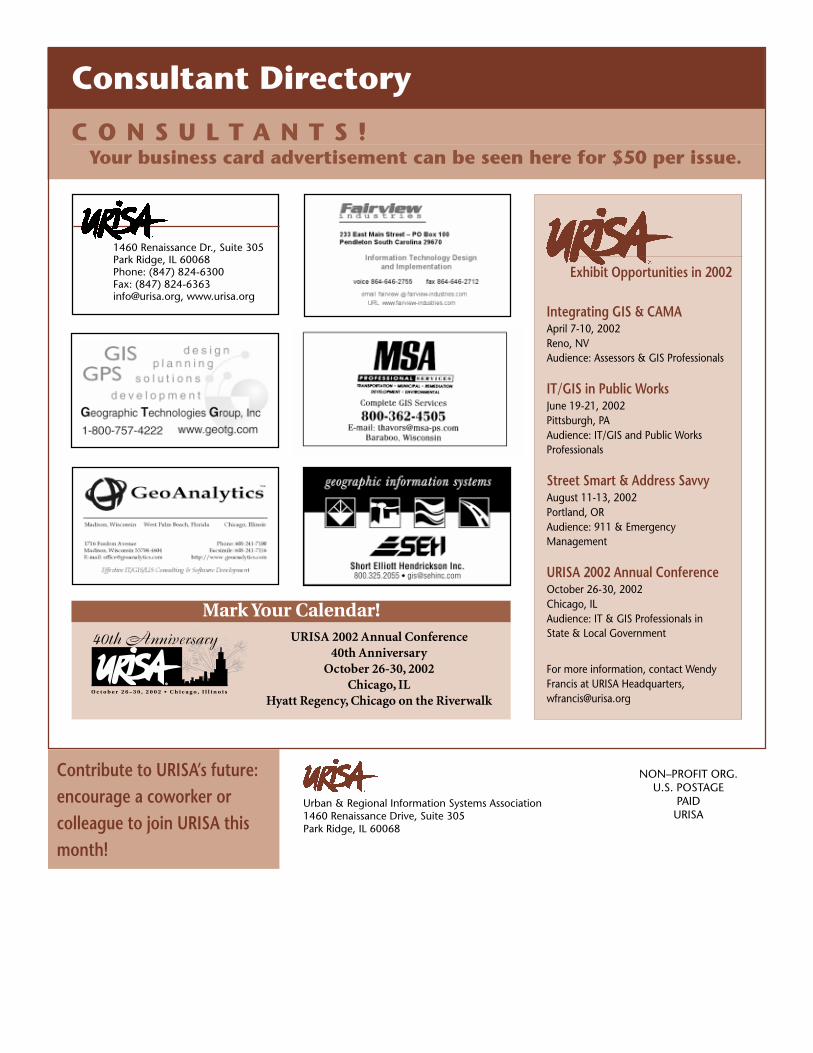
Consultant Directory
Your business card advertisement can be seen here for $50 per issue.C O N S U L T A N T S !
1460 Renaissance Dr., Suite 305Park Ridge, IL 60068Phone: (847) 824-6300Fax: (847) [email protected], www.urisa.org
Integrating GIS & CAMAApril 7-10, 2002Reno, NVAudience: Assessors & GIS Professionals
IT/GIS in Public WorksJune 19-21, 2002Pittsburgh, PAAudience: IT/GIS and Public WorksProfessionals
Street Smart & Address SavvyAugust 11-13, 2002Portland, ORAudience: 911 & EmergencyManagement
URISA 2002 Annual ConferenceOctober 26-30, 2002Chicago, ILAudience: IT & GIS Professionals inState & Local Government
For more information, contact WendyFrancis at URISA Headquarters,[email protected]
Exhibit Opportunities in 2002
URISA 2002 Annual Conference40th Anniversary
October 26-30, 2002Chicago, IL
Hyatt Regency, Chicago on the Riverwalk
Mark Your Calendar!
To _____________________________________ Company _______________________________________
Date ___________________________ Job No. __________________________________________________
Job Description ____________________________________________________________________________
No. of Pages (Including Cover Sheet) _________
Comments:
You are being sent the following:Date Sent (JL Design) Date Returned (Client)
❑ First draft ____________ ____________
❑ Draft No. 2 with revisions ____________ ____________
❑ Draft No. 3 with revisions ____________ ____________
❑ Draft No. 4 with revisions ____________ ____________
❑ Draft No. 5 with revisions ____________ ____________
❑ Draft No. 6 with revisions ____________ ____________
If this is a final proof of your job, carefully review and sign off. NOTE: You should re-reviewall copy before approving—not just last round of revisions.
❑ Please make the following noted revisions before approval. (Do not sign below if changesneed to be made.)
❑ Proof is OK—please go to print.I have examined this proof for spelling, color breaks, photos, and all other elements Irequested. I understand that any errors found at a later time are my responsibility.
For Approved Final ProofsI have reviewed the final proof of my job and approve it.
Signed __________________________________________________ Date __________
TYPESETT ING APPROVAL FORM
When reviewingtypesetting, it isimportant tocheck for thefollowing:
� Layout anddesign matchspecs
� Informationthat wassupplied is allincluded
� Spellingand grammarare correct
� All re-quested editshave beenmade
� Colorbreaks are setas you wantthem
� Pictureshave correctcaptions andare cropped toyour specs
16422 S McGrath DrPlainfield, IL 60544
phone630.330.0907
fax815.577.7903
Wendy URISA
Jan 28, 2001 02-018
URISA Jan/Feb Newsletter
Jan 28 (PDF) 8p Jan 29 (fax)
Jan 30 (PDF) 9:45a Jan 30 (fax)
Jan 31 (PDF) 1:30p Feb 1 (email)
Feb 4 (PDF) 2p Feb 4 (email)
Feb 5 (PDF) 9:15a Feb 5 (email)
Feb 5 (PDF) 10a