New ways to geo-reference and classify spatial data in Annex II & III data specifications Clemens...
21
New ways to geo-reference and classify spatial data in Annex II & III data specifications Clemens Portele interactive instruments GmbH Drafting Team „Data Specifications“, Chair Clemens Portele
-
date post
22-Dec-2015 -
Category
Documents
-
view
214 -
download
0
Transcript of New ways to geo-reference and classify spatial data in Annex II & III data specifications Clemens...

Clemens Portele
New ways to geo-reference and classify spatial data in Annex II & III
data specifications
Clemens Portele
interactive instruments GmbH
Drafting Team „Data Specifications“, Chair

Clemens Portele
Directive – Article 7(4)
„Implementing rules ... shall cover the definition and classification of spatial objects ... and the way in which those spatial data are geo-referenced.“
The Generic Conceptual Model specifies the framework how to do this for spatial objects across all themes
The spatial objects of the Annex II/III themes require support for additional ways
The hooks are already in the current version of the Generic Conceptual Model, but were refined as part of the Annex II/III data specification development

Clemens Portele
Classification of spatial objects
Classification of spatial objects occurs on two levels Identification of spatial object types Use of code lists for more fine-grained classifications
within a spatial object type
Two types of code lists are distinguished: Code lists where the values are part of the
Implementing Rule (the standard case in Annex I) Code lists that are managed outside of the
Implementing Rule and which may be extended by Member States / Communities

Clemens Portele
Example from Annex I: Adminitrative Unit

Clemens Portele
Classification of spatial objects
Additional requirements and changes in the approach in Annex II/III data themes Need for “hierarchical code lists” Need to reference code lists maintained outside of
INSPIRE, e.g. maintained by organisations within the European Commission or the UN
Stronger focus on code lists that are not foreseen to become part of the Implementing Rule
Clemens Portele
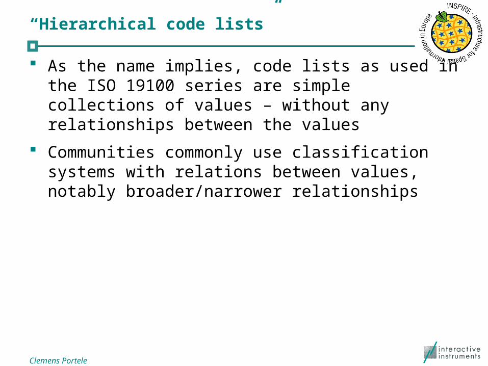
“Hierarchical code lists”
As the name implies, code lists as used in the ISO 19100 series are simple collections of values – without any relationships between the values
Communities commonly use classification systems with relations between values, notably broader/narrower relationships

Clemens Portele
Example from Annex II/III (theme “building”)
Clemens Portele
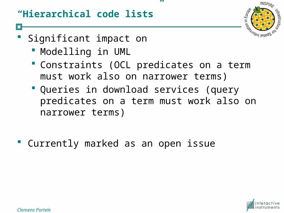
“Hierarchical code lists”
Significant impact on Modelling in UML Constraints (OCL predicates on a term must work
also on narrower terms) Queries in download services (query predicates on a
term must work also on narrower terms)
Currently marked as an open issue

Clemens Portele
External code lists
Requirements for using such code lists in INSPIRE: Managed by a competent international organisation Values will never be deleted, even if they have been
deprecated The code list must be available in HTML plus GML or
SKOS Just HTML is ok for a transition period
The code list and each of its values must be identifiable through a persistent URI in the ‘http’ scheme. Exceptions are values of code lists that are only
available as HTML.

Clemens Portele
Geo-referencing spatial objects
In Annex I spatial objects have been geo-referenced by providing a geometry for the object and all properties would apply over the whole geometry
Some spatial objects are geo-referenced indirectly by referencing other spatial objects
Clemens Portele
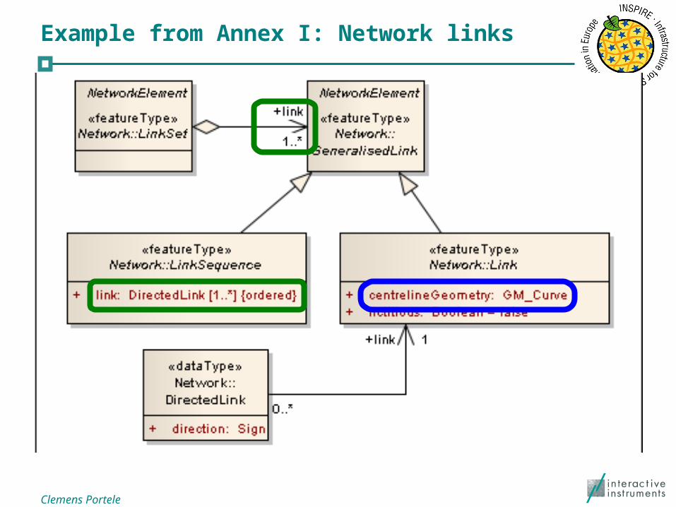
Example from Annex I: Network links

Clemens Portele
Geo-referencing spatial objects
Additional requirements were already identified for Annex II/III themes, in particular Use of coverages (representation of information that
varies over space/time) Harmonised grid systems recommended for such
coverages
Need for refinements identified during Annex II/III development
Clemens Portele
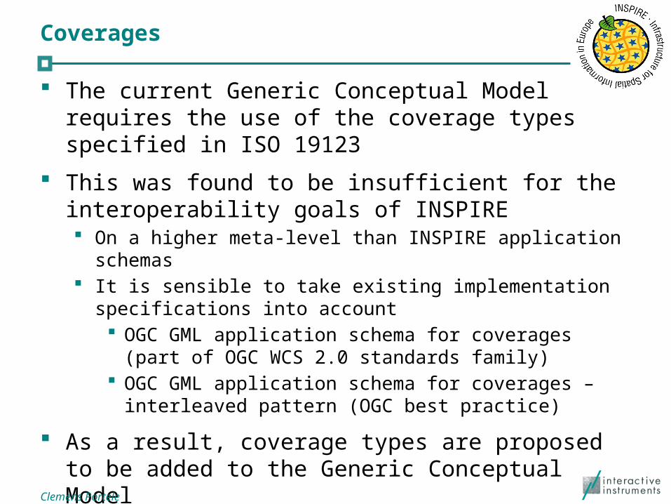
Coverages
The current Generic Conceptual Model requires the use of the coverage types specified in ISO 19123
This was found to be insufficient for the interoperability goals of INSPIRE On a higher meta-level than INSPIRE application schemas It is sensible to take existing implementation specifications into
account OGC GML application schema for coverages (part of OGC
WCS 2.0 standards family) OGC GML application schema for coverages – interleaved
pattern (OGC best practice)
As a result, coverage types are proposed to be added to the Generic Conceptual Model

Clemens Portele
Proposed coverage types
Two representations: Domain/range Geometry/value-pairs
Supported geometries: Recitified grids (RectifiedGridCoverage) Referencable grids (ReferenceableGridCoverage) Points (MultiPointCoverage) Curves (MultiCurveCoverage) Surface (MultiSurfaceCoverage) Solid (MultiSolidCoverage) Time instants (MultiTimeInstantCoverage)

Clemens Portele
Coverages – open issues
Typically only grid coverages are currently supported by implementations Approach in version 2.0: For non-gridded coverage geometries
create implementation models that are used when spatial data is exchanged and which do not rely on MultiSurfaceCoverages etc.
This reflects that coverages and the „traditional GIS feature model“ are basically a different view / representation of the real world
(Backwards compatible) changes required to the OGC Web Coverage Service 2.0 standard Active collaboration and harmonisation with OGC required
Clemens Portele
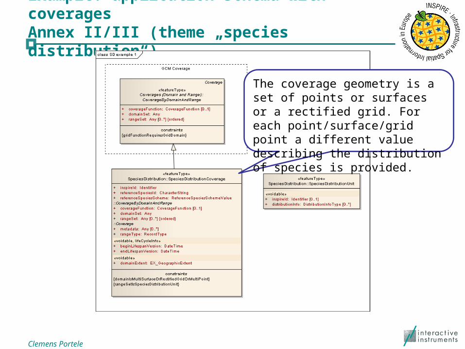
Example: application schema with coveragesAnnex II/III (theme „species distribution“)
The coverage geometry is a set of points or surfaces or a rectified grid. For each point/surface/grid point a different value describing the distribution of species is provided.

Clemens Portele
Example: Implementation modelAnnex II/III (theme „species distribution“)
In the implementation model, each point/surface/grid cell is represented by a spatial object with a geometry and the value describing the distribution of species is provided.

Clemens Portele
Grid systems
A grid system for spatial analysis has been specified as part of the Annex I work Uses LAEA projection (cells have equal area sizes – important
for spatial analysis)
Elevation and orthoimagery grids typically use geographic coordinates
Another grid system for such requirements has been been specified, currently as part of the Elevation data specification

Clemens Portele
Geophysical observations
In scientific communities spatial data is often organised using another viewpoint – observations of geophysical properties
An Observation is an action whose result is an estimate of the value of some property of the feature-of-interest, at a specific point in time, obtained using a specified procedure

Clemens Portele
Geophysical observations
The current Generic Conceptual Model already identifies the Observation and Measurement standard as the base model to integrate the different view points
A new framework document „Guidelines for the use of Observations & Measurements and Sensor Web Enablement-related standards in INSPIRE Annex II and III data specification development“ has been developed to provide more specific guidance
These guidelines have been applied in several Annex II/III data specifications Geology, Oceanographic geographical features, Atmospheric
conditions and Meteorological geographical features, Environmental monitoring facilities, Soil

Clemens Portele
We need your feedback!
As these are new mechanisms used in INSPIRE data specifications based on the work of the thematic experts we depend on feedback, in particular from Legally Mandated Organisations that will have to
publish spatial data of Annex II/III themes Spatial Data Interest Communities that are interested
in using the such data Software developers who have products that support
spatial data of these themes
Please use the consultation and testing opportunities!