National Geospatial Management Center …. Moving into the ...
48
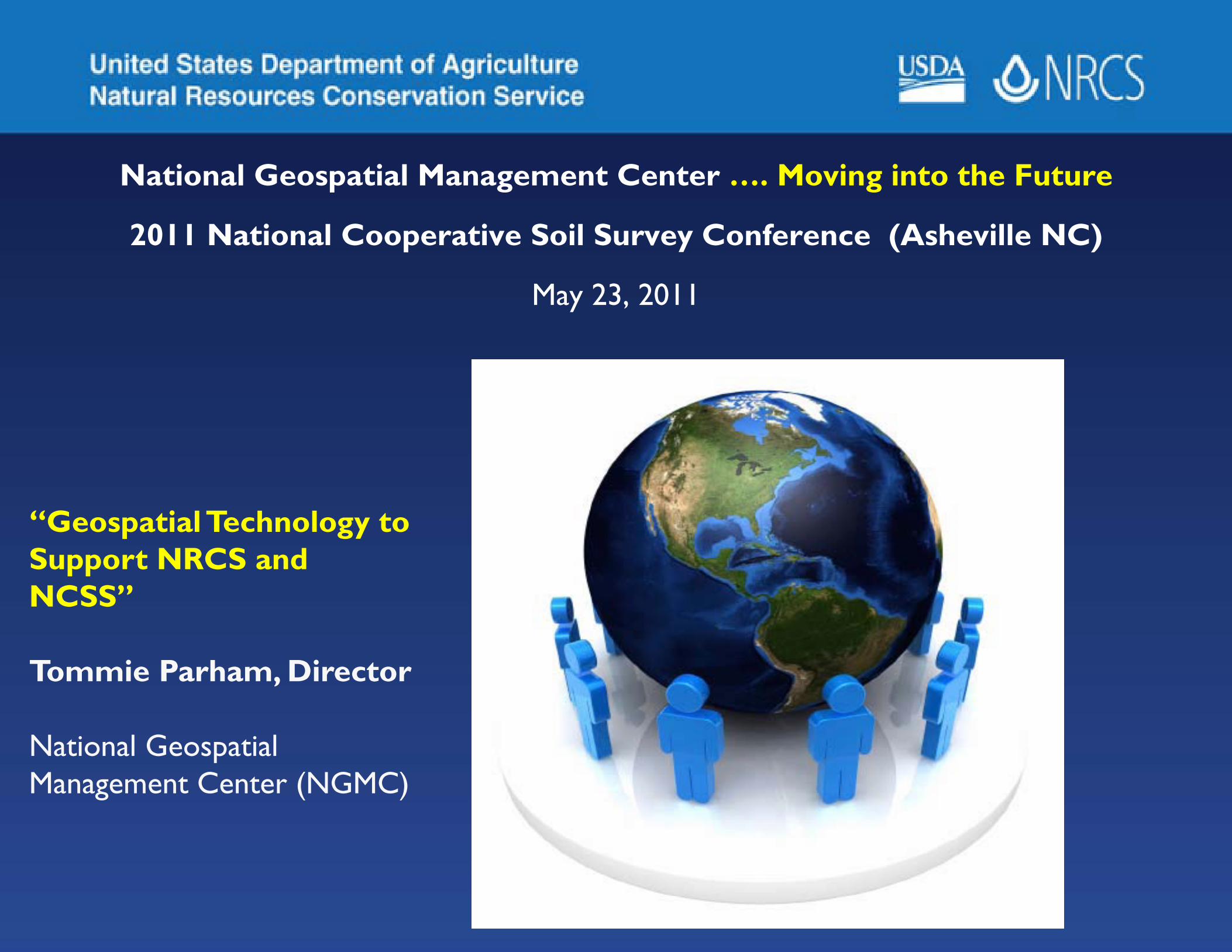
National Geospatial Management Center …. Moving into the Future 2011 National Cooperative Soil Survey Conference (Asheville NC) May 23, 2011 “Geospatial Technology to Support NRCS and NCSS” Tommie Parham, Director National Geospatial Management Center (NGMC)
Transcript of National Geospatial Management Center …. Moving into the ...
National Geospatial Management Center …. Moving into the Future
2011 National Cooperative Soil Survey Conference (Asheville NC)
May 23, 2011
“Geospatial Technology to Support NRCS and NCSS”
Tommie Parham, Director
National Geospatial Management Center (NGMC)
NGMC Presentation Outline
• NGMC Mission & Direction• H. H. Bennett Insight• Global Position System• Elevation (LiDAR IFSAR)• Imagery
2
NGMC Presentation Outline
• Geospatial Data Management• Cache Tile• CDSI Support• GeoObserver
3

National Geospatial Management Center (NMGC)
Mission
To provide consumers with accessible, always available, up-to-date, authoritative, and trusted geospatial data and value-added cartographyand geospatial services:
Key Services• Mapping sciences (cartography, GIS, remote sensing, PNT technology)• Aerial photography, elevation data, imagery, remote sensing, global positioning
systems, training• Natural resources data, geospatial technology, National Resources Inventory• Provide support for Soil Survey, Engineering, Conservation Planning (CDSI),
and Other agency programs• Geospatial Data Warehousing & Distribution
5
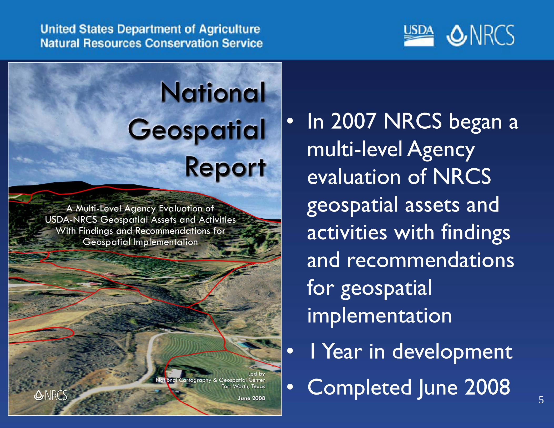
• In 2007 NRCS began a multi-level Agency evaluation of NRCS geospatial assets and activities with findings and recommendations for geospatial implementation
• 1 Year in development
• Completed June 2008
6
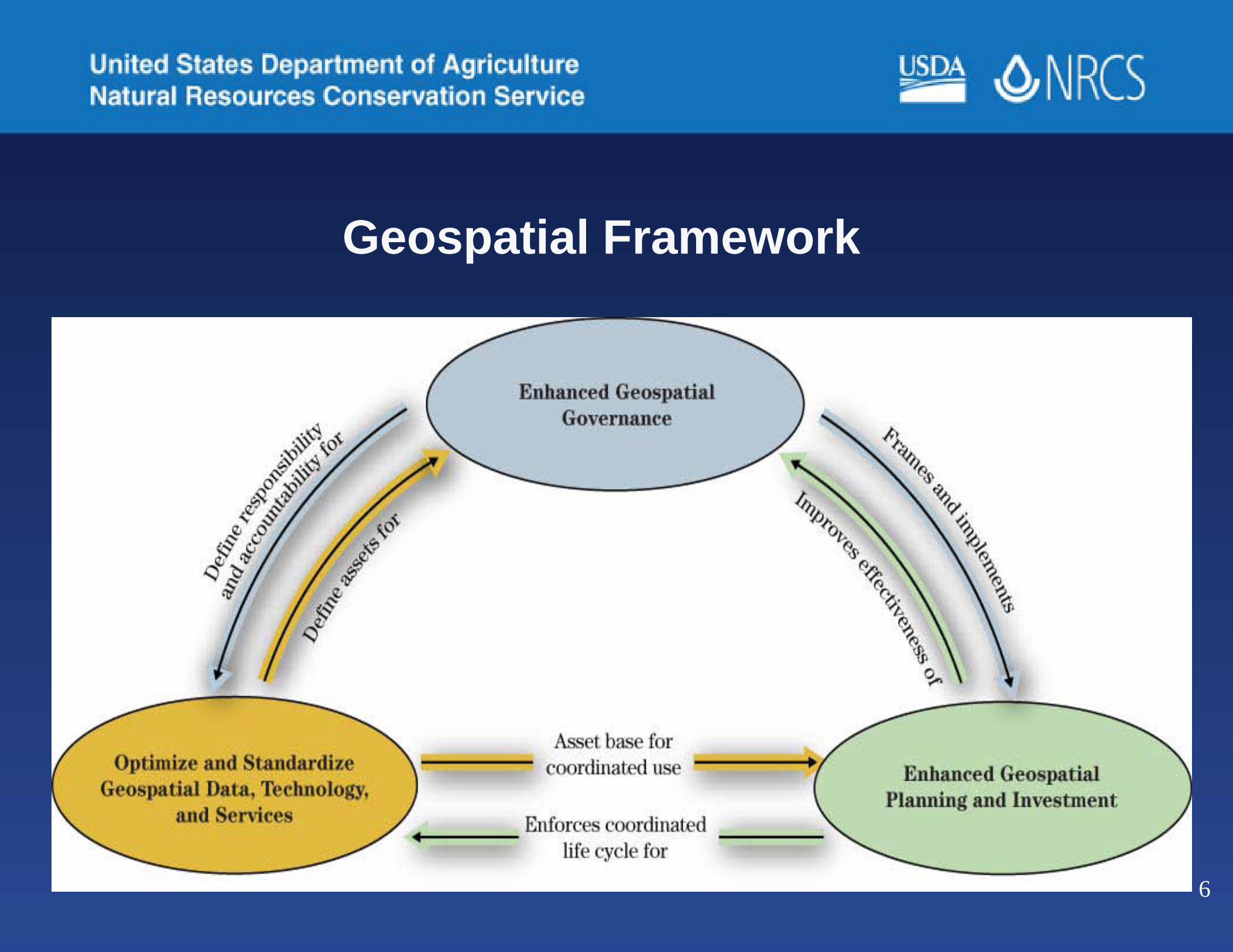
Geospatial Framework

Hugh Hammond Bennett
“Soil has long been confused with land. It is but one part of land. For conservation purposes, land must be regarded in terms of all its component parts: soil, slope, climate, susceptibility to depreciation by erosion, over-cropping or other processes of deterioration.”

Chapters in “Elements of Soil Conservation” by Hugh Hammond Bennett
1. The Erosion Problem in the Unites States2. Extent of Erosion3. Effects of Erosion4. How Erosion Takes Place5. Rates of Erosion and Runoff6. Climate and Soil Erosion7. Rainfall Penetration8. A National Program of Soil Conservation9. Planning for Conservation of Soil and Water10. Use of Vegetation in Soil and Water Conservation11. Contouring12. Terracing
Understanding and scientific use of terrain slopes is vital to soil conservation and other founding principles of the SCS and NRCS.

Chapters in “Elements of Soil Conservation” by Hugh Hammond Bennett (continued)
13. Channels and Outlets14. Gully Control15. Control of Erosion on Stream Banks16. Water Spreading17. Wildlife and Soil Conservation18. Farm Ponds for Water Storage19. Stubble-mulch Farming20. Farm Drainage21. Farm Irrigation22. The Place of Trees and Shrubs in Soil and Water Conservation23. Upstream Flood Control
Good science matters as much in 2011 as it did in 1935 …
The difference is that we now have “mission critical” HRED unheard of in 1935.
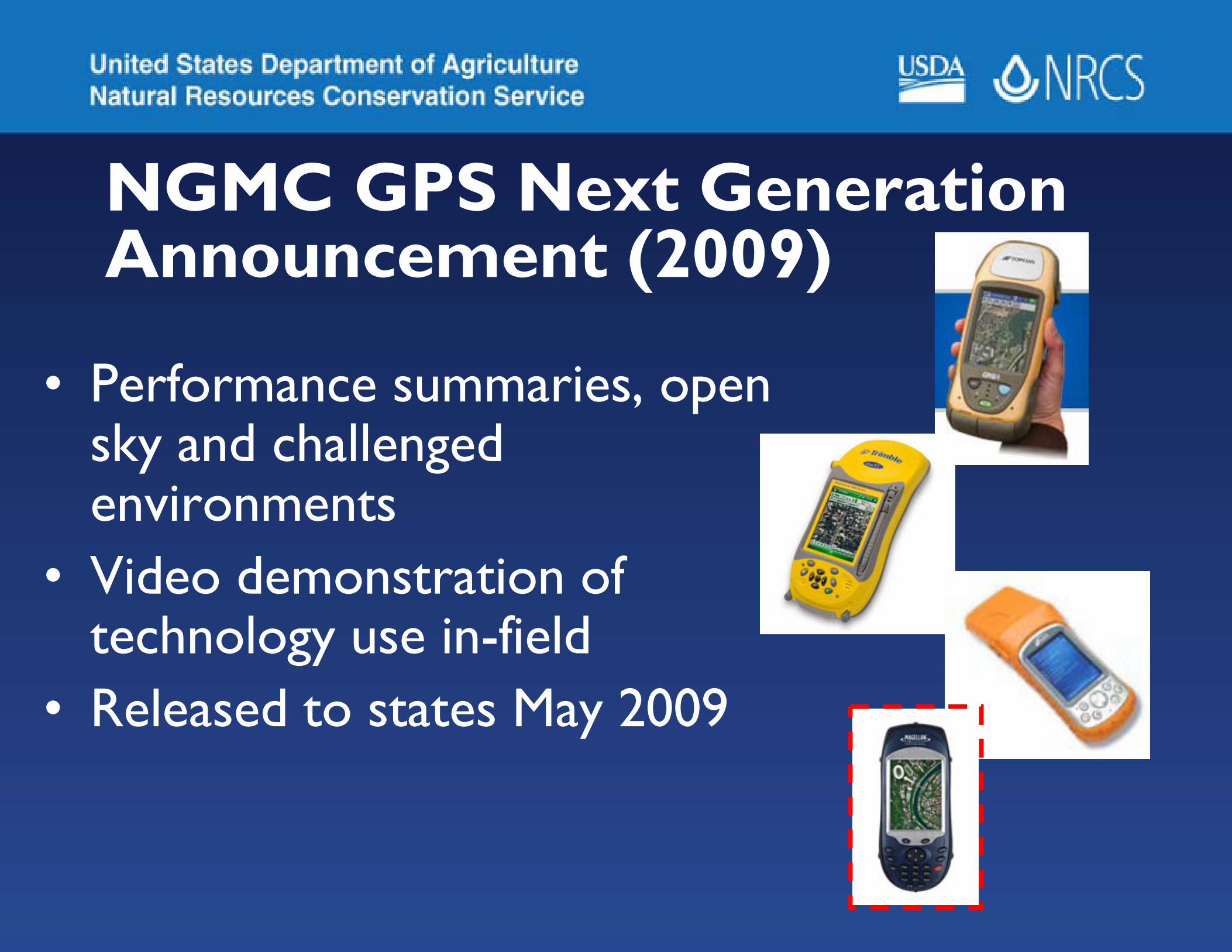
NGMC GPS Next Generation Announcement (2009)
• Performance summaries, open sky and challenged environments
• Video demonstration of technology use in-field
• Released to states May 2009

Issues with handheld devices –NGMC experience• Outdoor display visibility• Environmental extremes• Limited display area• Relatively slow processor• Limited memory

Issues with tablet devices –NGMC experience• Environmental extremes• Display territory• Outdoor display visibility• Weight• Cost

Issues with GPS integration
• GPS performance• Accessibility to augmentations• Orientation of antenna• Upgrade to new GPS signals and
GNSS– L2C and L5 GPS– GLONASS, Compass, Galileo GNSS
Opportunities• Integration of some kind of in-field
GPS collect / edit in Mobile Planner• Increased signals, improved signal
processing (L2C, L5, GNSS)• Integration of Inertial Movement Units
(IMU) into handhelds & tablets for challenging environments
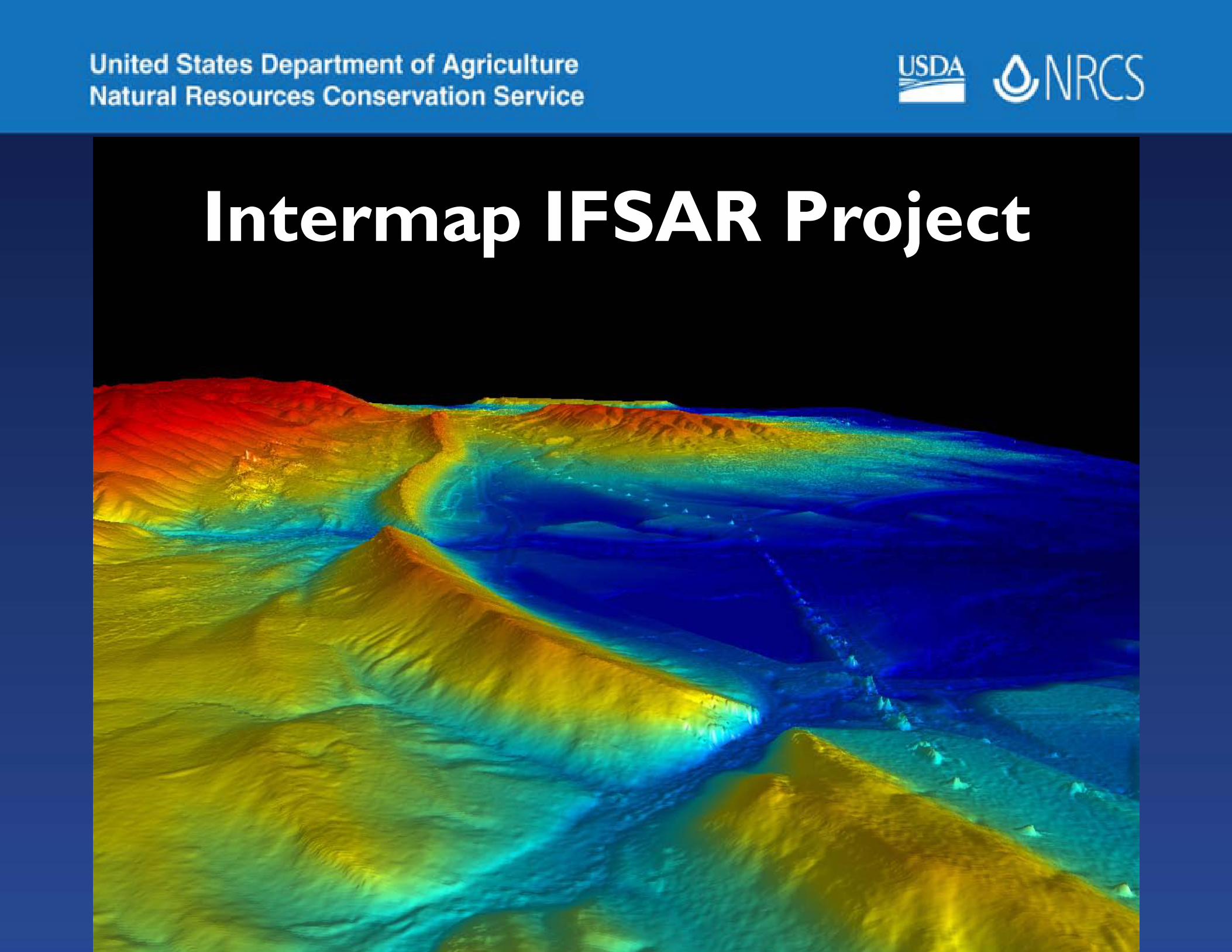
Intermap IFSAR Project

Light Detection and Ranging(LiDAR)
zx
y
GPS + INSControlled
1st Return
2nd Return
3rd Return
Multiple ReturnIntensity of Return
POSITION OFINSTRUMENT
LIDAR HEIGHT ANDCOVER DETERMINATION
Presenter
Presentation Notes
LIDAR data has emerged recently as the most detailed remotely sensed elevation data source available. The screen capture is a hillshade image of a cultivated area in Williamson Co., TX with many terraced fields. LIDAR can be captured in vertical or horizontal directions. Dependant on the sensor and the wavelength emitted, it is completely absorbed by water or can penetrate shallow clear water to provide a bathymetric surface. Multiple returns a varying intensity can be used to determine height of vegetation when the signal reaches the earth surface.
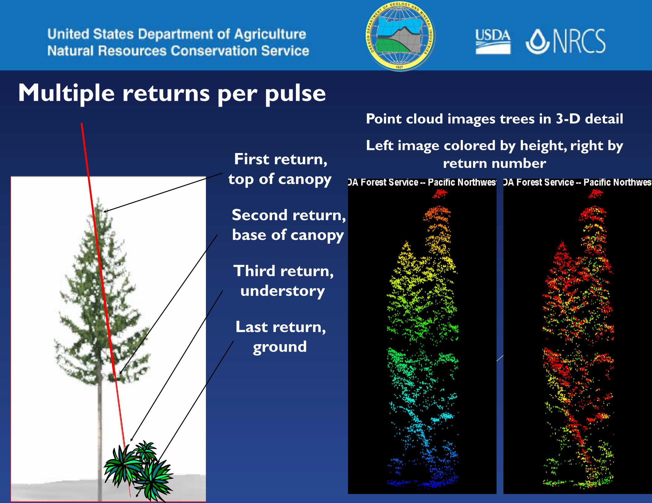
Multiple returns per pulse
First return, top of canopy
Second return, base of canopy
Third return, understory
Last return, ground
Point cloud images trees in 3-D detail
Left image colored by height, right by return number

LiDAR major advantageLiDAR only needs to see the ground from one view.
Photogrammetry requires stereo perspective; trees block dual views.

19
NRCS & USGS Partnership
Data Delivery & ProvisioningServices

Elevation Data and GIS Application for NRCS
-Model landscape surfaces-Derivatives products include
– Hill shade – Slope aspect– Slope gradient– slope curvature – spatial analysis for water movement– soil erosion– soil genesis and geomorphic models 21

LiDAR Elevation Data Management
Raw Points (las) NED Oracle ArcSDEBare EarthProcessing using LiDAR software
Process ModelsDerivatives
ArcGIS Server
NCGC
GDW
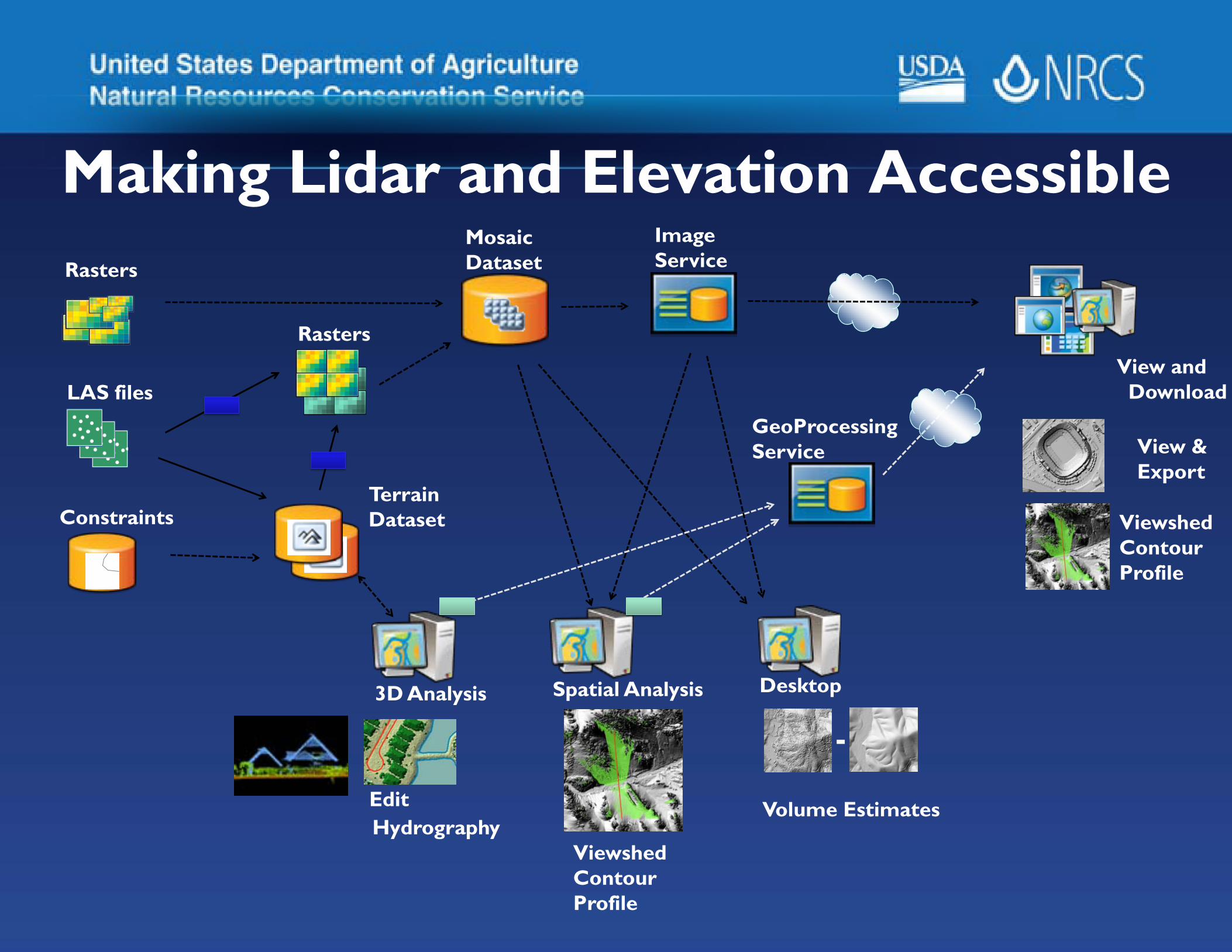
MosaicDataset
View &Export
ImageService
View andDownload
Spatial Analysis
Volume Estimates
ViewshedContourProfile
Rasters
Desktop
-
GeoProcessingService
ViewshedContourProfile
LAS files
Rasters
Constraints
Hydrography
3D Analysis
TerrainDataset
Edit
Making Lidar and Elevation Accessible

State Geology Layer
24

NGMC Cache Tile Service
Slides
25

NGMC Cache Tile Service
26
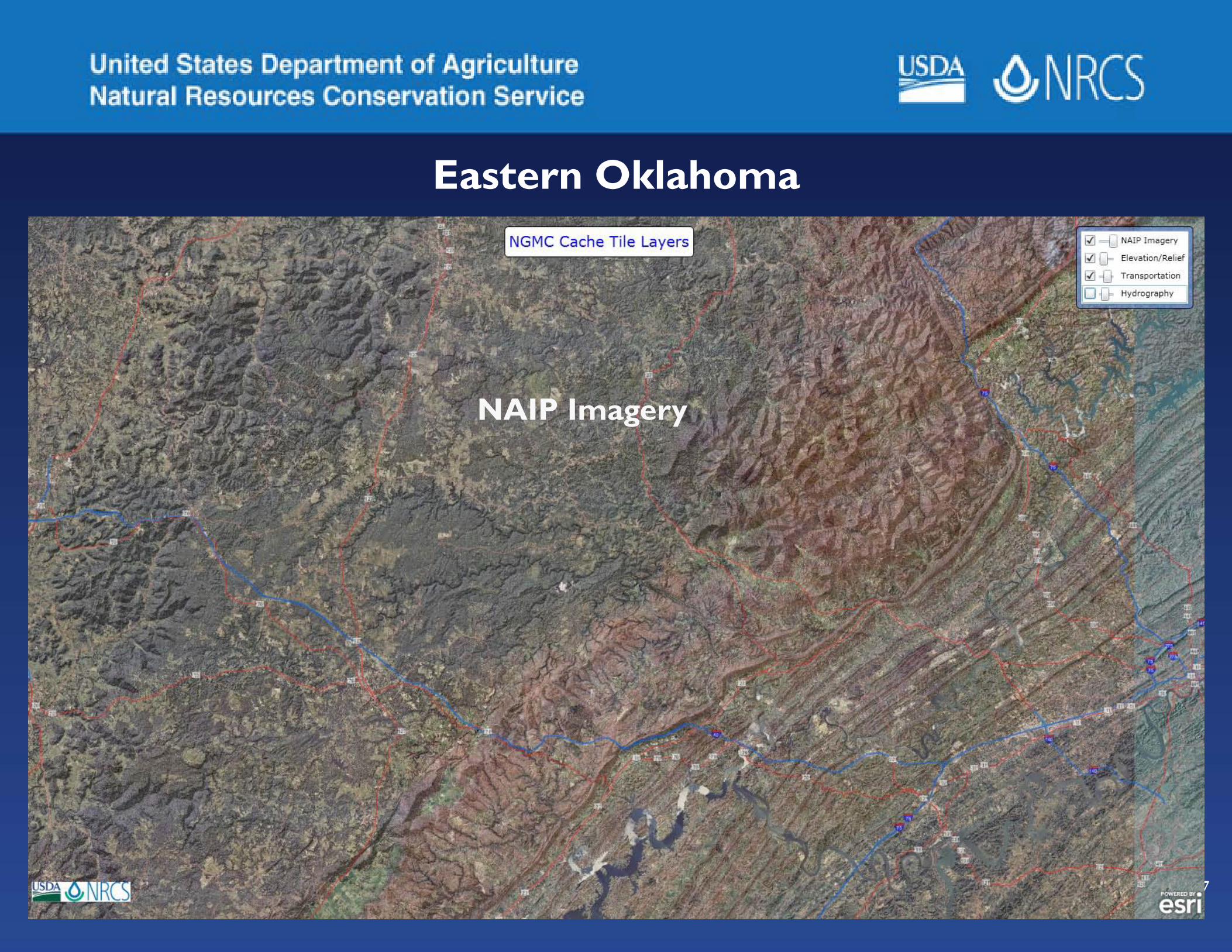
Eastern Oklahoma
27
NAIP Imagery

28
NED 10 meter Hillshade

29
Hydrography

30
2011 Asheville NC National Soil Survey Conference
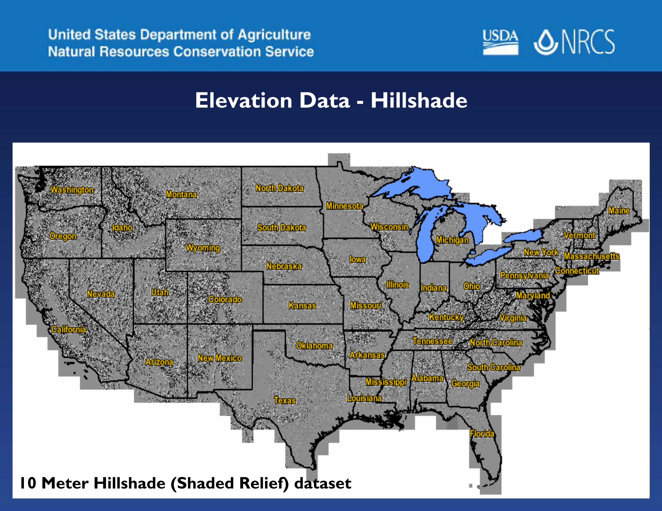
Elevation Data - Hillshade
3110 Meter Hillshade (Shaded Relief) dataset

Digital Map Finishing – Print on Demand and User Guide
32
-States will be enabled to create digitalmap finished products locally.
-New method uses Arc Map to create maps.
-High quality soil survey map productsare used for soil survey and conservationplanning.

2011 Imagery Acquisitions
• NAIP imagery for lower 48 states• Alaska imagery for soil survey• Hawaii and Pacific Basin 2010• Puerto Rico and Virgin Islands
33


FA Ranking Pilot and Other CDSI Work
1. Create Symbology
2. Prepare National layers for analysis purposes3. Receive State layers and process4. How to Access the Data5. Other ongoing CDSI work

4. Accessing the Data –
NRCS Ranking Mart http://web1.ftw.nrcs.usda.gov/nrcsrankingmart2/

Registry of Web Services – USDA GeoPortal
37
http://ncgcweb.ftw.nrcs.usda.gov/
Step Two,In the Search GeoPortal window enter a data theme, Example: “Elevation,” and Click the Go Button!
Step One, Log on to:
Access to more 50 Web Services

1
32
NAIP 2010, Northeast MinnesotaWhat ground features can you identify easier with CIR Imagery?
Natural Color (Bands 1,2,3) Color Infrared/CIR (Bands 2,3,4)
4 5
Ground Feature Type1) Hydric Soil with Vegetation 3) Mixed Hardwood/Coniferous Forests2) Hydric Soil with Submerged Vegetation 4) Hardwood Forest
5) Coniferous Forest

WorldView-2land covers
Salton SeaFeb 20, 2010
stressed vs mature crop

NRCS-NGMC Web Map Services

41
Data management experts stress that data life cycle management is not a product, but a comprehensive approach to managing an organization's data, involving procedures and practices as well as applications.
The goal is to provide the foundation for mapping, visualization, analysis, and distribution.

42
Data Lifecycle StagesStage 1 - DefineStage 2 -Inventory/EvaluateStage 3 - ObtainStage 4 - AccessStage 5 - MaintainStage 6 - Use/EvaluateStage 7 - Archive
http://www.fgdc.gov/policyandplanning/A16Draft/A16_SG_GeospatialDataLifecycle

43
How does this approach eliminate or minimize risk?
• RISK - Duplication of geospatial information and databasesSolution - Inventory all NRCS geodatabases at a national, state and local level and analyze the results to ensure we do not have duplication
• RISK - Poor quality or inadequate geospatial information Solution - QA/QC all warehouse data and check all themes for completeness and accuracy. The measure of success would be how many errors are found and how fast they would be corrected
• RISK - Inability to access and use geospatial information across NRCS business linesSolution - Geodatabase designs with custom map and data services that are multipurpose. Easements are an example. We have one database with separate services for monitoring, RSL activities, and public requests
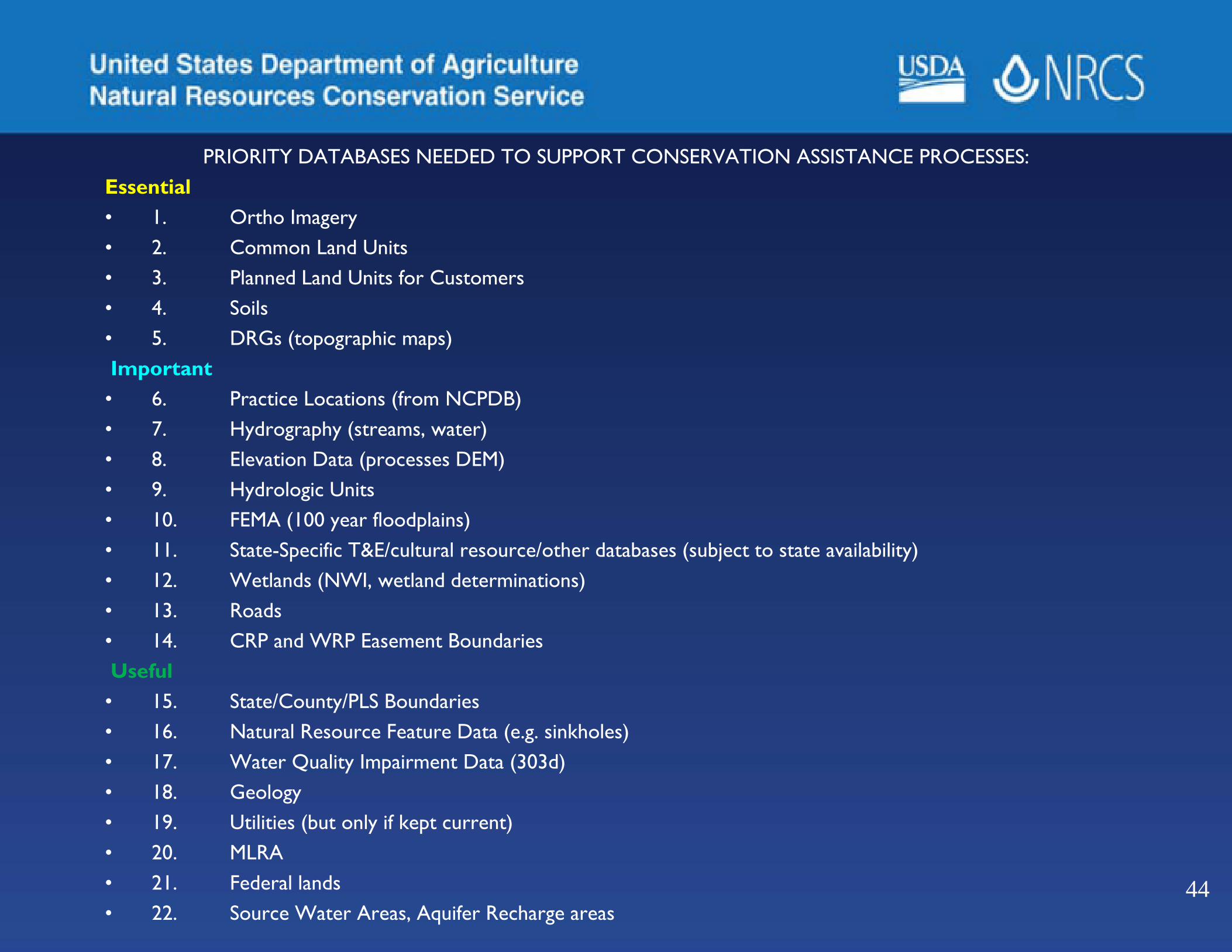
PRIORITY DATABASES NEEDED TO SUPPORT CONSERVATION ASSISTANCE PROCESSES:Essential• 1. Ortho Imagery • 2. Common Land Units• 3. Planned Land Units for Customers• 4. Soils • 5. DRGs (topographic maps)Important• 6. Practice Locations (from NCPDB)• 7. Hydrography (streams, water)• 8. Elevation Data (processes DEM) • 9. Hydrologic Units• 10. FEMA (100 year floodplains)• 11. State-Specific T&E/cultural resource/other databases (subject to state availability)• 12. Wetlands (NWI, wetland determinations)• 13. Roads• 14. CRP and WRP Easement BoundariesUseful• 15. State/County/PLS Boundaries • 16. Natural Resource Feature Data (e.g. sinkholes)• 17. Water Quality Impairment Data (303d)• 18. Geology• 19. Utilities (but only if kept current)• 20. MLRA• 21. Federal lands• 22. Source Water Areas, Aquifer Recharge areas
44

NGMC GeodatabasesQuality Improvements
• NRCS Dam Sites• Easements• Public Land Survey• Administrative Boundaries
45
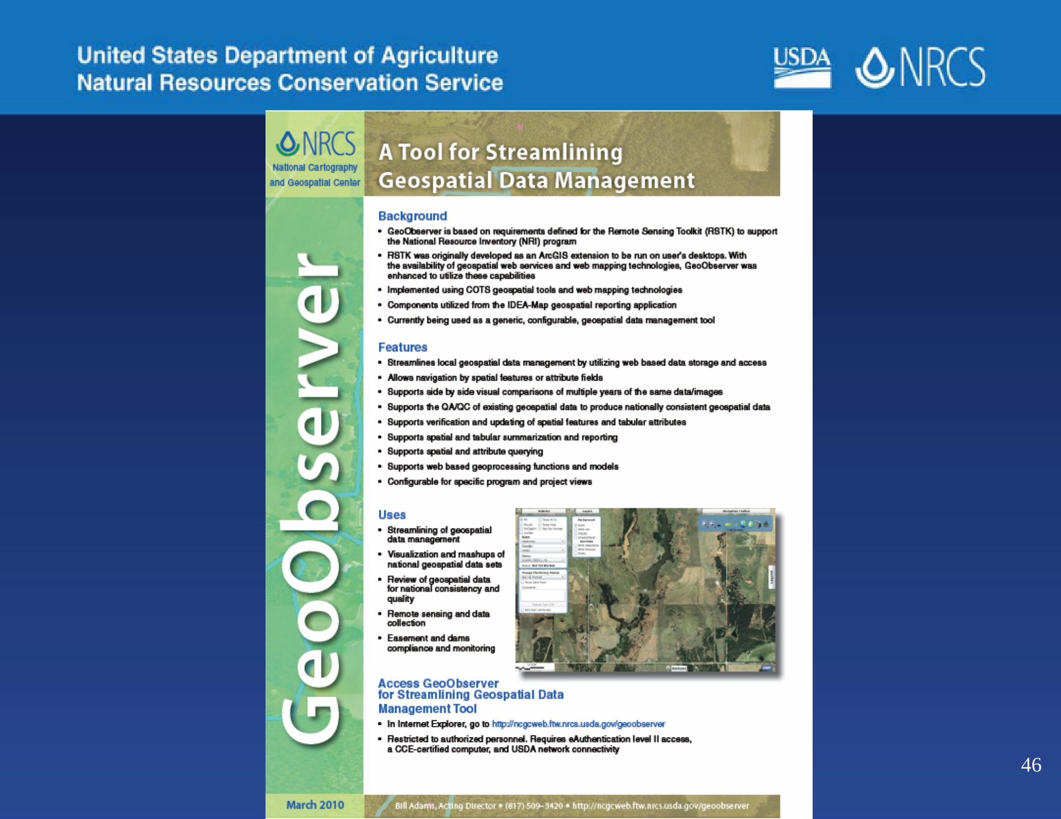
46

SSRA Planning
• Disasters (MS River Flood)• Google Fusion - NSSC• Cloud Computing - NGMC
–ESRI, Amazon, USDA
• Solutions for large data sets47
48
Tommie Parham, Director, National Geospatial Management Center
[email protected] 817-509-3420
[email protected] 817-09-3401
NGMC Home Page - http://www.ncgc.nrcs.usda.gov
Questions?