National Elevation Dataset (NED) Data Dictionary 20160115.pdfNational Elevation Dataset (NED) Data...
34
National Elevation Dataset (NED) Data Dictionary Last updated: January 16, 2016 Contents NED 1/3 Arc-second, 1 Arc-second, and 2 Arc-second Data Dictionary ............................................. 1 Source Identification ..................................................................................................................... 1 DEMNAME...................................................................................................................................................... 1 QUADNAME ................................................................................................................................................... 1 Source Production ........................................................................................................................ 1 PSITE.............................................................................................................................................................. 1 PMETHOD ...................................................................................................................................................... 2 PDEVICE ........................................................................................................................................................ 3 FREETEXT ..................................................................................................................................................... 3 RESOLUTION................................................................................................................................................. 4 HORIZRES_M ................................................................................................................................................ 4 S_DATE .......................................................................................................................................................... 4 I_DATE ........................................................................................................................................................... 5 Source Planimetric Descriptors..................................................................................................... 5 HDATUM......................................................................................................................................................... 5 LRLAT, LRLON, ULLAT, ULLON .................................................................................................................... 6 UTMZONE ...................................................................................................................................................... 6 XSHIFT, YSHIFT ............................................................................................................................................ 6 Source Elevation Descriptors ....................................................................................................... 6 VDATUM ......................................................................................................................................................... 7 ZUNIT ............................................................................................................................................................. 7 ZSTEP ............................................................................................................................................................ 7 ZSHIFT ........................................................................................................................................................... 7 Source Elevation Summary Statistics ........................................................................................... 8 ZMIN, ZMAX ................................................................................................................................................... 8 ZMEAN ........................................................................................................................................................... 8 ZSIGMA .......................................................................................................................................................... 8 Source Accuracy Statistics ........................................................................................................... 8 ABSX, ABSY, ABSZ........................................................................................................................................ 9 ABSPTS .......................................................................................................................................................... 9 RMSE.............................................................................................................................................................. 9 RMSEX, RMSEY, RMSEZ .............................................................................................................................. 9 RMSEPTS......................................................................................................................................................10 NED Production Timestamps ..................................................................................................... 10 QUADDATE ...................................................................................................................................................10 NED1/9 Arc-second Data Dictionary ................................................................................................. 11 Source Identification ................................................................................................................... 11 PROJ_NAME .................................................................................................................................................11
-
Upload
hoangthien -
Category
Documents
-
view
220 -
download
3
Transcript of National Elevation Dataset (NED) Data Dictionary 20160115.pdfNational Elevation Dataset (NED) Data...
National Elevation Dataset (NED) Data Dictionary Last updated: January 16, 2016
Contents
NED 1/3 Arc-second, 1 Arc-second, and 2 Arc-second Data Dictionary ............................................. 1
Source Identification ..................................................................................................................... 1
DEMNAME ...................................................................................................................................................... 1 QUADNAME ................................................................................................................................................... 1
Source Production ........................................................................................................................ 1
PSITE.............................................................................................................................................................. 1 PMETHOD ...................................................................................................................................................... 2 PDEVICE ........................................................................................................................................................ 3
FREETEXT ..................................................................................................................................................... 3 RESOLUTION ................................................................................................................................................. 4 HORIZRES_M ................................................................................................................................................ 4
S_DATE .......................................................................................................................................................... 4 I_DATE ........................................................................................................................................................... 5
Source Planimetric Descriptors..................................................................................................... 5
HDATUM ......................................................................................................................................................... 5 LRLAT, LRLON, ULLAT, ULLON .................................................................................................................... 6
UTMZONE ...................................................................................................................................................... 6
XSHIFT, YSHIFT ............................................................................................................................................ 6
Source Elevation Descriptors ....................................................................................................... 6
VDATUM ......................................................................................................................................................... 7
ZUNIT ............................................................................................................................................................. 7 ZSTEP ............................................................................................................................................................ 7 ZSHIFT ........................................................................................................................................................... 7
Source Elevation Summary Statistics ........................................................................................... 8
ZMIN, ZMAX ................................................................................................................................................... 8 ZMEAN ........................................................................................................................................................... 8
ZSIGMA .......................................................................................................................................................... 8
Source Accuracy Statistics ........................................................................................................... 8
ABSX, ABSY, ABSZ........................................................................................................................................ 9 ABSPTS .......................................................................................................................................................... 9 RMSE.............................................................................................................................................................. 9 RMSEX, RMSEY, RMSEZ .............................................................................................................................. 9 RMSEPTS ......................................................................................................................................................10
NED Production Timestamps ..................................................................................................... 10
QUADDATE ...................................................................................................................................................10
NED1/9 Arc-second Data Dictionary ................................................................................................. 11
Source Identification ................................................................................................................... 11
PROJ_NAME .................................................................................................................................................11
ii
DEMNAME .....................................................................................................................................................11
Source Production ...................................................................................................................... 11
RESOLUTION ................................................................................................................................................11 HORIZRES_M ...............................................................................................................................................12 PMETHOD .....................................................................................................................................................12 S_DATE .........................................................................................................................................................12
FREETEXT ....................................................................................................................................................12
Output Production ....................................................................................................................... 12
ZUNIT ............................................................................................................................................................12
Source Accuracy Statistics ......................................................................................................... 13
S_FVA............................................................................................................................................................13
S_CVA ...........................................................................................................................................................13 S_NVA ...........................................................................................................................................................14 S_VVA ...........................................................................................................................................................14
VA_UNIT ........................................................................................................................................................14
RMSEZ, RMSE_FVA, RMSE_SVA, RMSE_CVA ..........................................................................................14
NED Production Timestamp ....................................................................................................... 15
QUADDATE ...................................................................................................................................................15
NED Original Product (Source) Resolution Data Dictionary .............................................................. 16
Source Identification ................................................................................................................... 16
PROJ_NAME .................................................................................................................................................16
Source Production ...................................................................................................................... 16
PMETHOD .....................................................................................................................................................16
S_DATE .........................................................................................................................................................16
Output Production ....................................................................................................................... 16
ZUNIT ............................................................................................................................................................17 REFSYS .........................................................................................................................................................17 HORIZRES ....................................................................................................................................................17
HORIZUNIT ...................................................................................................................................................17 FORMAT ........................................................................................................................................................17 HORIZRES_M ...............................................................................................................................................18
Accuracy Statistics ..................................................................................................................... 18
FVA ................................................................................................................................................................18 CVA ..........................................................................................................................................................18 NVA ...............................................................................................................................................................19
VVA ................................................................................................................................................................19 VA_UNIT ........................................................................................................................................................19
NED Production Timestamp ....................................................................................................... 19
QUADDATE ...................................................................................................................................................19
The National Map – Elevation, Lidar Point Cloud Project Data Dictionary ......................................... 20
Lidar Project Information ............................................................................................................. 20
project_id .......................................................................................................................................................20 state ...............................................................................................................................................................20 vendor ............................................................................................................................................................20 s_date ............................................................................................................................................................20
iii
e_date ............................................................................................................................................................20
entry_date ......................................................................................................................................................20 lr_lat, lr_long, ll_lat, ll_long, ul_lat, ul_long, ur_lat, ur_long ............................................................................20 sensor_type ...................................................................................................................................................21
spec ...............................................................................................................................................................21 nva_swath ......................................................................................................................................................21 va_units ..........................................................................................................................................................21
Coordinate Reference System .................................................................................................... 21
refsys .............................................................................................................................................................21 horizunit .........................................................................................................................................................22 zunit ...............................................................................................................................................................22
Lidar Information ......................................................................................................................... 22
las_type ..........................................................................................................................................................23 quality.............................................................................................................................................................23 rptd_nps .........................................................................................................................................................23 rptd_pd ...........................................................................................................................................................23
rptd_units .......................................................................................................................................................23 rptd_anps ...................................................................................................................................................24
rptd_anpd .......................................................................................................................................................24
The National Map – Elevation, Lidar Point Cloud Tile Data Dictionary .............................................. 25
Lidar Tile Information .................................................................................................................. 25
project_id .......................................................................................................................................................25 tile_name .......................................................................................................................................................25
entity_id ..........................................................................................................................................................25 s_date ............................................................................................................................................................25 e_date ............................................................................................................................................................25 entry_date ......................................................................................................................................................25 lr_lat, lr_long, ll_lat, ll_long, ul_lat, ul_long, ur_lat, ur_long ............................................................................25
Coordinate Reference System .................................................................................................... 26
refsys .............................................................................................................................................................26 horizunit .........................................................................................................................................................26 zunit ...............................................................................................................................................................26
Lidar Information ......................................................................................................................... 27
las_type ..........................................................................................................................................................27 quality.............................................................................................................................................................27
version ...........................................................................................................................................................28 rtnct_1 ............................................................................................................................................................28 rtnct_2 ............................................................................................................................................................28 rtnct_3 ............................................................................................................................................................28 rtnct_4 ............................................................................................................................................................28 rtnct_5 ............................................................................................................................................................28 rtnct_6 ............................................................................................................................................................28 rtnct_7 ............................................................................................................................................................28 rtnct_8 ............................................................................................................................................................28 rtnct_9 ............................................................................................................................................................28 rtnct_10 ..........................................................................................................................................................28
iv
rtnct_11 ..........................................................................................................................................................28
rtnct_12 ..........................................................................................................................................................28 rtnct_13 ..........................................................................................................................................................29 rtnct_14 ..........................................................................................................................................................29
rtnct_15 ..........................................................................................................................................................29 point_ct ..........................................................................................................................................................29
References Cited .............................................................................................................................. 29
Appendix A ....................................................................................................................................... 30
Correspondence between selected NED metadata items and USGS DEM Type A records. ...... 30
1
NED 1/3 Arc-second, 1 Arc-second, and 2 Arc-second Data Dictionary
Source Identification DEMNAME
QUADNAME
DEMNAME
Data Name (text)
For projects used to produce the NED prior to March 31, 2014, this field indicates the name of the
source DEM file.
For projects used to produce the NED after April 1, 2014, DEMNAME is the name of the original
project that was adapted for incorporation into the 1/3, 1 and 2 arc-second NED layers. The format
of this field will most commonly be three parts separated by underscores: PRIMARYSTATE,
BRIEF-PROJECT-DESCRIPTION, YEAR.
QUADNAME
Quadrangle Name (text)
For DEMs derived from standard USGS paper map series, this is the name of the corresponding
USGS quadrangle. This information may also be present in the first 40 characters of the
FREETEXT field.
For new high resolution DEM source data, this field may be used in other ways.
Example QUADNAME = oak_island_MN
For DEMs introduced into the NED after April 1, 2014 this field will not be populated. Any values
already in this field for DEMs used to produce the NED prior to March 31, 2014 are preserved.
Source Production PSITE
PMETHOD
PDEVICE
FREETEXT
RESOLUTION
HORIZ_M
S_DATE
I_DATE
PSITE
Production Site (text)
The site or party who created the source DEM for DEMs used to produce the NED prior to March
31, 2014.
2
Valid codes are:
UNKNOWN Unknown
CONT Contractor
MCMC Mid-Continent Mapping Center
RMMC Rocky Mountain Mapping Center
EMC Eastern Mapping Center
WMC Western Mapping Center
MAC Mapping Applications Center
FS Forest Service
USFS Forest Service
BLM Bureau of Land Management
NGTO National Geospatial Technical Operations Center
AB Alberta Sustainable Resource Development: Edmonton, Alberta, Canada
GDB Center for Topographic Information, Geomatics Canada
NS Nova Scotia Geomatics Center
NTDB Center for Topographic Information Geomatics Canada: Ottawa, Ontario, Canada or Landscape Analysis - Canadian Forest Service: Sault Ste. Marie, Ontario, Canada
ON Water Resources Information Program: Ottawa, Ontario, Canada
RS Center for Topographic Information Geomatics Canada: Ottawa, Ontario, Canada
Z Direction generale de l'information geographique, MRNF, Quebec, Canada
YT Yukon Environment Information Management and Technology
BC Base Mapping and Geomatic Services: Victoria, British Columbia, Canada
MULT Multiple Canadian government agencies
For DEMs introduced into the NED after April 1, 2014 this field will be populated with the value
UNKNOWN. Any values already in this field for DEMs used to produce the NED prior to March
31, 2014 are preserved.
PMETHOD
Production Method (short integer)
The method used to compile or capture the source DEM. For more information regarding
PMETHODS see Digital Elevation Models (USGS, 1993).
Valid codes are:
0 Unknown
1 Electronic Image Correlation (specifically GPM II)
2 Manual Profiling
3 DLG2DEM
4 DCASS
5 LT4X
6 Complex polynomial interpolation, such as ANUDEM
7 Lidar
8 Photogrammetric mass points and break lines
9 Digital camera correlation
10 Ifsar
11 Other remote sensing technique
3
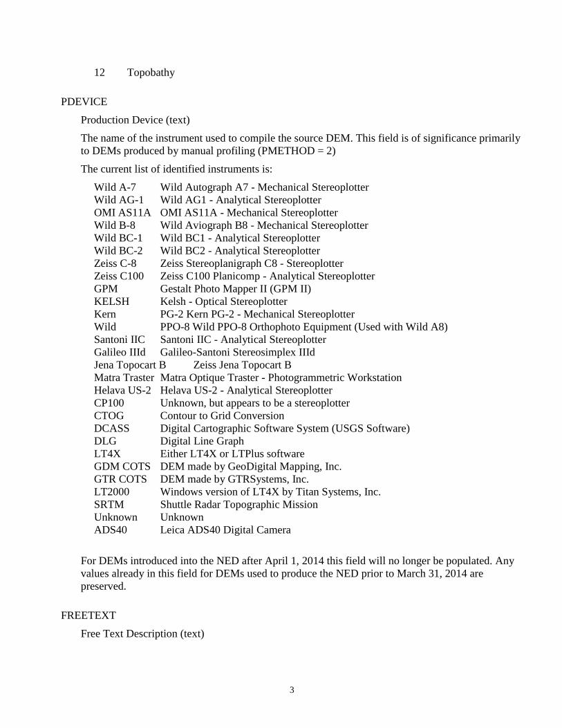
12 Topobathy
PDEVICE
Production Device (text)
The name of the instrument used to compile the source DEM. This field is of significance primarily
to DEMs produced by manual profiling (PMETHOD = 2)
The current list of identified instruments is:
Wild A-7 Wild Autograph A7 - Mechanical Stereoplotter
Wild AG-1 Wild AG1 - Analytical Stereoplotter
OMI AS11A OMI AS11A - Mechanical Stereoplotter
Wild B-8 Wild Aviograph B8 - Mechanical Stereoplotter
Wild BC-1 Wild BC1 - Analytical Stereoplotter
Wild BC-2 Wild BC2 - Analytical Stereoplotter
Zeiss C-8 Zeiss Stereoplanigraph C8 - Stereoplotter
Zeiss C100 Zeiss C100 Planicomp - Analytical Stereoplotter
GPM Gestalt Photo Mapper II (GPM II)
KELSH Kelsh - Optical Stereoplotter
Kern PG-2 Kern PG-2 - Mechanical Stereoplotter
Wild PPO-8 Wild PPO-8 Orthophoto Equipment (Used with Wild A8)
Santoni IIC Santoni IIC - Analytical Stereoplotter
Galileo IIId Galileo-Santoni Stereosimplex IIId
Jena Topocart B Zeiss Jena Topocart B
Matra Traster Matra Optique Traster - Photogrammetric Workstation
Helava US-2 Helava US-2 - Analytical Stereoplotter
CP100 Unknown, but appears to be a stereoplotter
CTOG Contour to Grid Conversion
DCASS Digital Cartographic Software System (USGS Software)
DLG Digital Line Graph
LT4X Either LT4X or LTPlus software
GDM COTS DEM made by GeoDigital Mapping, Inc.
GTR COTS DEM made by GTRSystems, Inc.
LT2000 Windows version of LT4X by Titan Systems, Inc.
SRTM Shuttle Radar Topographic Mission
Unknown Unknown
ADS40 Leica ADS40 Digital Camera
For DEMs introduced into the NED after April 1, 2014 this field will no longer be populated. Any
values already in this field for DEMs used to produce the NED prior to March 31, 2014 are
preserved.
FREETEXT
Free Text Description (text)
4
For DEMs derived from standard USGS paper map series, this field is first 136 bytes of the source
DEM file, including the quadrangle name, free format text, and process field. This field may
contain additional information, though there are no standards for the use of the free text field.
Example: NORTH CHINOOK RESERVOIR, MT -VDYA 1-09 9/06/75 WILD A-7 60000 4 -
10915 0.0000 4845 0.00002
The contents of the FREETEXT field vary greatly from one DEM to the next, and in some cases are
more confusing than helpful.
For DEMs introduced into the NED after April 1, 2014 this field will no longer be populated. Any
values already in this field for DEMs used to produce the NED prior to March 31, 2014 are
preserved.
RESOLUTION
Source Resolution (short integer)
This code indicates the planimetric (x, y) spacing of elevation postings within the source DEM.
Note that all source data are resampled to a common resolution during NED production.
For DEMs used to produce the NED prior to March 31, 2014 valid values are:
0 Unknown
1 1 arc-second (Alaska, Canada, Mexico)
2 2 arc-seconds (1:100k series)
3 3 arc-seconds (1:250k series)
5 5 meters (non-standard data)
10 10 meters (7.5-minute series)
30 30 meters (7.5-minute series)
13 1/3 arc-second (non-standard data)
19 1/9 arc-second (non-standard data)
For DEMs introduced into the NED after April 1, 2014 the actual resolution of the original high-
resolution source DEM will be populated in the HORIZRES_M field, and the RESOLUTION field
will be populated with:
100 High-resolution source
HORIZRES_M
Horizontal Resolution of Source DEM (floating point)
The horizontal resolution (x, y) of the original DEM which was used to produce the NED,
expressed in meters. Regardless of the source DEM horizontal units, this field is expressed in the
common unit meters for more meaningful comparisons and simplified queries.
This is a new field in the spatial metadata shapefiles for DEMs used to produce the NED after April
1, 2014. For DEMs used to produce the NED prior to March 31, 2014, this field will be populated
with -100.
S_DATE
Data Source Date (short integer)
5
For DEMs derived from standard USGS paper map series, this field is data element 21 in the source
DEM Type A record, the date of original photography from which the DEM was compiled (Digital
Elevation Models (USGS, 1993). This information was not provided with some standard DEMs
with a native resolution of 30 meters.
In the case of high resolution source data, this field reflects the year that the base elevation data was
collected, as in the case of LIDAR derived DEMs. For projects whose collection spanned more than
one calendar year, this is the earliest acquisition year.
Format: YYYY
I_DATE
Data Inspection Date (short integer)
For DEMs derived from standard USGS paper map series, this field is data element 22 in the source
DEMs Type A record: DEM Edit System (DES) inspection date (Digital Elevation Models, USGS,
1993). This information was not provided with some standard DEMs.
Format is either YYYY or YYMM
This field not used for newer, high-resolution data sources.
For DEMs introduced into the NED after April 1, 2014 this field be populated with -100. Any
values already in this field for DEMs used to produce the NED prior to March 31, 2014 are
preserved.
Source Planimetric Descriptors HDATUM
LRLAT
LRLON
ULLAT
ULLON
UTMZONE
XSHIFT
YSHIFT
HDATUM
Horizontal Datum (short integer)
Valid values:
0 Unknown
27 North American Datum of 1927 (NAD 27)
83 North American Datum of 1983 (NAD 83)
72 World Geodetic System of 1972 (WGS 72)
84 World Geodetic System of 1984 (WGS 84)
99 Other
6
LRLAT, LRLON, ULLAT, ULLON
Coordinates defining the minimum bounding box of the source DEM (floating point)
Units: decimal degrees. Coordinate System: NAD 83.
For DEMs derived from standard USGS paper map series, this field is derived from corner
coordinates indicated in data element 11 of the DEMs Type A record (Digital Elevation Models
USGS, 1993).
LRLAT Southern extent in latitude
LRLON Eastern extent in longitude
ULLAT Northern extent in latitude
ULLON Western extent in longitude
UTMZONE
Source UTM or State Plane Zone (short integer)
The projection zone of the source DEM.
If two digits, a UTM zone.
If four digits, a State Plane zone.
A value of zero in this field indicates that the source DEM is cast in geographic (lat/lon)
coordinates.
For DEMs introduced into the NED after April 1, 2014 this field will be populated with -100. Any
values already in this field for DEMs used to produce the NED prior to March 31, 2014 are
preserved.
XSHIFT, YSHIFT
Horizontal Shift (floating point)
Units: decimal degrees
The positional shifts in longitude and latitude, respectively, applied to each posting in the source
DEM to convert from NAD27 coordinates to NAD83 coordinates. These values will be zero if the
source DEM’s HDATUM field value is 83, 84 or 72. (WGS84 is nearly identical to NAD83, and
WGS72 is sufficiently similar that no shift was deemed necessary). The shift values were obtained
from NGS’s NADCON software, and were calculated at the nominal center of each quadrangle.
New high-resolution DEMs introduced into the NED after April 1, 2014 generally have a horizontal
datum of NAD83 and this field will be populated with -100. Any values already in this field for
DEMs used to produce the NED prior to March 31, 2014 are preserved.
Source Elevation Descriptors VDATUM
ZUNIT
ZSTEP
ZSHIFT
7
VDATUM
Vertical Datum (short integer)
This code represents the vertical datum of source DEM.
Valid values are:
0 Unknown
1 Local Mean Sea Level
29 National Geodetic Vertical Datum of 1929 (NGVD 29)
88 North American Vertical Datum of 1988 (NAVD 88)
99 Other
ZUNIT
Elevation Unit (short integer)
This code represents the unit of elevation values in source DEM.
Valid values:
0 International Feet
1 Meters
2 U.S. Survey Feet
3 Decimal degrees
4 Centimeters
5 Inches
99 Other
ZSTEP
Elevation Resolution (floating point)
For DEMs derived from standard USGS paper map series, this field, together with ZUNIT, defines
vertical resolution of the source DEM. Typical values are 1 and 0.1, though others are possible.
Example: ZSTEP = 0.1 This indicates that the source DEM records elevations to the nearest tenth
of a meter.
A value of 0 is used when this field does not apply, as in the case of source data with floating point
precision.
New high-resolution DEMs introduced into the NED after April 1, 2014 all have floating point
precision, and this field will be populated with -100. Any values already in this field for DEMs used
to produce the NED prior to March 31, 2014 are preserved.
ZSHIFT
Elevation Shift (floating point)
The elevation shift, in meters, applied to each posting within the source DEM to convert to
NAVD88 values. The shift values were obtained from NGS’s VERTCON software, and were
calculated at the nominal center of each quadrangle.
8
New high-resolution DEMs introduced into the NED after April 1, 2014 all have a vertical datum of
NAVD88, therefore this field will be populated with -100. Any values already in this field for
DEMs used to produce the NED prior to March 31, 2014 are preserved.
Source Elevation Summary Statistics ZMIN
ZMAX
ZMEAN
ZSIGMA
Discussion: The summary statistics shown in these fields usually describe the entire source DEM,
even when only some portion of the source DEM is used in NED, or when the source DEM is
represented by more than one polygon within the metadata. These data are presented in common
units (meters) and in a common vertical datum (NAVD88) to allow for more meaningful graphical
displays and simplified queries.
ZMIN, ZMAX
Minimum and Maximum Elevation of Source DEM (floating point)
The minimum and maximum elevation values of the source DEM before any filtering or
reprojection, but after conversion to meters and to NAVD88. For DEMs derived from standard
USGS maps, subtracting ZSHIFT and converting to the DEM’s original units results in the min and
max values reported in data element 12 of the DEM’s Type A record (Digital Elevation Models,
USGS, 1993).
ZMEAN
Mean Elevation of Elevations in Source DEM (floating point)
The mean elevation value of the source DEM before any filtering or reprojection, but after
conversion to meters and to NAVD88
ZSIGMA
Standard Deviation of Elevations in Source DEM (floating point)
The standard deviation of the elevations of the source DEM, before any filtering or reprojection, but
after conversion to meters.
Source Accuracy Statistics ABSX
ABSY
ABSZ
ABSPTS
RMSE
RMSEX
RMSEY
9
RMSEZ
RMSEPTS
VA_UNIT
ABSX, ABSY, ABSZ
Absolute Accuracy (short integers)
Absolute accuracy in X, Y, Z.
This field applies only to standard production USGS DEMs and echos data element 2 of the source
DEM’s Type C record,(Digital Elevation Models, USGS, 1993). See Standards for Digital
Elevation Models for more information. This field is populated with zero if not available.
For DEMs introduced into the NED after April 1, 2014 this field will be populated with -100. Any
values already in this field for DEMs used to produce the NED prior to March 31, 2014 are
preserved.
ABSPTS
Sample Size (short integer)
This field applies only to standard production USGS DEMs and echoes data element 3 of the source
DEM’s Type C (sample size record) (Digital Elevation Models, USGS, 1993).
For DEMs introduced into the NED after April 1, 2014 this field will be populated with -100. Any
values already in this field for DEMs used to produce the NED prior to March 31, 2014 are
preserved.
RMSE
Availability of Relative Accuracy Statistics (short integer)
This field applies only to standard production USGS DEMs and echoes data element 4 of the source
DEM’s Type C (relative accuracy statistics) (Digital Elevation Models, USGS, 1993).
Valid codes:
1 Available
0 Not available
For DEMs introduced into the NED after April 1, 2014 this field will be populated with -100. Any
values already in this field for DEMs used to produce the NED prior to March 31, 2014 are
preserved.
RMSEX, RMSEY, RMSEZ
Relative Accuracy (short integer)
This field applies only to standard production USGS DEMs and echoes data element 5 of the source
DEM’s Type C (relative accuracy in X, Y, Z (Digital Elevation Models, USGS, 1993).This field is
zero if not available.
For DEMs introduced into the NED after April 1, 2014 this field will be populated with -100. Any
values already in this field for DEMs used to produce the NED prior to March 31, 2014 are
preserved.
10
RMSEPTS
Sample Size (short integer)
This field applies only to standard production USGS DEMs and echoes data element 6 of the source
DEM’s Type C (sample size) (Digital Elevation Models, USGS, 1993).
For DEMs introduced into the NED after April 1, 2014 this field will populated with -100. Any
values already in this field for DEMs used to produce the NED prior to March 31, 2014 are
preserved.
NED Production Timestamps QUADDATE
QUADDATE
Date the data were used to produce the NED (long integer)
The date on which the source DEM was first processed into NED. This field is particularly useful in
the identification of recently updated areas.
Format: YYYYMMDD
11
NED1/9 Arc-second Data Dictionary
Source Identification PROJ_NAME
DEMNAME
PROJ_NAME
Project name (text)
This field is the name of the original project that was adapted for incorporation into the NED 1/9
arc-second layer. The format of this field will most commonly be three parts separated by
underscores: PRIMARYSTATE, BRIEF-PROJECT-DESCRIPTION, YEAR.
DEMNAME
Data Name (text)
The name of the final elevation dataset processed into a common coordinate system and units
according to NED 1/9 arc-second specifications.
For DEMs introduced into the NED after April 1, 2014 this field will no longer be populated. Any
values already in this field for DEMs used to produce the NED prior to March 31, 2014 are
preserved.
Source Production RESOLUTION
HORIZRES_M
PMETHOD
S_DATE
FREETEXT
RESOLUTION
Resolution (short integer)
The planimetric (x, y), spacing of elevation postings of the final pre-processed datasets. Source
LiDAR datasets resolution varies but is typically less than 3 meters. During NED 1/9 arc-second
processing, source datasets are resampled to a common resolution (e.g. 1/9 arc-second or about 3
meters).
For DEMs used to produce the NED prior to March 31, 2014 valid values are:
19 1/9 arc-second (non-standard data)
For DEMs introduced into the NED after April 1, 2014 the actual source resolution is used in NED
processing. The source resolution of the source data in meters of the original high-resolution
source DEM will be populated in the HORIZRES_M field, and the RESOLUTION field will be
populated with:
12
100 High-resolution source
HORIZRES_M
Horizontal Resolution of Source DEM (floating point)
The horizontal resolution (x, y) of the original DEM which was used to produce the NED,
expressed in meters. Regardless of the source DEM horizontal units, this field is expressed in the
common unit meters for more meaningful comparisons and simplified queries.
This is a new field in the spatial metadata shapefiles for DEMs used to produce the NED after April
1, 2014. For DEMs used to produce the NED prior to March 31, 2014, this field will not be
populated.
PMETHOD
Production Method (short integer)
The method used to collect the original source elevation data. Valid codes are:
7 Lidar
10 Ifsar
11 Other remote sensing technique
12 Topobathy
S_DATE
Data Source Date (short integer)
The year the source elevation data were collected. If acquisition of a project spanned two or more
calendar years, the earliest acquisition year is indicated in this field.
FREETEXT
Free Text Description (text)
There are no standards for the use of the free text field. This field may contain additional
information to further describe the source project or clarify other metadata fields.
For DEMs introduced into the NED after April 1, 2014 this field will no longer be populated. Any
values already in this field for DEMs used to produce the NED prior to March 31, 2014 are
preserved.
Output Production ZUNIT
ZUNIT
Elevation Unit (short integer)
13
This field describes the elevation units of the output 1/9 arc-second NED data. During the NED 1/9
arc-second processing, the source data vertical units are converted to a consistent elevation unit.
Valid value:
1 Meters
Source Accuracy Statistics S_FVA
S_CVA
S_NVA
S_VVA
VA_UNIT
RMSEZ
RMSE_FVA
RMSE_SVA
RMSE_CVA
S_FVA
Source DEM Fundamental Vertical Accuracy (FVA) (floating point)
This is the tested FVA of the source resolution DEM. FVA, or Accuracyz, is based only on points
in clear and open terrain. The fundamental accuracy is the value by which vertical accuracy can be
equitably assessed and compared among datasets. The S_FVA is calculated at the 95-percent
confidence level as a function of vertical Root Mean Square Error (RMSE) i.e., Accuracyz =
RMSEz x 1.96.
S_FVA is expressed in the units reported in the VA_UNIT field.
Valid values:
-1 Not available
Other Values Actual Calculated RMSE value
S_CVA
Source DEM Consolidated Vertical Accuracy (CVA) (floating point)
This is the tested CVA of the source resolution DEM. CVA is based on check points in all land
cover categories combined. Error distribution for points in vegetated areas does not have a normal
distribution. Therefore S_CVA is reported as the 95th
percentile.
S_CVA is expressed in the units reported in the VA_UNIT field.
Valid values:
-1 Not available
Other Values Actual Calculated RMSE value
14
S_NVA
Non-vegetated Vertical Accuracy (floating point)
This field is reserved for future use.
Current valid value: -1
S_VVA
Vegetated Vertical Accuracy (floating point)
This field is reserved for future use.
Current valid value: -1
VA_UNIT
Vertical Accuracy Unit (short integer)
The units in which the vertical accuracy statistics are reported.
Valid values:
0 International Feet
1 Meters
2 US Survey Feet
3 decimal degrees
4 centimeters
5 inches
99 unknown
RMSEZ, RMSE_FVA, RMSE_SVA, RMSE_CVA
RMSE(z), RMSE(FVA), RMSE(SVA), RMSE(CVA) (double)
Vertical accuracy for source DEMs introduced into the NED after April 1, 2014 are reported
in the S_FVA and S_CVA fields above.
Reported RMSE statistics are in meters.
RMSE(z): Root Mean Square Error of the elevation estimates.
RMSE(FVA): RMSE (Fundamental Vertical Accuracy).
RMSE(SVA): RMSE (Supplemental Vertical Accuracy).
RMSE(CVA): RMSE (Consolidated Vertical Accuracy).
RMSE is the square root of the average of the set of squared differences between dataset coordinate
values and coordinate values from an independent source of higher accuracy for identical points.
RMSEz = sqrt[ (Zdata I – Zcheck I)2/n]
where Zdata I is the vertical coordinate of the Ith check point in the elevation dataset, Zcheck I is the
vertical coordinate of the Ith check point in the independent reference source of higher accuracy,
n is the number of points being checked, and I is an integer from 1 to n.
The Fundamental Vertical Accuracy (FVA) of a dataset must be determined with check points
located only in open terrain, where there is a very high probability that the sensor will have detected
15
the ground surface. The fundamental accuracy is the value by which vertical accuracy can be
equitably assessed and compared among datasets. The FVA is calculated at the 95-percent
Confidence Level as a function of vertical RMSE, i.e., Accuracyz = RMSEz x 1.9600.
In addition to the fundamental accuracy, supplemental or consolidated accuracy values maybe
calculated for other ground cover categories or for combinations of ground cover categories.
Because elevation errors often vary with the height and density of ground cover, a normal
distribution of error cannot be assumed and, therefore, RMSE cannot be used to calculate accuracy
values. Consequently a nonparametric testing method (95th Percentile) is employed for
supplemental and consolidated accuracy tests. The SVA or CVA are calculated at the 95th
percentile for each supplemental land cover category or combination of categories.
Valid values:
0 Not available
Other Values Actual Calculated RMSE value
For DEMs introduced into the NED after April 1, 2014 theses RMSE fields will be populated with -
100. Instead, accuracy statistics for these DEMs will be provided in the S_FVA and S_CVA fields
or in the S_NVA and S_VVA fields above. Any values already in the RMSE fields for DEMs used
to produce the NED prior to March 31, 2014 are preserved.
NED Production Timestamp QUADDATE
QUADDATE
Date the data were used to produce the NED (long integer)
The date on which the source DEM was first processed into NED. This field is particularly useful in
the identification of new NED coverage areas.
Format: YYYYMMDD
16
NED Original Product (Source) Resolution Data Dictionary
Source Identification PROJ_NAME
PROJ_NAME
Source Project Name (text)
Project name is the name of the original source DEM project that was adapted for incorporation
into the 1/9, 1/3, 1, or 2 arc-second NED layers. The NED Original Product Resolution production
process maintains the coordinate reference system and horizontal units of the original project.
However, vertical units are converted to meters.
The format of this field will most commonly be three parts separated by underscores:
PRIMARYSTATE, BRIEF-PROJECT-DESCRIPTION, YEAR.
Source Production PMETHOD
S_DATE
PMETHOD
Production Method (short integer)
The acquisition method used to collect the source elevation data (Digital Elevation Models, USGS,
1993).
Valid values are:
7 Lidar
10 Ifsar
11 Other remote sensing technique
12 Topobathy
S_DATE
Data Source Date (short integer)
The year the source elevation data were collected. If acquisition of a project spanned two or more
calendar years, the earliest acquisition year is reported in this field.
Output Production ZUNIT
REFSYS
HORIZRES
HORIZUNIT
FORMAT
17
HORIZRES_M
ZUNIT
Elevation Unit (short integer)
This field describes the elevation units of the output data. During the NED Original Product
Resolution processing, the source data vertical unit is converted to consistent elevation unit, which
is meters.
Valid value:
1 Meter
REFSYS
Coordinate Reference System (text)
This field describes the coordinate reference system and projection of the NED Original Product
Resolution DEM.
HORIZRES
Horizontal Resolution (floating point)
The horizontal resolution (x, y) of the NED Original Product Resolution DEM. The value is
reported in the units recorded in the HORIZUNIT field.
HORIZUNIT
Horizontal Resolution Units (short integer)
The unit in which the horizontal resolution, HORIZRES, is reported.
Valid values:
0 International Feet
1 Meters
2 U.S. Survey Feet
3 Decimal Degrees
4 Centimeters
5 Inches
99 Unknown
FORMAT
Raster File Format (short integer)
The raster file format of the Original Product Resolution DEM.
Valid values:
1 IMG
2 ArcGrid
3 GridFloat
4 Tiff
18
5 Other
HORIZRES_M
Horizontal Resolution Expressed in Meters (floating point)
The horizontal resolution (x, y) of the Original Product Resolution DEM expressed in meters. This
field is provided for easy comparison of and sorting of horizontal resolutions, regardless of the
horizontal units of the actual DEM.
Accuracy Statistics FVA
CVA
NVA
VVA
VA_UNIT
FVA
Fundamental Vertical Accuracy (FVA) (floating point)
This is the tested FVA of the source resolution DEM. FVA, or Accuracyz, is based only on points
in clear and open terrain. The fundamental accuracy is the value by which vertical accuracy can be
equitably assessed and compared among datasets. The FVA is calculated at the 95-percent
confidence level as a function of vertical Root Mean Square Error (RMSE) i.e., Accuracyz =
RMSEz x 1.96.
FVA is expressed in the units reported in the VA_UNIT field.
Valid values:
-1 Not available
Other Values Actual Calculated RMSE value
CVA
Consolidated Vertical Accuracy (floating point)
This is the tested CVA of the source resolution DEM. CVA is based on check points in all land
cover categories combined. Error distribution for points in vegetated areas do not have a normal
distribution. Therefore S_CVA is reported as the 95th
percentile.
CVA is expressed in the units reported in the VA_UNIT field.
Valid values:
-1 Not available
Other Values Actual Calculated RMSE value
19
NVA
Non-Vegetated Vertical Accuracy (floating point)
This field is reserved for future use.
Current valid value: -1
VVA
Vegetated Vertical Accuracy (floating point)
This field is reserved for future use.
Current valid value: -1
VA_UNIT
Vertical Accuracy Unit (short integer)
The units in which the vertical accuracy values are reported.
Valid values:
0 International Feet
1 Meters
2 U.S. Survey Feet
3 Decimal Degrees
4 Centimeters
5 Inches
99 Unknown
NED Production Timestamp QUADDATE
QUADDATE
Date the data were released into the NED (long integer)
Quaddate is the date when the Original Product Resolution DEM was processed into the NED.
Format: YYYYMMDD
20
The National Map – Elevation, Lidar Point Cloud Project Data Dictionary
Lidar Project Information project_id
state
vendor
s_date
e_date
entry_date
lr_lat, lr_long, ll_lat, ll_long, ul_lat, ul_long, ur_lat, ur_long
sensor_type
spec
nva_swath
va_unit
project_id
Project Name (text)
The format of this field will most commonly be three parts separated by underscores:
PRIMARYSTATE, BRIEF-PROJECT-DESCRIPTION, YEAR.
state
The State(s) the project is in. (text)
Format: Two letter State abbreviations
vendor
The name of the company which collected and processed the data. (text)
s_date
Start date of data collection for the project (date)
e_date
End date of data collection for the project (date)
entry_date
Date the lidar data were released into the The National Map (date)
lr_lat, lr_long, ll_lat, ll_long, ul_lat, ul_long, ur_lat, ur_long
Coordinates defining the minimum bounding box of the lidar point cloud project (double)
Units: decimal degrees. Coordinate System: NAD 83.
21
lr_lat, lr_long Southeastern extent in latitude and longitude
ll_lat, ll_long Southwestern extent in latitude and longitude
ul_lat, ul_long Northwestern extent in latitude and longitude
ur_lat, ur_long Northeastern extent in latitude and longitude
sensor_type
Sensor used in lidar collection for the dataset. (text)
spec
Applicable specification for the dataset. (waiting on domain)
Valid Values:
0 Draft Version 12
1 Draft Version 13
2 USGS Lidar Base Specification 1.0
3 USGS Lidar Base Specification 1.2
4 USGS Lidar Base Specification 2.0
99 Other
nva_swath
Non-vegetated vertical accuracy assessed against a swath. Measured as RMSEz. (waiting on
domain)
va_units
Units of NVA RMSEz
Valid Values:
0 International Feet
1 Meters
2 US Survey Feet
3 Decimal Degrees
4 Centimeters
5 Inches
99 unknown
Coordinate Reference System refsys
horizunit
zunit
refsys
Coordinate Reference System (text)
22
This field describes the coordinate reference system and projection of the lidar project.
horizunit
HorizontalUnits (long integer)
This field describes the horizontal unit of the lidar point cloud project.
Valid values:
0 International Feet
1 Meters
2 U.S. Survey Feet
3 Decimal Degrees
4 Centimeters
5 Inches
99 Unknown
zunit
Elevation Unit (long integer)
This field describes the vertical unit of the lidar point cloud project.
Valid values:
0 International Feet
1 Meters
2 U.S. Survey Feet
3 Decimal Degrees
4 Centimeters
5 Inches
6 Feet
99 Unknown
Lidar Information las_type
quality
rptd_nps
rptd_pd
rptd_units
rptd_anps
rptd_anpd
23
las_type
LAS type (long integer)
This field describes the organization of the LAS files and whether or not the points are classified.
Valid values:
0 Tile unclassified
1 Tile classified
2 Swath unclassified
3 Swath classified
4 Other
quality
Quality Level (long integer)
This field indicates the 3DEP quality level of the tile. For more information regarding 3DEP quality
levels, see The 3D Elevation Program Initiative: A Call for Action (USGS, 2014).
Valid values:
1 Quality level 1 (10cm RMSEz, 0.35m nominal pulse spacing)
2 Quality level 2 (10cm RMSEz, 0.7m nominal pulse spacing)
3 Quality level 3 (20cm RMSEz, 1.4m nominal pulse spacing)
99 Other
rptd_nps
Vendor reported nominal pulse spacing (double)
This field describes the reported average point spacing of dataset.
rptd_pd
Vendor reported pulse density (double)
This field describes the reported concentration of points in the dataset.
rptd_units
The units of the vendor reported pulse density and nominal pulse spacing (long integer)
Valid values:
0 International Feet
1 Meters
2 U.S. Survey Feet
3 Decimal Degrees
4 Centimeters
5 Inches
6 Feet
99 Unknown

24
rptd_anps
Vendor reported aggregate nominal pulse spacing (waiting on domain). This field describes the
reported average aggregate pulse spacing of the dataset.
rptd_anpd
Vendor reported aggregate nominal pulse density (waiting on domain). This field describes the
reported average aggregate pulse density of the dataset.
25
The National Map – Elevation, Lidar Point Cloud Tile Data Dictionary
Lidar Tile Information project_id
tile_name
entity_id
s_date
e_date
entry_date
lr_lat, lr_long, ll_lat, ll_long, ul_lat, ul_long, ur_lat, ur_long
project_id
Project Name (text)
The format of this field will most commonly be three parts separated by underscores:
PRIMARYSTATE, BRIEF-PROJECT-DESCRIPTION, YEAR.
tile_name
Tile Name (text)
The .las file name, not including the extension.
entity_id
Project and tile name, separated by an underscore. (text)
s_date
Start date of data collection for the project (date).
Format: YYYYMMDD
e_date
End date of data collection for the project (date).
Format: YYYYMMDD
entry_date
Date tile became available in The National Map (date).
Format: YYYYMMDD
lr_lat, lr_long, ll_lat, ll_long, ul_lat, ul_long, ur_lat, ur_long
Coordinates defining the minimum bounding box of the point cloud tile (double)
Units: decimal degrees. Coordinate System: NAD 83.
26
lr_lat, lr_long Southeastern extent in latitude and longitude
ll_lat, ll_long Southwestern extent in latitude and longitude
ul_lat, ul_long Northwestern extent in latitude and longitude
ur_lat, ur_long Northeastern extent in latitude and longitude
Coordinate Reference System refsys
horizunit
zunit
refsys
Coordinate Reference System (text)
This field describes the coordinate reference system and projection of the lidar project.
horizunit
Horizontal Resolution Units (long integer)
This field describes the unit in which the horizontal resolution, HORIZRES, is reported.
Valid values:
0 International Feet
1 Meters
2 U.S. Survey Feet
3 Decimal Degrees
4 Centimeters
5 Inches
99 Unknown
zunit
Elevation Unit (integer).
This field describes the vertical units of the lidar tile.
Valid value:
0 International Feet
1 Meters
2 U.S. Survey Feet
3 Decimal Degrees
4 Centimeters
5 Inches
6 Feet
99 Unknown
27
Lidar Information las_type
quality
version
rtrnct_1
rtrnct_2
rtrnct_3
rtrnct_4
rtrnct_5
rtrnct_6
rtrnct_7
rtrnct_8
rtrnct_9
rtrnct_10
rtrnct_11
rtrnct_12
rtrnct_13
rtrnct_14
rtrnct_15
point_ct
las_type
LAS file type ( integer).
This field describes if the LAS file has been classified, and whether it is delivered as a tile or swath.
Valid values:
0 Tile unclassified
1 Tile classified
2 Swath unclassified
3 Swath classified
4 Other
quality
Quality Level (integer)
This field indicates the 3DEP quality level of the tile.For more information regarding 3DEP quality
levels, see The 3D Elevation Program Initiative: A Call for Action (USGS, 2014).
Valid values:
1 Quality level 1 (10cm RMSEz, 0.35m nominal pulse spacing)
2 Quality level 2 (10cm RMSEz, 0.7m nominal pulse spacing)
3 Quality level 3 (20cm RMSEz, 1.4m nominal pulse spacing)
99 Other
28
version
The LAS file format version of the tile (double)
rtnct_1
Number of first return points in the .las file. (integer).
rtnct_2
The number of second return points in the .las file. (integer)
rtnct_3
The number of third return points in the .las file. (integer)
rtnct_4
The number of fourth return points in the .las file. (integer)
rtnct_5
The number of fifth return points in the .las file. (integer)
rtnct_6
The number of sixth return points in the .las file. (integer)
rtnct_7
The number of seventh return points in the .las file. (integer)
rtnct_8
The number of eighth return points in the .las file. (integer)
rtnct_9
The number of ninth return points in the .las file. (integer)
rtnct_10
The number of tenth return points in the .las file. (integer)
rtnct_11
The number of eleventh return points in the .las file. (integer)
rtnct_12
The number of twelfth return points in the .las file. (integer)
29
rtnct_13
The number of thirteenth return points in the .las file. (integer)
rtnct_14
The number of fourteenth return points in the .las file. (integer)
rtnct_15
The number of fifteenth return points in the .las file. (integer)
point_ct
The total number of points in the .las file. (integer)
References Cited
U.S. Geological Survey, 1993, Digital Elevation Models; U.S. Geological Survey Data Users Guide 5, i-53 p., accessed
January 20, 2015 at http://pubs.er.usgs.gov/publication/70038376.
U.S.Geological Survey, 2014, The 3D Elevation Program Initiative – A Call for Action, i-36p., accessed January 20, 2015 at
http://pubs.er.usgs.gov/publication/cir139.
30
Appendix A
Correspondence between selected NED metadata items and USGS DEM Type A records.
Refer to Data User’s Guide 5, Appendix A, for complete descriptions of the A record data elements referenced
below.
FREETEXT The FREETEXT field is a literal copy of Data Element 1: The first 140 bytes of the A record. By
USGS definition, only bytes 41 through 80 are free format text, but this restriction is not commonly observed.
PSITE This is a literal copy of data element 2, the Mapping Center origin code. If this field is blank, the code
“UNKNOWN” is assigned to PSITE.
ZONE This is a literal copy of data element 6.
ZUNIT This field is derived from data element 9, but does not use the same values. Data element 9 is coded as 1 =
feet, 2 = meters. ZUNIT, however, is coded as 0 = feet, 1 = meters.
LRLAT, LRLON, ULLAT, ULLON These fields are derived from data element 11.
RESOLUTION This field is derived from data element 15, which indicates the x, y, and z resolutions of the source
DEM. In the case of Alaska data, where x and y resolutions differ, the y resolution is taken to be the resolution of
the DEM. Further, RESOLUTION is indicated in the DEM’s native units (meters or decimal seconds). Nonstandard
DEM’s may be assigned RESOLUTION values in a different manner.
ZSTEP This is a literal copy of the z resolution component of data element 15.
S_DATE This is a literal copy of data element 21, or 0 if data element 21 is absent.
I_DATE This is a literal copy of data element 22, or 0 if data element 22 is absent.
HDATUM This field is derived from data element 27, but uses different values. Data element 27 specifies unique
codes for the Old Hawaii Datum and the Puerto Rico Datum, both of which are designated as 27 in HDATUM.
VDATUM This field is derived from data element 26, but uses different values. A value of 0 is assigned to VDATUM if no
vertical datum information is present.