Nashville and Its Downtown: Creating Civic Space - … · Nashville and Its Downtown: Creating...
13
Nashville Civic Design Center Nashville and Its Downtown: Creating Civic Space Christine Kreyling “A place is nothing, not even space, unless at its heart a figure stands.” Amy Lowell, “Thorn Piece,” A Shard of Silence (1957) To understand why a downtown is important, we might as well begin with Jane Jacobs. In The Death and Life of Great American Cities, the grandmother of urban commentators writes: Probably everyone is aware of certain general dependencies by a city on its heart. When a city heart stagnates or disinte- grates, a city as the social neighborhood of the whole begins to suffer: People who ought to get together, by means of central activities that are failing, fail to get together. Ideas and money that ought to meet, and do so often by happenstance in a place of central vitality, fail to meet. The networks of city public life develop gaps they cannot afford. Without a strong and inclusive[ital.] central heart, a city tends to become a collection of interests isolated from one another. It falters at producing something greater, socially, culturally and eco- nomically, than the sum of its separated parts. 1 Nashville’s downtown stagnated in the 1970s and 80s, when the Opry left, sleaze shops and winos took over Broadway, and vacant storefronts littered the streetscape. Today, while there are definite signs of revival, much of this revival is dependent on the programming of special events. The downtown of daily life still lacks animation. The ubiquitous dead zones of surface parking, the absence of retail, and the fact that many new pro- jects in downtown have been subsidized by Metro monies leave open the question of whether Nashville’s central city is march- ing forward or staging the dance of one step forward, one step back. The march of progress depends on satisfying the needs and expectations of two downtown constituencies: the regional citizens, who use the city center for its resources and services, and Nashvillians for whom the center holds pride of place as the foremost among the city’s neighborhoods. For both groups downtown should, through its architecture and urban struc- ture, evoke a distinctive sense of place with twin and overlap- ping identities: a grand capital city that also functions as a self- sustaining neighborhood. Solids and Voids “I think the landscape is everything outside the building foot- print. It is the moment you walk out of the house and enter the world.” Martha Schwartz, New York Times Magazine[ital.], May 16, 2004. The relationship of buildings and spaces--the public rights-of- way of streets and sidewalks, as well as plazas and parks-- Nashville Civic Design Center • Urban Design / Policy Brief • Regional and Metropolitan Transportation Infrastructure • www.civicdesigncenter.org 1 1 Jane Jacobs, The Death and Life of Great American Cities, (New York: Random House, 1961; reprint, New York:Vintage Books, 1992), 165. The block of Fifth Avenue North between Church and Union Streets features fine urban design; buildings form continuous street walls with good transparency to the sidewalk. (Photograph, 2003: NCDC, Gary Gaston)
Transcript of Nashville and Its Downtown: Creating Civic Space - … · Nashville and Its Downtown: Creating...

Nashville Civic Design Center
Nashville and Its Downtown:Creating Civic SpaceChristine Kreyling
“A place is nothing, not even space, unless at its heart a figure stands.”Amy Lowell, “Thorn Piece,” A Shard of Silence (1957)
To understand why a downtown is important, we might as well begin with Jane Jacobs. In The Death and Life of Great American Cities, the grandmother of urban commentators writes:
Probably everyone is aware of certain general dependencies by a city on its heart. When a city heart stagnates or disinte-grates, a city as the social neighborhood of the whole begins to suffer: People who ought to get together, by means of central activities that are failing, fail to get together. Ideas and money that ought to meet, and do so often by happenstance in a place of central vitality, fail to meet. The networks of city public life develop gaps they cannot afford. Without a strong and inclusive[ital.] central heart, a city tends to become a collection of interests isolated from one another. It falters at producing something greater, socially, culturally and eco-nomically, than the sum of its separated parts.1
Nashville’s downtown stagnated in the 1970s and 80s, when the Opry left, sleaze shops and winos took over Broadway, and vacant storefronts littered the streetscape. Today, while there are definite signs of revival, much of this revival is dependent on the programming of special events. The downtown of daily life still lacks animation. The ubiquitous dead zones of surface parking, the absence of retail, and the fact that many new pro-jects in downtown have been subsidized by Metro monies leave open the question of whether Nashville’s central city is march-ing forward or staging the dance of one step forward, one step back.
The march of progress depends on satisfying the needs and expectations of two downtown constituencies: the regional citizens, who use the city center for its resources and services, and Nashvillians for whom the center holds pride of place as the foremost among the city’s neighborhoods. For both groups downtown should, through its architecture and urban struc-ture, evoke a distinctive sense of place with twin and overlap-ping identities: a grand capital city that also functions as a self-sustaining neighborhood.
Solids and Voids
“I think the landscape is everything outside the building foot-print. It is the moment you walk out of the house and enter the world.”Martha Schwartz, New York Times Magazine[ital.], May 16, 2004.
The relationship of buildings and spaces--the public rights-of-way of streets and sidewalks, as well as plazas and parks--
Nashville Civic Design Center • Urban Design / Policy Brief • Regional and Metropolitan Transportation Infrastructure • www.civicdesigncenter.org! 1
1 Jane Jacobs, The Death and Life of Great American Cities, (New York: Random House, 1961; reprint, New York: Vintage Books, 1992), 165.
The block of Fifth Avenue North between Church and Union Streets features fine urban design; buildings form continuous street walls with good transparency to the sidewalk. (Photograph, 2003: NCDC, Gary Gaston)

constitutes the character of a city. This relationship defines, or fails to define, the downtown’s sense of place.
To the extent that the traditional urban fabric survives in downtown Nashville, the relationship between buildings and spaces strikes a good urban balance between solid and void. What erodes Nashville’s urban character, however, is an inat-tention to the visual opportunities inherent in the urban fabric--the sightline to a major monument, for example--as well as the non-traditional propensity toward surface parking and buildings that do not meet the sidewalk and supply human scaled walls to the street. The result is too many voids, and too few solids. And the solids that exist are often far too[ital.] solid: blank walls at street level that are a hostile gesture to the pub-lic right-of-way and offer no visual interest to the pedestrian.
Tennessee Perform-ing Arts Center’s blank wall along Union Street be-
tween 5th and 6th Avenue is a hostile gesture to the public right-of-way. (Pho-tograph, 2004: NCDC, Raven Hardison.)
3rd Avenue North at Church Street. Note how street wall formed by buildings is eroded at corner by surface parking lot. (Photograph, 2004: NCDC, Gary Gaston)
For Nashville to physically affirm its status as capital city and downtown of the region, the central city should feature fine architecture, public art, plazas and parks. The mere presence of these elements, however, does not constitute a civic realm. The public realm is everything outside the building footprint, includ-ing the network--the boulevards and avenues and streets--that unites these elements. This network is the prime location of the “happenstance” encounters that Jane Jacobs stresses as crucial to the city as a “social neighborhood.”
Downtown Nashville has some admirable civic architecture: the State Capitol, War Memorial, Metro Courthouse, Public Library. But these structures are often visually and physically isolated from one another--as if scattered throughout down-town rather than placed as parts of a cohesive urban design. Public plazas and parks are underused because they don’t suc-cessfully function as daily gathering places for Nashvillians.
The Plan of Nashville presents a strategy of connectivity that redefines the relationship between downtown buildings and spaces. There are two scales to this strategy. The grand scale emphasizes Nashville’s identity as capital city, and stretches from the city center into the areas surrounding downtown. The secondary scale is the meat and potatoes of the urban fabric, operating locally within downtown as neighborhood. Both scales utilize elements of urban design that historically evolved from the concept of the axis.
“I think the landscape is everything outside the building footprint. It is the moment you walk out of the house and enter the world.”
Martha Schwartz, New York Times Magazine (May 16, 2004)
THE CAPITAL CITYIn the pre-skyscraper age, the Tennessee State Capitol was the highly visible symbol of Nashville as the home of state govern-ment. Today, however, the primacy of the Capitol is no longer self-evident. During the Plan of Nashville’s series of community visioning workshops, citizens lamented that Nashville no longer “feels” like a capital--because it doesn’t look like one.
To invigorate Nashville’s visual identity as Tennessee’s capital, planners logically turned to the urban design tradition whose main invention is the capi-tal city: the Baroque, as filtered through the American City Beautiful movement. The Plan of Nashville strengthens the rela-tionship of city to Capitol much as the McMillan Plan revived L’Enfant’s plan for the federal capital--by redefining the axes emanating from the Capitol and extending them deeper into the urban fabric.
Nashville Civic Design Center • Urban Design / Policy Brief • Regional and Metropolitan Transportation Infrastructure • www.civicdesigncenter.org! 2

William Strickland’s Greek Revival temple rides the crest of the city’s acropolis like the Athenian Parthenon, the state’s power and democratic aspirations incarnate in masonry and mortar. (Photograph, 2004: NCDC, Gary Gaston)
The Plan orients the city around the Capitol by formalizing its four axes--north, south, east and west--by using structures to enframe and punctuate them. These axes are like fingers reach-ing into the surrounding neighborhoods and districts, physically engaging specific parts of the city. Each axis terminates with a public building or monument, which relays the focus back to the Capitol so that the entire region seems to converge upon it. The Capitol building thus becomes the city’s unifying ele-ment, a frame of reference for citizens and visitors alike.
View from Capitol to north when this area was dominated by industrial uses. (Photograph, ca. 1955: Metro Archives)
North Capitol Axis
The Bicentennial Mall defines the north axis, providing an in-spiring example of the transformative power inherent in axial design. Governor Ned McWherter and the Bicentennial Commission decided on the 19-acre rectangle as a fitting way to celebrate the state’s 1996 birthday by preserving this sight-line to the Capitol. As a massive public works project under-taken, not for a strictly functional purpose but for the educa-tion and delight of the citizens, the Mall brings urban grandeur to an area formerly occupied by the sheds of light industry and wholesale agricultural produce.
The Plan of Nashville encourages the implementation of the 1997 Bicentennial Mall Urban Master Plan, which addresses the area lying east of the Mall. This master plan establishes a the-matic building program for the Mall’s area of influence devoted to educational and cultural institutions, including the State Li-brary and Archives, as well as the Tennessee State Museum to be placed directly on the Mall’s eastern flank. This design closely echoes the Mall in Washington, D.C., which is also lined with educational and cultural venues.
In the Plan, the north axis is the “front porch” of the state, connecting through the Bicentennial Mall to the new Governor House and Green near the 19th century Werthan Bag and Cotton Mill complex (See: “Nashville and Its Neighborhoods,” River District section, pp. xx). The Plan proposes a vertical marker at Werthan to denote the location of the Green and to punctuate the view from the Capitol.
View of Capitol to south from Bicentennial Mall; preservation of this sightline affirms the Capitol’s symbolic significance to the Capital City. (Photograph: Gary Layda)
South Capitol Axis
The short length of the south axis is no constraint to its sig-nificance as a bridge between city and state. The Nashville Pub-lic Library looks up the slope of Capitol Boulevard to the Capi-tol as if acknowledging the superior powers of state govern-ment. The library’s quiet classicism echoes Strickland’s more ornate classicism of 150 years earlier.
Nashville Civic Design Center • Urban Design / Policy Brief • Regional and Metropolitan Transportation Infrastructure • www.civicdesigncenter.org! 3

Capitol Boulevard is in the process of reconfiguration as a sim-ple, elegant, tree-lined street. Once this occurs, the flanking buildings should be programmed with uses to enliven the streetscape.
Victory parade after World War I. (Photograph, ca. 1918: Gilman Broth-ers)
East Capitol Axis
Plan of East Axis. Note the intersection of James Robertson Parkway has been changed from curvilinear to orthogonal, better integrating with the city grid. (Drawing, 2004: NCDC, Gary Gaston)
William Strickland intended the east facade--facing the Cum-berland River and thus visitors to the city arriving by boat--to serve as the Capitol’s ceremonial entrance. The main entrance to the grounds by carriage was from Park Place, a one-block residential street bordering the east side of the property. And a large terrace was constructed in 1880 on the eastern slope of the hill for the placement of Clark Mills’ bronze equestrian statue of Andrew Jackson, further emphasizing the primacy of this face of the Capitol.
Today the impact of the eastern facade is blunted by structures that unfortunately block the view corridor to it. Even more unfortunately, Metro’s new Beverly Briley building, to house the city’s criminal courts, is currently under construction directly within the east axis. In ensuing decades, when these buildings have served their useful lives, they should be removed to open up this historically weighted sightline from the Capitol.
The Plan of Nashville presents the east axis as a series of stepped plazas--linked by a continuous water feature--cascading all the way to the Cumberland and terminating in a vertical marker on the river’s east bank. As distinct from the cultural and education theme of buildings on the north axis, the walls of the east axis are formed by new government build-
ings to meet future needs of Metro and state. Following the precedent of the Jack-son sculpture, this civic theme finds further expression in the placement within the axis of memorials to leaders in the history of the city’s public life.
Left: East axis as proposed in Central Loop Plan, with a series of discrete plazas asymmetrically linked by terraced steps. This treat-ment of the axis, unlike the Plan of Nashville, does not extend to the Numberland River. (Drawing, 1963: MDHA, Clarke and Rapu-ano, Inc., for Nashville Housing Authority)
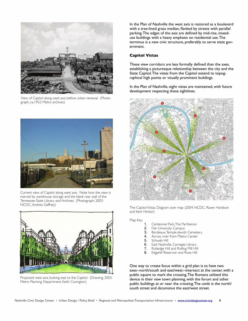
West Capitol Axis
In the 19th century, the west axis was residential, with many elegant town houses lying near the Capitol. But as their own-ers abandoned these dwellings--and downtown living entirely-- the neighborhood deteriorated. By the 1940s, the area imme-diately adjacent to the Capitol property contained dilapidated rooming houses, shacks and outdoor privies. All this housing--and several historic African American churches—was demol-ished for the Capitol Hill redevelopment in 1949, the first ur-ban renewal project funded by the U.S. Congress.
The major element in the redevelopment was a large, radial road, subsequently named James Robertson Parkway, which replaced the rectangular street grid. For most of its path, which loops around the base of Capitol Hill, the parkway lies at grade level. But to the west the parkway devolves into a series of elevated ramps and submerged roadways which form a barri-cade to the land beyond. And, the construction of the State Library and Archives building in 1952 blocked the sightline to all but the Capitol’s tower from the west.
Nashville Civic Design Center • Urban Design / Policy Brief • Regional and Metropolitan Transportation Infrastructure • www.civicdesigncenter.org! 4
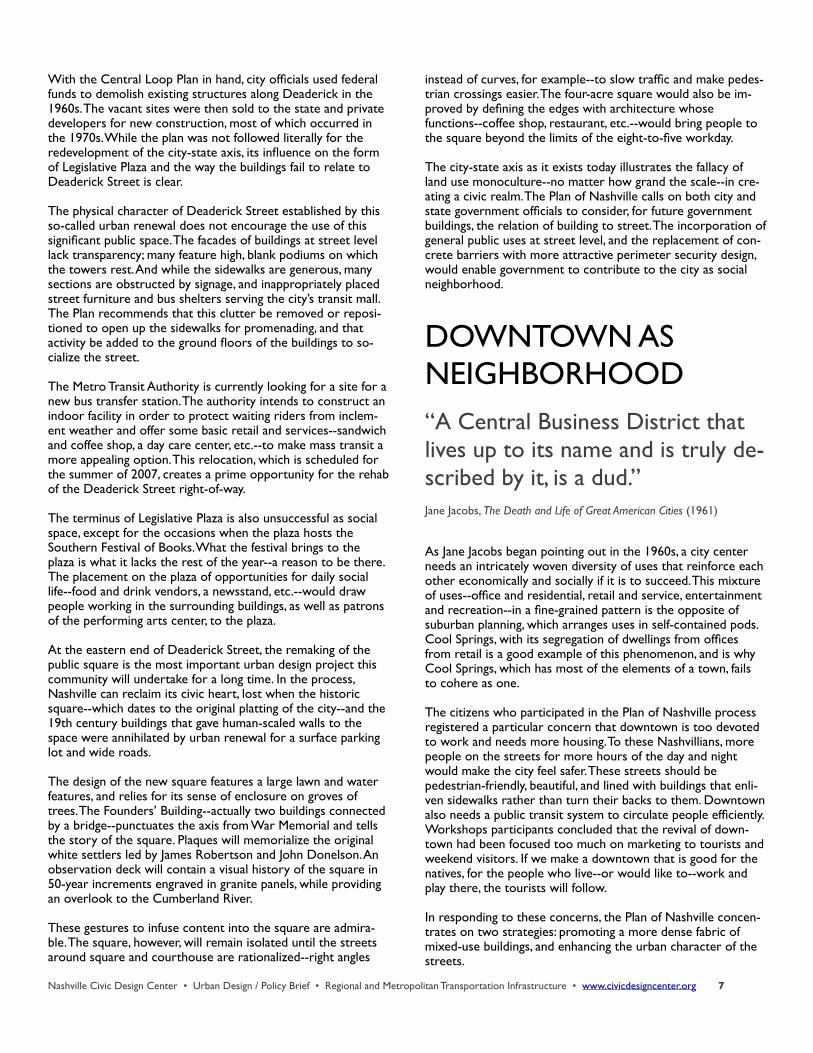
In the Plan of Nashville the west axis is restored as a boulevardwith a tree-lined grass median, flanked by streets with parallel parking. The edges of the axis are defined by mid-rise, mixed-use buildings with a heavy emphasis on residential use. The terminus is a new civic structure, preferably to serve state gov-ernment.
Capitol Vistas
These view corridors are less formally defined than the axes, establishing a picturesque relationship between the city and the State Capitol. The vistas from the Capitol extend to topog-raphical high points or visually prominent buildings.
In the Plan of Nashville, eight vistas are maintained, with future development respecting these sightlines.
The Capitol Vistas. Diagram over map (2004: NCDC, Raven Hardison and Kem Hinton)
Map Key:1. Centennial Park, The Parthenon2. Fisk University Campus3. Bordeaux, Temple Jewish Cemetery4. Across river from Metro Center5. Schwab Hill6. East Nashville, Carnegie Library7. Rutledge Hill and Rolling Mill Hill8. Edgehill Reservoir and Rose Hill
One way to create focus within a grid plan is to have two axes--north/south and east/west--intersect at the center, with a public square to mark the crossing. The Romans utilized this device in their new town planning, with the forum and other public buildings at or near the crossing. The cardo is the north/south street and decumanus the east/west street.
Nashville Civic Design Center • Urban Design / Policy Brief • Regional and Metropolitan Transportation Infrastructure • www.civicdesigncenter.org! 5
View of Capitol along west axis before urban renewal. (Photo-graph, ca.1952: Metro archives)
Current view of Capitol along west axis. Note how the view is marred by warehouse storage and the blank rear wall of the Tennessee State Library and Archives. (Photograph, 2003: NCDC, Andrea Gaffney)
Proposed west axis, looking east to the Capitol. (Drawing, 2003: Metro Planning Department, Keith Covington)

In the Plan of Nashville, Fifth Avenue is the cardo and Demon-breun Street the decumanus, which together form the axes of the cultural arts. As in the Roman model, significant public buildings and open space lie in the vicinity of the crossing: the Country Music Hall of Fame and Museum, the Gaylord Enter-tainment Center, the Schermerhorn Symphony Center and Hall of Fame Park.
Demonbreun currently terminates at the former location of the thermal plant. Proposals for the thermal site include a baseball stadium as well as a hotel and mixed-use development. Whatever the nature of new development, it should include public access to the riverbank in the form of an extension of Riverfront Park. The Plan provides a visual termination for the street with a vertical marker on the west bank.
“People . . . spend more per square foot on their kitchens than they would ever put into an open public space. The problem is that our no-tion of quality of life ends at our front door.”
Martha Schwartz, New York Times Magazine, May 16, 2004.
The City-State Axis
As the avenue between the major monuments of Metro and state government, it would be hard to equal Deaderick Street for symbolic value. The east end terminates in the public square-in-the-making in front of the Metro Courthouse, the west in Legislative Plaza and the War Memorial, which lie be-fore the State Capitol.
The importance of the relationship between the architecture of city and state was recognized by Emmons Woolwine and Frederick C. Hirons, the designers of what was originally called the Davidson County Public Building and Courthouse. Accord-ing to a Tennessean article by Rufus Jarman in May of 1935, when the result of the design competition for the Courthouse was announced, the winning design placed the building on the site “so that its entrance will fall in line with the general effect produced by the Capitol and War Memorial. The base of the columns is approximately on a level with the entrance to the Capitol grounds” from what was then called Cedar Street (now Charlotte Avenue). The visual relationship between Courthouse and Capitol that the architects sought was later obscured by the construction of large office buildings on the northern side of Deaderick Street.
The urban renewal plan for downtown Nashville by the New York firm of Clarke and Rapuano emphasized the significance of Deaderick Street as a boulevard lined with broad sidewalks shaded by double rows of trees. Note, however, that the build-
Deaderick Street, pre-urban renewal, looking towards War Memorial, and Deaderick Street today. (Top photograph, ca. 1960: Metro Archives; bottom photograph, 2003: NCDC)
ings flanking the street in this plan stand as individual entities surrounded by open space, thus violating the Baroque tradition of continuous planes of architecture that give strong walls to the street.
Nashville Civic Design Center • Urban Design / Policy Brief • Regional and Metropolitan Transportation Infrastructure • www.civicdesigncenter.org! 6
With the Central Loop Plan in hand, city officials used federal funds to demolish existing structures along Deaderick in the 1960s. The vacant sites were then sold to the state and private developers for new construction, most of which occurred in the 1970s. While the plan was not followed literally for the redevelopment of the city-state axis, its influence on the form of Legislative Plaza and the way the buildings fail to relate to Deaderick Street is clear.
The physical character of Deaderick Street established by this so-called urban renewal does not encourage the use of this significant public space. The facades of buildings at street level lack transparency; many feature high, blank podiums on which the towers rest. And while the sidewalks are generous, many sections are obstructed by signage, and inappropriately placed street furniture and bus shelters serving the city’s transit mall. The Plan recommends that this clutter be removed or reposi-tioned to open up the sidewalks for promenading, and that activity be added to the ground floors of the buildings to so-cialize the street.
The Metro Transit Authority is currently looking for a site for a new bus transfer station. The authority intends to construct an indoor facility in order to protect waiting riders from inclem-ent weather and offer some basic retail and services--sandwich and coffee shop, a day care center, etc.--to make mass transit a more appealing option. This relocation, which is scheduled for the summer of 2007, creates a prime opportunity for the rehab of the Deaderick Street right-of-way.
The terminus of Legislative Plaza is also unsuccessful as social space, except for the occasions when the plaza hosts the Southern Festival of Books. What the festival brings to the plaza is what it lacks the rest of the year--a reason to be there. The placement on the plaza of opportunities for daily social life--food and drink vendors, a newsstand, etc.--would draw people working in the surrounding buildings, as well as patrons of the performing arts center, to the plaza.
At the eastern end of Deaderick Street, the remaking of the public square is the most important urban design project this community will undertake for a long time. In the process, Nashville can reclaim its civic heart, lost when the historic square--which dates to the original platting of the city--and the 19th century buildings that gave human-scaled walls to the space were annihilated by urban renewal for a surface parking lot and wide roads.
The design of the new square features a large lawn and water features, and relies for its sense of enclosure on groves of trees. The Founders’ Building--actually two buildings connected by a bridge--punctuates the axis from War Memorial and tells the story of the square. Plaques will memorialize the original white settlers led by James Robertson and John Donelson. An observation deck will contain a visual history of the square in 50-year increments engraved in granite panels, while providing an overlook to the Cumberland River.
These gestures to infuse content into the square are admira-ble. The square, however, will remain isolated until the streets around square and courthouse are rationalized--right angles
instead of curves, for example--to slow traffic and make pedes-trian crossings easier. The four-acre square would also be im-proved by defining the edges with architecture whose functions--coffee shop, restaurant, etc.--would bring people to the square beyond the limits of the eight-to-five workday.
The city-state axis as it exists today illustrates the fallacy of land use monoculture--no matter how grand the scale--in cre-ating a civic realm. The Plan of Nashville calls on both city and state government officials to consider, for future government buildings, the relation of building to street. The incorporation of general public uses at street level, and the replacement of con-crete barriers with more attractive perimeter security design, would enable government to contribute to the city as social neighborhood.
DOWNTOWN AS NEIGHBORHOOD“A Central Business District that lives up to its name and is truly de-scribed by it, is a dud.”Jane Jacobs, The Death and Life of Great American Cities (1961)
As Jane Jacobs began pointing out in the 1960s, a city center needs an intricately woven diversity of uses that reinforce each other economically and socially if it is to succeed. This mixture of uses--office and residential, retail and service, entertainment and recreation--in a fine-grained pattern is the opposite of suburban planning, which arranges uses in self-contained pods. Cool Springs, with its segregation of dwellings from offices from retail is a good example of this phenomenon, and is why Cool Springs, which has most of the elements of a town, fails to cohere as one.
The citizens who participated in the Plan of Nashville process registered a particular concern that downtown is too devoted to work and needs more housing. To these Nashvillians, more people on the streets for more hours of the day and night would make the city feel safer. These streets should be pedestrian-friendly, beautiful, and lined with buildings that enli-ven sidewalks rather than turn their backs to them. Downtown also needs a public transit system to circulate people efficiently. Workshops participants concluded that the revival of down-town had been focused too much on marketing to tourists and weekend visitors. If we make a downtown that is good for the natives, for the people who live--or would like to--work and play there, the tourists will follow.
In responding to these concerns, the Plan of Nashville concen-trates on two strategies: promoting a more dense fabric of mixed-use buildings, and enhancing the urban character of the streets.
Nashville Civic Design Center • Urban Design / Policy Brief • Regional and Metropolitan Transportation Infrastructure • www.civicdesigncenter.org! 7

Density is Destiny
In city planning, the term “density” refers to the average num-ber of individuals or units per space unit, for example, a popu-lation density of 500 people per square mile or a housing den-sity of ten dwellings per acre. Synonyms for “density” are more revealing for our purposes here: “solidity” and “strength” are just what density can deliver to a city.
A strong downtown for Nashville--defined as the area bounded by the Cumberland River, the Gulch, Gateway Boule-vard and the railroad tracks immediately north of the State Capitol--is dependent on achieving higher levels of density in units and individuals. One of a city’s greatest assets is bringing together people into communities of needs and interests. The more people, the larger these communities, be they the need for mass transit or groceries or clothing or dry cleaning, or the interest in music or movies, books or newspapers, a glass of wine or a good meal. For downtown Nashville to succeed as a neighborhood, the central city must have a sufficient number of people in it to demand the necessities, and some of the luxu-ries, of daily life--which the market will then supply.
A larger downtown population would provide the critical mass necessary to sustain public transit, groceries and pharmacies, bars and restaurants, retail shops and services. Much of this commerce would logically locate in the ground levels of build-ings, which would bring a higher level of activity and visual in-terest to the street.
The workforce in the area bounded by Jefferson Street, the river and the interstates to the south and west numbers al-most 45,000, according to a 2003 survey by the Nashville Downtown Partnership. Of these, approximately 14,500 are in the numerically stable category of government workers. In-deed, the state, Metro and federal governments are the top three employers in downtown, in that order. Of the surveyed employees, only three percent also live in downtown and 90
percent drive to work alone.
Aside from lunch, these workers typically satisfy their need for goods, services and entertainment closer to their place of resi-dence and demand little from the city except car storage dur-ing working hours and transportation infrastructure to get them in and out of downtown. In the Partnership survey, re-spondents said that the downtown elements most in need of improvement were: cost and availability of parking, the high numbers of panhandlers and transients, and the variety of retail offerings.
The possibility of adding significant numbers to the downtown work force is bleak. The market for downtown office space is stagnant; vacancy rates have hovered in the 10 percent and higher range for some years now. If we are to grow the density of the downtown population--and animate the daily life of its public spaces--we must look elsewhere.
In the Plan of Nashville, the key strategy for achieving greater density is more residential development. As Memphis devel-oper Henry Turley stated during the “Housing Summit” at the Nashville Civic Design Center (January 29, 2002): “Downtown Nashville needs only three things to turn itself around: housing, housing and more housing. Everything else will follow.” One thing that would undoubtedly follow when the downtown population reaches a certain size is an increase in consumer goods and services available in downtown, which would make the central city more attractive to workers, their employers and potential residents as well.
The average density of housing in the rectangle formed by Charlotte and First Avenues, Gateway Boulevard and Ninth Avenue is very low: 2.8 units to the acre (687 units in 244 acres) according to August 2003 statistics supplied by the Nashville Downtown Living Initiative. Even a typical first ring suburb with a diverse mix of single and multifamily dwellings--such as East Nashville’s Edgefield or Lockeland Springs--
Nashville Civic Design Center • Urban Design / Policy Brief • Regional and Metropolitan Transportation Infrastructure • www.civicdesigncenter.org! 8
Second Avenue in downtown Nashville. (Photograph, 2003: Courtesy of Vanderbilt University)
This block on Fifth Avenue North in Germantown has a density of eight dwelling units to the acre. (Photograph, 2004: NCDC)

averages about eight units per acre. Cities such San Diego, Cin-cinnati and Indianapolis are building housing to achieve 50 units or more to the acre in their downtowns. If downtown Nash-ville were to reach a similar level of housing density, the num-ber of residential units would be 12,200.
In the Plan of Nashville, density of building fabric is increased by an infill of mixed-use mid-rise buildings constructed to the edge of property lines (see map below for heights for specific districts). The idea is to limit verticality to get greater horizon-tal density--the same number of apartments will occupy a larger footprint in a lower building, for example, and foster the formation of continuous planes or walls along the street.
Streets and a Network of Public Spaces
“No wonder the streets had seemed so empty. The city had gone somewhere else and cun-ningly hidden itself inside its own facade.”Jonathan Raban, Old Glory (1981)
As social space, a city is a connected series of outdoor rooms. The buildings are the walls; the sidewalks and streets are the living space of public life. Enhancing the character of these “rooms” enhances the quality of the life within them. The paramount issue in the cultivation of urban character is spatial enclosure. The Plan of Nashville calls for buildings to be placed at the sidewalk, not set back. The uses of the buildings at street level, and the transparency of the facade, should encour-age public interaction between inside and outside to reinforce
the sociability of the space. The sidewalk should be wide enough to accommodate seating and stroll-ing as well as brisker paces. In other words, the success of the urban street has less to do with the materials and street furniture in the right-of-way, and more to do with the buildings that compose the edge.
Above Image: Church Street look-
ing east to the Coli-seum. (Photograph, 2004: NCDC, Brian Christens and Nekya Young)
Image Below: Towers on Broadway. (Photograph, 2004: NCDC, Mark Schimmenti)
Broadway is the historic terminus of the spoke roads or pikes that tied Nashville to the Middle Tennessee region. Broadway is also the “High Street” bisecting downtown. In response to this dual identity, the Plan recommends that Broadway present attractions for locals as well as visitors, with music venues encouraged to support the Music City USA theme and Broadway’s traditional personality. The upper levels of the buildings along lower Broad should have residential or live/work uses.
The importance of Broadway is signified by the fact that the street serves as the address of many of the city’s most prominent buildings: Union Station, the Post Office (now Frist Center), Christ Church Cathe-dral, the Customs House, First Baptist Church, the Gaylord Entertain-ment Center, and the Nashville Convention Center. Many of these build-
ings are vertically punctuated by tow-ers, which defines a unique architectural character for the street. To preserve and enhance this character, these tow-ers and the sightlines to them should be maintained, and fu-ture development should consider the “tower’ theme when the scale and massing of new construction supports it.
The east end of Broadway terminates at Riverfront Park. While care should be taken to preserve the vista to the
Nashville Civic Design Center • Urban Design / Policy Brief • Regional and Metropolitan Transportation Infrastructure • www.civicdesigncenter.org! 9
This block on Fifth Avenue North in Germantown has a density of eight dwelling units to the acre. (Photograph, 2004: NCDC)

Cumberland River, the Plan recommends placing a vertical marker at the terminus of a scale commensurate with Broadway’s right-of-way and place within the hierarchy of streets. The Plan also recognizes two other forms of spatial enclosure to add variety to the grid. Streets with termi-nated vistas supply visual punctuation and hierarchy to public space. Looking north up Second Avenue to the Metro courthouse, for exam-ple, we see commerce crowned by government. On the non-monumental scale we have the Nashville Arcade: a room within the rooms.
Just as grand axial relationships help define the Capital City, so the sec-ondary or not-so-grand axes help define the downtown neighborhood. These streets form a tight, interlaced web that ties the downtown to-gether, adding much to its sense of place and feeling of cohesion.
The Secondary Axes
The Plan presents improvements to the existing streets of downtown organized by their orientation: “East-West” and “North-South.”
East-West StreetsGenerally wider than the streets that run north-south, the east-west streets should be enhanced as Nashville’s major downtown avenues.
North-South StreetsDowntown Nashville’s north-south streets are generally of smaller width--and often feature shorter building heights--than the east-west streets. While the north-south streets are the address for much of the city’s historic party wall architecture, they are rarely the address for significant structures and offer few connections between downtown and the neighborhoods to the north. In the blocks where the historic architecture prevails--such as Fifth Avenue between Church and Union Streets--the street walls are characterized by two-to-three-story masonry build-ings with a high degree of transparency at the ground floor. The future of these streets lies in the preservation of existing build-ings and the creative emulation of the historic, fine-grained character.
The Car in the City
Given that one definition of “street” is that part of a thorough-fare reserved for vehicles, it may seem myopic for the Plan of Nashville to put so much emphasis on the pedestrian portion of the thoroughfare--the sidewalk and crosswalks--and so little on the car as user of public space.
This emphasis, however, is a necessary form of vision correc-tion. As early as the 1920s and 30s, international “seers” like the architect Le Corbusier concluded that cities would have to be totally redesigned for the automobile. A 1928 Corbusier diagram of the city of the future looks much like the 1963 Central Loop Plan[ital.] for Nashville by Clarke and Rapuano--and the suburbia of today: wide arterials going directly into a pod of land use. The fine-grain network of the city disappears. Also absent in these diagrams is any traffic congestion on these arterials, and a storage place for all the vehicles once they stop moving. Now who’s nearsighted?
Fortunately, Paris was not remade to Corbusier’s plan, nor Nashville to Clarke and Rapuano’s. But enough damage was done to Nashville to raise the question, as Lewis Mumford puts it, “of whether any city dedicated wholeheartedly to traffic could sufficiently survive for any other purposes.”
Downtown Nashville has survived. But for it to prosper the internal combustion engines must be relegated to their proper place: as one user of space, but not the prime determinant of form and function in the downtown neighborhood.
The emphasis on moving as many vehicles as possible in the shortest time into and out of downtown has resulted in the widening of streets, the conversion of two-way streets to one-way corridors, and the elimination of on-street parking to in-crease the number of travel lanes. The right angles of the cor-ners at many intersections were also reformed into swoopy curves to increase the turning radii, especially for trucks. All these accommodations to vehicles encourage higher speeds and thus have a negative impact on the pedestrian environ-ment.
Privileging the private vehicle as the user of public space, in addition to eroding the pedestrian space, actually intensifies the
Nashville Civic Design Center • Urban Design / Policy Brief • Regional and Metropolitan Transportation Infrastructure • www.civicdesigncenter.org! 10
Left: Union Street was called the “Wall Street of the South” before the Depression and is still com-mercially active. Numerous banks, offices, hotels, and several residen-tial buildings are located here and only two small surface parking lots. The edges, therefore, are well defined by structures. The major urban design flaw of the street is the Tennessee Performing Arts Center’s rear facade. The massive blank wall and furtive doorways should be redesigned as a com-plement to the more user-friendly entrance to TPAC at Sixth Avenue and Deaderick Street. (Photograph, 2004: NCDC, Raven Hardison)
Left: Contrast this street of similar size in Chattanooga with Union Street. Trees form a pleasant can-opy and the sidewalks are activated by lively and transparent store-fronts.(Photograph, 2004: NCDC, Gary Gaston)
need for more accommodation to vehicles. In 1955, Ft. Worth planner Victor Gruen tried to calculate how much road space would be needed for cars in the downtown of 1970. He pre-dicted the amount of future economic development, translated that into individual users of the economic activities, and then into the number of cars the individuals would be driving. The resulting amount of road space he arrived at was three times the existing roadbed.
Gruen then realized that the downtown would have to spread out physically to supply the acreage for new road capacity, thus spreading thinner the economic activities the roads were in-tended to support. To take advantage of the new economic development--banks and legal offices, retail and restaurants, culture and entertainment--in lower density patterns, people would have to depend more on driving and less on walking. Public transportation would quickly become inefficient for both rider and operator. The downtown would thus need even more road space for cars traveling from venue to venue, and for parking once they got there. Gruen’s conclusion was that “the more space that is provided cars in cities, the greater be-comes the need for the use of cars, and hence for still more space for them.”
Given this automotive logic, the Plan of Nashville calls for a freeze on the addition of road capacity to downtown. The Plan also recommends strategies for streets that would balance the needs of vehicles with the other users competing for this pub-lic space.
The Plan recommends that Downtown be subjected to a pro-gram of traffic calming--return to two-way movement, on-street parking, and crosswalks signalized to allow walkers to get from curb to curb at a reasonable pace, not a trot. To eliminate potential conflicts between cars and pedestrians on sidewalks, curb cuts should be reduced to a minimum and al-leys used to bring vehicles within blocks. Pedestrian safety would also be improved by banning right-turns-on-red by vehi-cles at intersections. Many drivers don’t even bother to pause,
much less make the supposedly mandatory stop, before enter-ing the crosswalk--even when the pedestrian has the green light.
In addition to the demands on public space made by vehicles in motion are the demands made by cars when they are idle and must be stored.
Downtown Nashville currently has approximately 30,000 off-street parking spaces--excluding private garages--and 900 on-street metered spaces. Of the 30,000, 16,700 are in 94 surface lots and 13,200 are in 33 garages.
Surface parking is the bane of a downtown--gaps in the smile of the city. The lots erode the street wall, bring pedestrians into conflict with cars crossing sidewalks via curb cuts to access the lots, and contribute nothing but ugliness to the streetscape. The Plan of Nashville calls for the phasing out of surface park-ing in downtown.
The alternative is structured parking. The limestone on which Nashville rests makes underground garages costly. Above grade garages are expensive because of the high land values in down-town. The market unaided will not support either option.
“When traffic takes precedence over all other urban functions, [the city] can no longer perform its own role, that of facilitating meet-ing and intercourse. The assumed right of the private motor car to go any place in the city and park anywhere is nothing less than a li-cense to destroy the city.”Lewis Mumford, The City in History (1961)
City governments such as that of Bethesda, Maryland have built garages and then used the revenue they generate to pay off the construction costs. Metro Nashville should do the same after developing a downtown parking master plan that determines feasible locations of convenience to the bulk of users.
This structured parking should be of good urban character: first floor retail, architectural cladding of the upper levels, and accessed from alleys rather than the street proper. Placement at the center of blocks would allow the structure to be em-bedded within the architectural fabric so that higher and better land uses could directly address the street. Reduced fees, or no fees, for short term (up to two hours) parkers would make downtown more attractive to visit for meals and entertain-
Nashville Civic Design Center • Urban Design / Policy Brief • Regional and Metropolitan Transportation Infrastructure • www.civicdesigncenter.org! 11
Parking garage, Church Street. Note ground level retail and articulation of upper floors. (Photograph: NCDC, Gary Gaston, 2004)
ment and could provide a crucial support for the development of retail.
The long range vision in the Plan is a vastly improved public transit system (see: “Mass Transit for Local Circulation”) that will make driving and parking less attractive. But in the short term we must live with the car.
Art as Civic Enterprise
Art keeps awake the sense of wonder in the world, to para-phrase British essayist G. K. Chesterton. And there are no places more deserving of such wakefulness than the public realm of the city.
Weaving art into the urban fabric demonstrates that the citi-zens consider the city itself to be a work of art, a vessel of expression capable of being shaped by their collective vision and will. Art becomes, not a special event, but a gesture of re-spect to the spaces of daily life, embodying our human poten-tial as creative animals.
For art to express the public’s vision and will, however, it must be the result of the same kind of community-based planning process that has produced the Plan of Nashville[ital.]. Such artworks are a relatively recent addition to the American civic experience--Seattle and Portland pioneered the practice. But public art has ancient roots in the art-as-memorial tradition.
The Athenians erected votives on their most sacred public space--the Acropolis--commemorating citizens whose lives, and sometimes deaths, epitomized civic behavior. Nashville’s most effective commemorative is also its largest--the Parthenon, which has evolved from a symbol of the aspirations of 1897 into a symbol for the entire city. Not much smaller, the War Memorial (1925)--with its bronze Spirit of Youth holding in his palm a Nike, the Greek symbol of victory--is a tribute to the “Sons of Tennessee who gave their lives in the Great War, 1914-1918.” These combinations of architecture and sculpture in the classical style express a sense of civic destiny: The glory that was Greece is now ours.
During the Depression, art not specifically commemorative arrived in the public realm, funded by government--primarily federal--sources. The primary goal of the art programs was to put artists to work. While the community was not directly consulted on the nature of the projects or the selection of artists, the art produced was inspired by local history and cul-ture. The Davidson County Public Building and Courthouse (1938), for example, features murals depicting allegorical inter-pretations of the themes of Industry, Agriculture, Commerce and Statesmanship--in the person of Andrew Jackson--in Middle Tennessee.
After World War II, however, art and civic expression parted company. Commemoration became mere naming--witness the Victory Memorial and Jubilee Singers bridges, whose designs are indistinguishable from non-honorific public works. And “art” became embedded in the concept of individual self-expression and formal exploration, even when artworks were sited in civic spaces.
The most notorious example of individual self-expression in a public place is Richard Serra's Tilted Arc [ital.], a curved wall of rusted steel commissioned for New York's Federal Plaza in 1981. People who worked nearby, calling the sculpture an eye-sore and an obstruction, campaigned successfully for its re-moval in 1989. The validity of the citizens’ aesthetic judgment is irrelevant for our purpose here. What is relevant is that the public recognized that an artwork, commissioned without their involvement and thus essentially a vehicle of private expres-sion, had been placed in their space.
“I think the center is going to hold. I think it is going to hold because of the way people demonstrate by their actions how vital is centrality. The street rituals and encounters that seem so casual, the prolonged good-byes, the 100 percent conversations--these are not at all trivial. They are manifestations of one of the most powerful of im-pulses: the impulse to the center.”William H. Whyte, City: Rediscovering the Center (1990).
Metro Nashville’s Public Art Program brings art and the citi-zenry back together. In 2000, the Metro Council passed an or-dinance which sets aside one percent of the value of general obligation bonds issued for Metro construction projects--both new and major renovations--for public art. Community repre-sentatives work with the relevant government agencies to identify the site for and nature of each project, and select the artist. The artist then engages in an ongoing dialogue with the community--in the form of public workshops--to develop the artwork.
The Metro Arts Commission saw the Plan of Nashville as an opportunity to plan for public art. To this end, the Commission staff teamed with the Nashville Civic Design Center to spon-sor two workshops conducted by Seattle artist Jack Mackie. The workshops explored ways that public art can serve as a tool of urban design--both as functional elements of the public infrastructure and as artworks that will enhance the city’s sense of place.
Using the principles of the Plan of Nashville (see: “Avenues to a Great City,” Ten Principles, p. xx), workshop participants stud-ied the city and located areas and specific places where public
Nashville Civic Design Center • Urban Design / Policy Brief • Regional and Metropolitan Transportation Infrastructure • www.civicdesigncenter.org! 12

art could help to achieve these goals. The participants ulti-mately produced a priority list for public art sites, and identi-fied the East Bank near the Shelby Street Pedestrian Bridge as a primary area for one of the Public Art Program’s initial pro-jects.
Conclusion
To help the center hold, the Plan of Nashville addresses the two interlocking roles that Nashville’s downtown plays. In pre-senting strategies for enabling the central city to become a self-sustaining neighborhood, the Plan is occupied by how downtown works as social space. The strategies for accentuat-ing Nashville as the capital of Tennessee focus on the creation of a visual orientation for the city intended to satisfy the hu-man need for beauty.
It is unfashionable to talk about beauty today, whether the sub-ject be a painting or a sculpture--or a city. “Form follows func-tion,” which was the mantra of modernist architects and city planners, eroded our level of visual expectation. Some modern-ist designers--acutely sensitive to formal properties such a harmony and clarity--made beautiful objects. In the hands of less talented followers, their design philosophy devolved into a relentless focus on practical function for its own sake. The re-sult is a landscape of increasing ugliness and a citizenry which has suspended its ability to see because the sights are so un-lovely.
Beauty and functionality are not mutually exclusive properties, as long as function is defined in the broadest possible sense. “The beautiful rests on the foundations of the necessary,” writes Ralph Waldo Emerson in his essay “The Poet.” So the success of Nashville as capital city rests on the footings of the downtown neighborhood. A downtown may have vitality with-out being a capital. But a capital--no matter how grand a work of art--may falter if the daily life of the city is inanimate.
From The Plan of Nashville: Avenues to a Great City.Vanderbilt University Press (Nashville) 2005.
Nashville Civic Design Center • Urban Design / Policy Brief • Regional and Metropolitan Transportation Infrastructure • www.civicdesigncenter.org! 13

![Downtown Presentation DTI Civic River2Rail River South ... · Microsoft PowerPoint - Downtown Presentation DTI Civic_River2Rail_River South [Read-Only] Author: kwagers Created Date:](https://static.fdocuments.in/doc/165x107/5fde234ae286745b1860198d/downtown-presentation-dti-civic-river2rail-river-south-microsoft-powerpoint.jpg)