Mulibeam bathymetry Survey Rangiroa, French Polynesia
64
Multibeam Bathymetry Survey Rangiroa, French Polynesia Salesh Kumar, Jens Kruger, Zulfikar Begg, Eileen Handerson, & Manoël Alvis Ocean and Islands Programme SPC SOPAC TECHNICAL REPORT (PR106) SPC Applied Geoscience and Technology Division (SOPAC) September 2013
Transcript of Mulibeam bathymetry Survey Rangiroa, French Polynesia

Multibeam Bathymetry SurveyRangiroa, French Polynesia
Salesh Kumar, Jens Kruger, Zulfikar Begg, Eileen Handerson, & Manoël Alvis
Ocean and Islands Programme
SPC SOPAC TECHNICAL REPORT (PR106)
SPC Applied Geoscience and Technology Division (SOPAC)
September 2013

© Copyright Secretariat of the Pacific Community (SPC), 2013
All rights for commercial / for profile reproduction for translation, in any form, reserved. SPC authorises the partial reproduction or translation of this material for scientific, educational or research purposes, provided that SPC and the source document are properly acknowledged. Permission to reproduce the document and/or translate in whole, in any form, whether for commercial / for profit or non-profit purposes, must be requested in writing. Original SPC artwork may not be altered or separately published without permission.
SPC Applied Geoscience and Technology Division (SOPAC)Private Mail BagGPO SuvaFiji IslandsTelephone: (679) 338 1377Fax: (679) 337 0040E-mail: [email protected] site: http://www.sopac.org

Multibeam Bathymetry SurveyRangiroa, French Polynesia
Salesh Kumar, Jens Kruger, Zulfikar Begg, Eileen Handerson, & Manoël Alvis
Ocean and Islands Programme
September 2013
SPC SOPAC TECHNICAL REPORT (PR106)
SPC Applied Geoscience and Technology Division (SOPAC)

DISCLAIMER
While care has been taken in the collection, analysis, and compilation of the data, it is supplied on the condition that the Secretariat of Pacific Community Applied Geoscience and Technology Division (SOPAC) shall not be liable for any loss or injury whatsoever arising from the use of the data.
ImPOrTAnT nOTICe
This document has been produced with the financial assistance of the European Union through the Supporting Disaster Risk Reduction in Pacific Overseas Countries and Territories, 9th European Development Fund – C Envelope.
The contents of this document are the sole responsibility of the Secretariat of the Pacific Community and can under no circumstances be regarded as reflecting the position of the European Union.
The SPC Applied Geoscience and Technology (SOPAC) Division undertook the work in collaboration with ‘Service de I’Urbanisme’ of French Polynesia

1
TABLe OF COnTenTSeXeCUTIVe SUmmArY.......................................................................................................................... 2
1 InTrODUCTIOn.............................................................................................................................. 3
1.1 Background.................................................................................................................................................................... 3
1.2 Geography...................................................................................................................................................................... 3
2 reSULTS AnD DISCUSSIOn.......................................................................................................... 5
2.1 multibeam bathymetry.................................................................................................................................................... 5
3 ACQUISITIOn AnD PrOCeSSInG.................................................................................................. 11
3.1 Fieldwork summary......................................................................................................................................................... 11
3.2 Field personnel............................................................................................................................................................... 11
3.3 Geodetic reference system............................................................................................................................................. 11
3.4 Vessel description and static offsets.............................................................................................................................. 12
3.5 Positioning control.......................................................................................................................................................... 13
3.6 Survey computer............................................................................................................................................................. 13
3.7 multibeam echosounder................................................................................................................................................. 13
3.8 multibeam echosounder data processing...................................................................................................................... 14
3.9 Tidal information............................................................................................................................................................. 15
3.10 Sound velocity profiling.................................................................................................................................................. 15
4 APPenDICeS................................................................................................................................... 19
APPENDIX A: CONDUCTIVITY, TEMPERATURE AND DEPTH PROFILES................................................................................ 19
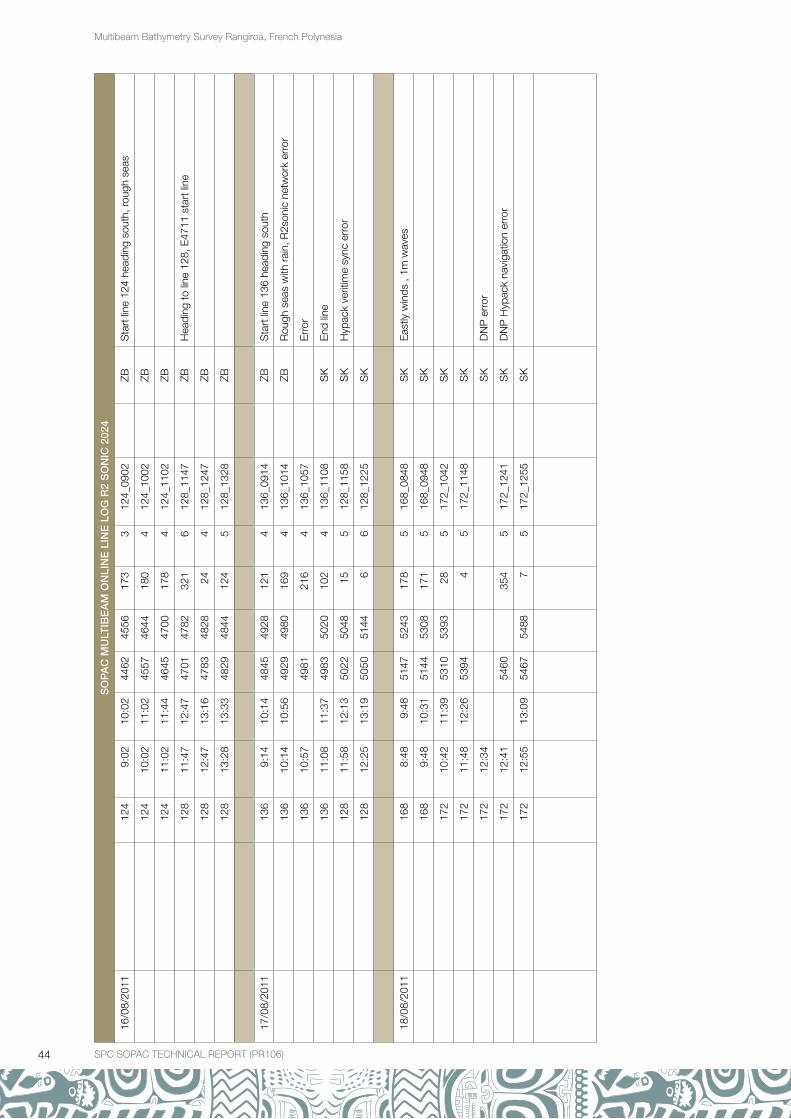
APPENDIX B: MULTIBEAM LOG SHEETS............................................................................................................................... 39
APPENDIX C: RANGIROA, FRENCH POLYNESIA BATHYMETRY CHART

2 SPC SOPAC TECHNICAL REPORT (PR106)
Multibeam Bathymetry Survey Rangiroa, French Polynesia
eXeCUTIVe SUmmArYThis report describes a multibeam bathymetric survey of Rangiroa Lagoon and nearshore areas around the atoll rim, from the northwest (near Tivaru) to the northeast (near Ataiaheo motu). The survey was a component of the Supporting Disaster Risk Reduction in Pacific Overseas Countries and Territories project, conducted by the Secretariat of the Pacific Community Applied Geoscience Division, in collaboration with the Urban planning Department, and the Lighthouses and Beacons Service. This project component called for an investigation of the nearshore and lagoon seabed of Rangiroa Atoll. The survey was carried out using a multibeam echosounder over a period of six months (July to December 2011).
Figure 1. Location of rangiroa Atoll, French Polynesia.

3SPC SOPAC TECHNICAL REPORT (PR106) SPC SOPAC TECHNICAL REPORT (PR106)
Multibeam Bathymetry Survey Rangiroa, French Polynesia
1 InTrODUCTIOn
1.1 BackgroundFrench Polynesia experiences a variety of major natural hazards, some of which are potentially very damaging to human life, the economy and infrastructure. In response, the country has introduced a risk-prevention policy that regulates development activities, and thereby increases protection for people and property against natural disaster hazards. The partnership programme between the Secretariat of the Pacific Community (SPC) and French Polynesia aims to assess the storm surge hazard in the Tuamotu Archipelago at the atoll scale, so that this hazard can be accurately addressed in future land-use plans.
This programme was jointly implemented by the Service de l’Urbanisme of French Polynesia and the Applied Geoscience Division (SOPAC) of SPC. Under this programme SOPAC carried out a multibeam echosounder (MBES) bathymetry survey of Rangiroa Lagoon and the outer reef slope to a depth of around 300 meters (m).
The objective was to investigate the seabed and provide information about water depths in the lagoon and nearshore areas of Rangiroa Atoll to assist French Polynesia in deriving coastal-related information to underpin and inform storm surge hazard mitigation in the Tuamotu Islands.
Figure 2. Chart of rangiroa Atoll, showing the location of the offshore survey areas (excerpt from the Service Hydrographique et Oceanographique de la marine; publication 1997, edition no. 2, 2002 chart 7373 of Archipel de Tuamotu, rangiroa).
1.2 GeographyRangiroa is the largest atoll in the Tuamotus, and one of the largest atolls in the world. It is located about 335 kilometres (km) northeast of Tahiti; the nearest atoll is Tikihau, located 12 km to the west. The main town on Rangiroa is Avatoru, in the northwestern part of the atoll (Figure 3). The atoll consists of about 415 motus, islets and sandbars, with a total land area of about 170 km2. There are approximately one hundred narrow passages in the fringing reef (called hoa). The atoll has a flattened elliptical shape, and is 80 km long and 5–32 km wide. The width of the land is 300–500 m, with a circumference of about 200 km. The lagoon has a maximum depth of 38 m, and a surface area of 1446 km2.
Only two islands, located on the northern end of the atoll, are permanently inhabited. In 2007, the island had a population of 2,473. The main villages are Avatoru, Tiputa, Ohutu, Taeo’o, Fenuaroa, Otepipi and Tivaru. Avatoru and Tiputa are on neighbouring islands, separated by Tiputa pass, one of the atoll’s two major passes (the other is Avatoru pass, immediately to the west of the island of Avatoru).

4 SPC SOPAC TECHNICAL REPORT (PR106)
Multibeam Bathymetry Survey Rangiroa, French Polynesia
Figure 3. Avatoru, in the northwestern part of rangiroa Atoll. The islet of Avatoru is bounded by Avatoru pass to the west and Tiputa pass to the east.
Table 1: Summary of the geography of rangiroa Atoll.
Summary of the geography of Rangiroa Atoll
Location Pacific Ocean: 15.12° S 147.64° W
Land Area The shape of the atoll is a flattened ellipse, extending 80 km from east to west and 32 km from north to south, with an approximate land area of 79 km2.
Coastline The lagoon is enclosed by an almost continuous reef flat, with approximately 100 narrow passages in the fringing reefs. The main villages are Avatoru and Tiputa. Avatoru and Tiputa are built on neighbouring islands that are 2.5 km and 4 km in length, respectively, and separated by Tiputa pass, one of the atoll’s two major passes (the other is Avatoru pass, immediately to the west of the island of Avatoru). The lagoon has a surface area of about 1,446 km2 and a maximum depth of 38 m.
Tides Tides are semi-diurnal with pronounced diurnal inequalities (i.e. two tidal cycles per day of unequal tidal range). Predicted mean range at Rangiroa Atoll is 0.52 m, with a mean spring range of 0.64 m. (Source: tidesandcurrents.noaa.gov/tides10/tab2wc3.html).
Climate Rangiroa has a humid tropical climate, with two relatively distinct seasons (a wet season from December to March, and a dry season from July to October). Rainfall is lower than would be recorded on a high island in the same location due to the lack of relief. The atoll is influenced by the easterly trade winds. The mean temperature ranges around 25°C, with a daily temperature range of approximately 4°C. The mean temperature is 27°C.

5SPC SOPAC TECHNICAL REPORT (PR106)
Multibeam Bathymetry Survey Rangiroa, French Polynesia
SPC SOPAC TECHNICAL REPORT (PR106)
2 reSULTS AnD DISCUSSIOn
2.1 Multibeam bathymetryIn total, 2,118 km of survey lines were run over the 141 days that the vessel was mobilised. A breakdown of data acquisition versus down time is summarised in Figure 5 below, showing that 39% of the time was spent on the acquisition of bathymetric data. The coverage achieved during that time is shown in Figure 5. Further details on line runs can be found in the log sheets attached as Appendix B.
Figure 4: Summary of vessel activity during mobilisation period. The survey vessel Toa nui was mobilised for a total of 141 days. Data was acquired during 54 survey days (39% of the time). The remainder of the time was spent as official leave for French Polynesia survey staff (26%); weather downtime (7%); mechanical downtime (13%); and electrical downtime (15%).
Figure 5: Survey coverage map. Survey lines run inside the lagoon are shown in red, and lines run on the oceanside to the north are shown in blue.
The MBES bathymetry acquired during this study is shown on a chart at a scale of 1:100,000, with contour intervals of 5 m in the lagoon, and 50 m on the nearshore slope. The original chart is drawn to fit an A0 paper size, with a reduced version shown in Figure 6.
26%39%
15%13%
7%
Official leave for FP survey staff (26%)
Weather downtime (7%)
mechanical downtime (13%)
electrical downtime (15%)
Survey days sucessful data acquisition (39%)

6 SPC SOPAC TECHNICAL REPORT (PR106)
Multibeam Bathymetry Survey Rangiroa, French Polynesia
Figure 6: Final bathymetric chart of rangiroa Atoll (scale 1:100,000 printed at A0).
The nearshore survey area on the ocean side of the reef slope extended from the coast to a water depth of approximately 300 m. Minimum water depths were measured near the coast on the outer slope of the fringing reef, with depths increasing in a general seaward direction at a mean slope angle of 31º toward the offshore limits of the survey area. As expected, the seabed is quite irregular locally, with highly variable slope angles ranging from 0º to 83º.
Bathymetric data provide information on the depth and morphology of the seafloor, as well as the shape and size of submarine features. Bathymetric derivatives (shaded relief maps, and three-dimensional rendered surfaces) can be used in addition to the high resolution bathymetry to aid visual interpretation of the seabed morphology (Figure 7 to Figure 10).
Table 2. Bathymetric derivatives.
Bathymetric derivatives
Shaded relief Shaded relief maps use shades of grey to indicate the local orientation of the seafloor relative to a user-defined light source direction. The light source can be thought of as the sun shining on a topographic surface, much like artificial hill shading that illuminates bathymetric roughness. Portions of the surface that face away from the light source reflect less light toward the viewer, and thus appear darker.
Three-dimensional surface
For three-dimensional surfaces, the height of the surface corresponds to the depth of the seafloor.

7SPC SOPAC TECHNICAL REPORT (PR106) SPC SOPAC TECHNICAL REPORT (PR106)
Multibeam Bathymetry Survey Rangiroa, French Polynesia
Figure 7: Shaded relief map of Tiputa channel. Sun illumination angle from the northwest.

8 SPC SOPAC TECHNICAL REPORT (PR106)
Multibeam Bathymetry Survey Rangiroa, French Polynesia
Figure 8: Three-dimensional perspective image of Tiputa channel, looking toward the southeast. Depths shallow (red) to deep (blue), 4x vertical exaggeration.

9SPC SOPAC TECHNICAL REPORT (PR106) SPC SOPAC TECHNICAL REPORT (PR106)
Multibeam Bathymetry Survey Rangiroa, French Polynesia
Figure 9: Shaded relief map of Tiputa channel. Sun illumination angle from the northwest.

10 SPC SOPAC TECHNICAL REPORT (PR106)
Multibeam Bathymetry Survey Rangiroa, French Polynesia
Figu
re 1
0: T
hree
-dim
ensi
onal
per
spec
tive
imag
e of
Ava
toru
cha
nnel
, loo
king
tow
ard
the
sou
thea
st. D
epth
s sh
allo
w (r
ed) t
o d
eep
(blu
e), 4
x ve
rtic
al e
xagg
erat
ion.
11SPC SOPAC TECHNICAL REPORT (PR106) SPC SOPAC TECHNICAL REPORT (PR106)
Multibeam Bathymetry Survey Rangiroa, French Polynesia
3 ACQUISITIOn AnD PrOCeSSInG
3.1 Fieldwork summaryTable 3: Survey particulars.
Survey particulars
Survey vessel Toa Nui
Fieldwork period 01/08/2011 to 13/12/2011
Equipment used R2Sonic 2024 multibeam
All dates and times in this report are given in local Tahiti time (Coordinated Universal Time –10).
3.2 Field personnelTable 4: Personnel
SOPAC
Jens Kruger Physical Oceanographer
Salesh Kumar Senior Technical Assistant
Zulfikar Begg Senior Technical Assistant
Peni Musunamasi Electronics Engineer
Avitesh Ram Electronics Techinician
Maleli Turangabeci Electronics Techinician
French Polynesia
Eileen Handerson Hydrographic Surveyor
Manoël Alvis Captain
3.3 Geodetic reference systemSurvey results were mapped in terms of the following geodetic reference system.
Table 5: Geodetic reference system
Geodetic reference system
Geodetic datum Universal Transverse Mercator Zone 6 South
ellipsoid WGS 84
semi-major axis 6378137.000
flattening (1/f) 298.257223563
eccentricity sq. (e2 )
Projection UTM Zone 6 South
projection type Transverse Mercator
Central meridian 147 00 00.000W
Reference latitude 00 00 00.000N
False easting 500000.000
False northing 1000000.000

12 SPC SOPAC TECHNICAL REPORT (PR106)
Multibeam Bathymetry Survey Rangiroa, French Polynesia
Geodetic reference system
Scale factor 0.9996000000
grid unit metres
Geodetic transformation from WGS 84 (GPS satellite datum) to UTM 6 South
source coordinate system WGS 84
target coordinate system UTM 6 South
transformation parameters
dX 0.00
dY 0.00
dZ 0.00
rX 0.00000
rY 0.00000
rZ 0.00000
scale 0.00000
3.4 Vessel description and static offsets
Table 6: Vessel description and static offsets
Vessel description and static offsets
Sensor X (m) Y (m) Z (m)
Not to scale
Reference point at water level 0.00 0.00 0.00
Motion reference unit (MRU) 0.00 0.00 -0.115
Positioning antenna (GPS1) 0.00 3.188 2.610
Multibeam echosounder (MBES) -1.875 -1.728 0.685
Vessel
Name Toa Nui
Length overall 9.90 m
Beam (mid) 3.10 m
Draft (mid) 0.75 m
Displacement 3.95 T
Port of registry Tahiti
Radio call sign FGD7522
Classification Motor yacht
3.4 Vessel description and static offsets
Table 6: Vessel description and static offsets
Sensor X (m) Y (m) Z (m) Not to scale
Reference point at water level 0.00 0.00 0.00
Motion reference unit (MRU) 0.00 0.00 -0.115
Positioning antenna (GPS1) 0.00 3.188 2.610
Multibeam echosounder (MBES) -1.875 -1.728 0.685
Vessel
Name Toa Nui
Length overall 9.90 m
Beam (mid) 3.10 m
Draft (mid) 0.75 m
Displacement 3.95 T
Port of registry Tahiti
Radio call sign FGD7522
Classification Motor yacht
-X
+X
+Y -Y MBES
MRU GPS1 GPS2
MBES
GPS2
-Z
+Z
+Y -Y
Water level MRU
GPS1
13SPC SOPAC TECHNICAL REPORT (PR106) SPC SOPAC TECHNICAL REPORT (PR106)
Multibeam Bathymetry Survey Rangiroa, French Polynesia
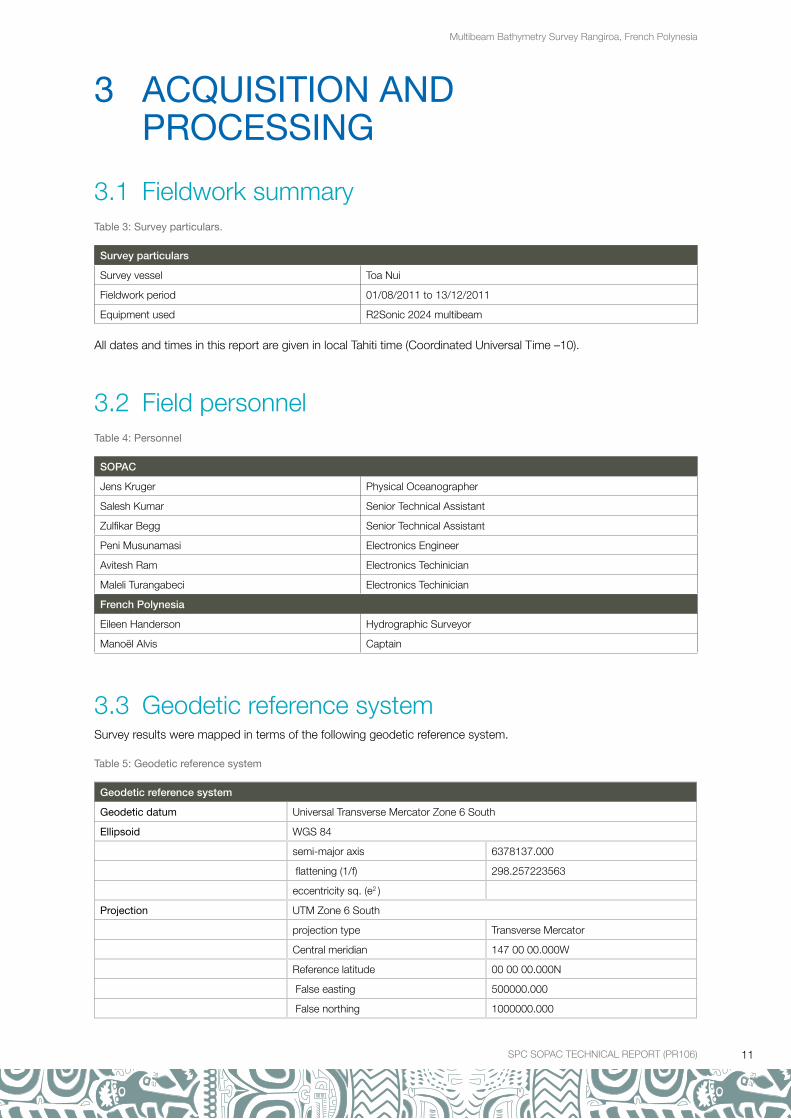
Figure 11: The survey vessel Toa nui.
3.5 Positioning control and headingThe vessel’s origin is the reference by which all devices and tracking points are positioned on the vessel. Each sensor is referenced to the origin based on the distance in survey units. It is starboard (X-direction), forward (Y-direction) and vertical (Z-direction). Vessel offsets are measured from the static water line, and are positive downward (Table 6).
Positioning was by the MarineSTAR 9200 G2H DGNSS dual frequency positioning equipment. The addition of the G2 service provided an accuracy of 0.2 m. The patch test was conducted in Tahiti and again in Rangiroa at the start and end of the survey. The MarineSTAR also provided heading information by use of a second antenna (see GPS2 in diagram of Table 6).
3.6 Survey computerThe survey computer was a Windows XP PC, running Hypack 11.0.1.49. This computer was used for continuous online data logging and computation of positioning and digital bathymetry. The package also provided a line control display for the helm. The online operator continuously monitored a range of quality control parameters.
An off-line Hypack 11.0.1.49 package was used in the office for replaying and post-processing of track data and bathymetry. An A0 plotter was available for the production of charts.
3.7 Multibeam echosounder A R2Sonic 2024 wideband multibeam echosounder system was temporarily installed on Toa Nui, and used to provide swath bathymetry data. An MBES provided high resolution information about the depth of water from the surface to the seafloor in a water body. The main instrumental and operating parameters are listed below.

14 SPC SOPAC TECHNICAL REPORT (PR106)
Multibeam Bathymetry Survey Rangiroa, French Polynesia
Table 7: multibeam echosounder parameters.
Multibeam echosounder parameters
Instrumentation
Multibeam echosounder R2Sonic 2024
Transducer mount Port side-mounted
Motion reference unit TSS DMS 2-05 Dynamic Motion Sensor
Sound velocity probe at transducer Valeport Mini SV
r2Sonic 2024 System Specification
Frequency 400 kHz/200 kHz
Beamwidth - across track 0.5° @ 400 kHz / 1.0° @ 200 kHz
Beamwidth - along track 1.0° @ 400 kHz / 2.0° @ 200 kHz
Number of beams 256
Swath sector 10° to 160° (user selectable)
Maximum slant range 500 meters
Pulse length 15 µsec - 1000 µsec
Pulse type Shaped Continuous Wave (CW)
Depth rating 100 meters
Operating temperature 0° C to 40° C
Dynamic offset calibration Rangiroa 01 August 2011
Roll correction -2.09
Pitch correction 0.25
Yaw correction -2.0
GPS latency correction 0.0
3.8 Multibeam echosounder data processingHypack 11.0.1.49 software was used for post-processing the MBES survey data. The production of contour maps was done using Surfer 10.7.972 software. The processing and gridding sequences are listed below.
Table 8: Data processing.
Data processing
Post-processing sequence
Phase 1 Tide (water level) and sound velocity corrections.
Phase 2 Search and filter options are used for editing the data. Removed poor-quality beams (quality <3) and outliers from individual survey lines.
Phase 3 Applied 4th standard deviation filter to remove outliers from median depth. Further manual cleaning of outliers.
Output ASCII XYZ file using actual positions of median sounding depths in the project coordinate system.
map Production Sequence
Input XYZ output data from Hypack reduced to 1 mm at charting scale (e.g. 50 m-grid size for a chart at 1:50 000).
Surface model XYZ output data were gridded using the Kriging method in Surfer 10.7.972. Data gaps were interpolated using three times the survey line spacing.
Output DXF contours, PDF chart, backdrop images, and DTM model in the project coordinate system. See Appendix C
Various levels of smoothing were applied to the contours and digital terrain model (DTM) to give a more realistic impression of the seabed without removing any real features from the dataset. However, due to the fact that the majority of survey lines were oriented from north to south, some striping can be observed on the final gridded and interpolated dataset.

15SPC SOPAC TECHNICAL REPORT (PR106) SPC SOPAC TECHNICAL REPORT (PR106)
Multibeam Bathymetry Survey Rangiroa, French Polynesia
3.9 Tidal informationObserved soundings were reduced to the chart datum using the observed tidal elevations from the Rangiroa tide gauge. The table below details the station metadata.
Table 9: Tidal station metadata.
Tidal station metadata
Code rangi
Country France
Location Rangiroa Atoll (Tuamotu, French Polynesia)
Status Operational
Local contact University of French Polynesia (France)
Other contact Service Hydrographique et Océanographique de la Marine (France)
Latitude -14.945834667°
Longitude -147.706037917°
Connection GTS message
GTS message type SEHI40
Sensor 1
Type of sensor Pressure
Sampling rate (min) 2
Sensor 2
Type of sensor Radar
Sampling rate (min) 2
The tide data were obtained from the Intergovernmental Oceanographic Commission website (www.ioc-sealevelmonitoring.org). Data on this website are not reduced to chart datum and a correction of -5.945 m was, therefore, applied to the pressure sensor values (Marie Protat, Service Hydrographique et Océanographique de la Marine, pers. comm.).
3.10 Sound velocity profilingThe accuracy of the depth soundings depends in part on the variation of the speed of sound with water depth. Sound velocity profiles are, therefore, required in order to find the correct depth and location of water depth soundings.The speed of sound in seawater varies with temperature, salinity and depth, and was determined by measuring the conductivity, temperature and depth (CTD) through the water column. The main instrumental, operational, and processing parameters are listed below.
Table 10: Sound velocity profiling.
Sound velocity profiling
CTD instrumentation
Make SeaBird Electronics
Model SeaCat 19 (self-powered, self-contained)
Serial number 2795
Depth rating 3,000 m
Operating parameters
Sample rate 1 scan every 0.5 s
Maximum depth Limited to 200 m due to rope length
Data recorded Profiles of conductivity, temperature, and pressure

16 SPC SOPAC TECHNICAL REPORT (PR106)
Multibeam Bathymetry Survey Rangiroa, French Polynesia
Sound velocity profiling
Data processing
Positioning The profile position was taken at the GPS attenna near the start of the downcast. No allowance was made for instrument or vessel drift over the duration of the profile, which may be significant (>50 m).
Data conversion Convert raw data (.hex) to a .cnv file. The following values are output from the recorded data:
•Pressure,dbar•Depth,m(derivedusingsaltwateratlocallatitude)•Temperature,°C(ITS-90)•Salinity,psu(derived)•Density,kgm-3 (derived)•Soundvelocity,ms-1 (derived using Chen and Millero 1977)
Bin average Average data into 1 m depth bins. No filtering was applied.
Output Processed data is saved in ASCII text format with the date_bin.cnv.
The CTD profile details are listed below, with locations plotted in Figure 12. Summaries of the CTD profile data in graphical form are shown in Appendix A.
Table 11: CTD profile details.
CTD profile details
CTD casts Date Time easting northing Depth (m)
CTD cast 1 03/08/2011 12:43 426531.13 8340621.39 33
CTD cast 2 04/08/2011 09:55 425275.8 8331685.1 36
CTD cast 3 05/08/2011 10:21 420512.09 8330968.56 28
CTD cast 4 07/08/2011 09:22 432057.4 8329436.6 30
CTD cast 5 09/08/2011 14:11 431340.36 8344030.48 24
CTD cast 6 10/08/2011 10:32 409312.33 8345559.75 21
CTD cast 7 11/08/2011 12:36 420998.66 8343142.51 26.5
CTD cast 8 12/08/2011 11:29 427526.12 8316849.16 30
CTD cast 9 14/08/2011 11:11 432533.56 8324540.37 29
CTD cast 10 15/08/2011 13:02 434920.94 8330379.36 28
CTD cast 11 16/08/2011 13:20 437263.4 8327419.46 30
CTD cast 12 17/08/2011 12:19 437217.61 8331051.16 28
CTD cast 13 18/08/2011 11:40 424091.38 8323799.33 32
CTD cast 14 21/08/2011 12:57 428359.4 8337199.26 35
CTD cast 15 23/08/2011 11:36 421610.51 8326826.94 28
CTD cast 16 24/08/2011 14:18 418133.35 8329982.81 26
CTD cast 17 29/08/2011 11:14 422875.24 8331083.36 34
CTD cast 18 30/08/2011 12:15 415776.73 8339525.67 30
CTD cast 19 31/08/2011 12:56 424817.61 8317423.33 23
CTD cast 20 02/09/2011 12:26 413363.27 8340145.3 28
CTD cast 21 06/09/2011 15:08 408572.34 8331638.08 18
CTD cast 22 07/09/2011 13:46 404925.64 8330558.14 18
CTD cast 23 12/09/2011 14:52 413311.2 8326739.73 29
CTD cast 24 13/09/2011 15:08 403635.08 8338633.92 20
CTD cast 25 14/09/2011 14:15 424126.64 8323178.7 33
CTD cast 26 15/09/2011 15:00 405023.4 8332326.78 19
CTD cast 27 16/09/2011 14:12 428969.21 8329763.81 30
CTD cast 28 27/09/2011 12:23 440949.31 8316954.74 26

17SPC SOPAC TECHNICAL REPORT (PR106) SPC SOPAC TECHNICAL REPORT (PR106)
Multibeam Bathymetry Survey Rangiroa, French Polynesia
CTD profile details
CTD casts Date Time easting northing Depth (m)
CTD cast 29 28/09/2011 13:18 443324.1 8320040.9 28
CTD cast 30 29/09/2011 14:10 444518.64 8324167.72 26
CTD cast 31 30/09/2011 12:30 430061.84 8320207.8 24
CTD cast 32 02/10/2011 13:45 466090.56 8312398.3 18
CTD cast 33 03/10/2011 14:08 464903.84 8310158.54 20
CTD cast 34 04/10/2011 12:32 463123.96 8310708.03 21
CTD cast 35 05/10/2011 13:02 446952.08 8319763.98 30
CTD cast 36 06/10/2011 13:30 449327.49 8318668.29 21
CTD cast 37 21/10/2011 12:12 451430.21 8310854.65 22
CTD cast 38 24/10/2011 10:50 462446.17 8314483.54 20
CTD cast 39 25/10/2011 13:26 460758.87 8313003.51 20
CTD cast 40 26/10/2011 13:02 459519.88 8312249.52 25
CTD cast 41 17/11/2011 10:30 421152.22 8332210.94 29
CTD cast 42 21/11/2011 13:53 457106.55 8312252.72 25
CTD cast 43 02/12/2011 13:28 430742.37 8342447.75 28
CTD cast 44 04/12/2011 13:20 432240.72 8343765.42 21
CTD cast 45 05/12/2011 13:55 453208.77 8317452.41 27
CTD cast 46 06/12/2011 13:28 406060.54 8344844.12 97
CTD cast 47 07/12/2011 13:20 406463.13 8336766.05 25
CTD cast 48 08/12/2011 12:30 462331.51 8319638.97 196
CTD cast 49 09/12/2011 13:35 426616.45 8347802.18 113
CTD cast 50 09/12/2011 13:20 431428.95 8344416.16 24
CTD cast 51 11/12/2011 13:28 427385.84 8346591.48 18
CTD cast 52 12/12/2011 10:53 427394.9 8346604.19 18

18 SPC SOPAC TECHNICAL REPORT (PR106)
Multibeam Bathymetry Survey Rangiroa, French Polynesia
Figu
re 1
2: L
ocat
ion
of c
ond
uctiv
ity,
tem
per
atur
e an
d d
epth
(CTD
) pro
files
for
ran
giro
a A
toll.
Loc
atio
ns o
f C
TD c
asts
are
sho
wn
by
yello
w c
ircle
s an
d t
he c
ast
num
ber
is in
dic
ated
by
the
red
num
ber
. Th
e b
ackd
rop
is a
200
2 IK
On
OS
sat
ellit
e im
age.

19SPC SOPAC TECHNICAL REPORT (PR106) SPC SOPAC TECHNICAL REPORT (PR106)
Multibeam Bathymetry Survey Rangiroa, French Polynesia
4 APPenDICeS
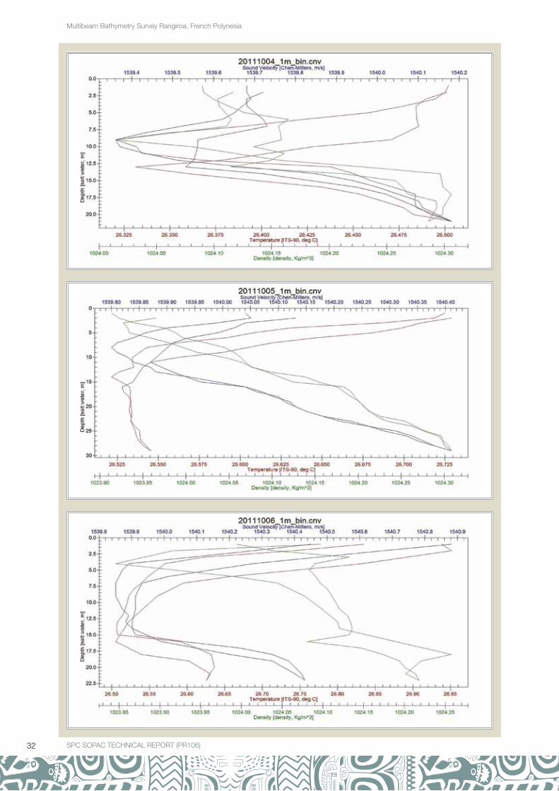
Appendix A: Conductivity, Temperature and Depth (CTD) profilesThis appendix shows plots of the CTD profiles. Both downcast and upcast are shown. The title of each plot indicates the date on which the cast was done year, month, and date format (yyyymmdd). Please refer to Table 11 and Figure 12 for numbering and locations.
The plots consist of three x-axis and one y-axis. The y-axis shows depth in metres. The different x-axis show sound velocity, temperature and density as follows: the first x-axis at the top of the plot shows sound velocity in m/s (blue labels and line); the second x-axis under the plot shows temperature in degrees Celcius (red labels and line); and the third x-axis at the bottom of the plot shows Density in kg/m3 (green labels and line).

20 SPC SOPAC TECHNICAL REPORT (PR106)
Multibeam Bathymetry Survey Rangiroa, French Polynesia

21SPC SOPAC TECHNICAL REPORT (PR106) SPC SOPAC TECHNICAL REPORT (PR106)
Multibeam Bathymetry Survey Rangiroa, French Polynesia

22 SPC SOPAC TECHNICAL REPORT (PR106)
Multibeam Bathymetry Survey Rangiroa, French Polynesia

23SPC SOPAC TECHNICAL REPORT (PR106) SPC SOPAC TECHNICAL REPORT (PR106)
Multibeam Bathymetry Survey Rangiroa, French Polynesia

24 SPC SOPAC TECHNICAL REPORT (PR106)
Multibeam Bathymetry Survey Rangiroa, French Polynesia

25SPC SOPAC TECHNICAL REPORT (PR106) SPC SOPAC TECHNICAL REPORT (PR106)
Multibeam Bathymetry Survey Rangiroa, French Polynesia

26 SPC SOPAC TECHNICAL REPORT (PR106)
Multibeam Bathymetry Survey Rangiroa, French Polynesia

27SPC SOPAC TECHNICAL REPORT (PR106) SPC SOPAC TECHNICAL REPORT (PR106)
Multibeam Bathymetry Survey Rangiroa, French Polynesia

28 SPC SOPAC TECHNICAL REPORT (PR106)
Multibeam Bathymetry Survey Rangiroa, French Polynesia

29SPC SOPAC TECHNICAL REPORT (PR106) SPC SOPAC TECHNICAL REPORT (PR106)
Multibeam Bathymetry Survey Rangiroa, French Polynesia

30 SPC SOPAC TECHNICAL REPORT (PR106)
Multibeam Bathymetry Survey Rangiroa, French Polynesia

31SPC SOPAC TECHNICAL REPORT (PR106) SPC SOPAC TECHNICAL REPORT (PR106)
Multibeam Bathymetry Survey Rangiroa, French Polynesia
32 SPC SOPAC TECHNICAL REPORT (PR106)
Multibeam Bathymetry Survey Rangiroa, French Polynesia

33SPC SOPAC TECHNICAL REPORT (PR106) SPC SOPAC TECHNICAL REPORT (PR106)
Multibeam Bathymetry Survey Rangiroa, French Polynesia

34 SPC SOPAC TECHNICAL REPORT (PR106)
Multibeam Bathymetry Survey Rangiroa, French Polynesia

35SPC SOPAC TECHNICAL REPORT (PR106) SPC SOPAC TECHNICAL REPORT (PR106)
Multibeam Bathymetry Survey Rangiroa, French Polynesia

36 SPC SOPAC TECHNICAL REPORT (PR106)
Multibeam Bathymetry Survey Rangiroa, French Polynesia

37SPC SOPAC TECHNICAL REPORT (PR106) SPC SOPAC TECHNICAL REPORT (PR106)
Multibeam Bathymetry Survey Rangiroa, French Polynesia

38 SPC SOPAC TECHNICAL REPORT (PR106)
Multibeam Bathymetry Survey Rangiroa, French Polynesia

39SPC SOPAC TECHNICAL REPORT (PR106) SPC SOPAC TECHNICAL REPORT (PR106)
Multibeam Bathymetry Survey Rangiroa, French Polynesia
App
endi
x B
: Mul
tibea
m lo
g sh
eets S
OP
AC
MU
LTIB
EA
M O
NLI
NE
LIN
E L
OG
R2
SO
NIC
202
4
Sta
tic O
ffset
sH
ypac
k P
roje
ct N
ame:
PF_
Ran
giro
a
GP
S: X
= 0
.0; Y
= 3
.188
; Z =
2.6
10C
ount
ry: F
renc
h P
olyn
esia
MR
U: X
= 0
.00;
Y =
0.0
0; Z
=-
0.11
5A
rea:
Ran
giro
a
MB
ES
Hea
d: X
= -
1.87
5; Y
= -
1.72
8.4;
Z =
0.6
85Ve
ssel
: Toa
Nui
Dyn
amic
Offs
ets
MB
ES
Sys
tem
: R2S
ON
IC 2
024
Yaw
= -
2.0;
Pitc
h =
0.2
5; R
oll =
-2.
09; L
aten
cy =
0.0
0P
ositi
onin
g: M
arin
eSta
r
Dat
eLo
catio
nLi
ne
no.
Tim
eFi
x
HD
GS
PD
File
nam
e (.H
SX
)Lo
g Fi
le
(.LO
G)
Line
QC
Com
men
ts /
Onl
ine
chan
ges
SO
Le
OL
SO
Le
OL
1/08
/201
1R
AN
GIR
OA
LA
GO
ON
2014
:12
31
53.
602
0_14
12
P
atch
Tes
t Lin
es
19
13
63.
101
9_14
18
18
32
44
018_
1423
17
12
73
017_
1426
16
32
14.
701
6_14
31
9
13
13.
800
9_14
34
8
33
63.
900
8_14
39
7
11
83.
500
7_14
42
7
31
54
007_
1446
8
13
23
008_
1450
9
32
04.
800
9_14
54
16
12
33.
101
6_14
57
17
31
15
017_
1502
18
12
64.
201
8_15
05
19
33
25.
101
9_15
09
20
14
54.
302
0_15
12
21
13
03.
702
1_15
16

40 SPC SOPAC TECHNICAL REPORT (PR106)
Multibeam Bathymetry Survey Rangiroa, French Polynesia
SO
PA
C M
ULT
IBE
AM
ON
LIN
E L
INE
LO
G R
2 S
ON
IC 2
024
18
13
47
018_
1522
2/08
/201
1
1
13
23.
700
1_09
10
6
32
04.
200
6_09
14
2
13
33.
900
2_09
16
3
32
64.
600
3_09
20
4
14
64.
400
4_09
22
5
30
74.
600
5_09
25
5
13
43.
700
5_09
29
4
31
14.
600
4_09
31
3
13
44.
400
3_09
34
2
32
04.
600
2_09
36
6
14
13.
100
6_09
39
1
30
54.
700
1_09
24
4
13
77.
300
4_09
48
9
31
3.5
009_
0957
8
22
34.
800
8_10
00
5
11
36.
500
5_10
10
Li
ne T
o Ti
puta
Wha
rf
3/08
/201
1ra
ngiro
a la
ggon
160
7:50
8:50
170
189
5.8
160_
0075
0
160
8:50
9;50
7112
618
02.
8516
0_08
50
160
9:50
10;3
512
7
151
2.94
160_
0950
164
10:3
611
:18
15
221
65
164_
1036
Sto
p lin
e (H
ypac
k pr
oble
m)
164
11:1
811
:53
217
250
165
164_
1118
164
11:5
312
:45
251
315
357
5.4
164_
1153
End
line
E 3
14, c
ontin
ue s
hore
par
alle
l to
wha
rf
4/08
/201
1R
angi
roa
Lago
on16
86:
497:
4931
635
726
95
168_
0649
Sta
rt o
f sur
vey,
hea
ding
tow
ards
line
168
168
7:49
8:49
358
414
184
316
8_07
49
168
8:49
9:46
415
467
179
316
8 _0
849

41SPC SOPAC TECHNICAL REPORT (PR106) SPC SOPAC TECHNICAL REPORT (PR106)
Multibeam Bathymetry Survey Rangiroa, French Polynesia
SO
PA
C M
ULT
IBE
AM
ON
LIN
E L
INE
LO
G R
2 S
ON
IC 2
024
172
9:57
10:5
746
853
428
04.
817
2_09
57
172
10:5
711
:57
534
619
284.
517
2_10
57
172
11:5
70:
0062
062
516
5.2
172_
1157
End
of l
ine
176
0:14
12:2
762
663
462
62.
717
6_12
01
G
oing
acr
oss
shor
e, a
nd th
en e
nd o
f lin
e.
5/08
/201
1R
angi
roa
Lago
on18
46:
517:
5163
564
330
74.
518
4_06
51
H
eadi
ng to
war
ds li
ne 1
84
184
7:51
8:51
643
699
171
3.5
184_
0751
184
8:51
9:51
700
764
165
3.7
184_
0851
184
9:51
10:2
076
579
716
63.
918
4_09
51
E
nd o
f lin
e 18
4
188
10:2
811
:28
798
864
291
3.18
188_
1028
Hea
ding
tow
ards
line
188
188
11:2
812
:28
865
945
214.
418
8_11
28
188
12:2
812
:44
946
970
6.1
4.5
188_
1228
End
of l
ine
188
184
12:5
013
:26
973
980
184
3.2
184_
1250
Hea
ding
to li
ne 1
2 w
est–
east
.
1212
:58
13:5
898
213
.54
493.
412
_125
8
Li
ne 1
2 w
est–
east
, end
of l
ine
12 s
urve
y
1313
:55
13:5
710
3110
3214
62.
813
_135
5
H
eadi
ng to
line
13
wes
t–ea
st
1413
:58
14:2
410
3110
6617
84.
314
_135
8
H
eadi
ng to
line
14,
end
of l
ine
goin
g to
wha
rf
7/08
/201
1R
angi
roa
Lago
on15
27:
098:
0910
6711
3611
35
152_
0709
ZB
Hea
ding
to s
tart
of l
ine
152,
E10
75 s
tart
ing
line
152
8:09
9:09
1137
1223
160
4.8
152_
0809
ZB
E11
46, E
1147
pro
blem
in H
ypac
k na
viga
tion
152
9:09
9:18
1224
1237
189
5.6
152_
0909
ZB
E11
49 p
robl
em in
Hyp
ack
navi
gatio
n
156
9:34
12
39
336
4.8
156_
0934
ZB
E11
93 e
rror
, E12
06 e
rror
, Hea
ding
to L
ine
156
Hyp
ack
erro
r

42 SPC SOPAC TECHNICAL REPORT (PR106)
Multibeam Bathymetry Survey Rangiroa, French Polynesia
SO
PA
C M
ULT
IBE
AM
ON
LIN
E L
INE
LO
G R
2 S
ON
IC 2
024
709:
4810
:48
1241
1356
264
770
_094
8
ZBS
tart
line
70
7010
:48
10;5
313
5713
6327
36
70_1
048
S
K
192
10:5
611
:56
1365
1454
45
192_
1056
S
KN
S li
ne
192
11:5
612
:53
1455
1548
196
192_
1156
S
KE
nd o
f lin
e
1612
:56
13:5
615
4816
2817
03
16_1
548
ZB
EW
hea
ding
to li
ne 1
6 st
art
1613
:56
14:2
716
2916
5984
4.9
16_1
356
ZB
End
of s
urve
y
9/08
/201
1
156
9:38
10:3
816
6017
2679
.95
156_
0938
ZB
Hea
ding
to li
ne 1
56
156
10:3
811
:38
1727
1798
161
4.3
156_
1038
ZB
1.5
to 2
m w
aves
156
11:3
812
:03
1799
1830
171
515
6_11
38
SK
148
12:0
412
:23
1831
1834
634.
914
8_12
04
SK
Hea
ding
to li
ne 1
48
148
12:2
313
:00
1834
1884
144.
114
8_12
23
SK
r2 s
onic
tim
e sy
nc e
rror
148
13:0
414
:04
1885
1971
95
148_
1304
ZB
148
14:0
414
:16
1972
1981
54.
314
8_14
04
ZBN
etw
ork
rece
ive
erro
r R
2son
ic, e
nd o
f lin
e 14
8
10/0
8/20
11
188:
449:
4420
0021
0727
75
18_0
844
ZB
Sta
rt li
ne 1
8, g
oing
wes
t
189:
4410
:24
2108
2184
272
4.9
18_0
944
ZB
NM
EA
gyr
o ba
d da
ta e
rror
1810
:37
10:4
621
8622
0028
14
18_1
037
ZB
E21
88-g
yro
erro
r, en
d of
line
18
2210
:51
11:5
122
0122
4124
35
22_1
051
S
KH
eadi
ng to
sta
rt li
ne 2
2
2211
:51
12:5
122
4222
9710
94
22_1
151
S
K
2212
:51
13:5
122
9723
6390
3.2
22_1
251
ZB
2213
:51
14:3
623
6424
3987
4.2
22_1
351
ZB
E23
73 h
ysw
eep
inte
rface
err
or, e
nd o
f lin
e
11/0
8/20
11
308:
218:
4424
4024
4116
35
30_0
821
ZB
Hea
ding
tow
ards
line
30
wes
t
308:
459:
4524
4225
4931
94.
830
_084
5
ZBS
tart
line
30
309:
4510
:45
2550
2661
280
5.4
30_0
945
ZB
3010
:45
10:5
226
6226
6927
55.
430
_104
5
ZBE
nd li
ne
2610
:54
11:0
526
7126
8221
226
_105
4
ZBH
eadi
ng to
line
26
2611
:05
12:0
526
8327
7754
426
_110
5
SK
Sta
rt li
ne 2
6
2612
:05
12:3
427
7828
2791
526
_110
5
SK
Sto
p lin
e fo
r C
TD

43SPC SOPAC TECHNICAL REPORT (PR106) SPC SOPAC TECHNICAL REPORT (PR106)
Multibeam Bathymetry Survey Rangiroa, French Polynesia
SO
PA
C M
ULT
IBE
AM
ON
LIN
E L
INE
LO
G R
2 S
ON
IC 2
024
2612
:41
13:4
128
2829
1475
226
_124
1
ZB
2613
:41
14:0
129
1529
5793
6.5
26_1
341
ZB
End
line
12/0
8/20
11
160
8:19
9:01
2959
3035
177
516
0_08
19
ZBS
tart
lin
e 16
0 m
iddl
e of
lag
oon,
goi
ng s
outh
, ca
lm s
ea,
R2s
onic
err
or
160
9:10
9:59
3036
3125
962
160_
0910
ZB
R2s
onic
net
wro
k re
ceiv
e er
ror,
end
of li
ne 1
60
164
10:3
211
:28
3126
3222
235
5.2
164_
1032
ZB
Hea
ding
to li
ne 1
64
164
11:3
812
:07
3223
3280
354
3.6
164_
1138
ZB
162
12:1
113
:11
3281
3395
186
162_
1211
ZB
Sta
rtin
g lin
e 16
2
162
13:1
113
:31
3396
3435
36
162_
1311
ZB
Line
end
14/0
8/20
11
140
7:22
7:27
3436
3441
116
814
0_07
22
ZBH
eadi
ng to
line
140
140
7:48
8:48
3443
3560
157
314
0_07
48
ZBS
tart
line
140
140
8:48
9:48
3561
3673
185
6.21
140_
0848
ZB
140
9:48
10:1
136
7437
1518
060
314
0_09
48
SK
End
of l
ine,
Uto
to
144
10:1
511
:11
3716
3803
311
4.6
144_
1015
ZB
Hea
ding
to li
ne 1
44, E
3718
line
144
sta
rts
144
11:4
712
:47
3805
3912
345
4.8
144_
1147
S
K
144
12:4
713
:32
3913
4000
347
5.18
144_
1247
613
:35
13:5
540
0240
1827
26_
1335
Tipu
ta P
ass
15/0
8/20
11
132
8:39
9:39
4020
4133
174
613
2_08
39
ZBS
tart
line
132
, hea
ding
sou
th
132
9:39
10:3
941
3442
1817
95
132_
0939
ZB
1m w
aves
, SE
win
ds
132
10:3
911
:20
4219
4281
179
413
2_10
39
SK
136
11:2
011
:29
4282
4282
283
413
6_11
20
SK
Hea
ding
to s
tart
line
136
136
11:2
912
:29
4285
4381
195
136_
1129
ZB
136
12:2
912
:59
4382
4429
65
136_
1229
ZB
Err
or H
ypac
k na
viga
tion
136
13:2
613
:34
4432
4441
95
136_
1326
Err
or H
ypac
k na
viga
tion
136
13:3
513
:35
4442
4443
136_
1335
DN
P
136
13:4
513
:52
4443
4461
8.7
13
6_13
45
Te
stin
g H
ypac
k,,,D
NP
44 SPC SOPAC TECHNICAL REPORT (PR106)
Multibeam Bathymetry Survey Rangiroa, French Polynesia
SO
PA
C M
ULT
IBE
AM
ON
LIN
E L
INE
LO
G R
2 S
ON
IC 2
024
16/0
8/20
11
124
9:02
10:0
244
6245
5617
33
124_
0902
ZB
Sta
rt li
ne 1
24 h
eadi
ng s
outh
, rou
gh s
eas
124
10:0
211
:02
4557
4644
180
412
4_10
02
ZB
124
11:0
211
:44
4645
4700
178
412
4_11
02
ZB
128
11:4
712
:47
4701
4782
321
612
8_11
47
ZBH
eadi
ng to
line
128
, E47
11 s
tart
line
128
12:4
713
:16
4783
4828
244
128_
1247
ZB
128
13:2
813
:33
4829
4844
124
512
8_13
28
ZB
17/0
8/20
11
136
9:14
10:1
448
4549
2812
14
136_
0914
ZB
Sta
rt li
ne 1
36 h
eadi
ng s
outh
136
10:1
410
:56
4929
4980
169
413
6_10
14
ZBR
ough
sea
s w
ith r
ain,
R2s
onic
net
wor
k er
ror
136
10:5
749
81
216
413
6_10
57
E
rror
136
11:0
811
:37
4983
5020
102
413
6_11
08
SK
End
line
128
11:5
812
:13
5022
5048
155
128_
1158
S
KH
ypac
k ve
ritim
e sy
nc e
rror
128
12:2
513
:19
5050
5144
66
128_
1225
S
K
18/0
8/20
11
168
8:48
9:48
5147
5243
178
516
8_08
48
SK
Eas
tly w
inds
, 1m
wav
es
168
9:48
10:3
151
4453
0817
15
168_
0948
S
K
172
10:4
211
:39
5310
5393
285
172_
1042
S
K
172
11:4
812
:26
5394
4
517
2_11
48
SK
172
12:3
4
SK
DN
P e
rror
172
12:4
1
5460
35
45
172_
1241
S
KD
NP
Hyp
ack
navi
gatio
n er
ror
172
12:5
513
:09
5467
5488
75
172_
1255
S
K

45SPC SOPAC TECHNICAL REPORT (PR106) SPC SOPAC TECHNICAL REPORT (PR106)
Multibeam Bathymetry Survey Rangiroa, French Polynesia
SO
PA
C M
ULT
IBE
AM
ON
LIN
E L
INE
LO
G R
2 S
ON
IC 2
024
21/0
8/20
11
E
rror
retu
rned
to w
harf
to c
heck
eve
ryth
ing
E
rror
with
the
NW
mat
rix, t
here
fore
cre
ated
new
nw
mat
rix
ZB
166
10:0
311
:03
5491
5574
230
316
6_10
03
ZBVe
ry ro
ugh
seas
166
11:0
312
:00
5575
5654
150
316
6_11
03
ZBE
nd li
ne
158
12:1
612
:57
5657
5716
863
158_
1216
ZB
Hea
ding
to li
ne 1
58
158
13:0
513
:59
5717
5810
75
158_
1305
ZB
End
line
23/0
8/20
11
176
8:12
9:12
5812
5900
175
517
6_08
12
ZBS
tart
line
, rou
gh s
eas
176
9:12
10:0
659
0159
8417
54
176_
0912
ZB
180
10:0
810
:33
5985
6006
253
318
0:10
08
ZBH
eadi
ng to
line
180
, err
or
180
10:3
4
6007
6
618
0_10
34
ZBE
rror
-R2s
onic
net
wor
k
180
10:3
611
:29
6010
6104
143
180_
1036
ZB
Sto
pped
for
CTD
180
11:3
812
:38
6105
6209
338
418
0_11
38
ZB
180
12:3
813
:31
6210
6317
358
618
0_12
38
ZBE
nd o
f lin
e
24/0
8/20
11
204
8:54
9:54
6318
6438
181
720
4_08
54
ZBS
tart
line
204
goi
ng s
outh
204
9:54
10:0
364
3864
5417
135
204_
0954
ZB
End
of l
ine
200
10:0
410
:20
6455
6467
101
520
0_10
04
ZBH
eadi
ng to
line
200

46 SPC SOPAC TECHNICAL REPORT (PR106)
Multibeam Bathymetry Survey Rangiroa, French Polynesia
SO
PA
C M
ULT
IBE
AM
ON
LIN
E L
INE
LO
G R
2 S
ON
IC 2
024
200
10:2
211
:22
6459
6594
124
200_
1022
ZB
End
of l
ine
196
11:3
012
:30
6596
6712
175
519
6_11
30
ZBS
tart
line
196
goi
ng s
outh
196
12:3
012
:48
6713
6746
178
519
6_12
30
ZBE
nd o
f lin
e
192
12:4
812
:57
6747
6748
138
619
2_12
48
ZBH
eadi
ng t
o lin
e 19
2,E
6747
sta
rt li
ne,
stop
ped
for
fuel
ing-
100L
fille
d
192
13:1
413
:58
6750
6846
115
192_
1314
ZB
192
14:0
014
:17
6847
6881
145
192_
1400
ZB
End
of l
ine
25/0
8/20
11
220
10:4
011
:40
6882
6966
175
522
0_10
40
ZBS
tart
line
-ver
y ro
ugh
seas
220
11:4
012
:05
6967
7005
171
522
0_11
40
ZBE
nd o
f lin
e
216
12:0
513
:05
7006
7097
163
521
6_12
05
ZBH
eadi
ng to
line
216
, E70
07 s
tart
line
216
13:0
513
:29
7098
17
621
6_13
05
ZBH
ypac
k cr
ashe
d cl
osed
216
13:3
113
:51
7136
7175
160
521
6_13
31
E
nd o
f sur
vey
29/0
8/20
11
196
8:43
9:43
7177
7270
176
419
6_08
43
ZBS
tart
line
196
9:43
72
71
195
419
6_09
43
ZBE
nd o
f lin
e-er
ror
surv
ey a
cqui
sitio
n
176
11:2
012
:20
7334
7426
213
176_
1120
ZB
176
12:2
013
:02
7427
7497
4.7
6.19
176_
1220
ZB
End
of l
ine
30/0
8/20
11
204
9:51
10:5
175
0176
0217
14.
620
4_09
51
ZBS
tart
line
204
204
10:5
111
:29
7603
7667
178
520
4_10
51
ZBE
nd o
f lin
e
200
11:3
412
:14
7668
7740
348
320
0_11
34
ZBS
tart
line
200
200
12:2
013
:14
7742
7833
358
520
0_12
20
ZBE
nd o
f lin
e
31/0
8/20
11
170
8:59
9:59
7834
7918
155
317
0_08
59
ZBS
tart
line
170
9:59
10:5
979
1980
0217
65
170_
0959
ZB
170
10:5
911
:59
8002
8088
171
517
0_10
59
ZB
170
11:5
912
:38
8089
8143
196
417
0_11
59
ZBE
RR
OR
, bad
dat
a fro
m G
yro
170
12:4
012
:46
8144
8153
181
417
0_12
40
ZBE
nd o
f lin
e

47SPC SOPAC TECHNICAL REPORT (PR106) SPC SOPAC TECHNICAL REPORT (PR106)
Multibeam Bathymetry Survey Rangiroa, French Polynesia
SO
PA
C M
ULT
IBE
AM
ON
LIN
E L
INE
LO
G R
2 S
ON
IC 2
024
2/09
/201
1
212
8:57
9:57
8157
8238
168
321
2_08
57
ZBS
tart
line
212
9:57
10:5
782
3983
0418
14.
521
2_09
57
ZB
212
10:5
711
:15
8305
8329
183
321
2_10
57
ZBE
nd o
f lin
e
208
11:3
112
:26
8333
8412
184
208_
1131
ZB
208
12:3
213
:32
8413
8503
73
208_
1232
ZB
208
13:3
213
:33
8503
8506
145
208_
1332
ZB
End
of l
ine
6/09
/201
1
220
8:51
8:52
8507
8510
164
3.9
220_
0851
ZB
Sta
rt li
ne 2
20 h
eadi
ng s
outh
, cal
m s
eas
220
8:55
9:55
8511
8625
168
422
0_08
55
ZB
220
9:55
10:2
286
2686
8418
36
220_
0955
ZB
224
10:2
811
:28
8685
8793
354
422
4_10
28
ZBS
tart
line
224
224
11:2
811
:47
8794
8829
56
224_
1128
ZB
228
11:5
812
:58
8830
8959
185
4.33
228_
1158
ZB
228
12:5
813
:30
5960
9032
181
6.6
228_
1258
ZB
228
13:3
213
:50
9033
9060
191
222
8_13
32
ZBE
nd o
f lin
e
224
14:0
415
:04
9061
9162
104
224_
1404
ZB
224
15:0
415
:06
9163
9168
27
224_
1504
ZB
CTD
,
224
15:1
215
:15
9170
9177
45
224_
1512
ZB
End
of l
ine
7/09
/201
1
240
9:51
10:5
191
7992
6920
93.
9624
0_09
51
ZBS
tart
line
240
hea
ding
sou
th ro
ugh
seas
240
10:5
111
:51
9270
9353
160
424
0_10
51
ZBE
nd o
f lin
e
236
11:5
312
:13
9354
9355
115
323
6_11
53
ZBH
eadi
ng to
line
236
236
12:3
812
:53
9356
9376
18.1
523
6_12
38
ZB
236
12:5
713
:13
9377
9400
553
236_
1257
ZB
236
13:1
613
:44
9401
9446
324
423
6_13
16
ZBC
TD
236
13:5
014
:02
9448
9468
45
236_
1350
ZB
End
of l
ine
12/0
9/20
11
216
9:09
10:0
994
7095
8117
85
216_
0909
S
K
216
10:0
910
:50
9582
9644
180
621
6_10
09
SK
212
11:0
112
:01
9645
9744
181
621
2_11
01
SK

48 SPC SOPAC TECHNICAL REPORT (PR106)
Multibeam Bathymetry Survey Rangiroa, French Polynesia
SO
PA
C M
ULT
IBE
AM
ON
LIN
E L
INE
LO
G R
2 S
ON
IC 2
024
212
12:0
112
:05
9745
9751
180
621
2_12
01
SK
208
12:0
612
:16
9752
9753
115
220
8_12
06
SK
Hea
ding
to li
ne 2
08
208
12:1
612
;50
9754
9810
145
208_
1216
S
K
208
13:0
1
9811
11
520
8_13
01
SK
DN
P
208
13:0
813
:16
9814
9825
135
208_
1308
S
K
208
13:2
713
;53
9827
9872
15
208_
1327
S
K
196
14:1
514
:52
9873
9941
105
196_
1415
S
K
13/0
9/20
11
251
10:1
210
:16
9942
9947
279
725
1_10
12
SK
r2 s
onic
pro
blem
251
10:3
211
:28
9948
2319
84
251_
1032
S
K
249
11:3
011
:52
9961
9965
824
249_
1130
S
KE
vent
rese
t
249
11:5
212
:04
9966
11
424
9_11
51
SK
249
12:0
7
SK
DN
P
249
12:0
812
:44
9981
9991
34
249_
1208
S
K
247
12:4
413
:45
9992
5017
74
247_
1244
S
KE
vent
s re
set t
o 1
afte
r 99
99
245
13:4
513
:57
5165
694
245_
1345
S
KS
VP
syn
c er
ror
245
14:0
214
:58
6615
92
524
5_14
02
SK
243
14:5
915
:02
160
161
365
243_
1459
S
K
14/0
9/20
11
174
9:53
10:5
016
325
918
05
174_
0953
S
K
174
10:5
311
:02
261
273
180
517
4_10
53
SK
SV
P e
rror
174
11:0
611
:11
275
281
180
517
4_11
061
S
KS
VP
err
or
174
11:1
511
:25
283
300
180
517
4_11
15
SK
SV
P e
rror
174
11:4
212
;42
301
388
180
517
4_11
42
SK
174
12:4
213
:39
389
485
180
517
4_12
42
SK
172
14:3
915
:10
490
558
96
172_
1439
S
K
15/0
9/20
11
243
9:59
10:5
056
065
518
05
243_
0959
S
K
243
10:5
911
:40
656
714
170
524
3_10
59
SK

49SPC SOPAC TECHNICAL REPORT (PR106) SPC SOPAC TECHNICAL REPORT (PR106)
Multibeam Bathymetry Survey Rangiroa, French Polynesia
SO
PA
C M
ULT
IBE
AM
ON
LIN
E L
INE
LO
G R
2 S
ON
IC 2
024
238
11:4
012
:12
715
744
123
523
8_11
40
SK
238
12:1
512
;27
745
759
213
523
8_12
15
SK
SV
P e
rror
238
12:2
912
:08
760
820
761
523
8_12
29
SK
238
13:1
113
:50
821
887
85
238_
1311
S
KG
yro
erro
r
238
13:5
314
:09
888
909
105
238_
1353
S
K
236
14:0
815
:00
910
1000
180
523
6_14
08
SK
16/0
9/20
11
154
8:12
8:55
1002
1059
180
415
4_08
12
SK
Ctr
l.dll
erro
r
154
9:09
9:17
1060
1069
180
415
4_09
09
SK
SV
P e
rror
154
9:22
10:2
210
7111
4618
04
154_
0922
S
K1.
5 to
2-m
wav
es, S
E w
inds
aro
und
15 k
t
154
10:2
211
:12
1147
1208
180
415
4_10
22
SK
154
11:1
412
:13
1208
1282
180
415
4_11
14
SK
154
12:1
612
:32
1283
2842
180
415
4_12
16
SK
156
12:3
213
:32
2843
1388
180
415
6_12
32
SK
156
13:3
214
:08
1389
12
415
6_13
32
SK
26/0
9/20
11A
vato
ru p
ass
69:
56
1440
1470
64
006_
0956
S
K
810
:21
14
7114
8715
22
008_
1021
S
K
710
:36
10:5
014
8814
8834
73
007_
1036
S
K
510
:51
11:0
614
8915
0912
53
005_
1051
S
K
411
:07
11:2
215
1015
2933
34
004_
1107
S
K
311
:22
11:3
215
3015
4915
25
003_
1122
S
K
211
:33
15
50
S
KD
NP
911
:37
11:5
315
5315
6932
34
009_
1137
S
K
1511
:55
12:0
615
7015
8714
94
015_
1155
S
K
1012
:12
12:2
115
8915
9934
23
010_
1212
S
K
1012
:26
12:3
316
0016
0735
83
010_
1226
6
SK
212
:34
12:4
816
0816
2511
24
002_
1234
S
K

50 SPC SOPAC TECHNICAL REPORT (PR106)
Multibeam Bathymetry Survey Rangiroa, French Polynesia
SO
PA
C M
ULT
IBE
AM
ON
LIN
E L
INE
LO
G R
2 S
ON
IC 2
024
27/0
9/20
11ea
st la
goon
116
8:59
9:59
1627
1725
149
511
6_08
59
SK
1 to
1.5
-m w
aves
116
9:59
10:1
817
2717
5617
65
116_
0959
S
K
116
10:5
6
1758
17
95
116_
1056
SK
DN
P
116
11:1
612
:03
1762
1829
146
511
6_11
16
SK
SV
P e
rror
116
12:3
012
:35
1830
1836
142
411
6_12
30
SK
116
12:4
112
;49
1837
1847
161
411
6_12
41
SK
116
12:5
312
:56
1848
1853
164
411
6_12
53
SK
SV
P e
rror
116
12:5
813
:14
1856
1876
164
511
6_12
58
SK
112
13:1
614
:16
1877
1890
646
112_
1316
SK
Line
to s
tart
112
112
14:1
615
:14
1891
2097
136
112_
14:1
6
SK
28/0
9/20
11ea
st la
goon
120
9:13
10:1
320
9921
8416
94
120_
0913
S
K8.
4 P
R @
28
m
120
10:1
311
;13
2185
2266
191
412
0_10
13
SK
1-m
wav
es, S
E w
inds
120
11:1
312
:03
2267
2338
162
412
0_11
13
SK
108
12:2
212
:16
2339
2423
285
108_
1222
S
K
108
13:2
414
:24
2424
2525
65
108_
1324
S
K
108
14:2
414
:41
2526
2557
65
108_
1424
S
K
29/0
9/20
11ea
st la
goon
100
9:34
10:3
425
5826
3316
55
100_
0934
S
K1
to 1
.5-m
wav
es, S
E w
inds
100
10:3
411
:34
2634
2706
167
510
0_10
37
SK
100
11:3
411
:50
2707
2733
190
510
0_11
34
SK
100
11:5
312
:25
2735
2782
181
510
0_11
53
SK
104
12:3
813
:38
2783
2871
135
104_
1238
S
K
104
13:3
814
:10
2872
2924
85
104_
1338
S
K
104
14:1
615
:06
2925
3007
35
104_
1416
S
K
30/0
9/20
11ne
ar th
e ai
rpor
t eas
t end
152
8:10
9:02
3009
3090
182
515
2_08
10
SK
3 w
hale
s se
en to
the
wes
t
152
9:42
10:0
930
9131
3218
05
152_
0942
S
KTh
is li
ne d
one
prev
ious
ly
150
10:1
211
:01
3134
3209
168
515
0_10
12
SK
NM
EA
err
or, b
ad d
ata
from
dev
ice
150
11:0
312
:03
3210
3299
180
515
0_11
03
SK

51SPC SOPAC TECHNICAL REPORT (PR106) SPC SOPAC TECHNICAL REPORT (PR106)
Multibeam Bathymetry Survey Rangiroa, French Polynesia
SO
PA
C M
ULT
IBE
AM
ON
LIN
E L
INE
LO
G R
2 S
ON
IC 2
024
150
12:0
312
:05
3300
3304
4
150_
1203
S
K
152
12:0
512
:29
3306
3342
65
152_
1205
S
K
2/10
/201
1ea
ster
n m
ost e
nd30
10:4
911
:47
3343
3358
?6
030_
1049
S
KA
roun
d th
e ea
ster
n en
d of
lago
on
3211
:58
12:4
233
6034
10?
603
2_11
58
SK
Aro
und
the
east
ern
end
of la
goon
3213
:19
13;4
534
1234
598
603
2_13
19
SK
3213
:49
14:0
534
6034
8810
603
2_13
49
SK
3/10
/201
1ea
ster
n la
goon
3411
:31
12:0
934
8935
6817
86
034_
1131
S
KVe
ry c
alm
sea
s
3612
:09
12:1
235
69
034_
1209
S
K
3612
:13
12:5
635
7036
512.
86
034_
1213
S
K
3813
:04
13:5
436
5237
4317
56
036_
1304
S
K
4/10
/201
1ea
ster
n la
goon
4011
:05
12:0
037
4438
4517
86
040_
1105
S
K0.
5 to
1-m
wav
es, N
W w
inds
4212
:04
12:3
238
4638
837
604
2_12
04
SK
4212
:36
13:2
338
8539
524
404
2_12
36
SK
4413
5214
:30
3953
4011
177
404
4_13
52
SK
5/10
/201
1ea
ster
n la
goon
9210
:08
11:0
840
1241
2117
36
092_
1008
S
KS
SE
win
ds, c
alm
sea
s
9211
:08
12:0
441
2242
2718
07
092_
1108
S
K
9612
:04
13:0
142
2843
411
609
6_12
04
SK
0.5-
m w
aves
9613
:09
14:0
143
4344
363
509
6_13
09
SK
9614
:04
14:1
144
3744
482
509
6_14
04
SK
6/10
/201
1ea
ster
n la
goon
8410
:07
11:0
744
5045
6318
66
084_
1007
S
KC
alm
sea
s, w
inds
from
the
sout
h
8411
:07
11:5
845
6446
5518
06
084_
1107
S
K
8812
:34
13:2
946
5647
6836
06
088_
1234
S
K
8813
:36
14:2
747
7048
7335
06
088_
1336
S
K

52 SPC SOPAC TECHNICAL REPORT (PR106)
Multibeam Bathymetry Survey Rangiroa, French Polynesia
SO
PA
C M
ULT
IBE
AM
ON
LIN
E L
INE
LO
G R
2 S
ON
IC 2
024
21/1
0/20
11
809:
3610
:36
4874
5063
304
5.8
080_
0936
ZB
Sta
rt li
ne 8
0, ro
ugh
seas
8010
:36
11:3
650
6452
4919
35
080_
1036
ZB
8011
:36
11:4
052
5052
6817
05
080_
1136
ZB
End
of l
ine
24/1
0/20
11
4410
:55
11:3
552
7053
4116
6.3
5.76
044_
1055
ZB
Rou
gh s
eas,
end
of l
ine
4611
:41
12:4
153
4254
421.
25.
1304
6_11
41
ZBS
tart
line
46
from
sou
th
4612
:41
12:4
854
4354
5635
85.
804
6_12
41
ZBE
nd li
ne
25/1
0/20
11
4811
:35
11:4
654
5754
7718
8.6
4.96
048_
1135
ZB
Sta
rt li
ne 4
8 fro
m n
orth
east
, rou
gh s
eas
4811
:49
12:4
454
7855
7822
95
048_
1149
ZB
Dat
a sy
nc o
ut e
rror
, end
of l
ine
5012
:50
13:2
455
7956
3714
505
0_12
50
ZBS
tart
line
50
from
sou
thea
st, R
2son
ic s
ync
out e
rror
5013
:31
14:0
756
3856
9925
.44
050_
1331
ZB
End
of s
urve
y
26/1
0/20
11
5210
:39
10:4
757
0157
1518
25.
3152
_103
9
ZBS
tart
line
, rou
gh s
eas,
SE
win
ds, R
2son
ic e
rror
5211
:19
11:3
757
1657
4617
46
52_1
119
ZB
Syn
c ou
t err
or
5211
:40
12:3
357
4758
2518
04
52_1
140
ZB
End
of l
ine
5412
:37
13:0
258
2658
7132
93
54_1
237
ZB
5413
:12
13:5
758
7259
5120
.35
54_1
312
ZB
End
of l
ine
27/1
0/20
11
5611
:01
11:0
359
5259
5317
15.
7856
_110
1
ZBS
tart
line
56,
nor
thea
st, s
ync
out e
rror
5611
:05
11:2
159
5659
7914
44
56_1
105
ZB
Syn
c ou
t err
or
5611
:25
11:2
959
8159
8817
75
56_1
125
ZB
Sim
box
erro
r
5611
:34
11:4
659
8960
0616
55
56_1
134
ZB
SV
P e
rror
, sim
box
erro
r
17/1
1/20
11
182
9:04
9:59
6008
6115
192
5.78
182_
0904
ZB
Hea
ding
sou
th, c
alm
sea
s
182
10:0
310
:28
6116
6167
175
518
2_10
03
ZB
188
10:4
211
:42
6169
6296
176.
97
188_
1042
ZB
188
11:4
211
:57
6297
6329
178
6.8
188_
1142
ZB
End
of l
ine
184
12:0
413
:04
6330
6457
42.9
418
4_12
04
ZB

53SPC SOPAC TECHNICAL REPORT (PR106) SPC SOPAC TECHNICAL REPORT (PR106)
Multibeam Bathymetry Survey Rangiroa, French Polynesia
SO
PA
C M
ULT
IBE
AM
ON
LIN
E L
INE
LO
G R
2 S
ON
IC 2
024
184
13:0
413
:22
6458
6497
2.8
7.04
184_
1304
ZB
178
13:3
014
:30
6498
6619
4.3
517
8_13
30
ZB
178
14:3
014
:45
6620
6650
358
6.34
178_
1430
ZB
End
of l
ine
21/1
1/20
11
569:
5210
:17
6651
6703
160
456
_095
2
ZBS
tart
line
- he
adin
g so
uth
east
5610
:19
10:5
667
0467
7817
76.
356
_101
9
ZB
5810
:57
67
79
58_1
057
S
K
5811
:03
11:1
067
8267
8635
66
58_1
103
S
K
5811
:12
12;0
767
9769
1113
.26
58_1
112
S
K
6012
:26
13:2
669
1270
3417
45
60_1
226
ZB
6013
:26
13:3
070
3570
4316
87
60_1
326
ZB
6213
:33
13:5
370
4570
8535
67
62_1
333
S
K
6213
:58
14:4
170
8771
7635
77
62_1
358
S
K
2/12
/201
1ha
bita
t1
8:54
71
78
180
500
1_08
54
SK
Res
tart
ed, m
atrix
pro
blem
ha
bita
t21
9:14
9:21
7193
7203
885
021_
0914
S
K
ha
bita
t20
9:23
72
04
312
502
0_09
23
SK
ha
bita
t19
9:53
10:0
272
2872
3972
501
9_09
53
SK
ha
bita
t18
10:0
410
:12
7241
7252
315
501
8_10
04
SK
ha
bita
t17
10:1
510
:23
7253
7264
795
017_
1015
S
K
ha
bita
t16
10:2
510
;30
7265
7276
292
501
6_10
24
SK
ha
bita
t15
10:3
310
:41
7278
7289
785
015_
1033
S
K
ha
bita
t14
10:4
310
:48
7291
7302
294
501
4_10
42
SK
ha
bita
t13
10:5
010
:58
7304
7315
735
013_
1050
S
K
ha
bita
t12
10:5
911
:06
7316
7327
300
501
2_10
59
SK
ha
bita
t11
11:0
711
:15
7328
7339
105
501
1_11
07
SK
ha
bita
t10
11:1
611
:23
7340
7351
286
501
0_11
16
SK
ha
bita
t9
11:2
611
:33
7352
7363
855
090_
1126
S
K
ha
bita
t8
11:3
511
:40
7365
7376
284
500
8_11
35
SK

54 SPC SOPAC TECHNICAL REPORT (PR106)
Multibeam Bathymetry Survey Rangiroa, French Polynesia
SO
PA
C M
ULT
IBE
AM
ON
LIN
E L
INE
LO
G R
2 S
ON
IC 2
024
ha
bita
t7
11:4
111
:48
7377
7388
925
007_
1141
S
K
tip
uta
pass
411
:54
12:0
573
9074
0815
500
4_11
54
SK
tip
uta
pass
312
:06
12:1
974
0974
3020
65
003_
1205
SK
On
line
5
ha
bita
t6
12:2
512
:31
7436
7447
279
500
6_12
25
SK
ha
bita
t5
12:3
212
:40
7449
7460
805
005_
1232
S
K
ha
bita
t4
12:5
413
:00
7462
7473
270
500
4_12
54
SK
ha
bita
t3
13:0
1##
####
7475
7488
825
003_
1301
S
K
ha
bita
t2
13:1
013
:16
7488
7499
279
500
2_13
10
SK
ha
bita
t1
13:1
913
:25
7500
7501
184
700
1_13
19S
KC
ross
line
4/12
/201
1Ti
puta
pas
s1
7:08
7:25
7502
7522
133
500
1_07
08
SK
Ti
puta
pas
s7
7:25
7:38
7502
16
85
007_
725
S
K
Ti
puta
pas
s1
7;49
75
32
001_
749
S
K
Ti
puta
pas
s7
007_
0806
S
K
A
vato
ru o
ffsho
re1
8:27
9:27
7564
7662
281
500
1_08
27
SK
A
vato
ru o
ffsho
re1
009:
279:
3876
6376
7928
05
001_
0927
S
K
A
vato
ru o
ffsho
re2
9:43
10:4
376
8077
6110
15
002_
0943
S
K
A
vato
ru o
ffsho
re2
10:4
311
:01
7762
11
95
002_
1043
S
K
A
vato
ru o
ffsho
re2
11:0
811
:14
7796
7803
145
500
2_11
08
SK
Ti
puta
pas
s1
11:4
812
:00
7807
7830
214
500
1_11
48
SK
Ti
puta
pas
s6
12:0
012
:17
7830
7844
305
006_
1200
S
K
Ti
puta
pas
s6
12:1
912
:22
7846
7852
202
500
6_12
19
SK
Ti
puta
pas
s15
12:2
712
:27
7853
7865
355
015_
1227
S
K
Ti
puta
pas
s17
12:3
912
:45
7866
7879
154
501
7_12
39
SK
Ti
puta
pas
s19
12:4
7
7880
60
501
9_12
47S
KD
ata
fill

55SPC SOPAC TECHNICAL REPORT (PR106) SPC SOPAC TECHNICAL REPORT (PR106)
Multibeam Bathymetry Survey Rangiroa, French Polynesia
SO
PA
C M
ULT
IBE
AM
ON
LIN
E L
INE
LO
G R
2 S
ON
IC 2
024
Ti
puta
pas
s21
78
98
02
1_13
10S
KV
feat
ure
jett
y
5/12
/201
1ea
ster
n la
goon
659:
5810
:58
7900
8016
180
506
5_09
58
SK
6510
:58
11:1
680
1780
4417
85
065_
1058
S
K
7011
:25
12:2
580
4580
649
507
0_11
25
SK
7012
:25
13:0
180
6480
785
607
0_12
25
SK
7513
:14
13:5
580
7980
9717
85
075_
1314
S
K
7514
;14
15:0
680
9981
1917
46
075_
1414
S
K
6/12
/201
1of
fsho
re n
orth
wes
t1
8:02
9;02
8121
8220
350
600
1_08
02
SK
19:
0210
:02
8221
8324
279
600
1_09
02
SK
110
:02
10:3
483
2583
8821
06
001_
1002
S
K
410
:36
11:2
584
0885
1747
700
4_10
36
SK
611
;27
12:2
285
1886
3620
36
006_
1127
S
KFr
eq 2
00 a
bs 8
9 P
r 1.
5 pu
lse
500
212
;26
86
42
546
002_
1226
S
KD
ata
fill
212
:58
13:2
386
8087
0220
700
2_12
57
SK
413
:31
14:3
187
1988
2086
400
4_14
31
SK
414
:31
15:3
188
2088
9795
400
4_14
31
SK
415
:32
8899
004_
1532
S
KC
hann
el
7/12
/201
1w
est
234
9:24
10:2
489
0089
9318
05
0234
_092
4
SK
234
10:2
411
:07
8994
9051
166
523
4_10
24
SK
231
11:2
412
:18
9053
9142
350
523
1_11
24
SK
231
12:2
513
:05
9143
9208
305
231_
1225
S
K
8/12
/201
1no
rthe
ast o
ffsho
re11
8:36
9:36
9209
9299
107
501
1_08
36
SK
119:
3610
:36
9300
9411
157
501
1_09
36
SK
1110
:36
11:3
694
1295
3213
65
011_
1036
S
K
1111
:36
12:2
495
3396
4813
97
011_
1136
S
K
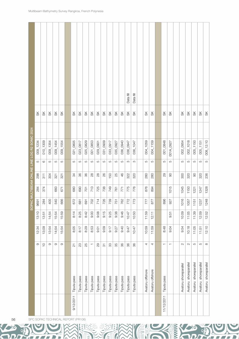
56 SPC SOPAC TECHNICAL REPORT (PR106)
Multibeam Bathymetry Survey Rangiroa, French Polynesia
SO
PA
C M
ULT
IBE
AM
ON
LIN
E L
INE
LO
G R
2 S
ON
IC 2
024
912
:34
13:1
096
9128
429
85
009_
1234
S
K
1013
;09
13:5
128
437
431
16
010_
1309
S
K
913
:54
14;5
440
0
304
500
9_13
54
SK
914
;54
15:5
454
066
032
15
009_
1454
S
K
915
:54
15:5
966
667
132
15
009_
1554
S
K
9/12
/201
1Ti
puta
pas
s21
8;05
8:14
672
680
345
021_
0805
S
K
Ti
puta
pas
s23
8:17
8:25
681
690
365
023_
0817
S
K
Ti
puta
pas
s25
8:29
8:42
691
701
365
025_
0829
S
K
Ti
puta
pas
s1
8:53
9:00
702
713
285
001_
0853
S
K
Ti
puta
pas
s29
9:01
9:08
714
725
285
029_
0901
S
K
Ti
puta
pas
s31
9:09
9:15
726
738
265
031_
0909
S
K
Ti
puta
pas
s33
9:17
9:25
739
749
150
503
3_09
17
SK
Ti
puta
pas
s35
9:27
9:38
751
761
255
035_
0927
S
K
Ti
puta
pas
s36
9:40
9:46
762
771
465
036_
0940
S
K
Ti
puta
pas
s36
9:47
10:4
777
277
532
23
036_
0947
S
KD
ata
fill
Ti
puta
pas
s36
10:4
710
:50
773
776
320
303
6_10
47
SK
Dat
a fil
l
A
vato
ru o
ffsho
re4
10:5
911
:59
777
876
280
500
4_10
59
SK
A
vato
ru o
ffsho
re4
11:5
912
:11
877
894
280
500
4_11
59
SK
11/1
2/20
11Ti
puta
pas
s1
8:48
89
6
295
001_
0848
S
K
19:
049:
5192
710
1590
500
1A_0
927
S
K
A
vato
ru s
hore
para
llel
29:
5410
:09
1016
1045
300
500
2_09
54
SK
A
vato
ru s
hore
para
llel
210
:18
11:0
510
5711
5032
05
002_
1018
S
K
A
vato
ru s
hore
para
llel
511
:05
11:3
911
5112
2190
500
5_11
50
SK
A
vato
ru s
hore
para
llel
511
:51
12:0
912
3712
4732
05
005_
1151
S
K
A
vato
ru s
hore
para
llel
812
:10
12:5
212
4813
2823
65
008_
12:1
0
SK

57SPC SOPAC TECHNICAL REPORT (PR106) SPC SOPAC TECHNICAL REPORT (PR106)
Multibeam Bathymetry Survey Rangiroa, French Polynesia
SO
PA
C M
ULT
IBE
AM
ON
LIN
E L
INE
LO
G R
2 S
ON
IC 2
024
A
vato
ru s
hore
para
llel
812
:57
13:0
813
3413
4075
500
8_12
56
SK
A
vato
ru s
hore
para
llel
413
:08
13:2
713
4013
8215
45
004_
1308
S
K
12/1
2/20
11pa
tch
test
Dec
19:
219:
2513
8613
9627
55
001_
0921
S
K
pa
tch
test
Dec
39:
279:
3214
0014
1697
500
3_09
27
SK
pa
tch
test
Dec
59:
349:
3814
1914
2725
95
005_
0933
S
K
pa
tch
test
Dec
79:
399:
4414
2814
3688
500
7_09
39
SK
pa
tch
test
Dec
99:
459:
5014
3814
4626
85
009_
0945
S
K
pa
tch
test
Dec
119:
519:
5614
4814
5696
501
1_09
51
SK
pa
tch
test
Dec
119:
5710
:02
1458
1466
259
501
1_09
57
SK
pa
tch
test
Dec
910
:04
10:0
914
6814
7697
500
9_10
04
SK
pa
tch
test
Dec
710
:10
10:1
414
7714
8527
35
007_
1010
S
K
pa
tch
test
Dec
510
:15
10:2
014
8614
9483
500
5_10
15
SK
pa
tch
test
Dec
310
:21
10:2
614
9615
0427
35
003_
1021
S
K
pa
tch
test
Dec
110
:27
10:3
215
0615
1480
500
1_10
27
SK
pa
tch
test
Dec
310
:33
10:4
115
1615
2328
03
003_
1033
S
KLa
tenc
y
pa
tch
test
Dec
310
:46
10:4
915
2515
3327
67
003_
1046
S
KLa
tenc
y
S
K
A
vato
ru s
hore
para
llel
311
:12
12:0
215
3416
4041
500
3_11
12
SK
612
:02
12:5
516
4017
4519
25
006_
1202
S
K
412
:57
13:1
017
4717
9256
500
4_12
57
SK
413
:13
13:2
917
9218
2528
95
004_
1313
S
K
13/1
2/20
11A
vato
ru s
hore
para
llel
98:
3408
"51
1834
1865
120
300
9_08
34

58 SPC SOPAC TECHNICAL REPORT (PR106)
Multibeam Bathymetry Survey Rangiroa, French Polynesia

SPC SOPAC TECHNICAL REPORT (PR106)