MODULAR USE OF OSGEO EXERCISES IN...
38
MODULAR USE OF OSGEO MODULAR USE OF OSGEO EXERCISES IN TEACHING EXERCISES IN TEACHING WEBMAPPING WEBMAPPING BAREND KÖBBEN BAREND KÖBBEN [email protected] || [email protected] [email protected] || [email protected]
Transcript of MODULAR USE OF OSGEO EXERCISES IN...
MODULAR USE OF OSGEO MODULAR USE OF OSGEO EXERCISES IN TEACHING EXERCISES IN TEACHING WEBMAPPINGWEBMAPPING
BAREND KÖBBEN BAREND KÖBBEN [email protected] || [email protected] [email protected] || [email protected]
2
Contents
the preparation and use of exercise modules:–based on OSGEO tools :
OSGEO Live DVD and others –for teaching a wide variety of courses
in the Geo-Informatics field –at ITC and elsewhere
3
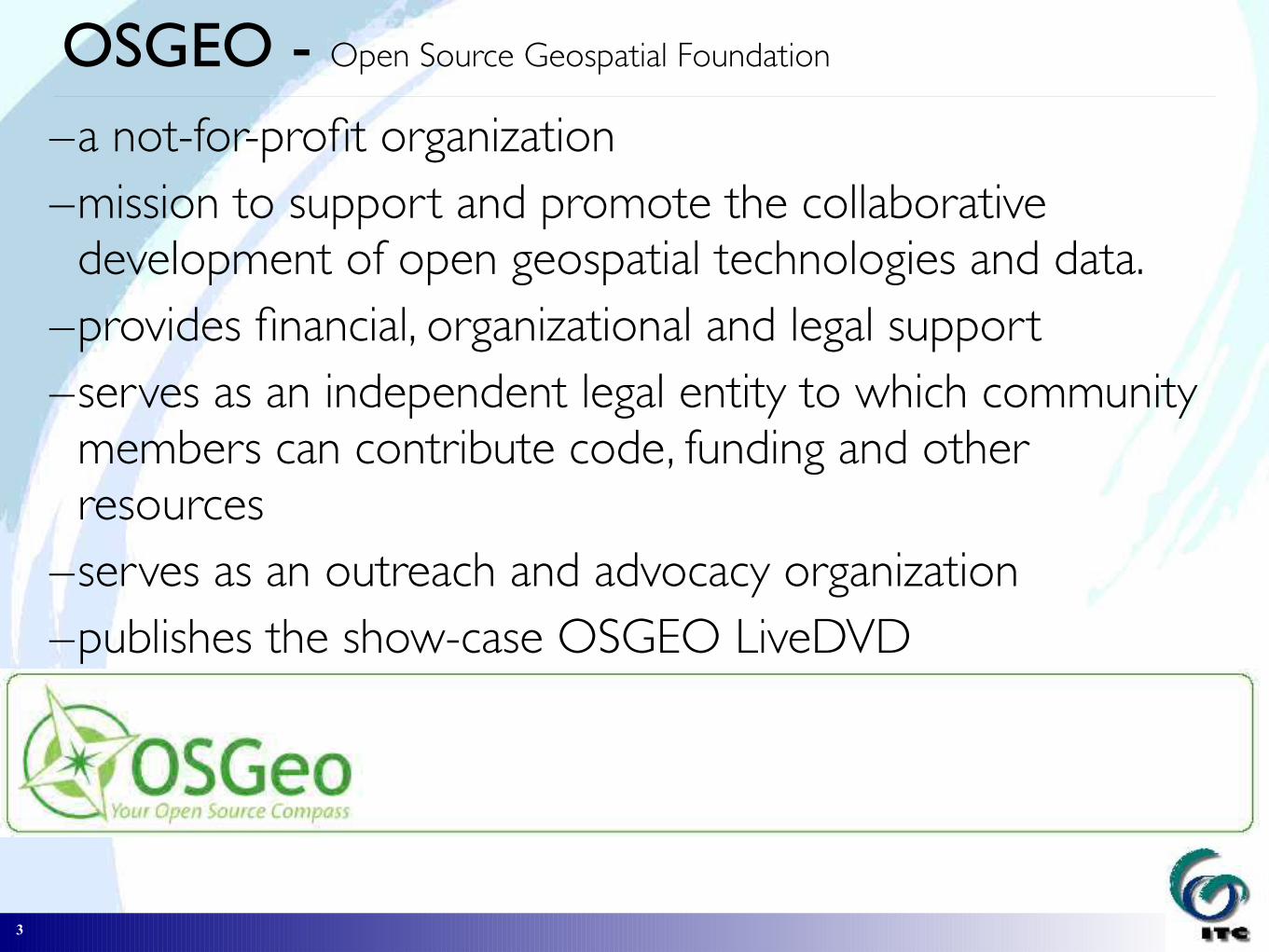
OSGEO - Open Source Geospatial Foundation
–a not-for-profit organization–mission to support and promote the collaborative
development of open geospatial technologies and data.–provides financial, organizational and legal support –serves as an independent legal entity to which community
members can contribute code, funding and other resources–serves as an outreach and advocacy organization–publishes the show-case OSGEO LiveDVD

4
OSGEO LiveDVD
a self-contained bootable DVD, USB thumb drive or Virtual Machine –based on the Xubuntu operating system–composed entirely of free software–pre-configured applications–a range of geospatial use cases, including storage,
publishing, viewing, analysis and manipulation of data.–also contains sample datasets and documentation

5
OSGEO LiveDVD
you can start up your computer with this system, try out virtually all existing Open Source software in the spatial domain, without having to install or even change anything on your computer
Short introduction of the ITCShort introduction of the ITC
http://www.itc.nl/

7
Faculty of Geo-Information Science and Earth Faculty of Geo-Information Science and Earth Observation of the University of TwenteObservation of the University of Twente
located in Enschede(The Netherlands)
students
yearly registration: > 400 students average duration of stay:
14 months average age: 34 years
staffscientific & supporting: ± 190 fte
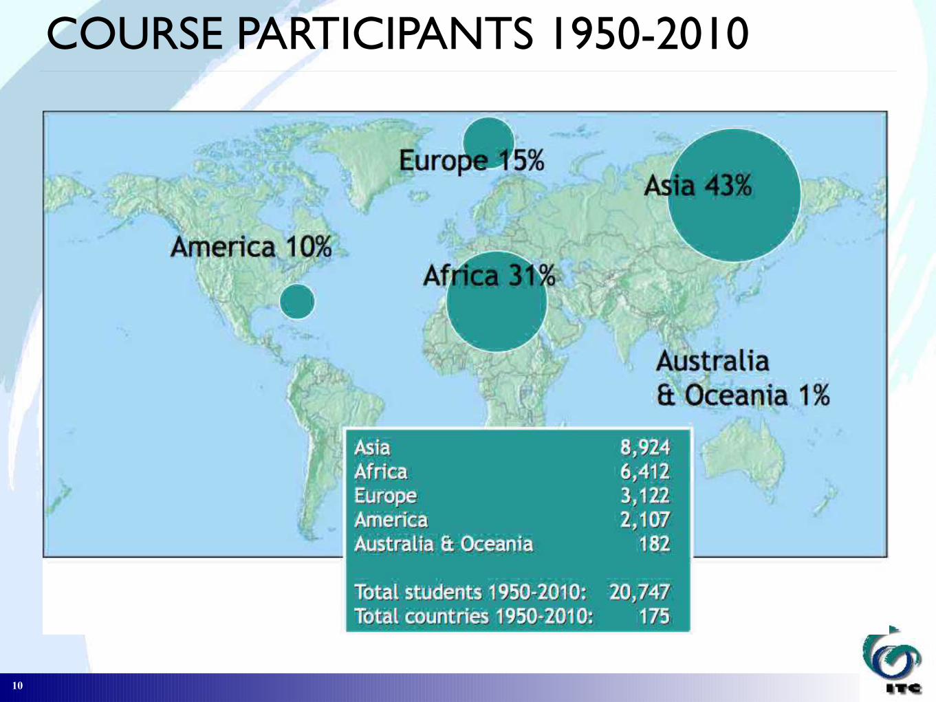
1950-2000> 14.000 students from > 160 countries
8
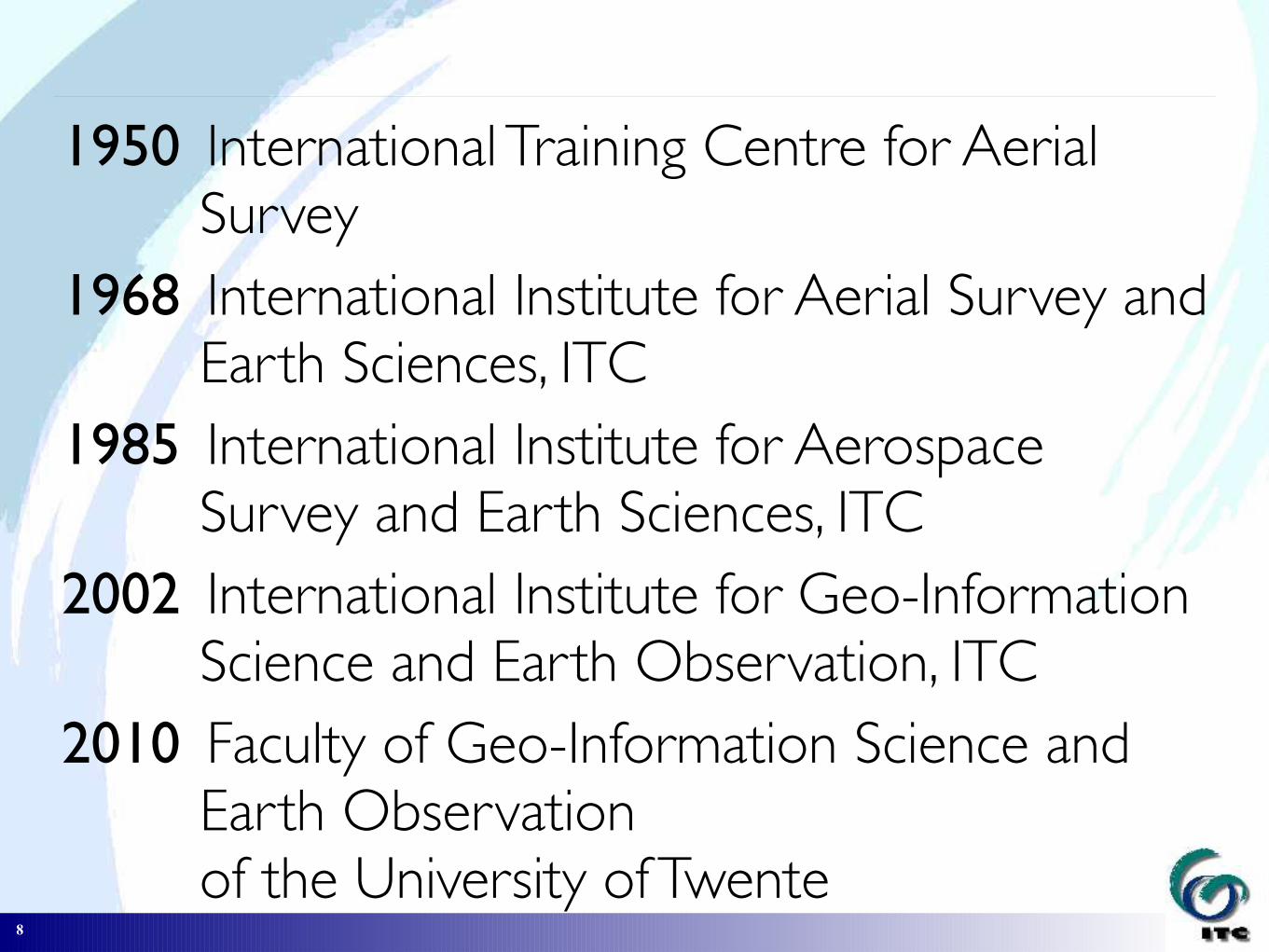
1950 International Training Centre for Aerial Survey
1968 International Institute for Aerial Survey and Earth Sciences, ITC
1985 International Institute for Aerospace Survey and Earth Sciences, ITC
2002 International Institute for Geo-Information Science and Earth Observation, ITC
2010 Faculty of Geo-Information Science and Earth Observation of the University of Twente
9
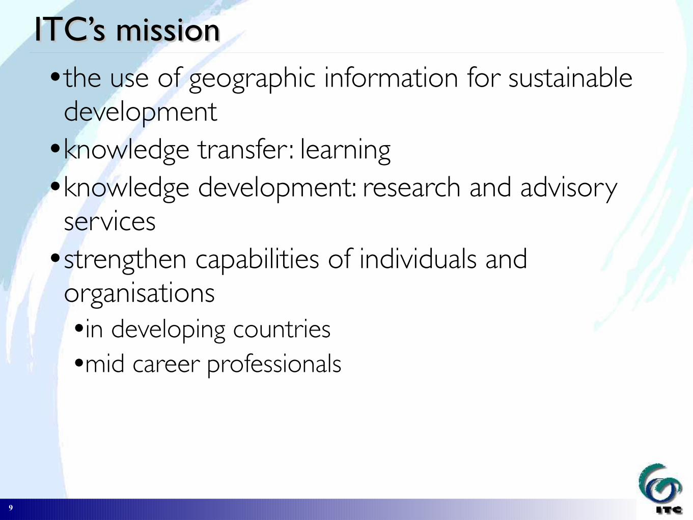
ITC’s missionITC’s missionthe use of geographic information for sustainable development
knowledge transfer : learningknowledge development: research and advisory services
strengthen capabilities of individuals and organisationsin developing countriesmid career professionals
10
COURSE PARTICIPANTS 1950-2010

11
Education at ITCEducation at ITCregular courses:
Graduate School (PhD – 3 years) Master of Science (MSc - 18 months) Professional Master (PM - 12 months) Diploma (9 months)
+ modules on demand, tailor-made coursesIn 6 programmes:–geoinformatics– land administration–urban planning and management–natural resources management–water resources and environmental management–earth resources and environmental geosciences

12
Webmapping and SDIlight
As part of many of our courses, we provide the participants with knowledge and tools to set up webmapping applications according to our SDIlight principles: => the technology of Spatial Data Infrastructures (SDI), applied in simple and cost–effective ways–to provide students with a platform for low–cost, yet
powerful ways of sharing data and maps

SDIlight
....?
SDI

SDI

SDIlight

SDIlight
SDIlight OSGEO stack

OSGEO stack
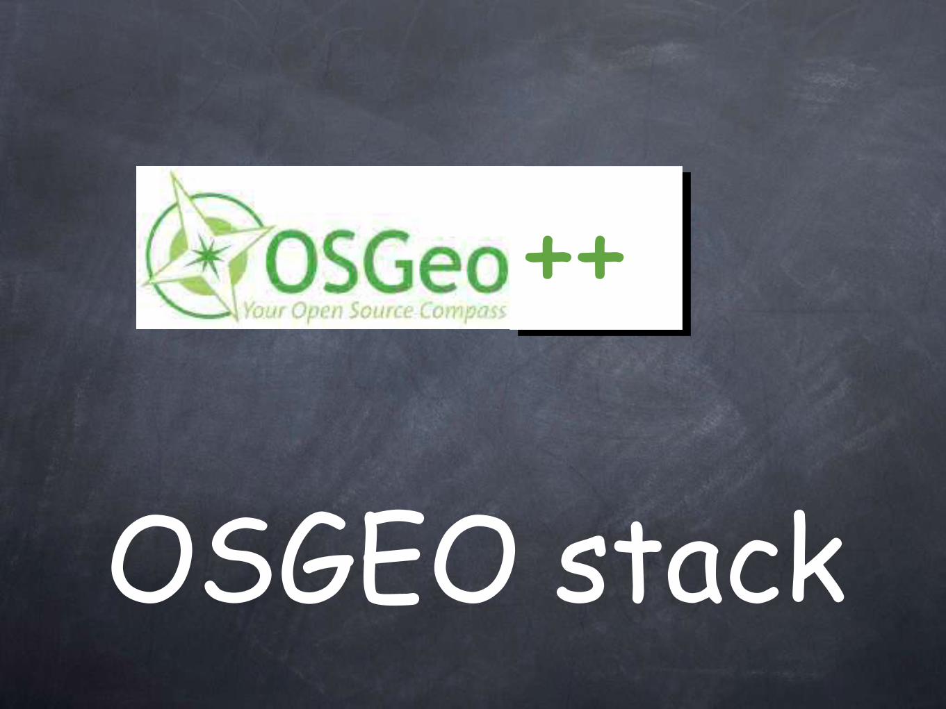
OSGEO stack
++

stack

stack++

stack++
// //

stack++
// //
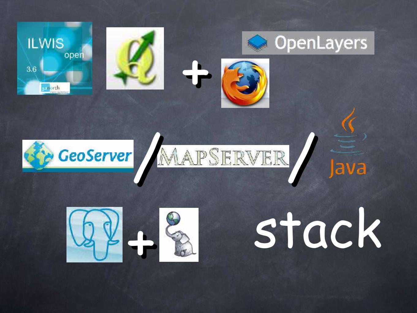
stack++
// //++

SDIlight in
research

development52o North communities
WPS

SDIlight in
education

Geo-webservices & web-clients
education Open Standards & interoperability
31
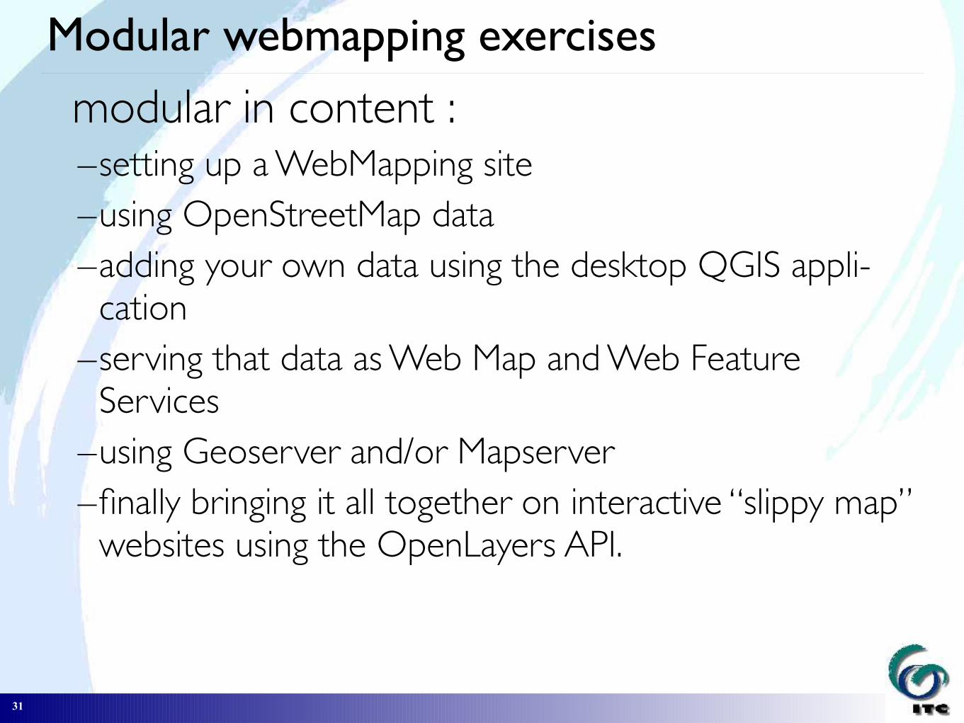
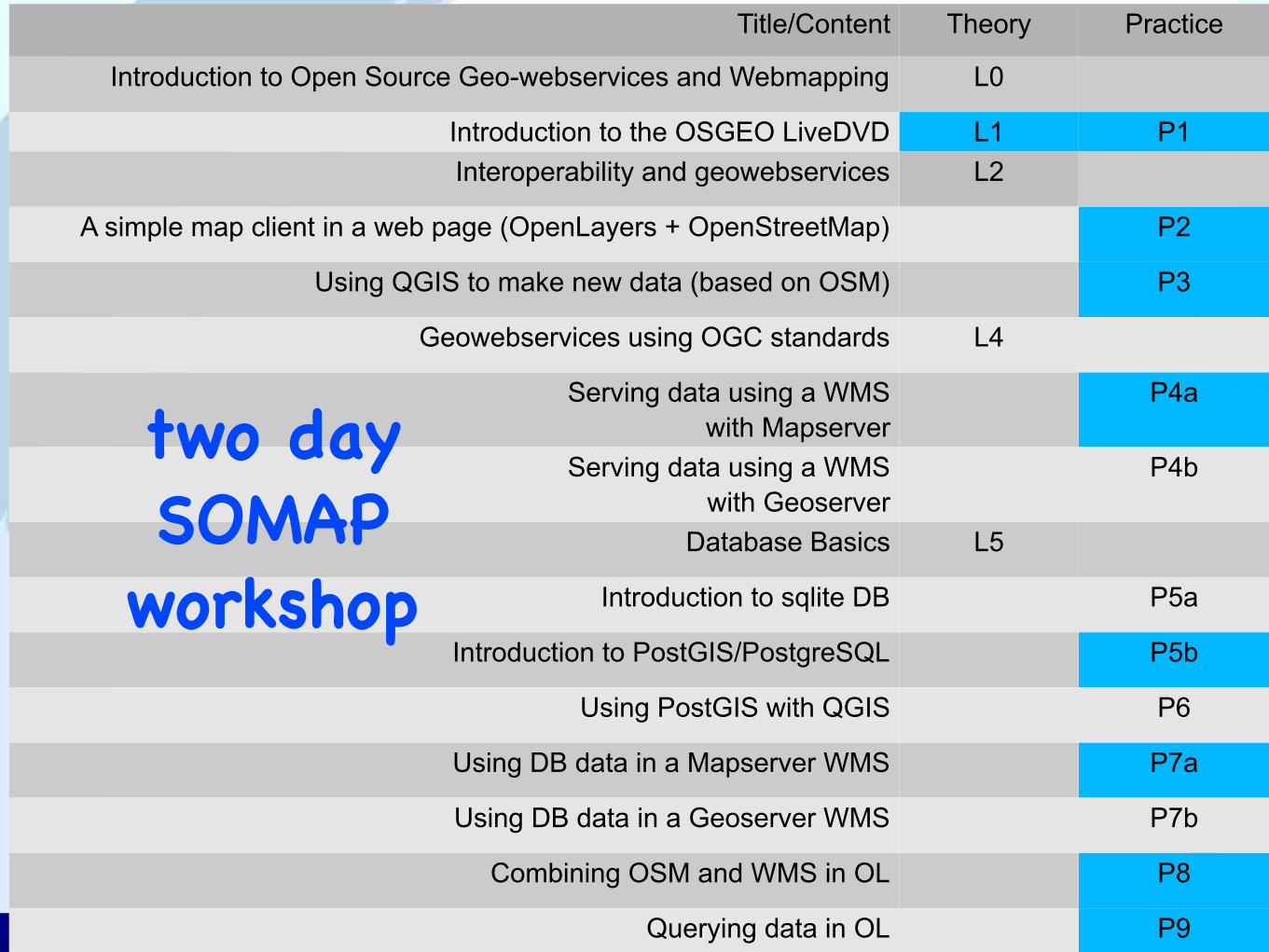
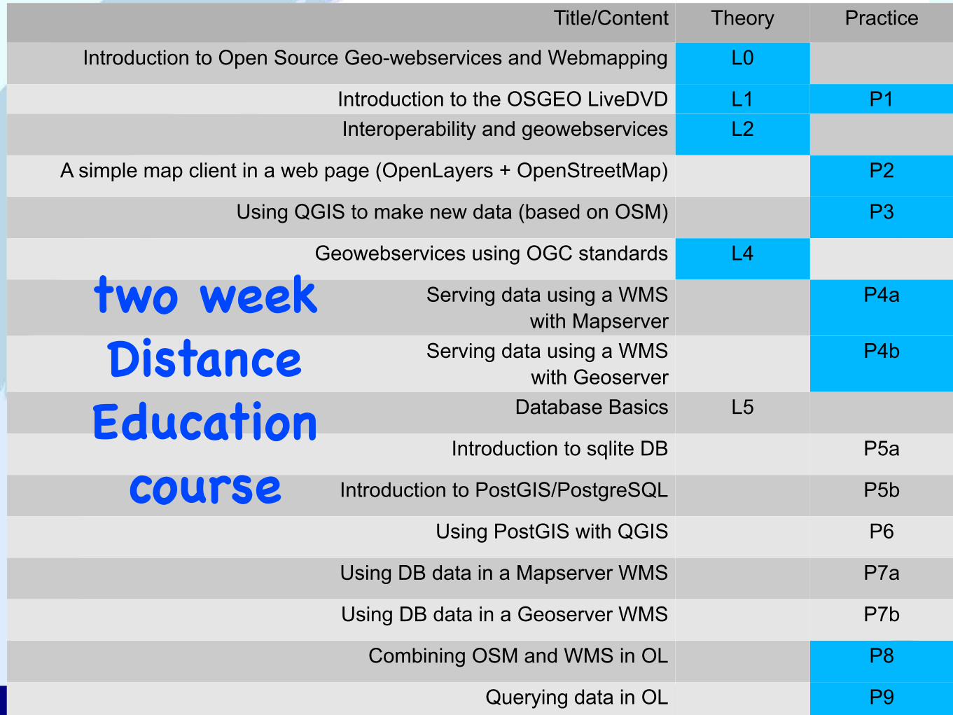
Modular webmapping exercises
modular in content :–setting up a WebMapping site –using OpenStreetMap data–adding your own data using the desktop QGIS appli-
cation–serving that data as Web Map and Web Feature
Services –using Geoserver and/or Mapserver–finally bringing it all together on interactive “slippy map”
websites using the OpenLayers API.

32
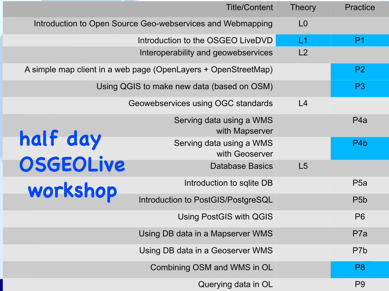
Title/Content Theory Practice
Introduction to Open Source Geo-webservices and Webmapping L0
Introduction to the OSGEO LiveDVD L1 P1
Interoperability and geowebservices L2
A simple map client in a web page (OpenLayers + OpenStreetMap) P2
Using QGIS to make new data (based on OSM) P3
Geowebservices using OGC standards L4
Serving data using a WMSwith Mapserver
P4a
Serving data using a WMSwith Geoserver
P4b
Database Basics L5
Introduction to sqlite DB P5a
Introduction to PostGIS/PostgreSQL P5b
Using PostGIS with QGIS P6
Using DB data in a Mapserver WMS P7a
Using DB data in a Geoserver WMS P7b
Combining OSM and WMS in OL P8
Querying data in OL P9
33
Title/Content Theory Practice
Introduction to Open Source Geo-webservices and Webmapping L0
Introduction to the OSGEO LiveDVD L1 P1
Interoperability and geowebservices L2
A simple map client in a web page (OpenLayers + OpenStreetMap) P2
Using QGIS to make new data (based on OSM) P3
Geowebservices using OGC standards L4
Serving data using a WMSwith Mapserver
P4a
Serving data using a WMSwith Geoserver
P4b
Database Basics L5
Introduction to sqlite DB P5a
Introduction to PostGIS/PostgreSQL P5b
Using PostGIS with QGIS P6
Using DB data in a Mapserver WMS P7a
Using DB data in a Geoserver WMS P7b
Combining OSM and WMS in OL P8
Querying data in OL P9
half dayOSGEOLive workshop
34
Title/Content Theory Practice
Introduction to Open Source Geo-webservices and Webmapping L0
Introduction to the OSGEO LiveDVD L1 P1
Interoperability and geowebservices L2
A simple map client in a web page (OpenLayers + OpenStreetMap) P2
Using QGIS to make new data (based on OSM) P3
Geowebservices using OGC standards L4
Serving data using a WMSwith Mapserver
P4a
Serving data using a WMSwith Geoserver
P4b
Database Basics L5
Introduction to sqlite DB P5a
Introduction to PostGIS/PostgreSQL P5b
Using PostGIS with QGIS P6
Using DB data in a Mapserver WMS P7a
Using DB data in a Geoserver WMS P7b
Combining OSM and WMS in OL P8
Querying data in OL P9
two daySOMAP
workshop
35
Title/Content Theory Practice
Introduction to Open Source Geo-webservices and Webmapping L0
Introduction to the OSGEO LiveDVD L1 P1
Interoperability and geowebservices L2
A simple map client in a web page (OpenLayers + OpenStreetMap) P2
Using QGIS to make new data (based on OSM) P3
Geowebservices using OGC standards L4
Serving data using a WMSwith Mapserver
P4a
Serving data using a WMSwith Geoserver
P4b
Database Basics L5
Introduction to sqlite DB P5a
Introduction to PostGIS/PostgreSQL P5b
Using PostGIS with QGIS P6
Using DB data in a Mapserver WMS P7a
Using DB data in a Geoserver WMS P7b
Combining OSM and WMS in OL P8
Querying data in OL P9
two weekDistanceEducationcourse

36
Modular webmapping exercises
modular in delivery :– starting with LaTeX source
delivered in many formats:– as “prose” for use in print (PDF)– as self-paced learning sheets (for Distance Education)
for workshops and courses in many guises:– from two hour informal “walk–in” workshops – to three week modules as part of our MSc curriculum– face-to-face teaching – using Distance Learning technology

37
Stand-alone Courses –Upcoming courses:•Hands-on Workshop Open Source GIS & WebMapping for UN staff -- 20 & 21 November 2012 -- Vienna (Austria)• EuroSDR EduServ11 Open Standards & Open Source WebMapping -- Spring 2013 -- On-line course
–Past courses:• EuroSDR EduServ10 Open Standards & Open Source WebMapping -- 7-18 May 2012 -- On-line course•Workshop Open Source GIS & WebCartography -- 24 April 2012 -- Avignon (France)•Walk-in Workshop Open Source GIS & WebCartography -- 5th, 6th & 7th July 13:30 – 15:15 -- Paris (France)