MiMhMapping Mashu ps - University of...
12
M i M h Mapping Mashu URPL 590 – Spring 2009 Applied GIS Workshop David Hart David Hart Department of Urban and Re University of Wisconsin University of Wisconsin A.J. Wortley Wisconsin State Cartograp Wisconsin State Cartograp Thursday, May 7, ps egional Planning n-Madison n Madison y pher’s Office pher s Office 2009
Transcript of MiMhMapping Mashu ps - University of...

M i M hMapping MashuURPL 590 – Spring 2009Applied GIS Workshoppp p
David HartDavid HartDepartment of Urban and Re
University of WisconsinUniversity of Wisconsin
A.J. WortleyWisconsin State CartograpWisconsin State Cartograp
Thursday, May 7,
ps
egional Planningn-Madisonn Madison
ypher’s Officepher s Office2009
Presentation Outline
• Background– What is a Mashup?– Workshop Goals– Collaborative Technologies
P t ti /D t ti– Presentations/Demonstrations– Workshop Structure
St d t P t ti (10 @• Student Presentations (10 @• Observations on mapping m• General Q&A (15 min.)
e
s
@ 5 i h)@ 5 min. each)mashup methods (10 min.)

What is a Mashup?
“In web development, a mashucombines data or functionalii t i l i t t d liinto a single integrated appli
http://neworleans.craigslist.org/
?
up is a Web application that ity from two or more sources i ti ” iki diication.” – wikipedia
http://www.housingmaps.com/
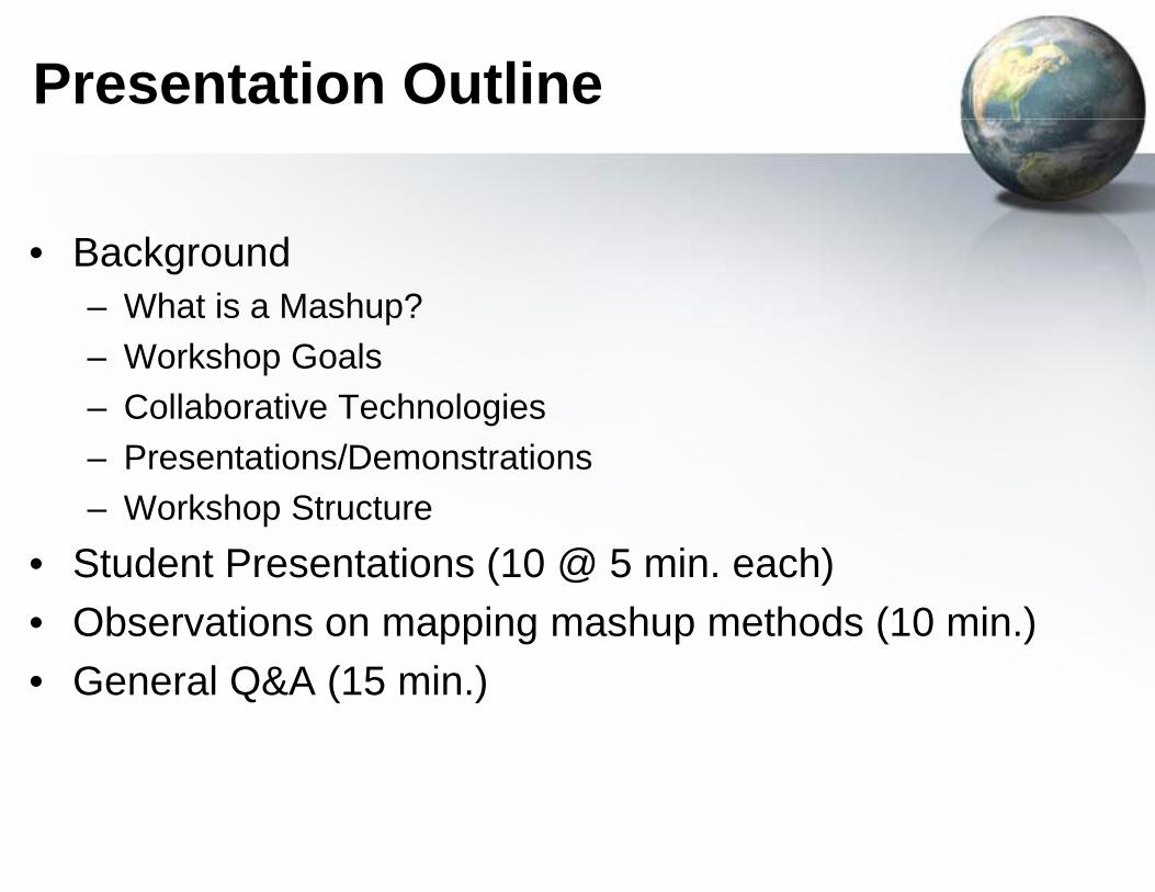
Workshop Goals
• Develop a better understandphenomenon
• Gain hands-on experience wweb mapping applications
• Learn to effectively communmashups to society
• Build and promote a mappinto society
• Utilize technology that prom• Learn to work effectively in a• Sharpen writing skills directe
ding of the mapping mashup
with software tools to develop
nicate the benefits of mapping
ng mashup that has benefits
otes collaborationa group settinged at a professional audience

Collaborative Tech
P t ti ll b ti• Presentation on collaborativ– Jeff Bohrer and John Thomso
C ll b ti Bl (W d• Collaborative Blog (Wordpre• Social Bookmarking (Delicio• Web Hosting (MyWebSpace• Web Conferencing (WisLine• Discussion Forum (Learn@
hnologiesg
t h l ive technologieson, DoIT
)ess)ous)e)eWeb)
@UW)
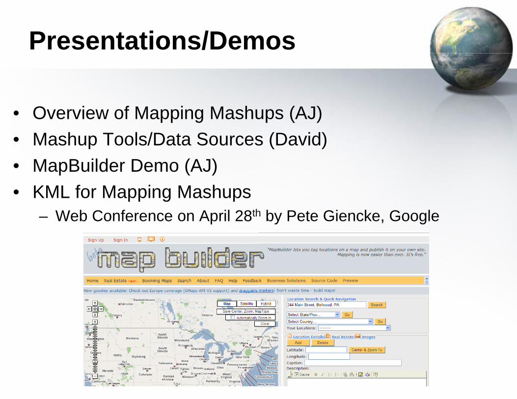
Presentations/Dem
• Overview of Mapping Mashu• Mashup Tools/Data Sources• MapBuilder Demo (AJ)• KML for Mapping Mashupspp g p
– Web Conference on April 28th
mos
ups (AJ)s (David)
h by Pete Giencke, Google
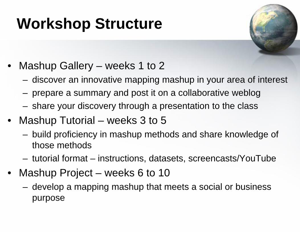
Workshop Structurp
• Mashup Gallery – weeks 1 t– discover an innovative mappi– prepare a summary and post – share your discovery through
• Mashup Tutorial – weeks 3 t– build proficiency in mashup m
those methodsthose methods– tutorial format – instructions, d
• Mashup Project weeks 6 to• Mashup Project – weeks 6 to– develop a mapping mashup th
purposep p
re
o 2ng mashup in your area of interestit on a collaborative webloga presentation to the class
to 5methods and share knowledge of
datasets, screencasts/YouTubeo 10o 10hat meets a social or business
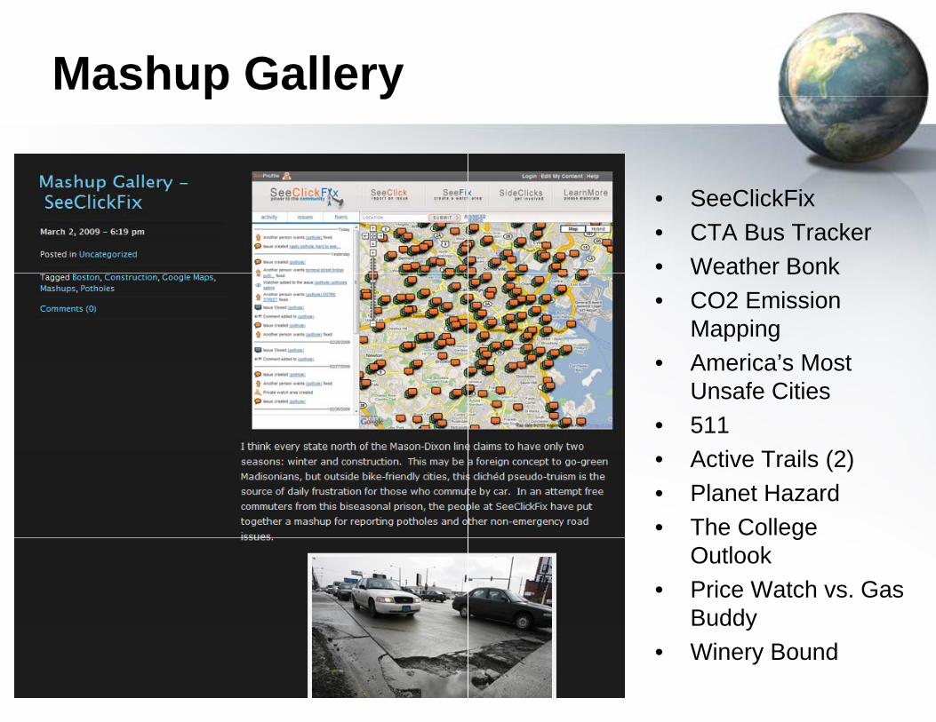
Mashup Galleryp y
• SeeClickFix• CTA Bus Tracker• Weather BonkWeather Bonk• CO2 Emission
Mapping• America’s Most• America s Most
Unsafe Cities• 511• Active Trails (2)• Planet Hazard• The College g
Outlook• Price Watch vs. Gas
Buddyy• Winery Bound
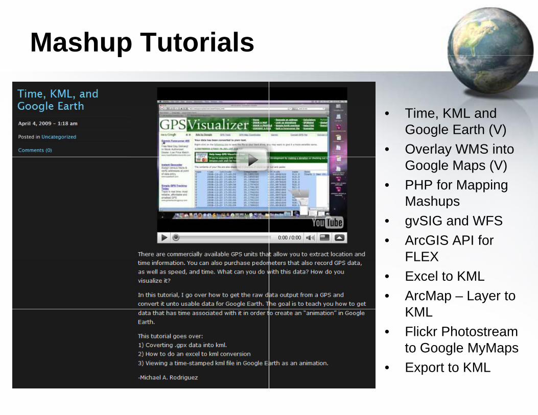
Mashup Tutorialsp
• Time, KML and Google Earth (V)
• Overlay WMS into Google Maps (V)
• PHP for Mapping Mashupsp
• gvSIG and WFS• ArcGIS API for
FLEXFLEX• Excel to KML• ArcMap – Layer to
KMLKML• Flickr Photostream
to Google MyMaps• Export to KML

Mashup Projectsp j
• Bicycle Tour around Lake M– Janice Baudewig Poehlman
• Travel Route Choice– Kaushik Bekkem (Google Ma
• Shipwrecks of the Great Lak– Danny Bera (Goolge Maps, G
• Bayou Bienvenue Wetland TRestoration– Lydia Bi (KML, Google Earth,
• Biking Suitability in Madison– Nicholas Kasang (Google Ear
Michigan(ArcGIS Server, Flex IDE)
ps API, mySQL)kesGoogle Earth, FlickrTriangle Community-Based
Google Maps API, geocoding), WIrth, KML)

Mashup Projectsp j
• City of Madison Plan Comm– David Kress (KML, EarthPoin
• Madison Area Networking E– Jamie Krug (KML, Google Ea
• Amtrak Station Ridership in Maps and Time Data– Michael Rodriguez (Google E
• Seeing the Wisconsin Idea (– Nick Terrible (Google Earth, K
• Massachusetts Maritime He– Tim Wallace (Flash ActionScr
Google Earth, Dreamweaver,
ission Meeting Itemst's Excel to KML, Google Earth)ventsrth, Google Maps, geocoding)Wisconsin - Proportional
Earth, time animation)(and beyond)KML, Log Parser, SQL Server)ritageript 3.0, Illustrator, Photoshop, AFComponents Umap API)

Next Steps
Workshop ProductsWorkshop Products– Promote Gallery, Tutorial
H l i l d id– Helping people decide onFuture Mashup Workshops
– Modular or full semester?
QuestQuest
D id H t (dh t@David Hart ([email protected]. Wortley (lwo
http://maps.aqua.wisc.edu/urpl5
s, Projectsh t l /t h l in mashup tools/technologies
s??
tions?tions?
@ i d )@aqua.wisc.edu)[email protected])90-spring09/mashups/index.htm