MapBiomas Coleção 3
27
Transcript of MapBiomas Coleção 3

MapBiomas Coleção 3 – (1985-2017)
COLEÇÃO 3.0[ Tasso Azevedo ]
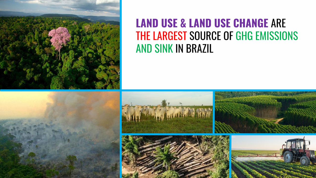
LAND USE & LAND USE CHANGE ARE THE LARGEST SOURCE OF GHG EMISSIONS AND SINK IN BRAZIL

70%

Since 80’s several systems to monitor deforestation through remote sensing have
being implemented
PRODES / AMAZON (since 1988)
SAD/AMAZON (since 2005)
DETER / Alerts AMAZON (since 2005)
ATLAS MATA ATLANTICA (Since 1985) (…)


We need to move from tree cover change to land use change
Forest Non-Forest
Forest
Non-ForestYe
ar 1
Year 2
Forest Pasture Crops Urban Mining (….)_ForestPastureCropsUrbanMaining(…)
Ye
ar 1
Year 2
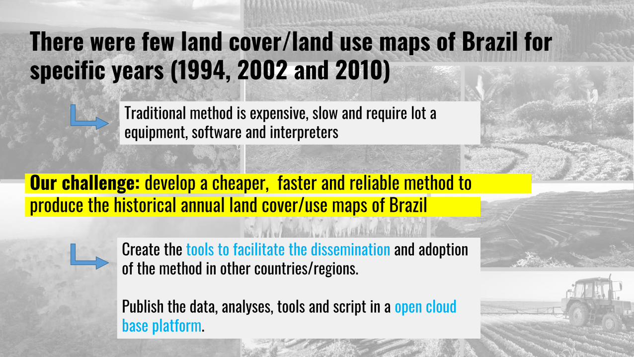
There were few land cover/land use maps of Brazil for specific years (1994, 2002 and 2010)
`Our challenge: develop a cheaper, faster and reliable method to produce the historical annual land cover/use maps of Brazil
Traditional method is expensive, slow and require lot a equipment, software and interpreters
Create the tools to facilitate the dissemination and adoption of the method in other countries/regions.
Publish the data, analyses, tools and script in a open cloud base platform.

CO-CREATORS Initiative of
Inst. Support
Funding
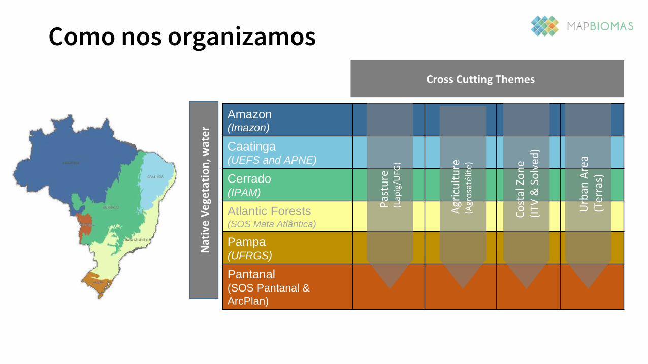
Como nos organizamos
Amazon(Imazon)
Caatinga(UEFS and APNE)
Cerrado(IPAM)
Atlantic Forests(SOS Mata Atlântica)
Pampa(UFRGS)
Pantanal(SOS Pantanal &
ArcPlan)
Pas
ture
(Lap
ig/U
FG)
Agr
icu
ltu
re(A
gro
saté
lite)
Co
stal
Zo
ne
(ITV
& S
olv
ed)
Cross Cutting Themes
Nat
ive
Ve
geta
tio
n, w
ate
r
Urb
an A
rea
(Ter
ras)

Mains characteristics
Based on Landsat Collection
(resolution 30 mt)
Processing pixel by pixel
(˜30 x 30 mt)
Organize by standardized maps
tiles (1 x 1,5o) (556 tiles for Brazil)
Cloud based processing

Project in 3 phases of implementation
1985 2000 2008 2017
Collection 217 years2000-2016
Collection 333 years1985-2017
Collection 18 years2008-2015
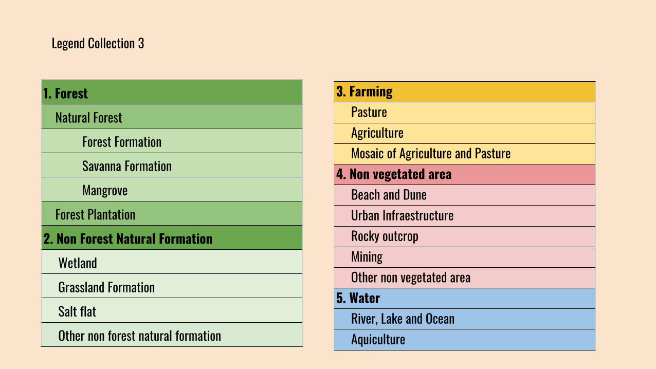
Legend Collection 3
1. Forest
Natural Forest
Forest Formation
Savanna Formation
Mangrove
Forest Plantation
2. Non Forest Natural Formation
Wetland
Grassland Formation
Salt flat
Other non forest natural formation
3. FarmingPastureAgricultureMosaic of Agriculture and Pasture
4. Non vegetated areaBeach and DuneUrban InfraestructureRocky outcropMiningOther non vegetated area
5. WaterRiver, Lake and OceanAquiculture
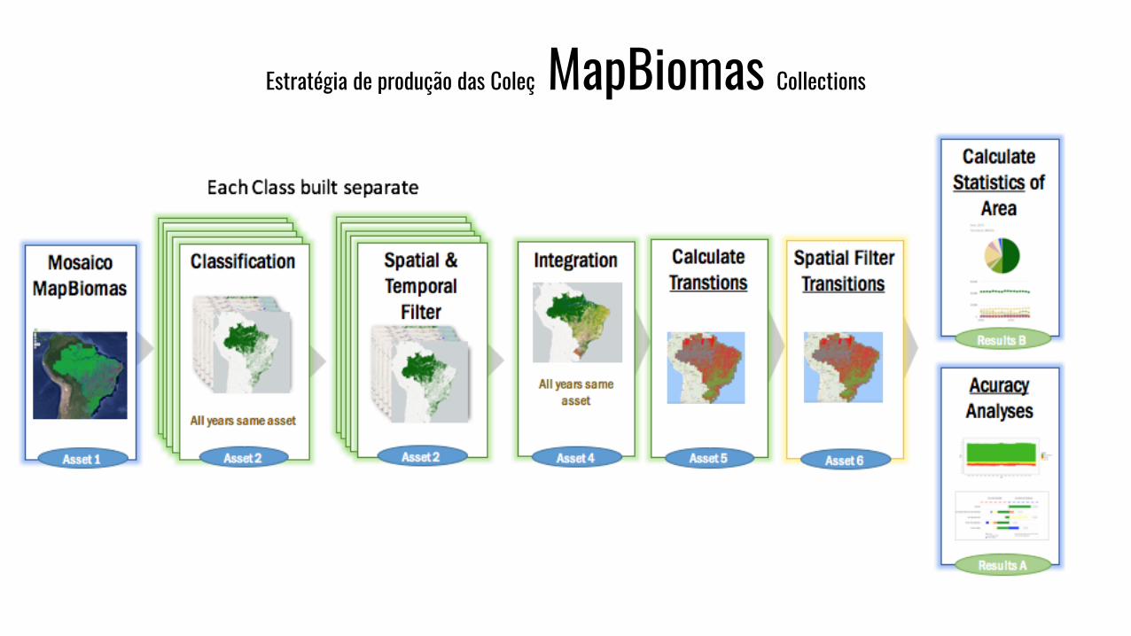
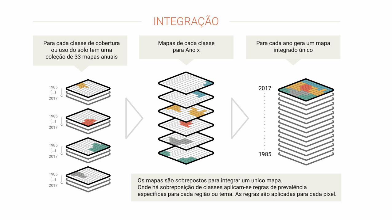
Estratégia de produção das Coleç MapBiomas Collections


Applications with MapBiomas
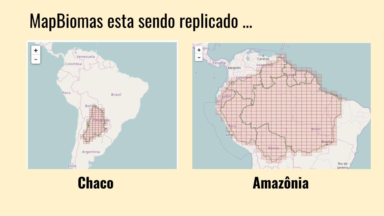
MapBiomas esta sendo replicado ...
Chaco Amazônia

mapbiomas.org

mapbiomas.org
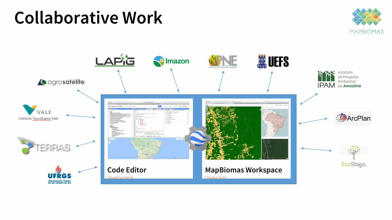
Collaborative Work
MapBiomas WorkspaceProduction
Code Editor Development

Collaborative Work