M. S. Rawat, Varun Joshi, B. S. Rawat, K. Kumar - Landslide Movement Monitoring Using GPS Technology...
7
Journal of Development and Agricultural Economics Vol. 3(5), pp. 194-200, May 2011 Available online at http://www.academicjournals.org/JDAE ISSN 2006- 9774 ©2011 Academic Journals Full Length Research Paper Landslide movement monitoring using GPS technology: A case study of Bakthang landslide, Gangtok, East Sikkim, India M. S. Rawat 1 , Varun Joshi 2 *, B. S. Rawat 3 and K. Kumar 4 1 G. B. Pant Institute of Himalayan Environment and Development Sikkim Unit, Pangthang, East Sikkim, Gangtok-737101, India. 2 University School of Environment Management, Guru Gobind Singh Indraprastha University, Sector-16C, Dwarka, New Delhi-110075. 3 DBS PG College, Dehradun, Uttarakhand. 4 G. B. Pant Institute of Himalayan Environment and Development, Kosi-Katarmal, Almora, Uttarakhand. Accepted 26 March, 2011 Landslide is a general term used to describe the down-slope of soil, rock and organic material under the influence of gravity. Several parts of northeastern region of India are vulnerable to landslide and moss movements. Nowadays, the Global Positioning System (GPS) technology has shown that it is capable to monitor sub-centimeter deformations of this ground movement. The main advantage of GPS sensors is that GPS requires no line-of-sight between the stations. This enables GPS to monitor the landslide even during unfavorable weather conditions either in real time or post-processing mode. However, the attainable accuracy of a GPS based system is limited by the satellite geometry and by systematic errors such as multipath, weak satellite geometry, etc. To monitor the landslide phenomena, it is imposed to represent the area under investigation by a number of points that are monumented durably. Some stations are used to define a stable reference frame and remaining stations are the monitoring points situated in the deformation area. In this way, the determination of the movement of the control stations is done relatively to the reference ones. Bakthang falls landslide selected for its movements. This paper therefore highlights an investigation of landslide motions to discover possible precursors of mass movement and periodical changing of landslide. Key words: Landslide movement, global positioning system technology, Bakthang falls landslide. INTRODUCTION The assessment of landslide behavior is usually undertaken by means of monitoring scheme. Usually the measurement of superficial displacement is the simplest way to observe the history of a landslide and to analyze the kinematics of the movement. In all cases, measure- ments have to be made efficiently in terms of time, manpower and budget. In the past, a varity of surveying techniques have been used to detect the superficial movements of unstable area. For examples, tapes and wire devices have been used to measure changes in *Corresponding author. E-mail: [email protected]. distance between points or crack walls. Levels, theo- dolites, Electronic Distance Measurement (EDM), and total station measurements provide both the coordinates and changes of target, control points and landslide features. In addition, aerial or terrestrial photo-grammetry compilation enables a quantitave analysis of the change in slope morphology and also the determina-tion of the movement vectors. A comprehensive summary of the main methods and their precisions is shown in Table 1. Although the active landslide has been observed and studied since the late 1800s (Endlich, 1876; Atwood and Mather, 1932; Crandell and Varnes, 1961; Varnes and Savage, 1996b), with the exception of limited observa- tions by Savage and Fleming (1996), little is known
description
Gangtok
Transcript of M. S. Rawat, Varun Joshi, B. S. Rawat, K. Kumar - Landslide Movement Monitoring Using GPS Technology...
Journal of Development and Agricultural Economics Vol. 3(5), pp. 194-200, May 2011 Available online at http://www.academicjournals.org/JDAE ISSN 2006- 9774 ©2011 Academic Journals
Full Length Research Paper
Landslide movement monitoring using GPS technology: A case study of Bakthang landslide,
Gangtok, East Sikkim, India
M. S. Rawat1, Varun Joshi2*, B. S. Rawat3 and K. Kumar4
1G. B. Pant Institute of Himalayan Environment and Development Sikkim Unit, Pangthang, East Sikkim,
Gangtok-737101, India. 2University School of Environment Management, Guru Gobind Singh Indraprastha University, Sector-16C,
Dwarka, New Delhi-110075. 3DBS PG College, Dehradun, Uttarakhand.
4G. B. Pant Institute of Himalayan Environment and Development, Kosi-Katarmal, Almora, Uttarakhand.
Accepted 26 March, 2011
Landslide is a general term used to describe the down-slope of soil, rock and organic material under the influence of gravity. Several parts of northeastern region of India are vulnerable to landslide and moss movements. Nowadays, the Global Positioning System (GPS) technology has shown that it is capable to monitor sub-centimeter deformations of this ground movement. The main advantage of GPS sensors is that GPS requires no line-of-sight between the stations. This enables GPS to monitor the landslide even during unfavorable weather conditions either in real time or post-processing mode. However, the attainable accuracy of a GPS based system is limited by the satellite geometry and by systematic errors such as multipath, weak satellite geometry, etc. To monitor the landslide phenomena, it is imposed to represent the area under investigation by a number of points that are monumented durably. Some stations are used to define a stable reference frame and remaining stations are the monitoring points situated in the deformation area. In this way, the determination of the movement of the control stations is done relatively to the reference ones. Bakthang falls landslide selected for its movements. This paper therefore highlights an investigation of landslide motions to discover possible precursors of mass movement and periodical changing of landslide. Key words: Landslide movement, global positioning system technology, Bakthang falls landslide.
INTRODUCTION The assessment of landslide behavior is usually undertaken by means of monitoring scheme. Usually the measurement of superficial displacement is the simplest way to observe the history of a landslide and to analyze the kinematics of the movement. In all cases, measure-ments have to be made efficiently in terms of time, manpower and budget. In the past, a varity of surveying techniques have been used to detect the superficial movements of unstable area. For examples, tapes and wire devices have been used to measure changes in *Corresponding author. E-mail: [email protected].
distance between points or crack walls. Levels, theo-dolites, Electronic Distance Measurement (EDM), and total station measurements provide both the coordinates and changes of target, control points and landslide features. In addition, aerial or terrestrial photo-grammetry compilation enables a quantitave analysis of the change in slope morphology and also the determina-tion of the movement vectors. A comprehensive summary of the main methods and their precisions is shown in Table 1.
Although the active landslide has been observed and studied since the late 1800s (Endlich, 1876; Atwood and Mather, 1932; Crandell and Varnes, 1961; Varnes and Savage, 1996b), with the exception of limited observa-tions by Savage and Fleming (1996), little is known

Rawat et al. 195
Table 1. Analysis of slope morphology and its movement vector, where X, Y, Z Are variable of geometry.
Method Typical range Results Typical precision
GPS (rapid static) Variable(<20 km) ∆X, ∆Y, ∆Z 5-10 mm + 1-2 ppm
Elec. Dist. Meas. Variable(1-14 km) ∆ distance 1-5 mm + 1-5 ppm
Fixed wire extensometer <10-80 m ∆distance 0.3 mm/30 m
Surveying triangulation <300-1000 m ∆X, ∆Y, ∆Z 5-10 mm
Surveying traverses Variable ∆X, ∆Y, ∆Z 5-10 mm
Geometrical leveling Variable ∆Z 2-5 mm/km
Precise geometrical level Variable ∆Z 0.2-1 mm/km
Terrestrial photogrammetry Ideally<100 m ∆X, ∆Y, ∆Z 20 mm from 100m
Aerial photo geo. Hflight<500 m ∆X, ∆Y, ∆Z 10 cm
regarding the nature and magnitude of the landslide movements in response to short-term and seasonal variations in meteorological conditions, and nothing is known regarding the effect of surface and subsurface water on landslide movements. Previous studies (Crandell and Varnes, 1961; Powers and Chiarle, 1996; Smith, 1996; Baum and Fleming, 1996; Savage and Fleming, 1996; Fleming et al., 1999) have documen-ted annual rates of movement ranging from 0.5 m/year at the head and toe of the landslide and up to about 6 m/year in the narrowest part of the landslide. Several additional studies have documented movements over shorter periods of time. Jackson et al. (1996) used global positioning system (GPS) surveys to measure daily velocities of upto 1 cm/day at six locations during a 4 day period in June, 1993. Savage and Fleming (1996) measured velocities over a 9 month period (April 1993 to January 1994) at three locations on the landslide and reported an increase of movement rate in the spring, presumably with spring snowmelt and thawing of the landslide surface. They inferred that variations in velocity over the course of a year were in part due to hydrologic controls. However, they suggest that, because of the remarkable long-term record of relatively constant movement, the landslide might contain various internal mechanisms to counterbalance changing meteorologic and hydrologic conditions that act to decrease or increase landslide movement. For example, high ground-water pressures following a wet winter might be equilibrated through a network of springs, which would bleed off excess water and decrease ground-water pressures. Although some preliminary mapping of springs and sinks has been completed (Fleming et al., 1999), the overall hydrology of the landslide and its relation to movement and meteorology is unknown. In 1998, Brigham Young University (BYU) and the US Geological Survey (USGS) began work on a National Aeronautics and Space Administration (NASA)-funded study of the Slumgullion landslide. The objectives of the study are to: 1) Measure movement of the entire active part of the landslide on a seasonal basis using GPS, and an
airborne, interferometric capable, Synthetic Aperture Radar (INSAR). 2) Attempt to correlate the measured movement with observed temperature, rainfall, snow depth, and ground-and surface-water levels and pressures. 3) Evaluate the use of INSAR for monitoring the movement of landslides by confirming that a static velocity field surrounds the landslide and by comparing INSAR data to simultaneous measurements at GPS points. 4) Develop a model for landslide deformation based on all of the combined data. Between June and October 2001, BYU acquired five sets of INSAR data over the landslide. These data are currently (April 2002) being processed. The USGS is responsible for monitoring landslide movement using GPS, as well as monitoring hydrologic and meteorologic fluctuations on the landslide. Nowadays, the Global Positioning System (GPS) has been fully operational. The GPS equipment is more reliable, cheaper, faster, easier to use compared to conventional instruments. New hardware’s, field procedures and software’s have also been developed to assist users in data collection and processing purposes. Thus, the GPS equipment has become more progressive and used for a wide range of monitoring applications. This paper therefore highlights the performance of GPS technology in landslide moni-toring encompassing a specific Bakthang landslide area Gangtok, East Sikkim, India. The use of GPS technology in landslide mapping A landslide phenomenon is one of the terms to be used in describing the down slope of soil, rock and organic material under the influence of gravity. Landslide studies can be organized into three phases, detection and classification of landslides, monitoring activity of existing landslides, analysis and prediction of slope failures in space (spatial distribution) and time (temporal distribution). The GPS is a radio navigation, timing and

196 J. Dev. Agric. Econ.
Figure 1. Location map of Bakthang landslide.
positioning system with a wide set of applications. By tracking the electromagnetic waves that are sent continuously to the earth, the system can obtain the 3D coordinates (Ф, λ, h or x, y, z). The results are discontinuous over time, and related to the cumulative movements of the surface point. The accuracy required for the measurement of landslide displacement should be many cases, at least in the order of centimeters (Josep et. al., 2000). Measurement of landslide displacement can be undertaken by means of either static or Kinematic method. The choice depends on the practical considerations:
1. The accessibility. 2. Number of points. 3. Precision and Distance from point to point. The RTK calculates new positions from the old ones, through continuous tracking of the satellites in real time. In this procedure, therefore, the post-processing of the field data is not required. Any problem encountered with the equipment can be localized and solved immediately. It works quickly and gives results with precision at centi-meter level for every second, even during movement. In RTK, corrections are transmitted to the rover via a local UHF data link; this transmission is quite directional. Therefore, unless repeaters are used, the RTK method needs an almost direct line of sight between base and rover. In general, this method also needs four or more satellite to work. Due to the continuous tracking of satellite, it is very sensitive to the loss of reception and to the quality of the signal. Even short interruption will
produce a loss of the initialization. To recover it, at least five satellites are needed. Study of mass movement has been monitored using satellite as instruments that have been installed in a stable or deform area. It gives the reference point on monument in each acquired observ-able. The concept of monitoring the landslide with GPS technology has been demonstrated (Georg et al., 2002; Hitoshi et al., 1996). In India, Kinematic survey is done in landslide area for 15 s at every point with 5 s sampling interval 10 x 10 m grid area. The processed co-ordinates are used to generate the surface of the landslide in different epochs using GIS. The methodology developed for the surface generation produced cm level accuracy after interpolation (Kumar et al., 2008). METHODOLOGY
Bakthang fall landslide has a strategic importance with imple-mented measures. Therefore, the same has been selected for the periodic observation of its movements using GPS campaign. The GPS permanent station at unit campus will also be utilized for interpretation of our campaign data. Before, the work of measure-ment of Bakthang fall landslide started, all necessary permission from Forest Deptt and GREF are obtained. The detail survey of Bakthang landslide carried out with the help of handheld GPS and DGPS. 50 monitoring points demarcated on the slide. Stakes have been fixed in all identified 50 points, and the periodical observation started with these 50 points. Some points were also taken out from the slide to consider that in those points, there was no movement taking place. At the same time a permanent point adjacent to landslide on a rock also identified for putting a GPS during campaign. Study area Bakthang falls landslide located at 3.5 km village. Which is situated within the latitude 27°21.37 to longitude 88°37.22 and 1755 m altitude (Figure 1). The topography of the study is highly undulating. During the blockage of National Highway BRO put their best of skills to keep this highway but monsoon after monsoon over different years, this site pose problems of varying magnitudes. Supply of essential commodities and other important materials for North Sikkim Border of China and Tibet. The experiments The performance of the GPS technique in measuring ground displacements has been tested in the active landslide phenomena. This landslide area is located at the 3.5 km. village (Figure 2), The J-N route is the only route that connected to North Sikkim. The Bakthang landslide is one of the subsidence slides, which has been declared and identified for stabilization measure as a high-risk landslide activity area by Border Road Organization. The GPS preliminary surveys for landslide study were made in December 2007. Thirty three point baselines ranging from 50 m length were observed by using dual frequency GPS receivers, Lieca 1220. The static technique has been applied to set up the reference network in the landslide areas. The rapid static and RTK GPS positioning techniques were used in the landslide monitoring scheme. In our experiment, Thirty three control points have been established at each landslide areas, namely: BK (1) and BK (33) (Figure 3) for km 3.5 test site (Figures 4 and 5). The static and rapid static GPS data

Rawat et al. 197
Figure 2. Bakthang falls landslide.
Figure 3. Monitoring network for Bakthang landslide (Km 3.5).
198 J. Dev. Agric. Econ.
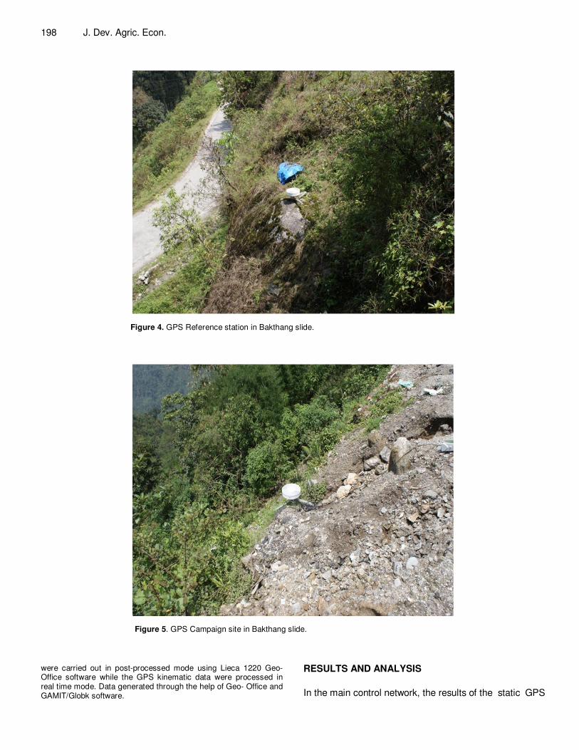
Figure 4. GPS Reference station in Bakthang slide.
Figure 5. GPS Campaign site in Bakthang slide.
were carried out in post-processed mode using Lieca 1220 Geo- Office software while the GPS kinematic data were processed in real time mode. Data generated through the help of Geo- Office and GAMIT/Globk software.
RESULTS AND ANALYSIS
In the main control network, the results of the static GPS

Rawat et al. 199
Figure 6. Surface formed by GPS periodic data of the landslide.
observations for control points BK (1) and BK (33) have been obtained. It can be seen from Table 2 that the standard errors in horizontal component (latitude and longitude) are less than 7 mm. This result has shown that the GPS technique can be obtained with high accuracy. Similarly, the standard errors in vertical component for control points at km 3.5 test sites are about 3.2 and 6 cm, respectively. Here, one may noticed that the accuracies were decreased proportionally with the increase in the distance from base stations; that is BAK (2) and BAK (4) are 3.5 km, in length (Figure 6). Conclusions GPS is a very useful tool to be utilized for a wide range of scientific applications. This technology increases the accuracy, productivity, monitoring capability, rapidly and economy with respect to size of the study area and it is often better than classical geodetic survey techniques. This paper evaluates the appropriate GPS technique that is, Rapid Static and RTK for monitoring the landslide behaviors at Bakthang landslide (3.5 km). The result indicated that the GPS modern techniques are very reliable for landslide monitoring. Using Global Positioning System technology to provide differential position infor-mation with sub centimeter level accuracy in structural
and land monitoring applications was investigated. The single software Geo-office elements of the system were described with an emphasis on the remote configuration and visualization programs. The results presented in this paper indicate that a base precision of less than one centimeter is achievable in many practical monitoring situations. Deformation in the narrow, central part of the landslide is characterized by nearly vertical, strike-slip shear surfaces that bound discrete blocks, in this part of the slide, individual blocks move downslope as rigid bodies. The pattern of the overall movement on the landslide surface is consistent with the experiment, it shows in fact that the highest surface-flow velocity, averaging 6 to 7 m/yr, occurs halfway down the active portion where the earth flow is confined to a width of 200 m. Flow velocities in the upper, wider part of the flow are estimated to be 4 m/yr. Flow velocities in the active toe (about 150 m wide) are estimated to be 2 m/yr. The maximum displacement of the monitoring point BAK (14), BAK (22), BAK (30), and BAK (4). ACKNOWLEDGEMENT Authors are thankful to Director, Scientist In Charge, G.B. Pant Institute of Himalayan Environment and Develop-ment for support and providing the facilities to carry

200 J. Dev. Agric. Econ.
Table 2. Rapid Static standard deviation of monitoring point in Bakthang slide.
Point I D X Coordinate Y Coordinate Z Coordinate Posi.
High Qua. Standard Deviation
of Posi. Ht Absolute error
ellipses (M) Reliability (M)
BAK (33) 136011.9683 5668706.3712 2914449.8595 4.3567 2.8975 0.01 0.001
BAK (32) 136014.8058 5668719.9557 2914425.8696 4.8249 4.3029 0.01 0.001
BAK (31) 136070.6490 5668687.5263 2914425.0495 4.5943 3.7626 0.01 0.001
BAK (30) 136071.8184 5668696.3765 2914402.2392 8.5040 7.2644 0.01 0.001
BAK (29) 136115.5264 5668649.7657 2914427.2583 3.4265 2.9011 0.01 0.001
BAK (28) 136090.0591 5668636.6615 2914472.6960 3.4202 2.8186 0.01 0.001
BAK (27) 136158.5565 5668641.1313 2914376.2977 5.1601 3.9659 0.01 0.001
BAK (26) 136155.3379 5668618.4064 2914417.2654 3.8729 3.1199 0.01 0.001
BAK (25) 136149.4771 5668604.3212 2914444.3739 4.3604 3.8995 0.01 0.001
BAK (24) 136137.5769 5668584.4039 2914496.3923 4.3875 3.7094 0.01 0.001
BAK (22) 136186.4749 5668631.8743 2914333.5192 9.3840 8.4814 0.01 0.001
BAK (21) 136193.1466 5668589.3567 2914425.6214 3.8984 3.2563 0.01 0.001
BAK (20) 136205.4139 5668571.2779 2914473.4504 3.5217 2.9134 0.01 0.001
BAK (19) 136177.4044 5668556.2480 2914504.6558 3.9265 3.2224 0.01 0.001
BAK (18) 136369.1378 5668505.9158 2914387.1225 4.2490 3.3178 0.01 0.001
BAK (17) 136369.7953 5668492.1960 2914420.3959 4.1538 3.6074 0.01 0.001
BAK (16) 136344.3314 5668476.7469 2914469.9368 4.9757 4.3956 0.01 0.001
BAK (15) 136355.6164 5668503.5128 2914424.6494 6.5233 5.3917 0.01 0.001
BAK (14) 136342.6941 5668527.3835 2914378.4915 12.6159 11.4098 0.01 0.001
BAK (13) 136319.9375 5668551.0579 2914339.3873 6.0891 4.9065 0.01 0.001
BAK (12) 136322.1257 5668515.6298 2914454.6513 3.9932 3.3643 0.01 0.001
BAK (11) 136282.9777 5668540.4618 2914388.0151 9.7335 8.3393 0.01 0.001
BAK (10) 136272.4318 5668586.0163 2914309.4011 6.4039 4.9282 0.01 0.001
BAK (9) 136261.2801 5668579.5650 2914337.8866 4.8148 3.8695 0.01 0.001
BAK (8) 136249.3011 5668578.4006 2914374.2961 4.5989 3.4449 0.01 0.001
BAK (7) 136254.3733 5668567.4314 2914391.7675 4.3100 3.5567 0.01 0.001
BAK (6) 136259.7097 5668556.8307 2914425.8601 5.6270 4.9955 0.01 0.001
BAK (4) 136203.5461 5668627.0296 2914346.9663 7.4160 6.4575 0.01 0.001
BAK (3) 136204.9579 5668601.9764 2914386.9704 3.3329 2.8341 0.01 0.001
BAK (2) 136215.9622 5668580.2064 2914432.8809 3.5655 2.9526 0.01 0.001
BAK (1) 136213.4748 5668558.5283 2914482.6763 4.4627 2.5085 0.01 0.001
out this work in different phases. REFERENCES Atwood WW, Mather KF (1932). Physiography and Quaternary geology
of the San Juan mountains, Colorado. U.S. Geol. Surv. Prof. Pap. 166: 163 – 164.
Crandell DR, Varnes DJ (1961). Movement of the Slumgullion earth flow near Lake City, Colorado. Short Papers in the Geologic and Hydrologic Sciences. U.S. Geol. Survey Prof. Pap. 424-B: 136 – 139.
Endlich FM (1876). Report of F.M. Endlich. In: U.S. Geological and Geographical Survey (Hayden) of the Territories Annual Report 1874, 203 p.
Fleming RW, Baum RL (1996). The Slumgullion landslide, Hinsdale County, Colorado. In: Thompson, R.A., Hudson, M.R., Pillmore, C.L. (Eds.), Geologic Excursions to the Rocky Mountains and Beyond. Geol. Soc. Am. Spec. Pub. 44, Ann. Meet., pp. 4–6.
Fleming RW, Baum RL, Giardino M (1999). Map and description of the active part of the Slumgullion Landslide, Hinsdale County, Colorado. U.S. Geol. Surv. Miscel. Investig. Ser. Map, pp. I-2672.
Georg G, Andreas W, Fritz KB (2002). ‘GPS Software Development For Monitoring of Landslide’. Proc. FIG XXII, Deformation Measurement and Analysis II, Congress Washington, D.C. p. 12.
Josep AG, Jordi C, Joan R (2000). ‘Using Global Positioning System Techniques In Landslide Monitoring’, Barcelona. Sepanyol. Eng. Geol. 55 (2000) 167-192
Kumar K, Pant MC, Satyal GS, Dumka RK (2008): “Comparison of Digital Surface Modeling Techniques for Sloping Hill Terrain Using GPS Data”, J. Model. Simul. ACTA Press, 28(4): 439-444.
Savage WZ, Fleming RW (1996). Slumgullion landslide fault creep studies. In: Varnes DJ, Savage WZ (Eds.), The Slumgullion Earth Flow: A Large-Scale Natural Laboratory. U.S. Geol. Surv. Bull., 2130: 73 – 76.
Smith WK (1996). Photogrammetric determination of slope movements on the Slumgullion landslide. In: Varnes, D.J., Savage, W.Z. (Eds.), The Slumgullion Earth Flow: A Large- Scale Natural Laboratory. U.S. Geol. Surv. Bull., 2130: 57 –60