Local Flood Analysis Claryville - sullivanswcd.org Mark Boncek, Zoning Board Chair Bill Bruning,...
12
Local Flood Analysis Claryville December 15, 2014 Karen Rauter, Stream Program Coordinator Sullivan County Soil & Water Conservation District Field Office: Grahamsville Rondout Neversink Stream Program is a project of Sullivan County SWCD funded by NYC DEP.
Transcript of Local Flood Analysis Claryville - sullivanswcd.org Mark Boncek, Zoning Board Chair Bill Bruning,...
Local Flood Analysis ClaryvilleDecember 15, 2014
Karen Rauter, Stream Program Coordinator
Sullivan County Soil & Water Conservation District
Field Office: GrahamsvilleRondout Neversink Stream Program is a project of Sullivan County SWCD funded by NYC DEP.

Understanding the elements of effective hazard mitigation projects: basic hydraulic modeling for rivers
How does Benefit/Cost Analysis help us choose best projects
Select a contractor to conduct the local flood analysis
Guide community through review of potential projects
Make recommendations to Towns for projects
District provides grant funds to Towns for design/construction; will oversee construction
LFA Project Goals
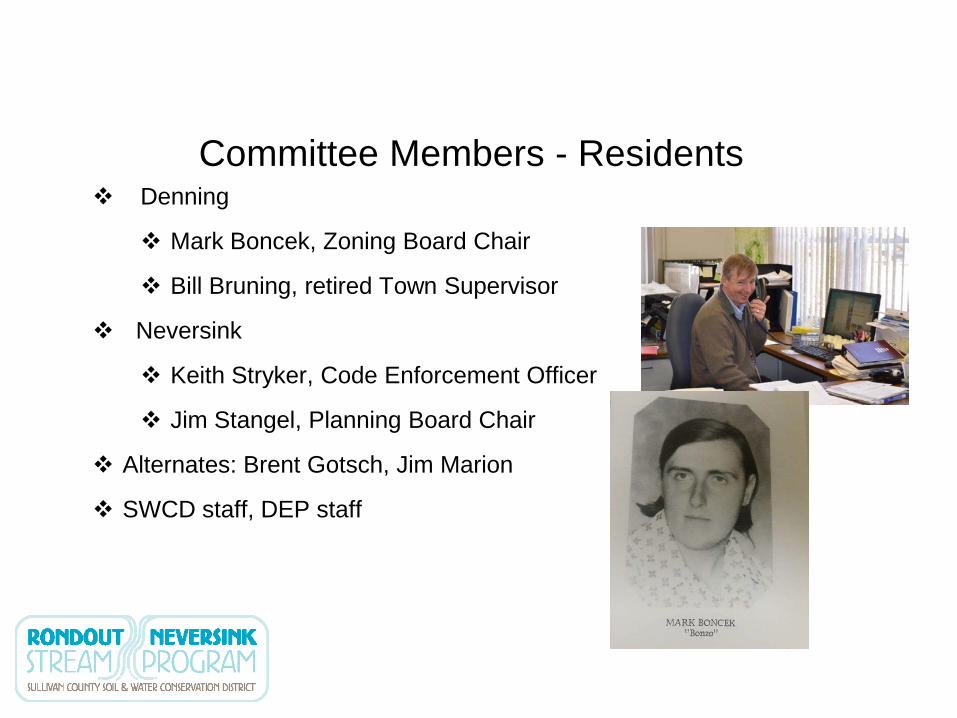
Denning
Mark Boncek, Zoning Board Chair
Bill Bruning, retired Town Supervisor
Neversink
Keith Stryker, Code Enforcement Officer
Jim Stangel, Planning Board Chair
Alternates: Brent Gotsch, Jim Marion
SWCD staff, DEP staff
Committee Members - Residents
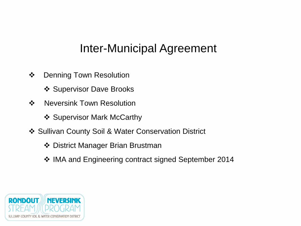
Inter-Municipal Agreement
Denning Town Resolution
Supervisor Dave Brooks
Neversink Town Resolution
Supervisor Mark McCarthy
Sullivan County Soil & Water Conservation District
District Manager Brian Brustman
IMA and Engineering contract signed September 2014

Request for Proposals (RFP)
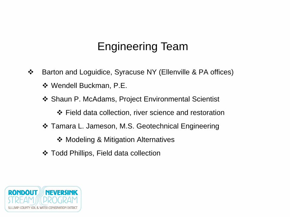
Engineering Team
Barton and Loguidice, Syracuse NY (Ellenville & PA offices)
Wendell Buckman, P.E.
Shaun P. McAdams, Project Environmental Scientist
Field data collection, river science and restoration
Tamara L. Jameson, M.S. Geotechnical Engineering
Modeling & Mitigation Alternatives
Todd Phillips, Field data collection

Data Collection Underway

Data Collection Underway (Approx. 7 mi)

Data Collection Underway (Approx. 7 mi)

With a complete data set to use for analyzing flooding Claryville can:
Identify specific causes of flooding
Choose the community’s best options
Accurately assess which options are most cost-beneficial
Modify floodplain?
Modify channel dimensions?
Modify infrastructure?
Integrate with priorities for water quality improvement (i.e., bank erosion)
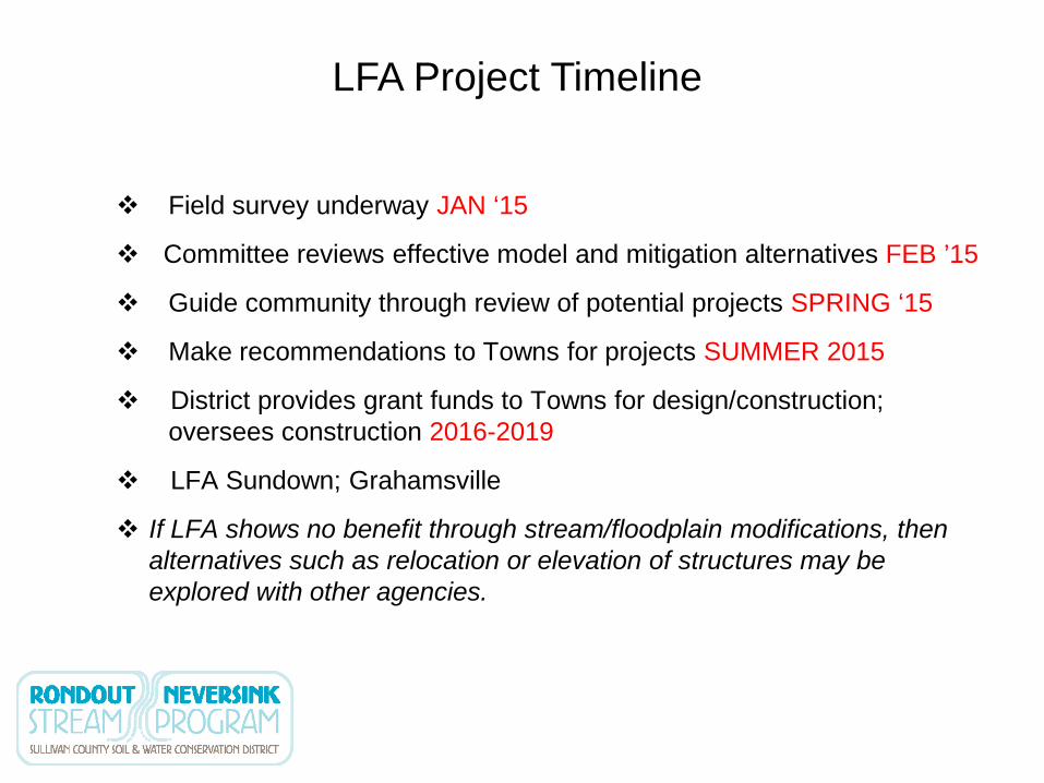
Field survey underway JAN ‘15
Committee reviews effective model and mitigation alternatives FEB ’15
Guide community through review of potential projects SPRING ‘15
Make recommendations to Towns for projects SUMMER 2015
District provides grant funds to Towns for design/construction; oversees construction 2016-2019
LFA Sundown; Grahamsville
If LFA shows no benefit through stream/floodplain modifications, then alternatives such as relocation or elevation of structures may be explored with other agencies.
LFA Project Timeline

Questions?