Landslide Monitoring Techniques · GeoNet landslide activities • Landslide distributions –...
38
Landslide response and monitoring – the New Zealand GeoNet experience C.I. Massey, M, McSaveney & G. Dellow GNS Science with contributions from the GeoNet landslide team and others
Transcript of Landslide Monitoring Techniques · GeoNet landslide activities • Landslide distributions –...
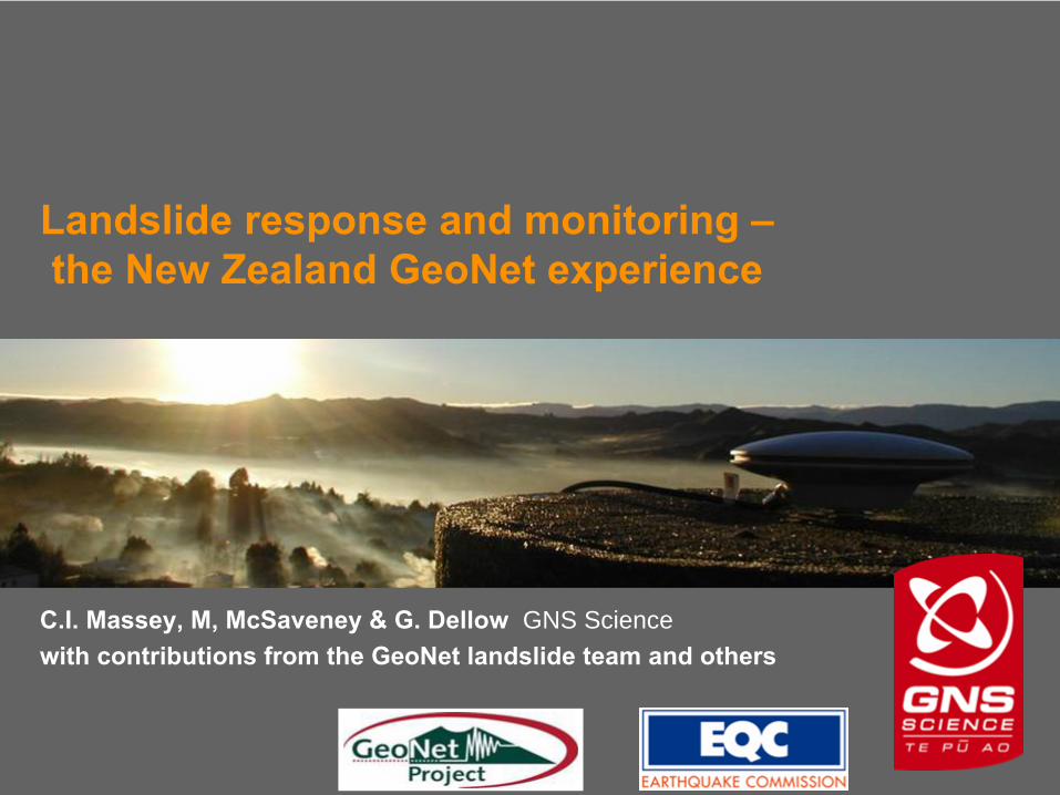
Landslide response and monitoring – the New Zealand GeoNet
experience
C.I. Massey, M, McSaveney & G. Dellow GNS Sciencewith contributions from the GeoNet
landslide team and others
GNS Science
The New Zealand GeoNet Project
An
integrated
geological hazards monitoring and data collection system, funded over 10 years by the New Zealand Earthquake Commission (EQC) and designed, built and operated by GNS Science
GNS Science
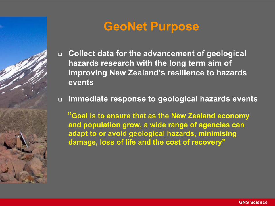
GeoNet Purpose
Collect data for the advancement of geological hazards research with the long term aim of improving New Zealand’s resilience to hazards events
Immediate response to geological hazards events
“Goal is to ensure that as the New Zealand economy and population grow, a wide range of agencies can adapt to or avoid geological hazards,
minimising
damage, loss of life and the cost of recovery”
GNS Science
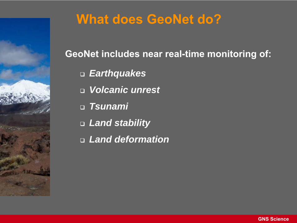
What does GeoNet do?
GeoNet includes near real-time monitoring of:
Earthquakes
Volcanic unrest
Tsunami
Land stability
Land deformation
GNS Science
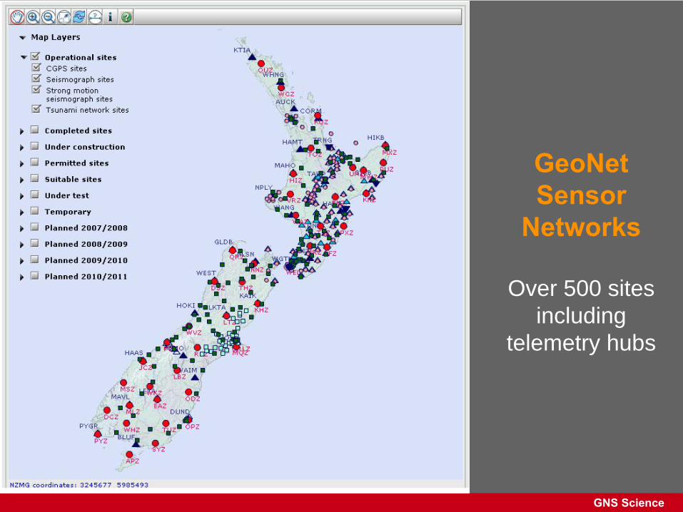
GeoNet Sensor
Networks
Over 500 sites including
telemetry hubs
GNS Science
GeoNet landslide activities
• Landslide distributions– National inventory of historical/pre-historical landslides– Catalogue of recent landslide events
• Landslide monitoring– Development of monitoring techniques– Surface and subsurface movement, – Movement triggers (rainfall, groundwater and ground
shaking)
• Rapid response (24/7) to landslide events– Facilitate collection of research quality data, of transient
phenomena – Maintain national register of responders
GNS Science
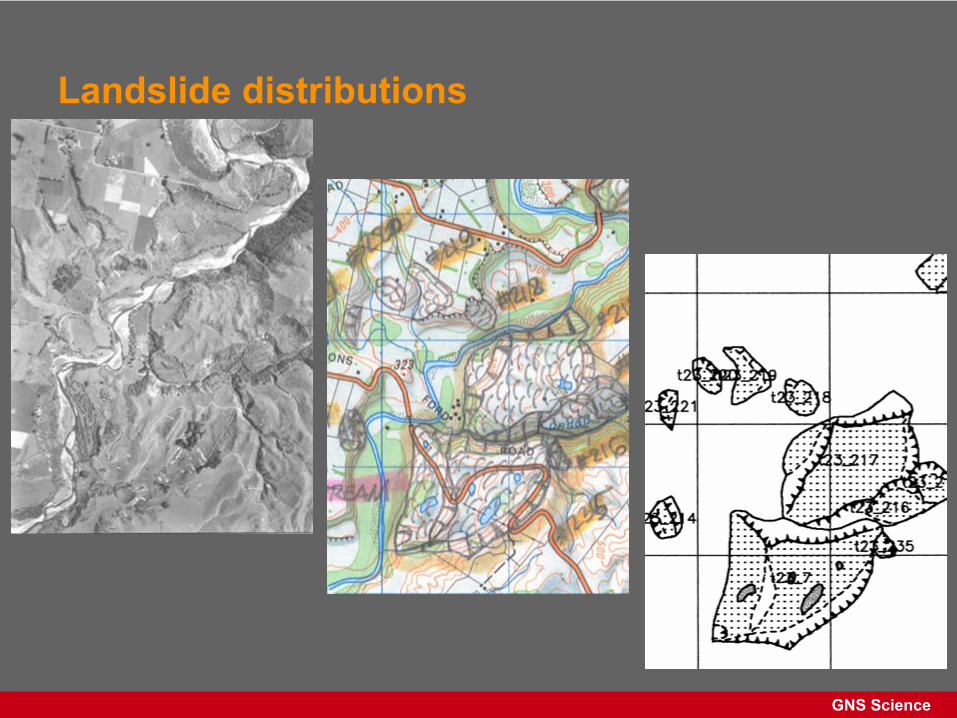
Landslide distributions
• Inventory:
mapped locations of landslides from aerial photographs, satellite images and field work
• Catalogue:
reported locations and time of occurrence (from 1996)
GNS Science
Landslide distributions
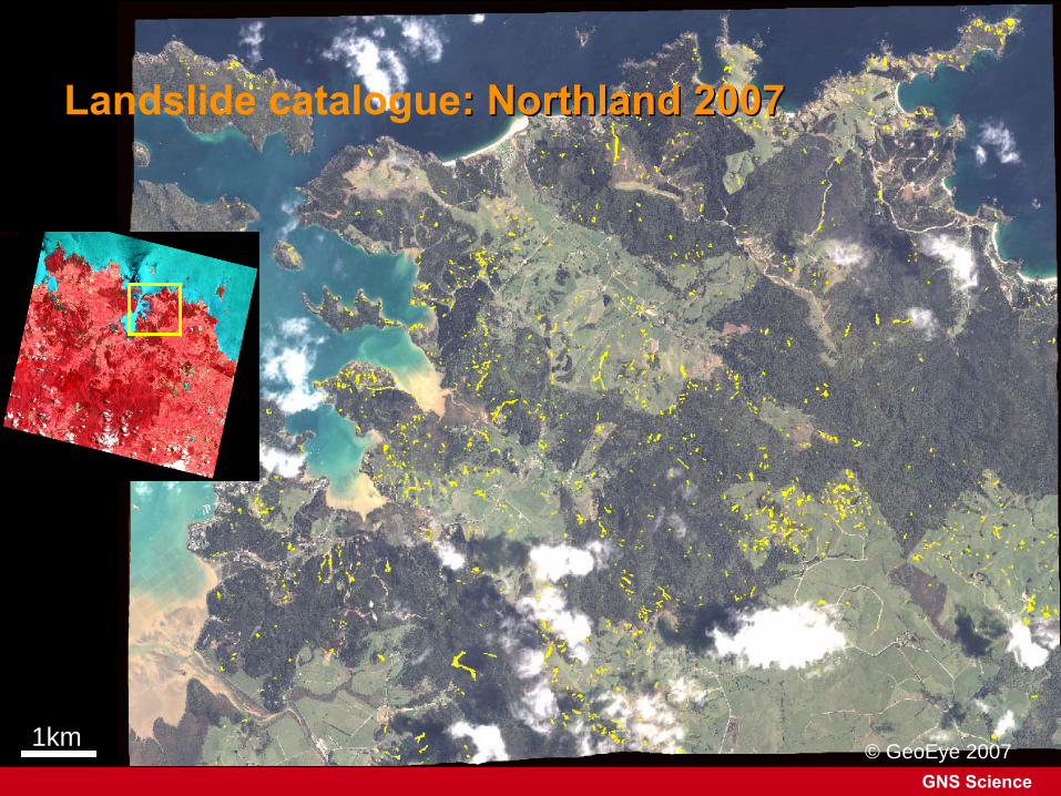
GNS Science© GeoEye 20071km
Landslide catalogue: Northland 2007: Northland 2007

GNS Science
Landslide monitoring –
the problems
• Techniques for improved temporal resolution
• Transfer, processing and display of data
• Landslide-specific data for NZ-wide models
GNS Science
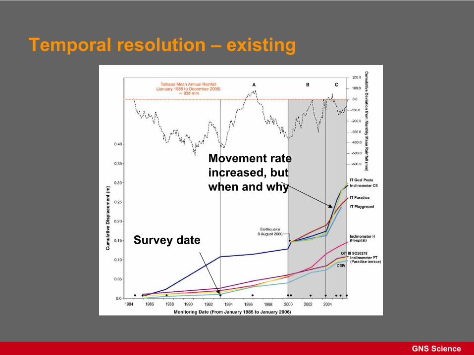
Temporal resolution –
existing
Movement rate increased, but when and why
Survey date
GNS Science
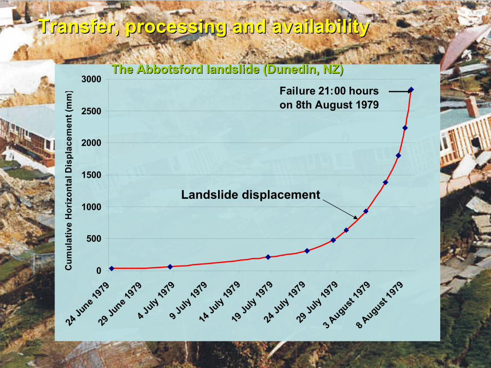
Transfer, processing and availabilityTransfer, processing and availability
0
500
1000
1500
2000
2500
3000
24 Ju
ne 1979
29 Ju
ne 1979
4 July
1979
9 July
1979
14 Ju
ly 1979
19 Ju
ly 1979
24 Ju
ly 1979
29 Ju
ly 1979
3 August
1979
8 August
1979
Cum
ulat
ive
Hor
izon
tal D
ispl
acem
ent (
mm
) Failure 21:00 hours on 8th August 1979
The Abbotsford landslide (Dunedin, NZ)The Abbotsford landslide (Dunedin, NZ)
Landslide displacement
GNS Science
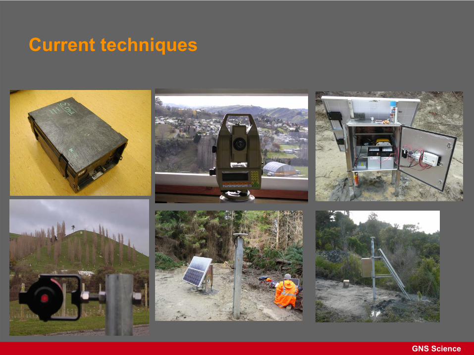
Current techniques
GNS Science
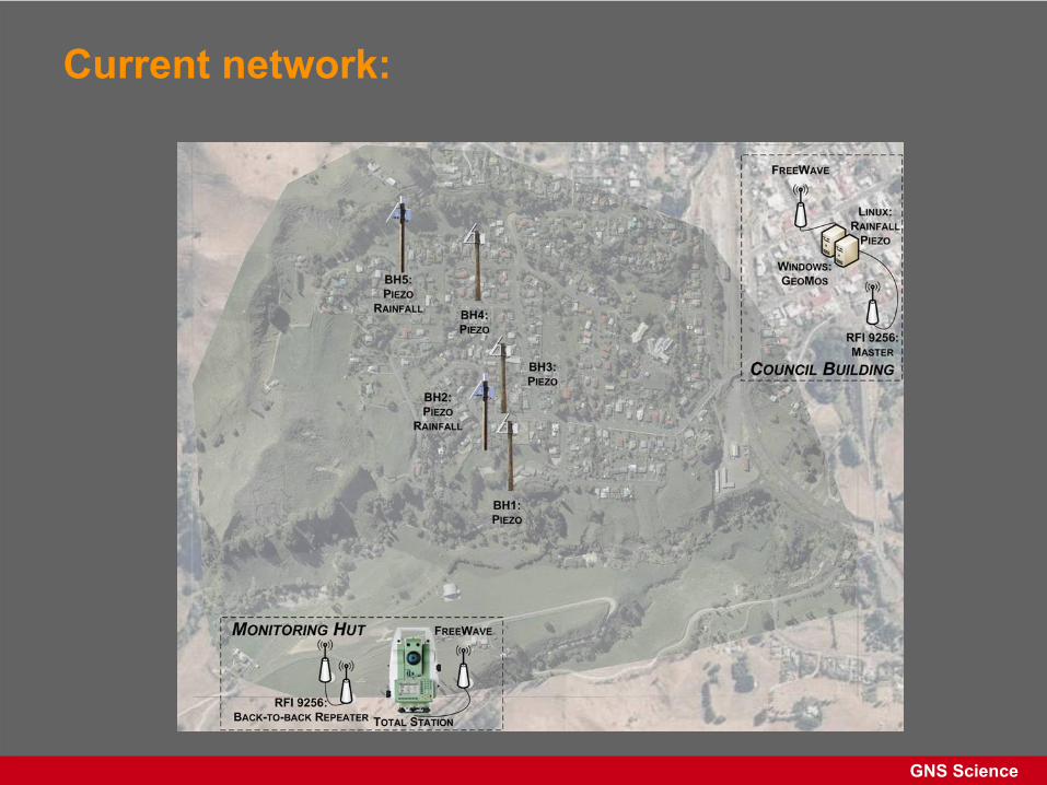
Current network:
GNS Science
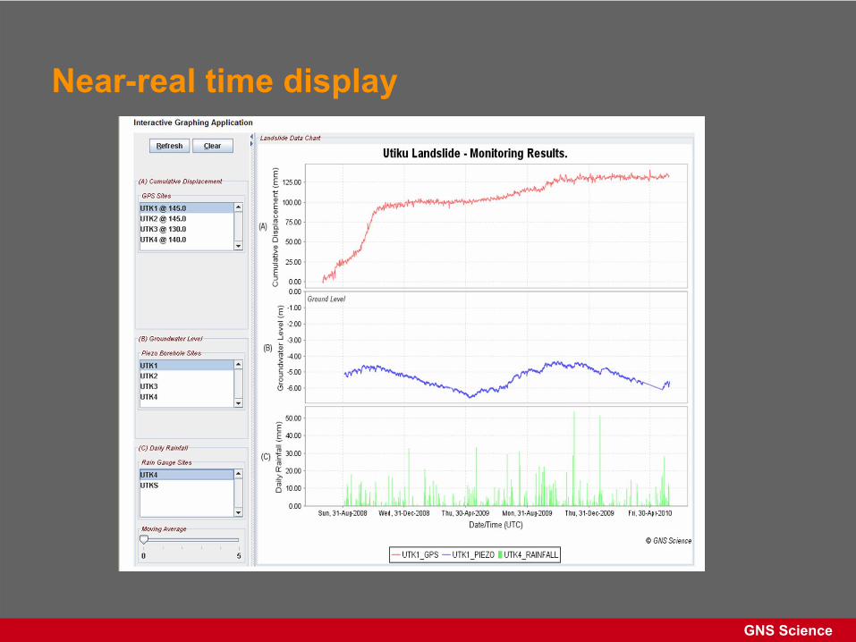
Near-real time display
GNS Science
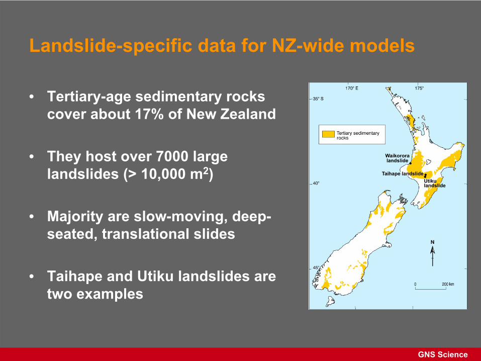
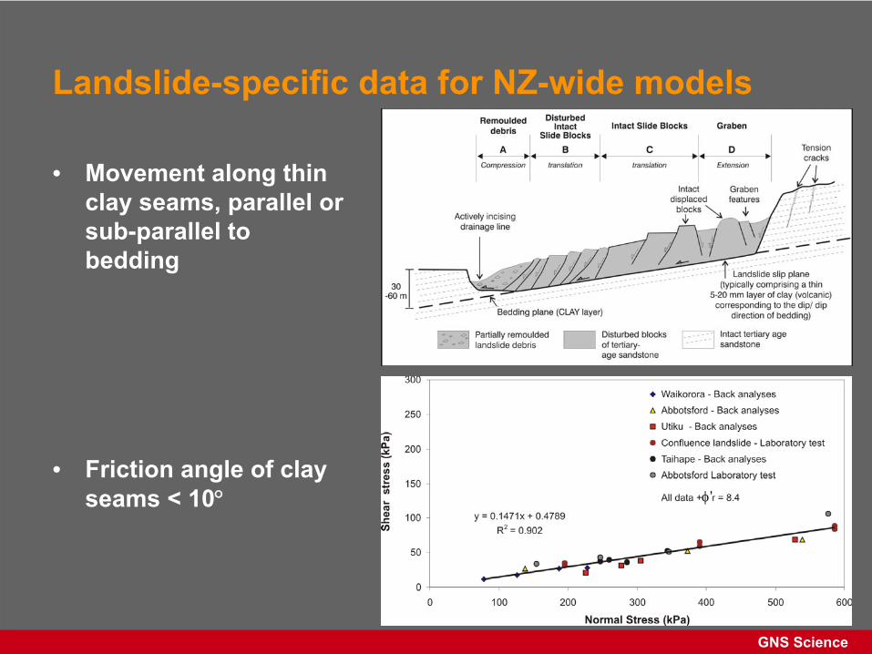
Landslide-specific data for NZ-wide models
• Tertiary-age sedimentary rocks cover about 17% of New Zealand
• They host over 7000 large landslides (> 10,000 m2)
• Majority are slow-moving, deep- seated, translational slides
• Taihape and Utiku landslides are two examples
GNS Science
• Movement along thin clay seams, parallel or sub-parallel to bedding
• Friction angle of clay seams < 10
Landslide-specific data for NZ-wide models
’
GNS Science
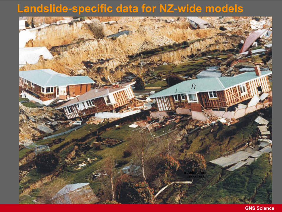
Landslide-specific data for NZ-wide models
Abbotsford landslides
GNS Science
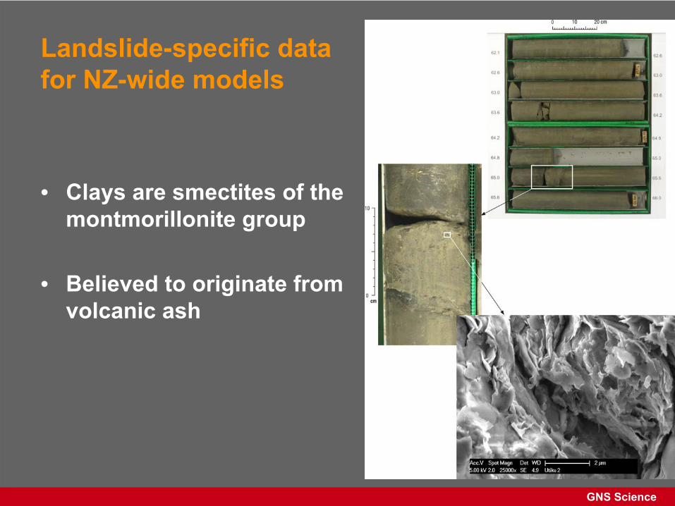
Landslide-specific data for NZ-wide models
• Clays are smectites
of the montmorillonite
group
• Believed to originate from volcanic ash
GNS Science
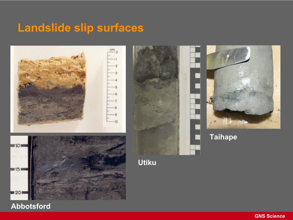
Landslide slip surfaces
Abbotsford
Utiku
Taihape
GNS Science
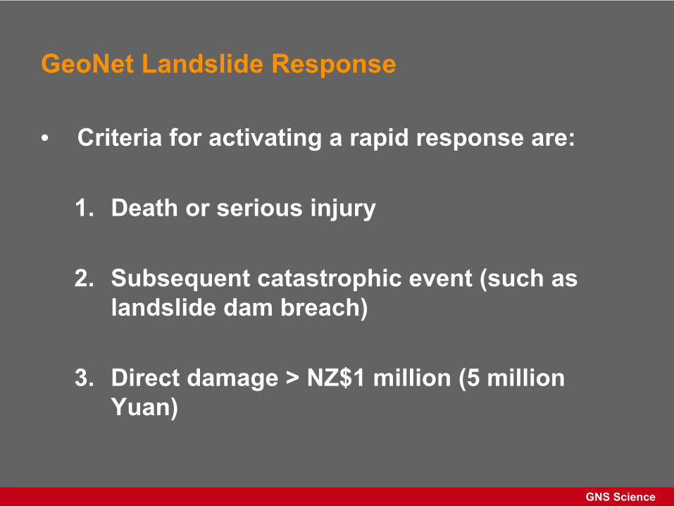
GeoNet
Landslide Response
• Criteria for activating a rapid response are:
1.
Death or serious injury
2.
Subsequent catastrophic event (such as landslide dam breach)
3.
Direct damage > NZ$1 million (5 million Yuan)
GNS Science
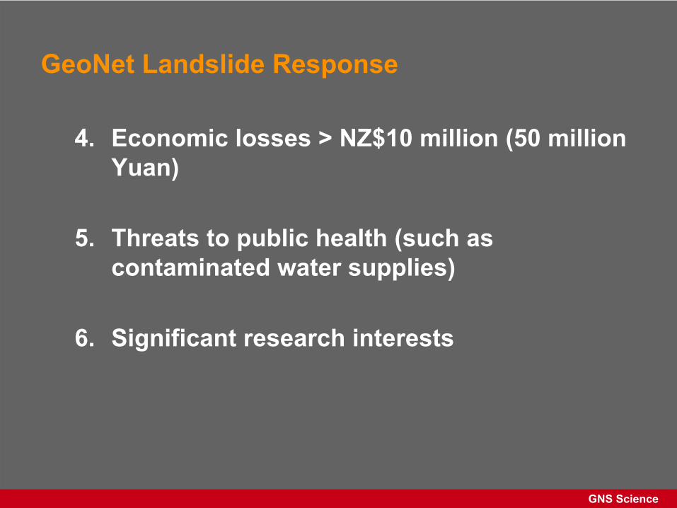
GeoNet
Landslide Response
4.
Economic losses > NZ$10 million (50 million Yuan)
5.
Threats to public health (such as contaminated water supplies)
6.
Significant research interests
GNS Science
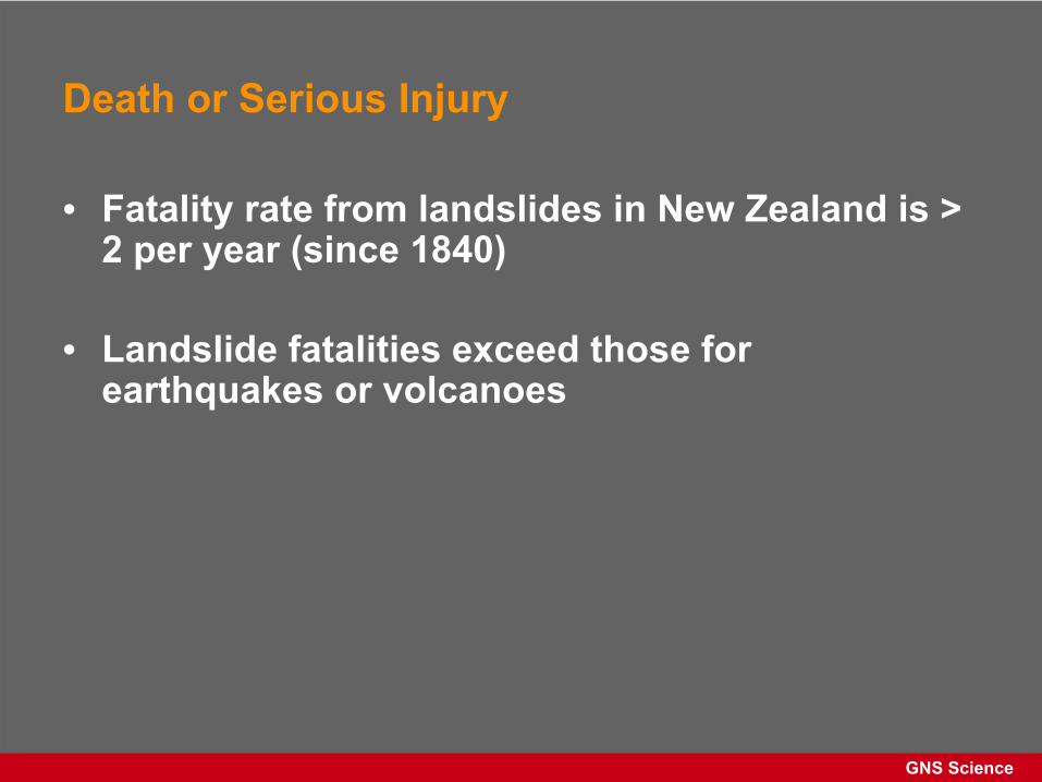
Death or Serious Injury
• Fatality rate from landslides in New Zealand is > 2 per year (since 1840)
• Landslide fatalities exceed those for earthquakes or volcanoes
GNS Science
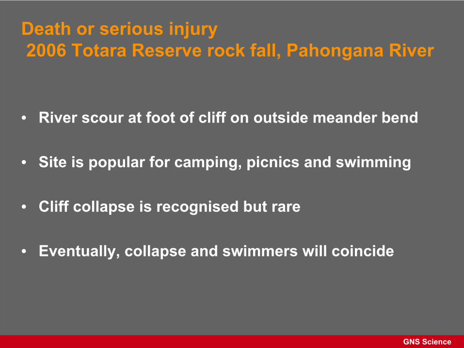
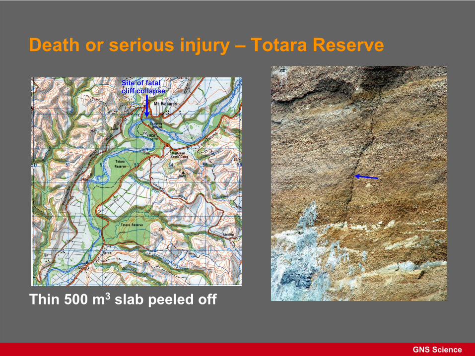
Death or serious injury 2006 Totara Reserve rock fall, Pahongana
River
• River scour at foot of cliff on outside meander bend
• Site is popular for camping, picnics and swimming
• Cliff collapse is recognised but rare
• Eventually, collapse and swimmers will coincide
GNS Science
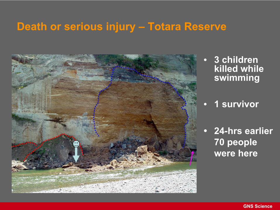
Death or serious injury –
Totara Reserve
Thin 500 m3
slab peeled off
GNS Science
Death or serious injury –
Totara Reserve
• 3 children killed while swimming
• 1 survivor
• 24-hrs earlier 70 people were here
GNS Science
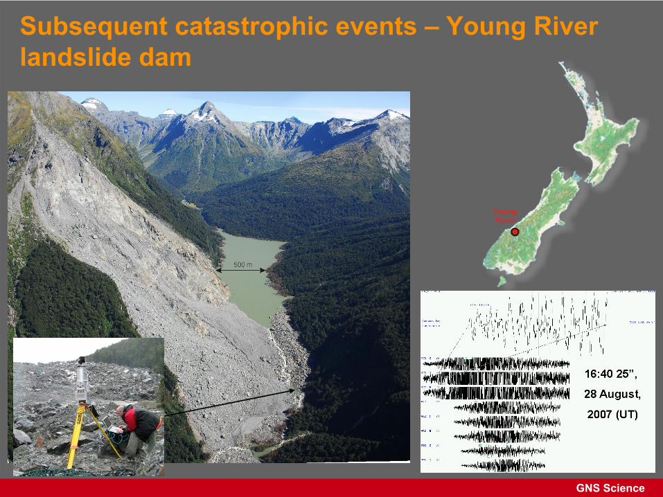
Subsequent catastrophic events –
Young River landslide dam
GNS Science
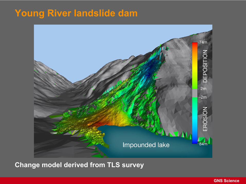
Young River landslide dam
Change model derived from TLS survey
GNS Science
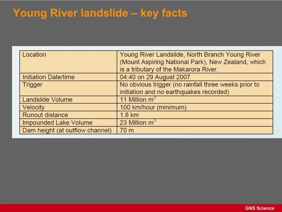
Young River landslide –
key facts
GNS Science
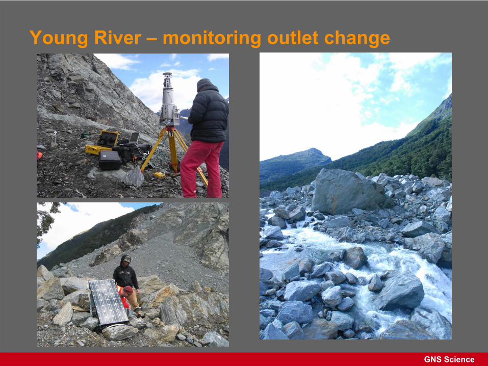
Young River –
monitoring outlet change
GNS Science
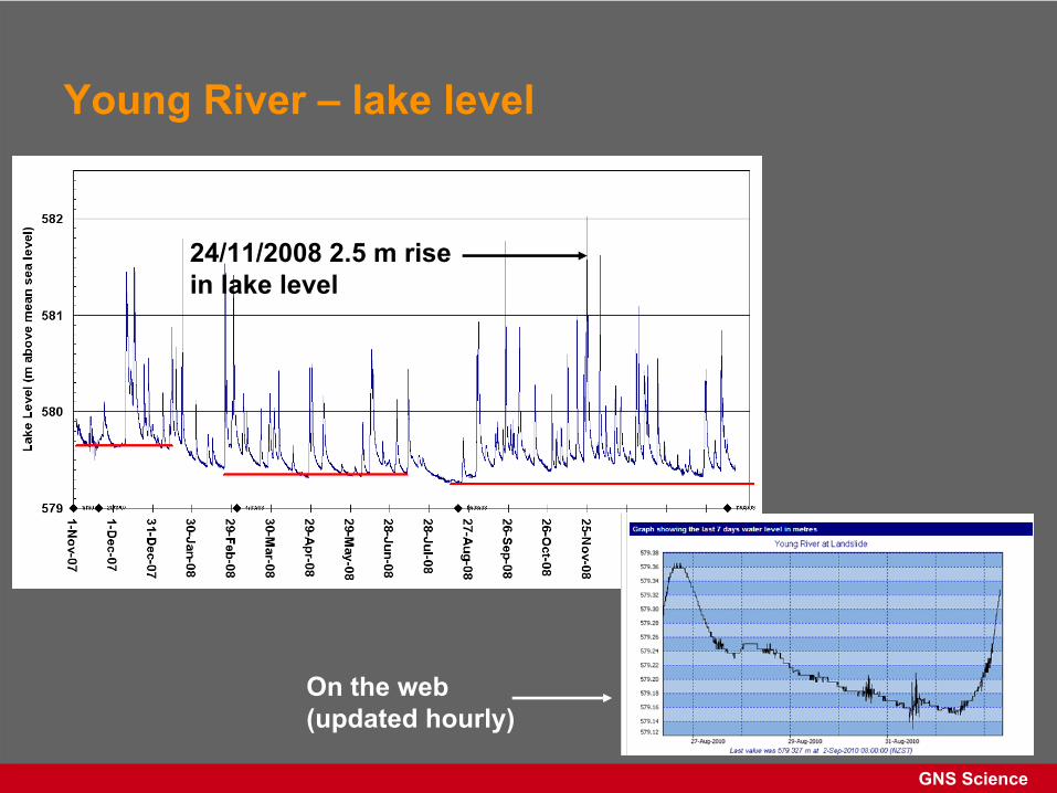
Young River –
lake level
24/11/2008 2.5 m rise in lake level
On the web (updated hourly)
GNS Science
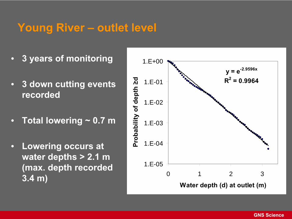
Young River –
outlet level
• 3 years of monitoring
• 3 down cutting events recorded
• Total lowering ~ 0.7 m
• Lowering occurs at water depths > 2.1 m (max. depth recorded 3.4 m)
y = e-2.9596x
R2 = 0.9964
1.E-05
1.E-04
1.E-03
1.E-02
1.E-01
1.E+00
0 1 2 3
Water depth (d) at outlet (m)
Prob
abili
ty o
f dep
th ≥
d
GNS Science
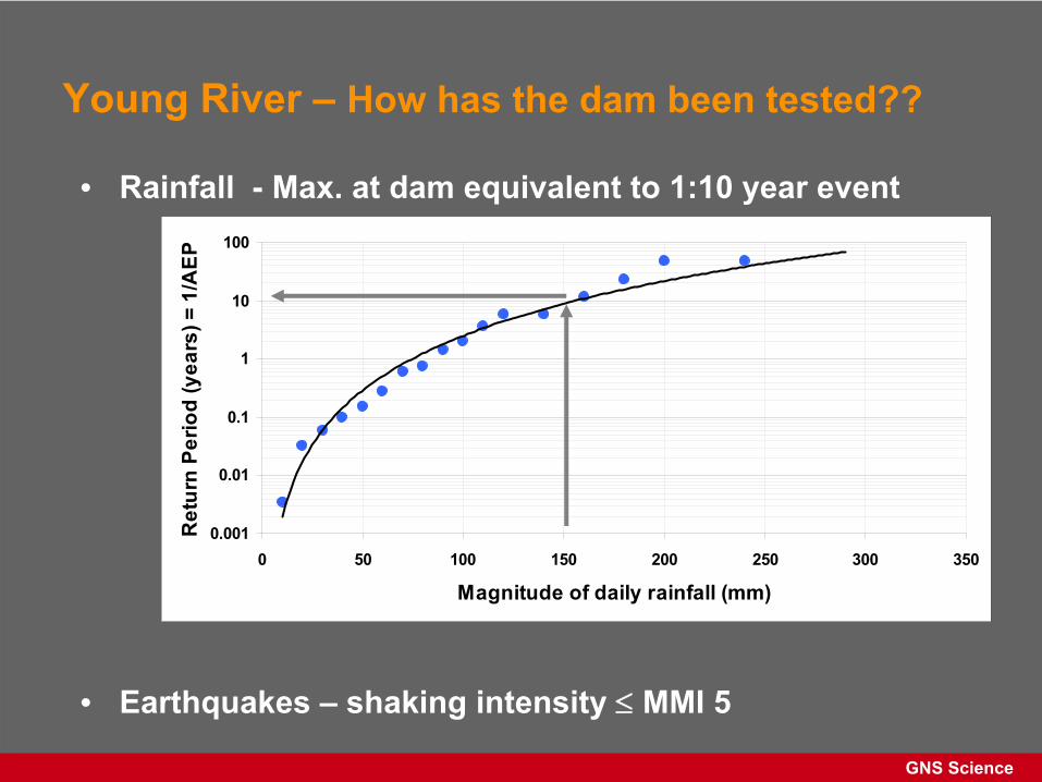
Young River –
How has the dam been tested??
0.001
0.01
0.1
1
10
100
0 50 100 150 200 250 300 350
Magnitude of daily rainfall (mm)
Ret
urn
Perio
d (y
ears
) = 1
/AEP
• Rainfall -
Max. at dam equivalent to 1:10 year event
• Earthquakes –
shaking intensity
MMI 5
GNS Science
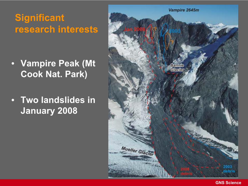
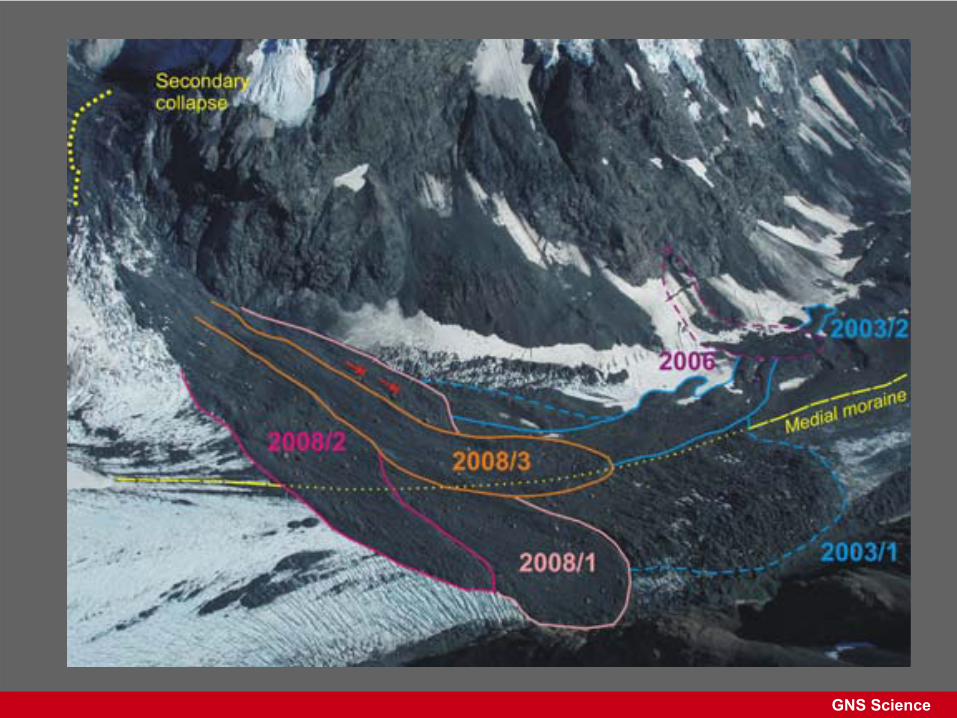
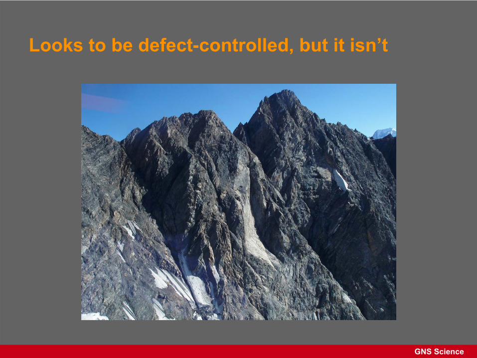
Significant research interests
• Vampire Peak (Mt Cook Nat. Park)
• Two landslides in January 2008
GNS Science
GNS Science
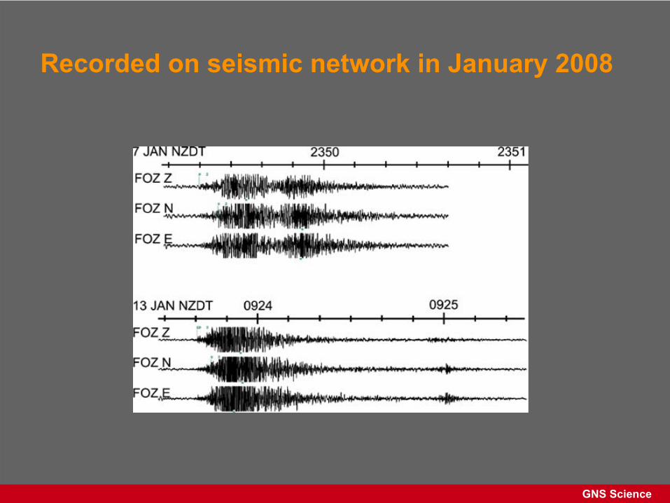
Recorded on seismic network in January 2008
GNS Science
Looks to be defect-controlled, but it isn’t
Thanks
C.I. Massey, M, McSaveney & G. Dellow GNS Sciencewith contributions from the GeoNet
landslide team and others