Joan bastide s1 land governance data tool
25
OneMap Myanmar Towards the coproduction of data and knowledge for inclusive land governance Joan Bastide – OneMap Myanmar Regional Land Forum – Hanoi, June 2016
-
Upload
mrlgregion -
Category
Education
-
view
167 -
download
2
Transcript of Joan bastide s1 land governance data tool
OneMapMyanmarTowardsthecoproductionofdataandknowledgeforinclusiveland
governance
JoanBastide– OneMapMyanmarRegionalLandForum– Hanoi, June2016
ContextandrationalesAddressinglandgovernanceinMyanmar

Thegovernanceoflandresourcesiscomplexbynature...
Knowledge
Navigatingtrade-offs(sectorsand
scale)
Goalorientedandequitable
decisionmaking
Sustainableland
management
Interconnectednessoflandfunctions
Data/information

Inagriculturalandnaturalresourcesbasedeconomies,landputsmany,andoftencompeting,interestsatstake
Onesinglesourceofdataonkeydatasetsisnotenough(oneversionofreality)
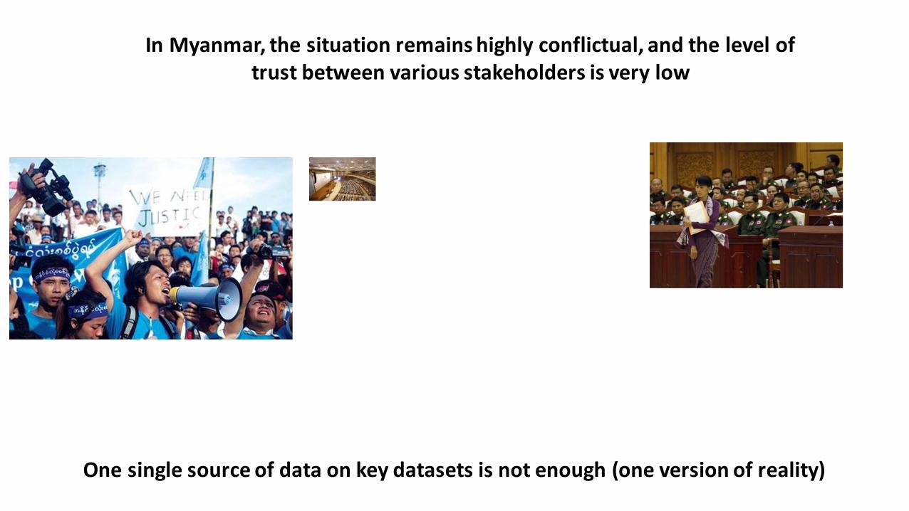
InMyanmar,thesituationremainshighlyconflictual,andtheleveloftrustbetweenvariousstakeholdersisverylow
Onesinglesourceofdataonkeydatasetsisnotenough(oneversionofreality)
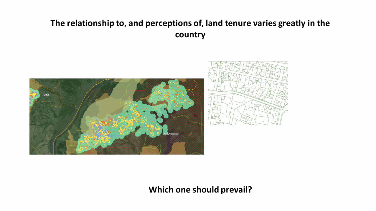
Therelationshipto,andperceptionsof,landtenurevariesgreatlyinthecountry
Whichoneshouldprevail?
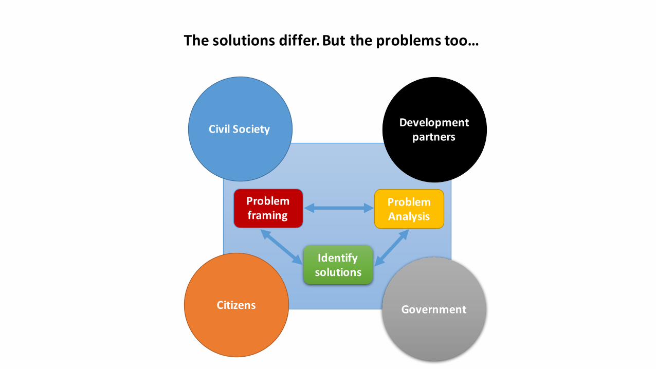
Developmentpartners
GovernmentCitizens
Problemframing
ProblemAnalysis
Identifysolutions
Thesolutionsdiffer.Buttheproblemstoo…
CivilSociety

Inordertotacklethecomplexity,gooddataandinformationisparamount

Butdataaloneisnotenough

Co-producingdataandknowledgeOneMapMyanmarasaframeworkfor

ProjectfactsheetTotalduration: 8YearsthroughmultiplephasesStartdate: August2015Funding: SwissAgencyforDevelopmentandCooperation(SDC)Implementingagencies:
Mainimplementers:UniversityofBerne,LandCoreGroupGovernmentpartners:25lineagenciesProjectpartners:MyanmarInformationManagementUnit;SERVIRMekong;FaunaandFloraInternational
Objective: An open-access spatial data platform on land-related informationfunctions as an effective basis for transparent and accountable landgovernance and development planningby government and citizens.

Knowledgegeneration
Dataquality/availability Capacities
InnovativeTools
Processes&
dialogues
StakeholderEngagement
Interventionlogic

Integrateavailableknowledgeanddata
Jointlyimplementactions
Learnfromexperience
UseevidencestofosterMSdialogue
Towardsanoperationalframeworkforco-productionofdataandknowledge
Workwithchampionsattechnicallevel
CSO Gov Research Politics Private Armedgroups

Developmentpartners
GovernmentCitizens
Problemframing
ProblemAnalysis
Identifysolutions
Thesolutionsdiffer.Buttheproblemstoo…
CivilSociety
Usingthetechnicalbackdoor
throughfacts&data
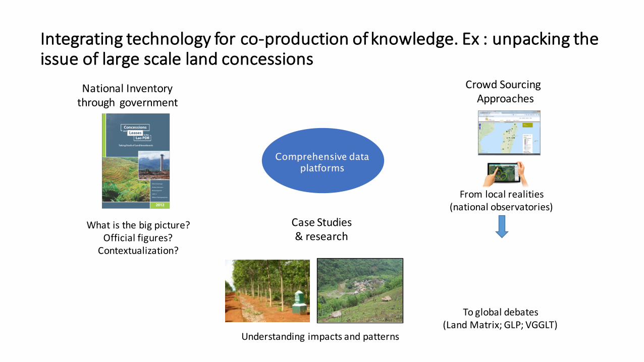
Integratingtechnologyforco-productionofknowledge.Ex:unpackingtheissueoflargescalelandconcessions
Whatisthebigpicture?Officialfigures?Contextualization?
CrowdSourcingApproaches
CaseStudies&research
Comprehensive data platforms
Fromlocalrealities(nationalobservatories)
Toglobaldebates(LandMatrix;GLP;VGGLT)
NationalInventorythrough government
Understandingimpactsandpatterns
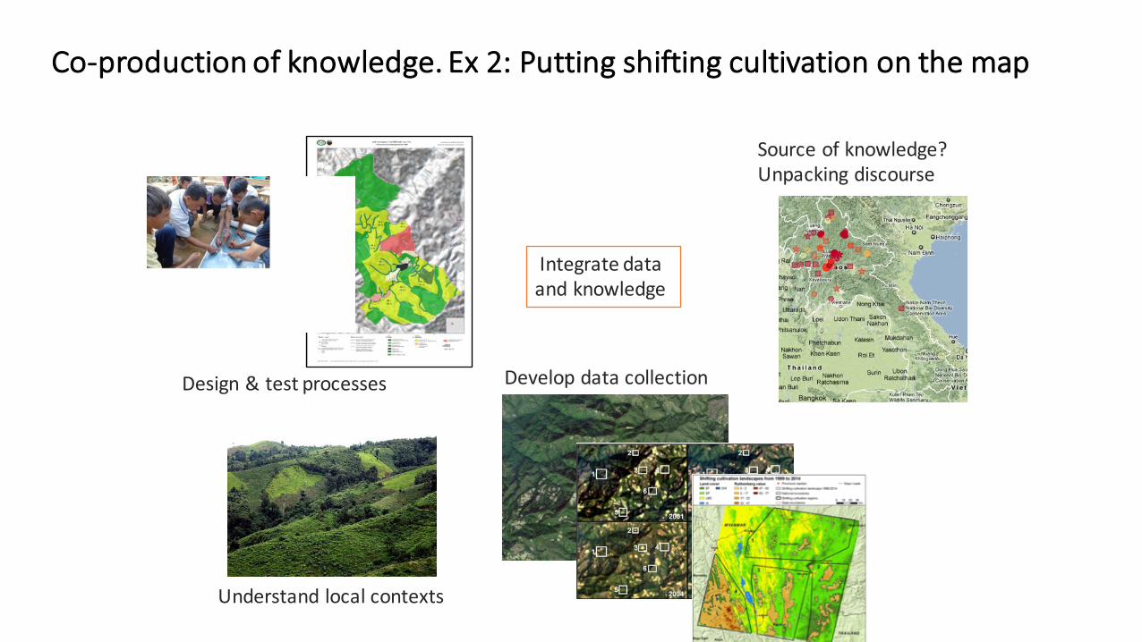
Co-productionofknowledge.Ex2:Puttingshiftingcultivationonthemap
Sourceofknowledge?Unpackingdiscourse
DevelopdatacollectionDesign&testprocesses
Understandlocalcontexts
Integratedataandknowledge

OneMaporOneMaps?Anecosystemofinterlinkedtools,modules,platformsandprocesses
gov.onemapmyanmar.info
cso.onemapmyanmar.infocrowd.onemapmyanmar.info
ParticipatoryMappingPlatform
DataRepository
MobileApplication
Department1
Department3
Department2
gis.onemapmyanmar.info
MetadataPlatform
MYGISWiki
LandObservatory
Mobileapps
Centralviewer
S???

Dataenhancement
DataintegrationDataanalysisOnlinePlatform
TECHNICALUNIT
(25Dpt)
TECHNICALASSISTANCE
DPT1
DPT2
DPT3
DPT…
WorkingwithgovernmentEnhanceddata
TechnicalSupport/Data integration/Crosssectoral analysis
OpenDataongovernment
Onlineplatform

Supportcompilationofdatagatheredlocally.Eg:Participatorymappingforcustomarytenure,villageboundaries,landuseplanning
OneMap

Engagingthebroadersociety:Map,documentanddiscusscasesbasedoncrowdsourcingapproach
20

Allowpublicmonitoringofprojectimplementation
21

Dataintegrationbetweenplatformsanddata
22

Customizedtools.Datacollectionapps?OpenTenure?Others?

StrengtheningthenationalGIScommunity
MyanmarGISWiki Datacatalogue
Knowledgebase
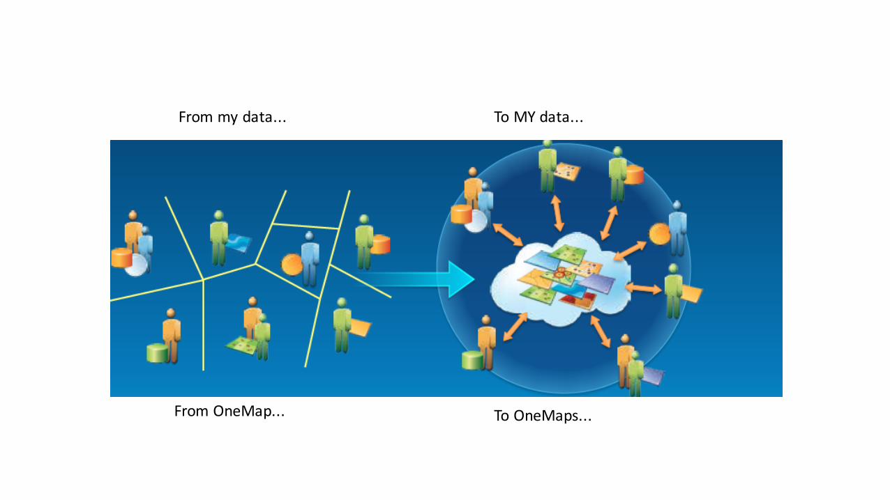
Frommydata... ToMYdata...
From OneMap... ToOneMaps...