Introducing GIS Getting to Know ArcGIS Desktop. Brief History Recap Studying the world using maps...
14
Introducing GIS Introducing GIS Getting to Know ArcGIS Getting to Know ArcGIS Desktop Desktop
-
date post
22-Dec-2015 -
Category
Documents
-
view
213 -
download
0
Transcript of Introducing GIS Getting to Know ArcGIS Desktop. Brief History Recap Studying the world using maps...

Introducing GISIntroducing GIS
Getting to Know ArcGISGetting to Know ArcGIS
DesktopDesktop
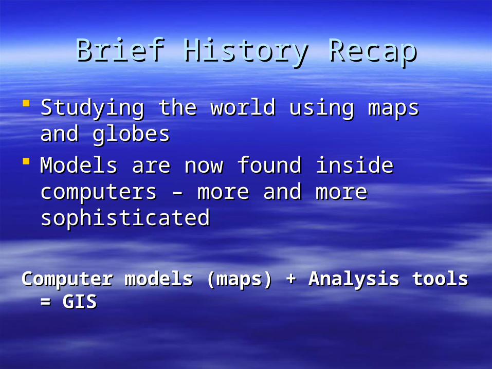
Brief History RecapBrief History Recap
Studying the world using maps and globesStudying the world using maps and globes Models are now found inside computers – Models are now found inside computers –
more and more sophisticatedmore and more sophisticated
Computer models (maps) + Analysis tools = GISComputer models (maps) + Analysis tools = GIS
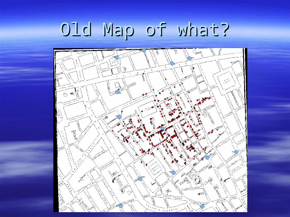
Old Map of what?Old Map of what?
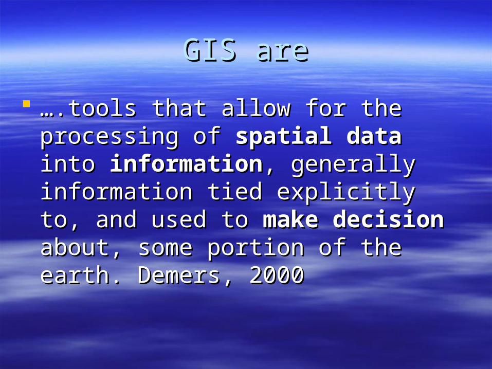
GIS areGIS are
…….tools that allow for the processing of .tools that allow for the processing of spatial dataspatial data into into informationinformation, generally , generally information tied explicitly to, and used to information tied explicitly to, and used to make decisionmake decision about, some portion of about, some portion of the earth. Demers, 2000the earth. Demers, 2000

Forecasting Geological TrendsForecasting Geological Trends
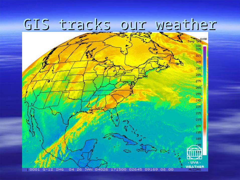
GIS tracks our weatherGIS tracks our weather

Layers of GISLayers of GIS

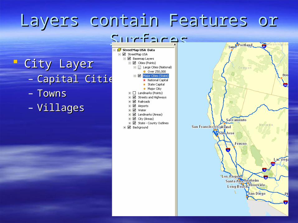
Layers contain Features or SurfacesLayers contain Features or Surfaces
City LayerCity Layer– Capital CitiesCapital Cities– TownsTowns– VillagesVillages

Features have shape and sizeFeatures have shape and size
Can be represented one of 3 waysCan be represented one of 3 ways– Point (cities, schools, fire hydrants etc…)Point (cities, schools, fire hydrants etc…)– Line (road, river, pipelines)Line (road, river, pipelines)– Polygon (countries, lakes, tracts of land)Polygon (countries, lakes, tracts of land)
Same object may be represented by a polygon in Same object may be represented by a polygon in one layer and line or point in another.one layer and line or point in another.
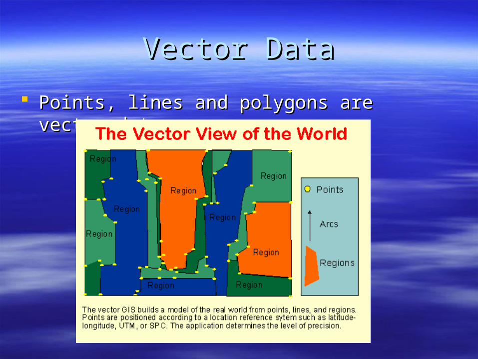
Vector DataVector Data
Points, lines and polygons are vector dataPoints, lines and polygons are vector data
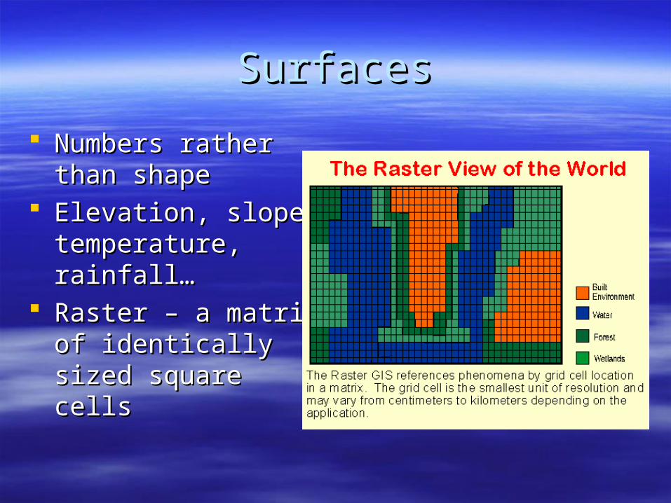
SurfacesSurfaces
Numbers rather than Numbers rather than shapeshape
Elevation, slope, Elevation, slope, temperature, rainfall…temperature, rainfall…
Raster – a matrix of Raster – a matrix of identically sized identically sized square cellssquare cells

Surface-Raster of OceanSurface-Raster of Ocean
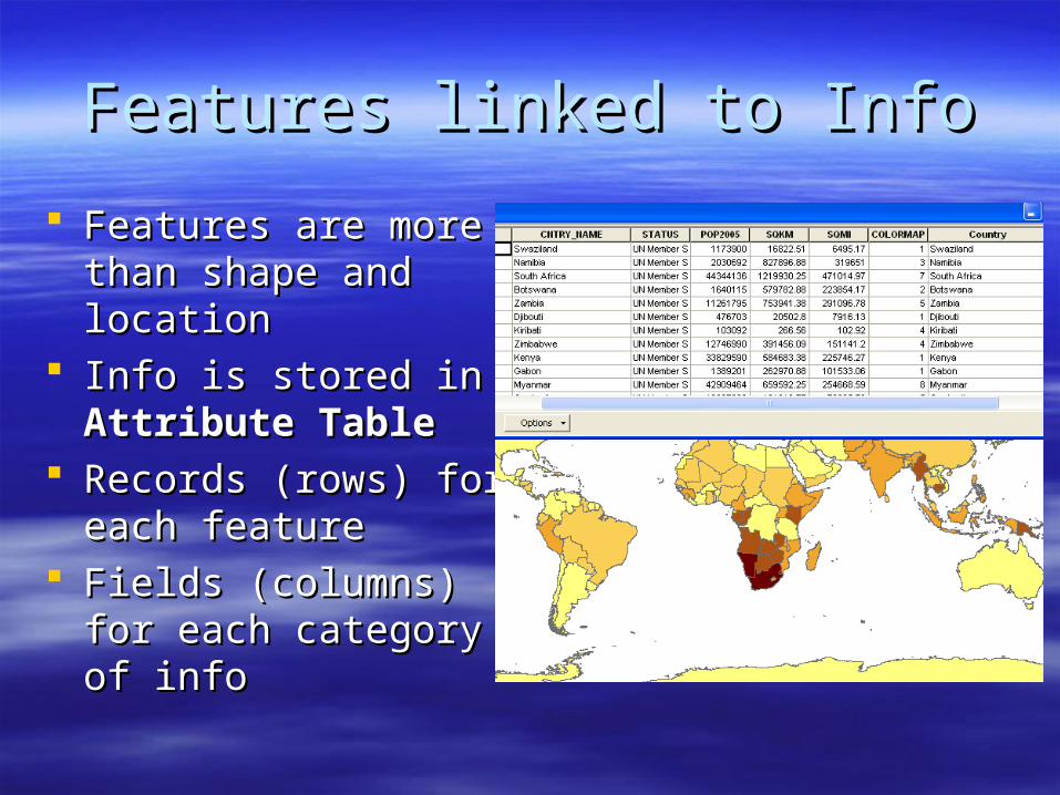
Features linked to InfoFeatures linked to Info
Features are more Features are more than shape and than shape and locationlocation
Info is stored in Info is stored in Attribute TableAttribute Table
Records (rows) for Records (rows) for each featureeach feature
Fields (columns) for Fields (columns) for each category of infoeach category of info