INDEPENDENT MONITOR REPORT 2017 - Home - Home · INDEPENDENT MONITOR REPORT 2017 In December 2017,...
4
INDEPENDENT MONITOR REPORT 2017 In December 2017, the Independent Monitor (IM) released a report on the activities of McArthur River Mine (MRM) covering the period October 2015 to September 2016. In the Report, the IM has noted substantial improvements at the site, including: • Better understanding of waste rock and tailings material geochemical properties at the mine site and improved waste rock classification criteria. • Improved understanding of groundwater across the site. • Continued improvements in tailings management. • Improved quality control in constructing the northern overburden emplacement facility. • Increased metals monitoring in freshwater fauna and flora in Barney Creek, including freshwater aquatic plants. • Continued falling levels of contaminants in biota sampled within the mine site, where the presence of lead has declined 600% since 2014. • Planting of over 25,000 plants, including over 20,000 along the McArthur River diversion channel. • Placing large wood debris into the downstream end of the McArthur River diversion channel. The IM recommended a number of areas for improvement, many of which have already been undertaken. It is important to remember that the IM Report covers a period that ended more than 14 months ago and further improvements have been made to operations since then. We take the findings of the IM Report seriously. Glencore has been transparent and open about the challenges facing MRM and we remain committed to engaging with the Northern Territory Government, the local community of Borroloola and other key stakeholders to provide information about our performance and ongoing progress. Our top priorities remain the health and safety of our workforce, the protection of the surrounding environment, ensuring the long-term sustainability of our operation and making a positive contribution to the community and the Territory. This factsheet has been developed to provide our stakeholders with a high level summary of the key issues or observations made in the IM Report and to outline steps MRM has taken since the reporting period to address these issues. WASTE ROCK In 2013, following detailed test work, MRM reported a change in the characterisation of the waste rock. MRM’s tests identified material in the waste rock pile (also called the overburden emplacement facility) that was saline and/ or metalliferous, which may increase the potential for saline and metalliferous drainage at the mine. There is no acid leaching from the waste rock area or the tailings dam. For the period October 2015 to September 2016, the IM noted continual improvements in MRM’s management of waste rock, particularly with regard to minimising potentially acid-forming (PAF) rock issues, including: • Completion of geochemical testing and investigations so that the geochemical properties of overburden materials at the mine are well understood. • Use of kinetic data to develop improved waste rock classification criteria. • Improvements to block modelling, materials tracking and checks. • Completion of a number of studies and assessments to address information gaps.
-
Upload
phamnguyet -
Category
Documents
-
view
214 -
download
0
Transcript of INDEPENDENT MONITOR REPORT 2017 - Home - Home · INDEPENDENT MONITOR REPORT 2017 In December 2017,...
INDEPENDENT MONITOR REPORT 2017
In December 2017, the Independent Monitor (IM) released a report on the activities of McArthur River Mine (MRM) covering the period October 2015 to September 2016.
In the Report, the IM has noted substantial improvements at the site, including:
• Better understanding of waste rock and tailings material geochemical properties at the mine site and improved waste rock classification criteria.
• Improved understanding of groundwater across the site.
• Continued improvements in tailings management.
• Improved quality control in constructing the northern overburden emplacement facility.
• Increased metals monitoring in freshwater fauna and flora in Barney Creek, including freshwater aquatic plants.
• Continued falling levels of contaminants in biota sampled within the mine site, where the presence of lead has declined 600% since 2014.
• Planting of over 25,000 plants, including over 20,000 along the McArthur River diversion channel.
• Placing large wood debris into the downstream end of the McArthur River diversion channel.
The IM recommended a number of areas for improvement, many of which have already been undertaken.
It is important to remember that the IM Report covers a period that ended more than 14 months ago and further improvements have been made to operations since then.
We take the findings of the IM Report seriously. Glencore has been transparent and open about the challenges facing MRM and we remain committed to engaging with the Northern Territory Government, the local community of Borroloola and other key stakeholders to provide information about our performance and ongoing progress.
Our top priorities remain the health and safety of our workforce, the protection of the surrounding environment, ensuring the long-term sustainability of our operation and making a positive contribution to the community and the Territory.
This factsheet has been developed to provide our stakeholders with a high level summary of the key issues or observations made in the IM Report and to outline steps MRM has taken since the reporting period to address these issues.
WASTE ROCK
In 2013, following detailed test work, MRM reported a change in the characterisation of the waste rock. MRM’s tests identified material in the waste rock pile (also called the overburden emplacement facility) that was saline and/or metalliferous, which may increase the potential for saline and metalliferous drainage at the mine. There is no acid leaching from the waste rock area or the tailings dam.
For the period October 2015 to September 2016, the IM noted continual improvements in MRM’s management of waste rock, particularly with regard to minimising potentially acid-forming (PAF) rock issues, including:
• Completion of geochemical testing and investigations so that the geochemical properties of overburden materials at the mine are well understood.
• Use of kinetic data to develop improved waste rock classification criteria.
• Improvements to block modelling, materials tracking and checks.
• Completion of a number of studies and assessments to address information gaps.
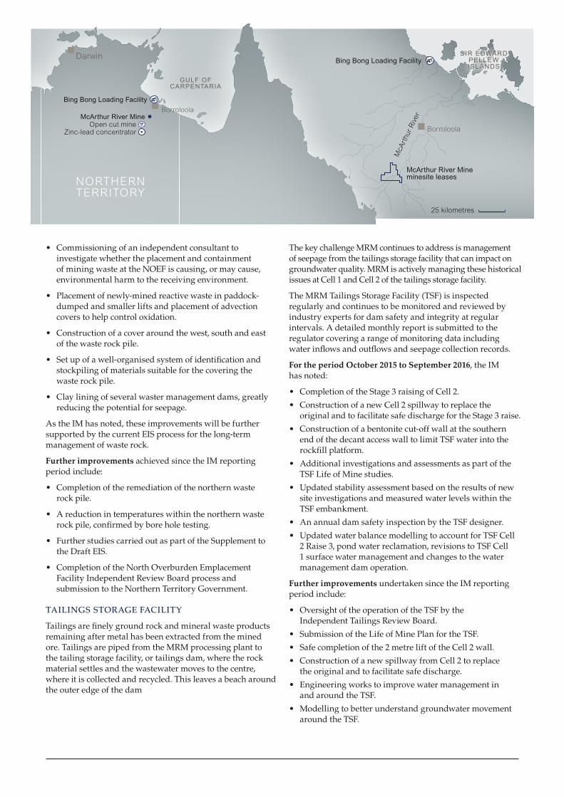
McArthur River Mine minesite leases
25 kilometres
McA
rthu
r R
iver
SIR EDWARD PELLEW ISLANDS
Borroloola
Bing Bong Loading Facility
Blown up to 425% in PowerPoint template (was 325%)
Darwin
Brisbane
McArthur River MineOpen cut mine
Zinc-lead concentrator
NORTHERN TERRITORY
Bing Bong Loading FacilityBorroloola
GULF OF CARPENTARIA
• Commissioning of an independent consultant to investigate whether the placement and containment of mining waste at the NOEF is causing, or may cause, environmental harm to the receiving environment.
• Placement of newly-mined reactive waste in paddock-dumped and smaller lifts and placement of advection covers to help control oxidation.
• Construction of a cover around the west, south and east of the waste rock pile.
• Set up of a well-organised system of identification and stockpiling of materials suitable for the covering the waste rock pile.
• Clay lining of several waster management dams, greatly reducing the potential for seepage.
As the IM has noted, these improvements will be further supported by the current EIS process for the long-term management of waste rock.
Further improvements achieved since the IM reporting period include:
• Completion of the remediation of the northern waste rock pile.
• A reduction in temperatures within the northern waste rock pile, confirmed by bore hole testing.
• Further studies carried out as part of the Supplement to the Draft EIS.
• Completion of the North Overburden Emplacement Facility Independent Review Board process and submission to the Northern Territory Government.
TAILINGS STORAGE FACILITY
Tailings are finely ground rock and mineral waste products remaining after metal has been extracted from the mined ore. Tailings are piped from the MRM processing plant to the tailing storage facility, or tailings dam, where the rock material settles and the wastewater moves to the centre, where it is collected and recycled. This leaves a beach around the outer edge of the dam
The key challenge MRM continues to address is management of seepage from the tailings storage facility that can impact on groundwater quality. MRM is actively managing these historical issues at Cell 1 and Cell 2 of the tailings storage facility.
The MRM Tailings Storage Facility (TSF) is inspected regularly and continues to be monitored and reviewed by industry experts for dam safety and integrity at regular intervals. A detailed monthly report is submitted to the regulator covering a range of monitoring data including water inflows and outflows and seepage collection records.
For the period October 2015 to September 2016, the IM has noted:
• Completion of the Stage 3 raising of Cell 2.
• Construction of a new Cell 2 spillway to replace the original and to facilitate safe discharge for the Stage 3 raise.
• Construction of a bentonite cut-off wall at the southern end of the decant access wall to limit TSF water into the rockfill platform.
• Additional investigations and assessments as part of the TSF Life of Mine studies.
• Updated stability assessment based on the results of new site investigations and measured water levels within the TSF embankment.
• An annual dam safety inspection by the TSF designer.
• Updated water balance modelling to account for TSF Cell 2 Raise 3, pond water reclamation, revisions to TSF Cell 1 surface water management and changes to the water management dam operation.
Further improvements undertaken since the IM reporting period include:
• Oversight of the operation of the TSF by the Independent Tailings Review Board.
• Submission of the Life of Mine Plan for the TSF.
• Safe completion of the 2 metre lift of the Cell 2 wall.
• Construction of a new spillway from Cell 2 to replace the original and to facilitate safe discharge.
• Engineering works to improve water management in and around the TSF.
• Modelling to better understand groundwater movement around the TSF.
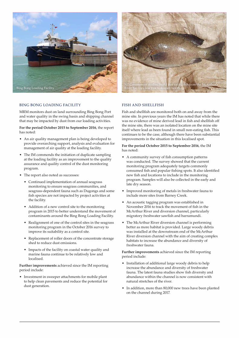
BING BONG LOADING FACILITY
MRM monitors dust on land surrounding Bing Bong Port and water quality in the swing basin and shipping channel that may be impacted by dust from our loading activities.
For the period October 2015 to September 2016, the report has noted:
• An air quality management plan is being developed to provide overarching support, analysis and evaluation for management of air quality at the loading facility.
• The IM commends the initiation of duplicate sampling at the loading facility as an improvement to the quality assurance and quality control of the dust monitoring program.
• The report also noted as successes:
• Continued implementation of annual seagrass monitoring to ensure seagrass communities, and seagrass-dependent fauna such as Dugongs and some fish species are not impacted by project activities at the facility.
• Addition of a new control site to the monitoring program in 2015 to better understand the movement of contaminants around the Bing Bong Loading Facility.
• Realignment of one of the control sites in the seagrass monitoring program in the October 2016 survey to improve its suitability as a control site.
• Replacement of roller doors of the concentrate storage shed to reduce dust emissions.
• Impacts of the facility on coastal water quality and marine fauna continue to be relatively low and localised.
Further improvements achieved since the IM reporting period include:
• Investment in sweeper attachments for mobile plant to help clean pavements and reduce the potential for dust generation.
FISH AND SHELLFISH
Fish and shellfish are monitored both on and away from the mine site. In previous years the IM has noted that while there was no evidence of mine derived lead in fish and shellfish off the mine site, there was an isolated location on the mine site itself where lead as been found in small non-eating fish. This continues to be the case, although there have been substantial improvements in the situation in this localised spot.
For the period October 2015 to September 2016, the IM has noted:
• A community survey of fish consumption patterns was conducted. The survey showed that the current monitoring program adequately targets commonly consumed fish and popular fishing spots. It also identified new fish and locations to include in the monitoring program. Samples will also be collected in the early and late dry season.
• Improved monitoring of metals in freshwater fauna to include more sites from Barney Creek.
• An acoustic tagging program was established in November 2016 to track the movement of fish in the McArthur River and diversion channel, particularly migratory freshwater sawfish and barramundi.
• The McArthur River diversion channel is performing better as more habitat is provided. Large woody debris was installed at the downstream end of the McArthur River diversion channel with the aim of creating complex habitats to increase the abundance and diversity of freshwater fauna.
Further improvements achieved since the IM reporting period include:
• Installation of additional large woody debris to help increase the abundance and diversity of freshwater fauna. The latest fauna studies show fish diversity and abundance within the channel is now consistent with natural stretches of the river.
• In addition, more than 80,000 new trees have been planted on the channel during 2017.
NT Government studies found that eating fish from the McArthur River has very low risk to human healthBing Bong Loading Facility
D10
_GLN
2873
A_1
2/17
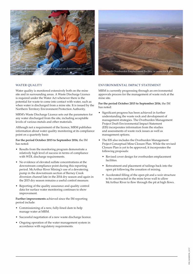
WATER QUALITY
Water quality is monitored extensively both on the mine site and in surrounding areas. A Waste Discharge Licence is required under the Water Act whenever there is the potential for waste to come into contact with water, such as when water is discharged from a mine site. It is issued by the Northern Territory Environment Protection Authority.
MRM’s Waste Discharge Licence sets out the parameters for any water discharged from the site, including acceptable levels of various metals and other materials.
Although not a requirement of the licence, MRM publishes information about water quality monitoring at its compliance point on a quarterly basis
For the period October 2015 to September 2016, the IM has noted:
• Results from the monitoring program demonstrate a relatively high level of success in terms of compliance with WDL discharge requirements.
• No evidence of elevated sulfate concentrations at the downstream compliance point during this reporting period. McArthur River Mining’s use of a dewatering pump in the downstream section of Barney Creek diversion channel late in the 2014 dry season and again in the 2015 dry season remains a useful control measure.
• Reporting of the quality assurance and quality control data for surface water monitoring continues to show improvement.
Further improvements achieved since the IM reporting period include:
• Commissioning of a new, fully-lined dam to help manage water at MRM.
• Successful negotiation of a new waste discharge licence.
• Ongoing operation of the water management system in accordance with regulatory requirements.
ENVIRONMENTAL IMPACT STATEMENT
MRM is currently progressing through an environmental approvals process for the management of waste rock at the mine site.
For the period October 2015 to September 2016, the IM has noted:
• Significant progress has been achieved in further understanding the waste rock and development of management strategies. The Overburden Management Project Draft Environmental Impact Statement (EIS) incorporates information from the studies and assessments of waste rock issues as well as management options.
• The EIS also includes the Overburden Management Project Conceptual Mine Closure Plan. While the revised Closure Plan is yet to be approved, it incorporates the following proposals:
• Revised cover design for overburden emplacement facilities.
• Retreatment and placement of tailings back into the open pit following the cessation of mining.
• Accelerated filling of the open pit and a weir structure to be constructed in the mine levee wall to allow McArthur River to flow through the pit at high flows.
Monitoring indicates that the mine’s impact on downstream water quality is limited The North Overburden Emplacement Facility, or waste rock pile