Importance, Key Questions on Resilience and Managing ... · PDF fileon Resilience and Managing...
29
Importance, Key Questions on Resilience and Managing Disasters in the Hindu Kush Himalayas
Transcript of Importance, Key Questions on Resilience and Managing ... · PDF fileon Resilience and Managing...

International Centre for Integrated Mountain Development
Kathmandu, Nepal
Importance, Key Questions
on Resilience and Managing
Disasters in the Hindu Kush
Himalayas

International Centre for Integrated Mountain Development
Kathmandu, Nepal
Supports extensive irrigation systems
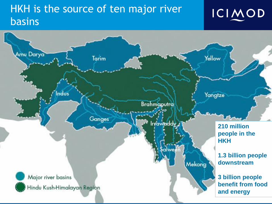
HKH is the source of ten major river
basins
210 million
people in the
HKH
1.3 billion people
downstream
3 billion people
benefit from food
and energy
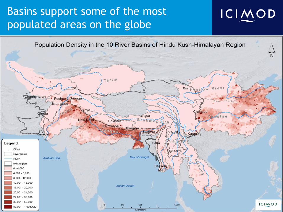
Basins support some of the most
populated areas on the globe

Home to
4 of the 34 Global Biodiversity Hotspots,
60 Eco-regions, 488 Pas, and 330 Important Bird Areas
International Centre for Integrated Mountain Development
Kathmandu, Nepal
Major Questions on the HKH Region that
needs to be addressed
looking into the
Future

Drivers of change and impacts on
resources and people
Increased
scarcity of
drinking water
Loss of productive
lands
Increased incidence
of forest fires
Habitat loss for wildlife and productive
lands for domestic animals
Natural springs and
water sources drying
up
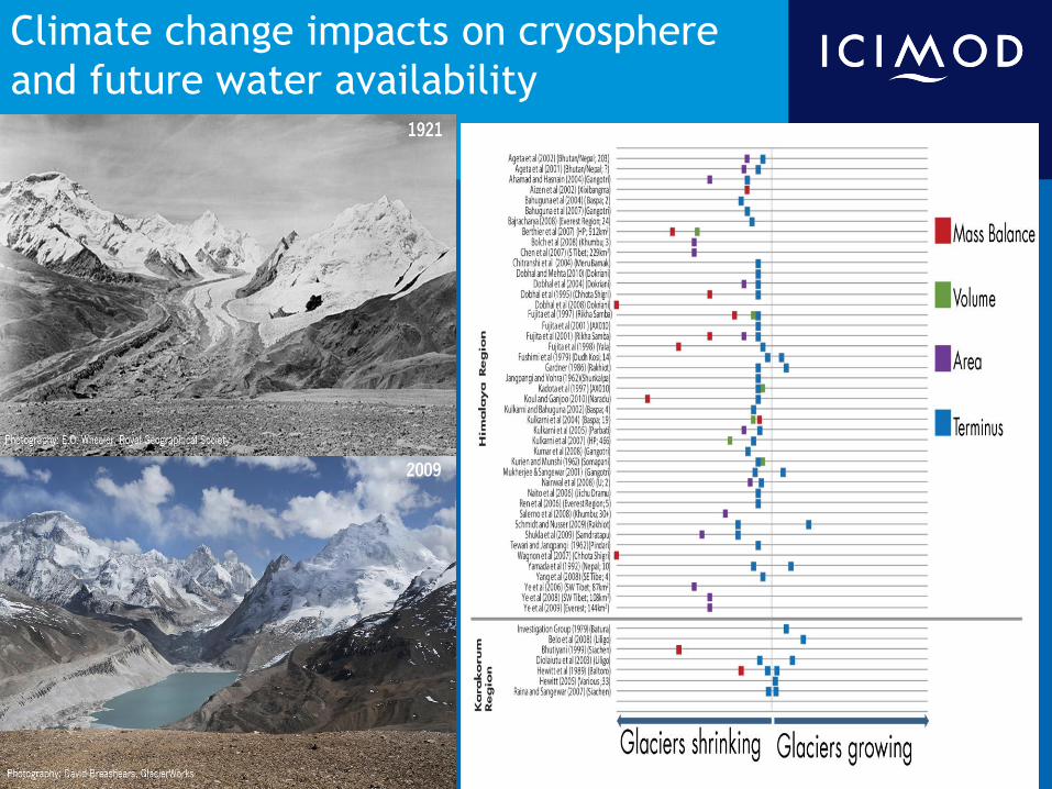
Climate change impacts on cryosphere
and future water availability
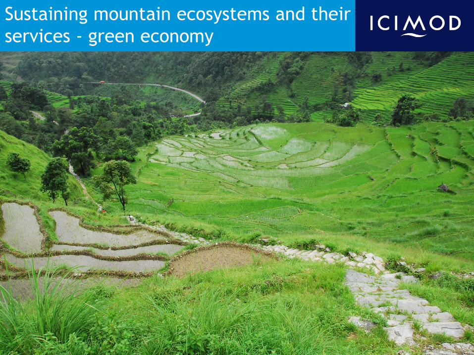
Sustaining mountain ecosystems and their
services - green economy
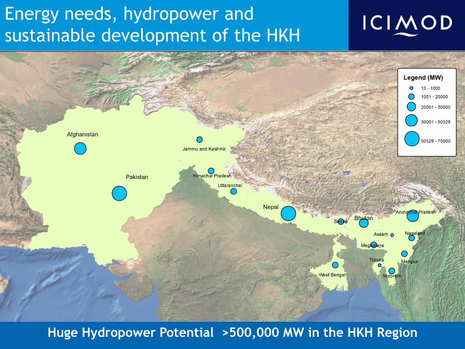
Energy needs, hydropower and
sustainable development of the HKH
Huge Hydropower Potential >500,000 MW in the HKH Region
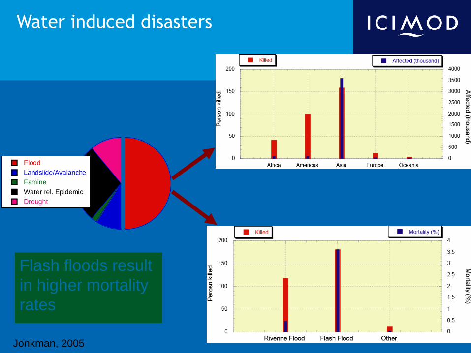
Water induced disasters
Flash floods result
in higher mortality
rates
Flood
Landslide/Avalanche
Famine
Water rel. Epidemic
Drought
Jonkman, 2005

Poverty, vulnerability and food security
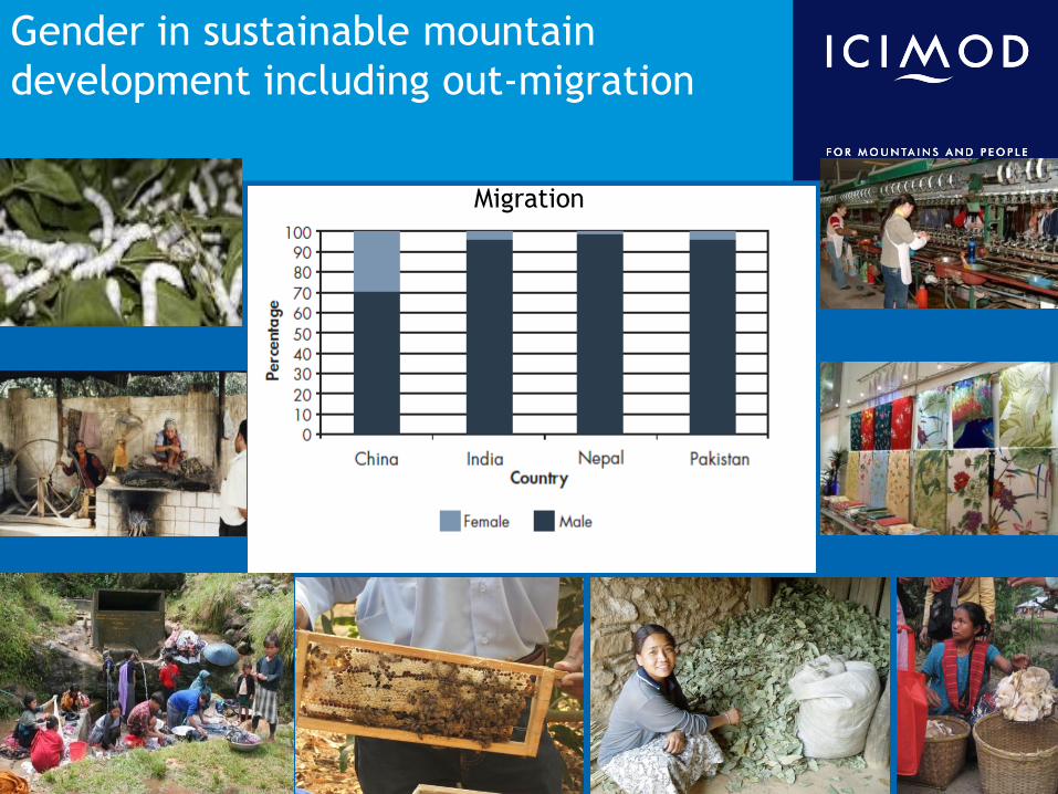
Gender in sustainable mountain
development including out-migration
Migration
International Centre for Integrated Mountain Development
Kathmandu, Nepal
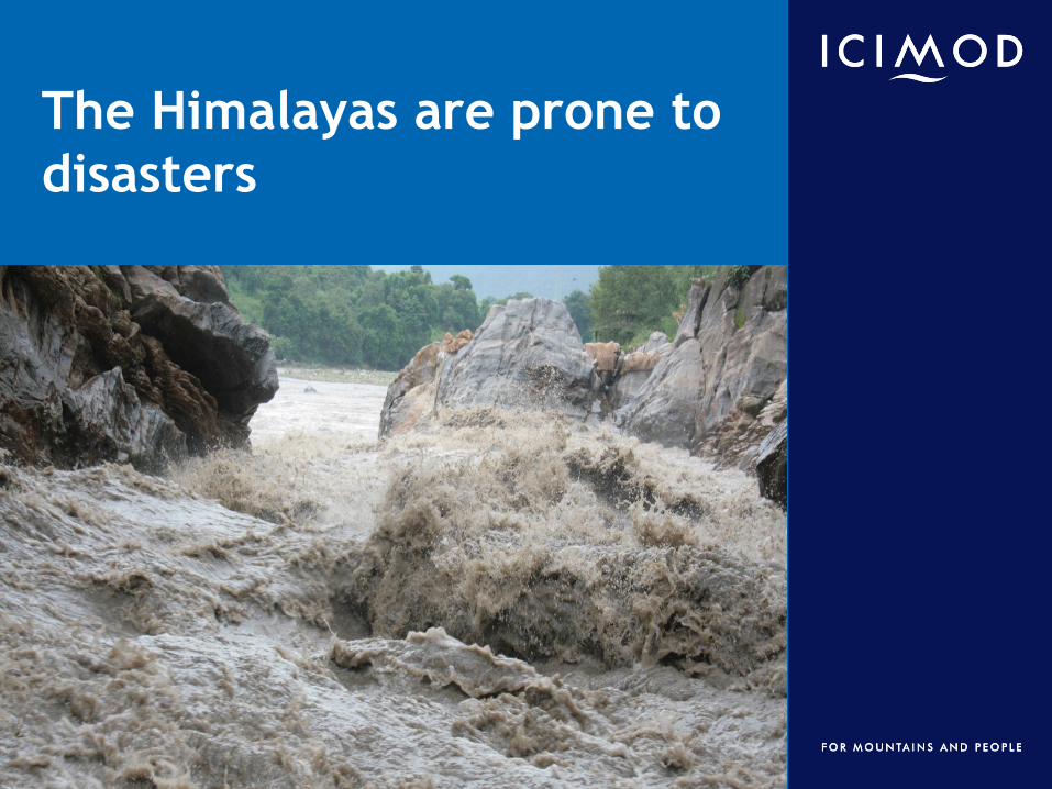
The Himalayas are prone to
disasters
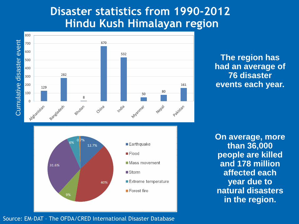
Disaster statistics from 1990-2012 Hindu Kush Himalayan region
The region has had an average of
76 disaster events each year.
On average, more than 36,000
people are killed and 178 million affected each year due to
natural disasters in the region.
Source: EM-DAT – The OFDA/CRED International Disaster Database
Cum
ula
tive d
isaste
r eve
nt

Flash floods result
in higher mortality
rates
Flood
Landslide/Avalanche
Famine
Water rel. Epidemic
Drought
Jonkman, 2005
Water-related hazards
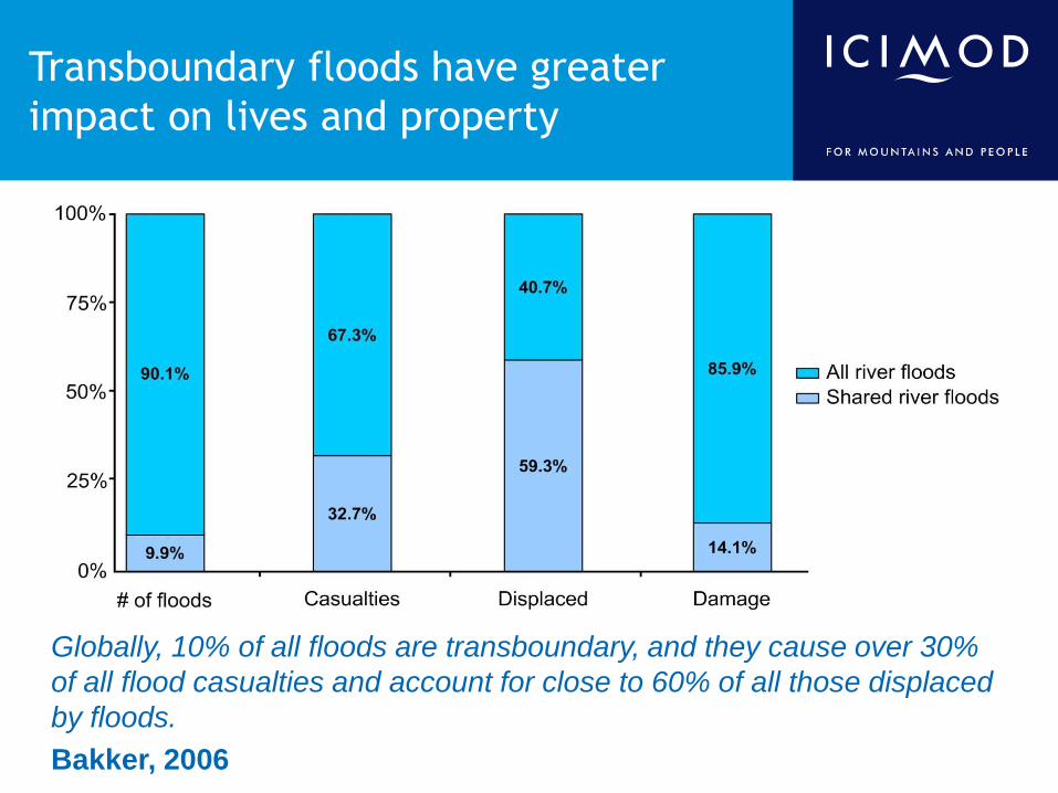
Transboundary floods have greater
impact on lives and property
Globally, 10% of all floods are transboundary, and they cause over 30%
of all flood casualties and account for close to 60% of all those displaced
by floods.
Bakker, 2006

Lack of information, little preparation
9 April 2000: Landslide blocked
the Yigong River, a tributary of
the Yarlung Zangbo
(Brahmaputra) River
Outburst on 10 June 2000
created a huge flash flood of up
to 1.26x10⁵ m3/s
Extensive damage, but no
casualties in China
In India, heavy causalities
- 30 dead
- >100 missing
- >50,000 homeless
- damage of USD 22.9 million

Data sharing can save lives and
property
Data sharing agreement developed between India
and China in 2002
22 June 2004: Landslide blocked the Pareechu River
in Tibet (upper reaches of Sutlej River)
Lake volume - 79,180,000 m3
Chinese authorities communicated to their Indian
counterparts well before and when the breach
occurred
56 villages along the Sutlej from Kinnaur to Bilaspur
were identified as at risk
The dam burst on 25 June 2005
The direct cost of flood damage was an estimated
USD 200 million
There were no human casualties because of prior
communication from the upstream country
1 month after
landslide
2.5 months after
landslide
After landslide
dam outburst
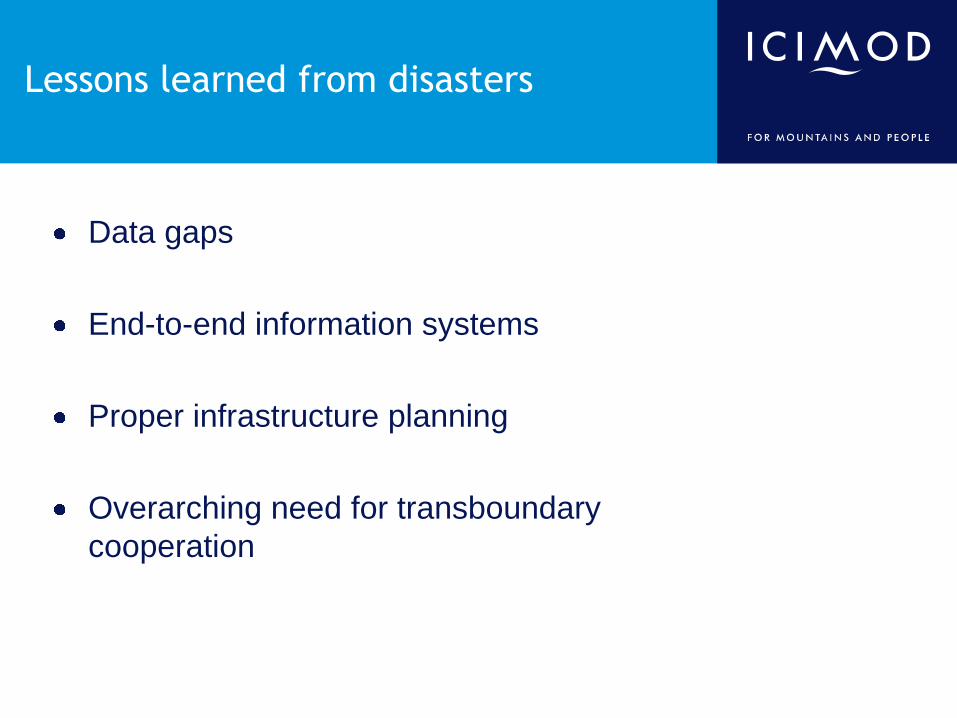
Lessons learned from disasters
Data gaps
End-to-end information systems
Proper infrastructure planning
Overarching need for transboundary
cooperation

Data gaps
• High-altitude monitoring stations are sparse
• Limited transboundary data sharing
Monitoring station distribution
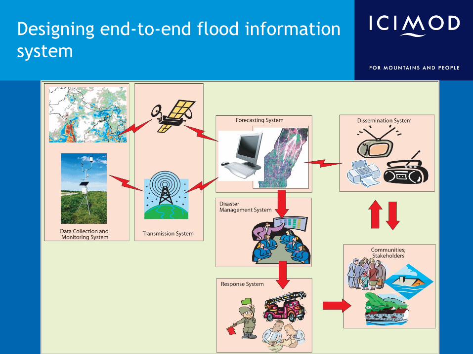
Designing end-to-end flood information
system
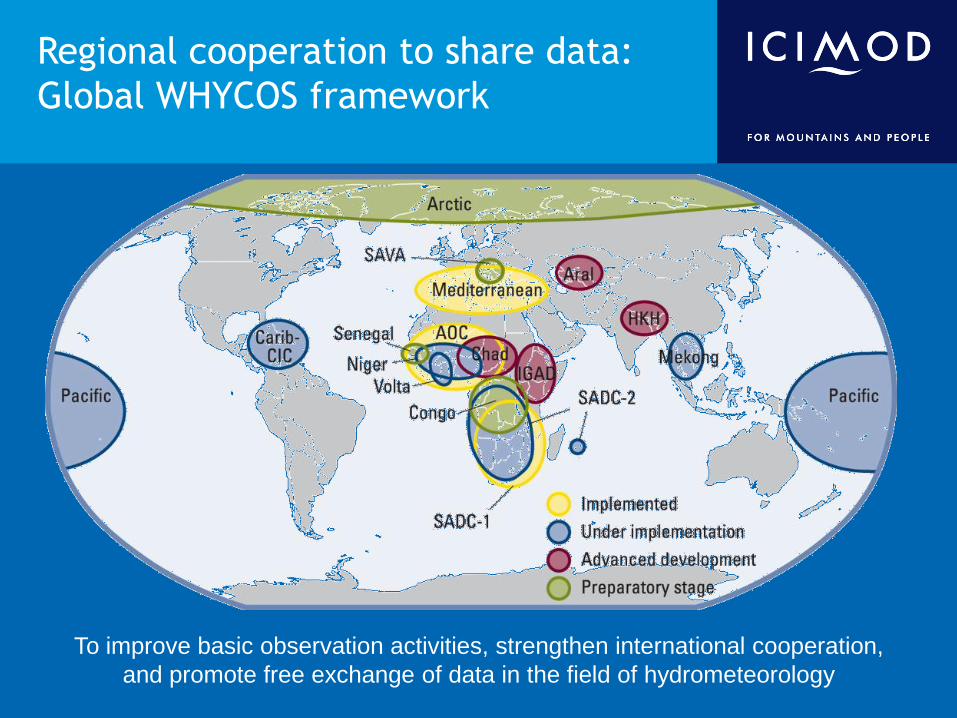
Regional cooperation to share data:
Global WHYCOS framework
To improve basic observation activities, strengthen international cooperation,
and promote free exchange of data in the field of hydrometeorology
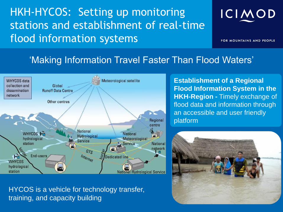
HKH-HYCOS: Setting up monitoring
stations and establishment of real-time
flood information systems
‘Making Information Travel Faster Than Flood Waters’
Establishment of a Regional
Flood Information System in the
HKH-Region - Timely exchange of
flood data and information through
an accessible and user friendly
platform
HYCOS is a vehicle for technology transfer,
training, and capacity building
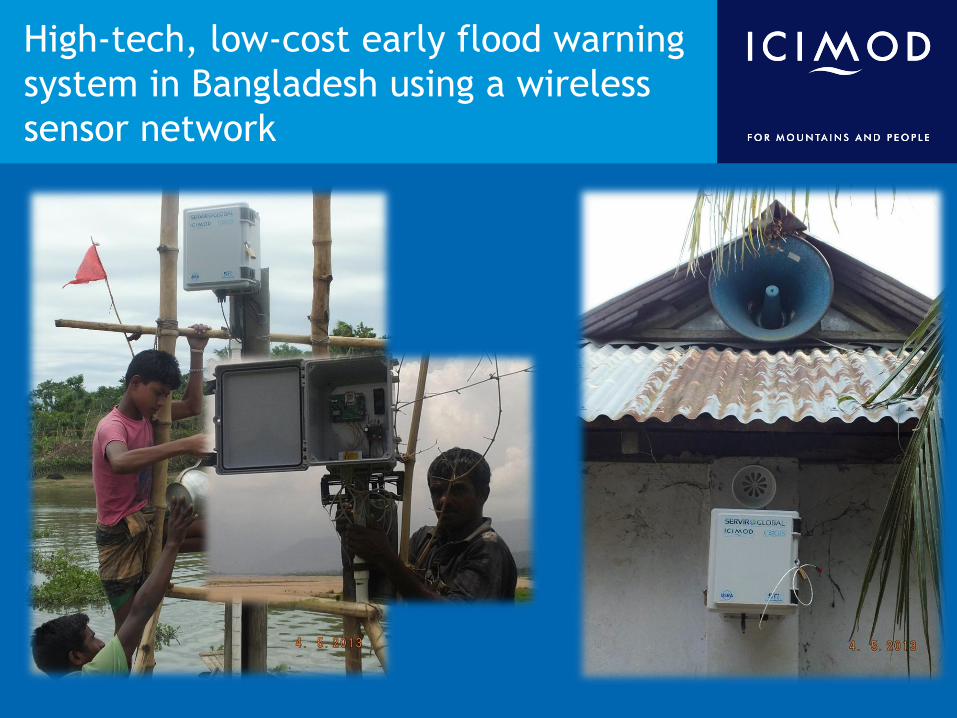
High-tech, low-cost early flood warning
system in Bangladesh using a wireless
sensor network
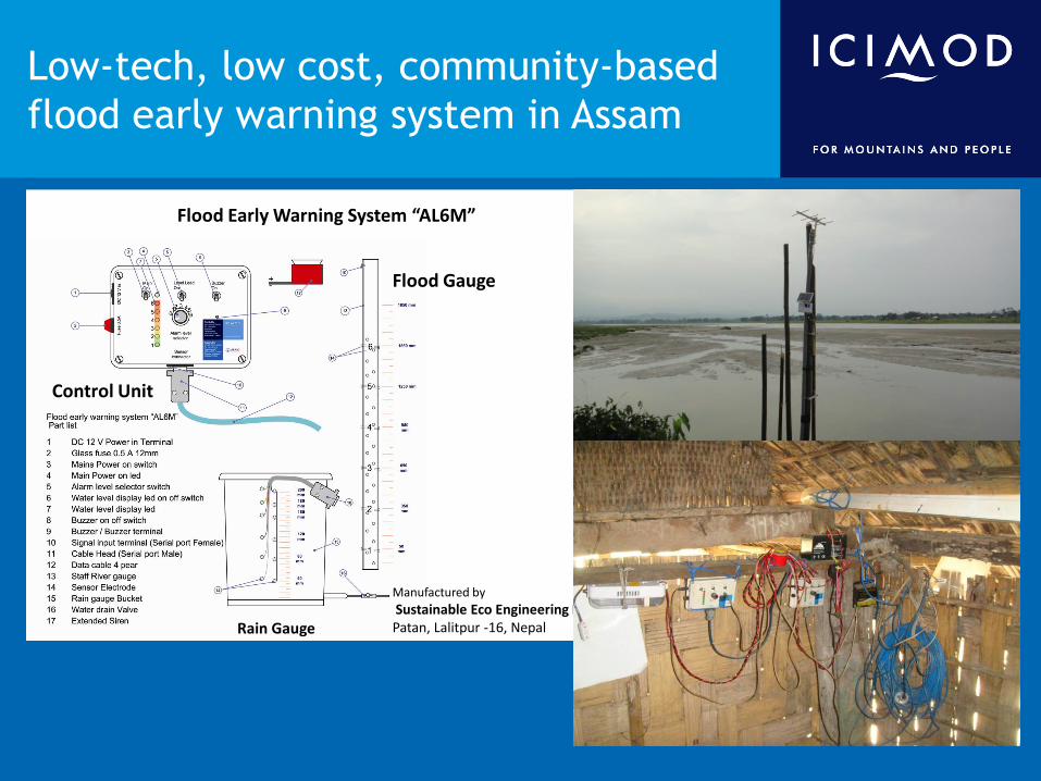
Control Unit
Flood Gauge
Rain Gauge
Flood Early Warning System “AL6M”
Manufactured by
Sustainable Eco Engineering Pvt. LtdPatan, Lalitpur -16, Nepal
Low-tech, low cost, community-based
flood early warning system in Assam

ICIMOD’s state-of-the-art MODIS receiving
facility helps provide timely data for various
applications, including early flood and fire
detection
MODIS receiving facility MODIS images are used for national
and regional level mapping including
rapid response mapping after a flood
event.
Visit http://geoportal.icimod.org/realtime/modis.aspx# to visualize MODIS image.

Conclusion
• Need for end-to-end information systems
– Hi-tech to low-tech
– Science to government to community
• Infrastructure planning
– Identify risks and vulnerabilities
• Mountain specific planning
• Transboundary information sharing
– Sharing mechanisms
• Underpinned by regional cooperation

Thank you Thank you