History of Remote Sensing Thanks to Jim Campbell for many of these slides! Photo from Flickr by...
36
History of Remote Sensing Thanks to Jim Campbell for many of these slides! Photo from Flickr by Steve Reno (hawks914)
-
Upload
owen-thomas -
Category
Documents
-
view
213 -
download
0
Transcript of History of Remote Sensing Thanks to Jim Campbell for many of these slides! Photo from Flickr by...
History of Remote Sensing
Thanks to Jim Campbell for many of these slides!
Photo from Flickr by Steve Reno (hawks914)
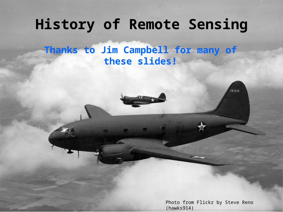
• The term remote sensing was coined ~1960. Previously, aerial photography was the primary term, but the history of RS has its roots in early observations of light.
• Legend of an Arab seeing a mysterious image on the wall of his tent, and realizing that it was people outside projected upside down.
• Al Hazen (of Basra) credited with articulating concept of the Camera Obscura
in 1038 A.D.
Early Remote Sensing
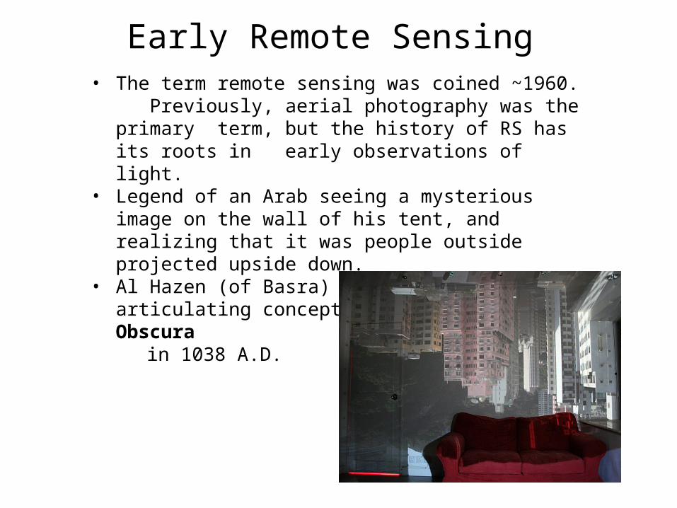
Camera Obscura; Used by Roger Bacon 1300)
Leonardo da Vinci used a camera obscura in 1490 and traced images on paper. Couldn’t record images because no film.
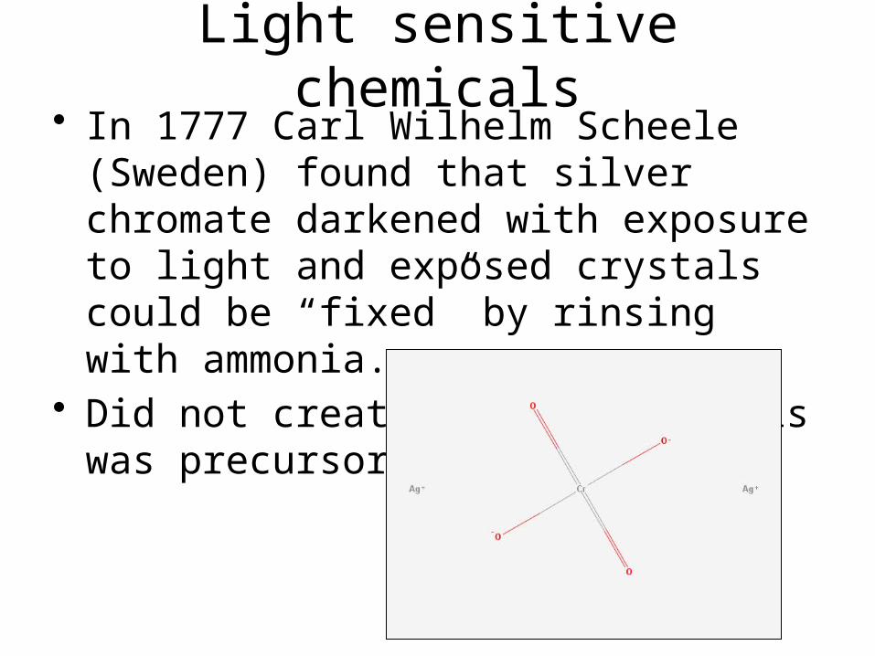
Light sensitive chemicals• In 1777 Carl Wilhelm Scheele (Sweden)
found that silver chromate darkened with exposure to light and exposed crystals could be “fixed” by rinsing with ammonia.
• Did not create images, but this was precursor to film.
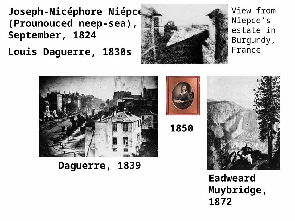
Daguerre, 1839Eadweard Muybridge, 1872
1850
Joseph-Nicéphore Niépce (Prounouced neep-sea), September, 1824
Louis Daguerre, 1830s
View from Niepce’s estate in Burgundy, France
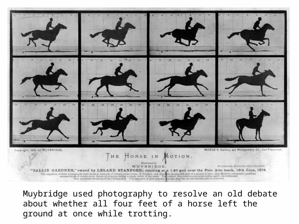
Muybridge used photography to resolve an old debate about whether all four feet of a horse left the ground at once while trotting.

Early aerial photographs
• Gaspard Tournachon (aka Nadar) 1859 – Balloon photos for land surveys
• These early photos mainly served as novelties and curiosities
• Inability to control altitude and flight path presented obstacles.
NARA

Bavarian Pigeon Corps (1903)
NARA
LIBRARY OF CONGRESS
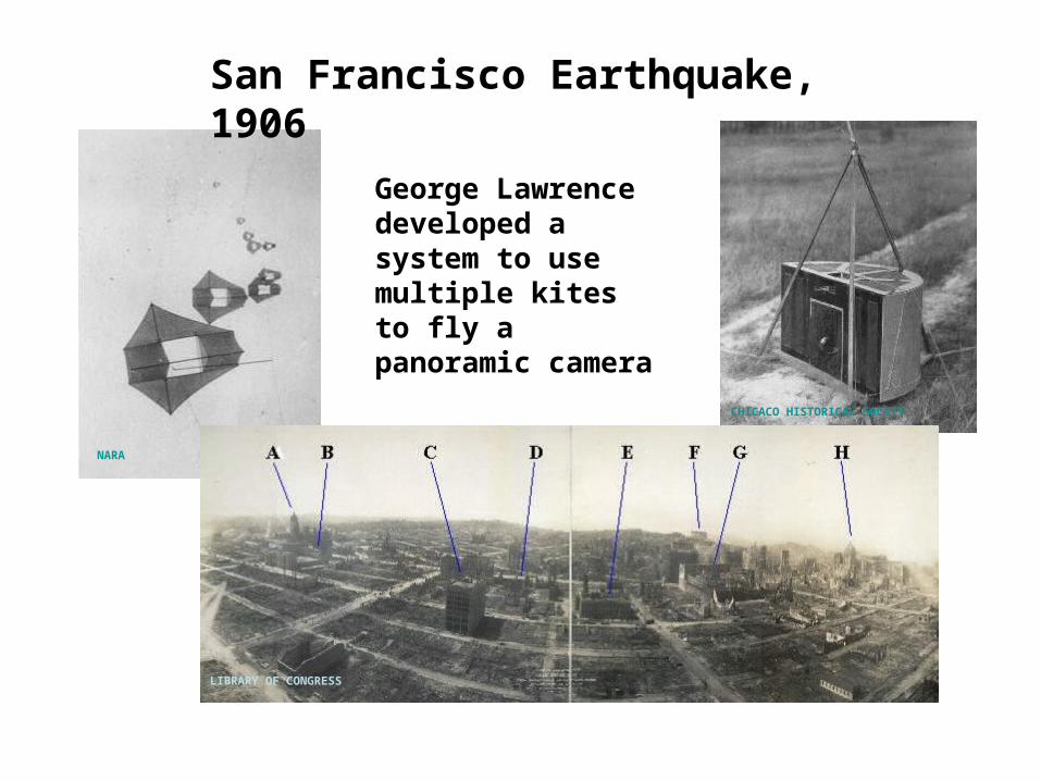
San Francisco Earthquake, 1906
CHICACO HISTORICAL SOCETY
George Lawrence developed a system to use multiple kites to fly a panoramic camera

Roll Film• George Eastman (1854-1932)
transformed photography from an expensive hobby to an inexpensive and immensely popular pastime.
• 1884: Patented the first practical roll film.
• 1888: Perfected the Kodak camera, designed for roll film.
• 1892: Established the Eastman Kodak Company.
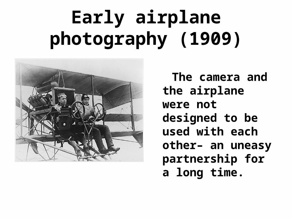
Early airplane photography (1909)
The camera and the airplane were not designed to be used with each other– an uneasy partnership for a long time.

• Propeller blast;
• Lens fogged by oil thrown by the engine;
• Difficulty in aiming and framing;
• Struts and wires block vision;
• Observers distracted by multiple duties, including
observation, navigation, and defense against enemy pursuit aircraft
• Vertical photography difficult;
• Changing plates in flight difficult;
• No supplemental oxygen
• Hard to get results to field quickly
Hand-held cameras/aerial observation
How would YOU have solved some of these problems??

World War IIncubator of aerial photography
• First conflict to focus upon mechanized
weaponry;
• Fixed lines across the western front- conventional reconnaissance
blinded;
• Artillery became the principal combat arm;
• Aviation in its infancy;
• Photography still in its youth;
• Aviation and photography not integrated.
". . . aviation is a good sport, but for the army it is useless"General Ferdinand Foch, Professor of Strategy, Ecole Superiure de Guerre, 1911
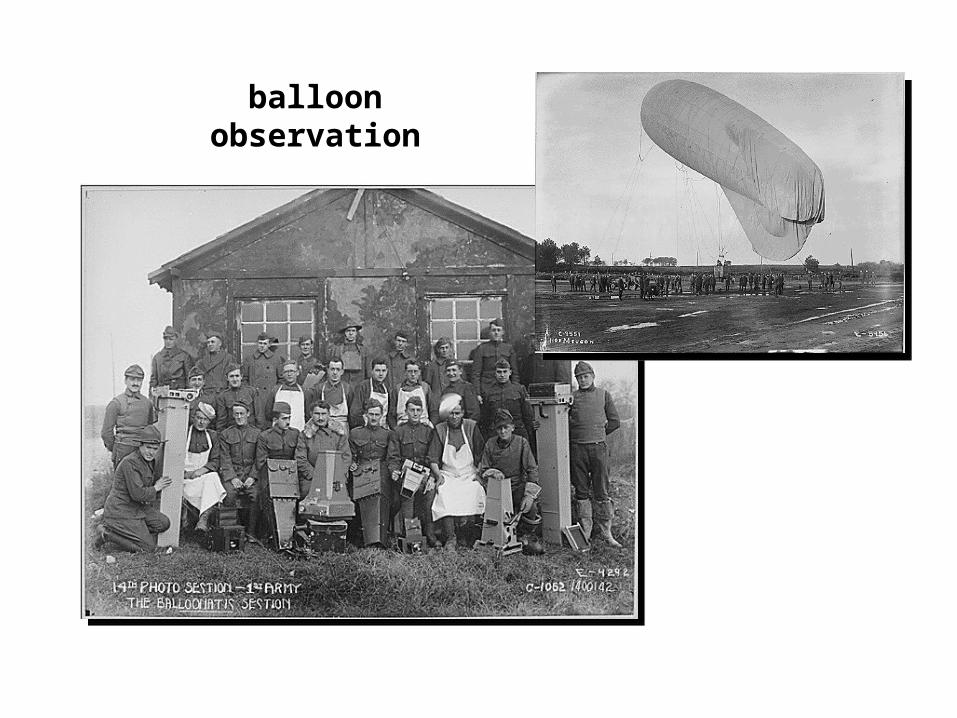
balloon observation

Fuselage-mounted cameras

supplymagazine
exposed plates
handle advancesunexposed plates
early innovations in aerial camera design

• Rapid evolution of aviation and photographic technology;
• Rapid development of techniques and tactics;
• Organizational structures did not respond in a timely or effective manner;
• Lack of vision by senior aviation leadership.
• Rapid progress and innovation not sustained during the post-war era
During World War I:

“…neither the infantry nor the cavalry understood the value of photography.” . . . “In fact, its safe to say that while the U.S. Army cared about reconnaissance, it cared very little about reconnaissance from the air . . .” [Goddard, 1969, p. 21).
Contributions of aerial reconnaissance not valued by senior leadership

The Face of the Earth as Seen From the Air • W.T. Lee, 1922;
• Lee envisioned a broad range of civil applications of aerial photography;
• His book can been seen as a blueprint for the development of aerial photography for the next 50 years.

• Aerial photography was applied as a tool to address economic and environmental issues during the Depression and Dust Bowl.
1919-1939

• U.S. Geological Survey and other agencies used images for topographic and geologic mapping
1919-1939

Agricultural economy
• Aerial photography was
used to derive timely information about the function of the agricultural economy.

Aerial photography, historical coverage, USDA
Historical legacy– we now have an achieve of 70 years of coverage

Werner von Fritsch1935-38, commander in chief of the German armed forces;
Killed in action during the invasion of Poland, 1939
“The military organization with the best aerial reconnaissance will win the next war.”

World War II• Use of non-visible spectrum;• Training of a broad population as
photointerpreters and photo specialists;• Formalization of photointerpretation;• Recognition of photointerpretation as a
source of strategic intelligence.

Photointerpretation for strategic intelligence
Success of photointerpretation in detecting German V-weapons earned it a status as a source of reliable strategic significance.
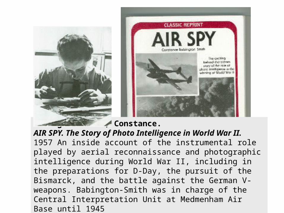
Babington-Smith, Constance.AIR SPY. The Story of Photo Intelligence in World War II.1957 An inside account of the instrumental role played by aerial reconnaissance and photographic intelligence during World War II, including in the preparations for D-Day, the pursuit of the Bismarck, and the battle against the German V-weapons. Babington-Smith was in charge of the Central Interpretation Unit at Medmenham Air Base until 1945

Strategic reconnaissance,cold war era

STRATEGIC RECONNAISSANCE
Cuban Missile Crisis, 1962

CORONA

TIROS, 1960
TELEVISION INFRARED OBSERVATION SATELLITE, 1960
TIROS was an experimental program to investigate the feasibility of observing cloud cover and weather patterns from space.
NIMBUS 5, 1972

NASA
Landsat 3, 1978 Landsat 4, 1982
NASA
Landsat 7, 1999
EARTH OBSERVATION SATELLITES, 1972 now
Landsat 8, 2013

HYPERSPECTRAL REMOTE SENSING, 1985
Instrumentation and processing innovations led to images with extraordinarily fine spatial and spectral resolution
JPL
JPL
JPL
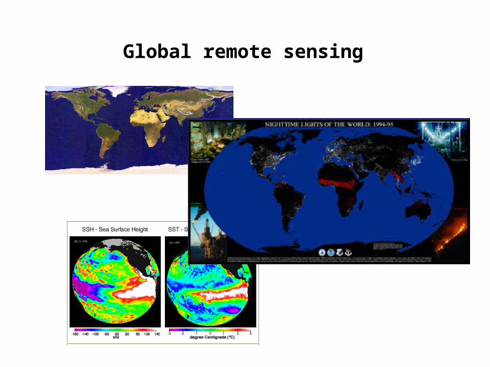
Global remote sensing

If interested, see:
http://www.geog.ucsb.edu/~jeff/115a/remotesensinghistory.html
for more detailed timeline