TCF 2014 - GPS Secrets Your GPS HOPE 2010 ... GPS Satellite Orbits Hacking Your GPS HOPE 2010
Upload
truongminhCategory
view
218download
0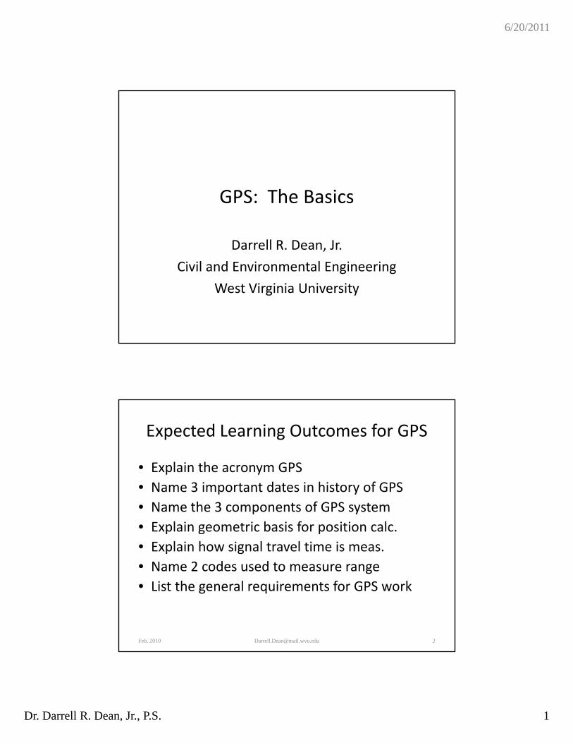
6/20/2011
Dr. Darrell R. Dean, Jr., P.S. 1
GPS: The Basics
Darrell R. Dean, Jr.
Civil and Environmental Engineering
West Virginia University
Expected Learning Outcomes for GPS
• Explain the acronym GPS
N 3 i t t d t i hi t f GPS• Name 3 important dates in history of GPS
• Name the 3 components of GPS system
• Explain geometric basis for position calc.
• Explain how signal travel time is meas.
• Name 2 codes used to measure rangeName 2 codes used to measure range
• List the general requirements for GPS work
Feb. 2010 [email protected] 2
6/20/2011
Dr. Darrell R. Dean, Jr., P.S. 2
Expected Outcomes (Cont.)
• State the required number of satellites to map i ta point.
• Name two types of GPS receivers
• List 3 attributes of GPS receivers
• Explain positional accuracy for different receivers and different techniquesreceivers and different techniques
Feb. 2010 [email protected] 3
What Is GPS?
• Global Positioning System
• NAVSTAR ‐ NAVigation System using Timing and Ranging
• Radio‐based Navigation System Using Satellites Developed by the U.S. Department of Defenseof Defense
Feb. 2010 [email protected] 4
6/20/2011
Dr. Darrell R. Dean, Jr., P.S. 3
GPS Attributes
• Output can include position (latitude, longitude, height), velocity, and time (PVT)longitude, height), velocity, and time (PVT)
• All‐weather, any place (?), and any time
• One‐way ranging system
• Requires precisely synchronized clocks on each end
• Atomic clocks in the satellite and a quartz clock in the receiver
Feb. 2010 [email protected] 5
GPS History
• Developmental satellites began launch in 19781978
• Operational satellite launches start in 1989
• Full Operational Capability (24 satellites) in 1995
• Selective availability turned off May 1,
Feb. 2010 [email protected] 6
y y ,2000
6/20/2011
Dr. Darrell R. Dean, Jr., P.S. 4
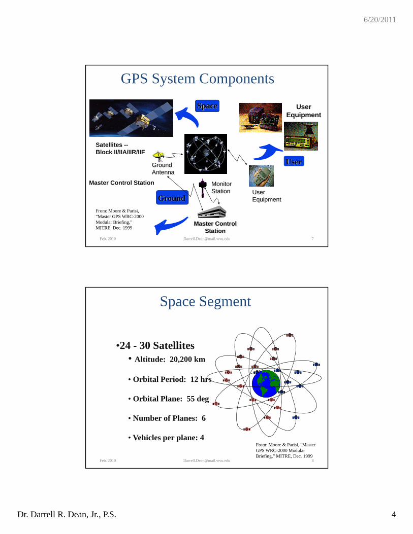
GPS System Components
UserEquipment
Space
User
Satellites --Block II/IIA/IIR/IIF
Master Control Station Monitor
GroundAntenna
GroundStation
Master ControlStation
UserEquipment
From: Moore & Parisi, “Master GPS WRC-2000 Modular Briefing,” MITRE, Dec. 1999
Feb. 2010 [email protected]
Space Segment
•24 - 30 Satellites24 30 Satellites• Altitude: 20,200 km
• Orbital Period: 12 hrs
• Orbital Plane: 55 deg
Feb. 2010 [email protected] 8
• Number of Planes: 6
• Vehicles per plane: 4From: Moore & Parisi, “Master GPS WRC-2000 Modular Briefing,” MITRE, Dec. 1999
6/20/2011
Dr. Darrell R. Dean, Jr., P.S. 5
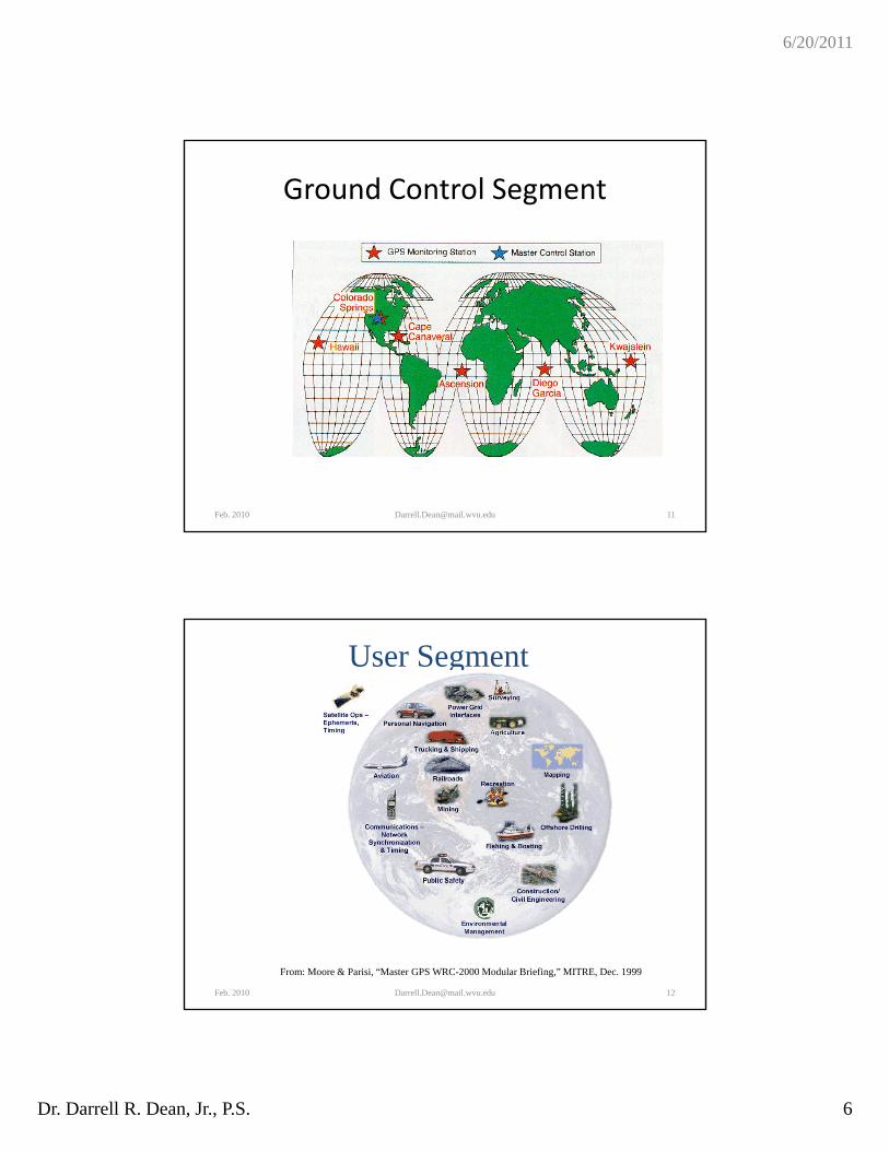
Ground Control Segment
• Five monitoring stationsk (d )• Precise position known in WGS‐84 (datum)
• Passively tracks satellites in view
• Accumulates range or distance data to the satellites
• Data transmitted to the master control station
Feb. 2010 [email protected] 9
Ground Control Segment (Cont.)
• Three ground antennas at 3 of the monitoring t tistations
• Transmits updated information to each satellite
• One master control station• Processes range data to precisely determine satellite orbits and positions
• Updates each satellite’s navigation message
Feb. 2010 [email protected] 10
6/20/2011
Dr. Darrell R. Dean, Jr., P.S. 6
Ground Control Segment
Feb. 2010 [email protected] 11
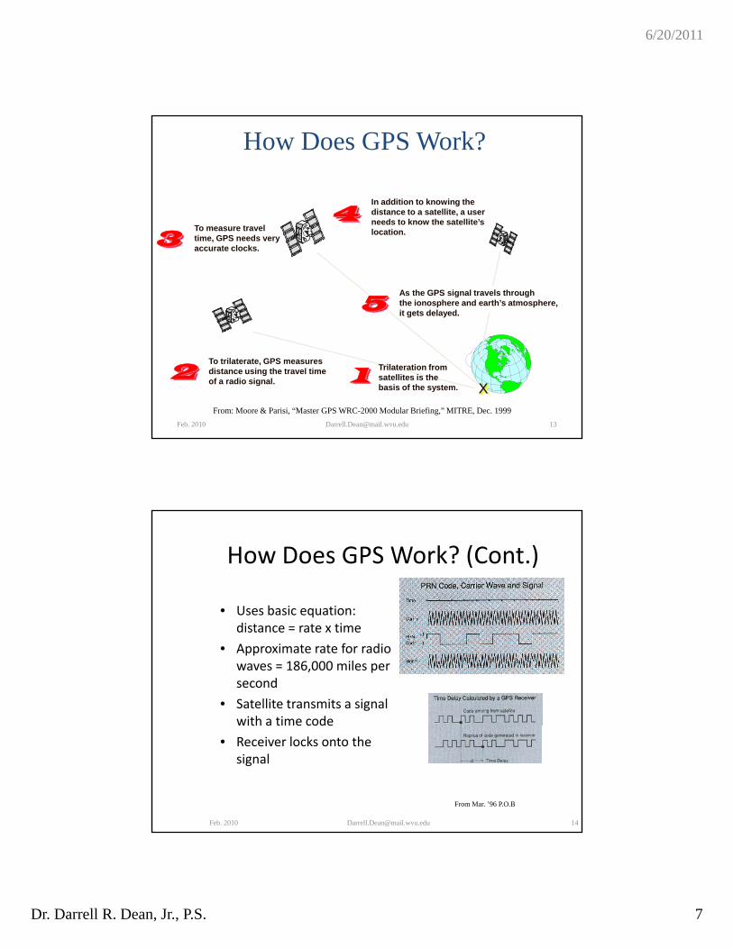
User Segment
Feb. 2010 [email protected] 12
From: Moore & Parisi, “Master GPS WRC-2000 Modular Briefing,” MITRE, Dec. 1999
6/20/2011
Dr. Darrell R. Dean, Jr., P.S. 7
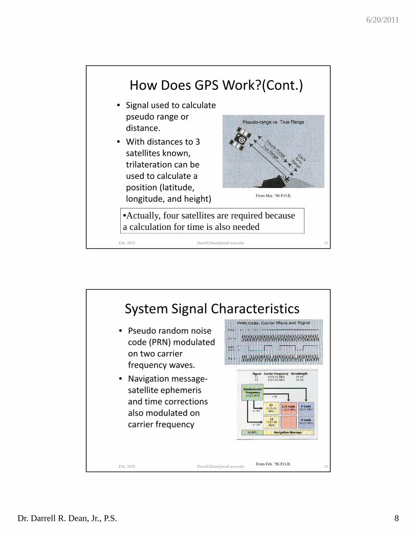
How Does GPS Work?
In addition to knowing the distance to a satellite, a userneeds to know the satellite’s4
To measure travel time, GPS needs veryaccurate clocks.
needs to know the satellite slocation.
As the GPS signal travels throughthe ionosphere and earth’s atmosphere,it gets delayed.
3
5
X
Trilateration fromsatellites is thebasis of the system.
To trilaterate, GPS measuresdistance using the travel time of a radio signal. 12
From: Moore & Parisi, “Master GPS WRC-2000 Modular Briefing,” MITRE, Dec. 1999
Feb. 2010 [email protected]
How Does GPS Work? (Cont.)
• Uses basic equation: qdistance = rate x time
• Approximate rate for radio waves = 186,000 miles per second
• Satellite transmits a signal with a time codewith a time code
• Receiver locks onto the signal
Feb. 2010 [email protected] 14
From Mar. ’96 P.O.B
6/20/2011
Dr. Darrell R. Dean, Jr., P.S. 8
How Does GPS Work?(Cont.)• Signal used to calculate pseudo range or distancedistance.
• With distances to 3 satellites known, trilateration can be used to calculate a position (latitudeposition (latitude, longitude, and height)
Feb. 2010 [email protected] 15
•Actually, four satellites are required because a calculation for time is also needed
From Mar. ’96 P.O.B.
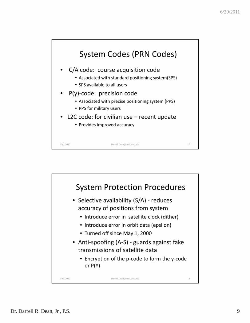
System Signal Characteristics
• Pseudo random noise code (PRN) modulated on two carrier frequency waves.
• Navigation message‐satellite ephemeris and time corrections l d l t dalso modulated on carrier frequency
Feb. 2010 [email protected] 16From Feb. ’96 P.O.B.
6/20/2011
Dr. Darrell R. Dean, Jr., P.S. 9
System Codes (PRN Codes)
• C/A code: course acquisition coded h d d ( )• Associated with standard positioning system(SPS)
• SPS available to all users
• P(y)‐code: precision code• Associated with precise positioning system (PPS)
• PPS for military users
• L2C code: for civilian use – recent update• Provides improved accuracy
Feb. 2010 [email protected] 17
System Protection Procedures
• Selective availability (S/A) ‐ reduces accuracy of positions from systemaccuracy of positions from system
• Introduce error in satellite clock (dither)
• Introduce error in orbit data (epsilon)
• Turned off since May 1, 2000
• Anti‐spoofing (A‐S) ‐ guards against fake transmissions of satellite data
• Encryption of the p‐code to form the y‐code or P(Y)
Feb. 2010 [email protected] 18
6/20/2011
Dr. Darrell R. Dean, Jr., P.S. 10
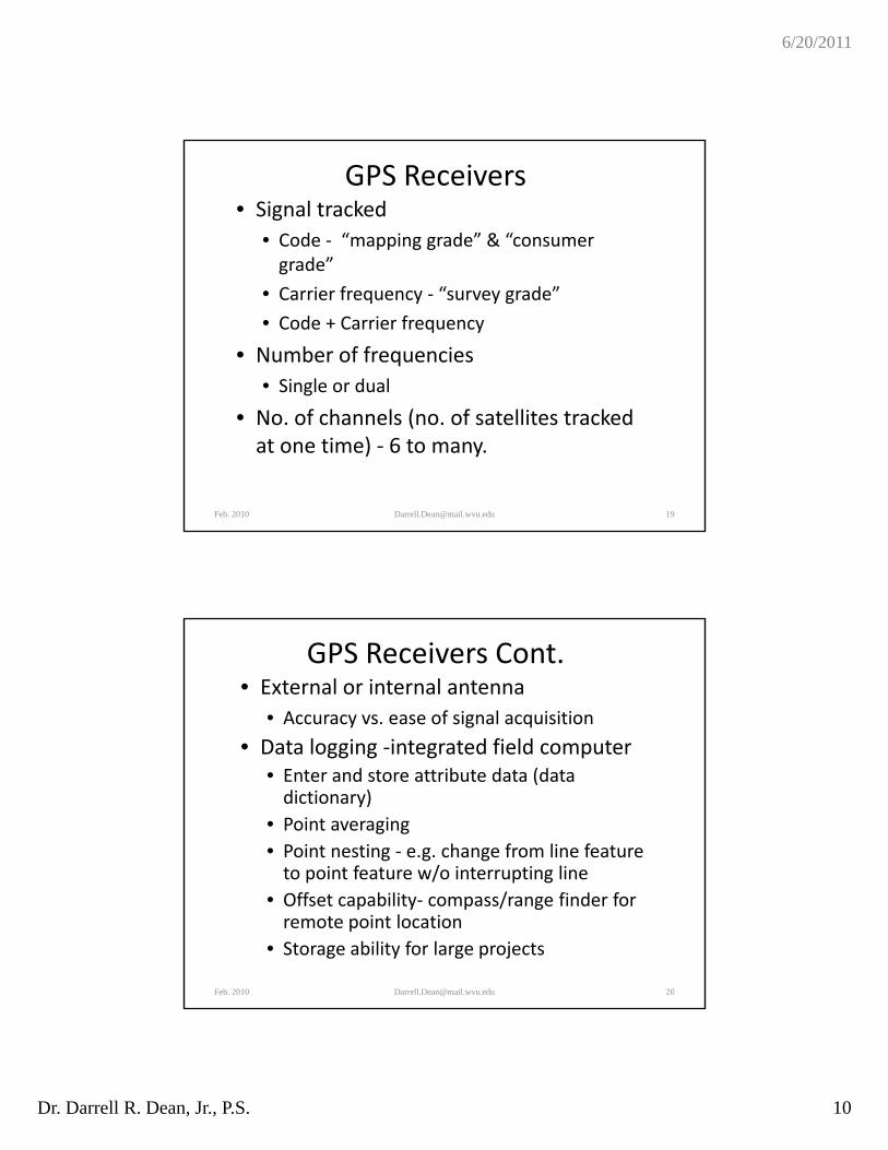
GPS Receivers• Signal tracked
• Code ‐ “mapping grade” & “consumer grade”grade
• Carrier frequency ‐ “survey grade”
• Code + Carrier frequency
• Number of frequencies
• Single or dual
• No. of channels (no. of satellites tracked at one time) ‐ 6 to many.
Feb. 2010 [email protected] 19
GPS Receivers Cont.• External or internal antenna
• Accuracy vs. ease of signal acquisition
• Data logging ‐integrated field computer• Data logging ‐integrated field computer• Enter and store attribute data (data dictionary)
• Point averaging
• Point nesting ‐ e.g. change from line feature to point feature w/o interrupting lineto point feature w/o interrupting line
• Offset capability‐ compass/range finder for remote point location
• Storage ability for large projects
Feb. 2010 [email protected] 20
6/20/2011
Dr. Darrell R. Dean, Jr., P.S. 11
GPS Positioning Methods
• Autonomous vs Relative positioning• Static positioningp g• Real‐time correction capability
• Wide area augmentation system (WAAS)• Satellite Based Augmentation System(SBAS)
• Radio (RTCM) broadcasts from beacons or communication satellites, some free some require a subscription fee (DGPS)
• RTK – Single base• RTK Network connection• RTK Network connection
• Wireless (cell phone) data connection• Commercial networks• Public entity (DOT, e.g.) networks
• Post Processing
Feb. 2010 [email protected] 21
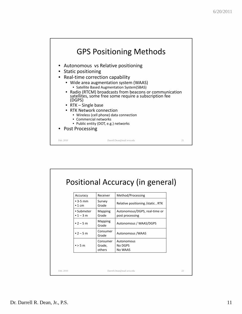
Positional Accuracy (in general)
Accuracy Receiver Method/Processing
• 3‐5 mm SurveyG d
Relative positioning /static , RTK• 1 cm Grade
Relative positioning /static , RTK
• Submeter• 1 – 3 m
Mapping Grade
Autonomous/DGPS, real‐time or post processing
• 2 – 5 mMappingGrade
Autonomous / WAAS/DGPS
• 2 – 5 mConsumer Grade
Autonomous /WAAS
• > 5 mConsumer Grade, others
Autonomous No DGPSNo WAAS
Feb. 2010 [email protected] 22
6/20/2011
Dr. Darrell R. Dean, Jr., P.S. 12
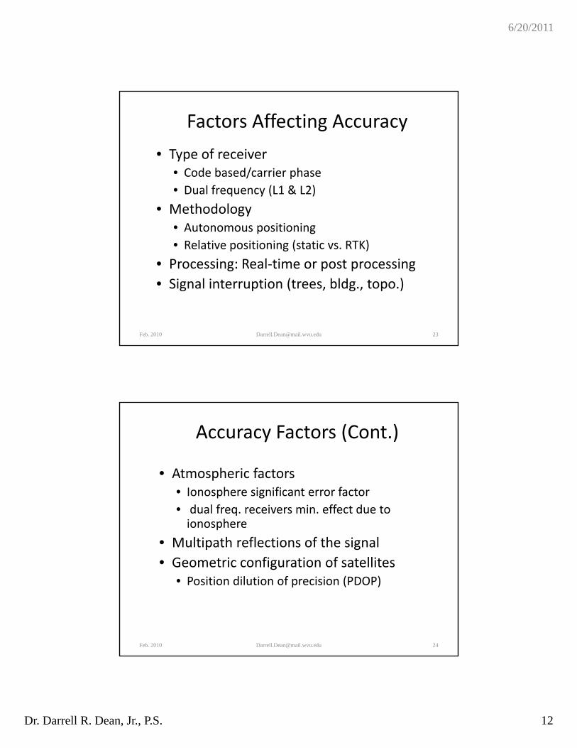
Factors Affecting Accuracy
• Type of receiver• Code based/carrier phaseCode based/carrier phase
• Dual frequency (L1 & L2)
• Methodology• Autonomous positioning
• Relative positioning (static vs. RTK)
P i R l ti t i• Processing: Real‐time or post processing
• Signal interruption (trees, bldg., topo.)
Feb. 2010 [email protected] 23
Accuracy Factors (Cont.)
• Atmospheric factors • Ionosphere significant error factor
• dual freq. receivers min. effect due to ionosphere
• Multipath reflections of the signal
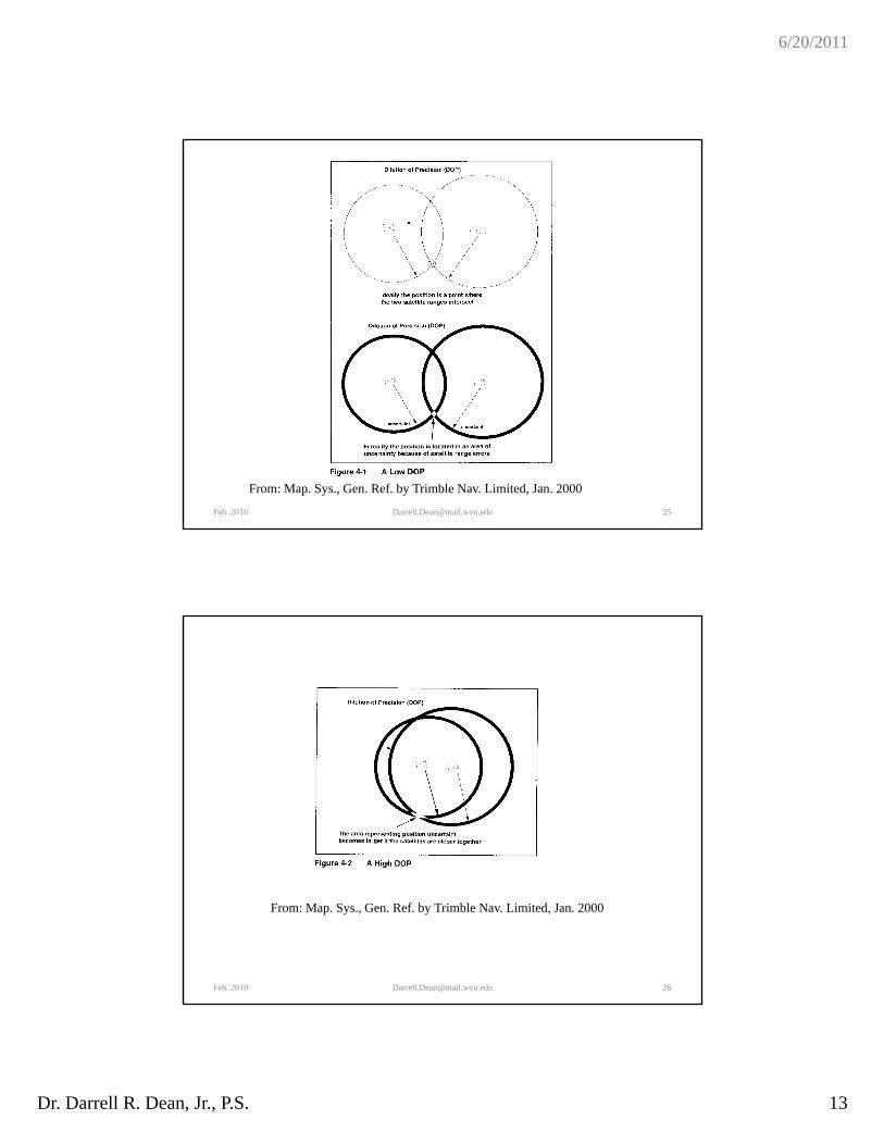
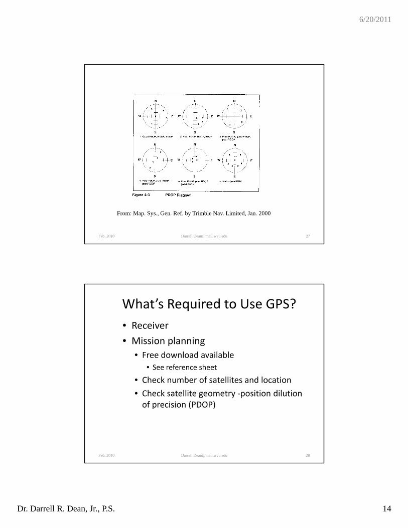
• Geometric configuration of satellites• Position dilution of precision (PDOP)
Feb. 2010 [email protected] 24
6/20/2011
Dr. Darrell R. Dean, Jr., P.S. 13
Feb. 2010 [email protected] 25
From: Map. Sys., Gen. Ref. by Trimble Nav. Limited, Jan. 2000
Feb. 2010 [email protected] 26
From: Map. Sys., Gen. Ref. by Trimble Nav. Limited, Jan. 2000
6/20/2011
Dr. Darrell R. Dean, Jr., P.S. 14
Feb. 2010 [email protected] 27
From: Map. Sys., Gen. Ref. by Trimble Nav. Limited, Jan. 2000
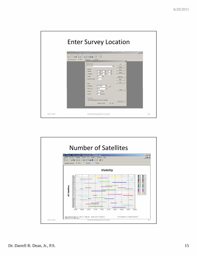
What’s Required to Use GPS?
• Receiver
• Mission planningMission planning
• Free download available
• See reference sheet
• Check number of satellites and location
• Check satellite geometry ‐position dilution of precision (PDOP)of precision (PDOP)
Feb. 2010 [email protected] 28
6/20/2011
Dr. Darrell R. Dean, Jr., P.S. 15
Enter Survey Location
Feb. 2010 [email protected] 29
Number of Satellites
Feb. 2010 [email protected] 30
6/20/2011
Dr. Darrell R. Dean, Jr., P.S. 16
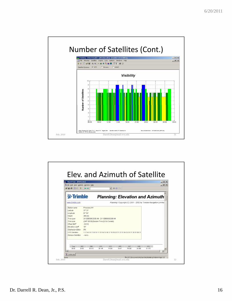
Number of Satellites (Cont.)
Feb. 2010 [email protected] 31
Elev. and Azimuth of Satellite
Feb. 2010 [email protected] 32
6/20/2011
Dr. Darrell R. Dean, Jr., P.S. 17
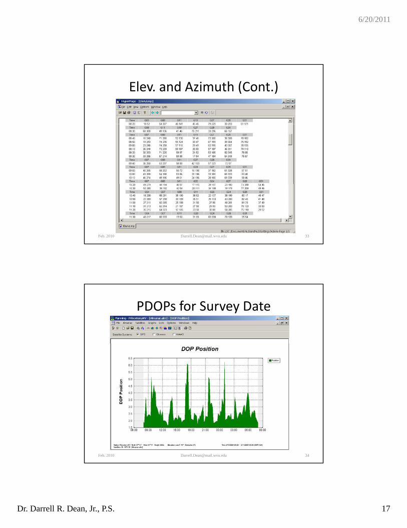
Elev. and Azimuth (Cont.)
Feb. 2010 [email protected] 33
PDOPs for Survey Date
Feb. 2010 [email protected] 34
6/20/2011
Dr. Darrell R. Dean, Jr., P.S. 18
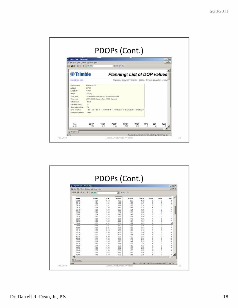
PDOPs (Cont.)
Feb. 2010 [email protected] 35
PDOPs (Cont.)
Feb. 2010 [email protected] 36
6/20/2011
Dr. Darrell R. Dean, Jr., P.S. 19
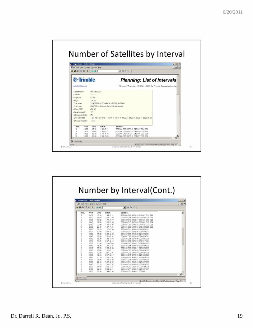
Number of Satellites by Interval
Feb. 2010 [email protected] 37
Number by Interval(Cont.)
Feb. 2010 [email protected] 38
6/20/2011
Dr. Darrell R. Dean, Jr., P.S. 20
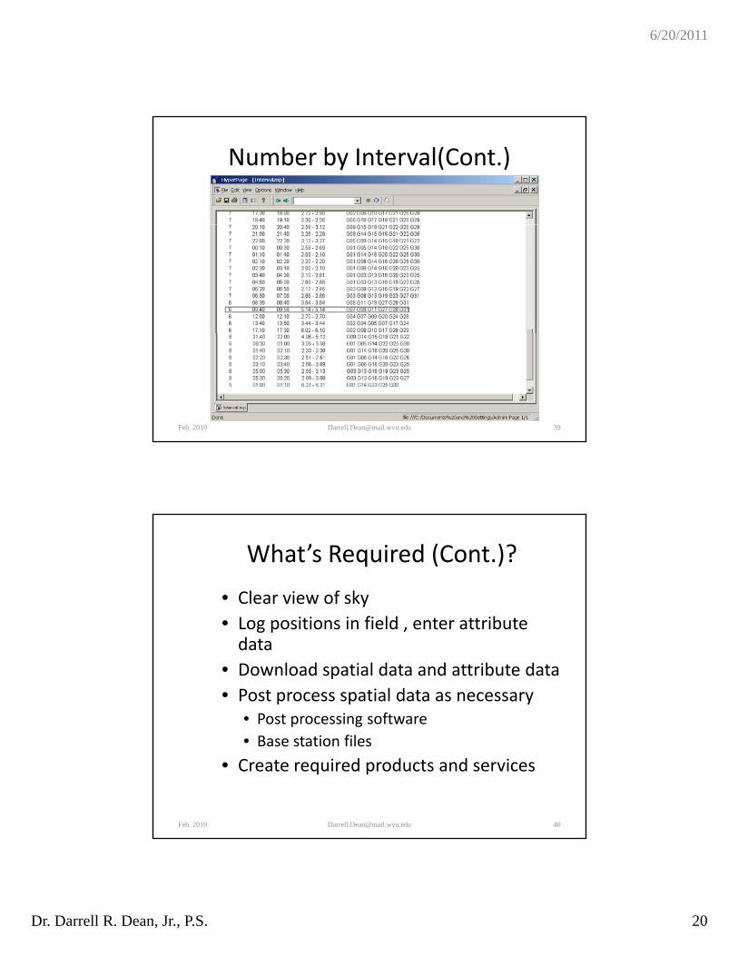
Number by Interval(Cont.)
Feb. 2010 [email protected] 39
What’s Required (Cont.)?
• Clear view of sky
• Log positions in field enter attribute• Log positions in field , enter attribute data
• Download spatial data and attribute data
• Post process spatial data as necessary• Post processing software
• Base station files
• Create required products and services
Feb. 2010 [email protected] 40
6/20/2011
Dr. Darrell R. Dean, Jr., P.S. 21
Conclusions
• Proper equipment and methods are necessary f i i ith GPSfor precise surveying with GPS
• Open conditions and a clear view of the sky are required for GPS surveying
• Relatively inexpensive GPS receivers may be used for collecting survey data and featureused for collecting survey data and feature attributes for management purposes
Feb. 2010 [email protected] 41