Geology 12 Presents Outline: Outline: Chp 14 Mass Wasting (Landslides)Chp 14 Mass Wasting...
116
Geology 12 Geology 12 Presents Presents
-
Upload
rosamond-riley -
Category
Documents
-
view
222 -
download
2
Transcript of Geology 12 Presents Outline: Outline: Chp 14 Mass Wasting (Landslides)Chp 14 Mass Wasting...
Geology 12Geology 12
PresentsPresents
Outline:Outline:• Chp 14 Mass Wasting (Landslides)Chp 14 Mass Wasting (Landslides)• Chp 15 Running WaterChp 15 Running Water• Chp 16 GroundwaterChp 16 Groundwater• Chp 17 Glaciers and GlaciationChp 17 Glaciers and Glaciation• Chp 18 Wind and DesertsChp 18 Wind and Deserts
Glaciers and Glaciation
A: Introduction
B: Glacial Erosion and Transport
C: Glacial Deposits
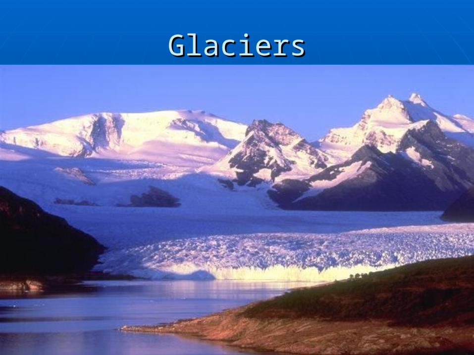
GlaciersGlaciers
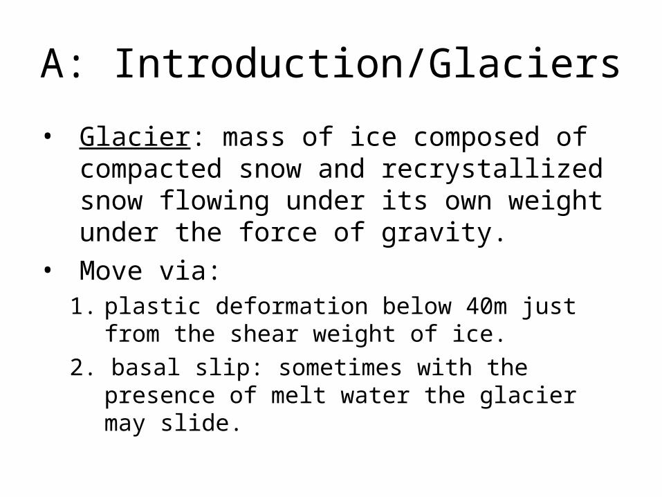
A: Introduction/Glaciers
• Glacier: mass of ice composed of compacted snow and recrystallized snow flowing under its own weight under the force of gravity.
• Move via:1. plastic deformation below 40m just from the
shear weight of ice.
2. basal slip: sometimes with the presence of melt water the glacier may slide.
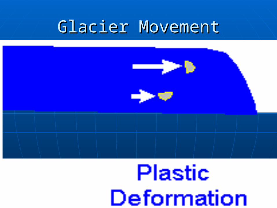
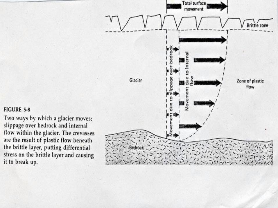
Glacier MovementGlacier Movement
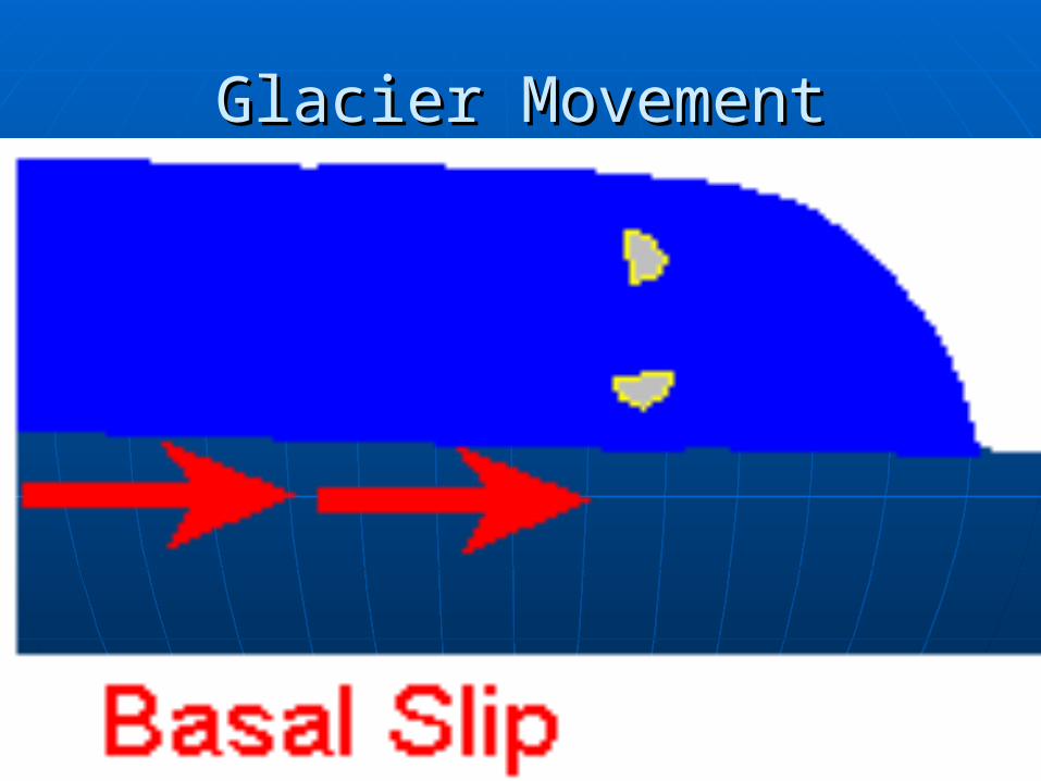
Glacier MovementGlacier Movement

Plastic deformation
Basal slip
Crevasse
Total surface movement
40m
•Copy diagram
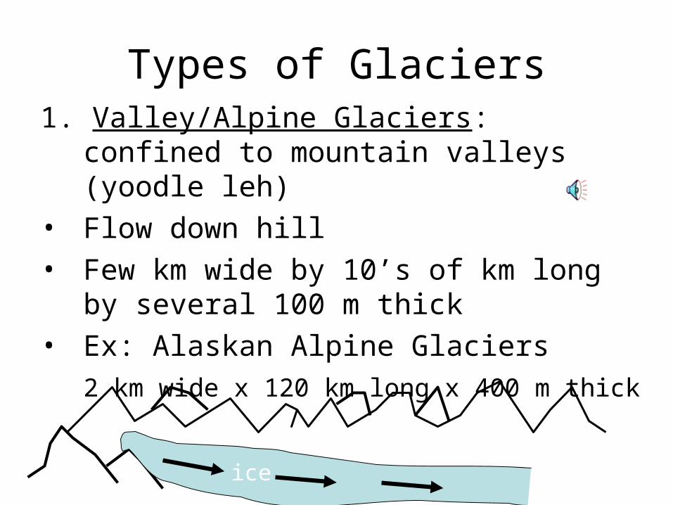
Types of Glaciers1. Valley/Alpine Glaciers: confined to
mountain valleys (yoodle leh)
• Flow down hill
• Few km wide by 10’s of km long by several 100 m thick
• Ex: Alaskan Alpine Glaciers
2 km wide x 120 km long x 400 m thick
ice
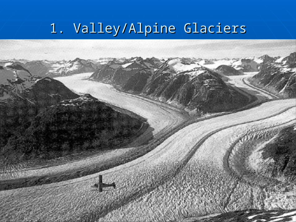
1. Valley/Alpine Glaciers1. Valley/Alpine Glaciers

Types of Glaciers2. Ice Sheets: BIG
• Flow out horizontally in every direction from where the snow accumulates the mosta) Continental Glaciers:
• Largest: 100s of km long/wide by 3-5 km thick
• Ex: Greenland, Antarctica (now) and N. Amer’ during the last ice age 25,000 yrs ago (most of Canada)
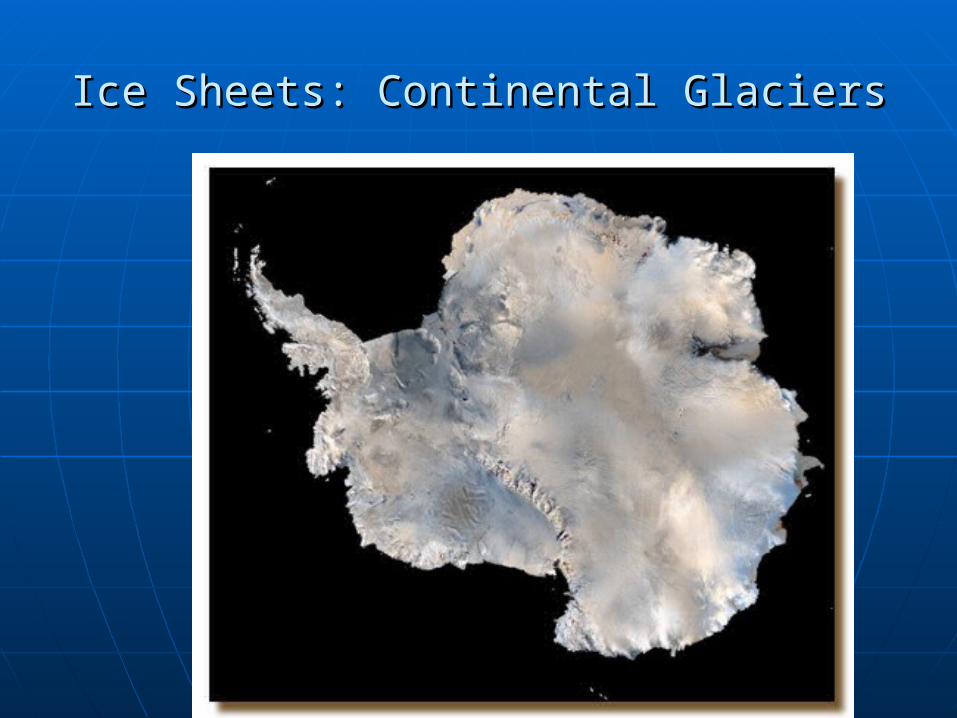
Ice Sheets: Continental GlaciersIce Sheets: Continental Glaciers
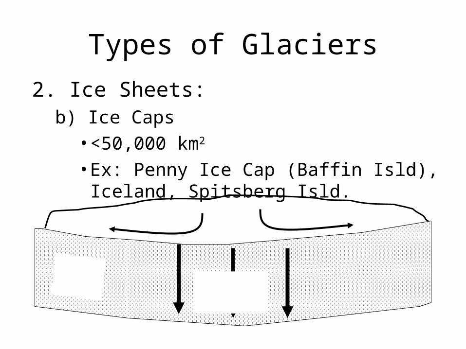
Types of Glaciers
2. Ice Sheets: b) Ice Caps
• <50,000 km2
• Ex: Penny Ice Cap (Baffin Isld), Iceland, Spitsberg Isld.
ice
crustisostacy
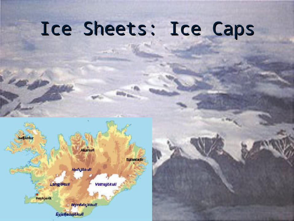
Ice Sheets: Ice CapsIce Sheets: Ice Caps
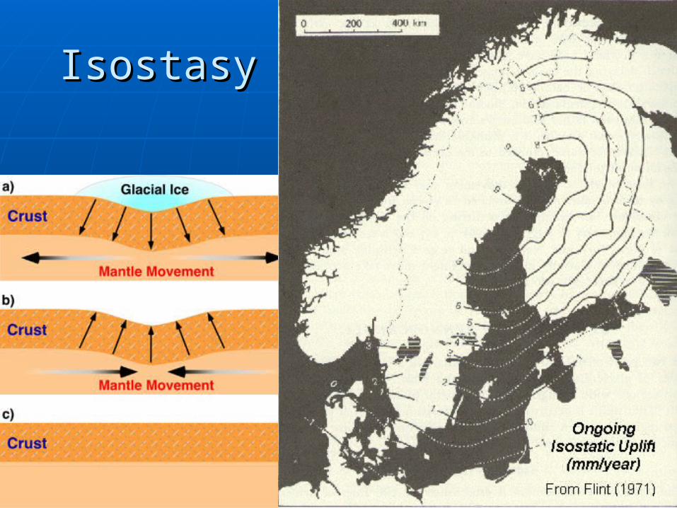
IsostasyIsostasy
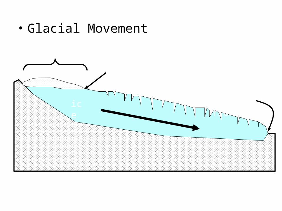
• Glacial Movement
Zone of accumulation
Firn limit
snow
ice
Zone of wastage
Ice front
Firn: pebbles of ice; intermediate stage between snow and ice
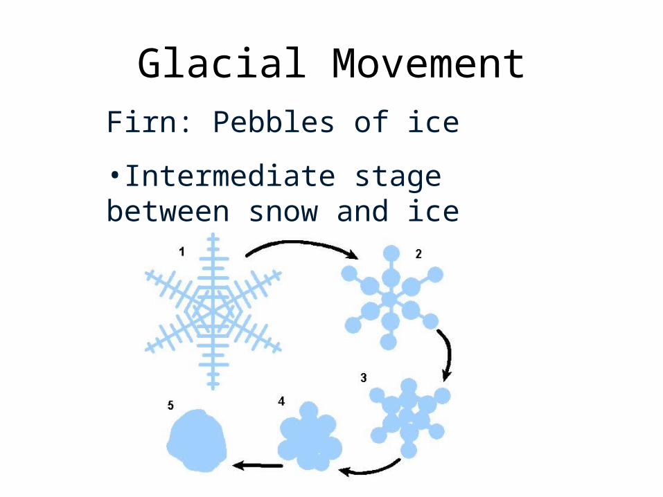
Glacial MovementFirn: Pebbles of ice
•Intermediate stage between snow and ice
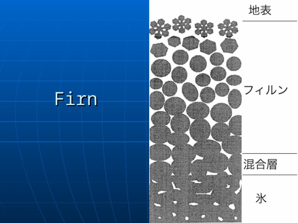
FirnFirn
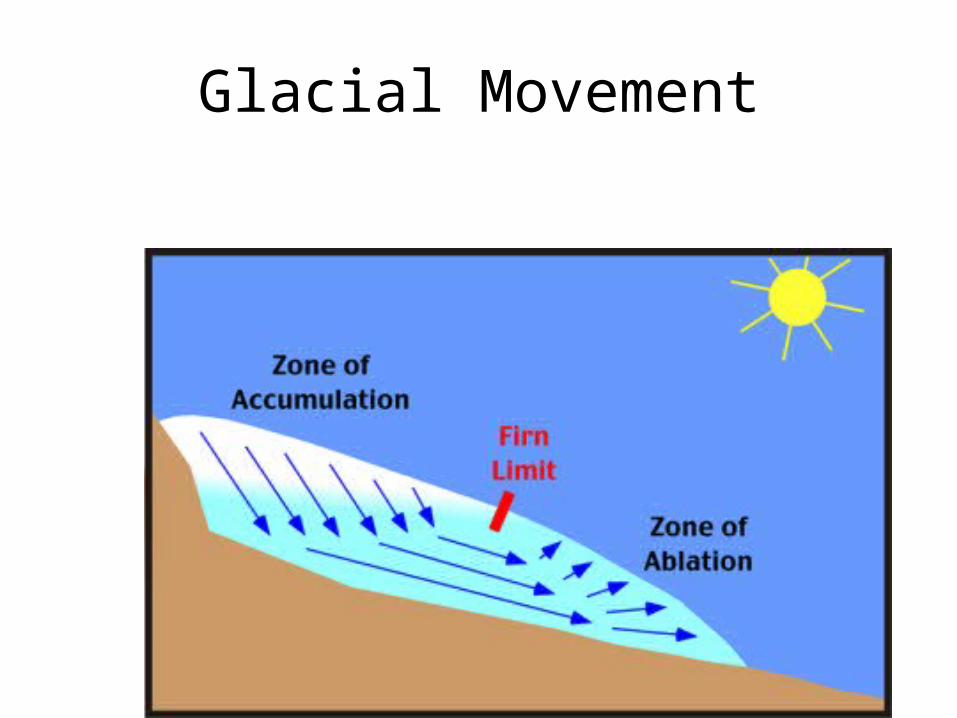
Glacial MovementGlacial advance: when accumulation > wastage
Glacial Retreat: when accumulation < wastage
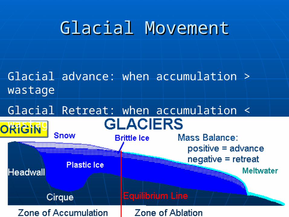
Glacial MovementGlacial Movement
Glacial advance: when accumulation > wastage
Glacial Retreat: when accumulation < wastage
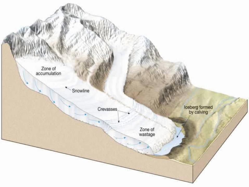
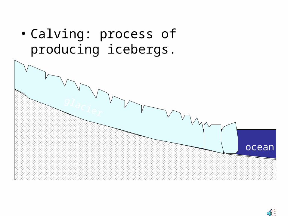
• Calving: process of producing icebergs.
glacier
ocean
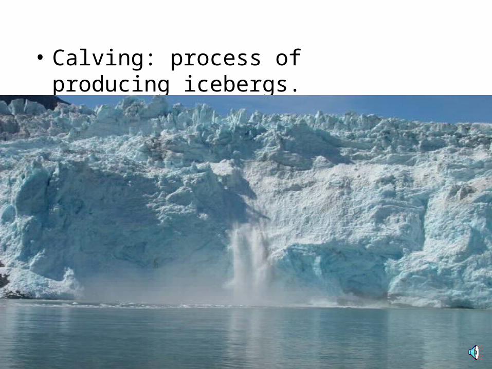
• Calving: process of producing icebergs.
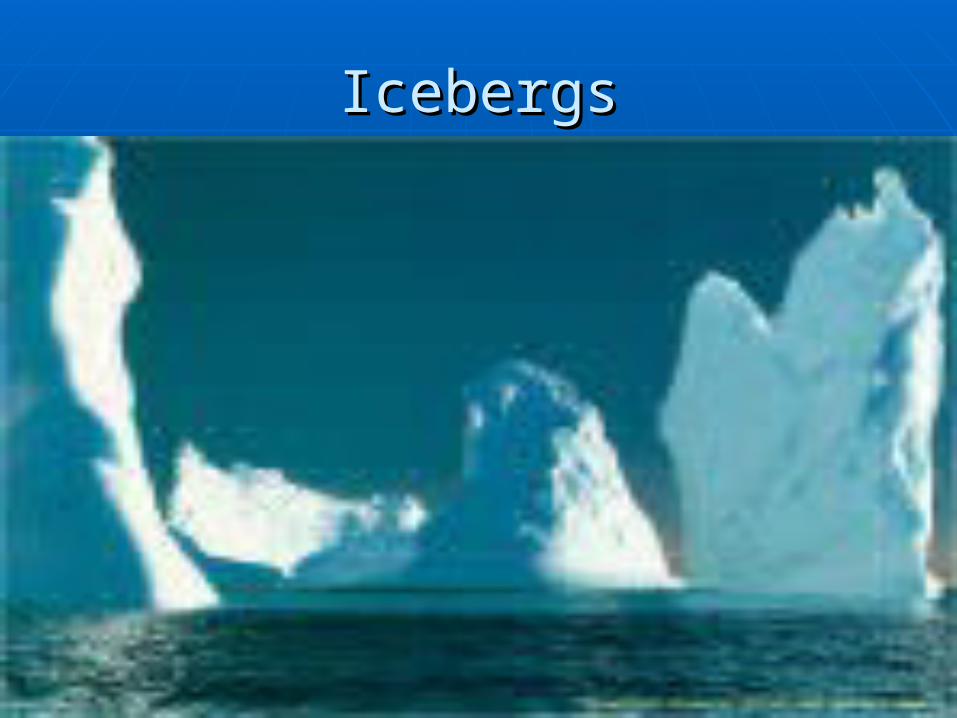
IcebergsIcebergs
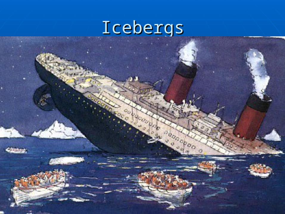
IcebergsIcebergs
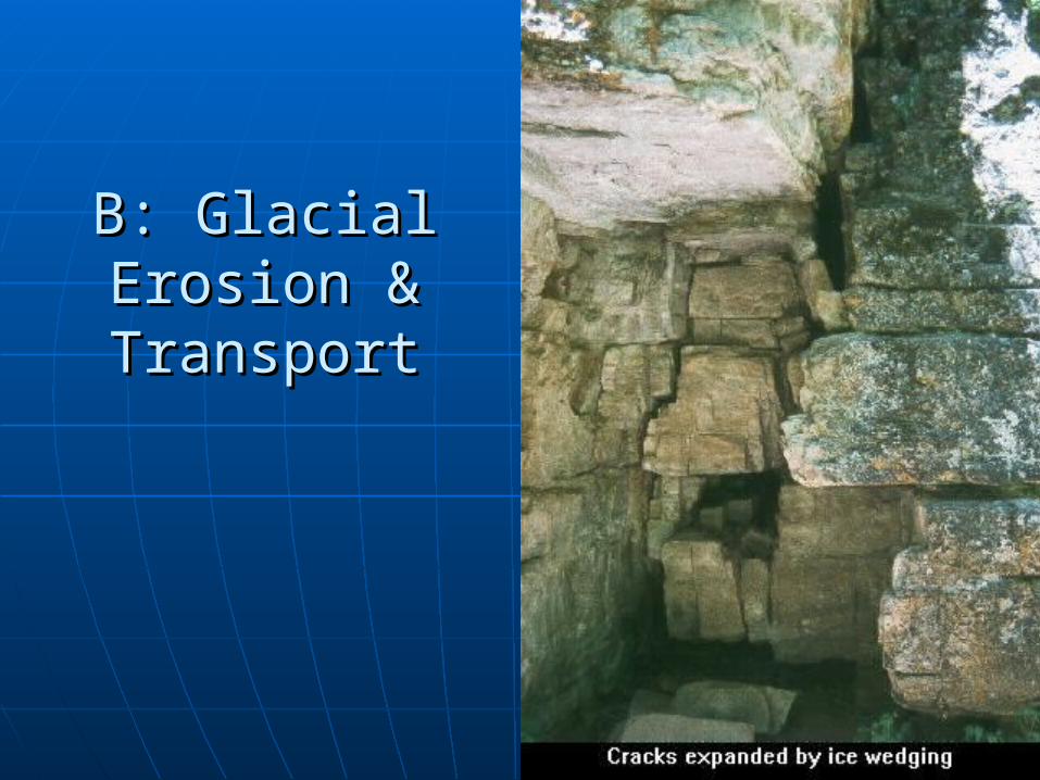
B: Glacial B: Glacial Erosion & Erosion & TransportTransport
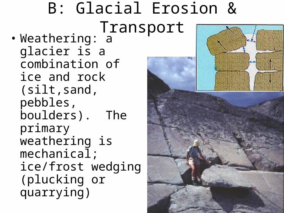
B: Glacial Erosion & Transport• Weathering: a glacier
is a combination of ice and rock (silt,sand, pebbles, boulders). The primary weathering is mechanical; ice/frost wedging (plucking or quarrying)

Handout WS 17.1 NoteHelperHandout WS 17.1 NoteHelper
Glacial Eroded Landforms
• Erosion: glaciers carry the sediment within the ice AND grind/polish bedrock via abrasion (rock within the ice grinds below the glacier).
• The plucking and grinding creates the following landforms (become visible after the ice is gone):
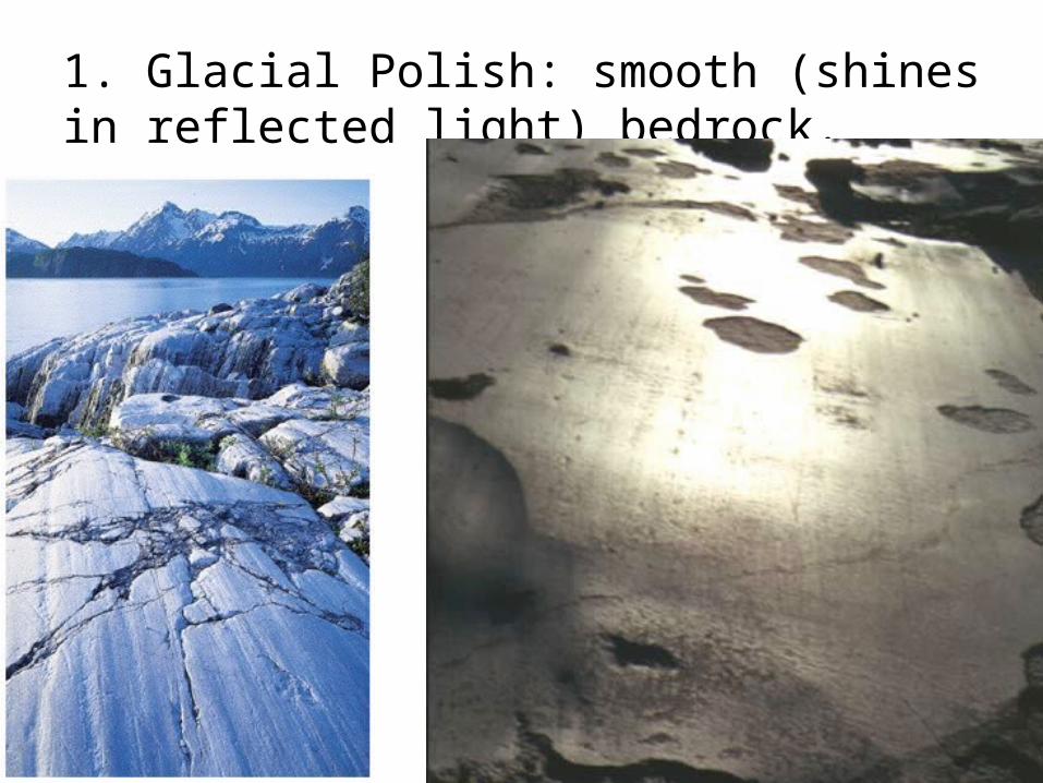
1. Glacial Polish: smooth (shines in reflected light) bedrock.
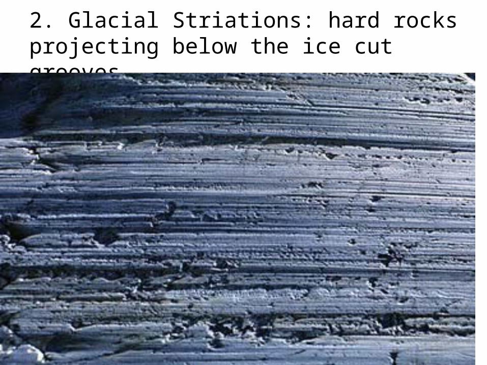
2. Glacial Striations: hard rocks projecting below the ice cut grooves.
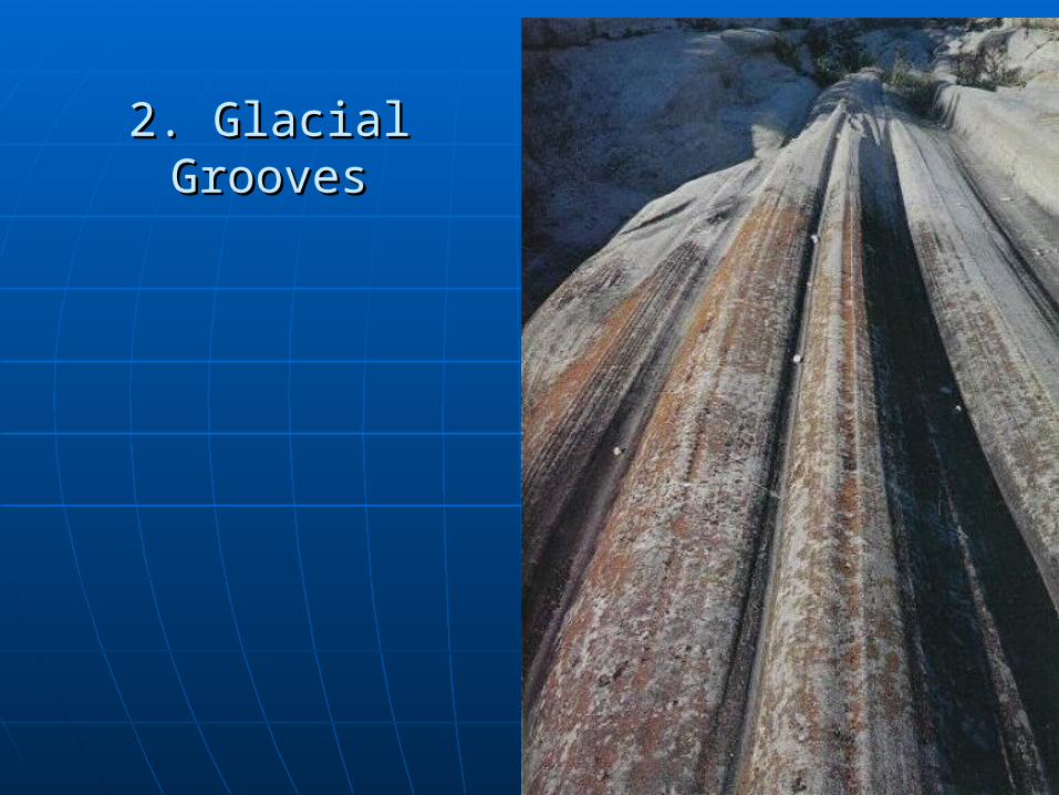
2. Glacial Grooves2. Glacial Grooves
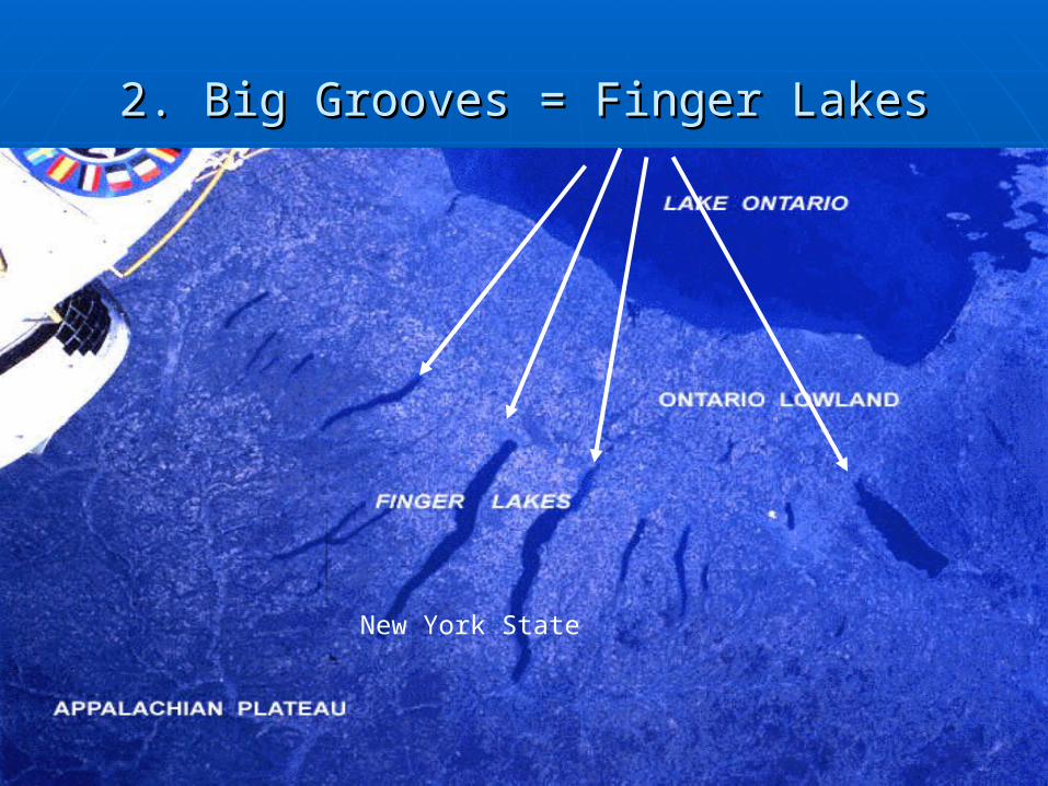
2. Big Grooves = Finger Lakes2. Big Grooves = Finger Lakes
New York State
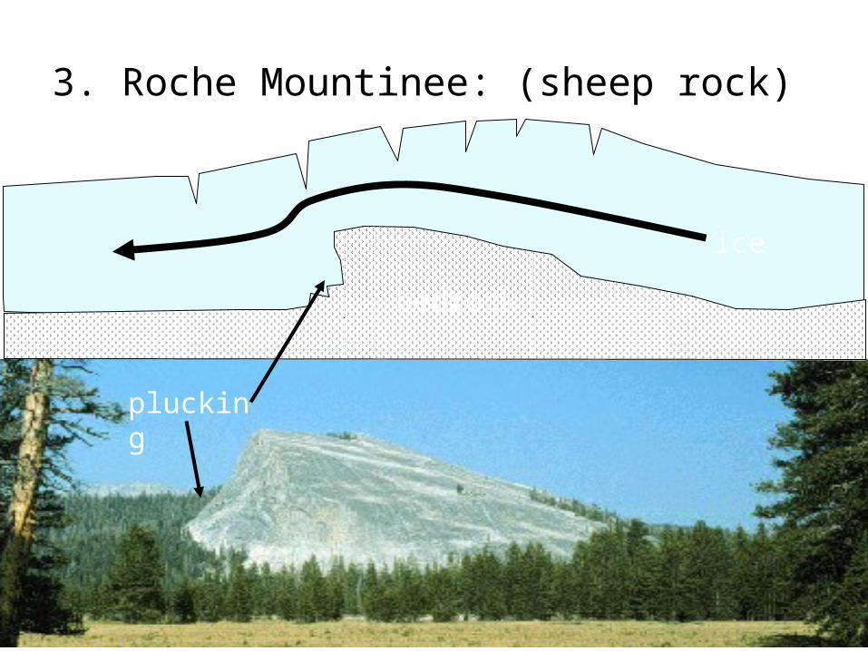
3. Roche Mountinee: (sheep rock)
plucking
bedrock
ice
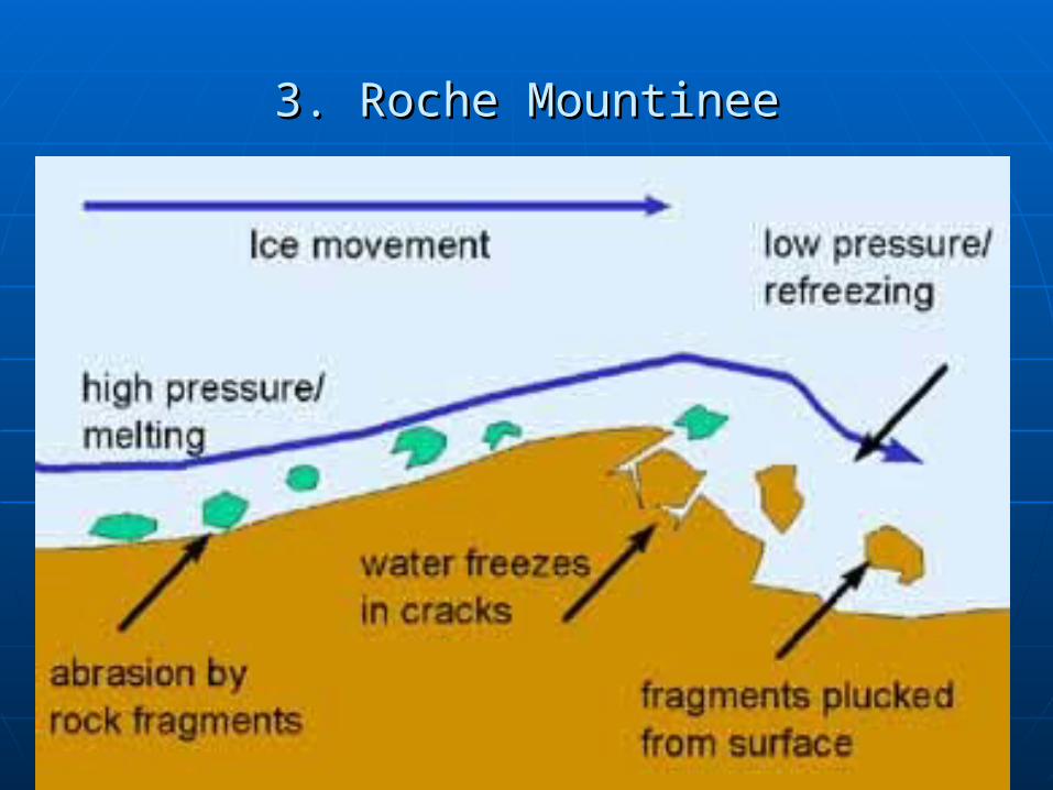
3. Roche Mountinee3. Roche Mountinee
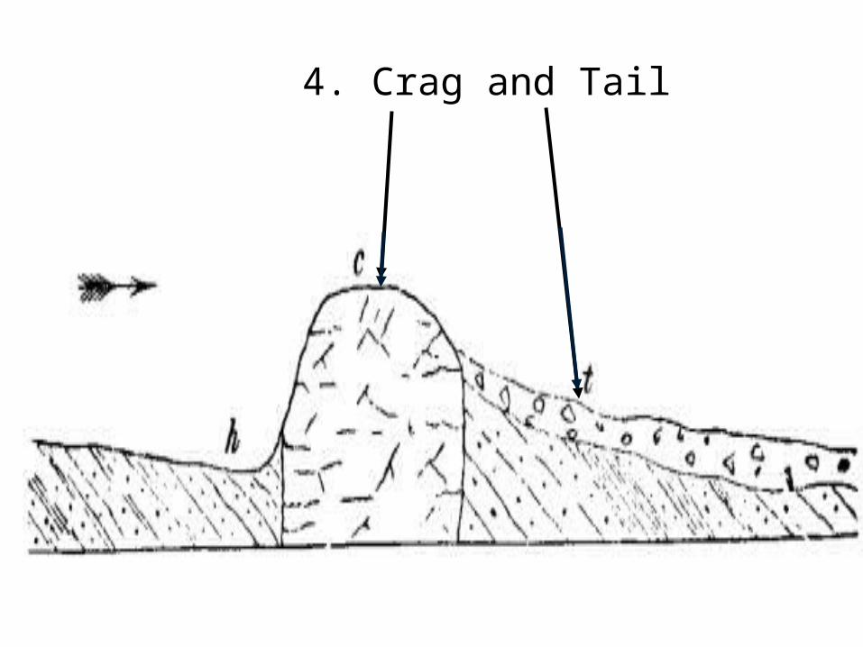
4. Crag and Tail
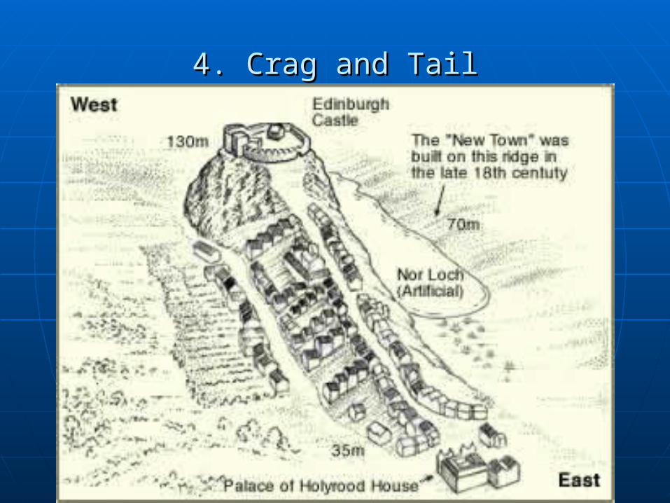
4. Crag and Tail4. Crag and Tail
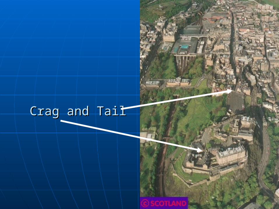
Crag and TailCrag and Tail
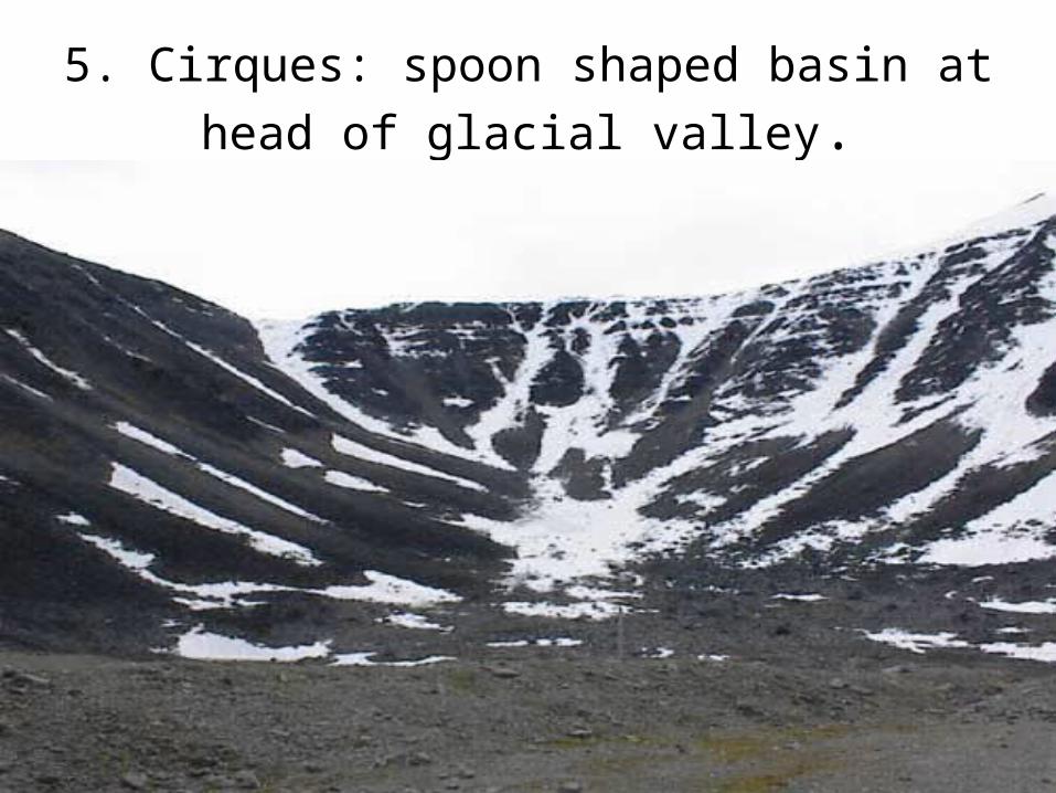
5. Cirques: spoon shaped basin at head of
glacial valley.
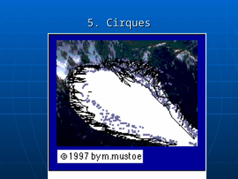
5. Cirques5. Cirques
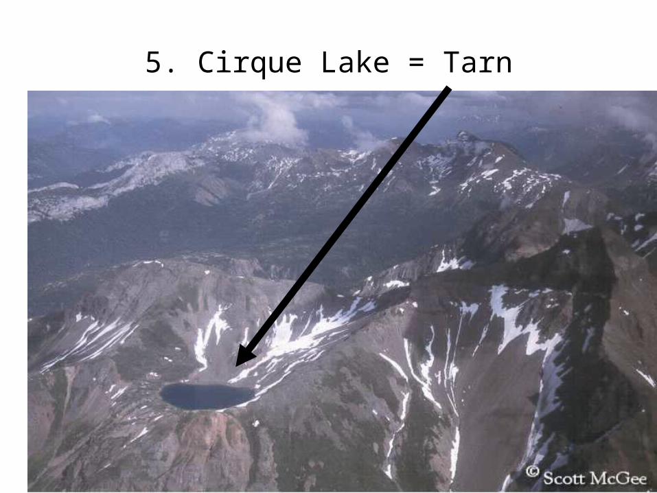
5. Cirque Lake = Tarn
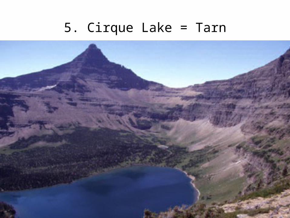
5. Cirque Lake = Tarn
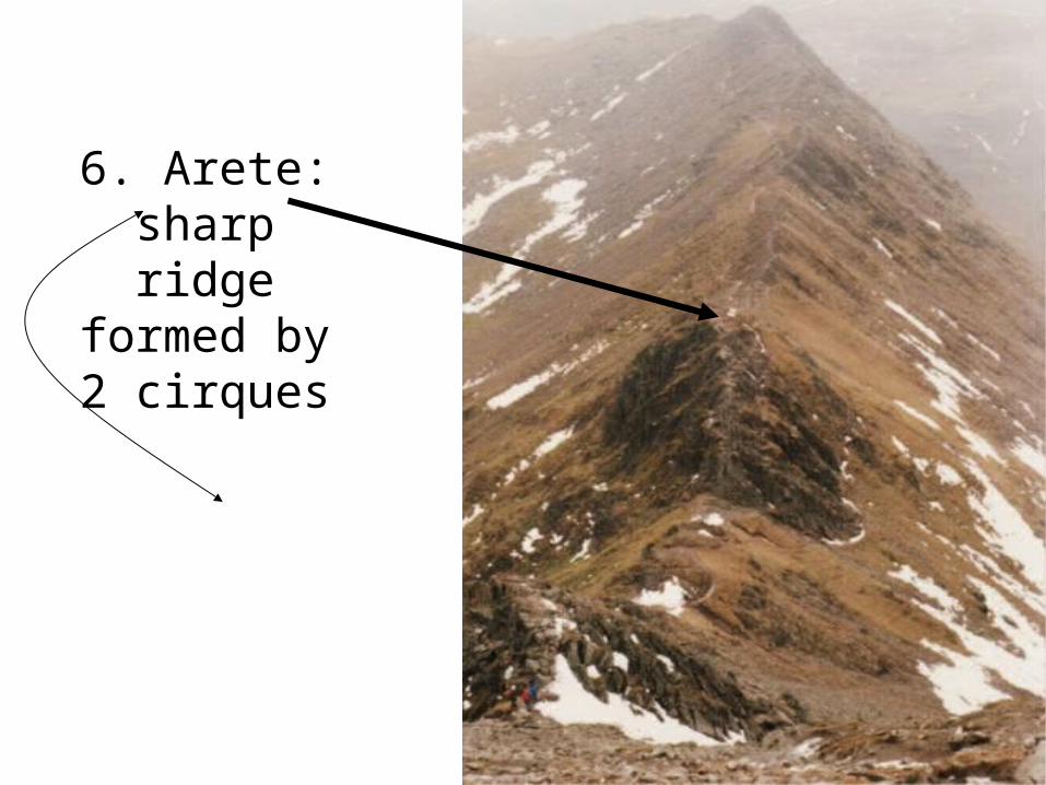
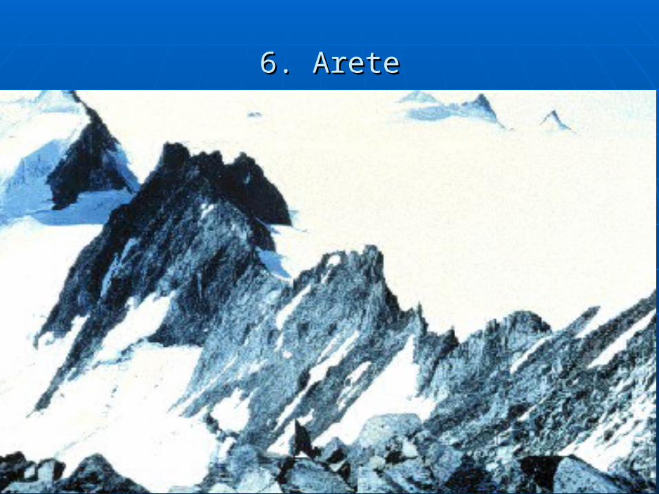
6. Arete: sharp ridge formed by 2
cirques
Stop right there, thank you very much….”
6. Arete6. Arete
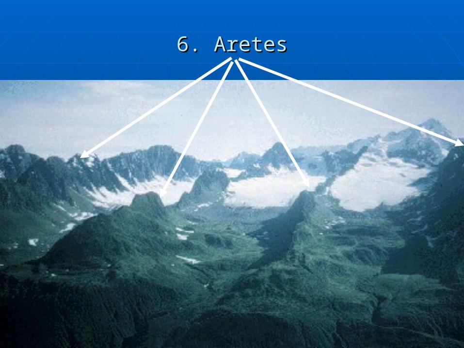
6. Aretes6. Aretes
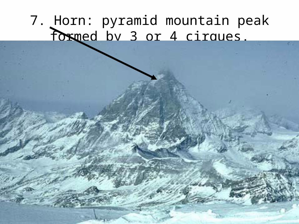
7. Horn: pyramid mountain peak formed by 3 or 4 cirques.
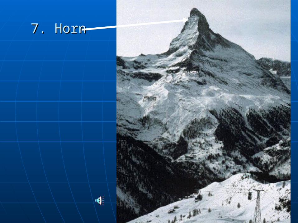
7. Horn7. Horn
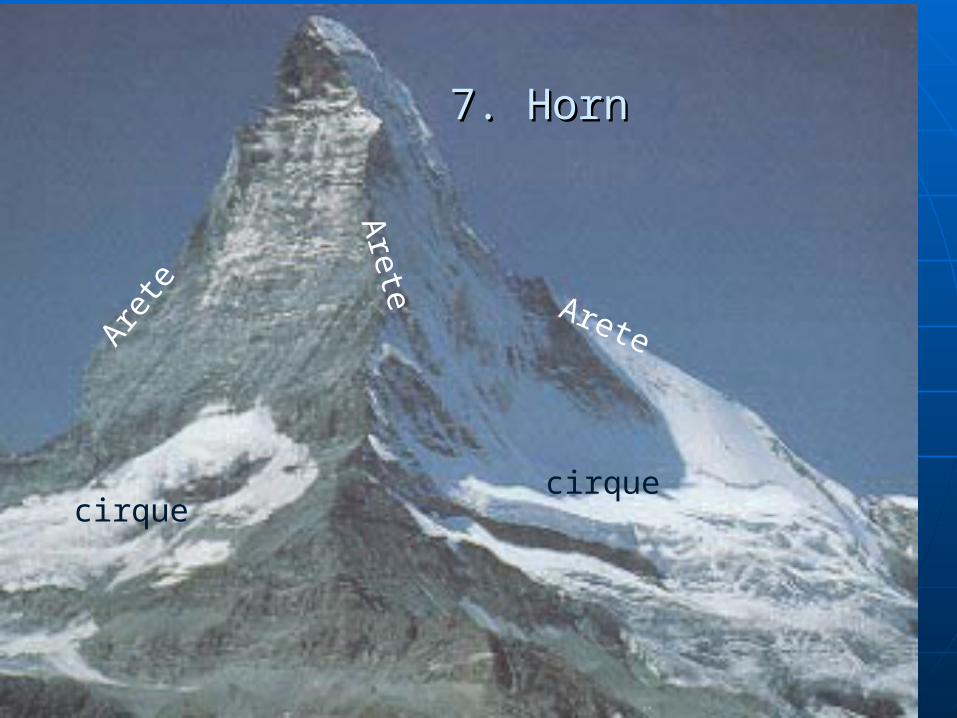
7. Horn7. Horn
Arete
Are
te
Aret
e
cirquecirque
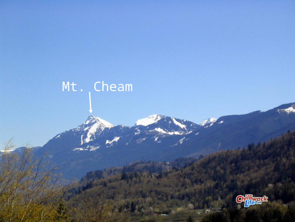
Mt. Cheam
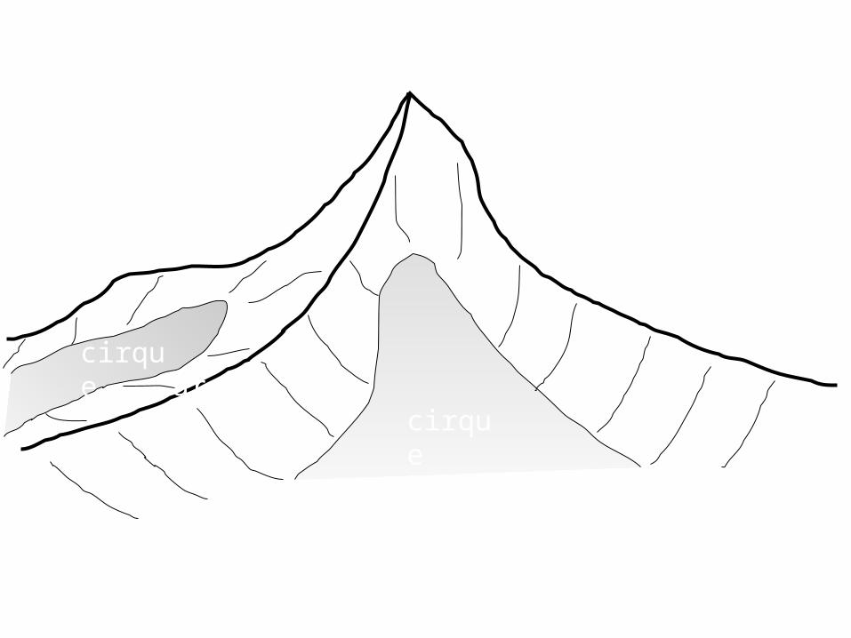
horn
arete
arete
aretecirque
cirque
Draw this
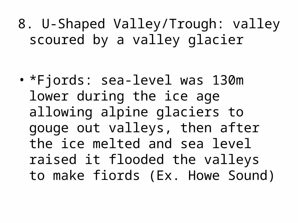
8. U-Shaped Valley/Trough: valley scoured by a valley glacier
• *Fjords: sea-level was 130m lower during the ice age allowing alpine glaciers to gouge out valleys, then after the ice melted and sea level raised it flooded the valleys to make fiords (Ex. Howe Sound)
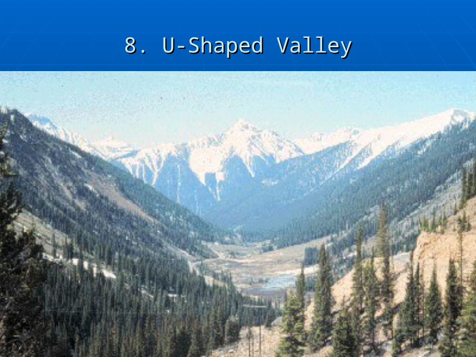
8. U-Shaped Valley8. U-Shaped Valley
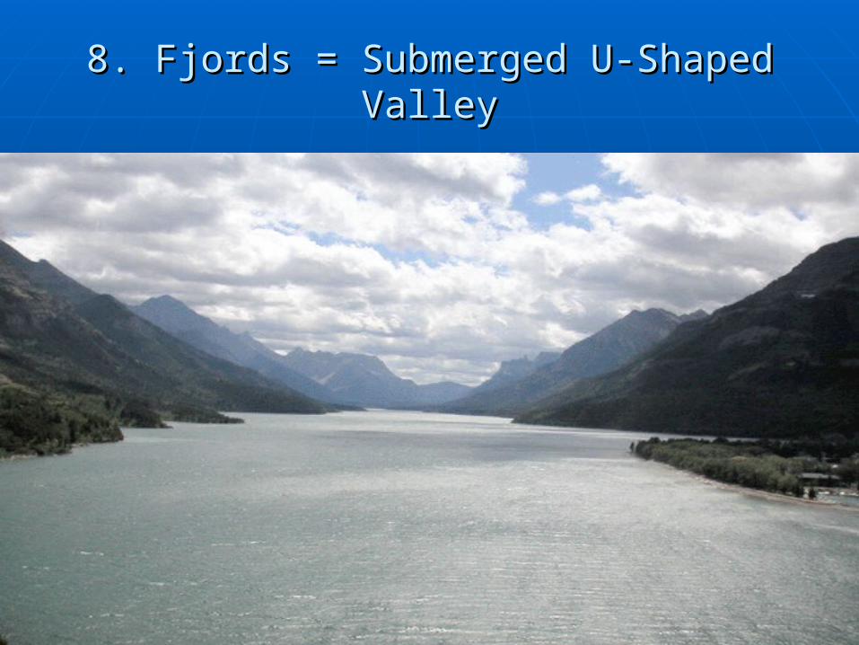
8. Fjords = Submerged U-Shaped Valley8. Fjords = Submerged U-Shaped Valley
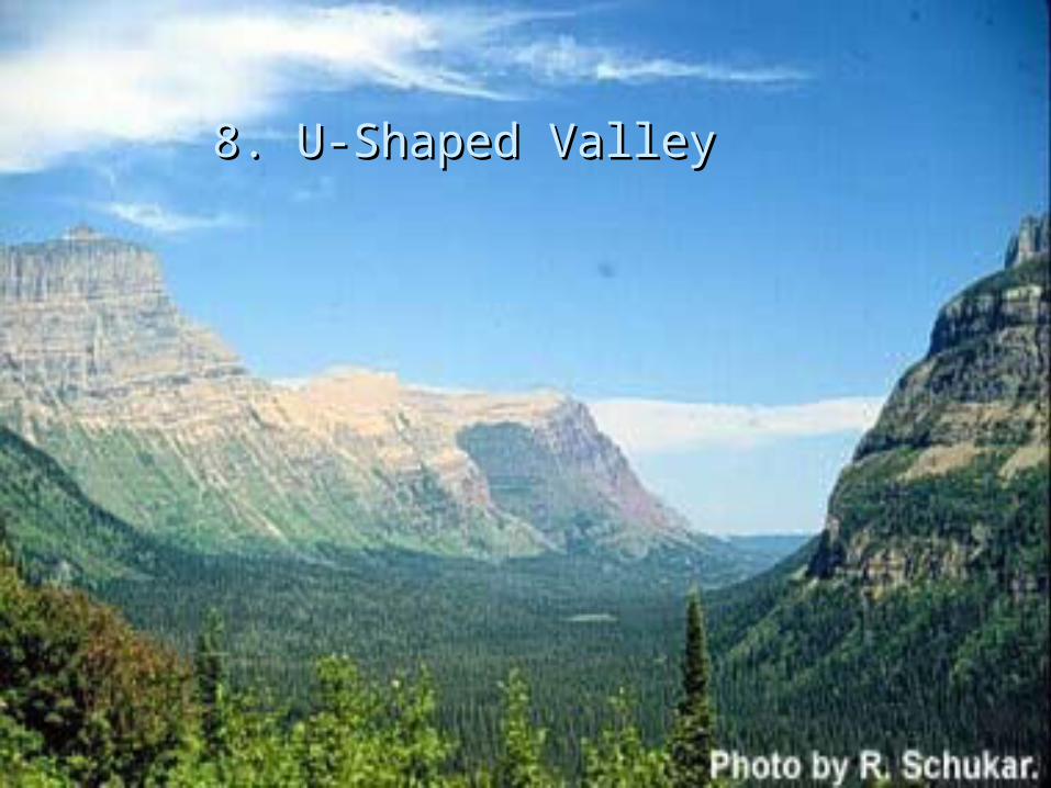
8. U-Shaped Valley8. U-Shaped Valley
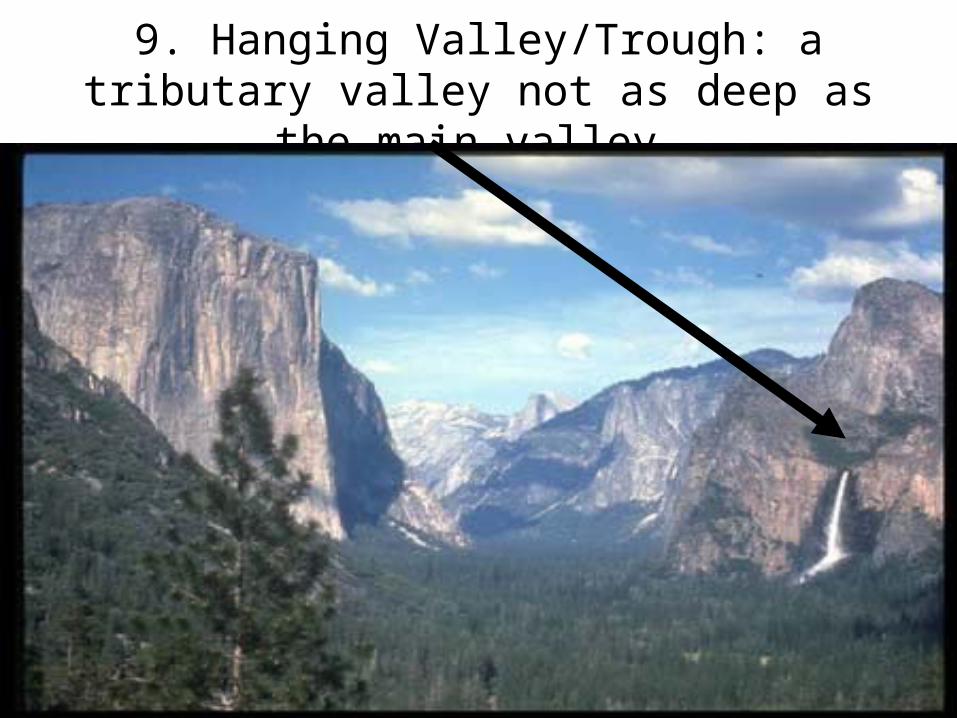
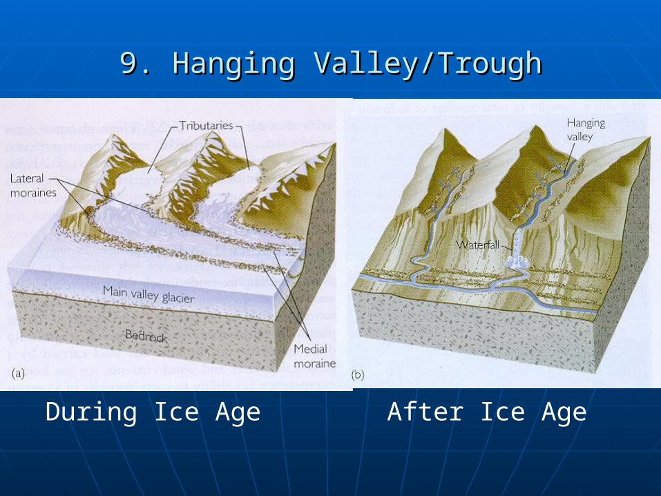
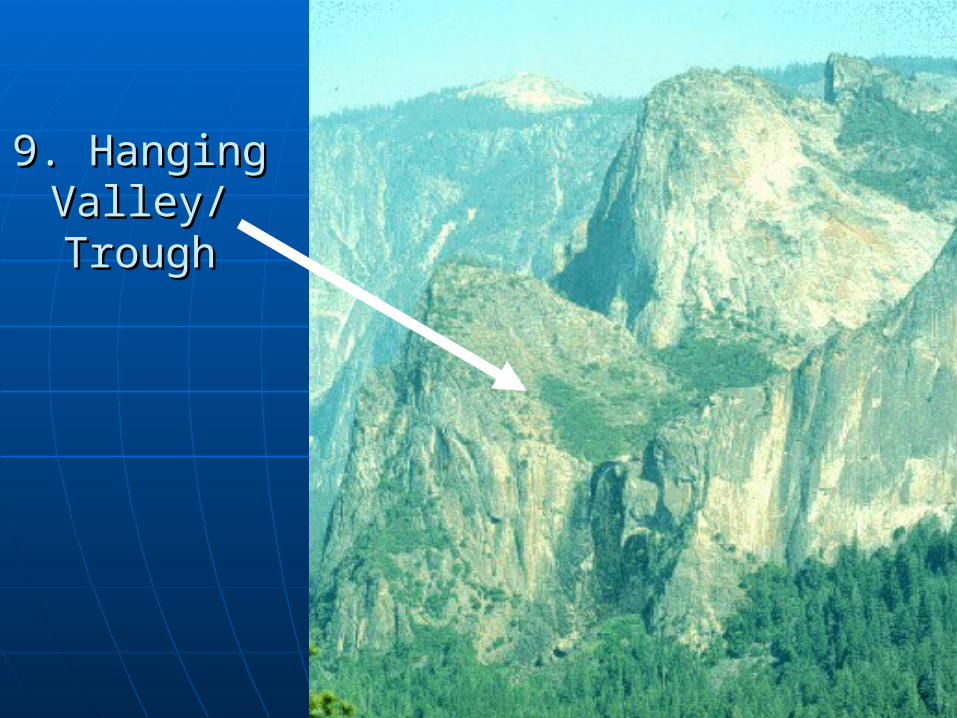
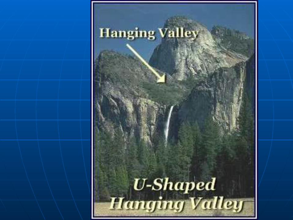
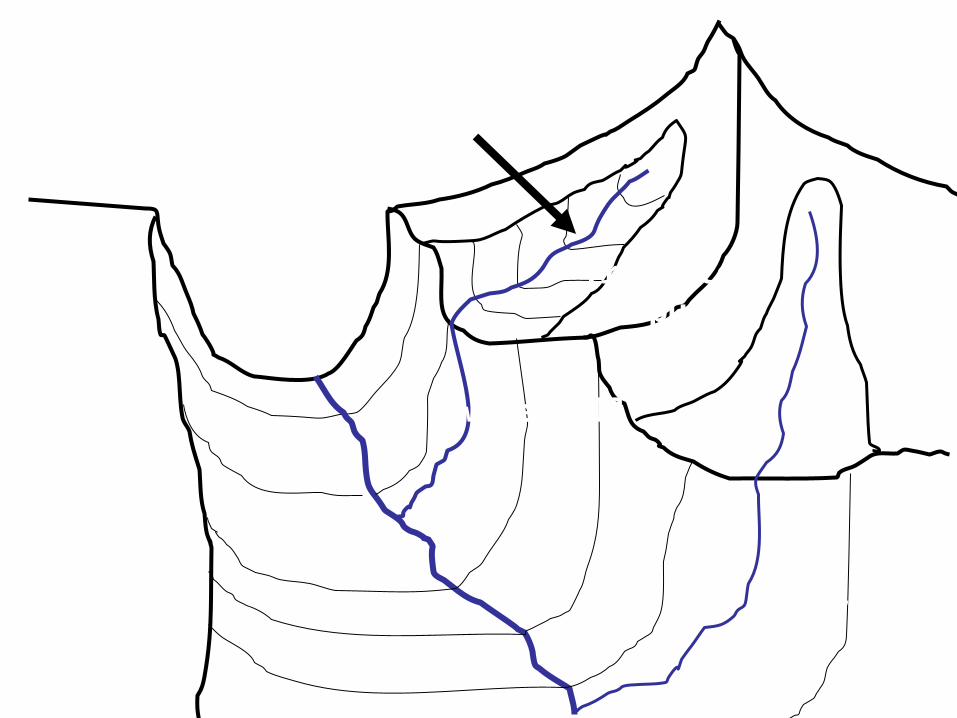
9. Hanging Valley/Trough: a tributary valley not as deep as the main valley.
9. Hanging Valley/Trough9. Hanging Valley/Trough
During Ice Age After Ice Age
9. Hanging 9. Hanging Valley/Valley/TroughTrough
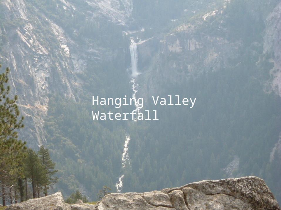
Hanging Valley Waterfall
U-shaped valley
Hanging valley/trough
Truncated spur
waterfall
waterfall
Draw
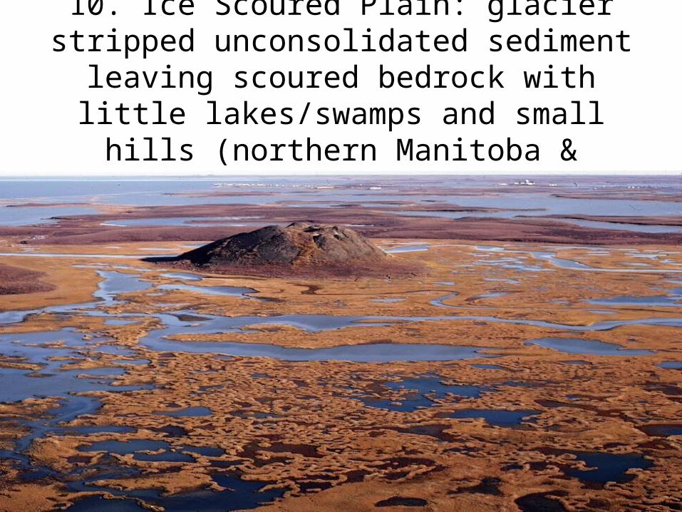
10. Ice Scoured Plain: glacier stripped unconsolidated sediment leaving scoured bedrock with little lakes/swamps and small hills (northern Manitoba & Quebec, NWT).
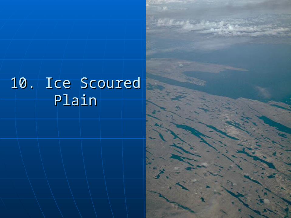
10. Ice Scoured Plain10. Ice Scoured Plain
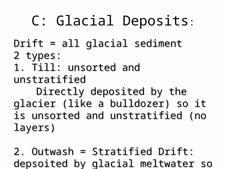
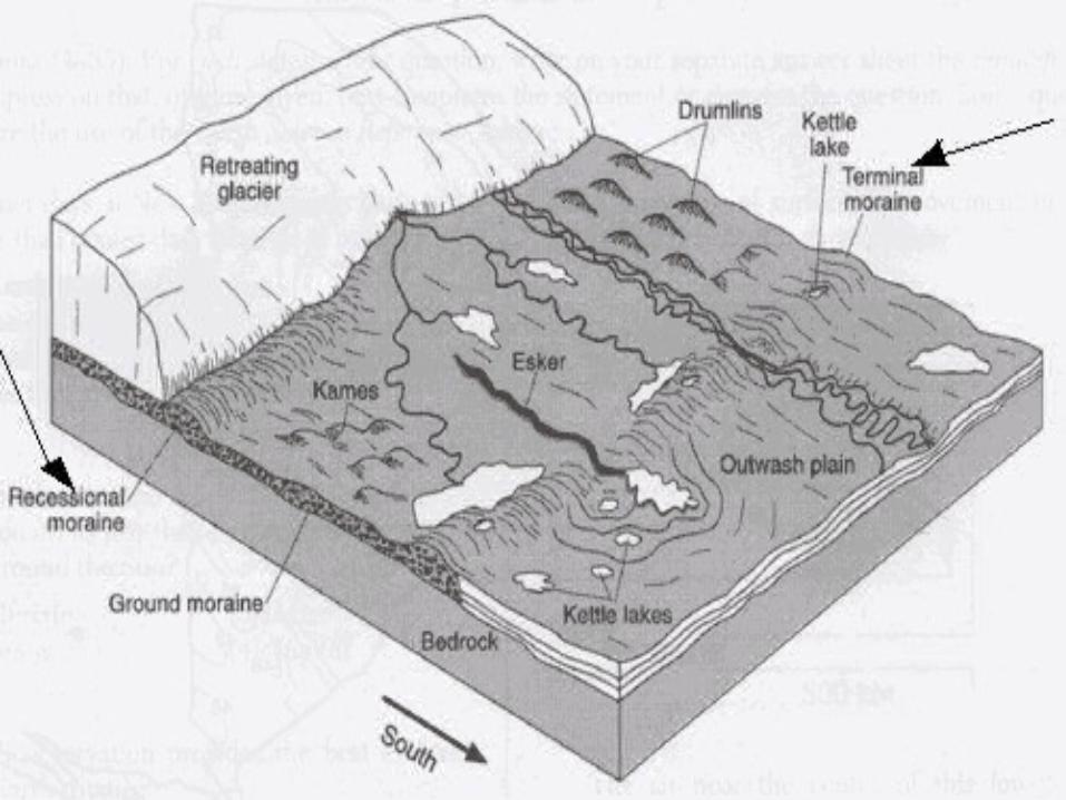
C: Glacial Deposits:
Drift = all glacial sedimentDrift = all glacial sediment2 types:2 types:1. Till: unsorted and unstratified1. Till: unsorted and unstratified
Directly deposited by the glacier Directly deposited by the glacier (like a bulldozer) so it is unsorted and (like a bulldozer) so it is unsorted and unstratified (no layers)unstratified (no layers)
2. Outwash = Stratified Drift: depsoited 2. Outwash = Stratified Drift: depsoited by glacial meltwater so it tends to be by glacial meltwater so it tends to be sorted and stratifiedsorted and stratified
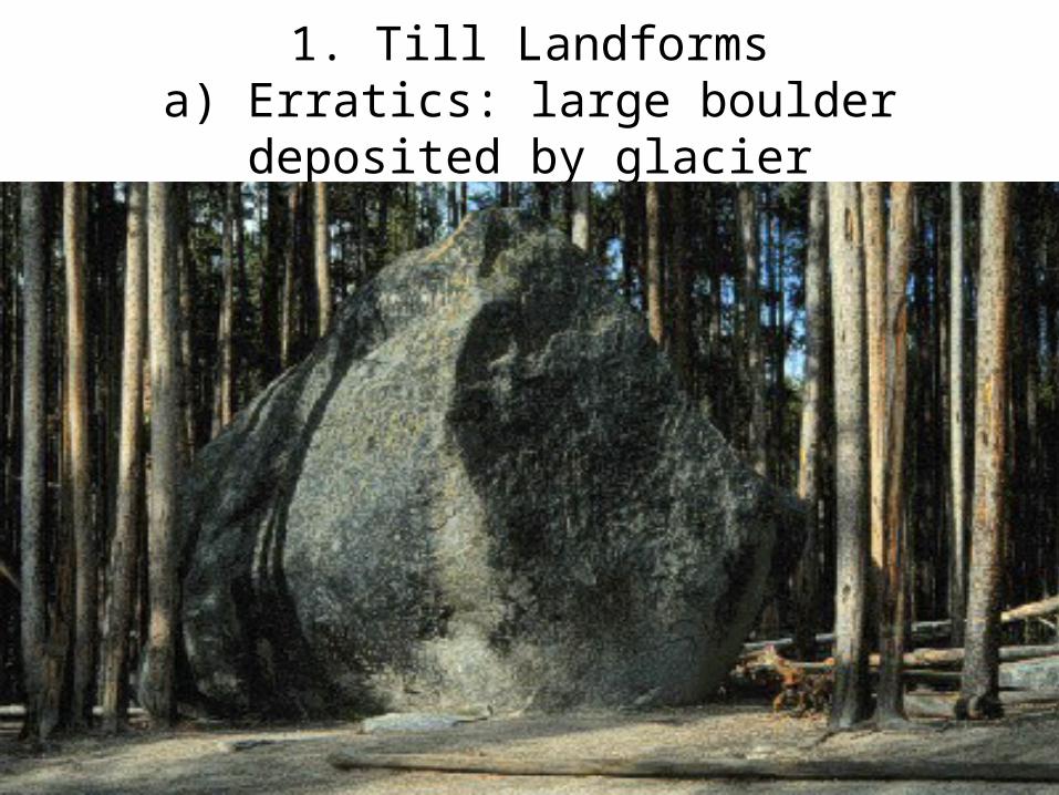
1. Till Landformsa) Erratics: large boulder deposited by
glacier
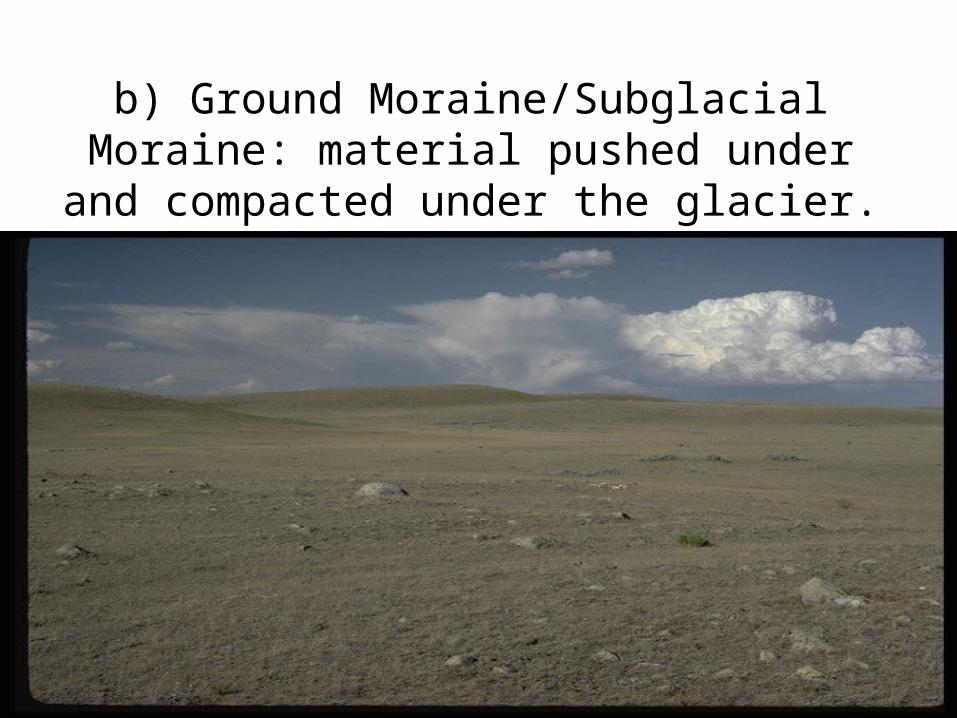
b) Ground Moraine/Subglacial Moraine: material pushed under and compacted under
the glacier.
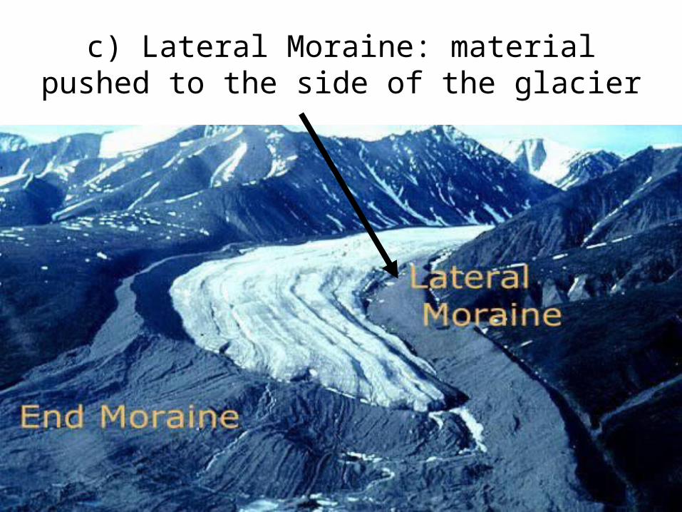
c) Lateral Moraine: material pushed to the side of the glacier
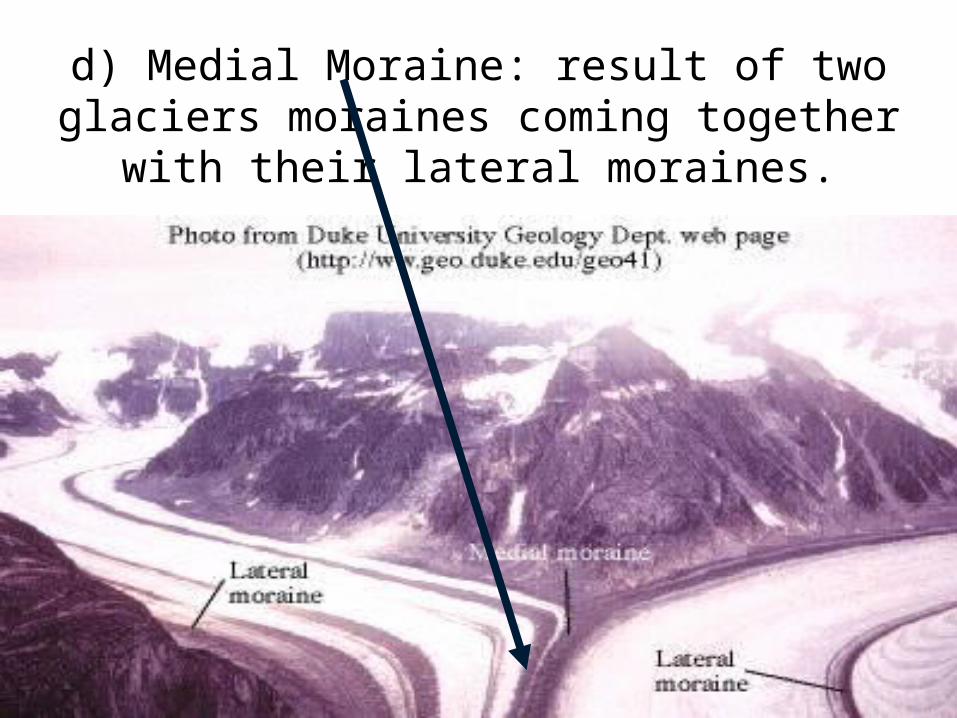
d) Medial Moraine: result of two glaciers moraines coming together with their lateral
moraines.
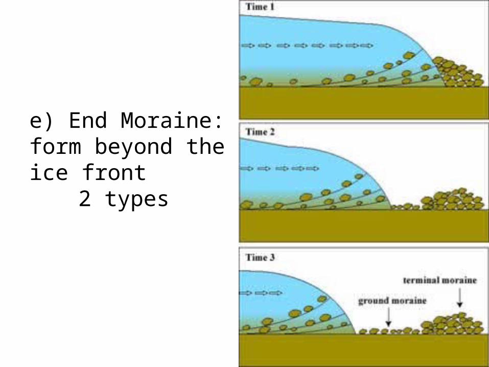
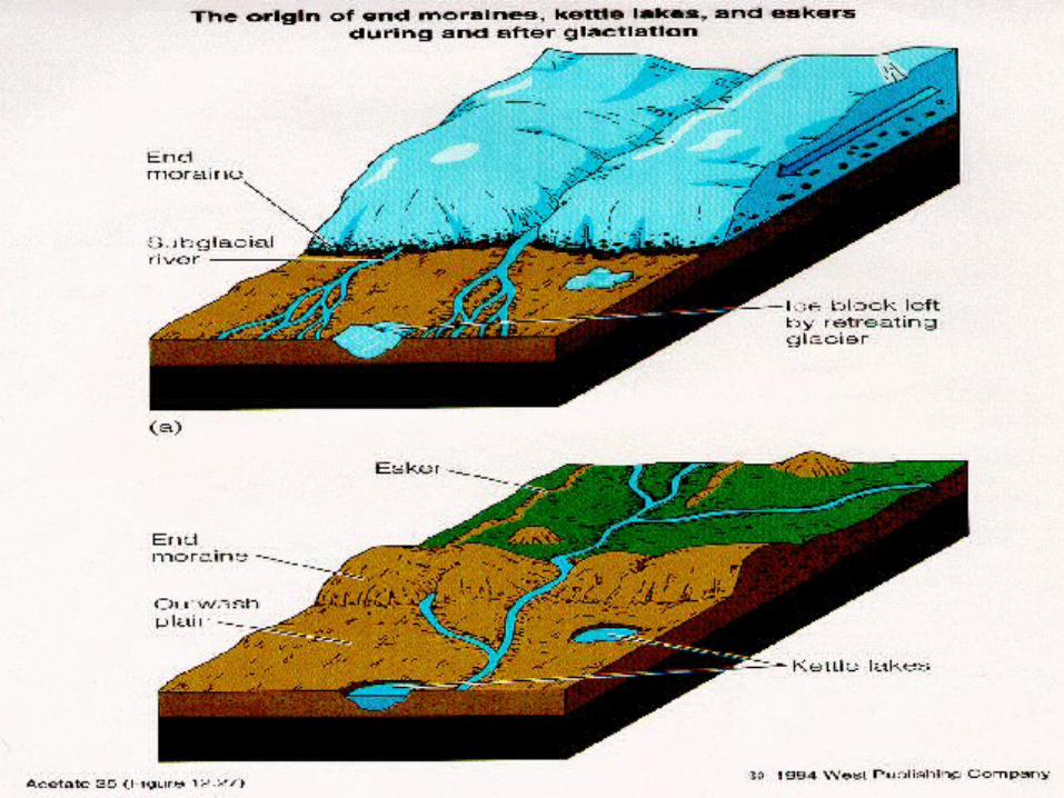
e) End Moraine: form beyond the ice front
2 types
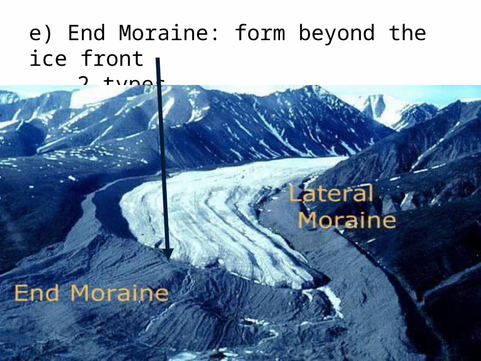
e) End Moraine: form beyond the ice front2 types
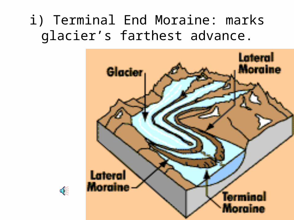
i) Terminal End Moraine: marks glacier’s farthest advance.
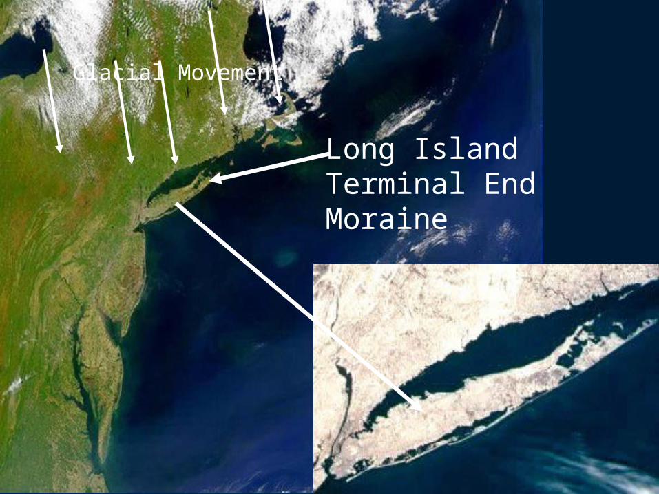
Long Island Terminal End Moraine
Glacial Movement
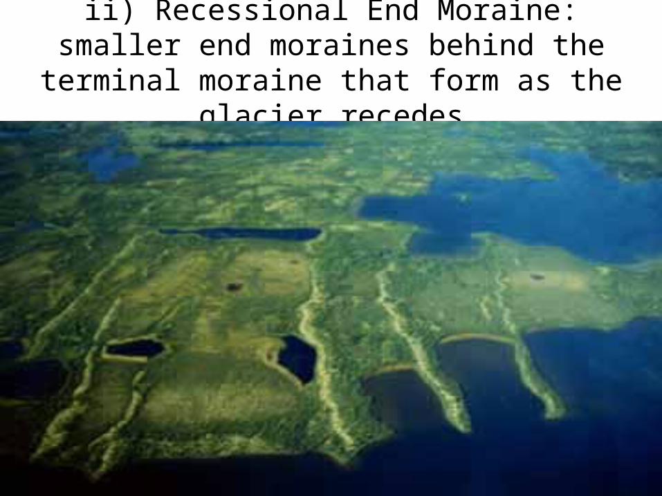
ii) Recessional End Moraine: smaller end moraines behind the terminal moraine that
form as the glacier recedes
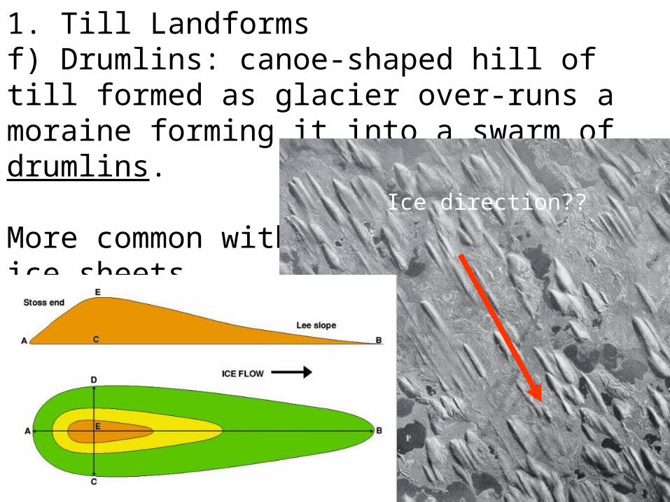
1. Till Landformsf) Drumlins: canoe-shaped hill of till formed as glacier over-runs a moraine forming it into a swarm of drumlins.
More common with ice sheets.
Ice direction??
Mtn’Mtn’Mtn’
End moraines
Medial moraine
Ground moraine (underneath ice)
Lateral moraines
ice ice Lateral moraine
Lateral moraine
recessional moraines
terminal moraine
drumlins
Draw
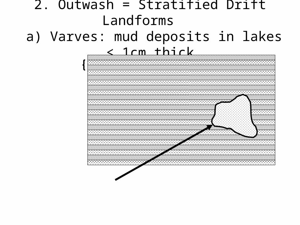
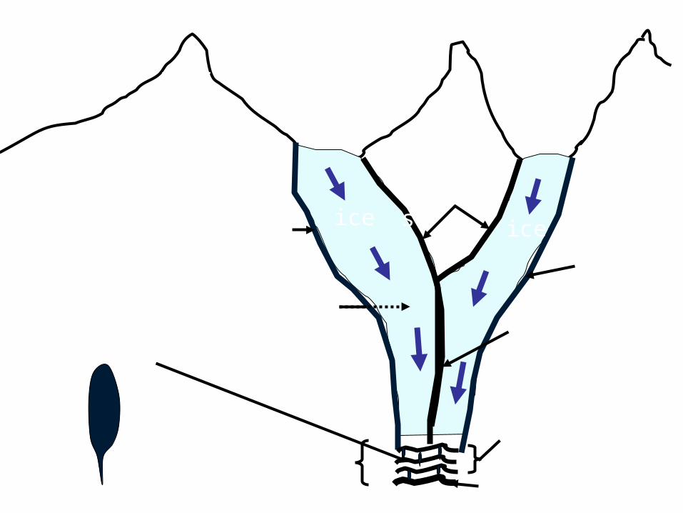
2. Outwash = Stratified Drift Landforms a) Varves: mud deposits in lakes < 1cm
thick
1 year: spring-summer: silt + clay = light colour
Fall-winter: clay + OM = dark layer
1 year
Drop stone: fell out of melting iceberg.
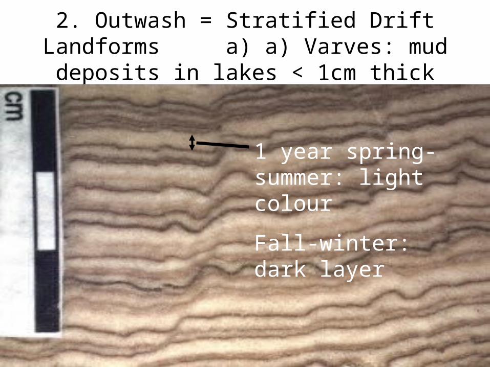
2. Outwash = Stratified Drift Landforms a) a) Varves: mud deposits in lakes < 1cm thick
1 year spring-summer: light colour
Fall-winter: dark layer
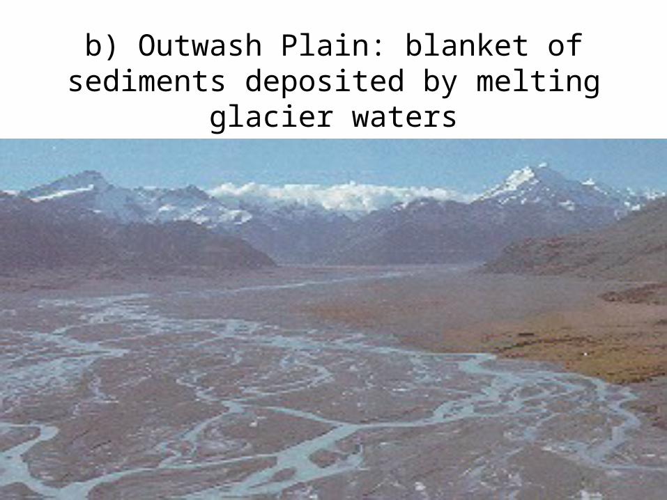
b) Outwash Plain: blanket of sediments deposited by melting glacier waters
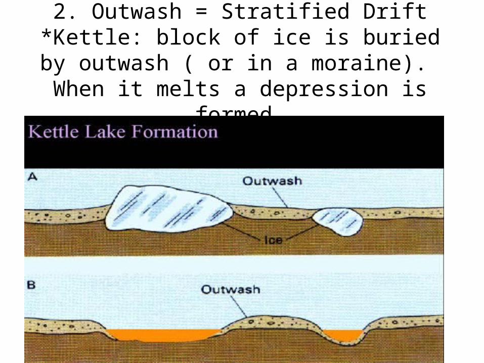
2. Outwash = Stratified Drift*Kettle: block of ice is buried by outwash ( or in a moraine). When it melts a depression is
formed.
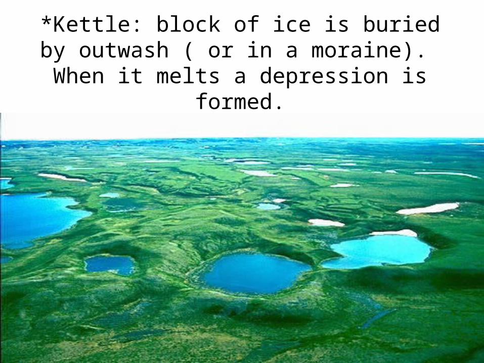
*Kettle: block of ice is buried by outwash ( or in a moraine). When it melts a depression is
formed.
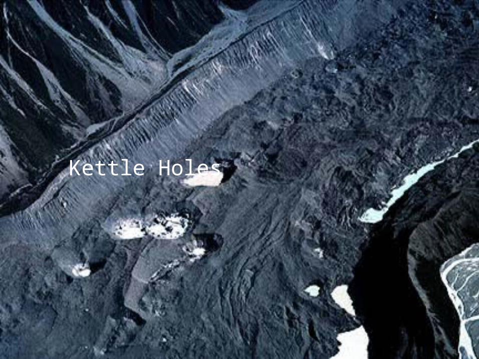
Kettle Holes
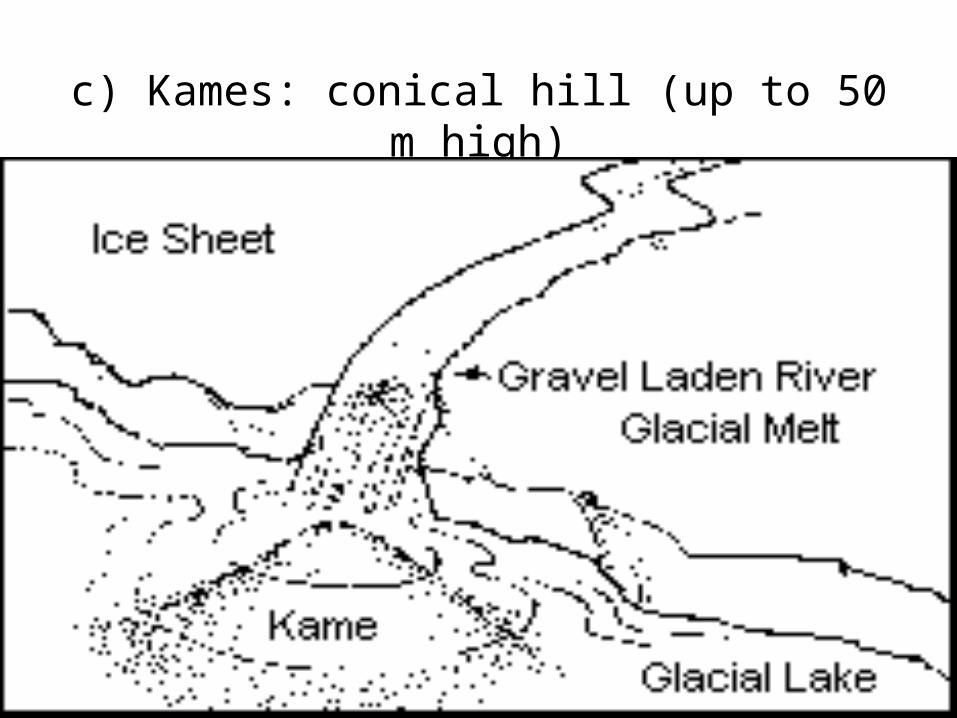
c) Kames: conical hill (up to 50 m high)
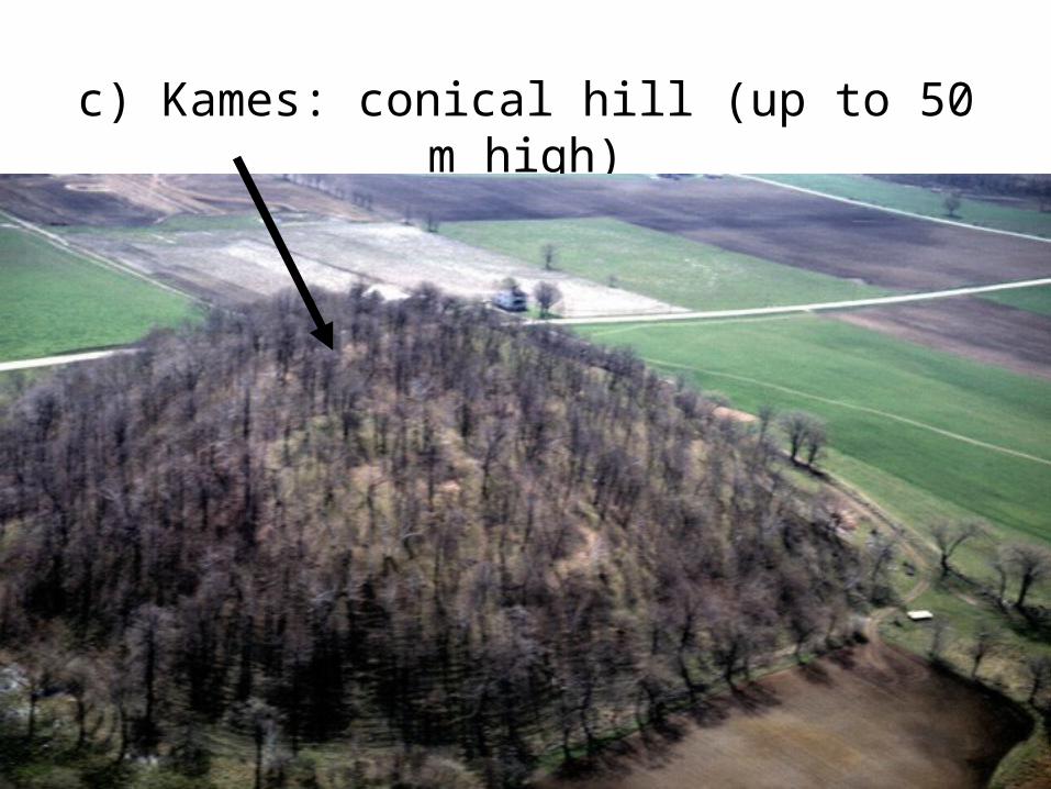
c) Kames: conical hill (up to 50 m high)
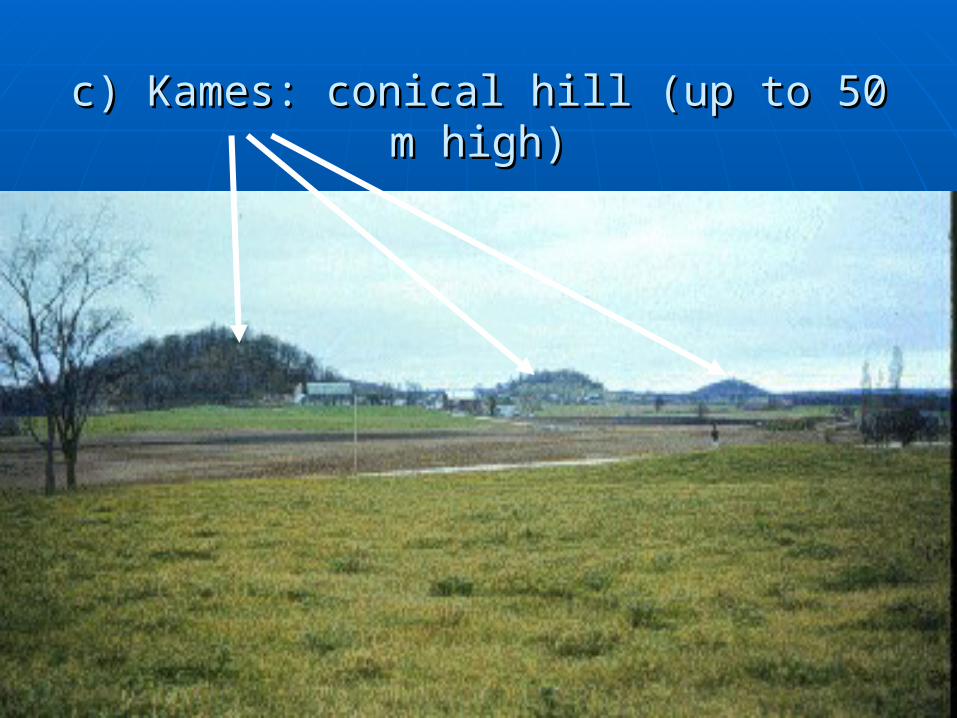
c) Kames: conical hill (up to 50 m high)c) Kames: conical hill (up to 50 m high)
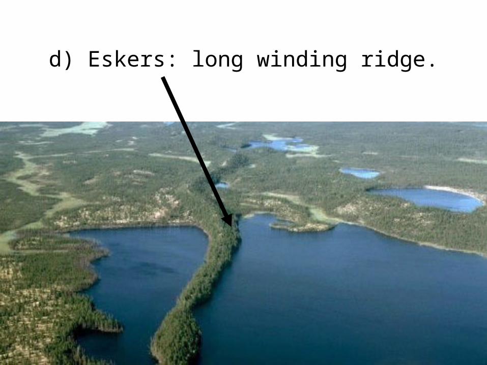
d) Eskers: long winding ridge.
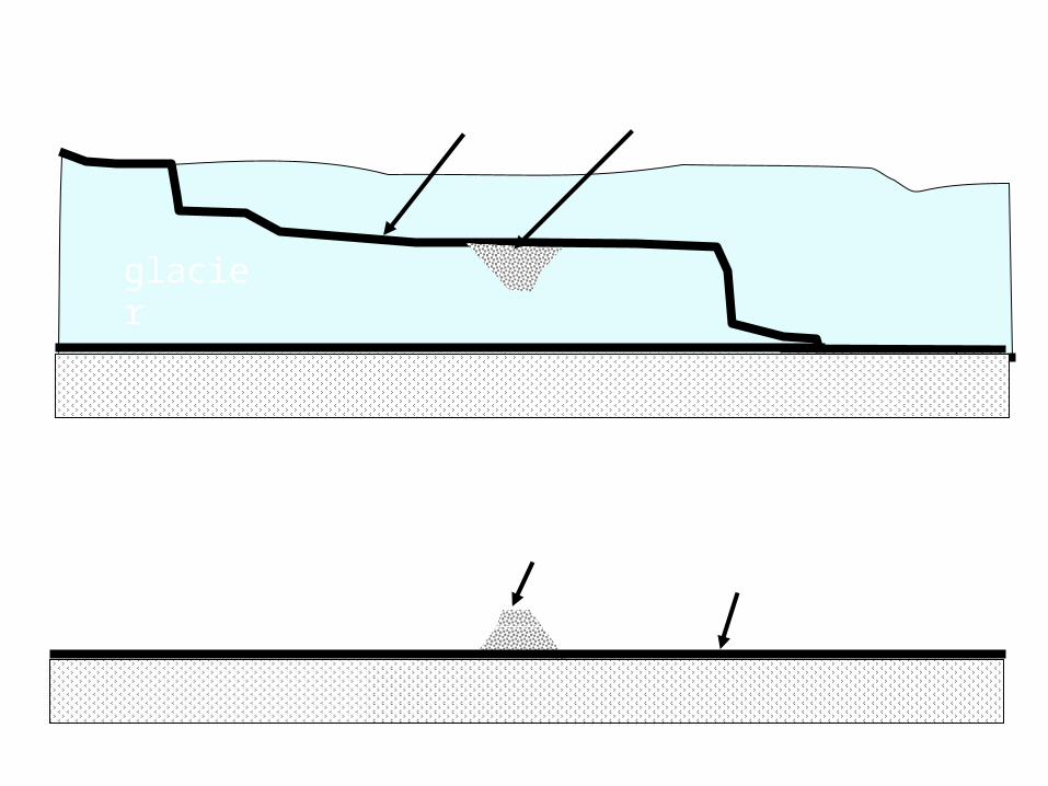
Before
AfterAfter kame esker
glacier
Glacial stream - pondIce Age Ends … glacier melts
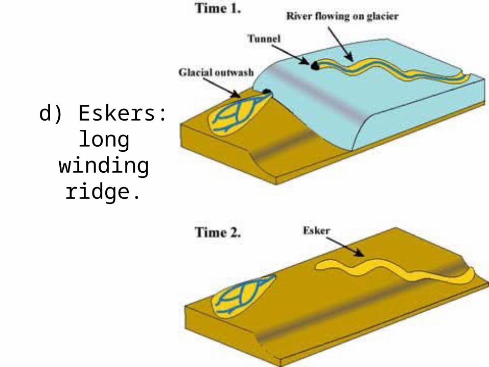
d) Eskers: long winding ridge.
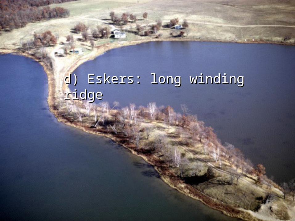
d) Eskers: long winding ridged) Eskers: long winding ridge
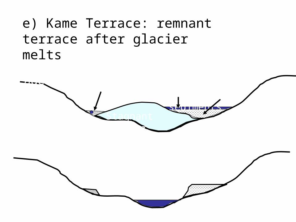
e) Kame Terrace: remnant terrace after glacier melts
Before, near end of ice age
Stagnant glacier -ice
Stream & sedimentsLake and clay sediments
Ice melts
esker
Kame terrace
lake
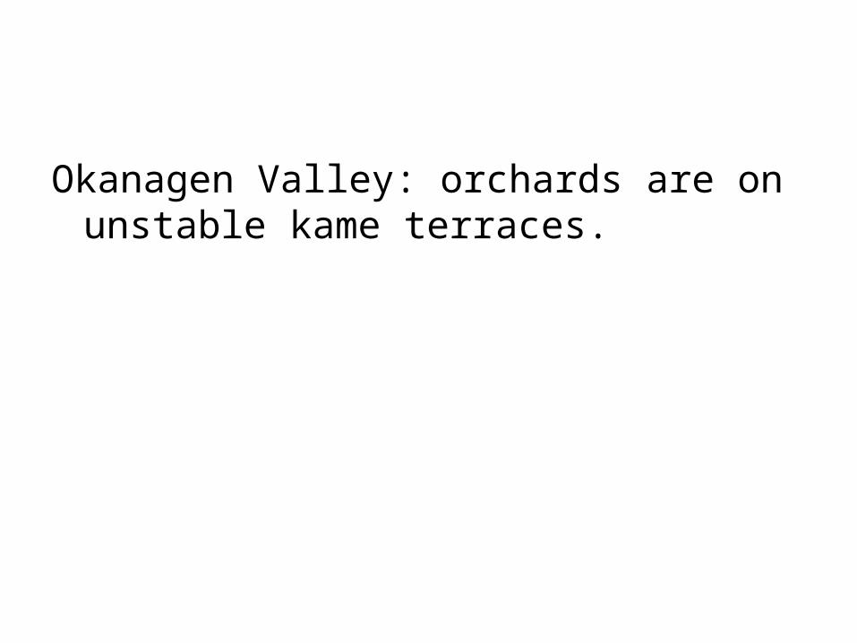
Okanagen Valley: orchards are on unstable kame terraces.
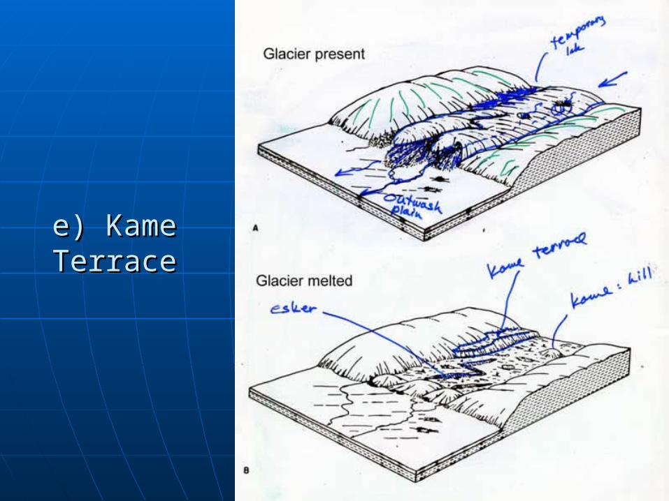
e) Kame e) Kame TerraceTerrace
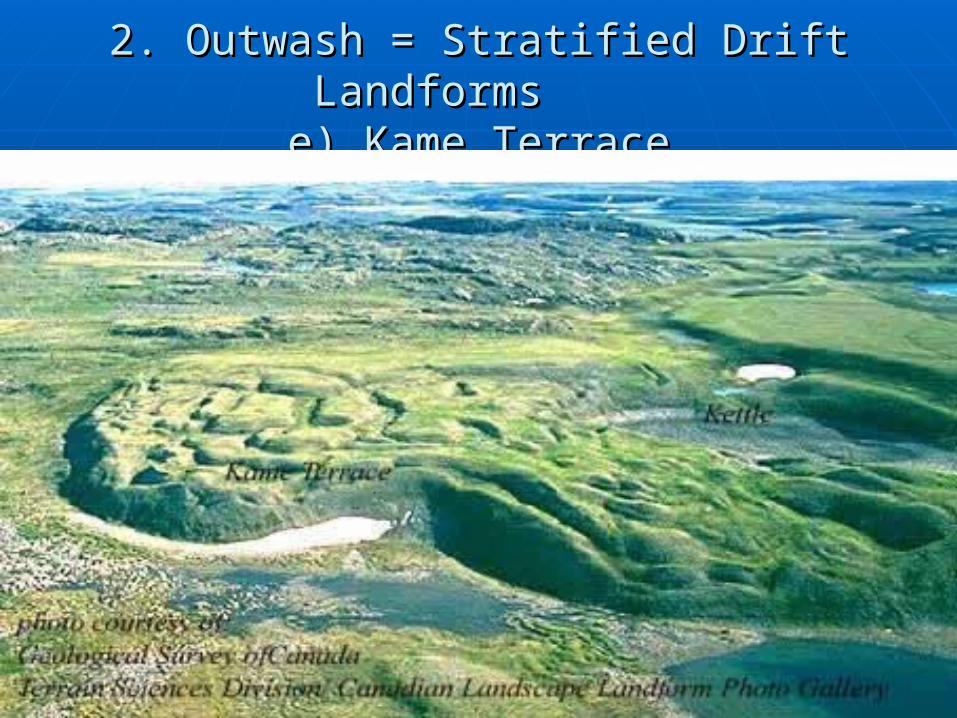
2. Outwash = Stratified Drift Landforms 2. Outwash = Stratified Drift Landforms e) Kame Terracee) Kame Terrace
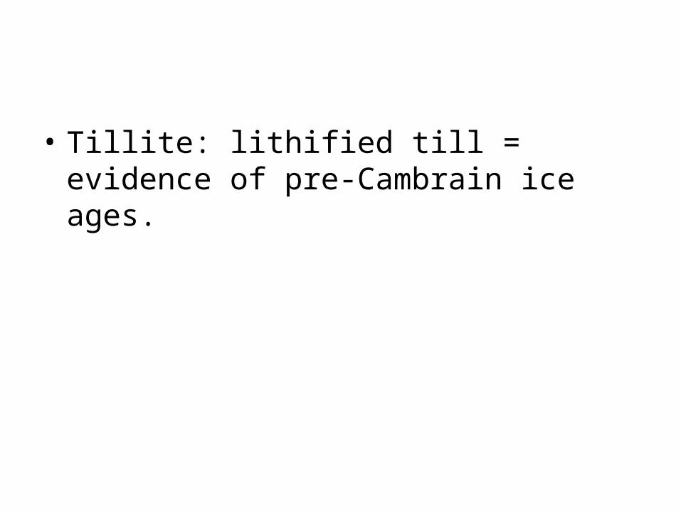
• Tillite: lithified till = evidence of pre-Cambrain ice ages.
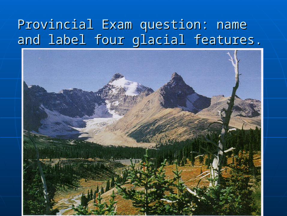
Provincial Exam question: name and Provincial Exam question: name and label four glacial features.label four glacial features.
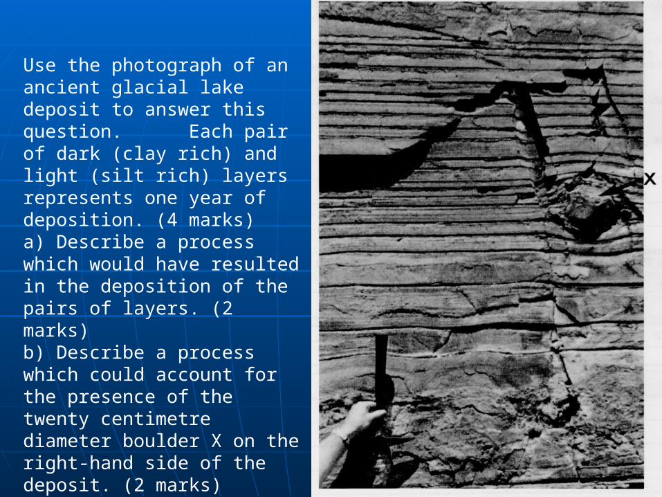
Use the photograph of an ancient glacial lake deposit to answer this question. Each pair of dark (clay rich) and light (silt rich) layers represents one year of deposition. (4 marks)a) Describe a process which would have resulted in the deposition of the pairs of layers. (2 marks)b) Describe a process which could account for the presence of the twenty centimetre diameter boulder X on the right-hand side of the deposit. (2 marks)
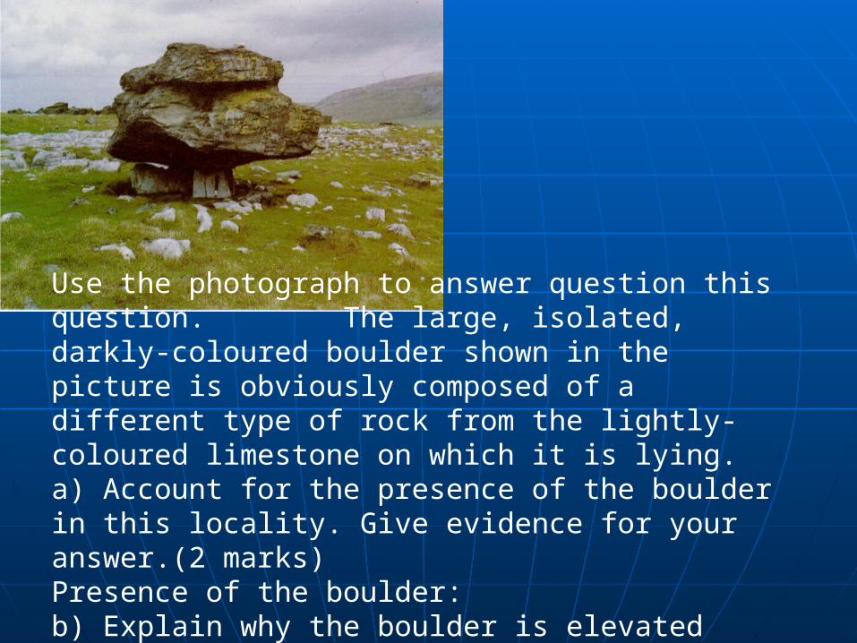
Use the photograph to answer question this question. The large, isolated, darkly-coloured boulder shown in the picture is obviously composed of a different type of rock from the lightly-coloured limestone on which it is lying.a) Account for the presence of the boulder in this locality. Give evidence for your answer.(2 marks)Presence of the boulder:b) Explain why the boulder is elevated above the general surface level. (2 marks)Elevation of the boulder:
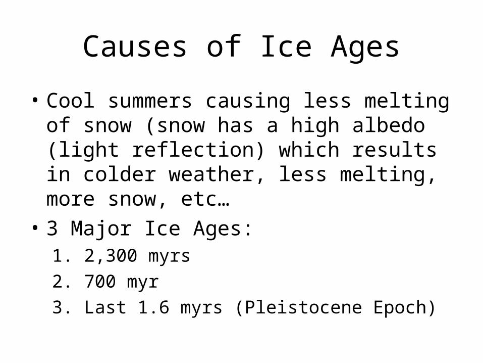
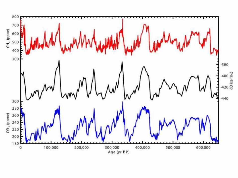
Causes of Ice Ages
• Cool summers causing less melting of snow (snow has a high albedo (light reflection) which results in colder weather, less melting, more snow, etc…
• 3 Major Ice Ages:1. 2,300 myrs
2. 700 myr
3. Last 1.6 myrs (Pleistocene Epoch)
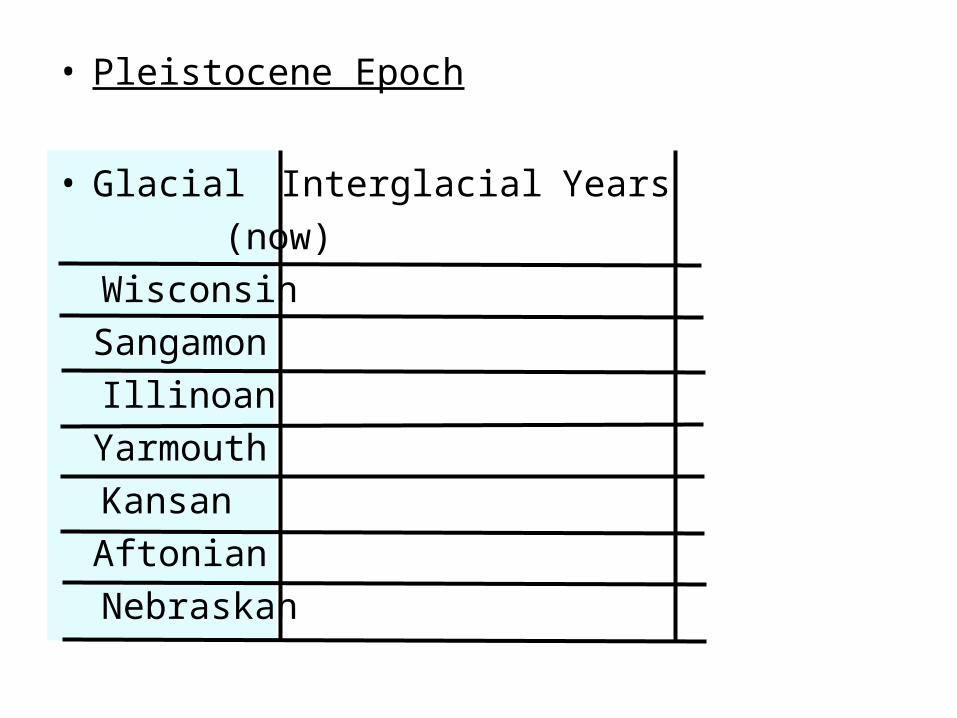
• Pleistocene Epoch
• Glacial Interglacial Years
(now)
Wisconsin
Sangamon
Illinoan
Yarmouth
Kansan
Aftonian
Nebraskan
10,000
500,000
1 million
1.5 million
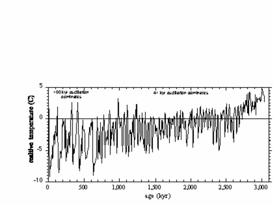
Climate Last 3 million years
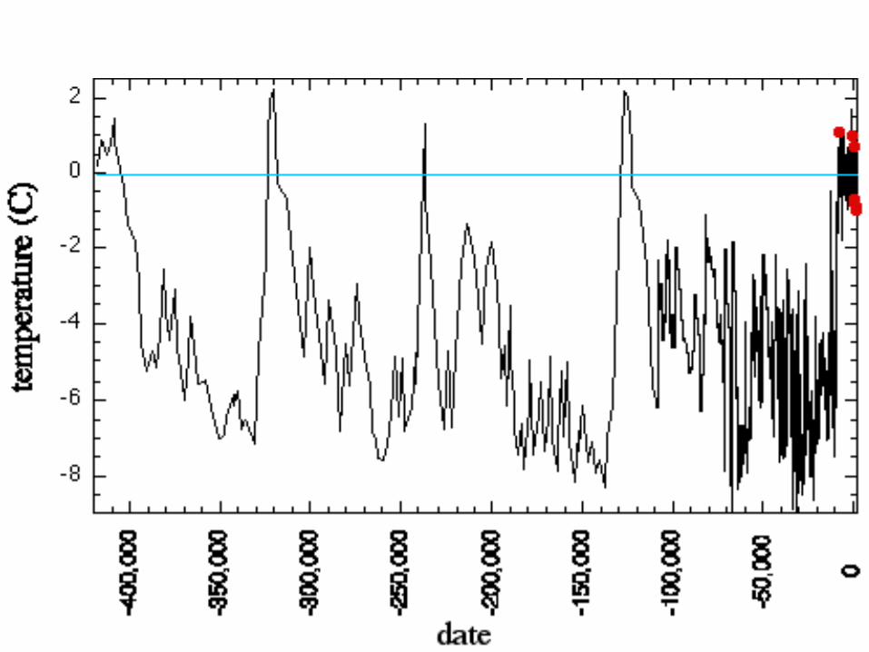
Climate Last 400,000 years
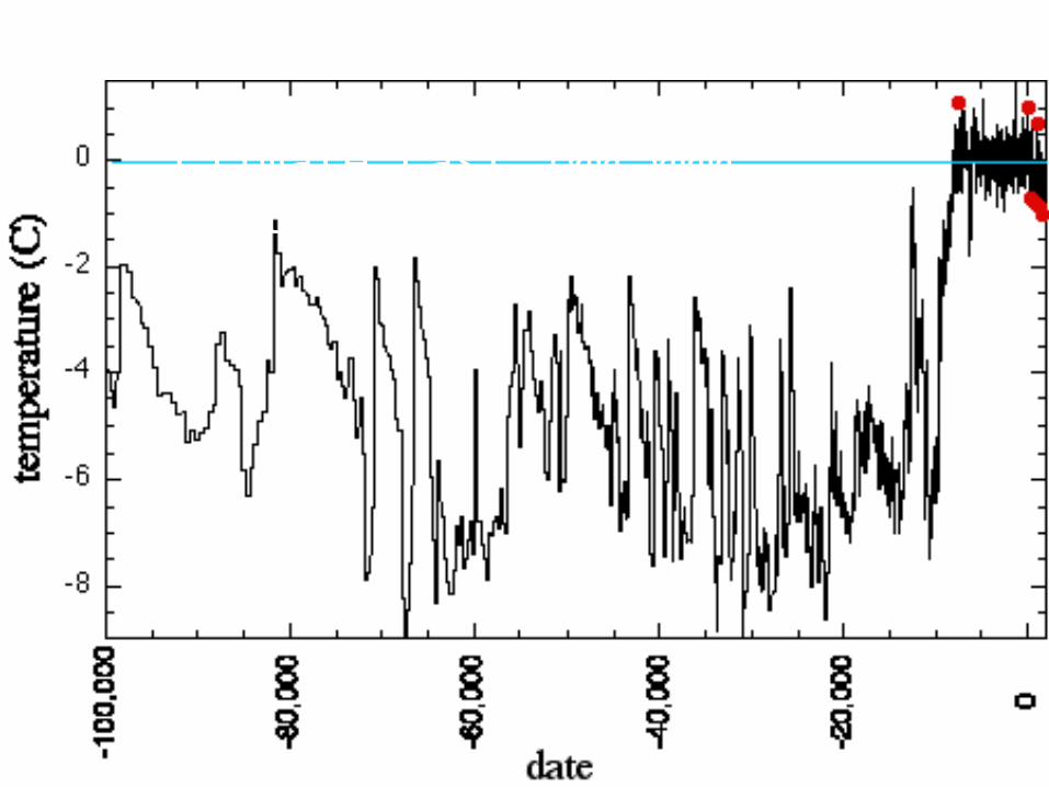
Climate Last 100,000 years
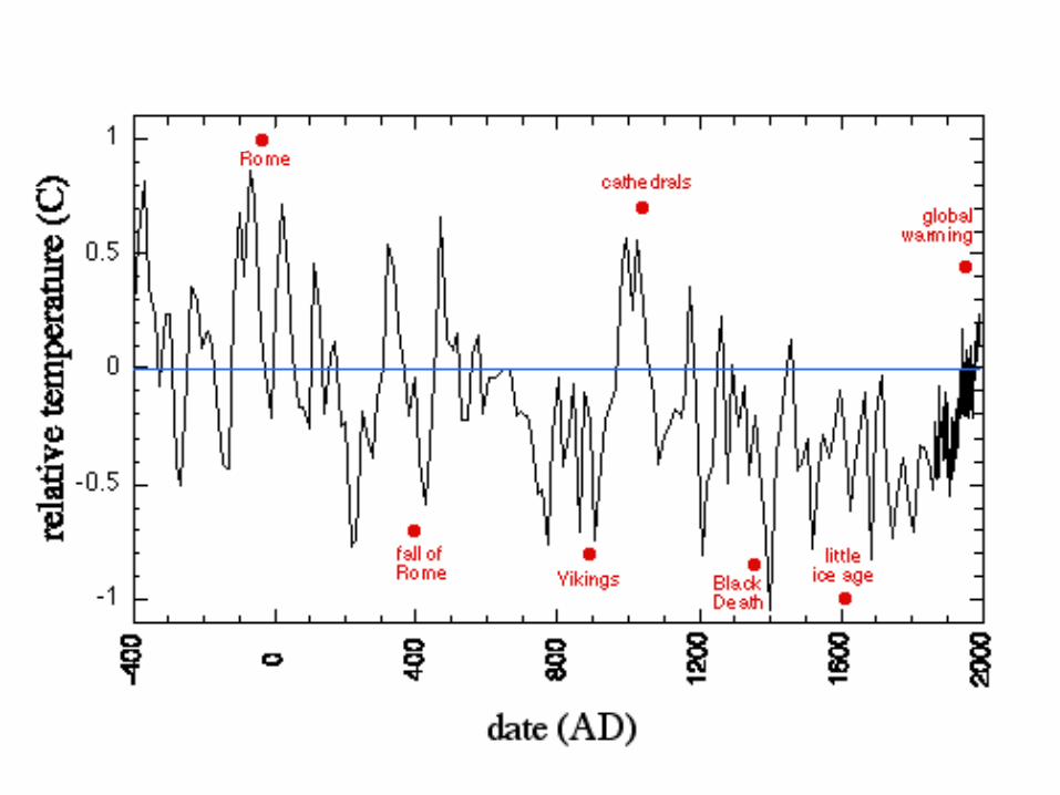
Climate Last 2,400 years
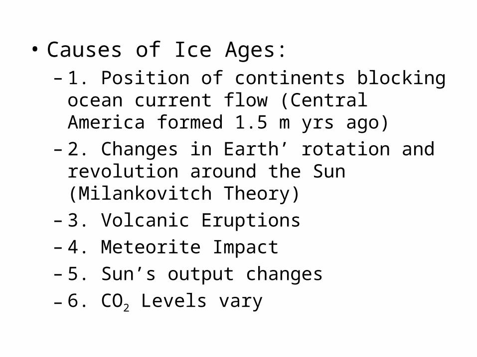
• Causes of Ice Ages:– 1. Position of continents blocking ocean
current flow (Central America formed 1.5 m yrs ago)
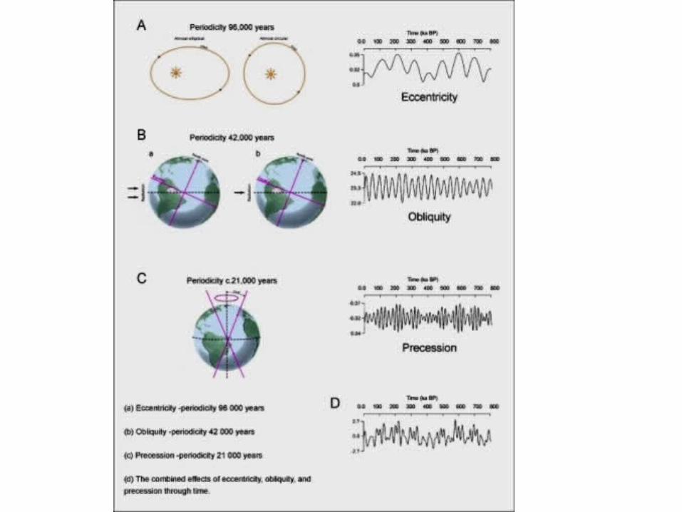
– 2. Changes in Earth’ rotation and revolution around the Sun (Milankovitch Theory)
– 3. Volcanic Eruptions– 4. Meteorite Impact– 5. Sun’s output changes
– 6. CO2 Levels vary
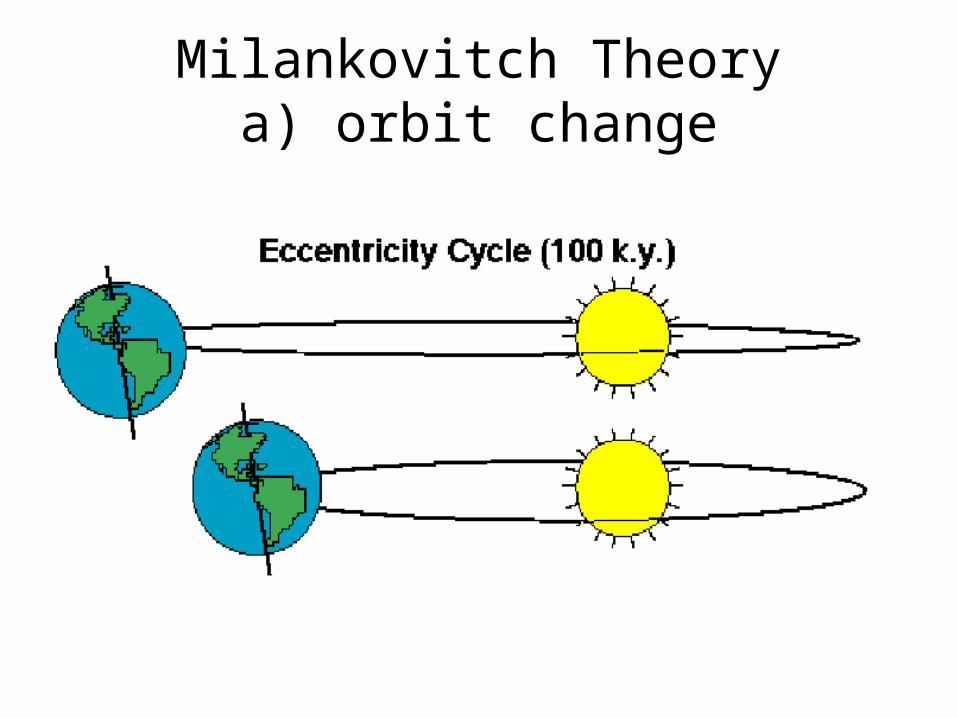
Milankovitch Theorya) orbit change
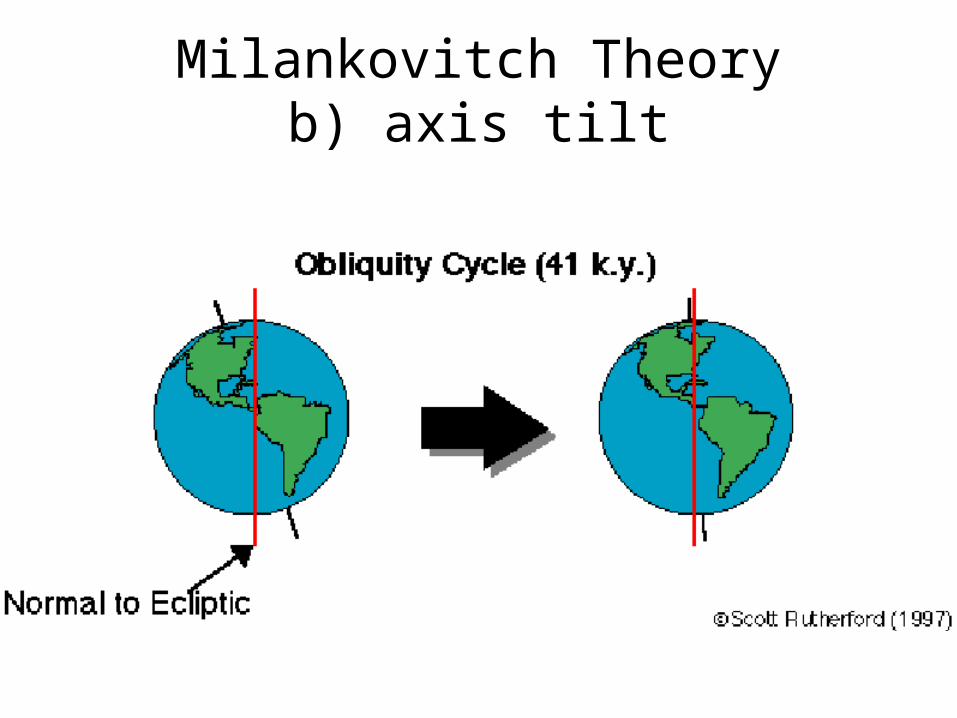
Milankovitch Theoryb) axis tilt
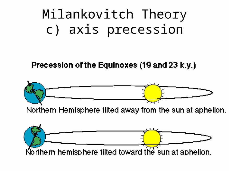
Milankovitch Theoryc) axis precession
• Do WS 17.2
18 Wind Erosion.ppt
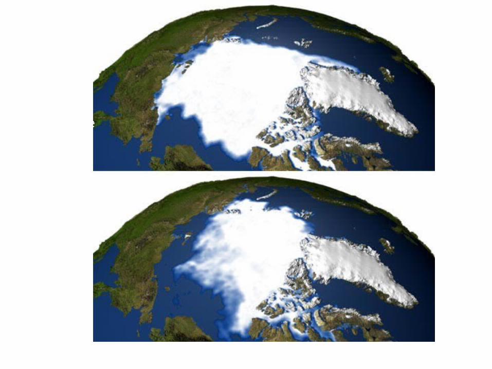
Northern Ice 1979 & 2003