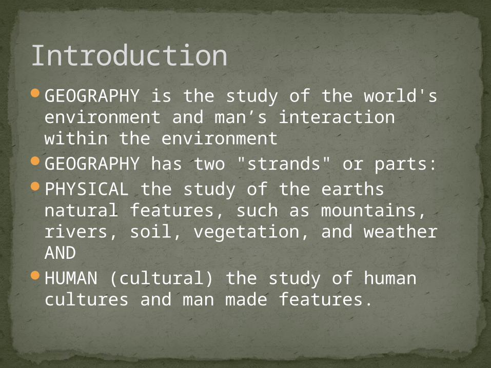
GEOGRAPHY is the study of the world's environment and man’s interaction within the environment...
23
TOOLS OF GEOGRAPHY
-
Upload
gwendoline-stephens -
Category
Documents
-
view
215 -
download
1
Transcript of GEOGRAPHY is the study of the world's environment and man’s interaction within the environment...

TOOLS OF GEOGRAPHY
IntroductionGEOGRAPHY is the study of the world's
environment and man’s interaction within the environment
GEOGRAPHY has two "strands" or parts:PHYSICAL the study of the earths natural
features, such as mountains, rivers, soil, vegetation, and weather AND
HUMAN (cultural) the study of human cultures and man made features.
MAPS
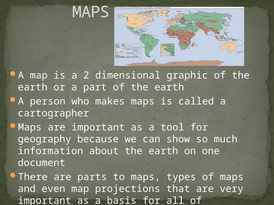
A map is a 2 dimensional graphic of the earth or a part of the earth
A person who makes maps is called a cartographer
Maps are important as a tool for geography because we can show so much information about the earth on one document
There are parts to maps, types of maps and even map projections that are very important as a basis for all of geography
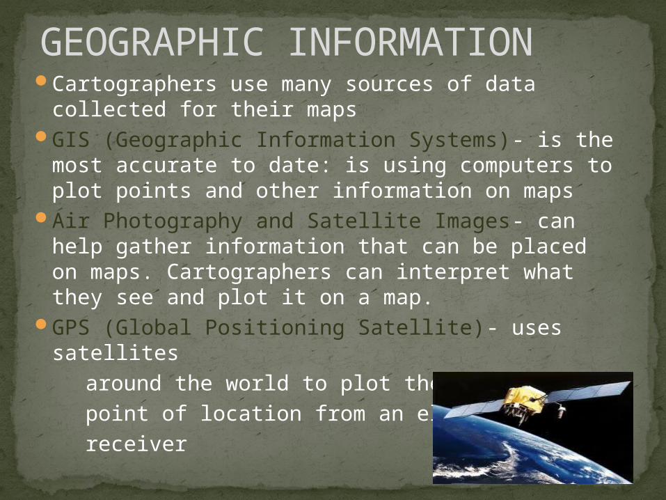
GEOGRAPHIC INFORMATIONCartographers use many sources of data
collected for their mapsGIS (Geographic Information Systems)- is the
most accurate to date: is using computers to plot points and other information on maps
Air Photography and Satellite Images- can help gather information that can be placed on maps. Cartographers can interpret what they see and plot it on a map.
GPS (Global Positioning Satellite)- uses satellites
around the world to plot the exact point of location from an electronic receiver

PARTS OF A MAP
Key/Legend: Shows information as symbolsScale: Used for measuring distance Scale can
be shown in ratio form (1:10) or by equation (1 inch = 10 miles)
Directional Arrow: All maps must have AT LEAST an arrow showing relative direction. This is called orientation (orientation is any direction or location in terms of points on a compass i.e.. DC is north of Fredericksburg)
Compass Rose: Shows Cardinal and Intermediary direction.

TYPES OF MAPSPolitical Maps-this is a map that shows political
boundaries, borders, area of political entities (countries, states, territories, districts, counties, zones, provinces, etc.) These types of maps may show capitals / other cities.
Physical Maps- this type of maps uses color to show elevation and other land/water features of the earth. This map may also show any other physical feature such as rivers, mountains, oceans, and valleys
Thematic Maps- this type of map shows "themes" or subjects on a map-basically any information. Anything can be shown on a map using symbols, color, pictures, numbers, contour lines, etc. ALL THEMATIC MAPS MUST HAVE A KEY- this tells the reader what each symbol/picture/color/etc. represents on the map i.e.
= Hospital

TOPOGRAPHIC MAPSOne type of thematic map is a TOPOGRAPHIC MAP.
This map uses curvy lines to show the relief and elevation of the landscape. These curvy lines also have the feet/meters above sea level of the physical features. The name of the curvy lines is CONTOUR.
The numbers increase so that means the elevation is increasing and this is above sea level.
The closer the lines the steeper the slope. The more apart the lines the more gentle the slope.The highest number is the peak or summit of the feature. In this case a hill. If the numbers were negative this feature would be a depression or hole.
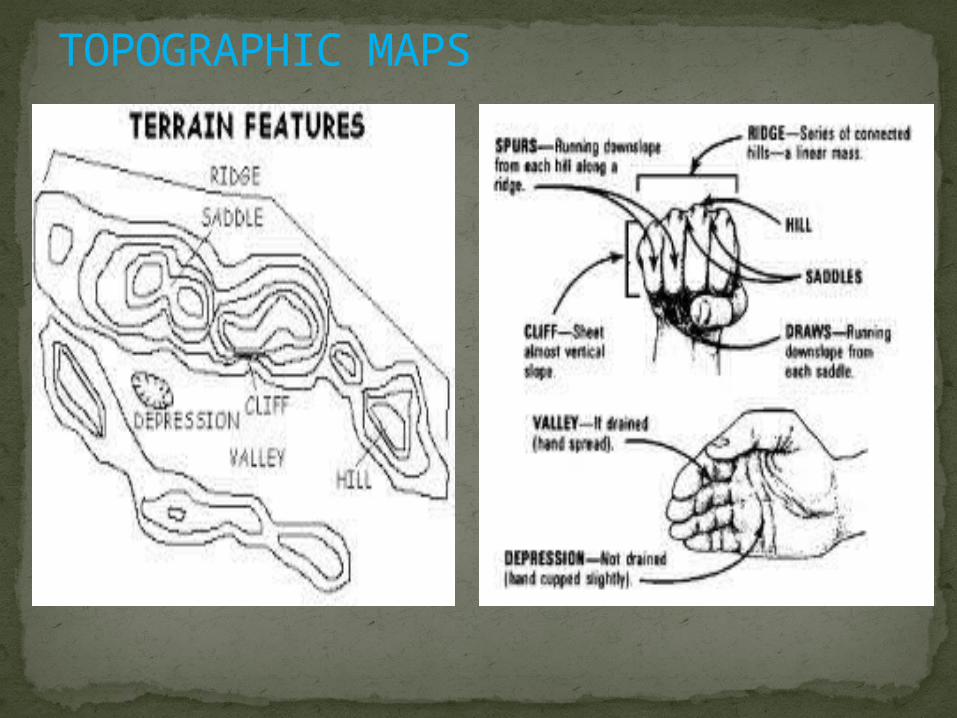
TOPOGRAPHIC MAPS

ATLASAny collection of maps, graphs, and
charts is called an ATLAS.We use atlases as geographic
resources for looking up all kinds of information from:
Where places are located to:Population and economic information
to:Topographic information about the
surface of the earth

USING AN ATLASUse the INDEX to help locate any
cities, states, and countries around the world.
Use the KEY on the map to read the information.
Use the SCALE on the map to find distances.
Use the COMPASS ROSE to locate and pinpoint orientation or direction.

MAP PERSPECTIVEMap Perspective is to look at a map
with a Different point of view.For instance how people from Africa
would look at a map versus someone from Far East Asia….or someone from Australia versus someone from Europe.
Everyone has a different point of view when it comes to maps…it’s not that they’re wrong, it’s just different.
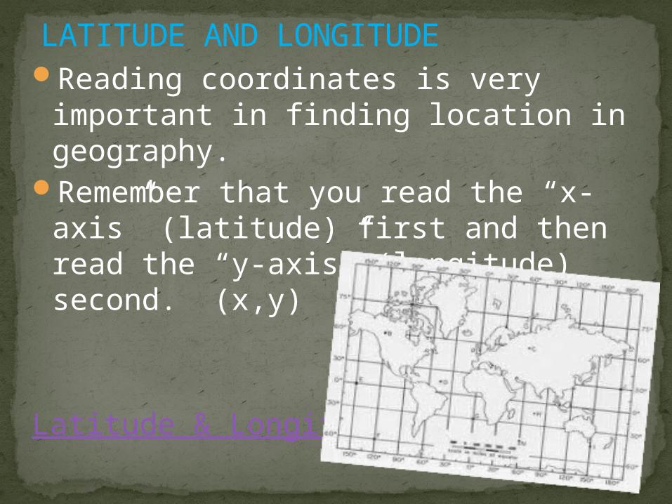
LATITUDE AND LONGITUDEReading coordinates is very important
in finding location in geography.Remember that you read the “x-axis”
(latitude) first and then read the “y-axis” (longitude) second. (x,y)
Latitude & Longitude

THE GLOBAL GRIDThe Earth is divided by latitude and longitude
lines. There are several important lines to know on the earths surface:
#1. is the ARCTIC CIRCLE found at 66
½ NORTH of the Equator#2. is the TROPIC OF CANCER found
at 23 ½ NORTH of the Equator#3 is the EQUATOR which splits the earth into two hemispheres at 0 Latitude.#4 is the TROPIC OF CAPRICORN
found at 23 ½ SOUTH of the Equator#5 is the ANTARCTIC CIRCLE found
at 66 ½ SOUTH of the Equator#6 is the PRIME MERIDIAN which runs north and south at 0 LONGITUDE
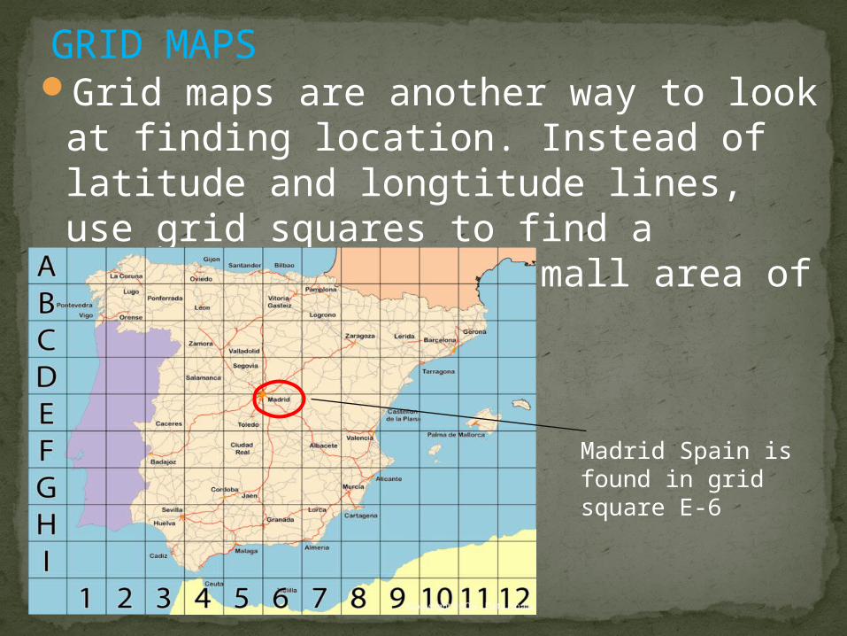
GRID MAPSGrid maps are another way to look at
finding location. Instead of latitude and longtitude lines, use grid squares to find a specific place on a small area of the earth.
Madrid Spain is found in grid square E-6
MAP PROJECTIONS
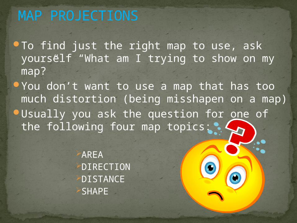
To find just the right map to use, ask yourself “What am I trying to show on my map?”
You don’t want to use a map that has too much distortion (being misshapen on a map)
Usually you ask the question for one of the following four map topics:
AREADIRECTIONDISTANCESHAPE

TYPES OF MAP PROJECTIONS

MERCATOR MAP
• Mercator Map Projection: Shows accurate direction, but area & shapes are severely distorted at the poles. Mercator projections are based on cylinders.
***Sailors would use these for true direction
Look how big I am on a Mercator Map

ROBINSON MAP
• Robinson Map Projection: Shows accurate shape & size of continents, but water areas are expanded to fill in area. Robinson projections are based on ovals. *** These maps are good for data collections like in a classroom or lab. Don’t I look like
the pull down map in the classroom?
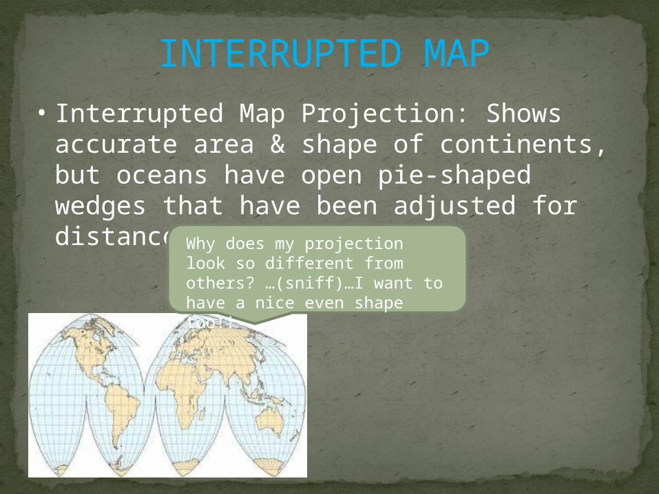
INTERRUPTED MAP• Interrupted Map Projection: Shows accurate
area & shape of continents, but oceans have open pie-shaped wedges that have been adjusted for distance.
Why does my projection look so different from others? …(sniff)…I want to have a nice even shape too!!

CONICAL
• Conical Map Projection: Used for mapping a large piece of Earth’s surface. It shows accurate distance, direction, & shape for the limited area mapped. Conical projections are based as cone-shaped.

AZIMUTH (aka POLAR)
• Polar Map Projection: Used for mapping hemispheres instead of whole Earth. Shows accurate distance & direction but shape and size are distorted at the edges. Polar view is called Azimuth.
***Airline Pilots would use these maps to follow Great Circle Routes (the shortest path between two points along the curve of the Earth.

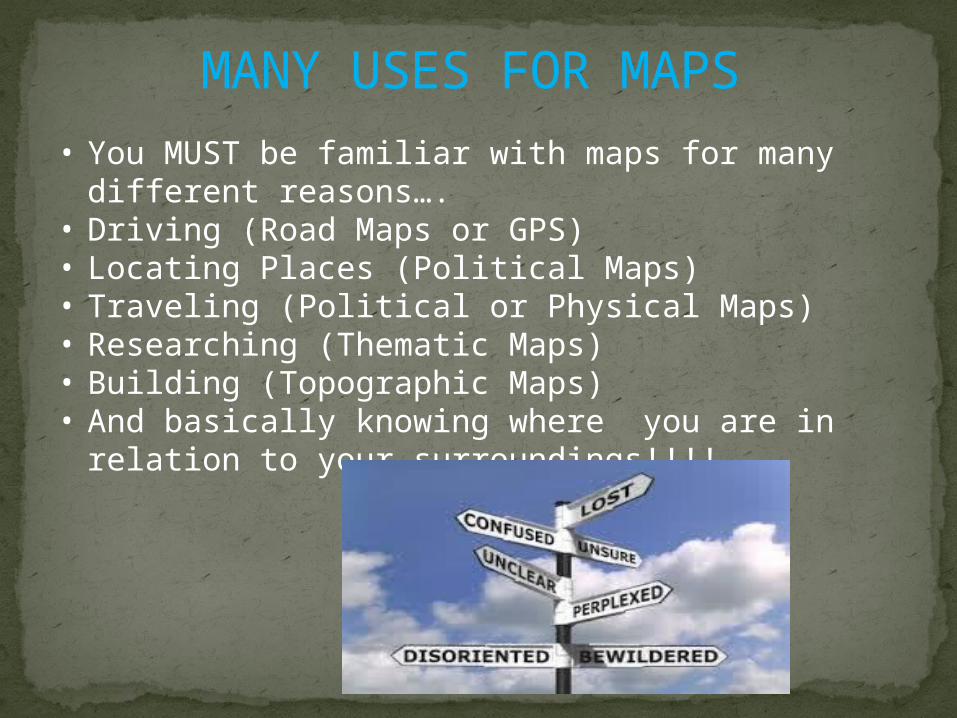
MANY USES FOR MAPS
• You MUST be familier with maps for many different reasons….
• Driving (Road Maps or GPS)• Locating Places (Political Maps)• Traveling (Political or Physical Maps)• Researching (Thematic Maps)• Building (Topographic Maps)• And basically knowing where you are in relation to
your surroundings!!!!
MANY USES FOR MAPS• You MUST be familiar with maps for many
different reasons….• Driving (Road Maps or GPS)• Locating Places (Political Maps)• Traveling (Political or Physical Maps)• Researching (Thematic Maps)• Building (Topographic Maps)• And basically knowing where you are in relation to
your surroundings!!!!