Geoconservation in the UK - Geoculturafiles.geocultura.net/200001817-61b5f62af3/8... ·...
60
Geoconservation in the UK Murray Gray Queen Mary University of London & University of Minho, Portugal
Transcript of Geoconservation in the UK - Geoculturafiles.geocultura.net/200001817-61b5f62af3/8... ·...

Geoconservation in the UK
Murray Gray
Queen Mary University of London
& University of Minho, Portugal
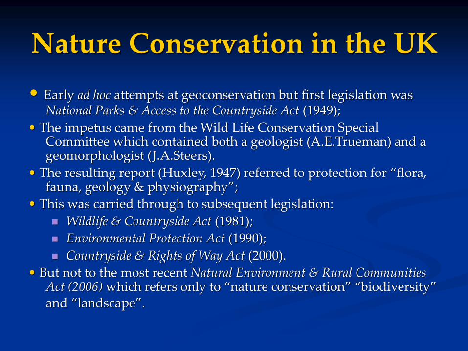
Nature Conservation in the UK
• Early ad hoc attempts at geoconservation but first legislation was National Parks & Access to the Countryside Act (1949);
• The impetus came from the Wild Life Conservation Special Committee which contained both a geologist (A.E.Trueman) and a geomorphologist (J.A.Steers).
• The resulting report (Huxley, 1947) referred to protection for “flora, fauna, geology & physiography”;
• This was carried through to subsequent legislation:
Wildlife & Countryside Act (1981);
Environmental Protection Act (1990);
Countryside & Rights of Way Act (2000).
• But not to the most recent Natural Environment & Rural Communities Act (2006) which refers only to “nature conservation” “biodiversity” and “landscape”.
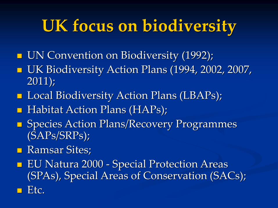
UK focus on biodiversity
UN Convention on Biodiversity (1992);
UK Biodiversity Action Plans (1994, 2002, 2007, 2011);
Local Biodiversity Action Plans (LBAPs);
Habitat Action Plans (HAPs);
Species Action Plans/Recovery Programmes (SAPs/SRPs);
Ramsar Sites;
EU Natura 2000 - Special Protection Areas (SPAs), Special Areas of Conservation (SACs);
Etc.
Geoconservation in the UK
But still a very active geoconservation community in the UK:
- Government agencies:
- Natural England (NE)
- Scottish Natural Heritage (SNH);
- Natural Resources Wales (NRW);
- Northern Ireland Environment Agency (Northern Ireland);
- Geological Societies - eg Geol Soc London, Geologists’Association;
- British Geological Survey - has become interested in recent years;
- Amateur geologists - many local societies and groups;
- Academics;
- Charities - e.g. National Trust; John Muir Trust.
- English Geodiversity Forum; Scottish Geodiversity Forum - have members from many of the above organisations plus others, e.g. museums, minerals industry, etc.
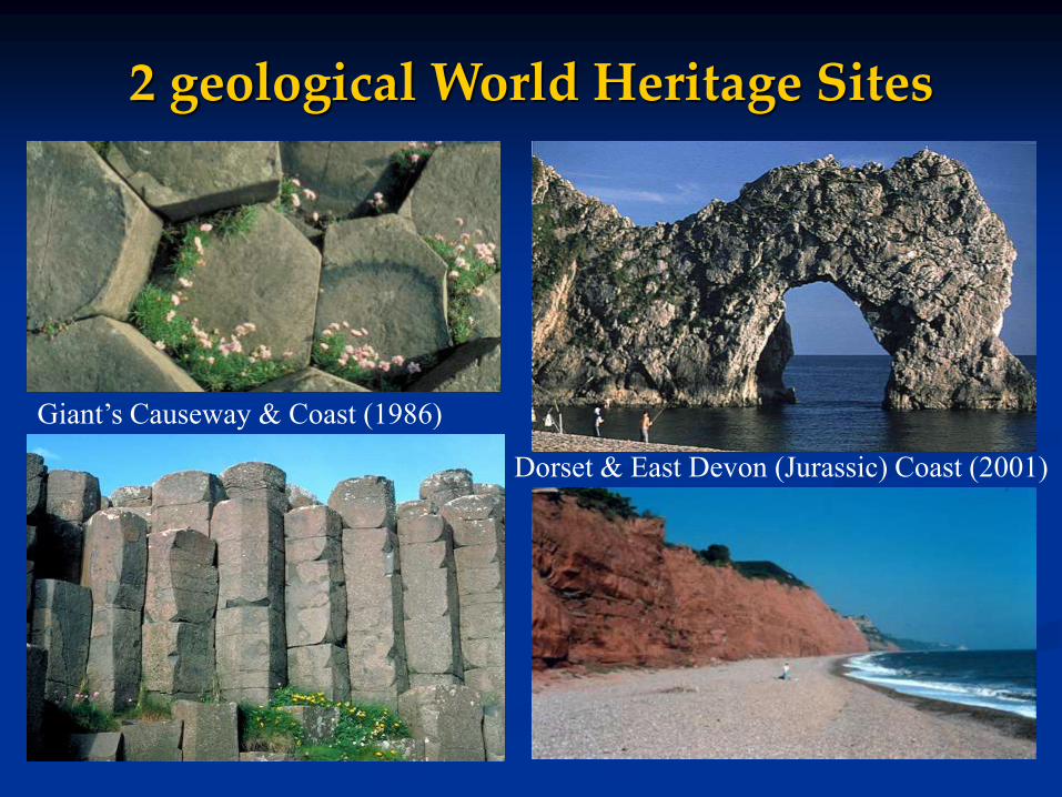
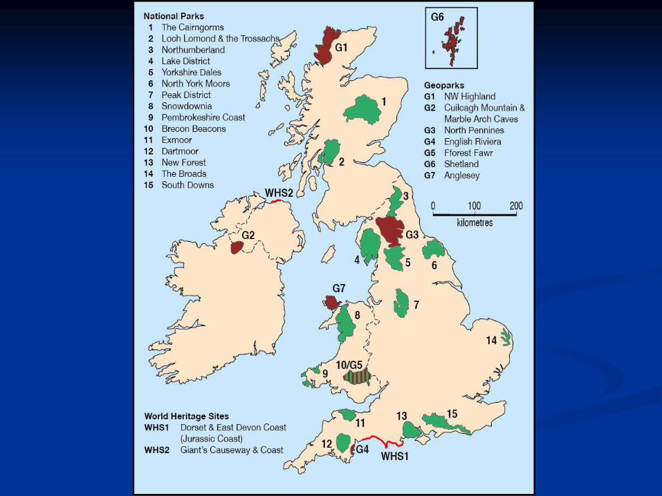
2 geological World Heritage Sites
Dorset & East Devon (Jurassic) Coast (2001)
Giant’s Causeway & Coast (1986)


National Parks
10 in England
3 in Wales
2 in Scotland
0 in Northern Ireland
Most land is privately owned;
Really protected landscapes (IUCN V) rather than National Parks (IUCN II)
Mostly designated for scenic beauty but many contain important geoscientic interests (e.g. Lake District, Snowdonia, Dartmoor).
National Parks
Yorkshire Dales NP
Dartmoor NP
Loch Lomond &
the Trossachs NP

National Nature ReservesAbout 250, but only a few (10-20)
are geological including:
• Port Rush Sill, NI (early debates
on the origin of igneous rocks);
• Stiperstones (quartzite tors);
• Parallel Roads of Glen Roy,
Scotland (ice-dammed lake
shorelines).
StiperstonesStiperstones - quartzite torsParallel Roads of Glen Roy
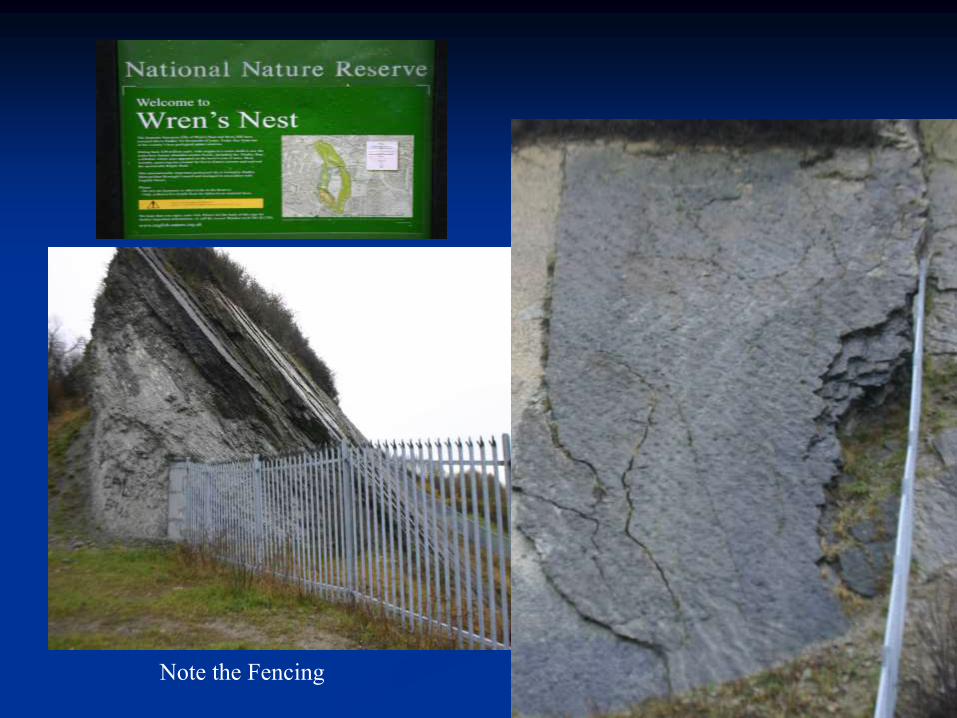
Note the Fencing

Sites of Special Scientific Interest (SSSI)
About 2300 of the c.7000 SSSIs are geological or partially geological;
In addition c. 300 ASSIs in Northern Ireland; Scientifically based, following national review of sites in
the Geological Conservation Review (1977-1990); Being documented in a 45 volume series (1989-2018),
probably the most detailed body of geoconservation work ever produced. 42 published so far.
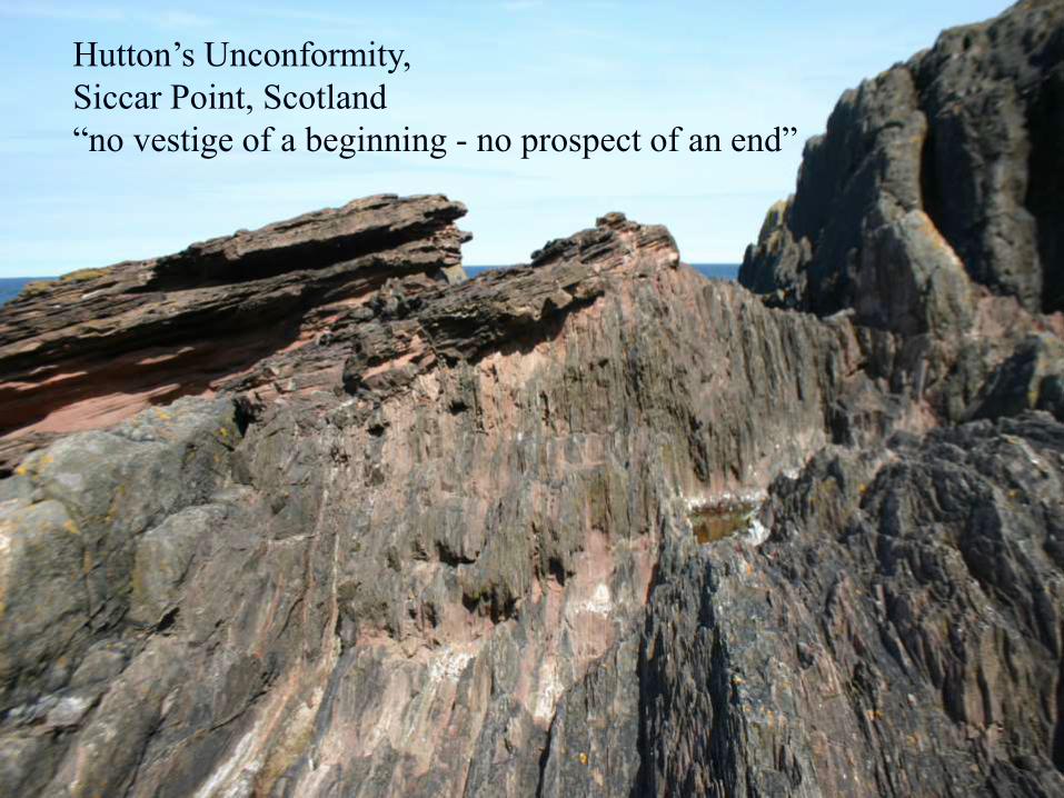
Hutton’s Unconformity,
Siccar Point, Scotland
“no vestige of a beginning - no prospect of an end”

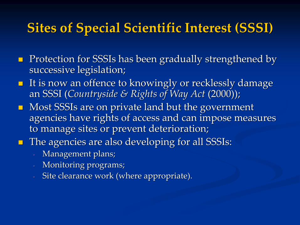
Sites of Special Scientific Interest (SSSI)
Protection for SSSIs has been gradually strengthened by successive legislation;
It is now an offence to knowingly or recklessly damage an SSSI (Countryside & Rights of Way Act (2000));
Most SSSIs are on private land but the government agencies have rights of access and can impose measures to manage sites or prevent deterioration;
The agencies are also developing for all SSSIs:- Management plans;
- Monitoring programs;
- Site clearance work (where appropriate).
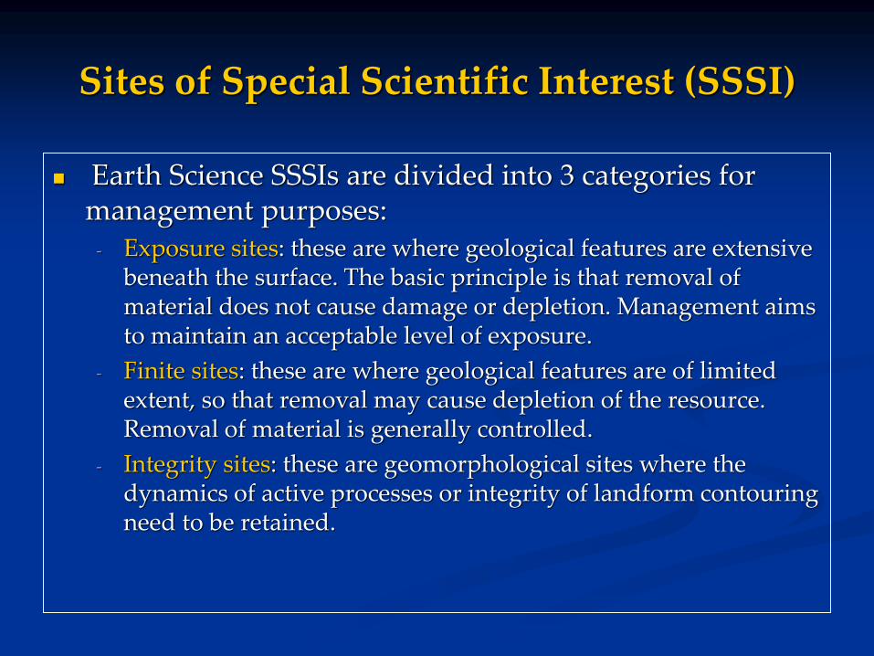
Sites of Special Scientific Interest (SSSI)
Earth Science SSSIs are divided into 3 categories for management purposes:
- Exposure sites: these are where geological features are extensive beneath the surface. The basic principle is that removal of material does not cause damage or depletion. Management aims to maintain an acceptable level of exposure.
- Finite sites: these are where geological features are of limited extent, so that removal may cause depletion of the resource. Removal of material is generally controlled.
- Integrity sites: these are geomorphological sites where the dynamics of active processes or integrity of landform contouring need to be retained.
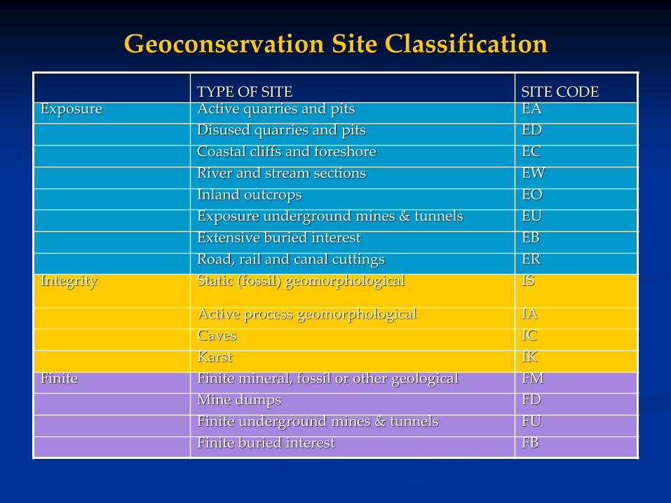
Geoconservation Site Classification
TYPE OF SITE SITE CODEExposure Active quarries and pits EA
Disused quarries and pits ED
Coastal cliffs and foreshore EC
River and stream sections EW
Inland outcrops EO
Exposure underground mines & tunnels EU
Extensive buried interest EB
Road, rail and canal cuttings ER
Integrity Static (fossil) geomorphological IS
Active process geomorphological IA
Caves IC
Karst IK
Finite Finite mineral, fossil or other geological FM
Mine dumps FD
Finite underground mines & tunnels FU
Finite buried interest FB
Limestone Pavement Orders
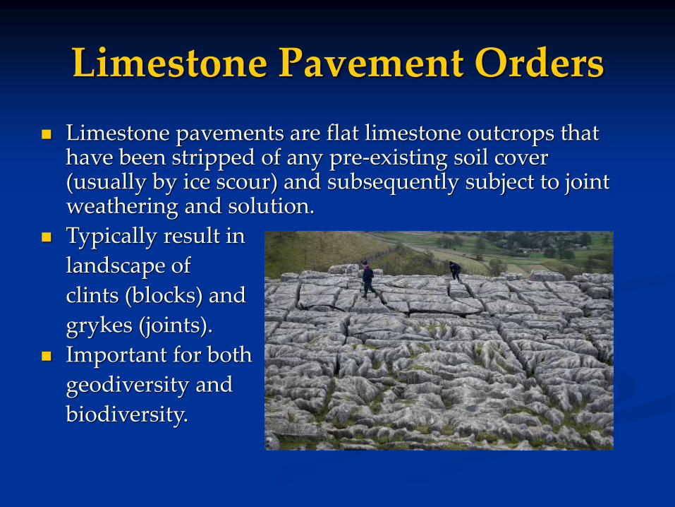
Limestone pavements are flat limestone outcrops that have been stripped of any pre-existing soil cover (usually by ice scour) and subsequently subject to joint weathering and solution.
Typically result in
landscape of
clints (blocks) and
grykes (joints).
Important for both
geodiversity and
biodiversity.
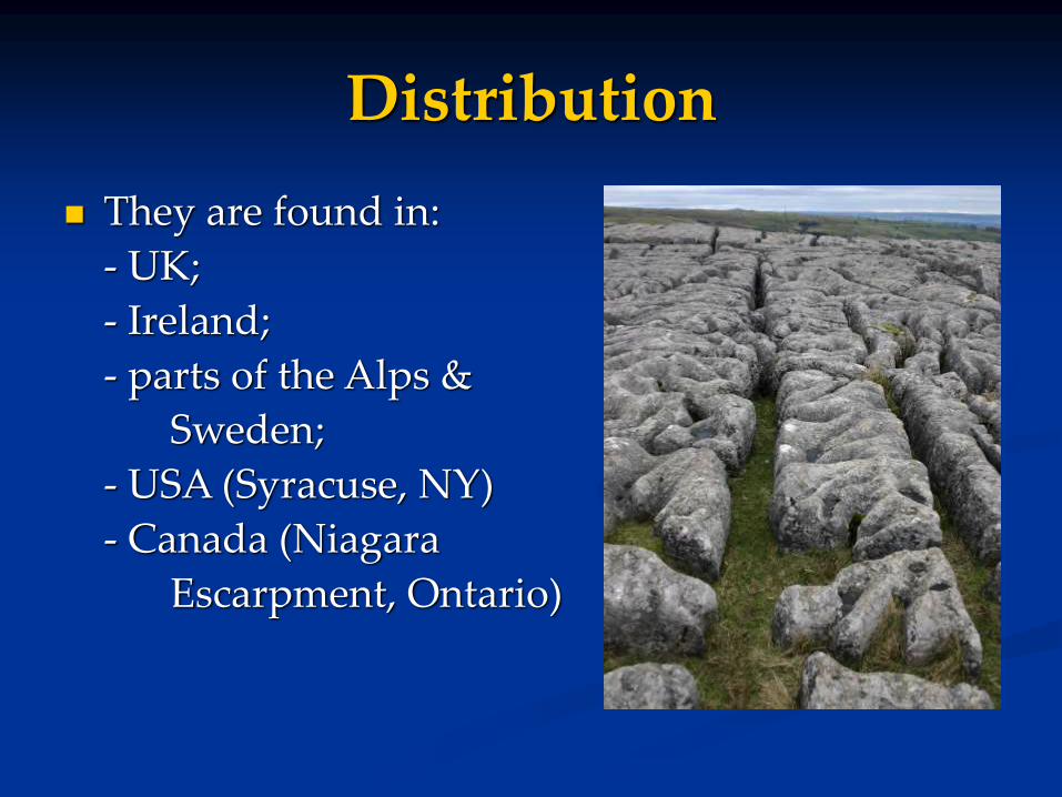
Distribution
They are found in:
- UK;
- Ireland;
- parts of the Alps &
Sweden;
- USA (Syracuse, NY)
- Canada (Niagara
Escarpment, Ontario)
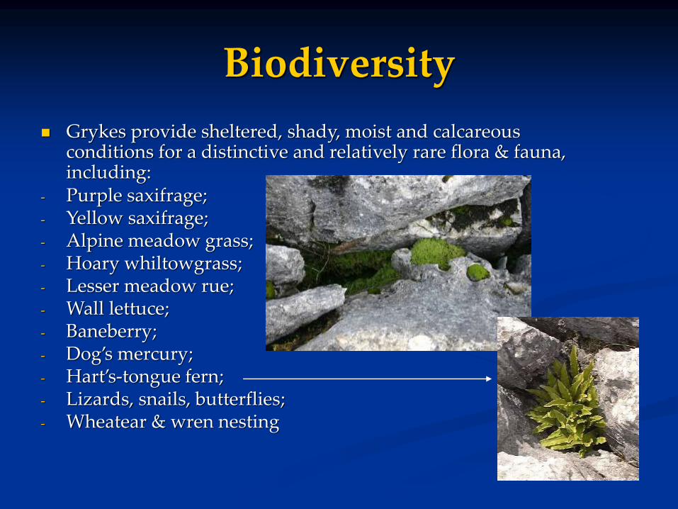
Grykes provide sheltered, shady, moist and calcareous conditions for a distinctive and relatively rare flora & fauna, including:
- Purple saxifrage;- Yellow saxifrage;- Alpine meadow grass;- Hoary whiltowgrass;- Lesser meadow rue;- Wall lettuce;- Baneberry;- Dog’s mercury;- Hart’s-tongue fern;- Lizards, snails, butterflies;- Wheatear & wren nesting
Biodiversity
Limestone Pavement Orders
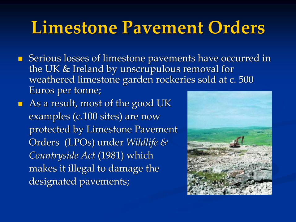
Serious losses of limestone pavements have occurred in the UK & Ireland by unscrupulous removal for weathered limestone garden rockeries sold at c. 500 Euros per tonne;
As a result, most of the good UK
examples (c.100 sites) are now
protected by Limestone Pavement
Orders (LPOs) under Wildlife &
Countryside Act (1981) which
makes it illegal to damage the
designated pavements;
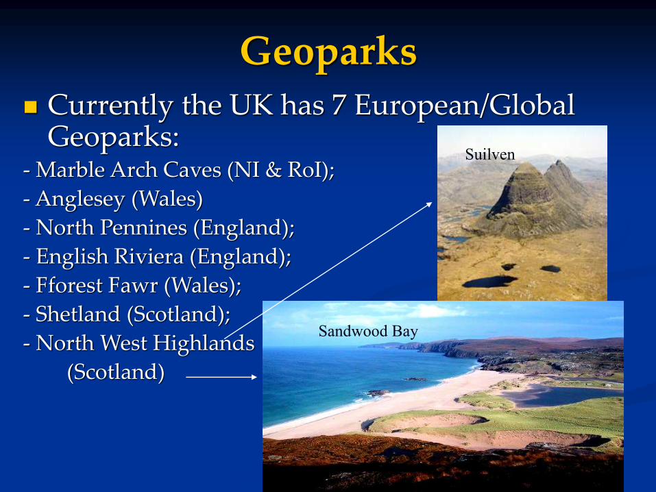
Geoparks Currently the UK has 7 European/Global
Geoparks:- Marble Arch Caves (NI & RoI);
- Anglesey (Wales)
- North Pennines (England);
- English Riviera (England);
- Fforest Fawr (Wales);
- Shetland (Scotland);
- North West Highlands
(Scotland)
Sandwood Bay
Suilven
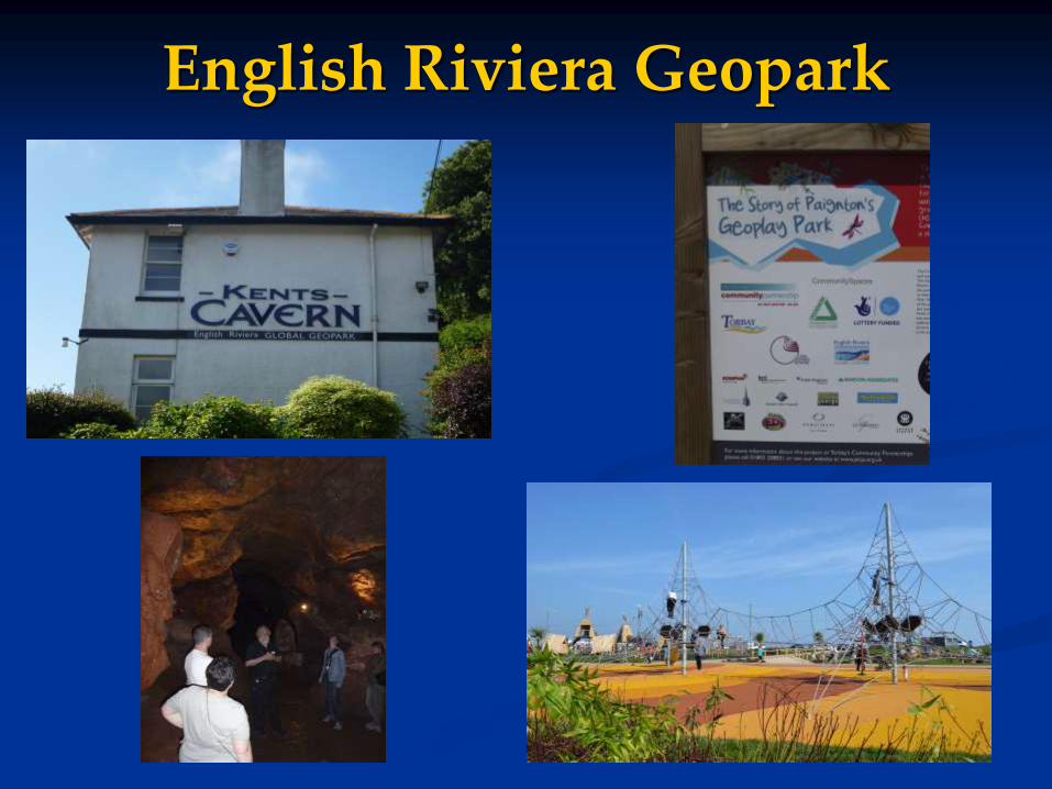
English Riviera Geopark

Local Sites
Regionally Important Geological Sites (RIGS) were introduced over 20 years ago to meet the need for local involvement in geoconservation;
RIGS are sites of regional or local importance on educational, scientific, historic or aesthetic/cultural grounds;
45 county groups in England; regional groups in Wales and Scotland;
Some groups are highly active, others less so; About 3500 RIGS have been established; National co-ordinating body (UKRIGS) established in
1999; now called GeoconservationUK; The term RIGS is being phased out to be replaced with
“Local Geological Sites” or “Local Geodiversity Sites”.

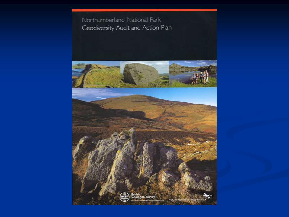
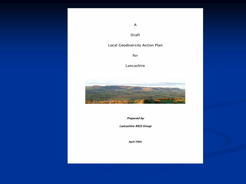
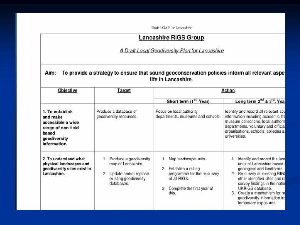
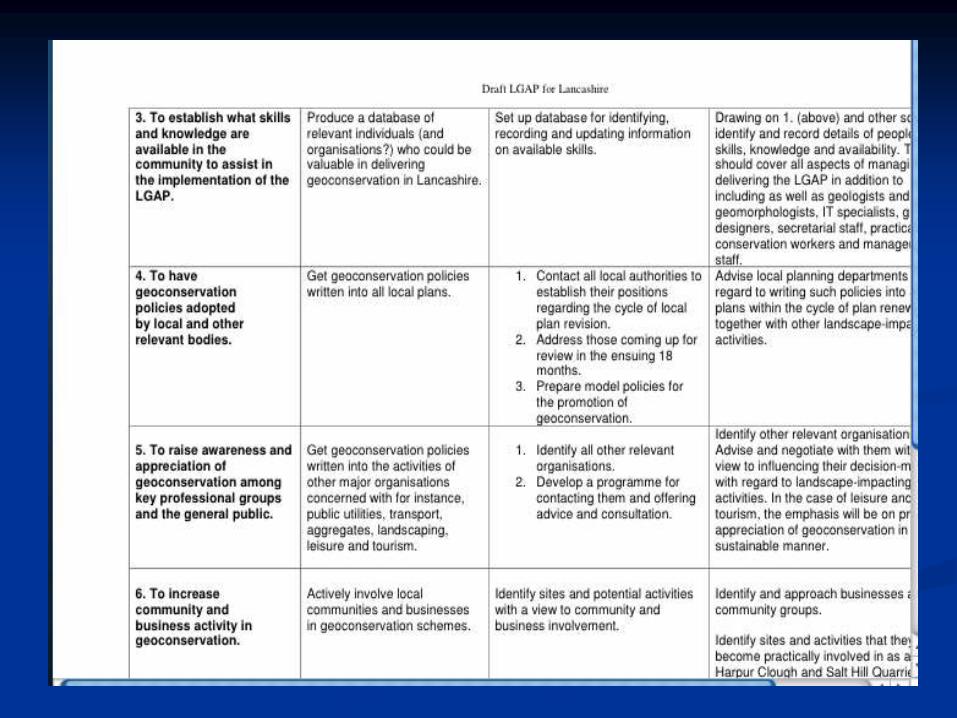
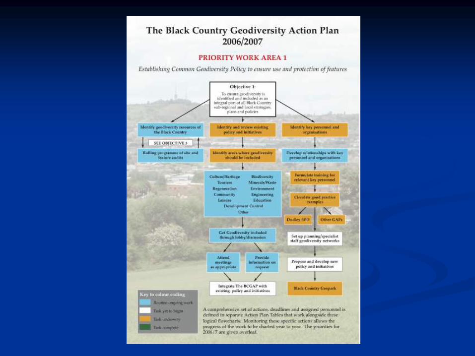
Geodiversity Audits….
…as precursors of LGAPs
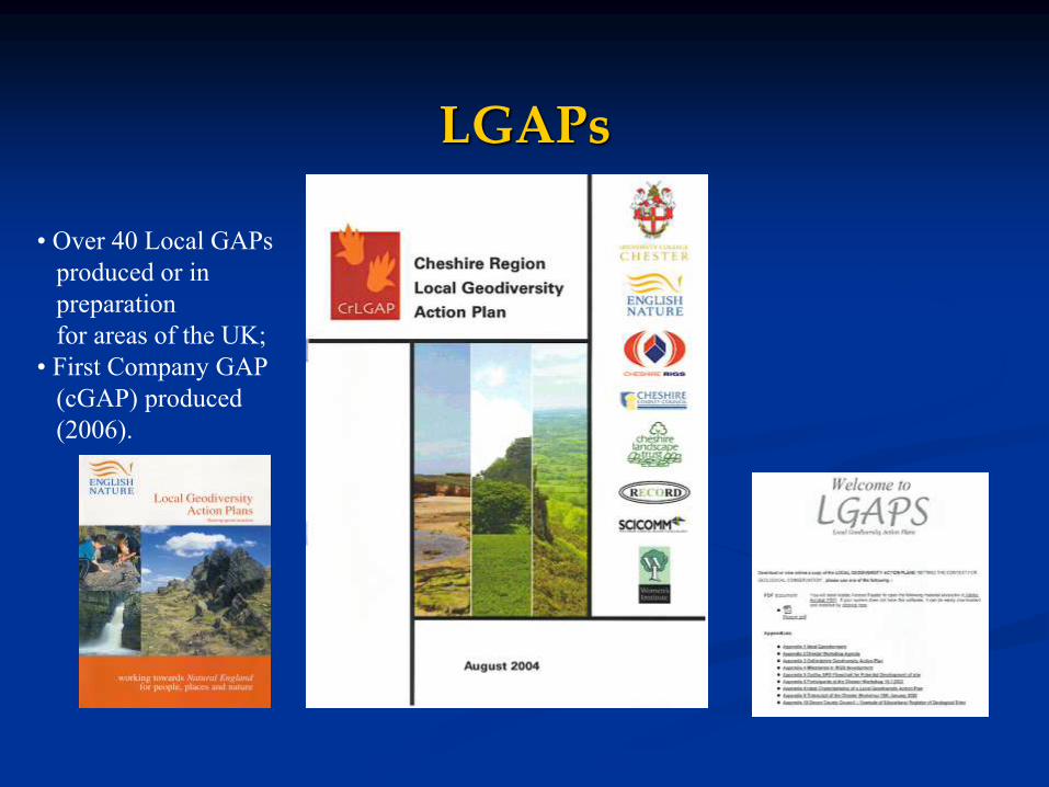
LGAPs
• Over 40 Local GAPs
produced or in
preparation
for areas of the UK;
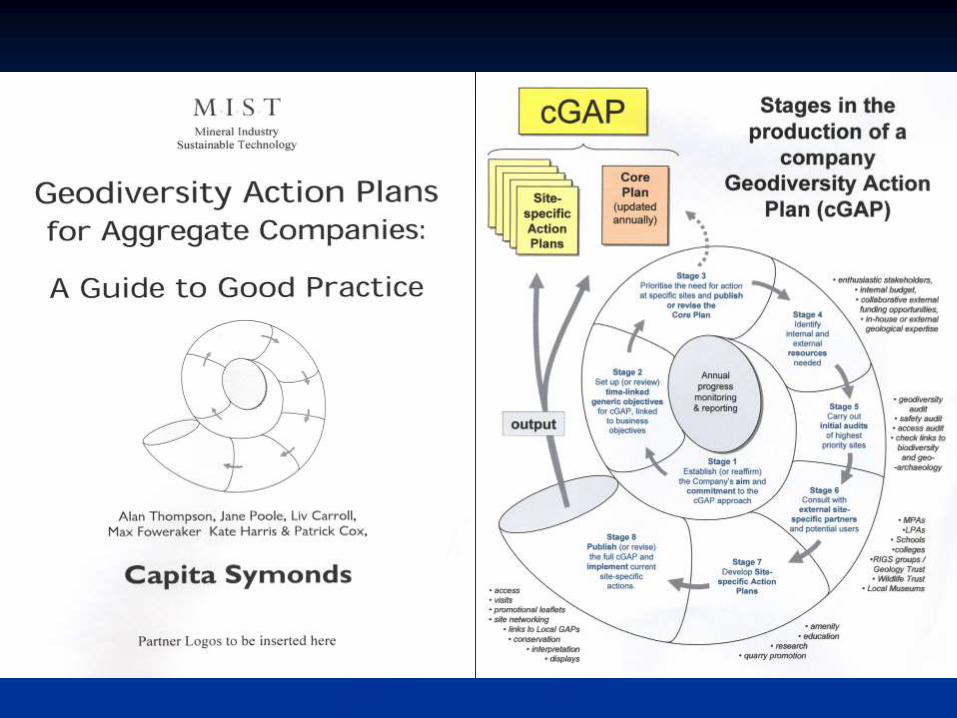
• First Company GAP
(cGAP) produced
(2006).
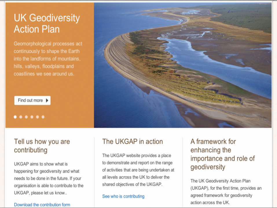
UKGAP
• Aim is to increase awareness of need for, and activity in geodiversity conservation;
• Objectives are to set national context for LGAPs and a
national geodiversity audit;
- Delivered by designing range of actions;
- Progress measured by setting timetables and targets for adopting, implementing & reviewing the UKGAP
- Core partners - EN, CCW, SNH, NIEA,
GeoconservationUK, NT, BGS, NPs/AONBs, academics
UKGAP
Aim - to provide an environment in which the rich geodiversity of the UK can be understood, valued and conserved.
Objectives
Building knowledge and understanding of the geodiversity resource;
Conserving and managing geodiversity;
Influencing national, regional and local planning policy;
Increasing awareness and appreciation of geodiversity
Establishing and sustaining a framework for delivering geological conservation.
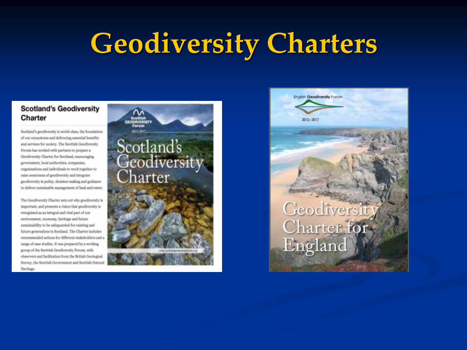
Geodiversity Charters
Conclusions
Despite an emphasis on biodiversity, there are very well developed geoconservation systems in the UK;
The cornerstone is the SSSI series. c. 2300 sites being published in 45 volumes;
In addition:
- 2 WHS;
- 7 Geoparks;
- 15 National Parks;
- c. 100 Limestone Pavement Orders;
- 10-20 geological National Nature Reserves;
- c. 3500 RIGS
Increasing attention on wider countryside, landscape scale and process dynamics;
Geoconservation is supported by the national land-use planning system.
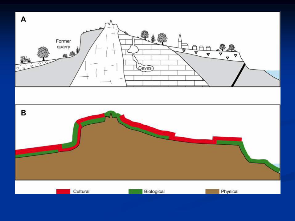
Geoconservation: a land management approach
Over the last 15 years, it has been realised that geoheritage conservation should be extended beyond protected areas to include a thoughtful policy towards the environment in general;
One way that this is being achieved is through a regionalisation approach in which the whole country is divided into areas of similar geology, geomorphology, landscape, soils and vegetation.
This then makes it possible to:- link sites together and manage them as themed groups;
- recognise regional distinctiveness;
- conserve and enhance landscape character.
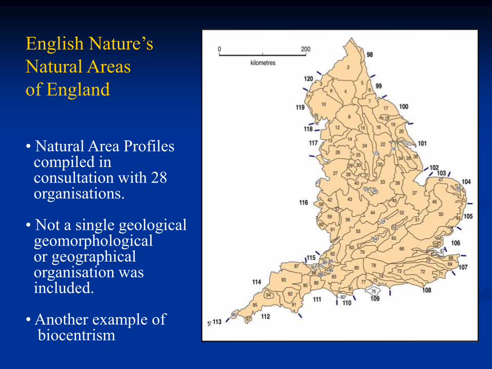
English Nature’s
Natural Areas
of England
• Natural Area Profiles compiled in consultation with 28 organisations.
• Not a single geologicalgeomorphologicalor geographical organisation was included.
• Another example of biocentrism

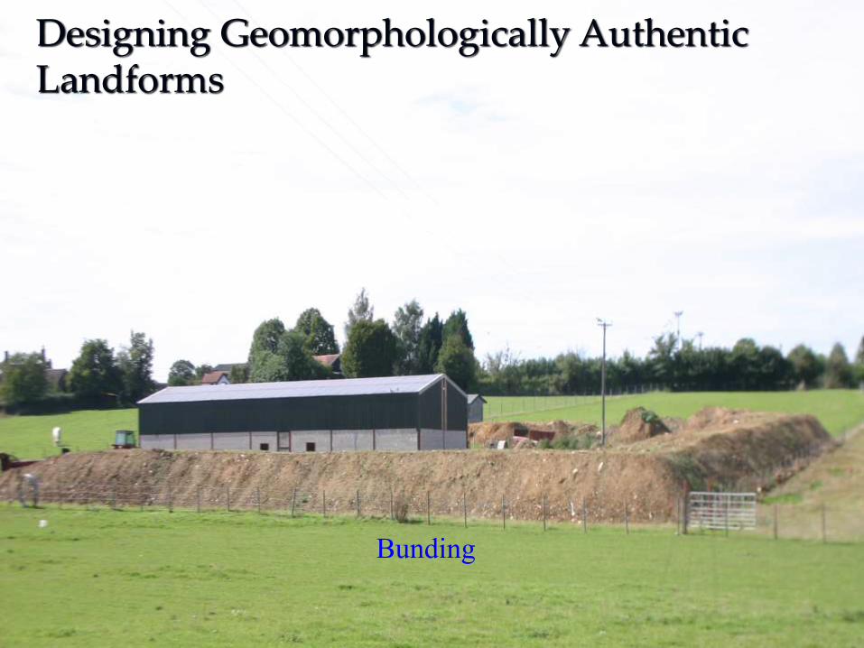
Bunding
Designing Geomorphologically Authentic Landforms

Golf course design
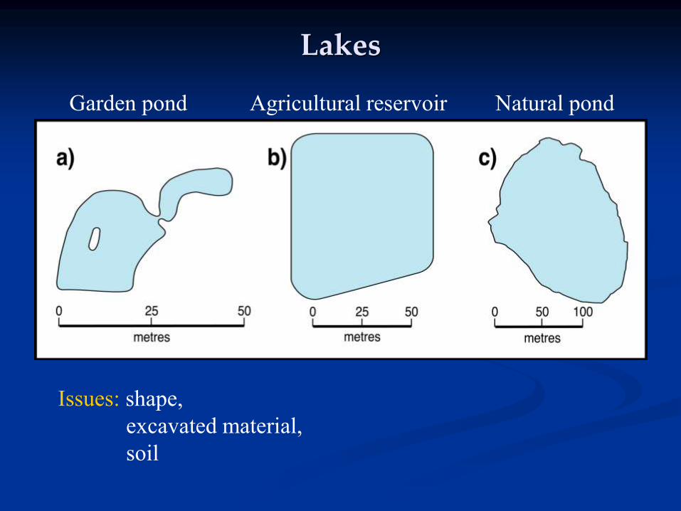
Lakes
Issues: shape,
excavated material,
soil
Garden pond Agricultural reservoir Natural pond
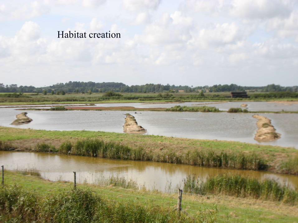
Habitat creation
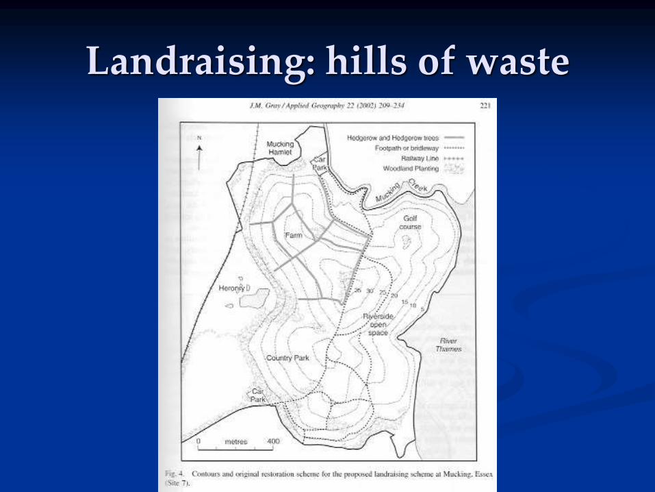
Landraising: hills of waste
Traditional geoconservation
Traditionally geoconservation effort has been aimed at identifying important sites and areas and getting them formally designated;
But this does not guarantee their protection and ignores important elements of geodiversity beyond protected areas (landscape scale);
We need a range of tools if we are to fully protect global geodiversity;
One important tool is land-use planning which has the potential to help protect both designated geoconservation sites and the wider landscape.
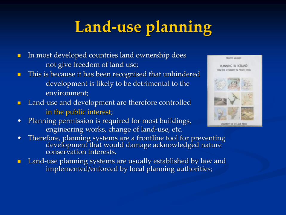
Land-use planning
In most developed countries land ownership does
not give freedom of land use;
This is because it has been recognised that unhindered
development is likely to be detrimental to the
environment;
Land-use and development are therefore controlled
in the public interest;• Planning permission is required for most buildings,
engineering works, change of land-use, etc. • Therefore, planning systems are a frontline tool for preventing
development that would damage acknowledged nature conservation interests.
Land-use planning systems are usually established by law and implemented/enforced by local planning authorities;

The UK planning system
• The aim of the UK planning system for over 50 years has been to control land-use in the public interest (Town & Country Planning Act, 1947 > Planning & Compulsory Purchase Act, 2004);
• It has been a highly centrally-controlled system. Most decisions are made by local authorities but central government has issued strong guidance on how decisions should be made.
• The system is “plan-led”, i.e. decisions on individual planning applications are made in relation to policies and plans decided in advance. These policies and plans follow a hierarchy from national guidance cascading down to local plans;
• Much of what I say refers to England. Wales, Scotland and N.Ireland increasingly diverge while retaining the same basic approach;
National Policy
• Is now in one document - the National Planning Policy Framework (NPPF, 2012);
• “The planning system should contribute to and enhance the natural and local environment by:
- protecting and enhancing valued landscapes, geological conservation interests and soils”…;
• “To minimise impacts on biodiversity and geodiversity, planning policies should:
- aim to prevent harm to geological conservation interests…”
Local Plans
Local Plans are drawn up by Local Councils but must conform to the NPPF guidance.
They are approved by the Planning Inspectorate (a semi-independent organisation funded by government) whose job is to test whether they do conform.
If so, they are then “adopted”.
Development Management
Development management is the name given to making decisions on individual planning applications
Development is “the carrying out of building, engineering, mining or other operations, in, on, over or under land, or the making of any material change in the use of any building or other land”.
UK Planning law states that decisions must be made in accordance with the Local Plan unless “material considerations” indicate otherwise, i.e unless there are good planning reasons to reach a different decision.
Material considerations might include changed government policy or local circumstances;
Decisions are made by local planning committees elected councillors or delegated to officers.
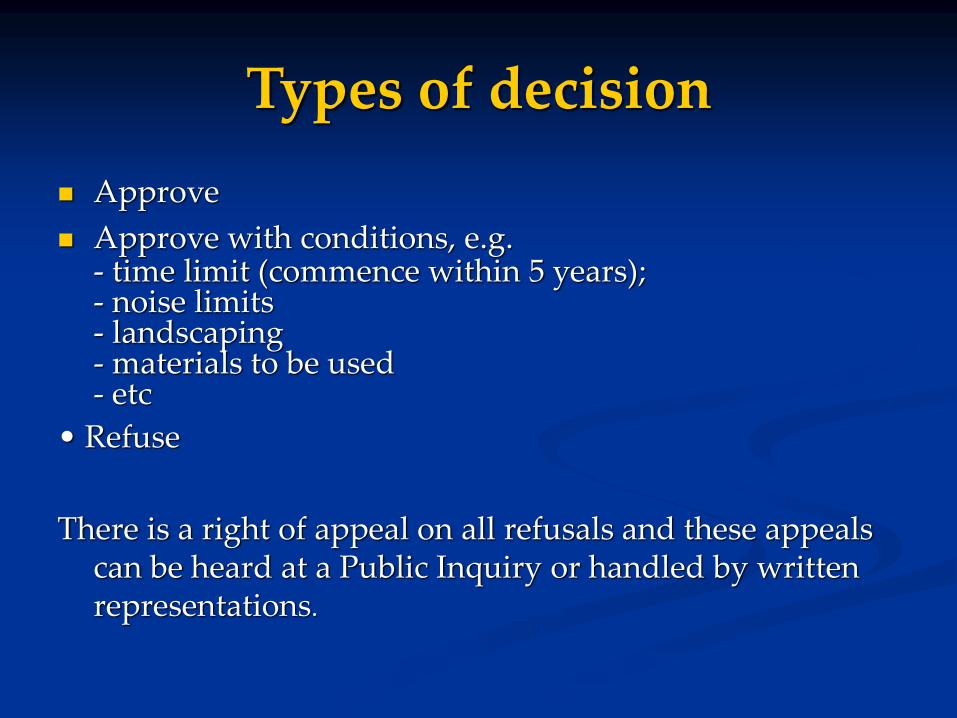
Types of decision
Approve
Approve with conditions, e.g.- time limit (commence within 5 years);- noise limits- landscaping- materials to be used- etc
• Refuse
There is a right of appeal on all refusals and these appeals can be heard at a Public Inquiry or handled by written representations.

Case study 1 - local policies
Local Plans/LDFs should contain policies to prevent damage or loss of protected sites/areas (WHS, SACs, SSSIs, etc);
Purbeck Local Plan Final Version (2004) Policy CA2: “Development which would have an adverse effect on the nature conservation
interest of a Site of Special Scientific Interest (SSSI), either directly or indirectly, will not be permitted unless:
(1) the social, economic and/or environmental benefits arising from the development clearly outweigh the damage to the nationally important ecological or geological value of the site; or
(2) the effect would not result in a significant reduction to the ecological or geological interest of the site; or
(3) it would result in only short term damage to the site’s ecological or geological interest which would recover within 3 years; and
(4) in all cases, there are no acceptable, less damaging, solutions”.

Local policies
Local Plans can extend beyond protected areas to include policies to: protect landscape character,
ensure continued operation of geomorphological processes,
conserve soil,
restore landscapes and processes,
specify building materials, etc.

Case study 2 - local policies
South Norfolk Local Plan (2015) Policy DM4.9
“All development proposals will be expected to respect the character and distinctiveness of the local landscape, its pattern, vegetation type and landform”.
DM 4.9 Incorporating landscape into design“Landscape schemes will be required to respect the character and distinctiveness of the local landscape and should ensure that any land remodelling respects the local topographic character in terms of height, slope, angle and character”.
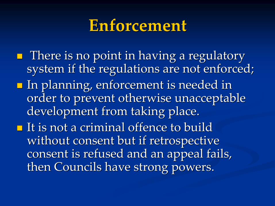
Enforcement
There is no point in having a regulatory system if the regulations are not enforced;
In planning, enforcement is needed in order to prevent otherwise unacceptable development from taking place.
It is not a criminal offence to build without consent but if retrospective consent is refused and an appeal fails, then Councils have strong powers.
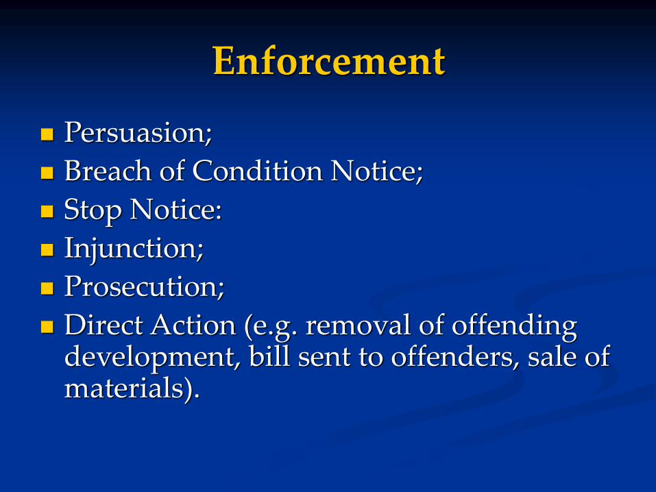
Enforcement
Persuasion;
Breach of Condition Notice;
Stop Notice:
Injunction;
Prosecution;
Direct Action (e.g. removal of offending development, bill sent to offenders, sale of materials).

Summary
• In general, the UK planning system has been effective in
protecting important geoconservation sites;
• It is also starting to be used to protect the wider
countryside;
• National and local policy-makers need to be more aware
of geoconservation issues in general and need to
understand that abiotic nature is fundamental to
integrated and sustainable land-use planning;
• Could planning systems in other countries do more for
geoconservation?