Geo-informatics Applications in...
23
Department of Science and Technology Government of Gujarat ISO 9001:2008 ISO 27001:2005 Geo-informatics Applications in Gujarat Bhaskaracharya Institute for Space Applications and Geo-informatics
Transcript of Geo-informatics Applications in...
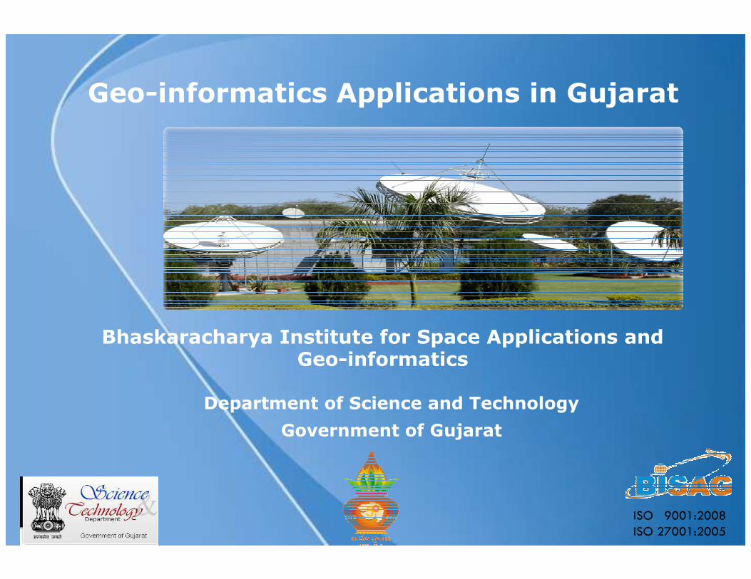
Department of Science and Technology
Government of Gujarat
ISO 9001:2008
ISO 27001:2005
Geo-informatics Applications in Gujarat
Bhaskaracharya Institute for Space Applications and Geo-informatics
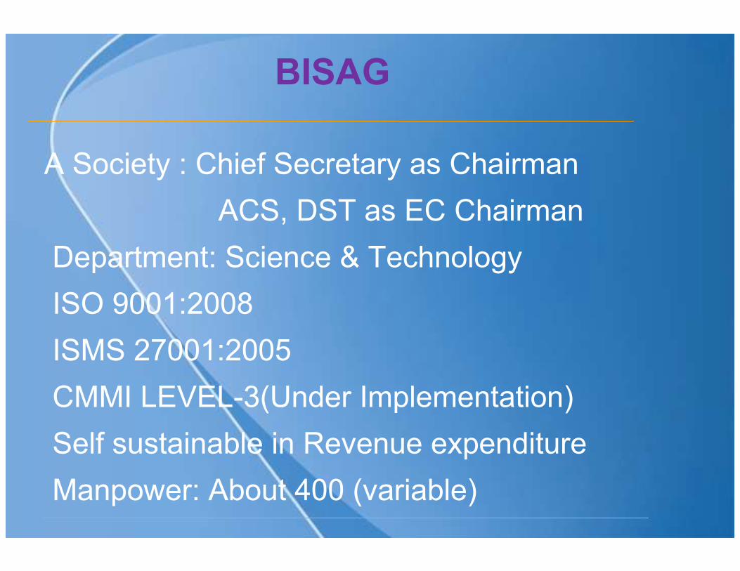
BISAG
A Society : Chief Secretary as Chairman
ACS, DST as EC Chairman
Department: Science & Technology
ISO 9001:2008
ISMS 27001:2005
CMMI LEVEL-3(Under Implementation)
Self sustainable in Revenue expenditure
Manpower: About 400 (variable)
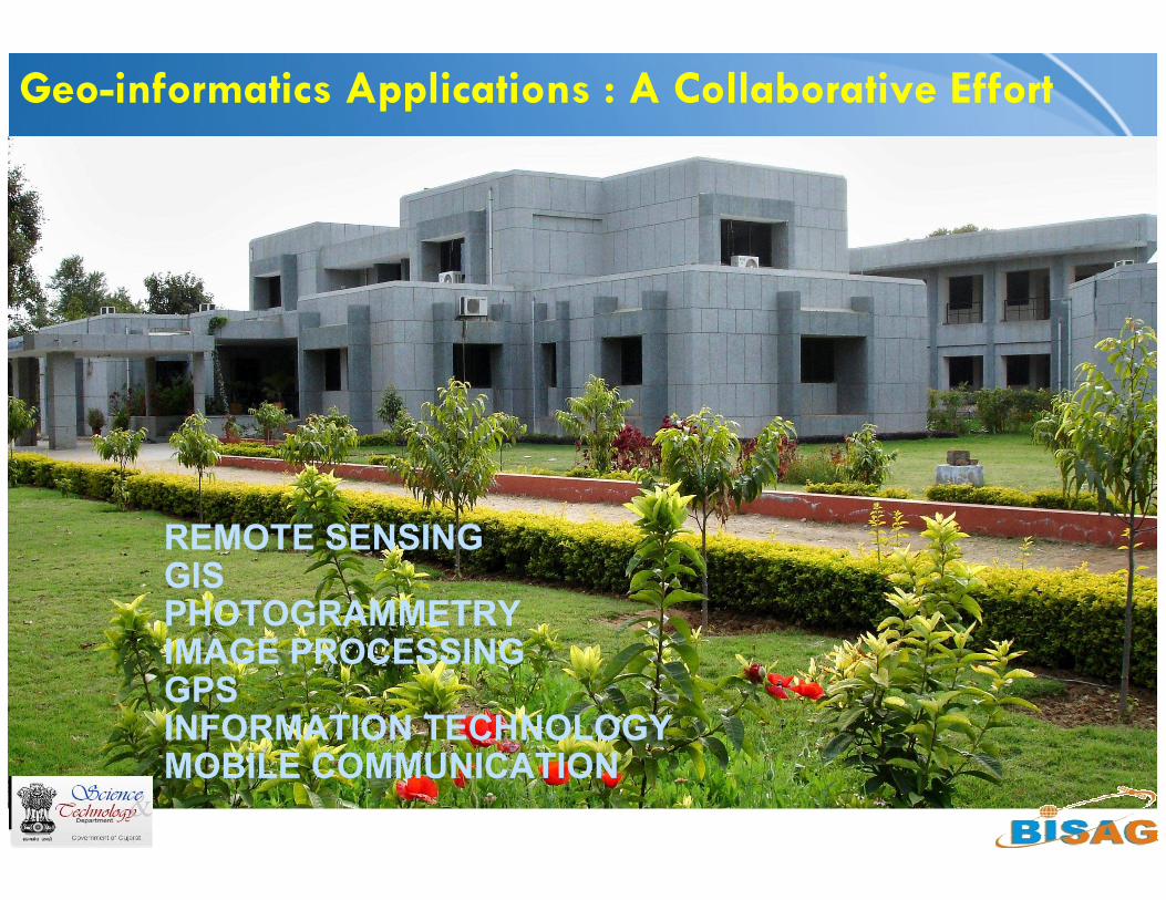
Geo-informatics Applications : A Collaborative Effort
REMOTE SENSINGGISPHOTOGRAMMETRYIMAGE PROCESSINGGPSINFORMATION TECHNOLOGYMOBILE COMMUNICATION
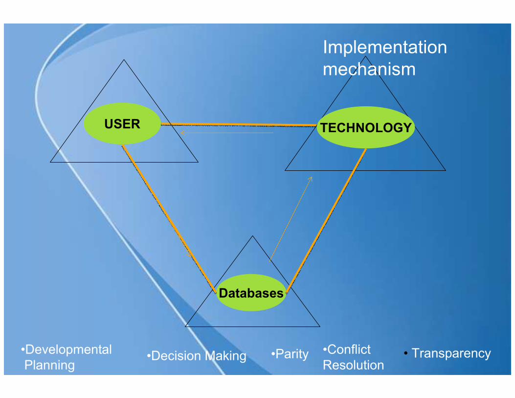
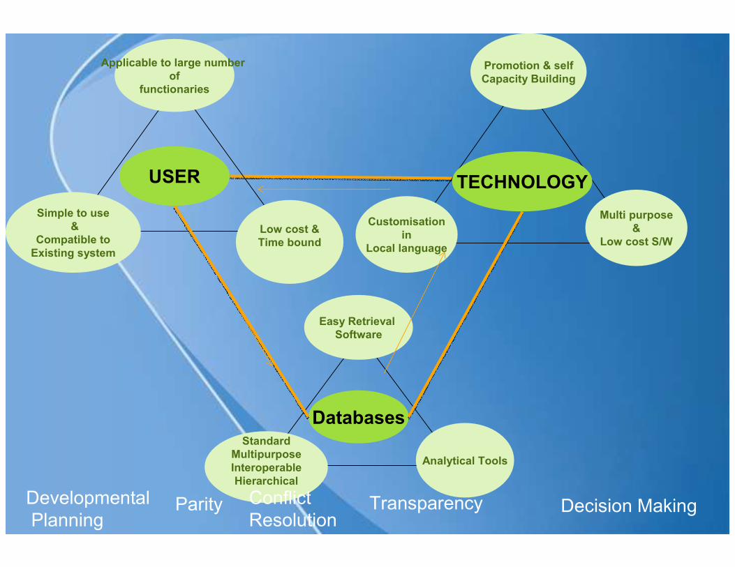
USER TECHNOLOGY
Databases
•Developmental
Planning• Transparency•Parity •Conflict
Resolution
Implementation
mechanism
•Decision Making
Applicable to large number
of
functionaries
Low cost &
Time bound
Simple to use
&
Compatible to
Existing system
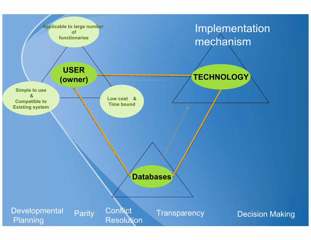
USER
(owner) TECHNOLOGY
Databases
Developmental
PlanningDecision Making TransparencyParity Conflict
Resolution
Implementation
mechanism
Applicable to large number
of
functionaries
Low cost &
Time bound
Simple to use
&
Compatible to
Existing system
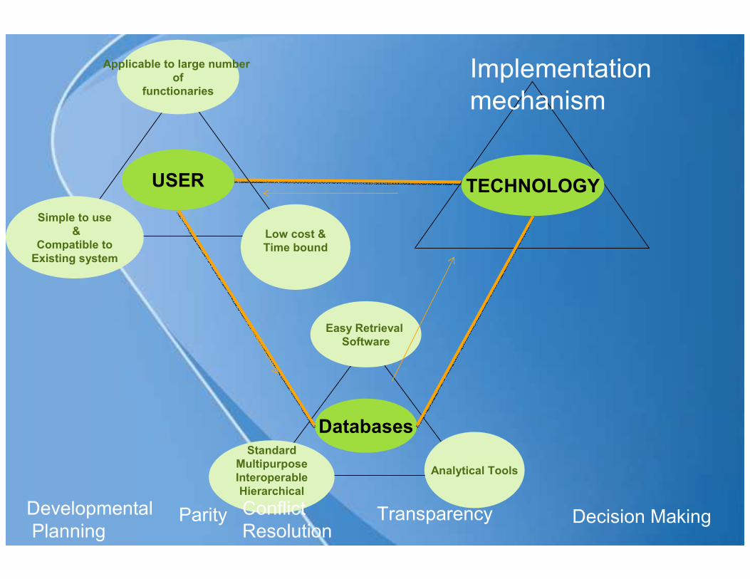
USER TECHNOLOGY
Easy Retrieval
Software
Analytical Tools
Standard
Multipurpose
Interoperable
Hierarchical
Databases
Developmental
PlanningDecision Making TransparencyParity Conflict
Resolution
Implementation
mechanism
Applicable to large number
of
functionaries
Low cost &
Time bound
Simple to use
&
Compatible to
Existing system
USER
Promotion & self
Capacity Building
Multi purpose
&
Low cost S/W
Customisation
in
Local language
TECHNOLOGY
Easy Retrieval
Software
Analytical Tools
Standard
Multipurpose
Interoperable
Hierarchical
Databases
Developmental
PlanningDecision Making TransparencyParity Conflict
Resolution
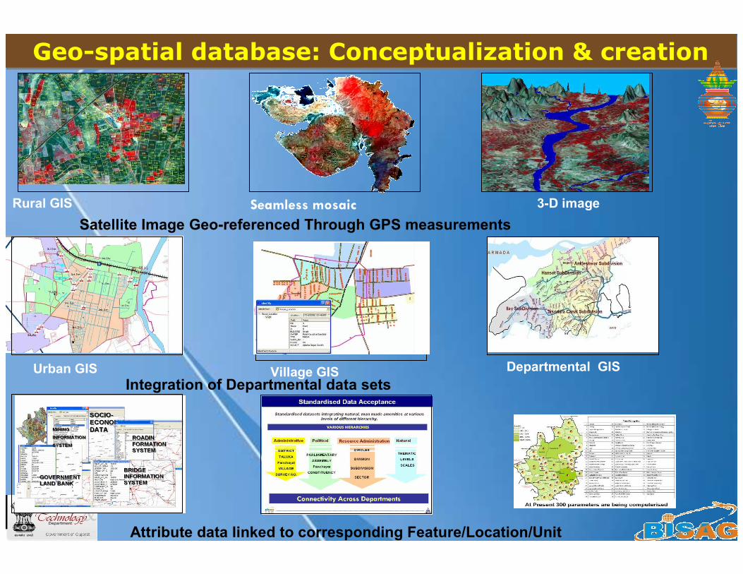
Satellite Image Geo-referenced Through GPS measurements
Rural GIS Seamless mosaic
Integration of Departmental data sets
Attribute data linked to corresponding Feature/Location/Unit
3-D image
Village GISUrban GIS Departmental GIS
Geo-spatial database: Conceptualization & creationGeo-spatial database: Conceptualization & creation
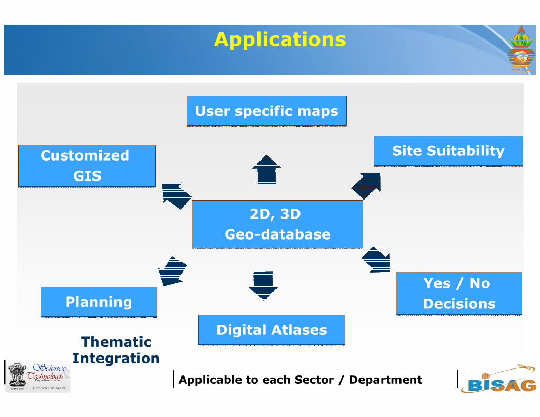
Applications
Thematic Integration
Applicable to each Sector / Department
User specific mapsUser specific maps
Customized
GIS
Customized
GIS
Site SuitabilitySite Suitability
Yes / No
Decisions
Yes / No
Decisions
2D, 3D
Geo-database
2D, 3D
Geo-database
PlanningPlanning
Digital AtlasesDigital Atlases

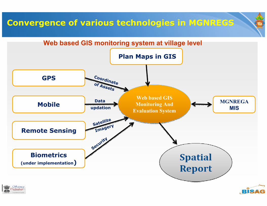
Convergence of various technologies in MGNREGS
Web based GIS
Monitoring And
Evaluation System
Web based GIS
Monitoring And
Evaluation System
MGNREGA
MIS
Remote Sensing
Mobile
GPS
Biometrics(under implementation)
Coordinate of Assets
Data
updation
Satellite
Imagery
Secu
rity
Web based GIS monitoring system at village level
Plan Maps in GIS
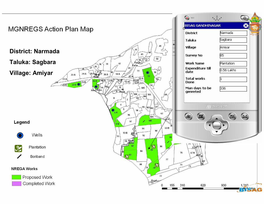
District: Narmada
Taluka: Sagbara
Village: Amiyar
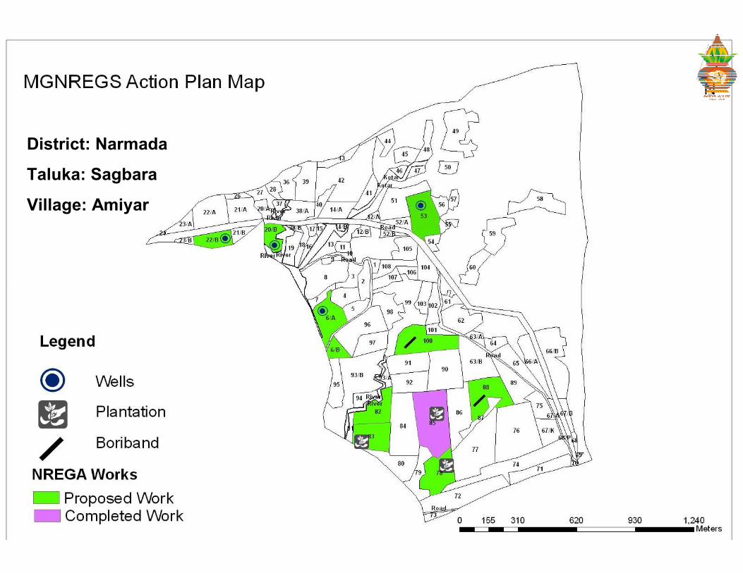
District: Narmada
Taluka: Sagbara
Village: Amiyar
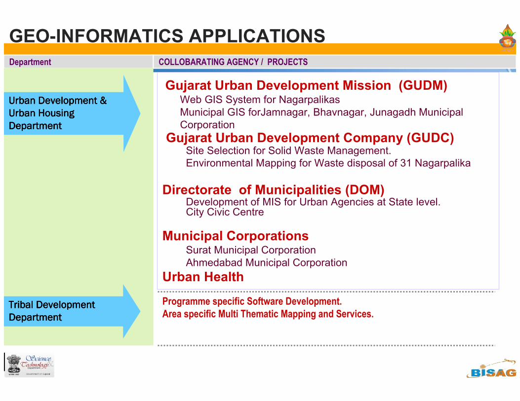
GEO-INFORMATICS APPLICATIONS
Department COLLOBARATING AGENCY / PROJECTS
Urban Development & Urban Development & Urban Development & Urban Development &
Urban Housing Urban Housing Urban Housing Urban Housing
Department Department Department Department
Gujarat Urban Development Mission (GUDM)Web GIS System for Nagarpalikas
Municipal GIS forJamnagar, Bhavnagar, Junagadh Municipal
Corporation
Gujarat Urban Development Company (GUDC) Site Selection for Solid Waste Management.
Environmental Mapping for Waste disposal of 31 Nagarpalika
Directorate of Municipalities (DOM) Development of MIS for Urban Agencies at State level. City Civic Centre
Municipal CorporationsSurat Municipal Corporation
Ahmedabad Municipal Corporation
Urban Health
Programme specific Software Development.
Area specific Multi Thematic Mapping and Services.Tribal Development Tribal Development Tribal Development Tribal Development
Department Department Department Department
GEO-INFORMATICS APPLICATIONSDepartment COLLOBARATING AGENCY / PROJECTS
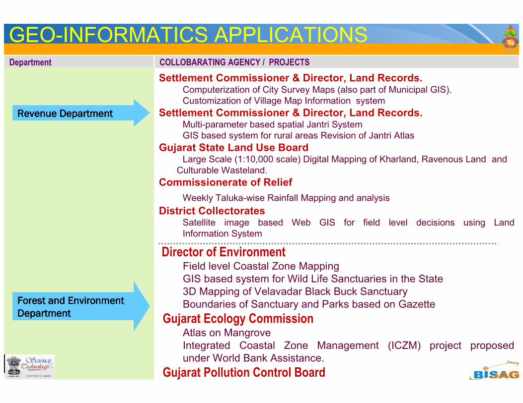
Revenue DepartmentRevenue DepartmentRevenue DepartmentRevenue Department
Settlement Commissioner & Director, Land Records.Computerization of City Survey Maps (also part of Municipal GIS).
Customization of Village Map Information system
Settlement Commissioner & Director, Land Records.Multi-parameter based spatial Jantri System
GIS based system for rural areas Revision of Jantri Atlas
Gujarat State Land Use BoardLarge Scale (1:10,000 scale) Digital Mapping of Kharland, Ravenous Land and
Culturable Wasteland.
Commissionerate of Relief
Weekly Taluka-wise Rainfall Mapping and analysis
District CollectoratesSatellite image based Web GIS for field level decisions using Land
Information System
Director of EnvironmentField level Coastal Zone Mapping
GIS based system for Wild Life Sanctuaries in the State
3D Mapping of Velavadar Black Buck Sanctuary
Boundaries of Sanctuary and Parks based on Gazette
Gujarat Ecology CommissionAtlas on Mangrove
Integrated Coastal Zone Management (ICZM) project proposed
under World Bank Assistance.
Gujarat Pollution Control Board
Forest and Environment Forest and Environment Forest and Environment Forest and Environment
DepartmentDepartmentDepartmentDepartment
GEO-INFORMATICS APPLICATIONSDepartment COLLOBARATING AGENCY / PROJECTS
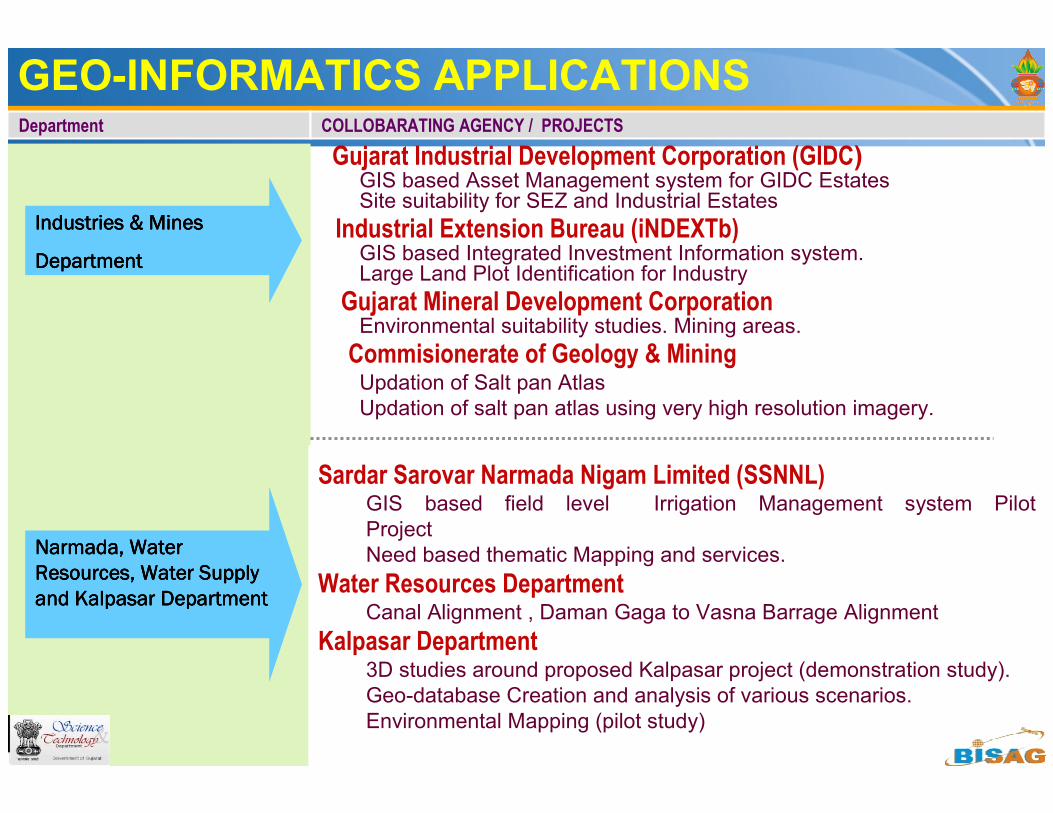
Industries & MinesIndustries & MinesIndustries & MinesIndustries & Mines
DepartmentDepartmentDepartmentDepartment
Narmada, Water Narmada, Water Narmada, Water Narmada, Water
Resources, Water Supply Resources, Water Supply Resources, Water Supply Resources, Water Supply
and Kalpasar Departmentand Kalpasar Departmentand Kalpasar Departmentand Kalpasar Department
Sardar Sarovar Narmada Nigam Limited (SSNNL)GIS based field level Irrigation Management system Pilot
Project
Need based thematic Mapping and services.
Water Resources DepartmentCanal Alignment , Daman Gaga to Vasna Barrage Alignment
Kalpasar Department3D studies around proposed Kalpasar project (demonstration study).
Geo-database Creation and analysis of various scenarios.
Environmental Mapping (pilot study)
Gujarat Industrial Development Corporation (GIDC)GIS based Asset Management system for GIDC EstatesSite suitability for SEZ and Industrial Estates
Industrial Extension Bureau (iNDEXTb)GIS based Integrated Investment Information system. Large Land Plot Identification for Industry
Gujarat Mineral Development CorporationEnvironmental suitability studies. Mining areas.
Commisionerate of Geology & MiningUpdation of Salt pan Atlas
Updation of salt pan atlas using very high resolution imagery.
Department COLLOBARATING AGENCY / PROJECTS
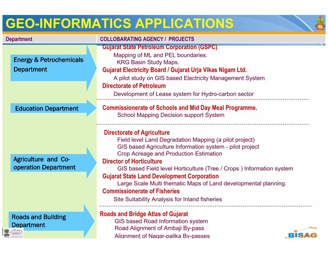
Energy & Petrochemicals Energy & Petrochemicals Energy & Petrochemicals Energy & Petrochemicals
DepartmentDepartmentDepartmentDepartment
Directorate of Agriculture Field level Land Degradation Mapping (a pilot project)
GIS based Agriculture Information system - pilot project
Crop Acreage and Production Estimation
Director of HorticultureGIS based Field level Horticulture (Tree / Crops ) Information system
Gujarat State Land Development CorporationLarge Scale Multi thematic Maps of Land developmental planning.
Commissionerate of Fisheries
Site Suitability Analysis for Inland fisheries
Agriculture and CoAgriculture and CoAgriculture and CoAgriculture and Co----
operationoperationoperationoperation DepartmentDepartmentDepartmentDepartment
Gujarat State Petroleum Corporation (GSPC)
Mapping of ML and PEL boundaries.
KRG Basin Study Maps.
Gujarat Electricity Board / Gujarat Urja Vikas Nigam Ltd.
A pilot study on GIS based Electricity Management System
Directorate of Petroleum
Development of Lease system for Hydro-carbon sector
Education Department Education Department Education Department Education Department Commissionerate of Schools and Mid Day Meal Programme.School Mapping Decision support System
Roads and Building Roads and Building Roads and Building Roads and Building
DepartmentDepartmentDepartmentDepartment
Roads and Bridge Atlas of Gujarat GIS based Road Information system
Road Alignment of Ambaji By-pass
Alignment of Nagar-palika By-passes
GEO-INFORMATICS APPLICATIONS
GEO-INFORMATICS APPLICATIONSDepartment COLLOBARATING AGENCY / PROJECTS
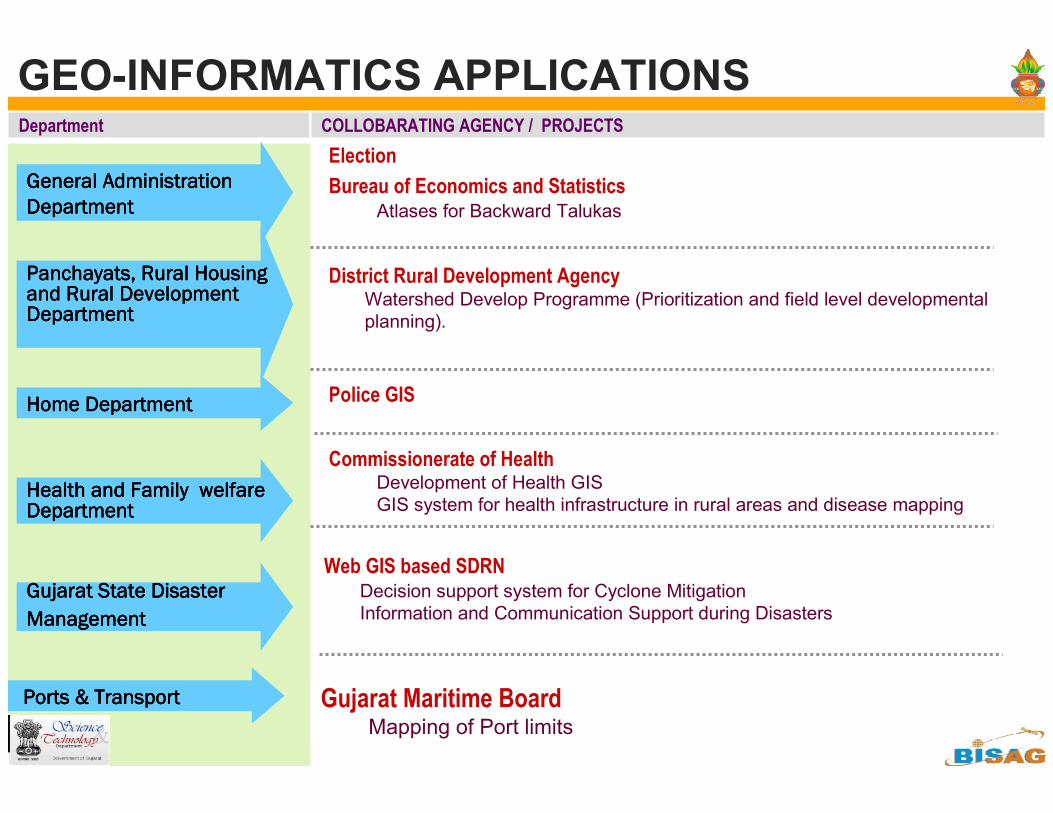
General Administration General Administration General Administration General Administration
DepartmentDepartmentDepartmentDepartment
Panchayats, Rural Housing Panchayats, Rural Housing Panchayats, Rural Housing Panchayats, Rural Housing and Rural Development and Rural Development and Rural Development and Rural Development DepartmentDepartmentDepartmentDepartment
District Rural Development AgencyWatershed Develop Programme (Prioritization and field level developmental
planning).
Home DepartmentHome DepartmentHome DepartmentHome Department
Election
Bureau of Economics and StatisticsAtlases for Backward Talukas
Police GIS
Health and Family Health and Family Health and Family Health and Family welfare welfare welfare welfare DepartmentDepartmentDepartmentDepartment
Commissionerate of HealthDevelopment of Health GIS
GIS system for health infrastructure in rural areas and disease mapping
Gujarat Maritime BoardMapping of Port limits
Gujarat State DisasterGujarat State DisasterGujarat State DisasterGujarat State Disaster
ManagementManagementManagementManagement
Web GIS based SDRNDecision support system for Cyclone Mitigation
Information and Communication Support during Disasters
Ports & TransportPorts & TransportPorts & TransportPorts & Transport
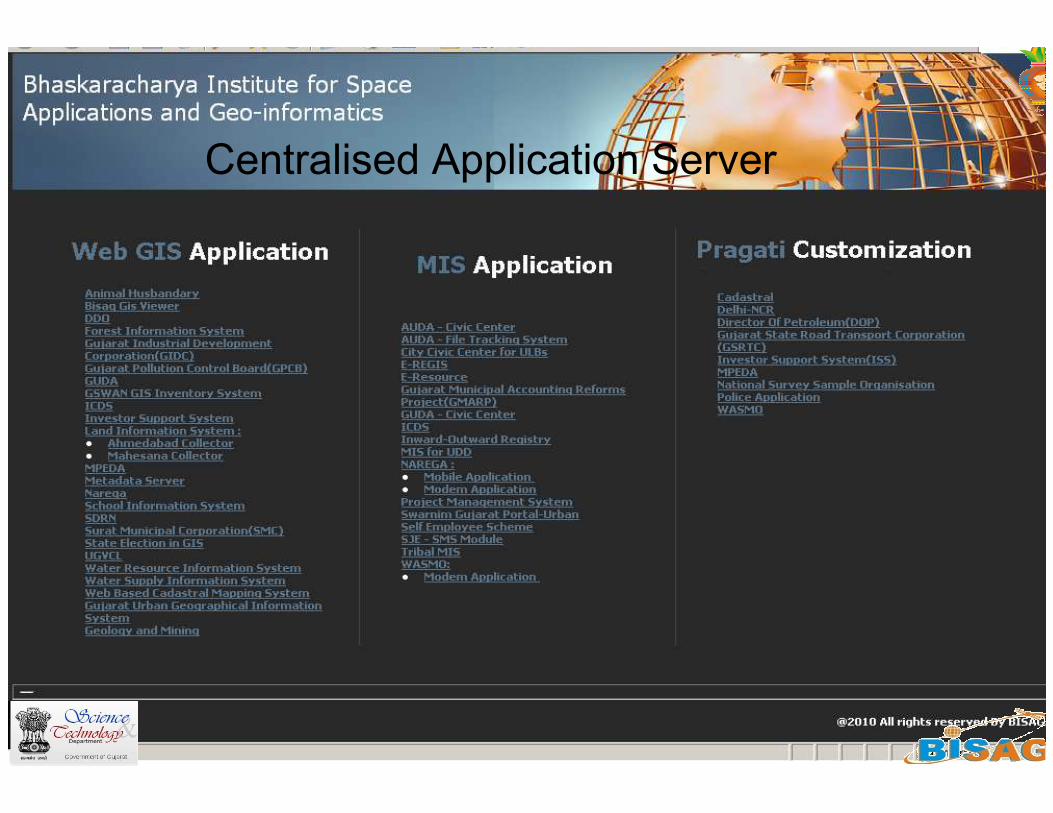
Centralised Application Server
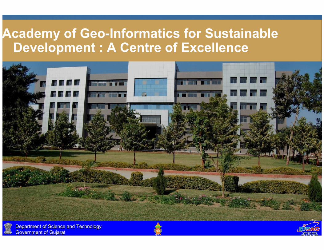
Academy of Geo-Informatics for Sustainable Development : A Centre of Excellence
Department of Science and Technology
Government of Gujarat
Department of Science and Technology
Government of GujaratDepartment of Science and Technology
Government of Gujarat
Department of Science and Technology
Government of Gujarat
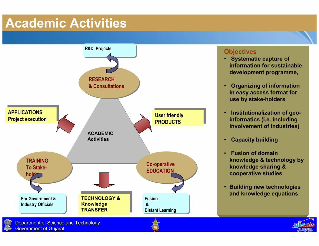
Academic Activities
ACADEMIC
Activities
ACADEMIC
Activities
RESEARCH
& Consultations
RESEARCH
& Consultations
TRAINING
To Stake-
holders
TRAINING
To Stake-
holders
Co-operative
EDUCATION
Co-operative
EDUCATION
APPLICATIONS
Project executionAPPLICATIONS
Project executionUser friendly
PRODUCTSUser friendly
PRODUCTS
TECHNOLOGY &
Knowledge
TRANSFER
TECHNOLOGY &
Knowledge
TRANSFER
For Government &
Industry Officials
For Government &
Industry OfficialsFusion
&
Distant Learning
Fusion
&
Distant Learning
R&D ProjectsR&D ProjectsObjectives• Systematic capture of
information for sustainable
development programme,
• Organizing of information
in easy access format for
use by stake-holders
• Institutionalization of geo-
informatics (i.e. including
involvement of industries)
• Capacity building
• Fusion of domain
knowledge & technology by
knowledge sharing &
cooperative studies
• Building new technologies
and knowledge equations
Department of Science and Technology
Government of Gujarat
Department of Science and Technology
Government of Gujarat
Thank you