
General Procedures in Acquiring land · AND CORRUPTION IN AFRICA (WLCA) PROJECT Women Land IN...
17
AND CORRUPTION IN AFRICA (WLCA) PROJECT Women Land IN ACQUIRING LAND REPORT CORRUPTION NOW!!! Call ALAC on 0800 100 25 / 0302 760 884 TRANSPARENCY INTERNATIONAL the global coalition against corruption Ghana Integrity Initiative Local Chapter of Transparency International GENERAL PROCEDURES
Transcript of General Procedures in Acquiring land · AND CORRUPTION IN AFRICA (WLCA) PROJECT Women Land IN...
AND CORRUPTIONIN AFRICA (WLCA) PROJECT
Women Land
IN ACQUIRING LAND
REPORT CORRUPTION NOW!!! Call ALAC on 0800 100 25 / 0302 760 884
TRANSPARENCYINTERNATIONALthe global coalition against corruption
Ghana Integrity InitiativeLocal Chapter of Transparency International
GENERAL PROCEDURES
WOMEN LAND AND CORRUPTION IN AFRICA (WLCA) PROJECTThe WLCA project with funding support from Friends of Transparency International (TI) is a project being implemented by TI chapters in Zimbabwe, Ghana and Uganda and coordinated by TI Secretariat (TIS) in Berlin.
IntroductionIn Africa, a large portion of arable land is in tenure by small-scale farmers – often women. Vast areas of savannah and semi-desert land are in tenure by pastoralists and indigenous communities. Each land deal – whether transparent or opaque – deprives
customary land users of two of their most relevant resources: water and land. Unfortunately, the results are often poverty and hunger. Approximately one in �ve people around the world, report that they have paid a bribe for land services during the last year; in Africa, almost every second client of land adminis- tration services was a�ected. At the same time, land investors seem to speci�cally target countries with weak governance.
BackgroundThe main purpose of Transparency International’s (TI) “Women Land & Corruption in Africa” (WLCA) project is to link with other civil society organizations and institutions concerned with women, land govern- ance, and together, generate and share relevant data and information on corruption in the land sector, as well as its trends, nature, and existing strategies and mechanisms that are utilized to combat it. The project is aimed at understanding the issue of corruption as it impacts land rights of women in Sub-Saharan Africa, speci�cally Ghana, Uganda, and Zimbabwe, and bringing this issue to the top of the agenda of
2
national, regional and international land governance discussions and projects. To achieve this, TI will �rst conduct research on corruption in land admin- istration and land deals in the target countries. Then, based on this research, TI will network and advocate for recognition and integration of women’s land rights and related anti-corruption activities in development and governance.
The overall goal of Transparency International’s “Women Land & Corruption in Africa” project is to contribute to improved livelihoods of men and women of all generations adversely a�ected by corrupt practices in land administration and land deals, and thereby to enhanced security of tenure, as well as to equitable and fair access to land and water, and ultimately to sustainable and inclusive develop- ment and growth.
The project intends;1. To increase the understanding on the issue of women, land and corruption
2. To leverage the discussion and recognition of cor- ruption issues e�ecting women in their access to, use of and control over land at national, regional and international forums
3. To enhance the capacity to design and implement projects which respond to women’s concerns about corruption in land administration and land deals.
INTRODUCTIONLand is a valuable asset, which appreciates or inc- reases in term of price, as time goes on. It is therefore very important that, when you are able to acquire a land, it is registered appropriately and accordingly with the land agencies involved to avoid future land disputes and forfeiture.
In Ghana, recently, acquisition of land has become tiresome and very expensive, especially in elite areas of Accra. This gives more reason why it is vital that the land is registered as this would also give the owner full rights over the land and in its development as well as save the owner from litigation.
SOME OF THE LAWS GOVERNING LAND IN GHANA ARE:• Lands Commission Act • The administration of lands Act• Land title registration Act • Conveyancing Act• Constitution- Art 257-267• Land registry Act• State lands ActThe above laws, among others were enacted to control and guide the acquisition and use of land.
WHAT IS THE LANDS COMMISSION?The Lands Commission was established under Article 258 of the 1992 Constitution and the Lands Com- mission Act 767 of 2008 as a corporate body.
The reason for the establishment of this commission was to make sure that the acquisition and use of land was properly regulated so as to limit the problems associated with lands in Ghana.
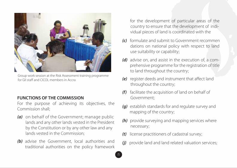
FUNCTIONS OF THE COMMISSIONFor the purpose of achieving its objectives, the Commission shall;
(a) on behalf of the Government; manage public lands and any other lands vested in the President by the Constitution or by any other law and any lands vested in the Commission;
(b) advise the Government, local authorities and traditional authorities on the policy framework
for the development of particular areas of the country to ensure that the development of indi- vidual pieces of land is coordinated with the
(c) formulate and submit to Government recommen dations on national policy with respect to land use suitability or capability; (d) advise on, and assist in the execution of, a com- prehensive programme for the registration of title to land throughout the country;
(e) register deeds and instrument that a�ect land throughout the country;
(f) facilitate the acquisition of land on behalf of Government;
(g) establish standards for and regulate survey and mapping of the country;
(h) provide surveying and mapping services where necessary;
(t) license practitioners of cadastral survey;
(j) provide land and land related valuation services;
(k) ensure that through sound, sustainable land use planning, socio-economic activities are consistent with sound land use through sustainable land use planning in the long term national development goals;
(I) in collaboration with other bodies instill order and discipline into the land market through curbing the incidence of land encroachment, unapproved development schemes, multiple or illegal land sales, land speculation and other forms of land racketeering;
(m) in collaboration with other bodies minimize or eliminate, where possible, the sources of protracted land boundary disputes, con�icts and litigations in order to bring their associated economic costs and socio-political upheavals under control;
(n) promote community participation and public awareness at all levels in sustainable land management and development practices to ensure the highest and best use of land;
(0) promote research into all aspects of land ownership, tenure and the operations of the land market and the land development process;
(P) impose and collect levies, fees, charges for services rendered;
(q) establish and maintain a comprehensive land information system, and
(r) perform other functions the Minister may assign to it.
The current Lands Commission, as part of the public sector reform programmes and the Ghana Land Administration Project (LAP) has substantially been remodeled by the Act 767 to increase its efficiency and e�ectiveness.
As part of the reforms, four Land Sector Agencies; 1. The ‘Old Lands Commission,2. Land Valuation Board, 3. Land Title Registry and 4. Survey Department
Have been integrated into one Corporate Agency-
the ‘New Lands Commission’ which now comprises of four distinct Divisions.
The Divisions are:1. Survey and Mapping Division (SMD), and the 2. Land Registration Division (LRD).3. Land Valuation Division (LVD).4. Public and Vested Land Management Division (PVLMD)
Functions of the Survey and Mapping DivisionThe Survey and Mapping Division has the following functions:
(a) supervise, regulate and control the survey and demarcation of land for the purposes of land use and land registration;
(b) take custody of and preserve records that relate to the survey of any parcel of land;
(c) direct and supervise the conduct of trigono- metric, hydrograhic, topographic and engin- eering surveys;
(d) coordinate the preparation of plans from the data derived from survey and any amendment of the plans;
(e) coordinate the production of photo-grammetric surveys including aerial photography, ortho- photomapping, and remote sensing;
(f ) survey, map and maintain the national territorial boundaries including maritime boundaries;
(g) supervise and regulate operations that relate to survey of any parcel of land:
(h) develop and maintain the national geodetic (1) supervise, regulate, control and certify the production of maps; and
(j) other functions determined by the Commission.
Functions of the Land Registration DivisionThe functions of the Land Registration Division include
(a) publication of notices of registration upon receipt of an application for registration;
(b) registration of tide to land and other interests in land;
(c) registration of deeds and other instruments a�ecting land in areas outside compulsory title registration districts;
(d) maintaining land registers that contains records of land and other interests in land.
(e) other functions determined by the Commission.
Functions of the Land Valuation DivisionThe functions of the Land Valuation Division include
(a) assessing the compensation payable upon acquisition of land by the Government; (b) assessment of stamp duty;
(c) determining the values of properties rented, purchased, sold or leased by or to Government;
(d) preparation and maintenance of valuation list for rating purposes;
(e) valuation of interests in land or land related interests for the general public at a fee;
(f ) valuation of interests in land for the adminis- tration of estate duty; and
(g) other functions determined by the Commission
Functions of the Public and Vested Lands Management DivisionThe functions of the Public and Vested Lands Management Division include
(a) facilitating the acquisition of land for Government;
(b) managing state acquired and vested lands in conformity with approved land use plans; and
(c) other functions determined by the Commission.
To improve land service delivery and management, the Commission with support from the Land Administration Project has developed a strategy to re-engineer the Commissions’ Business Processes and Work�ow integration as part of the restructuring of the land sector to reduce process time, improve productivity and efficiency as well as to reduce the cost of land transactions.
Objectives of the Re-Engineering;• Improve the process of land registration• Reduce the turn-around time in registration• Reduce client interference in registration process• Automate the process Integrate re-engineered business processes • Reducing customer frustrations • Simplify payment of fees Eliminate/reduce duplication of work
• Apply technology in business processes • Improve working environment
Causes of Delays in Land Registration Process in GhanaThe causes of delays and frustrations in the Land Registration system in the country can be categorized into three (3) broad areas;1. Institutional2. Business Process3. Technological Challenges
Institutional DelaysInstitutional challenges have been a major setback in rendering quality land services to clients and the general public. Multiple access or channels of clients to services for instance makes it difficult for management to track transactions, it’s speed, the quality and �uidity of those services rendered. The office layout/architecture is also a challenge.
The scattered nature of the Commissions’ offices and operations inhibit the free �ow of services and slows the pace of service delivery. For instance, the Land Registration Division, Survey and Mapping Division
and the Land Valuation Division of the Commission are not co-located and make the work�ow very slow and challenging. Sta� supervision under such work environment is very challenging as well.
Another institutional challenge that causes the delays in the land registration process is inadequate public education on the requirements for land registration by the Lands Commission.
Duplication of e�ort or work has also been identi�ed as a major cause of delays in the land registration process. There are instances where site inspections will have to be carried out by LRD and SMD in the process of registration, but instead of the inspection being done on a single visit by the Divisions; the site inspection is done separately and at di�erent times and visits by the Divisions.
Institutional delays like; double preparations of site plans, delays in the issuance of tax clearance certificate, consent, official requests for search reports from LRD to PVLMD, declaration of multiple requests by SMD, and lack of information on status of applications by clients.
The manual system of operations in areas like records management and generations is an inhibition to quickening the pace of service delivery at the Commission. There is a gradual application of ICT through the automation of some of the Commission’s operations, even though they are inadequate and its pace needs to be accelerated.
Speci�c Interventions to Deal with the DelaysThe Lands Commission has decided to make the following external dependency requirements; like request for planning comments from TCPD, tax clearance certi�cate from Ghana Revenue Authority and consent from Traditional Authorities as precon-dition for submission of documents for registration. The e�ect of this intervention is that the time for obtaining planning comments and tax clearance certi�cates will no longer be considered within the registration period at the Lands Commission.
The multiple preparations of sites plans have also been done away with, since Site Plan preparations have been captured and made a pre-registration requirement. Site plans under the new system would
be prepared once; under quality control checks and used throughout the registration process.
The e�ect of this intervention on the process of land registration is that, the Land Registration Division of the Commission will no longer be required to write a letter to the Survey and Mapping Division to prepare Title plans which normally takes some three (3) months to be done.
On the issues of inadequate information on land registration requirements and fees structure, the Lands Commission has established a Communication and Public Outreach Unit to sensitize clients and the general public on the land registration requirements, fees and processes on the electronic and print media and through public outreaches.
The e�ect of this intervention will also reduce extortions from clients; ensure improved document preparation by clients before submission for processing at the Commission and thereby reducing the number of queried documents mid-way in the registration process.
Another intervention aimed at reducing the delays in the land registration process is the elimination of request for official searches mid-way in the registration process by the Land Registration Division. All searches or records of information on the land from all Divisions would be carried out at the early stages to ensure that the land or property meets the requirements for registration.
Thus, the Land Registration Division will no longer be required to write to the Public and Vested Land Management Division to request for official search report during the process of registration, taking o� two weeks of delay in the previous system.
The Lands Commission has also proposed the merger of the Cartographic and Records Units of the Land Registration and Survey and Mapping Divisions to eliminate the declaration of multiple requests during the plan preparation and approval process. This also o�sets three months of delay in the process of registration.
Under the new system, the Commission has initiated the process to establish a document tracking system to automatically inform and update clients on the status of their applications through text messages, thereby reducing the direct contact of the Commission sta� with clients and the interference of clients in the registration process.
The four Divisions of the Commission; LRD, SMD, LVD and PVLMD are to be co-located at the Cantonments office to improve communication, supervision and work�ow in terms of access to Divisional records.
The Commission has set up Wide and Local Area Network systems and employed the appropriate softwares to improve efficiency and information sharing in the areas of parcel or cadastral plan generation and document tracking.
GENERAL PROCEDURES IN ACQUIRING A LAND IN GHANANB: It is always advisable to follow due diligence to avoid being dragged into a never conclusive land disputes by ensuring that:
(a) You are dealing with the rightful owner of the land recognized by law-a quick official search will do in addition to neighborhood questionings and supporting documents from claimed owner. Do an original survey of the said parcel for the search to be sure the plan used for the search is for the exact land of interest.
(b) You engage the services of a quali�ed land surveyor. In Ghana, only licensed surveyors are permitted legally to undertake cadastral surveys.
1. Land Inspection:The investor must check the boundary corners of the land in question to verify the full extent of the land and be sure of the feasibility of the project to be used. This must be done by an expert and must be in the presence of the land owners as witnesses. Carrying out thorough checks about the land is important, as this will enable the future land owner gets to know if the land is available to be acquired. In this process, the
prospective land owner can also consider the services of a land lawyer to research the land and prove its availability; such as if it has already been sold out. Checks must also be done with other government land overseers, for example; the Tema Development Corporation (TDC), to ascertain if the land had been earmarked for any developmental projects. One would also be told if the land is not suitable, say if it is a water-logged area, and therefore, not advisable to be purchased.
2. Land Search: This is the most important stage. Here Surveyors go onto the land to pick and demarcate the land parcel. The result is taken to the lands commission to verify the true ownership of the. If the name that comes up is the same as your land owners, then you can carry on the process, if not quit or seek a legal advice.
3. Acquisition and Negotiation: After the availability and suitability of the land has been established, the interested buyer or lessee negotiates with the actual owner of the land for sales. It is important to be reminded that the
interested buyer must deal with the rightful owner of the land because the use of middlemen is not advisable. An agreement is reached and documentsmade to its e�ect.
4. Land Documentation: The investor can proceed with the documentations; normally after a quarter or part payment has been done. The land owners then prepare the documents which must include a true and certi�ed copy of Indenture and site plans. Three copies of the agreement documents would be needed for endorsement by a land lawyer, who will have to sign the back of each of the copies with his practicing stamp duly �xed. Each copy of the documents must have a site plan attached, together with two extra copies of site plans, all making 5 documents. The back of the site plan would also be needed to be endorsed by the owner and the buyer of the land; after which they (the site plans) are to be certi�ed by the stamps of a licensed surveyor and the regional surveyor with accurate date.
5. Witnesses:These are people who would testify to the proceedings so that in future whenever there is any case of challenge about ownership of the land, they would be called upon for assistance. It is therefore required that at least, 2 quali�ed persons from both parties – the seller and buyer sides must sign as witnesses. The two witnesses signing on behalf of the buyer or lessee must do so with their full names, addresses and original signatures.
6. Land Commission:After the endorsement of the documents, it is then sent to the land commission, together with processing fees for of processing and registration of the land to begin. After the processing is completed, the documents are released to the Land Valuation Board for stamping and certifying.
7. Internal Revenue Authority (IRS):The IRS sees to the taxes associated with the registration process. From the land valuation board, the processed documents are then released to the IRS for tax clearing of the land to be made. When
this is complete, the applicant, or buyer is given a tax clearance certi�cate. The documents are from here, taken back to the land commission for �nal registration at the deeds registry.
8. Land Title Certi�cation: From the deeds registry, the buyer is given an original copy of the land title document. Actually this can be done simultaneously with the projects inception since the land title certi�cation from the Land title registry of Ghana takes quite some time.
WHAT IS LAND REGISTRATION?Land Registration is the recording of rights and interest in land as evidence by instruments. Instruments or deeds that could be registered include leases, sub-leases, conveyances, assignments, mortgages, gifts, tenancy agreements probate and wills, letters of administration, vesting assets, statutory declarations, power of attorney etc. in relation to land.
WHAT ARE THE BENEFITS OF REGISTERING YOUR LAND• It ensures certainty of your ownership of the land
• It establishes your rights and interests in the land • It protects your rights and interests in the land, promoting security• It renders you documents admissible in court• It minimizes land litigation• It enables you access credit facilities• It enables you invest in the land• It enables you develop land market and many more
TYPES OF LAND OWNERSHIP IN GHANA:
1. INDIVIDUAL/PRIVATE LANDS: These are lands owned by individuals and private entities
2. STOOL/ SKIN LANDS: These are lands under the custodianship of various chiefs3. FAMILY LANDS: These are lands managed by Heads of families assisted by principal members of the families.
4. STATE AND STOOL VESTED LANDS: These are lands managed by the Lands Commission
WOMEN LAND AND CORRUPTION IN AFRICA (WLCA) PROJECTThe WLCA project with funding support from Friends of Transparency International (TI) is a project being implemented by TI chapters in Zimbabwe, Ghana and Uganda and coordinated by TI Secretariat (TIS) in Berlin.
IntroductionIn Africa, a large portion of arable land is in tenure by small-scale farmers – often women. Vast areas of savannah and semi-desert land are in tenure by pastoralists and indigenous communities. Each land deal – whether transparent or opaque – deprives
customary land users of two of their most relevant resources: water and land. Unfortunately, the results are often poverty and hunger. Approximately one in �ve people around the world, report that they have paid a bribe for land services during the last year; in Africa, almost every second client of land adminis- tration services was a�ected. At the same time, land investors seem to speci�cally target countries with weak governance.
BackgroundThe main purpose of Transparency International’s (TI) “Women Land & Corruption in Africa” (WLCA) project is to link with other civil society organizations and institutions concerned with women, land govern- ance, and together, generate and share relevant data and information on corruption in the land sector, as well as its trends, nature, and existing strategies and mechanisms that are utilized to combat it. The project is aimed at understanding the issue of corruption as it impacts land rights of women in Sub-Saharan Africa, speci�cally Ghana, Uganda, and Zimbabwe, and bringing this issue to the top of the agenda of
3
national, regional and international land governance discussions and projects. To achieve this, TI will �rst conduct research on corruption in land admin- istration and land deals in the target countries. Then, based on this research, TI will network and advocate for recognition and integration of women’s land rights and related anti-corruption activities in development and governance.
The overall goal of Transparency International’s “Women Land & Corruption in Africa” project is to contribute to improved livelihoods of men and women of all generations adversely a�ected by corrupt practices in land administration and land deals, and thereby to enhanced security of tenure, as well as to equitable and fair access to land and water, and ultimately to sustainable and inclusive develop- ment and growth.
The project intends;1. To increase the understanding on the issue of women, land and corruption
2. To leverage the discussion and recognition of cor- ruption issues e�ecting women in their access to, use of and control over land at national, regional and international forums
3. To enhance the capacity to design and implement projects which respond to women’s concerns about corruption in land administration and land deals.
INTRODUCTIONLand is a valuable asset, which appreciates or inc- reases in term of price, as time goes on. It is therefore very important that, when you are able to acquire a land, it is registered appropriately and accordingly with the land agencies involved to avoid future land disputes and forfeiture.
In Ghana, recently, acquisition of land has become tiresome and very expensive, especially in elite areas of Accra. This gives more reason why it is vital that the land is registered as this would also give the owner full rights over the land and in its development as well as save the owner from litigation.
SOME OF THE LAWS GOVERNING LAND IN GHANA ARE:• Lands Commission Act • The administration of lands Act• Land title registration Act • Conveyancing Act• Constitution- Art 257-267• Land registry Act• State lands ActThe above laws, among others were enacted to control and guide the acquisition and use of land.
WHAT IS THE LANDS COMMISSION?The Lands Commission was established under Article 258 of the 1992 Constitution and the Lands Com- mission Act 767 of 2008 as a corporate body.
The reason for the establishment of this commission was to make sure that the acquisition and use of land was properly regulated so as to limit the problems associated with lands in Ghana.
FUNCTIONS OF THE COMMISSIONFor the purpose of achieving its objectives, the Commission shall;
(a) on behalf of the Government; manage public lands and any other lands vested in the President by the Constitution or by any other law and any lands vested in the Commission;
(b) advise the Government, local authorities and traditional authorities on the policy framework
for the development of particular areas of the country to ensure that the development of indi- vidual pieces of land is coordinated with the
(c) formulate and submit to Government recommen dations on national policy with respect to land use suitability or capability; (d) advise on, and assist in the execution of, a com- prehensive programme for the registration of title to land throughout the country;
(e) register deeds and instrument that a�ect land throughout the country;
(f) facilitate the acquisition of land on behalf of Government;
(g) establish standards for and regulate survey and mapping of the country;
(h) provide surveying and mapping services where necessary;
(t) license practitioners of cadastral survey;
(j) provide land and land related valuation services;
(k) ensure that through sound, sustainable land use planning, socio-economic activities are consistent with sound land use through sustainable land use planning in the long term national development goals;
(I) in collaboration with other bodies instill order and discipline into the land market through curbing the incidence of land encroachment, unapproved development schemes, multiple or illegal land sales, land speculation and other forms of land racketeering;
(m) in collaboration with other bodies minimize or eliminate, where possible, the sources of protracted land boundary disputes, con�icts and litigations in order to bring their associated economic costs and socio-political upheavals under control;
(n) promote community participation and public awareness at all levels in sustainable land management and development practices to ensure the highest and best use of land;
(0) promote research into all aspects of land ownership, tenure and the operations of the land market and the land development process;
(P) impose and collect levies, fees, charges for services rendered;
(q) establish and maintain a comprehensive land information system, and
(r) perform other functions the Minister may assign to it.
The current Lands Commission, as part of the public sector reform programmes and the Ghana Land Administration Project (LAP) has substantially been remodeled by the Act 767 to increase its efficiency and e�ectiveness.
As part of the reforms, four Land Sector Agencies; 1. The ‘Old Lands Commission,2. Land Valuation Board, 3. Land Title Registry and 4. Survey Department
Have been integrated into one Corporate Agency-
the ‘New Lands Commission’ which now comprises of four distinct Divisions.
The Divisions are:1. Survey and Mapping Division (SMD), and the 2. Land Registration Division (LRD).3. Land Valuation Division (LVD).4. Public and Vested Land Management Division (PVLMD)
Functions of the Survey and Mapping DivisionThe Survey and Mapping Division has the following functions:
(a) supervise, regulate and control the survey and demarcation of land for the purposes of land use and land registration;
(b) take custody of and preserve records that relate to the survey of any parcel of land;
(c) direct and supervise the conduct of trigono- metric, hydrograhic, topographic and engin- eering surveys;
(d) coordinate the preparation of plans from the data derived from survey and any amendment of the plans;
(e) coordinate the production of photo-grammetric surveys including aerial photography, ortho- photomapping, and remote sensing;
(f ) survey, map and maintain the national territorial boundaries including maritime boundaries;
(g) supervise and regulate operations that relate to survey of any parcel of land:
(h) develop and maintain the national geodetic (1) supervise, regulate, control and certify the production of maps; and
(j) other functions determined by the Commission.
Functions of the Land Registration DivisionThe functions of the Land Registration Division include
(a) publication of notices of registration upon receipt of an application for registration;
(b) registration of tide to land and other interests in land;
(c) registration of deeds and other instruments a�ecting land in areas outside compulsory title registration districts;
(d) maintaining land registers that contains records of land and other interests in land.
(e) other functions determined by the Commission.
Functions of the Land Valuation DivisionThe functions of the Land Valuation Division include
(a) assessing the compensation payable upon acquisition of land by the Government; (b) assessment of stamp duty;
(c) determining the values of properties rented, purchased, sold or leased by or to Government;
(d) preparation and maintenance of valuation list for rating purposes;
(e) valuation of interests in land or land related interests for the general public at a fee;
(f ) valuation of interests in land for the adminis- tration of estate duty; and
(g) other functions determined by the Commission
Functions of the Public and Vested Lands Management DivisionThe functions of the Public and Vested Lands Management Division include
(a) facilitating the acquisition of land for Government;
(b) managing state acquired and vested lands in conformity with approved land use plans; and
(c) other functions determined by the Commission.
To improve land service delivery and management, the Commission with support from the Land Administration Project has developed a strategy to re-engineer the Commissions’ Business Processes and Work�ow integration as part of the restructuring of the land sector to reduce process time, improve productivity and efficiency as well as to reduce the cost of land transactions.
Objectives of the Re-Engineering;• Improve the process of land registration• Reduce the turn-around time in registration• Reduce client interference in registration process• Automate the process Integrate re-engineered business processes • Reducing customer frustrations • Simplify payment of fees Eliminate/reduce duplication of work
• Apply technology in business processes • Improve working environment
Causes of Delays in Land Registration Process in GhanaThe causes of delays and frustrations in the Land Registration system in the country can be categorized into three (3) broad areas;1. Institutional2. Business Process3. Technological Challenges
Institutional DelaysInstitutional challenges have been a major setback in rendering quality land services to clients and the general public. Multiple access or channels of clients to services for instance makes it difficult for management to track transactions, it’s speed, the quality and �uidity of those services rendered. The office layout/architecture is also a challenge.
The scattered nature of the Commissions’ offices and operations inhibit the free �ow of services and slows the pace of service delivery. For instance, the Land Registration Division, Survey and Mapping Division
and the Land Valuation Division of the Commission are not co-located and make the work�ow very slow and challenging. Sta� supervision under such work environment is very challenging as well.
Another institutional challenge that causes the delays in the land registration process is inadequate public education on the requirements for land registration by the Lands Commission.
Duplication of e�ort or work has also been identi�ed as a major cause of delays in the land registration process. There are instances where site inspections will have to be carried out by LRD and SMD in the process of registration, but instead of the inspection being done on a single visit by the Divisions; the site inspection is done separately and at di�erent times and visits by the Divisions.
Institutional delays like; double preparations of site plans, delays in the issuance of tax clearance certificate, consent, official requests for search reports from LRD to PVLMD, declaration of multiple requests by SMD, and lack of information on status of applications by clients.
The manual system of operations in areas like records management and generations is an inhibition to quickening the pace of service delivery at the Commission. There is a gradual application of ICT through the automation of some of the Commission’s operations, even though they are inadequate and its pace needs to be accelerated.
Speci�c Interventions to Deal with the DelaysThe Lands Commission has decided to make the following external dependency requirements; like request for planning comments from TCPD, tax clearance certi�cate from Ghana Revenue Authority and consent from Traditional Authorities as precon-dition for submission of documents for registration. The e�ect of this intervention is that the time for obtaining planning comments and tax clearance certi�cates will no longer be considered within the registration period at the Lands Commission.
The multiple preparations of sites plans have also been done away with, since Site Plan preparations have been captured and made a pre-registration requirement. Site plans under the new system would
be prepared once; under quality control checks and used throughout the registration process.
The e�ect of this intervention on the process of land registration is that, the Land Registration Division of the Commission will no longer be required to write a letter to the Survey and Mapping Division to prepare Title plans which normally takes some three (3) months to be done.
On the issues of inadequate information on land registration requirements and fees structure, the Lands Commission has established a Communication and Public Outreach Unit to sensitize clients and the general public on the land registration requirements, fees and processes on the electronic and print media and through public outreaches.
The e�ect of this intervention will also reduce extortions from clients; ensure improved document preparation by clients before submission for processing at the Commission and thereby reducing the number of queried documents mid-way in the registration process.
Another intervention aimed at reducing the delays in the land registration process is the elimination of request for official searches mid-way in the registration process by the Land Registration Division. All searches or records of information on the land from all Divisions would be carried out at the early stages to ensure that the land or property meets the requirements for registration.
Thus, the Land Registration Division will no longer be required to write to the Public and Vested Land Management Division to request for official search report during the process of registration, taking o� two weeks of delay in the previous system.
The Lands Commission has also proposed the merger of the Cartographic and Records Units of the Land Registration and Survey and Mapping Divisions to eliminate the declaration of multiple requests during the plan preparation and approval process. This also o�sets three months of delay in the process of registration.
Under the new system, the Commission has initiated the process to establish a document tracking system to automatically inform and update clients on the status of their applications through text messages, thereby reducing the direct contact of the Commission sta� with clients and the interference of clients in the registration process.
The four Divisions of the Commission; LRD, SMD, LVD and PVLMD are to be co-located at the Cantonments office to improve communication, supervision and work�ow in terms of access to Divisional records.
The Commission has set up Wide and Local Area Network systems and employed the appropriate softwares to improve efficiency and information sharing in the areas of parcel or cadastral plan generation and document tracking.
GENERAL PROCEDURES IN ACQUIRING A LAND IN GHANANB: It is always advisable to follow due diligence to avoid being dragged into a never conclusive land disputes by ensuring that:
(a) You are dealing with the rightful owner of the land recognized by law-a quick official search will do in addition to neighborhood questionings and supporting documents from claimed owner. Do an original survey of the said parcel for the search to be sure the plan used for the search is for the exact land of interest.
(b) You engage the services of a quali�ed land surveyor. In Ghana, only licensed surveyors are permitted legally to undertake cadastral surveys.
1. Land Inspection:The investor must check the boundary corners of the land in question to verify the full extent of the land and be sure of the feasibility of the project to be used. This must be done by an expert and must be in the presence of the land owners as witnesses. Carrying out thorough checks about the land is important, as this will enable the future land owner gets to know if the land is available to be acquired. In this process, the
prospective land owner can also consider the services of a land lawyer to research the land and prove its availability; such as if it has already been sold out. Checks must also be done with other government land overseers, for example; the Tema Development Corporation (TDC), to ascertain if the land had been earmarked for any developmental projects. One would also be told if the land is not suitable, say if it is a water-logged area, and therefore, not advisable to be purchased.
2. Land Search: This is the most important stage. Here Surveyors go onto the land to pick and demarcate the land parcel. The result is taken to the lands commission to verify the true ownership of the. If the name that comes up is the same as your land owners, then you can carry on the process, if not quit or seek a legal advice.
3. Acquisition and Negotiation: After the availability and suitability of the land has been established, the interested buyer or lessee negotiates with the actual owner of the land for sales. It is important to be reminded that the
interested buyer must deal with the rightful owner of the land because the use of middlemen is not advisable. An agreement is reached and documentsmade to its e�ect.
4. Land Documentation: The investor can proceed with the documentations; normally after a quarter or part payment has been done. The land owners then prepare the documents which must include a true and certi�ed copy of Indenture and site plans. Three copies of the agreement documents would be needed for endorsement by a land lawyer, who will have to sign the back of each of the copies with his practicing stamp duly �xed. Each copy of the documents must have a site plan attached, together with two extra copies of site plans, all making 5 documents. The back of the site plan would also be needed to be endorsed by the owner and the buyer of the land; after which they (the site plans) are to be certi�ed by the stamps of a licensed surveyor and the regional surveyor with accurate date.
5. Witnesses:These are people who would testify to the proceedings so that in future whenever there is any case of challenge about ownership of the land, they would be called upon for assistance. It is therefore required that at least, 2 quali�ed persons from both parties – the seller and buyer sides must sign as witnesses. The two witnesses signing on behalf of the buyer or lessee must do so with their full names, addresses and original signatures.
6. Land Commission:After the endorsement of the documents, it is then sent to the land commission, together with processing fees for of processing and registration of the land to begin. After the processing is completed, the documents are released to the Land Valuation Board for stamping and certifying.
7. Internal Revenue Authority (IRS):The IRS sees to the taxes associated with the registration process. From the land valuation board, the processed documents are then released to the IRS for tax clearing of the land to be made. When
this is complete, the applicant, or buyer is given a tax clearance certi�cate. The documents are from here, taken back to the land commission for �nal registration at the deeds registry.
8. Land Title Certi�cation: From the deeds registry, the buyer is given an original copy of the land title document. Actually this can be done simultaneously with the projects inception since the land title certi�cation from the Land title registry of Ghana takes quite some time.
WHAT IS LAND REGISTRATION?Land Registration is the recording of rights and interest in land as evidence by instruments. Instruments or deeds that could be registered include leases, sub-leases, conveyances, assignments, mortgages, gifts, tenancy agreements probate and wills, letters of administration, vesting assets, statutory declarations, power of attorney etc. in relation to land.
WHAT ARE THE BENEFITS OF REGISTERING YOUR LAND• It ensures certainty of your ownership of the land
• It establishes your rights and interests in the land • It protects your rights and interests in the land, promoting security• It renders you documents admissible in court• It minimizes land litigation• It enables you access credit facilities• It enables you invest in the land• It enables you develop land market and many more
TYPES OF LAND OWNERSHIP IN GHANA:
1. INDIVIDUAL/PRIVATE LANDS: These are lands owned by individuals and private entities
2. STOOL/ SKIN LANDS: These are lands under the custodianship of various chiefs3. FAMILY LANDS: These are lands managed by Heads of families assisted by principal members of the families.
4. STATE AND STOOL VESTED LANDS: These are lands managed by the Lands Commission
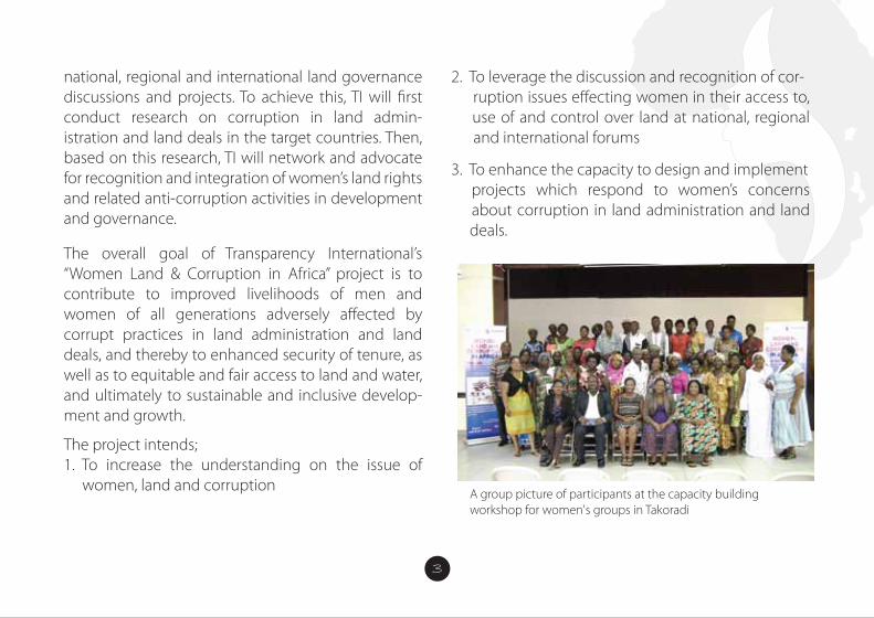
A group picture of participants at the capacity building workshop for women's groups in Takoradi
WOMEN LAND AND CORRUPTION IN AFRICA (WLCA) PROJECTThe WLCA project with funding support from Friends of Transparency International (TI) is a project being implemented by TI chapters in Zimbabwe, Ghana and Uganda and coordinated by TI Secretariat (TIS) in Berlin.
IntroductionIn Africa, a large portion of arable land is in tenure by small-scale farmers – often women. Vast areas of savannah and semi-desert land are in tenure by pastoralists and indigenous communities. Each land deal – whether transparent or opaque – deprives
customary land users of two of their most relevant resources: water and land. Unfortunately, the results are often poverty and hunger. Approximately one in �ve people around the world, report that they have paid a bribe for land services during the last year; in Africa, almost every second client of land adminis- tration services was a�ected. At the same time, land investors seem to speci�cally target countries with weak governance.
BackgroundThe main purpose of Transparency International’s (TI) “Women Land & Corruption in Africa” (WLCA) project is to link with other civil society organizations and institutions concerned with women, land govern- ance, and together, generate and share relevant data and information on corruption in the land sector, as well as its trends, nature, and existing strategies and mechanisms that are utilized to combat it. The project is aimed at understanding the issue of corruption as it impacts land rights of women in Sub-Saharan Africa, speci�cally Ghana, Uganda, and Zimbabwe, and bringing this issue to the top of the agenda of
national, regional and international land governance discussions and projects. To achieve this, TI will �rst conduct research on corruption in land admin- istration and land deals in the target countries. Then, based on this research, TI will network and advocate for recognition and integration of women’s land rights and related anti-corruption activities in development and governance.
The overall goal of Transparency International’s “Women Land & Corruption in Africa” project is to contribute to improved livelihoods of men and women of all generations adversely a�ected by corrupt practices in land administration and land deals, and thereby to enhanced security of tenure, as well as to equitable and fair access to land and water, and ultimately to sustainable and inclusive develop- ment and growth.
The project intends;1. To increase the understanding on the issue of women, land and corruption
2. To leverage the discussion and recognition of cor- ruption issues e�ecting women in their access to, use of and control over land at national, regional and international forums
3. To enhance the capacity to design and implement projects which respond to women’s concerns about corruption in land administration and land deals.
4
INTRODUCTIONLand is a valuable asset, which appreciates or inc- reases in term of price, as time goes on. It is therefore very important that, when you are able to acquire a land, it is registered appropriately and accordingly with the land agencies involved to avoid future land disputes and forfeiture.
In Ghana, recently, acquisition of land has become tiresome and very expensive, especially in elite areas of Accra. This gives more reason why it is vital that the land is registered as this would also give the owner full rights over the land and in its development as well as save the owner from litigation.
SOME OF THE LAWS GOVERNING LAND IN GHANA ARE:• Lands Commission Act • The administration of lands Act• Land title registration Act • Conveyancing Act• Constitution- Art 257-267• Land registry Act• State lands ActThe above laws, among others were enacted to control and guide the acquisition and use of land.
WHAT IS THE LANDS COMMISSION?The Lands Commission was established under Article 258 of the 1992 Constitution and the Lands Com- mission Act 767 of 2008 as a corporate body.
The reason for the establishment of this commission was to make sure that the acquisition and use of land was properly regulated so as to limit the problems associated with lands in Ghana.
FUNCTIONS OF THE COMMISSIONFor the purpose of achieving its objectives, the Commission shall;
(a) on behalf of the Government; manage public lands and any other lands vested in the President by the Constitution or by any other law and any lands vested in the Commission;
(b) advise the Government, local authorities and traditional authorities on the policy framework
for the development of particular areas of the country to ensure that the development of indi- vidual pieces of land is coordinated with the
(c) formulate and submit to Government recommen dations on national policy with respect to land use suitability or capability; (d) advise on, and assist in the execution of, a com- prehensive programme for the registration of title to land throughout the country;
(e) register deeds and instrument that a�ect land throughout the country;
(f) facilitate the acquisition of land on behalf of Government;
(g) establish standards for and regulate survey and mapping of the country;
(h) provide surveying and mapping services where necessary;
(t) license practitioners of cadastral survey;
(j) provide land and land related valuation services;
(k) ensure that through sound, sustainable land use planning, socio-economic activities are consistent with sound land use through sustainable land use planning in the long term national development goals;
(I) in collaboration with other bodies instill order and discipline into the land market through curbing the incidence of land encroachment, unapproved development schemes, multiple or illegal land sales, land speculation and other forms of land racketeering;
(m) in collaboration with other bodies minimize or eliminate, where possible, the sources of protracted land boundary disputes, con�icts and litigations in order to bring their associated economic costs and socio-political upheavals under control;
(n) promote community participation and public awareness at all levels in sustainable land management and development practices to ensure the highest and best use of land;
(0) promote research into all aspects of land ownership, tenure and the operations of the land market and the land development process;
(P) impose and collect levies, fees, charges for services rendered;
(q) establish and maintain a comprehensive land information system, and
(r) perform other functions the Minister may assign to it.
The current Lands Commission, as part of the public sector reform programmes and the Ghana Land Administration Project (LAP) has substantially been remodeled by the Act 767 to increase its efficiency and e�ectiveness.
As part of the reforms, four Land Sector Agencies; 1. The ‘Old Lands Commission,2. Land Valuation Board, 3. Land Title Registry and 4. Survey Department
Have been integrated into one Corporate Agency-
the ‘New Lands Commission’ which now comprises of four distinct Divisions.
The Divisions are:1. Survey and Mapping Division (SMD), and the 2. Land Registration Division (LRD).3. Land Valuation Division (LVD).4. Public and Vested Land Management Division (PVLMD)
Functions of the Survey and Mapping DivisionThe Survey and Mapping Division has the following functions:
(a) supervise, regulate and control the survey and demarcation of land for the purposes of land use and land registration;
(b) take custody of and preserve records that relate to the survey of any parcel of land;
(c) direct and supervise the conduct of trigono- metric, hydrograhic, topographic and engin- eering surveys;
(d) coordinate the preparation of plans from the data derived from survey and any amendment of the plans;
(e) coordinate the production of photo-grammetric surveys including aerial photography, ortho- photomapping, and remote sensing;
(f ) survey, map and maintain the national territorial boundaries including maritime boundaries;
(g) supervise and regulate operations that relate to survey of any parcel of land:
(h) develop and maintain the national geodetic (1) supervise, regulate, control and certify the production of maps; and
(j) other functions determined by the Commission.
Functions of the Land Registration DivisionThe functions of the Land Registration Division include
(a) publication of notices of registration upon receipt of an application for registration;
(b) registration of tide to land and other interests in land;
(c) registration of deeds and other instruments a�ecting land in areas outside compulsory title registration districts;
(d) maintaining land registers that contains records of land and other interests in land.
(e) other functions determined by the Commission.
Functions of the Land Valuation DivisionThe functions of the Land Valuation Division include
(a) assessing the compensation payable upon acquisition of land by the Government; (b) assessment of stamp duty;
(c) determining the values of properties rented, purchased, sold or leased by or to Government;
(d) preparation and maintenance of valuation list for rating purposes;
(e) valuation of interests in land or land related interests for the general public at a fee;
(f ) valuation of interests in land for the adminis- tration of estate duty; and
(g) other functions determined by the Commission
Functions of the Public and Vested Lands Management DivisionThe functions of the Public and Vested Lands Management Division include
(a) facilitating the acquisition of land for Government;
(b) managing state acquired and vested lands in conformity with approved land use plans; and
(c) other functions determined by the Commission.
To improve land service delivery and management, the Commission with support from the Land Administration Project has developed a strategy to re-engineer the Commissions’ Business Processes and Work�ow integration as part of the restructuring of the land sector to reduce process time, improve productivity and efficiency as well as to reduce the cost of land transactions.
Objectives of the Re-Engineering;• Improve the process of land registration• Reduce the turn-around time in registration• Reduce client interference in registration process• Automate the process Integrate re-engineered business processes • Reducing customer frustrations • Simplify payment of fees Eliminate/reduce duplication of work
• Apply technology in business processes • Improve working environment
Causes of Delays in Land Registration Process in GhanaThe causes of delays and frustrations in the Land Registration system in the country can be categorized into three (3) broad areas;1. Institutional2. Business Process3. Technological Challenges
Institutional DelaysInstitutional challenges have been a major setback in rendering quality land services to clients and the general public. Multiple access or channels of clients to services for instance makes it difficult for management to track transactions, it’s speed, the quality and �uidity of those services rendered. The office layout/architecture is also a challenge.
The scattered nature of the Commissions’ offices and operations inhibit the free �ow of services and slows the pace of service delivery. For instance, the Land Registration Division, Survey and Mapping Division
and the Land Valuation Division of the Commission are not co-located and make the work�ow very slow and challenging. Sta� supervision under such work environment is very challenging as well.
Another institutional challenge that causes the delays in the land registration process is inadequate public education on the requirements for land registration by the Lands Commission.
Duplication of e�ort or work has also been identi�ed as a major cause of delays in the land registration process. There are instances where site inspections will have to be carried out by LRD and SMD in the process of registration, but instead of the inspection being done on a single visit by the Divisions; the site inspection is done separately and at di�erent times and visits by the Divisions.
Institutional delays like; double preparations of site plans, delays in the issuance of tax clearance certificate, consent, official requests for search reports from LRD to PVLMD, declaration of multiple requests by SMD, and lack of information on status of applications by clients.
The manual system of operations in areas like records management and generations is an inhibition to quickening the pace of service delivery at the Commission. There is a gradual application of ICT through the automation of some of the Commission’s operations, even though they are inadequate and its pace needs to be accelerated.
Speci�c Interventions to Deal with the DelaysThe Lands Commission has decided to make the following external dependency requirements; like request for planning comments from TCPD, tax clearance certi�cate from Ghana Revenue Authority and consent from Traditional Authorities as precon-dition for submission of documents for registration. The e�ect of this intervention is that the time for obtaining planning comments and tax clearance certi�cates will no longer be considered within the registration period at the Lands Commission.
The multiple preparations of sites plans have also been done away with, since Site Plan preparations have been captured and made a pre-registration requirement. Site plans under the new system would
be prepared once; under quality control checks and used throughout the registration process.
The e�ect of this intervention on the process of land registration is that, the Land Registration Division of the Commission will no longer be required to write a letter to the Survey and Mapping Division to prepare Title plans which normally takes some three (3) months to be done.
On the issues of inadequate information on land registration requirements and fees structure, the Lands Commission has established a Communication and Public Outreach Unit to sensitize clients and the general public on the land registration requirements, fees and processes on the electronic and print media and through public outreaches.
The e�ect of this intervention will also reduce extortions from clients; ensure improved document preparation by clients before submission for processing at the Commission and thereby reducing the number of queried documents mid-way in the registration process.
Another intervention aimed at reducing the delays in the land registration process is the elimination of request for official searches mid-way in the registration process by the Land Registration Division. All searches or records of information on the land from all Divisions would be carried out at the early stages to ensure that the land or property meets the requirements for registration.
Thus, the Land Registration Division will no longer be required to write to the Public and Vested Land Management Division to request for official search report during the process of registration, taking o� two weeks of delay in the previous system.
The Lands Commission has also proposed the merger of the Cartographic and Records Units of the Land Registration and Survey and Mapping Divisions to eliminate the declaration of multiple requests during the plan preparation and approval process. This also o�sets three months of delay in the process of registration.
Under the new system, the Commission has initiated the process to establish a document tracking system to automatically inform and update clients on the status of their applications through text messages, thereby reducing the direct contact of the Commission sta� with clients and the interference of clients in the registration process.
The four Divisions of the Commission; LRD, SMD, LVD and PVLMD are to be co-located at the Cantonments office to improve communication, supervision and work�ow in terms of access to Divisional records.
The Commission has set up Wide and Local Area Network systems and employed the appropriate softwares to improve efficiency and information sharing in the areas of parcel or cadastral plan generation and document tracking.
GENERAL PROCEDURES IN ACQUIRING A LAND IN GHANANB: It is always advisable to follow due diligence to avoid being dragged into a never conclusive land disputes by ensuring that:
(a) You are dealing with the rightful owner of the land recognized by law-a quick official search will do in addition to neighborhood questionings and supporting documents from claimed owner. Do an original survey of the said parcel for the search to be sure the plan used for the search is for the exact land of interest.
(b) You engage the services of a quali�ed land surveyor. In Ghana, only licensed surveyors are permitted legally to undertake cadastral surveys.
1. Land Inspection:The investor must check the boundary corners of the land in question to verify the full extent of the land and be sure of the feasibility of the project to be used. This must be done by an expert and must be in the presence of the land owners as witnesses. Carrying out thorough checks about the land is important, as this will enable the future land owner gets to know if the land is available to be acquired. In this process, the
prospective land owner can also consider the services of a land lawyer to research the land and prove its availability; such as if it has already been sold out. Checks must also be done with other government land overseers, for example; the Tema Development Corporation (TDC), to ascertain if the land had been earmarked for any developmental projects. One would also be told if the land is not suitable, say if it is a water-logged area, and therefore, not advisable to be purchased.
2. Land Search: This is the most important stage. Here Surveyors go onto the land to pick and demarcate the land parcel. The result is taken to the lands commission to verify the true ownership of the. If the name that comes up is the same as your land owners, then you can carry on the process, if not quit or seek a legal advice.
3. Acquisition and Negotiation: After the availability and suitability of the land has been established, the interested buyer or lessee negotiates with the actual owner of the land for sales. It is important to be reminded that the
interested buyer must deal with the rightful owner of the land because the use of middlemen is not advisable. An agreement is reached and documentsmade to its e�ect.
4. Land Documentation: The investor can proceed with the documentations; normally after a quarter or part payment has been done. The land owners then prepare the documents which must include a true and certi�ed copy of Indenture and site plans. Three copies of the agreement documents would be needed for endorsement by a land lawyer, who will have to sign the back of each of the copies with his practicing stamp duly �xed. Each copy of the documents must have a site plan attached, together with two extra copies of site plans, all making 5 documents. The back of the site plan would also be needed to be endorsed by the owner and the buyer of the land; after which they (the site plans) are to be certi�ed by the stamps of a licensed surveyor and the regional surveyor with accurate date.
5. Witnesses:These are people who would testify to the proceedings so that in future whenever there is any case of challenge about ownership of the land, they would be called upon for assistance. It is therefore required that at least, 2 quali�ed persons from both parties – the seller and buyer sides must sign as witnesses. The two witnesses signing on behalf of the buyer or lessee must do so with their full names, addresses and original signatures.
6. Land Commission:After the endorsement of the documents, it is then sent to the land commission, together with processing fees for of processing and registration of the land to begin. After the processing is completed, the documents are released to the Land Valuation Board for stamping and certifying.
7. Internal Revenue Authority (IRS):The IRS sees to the taxes associated with the registration process. From the land valuation board, the processed documents are then released to the IRS for tax clearing of the land to be made. When
this is complete, the applicant, or buyer is given a tax clearance certi�cate. The documents are from here, taken back to the land commission for �nal registration at the deeds registry.
8. Land Title Certi�cation: From the deeds registry, the buyer is given an original copy of the land title document. Actually this can be done simultaneously with the projects inception since the land title certi�cation from the Land title registry of Ghana takes quite some time.
WHAT IS LAND REGISTRATION?Land Registration is the recording of rights and interest in land as evidence by instruments. Instruments or deeds that could be registered include leases, sub-leases, conveyances, assignments, mortgages, gifts, tenancy agreements probate and wills, letters of administration, vesting assets, statutory declarations, power of attorney etc. in relation to land.
WHAT ARE THE BENEFITS OF REGISTERING YOUR LAND• It ensures certainty of your ownership of the land
• It establishes your rights and interests in the land • It protects your rights and interests in the land, promoting security• It renders you documents admissible in court• It minimizes land litigation• It enables you access credit facilities• It enables you invest in the land• It enables you develop land market and many more
TYPES OF LAND OWNERSHIP IN GHANA:
1. INDIVIDUAL/PRIVATE LANDS: These are lands owned by individuals and private entities
2. STOOL/ SKIN LANDS: These are lands under the custodianship of various chiefs3. FAMILY LANDS: These are lands managed by Heads of families assisted by principal members of the families.
4. STATE AND STOOL VESTED LANDS: These are lands managed by the Lands Commission
WOMEN LAND AND CORRUPTION IN AFRICA (WLCA) PROJECTThe WLCA project with funding support from Friends of Transparency International (TI) is a project being implemented by TI chapters in Zimbabwe, Ghana and Uganda and coordinated by TI Secretariat (TIS) in Berlin.
IntroductionIn Africa, a large portion of arable land is in tenure by small-scale farmers – often women. Vast areas of savannah and semi-desert land are in tenure by pastoralists and indigenous communities. Each land deal – whether transparent or opaque – deprives
customary land users of two of their most relevant resources: water and land. Unfortunately, the results are often poverty and hunger. Approximately one in �ve people around the world, report that they have paid a bribe for land services during the last year; in Africa, almost every second client of land adminis- tration services was a�ected. At the same time, land investors seem to speci�cally target countries with weak governance.
BackgroundThe main purpose of Transparency International’s (TI) “Women Land & Corruption in Africa” (WLCA) project is to link with other civil society organizations and institutions concerned with women, land govern- ance, and together, generate and share relevant data and information on corruption in the land sector, as well as its trends, nature, and existing strategies and mechanisms that are utilized to combat it. The project is aimed at understanding the issue of corruption as it impacts land rights of women in Sub-Saharan Africa, speci�cally Ghana, Uganda, and Zimbabwe, and bringing this issue to the top of the agenda of
national, regional and international land governance discussions and projects. To achieve this, TI will �rst conduct research on corruption in land admin- istration and land deals in the target countries. Then, based on this research, TI will network and advocate for recognition and integration of women’s land rights and related anti-corruption activities in development and governance.
The overall goal of Transparency International’s “Women Land & Corruption in Africa” project is to contribute to improved livelihoods of men and women of all generations adversely a�ected by corrupt practices in land administration and land deals, and thereby to enhanced security of tenure, as well as to equitable and fair access to land and water, and ultimately to sustainable and inclusive develop- ment and growth.
The project intends;1. To increase the understanding on the issue of women, land and corruption
2. To leverage the discussion and recognition of cor- ruption issues e�ecting women in their access to, use of and control over land at national, regional and international forums
3. To enhance the capacity to design and implement projects which respond to women’s concerns about corruption in land administration and land deals.
INTRODUCTIONLand is a valuable asset, which appreciates or inc- reases in term of price, as time goes on. It is therefore very important that, when you are able to acquire a land, it is registered appropriately and accordingly with the land agencies involved to avoid future land disputes and forfeiture.
In Ghana, recently, acquisition of land has become tiresome and very expensive, especially in elite areas of Accra. This gives more reason why it is vital that the land is registered as this would also give the owner full rights over the land and in its development as well as save the owner from litigation.
SOME OF THE LAWS GOVERNING LAND IN GHANA ARE:• Lands Commission Act • The administration of lands Act• Land title registration Act • Conveyancing Act• Constitution- Art 257-267• Land registry Act• State lands ActThe above laws, among others were enacted to control and guide the acquisition and use of land.
WHAT IS THE LANDS COMMISSION?The Lands Commission was established under Article 258 of the 1992 Constitution and the Lands Com- mission Act 767 of 2008 as a corporate body.
The reason for the establishment of this commission was to make sure that the acquisition and use of land was properly regulated so as to limit the problems associated with lands in Ghana.
5
FUNCTIONS OF THE COMMISSIONFor the purpose of achieving its objectives, the Commission shall;
(a) on behalf of the Government; manage public lands and any other lands vested in the President by the Constitution or by any other law and any lands vested in the Commission;
(b) advise the Government, local authorities and traditional authorities on the policy framework
for the development of particular areas of the country to ensure that the development of indi- vidual pieces of land is coordinated with the
(c) formulate and submit to Government recommen dations on national policy with respect to land use suitability or capability; (d) advise on, and assist in the execution of, a com- prehensive programme for the registration of title to land throughout the country;
(e) register deeds and instrument that a�ect land throughout the country;
(f) facilitate the acquisition of land on behalf of Government;
(g) establish standards for and regulate survey and mapping of the country;
(h) provide surveying and mapping services where necessary;
(t) license practitioners of cadastral survey;
(j) provide land and land related valuation services;
(k) ensure that through sound, sustainable land use planning, socio-economic activities are consistent with sound land use through sustainable land use planning in the long term national development goals;
(I) in collaboration with other bodies instill order and discipline into the land market through curbing the incidence of land encroachment, unapproved development schemes, multiple or illegal land sales, land speculation and other forms of land racketeering;
(m) in collaboration with other bodies minimize or eliminate, where possible, the sources of protracted land boundary disputes, con�icts and litigations in order to bring their associated economic costs and socio-political upheavals under control;
(n) promote community participation and public awareness at all levels in sustainable land management and development practices to ensure the highest and best use of land;
(0) promote research into all aspects of land ownership, tenure and the operations of the land market and the land development process;
(P) impose and collect levies, fees, charges for services rendered;
(q) establish and maintain a comprehensive land information system, and
(r) perform other functions the Minister may assign to it.
The current Lands Commission, as part of the public sector reform programmes and the Ghana Land Administration Project (LAP) has substantially been remodeled by the Act 767 to increase its efficiency and e�ectiveness.
As part of the reforms, four Land Sector Agencies; 1. The ‘Old Lands Commission,2. Land Valuation Board, 3. Land Title Registry and 4. Survey Department
Have been integrated into one Corporate Agency-
the ‘New Lands Commission’ which now comprises of four distinct Divisions.
The Divisions are:1. Survey and Mapping Division (SMD), and the 2. Land Registration Division (LRD).3. Land Valuation Division (LVD).4. Public and Vested Land Management Division (PVLMD)
Functions of the Survey and Mapping DivisionThe Survey and Mapping Division has the following functions:
(a) supervise, regulate and control the survey and demarcation of land for the purposes of land use and land registration;
(b) take custody of and preserve records that relate to the survey of any parcel of land;
(c) direct and supervise the conduct of trigono- metric, hydrograhic, topographic and engin- eering surveys;
(d) coordinate the preparation of plans from the data derived from survey and any amendment of the plans;
(e) coordinate the production of photo-grammetric surveys including aerial photography, ortho- photomapping, and remote sensing;
(f ) survey, map and maintain the national territorial boundaries including maritime boundaries;
(g) supervise and regulate operations that relate to survey of any parcel of land:
(h) develop and maintain the national geodetic (1) supervise, regulate, control and certify the production of maps; and
(j) other functions determined by the Commission.
Functions of the Land Registration DivisionThe functions of the Land Registration Division include
(a) publication of notices of registration upon receipt of an application for registration;
(b) registration of tide to land and other interests in land;
(c) registration of deeds and other instruments a�ecting land in areas outside compulsory title registration districts;
(d) maintaining land registers that contains records of land and other interests in land.
(e) other functions determined by the Commission.
Functions of the Land Valuation DivisionThe functions of the Land Valuation Division include
(a) assessing the compensation payable upon acquisition of land by the Government; (b) assessment of stamp duty;
(c) determining the values of properties rented, purchased, sold or leased by or to Government;
(d) preparation and maintenance of valuation list for rating purposes;
(e) valuation of interests in land or land related interests for the general public at a fee;
(f ) valuation of interests in land for the adminis- tration of estate duty; and
(g) other functions determined by the Commission
Functions of the Public and Vested Lands Management DivisionThe functions of the Public and Vested Lands Management Division include
(a) facilitating the acquisition of land for Government;
(b) managing state acquired and vested lands in conformity with approved land use plans; and
(c) other functions determined by the Commission.
To improve land service delivery and management, the Commission with support from the Land Administration Project has developed a strategy to re-engineer the Commissions’ Business Processes and Work�ow integration as part of the restructuring of the land sector to reduce process time, improve productivity and efficiency as well as to reduce the cost of land transactions.
Objectives of the Re-Engineering;• Improve the process of land registration• Reduce the turn-around time in registration• Reduce client interference in registration process• Automate the process Integrate re-engineered business processes • Reducing customer frustrations • Simplify payment of fees Eliminate/reduce duplication of work
• Apply technology in business processes • Improve working environment
Causes of Delays in Land Registration Process in GhanaThe causes of delays and frustrations in the Land Registration system in the country can be categorized into three (3) broad areas;1. Institutional2. Business Process3. Technological Challenges
Institutional DelaysInstitutional challenges have been a major setback in rendering quality land services to clients and the general public. Multiple access or channels of clients to services for instance makes it difficult for management to track transactions, it’s speed, the quality and �uidity of those services rendered. The office layout/architecture is also a challenge.
The scattered nature of the Commissions’ offices and operations inhibit the free �ow of services and slows the pace of service delivery. For instance, the Land Registration Division, Survey and Mapping Division
and the Land Valuation Division of the Commission are not co-located and make the work�ow very slow and challenging. Sta� supervision under such work environment is very challenging as well.
Another institutional challenge that causes the delays in the land registration process is inadequate public education on the requirements for land registration by the Lands Commission.
Duplication of e�ort or work has also been identi�ed as a major cause of delays in the land registration process. There are instances where site inspections will have to be carried out by LRD and SMD in the process of registration, but instead of the inspection being done on a single visit by the Divisions; the site inspection is done separately and at di�erent times and visits by the Divisions.
Institutional delays like; double preparations of site plans, delays in the issuance of tax clearance certificate, consent, official requests for search reports from LRD to PVLMD, declaration of multiple requests by SMD, and lack of information on status of applications by clients.
The manual system of operations in areas like records management and generations is an inhibition to quickening the pace of service delivery at the Commission. There is a gradual application of ICT through the automation of some of the Commission’s operations, even though they are inadequate and its pace needs to be accelerated.
Speci�c Interventions to Deal with the DelaysThe Lands Commission has decided to make the following external dependency requirements; like request for planning comments from TCPD, tax clearance certi�cate from Ghana Revenue Authority and consent from Traditional Authorities as precon-dition for submission of documents for registration. The e�ect of this intervention is that the time for obtaining planning comments and tax clearance certi�cates will no longer be considered within the registration period at the Lands Commission.
The multiple preparations of sites plans have also been done away with, since Site Plan preparations have been captured and made a pre-registration requirement. Site plans under the new system would
be prepared once; under quality control checks and used throughout the registration process.
The e�ect of this intervention on the process of land registration is that, the Land Registration Division of the Commission will no longer be required to write a letter to the Survey and Mapping Division to prepare Title plans which normally takes some three (3) months to be done.
On the issues of inadequate information on land registration requirements and fees structure, the Lands Commission has established a Communication and Public Outreach Unit to sensitize clients and the general public on the land registration requirements, fees and processes on the electronic and print media and through public outreaches.
The e�ect of this intervention will also reduce extortions from clients; ensure improved document preparation by clients before submission for processing at the Commission and thereby reducing the number of queried documents mid-way in the registration process.
Another intervention aimed at reducing the delays in the land registration process is the elimination of request for official searches mid-way in the registration process by the Land Registration Division. All searches or records of information on the land from all Divisions would be carried out at the early stages to ensure that the land or property meets the requirements for registration.
Thus, the Land Registration Division will no longer be required to write to the Public and Vested Land Management Division to request for official search report during the process of registration, taking o� two weeks of delay in the previous system.
The Lands Commission has also proposed the merger of the Cartographic and Records Units of the Land Registration and Survey and Mapping Divisions to eliminate the declaration of multiple requests during the plan preparation and approval process. This also o�sets three months of delay in the process of registration.
Under the new system, the Commission has initiated the process to establish a document tracking system to automatically inform and update clients on the status of their applications through text messages, thereby reducing the direct contact of the Commission sta� with clients and the interference of clients in the registration process.
The four Divisions of the Commission; LRD, SMD, LVD and PVLMD are to be co-located at the Cantonments office to improve communication, supervision and work�ow in terms of access to Divisional records.
The Commission has set up Wide and Local Area Network systems and employed the appropriate softwares to improve efficiency and information sharing in the areas of parcel or cadastral plan generation and document tracking.
GENERAL PROCEDURES IN ACQUIRING A LAND IN GHANANB: It is always advisable to follow due diligence to avoid being dragged into a never conclusive land disputes by ensuring that:
(a) You are dealing with the rightful owner of the land recognized by law-a quick official search will do in addition to neighborhood questionings and supporting documents from claimed owner. Do an original survey of the said parcel for the search to be sure the plan used for the search is for the exact land of interest.
(b) You engage the services of a quali�ed land surveyor. In Ghana, only licensed surveyors are permitted legally to undertake cadastral surveys.
1. Land Inspection:The investor must check the boundary corners of the land in question to verify the full extent of the land and be sure of the feasibility of the project to be used. This must be done by an expert and must be in the presence of the land owners as witnesses. Carrying out thorough checks about the land is important, as this will enable the future land owner gets to know if the land is available to be acquired. In this process, the
prospective land owner can also consider the services of a land lawyer to research the land and prove its availability; such as if it has already been sold out. Checks must also be done with other government land overseers, for example; the Tema Development Corporation (TDC), to ascertain if the land had been earmarked for any developmental projects. One would also be told if the land is not suitable, say if it is a water-logged area, and therefore, not advisable to be purchased.
2. Land Search: This is the most important stage. Here Surveyors go onto the land to pick and demarcate the land parcel. The result is taken to the lands commission to verify the true ownership of the. If the name that comes up is the same as your land owners, then you can carry on the process, if not quit or seek a legal advice.
3. Acquisition and Negotiation: After the availability and suitability of the land has been established, the interested buyer or lessee negotiates with the actual owner of the land for sales. It is important to be reminded that the
interested buyer must deal with the rightful owner of the land because the use of middlemen is not advisable. An agreement is reached and documentsmade to its e�ect.
4. Land Documentation: The investor can proceed with the documentations; normally after a quarter or part payment has been done. The land owners then prepare the documents which must include a true and certi�ed copy of Indenture and site plans. Three copies of the agreement documents would be needed for endorsement by a land lawyer, who will have to sign the back of each of the copies with his practicing stamp duly �xed. Each copy of the documents must have a site plan attached, together with two extra copies of site plans, all making 5 documents. The back of the site plan would also be needed to be endorsed by the owner and the buyer of the land; after which they (the site plans) are to be certi�ed by the stamps of a licensed surveyor and the regional surveyor with accurate date.
5. Witnesses:These are people who would testify to the proceedings so that in future whenever there is any case of challenge about ownership of the land, they would be called upon for assistance. It is therefore required that at least, 2 quali�ed persons from both parties – the seller and buyer sides must sign as witnesses. The two witnesses signing on behalf of the buyer or lessee must do so with their full names, addresses and original signatures.
6. Land Commission:After the endorsement of the documents, it is then sent to the land commission, together with processing fees for of processing and registration of the land to begin. After the processing is completed, the documents are released to the Land Valuation Board for stamping and certifying.
7. Internal Revenue Authority (IRS):The IRS sees to the taxes associated with the registration process. From the land valuation board, the processed documents are then released to the IRS for tax clearing of the land to be made. When
this is complete, the applicant, or buyer is given a tax clearance certi�cate. The documents are from here, taken back to the land commission for �nal registration at the deeds registry.
8. Land Title Certi�cation: From the deeds registry, the buyer is given an original copy of the land title document. Actually this can be done simultaneously with the projects inception since the land title certi�cation from the Land title registry of Ghana takes quite some time.
WHAT IS LAND REGISTRATION?Land Registration is the recording of rights and interest in land as evidence by instruments. Instruments or deeds that could be registered include leases, sub-leases, conveyances, assignments, mortgages, gifts, tenancy agreements probate and wills, letters of administration, vesting assets, statutory declarations, power of attorney etc. in relation to land.
WHAT ARE THE BENEFITS OF REGISTERING YOUR LAND• It ensures certainty of your ownership of the land
• It establishes your rights and interests in the land • It protects your rights and interests in the land, promoting security• It renders you documents admissible in court• It minimizes land litigation• It enables you access credit facilities• It enables you invest in the land• It enables you develop land market and many more
TYPES OF LAND OWNERSHIP IN GHANA:
1. INDIVIDUAL/PRIVATE LANDS: These are lands owned by individuals and private entities
2. STOOL/ SKIN LANDS: These are lands under the custodianship of various chiefs3. FAMILY LANDS: These are lands managed by Heads of families assisted by principal members of the families.
4. STATE AND STOOL VESTED LANDS: These are lands managed by the Lands Commission
Group work session at the Risk Assessment training programme for GII sta� and CICOL members in Accra
WOMEN LAND AND CORRUPTION IN AFRICA (WLCA) PROJECTThe WLCA project with funding support from Friends of Transparency International (TI) is a project being implemented by TI chapters in Zimbabwe, Ghana and Uganda and coordinated by TI Secretariat (TIS) in Berlin.
IntroductionIn Africa, a large portion of arable land is in tenure by small-scale farmers – often women. Vast areas of savannah and semi-desert land are in tenure by pastoralists and indigenous communities. Each land deal – whether transparent or opaque – deprives
customary land users of two of their most relevant resources: water and land. Unfortunately, the results are often poverty and hunger. Approximately one in �ve people around the world, report that they have paid a bribe for land services during the last year; in Africa, almost every second client of land adminis- tration services was a�ected. At the same time, land investors seem to speci�cally target countries with weak governance.
BackgroundThe main purpose of Transparency International’s (TI) “Women Land & Corruption in Africa” (WLCA) project is to link with other civil society organizations and institutions concerned with women, land govern- ance, and together, generate and share relevant data and information on corruption in the land sector, as well as its trends, nature, and existing strategies and mechanisms that are utilized to combat it. The project is aimed at understanding the issue of corruption as it impacts land rights of women in Sub-Saharan Africa, speci�cally Ghana, Uganda, and Zimbabwe, and bringing this issue to the top of the agenda of
national, regional and international land governance discussions and projects. To achieve this, TI will �rst conduct research on corruption in land admin- istration and land deals in the target countries. Then, based on this research, TI will network and advocate for recognition and integration of women’s land rights and related anti-corruption activities in development and governance.
The overall goal of Transparency International’s “Women Land & Corruption in Africa” project is to contribute to improved livelihoods of men and women of all generations adversely a�ected by corrupt practices in land administration and land deals, and thereby to enhanced security of tenure, as well as to equitable and fair access to land and water, and ultimately to sustainable and inclusive develop- ment and growth.
The project intends;1. To increase the understanding on the issue of women, land and corruption
2. To leverage the discussion and recognition of cor- ruption issues e�ecting women in their access to, use of and control over land at national, regional and international forums
3. To enhance the capacity to design and implement projects which respond to women’s concerns about corruption in land administration and land deals.
INTRODUCTIONLand is a valuable asset, which appreciates or inc- reases in term of price, as time goes on. It is therefore very important that, when you are able to acquire a land, it is registered appropriately and accordingly with the land agencies involved to avoid future land disputes and forfeiture.
In Ghana, recently, acquisition of land has become tiresome and very expensive, especially in elite areas of Accra. This gives more reason why it is vital that the land is registered as this would also give the owner full rights over the land and in its development as well as save the owner from litigation.
SOME OF THE LAWS GOVERNING LAND IN GHANA ARE:• Lands Commission Act • The administration of lands Act• Land title registration Act • Conveyancing Act• Constitution- Art 257-267• Land registry Act• State lands ActThe above laws, among others were enacted to control and guide the acquisition and use of land.
WHAT IS THE LANDS COMMISSION?The Lands Commission was established under Article 258 of the 1992 Constitution and the Lands Com- mission Act 767 of 2008 as a corporate body.
The reason for the establishment of this commission was to make sure that the acquisition and use of land was properly regulated so as to limit the problems associated with lands in Ghana.
FUNCTIONS OF THE COMMISSIONFor the purpose of achieving its objectives, the Commission shall;
(a) on behalf of the Government; manage public lands and any other lands vested in the President by the Constitution or by any other law and any lands vested in the Commission;
(b) advise the Government, local authorities and traditional authorities on the policy framework
for the development of particular areas of the country to ensure that the development of indi- vidual pieces of land is coordinated with the
(c) formulate and submit to Government recommen dations on national policy with respect to land use suitability or capability; (d) advise on, and assist in the execution of, a com- prehensive programme for the registration of title to land throughout the country;
(e) register deeds and instrument that a�ect land throughout the country;
(f) facilitate the acquisition of land on behalf of Government;
(g) establish standards for and regulate survey and mapping of the country;
(h) provide surveying and mapping services where necessary;
(t) license practitioners of cadastral survey;
(j) provide land and land related valuation services;
6
(k) ensure that through sound, sustainable land use planning, socio-economic activities are consistent with sound land use through sustainable land use planning in the long term national development goals;
(I) in collaboration with other bodies instill order and discipline into the land market through curbing the incidence of land encroachment, unapproved development schemes, multiple or illegal land sales, land speculation and other forms of land racketeering;
(m) in collaboration with other bodies minimize or eliminate, where possible, the sources of protracted land boundary disputes, con�icts and litigations in order to bring their associated economic costs and socio-political upheavals under control;
(n) promote community participation and public awareness at all levels in sustainable land management and development practices to ensure the highest and best use of land;
(0) promote research into all aspects of land ownership, tenure and the operations of the land market and the land development process;
(P) impose and collect levies, fees, charges for services rendered;
(q) establish and maintain a comprehensive land information system, and
(r) perform other functions the Minister may assign to it.
The current Lands Commission, as part of the public sector reform programmes and the Ghana Land Administration Project (LAP) has substantially been remodeled by the Act 767 to increase its efficiency and e�ectiveness.
As part of the reforms, four Land Sector Agencies; 1. The ‘Old Lands Commission,2. Land Valuation Board, 3. Land Title Registry and 4. Survey Department
Have been integrated into one Corporate Agency-
the ‘New Lands Commission’ which now comprises of four distinct Divisions.
The Divisions are:1. Survey and Mapping Division (SMD), and the 2. Land Registration Division (LRD).3. Land Valuation Division (LVD).4. Public and Vested Land Management Division (PVLMD)
Functions of the Survey and Mapping DivisionThe Survey and Mapping Division has the following functions:
(a) supervise, regulate and control the survey and demarcation of land for the purposes of land use and land registration;
(b) take custody of and preserve records that relate to the survey of any parcel of land;
(c) direct and supervise the conduct of trigono- metric, hydrograhic, topographic and engin- eering surveys;
(d) coordinate the preparation of plans from the data derived from survey and any amendment of the plans;
(e) coordinate the production of photo-grammetric surveys including aerial photography, ortho- photomapping, and remote sensing;
(f ) survey, map and maintain the national territorial boundaries including maritime boundaries;
(g) supervise and regulate operations that relate to survey of any parcel of land:
(h) develop and maintain the national geodetic (1) supervise, regulate, control and certify the production of maps; and
(j) other functions determined by the Commission.
Functions of the Land Registration DivisionThe functions of the Land Registration Division include
(a) publication of notices of registration upon receipt of an application for registration;
(b) registration of tide to land and other interests in land;
(c) registration of deeds and other instruments a�ecting land in areas outside compulsory title registration districts;
(d) maintaining land registers that contains records of land and other interests in land.
(e) other functions determined by the Commission.
Functions of the Land Valuation DivisionThe functions of the Land Valuation Division include
(a) assessing the compensation payable upon acquisition of land by the Government; (b) assessment of stamp duty;
(c) determining the values of properties rented, purchased, sold or leased by or to Government;
(d) preparation and maintenance of valuation list for rating purposes;
(e) valuation of interests in land or land related interests for the general public at a fee;
(f ) valuation of interests in land for the adminis- tration of estate duty; and
(g) other functions determined by the Commission
Functions of the Public and Vested Lands Management DivisionThe functions of the Public and Vested Lands Management Division include
(a) facilitating the acquisition of land for Government;
(b) managing state acquired and vested lands in conformity with approved land use plans; and
(c) other functions determined by the Commission.
To improve land service delivery and management, the Commission with support from the Land Administration Project has developed a strategy to re-engineer the Commissions’ Business Processes and Work�ow integration as part of the restructuring of the land sector to reduce process time, improve productivity and efficiency as well as to reduce the cost of land transactions.
Objectives of the Re-Engineering;• Improve the process of land registration• Reduce the turn-around time in registration• Reduce client interference in registration process• Automate the process Integrate re-engineered business processes • Reducing customer frustrations • Simplify payment of fees Eliminate/reduce duplication of work
• Apply technology in business processes • Improve working environment
Causes of Delays in Land Registration Process in GhanaThe causes of delays and frustrations in the Land Registration system in the country can be categorized into three (3) broad areas;1. Institutional2. Business Process3. Technological Challenges
Institutional DelaysInstitutional challenges have been a major setback in rendering quality land services to clients and the general public. Multiple access or channels of clients to services for instance makes it difficult for management to track transactions, it’s speed, the quality and �uidity of those services rendered. The office layout/architecture is also a challenge.
The scattered nature of the Commissions’ offices and operations inhibit the free �ow of services and slows the pace of service delivery. For instance, the Land Registration Division, Survey and Mapping Division
and the Land Valuation Division of the Commission are not co-located and make the work�ow very slow and challenging. Sta� supervision under such work environment is very challenging as well.
Another institutional challenge that causes the delays in the land registration process is inadequate public education on the requirements for land registration by the Lands Commission.
Duplication of e�ort or work has also been identi�ed as a major cause of delays in the land registration process. There are instances where site inspections will have to be carried out by LRD and SMD in the process of registration, but instead of the inspection being done on a single visit by the Divisions; the site inspection is done separately and at di�erent times and visits by the Divisions.
Institutional delays like; double preparations of site plans, delays in the issuance of tax clearance certificate, consent, official requests for search reports from LRD to PVLMD, declaration of multiple requests by SMD, and lack of information on status of applications by clients.
The manual system of operations in areas like records management and generations is an inhibition to quickening the pace of service delivery at the Commission. There is a gradual application of ICT through the automation of some of the Commission’s operations, even though they are inadequate and its pace needs to be accelerated.
Speci�c Interventions to Deal with the DelaysThe Lands Commission has decided to make the following external dependency requirements; like request for planning comments from TCPD, tax clearance certi�cate from Ghana Revenue Authority and consent from Traditional Authorities as precon-dition for submission of documents for registration. The e�ect of this intervention is that the time for obtaining planning comments and tax clearance certi�cates will no longer be considered within the registration period at the Lands Commission.
The multiple preparations of sites plans have also been done away with, since Site Plan preparations have been captured and made a pre-registration requirement. Site plans under the new system would
be prepared once; under quality control checks and used throughout the registration process.
The e�ect of this intervention on the process of land registration is that, the Land Registration Division of the Commission will no longer be required to write a letter to the Survey and Mapping Division to prepare Title plans which normally takes some three (3) months to be done.
On the issues of inadequate information on land registration requirements and fees structure, the Lands Commission has established a Communication and Public Outreach Unit to sensitize clients and the general public on the land registration requirements, fees and processes on the electronic and print media and through public outreaches.
The e�ect of this intervention will also reduce extortions from clients; ensure improved document preparation by clients before submission for processing at the Commission and thereby reducing the number of queried documents mid-way in the registration process.
Another intervention aimed at reducing the delays in the land registration process is the elimination of request for official searches mid-way in the registration process by the Land Registration Division. All searches or records of information on the land from all Divisions would be carried out at the early stages to ensure that the land or property meets the requirements for registration.
Thus, the Land Registration Division will no longer be required to write to the Public and Vested Land Management Division to request for official search report during the process of registration, taking o� two weeks of delay in the previous system.
The Lands Commission has also proposed the merger of the Cartographic and Records Units of the Land Registration and Survey and Mapping Divisions to eliminate the declaration of multiple requests during the plan preparation and approval process. This also o�sets three months of delay in the process of registration.
Under the new system, the Commission has initiated the process to establish a document tracking system to automatically inform and update clients on the status of their applications through text messages, thereby reducing the direct contact of the Commission sta� with clients and the interference of clients in the registration process.
The four Divisions of the Commission; LRD, SMD, LVD and PVLMD are to be co-located at the Cantonments office to improve communication, supervision and work�ow in terms of access to Divisional records.
The Commission has set up Wide and Local Area Network systems and employed the appropriate softwares to improve efficiency and information sharing in the areas of parcel or cadastral plan generation and document tracking.
GENERAL PROCEDURES IN ACQUIRING A LAND IN GHANANB: It is always advisable to follow due diligence to avoid being dragged into a never conclusive land disputes by ensuring that:
(a) You are dealing with the rightful owner of the land recognized by law-a quick official search will do in addition to neighborhood questionings and supporting documents from claimed owner. Do an original survey of the said parcel for the search to be sure the plan used for the search is for the exact land of interest.
(b) You engage the services of a quali�ed land surveyor. In Ghana, only licensed surveyors are permitted legally to undertake cadastral surveys.
1. Land Inspection:The investor must check the boundary corners of the land in question to verify the full extent of the land and be sure of the feasibility of the project to be used. This must be done by an expert and must be in the presence of the land owners as witnesses. Carrying out thorough checks about the land is important, as this will enable the future land owner gets to know if the land is available to be acquired. In this process, the
prospective land owner can also consider the services of a land lawyer to research the land and prove its availability; such as if it has already been sold out. Checks must also be done with other government land overseers, for example; the Tema Development Corporation (TDC), to ascertain if the land had been earmarked for any developmental projects. One would also be told if the land is not suitable, say if it is a water-logged area, and therefore, not advisable to be purchased.
2. Land Search: This is the most important stage. Here Surveyors go onto the land to pick and demarcate the land parcel. The result is taken to the lands commission to verify the true ownership of the. If the name that comes up is the same as your land owners, then you can carry on the process, if not quit or seek a legal advice.
3. Acquisition and Negotiation: After the availability and suitability of the land has been established, the interested buyer or lessee negotiates with the actual owner of the land for sales. It is important to be reminded that the
interested buyer must deal with the rightful owner of the land because the use of middlemen is not advisable. An agreement is reached and documentsmade to its e�ect.
4. Land Documentation: The investor can proceed with the documentations; normally after a quarter or part payment has been done. The land owners then prepare the documents which must include a true and certi�ed copy of Indenture and site plans. Three copies of the agreement documents would be needed for endorsement by a land lawyer, who will have to sign the back of each of the copies with his practicing stamp duly �xed. Each copy of the documents must have a site plan attached, together with two extra copies of site plans, all making 5 documents. The back of the site plan would also be needed to be endorsed by the owner and the buyer of the land; after which they (the site plans) are to be certi�ed by the stamps of a licensed surveyor and the regional surveyor with accurate date.
5. Witnesses:These are people who would testify to the proceedings so that in future whenever there is any case of challenge about ownership of the land, they would be called upon for assistance. It is therefore required that at least, 2 quali�ed persons from both parties – the seller and buyer sides must sign as witnesses. The two witnesses signing on behalf of the buyer or lessee must do so with their full names, addresses and original signatures.
6. Land Commission:After the endorsement of the documents, it is then sent to the land commission, together with processing fees for of processing and registration of the land to begin. After the processing is completed, the documents are released to the Land Valuation Board for stamping and certifying.
7. Internal Revenue Authority (IRS):The IRS sees to the taxes associated with the registration process. From the land valuation board, the processed documents are then released to the IRS for tax clearing of the land to be made. When
this is complete, the applicant, or buyer is given a tax clearance certi�cate. The documents are from here, taken back to the land commission for �nal registration at the deeds registry.
8. Land Title Certi�cation: From the deeds registry, the buyer is given an original copy of the land title document. Actually this can be done simultaneously with the projects inception since the land title certi�cation from the Land title registry of Ghana takes quite some time.
WHAT IS LAND REGISTRATION?Land Registration is the recording of rights and interest in land as evidence by instruments. Instruments or deeds that could be registered include leases, sub-leases, conveyances, assignments, mortgages, gifts, tenancy agreements probate and wills, letters of administration, vesting assets, statutory declarations, power of attorney etc. in relation to land.
WHAT ARE THE BENEFITS OF REGISTERING YOUR LAND• It ensures certainty of your ownership of the land
• It establishes your rights and interests in the land • It protects your rights and interests in the land, promoting security• It renders you documents admissible in court• It minimizes land litigation• It enables you access credit facilities• It enables you invest in the land• It enables you develop land market and many more
TYPES OF LAND OWNERSHIP IN GHANA:
1. INDIVIDUAL/PRIVATE LANDS: These are lands owned by individuals and private entities
2. STOOL/ SKIN LANDS: These are lands under the custodianship of various chiefs3. FAMILY LANDS: These are lands managed by Heads of families assisted by principal members of the families.
4. STATE AND STOOL VESTED LANDS: These are lands managed by the Lands Commission
WOMEN LAND AND CORRUPTION IN AFRICA (WLCA) PROJECTThe WLCA project with funding support from Friends of Transparency International (TI) is a project being implemented by TI chapters in Zimbabwe, Ghana and Uganda and coordinated by TI Secretariat (TIS) in Berlin.
IntroductionIn Africa, a large portion of arable land is in tenure by small-scale farmers – often women. Vast areas of savannah and semi-desert land are in tenure by pastoralists and indigenous communities. Each land deal – whether transparent or opaque – deprives
customary land users of two of their most relevant resources: water and land. Unfortunately, the results are often poverty and hunger. Approximately one in �ve people around the world, report that they have paid a bribe for land services during the last year; in Africa, almost every second client of land adminis- tration services was a�ected. At the same time, land investors seem to speci�cally target countries with weak governance.
BackgroundThe main purpose of Transparency International’s (TI) “Women Land & Corruption in Africa” (WLCA) project is to link with other civil society organizations and institutions concerned with women, land govern- ance, and together, generate and share relevant data and information on corruption in the land sector, as well as its trends, nature, and existing strategies and mechanisms that are utilized to combat it. The project is aimed at understanding the issue of corruption as it impacts land rights of women in Sub-Saharan Africa, speci�cally Ghana, Uganda, and Zimbabwe, and bringing this issue to the top of the agenda of
national, regional and international land governance discussions and projects. To achieve this, TI will �rst conduct research on corruption in land admin- istration and land deals in the target countries. Then, based on this research, TI will network and advocate for recognition and integration of women’s land rights and related anti-corruption activities in development and governance.
The overall goal of Transparency International’s “Women Land & Corruption in Africa” project is to contribute to improved livelihoods of men and women of all generations adversely a�ected by corrupt practices in land administration and land deals, and thereby to enhanced security of tenure, as well as to equitable and fair access to land and water, and ultimately to sustainable and inclusive develop- ment and growth.
The project intends;1. To increase the understanding on the issue of women, land and corruption
2. To leverage the discussion and recognition of cor- ruption issues e�ecting women in their access to, use of and control over land at national, regional and international forums
3. To enhance the capacity to design and implement projects which respond to women’s concerns about corruption in land administration and land deals.
INTRODUCTIONLand is a valuable asset, which appreciates or inc- reases in term of price, as time goes on. It is therefore very important that, when you are able to acquire a land, it is registered appropriately and accordingly with the land agencies involved to avoid future land disputes and forfeiture.
In Ghana, recently, acquisition of land has become tiresome and very expensive, especially in elite areas of Accra. This gives more reason why it is vital that the land is registered as this would also give the owner full rights over the land and in its development as well as save the owner from litigation.
SOME OF THE LAWS GOVERNING LAND IN GHANA ARE:• Lands Commission Act • The administration of lands Act• Land title registration Act • Conveyancing Act• Constitution- Art 257-267• Land registry Act• State lands ActThe above laws, among others were enacted to control and guide the acquisition and use of land.
WHAT IS THE LANDS COMMISSION?The Lands Commission was established under Article 258 of the 1992 Constitution and the Lands Com- mission Act 767 of 2008 as a corporate body.
The reason for the establishment of this commission was to make sure that the acquisition and use of land was properly regulated so as to limit the problems associated with lands in Ghana.
FUNCTIONS OF THE COMMISSIONFor the purpose of achieving its objectives, the Commission shall;
(a) on behalf of the Government; manage public lands and any other lands vested in the President by the Constitution or by any other law and any lands vested in the Commission;
(b) advise the Government, local authorities and traditional authorities on the policy framework
for the development of particular areas of the country to ensure that the development of indi- vidual pieces of land is coordinated with the
(c) formulate and submit to Government recommen dations on national policy with respect to land use suitability or capability; (d) advise on, and assist in the execution of, a com- prehensive programme for the registration of title to land throughout the country;
(e) register deeds and instrument that a�ect land throughout the country;
(f) facilitate the acquisition of land on behalf of Government;
(g) establish standards for and regulate survey and mapping of the country;
(h) provide surveying and mapping services where necessary;
(t) license practitioners of cadastral survey;
(j) provide land and land related valuation services;
(k) ensure that through sound, sustainable land use planning, socio-economic activities are consistent with sound land use through sustainable land use planning in the long term national development goals;
(I) in collaboration with other bodies instill order and discipline into the land market through curbing the incidence of land encroachment, unapproved development schemes, multiple or illegal land sales, land speculation and other forms of land racketeering;
(m) in collaboration with other bodies minimize or eliminate, where possible, the sources of protracted land boundary disputes, con�icts and litigations in order to bring their associated economic costs and socio-political upheavals under control;
(n) promote community participation and public awareness at all levels in sustainable land management and development practices to ensure the highest and best use of land;
(0) promote research into all aspects of land ownership, tenure and the operations of the land market and the land development process;
(P) impose and collect levies, fees, charges for services rendered;
(q) establish and maintain a comprehensive land information system, and
(r) perform other functions the Minister may assign to it.
The current Lands Commission, as part of the public sector reform programmes and the Ghana Land Administration Project (LAP) has substantially been remodeled by the Act 767 to increase its efficiency and e�ectiveness.
As part of the reforms, four Land Sector Agencies; 1. The ‘Old Lands Commission,2. Land Valuation Board, 3. Land Title Registry and 4. Survey Department
Have been integrated into one Corporate Agency-
7
the ‘New Lands Commission’ which now comprises of four distinct Divisions.
The Divisions are:1. Survey and Mapping Division (SMD), and the 2. Land Registration Division (LRD).3. Land Valuation Division (LVD).4. Public and Vested Land Management Division (PVLMD)
Functions of the Survey and Mapping DivisionThe Survey and Mapping Division has the following functions:
(a) supervise, regulate and control the survey and demarcation of land for the purposes of land use and land registration;
(b) take custody of and preserve records that relate to the survey of any parcel of land;
(c) direct and supervise the conduct of trigono- metric, hydrograhic, topographic and engin- eering surveys;
(d) coordinate the preparation of plans from the data derived from survey and any amendment of the plans;
(e) coordinate the production of photo-grammetric surveys including aerial photography, ortho- photomapping, and remote sensing;
(f ) survey, map and maintain the national territorial boundaries including maritime boundaries;
(g) supervise and regulate operations that relate to survey of any parcel of land:
(h) develop and maintain the national geodetic (1) supervise, regulate, control and certify the production of maps; and
(j) other functions determined by the Commission.
Functions of the Land Registration DivisionThe functions of the Land Registration Division include
(a) publication of notices of registration upon receipt of an application for registration;
(b) registration of tide to land and other interests in land;
(c) registration of deeds and other instruments a�ecting land in areas outside compulsory title registration districts;
(d) maintaining land registers that contains records of land and other interests in land.
(e) other functions determined by the Commission.
Functions of the Land Valuation DivisionThe functions of the Land Valuation Division include
(a) assessing the compensation payable upon acquisition of land by the Government; (b) assessment of stamp duty;
(c) determining the values of properties rented, purchased, sold or leased by or to Government;
(d) preparation and maintenance of valuation list for rating purposes;
(e) valuation of interests in land or land related interests for the general public at a fee;
(f ) valuation of interests in land for the adminis- tration of estate duty; and
(g) other functions determined by the Commission
Functions of the Public and Vested Lands Management DivisionThe functions of the Public and Vested Lands Management Division include
(a) facilitating the acquisition of land for Government;
(b) managing state acquired and vested lands in conformity with approved land use plans; and
(c) other functions determined by the Commission.
To improve land service delivery and management, the Commission with support from the Land Administration Project has developed a strategy to re-engineer the Commissions’ Business Processes and Work�ow integration as part of the restructuring of the land sector to reduce process time, improve productivity and efficiency as well as to reduce the cost of land transactions.
Objectives of the Re-Engineering;• Improve the process of land registration• Reduce the turn-around time in registration• Reduce client interference in registration process• Automate the process Integrate re-engineered business processes • Reducing customer frustrations • Simplify payment of fees Eliminate/reduce duplication of work
• Apply technology in business processes • Improve working environment
Causes of Delays in Land Registration Process in GhanaThe causes of delays and frustrations in the Land Registration system in the country can be categorized into three (3) broad areas;1. Institutional2. Business Process3. Technological Challenges
Institutional DelaysInstitutional challenges have been a major setback in rendering quality land services to clients and the general public. Multiple access or channels of clients to services for instance makes it difficult for management to track transactions, it’s speed, the quality and �uidity of those services rendered. The office layout/architecture is also a challenge.
The scattered nature of the Commissions’ offices and operations inhibit the free �ow of services and slows the pace of service delivery. For instance, the Land Registration Division, Survey and Mapping Division
and the Land Valuation Division of the Commission are not co-located and make the work�ow very slow and challenging. Sta� supervision under such work environment is very challenging as well.
Another institutional challenge that causes the delays in the land registration process is inadequate public education on the requirements for land registration by the Lands Commission.
Duplication of e�ort or work has also been identi�ed as a major cause of delays in the land registration process. There are instances where site inspections will have to be carried out by LRD and SMD in the process of registration, but instead of the inspection being done on a single visit by the Divisions; the site inspection is done separately and at di�erent times and visits by the Divisions.
Institutional delays like; double preparations of site plans, delays in the issuance of tax clearance certificate, consent, official requests for search reports from LRD to PVLMD, declaration of multiple requests by SMD, and lack of information on status of applications by clients.
The manual system of operations in areas like records management and generations is an inhibition to quickening the pace of service delivery at the Commission. There is a gradual application of ICT through the automation of some of the Commission’s operations, even though they are inadequate and its pace needs to be accelerated.
Speci�c Interventions to Deal with the DelaysThe Lands Commission has decided to make the following external dependency requirements; like request for planning comments from TCPD, tax clearance certi�cate from Ghana Revenue Authority and consent from Traditional Authorities as precon-dition for submission of documents for registration. The e�ect of this intervention is that the time for obtaining planning comments and tax clearance certi�cates will no longer be considered within the registration period at the Lands Commission.
The multiple preparations of sites plans have also been done away with, since Site Plan preparations have been captured and made a pre-registration requirement. Site plans under the new system would
be prepared once; under quality control checks and used throughout the registration process.
The e�ect of this intervention on the process of land registration is that, the Land Registration Division of the Commission will no longer be required to write a letter to the Survey and Mapping Division to prepare Title plans which normally takes some three (3) months to be done.
On the issues of inadequate information on land registration requirements and fees structure, the Lands Commission has established a Communication and Public Outreach Unit to sensitize clients and the general public on the land registration requirements, fees and processes on the electronic and print media and through public outreaches.
The e�ect of this intervention will also reduce extortions from clients; ensure improved document preparation by clients before submission for processing at the Commission and thereby reducing the number of queried documents mid-way in the registration process.
Another intervention aimed at reducing the delays in the land registration process is the elimination of request for official searches mid-way in the registration process by the Land Registration Division. All searches or records of information on the land from all Divisions would be carried out at the early stages to ensure that the land or property meets the requirements for registration.
Thus, the Land Registration Division will no longer be required to write to the Public and Vested Land Management Division to request for official search report during the process of registration, taking o� two weeks of delay in the previous system.
The Lands Commission has also proposed the merger of the Cartographic and Records Units of the Land Registration and Survey and Mapping Divisions to eliminate the declaration of multiple requests during the plan preparation and approval process. This also o�sets three months of delay in the process of registration.
Under the new system, the Commission has initiated the process to establish a document tracking system to automatically inform and update clients on the status of their applications through text messages, thereby reducing the direct contact of the Commission sta� with clients and the interference of clients in the registration process.
The four Divisions of the Commission; LRD, SMD, LVD and PVLMD are to be co-located at the Cantonments office to improve communication, supervision and work�ow in terms of access to Divisional records.
The Commission has set up Wide and Local Area Network systems and employed the appropriate softwares to improve efficiency and information sharing in the areas of parcel or cadastral plan generation and document tracking.
GENERAL PROCEDURES IN ACQUIRING A LAND IN GHANANB: It is always advisable to follow due diligence to avoid being dragged into a never conclusive land disputes by ensuring that:
(a) You are dealing with the rightful owner of the land recognized by law-a quick official search will do in addition to neighborhood questionings and supporting documents from claimed owner. Do an original survey of the said parcel for the search to be sure the plan used for the search is for the exact land of interest.
(b) You engage the services of a quali�ed land surveyor. In Ghana, only licensed surveyors are permitted legally to undertake cadastral surveys.
1. Land Inspection:The investor must check the boundary corners of the land in question to verify the full extent of the land and be sure of the feasibility of the project to be used. This must be done by an expert and must be in the presence of the land owners as witnesses. Carrying out thorough checks about the land is important, as this will enable the future land owner gets to know if the land is available to be acquired. In this process, the
prospective land owner can also consider the services of a land lawyer to research the land and prove its availability; such as if it has already been sold out. Checks must also be done with other government land overseers, for example; the Tema Development Corporation (TDC), to ascertain if the land had been earmarked for any developmental projects. One would also be told if the land is not suitable, say if it is a water-logged area, and therefore, not advisable to be purchased.
2. Land Search: This is the most important stage. Here Surveyors go onto the land to pick and demarcate the land parcel. The result is taken to the lands commission to verify the true ownership of the. If the name that comes up is the same as your land owners, then you can carry on the process, if not quit or seek a legal advice.
3. Acquisition and Negotiation: After the availability and suitability of the land has been established, the interested buyer or lessee negotiates with the actual owner of the land for sales. It is important to be reminded that the
interested buyer must deal with the rightful owner of the land because the use of middlemen is not advisable. An agreement is reached and documentsmade to its e�ect.
4. Land Documentation: The investor can proceed with the documentations; normally after a quarter or part payment has been done. The land owners then prepare the documents which must include a true and certi�ed copy of Indenture and site plans. Three copies of the agreement documents would be needed for endorsement by a land lawyer, who will have to sign the back of each of the copies with his practicing stamp duly �xed. Each copy of the documents must have a site plan attached, together with two extra copies of site plans, all making 5 documents. The back of the site plan would also be needed to be endorsed by the owner and the buyer of the land; after which they (the site plans) are to be certi�ed by the stamps of a licensed surveyor and the regional surveyor with accurate date.
5. Witnesses:These are people who would testify to the proceedings so that in future whenever there is any case of challenge about ownership of the land, they would be called upon for assistance. It is therefore required that at least, 2 quali�ed persons from both parties – the seller and buyer sides must sign as witnesses. The two witnesses signing on behalf of the buyer or lessee must do so with their full names, addresses and original signatures.
6. Land Commission:After the endorsement of the documents, it is then sent to the land commission, together with processing fees for of processing and registration of the land to begin. After the processing is completed, the documents are released to the Land Valuation Board for stamping and certifying.
7. Internal Revenue Authority (IRS):The IRS sees to the taxes associated with the registration process. From the land valuation board, the processed documents are then released to the IRS for tax clearing of the land to be made. When
this is complete, the applicant, or buyer is given a tax clearance certi�cate. The documents are from here, taken back to the land commission for �nal registration at the deeds registry.
8. Land Title Certi�cation: From the deeds registry, the buyer is given an original copy of the land title document. Actually this can be done simultaneously with the projects inception since the land title certi�cation from the Land title registry of Ghana takes quite some time.
WHAT IS LAND REGISTRATION?Land Registration is the recording of rights and interest in land as evidence by instruments. Instruments or deeds that could be registered include leases, sub-leases, conveyances, assignments, mortgages, gifts, tenancy agreements probate and wills, letters of administration, vesting assets, statutory declarations, power of attorney etc. in relation to land.
WHAT ARE THE BENEFITS OF REGISTERING YOUR LAND• It ensures certainty of your ownership of the land
• It establishes your rights and interests in the land • It protects your rights and interests in the land, promoting security• It renders you documents admissible in court• It minimizes land litigation• It enables you access credit facilities• It enables you invest in the land• It enables you develop land market and many more
TYPES OF LAND OWNERSHIP IN GHANA:
1. INDIVIDUAL/PRIVATE LANDS: These are lands owned by individuals and private entities
2. STOOL/ SKIN LANDS: These are lands under the custodianship of various chiefs3. FAMILY LANDS: These are lands managed by Heads of families assisted by principal members of the families.
4. STATE AND STOOL VESTED LANDS: These are lands managed by the Lands Commission
WOMEN LAND AND CORRUPTION IN AFRICA (WLCA) PROJECTThe WLCA project with funding support from Friends of Transparency International (TI) is a project being implemented by TI chapters in Zimbabwe, Ghana and Uganda and coordinated by TI Secretariat (TIS) in Berlin.
IntroductionIn Africa, a large portion of arable land is in tenure by small-scale farmers – often women. Vast areas of savannah and semi-desert land are in tenure by pastoralists and indigenous communities. Each land deal – whether transparent or opaque – deprives
customary land users of two of their most relevant resources: water and land. Unfortunately, the results are often poverty and hunger. Approximately one in �ve people around the world, report that they have paid a bribe for land services during the last year; in Africa, almost every second client of land adminis- tration services was a�ected. At the same time, land investors seem to speci�cally target countries with weak governance.
BackgroundThe main purpose of Transparency International’s (TI) “Women Land & Corruption in Africa” (WLCA) project is to link with other civil society organizations and institutions concerned with women, land govern- ance, and together, generate and share relevant data and information on corruption in the land sector, as well as its trends, nature, and existing strategies and mechanisms that are utilized to combat it. The project is aimed at understanding the issue of corruption as it impacts land rights of women in Sub-Saharan Africa, speci�cally Ghana, Uganda, and Zimbabwe, and bringing this issue to the top of the agenda of
national, regional and international land governance discussions and projects. To achieve this, TI will �rst conduct research on corruption in land admin- istration and land deals in the target countries. Then, based on this research, TI will network and advocate for recognition and integration of women’s land rights and related anti-corruption activities in development and governance.
The overall goal of Transparency International’s “Women Land & Corruption in Africa” project is to contribute to improved livelihoods of men and women of all generations adversely a�ected by corrupt practices in land administration and land deals, and thereby to enhanced security of tenure, as well as to equitable and fair access to land and water, and ultimately to sustainable and inclusive develop- ment and growth.
The project intends;1. To increase the understanding on the issue of women, land and corruption
2. To leverage the discussion and recognition of cor- ruption issues e�ecting women in their access to, use of and control over land at national, regional and international forums
3. To enhance the capacity to design and implement projects which respond to women’s concerns about corruption in land administration and land deals.
INTRODUCTIONLand is a valuable asset, which appreciates or inc- reases in term of price, as time goes on. It is therefore very important that, when you are able to acquire a land, it is registered appropriately and accordingly with the land agencies involved to avoid future land disputes and forfeiture.
In Ghana, recently, acquisition of land has become tiresome and very expensive, especially in elite areas of Accra. This gives more reason why it is vital that the land is registered as this would also give the owner full rights over the land and in its development as well as save the owner from litigation.
SOME OF THE LAWS GOVERNING LAND IN GHANA ARE:• Lands Commission Act • The administration of lands Act• Land title registration Act • Conveyancing Act• Constitution- Art 257-267• Land registry Act• State lands ActThe above laws, among others were enacted to control and guide the acquisition and use of land.
WHAT IS THE LANDS COMMISSION?The Lands Commission was established under Article 258 of the 1992 Constitution and the Lands Com- mission Act 767 of 2008 as a corporate body.
The reason for the establishment of this commission was to make sure that the acquisition and use of land was properly regulated so as to limit the problems associated with lands in Ghana.
FUNCTIONS OF THE COMMISSIONFor the purpose of achieving its objectives, the Commission shall;
(a) on behalf of the Government; manage public lands and any other lands vested in the President by the Constitution or by any other law and any lands vested in the Commission;
(b) advise the Government, local authorities and traditional authorities on the policy framework
for the development of particular areas of the country to ensure that the development of indi- vidual pieces of land is coordinated with the
(c) formulate and submit to Government recommen dations on national policy with respect to land use suitability or capability; (d) advise on, and assist in the execution of, a com- prehensive programme for the registration of title to land throughout the country;
(e) register deeds and instrument that a�ect land throughout the country;
(f) facilitate the acquisition of land on behalf of Government;
(g) establish standards for and regulate survey and mapping of the country;
(h) provide surveying and mapping services where necessary;
(t) license practitioners of cadastral survey;
(j) provide land and land related valuation services;
(k) ensure that through sound, sustainable land use planning, socio-economic activities are consistent with sound land use through sustainable land use planning in the long term national development goals;
(I) in collaboration with other bodies instill order and discipline into the land market through curbing the incidence of land encroachment, unapproved development schemes, multiple or illegal land sales, land speculation and other forms of land racketeering;
(m) in collaboration with other bodies minimize or eliminate, where possible, the sources of protracted land boundary disputes, con�icts and litigations in order to bring their associated economic costs and socio-political upheavals under control;
(n) promote community participation and public awareness at all levels in sustainable land management and development practices to ensure the highest and best use of land;
(0) promote research into all aspects of land ownership, tenure and the operations of the land market and the land development process;
(P) impose and collect levies, fees, charges for services rendered;
(q) establish and maintain a comprehensive land information system, and
(r) perform other functions the Minister may assign to it.
The current Lands Commission, as part of the public sector reform programmes and the Ghana Land Administration Project (LAP) has substantially been remodeled by the Act 767 to increase its efficiency and e�ectiveness.
As part of the reforms, four Land Sector Agencies; 1. The ‘Old Lands Commission,2. Land Valuation Board, 3. Land Title Registry and 4. Survey Department
Have been integrated into one Corporate Agency-
the ‘New Lands Commission’ which now comprises of four distinct Divisions.
The Divisions are:1. Survey and Mapping Division (SMD), and the 2. Land Registration Division (LRD).3. Land Valuation Division (LVD).4. Public and Vested Land Management Division (PVLMD)
Functions of the Survey and Mapping DivisionThe Survey and Mapping Division has the following functions:
(a) supervise, regulate and control the survey and demarcation of land for the purposes of land use and land registration;
(b) take custody of and preserve records that relate to the survey of any parcel of land;
(c) direct and supervise the conduct of trigono- metric, hydrograhic, topographic and engin- eering surveys;
(d) coordinate the preparation of plans from the data derived from survey and any amendment of the plans;
(e) coordinate the production of photo-grammetric surveys including aerial photography, ortho- photomapping, and remote sensing;
(f ) survey, map and maintain the national territorial boundaries including maritime boundaries;
(g) supervise and regulate operations that relate to survey of any parcel of land:
(h) develop and maintain the national geodetic (1) supervise, regulate, control and certify the production of maps; and
(j) other functions determined by the Commission.
Functions of the Land Registration DivisionThe functions of the Land Registration Division include
(a) publication of notices of registration upon receipt of an application for registration;
(b) registration of tide to land and other interests in land;
(c) registration of deeds and other instruments a�ecting land in areas outside compulsory title registration districts;
8
(d) maintaining land registers that contains records of land and other interests in land.
(e) other functions determined by the Commission.
Functions of the Land Valuation DivisionThe functions of the Land Valuation Division include
(a) assessing the compensation payable upon acquisition of land by the Government; (b) assessment of stamp duty;
(c) determining the values of properties rented, purchased, sold or leased by or to Government;
(d) preparation and maintenance of valuation list for rating purposes;
(e) valuation of interests in land or land related interests for the general public at a fee;
(f ) valuation of interests in land for the adminis- tration of estate duty; and
(g) other functions determined by the Commission
Functions of the Public and Vested Lands Management DivisionThe functions of the Public and Vested Lands Management Division include
(a) facilitating the acquisition of land for Government;
(b) managing state acquired and vested lands in conformity with approved land use plans; and
(c) other functions determined by the Commission.
To improve land service delivery and management, the Commission with support from the Land Administration Project has developed a strategy to re-engineer the Commissions’ Business Processes and Work�ow integration as part of the restructuring of the land sector to reduce process time, improve productivity and efficiency as well as to reduce the cost of land transactions.
Objectives of the Re-Engineering;• Improve the process of land registration• Reduce the turn-around time in registration• Reduce client interference in registration process• Automate the process Integrate re-engineered business processes • Reducing customer frustrations • Simplify payment of fees Eliminate/reduce duplication of work
• Apply technology in business processes • Improve working environment
Causes of Delays in Land Registration Process in GhanaThe causes of delays and frustrations in the Land Registration system in the country can be categorized into three (3) broad areas;1. Institutional2. Business Process3. Technological Challenges
Institutional DelaysInstitutional challenges have been a major setback in rendering quality land services to clients and the general public. Multiple access or channels of clients to services for instance makes it difficult for management to track transactions, it’s speed, the quality and �uidity of those services rendered. The office layout/architecture is also a challenge.
The scattered nature of the Commissions’ offices and operations inhibit the free �ow of services and slows the pace of service delivery. For instance, the Land Registration Division, Survey and Mapping Division
and the Land Valuation Division of the Commission are not co-located and make the work�ow very slow and challenging. Sta� supervision under such work environment is very challenging as well.
Another institutional challenge that causes the delays in the land registration process is inadequate public education on the requirements for land registration by the Lands Commission.
Duplication of e�ort or work has also been identi�ed as a major cause of delays in the land registration process. There are instances where site inspections will have to be carried out by LRD and SMD in the process of registration, but instead of the inspection being done on a single visit by the Divisions; the site inspection is done separately and at di�erent times and visits by the Divisions.
Institutional delays like; double preparations of site plans, delays in the issuance of tax clearance certificate, consent, official requests for search reports from LRD to PVLMD, declaration of multiple requests by SMD, and lack of information on status of applications by clients.
The manual system of operations in areas like records management and generations is an inhibition to quickening the pace of service delivery at the Commission. There is a gradual application of ICT through the automation of some of the Commission’s operations, even though they are inadequate and its pace needs to be accelerated.
Speci�c Interventions to Deal with the DelaysThe Lands Commission has decided to make the following external dependency requirements; like request for planning comments from TCPD, tax clearance certi�cate from Ghana Revenue Authority and consent from Traditional Authorities as precon-dition for submission of documents for registration. The e�ect of this intervention is that the time for obtaining planning comments and tax clearance certi�cates will no longer be considered within the registration period at the Lands Commission.
The multiple preparations of sites plans have also been done away with, since Site Plan preparations have been captured and made a pre-registration requirement. Site plans under the new system would
be prepared once; under quality control checks and used throughout the registration process.
The e�ect of this intervention on the process of land registration is that, the Land Registration Division of the Commission will no longer be required to write a letter to the Survey and Mapping Division to prepare Title plans which normally takes some three (3) months to be done.
On the issues of inadequate information on land registration requirements and fees structure, the Lands Commission has established a Communication and Public Outreach Unit to sensitize clients and the general public on the land registration requirements, fees and processes on the electronic and print media and through public outreaches.
The e�ect of this intervention will also reduce extortions from clients; ensure improved document preparation by clients before submission for processing at the Commission and thereby reducing the number of queried documents mid-way in the registration process.
Another intervention aimed at reducing the delays in the land registration process is the elimination of request for official searches mid-way in the registration process by the Land Registration Division. All searches or records of information on the land from all Divisions would be carried out at the early stages to ensure that the land or property meets the requirements for registration.
Thus, the Land Registration Division will no longer be required to write to the Public and Vested Land Management Division to request for official search report during the process of registration, taking o� two weeks of delay in the previous system.
The Lands Commission has also proposed the merger of the Cartographic and Records Units of the Land Registration and Survey and Mapping Divisions to eliminate the declaration of multiple requests during the plan preparation and approval process. This also o�sets three months of delay in the process of registration.
Under the new system, the Commission has initiated the process to establish a document tracking system to automatically inform and update clients on the status of their applications through text messages, thereby reducing the direct contact of the Commission sta� with clients and the interference of clients in the registration process.
The four Divisions of the Commission; LRD, SMD, LVD and PVLMD are to be co-located at the Cantonments office to improve communication, supervision and work�ow in terms of access to Divisional records.
The Commission has set up Wide and Local Area Network systems and employed the appropriate softwares to improve efficiency and information sharing in the areas of parcel or cadastral plan generation and document tracking.
GENERAL PROCEDURES IN ACQUIRING A LAND IN GHANANB: It is always advisable to follow due diligence to avoid being dragged into a never conclusive land disputes by ensuring that:
(a) You are dealing with the rightful owner of the land recognized by law-a quick official search will do in addition to neighborhood questionings and supporting documents from claimed owner. Do an original survey of the said parcel for the search to be sure the plan used for the search is for the exact land of interest.
(b) You engage the services of a quali�ed land surveyor. In Ghana, only licensed surveyors are permitted legally to undertake cadastral surveys.
1. Land Inspection:The investor must check the boundary corners of the land in question to verify the full extent of the land and be sure of the feasibility of the project to be used. This must be done by an expert and must be in the presence of the land owners as witnesses. Carrying out thorough checks about the land is important, as this will enable the future land owner gets to know if the land is available to be acquired. In this process, the
prospective land owner can also consider the services of a land lawyer to research the land and prove its availability; such as if it has already been sold out. Checks must also be done with other government land overseers, for example; the Tema Development Corporation (TDC), to ascertain if the land had been earmarked for any developmental projects. One would also be told if the land is not suitable, say if it is a water-logged area, and therefore, not advisable to be purchased.
2. Land Search: This is the most important stage. Here Surveyors go onto the land to pick and demarcate the land parcel. The result is taken to the lands commission to verify the true ownership of the. If the name that comes up is the same as your land owners, then you can carry on the process, if not quit or seek a legal advice.
3. Acquisition and Negotiation: After the availability and suitability of the land has been established, the interested buyer or lessee negotiates with the actual owner of the land for sales. It is important to be reminded that the
interested buyer must deal with the rightful owner of the land because the use of middlemen is not advisable. An agreement is reached and documentsmade to its e�ect.
4. Land Documentation: The investor can proceed with the documentations; normally after a quarter or part payment has been done. The land owners then prepare the documents which must include a true and certi�ed copy of Indenture and site plans. Three copies of the agreement documents would be needed for endorsement by a land lawyer, who will have to sign the back of each of the copies with his practicing stamp duly �xed. Each copy of the documents must have a site plan attached, together with two extra copies of site plans, all making 5 documents. The back of the site plan would also be needed to be endorsed by the owner and the buyer of the land; after which they (the site plans) are to be certi�ed by the stamps of a licensed surveyor and the regional surveyor with accurate date.
5. Witnesses:These are people who would testify to the proceedings so that in future whenever there is any case of challenge about ownership of the land, they would be called upon for assistance. It is therefore required that at least, 2 quali�ed persons from both parties – the seller and buyer sides must sign as witnesses. The two witnesses signing on behalf of the buyer or lessee must do so with their full names, addresses and original signatures.
6. Land Commission:After the endorsement of the documents, it is then sent to the land commission, together with processing fees for of processing and registration of the land to begin. After the processing is completed, the documents are released to the Land Valuation Board for stamping and certifying.
7. Internal Revenue Authority (IRS):The IRS sees to the taxes associated with the registration process. From the land valuation board, the processed documents are then released to the IRS for tax clearing of the land to be made. When
this is complete, the applicant, or buyer is given a tax clearance certi�cate. The documents are from here, taken back to the land commission for �nal registration at the deeds registry.
8. Land Title Certi�cation: From the deeds registry, the buyer is given an original copy of the land title document. Actually this can be done simultaneously with the projects inception since the land title certi�cation from the Land title registry of Ghana takes quite some time.
WHAT IS LAND REGISTRATION?Land Registration is the recording of rights and interest in land as evidence by instruments. Instruments or deeds that could be registered include leases, sub-leases, conveyances, assignments, mortgages, gifts, tenancy agreements probate and wills, letters of administration, vesting assets, statutory declarations, power of attorney etc. in relation to land.
WHAT ARE THE BENEFITS OF REGISTERING YOUR LAND• It ensures certainty of your ownership of the land
• It establishes your rights and interests in the land • It protects your rights and interests in the land, promoting security• It renders you documents admissible in court• It minimizes land litigation• It enables you access credit facilities• It enables you invest in the land• It enables you develop land market and many more
TYPES OF LAND OWNERSHIP IN GHANA:
1. INDIVIDUAL/PRIVATE LANDS: These are lands owned by individuals and private entities
2. STOOL/ SKIN LANDS: These are lands under the custodianship of various chiefs3. FAMILY LANDS: These are lands managed by Heads of families assisted by principal members of the families.
4. STATE AND STOOL VESTED LANDS: These are lands managed by the Lands Commission

WOMEN LAND AND CORRUPTION IN AFRICA (WLCA) PROJECTThe WLCA project with funding support from Friends of Transparency International (TI) is a project being implemented by TI chapters in Zimbabwe, Ghana and Uganda and coordinated by TI Secretariat (TIS) in Berlin.
IntroductionIn Africa, a large portion of arable land is in tenure by small-scale farmers – often women. Vast areas of savannah and semi-desert land are in tenure by pastoralists and indigenous communities. Each land deal – whether transparent or opaque – deprives
customary land users of two of their most relevant resources: water and land. Unfortunately, the results are often poverty and hunger. Approximately one in �ve people around the world, report that they have paid a bribe for land services during the last year; in Africa, almost every second client of land adminis- tration services was a�ected. At the same time, land investors seem to speci�cally target countries with weak governance.
BackgroundThe main purpose of Transparency International’s (TI) “Women Land & Corruption in Africa” (WLCA) project is to link with other civil society organizations and institutions concerned with women, land govern- ance, and together, generate and share relevant data and information on corruption in the land sector, as well as its trends, nature, and existing strategies and mechanisms that are utilized to combat it. The project is aimed at understanding the issue of corruption as it impacts land rights of women in Sub-Saharan Africa, speci�cally Ghana, Uganda, and Zimbabwe, and bringing this issue to the top of the agenda of
national, regional and international land governance discussions and projects. To achieve this, TI will �rst conduct research on corruption in land admin- istration and land deals in the target countries. Then, based on this research, TI will network and advocate for recognition and integration of women’s land rights and related anti-corruption activities in development and governance.
The overall goal of Transparency International’s “Women Land & Corruption in Africa” project is to contribute to improved livelihoods of men and women of all generations adversely a�ected by corrupt practices in land administration and land deals, and thereby to enhanced security of tenure, as well as to equitable and fair access to land and water, and ultimately to sustainable and inclusive develop- ment and growth.
The project intends;1. To increase the understanding on the issue of women, land and corruption
2. To leverage the discussion and recognition of cor- ruption issues e�ecting women in their access to, use of and control over land at national, regional and international forums
3. To enhance the capacity to design and implement projects which respond to women’s concerns about corruption in land administration and land deals.
INTRODUCTIONLand is a valuable asset, which appreciates or inc- reases in term of price, as time goes on. It is therefore very important that, when you are able to acquire a land, it is registered appropriately and accordingly with the land agencies involved to avoid future land disputes and forfeiture.
In Ghana, recently, acquisition of land has become tiresome and very expensive, especially in elite areas of Accra. This gives more reason why it is vital that the land is registered as this would also give the owner full rights over the land and in its development as well as save the owner from litigation.
SOME OF THE LAWS GOVERNING LAND IN GHANA ARE:• Lands Commission Act • The administration of lands Act• Land title registration Act • Conveyancing Act• Constitution- Art 257-267• Land registry Act• State lands ActThe above laws, among others were enacted to control and guide the acquisition and use of land.
WHAT IS THE LANDS COMMISSION?The Lands Commission was established under Article 258 of the 1992 Constitution and the Lands Com- mission Act 767 of 2008 as a corporate body.
The reason for the establishment of this commission was to make sure that the acquisition and use of land was properly regulated so as to limit the problems associated with lands in Ghana.
FUNCTIONS OF THE COMMISSIONFor the purpose of achieving its objectives, the Commission shall;
(a) on behalf of the Government; manage public lands and any other lands vested in the President by the Constitution or by any other law and any lands vested in the Commission;
(b) advise the Government, local authorities and traditional authorities on the policy framework
for the development of particular areas of the country to ensure that the development of indi- vidual pieces of land is coordinated with the
(c) formulate and submit to Government recommen dations on national policy with respect to land use suitability or capability; (d) advise on, and assist in the execution of, a com- prehensive programme for the registration of title to land throughout the country;
(e) register deeds and instrument that a�ect land throughout the country;
(f) facilitate the acquisition of land on behalf of Government;
(g) establish standards for and regulate survey and mapping of the country;
(h) provide surveying and mapping services where necessary;
(t) license practitioners of cadastral survey;
(j) provide land and land related valuation services;
(k) ensure that through sound, sustainable land use planning, socio-economic activities are consistent with sound land use through sustainable land use planning in the long term national development goals;
(I) in collaboration with other bodies instill order and discipline into the land market through curbing the incidence of land encroachment, unapproved development schemes, multiple or illegal land sales, land speculation and other forms of land racketeering;
(m) in collaboration with other bodies minimize or eliminate, where possible, the sources of protracted land boundary disputes, con�icts and litigations in order to bring their associated economic costs and socio-political upheavals under control;
(n) promote community participation and public awareness at all levels in sustainable land management and development practices to ensure the highest and best use of land;
(0) promote research into all aspects of land ownership, tenure and the operations of the land market and the land development process;
(P) impose and collect levies, fees, charges for services rendered;
(q) establish and maintain a comprehensive land information system, and
(r) perform other functions the Minister may assign to it.
The current Lands Commission, as part of the public sector reform programmes and the Ghana Land Administration Project (LAP) has substantially been remodeled by the Act 767 to increase its efficiency and e�ectiveness.
As part of the reforms, four Land Sector Agencies; 1. The ‘Old Lands Commission,2. Land Valuation Board, 3. Land Title Registry and 4. Survey Department
Have been integrated into one Corporate Agency-
the ‘New Lands Commission’ which now comprises of four distinct Divisions.
The Divisions are:1. Survey and Mapping Division (SMD), and the 2. Land Registration Division (LRD).3. Land Valuation Division (LVD).4. Public and Vested Land Management Division (PVLMD)
Functions of the Survey and Mapping DivisionThe Survey and Mapping Division has the following functions:
(a) supervise, regulate and control the survey and demarcation of land for the purposes of land use and land registration;
(b) take custody of and preserve records that relate to the survey of any parcel of land;
(c) direct and supervise the conduct of trigono- metric, hydrograhic, topographic and engin- eering surveys;
(d) coordinate the preparation of plans from the data derived from survey and any amendment of the plans;
(e) coordinate the production of photo-grammetric surveys including aerial photography, ortho- photomapping, and remote sensing;
(f ) survey, map and maintain the national territorial boundaries including maritime boundaries;
(g) supervise and regulate operations that relate to survey of any parcel of land:
(h) develop and maintain the national geodetic (1) supervise, regulate, control and certify the production of maps; and
(j) other functions determined by the Commission.
Functions of the Land Registration DivisionThe functions of the Land Registration Division include
(a) publication of notices of registration upon receipt of an application for registration;
(b) registration of tide to land and other interests in land;
(c) registration of deeds and other instruments a�ecting land in areas outside compulsory title registration districts;
(d) maintaining land registers that contains records of land and other interests in land.
(e) other functions determined by the Commission.
Functions of the Land Valuation DivisionThe functions of the Land Valuation Division include
(a) assessing the compensation payable upon acquisition of land by the Government; (b) assessment of stamp duty;
(c) determining the values of properties rented, purchased, sold or leased by or to Government;
(d) preparation and maintenance of valuation list for rating purposes;
(e) valuation of interests in land or land related interests for the general public at a fee;
(f ) valuation of interests in land for the adminis- tration of estate duty; and
(g) other functions determined by the Commission
Functions of the Public and Vested Lands Management DivisionThe functions of the Public and Vested Lands Management Division include
(a) facilitating the acquisition of land for Government;
(b) managing state acquired and vested lands in conformity with approved land use plans; and
(c) other functions determined by the Commission.
To improve land service delivery and management, the Commission with support from the Land Administration Project has developed a strategy to re-engineer the Commissions’ Business Processes and Work�ow integration as part of the restructuring of the land sector to reduce process time, improve productivity and efficiency as well as to reduce the cost of land transactions.
9
Objectives of the Re-Engineering;• Improve the process of land registration• Reduce the turn-around time in registration• Reduce client interference in registration process• Automate the process Integrate re-engineered business processes • Reducing customer frustrations • Simplify payment of fees Eliminate/reduce duplication of work
• Apply technology in business processes • Improve working environment
Causes of Delays in Land Registration Process in GhanaThe causes of delays and frustrations in the Land Registration system in the country can be categorized into three (3) broad areas;1. Institutional2. Business Process3. Technological Challenges
Institutional DelaysInstitutional challenges have been a major setback in rendering quality land services to clients and the general public. Multiple access or channels of clients to services for instance makes it difficult for management to track transactions, it’s speed, the quality and �uidity of those services rendered. The office layout/architecture is also a challenge.
The scattered nature of the Commissions’ offices and operations inhibit the free �ow of services and slows the pace of service delivery. For instance, the Land Registration Division, Survey and Mapping Division
and the Land Valuation Division of the Commission are not co-located and make the work�ow very slow and challenging. Sta� supervision under such work environment is very challenging as well.
Another institutional challenge that causes the delays in the land registration process is inadequate public education on the requirements for land registration by the Lands Commission.
Duplication of e�ort or work has also been identi�ed as a major cause of delays in the land registration process. There are instances where site inspections will have to be carried out by LRD and SMD in the process of registration, but instead of the inspection being done on a single visit by the Divisions; the site inspection is done separately and at di�erent times and visits by the Divisions.
Institutional delays like; double preparations of site plans, delays in the issuance of tax clearance certificate, consent, official requests for search reports from LRD to PVLMD, declaration of multiple requests by SMD, and lack of information on status of applications by clients.
The manual system of operations in areas like records management and generations is an inhibition to quickening the pace of service delivery at the Commission. There is a gradual application of ICT through the automation of some of the Commission’s operations, even though they are inadequate and its pace needs to be accelerated.
Speci�c Interventions to Deal with the DelaysThe Lands Commission has decided to make the following external dependency requirements; like request for planning comments from TCPD, tax clearance certi�cate from Ghana Revenue Authority and consent from Traditional Authorities as precon-dition for submission of documents for registration. The e�ect of this intervention is that the time for obtaining planning comments and tax clearance certi�cates will no longer be considered within the registration period at the Lands Commission.
The multiple preparations of sites plans have also been done away with, since Site Plan preparations have been captured and made a pre-registration requirement. Site plans under the new system would
be prepared once; under quality control checks and used throughout the registration process.
The e�ect of this intervention on the process of land registration is that, the Land Registration Division of the Commission will no longer be required to write a letter to the Survey and Mapping Division to prepare Title plans which normally takes some three (3) months to be done.
On the issues of inadequate information on land registration requirements and fees structure, the Lands Commission has established a Communication and Public Outreach Unit to sensitize clients and the general public on the land registration requirements, fees and processes on the electronic and print media and through public outreaches.
The e�ect of this intervention will also reduce extortions from clients; ensure improved document preparation by clients before submission for processing at the Commission and thereby reducing the number of queried documents mid-way in the registration process.
Another intervention aimed at reducing the delays in the land registration process is the elimination of request for official searches mid-way in the registration process by the Land Registration Division. All searches or records of information on the land from all Divisions would be carried out at the early stages to ensure that the land or property meets the requirements for registration.
Thus, the Land Registration Division will no longer be required to write to the Public and Vested Land Management Division to request for official search report during the process of registration, taking o� two weeks of delay in the previous system.
The Lands Commission has also proposed the merger of the Cartographic and Records Units of the Land Registration and Survey and Mapping Divisions to eliminate the declaration of multiple requests during the plan preparation and approval process. This also o�sets three months of delay in the process of registration.
Under the new system, the Commission has initiated the process to establish a document tracking system to automatically inform and update clients on the status of their applications through text messages, thereby reducing the direct contact of the Commission sta� with clients and the interference of clients in the registration process.
The four Divisions of the Commission; LRD, SMD, LVD and PVLMD are to be co-located at the Cantonments office to improve communication, supervision and work�ow in terms of access to Divisional records.
The Commission has set up Wide and Local Area Network systems and employed the appropriate softwares to improve efficiency and information sharing in the areas of parcel or cadastral plan generation and document tracking.
GENERAL PROCEDURES IN ACQUIRING A LAND IN GHANANB: It is always advisable to follow due diligence to avoid being dragged into a never conclusive land disputes by ensuring that:
(a) You are dealing with the rightful owner of the land recognized by law-a quick official search will do in addition to neighborhood questionings and supporting documents from claimed owner. Do an original survey of the said parcel for the search to be sure the plan used for the search is for the exact land of interest.
(b) You engage the services of a quali�ed land surveyor. In Ghana, only licensed surveyors are permitted legally to undertake cadastral surveys.
1. Land Inspection:The investor must check the boundary corners of the land in question to verify the full extent of the land and be sure of the feasibility of the project to be used. This must be done by an expert and must be in the presence of the land owners as witnesses. Carrying out thorough checks about the land is important, as this will enable the future land owner gets to know if the land is available to be acquired. In this process, the
prospective land owner can also consider the services of a land lawyer to research the land and prove its availability; such as if it has already been sold out. Checks must also be done with other government land overseers, for example; the Tema Development Corporation (TDC), to ascertain if the land had been earmarked for any developmental projects. One would also be told if the land is not suitable, say if it is a water-logged area, and therefore, not advisable to be purchased.
2. Land Search: This is the most important stage. Here Surveyors go onto the land to pick and demarcate the land parcel. The result is taken to the lands commission to verify the true ownership of the. If the name that comes up is the same as your land owners, then you can carry on the process, if not quit or seek a legal advice.
3. Acquisition and Negotiation: After the availability and suitability of the land has been established, the interested buyer or lessee negotiates with the actual owner of the land for sales. It is important to be reminded that the
interested buyer must deal with the rightful owner of the land because the use of middlemen is not advisable. An agreement is reached and documentsmade to its e�ect.
4. Land Documentation: The investor can proceed with the documentations; normally after a quarter or part payment has been done. The land owners then prepare the documents which must include a true and certi�ed copy of Indenture and site plans. Three copies of the agreement documents would be needed for endorsement by a land lawyer, who will have to sign the back of each of the copies with his practicing stamp duly �xed. Each copy of the documents must have a site plan attached, together with two extra copies of site plans, all making 5 documents. The back of the site plan would also be needed to be endorsed by the owner and the buyer of the land; after which they (the site plans) are to be certi�ed by the stamps of a licensed surveyor and the regional surveyor with accurate date.
5. Witnesses:These are people who would testify to the proceedings so that in future whenever there is any case of challenge about ownership of the land, they would be called upon for assistance. It is therefore required that at least, 2 quali�ed persons from both parties – the seller and buyer sides must sign as witnesses. The two witnesses signing on behalf of the buyer or lessee must do so with their full names, addresses and original signatures.
6. Land Commission:After the endorsement of the documents, it is then sent to the land commission, together with processing fees for of processing and registration of the land to begin. After the processing is completed, the documents are released to the Land Valuation Board for stamping and certifying.
7. Internal Revenue Authority (IRS):The IRS sees to the taxes associated with the registration process. From the land valuation board, the processed documents are then released to the IRS for tax clearing of the land to be made. When
this is complete, the applicant, or buyer is given a tax clearance certi�cate. The documents are from here, taken back to the land commission for �nal registration at the deeds registry.
8. Land Title Certi�cation: From the deeds registry, the buyer is given an original copy of the land title document. Actually this can be done simultaneously with the projects inception since the land title certi�cation from the Land title registry of Ghana takes quite some time.
WHAT IS LAND REGISTRATION?Land Registration is the recording of rights and interest in land as evidence by instruments. Instruments or deeds that could be registered include leases, sub-leases, conveyances, assignments, mortgages, gifts, tenancy agreements probate and wills, letters of administration, vesting assets, statutory declarations, power of attorney etc. in relation to land.
WHAT ARE THE BENEFITS OF REGISTERING YOUR LAND• It ensures certainty of your ownership of the land
• It establishes your rights and interests in the land • It protects your rights and interests in the land, promoting security• It renders you documents admissible in court• It minimizes land litigation• It enables you access credit facilities• It enables you invest in the land• It enables you develop land market and many more
TYPES OF LAND OWNERSHIP IN GHANA:
1. INDIVIDUAL/PRIVATE LANDS: These are lands owned by individuals and private entities
2. STOOL/ SKIN LANDS: These are lands under the custodianship of various chiefs3. FAMILY LANDS: These are lands managed by Heads of families assisted by principal members of the families.
4. STATE AND STOOL VESTED LANDS: These are lands managed by the Lands Commission
Mr. Michael Okai, Project Coordinator for Climate Change and WLCA - GII delivering a presentation at the capacity building for women's groups in Takoradi
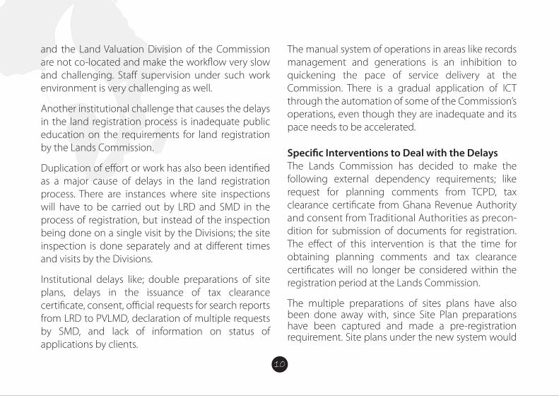
WOMEN LAND AND CORRUPTION IN AFRICA (WLCA) PROJECTThe WLCA project with funding support from Friends of Transparency International (TI) is a project being implemented by TI chapters in Zimbabwe, Ghana and Uganda and coordinated by TI Secretariat (TIS) in Berlin.
IntroductionIn Africa, a large portion of arable land is in tenure by small-scale farmers – often women. Vast areas of savannah and semi-desert land are in tenure by pastoralists and indigenous communities. Each land deal – whether transparent or opaque – deprives
customary land users of two of their most relevant resources: water and land. Unfortunately, the results are often poverty and hunger. Approximately one in �ve people around the world, report that they have paid a bribe for land services during the last year; in Africa, almost every second client of land adminis- tration services was a�ected. At the same time, land investors seem to speci�cally target countries with weak governance.
BackgroundThe main purpose of Transparency International’s (TI) “Women Land & Corruption in Africa” (WLCA) project is to link with other civil society organizations and institutions concerned with women, land govern- ance, and together, generate and share relevant data and information on corruption in the land sector, as well as its trends, nature, and existing strategies and mechanisms that are utilized to combat it. The project is aimed at understanding the issue of corruption as it impacts land rights of women in Sub-Saharan Africa, speci�cally Ghana, Uganda, and Zimbabwe, and bringing this issue to the top of the agenda of
national, regional and international land governance discussions and projects. To achieve this, TI will �rst conduct research on corruption in land admin- istration and land deals in the target countries. Then, based on this research, TI will network and advocate for recognition and integration of women’s land rights and related anti-corruption activities in development and governance.
The overall goal of Transparency International’s “Women Land & Corruption in Africa” project is to contribute to improved livelihoods of men and women of all generations adversely a�ected by corrupt practices in land administration and land deals, and thereby to enhanced security of tenure, as well as to equitable and fair access to land and water, and ultimately to sustainable and inclusive develop- ment and growth.
The project intends;1. To increase the understanding on the issue of women, land and corruption
2. To leverage the discussion and recognition of cor- ruption issues e�ecting women in their access to, use of and control over land at national, regional and international forums
3. To enhance the capacity to design and implement projects which respond to women’s concerns about corruption in land administration and land deals.
INTRODUCTIONLand is a valuable asset, which appreciates or inc- reases in term of price, as time goes on. It is therefore very important that, when you are able to acquire a land, it is registered appropriately and accordingly with the land agencies involved to avoid future land disputes and forfeiture.
In Ghana, recently, acquisition of land has become tiresome and very expensive, especially in elite areas of Accra. This gives more reason why it is vital that the land is registered as this would also give the owner full rights over the land and in its development as well as save the owner from litigation.
SOME OF THE LAWS GOVERNING LAND IN GHANA ARE:• Lands Commission Act • The administration of lands Act• Land title registration Act • Conveyancing Act• Constitution- Art 257-267• Land registry Act• State lands ActThe above laws, among others were enacted to control and guide the acquisition and use of land.
WHAT IS THE LANDS COMMISSION?The Lands Commission was established under Article 258 of the 1992 Constitution and the Lands Com- mission Act 767 of 2008 as a corporate body.
The reason for the establishment of this commission was to make sure that the acquisition and use of land was properly regulated so as to limit the problems associated with lands in Ghana.
FUNCTIONS OF THE COMMISSIONFor the purpose of achieving its objectives, the Commission shall;
(a) on behalf of the Government; manage public lands and any other lands vested in the President by the Constitution or by any other law and any lands vested in the Commission;
(b) advise the Government, local authorities and traditional authorities on the policy framework
for the development of particular areas of the country to ensure that the development of indi- vidual pieces of land is coordinated with the
(c) formulate and submit to Government recommen dations on national policy with respect to land use suitability or capability; (d) advise on, and assist in the execution of, a com- prehensive programme for the registration of title to land throughout the country;
(e) register deeds and instrument that a�ect land throughout the country;
(f) facilitate the acquisition of land on behalf of Government;
(g) establish standards for and regulate survey and mapping of the country;
(h) provide surveying and mapping services where necessary;
(t) license practitioners of cadastral survey;
(j) provide land and land related valuation services;
(k) ensure that through sound, sustainable land use planning, socio-economic activities are consistent with sound land use through sustainable land use planning in the long term national development goals;
(I) in collaboration with other bodies instill order and discipline into the land market through curbing the incidence of land encroachment, unapproved development schemes, multiple or illegal land sales, land speculation and other forms of land racketeering;
(m) in collaboration with other bodies minimize or eliminate, where possible, the sources of protracted land boundary disputes, con�icts and litigations in order to bring their associated economic costs and socio-political upheavals under control;
(n) promote community participation and public awareness at all levels in sustainable land management and development practices to ensure the highest and best use of land;
(0) promote research into all aspects of land ownership, tenure and the operations of the land market and the land development process;
(P) impose and collect levies, fees, charges for services rendered;
(q) establish and maintain a comprehensive land information system, and
(r) perform other functions the Minister may assign to it.
The current Lands Commission, as part of the public sector reform programmes and the Ghana Land Administration Project (LAP) has substantially been remodeled by the Act 767 to increase its efficiency and e�ectiveness.
As part of the reforms, four Land Sector Agencies; 1. The ‘Old Lands Commission,2. Land Valuation Board, 3. Land Title Registry and 4. Survey Department
Have been integrated into one Corporate Agency-
the ‘New Lands Commission’ which now comprises of four distinct Divisions.
The Divisions are:1. Survey and Mapping Division (SMD), and the 2. Land Registration Division (LRD).3. Land Valuation Division (LVD).4. Public and Vested Land Management Division (PVLMD)
Functions of the Survey and Mapping DivisionThe Survey and Mapping Division has the following functions:
(a) supervise, regulate and control the survey and demarcation of land for the purposes of land use and land registration;
(b) take custody of and preserve records that relate to the survey of any parcel of land;
(c) direct and supervise the conduct of trigono- metric, hydrograhic, topographic and engin- eering surveys;
(d) coordinate the preparation of plans from the data derived from survey and any amendment of the plans;
(e) coordinate the production of photo-grammetric surveys including aerial photography, ortho- photomapping, and remote sensing;
(f ) survey, map and maintain the national territorial boundaries including maritime boundaries;
(g) supervise and regulate operations that relate to survey of any parcel of land:
(h) develop and maintain the national geodetic (1) supervise, regulate, control and certify the production of maps; and
(j) other functions determined by the Commission.
Functions of the Land Registration DivisionThe functions of the Land Registration Division include
(a) publication of notices of registration upon receipt of an application for registration;
(b) registration of tide to land and other interests in land;
(c) registration of deeds and other instruments a�ecting land in areas outside compulsory title registration districts;
(d) maintaining land registers that contains records of land and other interests in land.
(e) other functions determined by the Commission.
Functions of the Land Valuation DivisionThe functions of the Land Valuation Division include
(a) assessing the compensation payable upon acquisition of land by the Government; (b) assessment of stamp duty;
(c) determining the values of properties rented, purchased, sold or leased by or to Government;
(d) preparation and maintenance of valuation list for rating purposes;
(e) valuation of interests in land or land related interests for the general public at a fee;
(f ) valuation of interests in land for the adminis- tration of estate duty; and
(g) other functions determined by the Commission
Functions of the Public and Vested Lands Management DivisionThe functions of the Public and Vested Lands Management Division include
(a) facilitating the acquisition of land for Government;
(b) managing state acquired and vested lands in conformity with approved land use plans; and
(c) other functions determined by the Commission.
To improve land service delivery and management, the Commission with support from the Land Administration Project has developed a strategy to re-engineer the Commissions’ Business Processes and Work�ow integration as part of the restructuring of the land sector to reduce process time, improve productivity and efficiency as well as to reduce the cost of land transactions.
Objectives of the Re-Engineering;• Improve the process of land registration• Reduce the turn-around time in registration• Reduce client interference in registration process• Automate the process Integrate re-engineered business processes • Reducing customer frustrations • Simplify payment of fees Eliminate/reduce duplication of work
• Apply technology in business processes • Improve working environment
Causes of Delays in Land Registration Process in GhanaThe causes of delays and frustrations in the Land Registration system in the country can be categorized into three (3) broad areas;1. Institutional2. Business Process3. Technological Challenges
Institutional DelaysInstitutional challenges have been a major setback in rendering quality land services to clients and the general public. Multiple access or channels of clients to services for instance makes it difficult for management to track transactions, it’s speed, the quality and �uidity of those services rendered. The office layout/architecture is also a challenge.
The scattered nature of the Commissions’ offices and operations inhibit the free �ow of services and slows the pace of service delivery. For instance, the Land Registration Division, Survey and Mapping Division
10
and the Land Valuation Division of the Commission are not co-located and make the work�ow very slow and challenging. Sta� supervision under such work environment is very challenging as well.
Another institutional challenge that causes the delays in the land registration process is inadequate public education on the requirements for land registration by the Lands Commission.
Duplication of e�ort or work has also been identi�ed as a major cause of delays in the land registration process. There are instances where site inspections will have to be carried out by LRD and SMD in the process of registration, but instead of the inspection being done on a single visit by the Divisions; the site inspection is done separately and at di�erent times and visits by the Divisions.
Institutional delays like; double preparations of site plans, delays in the issuance of tax clearance certificate, consent, official requests for search reports from LRD to PVLMD, declaration of multiple requests by SMD, and lack of information on status of applications by clients.
The manual system of operations in areas like records management and generations is an inhibition to quickening the pace of service delivery at the Commission. There is a gradual application of ICT through the automation of some of the Commission’s operations, even though they are inadequate and its pace needs to be accelerated.
Speci�c Interventions to Deal with the DelaysThe Lands Commission has decided to make the following external dependency requirements; like request for planning comments from TCPD, tax clearance certi�cate from Ghana Revenue Authority and consent from Traditional Authorities as precon-dition for submission of documents for registration. The e�ect of this intervention is that the time for obtaining planning comments and tax clearance certi�cates will no longer be considered within the registration period at the Lands Commission.
The multiple preparations of sites plans have also been done away with, since Site Plan preparations have been captured and made a pre-registration requirement. Site plans under the new system would
be prepared once; under quality control checks and used throughout the registration process.
The e�ect of this intervention on the process of land registration is that, the Land Registration Division of the Commission will no longer be required to write a letter to the Survey and Mapping Division to prepare Title plans which normally takes some three (3) months to be done.
On the issues of inadequate information on land registration requirements and fees structure, the Lands Commission has established a Communication and Public Outreach Unit to sensitize clients and the general public on the land registration requirements, fees and processes on the electronic and print media and through public outreaches.
The e�ect of this intervention will also reduce extortions from clients; ensure improved document preparation by clients before submission for processing at the Commission and thereby reducing the number of queried documents mid-way in the registration process.
Another intervention aimed at reducing the delays in the land registration process is the elimination of request for official searches mid-way in the registration process by the Land Registration Division. All searches or records of information on the land from all Divisions would be carried out at the early stages to ensure that the land or property meets the requirements for registration.
Thus, the Land Registration Division will no longer be required to write to the Public and Vested Land Management Division to request for official search report during the process of registration, taking o� two weeks of delay in the previous system.
The Lands Commission has also proposed the merger of the Cartographic and Records Units of the Land Registration and Survey and Mapping Divisions to eliminate the declaration of multiple requests during the plan preparation and approval process. This also o�sets three months of delay in the process of registration.
Under the new system, the Commission has initiated the process to establish a document tracking system to automatically inform and update clients on the status of their applications through text messages, thereby reducing the direct contact of the Commission sta� with clients and the interference of clients in the registration process.
The four Divisions of the Commission; LRD, SMD, LVD and PVLMD are to be co-located at the Cantonments office to improve communication, supervision and work�ow in terms of access to Divisional records.
The Commission has set up Wide and Local Area Network systems and employed the appropriate softwares to improve efficiency and information sharing in the areas of parcel or cadastral plan generation and document tracking.
GENERAL PROCEDURES IN ACQUIRING A LAND IN GHANANB: It is always advisable to follow due diligence to avoid being dragged into a never conclusive land disputes by ensuring that:
(a) You are dealing with the rightful owner of the land recognized by law-a quick official search will do in addition to neighborhood questionings and supporting documents from claimed owner. Do an original survey of the said parcel for the search to be sure the plan used for the search is for the exact land of interest.
(b) You engage the services of a quali�ed land surveyor. In Ghana, only licensed surveyors are permitted legally to undertake cadastral surveys.
1. Land Inspection:The investor must check the boundary corners of the land in question to verify the full extent of the land and be sure of the feasibility of the project to be used. This must be done by an expert and must be in the presence of the land owners as witnesses. Carrying out thorough checks about the land is important, as this will enable the future land owner gets to know if the land is available to be acquired. In this process, the
prospective land owner can also consider the services of a land lawyer to research the land and prove its availability; such as if it has already been sold out. Checks must also be done with other government land overseers, for example; the Tema Development Corporation (TDC), to ascertain if the land had been earmarked for any developmental projects. One would also be told if the land is not suitable, say if it is a water-logged area, and therefore, not advisable to be purchased.
2. Land Search: This is the most important stage. Here Surveyors go onto the land to pick and demarcate the land parcel. The result is taken to the lands commission to verify the true ownership of the. If the name that comes up is the same as your land owners, then you can carry on the process, if not quit or seek a legal advice.
3. Acquisition and Negotiation: After the availability and suitability of the land has been established, the interested buyer or lessee negotiates with the actual owner of the land for sales. It is important to be reminded that the
interested buyer must deal with the rightful owner of the land because the use of middlemen is not advisable. An agreement is reached and documentsmade to its e�ect.
4. Land Documentation: The investor can proceed with the documentations; normally after a quarter or part payment has been done. The land owners then prepare the documents which must include a true and certi�ed copy of Indenture and site plans. Three copies of the agreement documents would be needed for endorsement by a land lawyer, who will have to sign the back of each of the copies with his practicing stamp duly �xed. Each copy of the documents must have a site plan attached, together with two extra copies of site plans, all making 5 documents. The back of the site plan would also be needed to be endorsed by the owner and the buyer of the land; after which they (the site plans) are to be certi�ed by the stamps of a licensed surveyor and the regional surveyor with accurate date.
5. Witnesses:These are people who would testify to the proceedings so that in future whenever there is any case of challenge about ownership of the land, they would be called upon for assistance. It is therefore required that at least, 2 quali�ed persons from both parties – the seller and buyer sides must sign as witnesses. The two witnesses signing on behalf of the buyer or lessee must do so with their full names, addresses and original signatures.
6. Land Commission:After the endorsement of the documents, it is then sent to the land commission, together with processing fees for of processing and registration of the land to begin. After the processing is completed, the documents are released to the Land Valuation Board for stamping and certifying.
7. Internal Revenue Authority (IRS):The IRS sees to the taxes associated with the registration process. From the land valuation board, the processed documents are then released to the IRS for tax clearing of the land to be made. When
this is complete, the applicant, or buyer is given a tax clearance certi�cate. The documents are from here, taken back to the land commission for �nal registration at the deeds registry.
8. Land Title Certi�cation: From the deeds registry, the buyer is given an original copy of the land title document. Actually this can be done simultaneously with the projects inception since the land title certi�cation from the Land title registry of Ghana takes quite some time.
WHAT IS LAND REGISTRATION?Land Registration is the recording of rights and interest in land as evidence by instruments. Instruments or deeds that could be registered include leases, sub-leases, conveyances, assignments, mortgages, gifts, tenancy agreements probate and wills, letters of administration, vesting assets, statutory declarations, power of attorney etc. in relation to land.
WHAT ARE THE BENEFITS OF REGISTERING YOUR LAND• It ensures certainty of your ownership of the land
• It establishes your rights and interests in the land • It protects your rights and interests in the land, promoting security• It renders you documents admissible in court• It minimizes land litigation• It enables you access credit facilities• It enables you invest in the land• It enables you develop land market and many more
TYPES OF LAND OWNERSHIP IN GHANA:
1. INDIVIDUAL/PRIVATE LANDS: These are lands owned by individuals and private entities
2. STOOL/ SKIN LANDS: These are lands under the custodianship of various chiefs3. FAMILY LANDS: These are lands managed by Heads of families assisted by principal members of the families.
4. STATE AND STOOL VESTED LANDS: These are lands managed by the Lands Commission

WOMEN LAND AND CORRUPTION IN AFRICA (WLCA) PROJECTThe WLCA project with funding support from Friends of Transparency International (TI) is a project being implemented by TI chapters in Zimbabwe, Ghana and Uganda and coordinated by TI Secretariat (TIS) in Berlin.
IntroductionIn Africa, a large portion of arable land is in tenure by small-scale farmers – often women. Vast areas of savannah and semi-desert land are in tenure by pastoralists and indigenous communities. Each land deal – whether transparent or opaque – deprives
customary land users of two of their most relevant resources: water and land. Unfortunately, the results are often poverty and hunger. Approximately one in �ve people around the world, report that they have paid a bribe for land services during the last year; in Africa, almost every second client of land adminis- tration services was a�ected. At the same time, land investors seem to speci�cally target countries with weak governance.
BackgroundThe main purpose of Transparency International’s (TI) “Women Land & Corruption in Africa” (WLCA) project is to link with other civil society organizations and institutions concerned with women, land govern- ance, and together, generate and share relevant data and information on corruption in the land sector, as well as its trends, nature, and existing strategies and mechanisms that are utilized to combat it. The project is aimed at understanding the issue of corruption as it impacts land rights of women in Sub-Saharan Africa, speci�cally Ghana, Uganda, and Zimbabwe, and bringing this issue to the top of the agenda of
national, regional and international land governance discussions and projects. To achieve this, TI will �rst conduct research on corruption in land admin- istration and land deals in the target countries. Then, based on this research, TI will network and advocate for recognition and integration of women’s land rights and related anti-corruption activities in development and governance.
The overall goal of Transparency International’s “Women Land & Corruption in Africa” project is to contribute to improved livelihoods of men and women of all generations adversely a�ected by corrupt practices in land administration and land deals, and thereby to enhanced security of tenure, as well as to equitable and fair access to land and water, and ultimately to sustainable and inclusive develop- ment and growth.
The project intends;1. To increase the understanding on the issue of women, land and corruption
2. To leverage the discussion and recognition of cor- ruption issues e�ecting women in their access to, use of and control over land at national, regional and international forums
3. To enhance the capacity to design and implement projects which respond to women’s concerns about corruption in land administration and land deals.
INTRODUCTIONLand is a valuable asset, which appreciates or inc- reases in term of price, as time goes on. It is therefore very important that, when you are able to acquire a land, it is registered appropriately and accordingly with the land agencies involved to avoid future land disputes and forfeiture.
In Ghana, recently, acquisition of land has become tiresome and very expensive, especially in elite areas of Accra. This gives more reason why it is vital that the land is registered as this would also give the owner full rights over the land and in its development as well as save the owner from litigation.
SOME OF THE LAWS GOVERNING LAND IN GHANA ARE:• Lands Commission Act • The administration of lands Act• Land title registration Act • Conveyancing Act• Constitution- Art 257-267• Land registry Act• State lands ActThe above laws, among others were enacted to control and guide the acquisition and use of land.
WHAT IS THE LANDS COMMISSION?The Lands Commission was established under Article 258 of the 1992 Constitution and the Lands Com- mission Act 767 of 2008 as a corporate body.
The reason for the establishment of this commission was to make sure that the acquisition and use of land was properly regulated so as to limit the problems associated with lands in Ghana.
FUNCTIONS OF THE COMMISSIONFor the purpose of achieving its objectives, the Commission shall;
(a) on behalf of the Government; manage public lands and any other lands vested in the President by the Constitution or by any other law and any lands vested in the Commission;
(b) advise the Government, local authorities and traditional authorities on the policy framework
for the development of particular areas of the country to ensure that the development of indi- vidual pieces of land is coordinated with the
(c) formulate and submit to Government recommen dations on national policy with respect to land use suitability or capability; (d) advise on, and assist in the execution of, a com- prehensive programme for the registration of title to land throughout the country;
(e) register deeds and instrument that a�ect land throughout the country;
(f) facilitate the acquisition of land on behalf of Government;
(g) establish standards for and regulate survey and mapping of the country;
(h) provide surveying and mapping services where necessary;
(t) license practitioners of cadastral survey;
(j) provide land and land related valuation services;
(k) ensure that through sound, sustainable land use planning, socio-economic activities are consistent with sound land use through sustainable land use planning in the long term national development goals;
(I) in collaboration with other bodies instill order and discipline into the land market through curbing the incidence of land encroachment, unapproved development schemes, multiple or illegal land sales, land speculation and other forms of land racketeering;
(m) in collaboration with other bodies minimize or eliminate, where possible, the sources of protracted land boundary disputes, con�icts and litigations in order to bring their associated economic costs and socio-political upheavals under control;
(n) promote community participation and public awareness at all levels in sustainable land management and development practices to ensure the highest and best use of land;
(0) promote research into all aspects of land ownership, tenure and the operations of the land market and the land development process;
(P) impose and collect levies, fees, charges for services rendered;
(q) establish and maintain a comprehensive land information system, and
(r) perform other functions the Minister may assign to it.
The current Lands Commission, as part of the public sector reform programmes and the Ghana Land Administration Project (LAP) has substantially been remodeled by the Act 767 to increase its efficiency and e�ectiveness.
As part of the reforms, four Land Sector Agencies; 1. The ‘Old Lands Commission,2. Land Valuation Board, 3. Land Title Registry and 4. Survey Department
Have been integrated into one Corporate Agency-
the ‘New Lands Commission’ which now comprises of four distinct Divisions.
The Divisions are:1. Survey and Mapping Division (SMD), and the 2. Land Registration Division (LRD).3. Land Valuation Division (LVD).4. Public and Vested Land Management Division (PVLMD)
Functions of the Survey and Mapping DivisionThe Survey and Mapping Division has the following functions:
(a) supervise, regulate and control the survey and demarcation of land for the purposes of land use and land registration;
(b) take custody of and preserve records that relate to the survey of any parcel of land;
(c) direct and supervise the conduct of trigono- metric, hydrograhic, topographic and engin- eering surveys;
(d) coordinate the preparation of plans from the data derived from survey and any amendment of the plans;
(e) coordinate the production of photo-grammetric surveys including aerial photography, ortho- photomapping, and remote sensing;
(f ) survey, map and maintain the national territorial boundaries including maritime boundaries;
(g) supervise and regulate operations that relate to survey of any parcel of land:
(h) develop and maintain the national geodetic (1) supervise, regulate, control and certify the production of maps; and
(j) other functions determined by the Commission.
Functions of the Land Registration DivisionThe functions of the Land Registration Division include
(a) publication of notices of registration upon receipt of an application for registration;
(b) registration of tide to land and other interests in land;
(c) registration of deeds and other instruments a�ecting land in areas outside compulsory title registration districts;
(d) maintaining land registers that contains records of land and other interests in land.
(e) other functions determined by the Commission.
Functions of the Land Valuation DivisionThe functions of the Land Valuation Division include
(a) assessing the compensation payable upon acquisition of land by the Government; (b) assessment of stamp duty;
(c) determining the values of properties rented, purchased, sold or leased by or to Government;
(d) preparation and maintenance of valuation list for rating purposes;
(e) valuation of interests in land or land related interests for the general public at a fee;
(f ) valuation of interests in land for the adminis- tration of estate duty; and
(g) other functions determined by the Commission
Functions of the Public and Vested Lands Management DivisionThe functions of the Public and Vested Lands Management Division include
(a) facilitating the acquisition of land for Government;
(b) managing state acquired and vested lands in conformity with approved land use plans; and
(c) other functions determined by the Commission.
To improve land service delivery and management, the Commission with support from the Land Administration Project has developed a strategy to re-engineer the Commissions’ Business Processes and Work�ow integration as part of the restructuring of the land sector to reduce process time, improve productivity and efficiency as well as to reduce the cost of land transactions.
Objectives of the Re-Engineering;• Improve the process of land registration• Reduce the turn-around time in registration• Reduce client interference in registration process• Automate the process Integrate re-engineered business processes • Reducing customer frustrations • Simplify payment of fees Eliminate/reduce duplication of work
• Apply technology in business processes • Improve working environment
Causes of Delays in Land Registration Process in GhanaThe causes of delays and frustrations in the Land Registration system in the country can be categorized into three (3) broad areas;1. Institutional2. Business Process3. Technological Challenges
Institutional DelaysInstitutional challenges have been a major setback in rendering quality land services to clients and the general public. Multiple access or channels of clients to services for instance makes it difficult for management to track transactions, it’s speed, the quality and �uidity of those services rendered. The office layout/architecture is also a challenge.
The scattered nature of the Commissions’ offices and operations inhibit the free �ow of services and slows the pace of service delivery. For instance, the Land Registration Division, Survey and Mapping Division
and the Land Valuation Division of the Commission are not co-located and make the work�ow very slow and challenging. Sta� supervision under such work environment is very challenging as well.
Another institutional challenge that causes the delays in the land registration process is inadequate public education on the requirements for land registration by the Lands Commission.
Duplication of e�ort or work has also been identi�ed as a major cause of delays in the land registration process. There are instances where site inspections will have to be carried out by LRD and SMD in the process of registration, but instead of the inspection being done on a single visit by the Divisions; the site inspection is done separately and at di�erent times and visits by the Divisions.
Institutional delays like; double preparations of site plans, delays in the issuance of tax clearance certificate, consent, official requests for search reports from LRD to PVLMD, declaration of multiple requests by SMD, and lack of information on status of applications by clients.
The manual system of operations in areas like records management and generations is an inhibition to quickening the pace of service delivery at the Commission. There is a gradual application of ICT through the automation of some of the Commission’s operations, even though they are inadequate and its pace needs to be accelerated.
Speci�c Interventions to Deal with the DelaysThe Lands Commission has decided to make the following external dependency requirements; like request for planning comments from TCPD, tax clearance certi�cate from Ghana Revenue Authority and consent from Traditional Authorities as precon-dition for submission of documents for registration. The e�ect of this intervention is that the time for obtaining planning comments and tax clearance certi�cates will no longer be considered within the registration period at the Lands Commission.
The multiple preparations of sites plans have also been done away with, since Site Plan preparations have been captured and made a pre-registration requirement. Site plans under the new system would
11
be prepared once; under quality control checks and used throughout the registration process.
The e�ect of this intervention on the process of land registration is that, the Land Registration Division of the Commission will no longer be required to write a letter to the Survey and Mapping Division to prepare Title plans which normally takes some three (3) months to be done.
On the issues of inadequate information on land registration requirements and fees structure, the Lands Commission has established a Communication and Public Outreach Unit to sensitize clients and the general public on the land registration requirements, fees and processes on the electronic and print media and through public outreaches.
The e�ect of this intervention will also reduce extortions from clients; ensure improved document preparation by clients before submission for processing at the Commission and thereby reducing the number of queried documents mid-way in the registration process.
Another intervention aimed at reducing the delays in the land registration process is the elimination of request for official searches mid-way in the registration process by the Land Registration Division. All searches or records of information on the land from all Divisions would be carried out at the early stages to ensure that the land or property meets the requirements for registration.
Thus, the Land Registration Division will no longer be required to write to the Public and Vested Land Management Division to request for official search report during the process of registration, taking o� two weeks of delay in the previous system.
The Lands Commission has also proposed the merger of the Cartographic and Records Units of the Land Registration and Survey and Mapping Divisions to eliminate the declaration of multiple requests during the plan preparation and approval process. This also o�sets three months of delay in the process of registration.
Under the new system, the Commission has initiated the process to establish a document tracking system to automatically inform and update clients on the status of their applications through text messages, thereby reducing the direct contact of the Commission sta� with clients and the interference of clients in the registration process.
The four Divisions of the Commission; LRD, SMD, LVD and PVLMD are to be co-located at the Cantonments office to improve communication, supervision and work�ow in terms of access to Divisional records.
The Commission has set up Wide and Local Area Network systems and employed the appropriate softwares to improve efficiency and information sharing in the areas of parcel or cadastral plan generation and document tracking.
GENERAL PROCEDURES IN ACQUIRING A LAND IN GHANANB: It is always advisable to follow due diligence to avoid being dragged into a never conclusive land disputes by ensuring that:
(a) You are dealing with the rightful owner of the land recognized by law-a quick official search will do in addition to neighborhood questionings and supporting documents from claimed owner. Do an original survey of the said parcel for the search to be sure the plan used for the search is for the exact land of interest.
(b) You engage the services of a quali�ed land surveyor. In Ghana, only licensed surveyors are permitted legally to undertake cadastral surveys.
1. Land Inspection:The investor must check the boundary corners of the land in question to verify the full extent of the land and be sure of the feasibility of the project to be used. This must be done by an expert and must be in the presence of the land owners as witnesses. Carrying out thorough checks about the land is important, as this will enable the future land owner gets to know if the land is available to be acquired. In this process, the
prospective land owner can also consider the services of a land lawyer to research the land and prove its availability; such as if it has already been sold out. Checks must also be done with other government land overseers, for example; the Tema Development Corporation (TDC), to ascertain if the land had been earmarked for any developmental projects. One would also be told if the land is not suitable, say if it is a water-logged area, and therefore, not advisable to be purchased.
2. Land Search: This is the most important stage. Here Surveyors go onto the land to pick and demarcate the land parcel. The result is taken to the lands commission to verify the true ownership of the. If the name that comes up is the same as your land owners, then you can carry on the process, if not quit or seek a legal advice.
3. Acquisition and Negotiation: After the availability and suitability of the land has been established, the interested buyer or lessee negotiates with the actual owner of the land for sales. It is important to be reminded that the
interested buyer must deal with the rightful owner of the land because the use of middlemen is not advisable. An agreement is reached and documentsmade to its e�ect.
4. Land Documentation: The investor can proceed with the documentations; normally after a quarter or part payment has been done. The land owners then prepare the documents which must include a true and certi�ed copy of Indenture and site plans. Three copies of the agreement documents would be needed for endorsement by a land lawyer, who will have to sign the back of each of the copies with his practicing stamp duly �xed. Each copy of the documents must have a site plan attached, together with two extra copies of site plans, all making 5 documents. The back of the site plan would also be needed to be endorsed by the owner and the buyer of the land; after which they (the site plans) are to be certi�ed by the stamps of a licensed surveyor and the regional surveyor with accurate date.
5. Witnesses:These are people who would testify to the proceedings so that in future whenever there is any case of challenge about ownership of the land, they would be called upon for assistance. It is therefore required that at least, 2 quali�ed persons from both parties – the seller and buyer sides must sign as witnesses. The two witnesses signing on behalf of the buyer or lessee must do so with their full names, addresses and original signatures.
6. Land Commission:After the endorsement of the documents, it is then sent to the land commission, together with processing fees for of processing and registration of the land to begin. After the processing is completed, the documents are released to the Land Valuation Board for stamping and certifying.
7. Internal Revenue Authority (IRS):The IRS sees to the taxes associated with the registration process. From the land valuation board, the processed documents are then released to the IRS for tax clearing of the land to be made. When
this is complete, the applicant, or buyer is given a tax clearance certi�cate. The documents are from here, taken back to the land commission for �nal registration at the deeds registry.
8. Land Title Certi�cation: From the deeds registry, the buyer is given an original copy of the land title document. Actually this can be done simultaneously with the projects inception since the land title certi�cation from the Land title registry of Ghana takes quite some time.
WHAT IS LAND REGISTRATION?Land Registration is the recording of rights and interest in land as evidence by instruments. Instruments or deeds that could be registered include leases, sub-leases, conveyances, assignments, mortgages, gifts, tenancy agreements probate and wills, letters of administration, vesting assets, statutory declarations, power of attorney etc. in relation to land.
WHAT ARE THE BENEFITS OF REGISTERING YOUR LAND• It ensures certainty of your ownership of the land
• It establishes your rights and interests in the land • It protects your rights and interests in the land, promoting security• It renders you documents admissible in court• It minimizes land litigation• It enables you access credit facilities• It enables you invest in the land• It enables you develop land market and many more
TYPES OF LAND OWNERSHIP IN GHANA:
1. INDIVIDUAL/PRIVATE LANDS: These are lands owned by individuals and private entities
2. STOOL/ SKIN LANDS: These are lands under the custodianship of various chiefs3. FAMILY LANDS: These are lands managed by Heads of families assisted by principal members of the families.
4. STATE AND STOOL VESTED LANDS: These are lands managed by the Lands Commission

WOMEN LAND AND CORRUPTION IN AFRICA (WLCA) PROJECTThe WLCA project with funding support from Friends of Transparency International (TI) is a project being implemented by TI chapters in Zimbabwe, Ghana and Uganda and coordinated by TI Secretariat (TIS) in Berlin.
IntroductionIn Africa, a large portion of arable land is in tenure by small-scale farmers – often women. Vast areas of savannah and semi-desert land are in tenure by pastoralists and indigenous communities. Each land deal – whether transparent or opaque – deprives
customary land users of two of their most relevant resources: water and land. Unfortunately, the results are often poverty and hunger. Approximately one in �ve people around the world, report that they have paid a bribe for land services during the last year; in Africa, almost every second client of land adminis- tration services was a�ected. At the same time, land investors seem to speci�cally target countries with weak governance.
BackgroundThe main purpose of Transparency International’s (TI) “Women Land & Corruption in Africa” (WLCA) project is to link with other civil society organizations and institutions concerned with women, land govern- ance, and together, generate and share relevant data and information on corruption in the land sector, as well as its trends, nature, and existing strategies and mechanisms that are utilized to combat it. The project is aimed at understanding the issue of corruption as it impacts land rights of women in Sub-Saharan Africa, speci�cally Ghana, Uganda, and Zimbabwe, and bringing this issue to the top of the agenda of
national, regional and international land governance discussions and projects. To achieve this, TI will �rst conduct research on corruption in land admin- istration and land deals in the target countries. Then, based on this research, TI will network and advocate for recognition and integration of women’s land rights and related anti-corruption activities in development and governance.
The overall goal of Transparency International’s “Women Land & Corruption in Africa” project is to contribute to improved livelihoods of men and women of all generations adversely a�ected by corrupt practices in land administration and land deals, and thereby to enhanced security of tenure, as well as to equitable and fair access to land and water, and ultimately to sustainable and inclusive develop- ment and growth.
The project intends;1. To increase the understanding on the issue of women, land and corruption
2. To leverage the discussion and recognition of cor- ruption issues e�ecting women in their access to, use of and control over land at national, regional and international forums
3. To enhance the capacity to design and implement projects which respond to women’s concerns about corruption in land administration and land deals.
INTRODUCTIONLand is a valuable asset, which appreciates or inc- reases in term of price, as time goes on. It is therefore very important that, when you are able to acquire a land, it is registered appropriately and accordingly with the land agencies involved to avoid future land disputes and forfeiture.
In Ghana, recently, acquisition of land has become tiresome and very expensive, especially in elite areas of Accra. This gives more reason why it is vital that the land is registered as this would also give the owner full rights over the land and in its development as well as save the owner from litigation.
SOME OF THE LAWS GOVERNING LAND IN GHANA ARE:• Lands Commission Act • The administration of lands Act• Land title registration Act • Conveyancing Act• Constitution- Art 257-267• Land registry Act• State lands ActThe above laws, among others were enacted to control and guide the acquisition and use of land.
WHAT IS THE LANDS COMMISSION?The Lands Commission was established under Article 258 of the 1992 Constitution and the Lands Com- mission Act 767 of 2008 as a corporate body.
The reason for the establishment of this commission was to make sure that the acquisition and use of land was properly regulated so as to limit the problems associated with lands in Ghana.
FUNCTIONS OF THE COMMISSIONFor the purpose of achieving its objectives, the Commission shall;
(a) on behalf of the Government; manage public lands and any other lands vested in the President by the Constitution or by any other law and any lands vested in the Commission;
(b) advise the Government, local authorities and traditional authorities on the policy framework
for the development of particular areas of the country to ensure that the development of indi- vidual pieces of land is coordinated with the
(c) formulate and submit to Government recommen dations on national policy with respect to land use suitability or capability; (d) advise on, and assist in the execution of, a com- prehensive programme for the registration of title to land throughout the country;
(e) register deeds and instrument that a�ect land throughout the country;
(f) facilitate the acquisition of land on behalf of Government;
(g) establish standards for and regulate survey and mapping of the country;
(h) provide surveying and mapping services where necessary;
(t) license practitioners of cadastral survey;
(j) provide land and land related valuation services;
(k) ensure that through sound, sustainable land use planning, socio-economic activities are consistent with sound land use through sustainable land use planning in the long term national development goals;
(I) in collaboration with other bodies instill order and discipline into the land market through curbing the incidence of land encroachment, unapproved development schemes, multiple or illegal land sales, land speculation and other forms of land racketeering;
(m) in collaboration with other bodies minimize or eliminate, where possible, the sources of protracted land boundary disputes, con�icts and litigations in order to bring their associated economic costs and socio-political upheavals under control;
(n) promote community participation and public awareness at all levels in sustainable land management and development practices to ensure the highest and best use of land;
(0) promote research into all aspects of land ownership, tenure and the operations of the land market and the land development process;
(P) impose and collect levies, fees, charges for services rendered;
(q) establish and maintain a comprehensive land information system, and
(r) perform other functions the Minister may assign to it.
The current Lands Commission, as part of the public sector reform programmes and the Ghana Land Administration Project (LAP) has substantially been remodeled by the Act 767 to increase its efficiency and e�ectiveness.
As part of the reforms, four Land Sector Agencies; 1. The ‘Old Lands Commission,2. Land Valuation Board, 3. Land Title Registry and 4. Survey Department
Have been integrated into one Corporate Agency-
the ‘New Lands Commission’ which now comprises of four distinct Divisions.
The Divisions are:1. Survey and Mapping Division (SMD), and the 2. Land Registration Division (LRD).3. Land Valuation Division (LVD).4. Public and Vested Land Management Division (PVLMD)
Functions of the Survey and Mapping DivisionThe Survey and Mapping Division has the following functions:
(a) supervise, regulate and control the survey and demarcation of land for the purposes of land use and land registration;
(b) take custody of and preserve records that relate to the survey of any parcel of land;
(c) direct and supervise the conduct of trigono- metric, hydrograhic, topographic and engin- eering surveys;
(d) coordinate the preparation of plans from the data derived from survey and any amendment of the plans;
(e) coordinate the production of photo-grammetric surveys including aerial photography, ortho- photomapping, and remote sensing;
(f ) survey, map and maintain the national territorial boundaries including maritime boundaries;
(g) supervise and regulate operations that relate to survey of any parcel of land:
(h) develop and maintain the national geodetic (1) supervise, regulate, control and certify the production of maps; and
(j) other functions determined by the Commission.
Functions of the Land Registration DivisionThe functions of the Land Registration Division include
(a) publication of notices of registration upon receipt of an application for registration;
(b) registration of tide to land and other interests in land;
(c) registration of deeds and other instruments a�ecting land in areas outside compulsory title registration districts;
(d) maintaining land registers that contains records of land and other interests in land.
(e) other functions determined by the Commission.
Functions of the Land Valuation DivisionThe functions of the Land Valuation Division include
(a) assessing the compensation payable upon acquisition of land by the Government; (b) assessment of stamp duty;
(c) determining the values of properties rented, purchased, sold or leased by or to Government;
(d) preparation and maintenance of valuation list for rating purposes;
(e) valuation of interests in land or land related interests for the general public at a fee;
(f ) valuation of interests in land for the adminis- tration of estate duty; and
(g) other functions determined by the Commission
Functions of the Public and Vested Lands Management DivisionThe functions of the Public and Vested Lands Management Division include
(a) facilitating the acquisition of land for Government;
(b) managing state acquired and vested lands in conformity with approved land use plans; and
(c) other functions determined by the Commission.
To improve land service delivery and management, the Commission with support from the Land Administration Project has developed a strategy to re-engineer the Commissions’ Business Processes and Work�ow integration as part of the restructuring of the land sector to reduce process time, improve productivity and efficiency as well as to reduce the cost of land transactions.
Objectives of the Re-Engineering;• Improve the process of land registration• Reduce the turn-around time in registration• Reduce client interference in registration process• Automate the process Integrate re-engineered business processes • Reducing customer frustrations • Simplify payment of fees Eliminate/reduce duplication of work
• Apply technology in business processes • Improve working environment
Causes of Delays in Land Registration Process in GhanaThe causes of delays and frustrations in the Land Registration system in the country can be categorized into three (3) broad areas;1. Institutional2. Business Process3. Technological Challenges
Institutional DelaysInstitutional challenges have been a major setback in rendering quality land services to clients and the general public. Multiple access or channels of clients to services for instance makes it difficult for management to track transactions, it’s speed, the quality and �uidity of those services rendered. The office layout/architecture is also a challenge.
The scattered nature of the Commissions’ offices and operations inhibit the free �ow of services and slows the pace of service delivery. For instance, the Land Registration Division, Survey and Mapping Division
and the Land Valuation Division of the Commission are not co-located and make the work�ow very slow and challenging. Sta� supervision under such work environment is very challenging as well.
Another institutional challenge that causes the delays in the land registration process is inadequate public education on the requirements for land registration by the Lands Commission.
Duplication of e�ort or work has also been identi�ed as a major cause of delays in the land registration process. There are instances where site inspections will have to be carried out by LRD and SMD in the process of registration, but instead of the inspection being done on a single visit by the Divisions; the site inspection is done separately and at di�erent times and visits by the Divisions.
Institutional delays like; double preparations of site plans, delays in the issuance of tax clearance certificate, consent, official requests for search reports from LRD to PVLMD, declaration of multiple requests by SMD, and lack of information on status of applications by clients.
The manual system of operations in areas like records management and generations is an inhibition to quickening the pace of service delivery at the Commission. There is a gradual application of ICT through the automation of some of the Commission’s operations, even though they are inadequate and its pace needs to be accelerated.
Speci�c Interventions to Deal with the DelaysThe Lands Commission has decided to make the following external dependency requirements; like request for planning comments from TCPD, tax clearance certi�cate from Ghana Revenue Authority and consent from Traditional Authorities as precon-dition for submission of documents for registration. The e�ect of this intervention is that the time for obtaining planning comments and tax clearance certi�cates will no longer be considered within the registration period at the Lands Commission.
The multiple preparations of sites plans have also been done away with, since Site Plan preparations have been captured and made a pre-registration requirement. Site plans under the new system would
be prepared once; under quality control checks and used throughout the registration process.
The e�ect of this intervention on the process of land registration is that, the Land Registration Division of the Commission will no longer be required to write a letter to the Survey and Mapping Division to prepare Title plans which normally takes some three (3) months to be done.
On the issues of inadequate information on land registration requirements and fees structure, the Lands Commission has established a Communication and Public Outreach Unit to sensitize clients and the general public on the land registration requirements, fees and processes on the electronic and print media and through public outreaches.
The e�ect of this intervention will also reduce extortions from clients; ensure improved document preparation by clients before submission for processing at the Commission and thereby reducing the number of queried documents mid-way in the registration process.
Another intervention aimed at reducing the delays in the land registration process is the elimination of request for official searches mid-way in the registration process by the Land Registration Division. All searches or records of information on the land from all Divisions would be carried out at the early stages to ensure that the land or property meets the requirements for registration.
Thus, the Land Registration Division will no longer be required to write to the Public and Vested Land Management Division to request for official search report during the process of registration, taking o� two weeks of delay in the previous system.
The Lands Commission has also proposed the merger of the Cartographic and Records Units of the Land Registration and Survey and Mapping Divisions to eliminate the declaration of multiple requests during the plan preparation and approval process. This also o�sets three months of delay in the process of registration.
12
Under the new system, the Commission has initiated the process to establish a document tracking system to automatically inform and update clients on the status of their applications through text messages, thereby reducing the direct contact of the Commission sta� with clients and the interference of clients in the registration process.
The four Divisions of the Commission; LRD, SMD, LVD and PVLMD are to be co-located at the Cantonments office to improve communication, supervision and work�ow in terms of access to Divisional records.
The Commission has set up Wide and Local Area Network systems and employed the appropriate softwares to improve efficiency and information sharing in the areas of parcel or cadastral plan generation and document tracking.
GENERAL PROCEDURES IN ACQUIRING A LAND IN GHANANB: It is always advisable to follow due diligence to avoid being dragged into a never conclusive land disputes by ensuring that:
(a) You are dealing with the rightful owner of the land recognized by law-a quick official search will do in addition to neighborhood questionings and supporting documents from claimed owner. Do an original survey of the said parcel for the search to be sure the plan used for the search is for the exact land of interest.
(b) You engage the services of a quali�ed land surveyor. In Ghana, only licensed surveyors are permitted legally to undertake cadastral surveys.
1. Land Inspection:The investor must check the boundary corners of the land in question to verify the full extent of the land and be sure of the feasibility of the project to be used. This must be done by an expert and must be in the presence of the land owners as witnesses. Carrying out thorough checks about the land is important, as this will enable the future land owner gets to know if the land is available to be acquired. In this process, the
prospective land owner can also consider the services of a land lawyer to research the land and prove its availability; such as if it has already been sold out. Checks must also be done with other government land overseers, for example; the Tema Development Corporation (TDC), to ascertain if the land had been earmarked for any developmental projects. One would also be told if the land is not suitable, say if it is a water-logged area, and therefore, not advisable to be purchased.
2. Land Search: This is the most important stage. Here Surveyors go onto the land to pick and demarcate the land parcel. The result is taken to the lands commission to verify the true ownership of the. If the name that comes up is the same as your land owners, then you can carry on the process, if not quit or seek a legal advice.
3. Acquisition and Negotiation: After the availability and suitability of the land has been established, the interested buyer or lessee negotiates with the actual owner of the land for sales. It is important to be reminded that the
interested buyer must deal with the rightful owner of the land because the use of middlemen is not advisable. An agreement is reached and documentsmade to its e�ect.
4. Land Documentation: The investor can proceed with the documentations; normally after a quarter or part payment has been done. The land owners then prepare the documents which must include a true and certi�ed copy of Indenture and site plans. Three copies of the agreement documents would be needed for endorsement by a land lawyer, who will have to sign the back of each of the copies with his practicing stamp duly �xed. Each copy of the documents must have a site plan attached, together with two extra copies of site plans, all making 5 documents. The back of the site plan would also be needed to be endorsed by the owner and the buyer of the land; after which they (the site plans) are to be certi�ed by the stamps of a licensed surveyor and the regional surveyor with accurate date.
5. Witnesses:These are people who would testify to the proceedings so that in future whenever there is any case of challenge about ownership of the land, they would be called upon for assistance. It is therefore required that at least, 2 quali�ed persons from both parties – the seller and buyer sides must sign as witnesses. The two witnesses signing on behalf of the buyer or lessee must do so with their full names, addresses and original signatures.
6. Land Commission:After the endorsement of the documents, it is then sent to the land commission, together with processing fees for of processing and registration of the land to begin. After the processing is completed, the documents are released to the Land Valuation Board for stamping and certifying.
7. Internal Revenue Authority (IRS):The IRS sees to the taxes associated with the registration process. From the land valuation board, the processed documents are then released to the IRS for tax clearing of the land to be made. When
this is complete, the applicant, or buyer is given a tax clearance certi�cate. The documents are from here, taken back to the land commission for �nal registration at the deeds registry.
8. Land Title Certi�cation: From the deeds registry, the buyer is given an original copy of the land title document. Actually this can be done simultaneously with the projects inception since the land title certi�cation from the Land title registry of Ghana takes quite some time.
WHAT IS LAND REGISTRATION?Land Registration is the recording of rights and interest in land as evidence by instruments. Instruments or deeds that could be registered include leases, sub-leases, conveyances, assignments, mortgages, gifts, tenancy agreements probate and wills, letters of administration, vesting assets, statutory declarations, power of attorney etc. in relation to land.
WHAT ARE THE BENEFITS OF REGISTERING YOUR LAND• It ensures certainty of your ownership of the land
• It establishes your rights and interests in the land • It protects your rights and interests in the land, promoting security• It renders you documents admissible in court• It minimizes land litigation• It enables you access credit facilities• It enables you invest in the land• It enables you develop land market and many more
TYPES OF LAND OWNERSHIP IN GHANA:
1. INDIVIDUAL/PRIVATE LANDS: These are lands owned by individuals and private entities
2. STOOL/ SKIN LANDS: These are lands under the custodianship of various chiefs3. FAMILY LANDS: These are lands managed by Heads of families assisted by principal members of the families.
4. STATE AND STOOL VESTED LANDS: These are lands managed by the Lands Commission

Madam Lois Aduamuah Addo, Project Officer for Rural Women's Empowerment - WiLDAF delivering a presentation at the capacity building for women's groups in Takoradi
WOMEN LAND AND CORRUPTION IN AFRICA (WLCA) PROJECTThe WLCA project with funding support from Friends of Transparency International (TI) is a project being implemented by TI chapters in Zimbabwe, Ghana and Uganda and coordinated by TI Secretariat (TIS) in Berlin.
IntroductionIn Africa, a large portion of arable land is in tenure by small-scale farmers – often women. Vast areas of savannah and semi-desert land are in tenure by pastoralists and indigenous communities. Each land deal – whether transparent or opaque – deprives
customary land users of two of their most relevant resources: water and land. Unfortunately, the results are often poverty and hunger. Approximately one in �ve people around the world, report that they have paid a bribe for land services during the last year; in Africa, almost every second client of land adminis- tration services was a�ected. At the same time, land investors seem to speci�cally target countries with weak governance.
BackgroundThe main purpose of Transparency International’s (TI) “Women Land & Corruption in Africa” (WLCA) project is to link with other civil society organizations and institutions concerned with women, land govern- ance, and together, generate and share relevant data and information on corruption in the land sector, as well as its trends, nature, and existing strategies and mechanisms that are utilized to combat it. The project is aimed at understanding the issue of corruption as it impacts land rights of women in Sub-Saharan Africa, speci�cally Ghana, Uganda, and Zimbabwe, and bringing this issue to the top of the agenda of
national, regional and international land governance discussions and projects. To achieve this, TI will �rst conduct research on corruption in land admin- istration and land deals in the target countries. Then, based on this research, TI will network and advocate for recognition and integration of women’s land rights and related anti-corruption activities in development and governance.
The overall goal of Transparency International’s “Women Land & Corruption in Africa” project is to contribute to improved livelihoods of men and women of all generations adversely a�ected by corrupt practices in land administration and land deals, and thereby to enhanced security of tenure, as well as to equitable and fair access to land and water, and ultimately to sustainable and inclusive develop- ment and growth.
The project intends;1. To increase the understanding on the issue of women, land and corruption
2. To leverage the discussion and recognition of cor- ruption issues e�ecting women in their access to, use of and control over land at national, regional and international forums
3. To enhance the capacity to design and implement projects which respond to women’s concerns about corruption in land administration and land deals.
INTRODUCTIONLand is a valuable asset, which appreciates or inc- reases in term of price, as time goes on. It is therefore very important that, when you are able to acquire a land, it is registered appropriately and accordingly with the land agencies involved to avoid future land disputes and forfeiture.
In Ghana, recently, acquisition of land has become tiresome and very expensive, especially in elite areas of Accra. This gives more reason why it is vital that the land is registered as this would also give the owner full rights over the land and in its development as well as save the owner from litigation.
SOME OF THE LAWS GOVERNING LAND IN GHANA ARE:• Lands Commission Act • The administration of lands Act• Land title registration Act • Conveyancing Act• Constitution- Art 257-267• Land registry Act• State lands ActThe above laws, among others were enacted to control and guide the acquisition and use of land.
WHAT IS THE LANDS COMMISSION?The Lands Commission was established under Article 258 of the 1992 Constitution and the Lands Com- mission Act 767 of 2008 as a corporate body.
The reason for the establishment of this commission was to make sure that the acquisition and use of land was properly regulated so as to limit the problems associated with lands in Ghana.
FUNCTIONS OF THE COMMISSIONFor the purpose of achieving its objectives, the Commission shall;
(a) on behalf of the Government; manage public lands and any other lands vested in the President by the Constitution or by any other law and any lands vested in the Commission;
(b) advise the Government, local authorities and traditional authorities on the policy framework
for the development of particular areas of the country to ensure that the development of indi- vidual pieces of land is coordinated with the
(c) formulate and submit to Government recommen dations on national policy with respect to land use suitability or capability; (d) advise on, and assist in the execution of, a com- prehensive programme for the registration of title to land throughout the country;
(e) register deeds and instrument that a�ect land throughout the country;
(f) facilitate the acquisition of land on behalf of Government;
(g) establish standards for and regulate survey and mapping of the country;
(h) provide surveying and mapping services where necessary;
(t) license practitioners of cadastral survey;
(j) provide land and land related valuation services;
(k) ensure that through sound, sustainable land use planning, socio-economic activities are consistent with sound land use through sustainable land use planning in the long term national development goals;
(I) in collaboration with other bodies instill order and discipline into the land market through curbing the incidence of land encroachment, unapproved development schemes, multiple or illegal land sales, land speculation and other forms of land racketeering;
(m) in collaboration with other bodies minimize or eliminate, where possible, the sources of protracted land boundary disputes, con�icts and litigations in order to bring their associated economic costs and socio-political upheavals under control;
(n) promote community participation and public awareness at all levels in sustainable land management and development practices to ensure the highest and best use of land;
(0) promote research into all aspects of land ownership, tenure and the operations of the land market and the land development process;
(P) impose and collect levies, fees, charges for services rendered;
(q) establish and maintain a comprehensive land information system, and
(r) perform other functions the Minister may assign to it.
The current Lands Commission, as part of the public sector reform programmes and the Ghana Land Administration Project (LAP) has substantially been remodeled by the Act 767 to increase its efficiency and e�ectiveness.
As part of the reforms, four Land Sector Agencies; 1. The ‘Old Lands Commission,2. Land Valuation Board, 3. Land Title Registry and 4. Survey Department
Have been integrated into one Corporate Agency-
the ‘New Lands Commission’ which now comprises of four distinct Divisions.
The Divisions are:1. Survey and Mapping Division (SMD), and the 2. Land Registration Division (LRD).3. Land Valuation Division (LVD).4. Public and Vested Land Management Division (PVLMD)
Functions of the Survey and Mapping DivisionThe Survey and Mapping Division has the following functions:
(a) supervise, regulate and control the survey and demarcation of land for the purposes of land use and land registration;
(b) take custody of and preserve records that relate to the survey of any parcel of land;
(c) direct and supervise the conduct of trigono- metric, hydrograhic, topographic and engin- eering surveys;
(d) coordinate the preparation of plans from the data derived from survey and any amendment of the plans;
(e) coordinate the production of photo-grammetric surveys including aerial photography, ortho- photomapping, and remote sensing;
(f ) survey, map and maintain the national territorial boundaries including maritime boundaries;
(g) supervise and regulate operations that relate to survey of any parcel of land:
(h) develop and maintain the national geodetic (1) supervise, regulate, control and certify the production of maps; and
(j) other functions determined by the Commission.
Functions of the Land Registration DivisionThe functions of the Land Registration Division include
(a) publication of notices of registration upon receipt of an application for registration;
(b) registration of tide to land and other interests in land;
(c) registration of deeds and other instruments a�ecting land in areas outside compulsory title registration districts;
(d) maintaining land registers that contains records of land and other interests in land.
(e) other functions determined by the Commission.
Functions of the Land Valuation DivisionThe functions of the Land Valuation Division include
(a) assessing the compensation payable upon acquisition of land by the Government; (b) assessment of stamp duty;
(c) determining the values of properties rented, purchased, sold or leased by or to Government;
(d) preparation and maintenance of valuation list for rating purposes;
(e) valuation of interests in land or land related interests for the general public at a fee;
(f ) valuation of interests in land for the adminis- tration of estate duty; and
(g) other functions determined by the Commission
Functions of the Public and Vested Lands Management DivisionThe functions of the Public and Vested Lands Management Division include
(a) facilitating the acquisition of land for Government;
(b) managing state acquired and vested lands in conformity with approved land use plans; and
(c) other functions determined by the Commission.
To improve land service delivery and management, the Commission with support from the Land Administration Project has developed a strategy to re-engineer the Commissions’ Business Processes and Work�ow integration as part of the restructuring of the land sector to reduce process time, improve productivity and efficiency as well as to reduce the cost of land transactions.
Objectives of the Re-Engineering;• Improve the process of land registration• Reduce the turn-around time in registration• Reduce client interference in registration process• Automate the process Integrate re-engineered business processes • Reducing customer frustrations • Simplify payment of fees Eliminate/reduce duplication of work
• Apply technology in business processes • Improve working environment
Causes of Delays in Land Registration Process in GhanaThe causes of delays and frustrations in the Land Registration system in the country can be categorized into three (3) broad areas;1. Institutional2. Business Process3. Technological Challenges
Institutional DelaysInstitutional challenges have been a major setback in rendering quality land services to clients and the general public. Multiple access or channels of clients to services for instance makes it difficult for management to track transactions, it’s speed, the quality and �uidity of those services rendered. The office layout/architecture is also a challenge.
The scattered nature of the Commissions’ offices and operations inhibit the free �ow of services and slows the pace of service delivery. For instance, the Land Registration Division, Survey and Mapping Division
and the Land Valuation Division of the Commission are not co-located and make the work�ow very slow and challenging. Sta� supervision under such work environment is very challenging as well.
Another institutional challenge that causes the delays in the land registration process is inadequate public education on the requirements for land registration by the Lands Commission.
Duplication of e�ort or work has also been identi�ed as a major cause of delays in the land registration process. There are instances where site inspections will have to be carried out by LRD and SMD in the process of registration, but instead of the inspection being done on a single visit by the Divisions; the site inspection is done separately and at di�erent times and visits by the Divisions.
Institutional delays like; double preparations of site plans, delays in the issuance of tax clearance certificate, consent, official requests for search reports from LRD to PVLMD, declaration of multiple requests by SMD, and lack of information on status of applications by clients.
The manual system of operations in areas like records management and generations is an inhibition to quickening the pace of service delivery at the Commission. There is a gradual application of ICT through the automation of some of the Commission’s operations, even though they are inadequate and its pace needs to be accelerated.
Speci�c Interventions to Deal with the DelaysThe Lands Commission has decided to make the following external dependency requirements; like request for planning comments from TCPD, tax clearance certi�cate from Ghana Revenue Authority and consent from Traditional Authorities as precon-dition for submission of documents for registration. The e�ect of this intervention is that the time for obtaining planning comments and tax clearance certi�cates will no longer be considered within the registration period at the Lands Commission.
The multiple preparations of sites plans have also been done away with, since Site Plan preparations have been captured and made a pre-registration requirement. Site plans under the new system would
be prepared once; under quality control checks and used throughout the registration process.
The e�ect of this intervention on the process of land registration is that, the Land Registration Division of the Commission will no longer be required to write a letter to the Survey and Mapping Division to prepare Title plans which normally takes some three (3) months to be done.
On the issues of inadequate information on land registration requirements and fees structure, the Lands Commission has established a Communication and Public Outreach Unit to sensitize clients and the general public on the land registration requirements, fees and processes on the electronic and print media and through public outreaches.
The e�ect of this intervention will also reduce extortions from clients; ensure improved document preparation by clients before submission for processing at the Commission and thereby reducing the number of queried documents mid-way in the registration process.
Another intervention aimed at reducing the delays in the land registration process is the elimination of request for official searches mid-way in the registration process by the Land Registration Division. All searches or records of information on the land from all Divisions would be carried out at the early stages to ensure that the land or property meets the requirements for registration.
Thus, the Land Registration Division will no longer be required to write to the Public and Vested Land Management Division to request for official search report during the process of registration, taking o� two weeks of delay in the previous system.
The Lands Commission has also proposed the merger of the Cartographic and Records Units of the Land Registration and Survey and Mapping Divisions to eliminate the declaration of multiple requests during the plan preparation and approval process. This also o�sets three months of delay in the process of registration.
Under the new system, the Commission has initiated the process to establish a document tracking system to automatically inform and update clients on the status of their applications through text messages, thereby reducing the direct contact of the Commission sta� with clients and the interference of clients in the registration process.
The four Divisions of the Commission; LRD, SMD, LVD and PVLMD are to be co-located at the Cantonments office to improve communication, supervision and work�ow in terms of access to Divisional records.
The Commission has set up Wide and Local Area Network systems and employed the appropriate softwares to improve efficiency and information sharing in the areas of parcel or cadastral plan generation and document tracking.
GENERAL PROCEDURES IN ACQUIRING A LAND IN GHANANB: It is always advisable to follow due diligence to avoid being dragged into a never conclusive land disputes by ensuring that:
(a) You are dealing with the rightful owner of the land recognized by law-a quick official search will do in addition to neighborhood questionings and supporting documents from claimed owner. Do an original survey of the said parcel for the search to be sure the plan used for the search is for the exact land of interest.
(b) You engage the services of a quali�ed land surveyor. In Ghana, only licensed surveyors are permitted legally to undertake cadastral surveys.
13
1. Land Inspection:The investor must check the boundary corners of the land in question to verify the full extent of the land and be sure of the feasibility of the project to be used. This must be done by an expert and must be in the presence of the land owners as witnesses. Carrying out thorough checks about the land is important, as this will enable the future land owner gets to know if the land is available to be acquired. In this process, the
prospective land owner can also consider the services of a land lawyer to research the land and prove its availability; such as if it has already been sold out. Checks must also be done with other government land overseers, for example; the Tema Development Corporation (TDC), to ascertain if the land had been earmarked for any developmental projects. One would also be told if the land is not suitable, say if it is a water-logged area, and therefore, not advisable to be purchased.
2. Land Search: This is the most important stage. Here Surveyors go onto the land to pick and demarcate the land parcel. The result is taken to the lands commission to verify the true ownership of the. If the name that comes up is the same as your land owners, then you can carry on the process, if not quit or seek a legal advice.
3. Acquisition and Negotiation: After the availability and suitability of the land has been established, the interested buyer or lessee negotiates with the actual owner of the land for sales. It is important to be reminded that the
interested buyer must deal with the rightful owner of the land because the use of middlemen is not advisable. An agreement is reached and documentsmade to its e�ect.
4. Land Documentation: The investor can proceed with the documentations; normally after a quarter or part payment has been done. The land owners then prepare the documents which must include a true and certi�ed copy of Indenture and site plans. Three copies of the agreement documents would be needed for endorsement by a land lawyer, who will have to sign the back of each of the copies with his practicing stamp duly �xed. Each copy of the documents must have a site plan attached, together with two extra copies of site plans, all making 5 documents. The back of the site plan would also be needed to be endorsed by the owner and the buyer of the land; after which they (the site plans) are to be certi�ed by the stamps of a licensed surveyor and the regional surveyor with accurate date.
5. Witnesses:These are people who would testify to the proceedings so that in future whenever there is any case of challenge about ownership of the land, they would be called upon for assistance. It is therefore required that at least, 2 quali�ed persons from both parties – the seller and buyer sides must sign as witnesses. The two witnesses signing on behalf of the buyer or lessee must do so with their full names, addresses and original signatures.
6. Land Commission:After the endorsement of the documents, it is then sent to the land commission, together with processing fees for of processing and registration of the land to begin. After the processing is completed, the documents are released to the Land Valuation Board for stamping and certifying.
7. Internal Revenue Authority (IRS):The IRS sees to the taxes associated with the registration process. From the land valuation board, the processed documents are then released to the IRS for tax clearing of the land to be made. When
this is complete, the applicant, or buyer is given a tax clearance certi�cate. The documents are from here, taken back to the land commission for �nal registration at the deeds registry.
8. Land Title Certi�cation: From the deeds registry, the buyer is given an original copy of the land title document. Actually this can be done simultaneously with the projects inception since the land title certi�cation from the Land title registry of Ghana takes quite some time.
WHAT IS LAND REGISTRATION?Land Registration is the recording of rights and interest in land as evidence by instruments. Instruments or deeds that could be registered include leases, sub-leases, conveyances, assignments, mortgages, gifts, tenancy agreements probate and wills, letters of administration, vesting assets, statutory declarations, power of attorney etc. in relation to land.
WHAT ARE THE BENEFITS OF REGISTERING YOUR LAND• It ensures certainty of your ownership of the land
• It establishes your rights and interests in the land • It protects your rights and interests in the land, promoting security• It renders you documents admissible in court• It minimizes land litigation• It enables you access credit facilities• It enables you invest in the land• It enables you develop land market and many more
TYPES OF LAND OWNERSHIP IN GHANA:
1. INDIVIDUAL/PRIVATE LANDS: These are lands owned by individuals and private entities
2. STOOL/ SKIN LANDS: These are lands under the custodianship of various chiefs3. FAMILY LANDS: These are lands managed by Heads of families assisted by principal members of the families.
4. STATE AND STOOL VESTED LANDS: These are lands managed by the Lands Commission

WOMEN LAND AND CORRUPTION IN AFRICA (WLCA) PROJECTThe WLCA project with funding support from Friends of Transparency International (TI) is a project being implemented by TI chapters in Zimbabwe, Ghana and Uganda and coordinated by TI Secretariat (TIS) in Berlin.
IntroductionIn Africa, a large portion of arable land is in tenure by small-scale farmers – often women. Vast areas of savannah and semi-desert land are in tenure by pastoralists and indigenous communities. Each land deal – whether transparent or opaque – deprives
customary land users of two of their most relevant resources: water and land. Unfortunately, the results are often poverty and hunger. Approximately one in �ve people around the world, report that they have paid a bribe for land services during the last year; in Africa, almost every second client of land adminis- tration services was a�ected. At the same time, land investors seem to speci�cally target countries with weak governance.
BackgroundThe main purpose of Transparency International’s (TI) “Women Land & Corruption in Africa” (WLCA) project is to link with other civil society organizations and institutions concerned with women, land govern- ance, and together, generate and share relevant data and information on corruption in the land sector, as well as its trends, nature, and existing strategies and mechanisms that are utilized to combat it. The project is aimed at understanding the issue of corruption as it impacts land rights of women in Sub-Saharan Africa, speci�cally Ghana, Uganda, and Zimbabwe, and bringing this issue to the top of the agenda of
national, regional and international land governance discussions and projects. To achieve this, TI will �rst conduct research on corruption in land admin- istration and land deals in the target countries. Then, based on this research, TI will network and advocate for recognition and integration of women’s land rights and related anti-corruption activities in development and governance.
The overall goal of Transparency International’s “Women Land & Corruption in Africa” project is to contribute to improved livelihoods of men and women of all generations adversely a�ected by corrupt practices in land administration and land deals, and thereby to enhanced security of tenure, as well as to equitable and fair access to land and water, and ultimately to sustainable and inclusive develop- ment and growth.
The project intends;1. To increase the understanding on the issue of women, land and corruption
2. To leverage the discussion and recognition of cor- ruption issues e�ecting women in their access to, use of and control over land at national, regional and international forums
3. To enhance the capacity to design and implement projects which respond to women’s concerns about corruption in land administration and land deals.
INTRODUCTIONLand is a valuable asset, which appreciates or inc- reases in term of price, as time goes on. It is therefore very important that, when you are able to acquire a land, it is registered appropriately and accordingly with the land agencies involved to avoid future land disputes and forfeiture.
In Ghana, recently, acquisition of land has become tiresome and very expensive, especially in elite areas of Accra. This gives more reason why it is vital that the land is registered as this would also give the owner full rights over the land and in its development as well as save the owner from litigation.
SOME OF THE LAWS GOVERNING LAND IN GHANA ARE:• Lands Commission Act • The administration of lands Act• Land title registration Act • Conveyancing Act• Constitution- Art 257-267• Land registry Act• State lands ActThe above laws, among others were enacted to control and guide the acquisition and use of land.
WHAT IS THE LANDS COMMISSION?The Lands Commission was established under Article 258 of the 1992 Constitution and the Lands Com- mission Act 767 of 2008 as a corporate body.
The reason for the establishment of this commission was to make sure that the acquisition and use of land was properly regulated so as to limit the problems associated with lands in Ghana.
FUNCTIONS OF THE COMMISSIONFor the purpose of achieving its objectives, the Commission shall;
(a) on behalf of the Government; manage public lands and any other lands vested in the President by the Constitution or by any other law and any lands vested in the Commission;
(b) advise the Government, local authorities and traditional authorities on the policy framework
for the development of particular areas of the country to ensure that the development of indi- vidual pieces of land is coordinated with the
(c) formulate and submit to Government recommen dations on national policy with respect to land use suitability or capability; (d) advise on, and assist in the execution of, a com- prehensive programme for the registration of title to land throughout the country;
(e) register deeds and instrument that a�ect land throughout the country;
(f) facilitate the acquisition of land on behalf of Government;
(g) establish standards for and regulate survey and mapping of the country;
(h) provide surveying and mapping services where necessary;
(t) license practitioners of cadastral survey;
(j) provide land and land related valuation services;
(k) ensure that through sound, sustainable land use planning, socio-economic activities are consistent with sound land use through sustainable land use planning in the long term national development goals;
(I) in collaboration with other bodies instill order and discipline into the land market through curbing the incidence of land encroachment, unapproved development schemes, multiple or illegal land sales, land speculation and other forms of land racketeering;
(m) in collaboration with other bodies minimize or eliminate, where possible, the sources of protracted land boundary disputes, con�icts and litigations in order to bring their associated economic costs and socio-political upheavals under control;
(n) promote community participation and public awareness at all levels in sustainable land management and development practices to ensure the highest and best use of land;
(0) promote research into all aspects of land ownership, tenure and the operations of the land market and the land development process;
(P) impose and collect levies, fees, charges for services rendered;
(q) establish and maintain a comprehensive land information system, and
(r) perform other functions the Minister may assign to it.
The current Lands Commission, as part of the public sector reform programmes and the Ghana Land Administration Project (LAP) has substantially been remodeled by the Act 767 to increase its efficiency and e�ectiveness.
As part of the reforms, four Land Sector Agencies; 1. The ‘Old Lands Commission,2. Land Valuation Board, 3. Land Title Registry and 4. Survey Department
Have been integrated into one Corporate Agency-
the ‘New Lands Commission’ which now comprises of four distinct Divisions.
The Divisions are:1. Survey and Mapping Division (SMD), and the 2. Land Registration Division (LRD).3. Land Valuation Division (LVD).4. Public and Vested Land Management Division (PVLMD)
Functions of the Survey and Mapping DivisionThe Survey and Mapping Division has the following functions:
(a) supervise, regulate and control the survey and demarcation of land for the purposes of land use and land registration;
(b) take custody of and preserve records that relate to the survey of any parcel of land;
(c) direct and supervise the conduct of trigono- metric, hydrograhic, topographic and engin- eering surveys;
(d) coordinate the preparation of plans from the data derived from survey and any amendment of the plans;
(e) coordinate the production of photo-grammetric surveys including aerial photography, ortho- photomapping, and remote sensing;
(f ) survey, map and maintain the national territorial boundaries including maritime boundaries;
(g) supervise and regulate operations that relate to survey of any parcel of land:
(h) develop and maintain the national geodetic (1) supervise, regulate, control and certify the production of maps; and
(j) other functions determined by the Commission.
Functions of the Land Registration DivisionThe functions of the Land Registration Division include
(a) publication of notices of registration upon receipt of an application for registration;
(b) registration of tide to land and other interests in land;
(c) registration of deeds and other instruments a�ecting land in areas outside compulsory title registration districts;
(d) maintaining land registers that contains records of land and other interests in land.
(e) other functions determined by the Commission.
Functions of the Land Valuation DivisionThe functions of the Land Valuation Division include
(a) assessing the compensation payable upon acquisition of land by the Government; (b) assessment of stamp duty;
(c) determining the values of properties rented, purchased, sold or leased by or to Government;
(d) preparation and maintenance of valuation list for rating purposes;
(e) valuation of interests in land or land related interests for the general public at a fee;
(f ) valuation of interests in land for the adminis- tration of estate duty; and
(g) other functions determined by the Commission
Functions of the Public and Vested Lands Management DivisionThe functions of the Public and Vested Lands Management Division include
(a) facilitating the acquisition of land for Government;
(b) managing state acquired and vested lands in conformity with approved land use plans; and
(c) other functions determined by the Commission.
To improve land service delivery and management, the Commission with support from the Land Administration Project has developed a strategy to re-engineer the Commissions’ Business Processes and Work�ow integration as part of the restructuring of the land sector to reduce process time, improve productivity and efficiency as well as to reduce the cost of land transactions.
Objectives of the Re-Engineering;• Improve the process of land registration• Reduce the turn-around time in registration• Reduce client interference in registration process• Automate the process Integrate re-engineered business processes • Reducing customer frustrations • Simplify payment of fees Eliminate/reduce duplication of work
• Apply technology in business processes • Improve working environment
Causes of Delays in Land Registration Process in GhanaThe causes of delays and frustrations in the Land Registration system in the country can be categorized into three (3) broad areas;1. Institutional2. Business Process3. Technological Challenges
Institutional DelaysInstitutional challenges have been a major setback in rendering quality land services to clients and the general public. Multiple access or channels of clients to services for instance makes it difficult for management to track transactions, it’s speed, the quality and �uidity of those services rendered. The office layout/architecture is also a challenge.
The scattered nature of the Commissions’ offices and operations inhibit the free �ow of services and slows the pace of service delivery. For instance, the Land Registration Division, Survey and Mapping Division
and the Land Valuation Division of the Commission are not co-located and make the work�ow very slow and challenging. Sta� supervision under such work environment is very challenging as well.
Another institutional challenge that causes the delays in the land registration process is inadequate public education on the requirements for land registration by the Lands Commission.
Duplication of e�ort or work has also been identi�ed as a major cause of delays in the land registration process. There are instances where site inspections will have to be carried out by LRD and SMD in the process of registration, but instead of the inspection being done on a single visit by the Divisions; the site inspection is done separately and at di�erent times and visits by the Divisions.
Institutional delays like; double preparations of site plans, delays in the issuance of tax clearance certificate, consent, official requests for search reports from LRD to PVLMD, declaration of multiple requests by SMD, and lack of information on status of applications by clients.
The manual system of operations in areas like records management and generations is an inhibition to quickening the pace of service delivery at the Commission. There is a gradual application of ICT through the automation of some of the Commission’s operations, even though they are inadequate and its pace needs to be accelerated.
Speci�c Interventions to Deal with the DelaysThe Lands Commission has decided to make the following external dependency requirements; like request for planning comments from TCPD, tax clearance certi�cate from Ghana Revenue Authority and consent from Traditional Authorities as precon-dition for submission of documents for registration. The e�ect of this intervention is that the time for obtaining planning comments and tax clearance certi�cates will no longer be considered within the registration period at the Lands Commission.
The multiple preparations of sites plans have also been done away with, since Site Plan preparations have been captured and made a pre-registration requirement. Site plans under the new system would
be prepared once; under quality control checks and used throughout the registration process.
The e�ect of this intervention on the process of land registration is that, the Land Registration Division of the Commission will no longer be required to write a letter to the Survey and Mapping Division to prepare Title plans which normally takes some three (3) months to be done.
On the issues of inadequate information on land registration requirements and fees structure, the Lands Commission has established a Communication and Public Outreach Unit to sensitize clients and the general public on the land registration requirements, fees and processes on the electronic and print media and through public outreaches.
The e�ect of this intervention will also reduce extortions from clients; ensure improved document preparation by clients before submission for processing at the Commission and thereby reducing the number of queried documents mid-way in the registration process.
Another intervention aimed at reducing the delays in the land registration process is the elimination of request for official searches mid-way in the registration process by the Land Registration Division. All searches or records of information on the land from all Divisions would be carried out at the early stages to ensure that the land or property meets the requirements for registration.
Thus, the Land Registration Division will no longer be required to write to the Public and Vested Land Management Division to request for official search report during the process of registration, taking o� two weeks of delay in the previous system.
The Lands Commission has also proposed the merger of the Cartographic and Records Units of the Land Registration and Survey and Mapping Divisions to eliminate the declaration of multiple requests during the plan preparation and approval process. This also o�sets three months of delay in the process of registration.
Under the new system, the Commission has initiated the process to establish a document tracking system to automatically inform and update clients on the status of their applications through text messages, thereby reducing the direct contact of the Commission sta� with clients and the interference of clients in the registration process.
The four Divisions of the Commission; LRD, SMD, LVD and PVLMD are to be co-located at the Cantonments office to improve communication, supervision and work�ow in terms of access to Divisional records.
The Commission has set up Wide and Local Area Network systems and employed the appropriate softwares to improve efficiency and information sharing in the areas of parcel or cadastral plan generation and document tracking.
GENERAL PROCEDURES IN ACQUIRING A LAND IN GHANANB: It is always advisable to follow due diligence to avoid being dragged into a never conclusive land disputes by ensuring that:
(a) You are dealing with the rightful owner of the land recognized by law-a quick official search will do in addition to neighborhood questionings and supporting documents from claimed owner. Do an original survey of the said parcel for the search to be sure the plan used for the search is for the exact land of interest.
(b) You engage the services of a quali�ed land surveyor. In Ghana, only licensed surveyors are permitted legally to undertake cadastral surveys.
1. Land Inspection:The investor must check the boundary corners of the land in question to verify the full extent of the land and be sure of the feasibility of the project to be used. This must be done by an expert and must be in the presence of the land owners as witnesses. Carrying out thorough checks about the land is important, as this will enable the future land owner gets to know if the land is available to be acquired. In this process, the
prospective land owner can also consider the services of a land lawyer to research the land and prove its availability; such as if it has already been sold out. Checks must also be done with other government land overseers, for example; the Tema Development Corporation (TDC), to ascertain if the land had been earmarked for any developmental projects. One would also be told if the land is not suitable, say if it is a water-logged area, and therefore, not advisable to be purchased.
2. Land Search: This is the most important stage. Here Surveyors go onto the land to pick and demarcate the land parcel. The result is taken to the lands commission to verify the true ownership of the. If the name that comes up is the same as your land owners, then you can carry on the process, if not quit or seek a legal advice.
3. Acquisition and Negotiation: After the availability and suitability of the land has been established, the interested buyer or lessee negotiates with the actual owner of the land for sales. It is important to be reminded that the
14
interested buyer must deal with the rightful owner of the land because the use of middlemen is not advisable. An agreement is reached and documentsmade to its e�ect.
4. Land Documentation: The investor can proceed with the documentations; normally after a quarter or part payment has been done. The land owners then prepare the documents which must include a true and certi�ed copy of Indenture and site plans. Three copies of the agreement documents would be needed for endorsement by a land lawyer, who will have to sign the back of each of the copies with his practicing stamp duly �xed. Each copy of the documents must have a site plan attached, together with two extra copies of site plans, all making 5 documents. The back of the site plan would also be needed to be endorsed by the owner and the buyer of the land; after which they (the site plans) are to be certi�ed by the stamps of a licensed surveyor and the regional surveyor with accurate date.
5. Witnesses:These are people who would testify to the proceedings so that in future whenever there is any case of challenge about ownership of the land, they would be called upon for assistance. It is therefore required that at least, 2 quali�ed persons from both parties – the seller and buyer sides must sign as witnesses. The two witnesses signing on behalf of the buyer or lessee must do so with their full names, addresses and original signatures.
6. Land Commission:After the endorsement of the documents, it is then sent to the land commission, together with processing fees for of processing and registration of the land to begin. After the processing is completed, the documents are released to the Land Valuation Board for stamping and certifying.
7. Internal Revenue Authority (IRS):The IRS sees to the taxes associated with the registration process. From the land valuation board, the processed documents are then released to the IRS for tax clearing of the land to be made. When
this is complete, the applicant, or buyer is given a tax clearance certi�cate. The documents are from here, taken back to the land commission for �nal registration at the deeds registry.
8. Land Title Certi�cation: From the deeds registry, the buyer is given an original copy of the land title document. Actually this can be done simultaneously with the projects inception since the land title certi�cation from the Land title registry of Ghana takes quite some time.
WHAT IS LAND REGISTRATION?Land Registration is the recording of rights and interest in land as evidence by instruments. Instruments or deeds that could be registered include leases, sub-leases, conveyances, assignments, mortgages, gifts, tenancy agreements probate and wills, letters of administration, vesting assets, statutory declarations, power of attorney etc. in relation to land.
WHAT ARE THE BENEFITS OF REGISTERING YOUR LAND• It ensures certainty of your ownership of the land
• It establishes your rights and interests in the land • It protects your rights and interests in the land, promoting security• It renders you documents admissible in court• It minimizes land litigation• It enables you access credit facilities• It enables you invest in the land• It enables you develop land market and many more
TYPES OF LAND OWNERSHIP IN GHANA:
1. INDIVIDUAL/PRIVATE LANDS: These are lands owned by individuals and private entities
2. STOOL/ SKIN LANDS: These are lands under the custodianship of various chiefs3. FAMILY LANDS: These are lands managed by Heads of families assisted by principal members of the families.
4. STATE AND STOOL VESTED LANDS: These are lands managed by the Lands Commission
15
WOMEN LAND AND CORRUPTION IN AFRICA (WLCA) PROJECTThe WLCA project with funding support from Friends of Transparency International (TI) is a project being implemented by TI chapters in Zimbabwe, Ghana and Uganda and coordinated by TI Secretariat (TIS) in Berlin.
IntroductionIn Africa, a large portion of arable land is in tenure by small-scale farmers – often women. Vast areas of savannah and semi-desert land are in tenure by pastoralists and indigenous communities. Each land deal – whether transparent or opaque – deprives
customary land users of two of their most relevant resources: water and land. Unfortunately, the results are often poverty and hunger. Approximately one in �ve people around the world, report that they have paid a bribe for land services during the last year; in Africa, almost every second client of land adminis- tration services was a�ected. At the same time, land investors seem to speci�cally target countries with weak governance.
BackgroundThe main purpose of Transparency International’s (TI) “Women Land & Corruption in Africa” (WLCA) project is to link with other civil society organizations and institutions concerned with women, land govern- ance, and together, generate and share relevant data and information on corruption in the land sector, as well as its trends, nature, and existing strategies and mechanisms that are utilized to combat it. The project is aimed at understanding the issue of corruption as it impacts land rights of women in Sub-Saharan Africa, speci�cally Ghana, Uganda, and Zimbabwe, and bringing this issue to the top of the agenda of
national, regional and international land governance discussions and projects. To achieve this, TI will �rst conduct research on corruption in land admin- istration and land deals in the target countries. Then, based on this research, TI will network and advocate for recognition and integration of women’s land rights and related anti-corruption activities in development and governance.
The overall goal of Transparency International’s “Women Land & Corruption in Africa” project is to contribute to improved livelihoods of men and women of all generations adversely a�ected by corrupt practices in land administration and land deals, and thereby to enhanced security of tenure, as well as to equitable and fair access to land and water, and ultimately to sustainable and inclusive develop- ment and growth.
The project intends;1. To increase the understanding on the issue of women, land and corruption
2. To leverage the discussion and recognition of cor- ruption issues e�ecting women in their access to, use of and control over land at national, regional and international forums
3. To enhance the capacity to design and implement projects which respond to women’s concerns about corruption in land administration and land deals.
INTRODUCTIONLand is a valuable asset, which appreciates or inc- reases in term of price, as time goes on. It is therefore very important that, when you are able to acquire a land, it is registered appropriately and accordingly with the land agencies involved to avoid future land disputes and forfeiture.
In Ghana, recently, acquisition of land has become tiresome and very expensive, especially in elite areas of Accra. This gives more reason why it is vital that the land is registered as this would also give the owner full rights over the land and in its development as well as save the owner from litigation.
SOME OF THE LAWS GOVERNING LAND IN GHANA ARE:• Lands Commission Act • The administration of lands Act• Land title registration Act • Conveyancing Act• Constitution- Art 257-267• Land registry Act• State lands ActThe above laws, among others were enacted to control and guide the acquisition and use of land.
WHAT IS THE LANDS COMMISSION?The Lands Commission was established under Article 258 of the 1992 Constitution and the Lands Com- mission Act 767 of 2008 as a corporate body.
The reason for the establishment of this commission was to make sure that the acquisition and use of land was properly regulated so as to limit the problems associated with lands in Ghana.
FUNCTIONS OF THE COMMISSIONFor the purpose of achieving its objectives, the Commission shall;
(a) on behalf of the Government; manage public lands and any other lands vested in the President by the Constitution or by any other law and any lands vested in the Commission;
(b) advise the Government, local authorities and traditional authorities on the policy framework
for the development of particular areas of the country to ensure that the development of indi- vidual pieces of land is coordinated with the
(c) formulate and submit to Government recommen dations on national policy with respect to land use suitability or capability; (d) advise on, and assist in the execution of, a com- prehensive programme for the registration of title to land throughout the country;
(e) register deeds and instrument that a�ect land throughout the country;
(f) facilitate the acquisition of land on behalf of Government;
(g) establish standards for and regulate survey and mapping of the country;
(h) provide surveying and mapping services where necessary;
(t) license practitioners of cadastral survey;
(j) provide land and land related valuation services;
(k) ensure that through sound, sustainable land use planning, socio-economic activities are consistent with sound land use through sustainable land use planning in the long term national development goals;
(I) in collaboration with other bodies instill order and discipline into the land market through curbing the incidence of land encroachment, unapproved development schemes, multiple or illegal land sales, land speculation and other forms of land racketeering;
(m) in collaboration with other bodies minimize or eliminate, where possible, the sources of protracted land boundary disputes, con�icts and litigations in order to bring their associated economic costs and socio-political upheavals under control;
(n) promote community participation and public awareness at all levels in sustainable land management and development practices to ensure the highest and best use of land;
(0) promote research into all aspects of land ownership, tenure and the operations of the land market and the land development process;
(P) impose and collect levies, fees, charges for services rendered;
(q) establish and maintain a comprehensive land information system, and
(r) perform other functions the Minister may assign to it.
The current Lands Commission, as part of the public sector reform programmes and the Ghana Land Administration Project (LAP) has substantially been remodeled by the Act 767 to increase its efficiency and e�ectiveness.
As part of the reforms, four Land Sector Agencies; 1. The ‘Old Lands Commission,2. Land Valuation Board, 3. Land Title Registry and 4. Survey Department
Have been integrated into one Corporate Agency-
the ‘New Lands Commission’ which now comprises of four distinct Divisions.
The Divisions are:1. Survey and Mapping Division (SMD), and the 2. Land Registration Division (LRD).3. Land Valuation Division (LVD).4. Public and Vested Land Management Division (PVLMD)
Functions of the Survey and Mapping DivisionThe Survey and Mapping Division has the following functions:
(a) supervise, regulate and control the survey and demarcation of land for the purposes of land use and land registration;
(b) take custody of and preserve records that relate to the survey of any parcel of land;
(c) direct and supervise the conduct of trigono- metric, hydrograhic, topographic and engin- eering surveys;
(d) coordinate the preparation of plans from the data derived from survey and any amendment of the plans;
(e) coordinate the production of photo-grammetric surveys including aerial photography, ortho- photomapping, and remote sensing;
(f ) survey, map and maintain the national territorial boundaries including maritime boundaries;
(g) supervise and regulate operations that relate to survey of any parcel of land:
(h) develop and maintain the national geodetic (1) supervise, regulate, control and certify the production of maps; and
(j) other functions determined by the Commission.
Functions of the Land Registration DivisionThe functions of the Land Registration Division include
(a) publication of notices of registration upon receipt of an application for registration;
(b) registration of tide to land and other interests in land;
(c) registration of deeds and other instruments a�ecting land in areas outside compulsory title registration districts;
(d) maintaining land registers that contains records of land and other interests in land.
(e) other functions determined by the Commission.
Functions of the Land Valuation DivisionThe functions of the Land Valuation Division include
(a) assessing the compensation payable upon acquisition of land by the Government; (b) assessment of stamp duty;
(c) determining the values of properties rented, purchased, sold or leased by or to Government;
(d) preparation and maintenance of valuation list for rating purposes;
(e) valuation of interests in land or land related interests for the general public at a fee;
(f ) valuation of interests in land for the adminis- tration of estate duty; and
(g) other functions determined by the Commission
Functions of the Public and Vested Lands Management DivisionThe functions of the Public and Vested Lands Management Division include
(a) facilitating the acquisition of land for Government;
(b) managing state acquired and vested lands in conformity with approved land use plans; and
(c) other functions determined by the Commission.
To improve land service delivery and management, the Commission with support from the Land Administration Project has developed a strategy to re-engineer the Commissions’ Business Processes and Work�ow integration as part of the restructuring of the land sector to reduce process time, improve productivity and efficiency as well as to reduce the cost of land transactions.
Objectives of the Re-Engineering;• Improve the process of land registration• Reduce the turn-around time in registration• Reduce client interference in registration process• Automate the process Integrate re-engineered business processes • Reducing customer frustrations • Simplify payment of fees Eliminate/reduce duplication of work
• Apply technology in business processes • Improve working environment
Causes of Delays in Land Registration Process in GhanaThe causes of delays and frustrations in the Land Registration system in the country can be categorized into three (3) broad areas;1. Institutional2. Business Process3. Technological Challenges
Institutional DelaysInstitutional challenges have been a major setback in rendering quality land services to clients and the general public. Multiple access or channels of clients to services for instance makes it difficult for management to track transactions, it’s speed, the quality and �uidity of those services rendered. The office layout/architecture is also a challenge.
The scattered nature of the Commissions’ offices and operations inhibit the free �ow of services and slows the pace of service delivery. For instance, the Land Registration Division, Survey and Mapping Division
and the Land Valuation Division of the Commission are not co-located and make the work�ow very slow and challenging. Sta� supervision under such work environment is very challenging as well.
Another institutional challenge that causes the delays in the land registration process is inadequate public education on the requirements for land registration by the Lands Commission.
Duplication of e�ort or work has also been identi�ed as a major cause of delays in the land registration process. There are instances where site inspections will have to be carried out by LRD and SMD in the process of registration, but instead of the inspection being done on a single visit by the Divisions; the site inspection is done separately and at di�erent times and visits by the Divisions.
Institutional delays like; double preparations of site plans, delays in the issuance of tax clearance certificate, consent, official requests for search reports from LRD to PVLMD, declaration of multiple requests by SMD, and lack of information on status of applications by clients.
The manual system of operations in areas like records management and generations is an inhibition to quickening the pace of service delivery at the Commission. There is a gradual application of ICT through the automation of some of the Commission’s operations, even though they are inadequate and its pace needs to be accelerated.
Speci�c Interventions to Deal with the DelaysThe Lands Commission has decided to make the following external dependency requirements; like request for planning comments from TCPD, tax clearance certi�cate from Ghana Revenue Authority and consent from Traditional Authorities as precon-dition for submission of documents for registration. The e�ect of this intervention is that the time for obtaining planning comments and tax clearance certi�cates will no longer be considered within the registration period at the Lands Commission.
The multiple preparations of sites plans have also been done away with, since Site Plan preparations have been captured and made a pre-registration requirement. Site plans under the new system would
be prepared once; under quality control checks and used throughout the registration process.
The e�ect of this intervention on the process of land registration is that, the Land Registration Division of the Commission will no longer be required to write a letter to the Survey and Mapping Division to prepare Title plans which normally takes some three (3) months to be done.
On the issues of inadequate information on land registration requirements and fees structure, the Lands Commission has established a Communication and Public Outreach Unit to sensitize clients and the general public on the land registration requirements, fees and processes on the electronic and print media and through public outreaches.
The e�ect of this intervention will also reduce extortions from clients; ensure improved document preparation by clients before submission for processing at the Commission and thereby reducing the number of queried documents mid-way in the registration process.
Another intervention aimed at reducing the delays in the land registration process is the elimination of request for official searches mid-way in the registration process by the Land Registration Division. All searches or records of information on the land from all Divisions would be carried out at the early stages to ensure that the land or property meets the requirements for registration.
Thus, the Land Registration Division will no longer be required to write to the Public and Vested Land Management Division to request for official search report during the process of registration, taking o� two weeks of delay in the previous system.
The Lands Commission has also proposed the merger of the Cartographic and Records Units of the Land Registration and Survey and Mapping Divisions to eliminate the declaration of multiple requests during the plan preparation and approval process. This also o�sets three months of delay in the process of registration.
Under the new system, the Commission has initiated the process to establish a document tracking system to automatically inform and update clients on the status of their applications through text messages, thereby reducing the direct contact of the Commission sta� with clients and the interference of clients in the registration process.
The four Divisions of the Commission; LRD, SMD, LVD and PVLMD are to be co-located at the Cantonments office to improve communication, supervision and work�ow in terms of access to Divisional records.
The Commission has set up Wide and Local Area Network systems and employed the appropriate softwares to improve efficiency and information sharing in the areas of parcel or cadastral plan generation and document tracking.
GENERAL PROCEDURES IN ACQUIRING A LAND IN GHANANB: It is always advisable to follow due diligence to avoid being dragged into a never conclusive land disputes by ensuring that:
(a) You are dealing with the rightful owner of the land recognized by law-a quick official search will do in addition to neighborhood questionings and supporting documents from claimed owner. Do an original survey of the said parcel for the search to be sure the plan used for the search is for the exact land of interest.
(b) You engage the services of a quali�ed land surveyor. In Ghana, only licensed surveyors are permitted legally to undertake cadastral surveys.
1. Land Inspection:The investor must check the boundary corners of the land in question to verify the full extent of the land and be sure of the feasibility of the project to be used. This must be done by an expert and must be in the presence of the land owners as witnesses. Carrying out thorough checks about the land is important, as this will enable the future land owner gets to know if the land is available to be acquired. In this process, the
prospective land owner can also consider the services of a land lawyer to research the land and prove its availability; such as if it has already been sold out. Checks must also be done with other government land overseers, for example; the Tema Development Corporation (TDC), to ascertain if the land had been earmarked for any developmental projects. One would also be told if the land is not suitable, say if it is a water-logged area, and therefore, not advisable to be purchased.
2. Land Search: This is the most important stage. Here Surveyors go onto the land to pick and demarcate the land parcel. The result is taken to the lands commission to verify the true ownership of the. If the name that comes up is the same as your land owners, then you can carry on the process, if not quit or seek a legal advice.
3. Acquisition and Negotiation: After the availability and suitability of the land has been established, the interested buyer or lessee negotiates with the actual owner of the land for sales. It is important to be reminded that the
interested buyer must deal with the rightful owner of the land because the use of middlemen is not advisable. An agreement is reached and documentsmade to its e�ect.
4. Land Documentation: The investor can proceed with the documentations; normally after a quarter or part payment has been done. The land owners then prepare the documents which must include a true and certi�ed copy of Indenture and site plans. Three copies of the agreement documents would be needed for endorsement by a land lawyer, who will have to sign the back of each of the copies with his practicing stamp duly �xed. Each copy of the documents must have a site plan attached, together with two extra copies of site plans, all making 5 documents. The back of the site plan would also be needed to be endorsed by the owner and the buyer of the land; after which they (the site plans) are to be certi�ed by the stamps of a licensed surveyor and the regional surveyor with accurate date.
5. Witnesses:These are people who would testify to the proceedings so that in future whenever there is any case of challenge about ownership of the land, they would be called upon for assistance. It is therefore required that at least, 2 quali�ed persons from both parties – the seller and buyer sides must sign as witnesses. The two witnesses signing on behalf of the buyer or lessee must do so with their full names, addresses and original signatures.
6. Land Commission:After the endorsement of the documents, it is then sent to the land commission, together with processing fees for of processing and registration of the land to begin. After the processing is completed, the documents are released to the Land Valuation Board for stamping and certifying.
7. Internal Revenue Authority (IRS):The IRS sees to the taxes associated with the registration process. From the land valuation board, the processed documents are then released to the IRS for tax clearing of the land to be made. When
this is complete, the applicant, or buyer is given a tax clearance certi�cate. The documents are from here, taken back to the land commission for �nal registration at the deeds registry.
8. Land Title Certi�cation: From the deeds registry, the buyer is given an original copy of the land title document. Actually this can be done simultaneously with the projects inception since the land title certi�cation from the Land title registry of Ghana takes quite some time.
WHAT IS LAND REGISTRATION?Land Registration is the recording of rights and interest in land as evidence by instruments. Instruments or deeds that could be registered include leases, sub-leases, conveyances, assignments, mortgages, gifts, tenancy agreements probate and wills, letters of administration, vesting assets, statutory declarations, power of attorney etc. in relation to land.
WHAT ARE THE BENEFITS OF REGISTERING YOUR LAND• It ensures certainty of your ownership of the land
• It establishes your rights and interests in the land • It protects your rights and interests in the land, promoting security• It renders you documents admissible in court• It minimizes land litigation• It enables you access credit facilities• It enables you invest in the land• It enables you develop land market and many more
TYPES OF LAND OWNERSHIP IN GHANA:
1. INDIVIDUAL/PRIVATE LANDS: These are lands owned by individuals and private entities
2. STOOL/ SKIN LANDS: These are lands under the custodianship of various chiefs3. FAMILY LANDS: These are lands managed by Heads of families assisted by principal members of the families.
4. STATE AND STOOL VESTED LANDS: These are lands managed by the Lands Commission

Corporate OfficeH/No. 21 Abelenkpe Road (Near the Abelenkpe Traffic Light on the 37 Achimota Road) Abelenkpe - Accra
Report Corruption
0800 100 25Now to ALAC on
Postal Address P.M.B CT 317, Cantonments - Accra
Email: [email protected] Website: www.tighana.org
Contact Numbers Tel: +233 (0) 302 760 884/ 782 364 - 5/ 0303 939 470 Fax: +233 (0) 302 782 365
WOMEN LAND AND CORRUPTION IN AFRICA (WLCA) PROJECTThe WLCA project with funding support from Friends of Transparency International (TI) is a project being implemented by TI chapters in Zimbabwe, Ghana and Uganda and coordinated by TI Secretariat (TIS) in Berlin.
IntroductionIn Africa, a large portion of arable land is in tenure by small-scale farmers – often women. Vast areas of savannah and semi-desert land are in tenure by pastoralists and indigenous communities. Each land deal – whether transparent or opaque – deprives
customary land users of two of their most relevant resources: water and land. Unfortunately, the results are often poverty and hunger. Approximately one in �ve people around the world, report that they have paid a bribe for land services during the last year; in Africa, almost every second client of land adminis- tration services was a�ected. At the same time, land investors seem to speci�cally target countries with weak governance.
BackgroundThe main purpose of Transparency International’s (TI) “Women Land & Corruption in Africa” (WLCA) project is to link with other civil society organizations and institutions concerned with women, land govern- ance, and together, generate and share relevant data and information on corruption in the land sector, as well as its trends, nature, and existing strategies and mechanisms that are utilized to combat it. The project is aimed at understanding the issue of corruption as it impacts land rights of women in Sub-Saharan Africa, speci�cally Ghana, Uganda, and Zimbabwe, and bringing this issue to the top of the agenda of
national, regional and international land governance discussions and projects. To achieve this, TI will �rst conduct research on corruption in land admin- istration and land deals in the target countries. Then, based on this research, TI will network and advocate for recognition and integration of women’s land rights and related anti-corruption activities in development and governance.
The overall goal of Transparency International’s “Women Land & Corruption in Africa” project is to contribute to improved livelihoods of men and women of all generations adversely a�ected by corrupt practices in land administration and land deals, and thereby to enhanced security of tenure, as well as to equitable and fair access to land and water, and ultimately to sustainable and inclusive develop- ment and growth.
The project intends;1. To increase the understanding on the issue of women, land and corruption
2. To leverage the discussion and recognition of cor- ruption issues e�ecting women in their access to, use of and control over land at national, regional and international forums
3. To enhance the capacity to design and implement projects which respond to women’s concerns about corruption in land administration and land deals.
INTRODUCTIONLand is a valuable asset, which appreciates or inc- reases in term of price, as time goes on. It is therefore very important that, when you are able to acquire a land, it is registered appropriately and accordingly with the land agencies involved to avoid future land disputes and forfeiture.
In Ghana, recently, acquisition of land has become tiresome and very expensive, especially in elite areas of Accra. This gives more reason why it is vital that the land is registered as this would also give the owner full rights over the land and in its development as well as save the owner from litigation.
SOME OF THE LAWS GOVERNING LAND IN GHANA ARE:• Lands Commission Act • The administration of lands Act• Land title registration Act • Conveyancing Act• Constitution- Art 257-267• Land registry Act• State lands ActThe above laws, among others were enacted to control and guide the acquisition and use of land.
WHAT IS THE LANDS COMMISSION?The Lands Commission was established under Article 258 of the 1992 Constitution and the Lands Com- mission Act 767 of 2008 as a corporate body.
The reason for the establishment of this commission was to make sure that the acquisition and use of land was properly regulated so as to limit the problems associated with lands in Ghana.
FUNCTIONS OF THE COMMISSIONFor the purpose of achieving its objectives, the Commission shall;
(a) on behalf of the Government; manage public lands and any other lands vested in the President by the Constitution or by any other law and any lands vested in the Commission;
(b) advise the Government, local authorities and traditional authorities on the policy framework
for the development of particular areas of the country to ensure that the development of indi- vidual pieces of land is coordinated with the
(c) formulate and submit to Government recommen dations on national policy with respect to land use suitability or capability; (d) advise on, and assist in the execution of, a com- prehensive programme for the registration of title to land throughout the country;
(e) register deeds and instrument that a�ect land throughout the country;
(f) facilitate the acquisition of land on behalf of Government;
(g) establish standards for and regulate survey and mapping of the country;
(h) provide surveying and mapping services where necessary;
(t) license practitioners of cadastral survey;
(j) provide land and land related valuation services;
(k) ensure that through sound, sustainable land use planning, socio-economic activities are consistent with sound land use through sustainable land use planning in the long term national development goals;
(I) in collaboration with other bodies instill order and discipline into the land market through curbing the incidence of land encroachment, unapproved development schemes, multiple or illegal land sales, land speculation and other forms of land racketeering;
(m) in collaboration with other bodies minimize or eliminate, where possible, the sources of protracted land boundary disputes, con�icts and litigations in order to bring their associated economic costs and socio-political upheavals under control;
(n) promote community participation and public awareness at all levels in sustainable land management and development practices to ensure the highest and best use of land;
(0) promote research into all aspects of land ownership, tenure and the operations of the land market and the land development process;
(P) impose and collect levies, fees, charges for services rendered;
(q) establish and maintain a comprehensive land information system, and
(r) perform other functions the Minister may assign to it.
The current Lands Commission, as part of the public sector reform programmes and the Ghana Land Administration Project (LAP) has substantially been remodeled by the Act 767 to increase its efficiency and e�ectiveness.
As part of the reforms, four Land Sector Agencies; 1. The ‘Old Lands Commission,2. Land Valuation Board, 3. Land Title Registry and 4. Survey Department
Have been integrated into one Corporate Agency-
the ‘New Lands Commission’ which now comprises of four distinct Divisions.
The Divisions are:1. Survey and Mapping Division (SMD), and the 2. Land Registration Division (LRD).3. Land Valuation Division (LVD).4. Public and Vested Land Management Division (PVLMD)
Functions of the Survey and Mapping DivisionThe Survey and Mapping Division has the following functions:
(a) supervise, regulate and control the survey and demarcation of land for the purposes of land use and land registration;
(b) take custody of and preserve records that relate to the survey of any parcel of land;
(c) direct and supervise the conduct of trigono- metric, hydrograhic, topographic and engin- eering surveys;
(d) coordinate the preparation of plans from the data derived from survey and any amendment of the plans;
(e) coordinate the production of photo-grammetric surveys including aerial photography, ortho- photomapping, and remote sensing;
(f ) survey, map and maintain the national territorial boundaries including maritime boundaries;
(g) supervise and regulate operations that relate to survey of any parcel of land:
(h) develop and maintain the national geodetic (1) supervise, regulate, control and certify the production of maps; and
(j) other functions determined by the Commission.
Functions of the Land Registration DivisionThe functions of the Land Registration Division include
(a) publication of notices of registration upon receipt of an application for registration;
(b) registration of tide to land and other interests in land;
(c) registration of deeds and other instruments a�ecting land in areas outside compulsory title registration districts;
(d) maintaining land registers that contains records of land and other interests in land.
(e) other functions determined by the Commission.
Functions of the Land Valuation DivisionThe functions of the Land Valuation Division include
(a) assessing the compensation payable upon acquisition of land by the Government; (b) assessment of stamp duty;
(c) determining the values of properties rented, purchased, sold or leased by or to Government;
(d) preparation and maintenance of valuation list for rating purposes;
(e) valuation of interests in land or land related interests for the general public at a fee;
(f ) valuation of interests in land for the adminis- tration of estate duty; and
(g) other functions determined by the Commission
Functions of the Public and Vested Lands Management DivisionThe functions of the Public and Vested Lands Management Division include
(a) facilitating the acquisition of land for Government;
(b) managing state acquired and vested lands in conformity with approved land use plans; and
(c) other functions determined by the Commission.
To improve land service delivery and management, the Commission with support from the Land Administration Project has developed a strategy to re-engineer the Commissions’ Business Processes and Work�ow integration as part of the restructuring of the land sector to reduce process time, improve productivity and efficiency as well as to reduce the cost of land transactions.
Objectives of the Re-Engineering;• Improve the process of land registration• Reduce the turn-around time in registration• Reduce client interference in registration process• Automate the process Integrate re-engineered business processes • Reducing customer frustrations • Simplify payment of fees Eliminate/reduce duplication of work
• Apply technology in business processes • Improve working environment
Causes of Delays in Land Registration Process in GhanaThe causes of delays and frustrations in the Land Registration system in the country can be categorized into three (3) broad areas;1. Institutional2. Business Process3. Technological Challenges
Institutional DelaysInstitutional challenges have been a major setback in rendering quality land services to clients and the general public. Multiple access or channels of clients to services for instance makes it difficult for management to track transactions, it’s speed, the quality and �uidity of those services rendered. The office layout/architecture is also a challenge.
The scattered nature of the Commissions’ offices and operations inhibit the free �ow of services and slows the pace of service delivery. For instance, the Land Registration Division, Survey and Mapping Division
and the Land Valuation Division of the Commission are not co-located and make the work�ow very slow and challenging. Sta� supervision under such work environment is very challenging as well.
Another institutional challenge that causes the delays in the land registration process is inadequate public education on the requirements for land registration by the Lands Commission.
Duplication of e�ort or work has also been identi�ed as a major cause of delays in the land registration process. There are instances where site inspections will have to be carried out by LRD and SMD in the process of registration, but instead of the inspection being done on a single visit by the Divisions; the site inspection is done separately and at di�erent times and visits by the Divisions.
Institutional delays like; double preparations of site plans, delays in the issuance of tax clearance certificate, consent, official requests for search reports from LRD to PVLMD, declaration of multiple requests by SMD, and lack of information on status of applications by clients.
The manual system of operations in areas like records management and generations is an inhibition to quickening the pace of service delivery at the Commission. There is a gradual application of ICT through the automation of some of the Commission’s operations, even though they are inadequate and its pace needs to be accelerated.
Speci�c Interventions to Deal with the DelaysThe Lands Commission has decided to make the following external dependency requirements; like request for planning comments from TCPD, tax clearance certi�cate from Ghana Revenue Authority and consent from Traditional Authorities as precon-dition for submission of documents for registration. The e�ect of this intervention is that the time for obtaining planning comments and tax clearance certi�cates will no longer be considered within the registration period at the Lands Commission.
The multiple preparations of sites plans have also been done away with, since Site Plan preparations have been captured and made a pre-registration requirement. Site plans under the new system would
be prepared once; under quality control checks and used throughout the registration process.
The e�ect of this intervention on the process of land registration is that, the Land Registration Division of the Commission will no longer be required to write a letter to the Survey and Mapping Division to prepare Title plans which normally takes some three (3) months to be done.
On the issues of inadequate information on land registration requirements and fees structure, the Lands Commission has established a Communication and Public Outreach Unit to sensitize clients and the general public on the land registration requirements, fees and processes on the electronic and print media and through public outreaches.
The e�ect of this intervention will also reduce extortions from clients; ensure improved document preparation by clients before submission for processing at the Commission and thereby reducing the number of queried documents mid-way in the registration process.
Another intervention aimed at reducing the delays in the land registration process is the elimination of request for official searches mid-way in the registration process by the Land Registration Division. All searches or records of information on the land from all Divisions would be carried out at the early stages to ensure that the land or property meets the requirements for registration.
Thus, the Land Registration Division will no longer be required to write to the Public and Vested Land Management Division to request for official search report during the process of registration, taking o� two weeks of delay in the previous system.
The Lands Commission has also proposed the merger of the Cartographic and Records Units of the Land Registration and Survey and Mapping Divisions to eliminate the declaration of multiple requests during the plan preparation and approval process. This also o�sets three months of delay in the process of registration.
Under the new system, the Commission has initiated the process to establish a document tracking system to automatically inform and update clients on the status of their applications through text messages, thereby reducing the direct contact of the Commission sta� with clients and the interference of clients in the registration process.
The four Divisions of the Commission; LRD, SMD, LVD and PVLMD are to be co-located at the Cantonments office to improve communication, supervision and work�ow in terms of access to Divisional records.
The Commission has set up Wide and Local Area Network systems and employed the appropriate softwares to improve efficiency and information sharing in the areas of parcel or cadastral plan generation and document tracking.
GENERAL PROCEDURES IN ACQUIRING A LAND IN GHANANB: It is always advisable to follow due diligence to avoid being dragged into a never conclusive land disputes by ensuring that:
(a) You are dealing with the rightful owner of the land recognized by law-a quick official search will do in addition to neighborhood questionings and supporting documents from claimed owner. Do an original survey of the said parcel for the search to be sure the plan used for the search is for the exact land of interest.
(b) You engage the services of a quali�ed land surveyor. In Ghana, only licensed surveyors are permitted legally to undertake cadastral surveys.
1. Land Inspection:The investor must check the boundary corners of the land in question to verify the full extent of the land and be sure of the feasibility of the project to be used. This must be done by an expert and must be in the presence of the land owners as witnesses. Carrying out thorough checks about the land is important, as this will enable the future land owner gets to know if the land is available to be acquired. In this process, the
prospective land owner can also consider the services of a land lawyer to research the land and prove its availability; such as if it has already been sold out. Checks must also be done with other government land overseers, for example; the Tema Development Corporation (TDC), to ascertain if the land had been earmarked for any developmental projects. One would also be told if the land is not suitable, say if it is a water-logged area, and therefore, not advisable to be purchased.
2. Land Search: This is the most important stage. Here Surveyors go onto the land to pick and demarcate the land parcel. The result is taken to the lands commission to verify the true ownership of the. If the name that comes up is the same as your land owners, then you can carry on the process, if not quit or seek a legal advice.
3. Acquisition and Negotiation: After the availability and suitability of the land has been established, the interested buyer or lessee negotiates with the actual owner of the land for sales. It is important to be reminded that the
interested buyer must deal with the rightful owner of the land because the use of middlemen is not advisable. An agreement is reached and documentsmade to its e�ect.
4. Land Documentation: The investor can proceed with the documentations; normally after a quarter or part payment has been done. The land owners then prepare the documents which must include a true and certi�ed copy of Indenture and site plans. Three copies of the agreement documents would be needed for endorsement by a land lawyer, who will have to sign the back of each of the copies with his practicing stamp duly �xed. Each copy of the documents must have a site plan attached, together with two extra copies of site plans, all making 5 documents. The back of the site plan would also be needed to be endorsed by the owner and the buyer of the land; after which they (the site plans) are to be certi�ed by the stamps of a licensed surveyor and the regional surveyor with accurate date.
5. Witnesses:These are people who would testify to the proceedings so that in future whenever there is any case of challenge about ownership of the land, they would be called upon for assistance. It is therefore required that at least, 2 quali�ed persons from both parties – the seller and buyer sides must sign as witnesses. The two witnesses signing on behalf of the buyer or lessee must do so with their full names, addresses and original signatures.
6. Land Commission:After the endorsement of the documents, it is then sent to the land commission, together with processing fees for of processing and registration of the land to begin. After the processing is completed, the documents are released to the Land Valuation Board for stamping and certifying.
7. Internal Revenue Authority (IRS):The IRS sees to the taxes associated with the registration process. From the land valuation board, the processed documents are then released to the IRS for tax clearing of the land to be made. When
this is complete, the applicant, or buyer is given a tax clearance certi�cate. The documents are from here, taken back to the land commission for �nal registration at the deeds registry.
8. Land Title Certi�cation: From the deeds registry, the buyer is given an original copy of the land title document. Actually this can be done simultaneously with the projects inception since the land title certi�cation from the Land title registry of Ghana takes quite some time.
WHAT IS LAND REGISTRATION?Land Registration is the recording of rights and interest in land as evidence by instruments. Instruments or deeds that could be registered include leases, sub-leases, conveyances, assignments, mortgages, gifts, tenancy agreements probate and wills, letters of administration, vesting assets, statutory declarations, power of attorney etc. in relation to land.
WHAT ARE THE BENEFITS OF REGISTERING YOUR LAND• It ensures certainty of your ownership of the land
• It establishes your rights and interests in the land • It protects your rights and interests in the land, promoting security• It renders you documents admissible in court• It minimizes land litigation• It enables you access credit facilities• It enables you invest in the land• It enables you develop land market and many more
TYPES OF LAND OWNERSHIP IN GHANA:
1. INDIVIDUAL/PRIVATE LANDS: These are lands owned by individuals and private entities
2. STOOL/ SKIN LANDS: These are lands under the custodianship of various chiefs3. FAMILY LANDS: These are lands managed by Heads of families assisted by principal members of the families.
4. STATE AND STOOL VESTED LANDS: These are lands managed by the Lands Commission

Corporate OfficeH/No. 21 Abelenkpe Road (Near the Abelenkpe Traffic Light on the 37 Achimota Road) Abelenkpe - Accra
Postal Address P.M.B CT 317, Cantonments - Accra
Email: [email protected] Website: www.tighana.org
Contact Numbers Tel: +233 (0) 302 760 884/ 782 364 - 5/ 0303 939 470 Fax: +233 (0) 302 782 365


![Land Access and Corruption Practices in the Peri-Urban ...€¦ · and contexts ranging from petty and grand corruption (Koechlin et al., 2016 [9]). Petty corruption in the land accessibility](https://static.fdocuments.in/doc/165x107/5f55fb78db576c5265579aa2/land-access-and-corruption-practices-in-the-peri-urban-and-contexts-ranging.jpg)


