Extratropical Cyclones - CSUrams.atmos.colostate.edu/at540/fall03/fall03Pt5.pdf · What are...
63
Extratropical Cyclones AT 540
Transcript of Extratropical Cyclones - CSUrams.atmos.colostate.edu/at540/fall03/fall03Pt5.pdf · What are...

Extratropical Cyclones
AT 540

What are extratropical cyclones?
• Large low pressure systems• Synoptic-scale phenomena
– Horizontal extent on the order of 2000 km– Life span on the order of 1 week
• Named by– Cyclonic rotation– Latitude of formation: extratropics or middle-
latitudes

Why do extratropical cyclones exist?
• Energy surplus (deficit) at tropics (poles)– Angle of solar incidence– Tilt of earth’s axis
• Energy transport is required so tropics (poles) don’t continually warm (cool)
• Extratropical cyclones are an atmospheric mechanism of transporting warm air poleward and cold air equatorward in the mid-latitudes

Polar Front• The boundary between cold polar air and warm tropical
air is the polar front• Extratropical cyclones develop on the polar front where
large horizontal temperature gradients exist

Polar Front Jet StreamLarge horizontal
temperature gradients ⇓
Large thickness gradients⇓
Large horizontal pressure gradients aloft
⇓Strong winds
• Warm air to the south results in westerly geostrophic winds – polar jet stream

Polar Front Jet Stream• The polar jet is the narrow band of meandering strong
winds (~100 knots) found at the tropopause (why?)• The polar jet moves meridionally (30°-60° latitude) and
vertically (10-15 km) with the seasons• At times, the polar jet will split into northern and southern
branches and possibly merge with the subtropical jet

Polar Jet and Extratropical Cyclones• Extratropical cyclones are low pressure centers at the
surface; thus, upper-level divergence is needed to maintain the surface lows
• Generally, there is divergence aloft downwind of an upper level trough to the ridge – a prime location for extratropical cyclone development

Jet Streaks• Jet streaks are local maxima of wind speed in
the jet stream that also have an influence on upper-level divergence

Jet Streaks
agg
g
g
fvvvfdtdu
fvfvdtdu
fvxp
Fufvxp
dtdu
=−=
+−=
−=∂∂
−
−+∂∂
−=
)(
1substitue and posphere)(upper trofriction Neglect
1
ρ
ρ
Consider u-component of equation of motion with a straight west-east oriented jet streak:

Jet Streaksagg fvvvf
dtdu
=−= )(

Jet Streaks• Right entrance and left exit regions of jet streaks
are preferred areas of storm formation and extratropical cyclone development

Air Masses• Air masses are large bodies of air that take
on the properties of the underlying surface • Air masses are classified according to their
location of origin – essentially their temperature and moisture properties
• Geographical Characteristics - temperature– Tropical, Polar, Arctic
• Surface Properties - moisture– maritime, continental
• Source region characteristics most prevalent if air mass remains over source region for a long period

Air Mass Classifications• cP - continental Polar
– Cold, dry, stable– Extremely cold cP air mass may be designated cA (continental
Arctic)
• mP - maritime Polar– Cool, moist, unstable
• mT - maritime Tropical– Warm, moist, usually unstable
• cT - continental Tropical– Hot, dry– Stable air aloft, unstable surface air

Air Mass Source Regions
summeronly
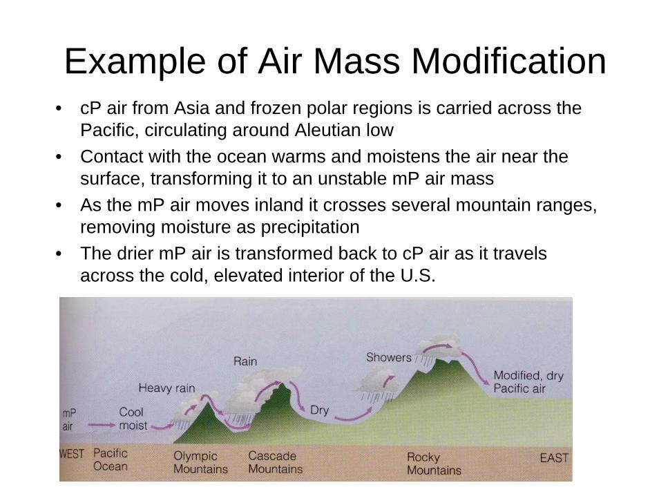
Example of Air Mass Modification• cP air from Asia and frozen polar regions is carried across the
Pacific, circulating around Aleutian low• Contact with the ocean warms and moistens the air near the
surface, transforming it to an unstable mP air mass• As the mP air moves inland it crosses several mountain ranges,
removing moisture as precipitation• The drier mP air is transformed back to cP air as it travels
across the cold, elevated interior of the U.S.

Air Masses

Fronts
• Fronts are the boundary or interface between air masses of different density
• A front is located on the warm side of a thickness gradient
• Generally, fronts are identified and plotted where the interface intersects the ground –surface maps
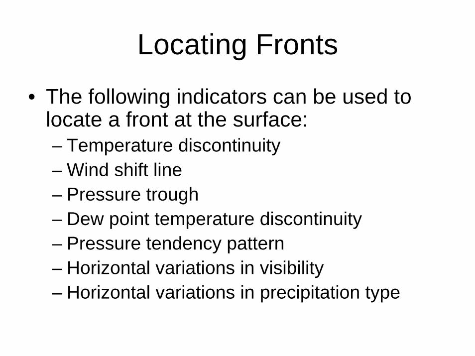
Locating Fronts
• The following indicators can be used to locate a front at the surface:– Temperature discontinuity– Wind shift line– Pressure trough– Dew point temperature discontinuity– Pressure tendency pattern– Horizontal variations in visibility– Horizontal variations in precipitation type
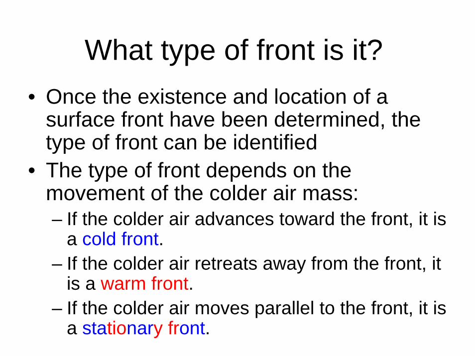
What type of front is it?• Once the existence and location of a
surface front have been determined, the type of front can be identified
• The type of front depends on the movement of the colder air mass:– If the colder air advances toward the front, it is
a cold front.– If the colder air retreats away from the front, it
is a warm front.– If the colder air moves parallel to the front, it is
a stationary front.

There are 5 basic fronts:1. Cold front
– shown on surface maps as blue lines with blue triangles which point in the direction of the warmer air
– at a cold front cold air is displacing the warmer air ahead of the front– SW winds ahead of front, gusty NW winds behind front– Dry air behind front– Pressure falls ahead of front, rises behind front– Excellent visibility behind cold front– Deep cumulus convection ahead of front
2. Warm front– Shown on surface maps as red lines with red semicircles which point in
the direction of the colder air– At a warm front, cold air is retreating on the cold side of the front and is
being replaced by warmer air– E winds ahead of front, S/SW winds behind front – not gusty– Weaker temperature gradients, pressure falls with warm front– Poor visibility ahead of warm front– Steady precipitation ahead of front
Characteristics of Fronts
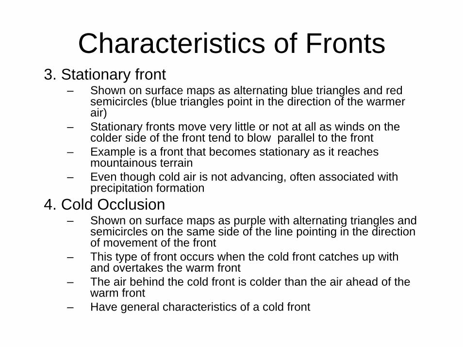
3. Stationary front– Shown on surface maps as alternating blue triangles and red
semicircles (blue triangles point in the direction of the warmerair)
– Stationary fronts move very little or not at all as winds on thecolder side of the front tend to blow parallel to the front
– Example is a front that becomes stationary as it reaches mountainous terrain
– Even though cold air is not advancing, often associated with precipitation formation
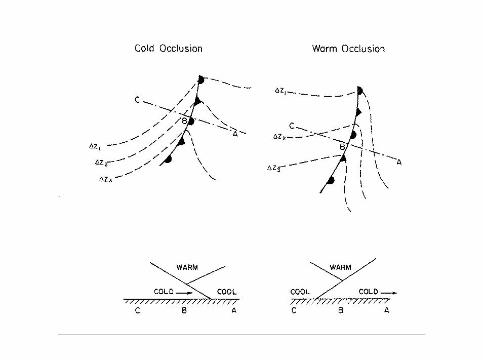
4. Cold Occlusion– Shown on surface maps as purple with alternating triangles and
semicircles on the same side of the line pointing in the direction of movement of the front
– This type of front occurs when the cold front catches up with and overtakes the warm front
– The air behind the cold front is colder than the air ahead of the warm front
– Have general characteristics of a cold front
Characteristics of Fronts

5. Warm Occlusion– Shown on surface maps as purple with alternating
triangles and semicircles on the same side of the line pointing in the direction of movement of the front
– This type of front occurs when the cold front catches up with and overtakes the warm front
– The air behind the cold front is warmer than the air ahead of the warm front
– Have general characteristics of a warm front
• Occluded fronts may also be new fronts that form as the surface low separates itself from the warm/cold front junction and deepens back into the cold air
Characteristics of Fronts

∆Z1 < ∆Z3

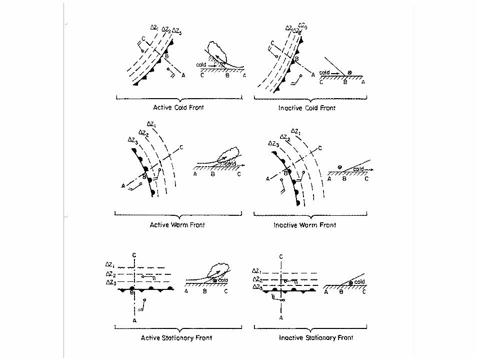
There are two types of each front:
1. Active fronts: occurs when the warmer air mass is overrunning the cold air mass
2. Inactive fronts: occurs when the warmer air mass is not overrunning the cold air mass
Characteristics of Fronts

Typical Cold Front Structure• Cold air replaces warm; leading edge is steep in fast-
moving front shown below due to friction at the ground– Strong vertical motion and unstable air forms cumuliform clouds– Upper level winds blow ice crystals downwind creating cirrus
and cirrostratus• Slower moving fronts have less steep boundaries and
less vertically developed clouds may form if warm air is stable

Typical Warm Front Structure• In an advancing warm front, warm air rides up over colder air at
the surface; slope is not usually very steep• Lifting of the warm air produces clouds and precipitation well in
advance of boundary• At different points along the warm/cold air interface, the
precipitation will experience different temperature histories as it falls to the ground

FRONTAL CHARACTERISTICS
WARM
FRONT COLD FRONT
SEQUENCE Warm air replaces cold air
Cold air replaces warm air
SLOPE ≈1/300
≈1/50
WIND SHIFT Yes, cyclonic Yes, cyclonic TEMPERATURE CHANGE
Cool to warm warm or cool to cold
MOISTURE CHANGE
Yes, air mass dependent
Yes, air mass dependent
PRECIPITATION Steady, large area
Convective, locally heavy
SPEED OF MOVEMENT
5-10 mph (slow)
10-50 mph (fast)

Other Boundaries• Dryline
– Sharp horizontal discontinuity in moisture– Often found during the warm season of the southern U.S.
High Plains– Warm, dry cT air to the west and warm, moist mT air to the
east– Typically, horizontal discontinuities only about 1500 m deep– Does not display typical frontal circulation characteristics– Nearly stationary with a diurnal oscillation– Often serve as a focal point for convective initiation
• Outflow boundary– Cool, moist air that exits and spreads horizontally from a
thunderstorm – a mesoscale cold front– Dry, mid-level air is brought down to the surface in the
downdraft of a thunderstorm– Precipitation evaporates into this air cooling it down– Can act as a focusing mechanism for new thunderstorms– Difficult to detect with current surface network, unless the
outflow boundary is from a large convective system
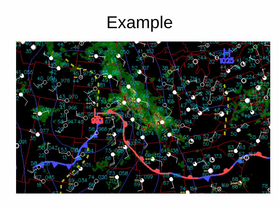
Example

Example

Frontal Vertical Cross Section

Frontal Vertical Cross Section

Cyclogenesis• Cyclogenesis is the development or
strengthening of an extratropical cyclone• Cyclogenesis occurs in baroclinic
environments - an environment where a thickness gradient exists
• The potential energy associated with the strong horizontal temperature gradients is the source of energy for developing extratropical cyclones
• Baroclinic instability is the primary mechanism for cyclogenesis

Baroclinic Instability
• Baroclinic instability occurs when a north/south temperature gradient becomes so strong in a uniform zonal flow that an infinitesimal perturbation amplifies into a synoptic-scale wave disturbance
• Northerly flow advects colder air southward and southerly flow advects warmer air northward, which increases amplitude of trough/ridge pattern
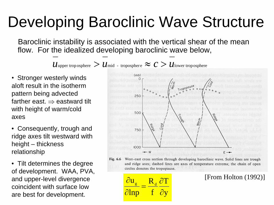
Developing Baroclinic Wave StructureBaroclinic instability is associated with the vertical shear of the mean flow. For the idealized developing baroclinic wave below,
ospherelower tropetropospher-midosphereupper trop ucuu >≈>
[From Holton (1992)]
yT
fR
lnpu
dg
∂∂
=∂∂
• Stronger westerly winds aloft result in the isotherm pattern being advected farther east. ⇒ eastward tilt with height of warm/cold axes
• Consequently, trough and ridge axes tilt westward with height – thickness relationship
• Tilt determines the degree of development. WAA, PVA, and upper-level divergence coincident with surface low are best for development.

Characteristics of Cyclogenesis
• Upper-level divergent geostrophic winds, which generates anticyclonic relative vorticity building the upper-level ridge downstream
• Surface pressure falls in response to upper-level divergent forcing
• Ageostrophic wind convergence acceleration at the surface
• Convergence generates cyclonic vorticity at low levels
• Midlevel ascent and associated cloudiness as a result of the convergence
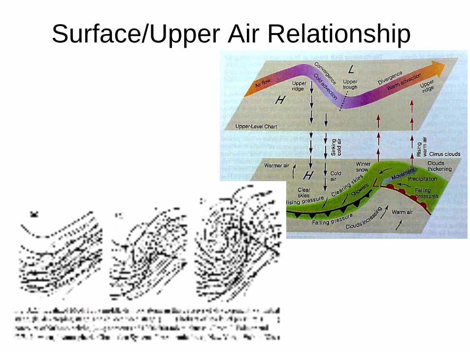
Surface/Upper Air Relationship


3-D Structure of Developing Extratropical Cyclone

Conditions for Cyclogenesis• Favorable:
– The existence of a thickness gradient in the lower troposphere (i.e., a front); particularly when it is anticyclonically curved
– The presence of an upper-level trough with cold advection (CAA) to its rear and warm advection (WAA) ahead also positive vorticity advection ahead and negative vorticity advection behind
– Release of latent heat near the center of the surface low by deep cumulonimbus and stratiform precipitation
• Unfavorable:– A weakening thickness gradient as a result of low-level
divergent flow– The absence of an upper-level trough or a trough with
CAA ahead of it and WAA behind, resulting in a trough which will decrease in intensity with time

Norwegian Cyclone Model
• The Norwegian Cyclone Model is named in honor of the Norwegian meteorologists who first conceptualized the life cycle stages of an extratropical cyclone shortly after World War I.
There needs to be an initial thickness gradient (i.e., front) for cyclogenesis to begin. This is often a stationary front.

Norwegian Cyclone Model
The initial (or incipient) stage of development is often called a wave cyclone. The front becomes anticyclonically curved.
The system continues to strengthen into a more organized system in the development stage.
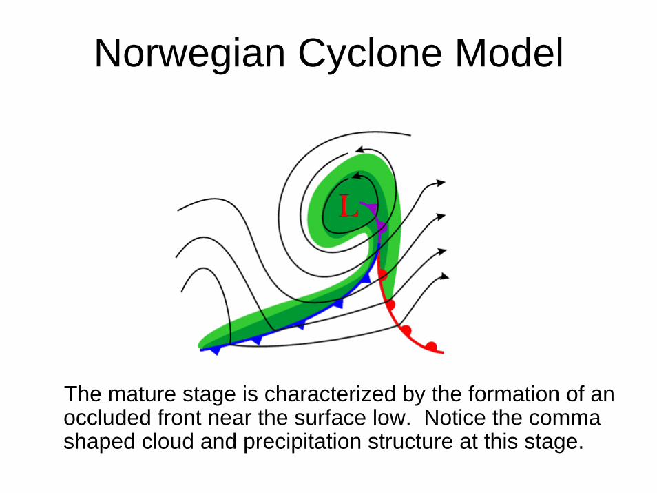
Norwegian Cyclone Model
The mature stage is characterized by the formation of an occluded front near the surface low. Notice the comma shaped cloud and precipitation structure at this stage.
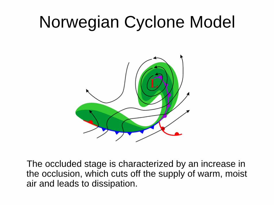
Norwegian Cyclone Model
The occluded stage is characterized by an increase in the occlusion, which cuts off the supply of warm, moist air and leads to dissipation.

Expected Weather Conditions

Trough Patterns• Troughs can be defined by their tilt: positive, neutral (zero), & negative• In a positively tilted trough, zonal momentum is transported northward,
so cold air advection (CAA) is needed into the trough to prevent it from weakening
• The negatively tilted trough will tend to deepen as zonal momentum and cold air is transported into the trough.
• The atmosphere tends to be more unstable with negatively tilted troughs as there is a rapid change from sub- to super-geostrophic winds. In addition, if this tilt occurs east of the Rockies in the U.S., there will be CAA aloft and warm, moist air at the surface
• With the development of extratropical cyclones, it is most common for upper-level troughs to be positively tilted initially and end up neutrally or negatively tilted
uv~0 uv~0 uv~0 uv~0uv>0 uv<0
neutralpositive negative

Preferred Areas of Cyclogenesis• Cyclogenesis occurs farthest south (~37° latitude) in the winter and
is reduced and farthest north (~47° latitude) in the summer.• Cyclogenesis preferentially occurs in strong baroclinic zones and on
the lee side of mountain ranges.

Explosive Cyclogenesis• Explosive (or “bomb”) cyclogenesis occurs when extratropical
cyclones deepen rapidly – the surface pressure falls ~24 mb in 24 hours
• These are often associated with severe weather, strong winds, and heavy precipitation
• Two examples:– President’s Day Storm: 19-20 February 1979
• System dumped ~2 feet of snow from Washington, D.C., to New York• A nor’easter – an extratropical cyclone that develops and intensifies as it
moves northeast along the Atlantic coast of the U.S. bringing heavy precipitation and strong northeast winds along the coast
• Does receive some energy from sensible and latent heat fluxes from the ocean (hurricane characteristic) along with baroclinicity (mid-latitude cyclone characteristic)
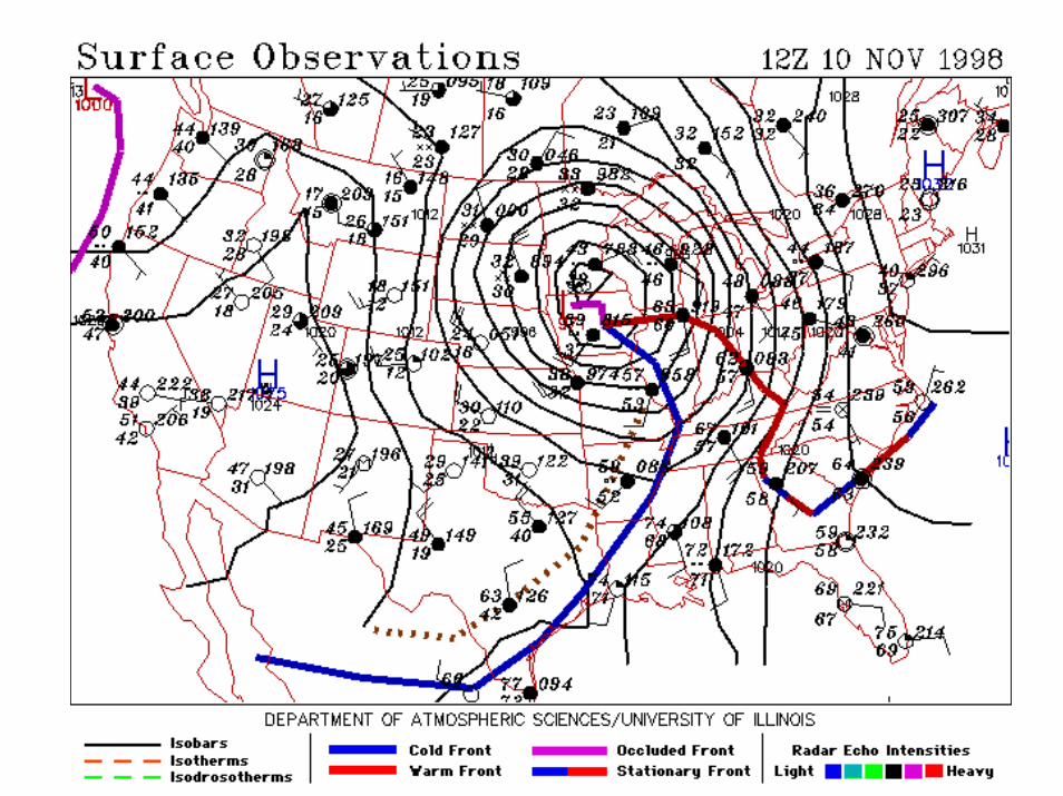
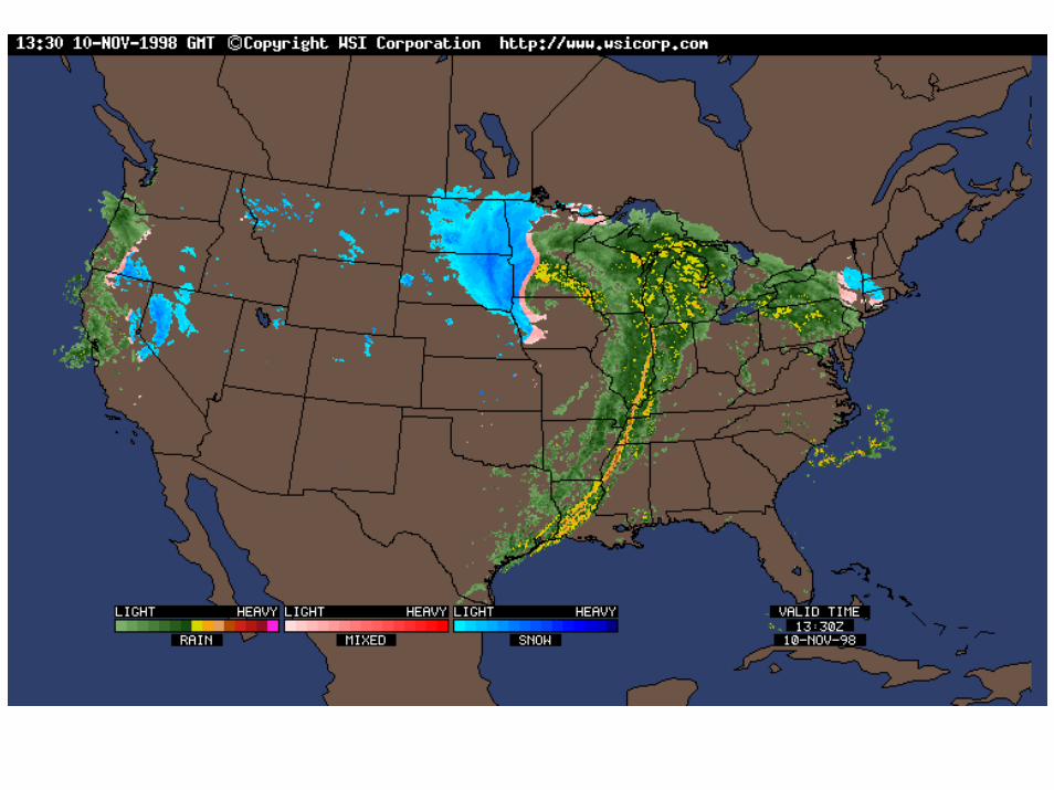
– 9-11 November 1998 over the continental U.S.
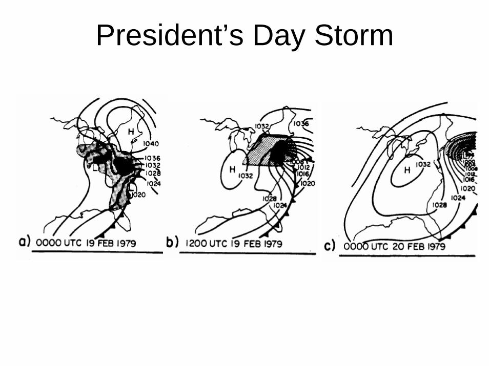
President’s Day Storm
Rapid Cyclone Intensification
An Example from November 9, 10 and 11, 1998


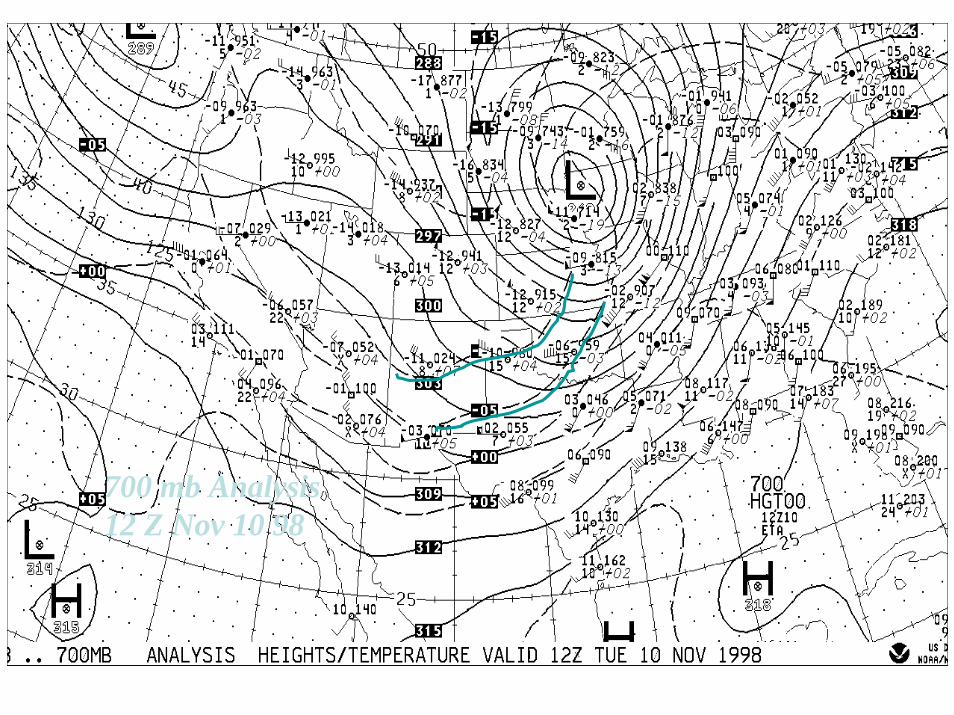
700 mb Analysis12 Z Nov 10 98