Empowering Self Service GIS -...
24
Empowering Self Service GIS NEARC 2015 Cary Chadwick, Emily Wilson, Dave Dickson University of Connecticut Center for Land use Education and Research
-
Upload
nguyenxuyen -
Category
Documents
-
view
220 -
download
4
Transcript of Empowering Self Service GIS -...

Empowering Self Service GISNEARC 2015
Cary Chadwick, Emily Wilson, Dave DicksonUniversity of ConnecticutCenter for Land use Education and Research

University of Connecticut
At a glance• Who am I?• How a failed grant proposal got me here• Web 2.0 & an abbreviated history of web mapping• Be the filter/teach and they will come• Examples of normal people making great maps• What’s the recipe for success?• …and why you shouldn’t worry about your job

University of Connecticut
Center for Land Use Education & Research (CLEAR)
Land & ClimateWater
Mapping & Geospatial
Connecticut NEMO National NEMO NetworkGeospatial Training ProgramLand Use AcademyExtension Forestry ProgramLab for Earth Resource Information Systems (LERIS)
CAHNR Dept. of Extension, CAHNR Dept. of Natural Resources,
Connecticut Sea Grant
University of Connecticut
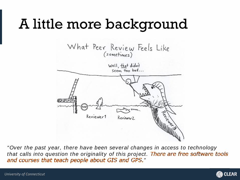
A little more background
“Over the past year, there have been several changes in access to technology that calls into question the originality of this project.
”

University of Connecticut

University of Connecticut
Intergenerational learners
University of Connecticut
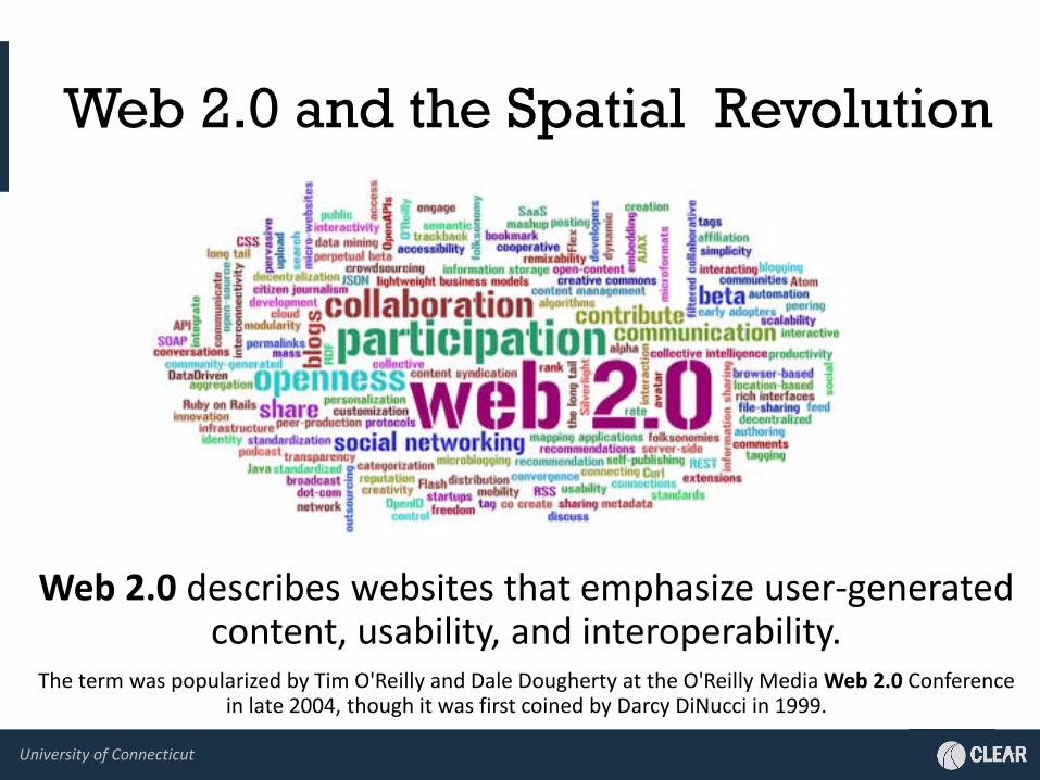
Web 2.0 and the Spatial Revolution
Web 2.0 describes websites that emphasize user-generated content, usability, and interoperability.
The term was popularized by Tim O'Reilly and Dale Dougherty at the O'Reilly Media Web 2.0 Conference in late 2004, though it was first coined by Darcy DiNucci in 1999.

University of Connecticut
Abbreviated History of Web Mapping
Hold on!
200720052004 2011 -present
2002-03
20082000-01
End of “selective
availability” of GPS
Yahoo MapsMapQuest
Google LocalGoogle is buyingOpenSteetMap
Google Street View50K+ Google
MashupsOpen SourceGTP Training
Esri ArcIMS
“The Cloud”WYSIWYG Builders,AGOL,HTML5,
Smart devices,Data, data, data
The Year Maps Broke the Internet2/8/05 – “G-Day”
“mashups”APIs
APIs!250K sites
GM API
2010
dot com madness
NASA WWKeyhole, Inc.
2008-09
RESTAPIs,
ArcGIS.comApple game changer

University of Connecticut
be the filter

University of Connecticut
Getting easier, still not easy
• “Self-service GIS” is still elusive.- Points on a map = easy. Feature access = not so much. - Constraints:
- IT support/overhead for configuration and maintenance- Training and skill acquisition- Budget- Time
• Just because it’s hard doesn’t mean we don’t try!

University of Connecticut
Teach and they will come
• Introduction to Desktop GIS• Introduction to Web Mapping• Introduction to ArcGIS Online (public)• Introduction to ArcGIS Online for Organizations• ArcGIS Online for Organizations, Advanced Topics• Introduction to Smartphone GPS Apps and Maps

University of Connecticut
Provide (good) toolsCT Environmental Conditions Online (CT ECO)Built to “encourage, support, and promote informed land use decisions in CT by providing local, state and federal agencies and the general public with convenient access to natural resource maps and information on the web”
http://cteco.uconn.edu

University of Connecticut
CT ECO
Maps for everyone• Map Catalog• Map Viewers• Map Services• ArcGIS Online• Data Guides• Data, Data, Data
University of Connecticut
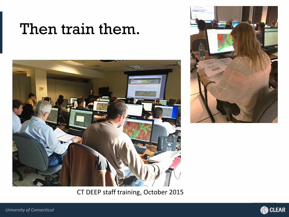
Then train them.
CT DEEP staff training, October 2015

University of Connecticut
They will make beautiful maps!

University of Connecticut
Citizen VolunteersCT Land Conservation Council
Land TrustsMunicipal Commissions
Inland WetlandsConservationShellfish

University of Connecticut
More Beautiful Maps!

University of Connecticut
Student Volunteers
Natural Resources Conservation Academy- Immersive summer field experience- Group project- Community projects
http://nrca.uconn.edu

University of Connecticut
Student Volunteers

University of Connecticut
Community Projects
University of Connecticut
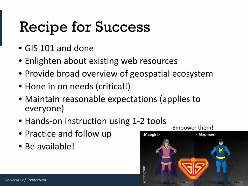
Recipe for Success• GIS 101 and done• Enlighten about existing web resources• Provide broad overview of geospatial ecosystem• Hone in on needs (critical!)• Maintain reasonable expectations (applies to
everyone)• Hands-on instruction using 1-2 tools• Practice and follow up• Be available!
Empower them!
@es
rigra
m

University of Connecticut
Outcomes and Offshoots• CTECO usage is up and rising• Volunteer based orgs and geospatial neophytes are
now creating their own effective maps• State agencies are more efficient at accomplishing
GIS related tasks• State regulators using web based GIS to improve
some application processes• Younger generations are engaged

University of Connecticut
Concluding thoughts• KISS and tell only what you need to• Provide open, easy access to your data (plan ahead!)• And yet, it’s still not easy, is it?
- CT Land Cover story map
Don’t worry, our jobs are safe. For now.

http://s.uconn.edu/clearfb
http://blog.clear.uconn.edu
@UConnCLEAR_GTP
http:clear.uconn.edu
Thank You!
Dave and Cary prep for training