DEVELOPMENT - UN-Habitat
188
URBAN LEGAL NETWORK SUPPLY OF LAND FOR DEVELOPMENT LAND READJUSTMENT EXPERIENCE IN GUJARAT, INDIA URBAN LEGAL CASE STUDIES VOLUME 2
Transcript of DEVELOPMENT - UN-Habitat

U R B A N L E G A L N E T W O R K
SUPPLY OF LAND FOR DEVELOPMENT LAND READJUSTMENT EXPERIENCE IN GUJARAT, INDIA
URBAN LEGAL CASE STUDIES
VOLUME 2
HU
AM
BO
LAN
D R
EAD
JUSTM
ENT


VOLUME 2:
SUPPLY OF LAND FOR DEVELOPMENT:
LAND READJUSTMENT EXPERIENCE IN
GUJARAT, INDIA
URBAN LEGAL CASE STUDIES
2013

SUPPLY OF LAND FOR DEVELOPMENT:
LAND READJUSTMENT EXPERIENCE IN GUJARAT, INDIA
First published in Nairobi in 2013 by UN-HabitatCopyright © United Nations Human Settlements Programme 2013
All rights reservedUnited Nations Human Settlements Programme (un-habitat)P. O. Box 30030, 00100 Nairobi KenyaTel: +254 - 020 - 762 3120 (Central Office)www.Unhabitat.Org
HS Number: HS/057/13EISBN number (series): 978-92-1-133365-7ISBN number (volume): 978-92-1-132600-0
DISCLAIMER:
The designations employed and the presentation of the material in this guide do not imply the expression of any opinion whatsoever on the part of Secretariat of the United Nations concerning the legal status of any country, territory, city or area of its authorities, or concerning the delimitation of its frontiers or boundaries. Views expressed in this publication do not necessarily reflect those of the United Nations Human Settlements Programme, the United Nations, or United Nations Member States.
ACKNOWLEDGEMENTS:
Principal author: Shirley Ballaney Team leader: Solomon HaileDesign and layout: Emma-Liisa Hannula, Paul OpondoEditors: Melissa Permezel, Vicky QuinlanContributors: Solomon Haile, Robert Lewis Lettington, Melissa Permezel and Gianluca Crispi
COVER PHOTO:
Survey of Areas by GPS. © Environmental Planning Collaborative, Ahmedabad

EXECUTIVE SUMMARY
ACKNOWLEDGEMENTS ABBREVIATIONS 1 INTRODUCTION 5
URBAN AREAS IN GUJARAT - DELINEATION AND GOVERNANCE
GOVERNANCE AND PLANNING LEGISLATION
URBAN AREAS IN GUJARAT - SPATIAL DELINEATION
CHAPTER 1: LAND MANAGEMENT IN URBAN GUJARAT 11
1.1 URBAN AREAS IN GUJARAT - DELINEATION AND GOVERNANCE 11
1.2 GOVERNANCE AND PLANNING LEGISLATION 12
CHAPTER 2: THE PLANNING PROCESS IN GUJARAT 27
2.1 LAND MANAGEMENT IN URBAN GUJARAT 27
2.2 LAND MANAGEMENT FUNCTIONS 28
CHAPTER 3: THE PLANNING PROCESS 37
3.1 HISTORY OF PLANNING LEGISLATION IN GUJARAT 37
3.2 THE DEVELOPMENT PLAN - TOWN PLANNING SCHEME MECHANISM FOR
URBAN PLANNING IN GUJARAT 48
3.3 STATUS OF DEVELOPMENT PLANS AND TOWN PLANNING SCHEMES
IN GUJARAT 56
CHAPTER 4: SUPPLY OF LAND FOR DEVELOPMENT 69
4.1 ROUTES FOR SUPPLY OF LAND 69
4.2 COMPARATIVE OVERVIEW OF METHODS FOR LAND SUPPLY 99
CONTENTS

4.3 SUMMARY 104
CHAPTER 5: LAND READJUSTMENT IN URBAN GUJURAT 105
5.1 LAND ZONED AND TRANSFORMED FOR URBAN DEVELOPMENT 105
5.2 SUCCESSFUL ASPECTS OF THE TOWN PLANNING SCHEME MECHANISM 113
5.3 LIMITATIONS OF THE TOWN PLANNING SCHEME MECHANISM 146
CHAPTER 6: LESSONS FOR NATIONAL POLICY 157
6.1 SUMMARY 157
6.2 IMPROVEMENTS TO THE GUJARAT MODEL OF LAND READJUSTMENT 157
6.3 TRANSFERRING THE LAND READJUSTMENT PRACTICE TO OTHER STATES
AND COUNTRIES AROUND THE WORLD 166
BIBLIOGRAPHY 169
APPENDICES 171
LIST OF FIGURES
FIGURE 1.1.1: CATEGORIZATION OF URBAN AREAS IN GUJARAT 12
FIGURE 1.2.1: DELINEATION OF A MUNICIPAL CORPORATION 14
FIGURE 1.2.2: DELINEATION OF A MUNICIPAL BOROUGH 17
FIGURE 1.2.3: DELINEATION OF DISTRICTS, TALUKAS AND VILLAGES 19
FIGURE 1.2.4: DELINEATION OF AN URBAN DEVELOPMENT AREA 23
FIGURE 1.2.5: DELINEATION OF A CONSTITUTED DEVELOPMENT AREA 23
FIGURE 1.2.6: DELINEATION OF A DESIGNATED DEVELOPMENT AREA 24
FIGURE 1.3.1: URBAN AREAS OF GUJARAT 26
FIGURE 2.2.1: DELINEATION OF A DESIGNATED DEVELOPMENT AREA 28
FIGURE 2.2.2: PROCESS FOR CONVERTING LAND TENURE 31
FIGURE 2.2.3: PROCESS FOR OBTAINING NA PERMISSION 32
FIGURE 3.1.1: KEY AMENDMENTS TO THE GUJARAT TOWN PLANNING AND URBAN
DEVELOPMENT ACT IN 1999 48
FIGURE 3.2.1: DP – TPS PLANNING PROCESS 49
FIGURE 3.2.2: DEVELOPMENT PLAN, AHMEDABAD, 2002 51

FIGURE 3.3.3: PROPOSED TOWN PLANNING SCHEMES, DEVELOPMENT PLAN,
AHMEDABAD, 2002 56
FIGURE 4.1.1: DP – TPS ROUTE FOR SUPPLY OF LAND FOR DEVELOPMENT 70
FIGURE 4.1.2: TPS 93 VINZOL 2, FINAL PLOT PLAN 73
FIGURE 4.1.3: DDO ROUTE FOR SUPPLY OF LAND FOR DEVELOPMENT 75
FIGURE 4.1.4: GROWTH OF BOPAL VILLAGE OUTSIDE THE CITY LIMITS
OF AHMEDABAD 78
FIGURE 4.1.5: CHANGODAR – DEVELOPMENT OF INDUSTRIAL AREAS
OUTSIDE CITY LIMITS OF AHMEDABAD 79
FIGURE 4.1.6: REDEVELOPMENT ROUTE FOR SUPPLY OF LAND FOR DEVELOPMENT 80
FIGURE 4.1.7: REDEVELOPMENT OF AREAS 83
FIGURE 4.1.8: TOWNSHIP ROUTE FOR SUPPLY OF LAND FOR DEVELOPMENT 84
FIGURE 4.1.9: SAFAL KANETI TOWNSHIP NEAR AHMEDABAD 89
FIGURE 4.1.10: ARVIND TOWNSHIP NEAR AHMEDABAD 90
FIGURE 4.1.11: SPECIAL ACT ROUTE – SPECIAL ECONOMIC ZONES FOR SUPPLY
OF LAND FOR DEVELOPMENT 91
FIGURE 4.1.12: SPECIAL ACT ROUTE – SPECIAL INVESTMENT REGIONS FOR
SUPPLY OF LAND FOR DEVELOPMENT 95
FIGURE 4.1.13: SEZS IN GUJARAT 97
FIGURE 4.1.14: SIRS IN GUJARAT 97
FIGURE 4.1.15: UNREGULATED DEVELOPMENTS 99
FIGURE 5.1.1: FINALIZED TPS DOCUMENT 111
FIGURE 5.1.2: TRANSFORMATION OF LAND THROUGH TOWN PLANNING SCHEMES,
AHMEDABAD 112
FIGURE 5.2.1: TOWN PLANNING SCHEMESIN AHMEDABAD OVER THE YEARS 116
FIGURE 5.2.2: TOWN PLANNING SCHEMESIN AHMEDABAD UNDER VARIOUS ACTS 116
FIGURE 5.2.3: ROAD NETWORK IN THE DEVELOPMENT PLAN 2002, AHMEDABAD 119
FIGURE 5.2.4: TOWN PLANNING SCHEMES ALONG THE RING ROAD, AHMEDABAD 122
FIGURE 5.2.5: ORIGINAL PLOTS, TOWN PLANNING SCHEME NO. 54 OGNAJ,
AHMEDABAD 123
FIGURE 5.2.6: FINAL PLOTS, TOWN PLANNING SCHEME NO. 54 OGNAJ,
AHMEDABAD 124
FIGURE 5.2.7: SARDAR PATEL RING ROAD, AHMEDABAD 125
FIGURE 5.2.8: LOW INCOME HOUSING IN TOWN PLANNING SCHEME PRAHLADNAGAR,
AHMEDABAD 126
FIGURE 5.2.9: TOPOGRAPHICAL SURVEY AND BOUNDARY,
TPS 97 NARODA NORTH 129
FIGURE 5.2.10: FINAL PLAN, TPS 97 NARODA NORTH 129
FIGURE 5.2.11: TOWN PLANNING SCHEME BOUNDARIES, WALLED CITY, BHUJ 133
FIGURE 5.2.12: TOWN PLANNING SCHEME 2, ORIGINAL PLOTS, WALLED CITY, BHUJ 134
FIGURE 5.2.13: TOWN PLANNING SCHEME 2, FINAL PLOTS, WALLED CITY, BHUJ 135
FIGURE 5.2.14: LOCATION OF THE INSTITUTIONAL ZONE, KOBA 136
FIGURE 5.2.15: GOVERNMENT LANDS, KOBA, GANDHINAGAR 137
FIGURE 5.2.16: INSTITUTIONAL ZONE, KOBA, GANDHINAGAR 138
FIGURE 5.2.17: F FORM OR THE LAND VALUATION AND DISTRIBUTION TABLE 143
LIST OF TABLES
TABLE 1.3.1: NUMBER AND TYPE OF URBAN AREAS 25
TABLE 2.2.1: LAND MANAGEMENT FUNCTIONS 28
TABLE 3.3.1: STATUS OF DEVELOPMENT PLANS IN GUJARAT 56
TABLE 3.3.2: TIME TAKEN TO PREPARE DEVELOPMENT PLANS IN GUJARAT 57
TABLE 3.3.3: TIMELINES PRESCRIBED IN THE GUJARAT TOWN PLANNING AND
URBAN DEVELOPMENT ACT 1976 TO PREPARE DEVELOPMENT PLANS 60
TABLE 3.3.4: TIME LAG BETWEEN THE PRINCIPAL AND IST REVISION
DEVELOPMENT PLANS 60
TABLE 3.3.5: STATUS OF TOWN PLANNING SCHEMES IN GUJARAT 63
TABLE 3.3.6: STATUS OF TOWN PLANNING SCHEMES IN AHMEDABAD 64
TABLE 3.3.7: TIME TAKEN TO FINALIZE TOWN PLANNING SCHEMES IN GUJARAT 65
TABLE 3.3.8: TIME TAKEN TO FINALIZE TOWN PLANNING SCHEMES IN AHMEDABAD 65
TABLE 3.3.9: TIMELINES PRESCRIBED IN THE GUJARAT TOWN PLANNING AND
URBAN DEVELOPMENT ACTTO PREPARE TOWN PLANNING SCHEMES 66
TABLE 4.1.1: STATUS AND DETAILS OF TOWNSHIPS IN AHMEDABAD
URBAN DEVELOPMENT AUTHORITY LIMITS 88
TABLE 4.1.2: STATUS AND DETAILS OF SPECIAL ECONOMIC ZONES IN GUJARAT 94
TABLE 4.1.3: STATUS OF SPECIAL INVESTMENT REGIONSIN GUJARAT 96

TABLE 4.2.1: COMPARATIVE OVERVIEW OF METHODS FOR SUPPLY OF LAND 101
TABLE 5.1.1: ESTIMATES OF LAND ZONED FOR URBAN DEVELOPMENT IN GUJARAT 106
TABLE 5.1.2: ESTIMATES OF LAND UNDER TOWN PLANNING SCHEMES IN GUJARAT 107
TABLE 5.1.3: ESTIMATES OF LAND UNDER TOWN PLANNING SCHEMES IN
AHMEDABAD 108
TABLE 5.1.4: STAGES IN THE PREPARATION OF ATOWN PLANNING SCHEME 110
TABLE 5.2.1: LAND APPROPRIATED IN AHMEDABAD THROUGH TOWN PLANNING
SCHEMES 117
TABLE 5.2.2: LAND DETAILS FOR THE SARDAR PATEL RING ROAD, AHMEDABAD 124
TABLE 5.2.3: KEY STATISTICS OF TPS NARODA NORTH, AHMEDABAD 128
TABLE 5.2.4: PLOT DEDUCTION POLICY, BHUJ 134
TABLE 5.2.5: INSTITUTIONAL ZONE LAND DETAILS, KOBA, GANDHINAGAR 138


A core objective of UN-Habitat is to develop and disseminate knowledge and information about urban law, particularly through the mechanism of the Urban Legal Network. This publication is the second in a series of informative papers supported by UN-Habitat’s Urban Legislation Unit and the Urban Legal Network, a chapter of the Global Land Tool Network.The aim of the series is to capture and share the experiences and findings from research and projects that can make important contributions to our understanding of urban law and development.
This publication focuses on an area of significant interest to UN-Habitat: the potential of land readjustment as a tool to deliver serviced land at scale in developing countries. The potential benefits for urban development of a good land readjustment process and outcome are significant. These benefits include land value sharing as an effective means to distribute costs, enhanced community engagement, and an enhanced capacity for authorities to reshape urban areas to meet current and future demands. These characteristics mean that land readjustment can improve working relationships between landowners, developers and public authorities, including through public-private partnerships. Importantly for UN-Habitat, land readjustment could do this while limiting the growth of informal settlements and addressing key needs of the poor, such as adequate shelter and affordable access to the economic life of urban areas.
The case study featured here, on land readjustment in the state of Gujarat India, provides an opportunity to learn about the potential, and the challenges, of land readjustment in a state experiencing rapid urban growth and grappling with a comprehensive but complex town planning scheme. The case of Gujarat presented in this publication, yields useful detailed technical information on the relationship between the land readjustment and the state’s town planning scheme which was updated in 1999. The publication shows how land readjustment as a tool, can deliver important urban development outcomes. Perhaps, however, of equal importance, is the case study’s analysis of how the planning scheme could be improved to facilitate more effective land readjustment outcomes and thus improved urban development.
We would like to thank Shirley Ballaney very much for her efforts.
EXECUTIVE SUMMARY


SUPPLY OF LAND FOR DEVELOPMENT: LAND READJUSTMENT EXPERIENCE IN GUJARAT, INDIA 1
Several people have generously contributed in various capacities and have enriched this paper:
Dr. Bimal Patel, for overall guidance in structuring the study and specific comments while reviewing numerous drafts; Ms. Neela Munshi, for several discussions on methods of land supply and providing the data on town planning schemes and Special Economic Zones for the Ahmedabad Development Authority area; Mr. M. M. Bhowmick, for discussions on methods of land supply and providing data for the Special Investment Regions in Gujarat; Mr. Rajesh Raval, for data on town planning schemes in Gujarat; Mr. R. B. Joshi, for discussions on the town planning scheme mechanism; Mr. B. Rajyaguru, for discussions on the provisions of the Planning Acts in Gujarat; Mr. Vatsal Patel, for innumerable clarifications on the provisions of the Gujarat Town Planning and Urban Development Act, 1976, the town planning scheme process and discussions on the draft; Mr. Ashwin Jagani at the Ahmedabad Urban Development Authority, Mr. Mahesh Shah at the Vadodara Urban Development Authority and Mr. R. Rupani at Rajkot Urban Development Authority for updated data on town planning schemes from the respective development authorities; Ms. Bindu Nair, for collating the database of urban areas and town planning schemes in Gujarat; Mr. Atul Patel, for the drawings and collating the data; Ms. Eashani Patel, for the drawings and collating the data and the Staff at UN-Habitat for reviewing and giving constructive comments that enriched the study.
ACKNOWLEDGEMENTS

ACKNOWLEDGEMENTS2

ADA Area Development Authority AMC Ahmedabad Municipal Corporation AUDA Ahmedabad Development Authority BPMCA Bombay Provincial Municipal Corporation Act BLRC Bombay Land Revenue Code BRTS Bus Rapid Transit System BTPA Bombay Town Planning Act CTP Chief Town Planner CEPT Centre for Environmental Planning and Technology DA Development Authority DDO District Development Officer DIC District Industries Commissioner EPC Environmental Planning Collaborative EPCDPM EPC Development Planning and Management DP Development Plan FSI Floor Space Index GIDB Gujarat Infrastructure Development Board GMA Gujarat Municipalities Act GPA Gujarat Panchayats Act GTPUDA Gujarat Town Planning and Urban Development Act GUDC Gujarat Urban Development Company NA Non Agricultural NOC No Objection Certificate NGO Non-Governmental Organization NT New Tenure OSD Officer on Special Duty POC Prescribed Officer Committee PS Principal Secretary RDP Revised Development Plan RT Restricted Tenure SEZ Special Economic Zone SCC State Screening Committee SG State Government SIR Special Investment Region
SUPPLY OF LAND FOR DEVELOPMENT: LAND READJUSTMENT EXPERIENCE IN GUJARAT, INDIA 3
ABBREVIATIONS
SRFD Sabarmati Riverfront Development SUPLM Streamlining Urban Planning and Land Management in Gujarat TPO Town Planning Officer TPS Town Planning Scheme TPVD Town Planning and Valuation Department UDA Urban Development Authority UD&UHD Urban Development and Urban Housing Department
ABBREVIATIONS4

BACKGROUND
The United Nations Human Settlements Programme, UN-Habitat, is the agency mandated by the United Nations General Assembly to promote socially and environmentally sustainable towns and cities with the goal of providing adequate shelter for all.
UN-Habitat has initiated a process of strengthening its urban legal knowledge and recently identified seven new focus areas, one of which is “urban legislation, land and governance”. The agency sees an important opportunity to influence member states’ and Habitat Agenda Partners’ initiatives on developing new and transforming old urban legislation. UN-Habitat has chosen to focus on a particular set of legal tools used to facilitate large-scale urban expansion, known as land readjustment / land pooling.
India, and in particular the state of Gujarat, has a lengthy history of implementing land readjustment. It has been successfully used to achieve a range of objectives. For example, it was used to reconstruct and rebuild the city of Bhuj after it was devastated by a massive earthquake on 26 January 2001 to build a 76km long ring road in Ahmedabadin 2004 to provide infrastructure in new growth areas etc. Land readjustment has proved to be flexible and versatile, and can be used to address a wide range of urban challenges. The Gujarat model of land readjustment is also enshrined in its urban planning legislation – the Gujarat Town Planning and Urban Development Act of 1976. Land readjustment in Gujarat is popularly referred to as the town planning scheme (TPS) mechanism.
The Gujarat model is an important case to understand. Land readjustment in India has been used in some innovative ways which the Gujarat case study suggests - but it also highlights some areas of where in the Gujurat and perhaps broader India context, approaches to land readjustment can be improved. In particular, in community engagement, by improving how current town planning schemes enable land readjustment and how the associated infrastructure is developed.
UN-Habitat commissioned the study on Documenting the Land Readjustment Experience in Gujarat, India, with a two-fold purpose:
INTRODUCTION
SUPPLY OF LAND FOR DEVELOPMENT: LAND READJUSTMENT EXPERIENCE IN GUJARAT, INDIA 5

1. To review the broader urban management and governance context and systematically interrogate the town planning scheme process, outcomes and limitations. This is with regard to:
(a) Legislation: the legal framework and experience of land readjustment in Gujarat. (b) Land management: impacts on supply of (serviced) land, secure access to land, the creation of public space, the functioning of land markets, etc. (c) Planning: contribution to improving local planning practice. (d) Local government finance: contribution to financing infrastructure services. (e) Governance: promotion of participation and collective action of stakeholders or affected communities.
The Gujarat experience could provide answers to some key questions (and many others):
i) What are the unique elements of Gujarat’s approach to and way of doing land readjustment? What areas of good practice should be taken into account by other countries considering using land readjustment or similar tools?
ii) Does land readjustment promote the assembly of better cadastral information and land administration information? How is this achieved in practice and are there legislative steps that support this process?
iii) To what extent does the implementation of land readjustment in Gujarat assist the poor and very poor to access secure tenure rights to developable urban land?
iv) Does the land readjustment process displace poorer citizens? If yes, then what measures adopted in Gujarat successfully mitigate this?
v) How does the implementation of land readjustment in Gujarat acknowledge and accommodate irregular construction?
vi) Does the practice of land readjustment in Gujarat realize the potential of managing development as envisioned in the development plan?
2. To review the Gujarat land readjustment experience from a national perspective with a view to guiding a future process of legislative reform – to reflect on issues and concerns to be taken into account when considering legislative options that govern urban land supply and expansion.
INTRODUCTION6

APPROACH
A set of key questions to structure the study were framed to meet the objectives and address the issues raised in the terms of reference:
1. Urban Gujarat a) How is urban Gujarat governed? b) How much of Gujarat is urban?
2. Urban land management in Gujarat a) How is urban land managed in Gujarat? b) What are the various land management functions?
3. Urban planning in Gujarat? a) Under what laws/legislation is urban planning done in Gujarat? b) What is the prescribed planning process? c) How up-to-date are urban plans in Gujarat? How long does it take to prepare plans? d) How up-to-date are the town planning schemes in Gujarat and Ahmedabad? How long does it take to prepare schemes?
4. Supply of land for development a) What are the various methods for ensuring a supply of land for development? b) How do the various methods of land supply compare with each other?
5. Land readjustment in urban Gujarat a) How much land has been zoned for urban development in Gujarat? For how much of this land have town planning schemes been prepared? b) What aspects of Gujarat’s land readjustment process have made it successful? c) What aspects of Gujarat’s land readjustment process have not been successful? What improvements can be made to the land development process? 6. Lessons for national policy a) Can the urban land development process in Gujarat provide useful lessons for other states?
The town planning scheme mechanism is a method to supply serviced land in urban areas. Section 1 begins with a brief review of the legislative framework for governance and planning for urban areas and a clear spatial definition of urban areas for the purpose of governance and planning as it impacts the town planning scheme process.
SUPPLY OF LAND FOR DEVELOPMENT: LAND READJUSTMENT EXPERIENCE IN GUJARAT, INDIA 7

Section 2 presents a summary of functions and issues pertaining to land administration in Gujarat to understand the linkage between the planning and land administration processes and the constraints imposed on the supply of land for development.
Section 3 traces the legal framework within which land readjustment was designed and implemented; it also demonstrates how the framework has been continuously improved over time and has been made more effective.1 An in-depth review of the planning process is presented along with the roles of various stakeholders. A review of all the development plans and town planning schemes shows how extensively the mechanism has been used in Gujarat and provides pointers towards the efficacy of the mechanism, which is dealt with in section 5.
As mentioned above, the development plans – town planning scheme mechanism is one methods used to supply serviced land for development and it is useful to compare it with other methods of land supply. Section 4 presents this comparative analysis and its inferences, some of which are discussed further in Section 5 – improvements required in the town planning scheme mechanism.
Section 5 also expands on the use of the mechanism in Gujarat with 1) empirical data – analysing the status of all the town planning schemes prepared in Gujarat and estimating how much of the land zoned in the development plans is transformed though this mechanism; 2) examples and the successful aspects; and finally 3) some of the limitations, drawing on some of the data presented in section 3 and section 4.
Section 6 concludes the study with an outline of the improvements required in the mechanism in Gujarat, as well as recommendations for transferring the land readjustment practice to other states in India and other cities around the world.
METHODOLOGY
The study is based on qualitative first and secondary sources of information. In particular, data was gathered from the author’s information sources as well as from a limited collection of data and case studies as required. The following specific tasks were undertaken:
• Adesktopreviewandanalysisoftheavailablematerial(policies,urban planning and land readjustment projects • Facetofaceandtelephoneinterviewsandconsultationswithpractitioners, policy makers, officials, etc. were carried out to get inputs, clarification and opinions.2
1 This is not to say that the process is perfect but to point out that it has been continuously improved over the years.
2A list of the people interviewed is given in Appendix 1.
INTRODUCTION8

• LimiteddataonthestatusofthetownplanningschemesinGujaratwas obtained to assess the situation with respect to the implementation of a particular land readjustment project. • Interimdraftswerereviewedbymentorsandexpertstocrosscheckthe information and to strengthen and verify the analysis.
LIMITATIONS
i) Coverage of the study
The study is limited to the Gujarat model of land adjustment, which is referred to as the town planning scheme mechanism in this report. This study does not attempt to compare this mechanism with other forms of land adjustment practised in other countries for two reasons: 1) There is no access to primary data on these and without this it would not be meaningful to compare forms of land adjustment; and 2) there is enough documentation on other studies on the topic in case a limited comparison is required. Instead, the study focuses on analysing the town planning scheme practice and process in Gujarat.
The study is based on a universally accepted understanding of land readjustment. Archer (1992) defines land readjustment as a technique for managing the urban development of urban-fringe lands, whereby a group of separate land parcels are assembled for their unified planning, servicing and subdivision as a single estate, and redistribution of new building plots back to the original landowners. The study broadly accepts this definition and the town planning scheme mechanism is this with additional aspects involving valuing of costs and benefits and allocating these in an equitable manner. These will become clear when we examine the process in detail.
ii) Review of the legal frameworks
This study is limited to the review of only that legislation (and only to the extent possible), that specifically helps to understand and affect the practice of the town planning scheme mechanism in Gujarat.
There is no attempt to address wider urban development issues or to provide a comprehensive overview of all legislation either at the national or federal level.
SUPPLY OF LAND FOR DEVELOPMENT: LAND READJUSTMENT EXPERIENCE IN GUJARAT, INDIA 9

INTRODUCTION10

1.1 URBAN AREAS IN GUJARAT– DELINEATION AND GOVERNANCE
The Census of India 2001 defines “urban” areas as:
(a) All statutory places such as with a municipality, corporation, cantonment board or notified town area committee, etc. (b) A place satisfying the following three criteria simultaneously: i) a minimum population of 5,000; ii) at least 75 per cent of the male working population engaged in non- agricultural pursuits; and iii) a population density of at least 400 per km2 (1,000 per mile2).3
In Gujarat, “statutory places” such as a municipal corporation, municipality, notified areas etc. are defined by the following legislation:
1. Bombay Provincial Municipal Corporation Act 2. Gujarat Municipalities Act 3. Gujarat Panchayats4 Act 4. Gujarat Town Planning and Urban Development Act
The basic spatial unit is the “revenue village” for the purpose of administration and all cadastral maps and records are prepared and maintained by revenue villages. A group of villages creates a taluka and a district for the purpose of state administration. All data is recorded accordingly, viz., population, land records, maps etc. A group of villages forms a municipal corporation or a municipality for the purpose of municipal functions. A group of villages, municipal corporations and or municipalities create a development authority for the purpose of planning and regulating growth. Though not so simple, an attempt is made to illustrate this spatial relationship in Figure 1.1.1 below:
3 See http://censusindia.gov.in/Metadata/Metada.htm#24 Panchayat refers to the local government for either a village, taluka or a district. See a review of the Gujarat Panchayats Act (1993) further in this section.
01 URBAN GUJARAT
SUPPLY OF LAND FOR DEVELOPMENT: LAND READJUSTMENT EXPERIENCE IN GUJARAT, INDIA 11

1.2 GOVERNANCE AND PLANNING LEGISLATION
This section reviews the major provisions in each piece of legislation listed above to give an overview of the governance and planning legislative framework in Gujarat5 as it affects the process and practice of the town planning scheme mechanism. This will help to better understand the mechanism’s various facets. These pieces of legislation not only define and delineate the urban areas but they also determine the constitution of governing authorities, their mandate, responsibilities and powers.
While the first three Acts focus on municipal management, governance and development, the fourth Act focuses on land-use planning and many urban development issues.
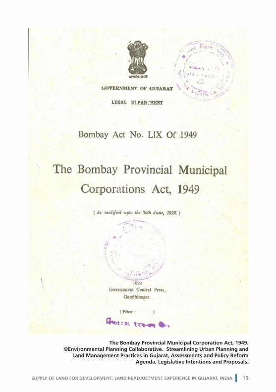
1. The Bombay Provincial Municipal Corporation Act (BPMCA), 1949
The Bombay Provincial Municipal Corporation Act was enacted in 1949 by the British in the erstwhile Bombay Presidency, which included the present day states of Maharashtra and Gujarat. With the creation of the separate states of Gujarat and Maharashtra in 1960, this Act was adopted by both states and has been subsequently amended by both.6
5 Various aspects of the Gujarat Town Planning and Urban Development Act are split across sections 1 and 3, as this is the most crucial and relevant Act in this paper.6 Gujarat last amended the Bombay Provincial Municipal Corporation Acton 31 August 2006. This review is based on this version.
URBAN GUJARAT12
State Administra�onFunc�ons
District(group of talukas)
Taluka(group of villages)
Muncipal Governance /Func�ons
Municipal Corpora�on Development Authority
Municipality
Planning and Regula�onDevelopment Func�ons
Village(basic spa�al unit)
Rural Urban
Figure 1.1.1: Categorization of urban areas in Gujarat.
Source: Generated by author © Shirley Ballaney
SUPPLY OF LAND FOR DEVELOPMENT: LAND READJUSTMENT EXPERIENCE IN GUJARAT, INDIA 13
The Bombay Provincial Municipal Corporation Act, 1949. ©Environmental Planning Collaborative. Streamlining Urban Planning and
Land Management Practices in Gujarat, Assessments and Policy Reform Agenda, Legislative Intentions and Proposals.

URBAN GUJARAT14
The Act comprises of 31 chapters that cover the aspects of:7
• Delineatingacitywithaviewtoensureabettergovernment8 • Constitutingmunicipalauthoritiestoachievethis • Prescribingthedutiesandpowersofthemunicipalauthorities,and • Regulatingdevelopment.
On delineating cities
The Bombay Provincial Municipal Corporation Act begins with provisions to notify areas to be cities and to delineate their boundaries. Although the Act does not lay down any specific population criteria, an area with a population of 350,000 and above can be declared a municipal corporation.9 Typically, the jurisdiction of a municipal corporation consists of several revenue villages (Figure 1.2.1). The expansion of the limits of a municipal corporation is determined by the state government and is influenced by its growth trends. For example, the limits of the municipal corporation of Ahmedabad have been extended at least three times since its formation, to cater to the governance needs of the immediate periphery due to development.
7 Only the major aspects are briefly reviewed, the last portion of the Act deals with a range of provisions for various permissions, licenses, penalties and judicial procedures which are not reviewed. 8 Bombay Provincial Municipal Corporation Act, p. 2.9 Criteria followed by the Urban Development and Urban Housing Department, Government of Gujarat.
Legend
Municipal Corporation
Villages
Figure 1.2.1: Delineation of a municipal corporation
Source: Generated by author © Shirley Ballaney

On constituting municipal authorities
The Bombay Provincial Municipal Corporation Act then lays down the constitution of the governing structure - the municipal authorities that are mandated to carry out the provisions of the Act, viz:
• A corporation, that consists of councillors who are elected from the area, • A standing committee, that consists of selected councillors, and • Amunicipal commissioner, a bureaucrat from the Indian administrative service, who heads the administrative body to execute the various duties laid down in the Act.10
Also prescribed in detail are the qualifications of the positions officials, their functions and entitlements, and procedural aspects.
On prescribing duties and powers
The Act specifies the duties / functions of the municipal authorities, which are exhaustive and encompass all that is required to ensure safety and health of the citizens. These are categorized as obligatory and discretionary.11 Obligatory functions include such activities as the cleaning of streets, providing and maintaining a sewerage system, water supply, attending to fires, education and health services; providing and maintaining open spaces, slaughterhouses, regulating hazardous activities, abating nuisances, removing encroachments, registering births / deaths, providing vaccinations and providing staff housing. Of these, the construction and maintenance of essential services such as drainage, water supply, streets, fire brigade, sanitation (solid waste management), markets and slaughterhouses, and transport are dealt with in considerable depth. Discretionary functions include providing swimming pools, maintaining dairies, urban forestry, the promotion of cultural activities, and urban planning including town planning and regulation of land use.
The corporation must make its budget to accomplish its functions. It is empowered by the Bombay Provincial Municipal Corporation Act to raise resources – levy taxes,12
10 In addition one of the councilors is appointed as the mayor, however the mayor’s role is largely ceremonial and the real powers vest with the municipal commissioner who belongs to the state bureaucracy.11 Obligatory functions are those that the corporation must perform and discretionary are those that the corporation may perform. In the Bombay Provincial Municipal Corporation Act the list is generic, however there are supporting manuals and guidelines adopted from time to time to perform these tasks.12 These include property tax, water tax, conservancy tax, vehicle tax, animal tax etc. India has a well-developed three-tiered tax structure, controlled by the three major bodies of the country– the national government, the state governments and the urban (municipal corporation, municipalities) and rural (gram panchayats) local bodies. Various types of taxes are distributed across three levels. The national government levies several types of taxes, charges, fees viz., income tax, service tax, surcharges on fuel, customs and exercise duties etc. Likewise, the state government levies sales tax, stamp duty, luxury tax, entertainment tax, professional tax etc. These taxes form the basis of fiscal transfers from the national government to the state government and from the state government to urban and rural local bodies.
SUPPLY OF LAND FOR DEVELOPMENT: LAND READJUSTMENT EXPERIENCE IN GUJARAT, INDIA 15

borrow money, raise money through bonds, debentures, and acquire and or dispose of assets.
On regulating development
The municipal corporation regulates development at two levels – at the scale of developing individual buildings and at the scale of developing an area.
Construction of buildings / development includes granting permissions; ensuring compliance to prescribed by-laws; approving construction; granting completion and occupancy certificates; demolishing dangerous structures; removing unauthorized structures and regulating areas with special character.
For the purpose of regulating development at an area level, the corporation can prepare “improvement schemes” under special circumstances. The Bombay Provincial Municipal Corporation Act specifies that improvement schemes can be prepared to improve areas in the city that have become unfit for human habitation, have very narrow streets that impact the health of residents, accommodate poor community housing, remedy defective ventilation and create / alter streets. Improvement scheme proposals can include creating new streets, widening streets, relaying of lands, providing infrastructure services – drainage, water supply, street lighting, and creating open spaces.13 To effect the improvements, the corporation can levy betterment charges and acquire lands. In addition, there are also two special provisions that enable the corporation to completely clear or redevelop certain areas.
2. Gujarat Municipalities Act, 1963
The Gujarat Municipalities Act was enacted in 1963 by the State of Gujarat to consolidate and amend laws pertaining to municipalities to give them wider powers in the management of municipal affairs. It draws from the Bombay Provincial Municipal Corporation Act but is much less exhaustive because the size and complexity of the problems in smaller areas are less intense and some simplification would be required given the limited capacities at that level.
The Gujarat Municipalities Act comprises of 17 chapters that cover the aspects of:
• Delineatinga“borough”, • Constitutingmunicipalitytogoverntheborough, • Prescribingthefunctions/dutiesandpowersofthemunicipality,and • Regulatingdevelopment.
13 Improvement schemes were conceived specifically to address derelict areas, overcrowded areas, slums and chawls created in the wake of industrial development in cities. Unlike the town planning scheme mechanism, these schemes were not structured to undertake land adjustment but a layout was prepared and if a land parcel was affected by, say, road widening, then land was acquired from the property and compensation was paid.
URBAN GUJARAT16

On delineating “boroughs”
The Gujarat Municipalities Act begins with the provisions to notify local areas to be “municipal boroughs” and delineate extents. The Act does not lay down any specific population criteria but states that all areas with a population of 25,000 and more that were notified as nagarpanchayats14 as per the Gujarat Panchayats Act, 1961,15 can be notified as municipal boroughs. In special circumstances, if looking at the growth needs of areas with a much smaller population that are notified as gram panchayats under the Act, they can also be notified as municipal boroughs. Typically, the jurisdiction of an area declared as a municipal borough can consist of a part of a revenue village and/or entire revenue village or more revenue villages (Figure 1.2.2). Municipal boroughs - popularly referred to as municipalities - are further classified into four size groups by population: A, B, C and D.16
The Gujarat Municipalities Act also has provision to declare some areas as Notified Areas where the state government feels that services need to be provided.
14 Nagar means a town. The body governing the nagar is referred to as nagarpanchayat. 15 The Gujarat Panchayats Act 1961 defined nagarpanchayats. The GPA 1993 replaced this Act and the nagarpanchayat classification was done away with. Hence, all the local areas defined as nagarpanchayats were either declared as municipal boroughs or gram panchayats. 16 Class A municipality – an area with a population of 100,000 and above; class B municipality – an area with a population of 50,000 to 99,999; class C municipality – an area with a population of 25,000 to 49,999 and class D – an area with a population of 15,000 to 24,999. These classifications are not specified in the Act but devised by the Urban Development and Urban Housing Department of Gujarat.
Legend
Municipality
Villages
Figure 1.2.2: Delineation of a municipal borough
Source: Generated by author © Shirley Ballaney
SUPPLY OF LAND FOR DEVELOPMENT: LAND READJUSTMENT EXPERIENCE IN GUJARAT, INDIA 17

The expansion of the limits of a municipality or a notified area is determined by the state government and is influenced by its growth trends.
On constituting “municipality”
The Gujarat Municipalities Act then lays down the constitution of the governing structure, which is the “municipality”. Every municipality consists of councillors elected from the area, the number of which is determined by the population. Amongst the councillors, a president and vice president are elected. Also prescribed are the qualifications of the positions / officials, their functions and entitlements, and procedures to be followed.
On prescribing functions (duties) and powers
The Gujarat Municipalities Act specifies a list of functions that are grouped into various spheres:17
• Publicworks(namingstreets,providingreliefduringcalamities). • Education(establishingandmaintainingschools). • Publichealthandsanitation(regulatingdangeroususes/practices,removing dangerous buildings, reclaiming unhealthy areas, ensuring water supply, vaccinations, solid waste management, establishing and maintaining health facilities, public toilets, etc.). • Development(maintainingstreets,markets,slaughterhouses,drains,sewerage, protecting municipal properties, improving agriculture, etc.). • Townplanning(undertakingplanningasperthetownplanninglaws). • Administration(streetlighting,fireprotection,removingencroachmentsand registering births / deaths). The Gujarat Municipalities Act empowers the municipality to raise taxes and levy charges and fees.18 It also receives transfers from the state government in proportion to the taxes and land revenues collected from the municipality area. The municipality is also empowered to fulfil its duties / functions – create new streets, widen streets, regulate buildings, prevent / remove nuisances, regulate markets, dairies etc.
All the urban areas defined under the above two Acts are referred to as “local authorities”.
3. Gujarat Panchayats Act (1993) GPA
The Gujarat Panchayats Act was enacted in 1993 to consolidate and amend laws relating to Panchayats in Gujarat. It replaced the earlier Act, 1961, which defined urban areas, referred to as nagarpanchayats, as described in the Gujarat Municipalities Act, 1963. 17 Here too these are listed separately as “obligatory” and “discretionary” for all the spheres or groups 18 These include property tax, drainage tax, sanitary tax, street lighting tax, vehicle tax, animal tax, tolls, etc.
URBAN GUJARAT18

The, Gujarat Panchayats Act 1993 did away with this category leaving it to the Bombay Provincial Municipal Corporation Act, 1949, and Gujarat Municipalities Act,1963, to define urban areas from the perspective of their governance. It now only defines the basic units for administration. Hence is not reviewed here in the same manner as the other three Acts but is mentioned to complete the understanding of the over view of the administrative, governance and planning framework in Gujarat.
The Gujarat Panchayats Act begins with the provisions for establishment of panchayats for the governance of the basic administrative units defined in the Bombay Land Revenue Code, 1879, which are the village, taluka and district. These are hierarchical – the basic unit is the village that comprises of individual land parcels, group of village make a taluka and a group of village makes a district (Figure 1.2.3). There are three types of panchayats established:
• Village Panchayat for each village • TalukaPanchayat for each taluka • DistrictPanchayat for each district.
Legend
Taluka Boundary
District Boundary
Villages
Figure 1.2.3: Delineation of districts, talukas and villages
Source: Generated by author © Shirley Ballaney
SUPPLY OF LAND FOR DEVELOPMENT: LAND READJUSTMENT EXPERIENCE IN GUJARAT, INDIA 19

4. Gujarat Town Planning and Urban Development Act (1976)
While the Bombay Provincial Municipal Corporation Act, the Gujarat Municipalities Act and Gujarat Panchayats Act address the issues of governance, and to an extent regulate development, they are not mandated to have major inputs into the planned development of the urban areas as a whole or comprehensively.
The Gujarat Town Planning and Urban Development Act was enacted in 1976 to carry out the functions of planning and regulating development in areas that were seeing growth. There were town planning acts in place already (refer to section 3), however, the 1976 Act was comprehensive and proactive because it envisaged the planning of a much larger area around a local area likely to experience development.
The Gujarat Town Planning and Urban Development Act comprises of eight chapters that cover the following aspects:19
19 Only the major aspects are briefly reviewed. The last portion of the Act deals with a mixed set of provisions that set out the powers and functions of the development authorities, and the preparation and implementation of development plans and town planning schemes
URBAN GUJARAT20
The Gujarat Urban Development and Town Planning Act, 1976. © Provided by Shirley Ballaney

• Delineatingadevelopmentareaforthepurposeofsecuringplanned development; • Constitutingadevelopmentauthoritytoachievethis; • Ensuringplanneddevelopment; • Levyingdevelopmentcharges.
On delineating areas, governing authorities, functions and powers
Any local area (municipal corporation, municipality, notified area, gram panchayat) and its periphery that is being developed and where there is a perceived need to manage its growth and undertake planning, can be declared a development area. The Gujarat Town Planning and Urban Development Act provides for delineating two types development areas – an urban development area and simple development area. This distinction depends on the size of the local area and complexity of the development issues to be addressed. The institutional structure created to undertake planning and regulate development in the development area is the development authority.
An urban development area is usually delineated around a municipal corporation and can include one or more municipalities and the entire group of revenue villages in between and around them (Figure 1.2.4). Thus, the urban development area is an overlay or sits atop the local areas as delineated in the above three Acts. Though the Gujarat Town Planning and Urban Development Act does not prescribe any population criteria, usually the population of the entire area is more than 500,000. An urban development authority is constituted to undertake planning and regulate development in the urban development area. The urban development authority is headed by a chairman appointed by the state government and consists of representatives of the local areas within, officials nominated by the state, heads of the district panchayats within, a representative of the chief town planner and the municipal commissioner.
The Act then specifies functions of the urban development authority – to prepare the development plan and town planning schemes, to regulate development and to execute infrastructure projects. It also empowers the urban development authority to fulfil its functions – levy fees to approve developments; levy charges / fees in lieu of services provided; to acquire and dispose of property and enter into contracts and agreements to execute the same.
A development area is usually delineated around a municipality or a notified area and adjoining areas (entire revenue villages or part of revenue villages) where growth needs to be regulated. The development area is an overlay or sits atop a local area and revenue villages. Though the Gujarat Town Planning and Urban Development Act does not prescribe any population criteria, usually the population of the entire area is more around 100,000 to 150,000.
SUPPLY OF LAND FOR DEVELOPMENT: LAND READJUSTMENT EXPERIENCE IN GUJARAT, INDIA 21

An area development authority is constituted to undertake planning and regulate development in the development area (Figure 1.2.5). The area development authority is headed by a chairman appointed by the state government and consists of representatives of the local areas within, officials nominated by the state, heads of the district panchayats within, a representative of the chief town planner and the municipal commissioner.
There is also a provision to “designate” a local authority (municipality / notified area / gram panchayat) as a development authority and such a local authority is called a designated area development authority (Figure 1.2.6). This is done when a particular local authority is developing rapidly, or is home to special activity, or where there are special circumstances that warrant the need for planning. The development area can be the entire area under the jurisdiction of the local authority or a part of the area. The local authority itself performs the functions of an area development authority and for this purpose is it sets up a “planning committee”. The planning committee consists of members of the local authority, a representative of the chief town planner, an official appointed by the state government and a chief officer.
A government company can also be designated as an area development authority of a development area.
The Gujarat Town Planning and Urban Development Act then specifies functions of the area development authority – to prepare the development plan and town planning schemes, to regulate development and to execute infrastructure projects. It also empowers the urban development authority to fulfil its functions – levy fees to approve developments; levy charges / fees in lieu of services provided; to acquire and dispose of property; and enter into contracts, agreement to execute the same.
URBAN GUJARAT22

Legend
Villages
Constituted ADA
Figure 1.2.5: Delineation of a constituted development area
Source: Generated by author © Shirley Ballaney
Legend
Urban Development Authority
Municipal Corporation
Municipality
Villages
Figure 1.2.4: Delineation of an urban development area
Source: Generated by author © Shirley Ballaney
SUPPLY OF LAND FOR DEVELOPMENT: LAND READJUSTMENT EXPERIENCE IN GUJARAT, INDIA 23

On ensuring planned development
The Act specifies in detail the two-stage process to prepare the development plan for the development area and the town planning schemes for portions of the development area (popularly referred to as the DP-TPS mechanism). Both the contents and procedural aspects to prepare and approve the development plan and town planning schemes are prescribed. The development authority must prepare a comprehensive development plan for the area within its jurisdiction within a period of three years of its formation. Section 3 describes and reviews the development plan-town planning scheme process in detail.
On levy, assessments and recovery of development charges
The last portion of the Gujarat Town Planning and Urban Development Act deals with the provision of levying, assessment and recovery of development charges.20 Provisions for appeal and revision are also included.
20 The Gujarat Town Planning and Urban Development Act makes the provision for levy of development charges on land and building within the development area and specifies the maximum amounts for these and protocols for levying these. It does not specify what these should constitute of. Basically they are interpreted as a form of conversion charges (as interpreted by Mr. M. M. Bhowmick ex Senior Town Planner, Ahmedabad Urban Development Authority)– the authority gives permission to an owner to develop to convert his / her property from agricultural use to urban uses as per the provisions of the development plan They do not include infrastructure costs,
Legend
VillagesDesignated ADA
Figure 1.2.6: Delineation of a designated development area
Source: Generated by author © Shirley Ballaney
URBAN GUJARAT24

1.3 URBAN AREAS IN GUJARAT – SPATIAL DELINEATION
This section outlines the how land is divided into specific areas.
1. Number of urban areas by type
There are in all 206 urban areas in Gujarat spread across 9,980.45 km2 and they accommodate a population of about 18.6 million (Census 2001). As compared to the total area of the state which is 196,024km2, about 5 per cent of the area is urban. The development plan and town planning scheme mechanism under review in this study is applicable to this spatial extent, classified as urban.
The table below gives the total number of urban areas by type as described in the preceding section on Gujarat.
Table 1.3.1: Number and type of urban areas21
No. Type of urban area Number Area (km2) Population (2001)*
1 Constituted Urban Development Authorities
6 4,689.53 9,674,920
2 Constituted Area Development Authorities
11 1,880.56 1,914,609
3 Designated Area Development Authorities
114 2,312.77 5,771,394
4 Municipalities other than part of UDAs & ADAs
47 1,064.84 1,131,372
5 Notified Area 1 0 0
Industrial Notified Areas 27 32.75 90,754
Total 206 9,980.45 18,583,049
Gujarat Total 196,024.00 50,671,017
% Urban 5% 36.7%
*See footnotes22 Source: Urban Development and Urban Housing Department (UD & UHD), Government of Gujarat
21 There are 206 urban areas in total including all the DAs, municipalities, notified area and Industrial Notified Areas. There are eight municipal corporations which are included in constituted urban development authorities; there are 161 municipalities in all, of which 101 are part of designated area development authorities and 11 are part of constituted area development authorities and there are 13 gram panchayats / census towns are designated as area development authorities 22 The total population is based on the 2001 Census as the 2011 numbers are yet published. The total urban population comes to 18,583,049 and the total urban as per Census is 18,930,250. The difference is about 350,000 which is due to the manner of defining and calculating urban population – the Census has a slightly different criteria, villages that are a part of the urban development authorities and area development authorities are counted as rural. There is another category of census towns not recognized by the Urban Development and Urban Housing Department, which counted as urban.
SUPPLY OF LAND FOR DEVELOPMENT: LAND READJUSTMENT EXPERIENCE IN GUJARAT, INDIA 25
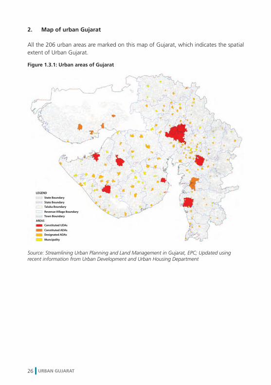
2. Map of urban Gujarat
All the 206 urban areas are marked on this map of Gujarat, which indicates the spatial extent of Urban Gujarat.
Figure 1.3.1: Urban areas of Gujarat
Source: Streamlining Urban Planning and Land Management in Gujarat, EPC; Updated using recent information from Urban Development and Urban Housing Department
URBAN GUJARAT26

2.1 LAND MANAGEMENT IN URBAN GUJARAT23
The Gujarat Town Planning and Urban Development Act, Development Plans and Development Control Regulations along with land-related regulations based on the Bombay Provincial Municipal Corporation Act and the Gujarat Municipalities Act (pertaining for example to property tax and land use) form one regime for managing land in urban areas. This regime of regulations is focused on urban land use issues and on urban planning and may be referred to as planning regulations. It is administered by the Urban Development and Urban Housing Department of the Gujarat State Government.
An older regulatory regime that continues to hold sway on land management in urban areas is that which is defined by the archaic Bombay Land Revenue Code, 1859, supported by the Gujarat Land Revenue Rules (1977) and several ancillary legislations amongst others. For example the 1) Bombay Prevention of Fragmentation and Consolidation of Holdings Act, 1947; 2) Bombay Tenancy and Agricultural Lands Act 1948 (State Act); 3) Various Inam24 Abolition Acts; 4) Gujarat Agricultural Land Ceiling Act, 1961 (State Act); 5) Allotment of Government Wastelands in 1960; 6) Government lands to persons without land for agriculture and for public purpose to individuals, charitable institutions; and 7) Registration Act, 1908 and Bombay Stamp Act, 1958. This regime of regulation is administered by the Revenue Department of the Gujarat Government and may be referred to as revenue regulations. Though this regime primarily focuses on cadastral issues, land tenure and land taxation, its scope is not limited to these issues. For example, its regulations have a significant influence on the “tradability” and use of land. Before land can become fully tradable or can be put to non-agricultural urban uses, owners have to obtain appropriate permissions from the revenue administration and pay conversion premiums,25 taxes and duties prescribed by revenue regulations.23 This section draws on two earlier works by the author and others, Streamlining Urban Planning and Land Management - Practices in Gujarat – Assessments and Policy Reform Agenda, 2008 for Gujarat Urban Development Company and a subsequent paper based on this study “Reforming Urban Land Management in Gujarat”, published in India Infrastructure Report, (2009). 24 Inam means gift. Lands were gifted away to by the rulers and these were conditional – to be used only for the purpose gifted for and under various inam categories which were listed in the records. With the abolition of inams the lands legally reverted to the state. 25 The term premium refer to the conversion charge that the landowner who owns a land parcel which has a restricted tenure pays to the state government to convert it into non-restricted land parcel. The conversion premium in urban areas is as high as 80 per cent of the land value.
02 LAND MANAGEMENT IN URBAN GUJARAT
SUPPLY OF LAND FOR DEVELOPMENT: LAND READJUSTMENT EXPERIENCE IN GUJARAT, INDIA 27

This makes policies of the revenue administration powerful arbiters of land supply and prices on the urban land market.
Two regimes then – the regime of revenue regulations and the regime of planning regulations – simultaneously define and impinge on land management and the functioning of land markets in urban Gujarat.
2.2 LAND MANAGEMENT FUNCTIONS
The following table lists key land management functions and indicates where the revenue and the urban development administrations have a role. The diagram below represents the overlaps graphically.
Table 2.2.1: Land management functions
Land Management Functions Department
Building and maintaining land cadastre Revenue
Changingland tenure Revenue
Reclassifying land for non-agricultural use Revenue
Registering and taxing land and property transactions Revenue
Valuing land for land management and urban planning Revenue and Urban
Mapping for land management and urban planning Revenue and Urban
Preparing development plans Urban
Preparing town planning schemes Urban
Regulating development Urban
Source: Streamlining Urban Planning and Land Management in Gujarat, EPC
Figure 2.2.1: Delineation of a designated development area
Source: Generated by author © Shirley Ballaney
LAND MANAGEMENT IN URBAN GUJARAT28

This section focuses on the land management functions administered by the Revenue Department. The functions pertaining to urban planning and regulating development are discussed in the next section.
Specifically we review:
1. Building and maintaining a cadastre 2. Managing land tenure 3. Registering land and property transactions 4. Valuing land
1. Building and maintaining a cadastre
A cadastre as referred to here is a basic land information system consisting of two parts: one is a series of maps showing the geometric and location attributes of land parcels, and the second is a set of text records that describe the ownership attributes of land parcels.
A cadastre may be seen as a skeletal framework on which an elaborate land and property information system can be built. An information system built on the robust platform of a cadastre can enable, support and enhance innumerable governance, planning, civil and commercial functions.
Building and maintaining a cadastre is a state function and in Gujaratis governed by provisions of the Bombay Land Revenue Code, 1879. Details are prescribed in the Revenue Accounts Manual and the City Survey Manual. Generally, the Bombay Land Revenue Code requires the following details to be recorded in the cadastre: geometry and location attributes of land parcels (coordinates and maps); property addresses; name of occupant;26 name of other right holders; details of easements and encumbrances; the nature and duration of tenure; and details of transactions (or mutations in the record). The Bombay Land Revenue Code, the Revenue Accounts Manual and the City Survey Manual also prescribe extensive processes and protocols to update the cadastre.27
The issues with the cadastral system in its present form are elaborated on in an earlier study by the Environment Planning Collaborative (2008) and in a paper by Patel et al (2009).28 Briefly, a few of these issues are:
26 An occupant is a person holding the right to use the land and/or holding primary responsibility to pay land taxes; occupant is popularly referred to as the “owner”. 27 Separate cadastre systems are devised for urban and rural areas. The definition of urban and rural as defined Revenue Administration is not the same as it is by the Urban Administration. Urban areas are referred to as city survey areas and rural areas are referred to as revenue survey areas. Refer to Patel et al (2009). 28 Streamlining Urban Planning and Land Management Study by the Environment Planning Collaborative for the Gujarat Urban Development Company and the paper, Reforming Urban Land Management in Gujarat published in the India Infrastructure Report 2009.
SUPPLY OF LAND FOR DEVELOPMENT: LAND READJUSTMENT EXPERIENCE IN GUJARAT, INDIA 29

• Lack of unified cadastres in an urban area has createdmultiple cadastres that are not clear to the public and so make it appear to be complex. This reduces the security of tenure, increases the risk when making land transactions, and increases the power of lower bureaucracies and the possibility of corruption. • Cadastrestodayarehopelesslyoutdated,partiallycomputerizedandinbadshape. • Therearemultipletextandmaprecordsforeachlandparcelandtheyarenotlinked. • Thereisnoconsistencyinpreparingrecordswhentheyaremanuallypreparedand different officials may end up recording details in a different manner.
The first task in preparing a town planning scheme is to build up a base map and ownership records based on cadastral records. In view of the above mentioned issues, this process is extremely time consuming, tedious and can never be relied on completely. Ownerships and rights are cleared up gradually as the process goes forward but this creates further delays. This is discussed in section 5.
2. Managing land tenure
The premise of the Bombay Land Revenue Code, 1879, is that the absolute owner of the all the land is the state. A person enjoying rights to use a parcel of land is referred to as the ‘occupant’. Popularly however, the occupant is known as the ‘owner’ of the parcel of land. Owners’/occupants’ rights in parcels of land are not unlimited; they are always restricted in some way. The way in which rights in land are held, or the mode of holding rights in land, is called tenure.
Defining tenure
There are three ways in which owner/s’ or occupant/s’ rights in land can be restricted, which impose three types of restrictions on parcels of land:
1. Restrictions on power of an owner to dispose of their interest in a parcel of land, 2. Restrictions on sale / transfer of land, 3. Restrictions on subdivision or amalgamation of a parcel of land, 4. Restrictions on use of a parcel of land.
The rights to use land are basically of two types:
1. Freehold rights, with the government having no interests. Parcels of land enjoying freehold rights are referred to as alienated lands29 (when referred to in the Bombay Land Revenue Code) or as old tenure, meaning unrestricted tenure type parcels of land. Such parcels of land may be:
a) transferred (sold) without prior approval of government, 29 “Alienated” from the state and granted to individuals.
LAND MANAGEMENT IN URBAN GUJARAT30

b) subdivided (within limits) or amalgamated without prior approval of government, c) used for agriculture (the default use for all parcels of land); or non- agricultural purposes if a “non-agricultural use permission” as been obtained from government. 2. Restricted rights, where the government has an interest in the land. Parcels of land with restricted rights are known as un-alienated lands (when referred to in the Bombay Land Revenue Code) Within this classification there are two types of tenure.
SUPPLY OF LAND FOR DEVELOPMENT: LAND READJUSTMENT EXPERIENCE IN GUJARAT, INDIA 31
Source: Environmental Planning Collaborative. Streamlining Urban Planning and Land Management Practices in Gujarat, Assessments and Policy Reform Agenda, Legislative Intentions and Proposals.
14
1
13
12
11
1683
4 7 15
6Circle OfficerTalati
Mamlatdar
PrantOfficer
Collector
Administrative approval by
Jan Seva Kendra
Occupant
End
Start
DLPC
Premiumdetermination by
5
9
10
2
• Collector - in rural areas and in areas that falls outside - urban areas where the population is more than 1 Lakh & 15 miles around it - notified industrial area & 7 miles around and - district HQ & 7 miles around• Secretary, Land Reforms - if the area falls within - urban areas where the population is more than 1 Lakh & 15 miles around it - notified industrial areas & 7 miles around and - distrtrict HQ & 7 miles around
17
Figure 2.2.2: Process for Converting Land Tenure

The first type of tenure is referred to as navi-sharataneavibhajysattaprakar (new and indivisible tenures). Lands were attributed this type of tenure when they came under various inam-abolition (land grant abolition) Acts or when they came under the Gujarat Agricultural Land Ceiling Act. Lands allotted by government for various public uses or when distributed to landless persons are also attributed this tenure.
LAND MANAGEMENT IN URBAN GUJARAT32
Source: Environmental Planning Collaborative. Streamlining Urban Planning and Land Management Practices in Gujarat, Assessments and Policy Reform Agenda, Legislative Intentions and Proposals.
14
1
13
12
11
1683
4 7 15
6Circle OfficerTalati
Mamlatdar
PrantOfficer
Collector
Administrative approval by
Jan Seva Kendra
Occupant
End
Start
DLPC
Premiumdetermination by
5
9
10
2
• Collector - in rural areas and in areas that falls outside - urban areas where the population is more than 1 Lakh & 15 miles around it - notified industrial area & 7 miles around and - district HQ & 7 miles around• Secretary, Land Reforms - if the area falls within - urban areas where the population is more than 1 Lakh & 15 miles around it - notified industrial areas & 7 miles around and - distrtrict HQ & 7 miles around
17
Figure 2.2.3: Process for Obtaining NA Permission

The second type of tenure is pratibandhitsatttaparakar (restricted tenure type). This tenure was attributed to all lands granted to tenants (as part of the land reforms programme of the state) under the Bombay Tenancy and Agricultural Lands Act, 1948.
Parcels of land attributed such restricted rights:
a) Cannot be transferred/sold without prior approval of government, b) Cannot be subdivided or amalgamated without prior approval of government, and c) Can only be used for permitted use.
Removing restrictions on land
Any parcel of land must enjoy freehold tenure status to be transferred, subdivided /amalgamated or used for non-agricultural uses. Only a freehold land parcel can be reclassified for non-agricultural use. Two types of conversion processes are defined:
1. Converting tenure from new / restricted tenure to old / unrestricted tenure. 2. Converting old tenure land from agricultural to non-agricultural use.
Revenue regulations allow for the change or conversion of tenures from new or restricted tenure to freehold tenure when the landowner/occupant applies for such a change. Conversion of tenure to freehold allows the owner to sell the land and allow its subdivision or amalgamation. Because of this, changing tenure is an important land management function. Protocols and policy for converting tenure from new or restricted tenure to old tenure is complex, has evolved over time and is periodically revised through Government Orders. It can take from year or more to complete the process.
To get a sense of how much land is affected by tenure restrictions, a sample study of land parcels affected by restricted tenures was carried out in a 10 km2 area between Ahmedabad and Gandhinagar. The study showed that about 20 per cent of the land is locked due to tenure issues. In the event of a large-scale development being considered, if there are a few land parcels in between with restricted tenures, the entire development could be stalled until the tenures are cleared, which can take several years.
Permission to use agricultural land for non-agricultural purposes can also be applied for by the owner / occupant of the land. Non-agricultural use is only permitted for freehold land and therefore when the non agriculture use permission is granted, it becomes freely tradable or can be subdivided and amalgamated and put to an array of uses. It is regarded as a very important check point as this frees the land from most, if not all, regulatory restrictions. Because of this a vigorous and comprehensive process granting non-agricultural permission is in place – the land parcel is scrutinized by a variety of other departments to ensure compliance with their policies.
SUPPLY OF LAND FOR DEVELOPMENT: LAND READJUSTMENT EXPERIENCE IN GUJARAT, INDIA 33

For example, the Airports Authority checks for impacts on the flight paths, the Roads and Buildings Department checks if there are any proposals that may affect the land parcel, the railway authorities check if it has any proposals, so on so forth. About 14 such No Objection Certificates are required.30
Conversion of agricultural land to non-agricultural land is necessary for almost all urban uses of land and the (legal) expansion of cities crucially depends on grant of non agriculture use permissions. The process is land parcel specific – each land parcel must be converted. In case of large scale public or private developments spread over several land parcels, non-agricultural conversion is to be carried out for each and every parcel and the process can take anything from six months to a year or more.
Issues with managing land tenure at present are elaborated in an earlier study by Environmental Planning Collaborative (2008) and a paper by Patel et al (2009). Briefly, a few of these are:
• Together, the revenue and urban planning regulations impose a formidable matrix of restrictions in urban areas. • Restrictive tenures and restrictions on non-agricultural use constrain supply of land for urban growth. • The protocols for converting restricted to freehold tenure and agricultural to non-agricultural freehold is too complex and lengthy. • Premium for converting restricted tenures to freehold tenures is very high resulting in under reporting of prices and the use of cash in transactions. • The objectives of stringent and elaborate procedures for converting agricultural land for non-agricultural uses are irrelevant in urban areas • Indiscriminate and widespread non-agricultural use permissions outside urban areas reduces the demand for land in urban areas and promotes growth that is harmful, unplanned and unregulated.31
The significance of the both the restrictions – tenure and non-agricultural permissions is that even though the land may be zoned for development in the plans of an urban area and a town planning scheme is prepared for it, either it is not available for development or it does not enter the urban land markets until these restrictions are removed. More crucially, these restrictions have to be lifted parcel by parcel given the provisions of revenue regulations and they inevitably delay the land development process. This aspect is also dealt in Section 4: Supply of Land for Development.30 These are – Land acquisition, Special Agencies – Narmada Project, Roads and Building, Gujarat Electricity Board, District Industries Commissioner, Gujarat Pollution Control Board, Airport Authority, District Health Officer, Revenue Department, Collector, urban development authorities/area development authorities, Public Works Department and Income Tax Department. 31 Non-agricultural use permissions are issued by the district administration / state government just outside the urban areas or the rural areas surrounding the urban areas. This results in low cost developments (low cost because the developers do not have to pay the planning authority for infrastructure development charges) and un-serviced areas. This also means sprawling development and vacant lands within urban area limits. The district development officer route for supply of land for development in Section 4 dwells on this aspect in more detail.
LAND MANAGEMENT IN URBAN GUJARAT34

3. Registering land and property transactions
There are three aspects to a property transaction: 1) conveyancing, 2) registration of deeds and, 3) an updating/mutating of the record of rights.
1. Conveyancing.Documents agreeing to the transfer of freehold ownership are passed between the seller and purchaser, usually with the guidance of a lawyer – a conveyancer. At this stage the state is not directly involved. However, adequate functioning of the state’s legal and judicial system is crucial for such transfers to take place efficiently; the contracts are enforceable and there is no risk involved in transactions.
2. Registration of deedsThe conveyancing documents are registered with the Inspector General of Registration and Superintendent of Stamps and the stamp duty32 and registration fee is paid. Maintaining a deeds registry enables the functioning of land markets – past transactions can be inspected to ensure confidence in the title and compulsory registration enables the taxing of all transactions.
3. Updating / mutating the land cadastre Once a transaction occurs, the Inspector General of Registration and Superintendent of Stamps’ office is required to periodically notify the District Inspector of Land Records Office and the City Survey Office of all registered transfers.
Using this notification, the District Inspector of Land Record sand City Survey are required to update/mutate the land cadastre. In practice, the onus of following up the District Inspector of Land Records and City Survey falls on the buyers because these departments are burdened by huge backlogs. The process has been computerized and made efficient, but the updating of the cadastre is considerably delayed.
The issues with registering transactions as it presently functions are elaborated on in an earlier study by the Environmental Planning Collaborative (2008) and a paper by Patel et al (2009). Briefly, a few of these are:
• Rate of stamp duty is perceived to be too high; it encourages evasion and under-reporting of land prices and the use of cash in transactions.
• The drive to increase stamp duty by insisting that each unit of built property being transacted be tied directly to a share in the ownership of land has the unintended outcome of fragmenting urban land ownership and the evasion of stamp duty.
32 Stamp duty is the tax paid to the government at the time of sale of the property.
SUPPLY OF LAND FOR DEVELOPMENT: LAND READJUSTMENT EXPERIENCE IN GUJARAT, INDIA 35

4. Valuing land
The state government maintains a fiscal cadastre for land and property called the jantri in Gujarati. The Inspector General of Registration and Superintendent of Stamps are responsible for maintaining the jantri. Several improvements to the jantri have already been made:
i) computerization; ii) transition from parcel-based to geographic cluster-based valuation; iii) improvement of publications that are now easy to read; iv) increase in transparency through explicitly documented calculations; v) fresh updates for many areas; vi) use of private sector expertise.
The jantri has now been in use for several years and is relied upon for calculating:
i) stamp duty / registration fees; ii) tenure conversion charges (premiums); iii) compensation under the Acquisition or the Gujarat Town Planning and Urban Development Act; iv) rent and sale prices of government properties.
However, it does not accurately reflect market prices of land, which are much higher.
The issues with valuing land as it is currently practised are elaborated on in an earlier study by the Environmental Planning Collaborative (2008) and in a paper by Patel et al (2009). Briefly, a few of these are:
• Recent sales data, the base data used for valuation, is very unreliable because the transactions involve a significant component of the land price being paid in cash, which is unrecorded. Only a part of the transaction is recorded and the stamp duty is paid. • Despite best attempts to improve valuation, the jantri and other valuation procedures are highly unreliable indicators of the market value of land and property because of the gap between the data and real prices and the lack of systematic and empirical research.
LAND MANAGEMENT IN URBAN GUJARAT36

3.1 HISTORY OF PLANNING LEGISLATION IN GUJARAT
The current regulatory framework for enabling urban planning in Gujarat is the Gujarat Town Planning and Urban Development Act enacted in 1976 by the Indian Parliament. This legislation has a long history and its origins lie in the early twentieth or nineteenth century town planning legislation enacted in Britain when India was a British colony. During this period, events and changes in Britain were reflected in India albeit with a time lag and some degree of adaptation. Modern planning legislation also found its way into India via the British. Development of planning legislation in India too follows a similar trajectory, arising out similar concerns – health and sanitation – with additional intentions of the colonial government being to try to clean up and control the Indian settlements.
A brief review of the history of the planning legislation in Gujarat is interesting in the particular context of land readjustment in that the legislation was continually amended when it encountered problems in practice and was replaced by newer and improved legislation whenever the situation demanded it.
Gujarat was a part of the erstwhile Bombay Presidency under British Rule. Bombay was the most prominent city and centre of administration; its growth and development elicited similar responses to those in Britain. After the plague of 1896, a quarter of the population deserted Bombay and the city faced commercial extinction. In order to improve hygiene conditions the Bombay Municipal Corporation was compelled to provide proper drainage and clean water and to plan reclamation. Towards this end, the Mumbai City Improvement Trust was established in 1898.33 The Trust began preparing improvement schemes for parts of Bombay but they were not too successful and ultimately were not enough. The population grew rapidly from 776,000 in 1901 to about a million, by about 1910 and as it grew the civic problems also increased. The British administrators sought a more comprehensive approach to the problem and the first Bombay Town Planning Act was introduced in 1915.
33 Bombay Improvement Trust was the first of its kind in India at that time.
03 THE PLANNING PROCESS IN GUJARAT
SUPPLY OF LAND FOR DEVELOPMENT: LAND READJUSTMENT EXPERIENCE IN GUJARAT, INDIA 37

1. The Bombay Town Planning Act, 1915
The Bombay Town Planning Act, 1915 was enacted by the British Government. According to Arthur Edward Mirams, the then Consulting Surveyor to the Bombay Presidency, the 1915 Act was “a sincere attempt to embody in one measure all that was best from every other Town Planning Act extant”.34 The town planning scheme process outlined in the Act combined elements of the English Housing and Town Planning Act of 1909, which dealt with land use zoning and land reservations, and the German LexAdickes, which dealt with land readjustment.35
The objective of the Act is made clear at the start– it is an Act to provide for the making and execution of town planning schemes. It says:“Whereas it is expedient that the development of certain areas should be regulated with the general object of securing proper sanitary conditions, amenity and convenience to the persons living in such areas and in neighbouring areas.”36 The mechanism specified by the legislation for achieving these ends of sanitation, amenity and convenience is the town planning scheme. The Act proceeds to describe in detail the contents and process for executing this.
The Bombay Town Planning Act is not long (18 pages), it has 52 sections organized into 5 chapters that cover:
• Proposalsinatownplanningscheme(Chapter1Preliminary(sections1to5)) • Processandprotocolstoprepareatownplanningscheme(Chapter2Declaration of Intention to make a Scheme, and Preparation of Draft Scheme (sections 8 to 15)) • Financeofthetownplanningscheme(Chapter3Finance(sections16to28)) • Finalization of the town planning scheme (Chapter 4 Arbitrator and Tribunal (sections 29 to 44))
The final chapter comprises of miscellaneous provisions (sections 45 to 52).
On the nature of proposals in a town planning scheme37
Section 3 lists that a town planning scheme could make provisions for:
a) the construction, diversion, alteration and stopping up of streets, roads and communications; b) the construction, alteration and removal of buildings, bridges and other structures;
34 Miriams (1919) p. 44. 35 Mirams (1924) p.196.36 Bombay Town Planning Act 1915, p. 1.37 The scope of the town planning scheme is envisioned for comprehensive development of an urban area. These are retained in the both, the Bombay Town Planning Act 1954 and the Gujarat Town Planning and Urban Development Act 1976, albeit slightly modified and with few more aspects included.
THE PLANNING PROCESS IN GUJARAT38

c) the plotting out of land as building sites whether such land is intended to be used for building purposes in the immediate future or not; d) the allotment or reservation of land for roads, open spaces, gardens, recreation grounds, schools, markets and public purposes of all kinds; e) drainage, inclusive of sewerage and of surface drainage and sewage disposal; f) lighting; g) water supply; h) the preservation of objects of historical interest or natural beauty and of buildings actually used for religious purposes or regarded by the public with special religious veneration; i) the imposition of conditions and restrictions in regard to the open space to be maintained about buildings, the number, height and character of buildings allowed in specified areas and the purposes to which buildings or specified areas may or may not be appropriated; j) the suspension, so far as may be necessary, for the proper carrying out of the scheme, of any rule having the force of law, bye-law, act or other provision which is in force in the area included in the scheme: k) such other matters not inconsistent with the objects of this Act as may be prescribed.
The provisions are far reaching; they gave the planning / statutory authorities tremendous scope to improve and or re-plan areas comprehensively.
On the process to prepare a town planning scheme
The Act first specifies the lands over which a town planning scheme can be prepared (Section 8). A scheme could be prepared for land which was in the course of development or likely to be used for building purposes. The Act further states that lands which were already built upon or lands not likely to be used for building but are situated with respect to lands likely to be used for building purposes, can also be included in any town planning scheme.38 The Act permitted the demolition of, alteration of any building necessary to implementing the proposals of the scheme, which could be either old /dilapidated developments or recent developments.
Sections 9 to 15 describe in depth the statutory process of preparing a town planning scheme – actions by the authority, timelines and contents of the draft scheme. Of these, Sections 11 and Section 12 are significant. Section 11 gives the contents of the draft scheme and Section 12 refers to the reconstitution of plots – altering the boundaries of the original land plots.
38 The town planning schemes could be prepared both for green field development and the reorganization of existing development.
SUPPLY OF LAND FOR DEVELOPMENT: LAND READJUSTMENT EXPERIENCE IN GUJARAT, INDIA 39

On the finances of a town planning scheme
Sections 16 to 28 deal with the financial aspects of the town planning scheme. The costs to be included are listed, such as providing for infrastructure, legal expenses incurred by the local authority and compensation to be paid to the landowners for the land appropriated as a part of the scheme. The manner of computing the increase or increment in the land values of the final plots is prescribed. Further the Act clearly states that the costs of the scheme shall be met in whole or part by a contribution39 to be levied by the local authority in proportion to the increment in the land value. The contribution is stipulated to be half of the increment in land value.
On finalization of the town planning scheme
Sections 29 to 24 deal with finalization of the scheme after it has been sanctioned by the provincial government.40 An arbitrator is appointed to finalize and implement the scheme.41 The Act prescribes the arbitrator’s tasks and the procedures that are to be followed. On appointment, the arbitrator issues notices to the landowners, gives them hearings and finalizes the scheme. The Act gives complete power to the arbitrator in all matters except the finances, which may be contested by the landowners and the Act provides for setting up an arbitration tribunal.
The Bombay Town Planning Act, 1915 laid out the foundation for the working of the town planning scheme in the Bombay presidency, including the current state of Gujarat. Several town planning schemes were prepared in the Bombay presidency under this Act. Ahmedabad’s first 14 town planning schemes in the area that currently makes up the core of the city on both sides of the Sabarmati River, were prepared under this Act. A. E. Miriams’ contribution to the successful preparation of several town planning schemes is key – he alone was the arbitrator on about 60 town planning schemes in India.
There are questions as to the efficacy of the town planning scheme mechanism as outlined in the Bombay Town Planning Act,1915. In practice, it took too long to finalize and implement the schemes under this legislation.42 The process was time consuming and until the town planning scheme was finalized and approved by the state government, it could not be implemented.
39 Contribution is taken as a combination of land and nominal costs for developing the infrastructure. 40 At the time (1915a), the level of the government above the local authority was the provincial government at the level of the province. Post-independence this was replaced by the state government. 41 An arbitrator is a quasi-judicial officer appointed to finalize the town planning scheme. The arbitrator arbitrates between the local authority and landowners to conclude both the physical and financial proposals.42 A review of the time taken to complete the first set of town planning schemes prepared under the Bombay Town Planning Act, 1915, supports this inference. It is not possible to point out the specific reasons but the time lines prescribed in the Act are much longer with provisions for longer extensions, for every stage which were later reduced in the Gujarat Town Planning and Urban Development Act, 1976. Another issue was that the Bombay Town Planning Act was framed in such a way that until the entire process was completed, which included finalizing the financial aspects, the town planning scheme could not be implemented. Again this particular set of provisions was changed in the Gujarat Town Planning and Urban Development Act, 1976.
THE PLANNING PROCESS IN GUJARAT40

The other serious problem was that the town planning schemes were prepared on a case by case basis in response to the problems of the area without really looking at the urban area as whole.
But overall, the enactment of the Bombay Town Planning Act,1915,was certainly a more positive step than the mechanism of preparing improvement schemes proposed by the improvement trust acts and later the Bombay Provincial Municipal Corporation Act that depended entirely on the acquisition of land for their implementation.
2. The Bombay Town Planning Act of 195443
In 1947, India became independent but up until about 1960 both Maharashtra and Gujarat constituted a single state. The 1915 Act continued to be amended, however it was perceived to be inadequate to address the increasingly complex problems posed by growth in cities and municipalities by undertaking town planning schemes. This is because these were narrowly focused on the problems of a particular area and did not offer a city wide framework to address the challenges of urbanization.
In 1947 the Town and Country Planning Act was enacted in Britain and this was an entirely new start because it repealed all previous town planning legislation. It introduced for the first time the concept of a preparation of a city wide development plan.
In 1954, the State of Bombay enacted the Bombay Town Planning Act of 1954, which superseded the 1915 Act. The overall objective of the 1954 Act was consistent with the 1915 Act as it stated at the beginning that it was “an Act to consolidate and amend the law for the making and execution of town planning schemes[…] Whereas in order that the town planning schemes are made in a proper manner and their execution is made effective, it is necessary to provide that a local authority shall prepare a development plan for the entire area within its jurisdiction”.44 The principal innovation or departure from the 1915 Act was the preparation of a development plan that took a more comprehensive, city wide perspective on planning than the exclusive focus on a portion of an area by the town planning scheme. The concept of a two-step planning process was introduced in this Act – 1) preparation of a city wide development plan and 2) town planning schemes for smaller areas. This also ensured some regulation of development in the non-town planning scheme areas. Another major change was in the refinement of the process of preparing a scheme to make it more effective – splitting the draft scheme into sections or smaller areas and treating each section or smaller area as a separate scheme for approval. This ensured that the land for roads, infrastructure works, open spaces and public purpose could vest with the local authority way ahead for some areas instead of waiting for the entire planning scheme process to be completed.45 43 This review is based on the Bombay Town Planning Act, 1954 as modified up to 15 February 1972. 44 Gujarat Town Planning and Urban Development Act, 1954, Preamble, p.1. 45 It is possible that in case of a large town planning scheme it may be stuck because of a problem in a particular portion or simply because a large scheme would involve considerable procedural work. An example of this is the town
SUPPLY OF LAND FOR DEVELOPMENT: LAND READJUSTMENT EXPERIENCE IN GUJARAT, INDIA 41

The Bombay Town Planning Act 1954 is more nuanced (introduction of the development plan and further developed process of preparing the town planning scheme) than the 1915 Act, has 39 pages, 91 sections organized in 9 chapters that cover:
• Objectivesandextent(Chapter1Preliminary(sections1,2)), • Process andprotocols to prepare a development plan (Chapter 2Development Plan (sections 3 to 17)), • Contents of a town planning scheme (Chapter 3Making of a Town Planning Scheme (sections 18 to 20)), • Processandprotocolstoprepareatownplanningscheme(Chapter4Declaration of intention to make a scheme and making of a draft scheme (sections 21 to 30)), • Finalizationofthetownplanningscheme(Chapter5TownPlanningOfficerand Board of Appeal (sections 31 to 43)), • Splitting the town planning scheme (Chapter 6 Splitting up of schemes into sections and preliminary schemes (sections 44 to 61)), • Financeofthetownplanningscheme(Chapter8Finance(sections64to78)).
There are some miscellaneous provisions and a provision to prepare joint town planning schemes across local authorities.
On preparing development plans
The various sections of Chapter 3 describe the process that the local authority has to follow to prepare the development plan; the proposals of the development plan; timelines and manner of approval; its implementation and the process of effecting a variation.
On nature of proposals in town planning scheme46
Chapter 3 lists that a town planning scheme could make provisions for: a) the laying out or re-laying out of land, either vacant or already built on; b) the filling up or reclamation of low lying, swamp or unhealthy areas or levelling of land; c) the layout of new streets or roads; construction, diversion, extension; alteration, improvement and stopping up of streets, roads and communications; d) the construction, alteration and removal of buildings, bridges and other structures; e) the allotment or reservation of land for roads, open spaces, gardens, recreation grounds, schools, markets, green belts and dairies, transport facilities and public purposes of all kinds;planning scheme 3 Ellisbridge in Ahmedabad. It had an area of 8 km2 but was split into five sections and each was treated as a separate scheme for approvals. 46 The list is very similar to the Bombay Town Planning Act, 1915, in intent, with a few modifications and additions to make it more encompassing.
THE PLANNING PROCESS IN GUJARAT42

f) drainage inclusive of sewerage, surface or sub-soil drainage and sewage disposal; g) lighting; h) water supply; i) the preservation of objects of historical interest or natural interest or natural beauty and of buildings actually used for religious purposes; j) the imposition of conditions and restrictions in regard to the open space to be maintained about buildings, the percentage building area for a plot, the number, height and character of buildings allowed in specified areas, the purposes to which buildings or specified areas may or may not be appropriated, the subdivision of plots, the discontinuance of objectionable users of land in any area in reasonable periods, parking space and loading and unloading space for any building and the sizes of projections and advertisement signs; k) the suspension, so far as may be necessary for the proper carrying out of the scheme, of any rule, by-law, regulation, notification or order made or issued under any Act of State Legislature or any of the Acts which the State Legislature Act is competent to amend; l) such other matters not inconsistent with the objects of this Act as may be prescribed.
On the process to prepare a town planning scheme
The various sections of Chapter 4 describe the making and nature of the proposals of the draft town planning scheme (which is more or less consistent with the 1915 Act); the process that the local authority has to follow to prepare the draft scheme; the proposals of the draft scheme; timelines and manner of approval of the draft scheme.
On finalization of the town planning scheme
The various sections of Chapter 5 deal with finalization of the scheme after it has been approved by the state government. A town planning officer47 is appointed to finalize and implement the scheme. The Act prescribes his tasks and the procedures that are to be followed. On appointment, the town planning officer issues notices to the landowners, gives them hearings and finalizes the scheme. The Act gives complete powers to the town planning officer in all matters except in case of the finances, which may be contested by the landowners and the Act provides for setting up a board of appeal.48
47 Bombay Town Planning Act 1915 assigns the role of finalizing the town planning scheme to an arbitrator as described above. In the Bombay Town Planning Act 1954 the term arbitrator was replaced by a town planning officer. The functions, roles and responsibilities remain the same. 48 Bombay Town Planning Act 1915 provided for setting up an arbitration tribunal to resolve cases where the landowners were not agreeable to the decision taken by the arbitrator as described above. In Bombay Town Planning Act 1954 the term arbitration tribunal was replaced by board of appeal and it is set up to resolve the cases where the landowners were not agreeable to the decision taken by the town planning officer.
SUPPLY OF LAND FOR DEVELOPMENT: LAND READJUSTMENT EXPERIENCE IN GUJARAT, INDIA 43

On splitting the town planning scheme
The various sections of Chapter 6 describe the provisions to “split” a town planning scheme at the behest of the local authority into sections and the process to take it forward.
Each section is then treated as a separate draft scheme and referred to as a preliminary scheme. A section is created especially for areas within a draft scheme that contain proposals for public purpose – roads, open spaces, drainage, sewerage, water supply etc. The town planning officer then finalizes each preliminary scheme49 albeit without the financial aspects and makes a proposal to the state government to vest such lands with the local authority. The state government, if convinced of the urgency of the public purpose, directs the town planning officer to take possession of such lands which fall in public domain while reconstituting the plots. The officer meanwhile continues to finalize the draft scheme as a whole and submits it to the state government for approval who then may sanction it.
On the Finance of a town planning scheme50
The various sections of Chapter 7 deal with the financial aspects of the town planning scheme. The costs to be included are listed, such as providing for infrastructure, legal expenses incurred by the local authority and compensation to be paid to the land owners for the land appropriated as a part of the scheme. The manner of computing the increase or increment in the land values of the final plots is prescribed. Further, the Bombay Town Planning Act clearly states that the costs of the scheme shall be met in whole or in part by a contribution to be levied by the local authority in proportion to the increment in the land value. The contribution is stipulated to be half of the increment in land value.
The Bombay Town Planning Act of 1954 had attempted to address the shortcomings of the 1915 Act. To begin with, the 1954 Act mandated the preparation of a development plan for the entire urban area and then preparation of a town planning scheme within the urban area. Thus the concept of a two-step planning process was introduced in this Act. As regards speeding up the process of the planning scheme, the concept of “sections” was introduced, meaning a planning scheme could be divided into sections if a particular portion of it needed to be completed or taken up faster. This could be a portion with some public purpose infrastructure.
49 While preparing the preliminary scheme the town planning officer is not expected to finalize the finances of the town planning scheme. 50 This is retained almost intact manner from the Bombay Town Planning Act 1915 with some elaboration of methodological aspects.
THE PLANNING PROCESS IN GUJARAT44

The 1954 Act has its own shortcomings – it was limited to the jurisdiction of the urban area, which at this point was the boundary of a local authority that could be either a municipal corporation or a municipality. By the mid-1970s,urban areas were growing rapidly and it was fringe areas or the peripheries that were growing fastest. With regard to the town planning scheme, the manner of breaking it into sections did not solve the problem as effectively as speeding implementation because the time lines prescribed were still on a higher side.
3. The Gujarat Town Planning and Urban Development Act, 1976
In 1960, both Maharashtra and Gujarat became independent states. Maharashtra replaced the Bombay Town Planning 1954 Act by the Maharashtra Regional and Town Planning Act in 1966 and Gujaratre placed the same with the Gujarat Town and Urban Development Act in 1976.51
While the Bombay Town Planning Act,1954, mandated the local authorities to produce development plans every 10 years, to plan the state’s cities in a more comprehensive manner and to address development taking place outside of town planning schemes, the approach was perceived to be inadequate to address the growth pace of the cities in Gujarat; by the 1970s the periphery of the cities started witnessing development, and problems associated with unplanned peripheries began appearing.
The Gujarat Town Planning and Urban Development Act was a significant departure from the Bombay Town Planning Act1954; it created a body that is distinct from the local authority to specifically control the development in broader areas surrounding the local areas. The reasoning underlying the 1976 Act is articulated in its preamble:“The Bombay Town Planning Act, 1954… controls town planning activities only within the areas falling within the jurisdiction of local authorities. Planning within the peripheral limits of cities and towns has created certain problems. It is felt that if planning activities are undertaken… with reference to development of areas which are not necessarily restricted to the jurisdiction of local authorities, it will be possible to create better environmental conditions.”52
The previous section has reviewed the Gujarat Town and Urban Development Act, with a focus on delineating “development areas” and constituting the development authorities. Here the overall structure is presented briefly and a more in depth review of the town planning scheme mechanism or the planning process in done in section 3.2.
51 The Act was enacted by Parliament and last amended on 31 May 2000. This is the version used for this review. 52 Gujarat Town and Urban Development Act, 1976, preamble, p.1 of the original Act. This has been removed from the amended versions.
SUPPLY OF LAND FOR DEVELOPMENT: LAND READJUSTMENT EXPERIENCE IN GUJARAT, INDIA 45

The Gujarat Town Planning and Urban Development Act has 67 pages, 124 sections organized in 8 chapters that cover:
• Objectivesandextent(Chapter1Preliminary(sections1,2)),
• Development areas, authorities and process and protocols to prepared development plans (Chapter 2 Development Area and Constitution of Area Development Authorities and Chapter 3 Declaration of Urban Development Authorities and Constitution of Urban Development Authorities (sections 3 to 25),
The Gujarat Urban Development and Town Planning Act, 1976 © Environmental Planning Collaborative, Ahmedabadof Roads after Sanction
of Draft TPS
THE PLANNING PROCESS IN GUJARAT46

• Process and protocols for development permission (Chapter 3 Control of Development and use of land included in development plans (sections 26 to 39),
• Process and protocols to prepare a town planning scheme (Chapter 5 Town Planning Schemes (sections 40 to 76),
• Financingofplans(Chapter6Finance(sections77to98),and
• Developmentcharges(Chapter7Levy,AssessmentandRecoveryofDevelopment Charges (sections 99 to 103).
• Thefinalchaptercomprisesofmiscellaneousprovisions(sections104to124).
The Gujarat Town Planning and Urban Development Act,1976, made significant departures from both earlier town planning Acts. It introduced the delineation “development area” which was an overlay over the jurisdiction of the local areas and much larger – encompassing the periphery that needed to be planned. It also mandated the creation of development authorities that were distinct from local authorities and made them responsible for the function of planning. The development authorities are mostly controlled by the state government. The two-step planning process was continued, however the development authority was responsible for preparing the development plan and the town planning scheme.
The 1976 Act also made significant changes as far town planning schemes were concerned. The planning process was broken into three distinct stages – preparation of the draft scheme, preliminary scheme and final scheme. Upon sanction of the draft scheme, a town planning officer53 is appointed who takes the planning scheme forward in a phased manner by breaking it into a preliminary scheme and final scheme. Upon sanction of the preliminary scheme the physical proposals canbe implemented, the process of implementation does not have to wait until the financial aspects are resolved and the scheme is finalized.
In is however important to note that since it became law, the 1976 Act has been continuously amended. Two sets of amendments made in 1999 (see Figure 3.11 below)really revitalized and galvanized the town planning scheme process in Gujarat, which had become dysfunctional for a variety of reasons. The amendments ensured that the authority could now appropriate land for a variety of different public purposes and, more importantly,could create plots for sale to finance the infrastructure investments because the development charges were inadequate.54
53 The town planning officer is usually appointed for the state’s Town Planning Department and there is a provision for different levels of staff. Theoretically, the town planning officer has a team but in practice he is constrained because the department is short staffed and there is limited recruitment. In the larger development authority’s staff is hired on a contractual basis to support the town planning officer. 54 The development charges are kept low (this is elaborated on in sections 5 and 6) and are realized over a long period of time, so they have not actually helped to finance the infrastructure.
SUPPLY OF LAND FOR DEVELOPMENT: LAND READJUSTMENT EXPERIENCE IN GUJARAT, INDIA 47

Figure 3.1.1: Key amendments to the Gujarat Town Planning and Urban Development
Act in 1999
Source: Generated by author © Shirley Ballaney
3.2 THE DEVELOPMENT PLAN – TOWN PLANNING SCHEME MECHANISM FOR URBAN PLANNING IN GUJARAT
The Gujarat Town Planning and Urban Development Act defines a two-step planning process (referred to as the DP-TPS mechanism) as the flow chart below illustrates:
1999 AmendmentsCreation of a land bank and appropriation upto 50 per cent of the total town planning scheme area (along with clause (j)):Section 40 (3) (jj)(a) The allotment of land from the total area covered under the scheme, to the extent of: i) 15 percent for roads. ii) 5 percent for parks, playgrounds, garden and open space. iii) 5 percent for social infrastructure such as schools, dispensary, fire brigade, public utility place as earmarked in the draft town planning scheme. iv) 15 percent for sale by appropriate authority for residential, commercial or industrial use depending upon the nature of development.
Provided that the percentage of the allotment of land specified in paragraphs (i) to (iii) may be altered depending upon the nature of development and for the reasons to be recorded in writing;
(b) The proceeds from the sale of land referred to in para (iv) of sub-clause (a) shall be used for the purpose of providing infrastructural facilities in the area covered under the scheme.
(c) The land allotted for the purposes referred to in paragraphs (ii) and (iii) of sub- clause (a) shall not be changed by variation of schemes for purpose other than public purpose. Vesting of land with the appropriate authority: Section 48 – A (1)
Where a draft scheme has been sanctioned by the state government under sub-section (2) of section 48 (hereinafter in this section, referred to as the sanctioned draft scheme), all lands required by the appropriate authority for the purposes specified in clauses (c), (f), (g) or (h) of sub-section (3) of section 40 shall vest absolutely in the appropriate authority free from all encumbrances.
THE PLANNING PROCESS IN GUJARAT48

1. Preparation of city wide development plan
As a first step in the planning process, a comprehensive city wide development plan is prepared by the development authority. The development authority must prepare a development plan within three years of its constitution. The Gujarat Town Planning and Urban Development Act, 1976 describes the contents and process in detail, briefly summarized here.55
• The development plan indicates the manner in which the land can be used (zoning) and the manner in which the development can be regulated (sections 11 and 12).
• Specificallytheproposalscanrangefrom: o Use of the land for residential, industrial, commercial, agricultural and recreational purposes. o Reservation of land for public purposes.56
o Designation of areas for zoological gardens, green belts, natural reserves and sanctuaries. o Transport and communication. o Services such as water supply, drainage, sewage disposal and other public utility amenities.
55 Sections 9 to 17 deal with the contents of and the process to prepare the development plan. 56 The Gujarat Town Planning and Urban Development Act provides for “reserving” land for public purposes which can be acquired by the authority. In practice, however, the authorities attempt to get these through the town planning scheme process. In Ahmedabad, the Ahmedabad Development Authority gave up this practice of making reservations in its development plan, 2002.
Step 1
Two Step Planning Process in Gujarat
Step 2
Imp
lem
enta
tio
nPl
ann
ing
Construction / development of land parcels as perthe development control regulations
•Construction of City level infrastructure•Redefining land parcel boundaries•Construction of neighbourhood / area level infrastructure
Development Plan(For the entire development area)• Identification of new growth areas.• Spatial land use plan indicating kind of uses permissable in an area.• Development control regulations.• Policies and programs for achieving a variety of social, economic and political objectives.• Projects for infrastructure development.• Projects for infrastructure development.• Cost estimations and resources mobilization strategies for implementing all of the above.
Town Planning Scheme (For parts of the development plan)• Reconstitution of land parcels and creation of area level roads and parcels for amenities.• Detailed infrastructure plans for the area.• Cost estimations to implement the scheme.• Statements for distribution of costs on the land owners.
Figure 3.2.1: DP – TPS Planning process
Source: Generated by the author © Shirley Ballaney
SUPPLY OF LAND FOR DEVELOPMENT: LAND READJUSTMENT EXPERIENCE IN GUJARAT, INDIA 49

o Reservation of land for community facilities and services o Designation of sites for service industries, industrial estates and any other industrial development on an extensive scale. o Preservation, conservation and development of areas of natural scenery and landscape. o Preservation of features, structures or places of historical, natural, architectural or scientific interest and of educational value. o Proposals for flood control and prevention of river pollution o Reservation of land for the purpose of union, any state, local authority or any other authority. o Filling up or reclamation of low-lying, swampy or unhealthy areas or levelling up of land. o Development control regulations.57 o Preventing or removing pollution of water or air caused by the discharge of waste or other means because of the use of land. o Public or other purpose approved by the development authority or as directed by the state government.
• Once the development plan is ready, the development authority “publishes” it (Section 13) and solicits public objections and suggestions for a period of two months. The planners need to explain how these have been dealt with in the plan. The development authority modifies the plan and again publishes it (Section 15) and solicits public objections and suggestions for a period of two months.
• After the second publication, the development authority makes changes (if required) and sends the development plan to the state government for approval.
• The state government then either approves the plan or suggests changes or refuses to approve the plan.
• Once the state government approves the development it is published in the official gazette and comes into force. It is valid for a period of 10 years after which it must be revised.
57 The Gujarat Town Planning and Urban Development Act allows for framing development control regulations for a town planning scheme and these have to be drafted at the time of planning and become a part of the draft scheme. In practice, however, the authorities end up retaining the development control regulations that are already drafted for the urban area as part of its development plan.
THE PLANNING PROCESS IN GUJARAT50

2. Preparation of town planning schemes
Once the development plan is prepared, as a second step detailed plans are drawn up for smaller areas of the development plan – these are called the town planning schemes. The town planning scheme enables the reconstitution of the land plots to realize the objectives of the development plan. Some of the possible objectives can be to:
WALLED CITY
RESIDENTIAL ZONE-R1
RESIDENTIAL ZONE-R2
RESIDENTIAL ZONE-R3
COMMERCIAL
INDUSTRY-SPECIAL
INDUSTRY-GENERAL
INDUSTRY -LIGHT
EDUCATION
PUBLIC PURPOSE
OPEN SPACE
AGRICULTURE
WATER BODY
Figure 3.2.2: Development plan, Ahmedabad, 2002
Source: Adapted from Draft Development Plan, Ahmedabad 2002, EPC
SUPPLY OF LAND FOR DEVELOPMENT: LAND READJUSTMENT EXPERIENCE IN GUJARAT, INDIA 51

1. Provide infrastructure in the new areas opened up for development at the periphery of urban areas. 2. Provide services to partially developed areas – these could be areas which may have developed using the unregulated route within urban areas or the areas developed using the District Development Officer58 route that are brought later in the jurisdiction of adjacent urban areas.59 3. Create a major city level infrastructure proposed in the development plan – an example of this is the ring road in Ahmedabad.
The Act describes the contents, process (Refer to Annex 2 Town planning scheme process chart) and roles of each level of government and stakeholders in detail, briefly summarized here:60
.• Theproposalsinatownplanningschemecanrangefrom:61 a) the laying out or re-laying out of land, either vacant or already built upon; b) the filling up or reclamation of low lying, swamp or unhealthy areas or levelling up of land; c) the laying out of new streets or roads; construction, diversion, extension; alteration, improvement and stopping up of streets, roads and communications; d) the construction, alteration and removal of buildings, bridges and other structures; e) the allotment or reservation of land for roads, open spaces, gardens, recreation grounds, schools, markets, green belts and dairies, transport facilities and public purposes of all kinds; f) drainage inclusive of sewerage, surface or sub-soil drainage and sewage disposal; g) lighting; h) water supply; i) the preservation of objects of historical interest or natural interest or natural beauty and of buildings actually used for religious purposes; j) the reservation of land to the extent of ten percent;62 or such percentage as near there to as possible of the total area covered under the scheme, for the purpose of providing housing accommodation to the members of socially 58 Both the unregulated route and the District Development Officer route are identified as methods for supply of land that are discussed in the next section – Section 4.59 Case D discussed in Section 5.2. 60 Section 41 to 67 of the,Gujarat Town Planning and Urban Development Act, 1976. 61 Proposals from (a) to (i) are exactly as in the Bombay Town Planning Act 1954. Clause (j) was inserted in 1986 and clause was inserted in 1999. In the earlier Bombay Town Planning Acts of 1915 and 1954 there were no prescriptions on allocations of areas for public uses and hence there was wide variation across town planning schemes with some having much less allocations, hence these clauses were inserted.62 There is no basis for the percentages prescribed in the Gujarat Town Planning and Urban Development Act. Some numbers appear to be derived from preparing earlier town planning scheme and development layouts such as typically 12 to 15 percent is required for roads, about 10 to 15 percent together ends up for providing open spaces and amenities. This is based on discussions with officials of the Town Planning and Valuation Department. The Gujarat Town Planning and Urban Development Actalso says ‘up to’, these are not the minimums, the authority does have a leeway is determining the actual percentages.
THE PLANNING PROCESS IN GUJARAT52

and economically backward classes of people. k) (a) The allotment of land from the total area covered under the scheme, to the extent of: i) Fifteen percent for roads. ii) Five percent for parks, playgrounds, garden and open space. iii) Five percent for social infrastructure such as schools, dispensary, fire brigade, public utility place as earmarked in the draft town planning scheme. iv) Fifteen percent for sale by appropriate authority for residential, commercial or industrial use depending upon the nature of development. Provide that the percentage of the allotment of land specified in paragraphs (i) to (iii) may be altered depending upon the nature of development and for the reasons to be recorded in writing; (b) The proceeds from the sale of land referred to in para (iv) of sub-clause (a) shall be used for the purpose of providing infrastructural facilities in the area covered under the scheme. (c) The land allotted for the purposes referred to in paragraphs (ii) and (iii) of sub-clause (a) shall not be changed by variation of schemes for purpose other than public purpose. l) the imposition of conditions and restrictions in regard to the open space to be maintained about buildings, the percentage building area for a plot, the number, height and character of buildings allowed in specified areas, the purposes to which buildings or specified areas may or may not be appropriated, the subdivision of plots, the discontinuance of objectionable users of land in any area in reasonable periods, parking space and loading and unloading space for any building and the sizes of projections and advertisement signs; m) the suspension, so far as may be necessary for the proper carrying out of the scheme, of any rule, by law, by-law, regulation, notification or order made or issued under any Act of State Legislature or any of the Acts which the State Legislature act is competent to amend; Provided that any suspension under this clause shall cease to operate in the event of the State Government refusing to sanction the preliminary scheme, or on the coming into force of the final scheme; n) such other matters not inconsistent with the objects of this Act as may be prescribed.
• Thetownplanningschemeexercisecanbeinitiatedbyagenciesthatare mandated by the Gujarat Town Planning and Urban Development Act to undertake planning: 1. Urban development authority 2. Area development authority
SUPPLY OF LAND FOR DEVELOPMENT: LAND READJUSTMENT EXPERIENCE IN GUJARAT, INDIA 53

3. Local authority (in case the powers of planning are delegated by a development authority to a local authority within its jurisdiction) 4. State government (it can direct a development authority or a local authority).
• Theboardoftheauthoritymakesaresolutiontoprepareatownplanningscheme and send a proposal with a drawing of the area showing the survey numbers and development planning proposals to the chief town planner / state government for approval.
• Thechieftownplannerreviewstheproposalmaygrantapprovalwithorwithout modifications. This is called the “Chief Town Planner Consultation”.
• Once the Chief Town Planner’s consultation is obtained, the development authority declares its intention to prepare a town planning scheme. This is done in the form of a public notice printed in newspapers with a wide circulation.
• Thedevelopmentauthoritythenbeginstopreparethedraftschemeandthisincludes undertaking a physical / topographical survey of the area, collating all the land records, valuing land, designing the road network, locating plots for amenities, reconstituting land parcels, designing infrastructure, estimating the costs of implementing the schemes and preparing redistribution statements.
• Oncedraftschemeisreadythedevelopmentauthorityputstheschemeproposals in the public domain. A meeting of owners is held, which is announced in a public notice in newspapers with wide circulation and individual notices are sent to all landowners informing them of the date, time and place. In the meeting, the development authority explains the proposals. It then solicits objections / suggestions for a period of two months from landowners and interested stakeholders in the area / city.
• Thedevelopmentauthorityneeds toaddressall theobjectionsand suggestions received with supporting rationale and modify the draft scheme if required.
• The development authority then publishes the draft scheme and again solicits objections and suggestions for a period of another month.
• Afterthepublication,thedevelopmentauthoritymakeschangesifrequiredand then sends the draft scheme to the state government for approval.
• Thestategovernmenttheneitherapprovesthedraftschemesorgivesaconditional approval with a few changes, which the authority then incorporates.
• Aftertheapprovalofthedraftscheme,atownplanningofficerisappointedwho takes the process forward. He divides the deals with the town planning scheme
THE PLANNING PROCESS IN GUJARAT54

into two parts – preliminary scheme and final scheme.
• Aspartofthepreliminaryscheme,thetownplanningofficerfinalizesthephysical proposals. The officer gives the first individual hearing to the land owners, finalizes the proposals and then consults chief town planner who may give suggestions. After this, the town planning officer consults with the development authority on the lands appropriated for the development authority. Based on the suggestions / opinion of both the town planning officer finalizes the preliminary town planning schemes and gives a second individual hearing to the landowners. Based on this, the plots are demarcated on the site and the process of handing over the possession of the final plots is carried out. The town planning officer consults the chief town planner again at this stage and goes ahead with the publication of the preliminary scheme. After this, the town planning officer submits the preliminary scheme to the state government for approval. The government consults the chief town planner before sanctioning the preliminary scheme. Upon sanction, the government notifies the preliminary scheme and at this point all the public purpose plots vest with the development authority.
• The town planning officer now begins to work on the final scheme and finalizes the financial aspects with the landowners. The town planning officer gives one more round of individual hearing to the landowners and reworks the finances (F form). The town planning officer finalizes the finances and seeks consultation from the chief town planner and publishes the final scheme. If a landowner still has disagreements with the finances then he / she can go the Board of Appeal that is constituted specifically for this purpose. Upon resolution of all cases, the town planning officer then submits the final scheme to the state government for sanction.63 Once the government sanctions the final scheme, it is sent to the Revenue Department for updating the land records.
63 In case the land owner is not satisfied with the decision of the Board of Appeal, he / she can take recourse to the law courts.
SUPPLY OF LAND FOR DEVELOPMENT: LAND READJUSTMENT EXPERIENCE IN GUJARAT, INDIA 55

3.3 STATUS OF DEVELOPMENT PLANS AND TOWN PLANNING SCHEMES IN GUJARAT
Data on the status of all development plans and town planning schemes prepared for the urban development areas and development areas was compiled from the Urban Development and Urban Housing Department and various development authorities.64 In this section, we look at the data and the inferences from the tables are drawn in sections 5 and 6.
64 The database on development plans comprised of – area, population, date of constitution of the development authority, date of sanction of the first/second/third development plan and the status of the development plan – whether it is in force, has lapsed, is under preparation or pending with the state government for approval. The database on the town planning schemes comprised of the various dates of the statutory processes such as consultation, declaration of intention, owners meeting, publication, submission of draft town planning scheme to the state, sanction of draft scheme by the government, appointment of town planning officer, preliminary award, preliminary sanction, preliminary in force, final award, final sanction and final in force.
THE PLANNING PROCESS IN GUJARAT56
Phase 1
Phase 2
Phase 3
Phase 4
Phase 5
Road
Railway
AMC Boundary
AUDA Boundary
Figure 3.3.3: Proposed town planning schemes, development plan, Ahmedabad, 2002
Source: Adapted from Draft Development Plan, Ahmedabad 2002, EPC

1. Status of the development plans
Table 3.3.1: Status of development plans in Gujarat
Status of Development Plans in Gujarat* Number Percentage
No. of DPs in force 20 15.27
No. of DPs lapsed* 35 26.72
Submitted to SG for sanction as on March 2010 / Pending Approval 32 24.43
No. of DPs / RDPs under preparation (principal / varied revisions) 43 32.82
No. of DPs rejected by the SG 1 0.76
No. of UDA / ADAs 131 100 Source: Generated by the author based on data from the UD&UHD © Shirley Ballaney
* The status of development plans is based on plans prepared under the Gujarat Town Planning and Urban Development Act, 1976. ** Lapsed DP means that it has completed 10 years and needs to be revised.
• In all, there are 131 urban / area development authorities’ which are required to produce a development plan. As seen, the process of preparing development plans has begun for all the development areas.
• Ofthese,todateonly20developmentplansareinforceor15percentofthe cities / urban areas in Gujarat have a valid development plan to guide and regulate the development.
• About25percentarependingwiththestategovernmentforapproval.
• About 43 per cent are under preparation and most of these are for the Area Development Authorities where the responsibility of preparing the development plans lies with the Town Planning and Valuation Department which is a state government department.
SUPPLY OF LAND FOR DEVELOPMENT: LAND READJUSTMENT EXPERIENCE IN GUJARAT, INDIA 57

2. Time taken to prepare development plans
Table 3.3.2: Time taken to prepare development plans in Gujarat
Time from the date of declaration as ADA /UDA to sanction of principal DP
No. of DPs Percentage
Within 1 year 14 10.69
1 – 3 years 6 4.58
3.1 - 6 years 12 9.16
6.1 - 10 years 25 19.08
10.1 - 15 years 23 17.56
> 15 years 5 3.82
Under preparation 17 12.98
No information* 29 22.15
Total 131 100
Source: Generated by the author based on data from the UD&UHD © Shirley Ballaney
* Here the development plans are there or under preparation the date of the constitution of the authority is missing which does not enable calculation of the time taken to prepare the development plan.
• Onlyabout15percentofthetotaldevelopmentplanshavebeenprepared within the stipulated time of three years. • About37percenthavetakenbetween6and15years.
Survey of Areas by GPS. © Environmental Planning Collaborative, Ahmedabad
THE PLANNING PROCESS IN GUJARAT58

The timelines to prepare a development plan as prescribed in the Gujarat Town Planning and Urban Development Act are also given for comparison:
Survey of Areas by Total Station Equipment.© Environmental Planning Collaborative, Ahmedabad
Owners Meeting. © Environmental Planning Collaborative, Ahmedabad
SUPPLY OF LAND FOR DEVELOPMENT: LAND READJUSTMENT EXPERIENCE IN GUJARAT, INDIA 59

Table 3.3.3: Timelines prescribed in the Gujarat Town Planning and Urban Development Act, 1976 to prepare development plans
No. Number Percentage
1 Preparation of principal development plan to its submission Totate government under section 9
3 years.This time can be extended by the state government from time to time as it sees fit.This period is specified in the Act (section 9)
2 From submission of draft development plan to state government under section 9 ToSubmission of draft development plan to state government under section 16
6 months.This time can be extended by the state government by another 12 monthsThis period is specified in the Act (section 16)
3 Sanction of development plan by state government under section 17
The state government can sanction the development plan within 12 months without modifications and within 24 months with modifications. This period is specified in Rule 7
Source: Streamlining Urban Planning and Land Management in Gujarat, Environmental Planning
Collaborative
Construction of Roads after Sanction of Draft TPS.© Environmental Planning Collaborative, Ahmedabad
THE PLANNING PROCESS IN GUJARAT60

Table 3.3.4: Time lag between the principal and 1st revised development plans
Time between the lapse of the Principal DP to the sanction of the 1st RDP
No. of DPs Percentage
Within 1 year 9 8.26
2-5 years 29 26.60
5.1 - 10 years 48 44.04
10.1 - 15 years 17 15.60
15 – 20 years 4 3.67
> 20 years 2 1.83
Total 109 100
Source: Generated by the author based on data from the UD&UHD © Shirley Ballaney
• Outofthetotal131developmentplans,109cameupforrevision. • Morethan60percentoftheplanshavetakenmorethanfiveyearsforarevision resulting in unregulated development.
Some of the reasons for the above situation are easy to discern:
1. Time periods allowed for preparing, sanctioning and revising development plans are too long.
The Gujarat Town Planning and Urban Development Act defines procedures that development authorities have to follow for preparing development plans and the state government has to follow for sanctioning plans. Maximum time periods allowed
Demarcation of Final Plots. © Environmental Planning Collaborative, Ahmedabad
SUPPLY OF LAND FOR DEVELOPMENT: LAND READJUSTMENT EXPERIENCE IN GUJARAT, INDIA 61

for various steps in the procedures are also prescribed. The Act also defines the period after which a plan has to be revised. There are three problems with these prescriptions:
i) Time limits prescribed for the planning and sanctioning process are too long. If one adds up all the time available between commencement and sanctioning of a plan it is six and a half years.
ii) The state government has been given wide powers to extend time limits for planning and sanctioning plans. Over the past few decades, these powers have been liberally used. As a consequence, for many urban areas the time between commencement and final sanction of the principal plan has extended beyond the period after which a revised plan has been mandated by the Act! The two tables above illustrate this.
iii) The period after which a revision of the development plan has been mandated in the Gujarat Town Planning and Urban Development Act – 10 years – is too long. This observation does not require much justification; it should be clear that in the present context of rapid urbanization and technological change it is imperative that a comprehensive assessment of the city be made more often than once every 10 years and that full use be made of modern technology to enable this.
2. The manner in which the state government reviews and sanctions development plans (and variations to development plans) increases government’s work load, impedes planning and discourages the development of local capacities. State government reviews both procedural and substantial aspects of a plan. Its manner of reviewing development plans has evolved over time to become a detailed scrutiny of draft plan proposals, suggestions of specific changes and following up to ensure compliance. Typically, a plan prepared by a development authority is first reviewed when the draft development plan has been submitted to the state government under provisions of section 16 of the Act. The government can of course accept the plan as is or reject it outright and demand a new draft plan. More often however, modifications (based on technical and / or political considerations) are suggested. If the development authority does not agree with the modifications, the government reserves the right to modify the plan by itself, to solicit the mandatory pubic objections and suggestions and to thereafter sanction the plan in the manner that it sees fit. The manner in which it is undertaken, then, makes reviewing and sanctioning plans a lot of work. The work load has also steadily increased with the number of development authorities increasing. Today 131 development authorities are required to periodically revise their plans and all revised plans have to be sanctioned by the state government. As discussed in more detail below, the
THE PLANNING PROCESS IN GUJARAT62

capacity of state government to undertake this work has not kept pace. The increased load, the lack of technical and institutional capacity and the manner in which plans are reviewed and sanctioned have all made the state government review and sanctioning process a major bottleneck in the urban planning process.
3. Planning capacity in development authorities, state government and the private sector is inadequate. At present only constituted Urban Development Authorities have separate planning divisions which are responsible for preparing their own development plans and town planning schemes, for the rest of the constituted Area Development Authorities and designated area development authorities, the Town Planning and Valuation Department (branch offices) provides the technical support to prepare development plans and town planning schemes. In the Town Planning and Valuation Department, a few sanctioned posts are vacant and are not filled because of the measures to reduce establishment costs. This results in multiple allocation of tasks and no clear allocation of responsibility – officers are involved in everything ranging from valuation, dealing with legal queries, preparing development plans / town planning schemes, serving as town planning officers, election duties etc. and holding of additional charges. All these severely constrain the capacity of the staff to keep pace with the task of preparing development plans and town planning schemes in time. Within the Urban Development Authorities, the higher level staff is deputed from the Town Planning and Valuation Department, however middle and lower level position are usually appointed by the authority and supported considerably by staff hired on temporary / contractual basis from the private sector. Gujarat is at the forefront in using private sector capacities to augment government capacity to undertake statutory planning. Unfortunately, because this is a recent initiative, private sector capacities have not significantly developed.
4. The lack of a land acquisition mechanism within the Gujarat Town Planning and Urban Development Act impedes the implementation of proposals which require compulsory purchase of land. The Act stipulates use of the Acquisition Act or the use of the town planning scheme mechanism for compulsory acquisition of land. The use of the Acquisition Act requires the Development Authority to rely on the Revenue Department for effecting an acquisition. The town planning scheme mechanism, while it is very effective for simultaneously appropriating and reconstituting land, is too cumbersome for focused appropriations of land. The lack of a land acquisition mechanism within the Gujarat Town Planning and Urban Development Act impedes the implementation of development plan proposals that require focused appropriations.
On account of these issues, most of the urban areas have expanded while the plans are still under preparation or approval. The consequences are unregulated construction,
SUPPLY OF LAND FOR DEVELOPMENT: LAND READJUSTMENT EXPERIENCE IN GUJARAT, INDIA 63

inadequate and incomplete networks, late or ad hoc provision of services etc. The development plans process as such does not affect the town planning scheme process as the Gujarat Town Planning and Urban Development Act empowers the development authority to prepare a town planning scheme in the absence of a development plan.
3. Status of the town planning schemes
Table 3.3.5: Status of town planning schemes in Gujarat
No. Status of TPSs in Gujarat Number Percentage
1 Decision to Prepare TPS (consultation) 1 0.15
2 Preparation of Draft TPS 143 21.50
3 (Declaration of Intention, Owners meeting, Publication, Draft Submission to SG)
17 2.56
4 Sanction of Draft TPS 191 28.72
5 Appointment/Entry of TPO 31 4.66
6 Preparation of Preliminary TPS 25 3.76
7 Sanction of Preliminary TPS 43 6.47
8 Preparation of Final TPS 207 31.13
9 Sanction of Final TPS 7 1.05
No information / Data not available 665 100
Total
Source: Generated by the author based on data from the UD&UHD © Shirley Ballaney
Note: No information / data not available category includes schemes for which no information on dates was available, but they have been prepared
The various stages identified in the table represent the statutory milestones in the preparation and implementation of the town planning scheme.
• Outofthetotal665schemesstartedsincetheenactmentofthe1915Act,only 207 or about 31 per cent have been completed. The majority of them are under preparation and at a stage where a town planning officer has been appointed or has taken over the scheme.
THE PLANNING PROCESS IN GUJARAT64

Table 3.3.6: Status of town planning schemes in Ahmedabad
No. Status of TPSs in Ahmedabad Number Percentage
1 Decision to Prepare TPS (consultation) 1 0.39
2 Preparation of Draft TPS 64 25.20
3 (Declaration of intention, Owners meeting, Publication, Draft Submission to SG)
13 5.12
4 Sanction of Draft TPS 80 31.50
5 Appointment/Entry of TPO 13 5.12
6 Preparation of Preliminary TPS 8 3.15
7 Sanction of Preliminary TPS 7 2.76
8 Preparation of Final TPS 66 25.98
9 Sanction of Final TPS 2 0.79
No information / Data not available 254 100
Total
Source: Generated by the author based on data from the UD&UHD © Shirley Ballaney
Note: No information / data not available category includes schemes for which no information on dates was available, but they have been prepared
• Offthetotal665townplanningschemespreparedinGujarat254(38percent) are prepared for Ahmedabad. • Outofthetotal254townplanningschemesstartedsincetheenactmentofthe 1915 Act, only 66 or about 26 per cent have been finalized. • Several of them are under preparation and at a stagewhere a town planning officer has been appointed or has taken over the draft scheme. The data clearly indicates that the mechanism has been more extensively used in Ahmedabad and not so much in Gujarat. Ahmedabad accounts for 35 per cent of the urban population and approximately 20 per cent of the “urban” area.
4. Time taken to prepare the town planning scheme
From the pool of town planning schemes that were completed or finalized, an analysis of the time taken to finalize them is done – which is from the date of declaration of intention to sanction of the final town planning scheme by the State Government.
SUPPLY OF LAND FOR DEVELOPMENT: LAND READJUSTMENT EXPERIENCE IN GUJARAT, INDIA 65

Table 3.3.7: Time taken to finalize town planning schemes in Gujarat
Final T P Scheme prepared in No. of T P Schemes %
4 year 1 month 0 0.00
4 years 2 months – 10 years 29 14.22
10 years 1 month – 15 years 47 23.04
15 years 1 month – 20 years 49 24.02
> 20 years 1 month 19 9.31
Data not available 60 29.41
Total 204 100
Source: Generated by the author based on data from the UD&UHD © Shirley Ballaney
Note: Data not available category includes schemes for which the start date of the scheme is not available
• 86 per cent of the town planning schemes has taken more than 10 years to finalize.
Table 3.3.8: Time taken to finalize town planning schemes in Ahmedabad
Final T P Scheme prepared in No. of T P Schemes %
4 year 1 month 0 0
4 years 2 months – 10 years 2 3.17
10 years 1 month – 15 years 14 22.22
15 years 1 month – 20 years 11 17.46
> 20 years 1 month 7 11.11
Data not available 29 46.03
Total 63 100
Source: Generated by the author based on data from the UD&UHD © Shirley Ballaney
Note: Data not available category includes schemes for which the start date of the scheme is not available
• 97 per cent of the town planning schemes has taken more than 10 years to finalize.
The timelines to prepare a development plan as prescribed in the Act are also given for comparison:
THE PLANNING PROCESS IN GUJARAT66

Table 3.3.9: Timelines prescribed in the Gujarat Town Planning and Urban Development Act, 1976 to prepare town planning schemes
No. Stages Time Periods
1 Declaration of Intention under section 41 (1) to Publication of Draft TPS under section 42 (1)
9 months This time can be extended by another 3 monthsThis period is specified in the Act (section 42 (1))
2 Publication of Draft TPS under section 42 (1) to Suggestion / Objection from the public under section 47
1 month This period is specified in the Act (section 47)
3 Publication of Draft TPS under section 42 (1) to Submission of draft TPS to state government under section 48 (1)
3 months (this includes the 1 month above) This period is specified in the Act (section 48 (1))
4 Submission of draft TPS to state government under section 48 (1) to Sanction of Draft TPS by state government under section 48 (2)
3 months This period is specified in the Act (section 48 (2)) In practice state government may take longer
5 Sanction of Draft TPS by state government under section 48 (2) to Appointment of TPO under section 50
1 month This period is specified in the Act (section 50 (1)) In practice SG may take longer
6 Appointment of TPO under section 50 to Preparing the Preliminary & Final Scheme under Section 51 and submitting the Final Scheme under section 52 (2) to the state government
12 months This time can be extended by 9 months and then again by another 6 months. This adds upto a total of 27 months. This period is specified in the Act (section 51)
SUPPLY OF LAND FOR DEVELOPMENT: LAND READJUSTMENT EXPERIENCE IN GUJARAT, INDIA 67

7 Submission of Preliminary Scheme to state government for sanction under section 52 (2) to Sanction of Preliminary Scheme by state government under section 65 (1) (a)
2 months This time is included in the above 27 months. This period is specified in the Act (section 65 (1) (a)) In practice,state government may take longer
8 Submission of Final Scheme to state government for sanction under section 52 (2) To Sanction of Final Scheme by state government under section 65 (1) (b)
3 months This time is in addition to the above 27 months. This period is specified in the Act (section 65 (1) (b)) In practice state government may take longer
Total maximum time 49 MONTHS 4 years and 1 month
Source: Streamlining Urban Planning and Land Management in Gujarat, Environmental Planning
Collaborative.
The reasons for the above situation are dealt with in sections 5 and 6.
THE PLANNING PROCESS IN GUJARAT68

4.1 ROUTES FOR SUPPLY OF LAND
The development plan-town planning scheme mechanism prescribed in the Gujarat Town Planning and Urban Development Act 1976 is the predominant method for supply of serviced land for development in Gujarat. However, it is not the only one. There are various methods or routes for supplying land for development and ensuring provision of infrastructure, space for public amenities and open space. The predominant routes practised in Gujarat are:
1. The DP – TPS Route 2. The District Development Officer Route 3. The Redevelopment Route 4. The Township Route 5. The Special Act Route 6. The Unregulated Route
In this section, each of the routes is reviewed briefly beginning with an overview, then a process chart that shows the various steps65 involved the transformation of agricultural land holdings to developed property for use, there is a description of the various steps and the section ends with summary of outcomes. In the process chart, the agencies involved in or responsible for each step are indicated on the right side.
At the end of the section a comparative overview of all methods is done across parameters of 1) systematic and planned release of land; 2) predictable amount of land released; 3) complexity of the process and minimum time for release of land; 4) costs of development to the owner / developer; 5) responsiveness to the land market.
1. The Development Plan – Town Planning Scheme Route
The development plan – town planning scheme route is the traditional route practiced in Gujarat. As the process is already described in detail in Section 3.2, it is not summarized here as the other methods are. 65 The sequence of steps in the process of transformation of land is given in the order they should ideally take place. In practice, however, some of the steps may not necessarily follow the same sequence – in between steps can be shuffled depending on the situation
04 SUPPLY OF LAND FOR DEVELOPMENT
SUPPLY OF LAND FOR DEVELOPMENT: LAND READJUSTMENT EXPERIENCE IN GUJARAT, INDIA 69

The flow chart below illustrates the various steps in the transformation of land from an agricultural holding to developed property using this route:
The various steps in the chart are explained below:
1. Zoning of land in the development plan. All of the land under the limits of the development authority for which the development plan is prepared is zoned for development under various uses.
2. Sanction of the development plan. The development authority submits the plan to the state government for sanction and only after the sanction of the development plan does land get opened up for development.
8Plot by plot
upgrading oftenure
9Plot by plotgrant of NA permission
5Sanction of TPS
2Sanction of DP
1Zoning of land
fordevelopment
in DP
3Building city
level infrastructure
4Detailed area
planning -TPS
6Building TPS
level infrastructure
7Preliminary
layout / building
approval for NA
14 Building permission
Development of real estate
15 Construction monitoring
16 Building use permission
10Purchase of land for development
13Detailed layouts
and design
18Use of
property
11Plot by plot
registering of land transaction and
levy of stamp duty
12Plot by plotupdating of
land cadastre
17Property
registrationand levy ofstamp duty
1 DP - TPS Route
Reve
nue
Dep
t.
Stat
e G
over
nmen
tD
ev. A
utho
rity
/ Lo
cal G
ovt.
Urb
an D
evel
opm
ent D
epar
tmen
tPr
ivat
e Se
ctor
if re
quir
ed
Figure 4.1.1: DP –TPS route for supply of land for development
Source: Generated by author © Shirley Ballaney
SUPPLY OF LAND FOR DEVELOPMENT70

3. Building of the city level infrastructure. With the sanction of the development plan, the authority commences the building of city level infrastructure66 – water supply, sewerage, drainage and roads Indicated in the development plan.
4. Detailed area planning – preparation of town planning schemes The development plan also determines the sequence of the next level of planning, which is the preparation of town planning schemes. The authority begins the task of preparing these.
5. Sanction of town planning scheme. After preparation of the town planning schemes, the development authority submits these to the state government for sanction.
6. Building of neighbourhood level infrastructure. As soon as the draft town planning scheme is sanctioned, the development authority starts the construction of area or neighbourhood level infrastructure 67 – roads, water supply, sewerage and drainage.
7. Preliminary layout / building approval for non-agricultural use permission Once the draft town planning scheme is sanctioned by the state government, the landowners can start the development on their final plots.68 The landowner prepares a preliminary layout / building plan indicating the use that he proposes for the development and gets a preliminary approval from the development authority. This is necessary in order to obtain the non-agricultural use permission (refer step 9).
8. Plot by plot upgrading of tenure (optional). If a plot has any tenure restrictions (of the sort described in Section 2.2) then these have to be lifted. In other words the land has to be converted to freehold tenure status to allow for any non-agricultural development.
66 City level infrastructure is the main lines usually laid along major roads determined in the development plan. These are usually financed through internal resources of the authority, loans, grants under special projects, issue of bonds etc. Eventually some capital costs are recovered through development charges (net demand) from the town planning scheme. 67 Neighbourhood infrastructure too in the beginning is usually financed through internal resources of the authority, loans, grants under special projects, issue of bonds etc. Eventually some capital costs are recovered through development charges (net demand) from the town planning scheme. 68 Plot owners can commence development in the development area at any time as long as the plot falls in one of the development zones. However the authority issues the permissions with conditions – requests the owner to leave out 40 per cent of the area which may be appropriated at a later stage when a planning scheme is prepared in the location.
SUPPLY OF LAND FOR DEVELOPMENT: LAND READJUSTMENT EXPERIENCE IN GUJARAT, INDIA 71

9. Plot by plot grant of non-agricultural use permission69 Status of all land by default is agricultural and it cannot be put to any other use than agriculture. All urban uses are essentially non-agricultural and in order to allow for non-agricultural uses it must be converted to non- agricultural use with a step by step process that is more clearly explained in the District Development Officer route. While requesting this, the landowner must submit the preliminary layout / building approval from the authority (refer to step 7). 10.Purchase of land for development. Developers / individuals purchase land for undertaking development. This step can also happen before tenure conversion and conversion for non-agricultural use.
11.Plot by plot registering of land transaction and levy of stamp duty After purchase, the land needs to be registered in the new owner’s name along with payment of necessary stamp duty (a form of transaction tax).
12.Plot by plot updating of cadastre After the registration process the cadastral records are updated to reflect the new owner’s name. Cadastral records are required to be updated even when there is a change in tenure and or when non-agricultural use permission is sought.
13.Detailed layouts and building designs The landowner prepares detailed layouts and building designs and submits it to the development authority for approval.
14.Building permission. The development authority issues a building permission, after which the owner commences construction.
15.Construction monitoring. The construction process is periodically monitored by the authority.
16.Building use permission. After the construction is over, the owner / developer seeks building use permission from the authority.
69 The revenue regulations prescribe that both the lifting of tenure restrictions and non-agricultural use permission processes have to be obtained parcel by parcel. The land owner can choose to retain them as separate plots or amalgamate them which is another long process managed by the Revenue Department, In practice the land owner prefers to commence development right away.
SUPPLY OF LAND FOR DEVELOPMENT72

17.Property registration and levy of stamp duty.70
Developed property is sold, it is registered in the name of the new owner and the stamp duty is paid.
18.Use of property. New owners begin the use of property.
70 Registration charges and stamp duty are to be paid every time a property is sold or transacted.
Railway
Existing Village
Railway
PondKhar
i Riv
er
Final Plot
Boundary of Town Planning Scheme
Proposed Road
Built Form
Sale for Residential
Sale for Commercial
Garden
Social Infrastructure
Low Income Housing
Source: EPC Development Planning and Management, Ahmedabad
Figure 4.1.2: TPS 93 Vinzol 2, Final Plot Plan
SUPPLY OF LAND FOR DEVELOPMENT: LAND READJUSTMENT EXPERIENCE IN GUJARAT, INDIA 73

The development plan-town planning scheme is the oldest route and the formal route to ensure supply of land for development. It ensures systematic and planned provision of land. This route has been used to zone a sizeable area for development (about 10,000 km2, refer to Section 5.1) however the systematic conversion of agricultural land holding suitable for urban development which is the preparation of town planning scheme is limited (about 1,000 km2, also refer to Section 5.1). This route takes a long time for the release of land for development as some of the steps can take years, which poses a serious limitation and gives impetus to the District Development Officer route and the Unregulated route.
2. The District Development Officer Route
In this route the non-agricultural use permissions and development permissions are granted by the District Development Officer who is the administrative office at the level of the district. The jurisdiction of the officer is outside the limits of a development / urban area. Typically when a developer / owner undertakes development within the limits of a development area he / she has to bear the costs attached, which are mainly the infrastructure charges levied by the authority and costs attached to various regulatory approvals, and confirmation of development and construction standards prescribed in the general development control regulations attached to the development plan as well. As a result,there is a strong propensity to undertake development just outside the limits of the development authority areas as some of the costs would reduce. Apart from residential and commercial developments, industrial developments that are not usually permitted within city limits also tend to locate close to the city limits71 to access the city services.
The developers buy land just outside the limits of the development area, prepare layouts and then apply for development permission from the nearest branch office of the Town Planning and Valuation Department and non-agricultural use permission from the District Development Officer of the district at the JillaPanchayat. Once both the approvals are obtained, they can commence development.
The flow chart below illustrates the various steps in the transformation of land from an agricultural holding to developed property using this route:
71 For the purpose of promoting and locating industrial development the state has established the Gujarat Industrial Development Corporation, which develops industrial estates within the state for industries to locate. However, to boost the industrial development, industries can also locate in other rural areas provided they obtain non-agricultural use permission. The Bombay Land Revenue Code was amended to grant non-agricultural use permission for industrial activity in Gujarat in 1997.
SUPPLY OF LAND FOR DEVELOPMENT74

The various steps in the chart are explained below:
1. Developer / owner purchases land. Developers / individual owners purchase land for undertaking development outside the authority area limits or the rural areas.
2. Plot by plot registering of land transaction and levy of stamp duty. After purchase, the land plot needs to be registered in the new owner’s name along with payment of necessary stamp duty.
3. Plot by plot upgrading of tenure (optional). If a plot has any tenure restrictions (of the kind described in Section 2.2) these have to be lifted, in other words the land has to be converted to freehold tenure status to allow for any non-agricultural development.
4. Owner / developer prepares layout and the non-agricultural use application. Status of all land by default is agricultural and it cannot be put to any other use than agriculture. All urban uses are essentially non-agricultural and to allow for non-agricultural uses it must be converted for non-agricultural use.
3Plot by plot
upgrading oftenure
6Application to DDO
with layout
7NOCs
6Building TPS
level infrastructure
5Layout approved by branch o�ce
TPVD
10Purchase of land for development
1Developer purchases land
4Developer prepares layout
and NA application
10Development and
construction
12Use of
property
8Plot by plotgrant of NApermission
2Plot by plot
registering of land transaction and
levy of stamp duty
9Plot by plotupdating of
land cadastre
11Property
registrationand levy ofstamp duty
2 DDO Route
Reve
nue
Dep
t.O
ther
Dep
ts.
Bran
ch O
�ce
, TPV
D
Urb
an D
ev. D
ept.
Priv
ate
Sect
or
if re
quir
ed
Figure 4.1.3: DDO route for supply of land for development
Source: Generated by author © Shirley Ballaney
SUPPLY OF LAND FOR DEVELOPMENT: LAND READJUSTMENT EXPERIENCE IN GUJARAT, INDIA 75

The owner / developer prepares the layout and or building design plans and the non- agricultural use application.
5. Owner gets the layout / building plans approved by the branch Town Planning and Valuation Department office. The owner / developer submits the layouts and or building plans to the nearest or relevant zonal branch office72 of the Town Planning and Valuation Department that provides the technical support for technical scrutiny to the District Development Officer’s office. The branch office reviews and approves73 the layout / building plans based on the development control regulations of the nearby development authority (there are no separate regulations framed for this situation).
6. Owner / developer submits layout and non-agricultural use application to the District Development Officer. The non-agricultural use application and the approved layout are submitted to the District Development Officer, Jilla (district) Panchyat office. The development officer’s office runs a check on the land ownership, whether there is a government interest in the land (meaning tenure issues) etc.
7. Other no-objection certificates. The District Development Officers office / JillaPanchayat forwards the layouts / building plans to other departments (refer to section 2.2) to review compliance with their regulations and requirements and issue relevant no-objection certificates.
8. Plot by plot grant of non-agricultural use permission. As soon as the District Development Officer’s office receives the no-objection certificates, it asks the owner / developer to pay the conversion charges, after which the District Development Officer’s office issues the non-agricultural use permission.
9. Plot by plot updating of cadastre. After the registration process (step 2), tenure change (step 3) the cadastral records are updated to reflect the new owner’s name. Cadastral records are required to be updated again after the non-agricultural use permission.
10.Development and construction. After receiving the non-agricultural use permission the owner / developer starts construction. The process is very loose from this point onwards – there are no
72 There are three branch offices in Gujarat – North Gujarat, South Gujarat and Saurashtra.73 The Town Planning and Valuation Department gives an “opinion” to the effect that the development confirms with the regulations and can be given the go ahead. The process is not as stringent as when a development authority issues such an opinion.
SUPPLY OF LAND FOR DEVELOPMENT76
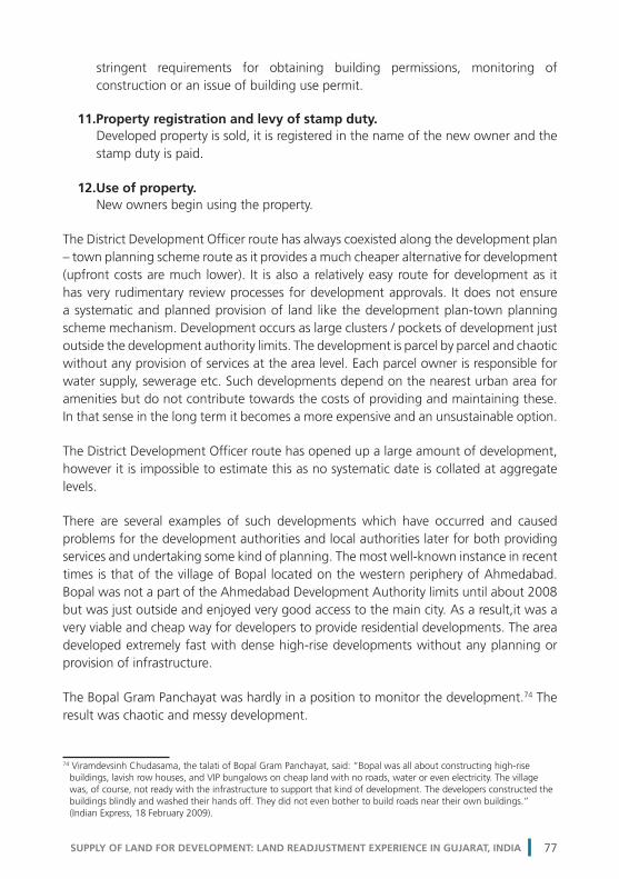
stringent requirements for obtaining building permissions, monitoring of construction or an issue of building use permit.
11.Property registration and levy of stamp duty. Developed property is sold, it is registered in the name of the new owner and the stamp duty is paid.
12.Use of property. New owners begin using the property.
The District Development Officer route has always coexisted along the development plan – town planning scheme route as it provides a much cheaper alternative for development (upfront costs are much lower). It is also a relatively easy route for development as it has very rudimentary review processes for development approvals. It does not ensure a systematic and planned provision of land like the development plan-town planning scheme mechanism. Development occurs as large clusters / pockets of development just outside the development authority limits. The development is parcel by parcel and chaotic without any provision of services at the area level. Each parcel owner is responsible for water supply, sewerage etc. Such developments depend on the nearest urban area for amenities but do not contribute towards the costs of providing and maintaining these. In that sense in the long term it becomes a more expensive and an unsustainable option.
The District Development Officer route has opened up a large amount of development, however it is impossible to estimate this as no systematic date is collated at aggregate levels.
There are several examples of such developments which have occurred and caused problems for the development authorities and local authorities later for both providing services and undertaking some kind of planning. The most well-known instance in recent times is that of the village of Bopal located on the western periphery of Ahmedabad. Bopal was not a part of the Ahmedabad Development Authority limits until about 2008 but was just outside and enjoyed very good access to the main city. As a result,it was a very viable and cheap way for developers to provide residential developments. The area developed extremely fast with dense high-rise developments without any planning or provision of infrastructure.
The Bopal Gram Panchayat was hardly in a position to monitor the development.74 The result was chaotic and messy development.
74 Viramdevsinh Chudasama, the talati of Bopal Gram Panchayat, said: “Bopal was all about constructing high-rise buildings, lavish row houses, and VIP bungalows on cheap land with no roads, water or even electricity. The village was, of course, not ready with the infrastructure to support that kind of development. The developers constructed the buildings blindly and washed their hands off. They did not even bother to build roads near their own buildings.” (Indian Express, 18 February 2009).
SUPPLY OF LAND FOR DEVELOPMENT: LAND READJUSTMENT EXPERIENCE IN GUJARAT, INDIA 77

On the directive of the Gujarat High Court, Bopal was brought into the limits of Ahmedabad Development Authority and now that authority faces enormous challenges in planning (it is in the process of preparing a town planning scheme75) and providing basic services. Another example of the similar developments is the Changodar industrial development close to Ahmedabad.
75 It is very difficult for the Ahmedabad Development Authority to prepare and implement the town planning scheme in an area that is already developed.
Figure 4.1.4: Growth of Bopal Village outside the city limits of Ahmedabad
Source: Google Earth
Figure 4.1.5: Changodar – Development of Industrial Areas outside city limits of Ahmedabad
Source: Google Earth
SUPPLY OF LAND FOR DEVELOPMENT78

3. The Redevelopment Route
This method is a part of the development plan-town planning scheme, final plots as determined by the town planning scheme process come up for renewal or redevelopment in the older and more central areas of the city along with growth in the peripheral areas as a regular process of a city’s growth and development. The redevelopment process is triggered by various circumstances. Usually, these land parcels (in the older areas) were developed under a much lower regime of development rights which are defined by a floor space index or floor area ratio; the current permitted index is much higher resulting in under-use of the development rights. 76 Often the uses become obsolete / derelict; the value of the land goes up significantly over the value of structures and uses therein etc. In most cases the developers end up assembling a group of such land parcels or, in some cases, large land parcels, the older developments are torn down and new plans are drawn up.
The flow chart below illustrates the various steps involved in transforming existing developed land parcels within an urban area using this route:
76 For example, in the 1987 development plan of Ahmedabad the permitted floor space index in most areas was 1; this was raised to 1.8 with an additional purchasable index of 0.45 in the revised development plan in 2002.
3Amalgamation
of plots
4NA
permission
6Amalgamation of
plots
12Use of
property
7Detailed layouts and
design
1Developer purchases land for redevelopment
18Use of
property
5Plot by plotupdating of
land cadastre
2Plot by plot
registering of land transaction and
levy of stamp duty
11Property
registrationand levy ofstamp duty
3 Redevelopment Route
Reve
nue
Dep
t.
Dev
. Aut
hori
ty /
Loca
l Gov
t.St
ate
Gov
ernm
ent
Urb
an D
evel
opm
ent D
epar
tmen
tPr
ivat
e Se
ctor
if re
quir
ed
if re
quir
ed
8 Building permission
Development of real estate
9 Construction monitoring
10 Building use permission
Process begins
after 1-18
of DP Route
Figure 4.1.6: Redevelopment route for supply of land for development
Source: Generated by author © Shirley Ballaney
SUPPLY OF LAND FOR DEVELOPMENT: LAND READJUSTMENT EXPERIENCE IN GUJARAT, INDIA 79

The various steps in the chart are explained below:
1. Developer purchases / assembles land for redevelopment. The developer identifies parcels with potential for redevelopment and purchases the land.
2. Registering of land transactions and levy of stamp duty. After purchase, the land plot needs to be registered in the new owner’s name along with payment of necessary stamp duty.
3. Amalgamation of plots (optional – either here or later, step 6). In case of contiguous land parcels, the developer at this stage may go in for amalgamation procedure under the Bombay Land Revenue Code,which is a process managed by the revenue department and is time consuming. Instead of this, the developer can undertake the process of amalgamation of land parcels at a later stage through the Gujarat Town Planning and Urban Development Act (step 6) by putting in a proposal for amalgamation to the development authority.
4. Plot by plot grant of non-agricultural use permission (optional). If the proposed use of the new development is different from the original use for which non-agricultural use permission was procured earlier, a new permission has to be procured for the proposed use.
5. Plot by plot updating of cadastre. After the registration process the cadastral records are updated to reflect the new owner’s name. Cadastral records are required to be updated even when non-agricultural use permission is sought on the land parcel.
6. Amalgamation of plots (optional – either here or earlier, step 3). In case the developer does not choose to amalgamate the contiguous land parcels via the revenue department, he or she can undertake the process using the provisions of parcel assembly in the Gujarat Town Planning and Urban Development Act 1976. He or she applies for amalgamation permission, pays the process charges and gets the amalgamation done. There are a few conditions though – for plots to be amalgamated they must be in the same use zone as prescribed in the development plans and the width to depth ratio of the amalgamated plots must not exceed 1:3. The process is necessary to use the gross floor space index over the entire set of plots to ensure better development, otherwise each plot will be treated separately for provisions such as margins, common open spaces etc.
SUPPLY OF LAND FOR DEVELOPMENT80

7. Detailed layouts and building designs. The landowner prepares the detailed layouts and designs and submits them to the development authority for approval.
8. Building permission. The authority issues a building permission, after which the owner starts construction.
9. Construction monitoring. The construction process is periodically monitored by the authority.
10.Building use permission. After the construction is complete, the owner / developer seeks building use permission from the authority.
11.Property registration and levy of stamp duty. When developed property is sold, it is registered in the name of the new owner and the stamp duty is paid.
12.Use of property. New owner begins using the property.
The Redevelopment route has also coexisted along with the development plans-town planning scheme route, although it has picked up pace recently with the increasing land values in already developed areas. Redevelopment of existing developed areas is critical in order to increase the supply of built space and contain the sprawl or horizontal expansion of the urban areas, which, in the long term, increases costs of development and is unsustainable. Until now, it has not been systematically addressed by the development authorities and has been largely driven by the market forces.
The process is messy and time consuming from the developer’s perspective. Usually the parcel sizes in the already developed areas are small and the developer has to amalgamate quite a number to get the larger footprint development that is more efficient in construction. Amalgamation is also necessary to avail and use the floor space index in an efficient manner. It becomes profitable only if there is a significant difference between the existing built-up and permissible built-up. Higher densities of development also mean that the infrastructure of the area will be affected and this becomes a challenge for the local government. At present there are no provisions for the developer to contribute towards these and the local government does not address these issues.
It is impossible to estimate how much land has undergone redevelopment as there is no systematic collation of development permissions issued with details of permissible build-up.
SUPPLY OF LAND FOR DEVELOPMENT: LAND READJUSTMENT EXPERIENCE IN GUJARAT, INDIA 81

This route opens up a considerable amount of land development or built-up area and results in a limited amount of build-up – the net addition in the built up area is the difference between the older development at a lower floor space index and the new development at a higher index. It is also impossible to rely on such a mechanism unless there is conscious effort made in the policies of the development plan and higher floor space indexes are permitted in certain zones or areas to encourage the process of redevelopment and densification. Thus far this is approach of raising the index to encourage the redevelopment has been tried out in Mumbai (with a fair degree of success) for slum areas.77
77 Mumbai has announced slum redevelopment schemes wherein a developer can take up parcels in slums for redevelopment. The developer is allowed to build more or given higher development rights provided he accommodates all the slum residents in new housing units free of cost on the same land parcel. He sells the balance construction to higher-income groups which finances the entire redevelopment.
Figure 4.1.7: Redevelopment of Areas
Source: Google Earth
SUPPLY OF LAND FOR DEVELOPMENT82

4. The Township Route
Today, with the increased pace of development and higher aspiration levels it has become clear that alternatives to the development plan-town planning scheme route, the District Development Officer route and the Redevelopment route are urgently required. There is also a greater willingness to experiment with market mechanisms and to partner with the private sector. A number of state governments are introducing Township Policies in which private developers are encouraged to assemble agricultural land in the countryside, wherever they think it is viable to develop serviced urban land or land and buildings (townships78). Government support is provided in a number of ways. Some states help with land acquisition, others only promise regulatory support such as re-zoning of the land in statutory development plans and quick “singe-window” approvals. Most assist by providing connectivity to existing infrastructure. Developers are expected to privately raise finances and invest in building infrastructure and / or buildings. Although, a number of township policies have been announced, there is considerable confusion and it is too early to say how this mode of land conversion will play out in the long run. Gujarat announced a township policy titled “Regulation for Residential Townships 2009”.
The flow chart below illustrates the various steps in the transformation of land from an agricultural holding to developed property:
78 There is no common statutory definition of a township across states. The Gujarat Township Policy 2009 defines a residential township as a land parcel owned by a township developer which 1) has a minimum size of 40 ha in the seven large urban development authorities and 20 ha in smaller urban areas and 2) 60 per cent of the land after deducting land for public purpose is under residential use.
SUPPLY OF LAND FOR DEVELOPMENT: LAND READJUSTMENT EXPERIENCE IN GUJARAT, INDIA 83

The various steps in the chart are explained below:
1. Developer purchases / assembles land. The developer identifies an area with a potential for undertaking a township.79 The developer either buys land parcels outright or engages in formal agreements with the landowners for developing the township.
2. Registering of land transactions and levy of stamp duty. After purchase, the land plot needs to be registered in the new owner’s name along with payment of necessary stamp duty.
3. Preliminary application to the development authority. The developer makes a preliminary application to the development authority to express his interest to undertake the development of a township. The application at this stage comprises of details of land parcels with ownership. The authority does an internal preliminary check pertaining to the proposals of the development plan. It gives the developer the go-ahead to proceed with the
79 The policy defines the types and sizes of townships.
14 Building permission
Construction of buildings
15 Construction monitoring
16 Building use permission
4Plot by plot
upgrading oftenure
2Plot by plot
registering of land transaction and
levy of stamp duty
5Plot by plotgrant of NA permission
6Plot by plotupdating of
land cadastre
17Property by
property registration and
levy of stamp duty
Reve
nue
Dep
t.U
rban
Dev
elop
men
t Dep
artm
ent
Priv
ate
Sect
or
Stat
e G
over
nmen
tD
ev. A
utho
rity
/ Lo
cal G
ovt.
1Developer purchases / assembles land
18Use of
property
12Detailed design
of buildings
10Detailed master
plan by developer
13Construction of site development works
8SSC review
3Preliminary
Application for Authority
7Application to POC & review
within authority
11Approval of detailed
master plan
9Gazette noti�cation
12Other approvals
4 Township Route
if re
quir
ed
Figure 4.1.8: Township route for supply of land for development
Source: Generated by author © Shirley Ballaney
SUPPLY OF LAND FOR DEVELOPMENT84

preparation of a detailed application and secure the non-agricultural use permissions.
4. Plot by plot upgrading of tenure (optional). If a plot has any tenure restrictions (of the sort described in Section 2.2) then these have to be lifted. In other words the land has to be converted to freehold tenure status to allow for any non-agricultural development.
5. Plot by plot grant of non-agricultural use permission. After the preliminary go-ahead by the authority, the developer begins the task of clearing issues of tenure if applicable and securing the non-agricultural use permission on all land parcels.
6. Plot by plot updating of cadastre. After the registration process the cadastral records are updated to reflect the new owner’s name. Cadastral records are required to be updated even when there is a change in tenure and or non-agricultural use permission is sought on the land parcel.
7. Plot by plot updating of cadastre. After clarifying ownerships, tenure conversions and non-agricultural use permissions, the developer submits a formal application to the Prescribed Officer Committee80 that is prescribed in the Gujarat Township Policy, 2009. This submission consists of the land ownership details and a preliminary master plan to show how the prescribed development norms in the township policy have been complied with, financial structuring of the project and phasing. The committee reviews the land ownership details, checks for any government lands included, any water bodies, with respect to the development plan and compliance with the township policy. The developer is asked to make a presentation to the Prescribed Officer Committee and respond / comply with queries.
8. Review of the of the township proposal by the State Screening Committee. The Prescribed Officer Committee recommends the township proposal to the State Screening Committee.81
9. Notification of the township in gazette. Once the State Screening Committee approves the notification of the township appears in the Government Gazette.
80 The Prescribed Officer Committee consists of the Municipal Commissioner, Chief Executive Authority and Senior Town Planner for the state in case of an Urban Development Authority. In case of the Ahmedabad Development Authority there are two other members – the STP of the Ahmedabad Development Authority and Deputy Municipal Commissioner (urban) of the Ahmedabad Municipal Corporation.81 State Screening Committee comprises of the Principal Secretary UDD, Principal Secretary Finance; Principal Secretary Revenue and Officer on Special Duty.
SUPPLY OF LAND FOR DEVELOPMENT: LAND READJUSTMENT EXPERIENCE IN GUJARAT, INDIA 85

10.Preparation of detailed master plan by developer. The developer now prepares a detailed master plan and submits it to the authority for approval.
11.Approval of authority of the detailed master plan. The development authority reviews the detailed master plan with respect to the prescribed norms in the Town Policy 2009 and approves the master plan.
12.Other approvals. Once the development authority approvers the detailed master plan the developer has to seek other key approvals – environment clearance and forest department clearance before he can commence construction of site infrastructure and site development works approved in the master plan. Some of these, such as the public roads and public purpose lands and green spaces, have to be handed over to the development authority.
13.Detailed design of buildings. The developer now prepares detailed building plans and submits it to the authority for approval. These follow the same processes as in the case of a building in a development plan area. There are other approvals involved – fire clearances etc.
14.Building permission. The authority issues building permission after which the developer starts construction.
15.Construction monitoring. The construction process is periodically monitored by the authority.
16.Building use permission. After the construction is finished, the owner / developer seeks building use permission from the authority.
17. Property registration and levy of stamp duty. Developed property is sold, it is registered in the name of the new owner and the stamp duty is paid.
18. Use of property New owners begin to use the property.
The government or public agencies did attempt to manage urban growth by developing new cities (such as Delhi, Gandhinagar, Chandigarh) in the past by acquiring large areas but the experiment did not meet with much success, apart from a few cities
SUPPLY OF LAND FOR DEVELOPMENT86

and industrial townships. The Township Route was proposed as a faster alternative to the delivery of serviced land in 2009 by encouraging the private sector to assemble and acquire land for accommodating new growth. However, the manner in which the policy was framed and the process outlined has turned out be more cumbersome and time consuming. The onus of assembling significantly large chunks of land (the policy stipulates minimum land requirements), getting all the clearances from the revenue department and stringent review processes by both the development authority and the state government is on the private developer. Further, the policy has insisted on higher building and planning standards that have raised the costs of development. The only exemption or advantage the policy offered was from zoning – a developer can propose a township in any zone. While there was an initial interest in setting up of townships, very few townships materialized. The table below gives the details of the townships in the Ahmedabad Urban Development Authority limits. Outside of these there is only one township approved in entire Gujarat, which is in Surat and is about 55 ha in area.
SUPPLY OF LAND FOR DEVELOPMENT: LAND READJUSTMENT EXPERIENCE IN GUJARAT, INDIA 87

Table 4.1.1: Status and details of townships within Ahmedabad Urban Development Authority limits
No. Name & Location Land Area (ha)
BUA proposed
Status
1 Applewoods Villages: Sarkhej-Sanathal
51.18 NA Approved by SG and AUDA Construction on-going
2 Sahara Villages: Shela
42.17 Approved by SG and AUDA TPS being finalized
3 Godrej Villages: Jagatpur, Chenpur, Tragad
109.84 Approved by SG and AUDA Construction on-going
4 Shantigram Khoraj, Khodiay, Jaspur, Dantali
249.67 Approved by SG and AUDA Construction on-going
5 Arvind 1 Villages: Motibhayan, Khatraj, Vadsar
55.04 Approved by SG and AUDA Construction on-going
6 Safal Villages: Kaneti, Telav
81.54 Approved by SG and AUDA Developer has not submitted the detailed master plan for approval.
7 Ganesh Housing: Smile City 1 Villages: Godhavi
183 Approved by SG and AUDA Developer has not submitted the detailed master plan for approval.
8 Ganesh Housing: Smile City 2 Villages: Godhavi
42.96 Approved by SG and AUDA Developer has not submitted the master plan for approval
9 Arvind 2 Villages: Jethlaj, Karoli
96.18 Land ownership not clear. Not approved by AUDA
SUPPLY OF LAND FOR DEVELOPMENT88

10 Ozone World Villages: Vadsar, Santej
114.75 Land ownership not clear.Not approved by AUDA
11 Venus 1, 2, 3 Villages: Ognaj, Lapkaman, Ranakpur, Santej
100.05 Land ownership not clear. Not approved by AUDA
12 Savvy Unispace Village: Sanand, Kaneti
43.36 Land ownership not clear. Not approved by AUDA
13 Shrinivas Organizers Villages: Santej, Ranakpur
60.15 Land ownership not clear. Not approved by AUDA
14 Arvind 3 Villages: Nasmed, Adhana
58.73 Awaiting NOCs Not approved by AUDA
TOTAL 1,288.62 Source: Generated by the author based on data from the UD&UHD, Shirley Ballaney
• Inall,about13km2 (and 18.5 km2 in Gujarat) of land is expected to enter the land market via this route. However of this only about 5 km2 is in process of being realized. • Mostofthedevelopershavesloweddownontheproposals. • Overall,theamountoflandanticipatedviathisrouteisofnoconsequence.
Figure 4.1.9: Safal Kaneti Township near Ahmedabad
Source: HCP Design, Planning and Management, Ahmedabad
SUPPLY OF LAND FOR DEVELOPMENT: LAND READJUSTMENT EXPERIENCE IN GUJARAT, INDIA 89

This is indeed a large-scale, market-based land acquisition mechanism and some ideas have been suggested on making the original landowners partners in the projects, however this is entirely the developers prerogative and depends on how he manages to acquire land; while getting permissions he has to show he controls the development process.
It is very clear from the data above that the process has failed to contribute to the supply of land.
5. The Special Act Route
Gujarat has been a frontrunner in terms of industrial development in the country. To boost industrial development, the state decided to reinforce its industrial policy from cluster and industrial estates based development to promoting Special Economic Zones and Special Investment Regions.
Figure 4.1.10: Arvind Township near Ahmedabad
Source: HCP Design, Planning and Management, Ahmedabad
SUPPLY OF LAND FOR DEVELOPMENT90

Special Economic Zones
The Government of India enacted the Special Economic Zones Act in June, 2005.82 The Act enables and promotes the creation of areas dedicated to the production of goods and services entirely for exports. Several exemptions in terms of taxes and duties on production of goods and services are provided and a clear route for providing approvals and clearances is laid out to speed up the setting up of these zones. Special Economic Zones are typically created on demand from the private sector and occasionally promoted by the state government. The lands for these zones are either acquired by public agencies or purchased by private enterprises.
Clearly being a product of an Act enacted by the central government, a sizeable number of approvals are given by the central government. At state level two departments play a seminal role – the industries and the revenue department in terms of granting various clearances. The flow chart below illustrates the various steps in the transformation of land from an agricultural holding to developed property:
82 Prior to this, the Gujarat Government had already enacted the Special Economic Zones Act in 2004 and three such zones were set up under this.
6Plot by plot
upgrading oftenure
7Plot by plotgrant of NA permission
3Board ofApproval
1State submits a
proposal
1Developer submits
a proposal
5Developer assembles and purchases land
13Construction of site and
buildings
15Use of
property
11Developer prepares plans and
applies for construction permits
4Letter of approval
10Noti�es the SEZ
12Committee of DIC and STP of DA
2State
Government approval
8Plot by plot
registering of land transaction and
levy of stamp duty
9Plot by plotupdating of
land cadastre
14Property
registrationand levy ofstamp duty
Priv
ate
Sect
orSt
ate
Gov
ernm
ent
Cent
ral G
over
nmen
t
if re
quir
ed
Indu
stri
es D
epar
tmen
tRe
venu
e D
epar
tmen
t
5 Special Act Route - SEZs
Figure 4.1.11: Special Act route – Special Economic Zones for supply of land for development
Source: Generated by author © Shirley Ballaney
SUPPLY OF LAND FOR DEVELOPMENT: LAND READJUSTMENT EXPERIENCE IN GUJARAT, INDIA 91

1. State government submits a proposal. The state government can initiate the setting up of a Special Economic Zone. It prepares and submits a proposal to the Board of Approval set up under the provisions of the Special Economic Zone Act 2005 at central government level.
or
1. Private developer submits a proposal. A private developer initiates the setting up of a Special Economic Zone. He prepares and submits a proposal to the state government (Industries Department).
2. State government approval. The state government runs a preliminary check on the proposal submitted by the developer and forwards the proposal to the Board of Approval.
3. Board of Approval. The board is a central government body comprising of high-ranking officials, evaluates the proposal and approves, suggests modifications or disapproves it. 4. Letter of Approval. As and when the Board of Approval clears the proposal, it issues a letter of approval to the state government or developer.
5. Developer purchases /assembles land. At the first proposal the developer tentatively indicates the land area and location to meet with the size requirements and the programme brief. Upon receiving the letter of approval the developer now confirms land ownership either by outright purchase or by agreements.
6. Plot by plot upgrading of tenure (optional). If a plot has any tenure restrictions (of the kind described in section 2.2) then these have to be lifted, in other words the land has to be converted to freehold tenure status to allow for any non-agricultural development.
7. Plot by plot grant of non-agricultural use permission. Status of all land by default is “agricultural” and it cannot be put to any other use than agriculture. All urban uses are essentially non-agricultural and in order to allow for non-agricultural uses it must be converted for non- agricultural use. The developer submits the layouts (attached with the preliminary proposal to the Board of Approval) and the non-agricultural use application.
8. Plot by plot registering of land transaction and levy of stamp duty.
SUPPLY OF LAND FOR DEVELOPMENT92

After purchase, the land plot needs to be registered in the new owner’s name along with payment of necessary stamp duty.
9. Plot by plot updating of cadastre. After the registration process the cadastral records are updated to reflect the new owner’s name. Cadastral records are required to be updated even when there is a change in tenure and or when non-agricultural use permission is sought.
10.Special Economic Zone notification. The developer submits the detailed plans and land ownership confirmation to the central government who then notifies the Special Economic Zone.
11.Developer prepares plans and applies for construction permits. The developer prepares detailed plans and applies for construction permits to the Department of Industries at the state government level.
12.Committee of District Industries Commissioner and Senior Town Planner of the Development Authority A committee comprising of the representatives of the District Industries Commissioner and the Senior Town Planner of the nearest development authority reviews these and gives approval.
13.Construction of site and buildings. The developer now commences construction of buildings and infrastructure. Portions of Special Economic Zone buildings / facilities may be sold.
14.Property registration and levy of stamp duty. Portions of Special Economic Zone buildings / facilities may be sold. Such developed property after sale / purchase needs to be registered in the new owner’s name along with the payment of necessary stamp duty.
15.Use of property. New owners begin using the property.
The status of the various Special Economic Zone proposals in Gujarat is given in the table below:
Table 4.1.2: Status and details of Special Economic Zones in Gujarat
SUPPLY OF LAND FOR DEVELOPMENT: LAND READJUSTMENT EXPERIENCE IN GUJARAT, INDIA 93

No. SEZ Status Land (km2) Total No.
1 Functional (before the 2005 Central Act) 5.07 03
2 Notified and operational/functional* 98.09 07
3 Notified 61.14 15
4 Formal approval 77.34 24
5 In principle approval 52.31 11
6 TOTAL 293.95 60
* Letter of approval issued by Government of India Source: Ahmedabad Urban Development Authority
Note: • Todate,about10SpecialEconomicZonesarefunctionalinGujaratextending over about 104 km2 of land. Special Investment Regions
The state government enacted the Gujarat Special Investment Region Act in 2009 to provide for the establishment, regulation and management of large investment regions and industrial areas. The planning process and enabling mechanisms are entirely modelled on the Gujarat Town Planning and Urban Development Act, 1976. The only difference is that a separate (or parallel) institutional structure is created to speed up the process instead of overburdening the institutional framework created in the Gujarat Town Planning and Urban Development Act, 1976. A regional development authority is created instead of a development authority; a regional development area is delineated instead of development area and all the approvals are granted by an “apex body” at the state level instead of the Urban Development and Urban Housing Department. This apex body is the Gujarat Industrial Development Board. The same two-step planning process is prescribed; first a regional development plan is prepared for the regional development area and then town planning schemes are prepared. The Special Investment Region Act refers to the respective sections of the Gujarat Town Planning and Urban Development Act to prepare and implement these.
The essential difference between a development area under the Gujarat Town Planning and Urban Development Act and a regional development area under the Special Investment Regions Act is that the area under the latter is predominantly zoned for industrial use (about 50 per cent) and the rest of the uses are support and or ancillary to the industrial use. Special Investment Regions are usually located away from large cities / urban areas. Whenever they encompass any developed areas, such as village settlements, municipal borough and municipal corporations, all surrounding areas become a part of the region except for these local areas, and their development is regulated as per the provisions of the regional development plan. In case there is development authority, it ceases to exist.
SUPPLY OF LAND FOR DEVELOPMENT94

The flow chart below illustrates the various steps in the transformation of land from an agricultural holding to developed property:
There various steps are same as the development plan-town planning scheme route and are not explained again.
The status of the various Special Investment Regions proposals in Gujarat is given in the table below:
8Plot by plot
upgrading oftenure
9Plot by plotgrant of NA permission
9Sanction of TPS
2Sanction of DP
2Zoning of land
fordevelopment
in DP
3Building city
level infrastructure
4Detailed area
planning -TPS
6Building TPS
level infrastructure
7Preliminary
layout / building
approval for NA
14 Building permission
Development of real estate
15 Construction monitoring
16 Building use permission
10Purchase of land for development
13Detailed layouts
and design
18Use of
property
11Plot by plot
registering of land transaction and
levy of stamp duty
12Plot by plotupdating of
land cadastre
17Property
registrationand levy ofstamp duty
5 Special Act Route - SIRs
Reve
nue
Dep
t.A
pex
Aut
horit
yPr
ivat
e Se
ctor
Regi
onal
Dev
Aut
hori
ty
if re
quir
ed
Figure 4.1.12: Special Act Route – Special Investment Regionsfor supply of land for development
Source: Generated by author © Shirley Ballaney
SUPPLY OF LAND FOR DEVELOPMENT: LAND READJUSTMENT EXPERIENCE IN GUJARAT, INDIA 95

Table 4.1.3: Status of Special Investment Regions in Gujarat
No. SIR Land (km2)
Status
1 Petroleum Chemical & Petrochemical Investment Region, Bharuch District
453 SIR notified SIRDA notified DDP prepared and submitted for sanction TPS under preparation Already functional as was set up on existing industries with a view to expand the industrial activity
2 Dholera 879.33 SIR notified RDA notified DDP prepared and submitted for sanction TPS under preparation
3 Santalpur, Patan District 186 SIR notified RDA notification pending
4 HalolSavli, Vadodara District 123 SIR notified RDA notified DDP under preparation
5 Aliyabet 163 SIR notified RDA notification pending
6 Changodar, Ahmedabad District
319 SIR notification pending with SG
7 Pipavav 147 SIR notification pending with SG
8 Viramgam, Ahmedabad District
190 SIR notification in process
9 Simar 84 SIR notification in process
10 Navlakhi 182 SIR notification in process
11 Anjar 237 SIR notification in process
12 Okha 206 SIR notification in process
TOTAL 3,168.33
Source: Generated by the author based on data from the Industries Department, Government of Gujarat, Shirley Ballaney
• SpecialInvestmentRegionsareproposedoveranareaofabout3,168km2 in Gujarat.
SUPPLY OF LAND FOR DEVELOPMENT96

• Todate,only1regionispartiallyfunctional,thatofthePetroleumChemicaland Petrochemical Investment Region in Bharuch. Another one, that of Dholera, is being planned.
Figure 4.1.13: SEZs in Gujarat
Source: http://www.vibrantgujarat.com/images/pdf/special-economic-zones.pdf
Figure 4.1.14: SIRs in Gujarat
Source: http://www.gidc.gov.in/pdf/SIR-Brochure.pdf
SUPPLY OF LAND FOR DEVELOPMENT: LAND READJUSTMENT EXPERIENCE IN GUJARAT, INDIA 97

Both the Special Economic Zones and Special Investment Regions are a recent introduction. The SEZ route was proposed by the central government to promote industrial / economic growth in 2005. However, since then Gujarat has seen about 10 functional Special Economic Zones over an area of about 104km2. The Special Investment Regions route was proposed by the state government in 2009, again to promote industrial / economic growth. To date about four regions are notified covering an area of 1,641km2. However none of these is fully developed and operational yet, only the Petroleum Chemical & Petrochemical Investment Region in Bharuch District is partially operational. It is yet to be seen how these play out and how the industrial growth is promoted, especially when the state government continuous to actively promote industrial development in a major way through the Gujarat Industrial Development Corporation. This corporation is acquiring lands and setting up industrial estates within and outside Special Investment Regions.
Both these routes ensure a systematic and planned provision of land for industrial growth and adequate supporting development that was not possible in the case of setting up of estates by the Gujarat Industrial Development Corporation.
6. The Unregulated Route
This refers to all the development that occurs in the development plans, town planning scheme and non-urban areas in an unauthorized manner, or when the owners / developers / encroachers / squatters do not seek any formal approvals or permissions before starting any development.
Housing for Poor, Prahladnagar TPS, Ahmedabad.© Environmental Planning Collaborative, Ahmedabad
SUPPLY OF LAND FOR DEVELOPMENT98

This is a frequent occurrence in urban areas (development authority areas / municipalities) when the costs of complying with any regulatory process are not tenable and the regulatory authorities lack the capacity / resources / political will to check these or penalize any violations.
In rural areas, the regulatory enforcement institutions and mechanisms are simply too weak or are only elementary – the gram panchayats are not equipped to address such issues because they do not have the staff or resources or capacities.
The Unregulated Route has always existed and is the easiest for development. Development is parcel by parcel and occurs in an adhoc manner without any provision of services. Large portions of urban areas, especially in the early years, developed in this manner and it is not possible to get an estimate of such developments. The authorities typically end up upgrading and or regularizing such developments in future.
4.2 COMPARATIVE OVERVIEW OF METHODS FOR LAND SUPPLY
The comparison is based on observations and the processes involved to get an overall sense of the methods and to gain an understanding the strengths and limitations of each vis a vis each other. The indicators or parameters include:
1. Systematic and planned release of land.
The question here is whether the method enables the release of land for development in a systematic and planned manner. By these, two things are implied – 1) the location is
Figure 4.1.15: Unregulated Developments
Source: Google Earth
SUPPLY OF LAND FOR DEVELOPMENT: LAND READJUSTMENT EXPERIENCE IN GUJARAT, INDIA 99

determined where the land will be released, and 2) the timely release of land.
2. Predictable amount of serviced land released.
The question here is whether the method makes it possible to predict the quantum of serviced land released. Serviced land includes provision of infrastructure, space for public amenities and open spaces (public space).
3. Complexity of the process and minimum time taken for release of land.
The question here is about the minimum time for the release of land as per the statutory provisions.
4. Costs of development to the owner / developer.
The question here is whether there are costs associated with the development that are borne by the owner / developer. These would be actual costs associated with 1) obtaining non-agricultural use permissions from the revenue department; 2) processing development permissions from the development / local authority / Town Planning and Valuation Department; 3) complying with various building and planning regulations framed by the development authority and; 4) paying for infrastructure services to the development authority.
5. Responsiveness to the land market.
The question is whether the method is responsive to the signals of the land market; that is, does it provide land where there is demand for it. The land price would be the indicator of the demand for land.
SUPPLY OF LAND FOR DEVELOPMENT100

Tab
le 4
.2.1
: Co
mp
arat
ive
ove
rvie
w o
f m
eth
od
s fo
r su
pp
ly o
f la
nd
No.
Met
hod
Syst
emat
ic
and
plan
ned
rele
ase
of la
nd
Pred
icta
ble
amou
nt
of s
ervi
ced
land
re
leas
ed
Com
plex
ity o
f th
e pr
oces
s an
d m
inim
um t
ime
take
n fo
r re
leas
e of
land
Cos
ts o
f de
velo
pmen
t to
the
ow
ner
/ de
velo
per
Resp
onsi
vene
ss t
o th
e la
nd m
arke
t
1D
P TP
S Ro
ute
Yes.
Th
e lo
catio
n of
the
land
to
be r
elea
sed
is
dete
rmin
ed
but
the
time
fram
e is
un
pred
icta
ble
Yes.
A
bout
3,0
00 k
m2
of a
nd is
ope
ned
up f
or d
evel
opab
le
uses
. TPS
hav
e be
en
done
ove
r ab
out
850
km2
of la
nd.
The
proc
ess
is a
long
on
e an
d in
volv
es v
ario
us
step
s –
first
a D
P ha
s to
be
prep
ared
and
ap
prov
ed a
nd t
hen
the
TPS
have
to
be p
repa
red
to r
elea
se s
ervi
ced
land
into
the
mar
ket.
The
follo
win
g co
sts
are
asso
ciat
ed w
ith
deve
lopm
ent:
•
NApermission
•
Develop
men
tpe
rmis
sion
pro
cess
ing
•Com
plianceto
build
ing
and
plan
ning
re
gula
tions
•
Paym
entof
bett
erm
ent
/ in
fras
truc
ture
cos
ts
The
DP-
TPS
rout
e is
not
re
spon
sive
to
the
land
m
arke
t or
dem
and
for
land
. It
open
s up
a h
uge
quan
tum
of
land
in s
ever
al
loca
tions
. Som
e of
the
se
may
dev
elop
rap
idly
w
hile
som
e ar
eas
coul
d de
velo
p la
ter
or s
low
ly.
2D
DO
Rou
teN
o.
Nei
ther
the
lo
catio
n of
land
is
pred
icta
ble
nor
is t
he
time.
No.
N
A p
erm
issi
ons
are
issu
ed o
n a
case
by
cas
e ba
sis.
It
is n
ot p
ossi
ble
to
pred
ict
whe
re t
he
next
req
uest
will
co
me
from
. It
is
how
ever
pos
sibl
e to
est
imat
e th
e to
tal l
and
rele
ased
in
thi
s m
anne
r bu
t no
sys
tem
atic
and
ce
ntra
lized
rec
ords
ar
e m
aint
aine
d to
ena
ble
this
.
The
min
imum
tim
e fo
r a
DP
is f
our
year
s an
d si
x m
onth
s an
d th
e m
inim
um t
ime
for
a TP
S is
fou
r ye
ars
and
one
mon
th.
The
follo
win
g co
sts
are
asso
ciat
ed w
ith
deve
lopm
ent:
•
NApermission
•
Develop
men
t
perm
issi
on p
roce
ssin
g •
Com
pliance
to b
uild
ing
and
plan
ning
reg
ulat
ions
(n
ot s
o st
ringe
nt)
This
rou
te is
driv
en b
y th
e de
man
d fo
r la
nd f
or
deve
lopm
ent.
It
occu
rs
beca
use
of t
he d
isto
rtio
ns
in t
he la
nd m
arke
ts c
ause
d by
the
DP
TPS
proc
ess.
It
also
cau
ses
it al
so in
a s
ense
th
at t
he D
P-TP
S pr
oces
s is
lo
ng a
nd t
his
proc
ess
offe
rs
a sh
orte
r an
d le
ss e
xpen
sive
w
ay. T
his
then
red
uces
th
e de
man
d fo
r se
rvic
ed
land
in t
he D
P TP
S ar
eas.
SUPPLY OF LAND FOR DEVELOPMENT: LAND READJUSTMENT EXPERIENCE IN GUJARAT, INDIA 101

No.
Met
hod
Syst
emat
ic
and
plan
ned
rele
ase
of la
nd
Pred
icta
ble
amou
nt
of s
ervi
ced
land
re
leas
ed
Com
plex
ity o
f th
e pr
oces
s an
d m
inim
um t
ime
take
n fo
r re
leas
e of
land
Cos
ts o
f de
velo
pmen
t to
the
ow
ner
/ de
velo
per
Resp
onsi
vene
ss t
o th
e la
nd m
arke
t
3Re
deve
lopm
ent
Rout
eYe
s.N
o.
Requ
ests
for
re
deve
lopm
ent
at
pres
ent
are
driv
en
by t
he m
arke
t as
th
e D
Ps d
o no
t fo
llow
a p
olic
y fo
r ta
rget
ing
area
s fo
r re
deve
lopm
ent.
No
data
is s
epar
atel
y co
llate
d th
at c
an
give
an
estim
atio
n of
the
rat
e of
re
deve
lopm
ent.
The
proc
ess
is e
mbe
dded
in
the
DP-
TPS
rout
e.
The
proc
ess
of la
nd
asse
mbl
y is
mes
sy a
nd
time
cons
umin
g. I
t is
co
mpl
icat
ed a
s th
e la
nd
parc
el in
mos
t ca
ses
has
to u
nder
go t
he N
A
perm
issi
on p
roce
ss a
nd
amal
gam
atio
n pr
oces
s.
This
can
tak
e an
ythi
ng
from
a y
ear
to lo
nger
.
The
follo
win
g co
sts
are
asso
ciat
ed w
ith
deve
lopm
ent:
•
NApermission
•
Develop
men
tpe
rmis
sion
pro
cess
ing
•Com
plianceto
build
ing
and
plan
ning
re
gula
tions
•
Paym
entof
bett
erm
ent
/ in
fras
truc
ture
cos
ts
This
rou
te d
riven
by
the
dem
and
for
land
fo
r de
velo
pmen
t.
4To
wns
hip
Rout
eYe
s.
Both
the
lo
catio
n of
th
e la
nd t
o be
re
leas
ed a
nd
the
time
fram
e ar
e pr
edic
tabl
e as
it is
driv
en
by t
he p
rivat
e se
ctor
.
Yes.
Abo
ut 1
8.5
km2
of
land
is p
lann
ed f
or
rele
ase
of w
hich
ab
out
5 km
2 is
in
the
pro
cess
of
bein
g re
aliz
ed.
The
proc
ess
is s
impl
er
than
the
DP
TPS
proc
ess
in a
sen
se t
hat
it co
mbi
nes
both
and
the
ap
prov
als
are
obta
ined
in
a c
ombi
ned
man
ner.
It in
volv
es a
ppro
vals
fro
m
both
the
dev
elop
men
t au
thor
ity a
nd t
he
stat
e go
vern
men
t.
The
perm
issi
on f
or t
he
tow
nshi
ps in
the
AU
DA
ar
ea h
ave
on a
n av
erag
e ta
ken
1-2
year
s.
The
follo
win
g co
sts
are
asso
ciat
ed w
ith
deve
lopm
ent:
•
NApermission
•
Develop
men
tpe
rmis
sion
pro
cess
ing
•Com
plianceto
build
ing
and
plan
ning
re
gula
tions
(nor
ms
are
high
er)
•Absorbing
the
in
fras
truc
ture
cos
ts
This
rou
te d
riven
by
the
dem
and
for
land
fo
r de
velo
pmen
t. T
he
deve
lope
r ju
dges
the
de
man
d an
d m
akes
a
prop
osal
to
deve
lop
a to
wns
hip.
SUPPLY OF LAND FOR DEVELOPMENT102

No.
Met
hod
Syst
emat
ic
and
plan
ned
rele
ase
of la
nd
Pred
icta
ble
amou
nt
of s
ervi
ced
land
re
leas
ed
Com
plex
ity o
f th
e pr
oces
s an
d m
inim
um t
ime
take
n fo
r re
leas
e of
land
Cos
ts o
f de
velo
pmen
t to
the
ow
ner
/ de
velo
per
Resp
onsi
vene
ss t
o th
e la
nd m
arke
t
5U
nreg
ulat
ed
Rout
eN
oN
oN
one
as n
o pr
oces
s is
fol
low
edN
ilTh
is r
oute
is d
riven
by
the
dem
and
for
land
fo
r de
velo
pmen
t.
6Sp
ecia
l Act
Ro
ute
(SEZ
and
SIR
)
Yes
SEZ
– Bo
th
the
loca
tion
of
the
land
to
be
rele
ased
and
th
e tim
e fr
ame
are
pred
icta
ble
as it
is d
riven
by
the
priv
ate
sect
or
SIR
– Th
e lo
catio
n of
th
e la
nd t
o be
rel
ease
d is
de
term
ined
bu
t th
e tim
e fr
ame
is
unpr
edic
tabl
e
Yes
SEZs
– A
bout
294
km
2 of
land
is
plan
ned
for
rele
ase
of w
hich
abo
ut 1
04
km2
is r
ealiz
ed.
SIRs
– A
bout
3,1
68
km2
of la
nd is
pl
anne
d fo
r re
leas
e,
of w
hich
abo
ut
450k
m2
is s
till i
n th
e pr
oces
s of
be
ing
real
ized
.
SEZs
– T
he p
roce
ss
com
plic
ated
ow
ing
to t
he f
act
that
bot
h th
e ce
ntra
l and
sta
te
gove
rnm
ent
appr
oval
s ar
e re
quire
d. I
t ha
s ta
ken
abou
t ei
ght
year
s to
re
aliz
e 60
SEZ
cov
erin
g ab
out
294
km2
of a
rea.
SIRs
–Th
e pr
oces
s is
sa
me
as t
he D
P TP
S pr
oces
s. I
t is
diff
icul
t to
es
timat
e th
e tim
e bu
t it
is a
lread
y th
ree
year
s si
nce
wor
k on
the
firs
t tw
o st
arte
d an
d it
will
ta
ke a
whi
le f
or t
hese
to
be
fully
ope
ratio
nal.
The
follo
win
g co
sts
are
asso
ciat
ed w
ith
deve
lopm
ent:
•NApermission
•
Develop
men
tpe
rmis
sion
pro
cess
ing
•Com
plianceto
build
ing
and
plan
ning
re
gula
tions
•
Paym
entof
bett
erm
ent
/ in
fras
truc
ture
cos
ts
Driv
en b
y th
e de
man
d fo
r la
nd f
or d
evel
opm
ent.
Th
e de
velo
per
judg
es
the
dem
and
and
mak
es a
pro
posa
l to
deve
lop
a to
wns
hip.
SIR
– sa
me
as t
he
DP
– TP
S ro
ute.
Sour
ce: G
ener
ated
by
the
auth
or ©
Shi
rley
Balla
ney
SUPPLY OF LAND FOR DEVELOPMENT: LAND READJUSTMENT EXPERIENCE IN GUJARAT, INDIA 103

4.3 SUMMARY
The development plan-town planning scheme mechanism is the predominant route for the supply of land for development; it is the oldest route and has been used to release a large amount of land. It ensures the systematic and planned release of land and a predictable amount of land. However, the complexity of the process (number of steps), the time it takes and some of the regulatory costs involved have resulted in the development of the District Development Officer route and the Unregulated Route, both of which result in unsustainable development in the long term. Both these two latter methods can be easily restricted by addressing the shortcomings in the development plan-town planning scheme process (dealt with in sections 5 and 6).
The Redevelopment Route presently does not contribute to significant amounts of land for development but needs to be promoted to encourage densification of urban areas, and to avoid sprawl and increased development costs. This can be done easily by adopting differential floor space index regime in an urban area. Its use to encourage the renewal of slum areas can be easily scaled up and it could be more extensively used for the renewal of other areas, such as heritage precincts or dilapidated building stock or derelict areas. It is a part of the development plan-town planning scheme mechanism and, if promoted, would contribute to its efficacy.
The Township Route emerged as a market-based solution for a supply of land but does not seem to have taken off as anticipated because of more stringent permission process and because it results in much higher costs of development. This route can also be easily encouraged by making the approval processes simpler and not imposing unrealistically high standards of development. This would also strengthen the development plan-town planning scheme process by meeting the demand in areas that this process cannot address.
Within the Special Act Route, the Special Investment Region mechanism is the same as development plan-town planning scheme mechanism and is faced with similar challenges. The Special Economic Zone route that depends on large-scale acquisition of land is faced with the challenges of acquisition. Since this is predominantly concerned with the supply of land for economic activity, it may, however, be better to leave it to the market to determine its emergence and success. Both the Special Investment Region route and the setting up of Gujarat Industrial Development Corporation estates in a sense compete with it as far the objective of encouraging economic activity and the only advantage it has is some tax breaks on it being geared for exports.
In summary, in Gujarat it is clear that arguably far too much land is already released, or is in the process of being released, for development. The important question is how to make these methods more effective so that they do not compete with and thwart each other but work in a synergistic manner and benefit a broad group of stakeholders and not just a few.
SUPPLY OF LAND FOR DEVELOPMENT104

In this section the town planning scheme experience in Gujarat is reviewed. To begin with, land zoned for development is an estimate based on the data available for the development plans. Within the estimate, how much of the land zoned for development is transformed through the town planning scheme mechanism, is based on the status of the scheme prepared in Gujarat. This is followed by an enumeration of some of the attributes of the mechanism that make it successful when compared with other methods of land development. The section ends with some of the limitations of the town planning scheme mechanism drawing from the data presented in sections 3 and 4.
5.1 LAND ZONED AND TRANSFORMED FOR URBAN DEVELOPMENT
1. Land zoned for urban development
Typically the entire area under the jurisdiction of an Urban Development Authority or Area Development Authority is not zoned for developable uses; a major portion of the surrounding area continues to be zoned for agricultural or non-developable uses.83 The data set used for this study does not provide the breakup of the developable and non-developable zones in all the development plans. However based on a review of a few development plans (data for which was available) it is estimated that about 25 to 35 per cent of the land is allocated for developable uses. Taking this at 30 per cent, land zoned for development is estimated.
83 Developable means that development for different purposes such as residential, industrial, commercial etc. is permitted.
05 LAND READJUSTMENT IN URBAN GUJARAT
SUPPLY OF LAND FOR DEVELOPMENT: LAND READJUSTMENT EXPERIENCE IN GUJARAT, INDIA 105

Table 5.1.1: Estimates of land zoned for urban development in Gujarat
No. Type of urban area Area (km2) Population (Urban) 2001
1 Constituted Urban Development Authorities 4,689.53. 9,674,920
2 Constituted Area Development Authorities 1,880.56 1,914,609
3 Designated Area Development Authorities 2,312.77 5,771,394
4 Municipalities other than part of UDAs & ADAs
1,064.84 1,131,372
5 Notified Area 0 0
6 Industrial Notified Areas 32.75 90,754
7 Total 9,980.45
Total Gujarat Area 196,024.00 50,671,017
Percentage of Urban Area 5% 37%
Land Zoned for development (30%) of Row 7
2,994
Average Per capita land zoned (m2) 160m2
Source: Computed on the basis of data obtained from Urban Development and Urban Housing Department(UD & UHD), Government of Gujarat
• About37percentofthestatepopulationlivesinurbanareaswhichoccupy5per cent of the land area (entire area under all types of urban areas). • About3,000km2 or 30 percent of land is zoned for developable uses out of a total area of 9,980 km2. • Averagepercapitalandzonedapproximatelyworksoutto160m2.
2. Land transformed through the town planning scheme process
The development plan zones the land for development under various uses. There is a category, however, that specifies land that is not yet “suitable” for urban uses – the land plots are irregular, there is no infrastructure in place and all, or the land holdings do not have appropriate access. The town planning schemes are prepared in the areas zoned for development and, as a consequence, the land plots are suitably transformed to support urban uses – plots are reconstituted, each plot is given access and infrastructure services are planned.
This section of the paper reviews how much of the area zoned for developable uses is transformed or serviced through the mechanism of a town planning scheme. The amount “transformed” is important to note as an indicator of the mechanism’s efficacy.
LAND READJUSTMENT IN URBAN GUJARAT106

Table 5.1.2: Estimates of land under town planning schemes in Gujarat
No. Status of TPSs in Gujarat
Total No. of TPS
No. of TPS for Area is available
Area (km2) % Area released at each stage
1 Resolution to Prepare TPS
1 1 0.70 0.08
2 Preparation of Draft TPS (CTP consultation, Owners meeting, Publication, Draft Submission to SG)
1,880.56 1,914,609
3 Sanction of Draft TPS
17 17 29.28 3.51
4 Appointment/Entry of TPO
191 189 201.99 24.19
5 Preparation of Preliminary TPS
31 31 32.51 3.89
6 Sanction of Preliminary TPS
25 25 27.10 3.25
7 Preparation of Final TPS
43 43 43.86 5.25
8 Sanction of Final TPS
207 194 260.41 31.19
9 No information / Data not available
7 4 8.99 1.08
10 Total 665 625 834.95 100
11 Average area under a TPS (835/625)
1.34 km2
12 Total Area under TPS (665 x 1.34)
891 km2
Source: Computed on the basis of data obtained from Urban Development and Urban Housing Department(UD & UHD), Government of Gujarat
• Out of a total area zoned for development that is 3,000 km2, town planning schemes are prepared for about 891 km2 or roughly 30 per cent of the area.
SUPPLY OF LAND FOR DEVELOPMENT: LAND READJUSTMENT EXPERIENCE IN GUJARAT, INDIA 107

Table 5.1.3: Estimates of land under town planning schemes in Ahmedabad
No. Status of TPSs in Ahmedabad
Total No. of TPS
No. of TPS for Area is available
Area (km2)
% Area released at each stage
1 Resolution to Prepare TPS
1 1 0.70 0.17
2 Preparation of Draft TPS
64 62 138.12 34.08
3 Sanction of Draft TPS 13 13 24.96 6.16
4 Appointment/Entry of TPO
80 80 87.16 21.67
5 Preparation of Preliminary TPS
13 13 13.53 3.34
6 Sanction of Preliminary TPS
8 8 10.06 2.48
7 Preparation of Final TPS
7 7 8.79 2.17
8 Sanction of Final TPS 66 66 119.56 29.50
9 No information / Data not available
2 2 2.46 0.61
Total 254 252 405.34 100
11 Average area under a TPS (405/252)
1.6 km2
12 Total Area under TPS (254 x 1.6)
407 km2
Source: Computed on the basis of data obtained from Urban Development and Urban Housing Department(UD & UHD), Government of Gujarat
• In the case of Ahmedabad, town planning schemes are prepared for almost 100 per cent of the area zoned for development. Figure 5.1.2 shows the map of Ahmedabad with the town planning scheme boundaries prepared over the years, the entire area zoned for development is proposed to be developed by this mechanism.
3. Transformation of land at various town planning schemes
In this section we review in detail the supply of land or the transformation of land in the town planning scheme process at various stages.
LAND READJUSTMENT IN URBAN GUJARAT108

This analysis is based on the dates of the various statutory processes and town planning scheme areas. This information is collated at the state level and was updated as a part of the study.
The dates are maintained for the following statutory steps:
1. Consultation with state government 2. Declaration of Intention 3. Owners’ Meeting 4. Publication 5. Submission of Draft town planning scheme to state government 6. Sanction of Draft town planning scheme 7. Appointment of town planning officer 8. Entry of town planning officer 9. Preliminary Award 10. Preliminary Sanction 11. Preliminary in-force 12. Final Award 13. Final Sanction 14. Final in-force
The statutory steps are collapsed into seven major stages indicated in the table below:
SUPPLY OF LAND FOR DEVELOPMENT: LAND READJUSTMENT EXPERIENCE IN GUJARAT, INDIA 109

Table 5.1.4: Stages in the preparation of a town planning scheme
No. Stage in the Graph
Start Date / in between Dates
In between Dates and End Date
Responsibility
1 Functional (before the 2005 Central Act)
5.07 Declaration of Intention Owners Meeting Publication Submission of Draft TPS to SG
Authority
2 Scrutiny of Draft TPS
Submission of Draft TPS to SG
Sanction of Draft TPS SG
3 Appointment of TPO
Sanction of Draft TPS
Appointment of TPO OR Entry of TPO (There is usually a time lag between the appointment of the TPO by the SG and the actual date when he takes charge of the draft TPS. It can range from 2 months to 6 months.)
SG
4 Preparation of Preliminary TPS
Appointment of TPO OR Entry of TPO
Award of Preliminary TPS TPO
5 Scrutiny of Preliminary TPS
Award of Preliminary TPS
Preliminary Sanction SG
6 Preparation of Final TPS
Preliminary Sanction
Preliminary in force
Award of Final TPS TPO
7 Scrutiny of Final TPS
Award of Final TPS
Final Sanction/Final in force SG
Source: Source: Generated by the author © Shirley Ballaney
A graph (Figure 5.2.10) is prepared for each town planning scheme for the various stages it is at. This analysis is possible for all the schemes prepared under the Gujarat Town Planning and Urban Development Act 1976. In both the earlier Bombay Town Planning Acts of 1915
LAND READJUSTMENT IN URBAN GUJARAT110

and 1954 the stages were different – the draft scheme was followed by the final scheme. Also limited data on dates was available and hence in these town planning schemes only two stages are shown – the preparation of a draft scheme and finalization of the scheme. Notes:1 This graph represents the status of town planning schemes under Ahmedabad Municipal Corporation and Ahmedabad Development Authority jurisdictions.
2 The graph is plotted for 244 schemes out of a total of 254. Various data were not available for other 10 schemes
Figure 5.1.1: Finalized TPS Document
Source: EPC Development Planning and Management, Ahmedabad
SUPPLY OF LAND FOR DEVELOPMENT: LAND READJUSTMENT EXPERIENCE IN GUJARAT, INDIA 111

Prep
arat
ion
ofdr
aft T
PSSc
rutin
y of
draf
t TPS
Sele
ctio
n of
TPO
Prep
arat
ion
ofpr
elim
inar
y TP
SSc
rutin
y of
prel
imin
ary
TPS
Prep
arat
ion
ofFi
nal T
PSSc
rutin
y of
Fina
l TPS
Fig
ure
5.1
.2: T
ran
sfo
rmat
ion
of
lan
d t
hro
ug
h t
ow
n p
lan
nin
g s
chem
es, A
hm
edab
ad
Sour
ce: G
ener
ated
by
auth
or ©
Shi
rley
Balla
ney
LAND READJUSTMENT IN URBAN GUJARAT112

5.2 SUCCESSFUL ASPECTS OF THE TOWN PLANNING SCHEME MECHANISM
At first glance,the data suggests that the town planning scheme mechanism is complicated, tedious, unwieldy, time consuming and difficult to use. Despite its inherent flaws, however, it has been and still is a very effective planning, infrastructure development, financing and implementation tool in Gujarat.
Furthermore, the legislation has been continuously improved to address the various flaws and constraints to make it more effective. It was after the 1999 amendments to the Gujarat Town Planning and Urban Development Act 1976 (refer to Section 3) that the process was considerably revitalized and the pace of preparing the town planning scheme mechanism went up significantly. This is clear from Figure 5.1.2, a dotted line highlights the year 2000 and there is a sharp rise in the number of schemes being initiated.
This section enumerates important attributes of the mechanism on account of which the works well in Gujarat, and is perceived to be fair, equitable and democratic. It also provides valuable and important lessons that can inform public policy in other jurisdictions and possibly places.
1. Versatile tool to address several urban challenges
The most extensive use of the town planning scheme mechanism is to transform the agricultural land holdings at the periphery of the urban area into land that can be used for other non-agricultural development.84 However managing urban expansion in the periphery of cities is only one use for the mechanism; it is a powerful and well-coordinated statutory tool for simultaneously preparing a detailed land appropriation, land readjustment and infrastructure building plan, a mechanism for financing and implementing the plan and a mechanism for involving landowners in the process. Being a general purpose mechanism, it can and has been used to address a variety of urban land appropriation and infrastructure provision problems.
A series of examples are presented in this section that demonstrates the versatility of the mechanism. This creative use of the mechanism is recent and one of a kind. It is debatable whether some of these uses can be replicated or widely promoted as a norm without a really strong objective anticipated in the development plan.
A Providing infrastructure in peripheral areas, B Building citywide infrastructure, 84 The town planning scheme mechanism or land readjustment is one of the methods to covert agricultural land to serviced urban land. Some other methods include laissez-faire development, laissez-faire with minimal planning, bulk land acquisition and its development by public land development agencies and bulk land acquisition by private players and it development (private townships). These are explained in Ballaney and Patel (2009).
SUPPLY OF LAND FOR DEVELOPMENT: LAND READJUSTMENT EXPERIENCE IN GUJARAT, INDIA 113

C Providing land for housing the urban poor, D Providing infrastructure in unauthorized developments, E Reconstructing and regenerating a historic core, and, F Consolidating land for developing an institutional zone.
A. Providing infrastructure in peripheral areas / managing peripheral growth
Case study of Ahmedabad Urban Development Authority, Ahmedabad
Managing the growth in the periphery of cities thus far has been the most extensive application of the town planning scheme mechanism in Gujarat.85 Typically the authorities undertake the preparation of the schemes in the new areas zoned for development in their respective development plans. Key tasks involved in the preparation of a town planning scheme include (as practised):
• Delineatinganareaforpreparingascheme, • Undertakingadetailedtopographicalsurveyofthearea, • Collatingthelandownershipdocumentsandlandtenurestatus, • Preparingthebasemapandareastatements,
85However, the Act does not limit it to this; in fact it clearly mentions that town planning schemes can be done on partially or already developed areas.
Versatile Tool for Planning, Financing and Implementing Development. © Environmental Planning Collaborative, Ahmedabad
LAND READJUSTMENT IN URBAN GUJARAT114

• Tabulatingtheownerships,plotsizesandoriginallandvalues, • Markingoriginallandownershipsonmap, • Preparingaconceptualplan–determiningtheroadnetwork,reconstituting land plots and appropriating land 86 from each, carving out plots for amenities and delineating final plots, • Designingthearealevelinfrastructure–watersupply,sewerage,drainage,street lights, • Estimatingthecostsofinfrastructureandothercostsofimplementingthe scheme, • Valuingthefinalplots, • Computingthecompensationforthelandappropriated,estimatinglandvalues increases and betterment charges, • Formallyinforminglandownersofproposedplansattheowners’meeting, • Recordingtheirsuggestionsandobjections, • Empoweringtownplanningofficers(quasi-judicialofficers)forredressing grievances and finalizing the plots, compensation and charges, and, • Buildingthephysicalandsocialinfrastructure.
The entire city of Ahmedabad has been developed using the town planning scheme mechanism since the enactment of the very first Act – the Bombay Town Planning Act 1915.
The first scheme was prepared for Jamalpur (an already developed area in the historic core of the city) in 1925 and the first scheme on the western bank of the river Sabarmati was prepared for the Ellisbridge area (now a part of the city) in 1945.
Figures 5.2.1 and 32 show the town planning schemes done over the years under the different Acts – 1915, 1954 and 1976.
86The term appropriating land is used when obtaining the land contribution from each landowner while reconstituting his / her plot. This could range from 25 per cent to 40 per cent depending on the appropriation policy set by the authority. Compensation is paid for the land appropriated based on the original land value, ie, before the implementation of the town planning scheme.
SUPPLY OF LAND FOR DEVELOPMENT: LAND READJUSTMENT EXPERIENCE IN GUJARAT, INDIA 115

Data for about 103 town planning schemes covering an area of about 154 km2 and prepared by Ahmedabad Development Authority for the areas newly zoned or opened up for development in its Development Plan 2002, shows the following:
1915 to 1935
1935 to 1950
1950 to 1975
1975 to 2000
2000 to 2009
Figure 5.2.1: Town planning schemes in Ahmedabad over the years
Source: Town Planning Scheme Mechanism, Gujarat, Presentation by Shirley Ballaney at The World Bank, 26-28 April 2012)
TPS under the 1915 Act
TPS under the 1954 Act
TPS under the 1976 Act
TPS Work to be startedunder the Act 1976
Figure 5.2.2: Town planning schemes in Ahmedabad under various Acts
Source: Town Planning Scheme Mechanism, Gujarat, Presentation by Shirley Ballaney at The World Bank, 26-28 April 2012)
LAND READJUSTMENT IN URBAN GUJARAT116

Table 5.2.1: Land appropriated in Ahmedabad through town planning schemes
No. Land appropriated for Area (km2) %
1 Roads 21.78 14.2
2 Public purpose (education, health etc.) 1.01 0.70
3 Affordable housing 4.52 2.90
4 Land bank / land for sale 12.05 7.80
5 Public utilities 4.69 3.10
6 Gardens, open spaces, playgrounds 4.45 2.90
Total land with Authority 48.52 31.60
7 Total land with private owners, area 105.25 68.40 Source: Ahmedabad Urban Development Authority
• Inthepast10years,theAhmedabadUrbanDevelopmentAuthorityhasmanaged to prepare and implement 103 schemes covering 154 km287 of newly zoned area for development.
• Intheprocessithaspainlesslyappropriatednearly32percentoflandtoservice this area with physical and social infrastructure. Ahmedabad’s growth has been managed using the town planning scheme mechanism over the years and a few noteworthy outcomes are: 88
• Aclearandwell-definedroadnetworkpatternthatenablesefficientmovement. o Ahmedabad has a clear ring and radial road pattern forming grids at regular intervals that are supported by a good density of second level road network. The network enables efficient movement of traffic and reduced levels of congestion are observed.89
• Aclearandwell-definedroadnetworkpatternthatenablesequitableaccess. o The road network provides good accessibility to all parts of the city irrespective of the socio economic status of the residents. o Due to adequate right of ways, the road network has been able to support the introduction of a Bus Rapid Transit System fairly well. This system has also improved accessibility to public transport to most parts equitably.
• Efficientandequitableprovisionofinfrastructure. o A regular and well-defined grid road network has enabled efficient provision of basic infrastructure – water supply, sewerage, storm water drainage and street lighting.
87This data is for 2010. Since then, the Ahmedabad Development Authority has added to it but it could not be collated. 88 The case of Ahmedabad is cited as an example 89This observation is based on perceptions, Ahmedabad unlike Mumbai, has several alternate routes to get from one place to another.
SUPPLY OF LAND FOR DEVELOPMENT: LAND READJUSTMENT EXPERIENCE IN GUJARAT, INDIA 117

o Good road network density allows adequate and equitable coverage of physical infrastructure.
• Betterurbanform. o A regular and well-defined grid road network and regular shaped final plots has resulted in better urban form.
• Compacturbanform. o Implementation of the town planning scheme has ensured a far more systematic and timely supply of land in Ahmedabad resulting in compact development, as compared to other large cities such as Bangalore, Hyderabad etc., which have developed in a laissez fare manner.
• Landavailabilityforamenities,socialinfrastructure. o Land is now available with the Ahmedabad Development Authority to provide for amenities and social infrastructure. o More importantly, this land is available in a well spread or well distributed manner across all parts of the city that creates the possibility of equitably covering all areas with social infrastructure.
TPS Jamalpur -2, First Town Planning Scheme in Ahmedabad prepared in 1925. © Environmental Planning Collaborative, Ahmedabad
LAND READJUSTMENT IN URBAN GUJARAT118

B. Building city wide infrastructure
Case Study of the Sardar Patel Ring Road, Ahmedabad
The Sardar Patel Ring Road was envisaged in Ahmedabad’s Draft Development Plan 2002 to handle increased traffic volumes, segregate the regional and urban traffic, ease congestion on highways and peripheral roads, provide good infrastructure to support the new growth and support a mass transportation system if required. Figure 5.2.3 shows the arterial road network in the plan for Ahmedabad.
Figure 5.2.3.: Road network in the development plan 2002, Ahmedabad
Source: : Adapted from the Draft Development Plan, Ahmedabad 2002, EPC
SUPPLY OF LAND FOR DEVELOPMENT: LAND READJUSTMENT EXPERIENCE IN GUJARAT, INDIA 119

TPS 3 Ellisbridge First Town Planning Scheme in Western Ahmedabad prepared in 1946.© Environmental Planning Collaborative, Ahmedabad
The total length of the ring road is about 76km and the right of way is 60m. To implement a project on such a scale, a development authority would typically have to go through the process of land acquisition. The total land to be acquired in this case
LAND READJUSTMENT IN URBAN GUJARAT120

was approximately 456 ha/ 4.56 km2. The Ahmedabad Urban Development Authority was responsible for implementing the road as it was outside the Ahmedabad Municipal Corporation limits. This was a formidable task as it would not only be very expensive given the land prices in the area, but the process of acquisition would be extremely time consuming as it could easily involve over several hundred landowners.
Other impacts of taking the land acquisition approach were that the affected landowners would be forcibly evicted and the benefit of the project would accrue to the adjacent landowners and not necessarily those evicted.
Instead of taking the conventional approach of land acquisition for the entire length, the Ahmedabad Urban Development Authority decided to use the combined approach of the town planning scheme mechanism and land acquisition. This is because although a major portion of the alignment fell in the developable area or the area zoned for development in the DP where it was possible to introduce town planning schemes , there was a stretch of about 13km that was in the agricultural zone and here compulsory land acquisition was the only option. By taking such an approach the cost of land acquisition was minimized.
The Ahmedabad Urban Development Authority declared a series of about 47 town planning schemes with a total area of about 91.2 km2 along the alignment of the ring road on both the sides of the road to appropriate land for it. Figure 5.2.4 shows these. The process of preparing the planning scheme was initiated as soon as the revised Draft Development Plan was submitted to the state government in 1999, not waiting for its approval. Treating this as a special project, the Ahmedabad Urban Development Authority officials had initiated consultations with the landowners at the start to ensure their cooperation.
SUPPLY OF LAND FOR DEVELOPMENT: LAND READJUSTMENT EXPERIENCE IN GUJARAT, INDIA 121

The draft town planning schemes were rapidly prepared and land plots on both the sides of the road were reconstituted and land for a 60m wide road was carved out. Figures 5.2.5 and 5.2.6 illustrate the process in one of the town planning schemes prepared along the alignment (TPS No. 54 Ognaj). Most of the schemes were submitted to the state government by 2006. Usually as per the provisions of the Gujarat Town Planning and Urban Development Act, the development authority can get the possession of the roads only after the Draft Town Planning Scheme has been approved by the state government. However, since the Ahmedabad Urban Development Authority had worked closely with the landowners while preparing the schemes, and had played a proactive
Figure 5.2.4: Town planning schemes along the ring road, Ahmedabad
Source: Generated by author © Shirley Ballaney
LAND READJUSTMENT IN URBAN GUJARAT122

role in building consensus around the project, it was able to get advance possession of the land required for the ring road from the landowners by their “voluntary consent”, even before the approval of the Draft Town Planning Schemes by the state government. In this case the landowners were assured that the land that they were contributing would be considered towards their contribution in the town planning scheme and that they would get final plots abutting the ring road.
Figure 5.2.5: Original plots,Town Planning Scheme No. 54 Ognaj, Ahmedabad
Source: Adapted from Ahmedabad Urban Development Authority
SUPPLY OF LAND FOR DEVELOPMENT: LAND READJUSTMENT EXPERIENCE IN GUJARAT, INDIA 123

The table below summarizes the salient features:
Table 5.2.2: Land details for the Sardar Patel Ring Road, Ahmedabad
No. Detail No.
1 Total length of the ring road 76 km
2 Length of the ring road acquired under the Land Acquisition Act
13 km
3 Total length of the Ring Road appropriated through the TPS mechanism
63 km
4 Total No. of TP Schemes 47
5 Total Area under the TP Schemes 91.2 km2
6 Total Area under the ring road 4.56 km2
7 % area of the ring road to the total area under TPS 5%
Source: Derived from data provided by Ahmedabad Urban Development Authority
LEGENDSale for Residential
Sale for Commercial
Garden
Social InfrastructureLow Income Housing
Figure 5.2.6: Final plots, Town Planning Scheme No. 54 Ognaj, Ahmedabad
Source: Adapted from Ahmedabad Urban Development Authority
LAND READJUSTMENT IN URBAN GUJARAT124

The ring road was implemented in four years – construction began in 2002 and was completed by 2006. Figure 5.2.7 shows the road.
• Theexampleshowsthatitispossibletorealizelarge-scaleinfrastructureprojects envisioned in the development plans through the town planning scheme mechanism. • Acombinationoftwomethodswasusedveryeffectively–landreadjustmentas well as minimal land acquisition.
Figure 5.2.7: Sardar Patel Ring Road, Ahmedabad
Source: Created by author - Shirley Ballaney
SUPPLY OF LAND FOR DEVELOPMENT: LAND READJUSTMENT EXPERIENCE IN GUJARAT, INDIA 125

C. Providing land for housing the urban poor
Case Study of Ahmedabad Urban Development Authority, Ahmedabad
The Gujarat Town Planning and Urban Development Act, 1976, unlike the previous two town planning Acts, included a provision for allocating upto 10 per cent90 of the total land of the scheme area to provide housing for “socially and economically backward classes of people”.91
This provision ensures that some land is generated to enable the provision of “affordable housing”. As can be seen in Table 20 above, about 4.5 km2 of land was generated for this purpose by the Ahmedabad Urban Development Authority over a span of 10 years. The town planning scheme of Prahladnagar was prepared by the authority as a “model scheme”. Of the total area of about 161 ha, about 8 per cent or roughly 13 ha of land was appropriated for developing low-cost housing. The Ahmedabad Urban Development Authority then went on to develop about 5,000 units of affordable housing which then it allocated to “eligible” people through a due process.
90 The total maximum suggested percentage of appropriations in the Gujarat Town Planning and Urban Development Act 1976 is 50 per cent. 91This term is used in the Gujarat Town Planning and Urban Development Act, 1976, Refer Section 3.
Final PlotBoundary of Town Planning SchemeProposed RoadSale for ResidentialSale for CommercialGardenSocial InfrastructureLow Income HousingWater Body
Figure 5.2.8: Low-income housing in the Town Planning SchemePrahladnagar, Ahmedabad
Source: Adapted from Ahmedabad Urban Development Authority
LAND READJUSTMENT IN URBAN GUJARAT126

• Suchaprovisionensureslandforcreatingaffordablehousinginhighlandvalue neighbourhoods.
• More recently, such land parcels are being used to relocate people who are dislocated owing to the implementation of large-scale urban development projects in Ahmedabad
D. Providing infrastructure in “unauthorized developments”
Addressing informal contexts
Accommodating irregular construction
Case Study of Town Planning Scheme 97 Naroda North, Ahmedabad.
Several areas of our cities and towns had already been developed prior to the introduction of any planning interventions. It is crucial to provide basic infrastructure services in such areas viz., roads, water supply, drainage and storm water networks. The town planning scheme mechanism has been extensively used in Ahmedabad in many such situations, primarily to provide basic infrastructure services and levy development charges. An example of one such TPS No. 97 Naroda North in Ahmedabad.92
92 This TPS was prepared by Environmental Planning Collaborative for Ahmedabad Municipal Corporation.
Sardar Patel Ring Road, Ahmedabad.© Environmental Planning Collaborative, Ahmedabad
SUPPLY OF LAND FOR DEVELOPMENT: LAND READJUSTMENT EXPERIENCE IN GUJARAT, INDIA 127

The revenue village of Naroda lies in eastern part of Ahmedabad. It was outside the Ahmedabad Municipal Corporation limits when the two successive development plans were prepared in 1965 and 1976.93 In the early 1970s, the Gujarat Industrial Development Corporation established the three major industrial estates of Naroda, Odhav and Vatva encompassing the entire eastern periphery of Ahmedabad. This area saw development because of the industrial estates and most of this was “unauthorized” or had perhaps come about using the District Development Officer Route (refer section 4). In 1983, the limits of Ahmedabad Municipal Corporation were extended to include the entire periphery. The next Revised Development Plans were prepared in 1987 and 2002, and included the extended limits. For the corporation, it was crucial to build some of the major roads indicated in the successive Revised Development Plans and to provide the existing developments with infrastructure such as roads, water supply, drainage and street lights. Several town planning schemes were declared and prepared in the area. One of these, TPS No. 97 Naroda North, is illustrated.
The town planning scheme was declared in June 2004, prepared within 13 months and the state government approved it on 30 August 2006. Figure 5.2.9 shows the area with the boundary and findings of the topographical survey. It is evident approximately 70 per cent of the area was already developed. A few access roads accounted for about 3.6 per cent of the area. The town planning scheme proposals were prepared and consequently it was possible to appropriate an additional 18.08 per cent (aside from the 3.6 per cent already under roads) of the total area for more roads and plots for amenities and revenue generation. Figure 5.2.10 shows the proposed roads and the plots for amenities and revenue generation. The salient features of the scheme are summarized below:
Table 5.2.3: Key statistics of TPS Naroda North, Ahmedabad
No. Detail Area (Ha) %
Total TPS Area 87.45 Ha 100
Before the TPS was prepared 84.30 Ha 96.40
1 Area under original plots 3.15 Ha 3.60
2 Area under access roads 47
After the TPS was prepared
1 Area under final plots 68.47 Ha 78.32
2 Area under access roads 8.27 Ha 09.46
3 Plots for amenities and poor 5.90 Ha 06.75
4 Plots for revenue generation 4.78 Ha 05.46
5 Total area under roads and plots for amenities and revenue generation (2+3+4)
18.95 Ha 21.68
Source: Derived from data provided by Ahmedabad Urban Development Authority93 The 1976 development plan was prepared under the 1954 Bombay Town Planning Act but before it could be published, the 1976 Gujarat Town Planning and Urban Development Act was promulgated. Hence the process was not taken forward but the same plan was incorporated with new areas and the next plan was brought in 1987.
LAND READJUSTMENT IN URBAN GUJARAT128

Since it was not possible in this scheme, to appropriate the usual prescribed 35 to 40 per cent of the land, a higher betterment charge was levied in comparison to the schemes where the amount of land appropriated is usually in the prescribed range.
LEGENDStreetlight Temporary Structure
PlinthBund/Fence/Property Line
Electric PoleTelephone PoleTreeElectricity BoxExisting Built Structure
RailwayWater Body
Figure 5.2.9: Topographical survey and boundary, TPS 97 Naroda North
Source: TPS 97 Naroda North, Ahmedabad, EPC
LEGENDSale for Residential
Sale for Commercial
Sale for Industrial
Garden
Social Infrastructure
Low Income Housing
Figure 5.2.10: Final Plan, TPS 97 Naroda North
Source: TPS 97 Naroda North, Ahmedabad, EPC
SUPPLY OF LAND FOR DEVELOPMENT: LAND READJUSTMENT EXPERIENCE IN GUJARAT, INDIA 129

• Thetownplanningschemeisaformalmechanismthathasbeenusedinbothformal and informal contexts – it has been used to deal with areas that are new and are being formally brought in the process of development (without any development as we saw in the first example) and in areas that have already seen some development in an informal or unauthorized manner.
• Thisschemeisanexampleofthelatter.Itisclearthattheinformalconstruction is acknowledged and accommodated, but the planners did not apply the land appropriation policy very stringently – land to the only extent possible was appropriated and demolition of structures was kept to the minimum – only to the extent of providing the access roads.
• Thetownplanningschememechanismendsupprovidingtheinfrastructureservices and lays the framework for “formalizing”the informal development at a later stage through other tools such as legislation dealing with regularizing informal / unauthorized areas.
E. Reconstructing and regenerating a historic core
Case Study of the Walled City, Bhuj.
Bhuj was established as the capital of Kutch region in 1549 AD and the early settlement was fortified in 1723 AD. The Walled City also functioned as the regional trade and business centre. It is 1km2 and has five gates. Growth beyond the fort wall began from the 1960s onwards and today Bhuj is the administrative headquarter of Kutch district and continues to function as an important centre for trade and commerce, tourism and traditional handicrafts. The 1991 Census determined that approximately 38,600 people inhabited the Walled City. Bhuj Municipality covered an area of about 20 km2 and had a population of 125,000 people.
On January 2001, Bhuj was devastated by a severe earthquake of magnitude 6.9 on the Richter Scale. Most of the buildings and public infrastructure, such as the roads, sewerage network, water supply network and streetlights,were badly damaged. In particular, the densely built and populated Walled City was severely affected. Over 7,000 people perished in Bhuj of which the majority were in the Walled City area. This happened because buildings constructed of stone and mud mortar fell down on extremely narrow streets. About 40 to 50 per cent of the standing structures were destroyed. The lack of an effective street pattern was a major obstacle to disaster management in the earthquake’s aftermath.
The DP development plan – town planning scheme mechanism was adopted to reconstruct Bhuj and to plan for a larger area around it because the city had been growing. The earlier development plan was archaic; it was prepared in 1968 under
LAND READJUSTMENT IN URBAN GUJARAT130

Bhuj after the Earthquake in 2001 . © Environmental Planning Collaborative, Ahmedabad
Bhuj after the Earthquake in 2001 . © Environmental Planning Collaborative, Ahmedabad
SUPPLY OF LAND FOR DEVELOPMENT: LAND READJUSTMENT EXPERIENCE IN GUJARAT, INDIA 131

the 1954 Bombay Town Planning Act and had not been revised since. A lot of growth had already taken place in the periphery and outside the municipal limits but it was haphazard and without any basic infrastructure services. After the earthquake, a larger planning area was delineated with a total area of 56km2. Bhuj Area Development Authority was established and a comprehensive plan was prepared within six months. 94 This became the framework for building a new road network and infrastructure. The planning process was far more participatory than the regular development plan-town planning scheme process, and involved over a 100 consultations and ward meetings. 95
In the case of the Walled City the situation was complex. Many buildings had collapsed as the building stock was old and densely built, and the infrastructure had been almost totally damaged. There was a clear consensus that the Walled City needed to be drastically improved. The key requirement was to enhance safety and enable effective disaster management. For this, it was necessary to make the street network more efficient and create more open spaces. The existing street network was full of bottlenecks. There were two options:
Option 1. Widen existing main streets: This would have meant the demolition of large numbers of standing buildings, particularly the thriving market streets that had survived the earthquake. It would have resulted in massive displacement of people and businesses that drive Bhuj’s economy.
Option 2. Create new streets using space created by collapsed buildings: The second option was clearly the better one not only from the economic point of view but also from a practical implementation point of view. The development plan published in September 2001 proposed that a set of new wide loop roads be created using patches of open land created by the collapsed buildings. These roads would give access to the markets and the entire walled city, while the market streets could be converted into pedestrian areas. This approach was endorsed by all stakeholders in Bhuj, from the general public to the officials.
There were three options again for realizing the proposed plan:
1. Putting in “road widening lines” in the development plan and hoping that the roads would be created over many years when buildings were rebuilt. 2 Acquiring the land and buildings coming in the major road alignments through the land acquisition process (leaving the rest of the Walled City as it was). 3 Reorganizing all the open plots using the town planning scheme process, improving the plot layout and also creating the new streets. 94 Environmental Planning Collaborative (EPC), Ahmedabad were appointed at Town Planning Consultants; the entire task of planning, reconstruction and rebuilding of Bhuj was supported by the Asian Development Bank and the nodal agency to manage the assignment was the Gujarat Urban Development Company (GUDC), Gandhinagar. 95 The preparation of the Bhuj Development Plan and Town Planning Schemes is an exceptional example in terms public participation as the contract executed between Gujarat Urban Development Company and EPC had mandated additional public consultations than what is specified in the Gujarat Town Planning and Urban Development Act, 1976.
LAND READJUSTMENT IN URBAN GUJARAT132

Since urban renewal in such a complex situation had never been attempted before in India - and rarely in the world - it was a difficult decision for the state government. The town planning scheme option was chosen because it would create overall improvement and, at the same time, spread the burden of land/property loss evenly over all affected properties. Displacement would be minimized.
Preparing a scheme for the Walled City was a formidable task – there were about 12,000 land holdings in an area of 1km2, the plot sizes ranged from 5m2 to over 500m2, and the land records were in disarray. Using the municipal ward boundaries, the entire Walled City was divided into eight town planning schemes which would make each scheme a manageable design unit. Figure 5.2.11 shows the planning scheme boundaries.
In the case of the Walled City of Bhuj, to ensure equity and taking the practical situation into consideration – the earthquake had caused hardship- the following deduction policy was adopted:
Figure 5.2.11: Town planning scheme boundaries, Walled City, Bhuj
Source: Draft Development Plan and Town Planning Schemes, Bhuj, EPC
SUPPLY OF LAND FOR DEVELOPMENT: LAND READJUSTMENT EXPERIENCE IN GUJARAT, INDIA 133

Table 5.2.4: Plot deduction policy, Bhuj
No. Plot Size Range % Deduction
1 Plots less than 30 m2 No deduction
2 30 m2 to 100 m2 10%
3 100 m2 to 200 m2 20%
4 200 m2 to 500 m2 30%
5 More than 500 m2 35% Source: Generated by author © Shirley Ballaney
It was decided that standing buildings would be spared from deduction unless they were affected by proposed road alignments. Against every Original Plot a Final Plot is allotted after deduction as per policy.
The ownership rights associated with the Original Plot are transferred into the Final Plot. Figures 5.2.12 and 5.2.13 show the Original Plot and Final Plot plans for one of the eight town planning schemes that were prepared.
ADJACENT PLANNING SCHEME BHUJ NO.4
ADJACENT TOWN PLANNING SCHEME BHUJ NO.4
AD
JACE
NT
TOW
N P
LAN
NIN
G S
CHEM
E BH
UJ N
O.1
Figure 5.2.12: Town planning scheme 2, Original Plots, Walled City, Bhuj
Source: Draft Development Plan and Town Planning Schemes, Bhuj, EPC
LAND READJUSTMENT IN URBAN GUJARAT134

• Thisexampledemonstratestheuseofthetownplanningschememechanismina post-disaster situation to facilitate the rebuilding and reconstruction of an entire historic core. The whole of the walled city was re-planned and rebuilt to be more disaster resilient. The extent of access was improved and the amount of open space was increased. • Newroadsandinfrastructure96 were provided and all of the urban fabric was re-knit in a manner that made the area much more resilient.
F. Consolidating land for developing an institutional zone
Case Study of town planning schemes 19 and 20, Gandhinagar.
In 2005, the state government intended to create an “institutional enclave” or a special zone to bring together a host of public / semi-public institutions, for example the Institute of Seismological Research,the Gujarat Institute for Disaster Management, Gujarat Energy Research and Management Institute and its convention centre (now known as PanditDeenDayal Petroleum University) etc. The area was between Ahmedabad and Gandhinagar along the highway connecting the two cities. The possible location was in and around the villages of Koba, Raysan and Randesan within the Gandhinagar Area Development Authority Area. Figure 5.2.14 indicates this.
96 The infrastructure investments were financed by the Government of Gujarat, initially with a loan from the Asia Development Bank. Gujarat Urban Development Company procured infrastructure design consultants after the work of the town planning consultants for detailed infrastructure design and to implement the infrastructure works.
ADJACENT PLANNING SCHEME BHUJ NO.4
ADJACENT TOWN PLANNING SCHEME BHUJ NO.4
ADJACE
NT TO
WN P
LANNIN
G SCH
EME
BHUJ N
O.1
PROPOSED DEVELOPMENT PLAN ROAD - 24M
LEGENDSale for Residential
Sale for Commercial
Garden
Utilities
Parking
Figure 5.2.13: Town planning scheme2, Final Plots, Walled City, Bhuj
Source: Draft Development Plan and Town Planning Schemes, Bhuj, EPC
SUPPLY OF LAND FOR DEVELOPMENT: LAND READJUSTMENT EXPERIENCE IN GUJARAT, INDIA 135

There were several land plots belonging to the state government in the area and it was proposed to allot these to the various institutions that needed land to establish their campuses. However two issues soon became apparent. First, the government plots were not contiguous and had irregular shapes. Also, the amount of available land was not adequate for the agglomeration of institutions of public importance that was envisaged.
Figure 5.2.14: Location of the institutional zone, Koba
Source: Koba Institutional Zone Master Plan, Gandhinagar, EPCDPM
LAND READJUSTMENT IN URBAN GUJARAT136

Second, it was necessary to give appropriate access to each institution from the highway connecting Ahmedabad and Gandhinagar. Figure 5.2.15 illustrates the situation.
To address these issues, the use of the town planning scheme mechanism was proposed; the idea was to consolidate the government lands as well as to augment additional land requirements by earmarking the plots that would be appropriated for revenue generation in the scheme for the use of institutions. Initially only one scheme was envisaged – Town Planning Scheme 19 Raysan – Randesan in the area, but as the task of preparing this proceeded, a second scheme– Town Planning Scheme 20 Koba- was immediately declared to scale up the idea and create an “Institutional Zone”. 97
Through the process of the town planning scheme,a large “Institutional Zone” of about 150 ha was created to house several public institutions. Both schemes were prepared and implemented rapidly; construction of some of institutions is already underway.
The following table gives the details and Figure 5.2.16 illustrates the outcomes.
97 Both TPS 19 and 20 were prepared by EPC Development Planning and Management Pvt. Ltd for the Gandhinagar Urban Development Authority.
Government Land
Gamtal
Waterbody
Figure 5.2.15: Government lands, Koba, Gandhinagar
Source: TPS 1, 19 and 20, Gandhinagar, EPCDPM
SUPPLY OF LAND FOR DEVELOPMENT: LAND READJUSTMENT EXPERIENCE IN GUJARAT, INDIA 137

Table 5.2.5: Institutional zone land details, Koba, Gandhinagar
No. TPS Name Area (Ha)
A TPS 19 Raysan – Randesan
1 Total TPS Area 263.62 Ha
2 Government Land in the TPS Area 17.53 Ha
3 Plots appropriated for Institutions in the TPS Area 38.50 Ha
Total appropriation for Institutions 56.03 Ha
B TPS 20 Koba
1 Total TPS Area 186.35 Ha
2 Government Land in the TPS Area 74.86 Ha
3 Plots appropriated for Institutions in the TPS Area 20.00 Ha
Total appropriation for Institutions 94.86 Ha
C TOTAL LAND FOR INSTITUTIONS 150.89 Ha Source: Computed from TPS 19 and 20, Gandhinagar, EPCDPM
Institutional Plots AppropriatedGovernment Land Reorganised
Gamtal
Waterbody
Figure 5.2.16: Institutional zone, Koba, Gandhinagar
Source: TPS 1, 19 and 20, Gandhinagar, EPCDPM
LAND READJUSTMENT IN URBAN GUJARAT138

2. Simultaneous techno-legal tool for city planning, financing and implementing
The town planning scheme mechanism is simultaneously a technical and legal mechanism. Using it requires paying attention to technical issues such as engineering, finance and urban design.
The town planning scheme mechanism enables all of the following three tasks:
a. Planning
• Itpromotesandenablesthedevelopmentauthoritytothinkandplanatboth,the macro and micro level. It requires planners to think at a city wide level and allows them to undertake very detailed planning.
• Themechanismisspatialplanningtoolthatpromotesacomprehensiveapproach. When developing a spatial plan, a planner is forced to simultaneously deal with all the complexities of an urban area—roads, variety land uses, buildings, infrastructure, traffic, rights of way, and so on. Thinking in a sector-based engineering fashion in the urban context and not anticipating how one piece of infrastructure is linked to the rest or how all the infrastructure connects with living environments in an area,are often the main reasons why projects fail.
Consensus Building – Meeting with Land Owners with the Draft Scheme. © HCP Design, Planning and Management, Ahmedabad
SUPPLY OF LAND FOR DEVELOPMENT: LAND READJUSTMENT EXPERIENCE IN GUJARAT, INDIA 139

b. Financing
• Themechanismallowsforraisingfinancesforprovidingbasicinfrastructureservices by levying betterment charges and creating assets in the form of land.
• Betterment o The computation of these is linked to the costs of providing infrastructure in the town planning scheme area. Typically all costs of infrastructure and some administrative costs associated with preparing the scheme are calculated and then are spread over all the final plots.
• Landbank o Up to about 10 per cent of the total area of the scheme can be appropriated to create a land bank for the development authority. o The development authority can accumulate a significant asset base (refer to Table 20). o Such plots sell at a higher price than the market price because there is a premium attached to them – such plots come with clear titles, are large, better shaped and better located.
Consensus Building – Meeting with Land Owners with the Draft Scheme. © HCP Design, Planning and Management, Ahmedabad
LAND READJUSTMENT IN URBAN GUJARAT140

c. Implementing
• The town planning scheme mechanism / Gujarat Town Planning and Urban Development Act 1976 makes it possible to coordinate an array of very different tasks under single legislation.
• In the absence of such a mechanisms / legislation, many of the tasks can be accomplished using various existing legislations. Private property can be acquired using the Land Acquisition Act; land for low-income housing can be acquired using the Land Ceiling Act; municipal legislation allows the levying of betterment charges; revenue laws specify mechanisms for reordering property holdings.
• However, it is extremely difficult to work with such disparate laws. A number of different authorities and departments would have to work in tandem while being governed by different government departments and different legal timeframes. Also,much of this legislation is widely considered to be clumsy, outdated, impractical and unfair. • Solvingcomplexurbanproblemsrequiresasinglelegalmechanism,underasingle control, working towards a single objective,such as the Gujarat Town Planning and Urban Development Act.
3. Flexible tool that enables computation of and allocation of costs and benefits in a rational and transparent manner
• The town planning scheme mechanism is structured in a manner that provides tremendous flexibility in the allocation of costs and benefits.
• The land valuation and distribution statement or the F form,is the master statement (table) which enables this process in a rational and logical manner.
• Mostimportantlyitisaccessibletoallthelandowners,whichmakestheprocess entirely transparent.
• To being with, the F form tabulates all the owners in a sequence along with the details of the land parcels – number, area, rights, tenure status. The original land values are tabulated and the value of the original land parcel is also recorded. These are followed by the details of the final land parcels, namely size and final land values. The final land values take into account several factors, such as original values, location of final plot, zoning, shape of the plot etc. Then the following are computed: the increase in the land value or the increment for each land parcel; the compensation to be paid for the land appropriated; the net demand to be levied on each landowner, which is the increment minus the compensation.
SUPPLY OF LAND FOR DEVELOPMENT: LAND READJUSTMENT EXPERIENCE IN GUJARAT, INDIA 141

• With the F form, all landowners are brought onto a single decision-making platform. Once prepared, the form enables the planner to allocate costs and benefits in a rational, logical manner. For example, in case of landowners making differential contributions to the land for the authority, the F form allows for levying a larger betterment on a landowner who contributes less land (in certain circumstances) versus a landowner who contributes the maximum land as per the policy. Another example is when differences in land values are accounted for in the F form, or that locational advantages could be factored etc.
• Allthereasonsformakingdecisionsaredocumentedinwriting.Insummary,costs and benefits can be valued and allocated in the form of land, location, money or development rights.
LAND READJUSTMENT IN URBAN GUJARAT142

FOR
M F
VIL
LAG
E: M
OTE
RA
Sr.
No
.
1 11
278
1
23
45
78
3(a)
6(a)
6(b
)9(
a)10
(a)
10(b
)11
1213
1415
169(
b)
Nam
e o
f th
e o
wn
er
Tenure
Rev
enu
esu
rvey
no
.N
oA
rea
inSq
. mts
.A
rea
insq
. mt.
No
.
Wit
ho
ut
refe
ren
ceto
val
ue
of
stru
ctu
res
Incl
usi
veo
fst
ruct
ure
s
Un
dev
elo
ped
Dev
elo
ped
OR
IGIN
AL
PLO
TFI
NA
L PL
OT
CON
TRIB
UTI
ON
(+)
COM
PEN
SATI
ON
(-)
UN
DER
SEC.
80
Colu
mn
9(b)
-Co
lum
n 6(
b)
Add
itio
n to
(+) o
rde
duct
ion
on f
rom
(-)
Cont
ribu
tion
to b
e m
ade
unde
r ot
her
Sect
ion
Net
dem
and
from
(+) o
rby
(-) o
wne
rbe
ing
the
addi
tion
of
colu
mns
11,1
3,14
Rem
arks
Incr
emen
t(S
ecti
on
78)
Co
lum
n10
(a)
-C
olu
mn
9 (a
)
Co
ntr
ibu
tio
n(S
ecti
on
79)
50%
of
Co
lum
n 1
2
VA
LUE
IN R
UPE
ESV
ALU
E IN
RU
PEES
DR
AFT
TO
WN
PLA
NN
ING
SC
HEM
E N
O.6
7, (
HA
ND
OSL
-1, A
HM
EDA
BA
D)
RED
ISTR
IBU
TIO
N A
ND
VA
LUA
TIO
N S
TATE
MEN
T
(RU
LE 2
1 A
ND
35)
THE
GU
JURA
T TO
WN
PLA
NN
ING
AN
D U
RBA
N D
EVEL
OPM
ENT
ACT
- 19
76
Wit
ho
ut
refe
ren
ceto
val
ue
of
stru
ctu
res
Incl
usi
veo
fst
ruct
ure
s
Wit
ho
ut
refe
ren
ceto
val
ue
of
stru
ctu
res
Incl
usi
veo
fst
ruct
ure
s
Colle
ctor
, Ahm
edab
ad f
orG
ovt.
of
Guj
arat
12,8
4919
2735
019
2735
08,
031
1204
650
1204
650
4818
600
4818
600
3613
950
1806
975
1084
275
--7
2270
0
22
279
2K
inan
Sub
odhc
hand
ra
Shan
tila
l Pop
atla
l, Su
mat
ilal
Popa
tlal
1. R
ight
s of
the
ow
ners
inFP
, as
per
thei
r sh
ares
in O
P
2. O
wne
rs t
o re
ceiv
eco
mpe
nsan
tion
or
pay
any
cont
ribu
tion
in p
ropo
rtio
nto
the
ir s
hare
s in
OP
11,5
3317
2995
017
2995
07,
208
1081
219
1081
219
4324
875
4324
875
3243
656
1621
828
9730
97-
-648
731
23
280
3Su
rajk
anta
(wd/
oPr
ahla
dhha
i), N
ares
hkum
arPr
ahla
dbha
i,Ra
mes
hwar
Pra
bhat
imal
,O
mpr
akas
h Pr
abha
tim
al
1. R
ight
s of
the
ow
ners
inFP
, as
per
thei
r sh
ares
in O
P
2. O
wne
rs t
o re
ceiv
eco
mpe
nsan
tion
or
pay
any
cont
ribu
tion
in p
ropo
rtio
nto
the
ir s
hare
s in
OP
12,1
4018
2100
018
2100
07,
588
1138
230
1138
230
4363
215
4363
215
3224
985
1612
493
9297
23-
-682
770
Fig
ure
5.2
.17:
F F
orm
or
the
lan
d v
alu
atio
n a
nd
dis
trib
uti
on
tab
le
Sour
ce: T
PS 6
7 H
anso
l 1, A
hmed
abad
, EPC
SUPPLY OF LAND FOR DEVELOPMENT: LAND READJUSTMENT EXPERIENCE IN GUJARAT, INDIA 143

4. Inexpensive tool for achieving a variety of tasks
• The town planning scheme mechanism is relatively inexpensive for planning if one compares it with the other formal methods of land supply. For example, the cost of acquiring land for a physical and social infrastructure by the planning authority is reduced to zero because land is appropriated from each landowner as each plot is reconstituted. Other costs, such as for providing the infrastructure and the administrative and technical surveys costs for preparing a town planning scheme can be realized easily from the increments in the land value that accrue to the landowners due to the implementation of the scheme. The development authority can also be simply a “no-profit-no-loss” facilitator. Finally, all that is required is a pool of skilled planners with the development authority.
5. Consensus building tool -promoting participation and collective action
• Atabroadlevel,thetownplanningschememechanismissimultaneouslyatechnical and a governance mechanism paying attention to technical issues such as engineering, finance and urban design and governance issues. It also pays attention to issues such as consensus building amongst landowners on the proposals, deliberative decision making to ensure equity and collective action, and redressing grievances.
• TheprocessasdefinedintheGujaratTownPlanningandUrbanDevelopmentAct is geared towards promoting participation and collective action by the stakeholders.
• Oncetheplanningschemeisgiventhechieftownplannerconsultation,apublic notice is issued by the development authority in newspapers to announce the “declaration of intention” by the development authority to prepare the planning scheme. At this stage,anyone who may or may not have a direct relationship with the land parcels may raise objections or give suggestions towards the preparation of the town planning scheme.
• Whenadraftschemesready,thedevelopmentauthorityannouncesthe“owners meeting” through a public notice in the newspapers. Again, anyone may raise objections or give suggestions towards modifying the proposals suitably.
• Oncethedraftschemeisapprovedbythestategovernmentandthetownplanning officer takes over the scheme, the process is limited to the stakeholders who have a direct relationship with the land parcels as owners or lessees. The mechanism offers a redress platform to the landowners at several stages in the process until the end. If the owner is not satisfied with the proposals even after the scheme has been finalized by the town planning officer, a Board of Appeal is constituted to address such cases. The landowner can go to the court of law if he / she is not
LAND READJUSTMENT IN URBAN GUJARAT144

satisfied with the board’s decision.
• Onthewhole,thetownplanningschememechanismpromotesparticipationand collective action by the landowners by bringing them together to agree on a common plan for the area.
• Thereissomepressureonlandownerstoparticipateintheschemeifmorethan50 per cent of them agree to the plan at the preliminary stage. With that, nothing can stop the finalization and implementation of the town planning scheme.
• Butwhencomparing the townplanning schememechanism to realize land for projects with the use of the Land Acquisition Act, it is far more participatory and takes cognizance of / respects collective action.
• The development authority here plays the role of the facilitator or facilitates common decision making amongst the landowners.
6. Tool to update and harmonize the cadastre
• Therearetwoaspectstoupdatingofcadastralinformation;1)actualupdatingof the cadastral records to reflect the changed ownership, sub divisions, amalgamation, use and tenure, and 2) the plethora and complexity of the cadastral records.
• The town planning schememechanism offers a unique opportunity to update cadastral records that were prepared along time ago and have not been consistently updated since. Updating of cadastral records happens whenever there is a change, generally at the request of the owner and therefore it is parcel by parcel updating. On the other hand, when a town planning scheme is prepared the development authority collates all the cadastral records (map and text), reconciles them with the actual situation on ground. This is verified by the Land Records Department. All the existing land parcels are then systematically listed and numbered as “original plots”, the development authority preparing the scheme reconstitutes the original plots into final plots that have a different shape and size. Once the final scheme is sanctioned by the state government, the development authority then sends the records to the Revenue Department for promulgation. From this point the original plots cease to exist and are replaced by the new and final plots, thus new cadastral records are created.
• More important than the updating of the cadastral records is perhaps the harmonization and the integration of records into a single system. At present there is plethora of land records for a single land parcel; one record states the ownership and tenure status, another one gives the area, and yet another gives a schematic map showing its configuration. There is yet another set of records that show the
SUPPLY OF LAND FOR DEVELOPMENT: LAND READJUSTMENT EXPERIENCE IN GUJARAT, INDIA 145

changes or mutations. There is no link between the text and map records – if a text records is updated it is not essential that the corresponding map record is updated as well. With a town planning scheme, there is only one record, the F Form, that gives the area, tenure, size and other rights that are linked to the map. The link can be made dynamically using GIS systems, so that whenever there is a change, it is effected in both records.
7. Tool for facilitating slum upgrading
The town planning scheme mechanism facilitates slum upgrading by bringing access to services and trunk infrastructure to the parcels under slum neighbourhoods. The following points give a brief overview of the mechanism’s response to the presence of slums:
• InschemespreparedbeforetheGujaratTownPlanningandUrbanDevelopment Act 1976, wherein there were no provisions for housing for socially and economically weaker communities, the development authority / local authorities varied these schemes and reserved those land parcels that had slums for upgrading. Such land parcels are eventually taken up under different slum upgrading efforts. The planning mechanism in such cases provided the framework for slum improvement programmes and also ensured that the infrastructure was already available in the area.
• Inschemesdoneunderwiththe1976Actthereisprovisionforappropriatingup to 10 per cent of the total scheme area to create plots for the “socially and economically weaker sections”. Some of the plots created this way may be used to relocate slums.
• Ingeneral,whenatownplanningschemeisdeclaredoveranarea,theremaybe slum pockets. The mechanism looks at and respects the ownership of land as indicated in the official cadastral records. In cases of a land parcel with a slum that is recorded as a single plot with one or more ownerships in the cadastral records, for the town planning scheme mechanism a single final plot is allocated to the same owner/s. The mechanism does not recognize informal arrangements that the landowner/s may have had with individual slum dwellers if they are not updated on the land cadastre. The status quo is maintained as far as land rights and tenures are concerned.
• While the townplanning schememechanismdoesnot recognize informal land ownerships rights, it does nothing to undermine them either. The planners take into consideration the reality – the land appropriation policy is not stringently applied – the land is appropriated to the extent possible and the status quo for residents is maintained, i.e. they are not evicted. In fact,the mechanism brings trunk
LAND READJUSTMENT IN URBAN GUJARAT146

infrastructure to the plots and sets the framework for future slum upgrading if planned.
5.3 LIMITATIONS OF THE TOWN PLANNING SCHEME MECHANISM
The mechanism has several inherent strengths that make it possible to plan, finance and implement plans. More importantly, the law underpinning the mechanism has been improved continuously and the mechanism has been put to a variety of uses.
Nonetheless, the increasing pace of urbanization, tightening and vibrancy of the land markets, the emergence of new challenges and aspirations, constraints on government resources, change in the ideology of planning and governance, have all exposed a number of weaknesses in the mechanism. Simultaneously the dynamic context in which the town planning scheme mechanism is used created a range of opportunities for improving the efficacy of the mechanism and for creatively using it in a variety of new ways to improve urban areas.
This section outlines some of the limitations of the mechanism that have emerged because of certain provisions in the Gujarat Town Planning and Urban Development Act as well as the procedural and institutional aspects and the manner in which it is practised. Most of the issues raised could easily be dealt with and possible improvements are suggested in section 6. These suggestions may also be taken as inputs towards the formulation of an improved land readjustment mechanism at the national level and for providing lessons learnt for other countries.
Limitation 1Long time periods allowed for preparing and sanctioning the town planning scheme
• TheGujaratTownPlanningandUrbanDevelopmentActdefinesproceduresthat Development Authorities and town planning officers have to follow to prepare town planning schemes and those that the state government has to follow to sanction them. The maximum period that may be taken for various steps are also prescribed.
• Atotalof49monthsareallowedbetweendeclarationofintentiontoundertakea scheme and its sanction, which is far too long.
• Thestategovernmenthasbeenenabledtoextendtheperiodsforbothreviewing and sanctioning schemes. A review of all the schemes prepared thus far (refer to Section 3.3) shows that not one was completed within the stipulated period and several stretched beyond 20 years!
SUPPLY OF LAND FOR DEVELOPMENT: LAND READJUSTMENT EXPERIENCE IN GUJARAT, INDIA 147

• TheGujaratTownPlanningandUrbanDevelopmentActallowslongtimeperiods for preparation and sanction of the schemes because of the following: 1. In the 1970s when the Gujarat Town Planning and Urban Development Act was enacted, computers, GIS systems and total station survey equipment was not available. Long periods were required to undertake detailed and accurate surveys, manually prepare drawings and documents, deal with repetitive tasks such as the preparation and dispatch of notices to various land owners etc. 2. The pace of urban development was slow and it was possible to freeze development in an area for a long period. Today this is not possible because it impedes development and constrains the supply of land into the land market.
• Allowingthestategovernmentsomelatitudetoextendtimeperiodsinanopen ended manner – without having to clearly specify firm dates for completion of schemes – provides actors in land and property markets no timeframes on which to formulate long term expectations and plans. This encourages shortsighted behaviour, and thus inadvertently promotes unauthorized construction. It also encourages informality in land delivery as well development.
Limitation 2Procedure requiring case by case approvals from the chief town planner at various stages in the preparation of schemes causes delays
• Procedure requires a development authority intending to prepare a scheme to seek approval from the state government. Such approval is granted after the chief town planner has been consulted and after he has reviewed and approved the proposal. Both procedural and planning aspects of the proposal are audited to verify their merit and some audits are very simple. For example: 1. Survey numbers along the boundaries of proposed schemes are checked to verify that they are not missed or included in another scheme. 2. Boundaries of proposed schemes are verified to ensure that they fall within areas zoned for urban development in relevant development plans. 3. Survey of the scheme area is checked for unauthorized construction and, to as certain the possibility of implementing a scheme. 4. Availability of staff within the development authority is checked to ascertain capacity to plan and implement the scheme and to provide support to the town planning officer.
• Aftertheinitialconsultation,thetownplannerisconsultedfivetimesduringthe process.
• Procedurerequiringsuchdetailedin-houseauditatthestategovernmentlevelfor all the urban areas is bound to generate considerable work. When one considers
LAND READJUSTMENT IN URBAN GUJARAT148

the severe lack of staff in the office of the chief planner, and the fact that the audit is only a desk review of rudimentary aspects of proposals, based on data supplied by Development Authorities98, and subsequently the TPO, it is not surprising that development authorities see this stage as a cause of delays that can be easily avoided. This could be by retaining the chief town planner’s oversight function but modifying the procedure for effecting it.
Limitation 3 Tradition insisting on building the town planning scheme base maps on archaic maps of Revenue Administration and their certification by that administration is irrelevant and wasteful.
• As apractice,basemaps fordrawingup townplanning schemesareprepared by first undertaking a detailed survey of the area in which the scheme is proposed. The survey drawing is then reconciled with cadastre maps maintained by the Revenue Administration along with the areas, and the reconciled map and area statement is required to be certified by relevant officer of the revenue administration.
• The revenue department maintains maps separately for every land parcel in each village and a group of plots in the city survey area to broadly establish the shape and relative location of land parcels. These maps were produced nearly a 100 years ago using plane table surveys and have been manually updated / redrawn over the years (infrequently for limited areas or on a case basis). Thus they are inaccurate and only serve as a reference.
• The revenuedepartmentmaintains text records separately foreach landparcel. These records are updated in far more regularly because they are used for effecting transactions. In past they were updated because the emphasis was on effectively collecting revenue.
• When a town planning scheme is prepared, often (and as expected) the land parcel boundaries as obtained from the survey do not match the cadastral maps and there are area discrepancies. In such a situation the survey data (which is more accurate) is distorted to match the revenue administration maps and areas, otherwise else the revenue administration department may not approve. 99 When a scheme is ready for implementation, problems arise with what the map shows and what is on ground and again a round of distortion occurs. In the process a unique opportunity to create a highly accurate cadastral map that mirrors ground condition is lost.
98 While seeking the chief town planner’s approval, the development authority is required to send maps showing the following: 1) TPS boundaries and survey numbers; 2) existing land use in the town planning scheme area; and 3) development plan proposals in area around the town planning scheme.99 The chief town planner consultation procedure requires submittance of a certified base map.
SUPPLY OF LAND FOR DEVELOPMENT: LAND READJUSTMENT EXPERIENCE IN GUJARAT, INDIA 149

• Whilepreparingatownplanningscheme,whatmattersistheaccurate ownership, area and encumbrances. The old spatial information maintained by the revenue department is irrelevant (at best, it is only useful as a reference to trace missing records) because new land parcel boundaries are drawn.
Limitation 4Limited availability of accurate, updated and well-collated cadastral information records delays the preparation of town planning schemes.
• Accurate and updated cadastral records are essential for preparing the town planning scheme.
• Cadastralinformationisnotupdatedonaregularbasisandisnotavailableina collated manner, which considerably delays preparation of the schemes. The planner has to undertake this task.
• Theproblemisexacerbatedbecausethereisnocoordinationbetweentherevenue administration and urban development administration. It can take up to six months to collate the information and bring it up to date. Too much time and effort are wasted on procuring records and reconciling the base map with revenue maps.100
Limitation 5Manner of reviews and sanctions by the state government severely impedes the planning and urban development process.
• The state government reviews both the procedural and planning aspects of a planning scheme through several rounds. It first approves the development authority’s decision to prepare a town planning scheme. Typically a scheme is first reviewed after the physical planning proposals have been vetted by the landowners. The state government usually gives conditional sanction with a list of issues that the town planning officer has to bear in mind. After sanctioning, the appointed town planning officer divides the task of finalizing the scheme into a preliminary scheme and a final scheme. The state government does two reviews before
100 This process takes a long time and is fraught with delays. It can take six months at least and involves: • Procuringrecords–fullrecordsareneveravailableatthefirsttry,asoneproceedswiththeprocess,theneedfor other records such as Kami Jasti Patraks, land acquisition sheets, hiss sheets, hissa patraksetc comes up. Often the TPS is spread over both the city survey and revenue survey areas, records have to be procured from both departments. • Draftingthetippansandmatchingthemwiththegroundlinessuchasfences,bunds,wallsetc • Cross checking the areas from the fitted tippan and area record and reconciling the differences. Generally, differences within a limit of +-5% are allowed. The final area is usually taken as per the DSO record (spatial records – kayamkhardo, ekatrikarantakhto, hissapatrak orkami jasti patrak). Anything more or less than 5% leads to further inquiry and its resolution. This could involve search for additional records, site verification / inquiry etc. • The“draft”melavniistakentotheDistrictInspectorofLandRecordsforverificationandresolvingaberrationsin area / records.
LAND READJUSTMENT IN URBAN GUJARAT150

sanctioning the preliminary scheme and then the final scheme starts. There are more two reviews of the final scheme by the state. All this makes the reviewing and sanctioning of scheme a lot of work. The government is also involved in reviewing several schemes at the same time and the increased load, the lack of technical and institutional capacity and the manner in which schemes are reviewed and sanctioned, all make the government process a formidable impediment to the urban planning process.
• Section3.3 indicates thatof716 townplanningschemessince1915,only205 schemes or 29 per cent have been sanctioned and are in force. A significant number is pending with the town planning officer. Also, the analysis of the time taken for completion of the scheme clearly shows that none of them have been completed within the prescribed timelines.
• Themannerofreviewingandsanctioningofschemesalsoseemspaternalistic.It presumes that local capacities are inadequate, that they cannot be developed and that higher levels of government know better. That plans need to be protected from vested interests at local levels is often cited as the main reason why the state government should have such broad and overarching review and sanctioning powers. Whatever the merit of this view, it is clear that role of the development authority is envisaged as being dependent, a vision that undermines the building of capacity at local levels.
Limitation 6The role of town planning officers and the protocols they are required to follow are insufficiently transparent and accountable. Powers granted to them to alter schemes are unlimited.
• Thepositionofthetownplanningofficer isquasi-judicialandhisrole isthatof an arbitrator. Both the Gujarat Town Planning and Urban Development Act and the state government give tremendous powers to this officer and usually most of the decisions are taken and finalized by him or her. Except for compensation and contribution related issues none of the decisions of the town planning officer can be challenged. This gives power to the officer while conducting hearings with individual landowners to finalize the scheme. It is reported that many changes occur in the overall physical layout of the scheme at this stage as a result of individual negotiations between landowners and the town planning officer. Extended and open-ended timelines further the tendency of malpractices by officers. One of the reported outcomes is that the number of final plots that are appropriated after the final scheme is sanctioned is considerably less than what is envisioned in the draft scheme.
SUPPLY OF LAND FOR DEVELOPMENT: LAND READJUSTMENT EXPERIENCE IN GUJARAT, INDIA 151

Limitation 7In practice, town planning schemes are often: 101
a. Mechanically prepared and therefore formulaic b. Uncoordinated with one another c. Insufficiently detailed d. Limited in their scope and approach e. Prepared with insufficient stakeholder engagement prior to owners meeting f. Arbitrary, particularly with reference to valuation of land and betterment charges
• TheGujaratTownPlanningandUrbanDevelopmentActandrulesareaconfusing mix of enabling provisions, procedural prescriptions and planning prescriptions. These prescriptions are mixed up in certain sections and this makes it difficult to discern between them. They are supported by a range of government resolutions and guidelines issued from time to time, which adds to the confusion.
• The technical or planning prescriptions are not articulated sufficiently and are not illustrated by manuals, which results in insufficient attention being paid towards planning aspects. The task of preparing a town planning scheme is usually treated as a mechanical exercise – it is a reconstitution of plots as per a uniform deduction policy, ensuring that every plot gets access and that in most cases the final plot is given over the original plot.
• Preparationofeachschemeisseeninapiecemealmannerandnotcoordinated with the adjoining scheme. The reasons for this are apparent; the adjoining scheme may not have received a chief town planner consultation or the development authority may not have considered it. A consequence is that the continuity in the alignment of road networks is seldom maintained resulting in odd junctions and alignment shifts.
• There is no strategy to create the land appropriationswithin a town planning scheme or across a group of schemes for public purposes, which ends up creating small, scattered appropriations that cannot be used meaningfully. In fact, the location of public plots is not based on any design principles or planning standards. Instead, the overriding concern is to place at least one appropriation in the middle of a sector of plots defined by roads so that if there are any “area adjustments” to be made when the town planning officer finalizes the scheme it is possible to do so.
101 Here the reference is to the practice of preparing the TPS over the years which needs to improve given the changed context. The regulatory provisions do not advocate any of the foregoing, in fact, they permit innovation or improvements to the process of preparing TPS. Improvements are visible in the practice post the 1999 amendments and introduction of the private sector in the planning process which also happened in Gujarat around the same time. Most of the examples cited in the report are post 1999 and are evidence of this trend.
LAND READJUSTMENT IN URBAN GUJARAT152

• Although the Gujarat Town Planning and Urban Development Act allows for framing for special development control regulations for schemes, this provision is rarely invoked. Use of this provision can enable planning of the third dimension and the town planning scheme mechanism can be fully exploited to shape smaller portions of a city in detail.
• TheGujaratTownPlanningandUrbanDevelopmentActprescribesseveralpoints of engagement throughout the scheme preparation process. However most of these occur after the first draft of the layout is prepared and it is presented in the owners’ meeting. The Act, however, does not prevent having more rounds of consultations and engagement with the stakeholder prior to this – a planner can do so if he/she wishes to. In case of preparation of the scheme in Bhuj, we see that a systematic engagement process was carried out before the presenting the draft scheme at the owners’ meeting. This was possible because the private sector was brought in the preparation of the draft scheme and the process of engagement was made a part of their terms of reference. This however still continues to an exception rather than the norm because the sort of engagement process that was carried out in Bhuj requires a massive effort and a lot of time, which the authorities with their staffing patterns and capacities cannot provide. Authorities and the state government are still very guarded about involving the private sector on a regular basis because they perceive this as losing control over the process, are wary of the intentions of the private sector and also because the private sector capacities need to be considerably enhanced.
• The type of infrastructure taken into consideration and the manner in which costs are estimated is questionable. Only four basic infrastructure services – roads, water supply, drainage and streetlights- are considered and are estimated at unrealistically low prices. Other administrative expenses are factored in on a lump sum basis without really estimating the level of effort involved. Usually the cost to be borne by the development authority is predetermined (because it is presumed that the development authority cannot recover full costs or make a profit) and the resultant development costs to be levied on each parcel owner are worked out. These are deliberately kept low102 because it is regarded as politically unfeasible to charge infrastructure at cost.
• Finally, themanner inwhich the financial aspects areworkedout also appears to be arbitrary. To begin with the process of valuation is flawed; it is based on the jantri or the ready land recknor 103 and there is a substantial difference between the land values prescribed in the jantri and prevalent market values. As described in Section 2: Land Management, the preparation of the jantri itself is flawed. The costs of the town planning schemes are estimated and per m2 development cost 102These usually range from Rs. 150 to 300 per m2 of land, while the actual development costs for good quality infrastructure range from Rs. 700 to 1000 per m2. 103 Jantri is the land and property price cadastre. The state government maintains this and revises the rates periodically
SUPPLY OF LAND FOR DEVELOPMENT: LAND READJUSTMENT EXPERIENCE IN GUJARAT, INDIA 153

is (as described above) worked out. Then the increment in land value is worked out which is the addition of the development costs to the original land values times two. This increment is then halved and is the landowner’s contribution to the scheme. From this amount the compensation to be paid to the landowner is deducted and the“net demand” or the development charge is levied. The value of the development final plot is thus much lower than the market value. This practice works well as the owners are happy paying low development charges and letting go of the 35 to 40 per cent because the market value of the land after the town planning scheme is done are at least 10 times higher. But the negative impact of this is low quality infrastructure and the authority not being able to tap into the land value gains. The authority ends up gaining the land for roads and amenities and a land bank which becomes a substantial source of raising funds for city level infrastructure.
Limitation 8At present the rules to the Gujarat Town Planning and Urban Development Act stipulate that only an officer of the Town Planning and Evaluation Department can be appointed as town planning officer, which delays the finalization of the town planning scheme.
• The rules of the Gujarat Town Planning and Urban Development Act clearly specify that only a person with the Town Planning and Evaluation Department, who has functioned as a Junior Town Planner or more senior,and has at least three years’ experience in town planning and valuation can be appointed as a town planning officer. This is because the officer plays a quasi-judicial role and only serving government officers can be appointed.
• TheTownPlanningandEvaluationDepartment is alreadyunderstaffedbecause of a freeze on recruitment. Most officials have multiple charges and are overloaded with work. Usually a town planning officer is appointed within one month of a planning scheme being sanctioned but this usually is not possible as there is a dearth of staff. Even if appointments are made, the person is unable to take charge immediately because they have current tasks to complete. A town planning officer manages 8 to 10 schemes at a time and these may be scattered all over Gujarat. In many instances, town planning officers are moved in between the finalization of schemes. All these factors cause considerable delays in finalizing the schemes.
Limitation 9There are no provisions for overlaying a new town planning scheme over an older version. This deters the redevelopment / renewal of older areas
• Given current practices, the “boundary” of a town planning scheme becomes watertight once declared. The Gujarat Town Planning and Urban Development
LAND READJUSTMENT IN URBAN GUJARAT154

SUPPLY OF LAND FOR DEVELOPMENT: LAND READJUSTMENT EXPERIENCE IN GUJARAT, INDIA 155
Act does provide for varying a town planning scheme but this is to be done keeping the boundaries intact. The explanation given for this is that the financing of the scheme is linked with it. There is no precedent or procedures prescribed for overlaying a scheme over an older one, or say overlaying a new scheme over a group of older schemes. A reason this is that when the department was framed this possibility was never envisaged. Several new uses have been introduced and new requirements have emerged since then. At present,large-scale redevelopment is seen in several areas as are the amalgamation of plots and the introduction of high intensive activities that create problems such as traffic congestion and discordant uses. This brings up the issue of modifying or re-planning areas and raises infrastructure standards, but it is not possible to undertake this with the present provisions.
Limitation 10Planning capacity in development authorities, state government and the private sector is inadequate.
• At present only the constituted Urban Development Authorities have separate planning divisions that are responsible for preparing their own development plans and town planning schemes, for the rest of the constituted Area Development Authorities and designated authorities, the Town Planning and Valuation Department (branch offices) provide the technical support to prepare plans and schemes.
• Thedepartmentisseverelyconstrainedinitstaskofprovidingthetechnicalsupport because it does not have adequate personnel – about 37 per cent of the posts are vacant, which results in multiple allocation of tasks with no clear allocation of responsibility in the existing staff. The officers are involved in everything ranging from valuation, dealing with legal queries, preparing plan and schemes, serving as town planning officers, election duties etc. and holding of additional charges.
• Gujaratisattheforefrontinusingprivatesectorcapacitiestoaugmentgovernment capacity to undertake statutory planning. Unfortunately, because this initiative is very recent, private sector capacities have not been significantly developed.

LAND READJUSTMENT IN URBAN GUJARAT156

6.1 SUMMARY
The study has attempted to analyse the Gujarat Model of land readjustment, or the town planning scheme mechanism, from various perspectives with a view to guiding a future process of legislative reform – issues and concerns to be taken into account when considering legislative options that govern urban land supply and expansion in India.
Overall, the mechanism as practised, has worked relatively well in Gujarat after the process was revitalized due to the amendments made to the Gujarat Town Planning and Urban Development Actin 1999. Seen in comparison with other methods of supplying serviced land for development, the town planning scheme mechanism is extremely versatile to deal with several challenges of urbanization in a fair, equitable and inclusive manner. In view of the present growth trends and the changing context, there certain limitations posed by the manner in which the scheme is practiced and certain provisions in the Gujarat Town Planning and Urban Development Act, 1976. These can be addressed. We have seen that since the Act’s inception in 1915, both the practice and the statutory provisions are continuously improved.
The following section suggests a few areas for improving the Gujarat model of land readjustment.
6.2 IMPROVEMENTS TO THE GUJARAT MODEL OF LAND READJUSTMENT A few key areas for improving the land readjustment as practised in Gujarat include:
1. Speeding up the process of preparing and implementing the town planning scheme and making it more efficient.
This can be achieved by:
a) Reducing the time periods in the Gujarat Town Planning and Urban Development Act for preparing and sanctioning the scheme:
06 LESSONS FOR NATIONAL POLICY
SUPPLY OF LAND FOR DEVELOPMENT: LAND READJUSTMENT EXPERIENCE IN GUJARAT, INDIA 157

o The time to prepare the scheme can easily be reduced with the technological changes and increasingly available pool of private sector expertise. o Timelines for the state government to review and approve the scheme need to be introduced. The concept of deemed approval can be introduced as suggested below.
b) Reviewing / limiting the role of the state government: o State government reviews,both procedural and planning aspects of a town planning scheme involving several rounds of reviews at all stages. This severely impedes the town planning scheme process. Scrutiny of procedural aspects can be streamlined if the Gujarat Town Planning and Urban Development Act rules and government regulations are restructured and simple checklists are devised to verify if procedures have been complied with and a concept of deemed approvals and or conditional approvals is introduced. o Some rounds of the consultation and review process can be reduced or made into procedural checks. This can substantially reduce the workload at the state government level. Scrutiny of planning issues can also be streamlined if manuals are prepared as described in improvement 3 below. Further, a better system of reviewing plans can be introduced by outsourcing the service to competent private sector actors.
c) Simplifying and limiting the number of times a chief town planner is consulted: o The chief town planner is consulted six times in the entire process of preparing a scheme. o The approval / audit on behalf of the chief town planner can be considerably simplified by limiting it to examining whether the development authorities and the town planning officers have fulfilled the various conditions required to undertake a scheme or not. Having simple checklists and documents can considerably streamline the process and reduce the burden at the state level and speed up the process of approving the preparation of the scheme.
d) Giving up the practice of preparing base maps on archaic revenue records and their certification by revenue department: o While it is important to prepare a base map before commencing a town planning scheme, by overlaying the records on the accurate physical survey, it must be kept in mind that this is necessary only for reference. Further, the capacity of these base maps to reflect the current context might be too limited given they are often outdated themselves. While preparing a base map, one realizes there are missing records or that several records need to be updated for areas, ownerships and tenures. o The insistence on “certification” of this base map by the revenue administration considerably delays the process because the revenue administration does not have adequate staff to check and verify the maps. This also leads to corruption.
LESSONS FOR NATIONAL POLICY158

It has been reported that officials of the department do not undertake timely verifications until they have received informal payments. o In practice, the precise matching of the spatial configurations of the plots with the map records is irrelevant because what matters is accurate ownership and area. In view of this, preparing an accurate and/or certified map of the existing situation seems to be unnecessary and can easily be given up.
e) Streamlining the land records at state level: o Planners spend considerable time and effort collating the cadastral information. As there a variety of records, they are often not updated but the lack of coordination between the revenue and urban development administration makes accessing relevant data quickly more difficult. o Accurate and updated land records for urban areas need to be built at state level. Once built, they must be updated as soon as a mutation or a change occurs. Use of technology can easily make this possible.
f) Streamlining the land administration processes: o Processes such as tenure changes and non-agricultural permissions need to be simplified and streamlined for urban areas because they cause major delays. The concept of “deemed approved” non-agricultural permissions for all areas that are zoned for development could be introduced. The applicable conversion charges could be realized along with the development permissions. Tenure changes in urban areas must be triggered or started as soon as possible on an area-wide basis, which will enable faster release of land to the market.
g) Not limiting the position of the town planning officer to an officer of the Town Planning Valuation Department: o Currently the rules of the Gujarat Town Planning and Urban Development Act stipulate that only an officer of the department can perform the functions and duties of a town planning officer. This is because the officer plays a quasi- judicial role and it is believed that only serving government officers can be appointed. The department is already understaffed because of a freeze on recruitment. Most of the officials have multiple charges and are overloaded with work. It is observed that a planning officer handles the task of 8 to 10 schemes at a time and these schemes may be scattered all over Gujarat. In many instances planning officers are shifted in between finalization of schemes. All of these factors cause considerable delays in finalizing the town planning scheme. o Given the pace of urbanization a large number of schemes will have to be prepared and implemented. Because of this and the inadequate skills of typical town planning officers it may be necessary to review the stipulation that only a staff member of the Town Planning and Valuation Department may be appointed as a town planning officer. It may be useful to create a specially
SUPPLY OF LAND FOR DEVELOPMENT: LAND READJUSTMENT EXPERIENCE IN GUJARAT, INDIA 159

trained dedicated cadre of professionals who would be equipped to deal with finalizing the schemes rapidly and efficiently. This would require training in both law and being proficient in the understanding and interpretation of the Gujarat Town Planning and Urban Development Act .
h) Using the private sector capacities: o Private sector capacities, though not very well developed, are being used for surveys and the task of preparing town planning schemes until the draft stage and eventually for demarcating the final plots when the scheme is finalized. o The scope of tapping the private sector needs to expand considerably – having town planning officers from the private sector and providing technical assistance to the officers to speed up their tasks which right now are constrained because of a lack of support staff within the Town Planning and Valuation Department . o This will need building capacities within the private sector in the areas of performing the technical tasks to assist the planning authorities.
2. Making the role of the town planning officer sufficiently accountable and transparent.
• The position of the town planning officer is quasi-judicial and his role is that ofan arbitrator. Both the Gujarat Town Planning and Urban Development Act and the state government give tremendous powers to the town planning officer who usually takes and finalizes most of the decisions. Except for compensation and contribution related issues, none of the decisions of the town planning officer can be challenged, which gives him or her tremendous powers while conducting hearings with individual landowners to finalize the scheme. It can also lead to corrupt practices. It is reported that a lot of changes occur in the overall physical layout of the scheme at this stage as a result of individual negotiations between the land owners and the town planning officer. Extended and open-ended timelines further the tendency of malpractice by town planning officers. One of the reported outcomes is that the extent of final plots that are appropriated after the final scheme is sanctioned is considerably less than what is envisioned in the draft scheme.
• Theroleandpowersof thetownplanningofficerneedstobereviewedgiventhecurrent lack of transparency in the system. Such a review, however, will require in-depth discussions with state government and major changes in the Gujarat Town Planning and Urban Development Act.
3. Improving the practice of preparing a town planning scheme.
In practice, the town planning schemes are often mechanically prepared, insufficiently detailed, limited in their scope and approach, arbitrary with reference to valuation of
LESSONS FOR NATIONAL POLICY160

land and computation of betterment charges. Part of the problem lies in the way the Gujarat Town Planning and Urban Development Act and its rules are framed – they are a confusing mix of enabling provisions and procedural prescriptions. Several amendments have been made resulting in the introduction of clauses in various sections where they may best fit and several government resolutions, circulars and checklists have been introduced over time making the process cumbersome and opaque. The technical or planning prescriptions are not sufficiently articulated or illustrated in manuals. Each town planning scheme is seen as an isolated exercise without referring to the context. Further, because there is no strategy at the city level for using the land appropriated, the resultant land appropriations are scattered, oddly sized and residual parcels that cannot be used meaningfully. The manner in which the financial aspects of the schemes are worked out also appears to be arbitrary; jantri or land recknor values are used, which are substantially lower than market prices, costs for infrastructure are estimated as unrealistically low levels and the final plot values are derived by adding the costs of providing infrastructure along with some administration costs to the original land values. An opportunity to recover the cost of providing good quality infrastructure by capturing a portion of the real gains in land values is lost.
Some of these issues can be easily addressed by:
a) Revamping the Gujarat Town Planning and Urban Development Act.
The enabling provisions, procedural prescription and planning prescriptions could be segregated into the Act containing the enabling provisions, the procedural prescriptions and formats could be prescribed in a separate publication titled “Rules”, and the planning prescriptions could be illustrated in a more elaborate and comprehensive manner in a series of manuals. These manuals could deal with various aspects from preparing base maps, public participation, principles, approaches and guidelines along with best practices etc., and would make the process transparent and easier to understand by lay people. It would enable the amending of rules and manuals far easier and responsive to the changes in the technology or the requirements of the context.
b) Increasing the stakeholders’ engagement in the process while preparing the draft town planning scheme.
This can be easily ensured especially by harnessing the private sector in preparing the draft schemes and mandating such a process as a part of their scope. At the same time the state government and the authorities need to provide manuals or guides or toolkits to ensure consistent and systematic processes, which are then monitored by the authorities. By doing this many other stakeholders who may not have formal rights may also be brought into the process and the emerging layouts may be better. There would also be less scope for objections in subsequent stages, which could speed up the process.
SUPPLY OF LAND FOR DEVELOPMENT: LAND READJUSTMENT EXPERIENCE IN GUJARAT, INDIA 161

c) Improving the system of valuation – jantri.
The valuation process and methods used to determine the jantri are vital as this approach is the accepted source for all valuation – sale, levy of stamp duties, acquisition etc. Because valuation is an art and a science makes it very difficult even in more advanced countries. Therefore, the practice requires on-going calibration and capacity development. Experiences in countries with respectable valuation practices show that this is one area where private sector expertise, with robust regulatory and accountability frameworks, can be outsourced.
d) Introducing design manual for planning the layouts.
The preparation of the town planning scheme layouts can be easily improved by having simple and illustrated manuals on good design principles – walkable blocks, locations of appropriations, urban design guidelines, consolidation of appropriations, road network design, and design of street section for example.
e) Expanding the scope and quality of infrastructure.
Currently only four basic infrastructure services are included while preparing the town planning scheme. The standards adopted for providing these services are also low. Consequently, the new areas that are opened up for development have only basic and low quality infrastructure. With increased economic growth, there is a demand for a higher and better level of services. A greater number of infrastructure services and higher standards will have to be included while designing the infrastructure in a town planning scheme. Here again, there could be a manual on the design and planning of infrastructure services.
f) Changing manner of pricing infrastructure costs and cost recovery
Infrastructure needs to be appropriately and realistically priced and the cost must be recovered if the town planning scheme mechanism is to be made effective as a mechanism to capture the land value gains, which are currently going to landowners. There is an increasing willingness on the part of people to pay real time costs for good quality infrastructure and it is now politically unfeasible. The practice of cost recovery needs to be changed for one that is more realistic; this can be easily prescribed in one of the manuals.
g) Putting in place an asset management framework and linking with the development plan requirements
There is no comprehensive list of all the land parcels appropriated by the way of town planning scheme over the years. This can be easily built although the data is scattered
LESSONS FOR NATIONAL POLICY162

over different planning documents. An asset management plan and a strategy of using the appropriated land can be easily and quickly put in place to leverage the land assets created efficiently and raise resources for city development.
4. Introducing provisions for preparing a new town planning scheme over an older one to enable renewal / redevelopment of older areas.
• Giventhepresentpractices, the“boundary”ofa townplanningschemebecomeswater tight once declared. The Gujarat Town Planning and Urban Development Act does provide for varying a scheme but this is to be done keeping the boundaries intact. The explanation for this is that the financing of the scheme is linked with it. There are no procedures prescribed for overlaying a scheme over an older one or for example overlaying a new scheme over a group of older schemes. Perhaps this possibility was never envisaged when the Act was framed. Several new uses have been introduced and new requirements have emerged since then.
• At present there are several older areas undergoing redevelopment and new andhigh intensive activities are putting the existing infrastructure under pressure, creating problems such as traffic congestion, and other discordant uses. This redevelopment occurs on existing land parcels or land parcels are amalgamated to achieve higher intensities of development and intensive uses. This creates the need for systematically guiding the process renewal / redevelopment and one of the ways to do this is with another town planning scheme over the area, however it is not possible to do this under the current provisions.
• Toenabletotherenewalofolderareasusingthetownplanningschememechanismit will be necessary to clarify procedures or introduce enabling provisions in the Gujarat Town Planning and Urban Development Act.
5. Building capacity in the public and private sectors to prepare town planning schemes.
• Planningcapacityinthedevelopmentauthorities,stategovernmentandtheprivatesector is inadequate. Only the Urban Development Authorities have separate planning divisions, which are responsible for preparing the development plans and planning scheme, the rest of the development authorities are dependent on the state’s Town Planning and Valuation Department for planning.
• Thatdepartmentisseverelyconstrainedinprovidingthetechnicalsupportasitdoesnot have adequate personnel – about 37 per cent of the posts are vacant which results in the multiple allocation of tasks with no clear responsibility in the existing staff. The officers are involved in everything ranging from valuation, dealing with legal queries,
SUPPLY OF LAND FOR DEVELOPMENT: LAND READJUSTMENT EXPERIENCE IN GUJARAT, INDIA 163

preparing plans and schemes, serving as town planning officers, election duties etc. and holding of additional charges.
• Apartfromtheinadequacyofnumbers,theskillsetsoftheplanningstaffneedtobe considerably improved – computer literacy, domain knowledge, communication and consensus building skills, and a good understanding of the Gujarat Town Planning and Urban Development Act.
• Gujaratisattheforefrontinusingprivatesectorcapacitiestoaugmentgovernmentcapacity to undertake statutory planning. Unfortunately, because the initiative is recent, private sector capacities have not significantly developed.
• Giventhepaceofgrowthandtheseveredearthoftechnicallyqualifiedpersonnelforurban planning, systematic efforts need to be made to build planning capacities in the public and private sectors. The state government may well play the role of enabling and facilitating planning rather than actually planning. Efforts could well range from:
o Capacity building programmes in the public sector which could be run by academic institutions, non-government organizations in the field of development planning etc.
o Short courses on specific subjects by institutions such as the Centre for Environmental Planning and Technology,Indian Institute of Management, Environmental Planning Collaborative, etc.
o Opening more graduate planning courses and increasing the capacity of existing ones to generate more professionals.
o Quality improvement programmes for teachers / instructors.
o Building up databases of best practices to share with the public and private sector.
o Organizing urban symposiums, conferences and exhibitions to showcase and share best practices across the public and private sectors to increase learning and create a forum for cross-sectoral information exchange.
6. Strengthening and reorienting the roles of the planning departments.
• At present, the preparation of development plans and town planning schemes ismanaged by the planning departments for urban development authorities and by the Town Planning Valuation Department for area development authorities.
• Inbothinstancestheplanningdepartmentsareinsufficientandinadequatelyequipped
LESSONS FOR NATIONAL POLICY164

– staff is inadequate (insufficient in number), the staff is expected to perform several other tasks (overloaded and not dedicated), does not possess modern infrastructure or the skills needed to perform. This results in considerably slowing the process of planning and making it inefficient.
• Itisdebatablewhethercreatingaseparatelandreadjustment/townplanningschemeagency (which is public) would address some of these concerns or strengthen the planning departments to do so.
• It must also be remembered that the planning department would prepare thedevelopment plan and that the town planning scheme process is inextricably connected with it, so it makes sense for the planning department to do both. For this to happen efficiently, the planning department would have to be strengthened sufficiently.
• Arelatedaspectisthattheemergingprivatesectorcapacitiesinsomeofthetasksneed to be harnessed to speed up the process of preparing schemes and making it more efficient. Some of these tasks include topographical surveys and planning until the draft stage. So, instead of having huge government departments that have all capacities in built and which perform all tasks in-house, it makes sense to have leaner departments that focus on the statutory aspects of the town planning process and manage/monitor the tasks that can be easily performed by the private sector (far more efficiently). This will need restructuring of the planning departments and considerable capacity building of the planning staff to monitor and facilitate the planning processes.
6.3 TRANSFERRING THE LAND READJUSTMENT PRACTICE TO OTHER STATES AND COUNTRIES AROUND THE WORLD
The land readjustment mechanism is currently not being used in other parts of India. It is interesting to note that modern town planning legislation in India was introduced by the British and in fact began with the introduction of town planning schemes or improvement schemes. After India attained independence in 1947, all states enacted their respective urban or town planning laws because management of land and urban development is a state responsibility. In doing so, the prevalent legislation was adapted and modified as shown in the case of the Bombay Town Planning Act 1954 that was enacted to replace the 1915 Act. Owing to this, in most town planning legislation, the provisions pertaining to town planning schemes or improvement schemes were retained. This is a positive aspect because the legislative basis continues to be there and can be resumed, albeit with some improvements.
It also emerges from the review of the 1915, 1954 and 1976 legislation in Gujarat, and the time taken to finalize the early town planning schemes, the process was cumbersome
SUPPLY OF LAND FOR DEVELOPMENT: LAND READJUSTMENT EXPERIENCE IN GUJARAT, INDIA 165

and time consuming in the early stages. In Gujarat, with the enactment of the 1976 legislation, the process was restructured to ease implementation and was amended at critical junctures to speed it up. This somehow did not happen in other states; the provisions were retained in the Acts and were seldom used. So, while Gujarat continued the tradition of preparing the town planning schemes, other states gave up the practice and as a result have no familiarity with the process and practice of preparing schemes.
In the present context, in which urban land values have risen considerably and city governments find it increasingly difficult to appropriate land for public purpose through eminent domain (land acquisition), many of India’s states are exploring the option of implementing town planning schemes. Some of the bottlenecks or constraints to recommence the practice of land readjustment are:
• Theexistingarchaiclegalframework.
• Unfamiliaritywith the complex legal processmakes the process as practised in Gujarat appear to be insurmountable for all – planners, politicians, administrators and public at large.
• Lack of technical capacity to revamp the existing legal frameworks. The legal frameworks need to be simplified,oriented towards modern planning ideologies and more responsive to markets.
• Lack of skilled planners in both the public and private sectors to take up the challenge of preparing the town planning scheme.
Transferring the capacity to undertake land readjustment to other states in India and possibly other cities around the world, will require in-depth consideration of what can be adapted to suit the particular local context. Several things need to be done simultaneously for the practice to take root:
• Appropriateregulatorychangeswillhavetobeintroduced.Inmostcasesthetown planning legislation of states needs to be rewritten to better address the current context. It is not going to be enough to simply insert clauses that enable the preparation of land readjustment schemes into present legislation because such piece meal changes have more often than not complicated issues. Lessons from the Gujarat experience suggest that strong urban legislation and regulatory frameworks are vital.
• Allstakeholders–landowners,politicians,planners,administratorsetc.-willhave to be familiarized with the process and made to see the advantages of it compared to other methods of development so that they are committed to the process. This will require a lot of preparatory work, several and on-going consultations as well
LESSONS FOR NATIONAL POLICY166

as specific capacity building with certain stakeholders.
• Investmentswillhavetobemadetobuildthecapacitiesofboththepublicand private sector actors that will be involved in the process.
• Pilottownplanningschemesorspecialprojectswillhavetobetriedoutandfor this experienced planning professionals who are familiar with the process will have to be brought in to manage it, effectively communicate the process and build consensus around it. A recent example of this is the transfer of the town planning scheme practice to the city of Nagpur in Maharashtra. Private sector experts were brought in to undertake this. Interestingly, the Nagpur Improvement Trust Act, 1936, was used and the process of modifying improvement schemes based on the Gujarat pattern was attempted. Along with this, certain limitations, such as the lengthy approval process were done away with. The level of stakeholder engagement was increased.
• Effortswill alsohave tobemade to improveor introduce thegovernance and implementation aspects. The existing structure and functioning of the planning authorities need to be geared towards this.
The process will take long, there will be lot of learning on all fronts and the learning curve is going to be very slow before benefits of the process are realized. The short duration or time frames that the administrators and politicians operate within will add to slowing the process. The one way out perhaps is to build strong planning departments within development authorities who will continue to remain long term and be committed to the process.
SUPPLY OF LAND FOR DEVELOPMENT: LAND READJUSTMENT EXPERIENCE IN GUJARAT, INDIA 167

LESSONS FOR NATIONAL POLICY168

BIBLIOGRAPHY
Andhra Pradesh Urban Areas (Development) Act, 1975, and Urban Development Authority (Hyderabad) Rules 1975 as amended up to 1983. Hyderabad Urban Development Authority, 1988.
Archer, R.W. (1992). “Introducing the Urban Land Pooling/Readjustment technique into Thailand to improve Urban Development and land supply, Public Administration and Development”, Vol. 12, John Wiley & Sons, Ltd.
Ballaney, S. (2008).The Town Planning Mechanism in Gujarat, India.World Bank Institute.
Ballaney, S and Patel, B. (2009).“Using the ‘Development Plan—Town Planning Scheme Mechanism to Appropriate Land and Build Urban Infrastructure”, India Infrastructure Report 2009: Land - A Critical Resource for Infrastructure.Oxford University Press, pp. 190-204.
Bombay Act No.I of 1915. The Bombay Town Planning Act, 1915 as modified up to 31 December 1937. Government Central Press, Mumbai, 1938.
Bombay Act No.LIX of 1949. The Bombay Provincial Municipal Corporations Act, 1949, as modified up to 31 August, 2006. Legislative and Parliamentary Affairs Department, Government of Gujarat.
Bombay Act No.XXVII of 1955. The Bombay Town Planning Act, 1954 as modified up to 15 February 1972. Legal Department, Government of Gujarat, Government Press, Gujarat, 1972.
Environmental Planning Collaborative (2008).Streamlining Urban Planning and Land Management Practices in Gujarat, Assessments and Policy Reform Agenda, Legislative Intentions and Proposals. Gujarat Urban Development Company, Government of Gujarat.
Gujarat Act No. 18 of 1993. The Gujarat Panchayats Act, 1993 as on 1 September 1996). Legislative and Parliamentary Affairs Department, Government of Gujarat.
SUPPLY OF LAND FOR DEVELOPMENT: LAND READJUSTMENT EXPERIENCE IN GUJARAT, INDIA 169

Gujarat Act No. 34 of 1964. The Gujarat Municipalities Act, 1963 as modified up to 15 December 1996). Legislative and Parliamentary Affairs Department, Government of Gujarat.
Gujarat Act No. 11 of 1999 and Gujarat Act No. 18 of 2006. The Gujarat Infrastructure Development Act, 1999 and 2006 (Amendment). Gujarat Government Gazette, Government of Gujarat, 5 October 1999 and 31 March 2006.
Gujarat Act No. 2 of 2009. The Gujarat Special Investment Region Act, 2009. Gujarat Government Gazette, Government of Gujarat, 3 March 2009. .
Hall, P and M. Tewdwr-Jones (2011).Urban and Regional Planning. New York and London: Routledge.
Heap, D.(1973).An Outline of Planning Law.London: Sweet and Maxwell.
Home, R. (1997). Of Planting and Planning: The making of British Colonial cities. London: E & FN Spon.
Jindal, M. L. (2005). Commentary on the Bombay Land Revenue Code. Jodhpur: India Publishing House.
Maharashtra Regional and Town Planning Act, 1966 as amended up to 15 December 2010. Mumbai: Current Publications.
Mirams, A. E. (1919). Town planning in Bombay under the Bombay Town Planning Act, 1915.London: Town Planning Institute.
Mirams, A. E.(1923-4).Comments.Journal of Town Planning Institute 10, pp.195-197.
Oldenburg, VeenaTalwar. (2006).The Making of Colonial Lucknow 1856-1977. New Delhi: Oxford University Press.
Patel, B., S. Ballaney,C. Koshy and N. Matthias (2009).Reforming Urban Land Management in Gujarat, India Infrastructure Report 2009: Land - A Critical Resource for Infrastructure, Oxford University Press, pp.176-189.
Raval Rajesh.Database Compilation of Development Plans and Town Planning Schemes information in Gujarat, Town Planning and Valuation Department Government of Gujarat, 2010.
BIBLIOGRAPHY170

APPENDICES
APPENDIX 1: ANNEX 2 PROCESS TPS CHART
SUPPLY OF LAND FOR DEVELOPMENT: LAND READJUSTMENT EXPERIENCE IN GUJARAT, INDIA 171
1. Preparation of Base map
2. Resolution passed by the Authority to prepare Town Planning Scheme
5. Declaration of Intention to prepare TPS
5a. Publication of Declaration of Intention in the Official Gazette and in local newspapers of wide circulation
10. Publication of draft TPS in the Official Gazette and in local newspapers of wide circulation
12. Suggestion / Objections from the public
5c. Copy of Plan of TPS area kept open for public inspection
14. Modification in the draft TPS
3. Consultation with Chief Town Planner
6. Preparation of tentative draft TPS
7. Owners meeting for eliciting public opinion and suggestions on the proposals
16. Submission of draft TPS to the State Govt. for sanction
8. Scrutinising the objections / suggestions received
9. Modification in the tentative TPS & preparing final draft scheme
13. Scrutinising the objections / suggestions received
SG m
ay e
xten
d th
e �m
e up
to 3
mon
ths
Time limit
1 m
onth
3
mon
ths
5b. Dispatch a copy of the declaration along with a plan of the TPS area to the State Govt.
4. Resolution passed by the Authority to declare the intention to prepare TPS
15. Resolution passed by the Authority for submission of TPS to the State Govt.
9 m
onth
s
11. Copy published draft TPS kept open for public inspection

17. Review & Sanction of draft TPS by the State Govt.
18. Copy of draft TPS kept open for public inspection
20. Appointment of Town Planning Officer (TPO)
23. Hearing of individual owner by the TPO
33. Submission of Preliminary Scheme to the State Govt. for sanction
22. Preparation of Preliminary Scheme
35. Sanction of Preliminary Scheme
36. Notification about sanction of Preliminary Scheme
24. Modification of Preliminary scheme
30. Demarcation on site of the Final Plots
25. Consultation with STP & CTP
32. Declaration & Publication of Preliminary scheme in the Official Gazette and in local newspapers of wide circulation
3 m
onth
s 1
mon
th
2 m
onth
s
26. Consultation with Authority regarding plots allocated for roads and reservation
37. Implementation
19. Possession of Roads by Authority
21. Entering of TPO
28. Hearing of individual owner by the TPO
27. Finalization of Preliminary scheme
29. Modification of Preliminary scheme
31. Consultation with STP & CTP
34. Consultation with CTP by State Govt.
APPENDICES172

39. Preparation of tentative proposal for Final Scheme
48. Sanction of Final Scheme
50. Copy of the scheme sends to SLR for correcting records
49. Notification about sanction of Final Scheme
45. Constitution of Board of Appeal
46. Decision of Board of Appeal
44. Publication of Final scheme in the Official Gazette and in local newspapers of wide circulation
3 m
onth
s
47. Submission of Final scheme to the State Govt.
38. Hearing of individual owner by the TPO for the Final Scheme
40. Consultation with STP & CTP
41. Preparation of Final scheme
42. Consultation with STP & CTP
43. Modifications of Final scheme & finalization of decisions
12 m
onth
s
SG M
AY e
xten
t the
�m
e lim
it up
to 9
+ 6
mon
ths
SUPPLY OF LAND FOR DEVELOPMENT: LAND READJUSTMENT EXPERIENCE IN GUJARAT, INDIA 173

APPENDICES174
APPENDIX 2: INTERVIEWS AND DISCUSSIONS:
Interviews and discussion with the following experts were carried out for the purposes of this paper:
1. Ms. Neela Munshi, Senior Town Planner, AUDA, Ahmedabad.
2. Mr. R. B. Joshi, Retd Town Planner, AUDA, Ahmedabad.
3. Mr. Vatsal Patel, Deputy Town Development Officer, AMC, Ahmedabad.
4. Mr. M. M. Bhowmick, Retd Town Planner, UD & UHD, GOG, Gujarat, Ahmedabad.
5. Mr. Rajesh Raval, Town Planner, TPVD, Government of Gujarat, Gandhinagar.
6. Mr. B. Rajyaguru, Retired Deputy Town Planner, TPVD, Government of Gujarat, Gandhinagar.


URBAN LEGAL NETWORK (ULN)The Urban Legal Network aims to become a leading global Network that
promotes the exchange of urban legal knowledge in the field of urban
development. ULN will be a global focal point for:
• Urbanlegalknowledgeandideaexchange,
• Urbanlegislationbestpracticeandtools,and,
• Urbanlegalpartnershipsandexpertsintheurbanlegislationfield.
The Network is based on the belief that good urban legal knowledge and
robust urban legislation are fundamental for developing innovative, inclusive
and productive cities. Importantly, good urban legislation is vital for improving
the lives of everyday people within cities and is thus fundamental to urban
planning and development initiatives.
If decision makers, planners, organizations and citizens in cities have access
to this knowledge in one spot, they can use and adapt this information to
strengthen their specific urban contexts.
ULN is hosted by GLTN but reflects UN-Habitat’s new mandate to enhance
the role of urban legal knowledge and practice in the process of solving
urban issues and building better urban futures. ULN will therefore be an
ongoing project to improve knowledge and resources and partnerships in
the urban legal field.
For more information please contact UN-HABITAT atPost: P.O. Box 30030, Nairobi 00100, KenyaTel: +254 20 76 23120Email: [email protected]: www.unhabitat.org
HS Number: HS/057/13EISBN Number (Series): 978-92-1-133365-7ISBN Number (Volume): 978-92-1-132600-0