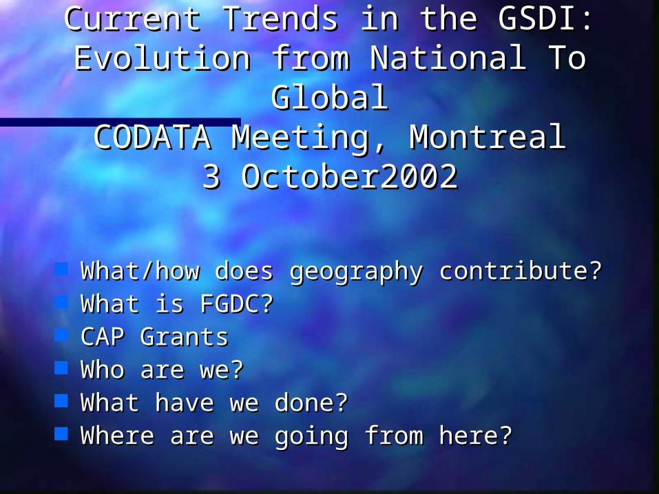
Current Trends in the GSDI: Evolution from National To Global CODATA Meeting, Montreal 3 October2002...
38
Current Trends in the GSDI: Current Trends in the GSDI: Evolution from National To Evolution from National To Global Global CODATA Meeting, Montreal CODATA Meeting, Montreal 3 October2002 3 October2002 Alan Stevens Alan Stevens International Program Manager International Program Manager US Federal Geographic Data Committee US Federal Geographic Data Committee Global Spatial Data Infrastructure (GSDI) Global Spatial Data Infrastructure (GSDI) [email protected] [email protected] +703-648-5119 +703-648-5119
-
Upload
malcolm-morrison -
Category
Documents
-
view
215 -
download
0
Transcript of Current Trends in the GSDI: Evolution from National To Global CODATA Meeting, Montreal 3 October2002...

Current Trends in the GSDI:Current Trends in the GSDI:Evolution from National To Evolution from National To
GlobalGlobalCODATA Meeting, MontrealCODATA Meeting, Montreal
3 October20023 October2002
Alan StevensAlan Stevens
International Program ManagerInternational Program Manager
US Federal Geographic Data CommitteeUS Federal Geographic Data Committee
Global Spatial Data Infrastructure (GSDI) Global Spatial Data Infrastructure (GSDI)
[email protected][email protected]
+703-648-5119+703-648-5119

Current Trends in the GSDI:Current Trends in the GSDI:Evolution from National To Evolution from National To
GlobalGlobalCODATA Meeting, MontrealCODATA Meeting, Montreal
3 October20023 October2002
What/how does geography contribute? What/how does geography contribute? What is the FGDC?What is the FGDC? CAP GrantsCAP Grants Who are we?Who are we? What have we done?What have we done? Where are we going from here?Where are we going from here?

What is it that Geography What is it that Geography brings to the Information brings to the Information Technology Community???Technology Community???
It contributes:It contributes:
The Power of “Place” to Support The Power of “Place” to Support
Decision MakingDecision Making
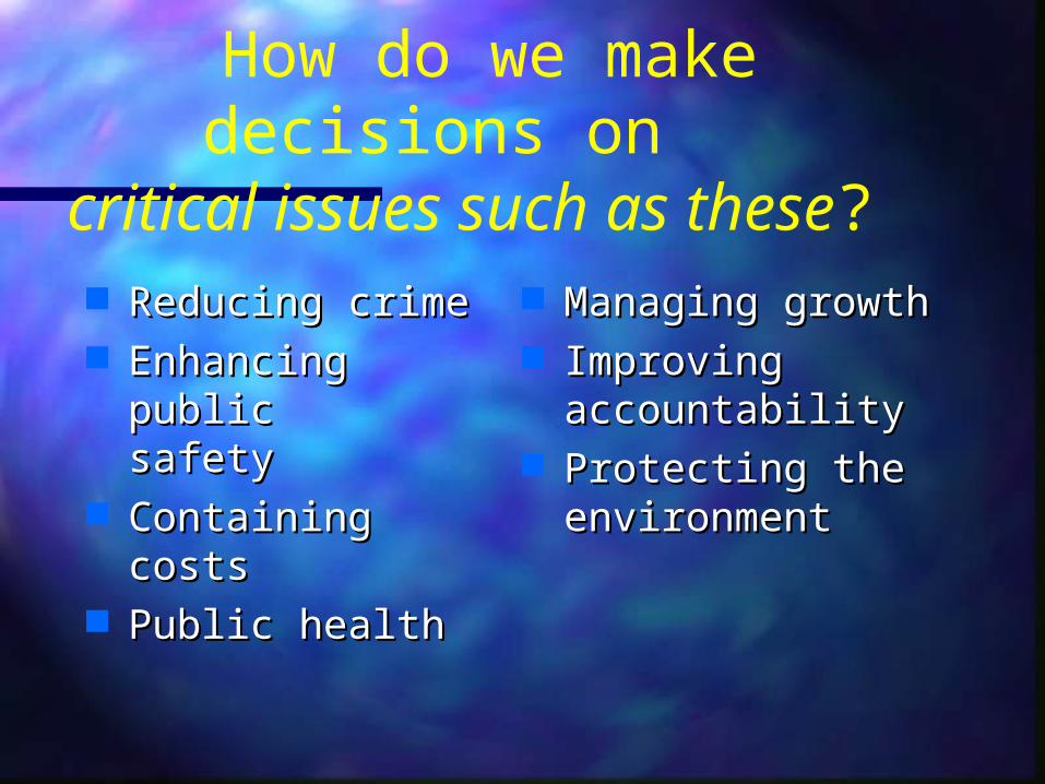
How do we make decisions on critical issues such as these?
Reducing crimeReducing crime Enhancing public Enhancing public
safety safety Containing costsContaining costs Public healthPublic health
Managing growthManaging growth Improving Improving
accountabilityaccountability Protecting the Protecting the
environmentenvironment

What if there was a tool that could integrate data from
diverse sources — and visually analyze data
to support decision making — many times faster than
any other tool?
What if there was a tool that could integrate data from
diverse sources — and visually analyze data
to support decision making — many times faster than
any other tool?

Geographic Information Systems (GIS)
Geographic Information Systems (GIS)
Giving decision-makers the power to make more informed decisions.
Giving decision-makers the power to make more informed decisions.
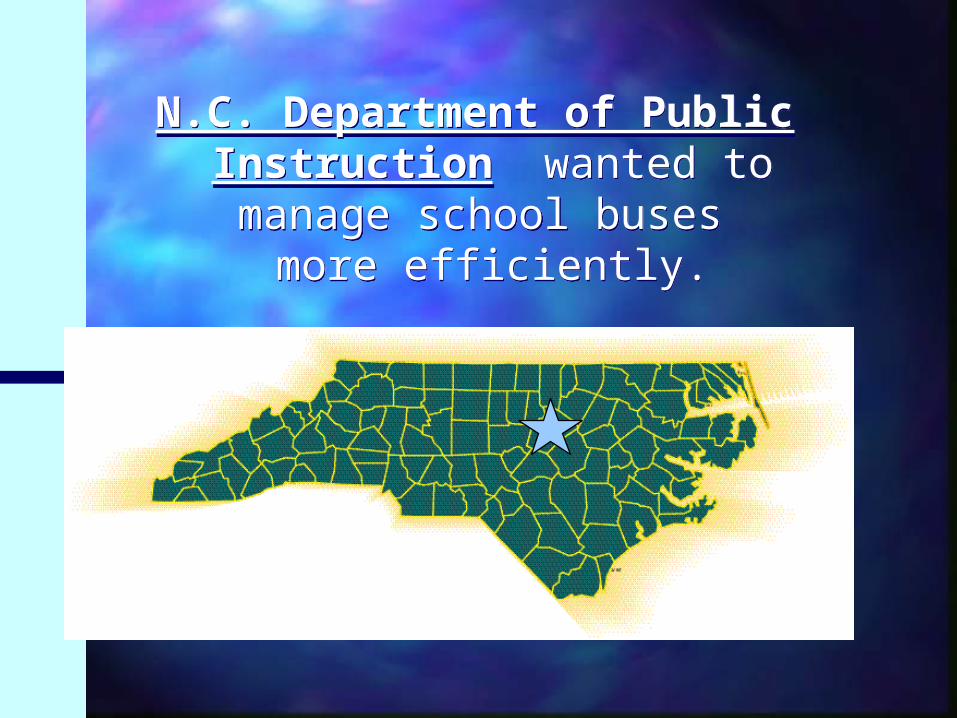
N.C. Department of Public Instruction wanted to manage
school buses more efficiently.
N.C. Department of Public Instruction wanted to manage
school buses more efficiently.

North Carolina Department
of Public Instruction
North Carolina Department
of Public Instruction
Hit-or-miss route mapping in 107 school districts
Huge inefficiencies
Inability to contain costs efficiently
Hit-or-miss route mapping in 107 school districts
Huge inefficiencies
Inability to contain costs efficiently
Without GIS:Without GIS:
North Carolina Department
of Public Instruction
North Carolina Department
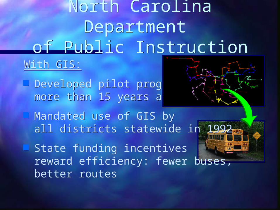
of Public InstructionWith GIS:
Developed pilot program more than 15 years ago
Mandated use of GIS by all districts statewide in 1992
State funding incentives reward efficiency: fewer buses, better routes
With GIS:
Developed pilot program more than 15 years ago
Mandated use of GIS by all districts statewide in 1992
State funding incentives reward efficiency: fewer buses, better routes

North Carolina Department
of Public Instruction
North Carolina Department
of Public InstructionResults:
In the 1994-95 school year:- more than 500 fewer buses were needed
statewide than originally estimated- 15,000,000 fewer miles were driven than
originally estimated
Between 1990 & 1996:- the state saved over 2,000,000 gallons of fuel
Results:
In the 1994-95 school year:- more than 500 fewer buses were needed
statewide than originally estimated- 15,000,000 fewer miles were driven than
originally estimated
Between 1990 & 1996:- the state saved over 2,000,000 gallons of fuel
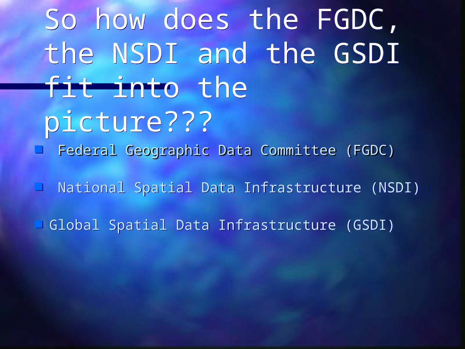
So how does the FGDC, the NSDI and the GSDI fit into the picture???
So how does the FGDC, the NSDI and the GSDI fit into the picture???
Federal Geographic Data Committee (FGDC)Federal Geographic Data Committee (FGDC)
National Spatial Data Infrastructure (NSDI)
Global Spatial Data Infrastructure (GSDI)
Federal Geographic Data Committee (FGDC)Federal Geographic Data Committee (FGDC)
National Spatial Data Infrastructure (NSDI)
Global Spatial Data Infrastructure (GSDI)
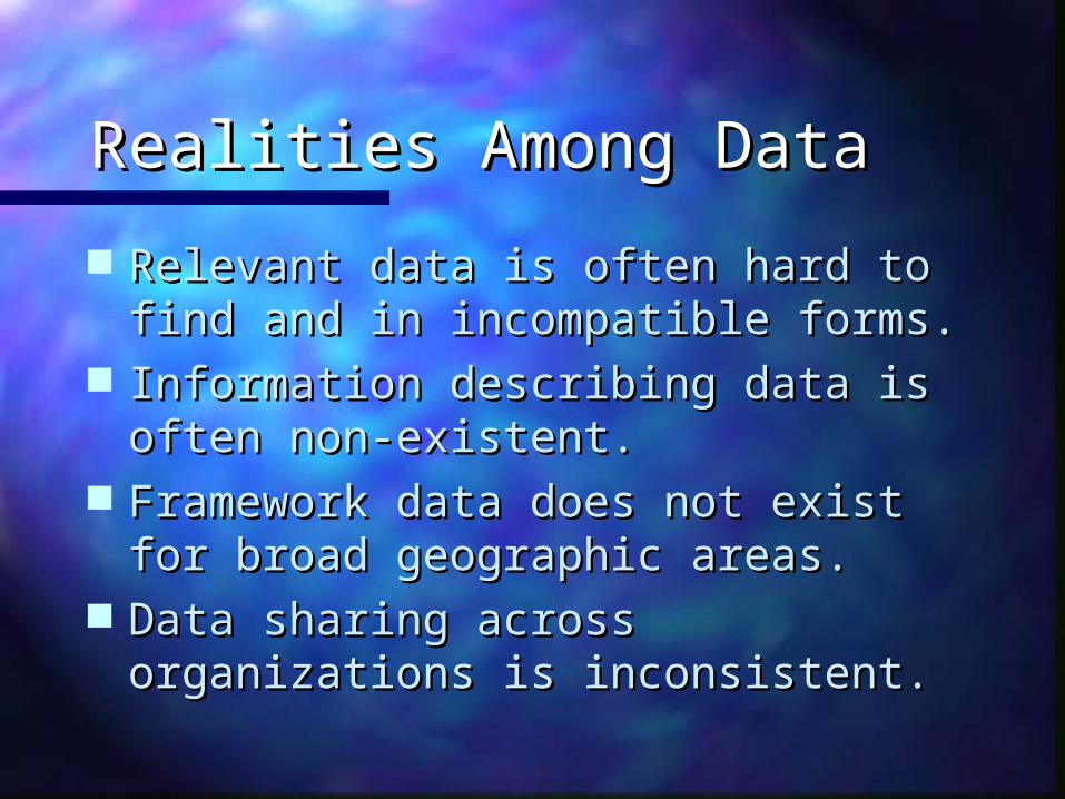
Realities Among DataRealities Among Data
Relevant data is often hard to find and in Relevant data is often hard to find and in incompatible forms.incompatible forms.
Information describing data is often non-Information describing data is often non-existent.existent.
Framework data does not exist for broad Framework data does not exist for broad geographic areas.geographic areas.
Data sharing across organizations is Data sharing across organizations is inconsistent.inconsistent.
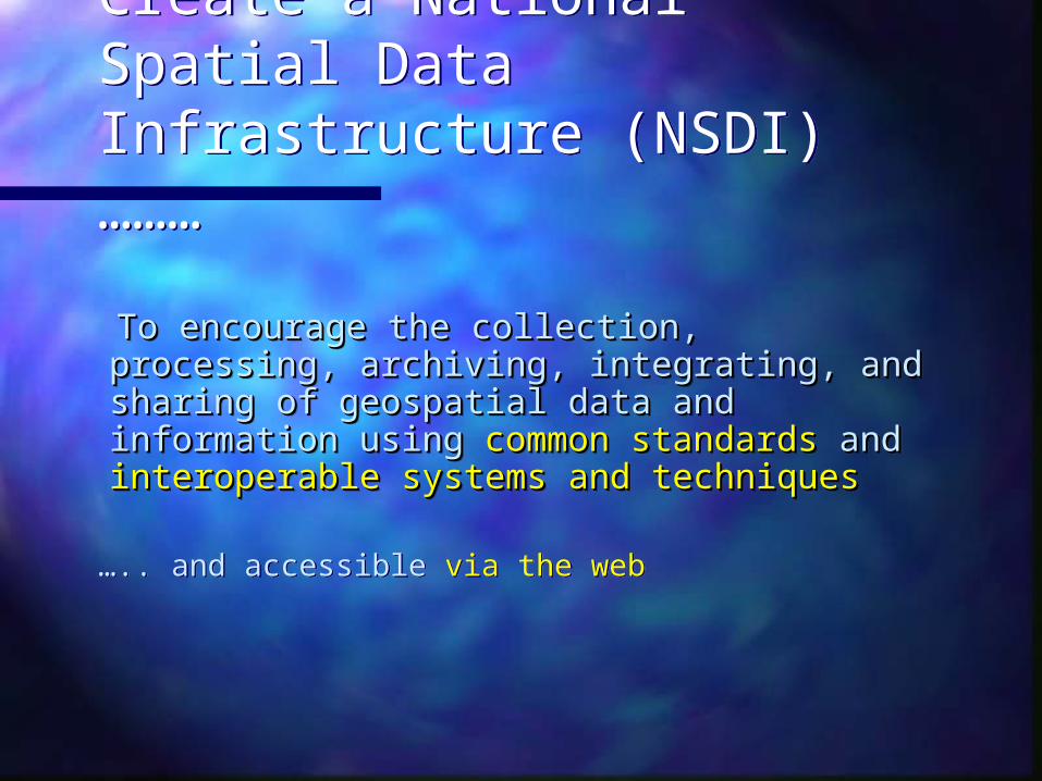
Create a National Spatial Data Infrastructure (NSDI) ………
Create a National Spatial Data Infrastructure (NSDI) ………
To encourage the collection, processing, To encourage the collection, processing, archiving, integrating, and sharing of archiving, integrating, and sharing of geospatial data and information using geospatial data and information using common standardscommon standards and and interoperable interoperable systems and techniquessystems and techniques
….. and accessible via the web
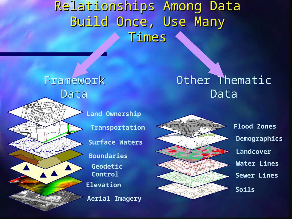
Aerial Imagery
Elevation
Geodetic Control
Boundaries
Surface Waters
Transportation
Land Ownership
Other Thematic DataOther Thematic DataFramework Data
Framework Data
Relationships Among DataRelationships Among DataBuild Once, Use Many TimesBuild Once, Use Many TimesRelationships Among DataRelationships Among Data
Build Once, Use Many TimesBuild Once, Use Many Times
Soils
Sewer Lines
Water Lines
Landcover
Demographics
Flood Zones

Core Components of the Core Components of the NSDINSDI
Partnerships
MetadataMetadata
GEOdataGEOdata
Clearinghouse (catalog)Clearinghouse (catalog)
FrameworkFramework
StandardsStandards

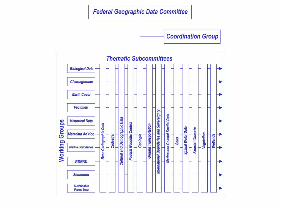
Federal Geographic Data Federal Geographic Data Committee (FGDC) Committee (FGDC)
Organisation and OperationOrganisation and Operation Staff support to the Secretary of Staff support to the Secretary of
the Interiorthe Interior 20 Staff Positions20 Staff Positions 19 Cabinet Departments19 Cabinet Departments States, Regional Organisations States, Regional Organisations

FGDCFGDCWorking Groups (8)Working Groups (8)
MetadataMetadata ClearinghouseClearinghouse
StandardsStandards Historical DataHistorical Data
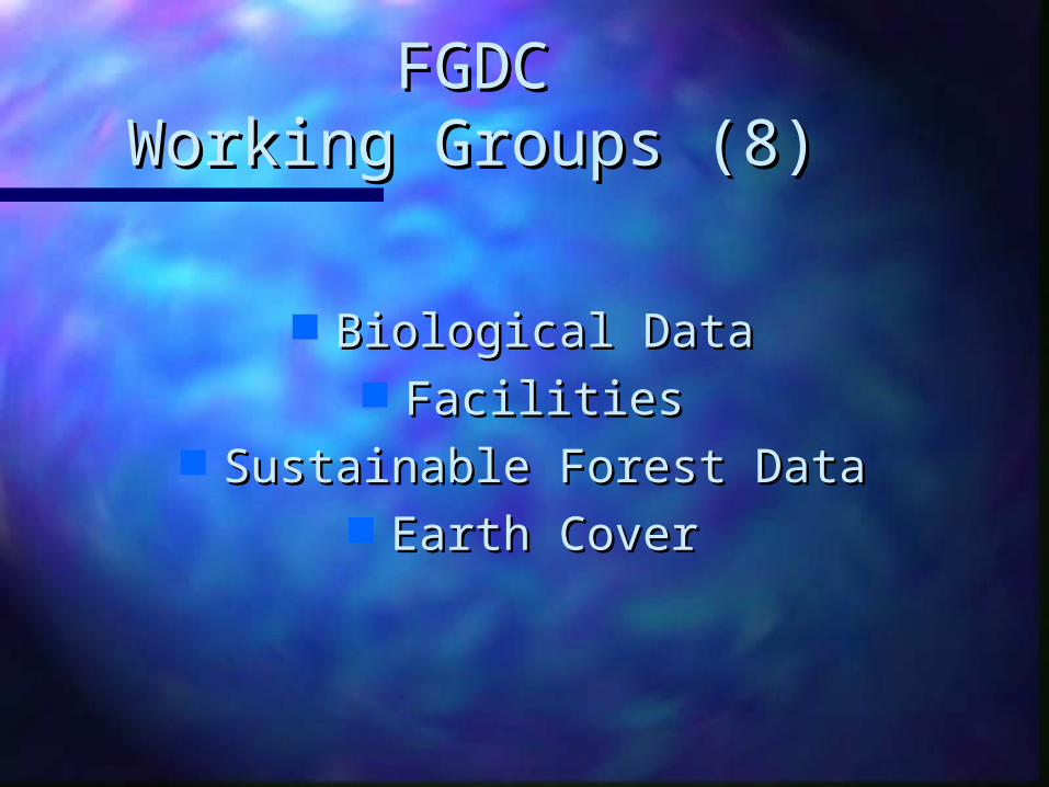
FGDCFGDCWorking Groups (8)Working Groups (8)
Biological DataBiological Data FacilitiesFacilities
Sustainable Forest DataSustainable Forest Data Earth CoverEarth Cover
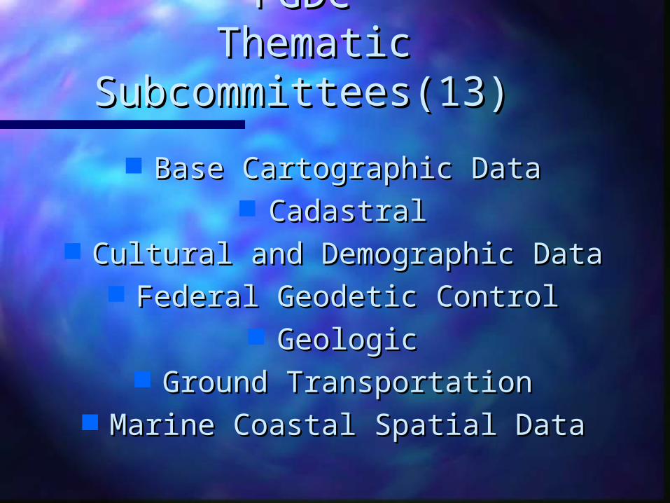
FGDCFGDC Thematic Thematic
Subcommittees(13)Subcommittees(13)
Base Cartographic DataBase Cartographic Data CadastralCadastral
Cultural and Demographic DataCultural and Demographic Data Federal Geodetic ControlFederal Geodetic Control
GeologicGeologic Ground TransportationGround Transportation
Marine Coastal Spatial DataMarine Coastal Spatial Data
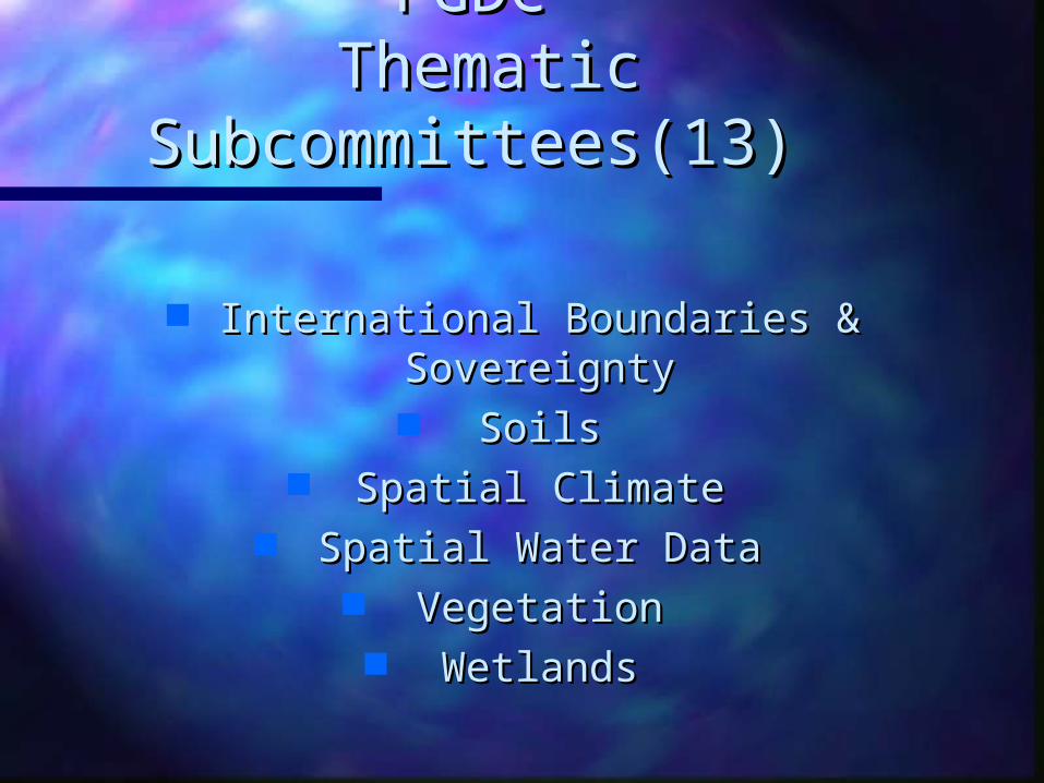
FGDCFGDC Thematic Thematic
Subcommittees(13)Subcommittees(13)
International Boundaries & International Boundaries & SovereigntySovereignty SoilsSoils
Spatial ClimateSpatial Climate Spatial Water DataSpatial Water Data
VegetationVegetation WetlandsWetlands
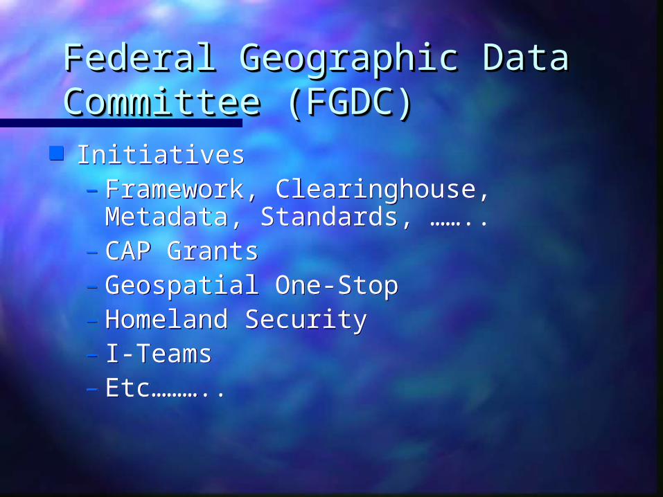
Federal Geographic Data Federal Geographic Data Committee (FGDC)Committee (FGDC)Federal Geographic Data Federal Geographic Data Committee (FGDC)Committee (FGDC)
Initiatives– Framework, Clearinghouse, Metadata,
Standards, ……..– CAP Grants– Geospatial One-Stop– Homeland Security– I-Teams– Etc………..
Initiatives– Framework, Clearinghouse, Metadata,
Standards, ……..– CAP Grants– Geospatial One-Stop– Homeland Security– I-Teams– Etc………..
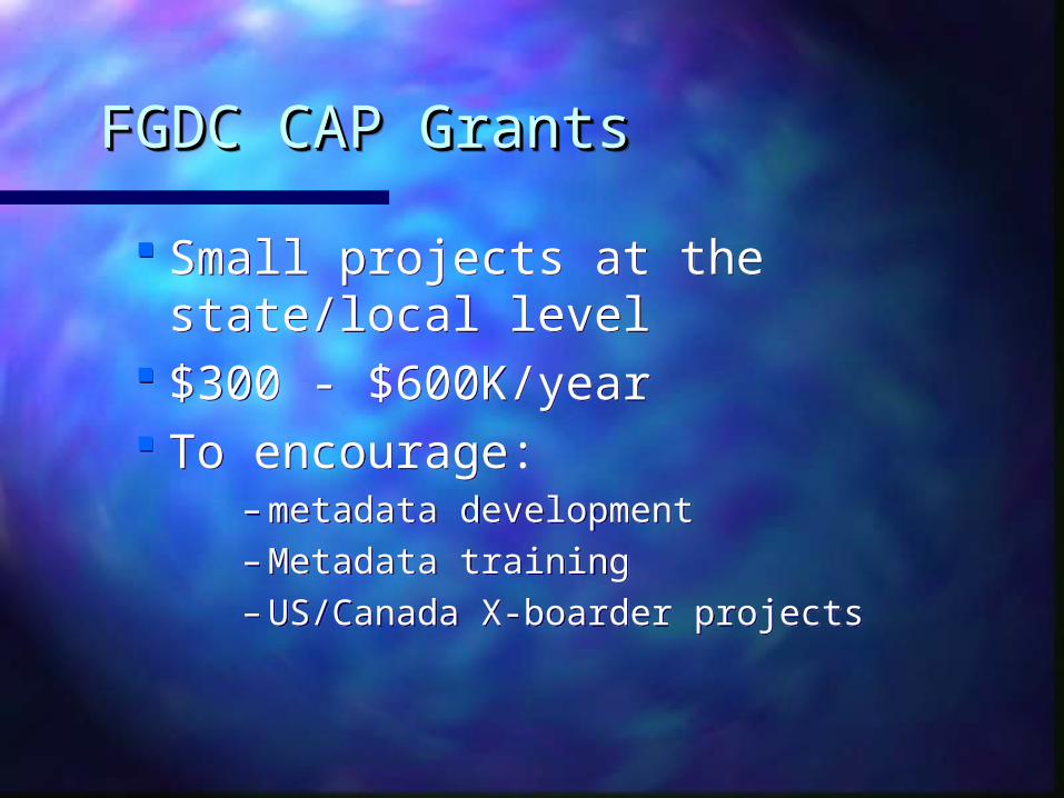
FGDC CAP GrantsFGDC CAP GrantsFGDC CAP GrantsFGDC CAP Grants
Small projects at the state/local level
$300 - $600K/year To encourage:
– metadata development– Metadata training– US/Canada X-boarder projects
Small projects at the state/local level
$300 - $600K/year To encourage:
– metadata development– Metadata training– US/Canada X-boarder projects

Collaboration:Collaboration:Collaboration:Collaboration:
GeoConnections, Canada The FGDC of Canada
Three years of projects
GeoConnections, Canada The FGDC of Canada
Three years of projects
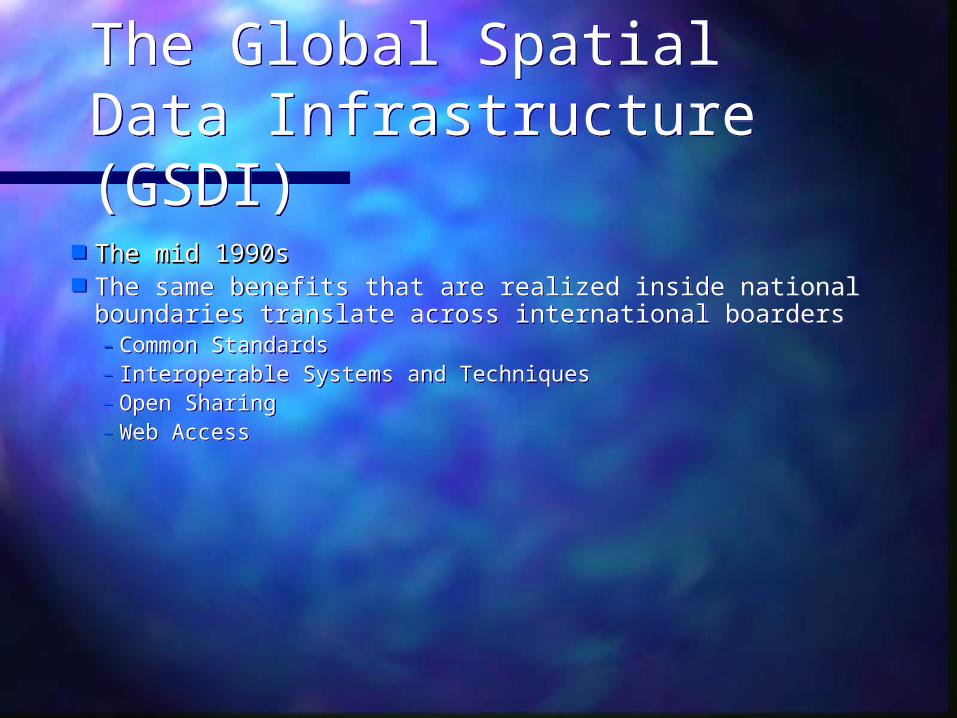
The Global Spatial Data Infrastructure (GSDI)The Global Spatial Data Infrastructure (GSDI)
The mid 1990sThe mid 1990s The same benefits that are realized inside national
boundaries translate across international boarders– Common Standards– Interoperable Systems and Techniques– Open Sharing– Web Access
The mid 1990sThe mid 1990s The same benefits that are realized inside national
boundaries translate across international boarders– Common Standards– Interoperable Systems and Techniques– Open Sharing– Web Access

The Global Spatial Data Infrastructure (GSDI)The Global Spatial Data Infrastructure (GSDI)
First GSDI meeting in Bonn Germany with a handful of invited First GSDI meeting in Bonn Germany with a handful of invited professionals (1995)professionals (1995)
GSDI-6 Meeting, Budapest, Sept 02Budapest, Sept 02 Jointly with International Steering Committee for Global Map Jointly with International Steering Committee for Global Map 250 attendees250 attendees 52 Countries52 Countries
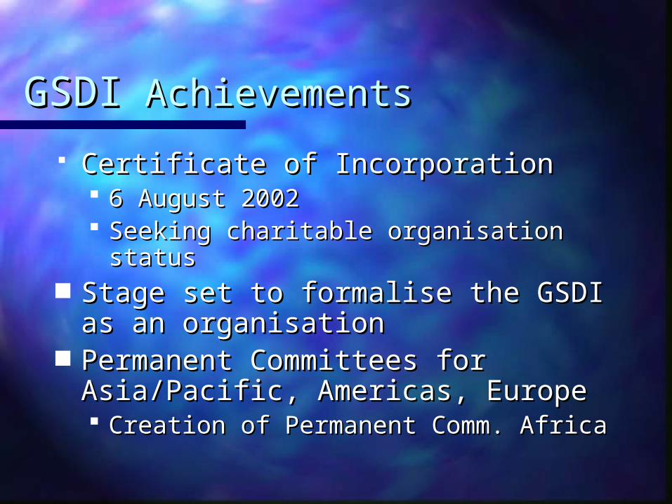
GSDIGSDI Achievements Achievements
Certificate of Incorporation Certificate of Incorporation 6 August 20026 August 2002 Seeking charitable organisation statusSeeking charitable organisation status
Stage set to formalise the GSDI as Stage set to formalise the GSDI as an organisationan organisation
Permanent Committees for Permanent Committees for Asia/Pacific, Americas, Europe Asia/Pacific, Americas, Europe Creation of Permanent Comm. AfricaCreation of Permanent Comm. Africa

GSDIGSDI Achievements Achievements
GSDI Cookbook publication and GSDI Cookbook publication and adoptionadoption
Capacity building –Capacity building – CODI, Addis Ababa CODI, Addis Ababa Africa GIS, Nairobi Africa GIS, Nairobi KISM Survey of Kenya, Nairobi KISM Survey of Kenya, Nairobi Denver Denver Sioux Falls Sioux Falls Workshops, FIG Workshops, FIG
GSDIGSDI Achievements Achievements
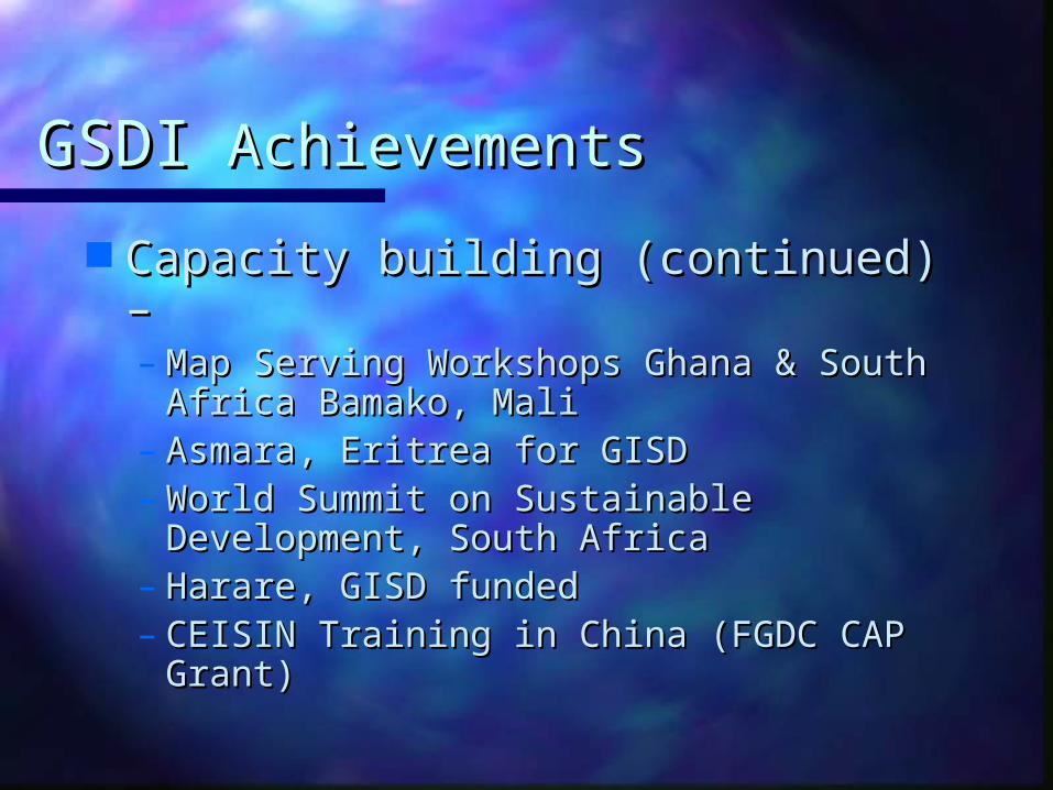
Capacity building (continued) –Capacity building (continued) –– Map Serving Workshops Ghana & Map Serving Workshops Ghana &
South Africa Bamako, Mali South Africa Bamako, Mali – Asmara, Eritrea for GISD Asmara, Eritrea for GISD – World Summit on Sustainable World Summit on Sustainable
Development, South Africa Development, South Africa – Harare, GISD funded Harare, GISD funded – CEISIN Training in China (FGDC CAP CEISIN Training in China (FGDC CAP
Grant) Grant)

GSDIGSDI Achievements Achievements
Capacity building (continued) –Capacity building (continued) – Global Map/GSDI/ESRI $9M (USD) Global Map/GSDI/ESRI $9M (USD)
Grant ProgramGrant Program Goal 150 countries at $60,000 eachGoal 150 countries at $60,000 each RequirementsRequirements
Contribute 1:1M or 1:250K data to GMContribute 1:1M or 1:250K data to GM Use common standards and interoperable Use common standards and interoperable
techniques and systemstechniques and systems 140 applications/98+ awarded140 applications/98+ awarded
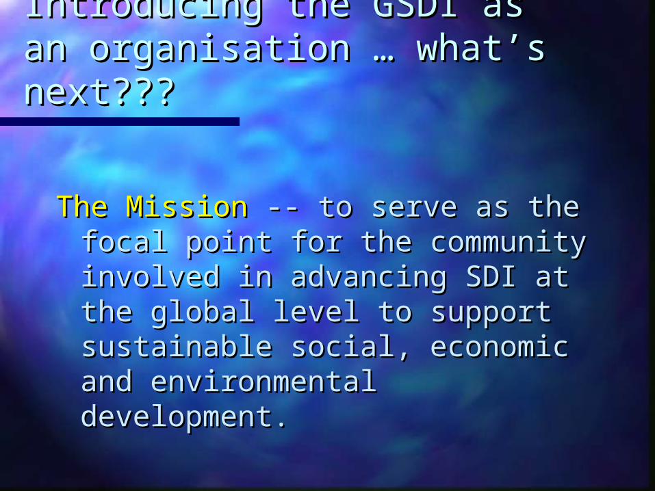
Introducing the GSDI as an Introducing the GSDI as an organisationorganisation … what’s … what’s next???next???
The MissionThe Mission -- -- to serve as the focal to serve as the focal point for the community involved point for the community involved in advancing SDI at the global level in advancing SDI at the global level to support sustainable social, to support sustainable social, economic and environmental economic and environmental development.development.

Introducing the GSDI as an Introducing the GSDI as an organisationorganisation … what’s … what’s next???next???
The GoalThe Goal – – – To support the establishment and To support the establishment and
expansion of globally compatible expansion of globally compatible spatial data infrastructures. spatial data infrastructures.
– To promote better public policy To promote better public policy and scientific decision-making.and scientific decision-making.
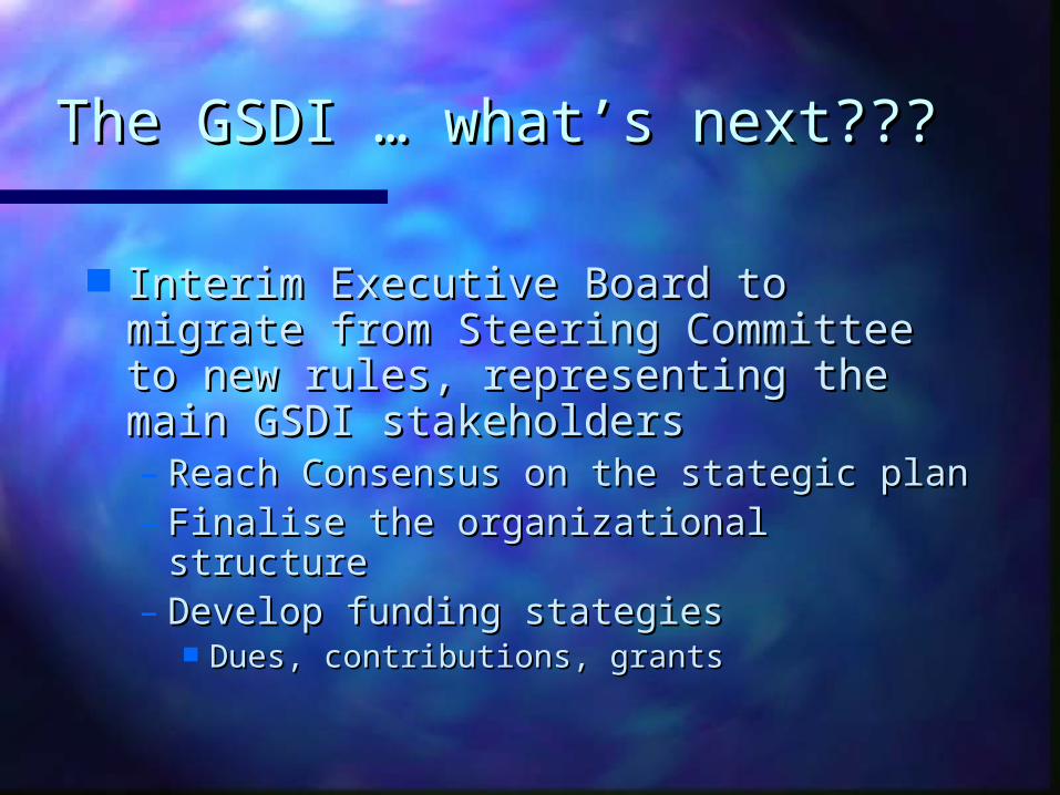
The GSDI The GSDI … what’s next???… what’s next???
Interim Executive Board to migrate Interim Executive Board to migrate from Steering Committee to new from Steering Committee to new rules, representing the main GSDI rules, representing the main GSDI stakeholdersstakeholders– Reach Consensus on the stategic planReach Consensus on the stategic plan– Finalise the organizational structure Finalise the organizational structure – Develop funding stategiesDevelop funding stategies
Dues, contributions, grantsDues, contributions, grants
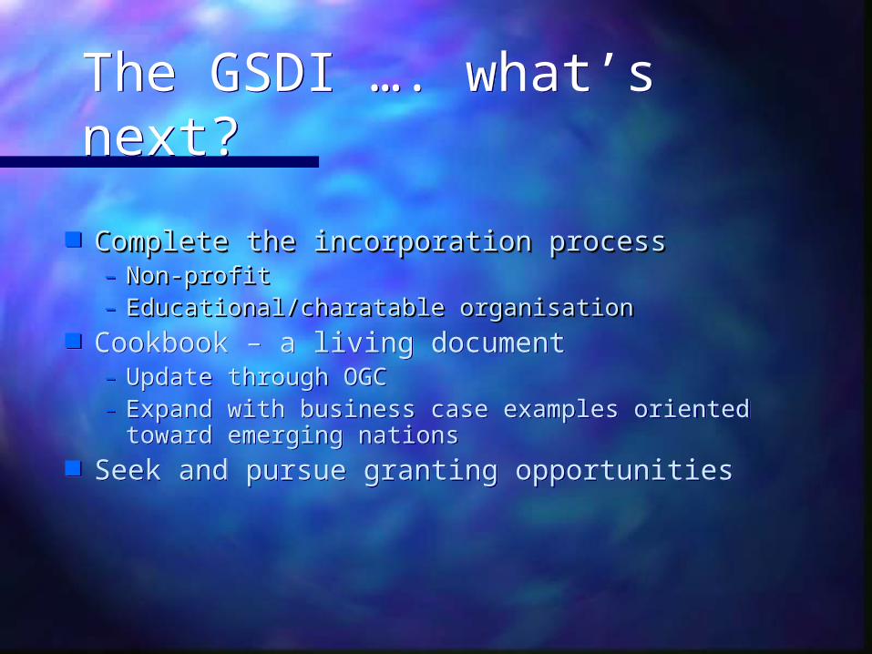
The GSDI …. what’s next?The GSDI …. what’s next?
Complete the incorporation processComplete the incorporation process– Non-profit Non-profit – Educational/charatable organisationEducational/charatable organisation
Cookbook – a living document– Update through OGC– Expand with business case examples oriented
toward emerging nations Seek and pursue granting opportunities
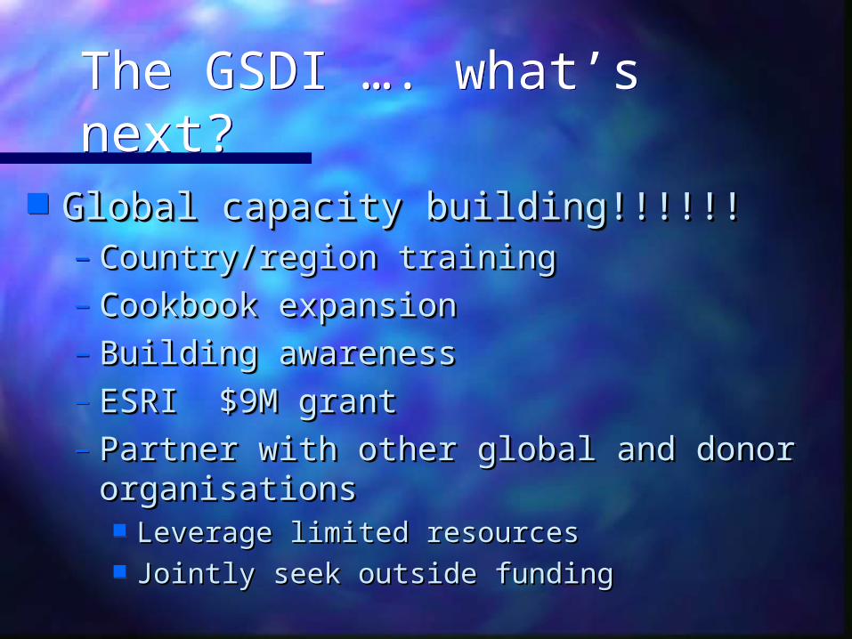
The GSDI …. what’s next?The GSDI …. what’s next?
Global capacity building!!!!!!Global capacity building!!!!!!– Country/region trainingCountry/region training– Cookbook expansionCookbook expansion– Building awarenessBuilding awareness– ESRI $9M grantESRI $9M grant– Partner with other global and donor Partner with other global and donor
organisations organisations Leverage limited resourcesLeverage limited resources Jointly seek outside fundingJointly seek outside funding
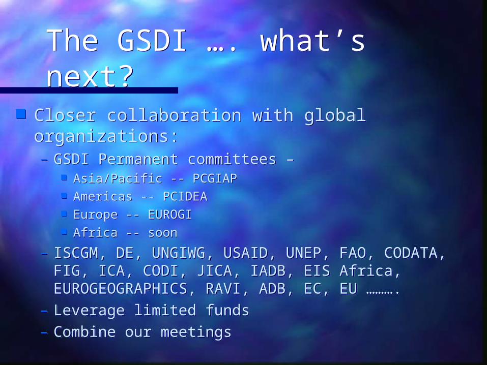
The GSDI …. what’s next?The GSDI …. what’s next?
Closer collaboration with global organizations:– GSDI Permanent committees –
Asia/Pacific -- PCGIAP Americas -- PCIDEA Europe -- EUROGI Africa -- soon
– ISCGM, DE, UNGIWG, USAID, UNEP, FAO, CODATA, FIG, ICA, CODI, JICA, IADB, EIS Africa, EUROGEOGRAPHICS, RAVI, ADB, EC, EU ……….
– Leverage limited funds– Combine our meetings
Current Trends in the GSDI:Current Trends in the GSDI:Evolution from National To Evolution from National To
GlobalGlobalCODATA Meeting, MontrealCODATA Meeting, Montreal
3 October20023 October2002
What/how does geography contribute? What/how does geography contribute? What is FGDC?What is FGDC? CAP GrantsCAP Grants Who are we?Who are we? What have we done?What have we done? Where are we going from here?Where are we going from here?
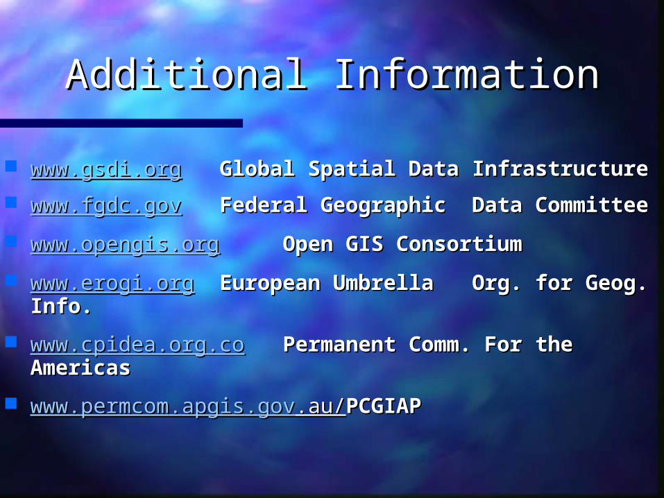
Additional InformationAdditional Information
www.gsdi.orgwww.gsdi.org Global Spatial Data Global Spatial Data InfrastructureInfrastructure
www.fgdc.govwww.fgdc.gov Federal Geographic Federal Geographic Data CommitteeData Committee
www.opengis.orgwww.opengis.org Open GIS ConsortiumOpen GIS Consortium
www.erogi.orgwww.erogi.org European Umbrella European Umbrella Org. for Geog. Info.Org. for Geog. Info.
www.cpidea.org.cowww.cpidea.org.co Permanent Comm. For Permanent Comm. For the Americas the Americas
www.www.permcompermcom..apgisapgis..govgov.au/.au/ PCGIAPPCGIAP