Shreveport-Bossier, LA 629 Spring Street, Shreveport, LA ...

M AY 3 0 , 2 0 1 9
Meeting No. 8
Council on Watershed Management Meeting

W O R K I N G T O G E T H E R F O R S U S T A I N A B I L I T Y A N D R E S I L I E N C E L O U I S I A N A W A T E R S H E D I N I T I A T I V E 2
Public Comment

W O R K I N G T O G E T H E R F O R S U S T A I N A B I L I T Y A N D R E S I L I E N C E L O U I S I A N A W A T E R S H E D I N I T I A T I V E 3
Consent Agenda Items

W O R K I N G T O G E T H E R F O R S U S T A I N A B I L I T Y A N D R E S I L I E N C E L O U I S I A N A W A T E R S H E D I N I T I A T I V E 4
Opening Remarks

W O R K I N G T O G E T H E R F O R S U S T A I N A B I L I T Y A N D R E S I L I E N C E L O U I S I A N A W A T E R S H E D I N I T I A T I V E 5
Old Business

W O R K I N G T O G E T H E R F O R S U S T A I N A B I L I T Y A N D R E S I L I E N C E L O U I S I A N A W A T E R S H E D I N I T I A T I V E 6
New BusinessRECOMMENDATIONS
W O R K I N G T O G E T H E R F O R S U S T A I N A B I L I T Y A N D R E S I L I E N C E L O U I S I A N A W A T E R S H E D I N I T I A T I V E 7
RE
CO
MM
EN
DA
TIO
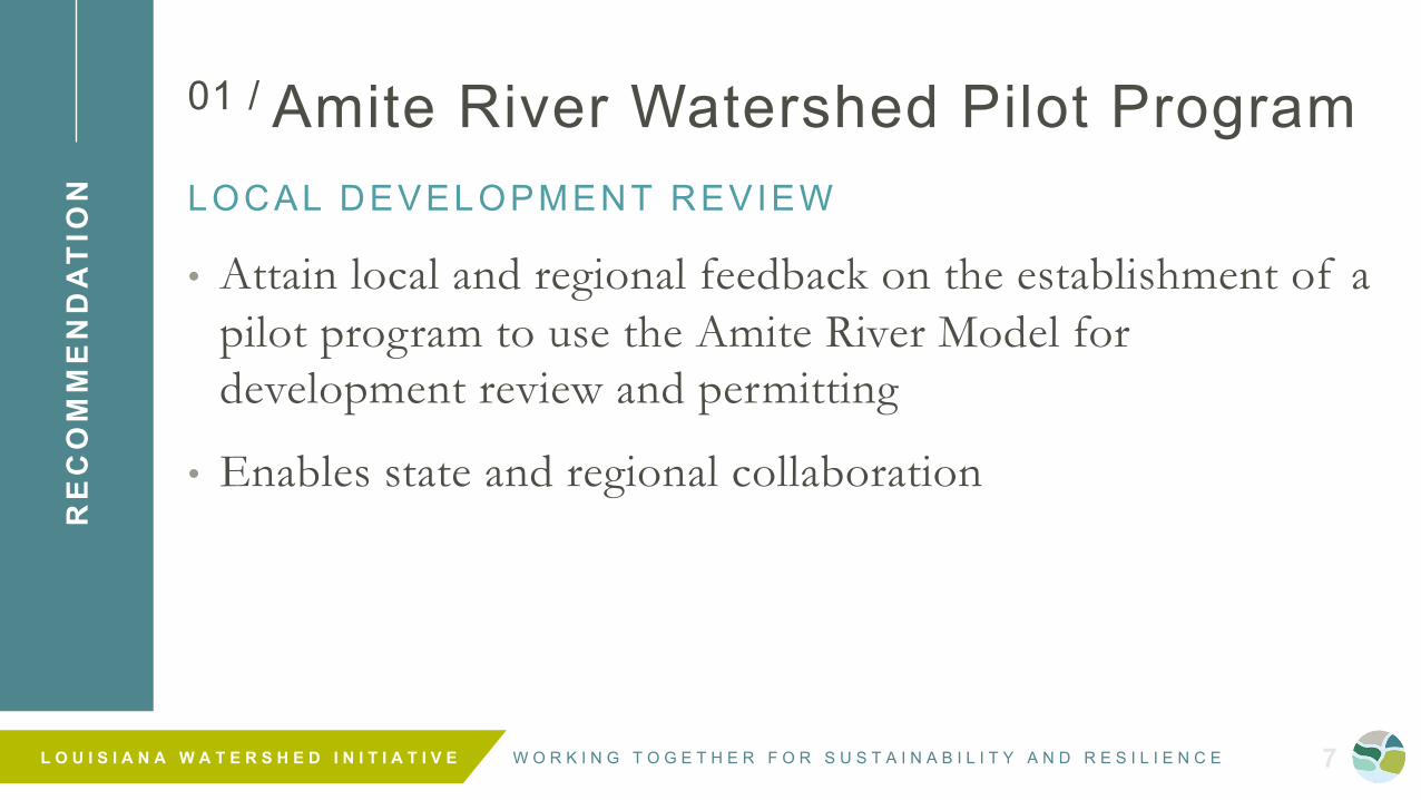
N01 / Amite River Watershed Pilot ProgramLOCAL DEVELOPMENT REVIEW
• Attain local and regional feedback on the establishment of a pilot program to use the Amite River Model for development review and permitting
• Enables state and regional collaboration

W O R K I N G T O G E T H E R F O R S U S T A I N A B I L I T Y A N D R E S I L I E N C E L O U I S I A N A W A T E R S H E D I N I T I A T I V E 8
RE
CO
MM
EN
DA
TIO
N02 / Amite River Watershed Pilot ProgramSTATE AGENCY PROJECT PRIORIT IZATION
• Implement the use of watershed modeling within a single state agency for project prioritization and funding processes
• Enables establishment of best practices and guidance for use of watershed models

W O R K I N G T O G E T H E R F O R S U S T A I N A B I L I T Y A N D R E S I L I E N C E L O U I S I A N A W A T E R S H E D I N I T I A T I V E 9
UpdatesPROGRAM DEVELOPMENT

W O R K I N G T O G E T H E R F O R S U S T A I N A B I L I T Y A N D R E S I L I E N C E L O U I S I A N A W A T E R S H E D I N I T I A T I V E 10
ABOUT
WATERSHEDS

W O R K I N G T O G E T H E R F O R S U S T A I N A B I L I T Y A N D R E S I L I E N C E L O U I S I A N A W A T E R S H E D I N I T I A T I V E 11
What is a Watershed?
The land area that drains to a single water body - affects water quality and quantity in the water body that it surrounds.
W O R K I N G T O G E T H E R F O R S U S T A I N A B I L I T Y A N D R E S I L I E N C E L O U I S I A N A W A T E R S H E D I N I T I A T I V E 12
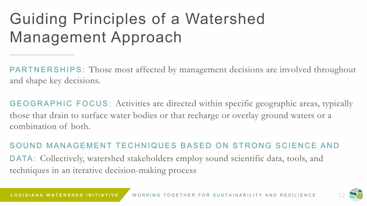
Guiding Principles of a Watershed Management Approach
PA RT N E R S H I P S : Those most affected by management decisions are involved throughout and shape key decisions.
G E O G R A P H I C F O C U S : Activities are directed within specific geographic areas, typically those that drain to surface water bodies or that recharge or overlay ground waters or a combination of both.
S O U N D M A N A G E M E N T T E C H N I Q U E S B A S E D O N S T R O N G S C I E N C E A N D D ATA : Collectively, watershed stakeholders employ sound scientific data, tools, and techniques in an iterative decision-making process

W O R K I N G T O G E T H E R F O R S U S T A I N A B I L I T Y A N D R E S I L I E N C E L O U I S I A N A W A T E R S H E D I N I T I A T I V E 13
Louisiana’s Watersheds
Our watersheds are not defined by our political boundaries.

W O R K I N G T O G E T H E R F O R S U S T A I N A B I L I T Y A N D R E S I L I E N C E L O U I S I A N A W A T E R S H E D I N I T I A T I V E 14
UpdatesPROGRAM DEVELOPMENT

W O R K I N G T O G E T H E R F O R S U S T A I N A B I L I T Y A N D R E S I L I E N C E L O U I S I A N A W A T E R S H E D I N I T I A T I V E 15
Louisiana’s State Claimed Waterbodies
• 900 named bayous
• 110 named rivers• 242 named lakes
Actions in one community can impact entire systems.( S O U R C E : L O U I S I A N A S TA T E L A N D S O F F I C E A N D L O U I S I A N A D N R ’ S S O N R I S G E O D A TA B A S E )

W O R K I N G T O G E T H E R F O R S U S T A I N A B I L I T Y A N D R E S I L I E N C E L O U I S I A N A W A T E R S H E D I N I T I A T I V E 16
Elevation and Hydrography
Louisiana is very FLAT.We are the fourth-flattest state in the nation.
Within the flatter (orange, brown, yellow) areas, it becomes more difficult to predict how water will be absorbed.

W O R K I N G T O G E T H E R F O R S U S T A I N A B I L I T Y A N D R E S I L I E N C E L O U I S I A N A W A T E R S H E D I N I T I A T I V E 17
Special Flood Hazard Areas
Regulated by FEMA through the National Flood Insurance Program
• 26,826 square miles in the SFHA
• 51.21% of the State
( S O U R C E : L O U I S I A N A W A T E R S H E D R E S I L I E N C Y S T U D Y. M A P 3 . 5 . 1 . F E M A ; D A T E D U P D A T E D 2 0 J U LY 2 0 1 7 )
W O R K I N G T O G E T H E R F O R S U S T A I N A B I L I T Y A N D R E S I L I E N C E L O U I S I A N A W A T E R S H E D I N I T I A T I V E 18
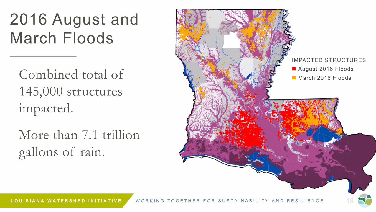
2016 August and March Floods
Combined total of 145,000 structures impacted.
More than 7.1 trillion gallons of rain.
IMPACTED STRUCTURESn August 2016 Floodsn March 2016 Floods

W O R K I N G T O G E T H E R F O R S U S T A I N A B I L I T Y A N D R E S I L I E N C E L O U I S I A N A W A T E R S H E D I N I T I A T I V E 19
ABOUT
THE LOUISIANA WATERSHED INITIATIVE

W O R K I N G T O G E T H E R F O R S U S T A I N A B I L I T Y A N D R E S I L I E N C E L O U I S I A N A W A T E R S H E D I N I T I A T I V E 20
Timeline20

W O R K I N G T O G E T H E R F O R S U S T A I N A B I L I T Y A N D R E S I L I E N C E L O U I S I A N A W A T E R S H E D I N I T I A T I V E 21
Reduce flood risk and improve
floodplain management across the
state, including through maximizing
the natural and beneficial functions
of the floodplain
OUR MISSIONL
OU
ISIA
NA
WA
TE
RS
HE
D
INIT
IAT
IVE

W O R K I N G T O G E T H E R F O R S U S T A I N A B I L I T Y A N D R E S I L I E N C E L O U I S I A N A W A T E R S H E D I N I T I A T I V E 22
FUNDING
STANDARDS
INTEGRATED PLANNING
CAPABILITY & CAPACITY
$
DATA
ENGAGEMENT
Strategic Areas of Focus

W O R K I N G T O G E T H E R F O R S U S T A I N A B I L I T Y A N D R E S I L I E N C E L O U I S I A N A W A T E R S H E D I N I T I A T I V E 23
The goal is to improve water management to proactively address flood risk and mitigation.

W O R K I N G T O G E T H E R F O R S U S T A I N A B I L I T Y A N D R E S I L I E N C E L O U I S I A N A W A T E R S H E D I N I T I A T I V E 24
PHASE I INVESTIGATIONSet the stage for state agency coordination -alignment of programs, policies, and practices
$1 .2 B ILL ION HUD CDBG ALLOCATIONCreates opportunity for long-term governance structures, demonstration projects, adoption of higher development standards, improved policies and approaches
Louisiana Watershed Initiative Program Development

W O R K I N G T O G E T H E R F O R S U S T A I N A B I L I T Y A N D R E S I L I E N C E L O U I S I A N A W A T E R S H E D I N I T I A T I V E 25
WE UNDERSTAND
• Water knows no boundaries.
• It requires a new way of thinking.• It requires a watershed approach.• We need to address inland and coastal
flooding to mitigate future flood loss.
What do we know today about water management and flood risk reduction?

W O R K I N G T O G E T H E R F O R S U S T A I N A B I L I T Y A N D R E S I L I E N C E L O U I S I A N A W A T E R S H E D I N I T I A T I V E 26
Trib Photo by Jerry Hickerson
PILOT PROJECTS:• Amite River Basin Model• State Agency Resilience
Internal Audit• State Agency H&H Model
Use in Project Prioritization• H&H Model Use in Local
Development Review
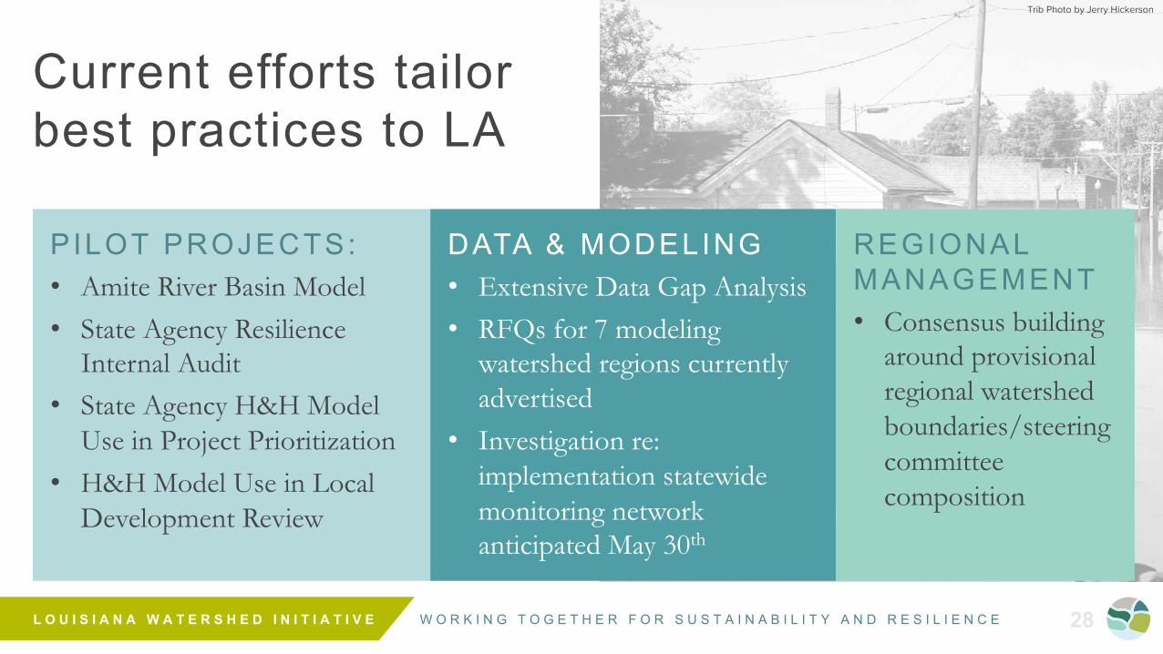
Current efforts tailor best practices to LA

W O R K I N G T O G E T H E R F O R S U S T A I N A B I L I T Y A N D R E S I L I E N C E L O U I S I A N A W A T E R S H E D I N I T I A T I V E 27
Trib Photo by Jerry Hickerson
DATA & MODELING• Extensive Data Gap Analysis • RFQs for 7 modeling
watershed regions currently advertised
• Investigation re: implementation statewide monitoring network anticipated May 30th
Current efforts tailor best practices to LA
PILOT PROJECTS:• Amite River Basin Model• State Agency Resilience
Internal Audit• State Agency H&H Model
Use in Project Prioritization• H&H Model Use in Local
Development Review
W O R K I N G T O G E T H E R F O R S U S T A I N A B I L I T Y A N D R E S I L I E N C E L O U I S I A N A W A T E R S H E D I N I T I A T I V E 28
Trib Photo by Jerry Hickerson
DATA & MODELING• Extensive Data Gap Analysis • RFQs for 7 modeling
watershed regions currently advertised
• Investigation re: implementation statewide monitoring network anticipated May 30th
Current efforts tailor best practices to LA
PILOT PROJECTS:• Amite River Basin Model• State Agency Resilience
Internal Audit• State Agency H&H Model
Use in Project Prioritization• H&H Model Use in Local
Development Review
REGIONAL MANAGEMENT• Consensus building
around provisional regional watershed boundaries/steering committee composition

W O R K I N G T O G E T H E R F O R S U S T A I N A B I L I T Y A N D R E S I L I E N C E L O U I S I A N A W A T E R S H E D I N I T I A T I V E 29
Louisiana Watershed Initiative ListensTransparent & Collaborative Approach to Program Design
555engineers, planners, floodplain managers, public works staff, emergency responders, code
enforcement staff, elected officials, and more
FALL 20188 REGIONAL CONFERENCES
Locals informing the process
STA
TE
WID
E L
IST
EN
ING
T
OU
R

W O R K I N G T O G E T H E R F O R S U S T A I N A B I L I T Y A N D R E S I L I E N C E L O U I S I A N A W A T E R S H E D I N I T I A T I V E 30
Louisiana Watershed Initiative ListensTransparent & Collaborative Approach to Program Design
150
engineers, planners, floodplain managers, public works staff, emergency responders, code
enforcement staff, elected officials, and more
WINTER 2019TWO DAYS IN HARD HIT AREAS
National experts informing the process
local, state, and national experts in attendance and another 1,000+ who joined us online
W O R K I N G T O G E T H E R F O R S U S T A I N A B I L I T Y A N D R E S I L I E N C E L O U I S I A N A W A T E R S H E D I N I T I A T I V E 31
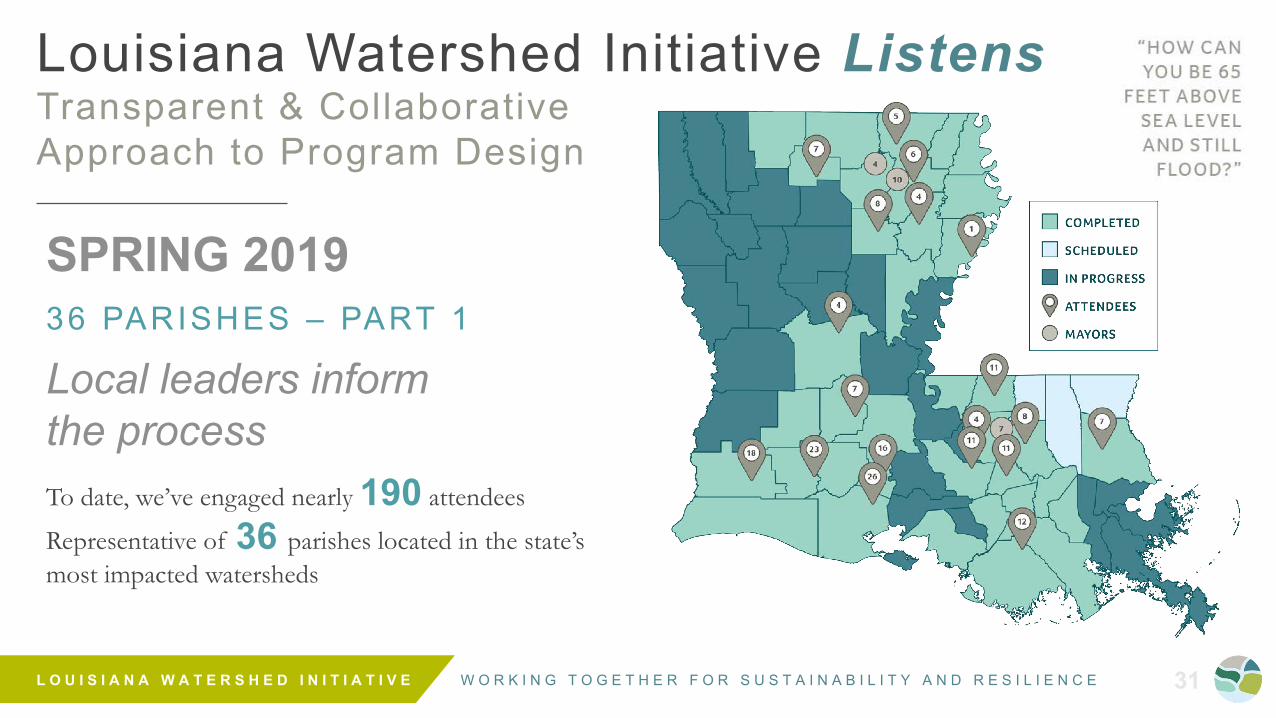
Louisiana Watershed Initiative ListensTransparent & Collaborative Approach to Program Design
SPRING 201936 PARISHES – PART 1
Local leaders inform the process To date, we’ve engaged nearly 190 attendees
Representative of 36 parishes located in the state’s most impacted watersheds

W O R K I N G T O G E T H E R F O R S U S T A I N A B I L I T Y A N D R E S I L I E N C E L O U I S I A N A W A T E R S H E D I N I T I A T I V E 32
We’r
e List
enin
gParish Leadership Meetings RecapLOCAL VOICES
“How can you be 65 feet above sea level and still flood?”
“Streets we’ve never seen go under water, are going under water, because everything is full.”
“With the expected snow melt, and June peak river heights, we are—again—preparing for the worst.”

W O R K I N G T O G E T H E R F O R S U S T A I N A B I L I T Y A N D R E S I L I E N C E L O U I S I A N A W A T E R S H E D I N I T I A T I V E 33
International Best Practices Workshop with Henk OvinkMAY 24 , 2019
Center for Coastal and Deltaic Solutions, Baton Rouge
Ovink shared his experiences addressing flood risk in The Netherlands and around the world (e.g., overlapping jurisdictions and long-term governance around flood risk issues)
LWI Council and technical advisory group members were able to share their most pressing challenges, ask questions and seek guidance to guide ongoing program and planning efforts

W O R K I N G T O G E T H E R F O R S U S T A I N A B I L I T Y A N D R E S I L I E N C E L O U I S I A N A W A T E R S H E D I N I T I A T I V E 34
International Best Practices Workshop with Henk OvinkMAY 24 , 2019
Center for Coastal and Deltaic Solutions / Baton Rouge, LA
Ovink shared his experiences addressing flood risk in The Netherlands and around the world (e.g., overlapping jurisdictions and long-term governance around flood risk issues)
LWI Council and technical advisory group members were able to share their most pressing challenges, ask questions and seek guidance to guide ongoing program and planning efforts
“Data without THE PROCESS is worthless.”
“Focusing on both long-term GOVERNANCE and short-term DEMONSTRATION PROJECTS will be key to the Initiative’s success.”
– Henk Ovink

W O R K I N G T O G E T H E R F O R S U S T A I N A B I L I T Y A N D R E S I L I E N C E L O U I S I A N A W A T E R S H E D I N I T I A T I V E 35
Provisional Regional Steering CommitteesSHARING RESPONSIBIL ITY FOR RESIL IENT DECISION-MAKING AND IMPLEMENTATION
Regional Steering Committees• Organized within
watershed-based boundaries
• 11-13 residents with diverse areas of expertise in watershed issues
Continuous input from additional stakeholders and experts
Technical Advisory Groups
Council on Watershed Management

W O R K I N G T O G E T H E R F O R S U S T A I N A B I L I T Y A N D R E S I L I E N C E L O U I S I A N A W A T E R S H E D I N I T I A T I V E 36
WE
’RE
LIS
TE
NIN
GParish Leadership Meetings RecapFEEDBACK AND FINDINGS
• Input provided on two priority topics:
- Provisional Watershed Boundaries
- Proposed Regional Steering Committees
• Provided a better understanding of impacts, a sense of urgency and engagement in the Initiative’s mission
• Feedback captured through exit surveys and LWI staff reports/parish feedback form

W O R K I N G T O G E T H E R F O R S U S T A I N A B I L I T Y A N D R E S I L I E N C E L O U I S I A N A W A T E R S H E D I N I T I A T I V E 37
Provisional Regional Steering CommitteesSHARING RESPONSIBIL ITY FOR RESIL IENT DECISION-MAKING AND IMPLEMENTATION
Regional Steering Committees
• Organized within watershed-based boundaries
• Minimum 11-13 residents with diverse areas of expertise in watershed issues
W O R K I N G T O G E T H E R F O R S U S T A I N A B I L I T Y A N D R E S I L I E N C E L O U I S I A N A W A T E R S H E D I N I T I A T I V E 38
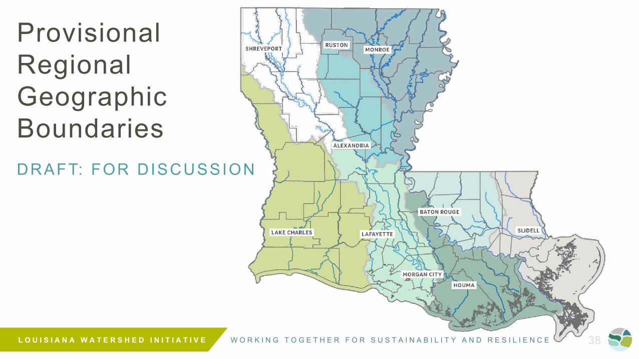
Provisional Regional Geographic BoundariesDRAFT: FOR DISCUSSION

W O R K I N G T O G E T H E R F O R S U S T A I N A B I L I T Y A N D R E S I L I E N C E L O U I S I A N A W A T E R S H E D I N I T I A T I V E 39
WE
’RE
LIS
TE
NIN
GParish Leadership Meetings RecapSURVEY F INDINGS
• Provisional Watershed Boundary Delineation - Overwhelming support in favor of delineating
• Regional Steering Committee Composition- Highest-priority membership recommendations included:
• Floodplain managers
• Local drainage or levee district representatives
• Local engineers

W O R K I N G T O G E T H E R F O R S U S T A I N A B I L I T Y A N D R E S I L I E N C E L O U I S I A N A W A T E R S H E D I N I T I A T I V E 40
WE
’RE
LIS
TE
NIN
GParish Leadership Meetings RecapREGIONAL STEERING COMMITTEE RECOMMENDATIONS
Floodplainmanager
Drainage orleveedistrict
Localengineer
Planning/development
district
Soil/waterconservatio
n
Builder,developer
Environmental
nonprofit
Regionalchamber ofcommerce
Realestate,
insuranceor banking
Other
Series1 8.7 8.5 8.1 7.1 6.9 5.1 5.1 5 5 2.9
1
2
3
4
5
6
7
8
9
10

W O R K I N G T O G E T H E R F O R S U S T A I N A B I L I T Y A N D R E S I L I E N C E L O U I S I A N A W A T E R S H E D I N I T I A T I V E 41
WE
’RE
LIS
TE
NIN
GParish Leadership Meetings RecapADDITIONAL KEYS AREAS OF FEEDBACK
• Need for increased collaboration across multiple parish boundaries and larger regions
• Planning that remains proactive versus reactive
• Refining provisional watershed regions and boundaries where feasible

W O R K I N G T O G E T H E R F O R S U S T A I N A B I L I T Y A N D R E S I L I E N C E L O U I S I A N A W A T E R S H E D I N I T I A T I V E 42
WE
’RE
LIS
TE
NIN
GParish Leadership MeetingsPARISH LEADERSHIP SURVEY: SHARE YOUR FEEDBACK
• Seeking feedback from parish leaders and staff on provisional watershed boundaries, regional steering committee composition, and more
• Visit the link below to take a quick survey and share your feedback:
WATERSHED.LA.GOV/REGIONALSURVEY

W O R K I N G T O G E T H E R F O R S U S T A I N A B I L I T Y A N D R E S I L I E N C E L O U I S I A N A W A T E R S H E D I N I T I A T I V E 43
UpdatesENGAGEMENT ACTIVIT IES

W O R K I N G T O G E T H E R F O R S U S T A I N A B I L I T Y A N D R E S I L I E N C E L O U I S I A N A W A T E R S H E D I N I T I A T I V E 44
2019 Legislative UpdateMAY 29-JUNE 6 2019
Louisiana State Capitol Baton Rouge, LA
Includes an overview of progress to-date
Information packets with key program information, parish leadership meeting updates, and LWI staff contact information to be distributed

W O R K I N G T O G E T H E R F O R S U S T A I N A B I L I T Y A N D R E S I L I E N C E L O U I S I A N A W A T E R S H E D I N I T I A T I V E 45
Interstate SummitJUNE 12 , 2019
Bossier Civic Center, Bossier City
Focus on bringing together state and regional counterparts in Louisiana, Texas, Arkansas and Mississippi to build partnerships and enhance coordination of water management issues across state lines
Free and open to the public – attendees will include state, regional and local leadership working on flood risk reduction programs or initiatives near state lines in Louisiana, Texas, Arkansas and Mississippi
RSVP today at:W AT E R S H E D . L A . G O V / I N T E R S TAT E - S U M M I T- R S V P
W O R K I N G T O G E T H E R F O R S U S T A I N A B I L I T Y A N D R E S I L I E N C E L O U I S I A N A W A T E R S H E D I N I T I A T I V E 46
Next StepsREGIONAL CAPACITY BUILDING GRANT PROGRAM:
SUMMER 2019

W O R K I N G T O G E T H E R F O R S U S T A I N A B I L I T Y A N D R E S I L I E N C E L O U I S I A N A W A T E R S H E D I N I T I A T I V E 47
• Coalition-building
• Policy development/evaluation
• Grant application support
• Program development
Capacity Building Grant Program
• Planning/ plan alignment efforts
• Outreach, education, and training
• Other non-structural activities that support floodplain management and risk reduction
O B J E C T I V E
Enhance the capacity of local floodplain management and mitigation efforts, watershed coalitions, and other regional entities
EL
IGIB
LE
A
CT
IVIT
IES

W O R K I N G T O G E T H E R F O R S U S T A I N A B I L I T Y A N D R E S I L I E N C E L O U I S I A N A W A T E R S H E D I N I T I A T I V E 48
ANTICIPATED TIMELINE
S U M M E R 2 0 1 9Council presentation
and webinar
S U M M E R 2 0 1 9Open NOFA
FA L L 2 0 1 9Award Notices
• Planning and Development Districts (PDDs)
• Metropolitan Planning Organizations (MPOs)
Program Description
• Watershed-Based Regional Entities (Groups of parishes and other local/regional governments that convene within a defined watershed-based region)E
LIG
IBL
E
AP
PL
ICA
NT
S

W O R K I N G T O G E T H E R F O R S U S T A I N A B I L I T Y A N D R E S I L I E N C E L O U I S I A N A W A T E R S H E D I N I T I A T I V E 49
Next StepsSTATEWIDE RIVER AND
RAIN GAUGE MONITORING NETWORK
W O R K I N G T O G E T H E R F O R S U S T A I N A B I L I T Y A N D R E S I L I E N C E L O U I S I A N A W A T E R S H E D I N I T I A T I V E 50
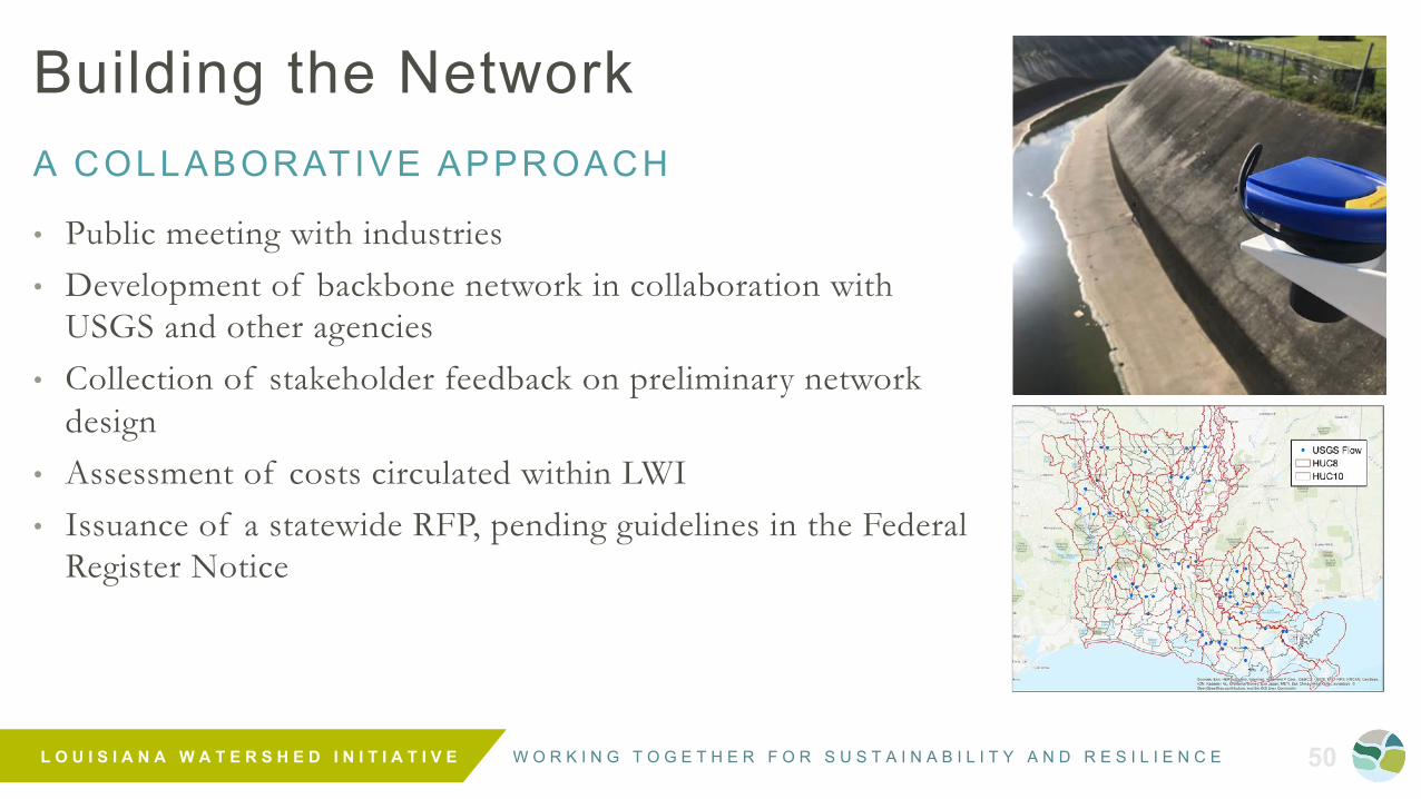
Building the NetworkA COLLABORATIVE APPROACH
• Public meeting with industries • Development of backbone network in collaboration with
USGS and other agencies• Collection of stakeholder feedback on preliminary network
design • Assessment of costs circulated within LWI• Issuance of a statewide RFP, pending guidelines in the Federal
Register Notice
W O R K I N G T O G E T H E R F O R S U S T A I N A B I L I T Y A N D R E S I L I E N C E L O U I S I A N A W A T E R S H E D I N I T I A T I V E 51
Next StepsCDBG-MIT FUNDING ACTION PLAN
APPROVAL PROCESS

W O R K I N G T O G E T H E R F O R S U S T A I N A B I L I T Y A N D R E S I L I E N C E L O U I S I A N A W A T E R S H E D I N I T I A T I V E 52
HO
W L
ON
G W
ILL
TH
IS T
AK
E?
$1.2B CDBG-MIT FundingREQUIRED NEXT STEPS ARE T IME CONSUMING
1. Updated Action Plan (in development) in response to FRN
2. LWI Council Meeting to review/approve summary & budget
3. Proposed Action Plan published, including a minimum 30-day period for citizen review and comment (pre-submittal)
4. HUD review and approval of the Action Plan takes up to 45 days; more to address comments, revisions, or plan denial
5. Before disbursing funds to any organization that is carrying out CDBG activities, a written agreement must be executed

W O R K I N G T O G E T H E R F O R S U S T A I N A B I L I T Y A N D R E S I L I E N C E L O U I S I A N A W A T E R S H E D I N I T I A T I V E 53
Public Comment

W O R K I N G T O G E T H E R F O R S U S T A I N A B I L I T Y A N D R E S I L I E N C E L O U I S I A N A W A T E R S H E D I N I T I A T I V E 54
Closing Remarks

@ L AWAT E R S H E D I N I T I AT I V E
@ L AWAT E R S H E D
WAT E R S H E D @ L A . G O V
WAT E R S H E D . L A . G O V
Thank You
![Counterparts[1] jose guzman](https://static.fdocuments.in/doc/165x107/558d536fd8b42a96338b462e/counterparts1-jose-guzman.jpg)