Contrails, Cirrus Trends, and Climate
13
Contrails, Cirrus Trends, and Climate Patrick Minnus Atmospheric Sciences, NASA Langley Research Center, Hampton, Virginia J. Kirk Ayers, Rabindra Palikonda, and Dung Phan Analytical Services and Materials, Inc., Hampton Virginia Presented by Matthew Widlansky Clouds and Aerosols EAS 8802 February 13, 2006
Transcript of Contrails, Cirrus Trends, and Climate
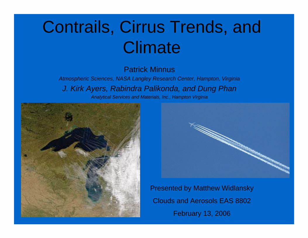
Contrails, Cirrus Trends, and ClimatePatrick Minnus
Atmospheric Sciences, NASA Langley Research Center, Hampton, Virginia
J. Kirk Ayers, Rabindra Palikonda, and Dung PhanAnalytical Services and Materials, Inc., Hampton Virginia
Presented by Matthew Widlansky
Clouds and Aerosols EAS 8802
February 13, 2006

Impacts of Contrails and Cirrus Clouds on Radiative Forcing
• Contrails produced by global air traffic have the potential to warm the troposphere by trapping out going long wave radiation.
• Surface observations from 1971 to 1995 show a significant rise in aerial coverage of contrails and cirrus over the northern oceans and U.S.
• GCM simulations show that cirrus trends over the U.S. may have accounted for a .2°-.3°C decade-1 local temperature increase.

Contrail and Cirrus formation are dependent on Upper Tropospheric Relative Humidity.
• Region A- Atmosphere is too dry for Contrails or Cirrus to form.
• Region B-Moist jet engine exhaust can trigger cloud formation.
• Region C-Cirrus formation through natural nucleation is likely.
Relative humidity probability distribution at flight latitudes with T= -50°C

Data Sets• Cloud Coverage- Surface-based synoptic weather
reports from land surfaces and ships. (1971-1995) Spreading contrail coverage is taken into account.
• Relative Humidity- NCEP Reanalysis 300mb annual mean measurements, 2.5° grids.
• Flight Frequency- 1992 air traffic data is used in the Expected Linear Contrail Coverage (ECON) model. Air traffic routes are assumed to be “great circle routes between two airports”.
Questions• Is rising air traffic causing a regional or global increase in cirrus and contrail coverage?
• What climate impact are upper tropospheric clouds having?

Major flight paths are generally over regions where the relative humidity has remained
the same or decreased.
Major flight paths as indicated by contrail coverage.
Decrease of 300mb RH over Western Europe between 1971-95.
Annual Mean NCEP RH at 300mb

Trends in Cirrus Coverage
Regions with more than 15yrs of data displayed
Regions having trends significant at the 90% level displayed
• There have been significant increases in cirrus cloud cover over the U.S. and northern oceans.
• A decrease is observed over Europe and Southeast Asia.

Trends in annual mean 300mb RH
RH (300mb) has decreased over Europe.
RH (300mb) has remained about the same over other land areas.

Correlations of RH (300mb) and Cirrus Cloud Cover
• RH trends do not explain the variation of cirrus over the U.S. and Western Europe.
• RH trends explain 30-45% of cirrus cloud variance over other land areas.

Trends in Cirrus Coverage(broken down by regions)
Ocean Flight Path RegionsContinental Flight Path
Regions
• There have been significant increases in cirrus cloud cover over the U.S. and northern oceans.
• A decrease is observed over Europe and Southeast Asia.

Seasonal Trends in Cirrus and Contrails
ISCCP= Cirrus trends
ECON= Expected contrail coverage for 1992.
United States Western Europe
• Cirrus and contrail coverage are positively correlated over the U.S.
• No correlation exists over Western Europe.

Climate Effects• Global net radiative forcing from air traffic of .006 - .0255
W m-2. (1992 values)• Immediate response is a warming of the atmosphere
below the contrail or cirrus and a warming (night) and cooling (day) of the land surface.
• Temperature trends over the U.S. due to air traffic are between .16°-.19°C decade-1.
• Net radiative forcing is expected to increase as global flight paths become more numerous.
Substantial regional climate warming already observed in areas with heavy air traffic.“Impact may become globally significant” as air travel continues to grow.

Future Research• Improved GCM Simulations
– Take into account aerosol concentrations, greenhouse gases, and geographical distribution of clouds.
– Ozone formed from exhaust can cause a tropospheric warming comparable to that from cirrus.
– Contrails forming in existing cirrus may increase the optical depth and affect FNET.
• Better measurements of upper tropospheric RH, cloud distributions, contrail properties, and flight paths to parameterize GCMs.

References
• Minnis, P., and Coauthors, 2004: Contrails, Cirrus Trends, and Climate.Bull. Amer. Meteor. Soc., 17, 1671-85.
• Lohmann, U. and Feichter, J., 2005: Global indirect aerosol effects: a review. Atmos. Chem. Phys. 5, 715-37.