Conservation Blueprint for the Sagadahoc Region - … blueprint A Guidebook for protecting place and...
51
Conservation blueprint A Guidebook for protecting place and prosperity in Arrowsic, Bath, Bowdoin, Bowdoinham, Brunswick, Georgetown, Harpswell, Phippsburg, Richmond, Topsham, West Bath and Woolwich Prepared by SRRRI: The Sagadahoc Region Rural Resources Initiative March 2010
Transcript of Conservation Blueprint for the Sagadahoc Region - … blueprint A Guidebook for protecting place and...

Conservation blueprint A Guidebook for protecting place and prosperity in Arrowsic, Bath, Bowdoin, Bowdoinham, Brunswick, Georgetown, Harpswell, Phippsburg, Richmond, Topsham, West Bath and Woolwich
Prepared by SRRRI: The Sagadahoc Region Rural Resources Initiative
March 2010

Conservation blueprint
A Guidebook for protecting place and prosperity in Arrowsic, Bath, Bowdoin, Bowdoinham, Brunswick, Georgetown,
Harpswell, Phippsburg, Richmond, Topsham, West Bath and Woolwich
Prepared by the Sagadahoc Region Rural Resources Initiative March 2010
Acknowledgments
Steve Walker from the state Beginning with Habitat Program was the primary author of the Guidebook. Katrina Van Dusen, Regional Planner for Midcoast Council of Governments, was the primary editor and wrote additional text. Eileen Johnson, Bowdoin College Environmental Studies Program, coordinated development of the maps that accompany the Guidebook. Erik Martin at The Nature Conservancy completed the maps. Pam Tetley developed the Quick Start Checklist. Lorraine Lessard, Maine State Planning Office, did the final layout of the Guidebook. Heather Perry took the cover photo.
The members of the SRRRI Steering Committee from twelve municipalities and various organizations and agencies provided valuable input on content and design of the Guidebook and the accompanying maps. Let’s hope they will find it a useful tool!
Work to complete the Conservation Blueprint, Guidebook and Maps, was funded by: the Maine State Planning Office and the Maine Coast Protection Initiative.
Work to complete the Conservation Blueprint, a Guidebook and Maps, was funded by the U.S. Department of Commerce, Office of Ocean and Coastal Resource Management, under the Coastal Zone Management Act (CZMA) of 1972, as amended under appropriation # 013‐07B‐9050‐008021. CZMA is administered in Maine by the State Planning Office’s Maine Coastal Program.

Table of Contents Introduction ..................................................................................................................................1 Overview of SRRRI, the region and threats to it ....................................................................2 Elements of the Conservation Blueprint ..................................................................................5 Priority Areas for Local Action..................................................................................................9
Protect water resources and riparian areas .........................................................................9 Maintain large unfragmented blocks of habitat ...............................................................15 Maintain connections between core habitat areas...........................................................18 Protect habitat for rare species and rare and exemplary natural communities ...........21 Protect farmland and support farmers..............................................................................26 Protect, develop and maintain trails ..................................................................................29
Appendix A: Focus Areas of Statewide Significance............................................................33 Appendix B: All About the Mapping ......................................................................................37 Appendix C: Quick Start Checklist..........................................................................................40


INTRODUCTION
This Conservation Blueprint Guidebook and the accompanying paper and digital maps are intended to assist people working in the twelve municipalities of the Sagadahoc region with their efforts to preserve open space and protect natural resources. People affiliated with a Conservation Commission, Planning Board, Comprehensive Plan Committee, land trust or other local, regional or statewide organization may find these materials helpful. The maps and Guidebook can be used a number of ways, including: to educate the public about valuable resources in town, to conduct conservation planning and priority setting, to consider relevant regulatory and non-regulatory tools for local adoption, and in review of development projects. The Guidebook includes highlights of the region’s outstanding ecological features, identify priority areas for local action, and recommend tools for protecting valued open spaces and trails, working farm and forest land, and important wildlife habitat.
Each municipality will receive a map that portrays important wildlife habitats and other natural resources in town for public education and planning. They will also receive a second map that shows the relative significance of each town’s natural resources and open spaces within the region. Towns can receive the mapped data in digital format and as paper maps. SRRRI towns with in-house Geographic Information System (GIS) mapping capacity are using the data for mapping and analysis as they develop and implement local open space plans. SRRRI is working on a way to make the digital mapped data easily available to citizen planners without full GIS capability. This Sagadahoc Region Conservation Blueprint Guidebook and related maps build on the State’s Beginning with Habitat (BwH) mapping and technical assistance program. Each town’s Beginning with Habitat maps are a complementary resource to use with the SRRRI maps, which portray relative wildlife habitat values across the 12-town region.
For more information about SRRRI or for assistance with local planning to protect open space and preserve natural resources, contact: Beginning with Habitat Midcoast Council of Governments Maine Dept. of Inland Fisheries and Wildlife 7 Park Street, Bath Maine 04530 41 State House Station, Augusta Maine 04333 (207) 443-5790 (207) 287-5254 [email protected] [email protected]
Conservation Blueprint by SRRRI, March 2010 Page 1

OVERVIEW OF SRRRI, THE REGION AND THREATS TO IT
The Sagadahoc Region Rural Resource Initiative (SRRRI) is a collaborative project comprised of representatives of twelve municipalities, land trusts, environmental organizations, state agencies and Bowdoin College. Motivating this cooperative effort is the shared belief that the region’s natural assets and vibrant communities, large and small, make it a desirable place to live, work and do business. The SRRRI Steering Committee has been working together since 2004 to learn about and implement techniques for preserving rural working landscapes, wildlife habitat and other natural areas. The Committee has sought input from the region’s citizens regarding valued natural resources and special places that define their communities. SRRRI has provided training and outreach to citizen volunteers, municipal staff and elected officials highlighting options for locally-adopted tools to protect natural resources and open spaces. The shared vision of SRRRI participants is to serve as a unified voice promoting natural resource protection and land conservation in each of the twelve participating municipalities.
The twelve SRRRI municipalities include: Arrowsic, Bath, Bowdoin, Bowdoinham, Brunswick, George-town, Harpswell, Phippsburg, Richmond, Topsham, West Bath and Woolwich. The twelve town SRRRI region harbors some of the greatest plant, animal and natural community diversity found anywhere in the state of Maine. This diversity includes several globally rare species, one of the most significant waterfowl concentration areas on the Atlantic flyway, and the easternmost examples of several rare natural community types in the US. The region includes one of the only shared major river deltas on earth, Merrymeeting Bay, which supports a unique assemblage of plants specific to tidal freshwater. The SRRRI region also includes sandy
beaches that offer some of the last remaining habitat in Maine for piping plovers and least terns. Healthy coastal bays throughout the region support some of the most productive shellfish flats and lobster grounds in the state. A thriving marine resource industry depends on them. The region’s alluvial soils have been farmed for hundreds of years, and are presently supporting a growing agriculture cluster comprised of farmers, farmers markets and value-added organic food producers. Sandy glacial outwash soils centrally located in Topsham and Brunswick are becoming increasingly fragmented, but continue to support
Page 2 Conservation Blueprint by SRRRI, March 2010

regionally rare plant and animal species and rare natural communities. They also provide irreplaceable aquifer recharge zones. In both inland towns and on the peninsulas there remain large blocks of land that serve as a critical mass of unfragmented wildlife habitat.
“The Brookings Institution, a national research organization that has studied the economies of many states, issued a report asserting that Maine’s Quality of Place is an economic asset of increasing value for Maine. Not just an asset, but Maine’s chief asset. Our own research confirms this finding.” – Governor’s Council on Maine’s Quality of Place
The SRRRI region stands out as an area of the state with a high concentration of rare, threatened, and endangered species and habitat types. The Beginning with Habitat program has identified two Focus Areas of Statewide Ecological Significance within the region, and the Maine Department of Inland Fisheries and Wildlife (IF&W) has identified these focus areas in the State Wildlife Action Plan as conservation priorities. Appendix A includes detailed descriptions of the Kennebec Estuary Focus Area and the Maquoit and Middle Bay Focus Area. People living in the Sagadahoc region, whether they reside in town or out in the country, rely on the opportunity to shop, seek professional services and enjoy cultural happenings along Main Street. Chance encounters with friends, neighbors and elected officials, when downtown, strengthen the fabric of our communities. Residents also value the rural parts of the region where they can celebrate the changing seasons by visiting orchards and berry farms, swimming and kayaking, hunting, cross country skiing, smelt fishing and snowmobiling. It is the combination of vibrant, walkable downtowns and memorable rural experiences that define the Sagadahoc Region’s “quality of place”.
The functions and values of natural resources within the SRRRI study area are threatened by planned and unplanned development. In the Sagadahoc region, most development between 1900 and 1970 took place near town centers and along existing, well-traveled corridors, particularly Route 1. More recently, however, residential growth has been spreading far out along secondary roads into areas increasingly distant from the larger downtowns and smaller town centers. In many cases, new development is occurring on tracts of previously roadless, undeveloped land. The trend is especially striking in the Sagadahoc region, where regional hubs absorbed only 18 percent of new residents with the remainder scattered throughout formerly rural communities. The continuing trend of decentralized rural development increases town costs associated with providing municipal services such as plowing, police, fire, ambulance, school busing and road repairs. The
Conservation Blueprint by SRRRI, March 2010 Page 3
outward spreading of the population also costs in terms of rural character and quality of place, as once scenic fields are dotted with new homes and woodlots used by generations of hunters are posted by new residents. Development can also alter hydrology and reduce water quality in ways that affect drinking water for people as well as aquatic wildlife habitat. Commercial forestry and traditional agriculture that has existed as part of our regional culture since settlement, is being displaced as prime agricultural soils sprout subdivisions, and woodlots are fragmented below viable management acreage. The biggest, and perhaps least obvious, cost, however, is to the plants and animals that share the landscape. More and more large undeveloped blocks of forestland are being split, divided and developed. The remaining smaller patches of habitat are less likely to support both the numbers and diversity of species once found. Roads create barriers to movement and risk of mortality. Lights, pets, runoff and invasive species that come with development degrade portions of the remaining habitat. Although much of what residents see in their day-to-day lives appears relatively green and unchanged, landscape functions are declining. Fewer streams support trout, fewer
clam flats are open for harvest, and fewer whippoorwills call on spring evenings. There is uncertainty regarding how Maine’s habitats and species will respond to the changing climate, however maintaining a functional network of green space will increase the resiliency of wildlife to adapt to change.
Much opportunity exists to guide growth. Increasingly the SRRRI towns are looking to update comprehensive plans, adopt land use ordinances, and draft open space plans. Now is the time to grow differently and to grow better. Maine has a long tradition of home rule authority; however if ever there was a
case to be made for the critical importance of regional cooperation, the SRRRI region with its shared bays, clam flats, hunting grounds, aquifers and service centers would be a top candidate. The collaborative efforts of SRRRI participants to date are the starting point for new inter-municipal efforts. Maintaining the region’s quality of place through proactive and well-planned open space conservation is the best hope for preserving the rural working landscape and for attracting meaningful economic development opportunities in the future.
“Not surprisingly, the state’s largest percentage losses of rural land have been taking place in the growing Southern and Mid‐coast regions. Cumberland County alone lost over 56,000 rural acres – a 39% reduction. Not far behind this pace of development was the mid‐coast, which lost 26% of its rural land between 1980 and 2000, with Sagadahoc County’s rural acres falling 35%.” – Charting Maine’s Future
Page 4 Conservation Blueprint by SRRRI, March 2010

ELEMENTS OF THE CONSERVATION BLUEPRINT
The Conservation Blueprint is a multi-faceted package that can be used to help guide growth in a way that maintains our quality of life. The maps and Guidebook can be used to inform municipal planning efforts, land trust strategic planning, and private land management decisions. The primary audience for the Conservation Blueprint is people working with the twelve SRRRI municipalities. Municipal land use decisions have a huge impact on conservation of plant and wildlife diversity. Money available to purchase easements or land in fee is limited, land ownership and landowner intent is continually changing, but municipalities have the ability to steer where future growth takes place, how it impacts natural resources, and where conservation is most appropriate. An important first step for local planners would be to use the mapped data prepared by SRRRI, along with local knowledge, to help identify candidate areas within each town as conservation priorities. The second step could be to select tools from this Guidebook and implement them as local conservation actions.
The Maps: Starting with the information included on Beginning with Habitat (BwH) maps, which the state has made available to towns since 2001, SRRRI crafted project-specific maps. SRRRI undertook to rank the region’s habitat using BwH and additional habitat data. SRRRI also used a multi-step process to map fields, unfragmented forest blocks, and corridors between fields and forest. Information in the SRRRI map database include:
Unfragmented forest blocks Large fields and recently grown over fields
likely to provide unique habitat and scenic value
Connections between blocks of forest and fields
Habitat ranked by its ecological significance, based on known species occurrences
Prime agriculture soils Regional and local trail networks Special places as identified in public forums Conservation lands Parcel lines
The complementary regional and local SRRRI natural resource maps can serve multiple functions:
From the regional map, local people can appreciate the relative importance of places in their town and consider appropriate steps for stewarding resources of regional significance.
Conservation Blueprint by SRRRI, March 2010 Page 5

Page 6 Conservation Blueprint by SRRRI, March 2010
The regional map also shows clearly where high value resources cross municipal boundaries and cooperative protection is desirable, such as a large unfragmented forest block, a long distance trail, or a shared coastal embayment.
For each town, the maps identify a range of valuable habitat, for which to strategically consider committing financial and planning resources that will lead to long-term protection.
Digital data: The data that make up the maps are available to the towns in two ways:
Towns with capacity to use the digital data for GIS mapping can make arrangements with SRRRI to receive it. Some towns are already using the data in local planning.
SRRRI is working on a way for people without full GIS capacity manipulate the data layers so as to create maps of local interest.
Map availability: To view and download the regional and individual town maps, go to: www.beginningwithhabitat.org/the_maps. Click on “Map Availbility/Request Map” and then on “Watersheds/Regions” and look for Sagadahoc Region Rural Resource Initiative. Appendix B: “All about the SRRRI Maps” includes:
A description of the SRRRI mapped data and how it has been analyzed, and
Directions to find the SRRRI maps and some data, and how to use it to make customized maps.

The Sagadahoc Region Rural Resource Initiative Maps
Town‐specific Habitat Rankings with Forest Blocks Town maps: SRRRI ran a computer model with Beginning with Habitat and other habitat data to rank places in the region of greatest ecological significance, shown in a range of fire colors. The model relies on known species occurrence records and the quality of surrounding habitat. On the SRRRI town maps the ranked habitat is overlain with fields (cross hatched), conserved land (purple), corridors(kelly green), and undeveloped forest blocks (shades of green).
Region‐wide Habitat Rankings of Forest Blocks Regional map: The regional SRRRI map utilizes the same SRRRI‐developed habitat model as the town maps, but adds information about undeveloped blocks of land, resulting in a map that ranks the habitat value of the forest blocks throughout the region. Red is most valuable; green is least.
Other Rural Resources Inset maps: The SRRRI map posters also include inset maps depicting prime agricultural soils and trail networks, locally and in the region.
Note: This page is more understandable when printed in color.
Conservation Blueprint by SRRRI, March 2010 Page 7

The Guidebook’s Priorities for Local Action: The Guidebook presents six broad categories of resources of high importance in the region and outlines steps to protect each with measures to be adopted and implemented locally. Deliberation among the SRRRI Steering Committee resulted in selection of these priorities. Local action to address each resource area can make a difference. By choosing tools that consider local interests, fit within existing town government capacity, and balance landowner concerns, municipalities can significantly contribute to maintaining the local and regional assets that contribute to our quality of life and are critical to sustaining the region’s ecological integrity. The recommended Priorities for Local Action are:
1. Protect water resources and riparian areas 2. Maintain large unfragmented blocks 3. Maintain connections between core habitat areas 4. Protect habitat for rare species and rare and
exemplary natural communities 5. Protect farmland and support farmers 6. Protect, develop and maintain trails
The most challenging step in municipal conservation planning is figuring out where to begin. This Conservation Blueprint Guidebook makes it easier
to get started. Types of natural resources that should be priorities for protection have been identified by a working group of knowledgeable scientists and state and local planners. A selection of tools that can be adopted locally is offered. An analysis of mapped natural resource data is available to help towns identify specific places that could be priorities for conservation. By adopting tools to address each of the priority areas, municipalities will start to assemble a local toolbox for land and habitat conservation. Adopt local goals related to natural resource protection and open space conservation to provide an effective framework for further local actions. It is optimal for municipalities have an up-to-date local comprehensive plan that includes goals and strategies for protecting and promoting valued open spaces and trails, working farms and forests, and important wildlife habitat. Forming and sustaining a municipal Conservation Commission and adopting a local Open Space Plan can provide a work plan and people to implement it. In seven of the twelve SRRRI towns there are local Conservation Commissions working to implement conservation strategies. Brunswick, Harpswell and Topsham have developed local open space plans to guide their efforts; other communities are getting started on open space plans.
An excellent source of additional information regarding most of the recommended strategies can be found by visiting: www.beginningwithhabitat.org/toolbox/about_toolbox.html
Page 8 Conservation Blueprint by SRRRI, March 2010
PRIORITY AREAS FOR LOCAL ACTION
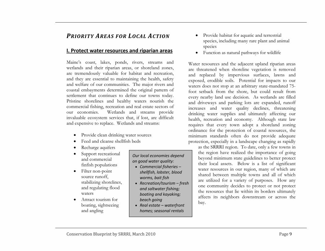
I. Protect water resources and riparian areas Maine’s coast, lakes, ponds, rivers, streams and wetlands and their riparian areas, or shoreland zones, are tremendously valuable for habitat and recreation, and they are essential to maintaining the health, safety and welfare of our communities. The major rivers and coastal embayments determined the original pattern of settlement that continues to define our towns today. Pristine shorelines and healthy waters nourish the commercial fishing, recreation and real estate sectors of our economies. Wetlands and streams provide invaluable ecosystem services that, if lost, are difficult and expensive to replace. Wetlands and streams:
Provide clean drinking water sources Feed and cleanse shellfish beds Recharge aquifers Support recreational
and commercial finfish populations
Filter non-point source runoff, stabilizing shorelines, and regulating flood waters
Attract tourism for boating, sightseeing and angling
Provide habitat for aquatic and terrestrial species, including many rare plant and animal species
Function as natural pathways for wildlife Water resources and the adjacent upland riparian areas are threatened when shoreline vegetation is removed and replaced by impervious surfaces, lawns and exposed, erodible soils. Potential for impacts to our waters does not stop at an arbitrary state-mandated 75-foot setback from the shore, but could result from every nearby land use decision. As wetlands are filled and driveways and parking lots are expanded, runoff increases and water quality declines, threatening drinking water supplies and ultimately affecting our health, recreation and economy. Although state law requires that every town adopt a shoreland zoning ordinance for the protection of coastal resources, the minimum standards often do not provide adequate protection, especially in a landscape changing as rapidly
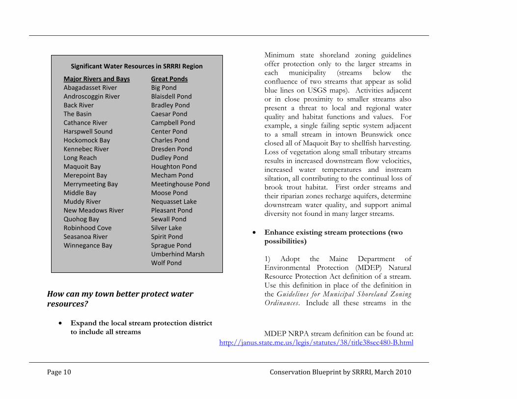
as the SRRRI region. To date, only a few towns in the region have realized the importance of going beyond minimum state guidelines to better protect their local assets. Below is a list of significant water resources in our region, many of which are shared between multiple towns and all of which are utilized for a variety of purposes. How any one community decides to protect or not protect the resources that lie within its borders ultimately affects its neighbors downstream or across the bay.
Our local economies depend on good water quality: Commercial fisheries – shellfish, lobster, blood worms, bait fish
Recreation/tourism – fresh and saltwater fishing; boating and kayaking; beach going
Real estate – waterfront homes; seasonal rentals
Conservation Blueprint by SRRRI, March 2010 Page 9
How can my town better protect water resources?
Expand the local stream protection district to include all streams
Minimum state shoreland zoning guidelines offer protection only to the larger streams in each municipality (streams below the confluence of two streams that appear as solid blue lines on USGS maps). Activities adjacent or in close proximity to smaller streams also present a threat to local and regional water quality and habitat functions and values. For example, a single failing septic system adjacent to a small stream in intown Brunswick once closed all of Maquoit Bay to shellfish harvesting. Loss of vegetation along small tributary streams results in increased downstream flow velocities, increased water temperatures and instream siltation, all contributing to the continual loss of brook trout habitat. First order streams and their riparian zones recharge aquifers, determine downstream water quality, and support animal diversity not found in many larger streams.
Significant Water Resources in SRRRI Region
Major Rivers and Bays Great Ponds Abagadasset River Big Pond Androscoggin River Blaisdell Pond Back River Bradley Pond The Basin Caesar Pond Cathance River Campbell Pond Harspwell Sound Center Pond Hockomock Bay Charles Pond Kennebec River Dresden Pond Long Reach Dudley Pond Maquoit Bay Houghton Pond Merepoint Bay Mecham Pond Merrymeeting Bay Meetinghouse Pond Middle Bay Moose Pond Muddy River Nequasset Lake New Meadows River Pleasant Pond Quohog Bay Sewall Pond Robinhood Cove Silver Lake Enhance existing stream protections (two
possibilities) 1) Adopt the Maine Department of Environmental Protection (MDEP) Natural Resource Protection Act definition of a stream. Use this definition in place of the definition in the Guidelines for Municipal Shoreland Zoning Ordinances. Include all these streams in the
Seasanoa River Spirit Pond Winnegance Bay Sprague Pond Umberhind Marsh Wolf Pond
MDEP NRPA stream definition can be found at:http://janus.state.me.us/legis/statutes/38/title38sec480-B.html
Page 10 Conservation Blueprint by SRRRI, March 2010
This approach requires that streams meeting the definition be mapped on the town’s official shoreland zoning map. Such mapping can be accomplished by reviewing soil survey maps, which typically show small streams, and USGS topo maps, and field checking areas with local volunteers. 2) Alternatively, towns can integrate similar stream protection measures into a town wide overlay zone (Brunswick’s Natural Resource Protection Zone, for instance). The second approach eliminates the reliance on an official map and sets performance standards for land use activities regardless of underlying zone. Note: MDEP regulates activities that cause soil disturbance within 75-feet of more streams than are protected under mandatory shoreland zoning. Given that state regulations apply to smaller streams, expansion of local stream protection does not pose a significant increase in regulatory burden faced by the landowner. Incorporating protections for smaller streams into local ordinances allows for greater local review authority and increased regulatory consistency for landowners.
Enhance required shoreland zone setbacks and buffer requirements The state Guidelines for Municipal Shoreland Zoning Ordinances require that structures be
setback 75-feet from the normal high water line of coastal waters and rivers and require that a certain amount of the woody vegetation within this zone be retained. Towns can increase the setback distance and the amount of vegetation that cannot be cut. Stronger requirements enhance water quality by providing greater treatment of run-off, thereby protecting downslope clam flats, eelgrass beds, or freshwater fisheries. Wider setback zones can also function as better travel corridors for wildlife and can support recreational trails. Increased protection of today’s undeveloped low-lying coastal uplands will provide opportunity for tomorrow’s coastal wetlands to migrate landward as the sea level rises. Towns in the SRRRI region have required setback distances of 100-125 feet to provide greater protection of water resources and related commercial industries. No disturbance stream buffers of 100-feet are typically recommended by the Maine Department of Inland Fisheries and Wildlife fisheries biologists to adequately protect native brook trout habitat.
Provide local protections for wetland resources All wetlands regardless of size or type are regulated by the MDEP and the US Army Corps of Engineers. However, the state Guidelines for Municipal Shoreland Zoning Ordinances
Conservation Blueprint by SRRRI, March 2010 Page 11
only require that municipalities implement local standards for large (>10-acre) non-forested wetlands, salt marshes, mapped high to moderate value wading bird and waterfowl habitats, and non-forested wetlands associated with great ponds and rivers. Some towns in the region do include all wetlands per the US Army Corps definition in their land use ordinances and require that projects submitted for local development review avoid wetland disturbance and subtract wetland acreage from net residential density calculations. This is a good first step to providing some level of local protection, but more can be done. Currently, the state wetland rules allow 4,300 square feet of wetland disturbance to happen
without permitting so long as the wetland is not considered a wetland of special significance by state definition. This exemption can and does result in numerous small wetland losses that when considered cumulatively can significantly impact how a watershed functions (death by one thousand cuts). Towns in southern Maine are witnessing the effects of cumulative wetland losses and are beginning to adopt local wetland ordinances that require wetland setbacks and buffering regardless of wetland size or type. Municipalities can also adopt local ordinances that require wetland mitigation in the form of an impact fee or wetland replacement to recapture local losses of wetland services resulting from the statewide exemption.
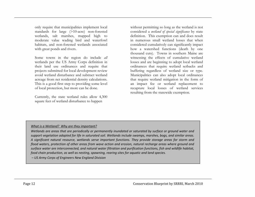
What is a Wetland? Why are they important? Wetlands are areas that are periodically or permanently inundated or saturated by surface or ground water and support vegetation adapted for life in saturated soil. Wetlands include swamps, marshes, bogs, and similar areas. A significant natural resource, wetlands serve important functions. They provide storage areas for storm and flood waters, protection of other areas from wave action and erosion, natural recharge areas where ground and surface water are interconnected, and natural water filtration and purification functions, fish and wildlife habitat, food chain production, as well as nesting, spawning, rearing sites for aquatic and land species. – US Army Corps of Engineers New England Division
Page 12 Conservation Blueprint by SRRRI, March 2010

Educate land owners, especially new residents, about the proper care of septic systems Many of the region’s new landowners, especially those who have always lived in a home serviced by public sewer, may not be aware of the need for regular pumping of septic systems. As a result, many private systems fail, polluting nearby waters for months if not years. As more homes are constructed in rural watersheds, the need for septic system education has never been more important. Both the MDEP and the New Meadows Watershed Partnership provide educational materials that can be used to educate new home buyers and long-term residents alike.
Proactively identify altered or impaired water resources for potential mitigation funding
Given the region’s long history of settlement and close ties to the navigable waters that continue to drive our economies, many wetlands and stream resources have been altered over time. Current state and federal regulations contain mitigation provisions that require developers to replace or restore wetland functions and values if their project will result in unavoidable wetland impacts. Good wetland mitigation sites are hard to come by. It is not uncommon for developers to retain the services of private consultants to scour the watershed in search of wetland mitigation opportunities. Towns can position themselves to benefit from these wetland mitigation requirements by proactively identifying sites that can be restored and high value wetlands that can be preserved for the good of the town. By making this information available to the development community and state regulators, win-win results can be realized as the restored or preserved wetlands will provide valuable ecological services for the community in perpetuity and developers avoid costly mitigation searches. The MDEP In Lieu Fee Program for wetland mitigation allows developers to pay a fee based on impact size and the monies collected fund priority wetland preservation and restoration projects. Emphasis is placed on projects within coastal Focus Areas of Statewide Ecological Significance.
Conservation Blueprint by SRRRI, March 2010 Page 13
Page 14 Conservation Blueprint by SRRRI, March 2010
Adopt road crossing standards for public and private roads One of the leading causes in the decline of freshwater and anadromous fish stocks in our region is the fragmentation of aquatic habitat by poorly sized and constructed road crossing structures such as culverts. These structures can block upstream migration, increase flow velocities beyond the swimming capabilities of many species, and result in increased sedimenta-
tion through channel scouring. Local public works departments can be trained in proper sizing and placement of stream and wetland crossing structures, and land use ordinances can require that new subdivisions adhere to habitat friendly crossing designs. The Beginning with Habitat program and the Maine Department of Transportation provide guidelines for fish and other aquatic organism passage.
For more information on the importance of water resources and riparian areas:
Beginning with Habitat: An Approach to Conserving Maine’s Natural Landscape for Plants, Animals and People: www.beginningwithhabitat.org
Conserving Wildlife in Maine’s Shoreland Habitats, Maine Audubon: www.maineaudubon.org/resource/index.shtml
Conserving Wildlife in Maine’s Coastal Habitats, Maine Audubon: www.maineaudubon.org/resource/index.shtml
Maine’s Wetlands - Their Functions and Values: www.maine.gov/dep/blwq/docstand/ipwetfv2.htm
Wetlands Protection - A Federal, State and Local Partnership: www.maine.gov/dep/blwq/docstand/nrpa/ip_wl_protection.htm
Maine Shoreland Zoning- A Handbook for Shoreland Owners: www.maine.gov/dep/blwq/docstand/szpage.htm (scroll down for document)
Maine State Planning Office on-line wetland characterization map: http://megisims.state.me.us/website/spowetc/viewer.htm

II. Maintain large unfragmented blocks of habitat Large undeveloped blocks of open space, or rural areas unbroken by roads and development, provide enough habitat to keep common species common and to support traditional natural resource based industries that contribute to the region’s rural character and economy. Protecting such intact landscapes is one of the best remaining opportunities to ensure the viability of our rural areas. Large undeveloped blocks of open space have many values. They:
Support a variety of habitat types for both common and uncommon plant and animal species
Support rural character by providing adequate acreage for production
Provide visual breaks between growth pockets and offer scenic views
Provide opportunity for traditional outdoor recreation
Protect underlying aquifers and other water resources
Require minimal public services, but offer multiple public values
The degree of landscape fragmentation and the size of remaining undeveloped blocks varies significantly by SRRRI town. The current level of fragmentation is strongly influenced by where people live, but also is a result of the historic layout of roads and the physical shape of local landscape features. Brunswick, the region’s most populous town, retains unfragmented tracts of land larger than 2,000 acres. These blocks occur in the northwest part of town that is cut off from the rest of town by I-295. Recently, however, long, dead-end subdivision roads are beginning to chip away at the large tracts. Harpswell, on the other hand, has few large unfragmented blocks on its multiple narrow, north-south oriented peninsulas. Much residential development has been in the form of dead-end spur roads to desirable waterfront locations. The largest remaining undeveloped blocks of habitat in the SRRRI region occur in Bowdoin, Bowdoinham and Woolwich. These blocks, however, are experiencing rapid changes as road frontage is built out and new homes are constructed in subdivisions and on single lots outside of town in the more rural communities.
“The state is converting extraordinary quantities of rural fields and woodlots to residential uses.” – Charting Maine’s Future
Conservation Blueprint by SRRRI, March 2010 Page 15

How can my town better protect undeveloped blocks?
Encourage rural subdivisions to follow conservation or open space design principles Rural residential development does not necessarily need to result in significant habitat fragmentation. There are alternatives to dividing a parcel into large residential lots. Subdivision designs that feature shorter roads and smaller lots have shown to be just as marketable, if not more so, project after project, town after town. Such developments are especially desirable when buyers are guaranteed access to permanently protected open space a short walk from their back door. Many towns have “cluster” provisions in their subdivision ordinances intended to provide resource protection, but these are often outdated approaches that offer little guidance as to what lands should be prioritized for open space designation. Towns, including Brunswick, are now revising old “cluster” subdivision requirements to offer incentives, usually density bonuses, to developments that minimize intrusion into mapped undeveloped blocks and designate open space that maintains undeveloped block integrity in perpetuity as part the subdivision plan. In some towns open space subdivisions are mandatory in most cases.
Incorporate dead-end road standards Limiting the length of subdivision roads that will be accepted by a town can provide a disincentive for subdivision designs that fragment the landscape. Such a regulation will be most effective when coupled with an open space subdivision provision that requires or offers incentives (bonus densities) for reduced lot sizes and road frontages.
Assist landowners who do not want to develop, but are faced with growing tax burdens The main reason why undeveloped blocks remain part of the landscape is landowner stewardship. Finding ways to make it easier for landowners to choose not to develop their property is a valuable first step in protecting open space until more permanent solutions can be identified. Towns can encourage enrollment in tree growth and open space tax classifications.
Page 16 Conservation Blueprint by SRRRI, March 2010
Conservation Blueprint by SRRRI, March 2010 Page 17
Pursue local appropriation of funds for land acquisition Several towns in Maine have passed local land bonds. Other towns appropriate an amount every year for a land acquisition fund. They use the funds to purchase easements or land in fee from willing sellers. Many municipalities have passed appropriations for a specific open space purchase. Often local funds can be matched with state, federal and private funds, allowing a town to purchase significantly more than it would be able to with local funds alone. Going out to vote for an annual appropriation or on a local referendum to bond for open space acquisition funds usually follows adoption of a local open space plan. Towns will need to
develop a deliberate process for selecting acquisition projects. Another means that has been adopted locally for building a local land acquisition fund is to put all or some of the penalties paid when land is taken out of the tree growth tax classification into a special fund. Yet another possibility, proposed but not implemented in one Maine town, is to appropriate funds annually to purchase 10-year conservation leases from willing landowners. The lease terms, in essence, would pay a landowner’s property tax burden in exchange for the landowner’s agreement not to develop or post their land for a 10-year term.
For more information on the importance of large undeveloped blocks of open space:
Beginning with Habitat: An Approach to Conserving Maine’s Natural Landscape for Plants, Animals and People: www.beginningwithhabitat.org
Conserving Wildlife in Maine’s Developing Landscape, Maine Audubon: www.maineaudubon.org/resource/index.shtml
Maine Revenue Service Current Use Programs: www.maine.gov/revenue/propertytax/propertytaxbenefits/CurrentUseLandPrograms.htm
Information about passing a local land bond: www.beginningwithhabitat.org/toolbox/finance_landbond.html
III. Maintain connections between core habitat areas Connections between habitat types and locations are critical to the viability of all wildlife and plant species for many reasons, and also serve other important functions. For plants and animals, connections:
Allow dispersal and movement Allow genetic mixing among populations Allow seasonal or daily movements of many
species which use multiple habitats across the landscape, (e.g., deer have special wintering areas and salamanders breed only in certain places)
In aquatic environments, allow for animals to move around the watershed (e.g. for individuals to move from a small stream to an open bay)
Allow species to re-colonize when they have been locally depleted by roads, hunting, fishing or natural events
Conserve landscape connectivity that will enhance the ability of species to shift ranges in response to climate change
Providing for habitat connectivity on the landscape has multiple ancillary benefits. Corridors serve to:
Maintain rural hunting and trapping opportunities
Maintain recreational brook trout fisheries Allow recreational trail connections for
snowmobiling, hiking and cross county skiing Maintain water quality for drinking water
supplies and aquatic and marine species When designing a local conservation blueprint, it is important to consider ways to maintain landscape connections between open space and conservation lands that will exist over time. The SRRRI project has highlighted the less fragmented and likely higher value overland connections between undeveloped blocks, based on aerial imagery and structure locations. These SRRRI “potential wildlife corridors” depict places where:
A corridor connects relatively intact habitat “patches” and the road crossing does not appear to be a formidable barrier
Adequate vegetative cover exists that would support overland movement by more disturbance-sensitive species
Spacing between structures is adequate to limit secondary disturbances such as lights and outdoor pets
The “potential wildlife corridors” depicted on the SRRRI maps can serve as a starting point for a town’s local corridor identification process.
Page 18 Conservation Blueprint by SRRRI, March 2010

How can my town better protect landscape connectivity?
Encourage rural subdivisions to follow conservation or open space design principles As explained in the “Undeveloped Block” section, above, working within the subdivision review process to encourage the designation of functional open space is a good way to implement a local conservation blueprint. Incentives for following conservation design principles can be worked into the regulatory approach and benefit the developer. Like undeveloped blocks, corridors can be mapped on a town-wide scale and designated as priority habitats for open space protection through the subdivision review process. Developers can be encouraged to leave identified priority corridors unobstructed with roads and houses where possible and in turn rewarded with bonus densities or flexible setback and lot size requirements. Brunswick has accomplished this through its Rural Brunswick Smart Growth approach, and other towns in Maine have required that subdivision-designated open space abut or provide connections to other open spaces. In effect, protected habitat connections are built project by project.
Create habitat overlay zones that include performance standards designed to minimize fragmentation Overlay zones are becoming a common approach used by towns to apply certain performance standards to geographically explicit areas without changing the allowed land uses or densities that landowners are accustomed to. The Town of Brunswick has adopted a wildlife habitat corridor overlay district that sets avoidance and minimization standards for rural residential activities in mapped corridors. Developers are asked to minimize clearing associated with development within these zones and are rewarded based on their efforts to avoid habitat disturbance. Where disturbance is unavoidable, developers can enhance other parts of the corridor with landscaping or permanently protect other corridors as mitigation.
Include aquatic species passage requirements in local road design standards Just as overland movement of terrestrial species can be impaired when natural cover is replaced with buildings, roads and lawns, aquatic species including brook trout, crayfish and caddis flies can experience local population extinctions when stream networks are fragmented by culverts, impoundments and channelization. As discussed in the “Water Resources” section,
Conservation Blueprint by SRRRI, March 2010 Page 19
Page 20 Conservation Blueprint by SRRRI, March 2010
improving local standards for culvert sizing and placement can significantly improve the long-term prospects for local recreational fisheries and also improve ecological function within the watershed. Hanging culverts can prevent upstream passage of aquatic organisms and undersized culverts, even if installed at or below
streambed grade, can alter flow velocities and increase siltation, making in-stream habitat inhospitable for many species. The Maine Department of Transportation has developed passage standards for aquatic organisms, small mammals, reptiles and amphibians that utilize streamside habitats for daily movements.
For more information on the importance of connectivity:
Conserving Wildlife in Maine’s Developing Landscape, Maine Audubon: www.maineaudubon.org/resource/index.shtml
2008 Waterway and Wildlife Crossing Policy and Design Guide, Maine Department of Transportation, Environmental Office: www.maine.gov/mdot/environmental-office-homepage/other_environmental.php
Conserving Wildlife On and Around Maine’s Roads: www.maineaudubon.org/resource/index.shtml

IV. Protect habitat for rare species and rare and exemplary natural communities With an abundance of unique ecosystems and a wealth of natural resources, the SRRRI region supports a concentration of rare plant and animal species and rare and exemplary natural communities worthy of being designated as a statewide conservation priority. The region hosts 36 rare, threatened and endangered plants, 20 rare or exemplary natural communities, and 16 rare, threatened and endangered animals have been observed and mapped at 163 distinct locations (See following table). Rare species and natural communities are an important part of Maine’s natural heritage. Some of these species and communities are admired for their beauty, some are little known, and some play a critical role in ecosystems. The loss of a native species can create repercussions along the food chain, which can result in the decline of other species that depend on it or over abundance of populations that it preys upon. When natural systems become out of balance, there can be impacts to human interests, whether health or economy related. Adequate protection of rare species and natural communities is an important conservation challenge in Maine. Most upland (non-wetland) occurrences of rare plants and rare and exemplary natural communities have no formal protection in state regulation. Threatened and endangered animal species have some protection under the Maine Endangered Species Act against direct “take”, but few funds are available for protecting their habitat and avoiding further population
declines. Given the reality that most land use decisions are made at the town level, town governments are in the best position to protect Maine’s natural heritage. Habitat for rare species and rare and exemplary natural communities are a critical element of our landscape because they:
Protect endangered plants and animals, enhancing the chance of individual and population survival
Protect ecosystem health and functioning Increase eco-tourism and experiential tourism
opportunities Provide outdoor classroom opportunities Demonstrate town pride and concern for local
natural heritage
What is a natural community? A natural community is an assemblage of interacting plants and animals and their common environment, recurring across the landscape, which has been minimally affected by human activity. A natural community includes all of the organisms (plant, animal, etc.) in a particular physical setting, as well as the setting itself. The Maine Natural Areas Program has identified 98 distinct natural community types in Maine, 35 of which occur in the SRRRI region.
Conservation Blueprint by SRRRI, March 2010 Page 21

Known Rare Species Occurrences in SRRRI Region
Rare Vertebrate Rare & Exemplary Natural Community Arctic Tern Threatened Alder Thicket Exemplary Bald Eagle Threatened Brackish Tidal Marsh Rare Barrow’s Goldeneye Threatened Coastal Dune‐marsh Ecosystem Rare Brown Snake Special Concern Dune Grassland Imperiled Eastern Meadowlark Special Concern Freshwater Tidal Marsh Imperiled Grasshopper Sparrow Endangered Low‐elevation Bald Rare Harlequin Duck Threatened Maritime Spruce ‐ Fir Forest Exemplary Horned Lark Special Concern Mixed Saltmarsh Exemplary Least Tern Endangered Pickerelweed Marsh Exemplary Peregrin Falcon Endangered Pitch Pine ‐ Heath Barren Critically Imperiled Piping Plover Endangered Pitch Pine Bog Imperiled Redfin Pickeral Endangered Pitch Pine Dune Woodland Critically Imperiled Ribbon Snake Special Concern Pitch Pine Woodland Rare Roseate Tern Endangered Rose Maritime Shrubland Exemplary Saltmarsh Sharp‐tailed Sparrow Special Concern Salt‐bay Saltmarsh Rare Spotted Turtle Threatened Sandplain Grassland Critically Imperiled Upland Sandpiper Threatened Silver Maple Floodplain Forest Rare Spruce ‐ Pine Woodland Exemplary Rare Invertebrate Streamshore Ecosystem Exemplary Acadian Swordgrass Moth Special Concern Tidal Marsh Estuary Ecosystem Rare Dusted Skipper Endangered White Oak ‐ Red Oak Forest Rare Tidewater Mucket Threatened
Page 22 Conservation Blueprint by SRRRI, March 2010

Known Rare Species Occurrences in SRRRI Region (con’t)
Rare Plant Beaked Spikerush Endangered Mudwort Special Concern Beaked Spikerush Endangered Mudwort Special Concern Clammy Azalea Endangered Narrow‐leaf Arrowhead Special Concern Clammy Azalea Endangered Narrow‐leaf Arrowhead Special Concern Clothed Sedge Endangered Parker’s Pipewort Special Concern Clothed Sedge Endangered Parker’s Pipewort Special Concern Dry Land Sedge Threatened Pygmyweed Special Concern Dry Land Sedge Threatened Pygmyweed Special Concern Dwarf Bulrush Threatened Saltmarsh False‐foxglove Special Concern Dwarf Bulrush Threatened Saltmarsh False‐foxglove Special Concern Eaton’s Bur‐marigold Special Concern Sassafras Special Concern Eaton’s Bur‐marigold Special Concern Sassafras Special Concern Estuary Bur‐marigold Special Concern Screwstern Threatened Estuary Bur‐marigold Special Concern Screwstern Threatened Estuary Monkeyflower Special Concern Small Reed‐grass Special Concern Estuary Monkeyflower Special Concern Small Reed‐grass Special Concern Great Rhododendron Threatened Small Saltmarsh Aster Endangered Great Rhododendron Threatened Small Saltmarsh Aster Endangered Horned Pondweek Special Concern Smooth Sandwort Special Concern Horned Pondweek Special Concern Smooth Sandwort Special Concern Large‐purple False Foxglove Endangered Spongy Arrowhead Special Concern Large‐purple False Foxglove Endangered Spongy Arrowhead Special Concern Lilaeopsis Threatened Southern bog‐clubmoss Special Concern Lilaeopsis Threatened Southern bog‐clubmoss Special Concern Long‐leaved Bluet Special Concern Stiff Arrowhead Threatened Long‐leaved Bluet Special Concern Stiff Arrowhead Threatened Long’s Bitter‐cress Threatened Sweet Pepper‐bush Special Concern Long’s Bitter‐cress Threatened Sweet Pepper‐bush Special Concern Marsh Bulrush Special Concern Tidal Spikerush Special Concern Marsh Bulrush Special Concern Tidal Spikerush Special Concern March alder Endangered Upright Bindweed Threatened March alder Endangered Upright Bindweed Threatened Michaux’s Blue‐eyed‐grass Special Concern Water Pimpernel Special Concern Michaux’s Blue‐eyed‐grass Special Concern Water Pimpernel Special Concern Mountain Honeysuckle Endangered Wild Leek Special Concern Mountain Honeysuckle Endangered Wild Leek Special Concern Mountain laurel Special Concern Yellow Pond‐Lily Endangered Mountain laurel Special Concern Yellow Pond‐Lily Endangered
Conservation Blueprint by SRRRI, March 2010 Page 23

How can my town better protect Rare Species and Rare and Exemplary Natural Communities?
Utilize shoreland zoning Resource Protection allowances to benefit rare species and communities Shoreland zoning guidelines provide towns the option to include “important wildlife habitat” and “natural areas of significance” in local Resource Protection districts. To take advantage of this provision, towns must first identify the need for protection in their comprehensive plan. Data regarding known locations of rare plants and animals and rare and exemplary natural communities is available through the Beginning with Habitat program.
Specifically include avoidance of habitat for rare species and rare and exemplary natural communities as an element in local development review criteria Most towns in the region have specific review criteria by which major development projects are reviewed by the planning board. Typically, one of the criteria is: “Aesthetic, cultural and natural values” or similar, but often performance standards for meeting this criteria are general and do not provide specific guidance. This part of local regulation can be amended to provide clear standards for avoiding and minimizing
disturbance to rare species and community occurrences. Additionally, many towns now require that project applicants contact IF&W regional biologists to comment on proposed projects. The Maine Natural Areas Program can also be listed as a required contact to screen projects for known plant and natural community occurrences. Currently, neither contact is typically required unless the project triggers formal MDEP review.
Coordinate efforts with local land trusts to prioritize these habitat types for protection By highlighting areas known to harbor rare element occurrences in a local open space plan, and by working cooperatively with local land trusts in developing strategic conservation plans, municipalities can position themselves to have greater chance of success in protecting rare element occurrences. Many state, federal, and private grant sources favor projects that respond to publicly identified priorities incorporated in strategic plans. Additionally, by partnering with local land trusts, municipalities can identify protection options for willing landowners that do not involve town ownership of lands or town responsibilities associated with holding conservation easements.
Page 24 Conservation Blueprint by SRRRI, March 2010
Conservation Blueprint by SRRRI, March 2010 Page 25
Encourage landowners with rare element occurrences to take advantage of the open space tax program There is no minimum acreage requirement for a landowner to enroll in the Open Space Tax program. However a property must be preserved or restricted in use so as to provide a public benefit by conserving scenic resources,
enhancing public recreation opportunities, promoting game management, or preserving wildlife or wildlife habitat. Landowners apply to enroll with the local tax assessor. Although not a permanent protection, the Open Space Tax program can be effective, offering a landowner a monetary incentive to keep their property undeveloped, providing a temporary level of protection from development.
For more information on rare species and natural communities:
Beginning with Habitat: An Approach to Conserving Maine’s Natural Landscape for Plants, Animals and People: www.beginningwithhabitat.org
Rare Plant and Natural Community information: www.maine.gov/doc/nrimc/mnap
Rare Animal Factsheets: www.maine.gov/ifw/wildlife/species/endangered_species/species.htm
Essential Habitats: www.maine.gov/ifw/wildlife/species/endangered_species/essential_habitat/introduction.htm
Significant Wildlife Habitats: Birds – www.maine.gov/dep/blwq/docstand/nrpa/birdhabitat/index.htm Vernal Pools – www.maine.gov/dep/blwq/docstand/nrpa/vernalpools/index.htm
Maine Revenue Service Current Use Programs (open space tax program): www.maine.gov/revenue/propertytax/propertytaxbenefits/CurrentUseLandPrograms.htm
V. Protect farmland and support farmers The growing interest in and demand for locally grown agricultural products presents an important opportunity for supporting farmers and farmland conservation in the SRRRI towns. Residents appreciate the opportunity to purchase fresh, locally grown food from fellow residents who are running viable farm businesses. The region, especially the area surrounding Merrymeeting Bay, is blessed with rich soils that have been farmed for centuries. Protecting farmland and supporting farmers can:
Give residents access to locally grown food through a variety of markets
Serve as a stimulus to economic development by supporting a network of traditional and new agricultural businesses
Keep land that is being farmed and areas with high value agricultural soils available for farming now and in the future
Sustain the SRRRI region’s quality of place, including vibrant villages, scenic rural working landscapes, and valuable wildlife habitats
Regionally, SRRRI is collecting and mapping farmland information, supporting local agriculture promotion efforts, and conducting outreach and education about protecting farmland to local officials and landowners. There are a number of ways that towns, land trusts and other groups can conserve farmland and support
farming. Your town can work to be “farm friendly” through planning, zoning, communication, promotion, education and coordination, as well as avoiding or removing planning or regulatory barriers to the viability of farming and the conservation of farmland. How can my town better protect farmland and support farmers?
Engage farmers as business people and landowners when planning any activities to promote and preserve farms
Include sustaining and promoting agriculture as a goal in your local comprehensive plan
Describe the value agriculture contributes to your town, including not only directly to the local economy, but also by the protection of open space, scenic views, wildlife habitat and other natural resources, as well as costing less in local services than other types of land use
Include an inventory of farming ventures Develop relevant implementation
strategies
Develop and adopt an open space plan that includes farmland protection strategies
Page 26 Conservation Blueprint by SRRRI, March 2010

Consider how local ordinances could make it easier to farm and adopt changes Ordinances to consider changing include:
Zoning: land uses & standards Subdivision ordinances, with respect to
clustering and density Nuisance ordinances, right-to-farm
ordinances Site plan review Resource protection zoning, shoreland
zoning
Such ordinances could: Allow farming in multiple districts Allow simple site review standards that
give consideration to the limited, seasonal impacts of farming activities
Allow flexibility in regulating low impact seasonal farm activities such as for signage and parking
Require buffers on property to be developed adjacent to farms
Promote protection of agricultural land in open space subdivisions
Be inclusive and flexible in allowing accessory agricultural uses
Give agricultural structures unique consideration in building codes
Consider techniques less commonly used in
Maine to protect farmland
These include impact fees, transfer of development rights variations, and municipal bonding
Pass a local open space bond or other municipal appropriation that can be used to purchase farms or agricultural easements on farms
Actively promote farmers markets, local food and agricultural products, and build community support of farms
Encourage farmers to serve on local planning and economic development boards and committees
Partner with local the land trust to reach out to farmland owners
Find out which farms might be interested in temporary or permanent protection of their land and work with them to secure it
Encourage landowners to enroll in a Current Use Tax Property Program (e.g., Farmland, Open Space and Tree Growth Tax Programs) to decrease their tax burden
Inform landowners that funding for fee or easement acquisition can be available through Land for Maine’s Future Program and the federal Farm and Ranchland Protection Program
Conservation Blueprint by SRRRI, March 2010 Page 27

Page 28 Conservation Blueprint by SRRRI, March 2010
The town’s enthusiastic support for local agriculture is also responsible in part for three entrepreneurs locating a start up organic farm called Locally Known that includes the first certified processing plant for organic greens in New England. Locally Known’s investment in Bowdoinham allows the company to wash, dry and package locally harvested greens to industry standards. Locally Known is now able to supply large grocery chains, and given demand, is actively seeking additional farmland in the region to increase harvests.
The Town of Bowdoinham has made promoting farming a priority in its economic development efforts. The town recently partnered with the Maine Farmland Trust (MFT) to protect a well‐known local farm with MFT’s Buy‐Protect‐Sell program through which vulnerable farm properties are purchased, future development is restricted through an easement, and the land is resold at a reduced price for agricultural purposes.
help farmers understand their options for conserving the family farm. For more information please contact Stephanie Gilbert ([email protected] or 207-287-7520).
Bowdoinham also has its own weekly farmer’s market.
Make connections with various agencies that can offer assistance on farm-related questions, including Maine Department of Agriculture, University of Maine Cooperative Extension, and USDA’s Natural Resource Conservation Service
Farm Tools: Cultivating Maine’s Agricultural Future, A Handbook on Ways to Protect Farmland and Support Farming will be a web-based handbook designed to help Maine towns and their citizens conserve local farms and farming. The publication, which will offer more specifics than are included in this Guidebook, will be designed to raise consciousness about the values of farmland, the need to protect the agricultural land base, and to provide land trusts, planning boards, and municipal officials with the planning tools and information needed to keep farms and farmland active and viable over the long term. The publication is being developed by Maine Farmland Trust and will be available in 2010. Also in 2010, several agencies and organizations plan to collaborate to publish Saving Your Farm - a Guide for Maine’s 8,000+ Farmers. This set of fact sheets, to be available on the web and in print, will be designed to For more information on promoting farming and farmland conservation:
Maine Farmland Trust: www.mainefarmlandtrust.org American Farmland Trust: www.farmland.org Maine Department of Agriculture, Food and Rural Resources: www.maine.gov/agriculture/index.shtml
Bowdoinham Promotes Farming
Maine Revenue Service Current Use Programs: www.maine.gov/revenue/propertytax/propertytaxbenefits/CurrentUseLandPrograms.htm

VI. Protect, develop and maintain trails The SRRRI region is crisscrossed with trails ranging from snowmobile trails that connect to the rest of the state to shortcuts from a street to a schoolyard. People use trails in many ways including walking, running, skiing, biking, and on ATVs and snowmobiles. Trails cross land owned by towns, the state, land trusts, various public organizations, and often by private property owners. There may be formal signage, maps and rules about use, or a simple path in someone’s woods with none of that. In Maine many trails are on private land. For this tradition to continue, users need to be responsible stewards of the land they cross. Sometimes there are differences of opinion among trail users or between users and landowners, both public and private, about the amount and impact of use. Often such conflicts can be resolved, with dialogue, in a satisfactory way; other times solutions are more elusive. Informing private landowners that if they allow public use they are protected from liability claims by the Maine Landowner Liability Law can ease some concerns. (See link below.) These days, in the SRRRI region, there is strong interest in using and developing trails. Bringing together the groups, individuals and property owners in your town who are interested in trails can be a way to learn where trails are, minimize conflicts, assess need, and explore new trail opportunities.
How can my town protect, develop and maintain trails?
Organize a local or regional trail stewardship and planning group that develops a vision and goals
Map existing trails Collect mapped trail info from various
groups in town Learn to use a GPS so as to create a
digital layer of trails Find someone who will volunteer or be
hired to make a GIS map Once in digital form, the information can
be used for trail guides, planning, or project review
Hold a public vision session
Attendees can talk about trails they use and what they like about them, as well as where they wish there were trails
Consider whether the public input received is aligned with planning group’s vision and goals
Session will muster public interest in trail planning and stewardship
Develop a local (or regional) trail plan
The plan might include existing and desired: Bike lanes and sidewalks Walking trails Mountain biking trails
Conservation Blueprint by SRRRI, March 2010 Page 29

Page 30 Conservation Blueprint by SRRRI, March 2010
Snowmobile trails ATV trails
Create and protect trails through
development review For example, add a provision to the subdivision ordinance that looks to protect existing trails and requires developers to protect a trail corridor as part of the subdivision’s open space, carrying out a town-wide vision or map.
Develop a preliminary long-term trail maintenance budget It is critical to plan for long-term stewardship and maintenance of trails, given that the pool of
volunteer trail workers and private and town money for trails varies. Preparing a budget may help keep plans realistic.
Eventually you will need to figure out whether to continue trail planning as a loose collaboration, whether to do something more formal, or to do nothing more, and to consider what the town’s role will be. Some examples of how towns in the region are addressing trail planning are in the sidebar.
For more information on trails:
Bath Trails: www.cityofbath.com/bath_bathtrails.html
National Park Service Rivers & Trails Program: www.nps.gov/ncrc/programs/rtca/ and www.nps.gov/nero/rtcatoolbox/index_comtoolbox.htm
American Trails: www.americantrails.org/resources/index.html
Rails-to-Trails Conservancy: www.railstotrails.org/ourWork/trailBuilding/index.html
Accessing the Maine Coast: www.accessingthemainecoast.com
For more information on landowner liability, the Maine Department of Inland Fisheries and Wildlife has produced a useful webpage at: www.maine.gov/lor/index.htm. To see the language of the law itself, please refer to: www.mainelegislature.org/legis/statutes/14/title14sec159-A.html

Trail Planning in SRRRI Towns
Topsham has used summer interns in the Planning Department to begin to develop a trail database. The planners hope to add information over time and to use the mapped data to see where connections might be made, access is needed, natural constraints might limit access, etc. Trail data is being used by the town’s Natural Areas Planning Group and Conservation Commission to plan local hiking trails and their maintenance. In Freeport the local land trust organizes a monthly “Trail Breakfast” at a local restaurant. Attendance varies and includes representatives from the Town, various regional and local organizations, businesses and interested individuals. The loose group has submitted comments on relevant sections of the municipal comprehensive plan, helped the town set local bike/pedestrian infrastructure investment priorities, developed trail maps, and is scoping out a downtown trail. Bath Trails is a partnership of city government, land trusts, schools, non‐profits, hikers, bicycle riders, and private businesses, with a mission to create, connect, and maintain a network of multi‐use trails for recreation, transportation, and a healthier community in the City of Bath. Bath is working to connect and formalize existing trails as well as build new trails, forming a network of 20 – 30 miles of trails for the enjoyment of citizens and visitors alike. Bath Trails’ goals include:
Completion of its first project, the five mile multi‐use Wiskeag Trail Inventorying and mapping existing trails Identifying needed connections and new trail locations Identifying and applying for funding Establishing community support for and awareness of trails
Through Kennebec Estuary Land Trust, their 501(c)(3) sponsor, Bath Trails has received a grant for planning assistance from the National Park Service Rivers and Trails Program and a grant from L.L.Bean to pay for trail development work. A Maine Conservation Corps trail crew worked in summer 2009 to help build the Wiskeag Trail. Merrymeeting Trail is a collaboration of the municipalities of Topsham, Bowdoinham, Richmond and Gardiner, who are working together to develop a twenty mile regional rail‐with‐trail in the railroad corridor owned by Maine Department of Transportation. This new trail will connect to existing trails in Topsham and Gardiner. The municipalities and MidCoast Council of Governments have received state funding to help prepare a corridor study.
Conservation Blueprint by SRRRI, March 2010 Page 31
Page 32 Conservation Blueprint by SRRRI, March 2010

APPENDIX A: A REGION OF STATEWIDE ECOLOGICAL SIGNIFICANCE
Beginning with Habitat Focus Areas of Statewide Ecological Significance are landscape scale areas that have been identified by state and federal biologists and non-governmental conservation organizations as places that merit special attention towards their conservation. The state has identified about 140 Focus Areas. These areas are comprised of exceptionally rich concentrations of rare plants, animals and natural communities, high quality common natural communities, significant wildlife habitats, and they intersect with large blocks of undeveloped habitat. There are two Focus Areas of Statewide Ecological Significance in the SRRRI region. The Kennebec Estuary and Maquoit and Middle Bay Focus Areas are described briefly below. The richness of resources that resulted in the designation of these areas as statewide conservation priorities is the same richness that has attracted human settlement activity in the Sagadahoc region for centuries. However, human ties to the landscape have changed in modern society and so too have development patterns and land use practices. As a result, the ecological services provided by our waterways and woodlots are declining. Sensitive and special areas need protection from the impacts of growth and development. For more information on the state’s Focus Areas visit: www.maine.gov/doc/nrimc/mnap/ or www.beginningwithhabitat.org/about_bwh/focusareas.html Kennebec Estuary Focus Area of Statewide Ecological Significance
Activities in the following SRRRI municipalities directly impact the functions of this Focus Area: Arrowsic, Bath, Bowdoinham, Brunswick, Georgetown, Phippsburg, Richmond, Topsham, West Bath and Woolwich. The extensive estuarine system associated with the Kennebec River is one of Maine's most significant and unique natural areas. This area supports over 20 percent of Maine's tidal marshes, 25,000 acres of prime waterfowl habitat, a diverse complex of rare and exemplary natural communities, a remarkable concentration of rare plant species, a significant percentage of Maine’s sandy beach and associated dune habitats, as well as critical habitat for several endangered and threatened animal species. At the heart of the Kennebec Estuary Focus Area is Merrymeeting Bay. Draining one-third of Maine, the Kennebec, Androscoggin, Cathance, Eastern, Muddy and Agabadasset Rivers converge in Merrymeeting Bay to form one of the few places in the world where major rivers come together to form an enclosed freshwater tidal delta. The broad
Conservation Blueprint by SRRRI, March 2010 Page 33

emergent and aquatic beds and intertidal mudflats of this freshwater delta host numerous waterfowl and wading birds and make Merrymeeting Bay one of the most important waterfowl concentration areas in New England. Diverse floodplain forests and shrub swamps also serve as important migratory stop over sites for neo-tropical migrating birds. Merrymeeting Bay also provides important habitat to the threatened bald eagle. In addition, over 50 species of freshwater fish use the Bay, as well as ten species of anadromous fish, including several rare species. The Bay supports the American eel, currently declining throughout their range, and one of its tributaries is the state's only known location for the redfin pickerel (Esox americanus). Merrymeeting Bay's freshwater tidal marshes also support some of the best habitat for tidal freshwater rare plant species anywhere in the northeast and several “hot spots” around the Bay have been identified as being particularly significant. Below the outlet of Merrymeeting Bay, the salty, tidal waters in Arrowsic, Bath and Woolwich support a teeming community of plant and animal life. Wetlands associated with the Sasanoa and Back Rivers comprise one of the largest brackish tidal marsh systems in Maine. This area supports a variety of unique plant communities (salt marsh, pitch pine woodland, spruce woodland, oak-pine forests) amid large blocks of unbroken forest and hosts large populations of rare plant species, most of which are associated with the high quality salt marshes. Two birds that are uncommon throughout their range, the Nelson’s sharp-tail sparrow (Ammodramus nelsoni) and the saltmarsh sharp-tail sparrow (Ammodramus caudacutus), are a relatively common breeding species within these high quality marsh habitats. Small, scattered freshwater wetlands also support spotted turtles (Clemmys guttata), a state threatened species. This population is the eastern-most extent of spotted turtles in their range. Where the Kennebec River opens to the Atlantic Ocean between Phippsburg and Georgetown, the focus area is made up of unique upland natural communities, coastal wetlands, bold headlands and sandy beaches. Several large blocks remain undeveloped and unfragmented by roads. The varied terrain and unique features form a mosaic of rare and exemplary natural communities, including patches of pitch pine woodlands, maritime spruce fir larch forest, and coastal dune/marsh ecosystem, and provide habitat to several rare plant species. One of the largest pitch pine woodlands in the state, of over 200 acres, is located along Pasture Ridge in Phippsburg. This is a globally rare plant community. The coastal beaches, including Popham Beach State Park and Reid State Park, serve as nesting habitat for piping plovers (Charadrius melodus) and least terns (Sterna antillarum), and nearby Pond Island (protected by USFWS) has served as a restoration site for roseate terns (Sterna dougallii), while an area offshore has also been identified as a wintering area for Harlequin ducks (Histrionicus histrionicus). The Kennebec Estuary Focus Area faces ever-increasing development pressures, as more homes are built, damaging fragile habitat. Some types of recreational use and introduction of non-native species also pose threats to the unique
Page 34 Conservation Blueprint by SRRRI, March 2010
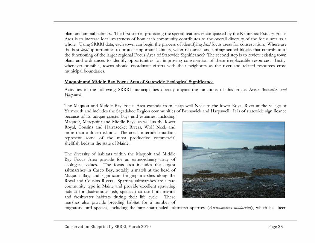
plant and animal habitats. The first step in protecting the special features encompassed by the Kennebec Estuary Focus Area is to increase local awareness of how each community contributes to the overall diversity of the focus area as a whole. Using SRRRI data, each town can begin the process of identifying local focus areas for conservation. Where are the best local opportunities to protect important habitats, water resources and unfragmented blocks that contribute to the functioning of the larger regional Focus Area of Statewide Significance? The second step is to review existing town plans and ordinances to identify opportunities for improving conservation of these irreplaceable resources. Lastly, whenever possible, towns should coordinate efforts with their neighbors as the river and related resources cross municipal boundaries. Maquoit and Middle Bay Focus Area of Statewide Ecological Significance
Activities in the following SRRRI municipalities directly impact the functions of this Focus Area: Brunswick and Harpswell. The Maquoit and Middle Bay Focus Area extends from Harpswell Neck to the lower Royal River at the village of Yarmouth and includes the Sagadahoc Region communities of Brunswick and Harpswell. It is of statewide significance because of its unique coastal bays and estuaries, including Maquoit, Merepoint and Middle Bays, as well as the lower Royal, Cousins and Harraseeket Rivers, Wolf Neck and more than a dozen islands. The area’s intertidal mudflats represent some of the most productive commercial shellfish beds in the state of Maine. The diversity of habitats within the Maquoit and Middle Bay Focus Area provide for an extraordinary array of ecological values. The focus area includes the largest saltmarshes in Casco Bay, notably a marsh at the head of Maquoit Bay, and significant fringing marshes along the Royal and Cousins Rivers. Spartina saltmarshes are a rare community type in Maine and provide excellent spawning habitat for diadromous fish, species that use both marine and freshwater habitats during their life cycle. These marshes also provide breeding habitat for a number of migratory bird species, including the rare sharp-tailed saltmarsh sparrow (Ammodramus caudacutus), which has been
Conservation Blueprint by SRRRI, March 2010 Page 35
documented at the head of Maquoit Bay as well as along the Cousins River. These bays are critically important wintering areas for migratory waterfowl with recorded numbers of American black ducks and Canada geese in the thousands annually. Eelgrass beds occur throughout the focus area, with the largest ones located at the head of Maquoit Bay and the mouth of the Harraseeket River. Others of notable size are located in the upper portion of Middle Bay and at the mouth of the Royal River. Eelgrass beds serve as nursery, habitat and feeding areas for many fish, waterfowl, wading birds, invertebrates and other wildlife, including commercially valuable fish and shellfish. The shallow waters attract anglers from around New England in search of abundant striped bass that utilize eelgrass beds for foraging and shelter. Breeding populations of horseshoe crabs are found in Middle Bay, the eastern shore of Maquoit Bay, as well as the Harraseeket River. The bays support nesting bald eagles, feeding stops for thousands of migratory shorebirds, and sheltered islands for sea bird and heron nesting. Upper Goose Island in Middle Bay supports one of the largest heron rookeries in New England. Similar to the Kennebec Estuary Focus Area, the Maquoit and Middle Bay Focus Area faces intense development pressure. The maintenance of water quality is critical not only for commercial fisheries that depend on this focus area’s resources, but also for the long-term protection of eelgrass beds. Eelgrass beds have declined quickly in southern Maine and New Hampshire where development has caused deterioration in coastal water quality. Non-point runoff reduces light penetration, and excess nutrients that can close shellfish beds can also touch off algal growth that smothers eelgrass leaves. Simple steps to assure there are vegetative buffers along upland tributary streams and to limit excess septic loading and impervious surfaces in the watersheds that drain into the focus area can make a difference to the long-term conservation of this land and water area.
Page 36 Conservation Blueprint by SRRRI, March 2010

APPENDIX B: ALL ABOUT THE SRRRI MAPS
1. A description of the SRRRI mapped data and how it has been analyzed and presented on the maps A subcommittee of the SRRRI Steering Committee developed the town and regional maps. The maps identify areas of regional significance based upon the presence of high value habitat. To conduct the habitat analysis, the mapping committee built a GIS database of regionally significant natural and cultural resources. The committee collected mapped natural resource data including: wetlands, riparian buffers, nesting sites for wading and waterfowl bird species, and locations of threatened and rare plant species. To complement the existing data, the mapping committee identified data gaps and developed additional data for the habitat analysis, including:
Fields: grassland fields were digitized from aerial imagery Buildings: building locations were digitized based upon aerial imagery and then buffered by 250 feet Forest blocks: the large undeveloped forest blocks provided by Beginning with Habitat data were edited to
incorporate the impact of buildings and their buffers Corridors: corridors that reflected likely connections for wildlife between the large blocks were digitized using
BwH maps of undeveloped blocks and aerial imagery The mapping committee, comprised of representatives of municipalities, land trusts, Midcoast Council of Governments, the Nature Conservancy, Maine Audubon, Maine State Planning Office, the state Beginning with Habitat Program and the Environmental Studies Program at Bowdoin College, provided much of the data and secured additional data from the Maine Office of GIS and the Maine Natural Areas Program. Cultural features are not a component of the habitat analysis, but they are included in the SRRRI database and some features are presented on the final maps. The “cultural” features include agricultural soils, trails, conservation land, tax parcels and points of interest such as farms, scenic vistas, and recreational areas, which were identified as regionally significant by local citizens at a 2005 visioning session. The trails layer is not complete. To add additional trails, contact: Eileen Johnson, [email protected].
Conservation Blueprint by SRRRI, March 2010 Page 37
For the habitat analysis, the mapping committee developed a matrix of mapped habitat features, (included below.) Each feature was assigned a numeric rank based on its presence or the quality of its occurrence (i.e. size of field or buffer.) Using ArcGIS mapping software, all habitat features, weighted according to rank, were merged into one single feature, “High Value Habitat”. The ranked habitats are displayed on the town maps. The areas shown to have the highest value habitat are the result of multiple occurrences of habitat features. For the regional map, the “High Value Habitat” data was “clipped” to the boundaries of the “Forest Blocks” and then merged to create a new feature, “Habitat Blocks”. Habitat blocks are ranked considering the high value habitat contained within the block and the associated summarized ranking. The ranking for each habitat feature was multiplied by the acreage of the feature. For example, a coastal riparian buffer with a ranking of two that covers two acres within a block would receive a final score of four. In this way, both the ranking and the proportional area covered by these habitat features within a particular block are captured in the final block analysis. The “Habitat Blocks” shown on the regional map are ranked and symbolized based on this final calculated value. Where to find the SRRRI maps and some data To access the SRRRI maps go to: www.beginningwithhabitat.org/the_maps/status-watersheds.html. Look under Sagadahoc Regional Rural Resource Initiative to find links to each of the town maps and the regional map. Digital data in formats compatible with Google Earth is available through the Beginning with Habitat Program. Contact: 207-287-5254
Page 38 Conservation Blueprint by SRRRI, March 2010

High Value Habitat Ranking Matrix Feature Attributes Rank
5‐30 acres 1 30‐75 acres 2
Fields
75+ acres 3 75 foot buffer 2 Coastal Riparian 250 foot buffer 1
Surface water With 75 foot buffer 1 With 75 foot buffer 1 Wetlands Two types of vegetation or finfish habitat with 250 foot buffer 2 Critically imperiled globally (S1 or G1‐G3) 4 Imperiled or rare (S2, S3 or G4) 2
Rare and exemplary plants and natural communities 250 foot buffer 1 Shellfish 2 Eagle, plover (endangered species)
4
Inland or Coastal Wading Waterfowl or Seabird Islands
2
Anadromous Fish 250 foot buffer 2
Conservation Blueprint by SRRRI, March 2010 Page 39
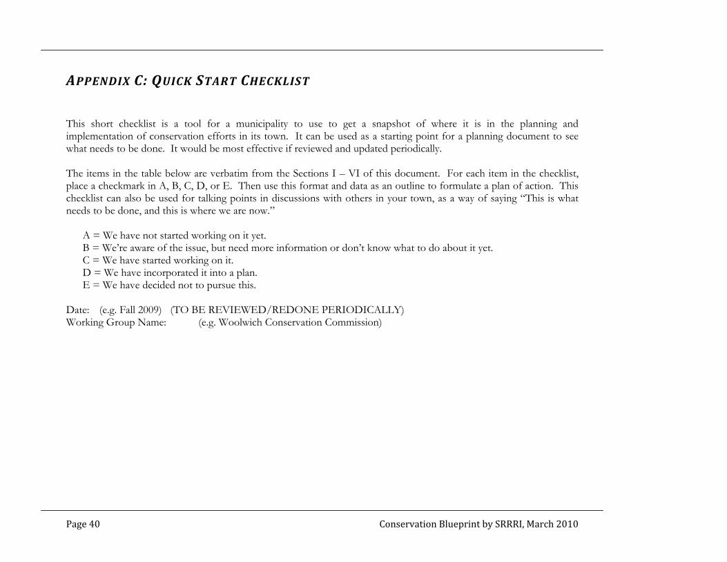
APPENDIX C: QUICK START CHECKLIST
This short checklist is a tool for a municipality to use to get a snapshot of where it is in the planning and implementation of conservation efforts in its town. It can be used as a starting point for a planning document to see what needs to be done. It would be most effective if reviewed and updated periodically. The items in the table below are verbatim from the Sections I – VI of this document. For each item in the checklist, place a checkmark in A, B, C, D, or E. Then use this format and data as an outline to formulate a plan of action. This checklist can also be used for talking points in discussions with others in your town, as a way of saying “This is what needs to be done, and this is where we are now.”
A = We have not started working on it yet. B = We’re aware of the issue, but need more information or don’t know what to do about it yet. C = We have started working on it. D = We have incorporated it into a plan. E = We have decided not to pursue this.
Date: (e.g. Fall 2009) (TO BE REVIEWED/REDONE PERIODICALLY) Working Group Name: (e.g. Woolwich Conservation Commission)
Page 40 Conservation Blueprint by SRRRI, March 2010
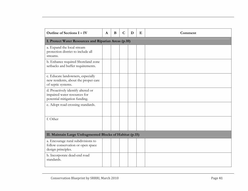
Outline of Sections I – IV A B C D E Comment
I. Protect Water Resources and Riparian Areas (p.10)
a. Expand the local stream protection district to include all streams.
b. Enhance required Shoreland zone setbacks and buffer requirements.
c. Educate landowners, especially new residents, about the proper care of septic systems.
d. Proactively identify altered or impaired water resources for potential mitigation funding.
e. Adopt road crossing standards.
f. Othe r
II. Maintain Large Unfragmented Blocks of Habitat (p.15)
a. Encourage rural subdivisions to follow conservation or open space design principles.
b. Incorporate dead-end road standards.
Conservation Blueprint by SRRRI, March 2010 Page 41

Outline of Sections I – IV A B C D E Comment
c. Assist landowners who do not want to develop, but are faced with growing tax burdens.
d. Other
III. Maintain Connections Between Core Habitat Areas (p.17)
a. Encourage rural subdivisions to follow conservation or open space design principles.
b. Create habitat overlay zones that include performance standards designed to minimize fragmentation.
c. Include aquatic species passage requirements in local road design standards.
d. Other
IV. Protect Habitat for Rare Species and Rare and Exemplary Natural Communities (p.19)
a. Utilize Shoreland Zone Resource Protection allowances to benefit rare species and communities.
b. Specifically include avoidance of habitat for rare species and rare and exemplary natural communities as an element in local development review criteria.
Page 42 Conservation Blueprint by SRRRI, March 2010

Outline of Sections I – IV A B C D E Comment
c. Coordinate efforts with local land trusts to prioritize these habitat types for protection.
d. Encourage landowners with rare element occurrences to take ad-vantage of open space tax program.
e. Oth er
V. Protect Farmland and Support Farmers
a. Engage farmers as business people and landowners when planning any activities to promote and preserve farms.
b. Include sustaining and promoting agriculture as a goal in your local comprehensive plan.
c. Develop and adopt an open space plan that includes farmland protection strategies.
d. Consider how local ordinances could make it easier to farm and adopt changes.
e. Consider techniques less commonly used in Maine to protect farmland, such as impact fees, transfer of development rights variations, and municipal bonding.
Conservation Blueprint by SRRRI, March 2010 Page 43

Outline of Sections I – IV A B C D E Comment
f. Pass a local open space bond or other municipal appropriation that can be used to purchase farms or agricultural easements on farms.
g. Actively promote farmers markets, local food and agricultural products, and build community support of farms.
h. Encourage farmers to serve on local planning and economic devel-opment boards and committees.
i. Partner with the local land trust to reach out to farmland owners.
j. Make connections with various agencies that can offer assistance on farm-related questions.
k. Othe r
VI. Protect, Develop and Maintain Trails
a. Organize a local or regional trail stewardship and planning group.
b. Map existing trails.
Page 44 Conservation Blueprint by SRRRI, March 2010

Conservation Blueprint by SRRRI, March 2010 Page 45
Outline of Sections I – IV A B C D E Comment
c. Hold a public vision session.
d. Develop a local (or regional) trail plan.
e. Create and protect trails through development review.
f. Develop a preliminary long-term trail maintenance budget.
g. Oth er