Coastal Impacts Planning for the Los Angeles Region · 2017-01-05 · Coastal Impacts Planning for...
22
Regional AdaptLA: Coastal Impacts Planning for the Los Angeles Region Results from the Local Coastal Program Sea Level Rise Grant Program Prepared by the University of Southern California Sea Grant Program Executive Summary and Technical Report
Transcript of Coastal Impacts Planning for the Los Angeles Region · 2017-01-05 · Coastal Impacts Planning for...

Regional AdaptLA: Coastal Impacts Planning for the Los Angeles Region
Results from the Local Coastal Program Sea Level Rise Grant Program
Prepared by the University of Southern California Sea Grant Program
Executive Summary and Technical Report

Executive Summary Authors/Editors University of Southern California Sea Grant ProgramPhyllis Grifman Alyssa Newton MannNick Sadrpour
TerraCosta Consulting Group Report AuthorsDr. Reinhard FlickDr. Adam Young
Environmental Science Associates Report AuthorsJames JacksonMatt BrennanBob Battalio
Cover Photo: King tides at the El Segundo Power Plant, November, 2016. Photo Credit: Nick Sadrpour / Urban Tides Community Science Initiative
FundingThis publication has been produced with support from the National Sea Grant College Program, National Oceanic and Atmospheric Administration, U.S. Department of Commerce, under grant number NA14OAR4170089.
The views expressed herein do not necessarily reflect the views of NOAA or any of its sub-agencies. The U.S. Government is authorized to reproduce and distribute copies for governmental purposes. The National Sea Grant Program is a network of 33 university-based programs in coastal and Great Lakes states involving more than 300 institutions nationwide in research, education and the transfer of technology regarding coastal, marine and Great Lakes issues.
Additional funding support provided to the University of Southern California Sea Grant Program by the State Coastal Conservancy, under grant number 13-088.
Publication Number: USCSG-TR-01-2017
Report CitationGrifman, P. M., A. G. Newton Mann, N. Sadrpour. (2016) Regional AdaptLA Executive Summary and Technical Report: Results from the Local Coastal Program Sea Level Rise Grant Program. University of Southern California Sea Grant Program. USCSG-TR-01-2017.
© 2017 University of Southern California Sea Grant Program
Partners & Funders
Coalition
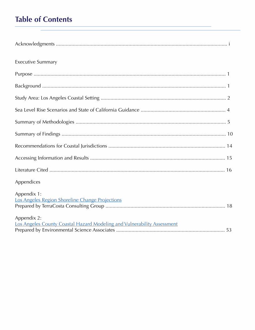
Acknowledgments ........................................................................................................................... i
Executive Summary
Purpose .......................................................................................................................................... 1 Background .................................................................................................................................... 1
Study Area: Los Angeles Coastal Setting .......................................................................................... 2
Sea Level Rise Scenarios and State of California Guidance ............................................................. 4 Summary of Methodologies ............................................................................................................ 5
Summary of Findings ...................................................................................................................... 10
Recommendations for Coastal Jurisdictions .................................................................................... 14
Accessing Information and Results ................................................................................................. 15
Literature Cited .............................................................................................................................. 16
Appendices
Appendix 1: Los Angeles Region Shoreline Change Projections Prepared by TerraCosta Consulting Group ...................................................................................... 18 Appendix 2: Los Angeles County Coastal Hazard Modeling and Vulnerability AssessmentPrepared by Environmental Science Associates .............................................................................. 53
Table of Contents
USC Sea Grant is grateful to the key contributors to this study. Most importantly, we would like to acknowledge the authors who contributed the technical reports: Dr. Reinhard Flick, Dr. AdamYoung, Bob Battalio, Matt Brennan and James Jackson. We would like to thank the whole team atthe City of Santa Monica, including Garrett Wong, Shannon Parry, Dean Kubani, Liz Bar-El, and Cary Fukui. Santa Monica provided an invaluable service to the entire region by serving as grant lead and project managers on this project. We would like to especially acknowledge Dr. Juliette Hart, Director of Outreach at the U.S. Geological Survey’s Pacific Coastal and Marine Science Center and former USC Sea Grant Climate and Marine Science Specialist for her leadership in coordinating the various science and modeling projects that comprise this report. We would also like to thank Dr. Patrick Barnard and the rest of the USGS team for all their work to bring the coastal storm modeling system to Southern California and collaborating closely with the teams from TerraCosta Consulting and Environmental Science Associates to ensure the best available science is available to the L.A. region. Dr. Guangyu Wang, Sarah Sikich, Dana Murray, and Krista Kline served as project partners to get this project off the ground. They provided us with extensive support in coordinating all the coastal cities and the county and numerous other regional stakeholders. Finally, we thank all the participating municipalities and agencies that participated in this grant, including City of Santa Monica, City of El Segundo, City of Hermosa Beach, City of Malibu, City of Redondo Beach, City of Torrance, the Los Angeles County Department of Beaches and Harbors, the South Bay Cities Council of Governments, the Los Angeles Department of Water and Power, the Port of Long Beach, and the Los Angeles World Airports.
Acknowledgments
i
Regional AdaptLA Executive Summary 1
EXECUTIVE SUMMARY
PURPOSE
Regional AdaptLA: Coastal Impacts Planning in the Los Angeles Region is a multi-year project to provide information on the potential impacts of sea level rise to local coastal jurisdictions. In the process, a community of practice on coastal planning is developing in the Los Angeles (L.A.) coastal region. Two science-based projects, developed by the TerraCosta Consulting Group (TCG) and Environmental Science Associates (ESA), modeled shoreline change, coastal erosion and coastal retreat under projected future climate scenarios for the Los Angeles County coast. The University of Southern California (USC) Sea Grant Program has developed this synthesis of the two Regional AdaptLA modeling projects for the benefit of the Regional AdaptLA coalition and stakeholder community. This Executive Summary provides background on the overall project, overviews of the methodologies used to conduct the scientific studies, a summary of major findings, and recommendations for how information provided in these studies can help inform local coastal adaptation planning efforts. This document provides a “bridge” between the technical work by ESA and TCG and the AdaptLA coalition. USC Sea Grant provides capacity building and technical assistance for local jurisdictions as well as coordination among stakeholders and critical government agencies.
For more technical detail, the full reports from the consulting groups can be found at USC Sea Grant’s Regional AdaptLA website: http://dornsife.usc.edu/uscseagrant/adaptla/. A subset of model outputs are available for public access on the Trust for Public Land’s Climate Smart Cities: Los Angeles mapping portal. More information on how to access the portal can be found at the Accessing Information and Results Section.
BACKGROUND
In 2013, Regional AdaptLA, a coalition of coastal municipalities in Los Angeles County, along with a team of support organizations, was established to develop a multisectoral and stakeholder-supported process focused on building capacity for assessing vulnerabilities to coastal change throughout the L.A. region. The goals of this coalition are to strengthen the ability of local jurisdictions to evaluate their vulnerable assets and populations and to begin planning to address the impacts of sea level rise. This coalition was formed following the Sea Level Rise Vulnerability Study conducted by the USC Sea Grant Program in partnership with the City of Los Angeles, which identified the need for regional cooperation in planning for coastal climate impacts.
With leadership from the City of Santa Monica and USC Sea Grant, the region applied for and was awarded $235,000 in state funding from the California Ocean Protection Council (OPC), the Coastal Commission (CCC) and State Coastal Conservancy under the Local Coastal Program Sea Level Rise Grant initiative to develop shoreline change and coastal erosion modeling information for Los Angeles County.

Regional AdaptLA Executive Summary 2
As the agent for the coalition of coastal cities in L.A. County, the City of Santa Monica contracted ESA and TCG to develop state-of-the-art shoreline change, coastal erosion and coastal retreat models under projected future climate scenarios for the Los Angeles County coast. Both organizations have extensive experience working with California coastal communities on sea level rise modeling and stakeholder processes. To support The Nature Conservancy’s Coastal Resilience project, ESA developed coastal hazard assessments for communities in Ventura, Santa Barbara and Monterey; ESA applied a similar approach in Los Angeles. TCG worked extensively in the San Diego region with the US Navy and was a lead participant in the City of L.A. Sea Level Rise Vulnerability Assessment. ESA and TCG coordinated throughout the project, and worked closely with the U.S. Geological Survey (USGS) as it developed an updated version of the Coastal Storm Modeling System (CoSMoS 3.0) for Southern California. USGS shared data and outputs, which were utilized by the ESA and TCG teams for the Regional AdaptLA project. USC Sea Grant facilitated coordination, provided technical assistance for local jurisdictions and conducted stakeholder outreach and training.
THE LOS ANGELES COASTAL SETTING
Figure 1. Reference map of Los Angeles County
Regional AdaptLA Executive Summary 3
The L.A. County coast is characterized by a number of distinct coastal subregions. Each subregion has a unique natural setting and a different history of development and human intervention. As a result, each has a distinct suite of current and future coastal problems and different sensitivities to the effects of future sea level rise. Coastal managers will need to consider different adaptation strategies appropriate for the needs, resources, and culture of each region to ensure these areas remain viable. Malibu to Will Rogers Beach: The coast from the Ventura County line to Will Rogers State Beach is south-facing, backed with steep hillsides, and sand transport from west to east. Ventura County east to Point Dume is characterized by a series of sea cliffs punctuated by private and public development and a relatively wide state beach at Zuma. East of Point Dume to Will Rogers State Beach, the coastline is dominated by oceanfront homes and the Pacific Coast Highway (PCH), fronting the mountainous coast, and beaches are narrow to non-existent, especially during high tides. This coastal section also features heavily used state and county beaches, such as Will Rogers and Topanga State Beaches. PCH through Malibu and Pacific Palisades is the essential coastal transportation and utility corridor; the only alternate route is Highway 101 located north of the Santa Monica Mountain coastal range. Much of Malibu consists of narrow pocket beaches backed by various shore protection revetments protecting PCH. The extent of existing revetments shows that this reach has in the past and continues to experience episodic erosion that threatens to undermine PCH. Santa Monica Bay (Will Rogers State Beach to Redondo Beach): Wider beaches emerge at Will Rogers State Beach and south along the Santa Monica Bay shoreline to Malaga Cove. Will Rogers State Beach is moderately wide owing to a beach groin stabilization system dating from the 1960s. The Santa Monica breakwater located just offshore of Santa Monica pier was built in the 1930s as an unsuccessful attempt to create a small craft harbor, but did lead to a significant increase in beach width and stability. As with the Malibu area beaches, the reach from Santa Monica to Redondo Beach provides major economic benefits from coastal recreation and tourism, boating, and utility and facility siting. These beaches are wide to very wide, largely created by sand supplied as by-products of coastal construction, including Los Angeles International Airport (LAX), Marina Del Rey, and the Hyperion sewage treatment plant. Inland from the Santa Monica Bay beaches, the backshore is comprised of a mix of developed dunes and short cliffs. Palos Verdes to Long Beach: The rocky shore stretching around Palos Verdes to Cabrillo Beach and the L.A. Harbor breakwater is comprised of steep eroding cliffs with little to no beach. The peninsula cliff top is heavily urbanized atop a flat coastal terrace that has a 115 ft high sea cliff. The Palos Verdes section of the Peninsula has a long history of geological instability. Most of the peninsula is exposed to the ocean, while the east-facing section is sheltered behind the L.A.-Long Beach outer breakwater, which has its root at Cabrillo Point. The geologic formations at sea level near Cabrillo Point are relatively more resistant to erosion, while there exists more erodible material to the west toward Point Fermin. East of the Port of Long Beach is the Long Beach/Belmont

Regional AdaptLA Executive Summary 4
Shore area, which is protected by a breakwater system.
SEA LEVEL RISE SCENARIOS AND STATE OF CALIFORNIA GUIDANCE
To select appropriate and consistent sea level rise scenarios and planning horizons for both projects, the full team met internally on multiple occasions and sought guidance from stakeholders and state representatives from the Ocean Protection Council and California Coastal Commission. Through that process, the team selected planning horizons of 2030, 2050 and 2100, with the medium and high sea level rise projections outlined in the adopted Coastal Commission Sea Level Rise Policy Guidance, which is based on the National Research Council’s 2012 study, Sea-Level Rise for the Coasts of California, Oregon and Washington. In addition to these two sea level rise scenarios, the team determined that the study would also address an “extreme” scenario, based on a 2016 study conducted by researchers at the Scripps Institute of Oceanography (SIO) as part of California’s ongoing Fourth Climate Assessment (Cayan et al. 2016).
The State of California is also currently updating its guidance to reflect the latest climate change science. This science suggests the rate of ice sheet melting in Antarctica may be greater than previously expected (DeConto and Pollard, 2016, Hansen et al. 2016). While formal guidance from the State has not yet emerged, the project team decided, in close consultation with state agencies, that including discussion of potential higher sea level rise scenarios will be beneficial to local municipalities. The low scenario outlined in the National Research Council’s report was not considered in these studies, since the latest science suggests that the low scenario is unlikely given current emissions and sea level rise trends (Pollard et al. 2015, Kopp et al. 2014).
Figure 2, provides an overview of sea level rise projections for the selected planning horizons that were used in both the ESA and TCG studies. These projections are also displayed graphically in Figure 3.
* Based on projected (for Medium scenario) and upper limit (for High scenarios) values for Los Angeles in Table5.3 of NRC (2012)** Based on 99.9th percentile for Representative Concentration Pathway 8.5 from Cayan et al. (2016)
Figure 2. ESA and TCG sea level rise projections.

Regional AdaptLA Executive Summary 5
SUMMARY OF METHODOLOGIES
Due to the science developed as part of the Regional AdaptLA program, coastal municipalities now have access to a suite of sophisticated and complementary sea level rise, coastal storm, shoreline evolution and coastal hazard projections. This work has been conducted by USGS, ESA and TCG. While detailed technical reports are available, below we provide a high level overview of the modeling methodologies.
ESA assessed flooding hazards along the entire Los Angeles County coastline and erosion hazards along the entire L.A. County coastline except the Ports of Los Angeles and Long Beach, because of the heavily managed nature of shoreline within the ports. The TCG study modeled shoreline change projections for the coastal reach from Point Dume in Malibu to Malaga Cove in Redondo Beach.
USGS Coastal Storm Modeling System (CoSMoS) The USGS has conducted a sea level rise, coastal storm and shoreline evolution modeling study for all of Southern California, including L.A. County, through the update of its Coastal Storm Modeling System (CoSMoS 3.0). ESA and TCG used the USGS modeled hindcast (1980-2011) and forecast (2012-2100) wave and water level predictions at nearshore locations (USGS model
Source: NRC 2012 Table 5.3; CCC 2015 Equation B3; Cayan 2016.
Figure 3. Sea level rise scenario projections (red=medium, green=high) used in the coastal change modeling and (blue=extreme) used only for discussion purposes (see ESA report).
Regional AdaptLA Executive Summary 6
output points) at three-hour time intervals as forcing for their modeling. The shoreline results from the CoSMoS modeling effort are not described in this executive summary. Please see the Accessing Information and Results Section for more information.
ESA: Coastal Hazard Assessments
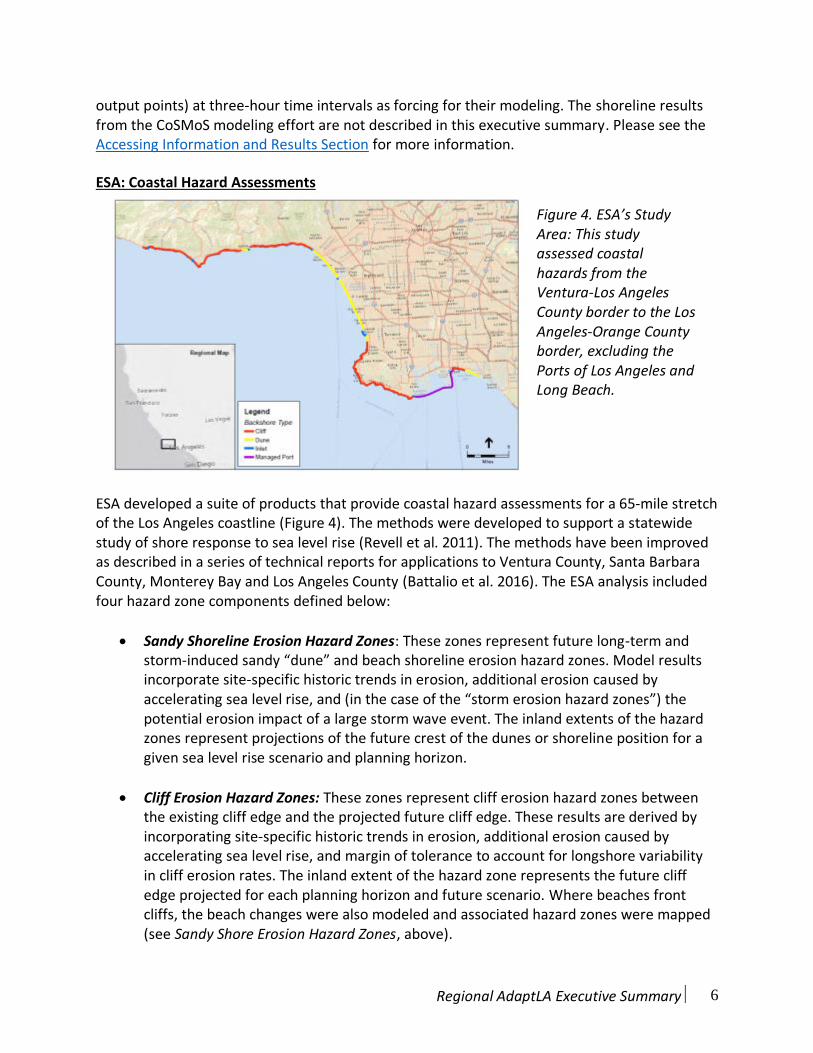
ESA developed a suite of products that provide coastal hazard assessments for a 65-mile stretch of the Los Angeles coastline (Figure 4). The methods were developed to support a statewide study of shore response to sea level rise (Revell et al. 2011). The methods have been improved as described in a series of technical reports for applications to Ventura County, Santa Barbara County, Monterey Bay and Los Angeles County (Battalio et al. 2016). The ESA analysis included four hazard zone components defined below:
Sandy Shoreline Erosion Hazard Zones: These zones represent future long-term andstorm-induced sandy “dune” and beach shoreline erosion hazard zones. Model resultsincorporate site-specific historic trends in erosion, additional erosion caused byaccelerating sea level rise, and (in the case of the “storm erosion hazard zones”) thepotential erosion impact of a large storm wave event. The inland extents of the hazardzones represent projections of the future crest of the dunes or shoreline position for agiven sea level rise scenario and planning horizon.
Cliff Erosion Hazard Zones: These zones represent cliff erosion hazard zones betweenthe existing cliff edge and the projected future cliff edge. These results are derived byincorporating site-specific historic trends in erosion, additional erosion caused byaccelerating sea level rise, and margin of tolerance to account for longshore variabilityin cliff erosion rates. The inland extent of the hazard zone represents the future cliffedge projected for each planning horizon and future scenario. Where beaches frontcliffs, the beach changes were also modeled and associated hazard zones were mapped(see Sandy Shore Erosion Hazard Zones, above).
Figure 4. ESA’s Study Area: This study assessed coastal hazards from the Ventura-Los Angeles County border to the Los Angeles-Orange County border, excluding the Ports of Los Angeles and Long Beach.

Regional AdaptLA Executive Summary 7
Coastal Storm Flood Hazard Zones: These hazard zones depict flooding that may becaused by a coastal storm and considers a suite of coastal processes, with theseprocesses exacerbated by future sea level rise. These hazard zones do not considerupland fluvial (river) flooding and local rain/run-off drainage, which likely play a largepart in coastal flooding, especially around coastal confluences where the creeks meetthe ocean. The processes included in the hazard zones are:
1. Elevated ocean levels due to climate effects (e.g. elevated water levels during ElNiño phases) and storm surge (a rise in the ocean water level caused primarily bywinds and pressure changes during a storm).
2. Wave runup, including wave setup and waves running up over the beach andcoastal property (calculated using the computed 100-year total water levels).
3. Extreme lagoon water levels, which can occur when lagoons fill up when themouths are closed (using maximum potential beach berm elevations).
Extreme Monthly Tidal Flooding Hazard Zones: These zones show the area and depthof flooding caused by the effect of rising sea level on the astronomic tides (notconsidering storms, erosion, or river discharge). The water level mapped in theseflooding areas is the Extreme Monthly High Water (EMHW) level, which is a high waterlevel that is occurs approximately once a month. These zones do not, however, considercoastal erosion or wave overtopping, which may increase the extent and depth ofregular tidal flooding in the future.
For each section of coast, ESA mapped lines indicating the shoreline (i.e., the waterline) and the backshore (where the beach meets coastal structures such as roads or structures). The margin between the shoreline and backshore line delineates the width of the beach. However, the erosion hazard zones are primarily organized by sandy shoreline and cliff edge, as described above. Two future sea level rise scenarios (medium and high) were assessed at 2030, 2050, and 2100 for each type of hazard. In addition, an extreme scenario was considered, where the projection for 2080 is equivalent to the projection for the high scenario at 2100 (see Figure 3).

Regional AdaptLA Executive Summary 8
TCG modeled projected coastal change to year 2100 relative to 2000 for a range of mean sea level rise scenarios consistent with the current but evolving State of California guidance (see above) and the sea level rise scenarios utilized by ESA. TCG modeled both short-term wave-driven future shoreline position changes as well as long-term sea level rise-driven future shoreline changes from Point Dume to Malaga Cove, Redondo Beach (Figure 5).
Short-term Wave-driven Shoreline Position Change: On the California coast, short-term(day-to-day to seasonal duration) shoreline position changes are driven by waveconditions. Two directions of sand transport are important: cross-shore and longshore.Both of these processes were modeled separately using existing techniques published inthe peer-reviewed scientific literature and described in the technical report. TCGmodeled 1) time series of daily shoreline position changes associated with short-termwave-driven cross-shore sand transport, and 2) time series of longshore sand transport.
Long-term Sea Level Rise-Driven Future Shoreline Position Change: Changes in long-term (100-year) shoreline position were estimated using the Conditionally DecoupledProfile Model (Young et al., 2014), which estimates shoreline retreat considering sealevel rise using a sand balance approach. The model conditionally accounts for beachand backshore retreat to occur while maintaining coastal system sand equilibrium.
Spatial Aggregation of ESA and TCG Modeling Results A set of simple layers were developed to easily visualize the range of hazard outcomes from all of ESA’s and TCG’s scenarios, a total of 38 scenarios. Existing conditions and all planning horizons (2030, 2050, 2100) hazard zones were overlaid to identify a location’s hazard exposure
Figure 5. TCG’s Study Area: This study modeled shoreline change projections and was geographically limited to the coastal reach from Point Dume in Malibu to Malaga Cove in Redondo Beach. Yellow dots represent model output point (MOP) transects.
TCG: L.A. Region Shoreline Change Projections
Regional AdaptLA Executive Summary 9
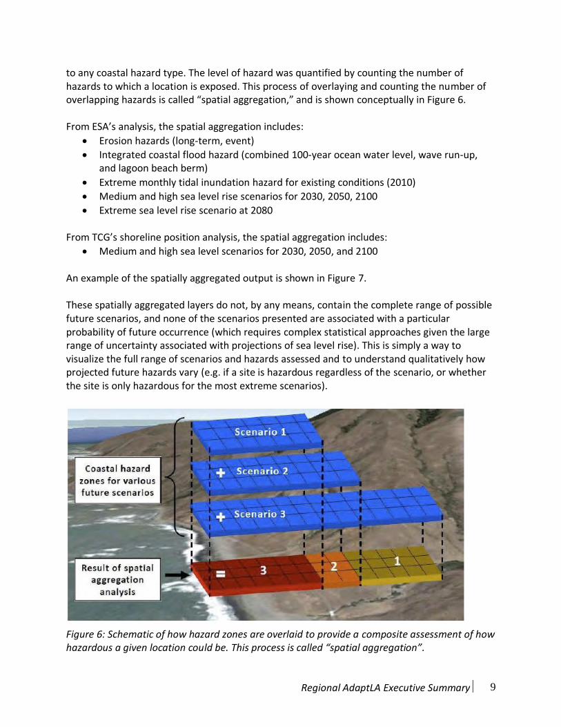
to any coastal hazard type. The level of hazard was quantified by counting the number of hazards to which a location is exposed. This process of overlaying and counting the number of overlapping hazards is called “spatial aggregation,” and is shown conceptually in Figure 6.
From ESA’s analysis, the spatial aggregation includes:
Erosion hazards (long-term, event)
Integrated coastal flood hazard (combined 100-year ocean water level, wave run-up,and lagoon beach berm)
Extreme monthly tidal inundation hazard for existing conditions (2010)
Medium and high sea level rise scenarios for 2030, 2050, 2100
Extreme sea level rise scenario at 2080
From TCG’s shoreline position analysis, the spatial aggregation includes:
Medium and high sea level scenarios for 2030, 2050, and 2100
An example of the spatially aggregated output is shown in Figure 7.
These spatially aggregated layers do not, by any means, contain the complete range of possible future scenarios, and none of the scenarios presented are associated with a particular probability of future occurrence (which requires complex statistical approaches given the large range of uncertainty associated with projections of sea level rise). This is simply a way to visualize the full range of scenarios and hazards assessed and to understand qualitatively how projected future hazards vary (e.g. if a site is hazardous regardless of the scenario, or whether the site is only hazardous for the most extreme scenarios).
Figure 6: Schematic of how hazard zones are overlaid to provide a composite assessment of how hazardous a given location could be. This process is called “spatial aggregation”.

Regional AdaptLA Executive Summary 10
Figure 7: An example of the spatial aggregation map for the northern stretch of Santa Monica. Warmer colors (reds, oranges, yellows) indicate areas where most of the model projections overlap, indicating these locations are most “hazardous,” or most vulnerable to coastal erosion and flooding.
SUMMARY OF FINDINGS
Shoreline Change Projections - Major Findings:
ESA’s and TCG’s shoreline change projections show similarity of hazard extents across thesuite of scenarios.
Owing to the relatively wide and stable existing beaches, troublesome levels of modeledbeach retreat are unlikely to occur before 2050 in and south of Santa Monica, even whenthe high 1.67 m (5.5 ft) rise by 2100 trajectory is combined with maximum plausible levelsof temporary storm erosion.
In Malibu, both low and high sea level rise scenarios suggest that long segments of beachwill essentially disappear by 2030. Cliff retreat will be a simultaneous hazard in this area,particularly for areas that are not armored. However, for armored sections, maintainingbeach width will be a difficult task.
By late this century, and assuming the high sea level rise scenario, beach retreat will beobvious everywhere. This may lead to economic losses due to reduced beach width forrecreation, but also due to occasional flooding of coastal facilities and related damages.
ESA projections for cliff shorelines without significant beaches indicate progressivelyincreasing exposure of property and assets at rates greater than experienced historically.(Discussed in the vulnerability summary, below).
Regional AdaptLA Executive Summary 11
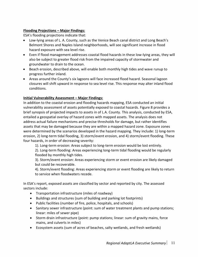
Flooding Projections – Major Findings: ESA’s flooding projections indicate that:
Low-lying areas of L. A. County, such as the Venice Beach canal district and Long Beach’sBelmont Shores and Naples Island neighborhoods, will see significant increase in floodhazard exposure with sea level rise.
Even if flood management addresses coastal flood hazards in these low-lying areas, they willalso be subject to greater flood risk from the impaired capacity of stormwater andgroundwater to drain to the ocean.
Beach erosion, described above, will enable both monthly high tides and wave runup toprogress further inland.
Areas around the County’s six lagoons will face increased flood hazard. Seasonal lagoonclosures will shift upward in response to sea level rise. This response may alter inland floodconditions.
Initial Vulnerability Assessment – Major Findings: In addition to the coastal erosion and flooding hazards mapping, ESA conducted an initial vulnerability assessment of assets potentially exposed to coastal hazards. Figure 8 provides a brief synopsis of projected impacts to assets in of L.A. County. This analysis, conducted by ESA, entailed a geospatial overlay of hazard zones with mapped assets. The analysis does not address actual failure mechanisms and precise thresholds for damage, but rather identifies assets that may be damaged because they are within a mapped hazard zone. Exposure zones were determined by the scenarios developed in the hazard mapping. They include: 1) long-term erosion, 2) long-term tidal flooding, 3) storm/event erosion, and 4) storm/event flooding. These four hazards, in order of decreasing severity:
1). Long-term erosion: Areas subject to long-term erosion would be lost entirely. 2). Long-term flooding: Areas experiencing long-term tidal flooding would be regularly flooded by monthly high tides. 3). Storm/event erosion: Areas experiencing storm or event erosion are likely damaged but could be recoverable. 4). Storm/event flooding: Areas experiencing storm or event flooding are likely to return to service when floodwaters recede.
In ESA’s report, exposed assets are classified by sector and reported by city. The assessed sectors include:
Transportation infrastructure (miles of roadway)
Buildings and structures (sum of building and parking lot footprints)
Public facilities (number of fire, police, hospitals, and schools)
Sanitary sewer infrastructure (point: sum of water treatment plants and pump stations;linear: miles of sewer pipe)
Storm drain infrastructure (point: pump stations; linear: sum of gravity mains, forcemains, and culverts in miles)
Ecosystem assets (sum of acres of beaches, salty wetlands, and fresh wetlands)

Regional AdaptLA Executive Summary 12
Figure 8: Assessment of projected impacts to various assets for all of L.A. County for medium and high sea level rise scenarios. The percent increase in exposure for each asset sector is provided relative to the miles, number, or acres using existing conditions of 2010 as a base. For instance, exposed transportation assets in L.A. County during Storm Flooding will increase by 140% (an increase of 136 miles, from 97.3 to 233 miles) compared to 2010 under the medium sea level rise (3 ft) by 2100.
The following table highlights some major findings of the vulnerability assessment. While impacts to each sector are illustrated with a time horizon, it will be important for coastal managers to develop adaptive approaches, such as thresholds or triggers that when reached will elicit an adaptation implementation response (CCC 2015). Planning that includes more flexibility will greatly reduce any temporary or permanent loss of service of critical infrastructure.

Regional AdaptLA Executive Summary 13
Transportation Infrastructure
PCH represents a “cross cutting” vulnerability; it acts as amain artery for the coastal communities in L.A. County. Ifdamaged and experiences a significant loss of service,transportation along coast would be impacted.
Under the 5.5’ by 2100 scenario, L.A. County could see143 miles of roadway or bikeway impacted by 2030, and327 miles by 2100 during a 100-year storm event.
Buildings and Structures Long Beach has the most buildings and structures exposed
in a 100-year storm hazard event. By 2050 (under the 5.5’by 2100 scenario), nearly half of the structures exposed inL.A. County are in Long Beach (7,617 out of 14,705).
Malibu has the most buildings and structures exposedunder the long-term erosion hazard, with 1,136 unitsexposed out of 1,591 across the county by 2050 (underthe 5.5’ scenario by 2100).
Public Facilities L.A. County will have 11 fire stations, 2 police stations,
and 9 schools vulnerable to a 100-year storm hazardevent under the 5.5’ by 2100 scenario.
Sanitary Sewer and Storm Drain Infrastructure
Under the 5.5’ scenario by 2100, 21 water treatmentplants and pump stations across L.A. County could beimpacted by 2100 under the long-term erosion hazardand the 100-year storm event.
Hyperion Water Reclamation Plant is elevated and setback from the ocean, so it is not exposed to any of thehazards on the time horizons addressed in this study;however, because much of the county depends on it forthe wastewater treatment, it should be considered in anyadaptation plans developed by the county. In addition,the current assessment only looks at surface impacts.Coastal storms, flooding, and/or erosion may affectunderground infrastructure and thus the operationalcapacity of the facility.
19 storm drain pump stations in Long Beach, and 11 in theCity of Los Angles would be vulnerable to a 100-yearstorm hazard event under the 5.5’ by 2100 scenario.
Asset Sector Major Findings
Regional AdaptLA Executive Summary 14
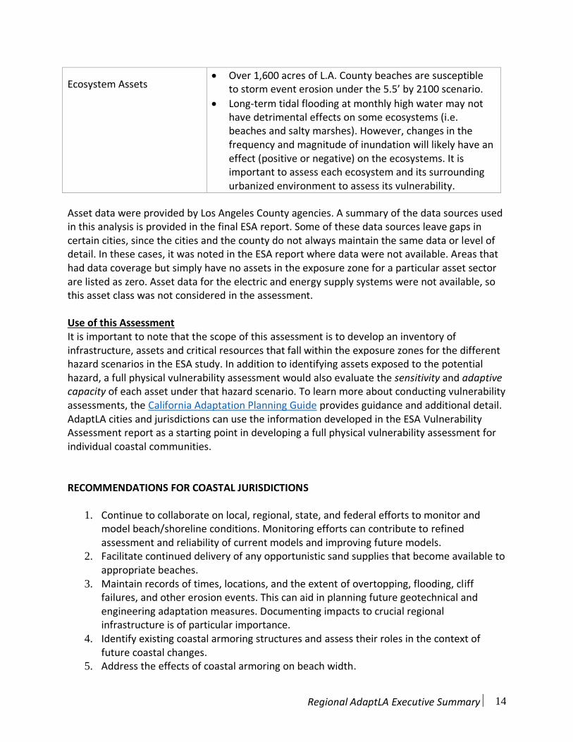
Ecosystem Assets Over 1,600 acres of L.A. County beaches are susceptible
to storm event erosion under the 5.5’ by 2100 scenario.
Long-term tidal flooding at monthly high water may nothave detrimental effects on some ecosystems (i.e.beaches and salty marshes). However, changes in thefrequency and magnitude of inundation will likely have aneffect (positive or negative) on the ecosystems. It isimportant to assess each ecosystem and its surroundingurbanized environment to assess its vulnerability.
Asset data were provided by Los Angeles County agencies. A summary of the data sources used in this analysis is provided in the final ESA report. Some of these data sources leave gaps in certain cities, since the cities and the county do not always maintain the same data or level of detail. In these cases, it was noted in the ESA report where data were not available. Areas that had data coverage but simply have no assets in the exposure zone for a particular asset sector are listed as zero. Asset data for the electric and energy supply systems were not available, so this asset class was not considered in the assessment.
Use of this Assessment It is important to note that the scope of this assessment is to develop an inventory of infrastructure, assets and critical resources that fall within the exposure zones for the different hazard scenarios in the ESA study. In addition to identifying assets exposed to the potential hazard, a full physical vulnerability assessment would also evaluate the sensitivity and adaptive capacity of each asset under that hazard scenario. To learn more about conducting vulnerability assessments, the California Adaptation Planning Guide provides guidance and additional detail. AdaptLA cities and jurisdictions can use the information developed in the ESA Vulnerability Assessment report as a starting point in developing a full physical vulnerability assessment for individual coastal communities.
RECOMMENDATIONS FOR COASTAL JURISDICTIONS
1. Continue to collaborate on local, regional, state, and federal efforts to monitor andmodel beach/shoreline conditions. Monitoring efforts can contribute to refinedassessment and reliability of current models and improving future models.
2. Facilitate continued delivery of any opportunistic sand supplies that become available toappropriate beaches.
3. Maintain records of times, locations, and the extent of overtopping, flooding, clifffailures, and other erosion events. This can aid in planning future geotechnical andengineering adaptation measures. Documenting impacts to crucial regionalinfrastructure is of particular importance.
4. Identify existing coastal armoring structures and assess their roles in the context offuture coastal changes.
5. Address the effects of coastal armoring on beach width.
Regional AdaptLA Executive Summary 15
6. Consider the combined impact of areas potentially affected by both sea level rise andwatershed runoff to creeks and rivers. Special attention is recommended for areasadjacent and tributary to coastal lagoons. In these areas flooding is set by the beachberm during closed conditions and elevated exposure and vulnerability are likely givenprojected future conditions.
7. Improve asset inventory to support a more detailed vulnerability assessment andsupport modeling the implications of adaptation scenarios.
ACCESSING INFORMATION AND RESULTS
All of the hazard projections from both ESA and TCG are available as shapefiles for use in Geospacial Information Systems (GIS). USC Sea Grant provides a repository of these shapefiles on its webpage: http://dornsife.usc.edu/uscseagrant/adaptla/. A small subset of the results is also available to view on the Trust for Public Lands Climate Smart Cities: Los Angeles web viewer. This viewer will be updated in summer 2017 to include a broader range of hazard projections and the updated CoSMoS 3.0 So Cal model results. This will allow users to easily compare model projections. This viewer also includes other climate impacts and provides tools that help the user analyze multiple types of vulnerabilities at once. Users of this web tool can therefore assess their vulnerability to a number of climate impacts in addition to coastal hazards. While access to this viewer is open to anyone interested, the Trust for Public Lands still requires a username and password. Interested users can access the viewer at website listed below with the AdaptLA username and passcode. You can also contact USC Sea Grant or can reach out directly to the Trust for Public Land [[email protected]] with any questions.
ESA and TCG Data and Webtool Webtool - Climate Smart Cities: Los Angeles The Trust for Public Land http://web.tplgis.org/losangeles_csc/
Username: AdaptLa Passcode: AdaptLaPass123
AdaptLA Webpage: Final Reports and Shapefiles http://dornsife.usc.edu/uscseagrant/adaptla/
USGS CoSMoS Data and Webtool Webtool – Our Coast Our Future Developed by Point Blue Conservation Science ourcoastourfuture.org
USGS ScienceBase Website: CoSMoS Technical Reports and Shapefiles https://walrus.wr.usgs.gov/coastal_processes/cosmos/socal3.0/index.html
Regional AdaptLA Executive Summary 16
LITERATURE CITED
Battalio, R. T., P. D. Bromirski, D. R. Cayan, L. A. White (2016). Relating Future Coastal Conditions to Existing FEMA Flood Hazard Maps: Technical Methods Manual, Prepared for California Department of Water Resources and California Ocean Science Trust, Prepared by Environmental Science Associates (ESA), pp. 114.
Cayan, D. R., J. Kalansky, S. Iacobellis, D. Pierce, and R. Kopp Kopp. (2016). Creating Probabilistic Sea Level Rise Projections to support the 4th California Climate Assessment. Prepared for the California Energy Commission.
California Coastal Commission (CCC). (2015). California Coastal Commission Sea Level Rise Policy Guidance: Interpretive Guidelines for Addressing Sea Level Rise in Local Coastal Programs and Coastal Development Permits, 293 pp.
DeConto and Pollard, 2016. Contribution of Antarctica to past and future sea-level rise, Nature 531, 591-597
Grifman, P. M., J. F. Hart, J. Ladwig, A. G. Newton Mann, M. Schulhof. (2013). Sea Level Rise Vulnerability Study for the City of Los Angeles. USCSG-TR-05-2013.
Hansen J, M. Sato, P. Hearty, R. Ruedy, M. Kelley, V. Masson-Delmotte, G. Russell, G. Tselioudis, J. Cao, E. Rignot, I. Velicogna, B. Tormey, B. Donovan, E. Kandiano, K. von Schuckmann, P.Kharecha, A. Legrande, M. Bauer, and K.W. Lo. (2016). Ice melt, sea level rise and superstorms:evidence from paleoclimate data, climate modeling, and modern observations that 2 ◦C globalwarming could be dangerous. Atmos. Chem. Phys., 16, 3761–3812, 2016
Kopp, R.E., R.M. Horton, C.M. Little, J.X. Mitrovica, M. Oppenheimer, D.J. Rasmussen, B.H. Strauss, and C. Tebaldi, 2014. Probabilistic 21st and 22nd century sea-level projections at a global network of tide-gauge sites, Earths Future, 2, 383-406.
National Research Council (NRC). (2012). Sea-Level Rise for the Coasts of California, Oregon, and Washington: Past, Present, and Future. Prepublication. National Academy Press: Washington, D.C.
Pollard, D., DeConto, R. M., and Alley, R. B. (2015). Potential Antarctic ice sheet retreat driven by hydrofracturing and ice cliff failure, Earth Planet. Sc. Lett., 412, 112–121.
Revell, D.L., Battalio, B., Spear, B., Ruggiero, P, and Vandever, J. A Methodology for Predicting Future Coastal Hazards due to Sea level Rise on the California Coast. Journal of Climatic Change (2011) B.V. 2011 109 (Suppl 1):S251–S276, DOI 10.1007/s10584-011-0315-2, 10 December 2011 # Springer Science+Business Media.

Regional AdaptLA Executive Summary 17
Young, A.P., R.E. Flick, W.C. O’Reilly, D.B. Chadwick, R.T. Guza, W.C. Crampton, and J.J. Helly, 2014. Estimating cliff retreat in southern California considering sea level rise using a sand balance approach, Mar. Geology, 348, 15-2.

University of Southern California Sea Grant Technical Report USCSG-TR-01-2017