Chapter 18
114
Chapter 18 Moisture, Clouds, and Precipitation
description
Transcript of Chapter 18

Chapter 18
Moisture, Clouds, and Precipitation

Water in the Atmosphere
Water vapor is the source of all condensation and precipitation, which is any form of water that falls from a cloud.
When understanding atmospheric processes, water vapor is the most important gas in the atmosphere.
Atmospheric water vapor varies form 0-4% by volume.
Water’s Changes of State
Its actually is a resident of OhioStupid humor…hehehehehheheehe
Water can exist in all three states of matter at temperatures and pressures that exist on Earth.
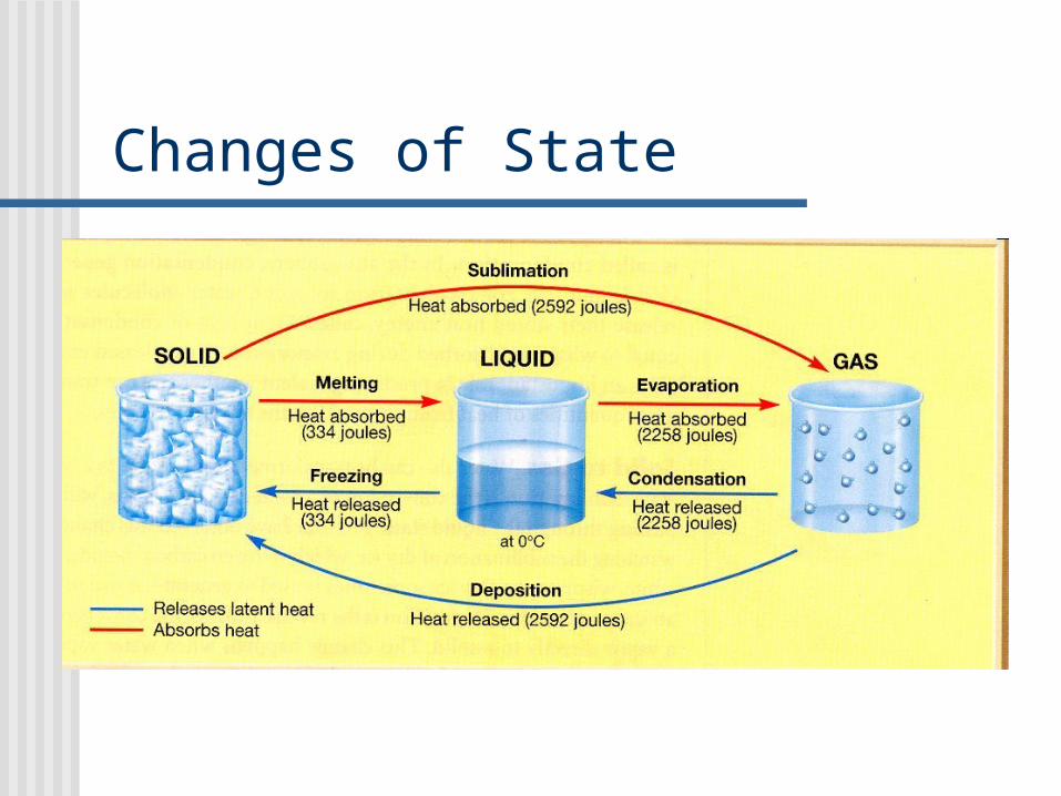
Changes of State

The Water Cycle
The water cycle begins with evaporation, then water condenses, precipitation occurs, and finally water either becomes runoff or ground water.
If all the water in the atmosphere were to fall as precipitation it would only be 2mm deep.

Water cycle
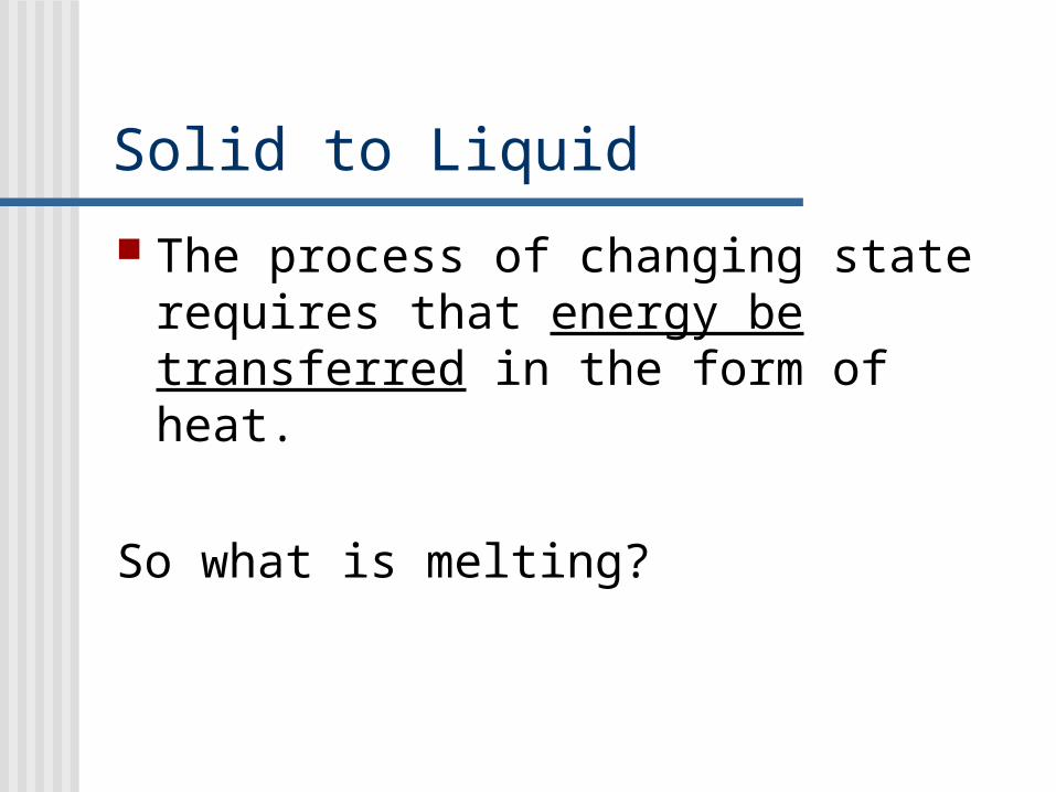
Solid to Liquid
The process of changing state requires that energy be transferred in the form of heat.
So what is melting?

“Hidden Heat” When heat is transferred to a glass of ice water,
the temperature of the ice water remains a constant 00C….until all the ice has melted.
If adding heat does not raise the temperature, then where does the heat go?
In this case, the added heat breaks apart the crystal structure of the ice cubes. The bonds between the ice crystals are broken forming liquid water. This is called melting.
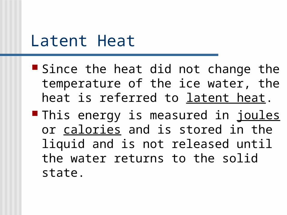
Latent Heat
Since the heat did not change the temperature of the ice water, the heat is referred to latent heat.
This energy is measured in joules or calories and is stored in the liquid and is not released until the water returns to the solid state.
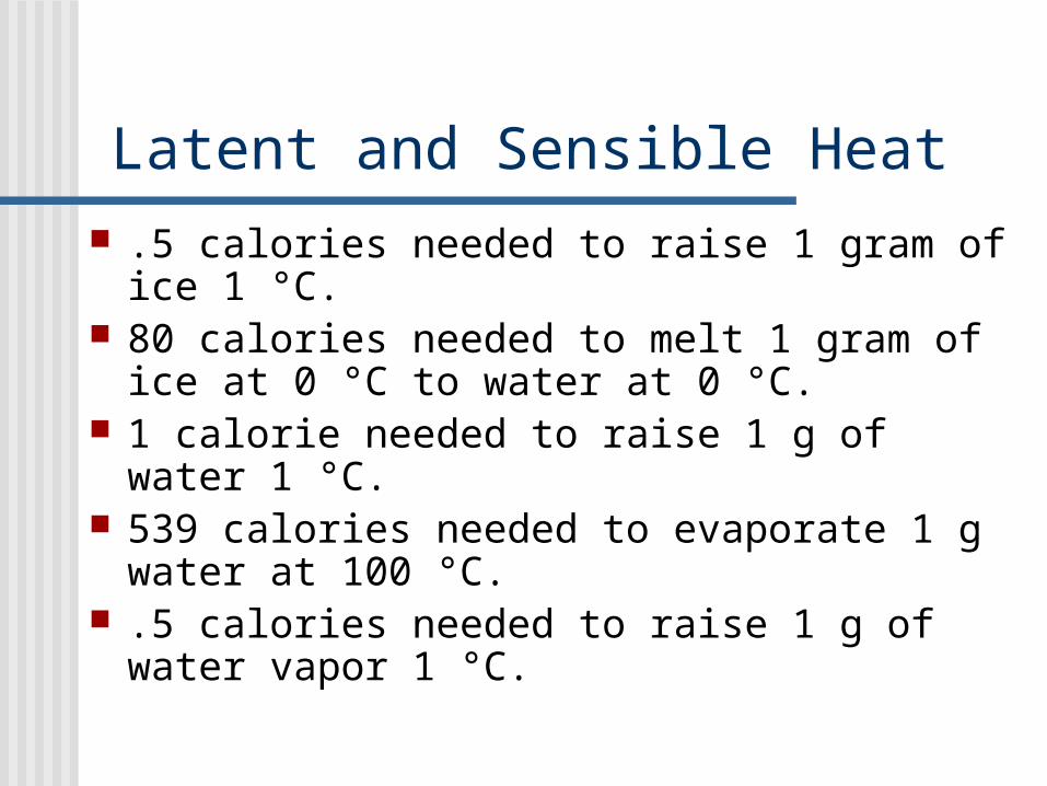
Latent and Sensible Heat .5 calories needed to raise 1 gram of ice 1
°C. 80 calories needed to melt 1 gram of ice at
0 °C to water at 0 °C. 1 calorie needed to raise 1 g of water 1 °C. 539 calories needed to evaporate 1 g water
at 100 °C. .5 calories needed to raise 1 g of water
vapor 1 °C.

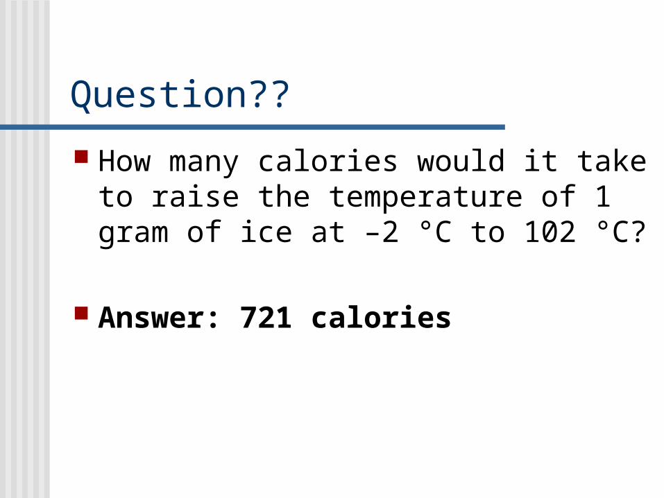
Question??
How many calories would it take to raise the temperature of 1 gram of ice at –2 °C to 102 °C?
Answer: 721 calories

Importance of Latent Heat
Latent heat is important in the formation of tall cumulus clouds, and is an energy source for thunderstorms, tornadoes, and hurricanes.

Liquid to Gas The process that changes liquid to gas is called
evaporation. The 2258 joules of energy provides enough
motion to allow one gram of water to escape the surface and become a gas.
Example: Stepping from a swimming pool feels cool because the heat from your body causes evaporation to occur. Therefore, evaporation is a cooling process.

Condensation When water changes from a gas to a
liquid condensation occurs. For condensation to occur molecules must release their stored energy or latent heat.
This energy is equal to the amount of energy absorbed during evaporation. How many calories or joules per gram??
Examples include: fog and cloud formation

Solid to Gas Sublimation is the conversion from a solid
to directly to a gas, without passing through the liquid state.
Examples: dry ice or carbon dioxide ice as in fire extinguishers. On occasion crystal-like frost can go through the same process.
Deposition is the reverse process, the conversion of a gas directly to a solid.
Example: When frost forms on cold objects like grass or car windows
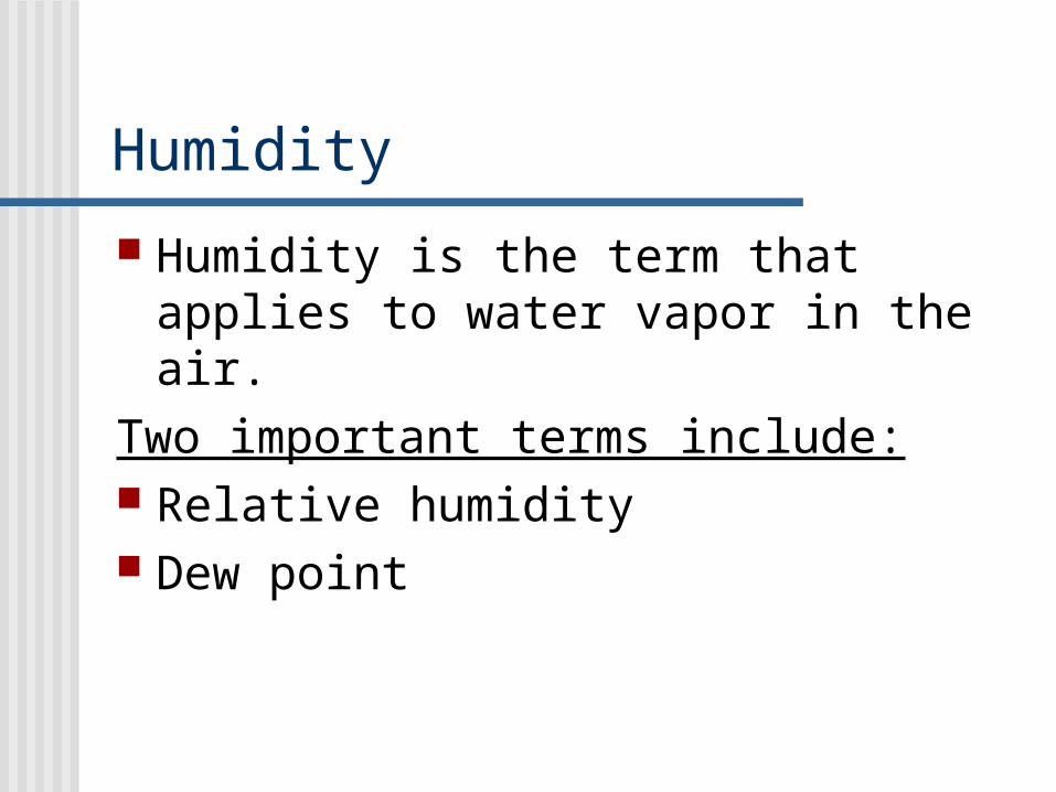
Humidity
Humidity is the term that applies to water vapor in the air.
Two important terms include: Relative humidity Dew point

Saturation
As water molecules escape the surface and are added to the air, the pressure in the air increases.
This forces water molecules to return to the liquid state.
Eventually, the number of water molecules returning to the surface will balance the number leaving.

Saturation
At this point the air is said to be saturated.
The amount of water vapor required for saturation depends upon temperature.
When saturated, warm air contains more water vapor than cool air.

Relative Humidity
Is the ratio of the air’s actual water vapor content compared to the amount of water vapor the air can hold at that temperature and pressure.
Relative humidity indicates how close the air is to saturation.
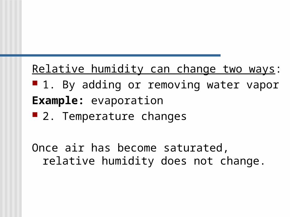
Relative humidity can change two ways: 1. By adding or removing water vaporExample: evaporation 2. Temperature changes
Once air has become saturated, relative humidity does not change.

Condensation and Cloud Formation
Cooling the air causes condensation, which keeps air at its saturation level for that temperature.
Condensation above the Earth’s surface causes cloud formation.
Water droplets forming clouds are no longer part of the water vapor content of the air.

Lets Summarize
When the water vapor content of the air remains constant, lowering the temperature causes an increase in relative humidity.
And raising the air temperature causes a decrease in relative humidity.

Dew Point
Dew point is the temperature to which a parcel of air would need to be cooled to reach saturation.
During evening hours, an object near the ground often cool below the dew point temperature and becomes coated with water or dew.

Temp. vs. Saturation
For every 100C increase in temperature, the amount of water vapor needed for saturation doubles.
00C saturated air contains about half the water vapor as saturated air at100C.
00C saturated air contains about 1/4th the water vapor as saturated air at 200C.
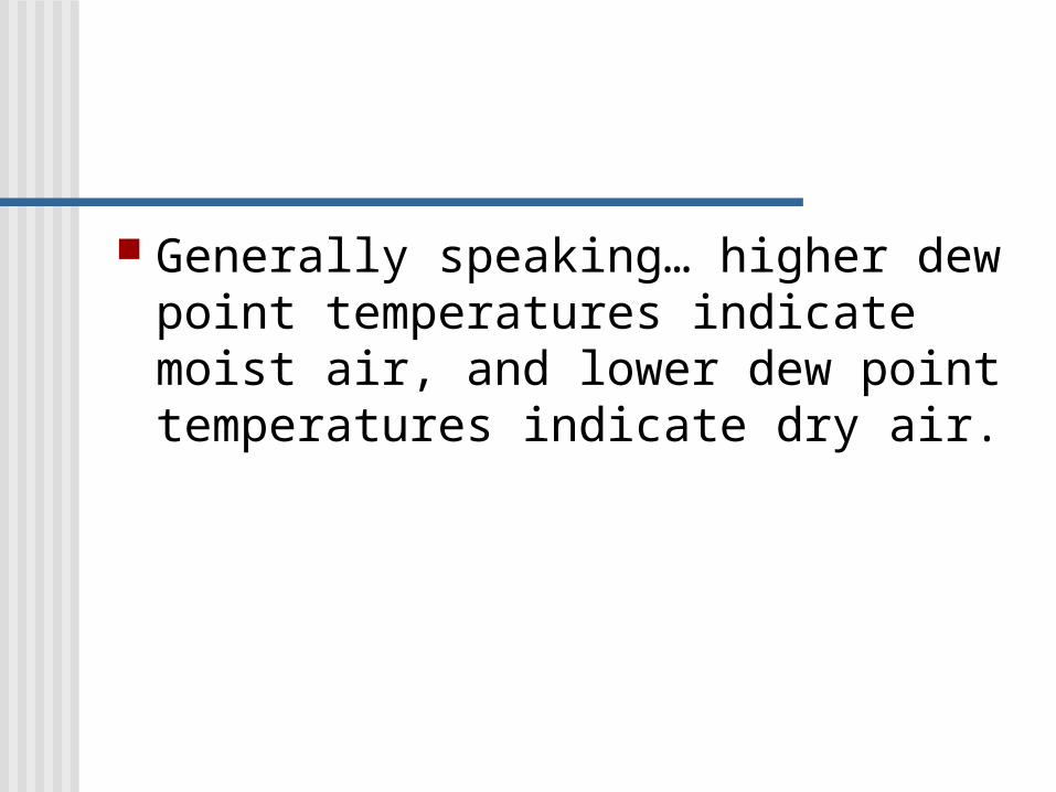
Generally speaking… higher dew point temperatures indicate moist air, and lower dew point temperatures indicate dry air.

Measuring Humidity
A hygrometer is generally used to measure relative humidity. One type of hygrometer is a psychrometer, which consists of two identical thermometers.
One is dry and is the dry-bulb temperature, the other has a wick and is dipped in water and is called the wet-bulb thermometer.

Reading a Psychrometer
Evaporation of the water causes the wet-bulb temperature to drop.
The amount of cooling that takes place is directly proportional to the dryness of the air.
Reading a Psychrometer
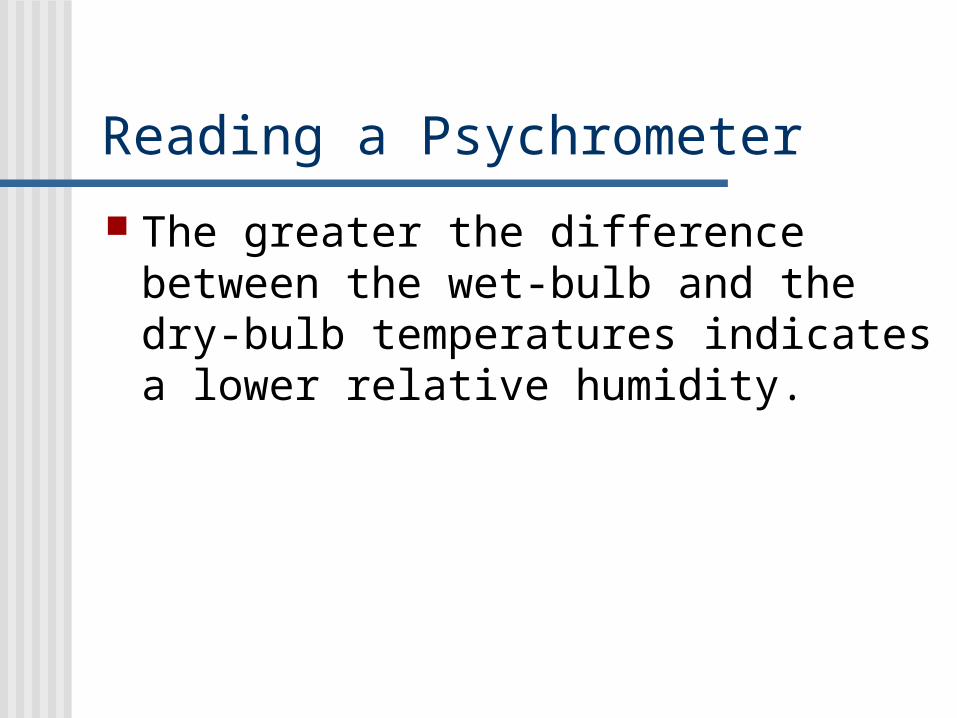
The greater the difference between the wet-bulb and the dry-bulb temperatures indicates a lower relative humidity.

If the air is saturated, than little evaporation occurs, the difference between the two thermometers is slight and the relative humidity is high.

Figuring Relative Humidity
Cloud Formation
Air Compression and Expansion When air is compressed, the motion
of gas molecules increases and the air temperature rises.
As air rises, it expands. As it expands, it cools.

Adiabatic temperature Changes
Temperature changes that happen even though heat isn’t added or subtracted are called adiabatic temperature changes.
These changes result when air is compressed or expands.
Expansion and Cooling
As you gain altitude above the Earth’s surface, the atmospheric pressure decreases due to…..
the fact that there are fewer and fewer gas molecules.

Dry Adiabatic Lapse Rate
This results in air expanding and cooling as it rises.
Unsaturated air-cools at a constant rate of 100C for every 1000 meters of ascent.
Descending air encounters higher pressure; it compresses, and is heated 100C for every 1000 meters it moves downward.

Condensation If a parcel of air rises high enough, it will
eventually cool below its dew point. Here the process of condensation begins. From here on latent heat in the water
vapor will be released. Although the air will continue to cool after
condensation begins, the latent heat works against the adiabatic cooling process and cools slower.
Wet Adiabatic Lapse Rate
This slower rate of cooling caused by the addition of latent heat is called the wet adiabatic rate.
Remember, as condensation occurs, heat is released to the atmosphere.
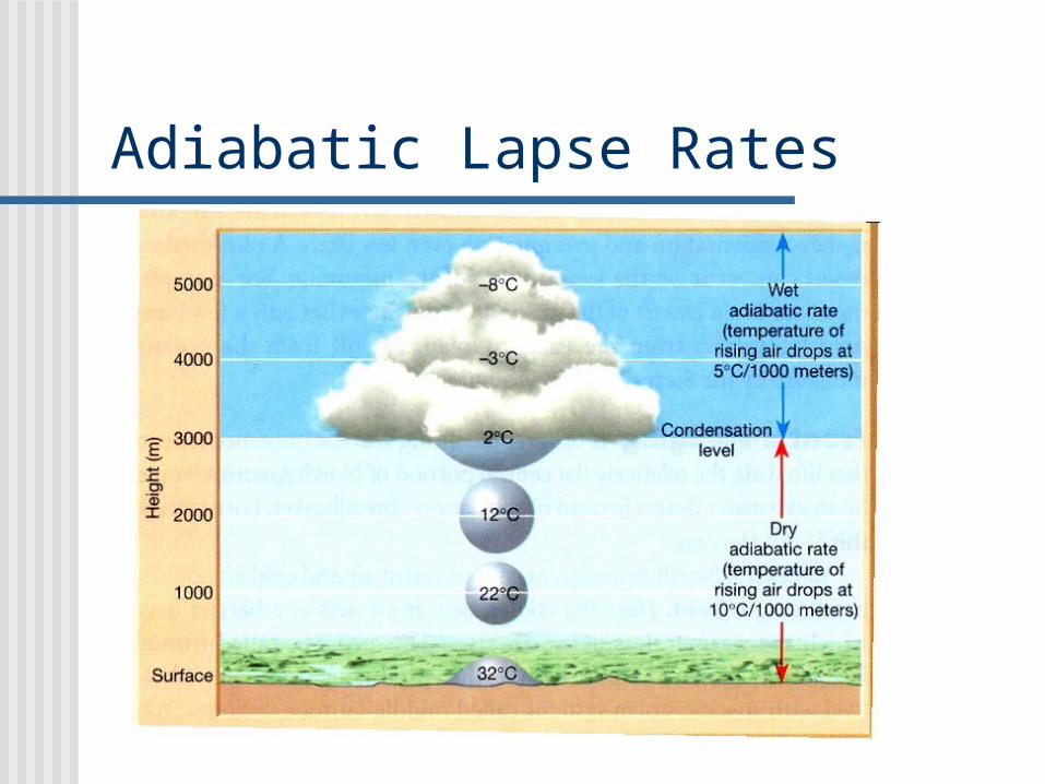
Adiabatic Lapse Rates

Processes That Lift Air
In general, air resists vertical movement. Air near the surface tends to stay near the surface.
Four mechanisms that can cause air to rise: Orographic lifting Frontal wedging Convergence Localized convective lifting

Orographic lifting
Occurs when terrains, such as mountains, act as barriers to air flow.
As air goes up a mountain slope, adiabatic cooling often generates clouds and precipitation.
Rain falls on the windward side of the mountain.

Leeward Loses Water
By the time air reaches the leeward side of this mountain, much of its moisture has been lost. If the air descends, it warms adiabatically.
This makes condensation and precipitation even less likely.

Rain Shadow
Rain shadow deserts from on leeward sides of mountains….
Example: Great Basin Desert in Southwestern U.S. is separated from the Pacific Ocean by the Sierra Nevada Mountains.


Orographic Lifting

Frontal Wedging
In central North America, masses of warm and cool air collide, producing a front.
Cooler, denser air acts as a barrier over which warmer less dense air rises.
This process is called frontal wedging. Weather producing fronts are associated with storm systems.

Frontal Wedging

Convergence
Occurs when air in the lower atmosphere flows together lifting results.
This is called convergence. When air flows together from more than one direction, it must go somewhere.
As this air rises leading to adiabatic cooling and possibly cloud formation.

Florida Example The Florida peninsula is an example of
where convergence can occur. During the day, ocean air flows inland along both coasts.
This causes a “pile up” of air over the coasts and convergence inland.
This uplift causes intense solar heating inland.
This situation causes a great many mid-afternoon thunderstorms.

Convergence

Localized Convective Uplifting On warm summer days, unequal heating of the
Earth’s surface may cause pockets of air to be warmed more than the surrounding air.
Example: Mall parking lot compared to a grassy field. As a result the air above the warm parking lot rises and is replaced by cooler surrounding air.
The rising warm air is called a thermal. The process that produces rising thermals is
localized convective uplift.

Localized Convective Lifting
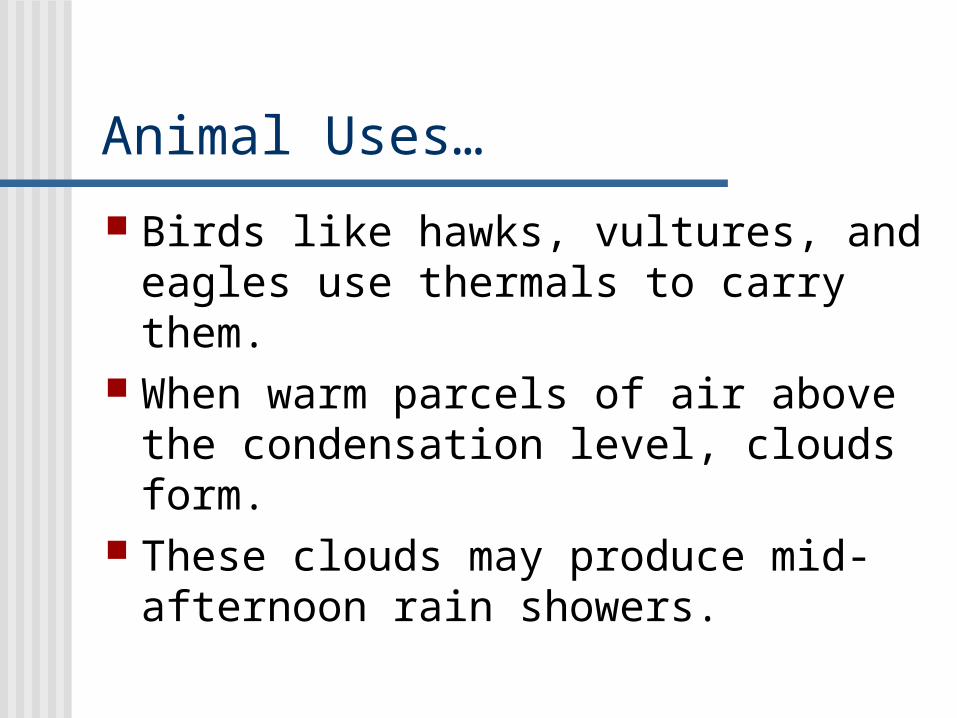
Animal Uses…
Birds like hawks, vultures, and eagles use thermals to carry them.
When warm parcels of air above the condensation level, clouds form.
These clouds may produce mid-afternoon rain showers.
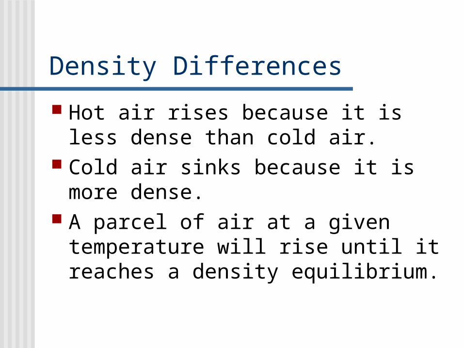
Density Differences
Hot air rises because it is less dense than cold air.
Cold air sinks because it is more dense.
A parcel of air at a given temperature will rise until it reaches a density equilibrium.
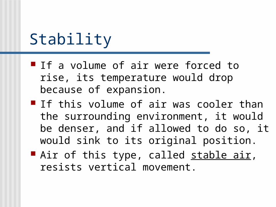
Stability
If a volume of air were forced to rise, its temperature would drop because of expansion.
If this volume of air was cooler than the surrounding environment, it would be denser, and if allowed to do so, it would sink to its original position.
Air of this type, called stable air, resists vertical movement.

Balloon Example What causes a hot air balloon to rise?
Warmer air that is less dense than the surrounding air
Ok, now what causes a hot air balloon to stop rising?
The balloon will stop rising when the air inside the balloon equalizes with the air outside the balloon.
The warmer rising air is classified as unstable air.
So……
Stable air tends to remain in its original position, while unstable air tends to rise.

Degrees of Stability
Air is stable when the temperature decreases gradually with increasing altitude.
The most stable conditions happen when the air temperature actually increases with height, called a temperature inversion.

Conditionally Stable

Very Stable Atmosphere

Temperature Inversions
Temperature inversions frequently happen on clear nights as a result of radiation cooling off Earth’s surface.
The inversion is created because the ground and the air above the ground cools faster than the air higher above the ground.
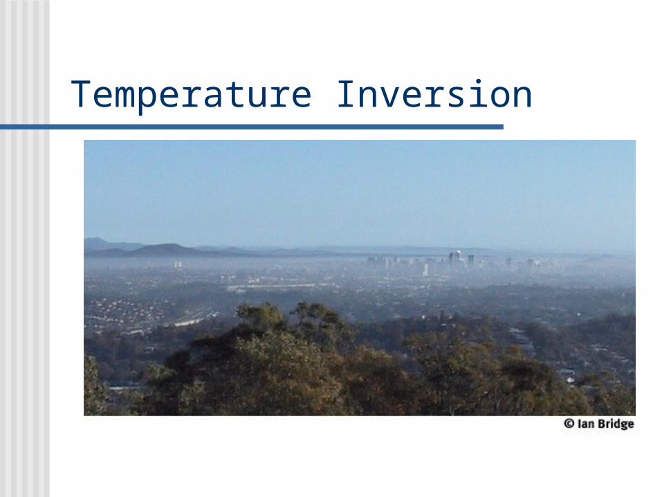
Temperature Inversion
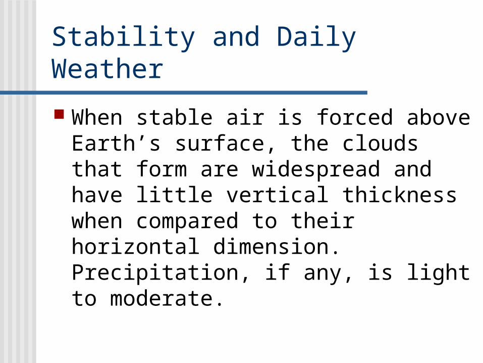
Stability and Daily Weather
When stable air is forced above Earth’s surface, the clouds that form are widespread and have little vertical thickness when compared to their horizontal dimension. Precipitation, if any, is light to moderate.
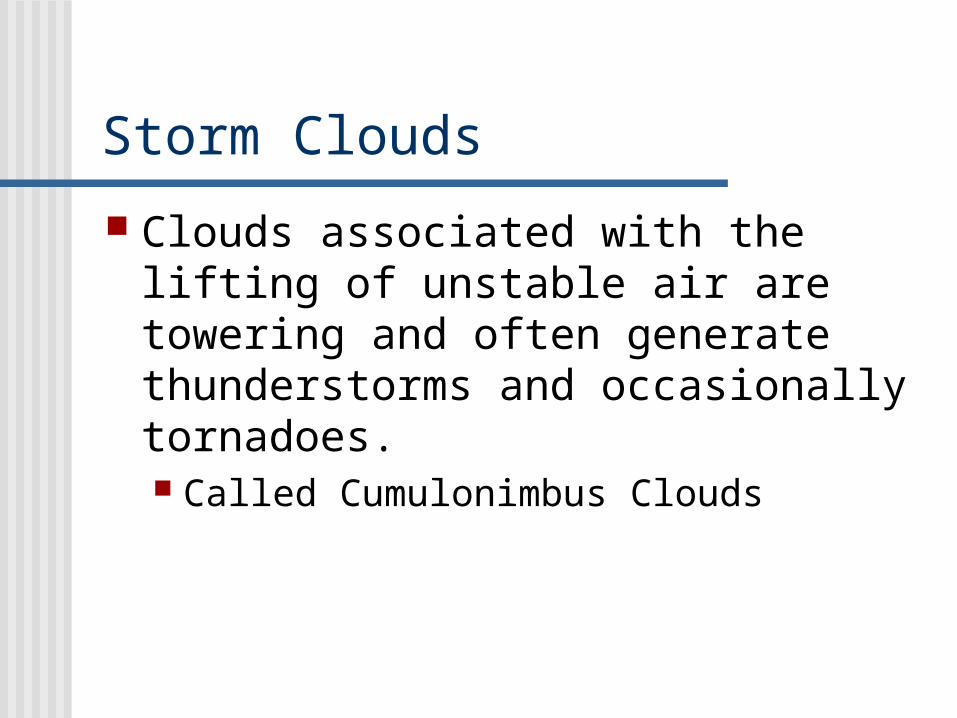
Storm Clouds
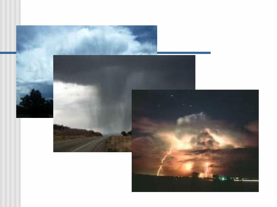
Clouds associated with the lifting of unstable air are towering and often generate thunderstorms and occasionally tornadoes. Called Cumulonimbus Clouds
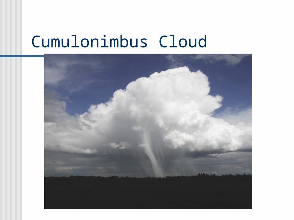
Cumulonimbus Cloud

Review Condensation
The forms of condensation include dew, fog, or clouds.
For condensation to occur, the air must be saturated.
Saturation most often occurs when air is cooled to its dew point.

Types of Surfaces
Generally, there must be a surface for or water vapor to condense on.
Dew forms on surfaces near the ground. Clouds form on tiny bits of particulate
matter called condensation nuclei. This material includes dust, smoke, and
salt particles.

CCN (Cloud Condensation Nuclei)
If condensation nuclei were not present in the atmosphere the relative humidity would need to exceed 100% to form clouds.
Since they are present, the relative humidity rarely exceeds 100%.

CCN
Salt particles are excellent condensation nuclei since they absorb water.
Clouds then are formed from millions of tiny bits of water droplets that are so tiny, they stay suspended in the air.

Cloud Types and Precipitation
Clouds are classified on the basis of their form and height.

Types of Clouds
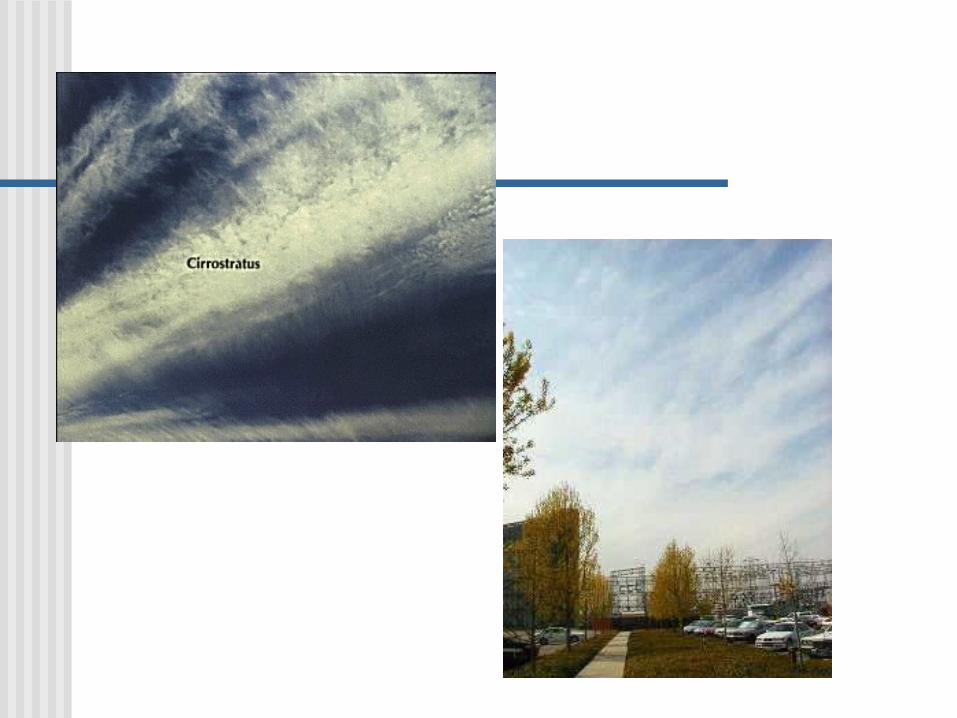
There are three basic cloud forms:1. cirrus – high, white, thin clouds. Described as
wispy or feathery in appearance.2. cumulus – cauliflower in appearance. These
clouds can have a lot of vertical height and are generally flat on the bottom.
3. stratus – described as sheets or layers that blanket the sky. They do not appear to have individual cloud units.
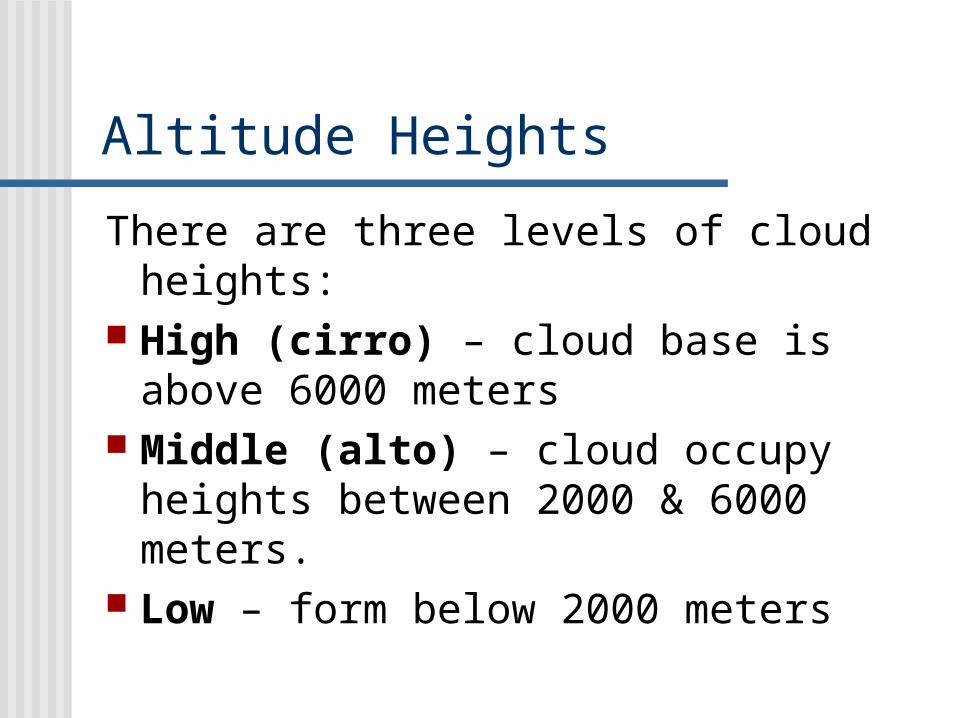
Altitude Heights
There are three levels of cloud heights:
High (cirro) – cloud base is above 6000 meters
Middle (alto) – cloud occupy heights between 2000 & 6000 meters.
Low – form below 2000 meters

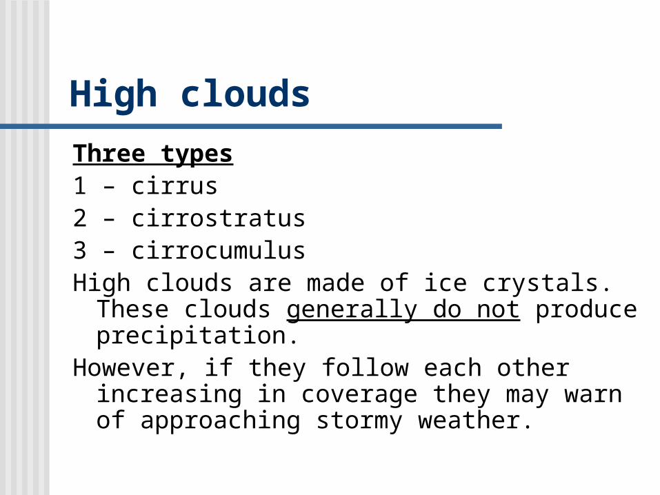
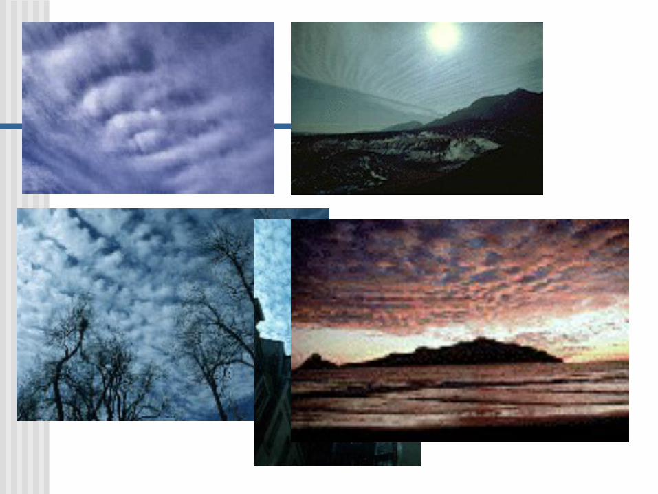
High clouds
Three types1 – cirrus2 – cirrostratus3 – cirrocumulus High clouds are made of ice crystals. These
clouds generally do not produce precipitation.
However, if they follow each other increasing in coverage they may warn of approaching stormy weather.

Middle clouds
These clouds have the prefix “alto” as part of their name.
Altocumulus or altostratus They may produce infrequent light
drizzle or snow


Low clouds
Three types1- stratus2 – stratocumulus, appear as long
parallel rows that blanket the sky3 – nimbostratus, are rain clouds.
These clouds make precipitation and are formed from stable air.


Clouds of Vertical Development
These clouds form from unstable air. Cumulus clouds are often associated with good weather, but when vertical development begins it accelerates and generally ends in a cumulonimbus or thunderstorm cloud.


Fog
Physically fog and clouds are the same. Fogs result from radiation cooling or the
movement of air over a cool surface. Fogs can also form when enough water
vapor is added to the air to bring about saturation.
Fog is defined as a cloud with its base at or very near the ground.
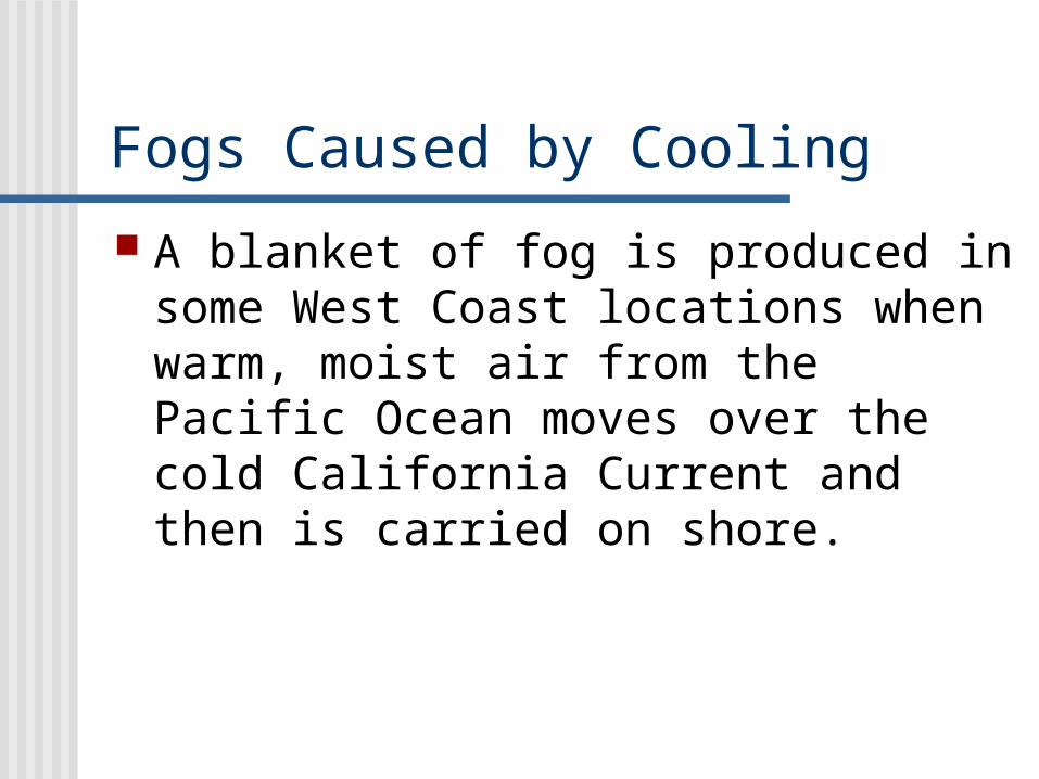
Fogs Caused by Cooling
A blanket of fog is produced in some West Coast locations when warm, moist air from the Pacific Ocean moves over the cold California Current and then is carried on shore.

Fogs can also form on calm, clear, cool nights when Earth’s surface cools rapidly by radiation.
As the night progresses, a thin layer of air in contact with the ground cools below dew point.
As the air cools, it becomes denser and drains into low areas such as river valleys.


Fogs Caused by Evaporation When cool air moves over warm water,
enough moisture may evaporate from the water surface to produce saturation.
As the rising water vapor meets the cold air it immediately condenses and rises with the air.
This type of fog has a steamy appearance.
It is fairly common over lakes and rivers in the fall and spring.


How Precipitation Forms
Clouds are made of tiny water droplets perhaps 20 micrometers in diameter.
These tiny droplets drop very slowly. Most of the droplets would evaporate after falling only a few meters.
Precipitation forms when cloud droplets grow in volume at least one million times.
Cold Cloud Precipitation
The Bergeron Process relies on two physical processes, supercooling and saturation.
Cloud droplets do not freeze at 00C as one would expect.
Pure water suspended in air doesn’t freeze until it reaches a temperature of nearly -400C.

Bergeron Process

Super-cooled water
Water in the liquid state below 00C is called supercooled water.
Supercooled water will freeze when it contacts a solid object.

Freezing Nuclei
Freezing nuclei are materials that have crystal form.
Freezing nuclei can cause supercooled water to freeze.

Saturation Differences
When air is saturated (100% relative humidity) with respect to water, it is supersaturated with respect to ice (greater than 100% humidity).
Ice crystals cannot exist with water droplets in the air because the air is supersaturated.
Excess water vapor becomes ice, which lowers relative humidity.

Bergeron Process
Water droplets then evaporate to provide a continual source of water vapor for the growth of ice crystals.
Because the level of supersaturation with respect to ice can be quite high, the growth of ice crystals is rapid enough to produce crystals that are large enough to fall.

As they fall ice crystals contact cloud droplets causing them to freeze.
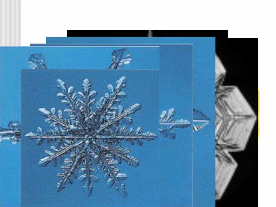
A chain reaction can occur and large crystals, called snowflakes form.
Snow
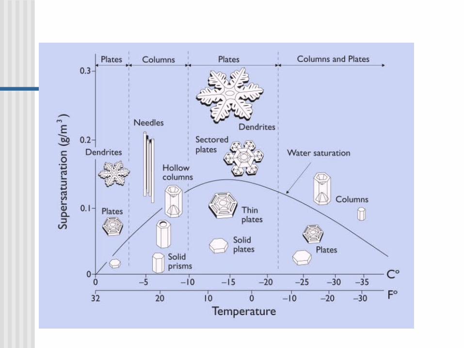
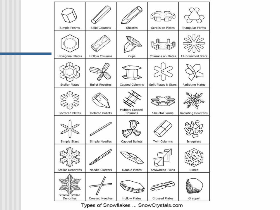
Each snow flake is different because of all the possible ways water molecules can freeze.
They are usually 6 sided.
It takes approx. 10 - 12 inches of snow to equal 1 inch of water.


Warm Cloud Precipitation
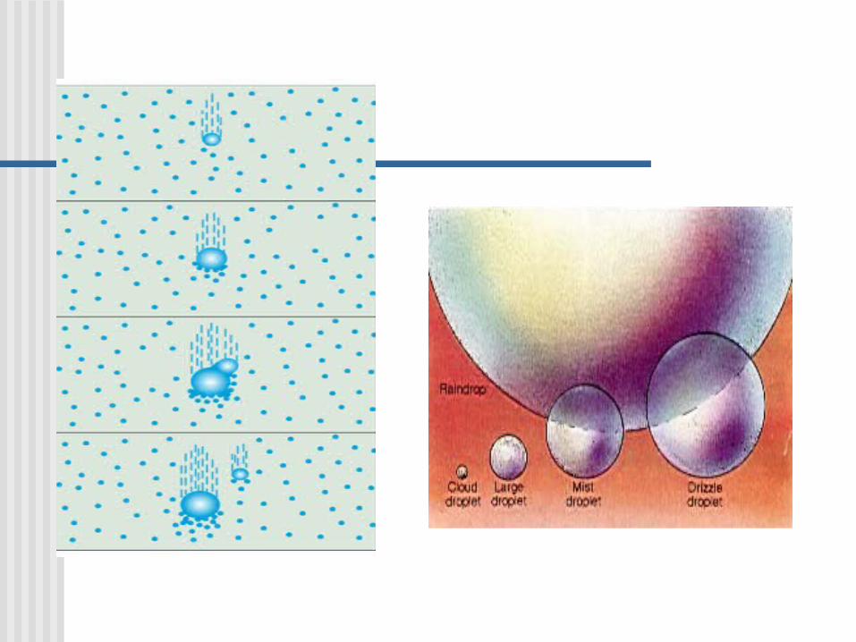
The mechanism that forms raindrops is the collision-coalescence process.
Some water-absorbing particles, such as salt, can remove water vapor from the air at relative humilities less than 100%, forming droplets that are quite large.
As these large droplets move through the cloud, they collide and coalesce (join) with smaller, slower droplets.

Forms of Precipitation
The type of precipitation that reaches the Earth’s surface depends on the temperature profile in the lowest few kilometers of the atmosphere.
Even on a hot summer day a large down pour may have started as snowstorm high the the clouds.

Rain and Snow
Rain – means drops of water that falls from a cloud and have a diameter of at least .5mm.
When the surface temperature is above 40C, snowflakes usually melt and continue to descend as rain.

Let it Snow
Snow – at very low temperatures (when the moisture content of the air is small) light, fluffy snow made up of individual six sided ice crystals forms.
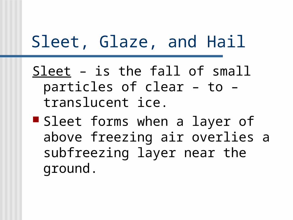
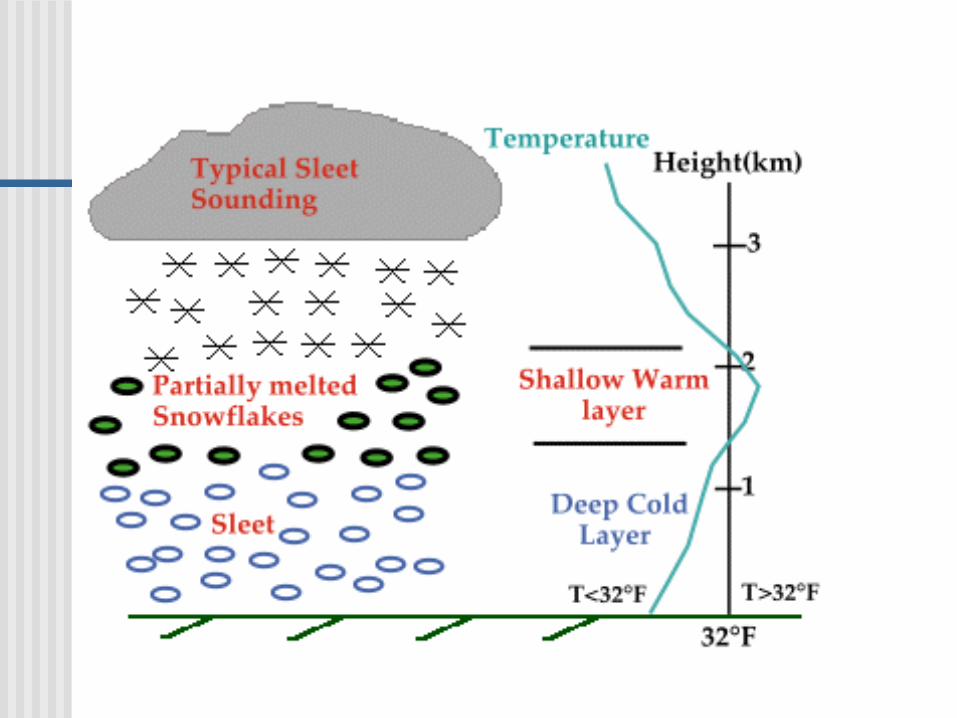
Sleet, Glaze, and Hail
Sleet – is the fall of small particles of clear – to – translucent ice.
Sleet forms when a layer of above freezing air overlies a subfreezing layer near the ground.

Freezing Rain
Glaze – or freezing rain, results when raindrops become supercooled as they fall through subfreezing air near the ground and turns to ice when they impact objects.
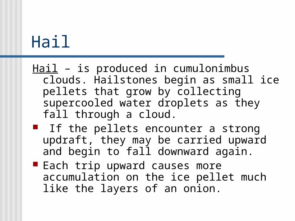
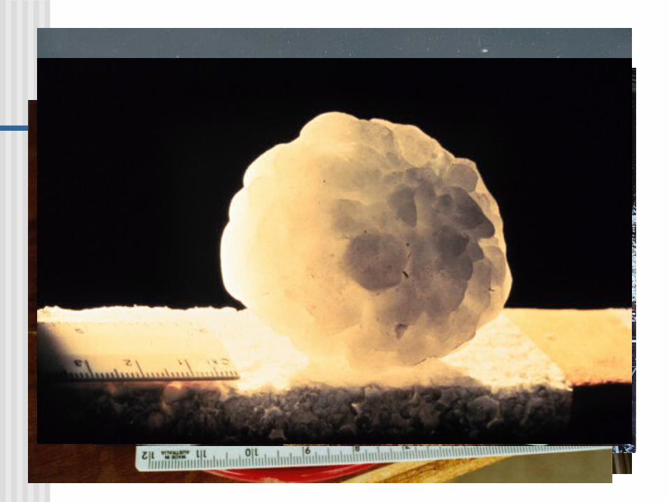
Hail
Hail – is produced in cumulonimbus clouds. Hailstones begin as small ice pellets that grow by collecting supercooled water droplets as they fall through a cloud.
If the pellets encounter a strong updraft, they may be carried upward and begin to fall downward again.
Each trip upward causes more accumulation on the ice pellet much like the layers of an onion.

Hail