Brian Vilmont - Using GIS Tools to Track and Prioritize ... · Geographic Information Systems (GIS)...
34
Using GIS to Track and Prioritize Your Assets
-
Upload
trinhquynh -
Category
Documents
-
view
213 -
download
0
Transcript of Brian Vilmont - Using GIS Tools to Track and Prioritize ... · Geographic Information Systems (GIS)...

Using GIS to Track and Prioritize
Your Assets

What is GIS??
�Geographic Information System
�Geographic – Location of an asset� Information – Characteristics of an asset� System – Software that allows connection between the mapping and the information.
�GIS = Map + Spreadsheet + Software

Asset Management
ESRI ArcGIS is foundational software
Leading standard for infrastructure management in the U.S.
Starting use was primarily for planning

Specialized Management ToolsComputerized Maintenance Management System (CMMS) for operations and maintenance
Software usually works in conjunction with with ESRI geodatabase
Maintenance and rehabilitation work orders, condition inspection schedules, monitoring programs
Roadsoft

Asset Management
GIS is the backbone used to develop applications for improving operations and data mining.
CMMS applications are used to schedule, track and archive all activities and costs.
CMMS should interface with the GIS and would ensure the GIS is used on a daily basis as part of your business process.
Roadsoft
Geographic Information Systems (GIS)
Know where things are and information about them.
Record your documents and make them accessible.• Paper files, drawings, spreadsheets, reports, manuals, etc.
How can GIS help?• Greater efficiency, reaction time and confidence• More effective collaboration•Assist in documenting regulatory compliance• Better customer service
•Are you being reactive or preventive?
Start simple - Get organized – Use right away – Use daily

Infrastructure Assets
What do infrastructure and opossums have in common?
They both get no respect.
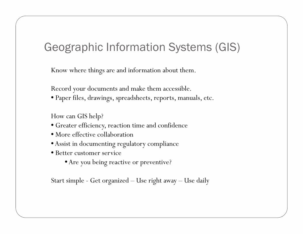
Design Life Cycles

Step 1 of Infrastructure Management
� Inventory your Assets� Identify assets�Mapping�Condition assessment
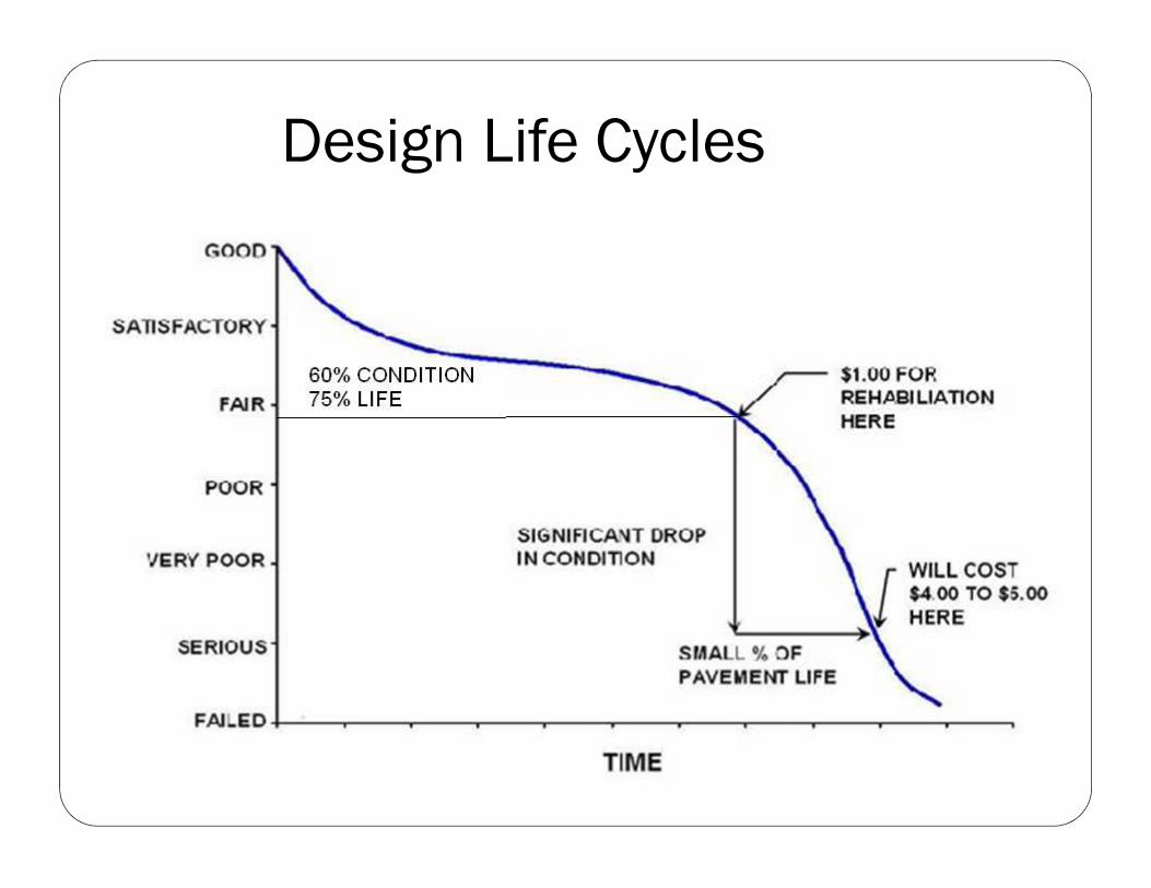
Identify Assets
� Sewer system
� Collection and treatment
� Water system� Supply and distribution
� Streets
� Storm sewers
� Sidewalks/pathways
� Buildings
� Parks/facilities

Create a Map of Assets
�Utilize geographic information system (GIS) to create asset maps
�Identification of individual asset segments� Roads – block by block� Sewers – segments between manholes � Water mains – segments by block

Asset Maps - Roads
•Surface Condition
•Structural Integrity
•Curbs
•Sidewalks
•Drive Approaches

Asset Maps - Water Main
� Age
� Materials
� Asbestos cement
� Cast iron
� Ductile iron
� PVC
� HDPE
� Break history
� Capacity (reliability)
� Fire flows

Asset Maps - Sanitary Sewer
� Infiltration and Inflow Study
� Capacity Analysis
� Sanitary Sewer Evaluation Study� Manhole Inspections
� Television Inspection
� Smoke Testing
� Dye Testing

Asset Maps – Storm Sewer
� Infiltration and Inflow Study
� Capacity Analysis
� Storm Sewer Evaluation Study� Manhole Inspections
� Television Inspection
� Smoke Testing
� Dye Testing
� Green Infrastructure

Facilities
�Water System� Surface Water Intakes and Wells �Metering and Chemical Feed Stations�Treatment Plants�Booster Pumping Stations�Ground and Elevated Storage Tanks
� Storm and Sanitary System�Pumping and Metering Stations� Storage and Equalization Systems�Treatment Plants� Surface Water and Groundwater Discharge Systems

Condition Assessment
� Initial assessment can be as straightforward as excellent, good, fair, marginal, and poor
� More detailed assessments can be added later

Infrastructure Catastrophes Happen

Infrastructure Catastrophes Happen

Infrastructure Catastrophes Happen

Infrastructure Catastrophes Happen

Identify Problem Areas
Composite Deficiencies
•Overlapping Issues
•Project Coordination
•Combined Projects
•GIS (geographic information system)

Prioritize Known Problem Areas
� Water system� Low-pressure areas� Fire flow issues� Frequent breaks� Water quality issues

Identify Projects
Projects by Type
•Identify Critical Factors
•Identify Project Extents
•Probable Costs
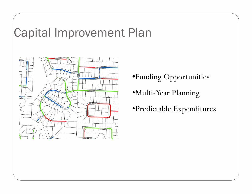
Capital Improvement Plan
•Funding Opportunities
•Multi-Year Planning
•Predictable Expenditures

Funding
• Where will the money come from?
• General Fund
• Bonds funded by:
– Water and Sewer Rates
– Dedicated Infrastructure Millage
– Special assessments
• Governmental Loans (DWRF & SRF) (Lower interest rate than the bond market)
• Grants

Why GIS?
� What is GIS� System that links data and maps
� What information do we put into the GIS� System Maps
� Key system information that allows queries (sorting)
� What does GIS do for us� Provides storage of institutional knowledge
� Provided mapping of sorted data

Why GIS?
� GIS condition ratings are edited as assets either decline or are improved
� Asset layers can be overlayed to identify multiple problem areas
� GIS viewers can be used by any staff� Maps provide a communication tool with elected officials and the public
Addition GIS applications
•Record Drawings•Staff Knowledge

As-built drawings can be scanned to PDF files then linked to the GIS. Finding record drawings is as simple as point and click.
Record Drawings

Handwritten notes layers
Capture knowledge of field crew or transitioning personnel.
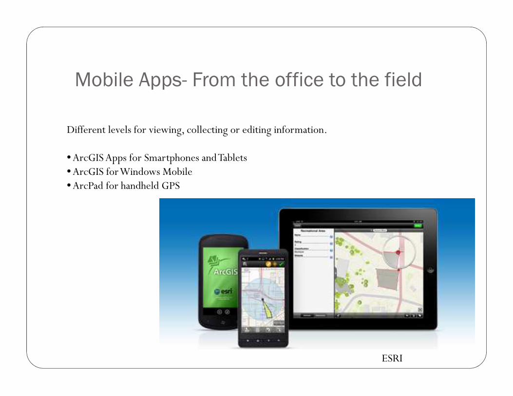
Mobile Apps- From the office to the field
Different levels for viewing, collecting or editing information.
•ArcGISApps for Smartphones and Tablets•ArcGIS for Windows Mobile•ArcPad for handheld GPS
ESRI

Reactive or ProactiveReactive or ProactiveReactive or ProactiveReactive or Proactive
How do you want to manage your assets?

Contact for Information or QuestionsBrian Vilmont, P.E.616-250-2468
THANK YOU!