BOYCE MAYVIEW PARK MASTER PLAN - The Township of … · boyce mayview park master plan township of...
54
BOYCE MAYVIEW PARK MASTER PLAN TOWNSHIP OF UPPER ST. CLAIR, PENNSYLVANIA Master Plan Submitted to: Township of Upper St. Clair Submitted by: Wallace Roberts & Todd with Ecological Restorations, Inc. Economics Research Associates H.F. Lenz Company October 1999
Transcript of BOYCE MAYVIEW PARK MASTER PLAN - The Township of … · boyce mayview park master plan township of...
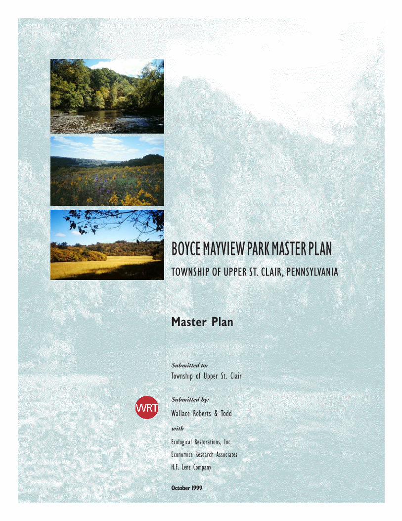
BOYCE MAYVIEW PARK MASTER PLANTOWNSHIP OF UPPER ST. CLAIR, PENNSYLVANIA
Master Plan
Submitted to:
Township of Upper St. Clair
Submitted by:
Wallace Roberts & Todd
with
Ecological Restorations, Inc.
Economics Research Associates
H.F. Lenz Company
October 1999

Boyce Mayview Park Master Plan
BOYCE MAYVIEW PARK MASTER PLAN
ACKNOWLEDGEMENTS:
UPPER ST. CLAIR TOWNSHIP DEPARTMENT OF RECREATION AND LEISURE SERVICES:
Melanie Finlay, Director
UPPER ST. CLAIR TOWNSHIP PARKS AND RECREATION BOARD:
Raymond D. Gergich
Karen M. McElhinny
William O. Barnard
Sue Grant
Thomas Browand
Don Rectenwald, Jr.
Roger Hartung
UPPER ST. CLAIR TOWNSHIP BOARD OF COMMISSIONERS:
T.A. Ward, President
Gloria S. Smith, Vice President
Cheryl S. Bayne
Edward S. Long, Jr.
Frank E. Marsh
Robert W. Orchowski
Brad S. Tupi
UPPER ST. CLAIR TOWNSHIP MANAGER:
Douglas A. Watkins
CONSULTANT TEAM:
Wallace Roberts and Todd
260 South Broad St., Philadelphia, PA 19102
Ecological Restorations, Inc.
1633 Gilmar Road, Apollo, PA 15613
Economic Research Associates
1101 Connecticut Ave., NW, Suite 17 Washington, DC 20036
H.F. Lenz Company
1407 Scalp Avenue, NW, Johnstown, PA 15904-3329

Boyce Mayview Park Master Plan
Boyce Mayview Park Master Plan
BOYCE MAYVIEW PARK MASTER PLAN
CONTENTS
PPPPPREFREFREFREFREFAAAAACECECECECE
A A A A A VVVVVISIONISIONISIONISIONISION FORFORFORFORFOR B B B B BOOOOOYYYYYCECECECECE M M M M MAAAAAYYYYYVIEVIEVIEVIEVIEWWWWW P P P P PARKARKARKARKARK, 2010, 2010, 2010, 2010, 2010 ......................................................................11111EEEEEXECUTIVEXECUTIVEXECUTIVEXECUTIVEXECUTIVE S S S S SUMMARYUMMARYUMMARYUMMARYUMMARY .................................................................................................................................................................................................................. 33333
VISION FOR BOYCE MAYVIEW PARK
SUMMARY OF RECOMMENDATIONS/PRINCIPLES
SUMMARY OF COSTS
SUMMARY OF IMPLEMENTATION STRATEGY
1.0 I1.0 I1.0 I1.0 I1.0 INTRODUCTIONNTRODUCTIONNTRODUCTIONNTRODUCTIONNTRODUCTION .................................................................................................................................................................................................................................91.1 PROJECT OVERVIEW
1.2 MASTER PLANNING PROCESS/PUBLIC INVOLVEMENT
1.3 TECHNICAL MEMORANDUM APPENDIX
2.0 C2.0 C2.0 C2.0 C2.0 CONTEXTONTEXTONTEXTONTEXTONTEXT ANDANDANDANDAND S S S S SITEITEITEITEITE A A A A ANALNALNALNALNALYSISYSISYSISYSISYSIS ............................................................................................................................. 132.1 REGIONAL CONTEXT
2.2 SITE HISTORY
2.3 EXISTING CULTURAL FEATURES
2.4 EXISTING NATURAL FEATURES
2.5 SITE ANALYSIS
2.6 SITE OPPORTUNITIES AND CONSTRAINTS
3.0 P3.0 P3.0 P3.0 P3.0 PROGRAMROGRAMROGRAMROGRAMROGRAM ..................................................................................................................................................................................................................................................... 23232323233.1 COMMUNITY CENTER
3.2 RECREATION CENTER
3.3 OUTDOOR POOL
3.4 ENVIRONMENTAL EDUCATION CENTER
3.5 ACTIVE RECREATION
3.6 PASSIVE RECREATION
3.7 GATHERING AREAS
3.8 COMMUNITY GARDENS
4.0 M4.0 M4.0 M4.0 M4.0 MASTERASTERASTERASTERASTER P P P P PLANLANLANLANLAN C C C C CONCEPTONCEPTONCEPTONCEPTONCEPT ........................................................................................................................................................... 25252525254.1 PRINCIPLES
4.2 MASTER PLAN CONCEPT
5.0 5.0 5.0 5.0 5.0 TTTTTHEHEHEHEHE M M M M MASTERASTERASTERASTERASTER P P P P PLLLLLANANANANAN .............................................................................................................................................................................................. 27272727275.1 SUSTAINABLE DESIGN
5.2 HABITAT CONSERVATION AND ENHANCEMENT
5.3 PARK GATEWAYS AND ACCESS
5.4 MAYVIEW COMMONS DEVELOPMENT

Boyce Mayview Park Master Plan
5.5 ENVIRONMENTAL EDUCATION CENTER
5.6 COMPOST AREA
5.7 COMMUNITY GARDENS/ORCHARD
5.8 TRAIL SYSTEM
5.9 ENVIRONMENTAL INTERPRETIVE NODES
5.10 MAINTENANCE, SERVICE, AND EMERGENCY ACCESS
6.0 I6.0 I6.0 I6.0 I6.0 IMPLEMENTMPLEMENTMPLEMENTMPLEMENTMPLEMENTAAAAATIONTIONTIONTIONTION S S S S STRATRATRATRATRATEGYTEGYTEGYTEGYTEGY ....................................................................................................................................... 43434343436.1 ESTIMATED COSTS
6.2 FUNDING SOURCES
6.3 PHASING
6.4 REQUIRED PERMITS
7.0 C7.0 C7.0 C7.0 C7.0 CONCLONCLONCLONCLONCLUSIONUSIONUSIONUSIONUSION ...................................................................................................................................................................................................................................... 4747474747

Boyce Mayview Park Master Plan
PREFACE
This document provides an overview of the process and products generated
to form the Master Plan for Boyce Mayview Park. Detailed information
related to each section of this report can be found in the Boyce Mayview
Park Technical Memorandum Appendix. The eleven Technical Memoranda
found in the Appendix were submitted to Upper St. Clair Township to
document each phase of the master planning process. The Technical
Memorandum Appendix includes:
1. Site Inventory and Analysis
2. Habitat Evaluation Report
3. Key Informant Interviews
4. Preliminary Program List
5. Opportunities and Constraints
6. Refined Program List
7. Site Development Alternatives
8. Park Master Plan
9. Phasing and Prioritization Plan
10. Order of Magnitude Cost Estimate
11. Implementation – Permitting and Funding Issues

Boyce Mayview Park Master Plan

B o y c e M a y v i e w P a r k M a s t e r P l a n 1
A VISION FOR BOYCE MAYVIEW PARK, 2010
A red tailed hawk hovers above the autumn meadow, its eye
fixed on prey in the meadow below. At the meadow’s edge, a
solitary hiker crouches, binoculars raised to the sky. In the nearby
woods, a group of children bound for the marsh wind their way
along the path to a clearing by the Creek for a look at the egrets.
On the hilltop overlook, a group of seniors from Friendship Village,
out for a Saturday morning walk, look from the meadow up to the
north at the soccer game on Morton Field.
Community gardeners and their grandchildren are harvesting
pumpkins and gourds for the harvest festival this afternoon at the
Mayview Commons.
Over at the Commons things are just getting started: tables are
being set up in the Community Center courtyard and preparations
are being made for the festival, the morning aerobics class at the
recreation center is just finishing, and several dog walkers stand
together in the dog run lawn sipping coffee, talking and watching
their Labradors play. Organizers are busy decorating the picnic
pavilion for the festival with corn stalks and gourds from the
gardens. Children play in the lawn in front of the pavilion in the
sight of their parents. Families sit in the Commons Plaza talking
about the harvest ball held the night before at the Community
Center, their older kids tossing frisbees at the multi purpose field
past the pavilion.
Visitors to the Environmental Education Center arrive for the
weekly nature walk. They join a group waiting on the path in front
of the Center for a guided walk through the woods. Among
today’s group is a mix of older residents, disabled residents and
parents with toddlers and infants in strollers who will walk down
the easy grade of the arc walk to the wetland after an orientation
talk at the Center.
It’s another Saturday at the park: along the creek the sound of
water is all that can be heard. In the meadow a hawk shadow
passes over a rabbit.

2 B o y c e M a y v i e w P a r k M a s t e r P l a n

B o y c e M a y v i e w P a r k M a s t e r P l a n 3
EXECUTIVE SUMMARY
THE VISION FOR BOYCE MAYVIEW PARK
The vision of the park on the preceding page would be the result of a
concerted, cooperative effort on the part of the residents, government and
funding partners of Upper St. Clair. The physical plan and actions necessary
to reach that vision are described in this report. The Master Plan for Boyce
Mayview Park demonstrates the capacity of the property to accommodate
the diverse recreational and preservation interests of Upper St. Clair
Township. The design, construction, and operation of Boyce Mayview Park
should serve as a model of sustainable design in practice.
Master Plan:
Boyce Mayview Park balances the community’s needs for passive, nature
oriented activities with limited recreational activities. 86% of the park will
be for passive, nature-oriented activities served by trails, overlooks and
seating areas. Miles of trails thread through open meadows and forests,
and gently traverse high value habitats and restoration areas.
Active uses clustered in the Mayview Commons are conceived as a “village
center” around green space comparable to a New England town common.
With a long history of productive uses that included farming and coal mining,
the park’s varied heritage is expressed in a contemporary theme of
productive, sustainable development.
Boyce Mayview Park, in recognition of its importance in the Township, offers
more than active and passive recreation. Environmental preservation and
recreation are placed in the context of a larger message of sustainablesustainablesustainablesustainablesustainable
development development development development development and communitycommunitycommunitycommunitycommunity. This message is presented through the
inclusion of an Environmental Education Center, community gardens, and
the community composting/recycling facility.
SUMMARY OF RECOMMENDATIONS/PRINCIPLES
The planning and design of the park was informed by a series of guiding
principles derived from the findings of the site analysis and community
involvement process. These principles comprise the core of the master plan
and are the touchstones for determining the physical form the park will
take on.
“[Sustainable design] is a conceptthat recognizes that humancivilization is an integral part ofthe natural world and that naturemust be preserved andperpetuated if the humancommunity is to sustain itselfindefinitely. Sustainable design isthe philosophy that humandevelopment should exemplify theprinciples of conservation, andencourage the application of thoseprinciples in our daily lives.”
- Guiding Principles of SustainableDesign, National Park Service, 1993.

4 B o y c e M a y v i e w P a r k M a s t e r P l a n
Principles:
• Preserve sensitive habitats. Preserve sensitive habitats. Preserve sensitive habitats. Preserve sensitive habitats. Preserve sensitive habitats. The park is blessed by an extraordinarily
diverse range of topography, vegetation, and water resources. Together
these systems form specific habitats for most of the native flora and
fauna indigenous to the region.
• ImprImprImprImprImprove water qualityove water qualityove water qualityove water qualityove water quality. . . . . Stretched along the Chartiers Creek, the
park can act as a giant filter for urban stormwater runoff from adjacent
development. Water quality is a major issue nationwide, and the actions
taken in the park specific to Chartiers Creek will aid the ongoing efforts
to improve water quality in the Creek.
• Limit vehicular access to the perimeter of the site to preserveLimit vehicular access to the perimeter of the site to preserveLimit vehicular access to the perimeter of the site to preserveLimit vehicular access to the perimeter of the site to preserveLimit vehicular access to the perimeter of the site to preserve
the interiorthe interiorthe interiorthe interiorthe interior. . . . . Provide access to the park, but in a way that does not
trammel the very resource being preserved.
• Link Boyce and Mayview propertiesLink Boyce and Mayview propertiesLink Boyce and Mayview propertiesLink Boyce and Mayview propertiesLink Boyce and Mayview properties. The two properties are
separated by a deep ravine that effectively severs the expanse of the
entire 475 acres. By linking north and south the public can better
experience the total park.
• Define and enhance spatial areas. Define and enhance spatial areas. Define and enhance spatial areas. Define and enhance spatial areas. Define and enhance spatial areas. Diversity of habitat is paralleled
by diversity of space on the park, ranging from hilltops to the creek
valley, from flat meadows to precipitous slopes. The changing spatial
experience of passing through and among these spaces makes the
park seem much larger, and greatly adds to its worth.
• Limit active rLimit active rLimit active rLimit active rLimit active recrecrecrecrecreation to the noreation to the noreation to the noreation to the noreation to the north arth arth arth arth area of the site. ea of the site. ea of the site. ea of the site. ea of the site. To retain
the largest reasonable area for preservation of wildlife habitat, limit
intensive human activity and vehicular access as much as possible to
the north of the site which is less constrained by the presence of sensitive
natural resources.
• Connect major habitats, program features and key adjacentConnect major habitats, program features and key adjacentConnect major habitats, program features and key adjacentConnect major habitats, program features and key adjacentConnect major habitats, program features and key adjacent
uses. uses. uses. uses. uses. A fully developed network of pedestrian and bicycle access to
and within the park will enable the community to fully appreciate the
park.
• Improve pedestrian access by developing trail links from theImprove pedestrian access by developing trail links from theImprove pedestrian access by developing trail links from theImprove pedestrian access by developing trail links from theImprove pedestrian access by developing trail links from the
community to the key areas within the Park. community to the key areas within the Park. community to the key areas within the Park. community to the key areas within the Park. community to the key areas within the Park. Getting people to
the park conveniently with the least amount of disturbance to the park
requires excellent connections to the planned sidewalk and bicycle paths
proposed by the Township. More people reaching the park on foot and
by bike mean less traffic in the adjoining neighborhoods and less impact
on the park.
• Green Design. Green Design. Green Design. Green Design. Green Design. The Park should be designed as a model of “green
design” using recycled materials, energy conservation techniques, and
low maintenance landscape treatments.
B o y c e M a y v i e w P a r k M a s t e r P l a n 5
Program:
Developed from interviews, public workshops, and the user survey, the
program below represents the diversity and intensity of interest in the park
held by the community. Because the park abuts two other public parks, its
design must take into account the adjacent facilities in terms of circulation
and access. The program for the park listed below includes all the features
within the public right of way around the park as noted.
• Community CenterCommunity CenterCommunity CenterCommunity CenterCommunity Center: Possibly re-using the existing Mayview Dairy
Barn, the community center could provide an attractive focal point in
the park for compatible activities.
• Recreation Center: Recreation Center: Recreation Center: Recreation Center: Recreation Center: An indoor space for basketball and other activities
in a new building.
• Environmental Education Center: Environmental Education Center: Environmental Education Center: Environmental Education Center: Environmental Education Center: A building that could
accommodate the needs of UStC and other school districts in meeting
state-mandated requirements for hands-on environmental education
facilities.
• Active Recreation: Active Recreation: Active Recreation: Active Recreation: Active Recreation: Primarily accommodated in Baker Park, limited
facilities would be provided at Boyce Mayview.
• Multipurpose Field: Multipurpose Field: Multipurpose Field: Multipurpose Field: Multipurpose Field: A level lawn area accommodating up to
two soccer-sized fields for overflow practice facilities
• Multi-Use (Bicycle) TMulti-Use (Bicycle) TMulti-Use (Bicycle) TMulti-Use (Bicycle) TMulti-Use (Bicycle) Trail: rail: rail: rail: rail: A trail around the park linking the
township sidewalk and path systems to the park and to a potential
spur connection to the Montour Trail via a rail-to-trail corridor.
••••• Pet Exercise Area (Dog Run)Pet Exercise Area (Dog Run)Pet Exercise Area (Dog Run)Pet Exercise Area (Dog Run)Pet Exercise Area (Dog Run): A popular activity at present in the
park, this space would provide a controlled area for unleashed dogs to
run without impact on other park users and wildlife.
••••• Baker Park and Morton Fields: Baker Park and Morton Fields: Baker Park and Morton Fields: Baker Park and Morton Fields: Baker Park and Morton Fields: The existing facilities would remain
intact and be linked to the park. Impact from runoff would be mitigated
within the park.
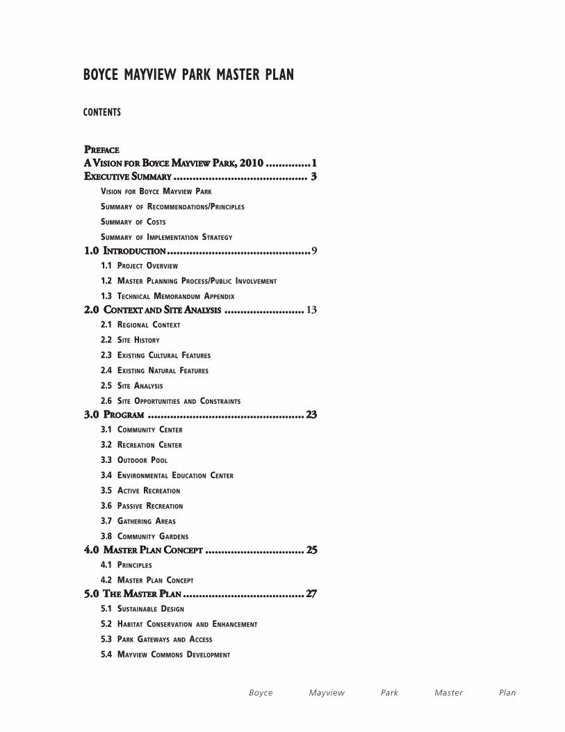
••••• Passive Recreation: Passive Recreation: Passive Recreation: Passive Recreation: Passive Recreation: Open lawn areas will allow for diverse
unprogrammed activities such as picnicking not possible on the other
programmed fields occupied by sports activities. Woodland and wetland
areas will invite passive appreciation of nature.
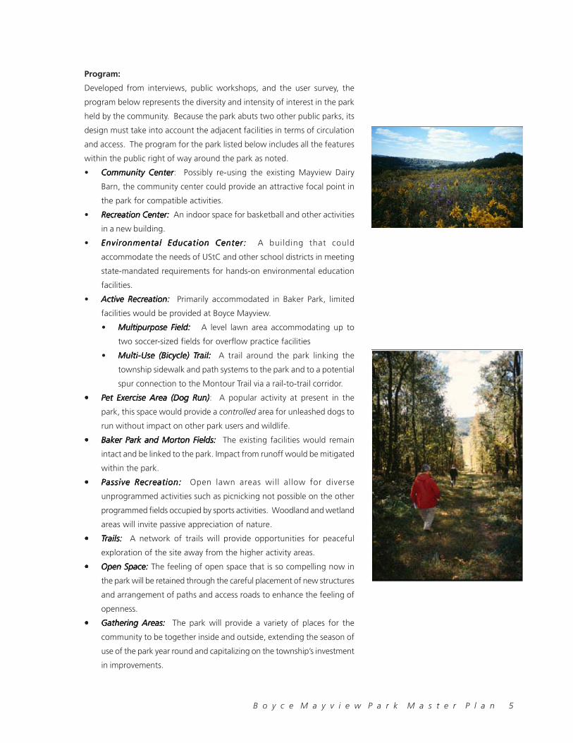
••••• TTTTTrails: rails: rails: rails: rails: A network of trails will provide opportunities for peaceful
exploration of the site away from the higher activity areas.
••••• Open Space: Open Space: Open Space: Open Space: Open Space: The feeling of open space that is so compelling now in
the park will be retained through the careful placement of new structures
and arrangement of paths and access roads to enhance the feeling of
openness.
••••• Gathering Areas: Gathering Areas: Gathering Areas: Gathering Areas: Gathering Areas: The park will provide a variety of places for the
community to be together inside and outside, extending the season of
use of the park year round and capitalizing on the township’s investment
in improvements.
6 B o y c e M a y v i e w P a r k M a s t e r P l a n
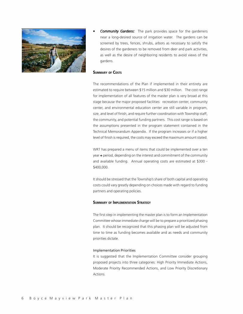
••••• Community Gardens: Community Gardens: Community Gardens: Community Gardens: Community Gardens: The park provides space for the gardeners
near a long-desired source of irrigation water. The gardens can be
screened by trees, fences, shrubs, arbors as necessary to satisfy the
desires of the gardeners to be removed from deer and park activities,
as well as the desire of neighboring residents to avoid views of the
gardens.
SUMMARY OF COSTS
The recommendations of the Plan if implemented in their entirety are
estimated to require between $15 million and $30 million. The cost range
for implementation of all features of the master plan is very broad at this
stage because the major proposed facilities: recreation center, community
center, and environmental education center are still variable in program,
size, and level of finish, and require further coordination with Township staff,
the community, and potential funding partners. This cost range is based on
the assumptions presented in the program statement contained in the
Technical Memorandum Appendix. If the program increases or if a higher
level of finish is required, the costs may exceed the maximum amount stated.
WRT has prepared a menu of items that could be implemented over a ten
year + + + + + period, depending on the interest and commitment of the community
and available funding. Annual operating costs are estimated at $300 -
$400,000.
It should be stressed that the Township’s share of both capital and operating
costs could vary greatly depending on choices made with regard to funding
partners and operating policies.
SUMMARY OF IMPLEMENTATION STRATEGY
The first step in implementing the master plan is to form an Implementation
Committee whose immediate charge will be to prepare a prioritized phasing
plan. It should be recognized that this phasing plan will be adjusted from
time to time as funding becomes available and as needs and community
priorities dictate.
Implementation Priorities
It is suggested that the Implementation Committee consider grouping
proposed projects into three categories: High Priority Immediate Actions,
Moderate Priority Recommended Actions, and Low Priority Discretionary
Actions.
B o y c e M a y v i e w P a r k M a s t e r P l a n 7
High Priority Immediate ActionsHigh Priority Immediate ActionsHigh Priority Immediate ActionsHigh Priority Immediate ActionsHigh Priority Immediate Actions, including projects such as site clean
up, hazardous waste removal, and structural stabilization, are the Township’s
responsibility to perform, based on the deed of trust for the land and the
need to ensure the safety and well being of park users. These actions are
high priority because they affect the health, safety and welfare of the
community, and are the minimal actions necessary to protect the natural
and cultural resources that have been entrusted to the Township. Certain
actions, such as provision of vehicular access and trail construction, should
be ranked as high priority actions as they have high utility, visibility and
excellent cost-benefit ratio.
Moderate Priority Recommended ActionsModerate Priority Recommended ActionsModerate Priority Recommended ActionsModerate Priority Recommended ActionsModerate Priority Recommended Actions are important to the
realization of the master plan. These actions must follow the high priority
actions but are of sufficient importance to be committed to a finite
implementation time frame, or are likely to be eligible for early funding.
These actions include the major facilities whose funding is linked to other
sources, and fundamental habitat enhancements.
Low Priority Discretionary ActionsLow Priority Discretionary ActionsLow Priority Discretionary ActionsLow Priority Discretionary ActionsLow Priority Discretionary Actions are not critical to staging or “critical
mass” of the master plan, and can be phased throughout the project build-
out period. These actions include the full development of the trail system
and habitat enhancements
A plan for securing regulatory permitting is a necessary component of the
implementation plan.
Funding Sources:
Funding for the park improvements will entail partnerships with public and
private entities, particularly for major facilities. The Environmental Education
Center could be a joint UStC/state/private/school districts partnership , and
the pool and recreation center could be a partnership with the local YMCA.
UStC’s substantial bonding capacity would permit a high level of funding
directly from the township. State (DCNR) and Federal grants (TEA-21) and
in-kind services (US Army Corps of Engineers) are available for park
improvements, infrastructure and bicycle path/sidewalk development.
Additionally, volunteer labor can be used to defray the cost of labor-intensive
activities. Other privately-sponsored efforts such as a corporate-sponsored
“Friends of Boyce Mayview Park” could be a conduit for funding from
private sources.
While there is no single, clear, easy strategy to follow with regard to the
raising of capital funds or Operations and Maintenance (O&M) funds for the
park, the community does have a number of choices/different directions

8 B o y c e M a y v i e w P a r k M a s t e r P l a n
that it might take with regard to funding. The selection of the appropriate
choice(s) will be a function of the community’s values, needs and priorities.
Urgency
To ensure the safety of the community, the Township needs to act quickly to
remove hazards such as the unsecured, unsupervised barn, rusted metal
fences, numerous utility remnants. The barns are important structures well
worth further consideration for renovation. It is imperative that they are
secured and stabilized before they are further vandalized and subject to
weather damage. It is worth the Township to take immediate emergency
action to safeguard these structures.
High Standard of Quality - High Standard of Living
The Township is committed to excellence in its public facilities as is evident
in its new high school and township offices. A high quality park brings
quality of life, thereby maintaining the value and attractiveness of UStC as
a community of choice among the best places to live in suburban Pittsburgh.
In implementing the vision for Boyce Mayview Park, the Township will have
only one chance to “get it right” the first time. The high cost of any
investment in public infrastructure dictates that the money be well spent
and considered an investment rather than an expedience. As the community
input had it during the meetings: “Whatever you do, make sure that it’s
done well.” While it’s typical that funds for “recreation” be the minimal
amount necessary to meet the demand, today’s real estate market is highly
competitive and has proven that carefully considered high investment can
generate returns in increased community value, both economically and
intangibly in improved quality of life.
Competition
With limited space available in the Township for substantial new community
development other than at Boyce Mayview Park, the Township has been
given a once-in-a-community opportunity to reinvent its image by positioning
itself as leader in the quality of recreation in the South Hills communities.
Excellence in implementation of Boyce Mayview Park could further secure
the reputation for high quality public service in a time of increasing competition
by neighboring communities for retention of present residents and
recruitment of new residents. Several quantitative studies have proven
that the value of private property in a community is stabilized or increased
by the presence of high-quality open space. There is a clear benefit to the
Community to have a park design that meets the standards of excellence
of which Boyce Mayview is capable.
B o y c e M a y v i e w P a r k M a s t e r P l a n 9
1.0 INTRODUCTION
1.1 PROJECT OVERVIEW
Having acquired the Boyce and Mayview parcels through transactions with
Allegheny County and the State, Upper St. Clair Township set about several
planning initiatives to determine a use for the park. Ultimately the township
opted for a planning process that would lead to an inclusive, defensible
planning process, and established the following goals for the planning
process:
· To preserve and enhance the existing natural/scenic attributes of the
site and provide for passive types of recreation.
· To use the property for historic conservation, or recreation purposes.
· To provide family-friendly opportunities and facilities for the use and
enjoyment of all citizens of the Township.
· To provide environmental and historical educational opportunities.
· To involve citizens, agencies, and the Township in a single vision for the
Park.
· To explore funding alternatives for developing and maintaining the park.
· To develop long range guidelines for preservation, recreating, planning,
and development.
The largest of Upper St. Clair Township’s public parks, Boyce Mayview Park
displays a unique diversity of natural features representative of the region
and offers high quality passive recreation, with close access to active
recreational areas. Its proximity to several Upper St. Clair neighborhoods,
housing developments, and public schools make it accessible to many
Township residents.
The information analyzed in the inventory of existing site features, combined
with public input and dialogue with interested residents of Upper St. Clair
throughout the master planning process, helped to form the specific
recommendations regarding the development and management of the Park.
1.2 MASTER PLANNING PROCESS/PUBLIC INVOLVEMENT
The Master Planning process began with data collection and review, including
a site reconnaissance visit, key informant interviews, and review of data
such as the 1997 Boyce Mayview Park Recreational Preference Survey, UStC
Township Comprehensive Plan, Allegheny County Natural Heritage Inventory
Report, and a variety of other documents and maps identifying natural
features and existing conditions.

10 B o y c e M a y v i e w P a r k M a s t e r P l a n
The site inventory and analysis synthesized the collected data on hydrology/
floodplain patterns, wetland locations, slope categories, and habitat units
on site into a composite sensitivity map identifying the areas of the site
most and least suited for development (maps can be found in Section 2.0 of
this report). The Site Inventory and Analysis maps were presented to the
public at Public Meeting #1 in February 1999.
After the natural and cultural features of the Park site were analyzed,
opportunities for and constraints to park development were summarized
with respect to habitat conservation and the location of possible program
elements on site. This information is presented in two separate maps: Habitat
Opportunities and Constraints and Recreation Opportunities and Constraints
(found in Section 2.0 of this report). The Opportunities and Constraints
were presented to the public at Public Meeting #2 in April 1999.
Potential program elements to be located on the Park site were generated
based on the UStC Recreational Preference Survey, Key Informant Interviews,
and input from the study group. The proposed program elements were
arranged on the areas of the Park site deemed most suited for development
in the opportunities and constraints. Three alternative site layout schemes
were presented to the public at Public Meeting #3 in May 1999. Comments
were received from the public at this meeting and the comments were
reviewed to generate a diagrammatic Master Plan Concept.
The Master Plan Concept (found in Section 4.0 of this report) was then
developed into a more detailed draft Master Plan. The draft Master Plan
proposed the approximate size, placement, and orientation of buildings and
other program elements, and presented a proposed circulation and parking
layout. This draft Master Plan was presented to the public at Public Meeting
#4 in September 1999.
Comments on the draft Master Plan were received from the Township
residents and officials and the Plan was revised accordingly. The final
illustrative Master Plan (found in Section 5.0 of this report) was presented
to the public at Public Meeting #5 in October 1999.
1.3 TECHNICAL MEMORANDUM APPENDIX
This report provides an overview of the process and products generated to
form the Master Plan for Boyce Mayview Park. Detailed information related
to each section of this report can be found in the Boyce Mayview Park
Technical Memorandum Appendix. The eleven Technical Memoranda found
in this appendix were submitted to the Township to document each phase

B o y c e M a y v i e w P a r k M a s t e r P l a n 11
of the master planning process and include the following:
1. Site Inventory and Analysis
2. Habitat Evaluation Report
3. Key Informant Interviews
4. Preliminary Program List
5. Opportunities and Constraints
6. Refined Program List
7. Site Development Alternatives
8. Park Master Plan
9. Phasing and Prioritization Plan
10. Order of Magnitude Cost Estimate
11. Implementation – Permitting and Funding Issues

12 B o y c e M a y v i e w P a r k M a s t e r P l a n
B o y c e M a y v i e w P a r k M a s t e r P l a n 13
2.0 CONTEXT AND SITE ANALYSIS
The following establishes a thorough knowledge of the external and internal
factors that bear on the park plan. These factors form the basis for
understanding the intrinsic value of the park prior to considering the use
and facility program. Please refer to the “Existing Conditions” plan at the
end of this Section for a view of the existing conditions of the site.
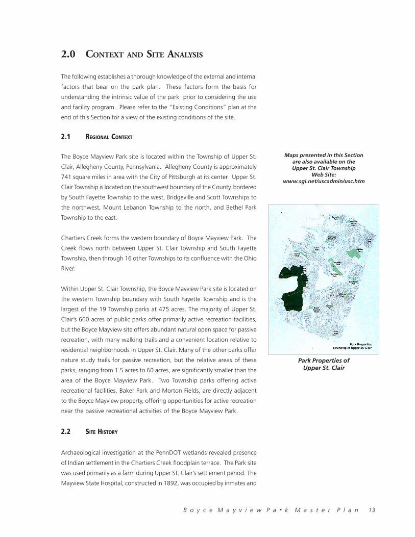
2.1 REGIONAL CONTEXT
The Boyce Mayview Park site is located within the Township of Upper St.
Clair, Allegheny County, Pennsylvania. Allegheny County is approximately
741 square miles in area with the City of Pittsburgh at its center. Upper St.
Clair Township is located on the southwest boundary of the County, bordered
by South Fayette Township to the west, Bridgeville and Scott Townships to
the northwest, Mount Lebanon Township to the north, and Bethel Park
Township to the east.
Chartiers Creek forms the western boundary of Boyce Mayview Park. The
Creek flows north between Upper St. Clair Township and South Fayette
Township, then through 16 other Townships to its confluence with the Ohio
River.
Within Upper St. Clair Township, the Boyce Mayview Park site is located on
the western Township boundary with South Fayette Township and is the
largest of the 19 Township parks at 475 acres. The majority of Upper St.
Clair’s 660 acres of public parks offer primarily active recreation facilities,
but the Boyce Mayview site offers abundant natural open space for passive
recreation, with many walking trails and a convenient location relative to
residential neighborhoods in Upper St. Clair. Many of the other parks offer
nature study trails for passive recreation, but the relative areas of these
parks, ranging from 1.5 acres to 60 acres, are significantly smaller than the
area of the Boyce Mayview Park. Two Township parks offering active
recreational facilities, Baker Park and Morton Fields, are directly adjacent
to the Boyce Mayview property, offering opportunities for active recreation
near the passive recreational activities of the Boyce Mayview Park.
2.2 SITE HISTORY
Archaeological investigation at the PennDOT wetlands revealed presence
of Indian settlement in the Chartiers Creek floodplain terrace. The Park site
was used primarily as a farm during Upper St. Clair’s settlement period. The
Mayview State Hospital, constructed in 1892, was occupied by inmates and
Maps presented in this Sectionare also available on theUpper St. Clair Township
Web Site:www.sgi.net/uscadmin/usc.htm
Park Properties ofUpper St. Clair

14 B o y c e M a y v i e w P a r k M a s t e r P l a n
patients by 1894. The State Hospital’s farm site was located in Upper St.
Clair Township, just across Chartiers Creek from the Mayview Hospital
Grounds at the Barn Complex that is seen today. The farm produced food
for the Mayview State Hospital and included a variety of livestock, including
hogs, Holstein cows, and chickens, as well as a fruit and vegetable garden.
Memoirs of farm families note the celebrations that took place near the
orchards in the northwest corner of the park property. The entire park
property has been deep mined for coal, which involved the creation of an
extensive underground tunnels (room and pillar mining) for the transport of
coal.
2.3 EXISTING CULTURAL FEATURES
Existing Structures and Building Assessment
The Mayview Barn Complex is located in the northwest section of the site.
The existing structures on site include a large wooden storage building, a
small wooden storage building (root cellar), a dairy barn with two pair of
structural tile silos and one pair of concrete silos, a main hay storage barn
with livestock pens and storage below, two attached milking barns with
hay lofts above, attached concrete block milk handling rooms, a weigh
station, a fuel storage building, an open pole barn, and other miscellaneous
structures
Use of the complex as a dairy stopped in early 1980s. Since that time, while
some attempt has been made to secure and maintain the buildings, moderate
to severe damage from vandalism, scavenging of materials and the weather
has occurred. Portions of some buildings have collapsed. The buildings are
currently not used except for limited hay and machinery storage.
Land Use
Historical Photograph of MayviewState Hospital grounds

B o y c e M a y v i e w P a r k M a s t e r P l a n 15
Vehicular Access
Boyce Road forms the southern border of Boyce Mayview Park and is a
heavily traveled roadway in Upper St. Clair Township, linking Route. 19 with
South Fayette Township. From Boyce Road, Boyce Mayview Park can be
accessed at the location of the Community Gardens, near the intersection
of Boyce Road and Morton Road, as well as from the southwest corner of
the Park where the road leading to the municipal Compost Facility is located.
Morton Road forms the eastern border of Boyce Mayview Park and is a
narrow roadway with a steep grade and many curves. The road does not
have significant shoulders and is lined with guardrails in many places on the
west edge of the road. The grade to the west of the road drops steeply
down into the Park site in several locations.
Morrow Road borders the Baker Park and Baker School complex to the
north and connects Sky Ridge Drive to Morton Road. One access point
exists along Morrow Road to the Baker Park paved parking areas.
Mayview Barn Complex
Plan view of Mayview Farm Propertywith figure-ground drawing of thecoal mine patterns under the site.Note the Mayview Barn Complex onthe lower left corner of the drawing.
16 B o y c e M a y v i e w P a r k M a s t e r P l a n
M a y v i ew B a rn C o m p le x M a y v i e w R o a dCoal Seam
C h a r t ie rs C re ek M e a d o w
Site Cross Section
Sky Ridge Drive is located to the north of the Boyce Mayview Park site and
is a double loaded residential street. It is bordered on both sides by single
family residential housing. Sky Ridge Drive offers no direct access to Boyce
Mayview Park.
Mayview Road is located to the west of the Boyce Mayview Park site. It
offers two accesses to the Park at the Mayview Barn complex and at a
small scale access road at the north west corner of the Park near the junction
of Sky Ridge Drive. The access to the Mayview Barn complex is currently
closed to vehicles with a cable gate across the driveway to the Barns. No
parking is currently available at either of these access points.
Utilities/Infrastructure
The existing utilities in the area of the Boyce Mayview Park property are
primarily located around its perimeter. All utility connections to the site have
been disconnected.
Several utilities such as electric, natural gas and sanitary sewers traverse
the property. In general, it appears that utility services to serve new
development within the Park could be secured. This would also be the case
for the existing recreational complexes in the Park, which would be expanded
or upgraded.
2.4 EXISTING NATURAL FEATURES
The combined value of the park’s wide range of physiographic characteristics
is more important than any specific natural feature found in the park. The
site includes the extremes of elevations found in the region and an unusual
spectrum of topographic features. Ravines, floodplain or bottomlands, river
terraces, upper plateaus, three unnamed headwater tributary streams and
the full range of possible aspects and slopes are all present on the site.
Geology
The geology of the Park site exhibits the range of geological features seen
throughout the region.
This cross-section cuts through theMayview Barn Complex. Coal depositslie under much of the Park.

B o y c e M a y v i e w P a r k M a s t e r P l a n 17
Bedrock underlying the Boyce Mayview Park site has been dated back to
the Permian Age (250-290 million years). This sedimentary rock consists of
shale, sandstone, conglomerate, limestone, and coal. The coal deposits for
the Mayview Mine are classified as a Pittsburgh Seam, ranging from a surface
elevation of 820-1170 feet to a depth of 780-840 feet.
Hydrology/Wetlands
Chartiers Creek, bordering the site to the west, is considered to be a mid-
sized stream within the region. Three unnamed headwater tributary streams
exist on the Park site and flow into Chartiers Creek. Two of these tributaries
lie within the Park boundaries in their entirety, providing a unique feature
and educational opportunity.
Wetlands on site have been verified via field investigation by the team
Hydrology - Floodplain
Map of coal seam deposits insouthwestern Pennsylvania(source: The Atlas of Pennsylvania,Temple University Press, 1989)

18 B o y c e M a y v i e w P a r k M a s t e r P l a n
Slope Analysis
ecologists. The Pennsylvania Department of Transportation (PennDOT) has
completed three phases in a compensatory mitigation project to create
wetlands along Chartiers Creek adjacent to the Boyce Mayview Park site.
These three wetlands have been constructed to offset the impacts of local
highway construction.
Slopes
The slopes on site were analyzed and classified into four categories: 0-5
percent slopes (flat or gently sloping land), 6-12 percent slopes, 13-25 percent
slopes, and slopes greater than 25 percent (steepest slopes). These slope
categories, when compared against the Township development standards
and regulations, assume that slopes from 0-5 percent are developable, 6-
12 percent are developable, but would require more earthwork and be
more costly to develop, 13-25 percent slopes are not appropriate for
development, and slopes greater than 25 percent are not developable.
Habitat Units
Soils:
Boyce-Mayview Park exhibits a variety of soil characteristics in the context
of the surrounding region. The presence of the full range of regional soil
types on site helps to account for the site’s wide diversity of vegetation and
habitat types. The parent material in the northern part of the region is
characterized by acidic siltstone and sandstone, with silt loam and clayey
soils.
The pH for the majority of the soils found throughout the site is slightly
acidic (typical pH=5.5). The southern portion of the site, however, also
includes soils that have shale imbedded with limestone as the parent material,
resulting in a soil pH that is closer to neutral (pH=7). This soil condition is
considered to be unique in the Allegheny County region. The varied soil pH
Wetland Areas
B o y c e M a y v i e w P a r k M a s t e r P l a n 19
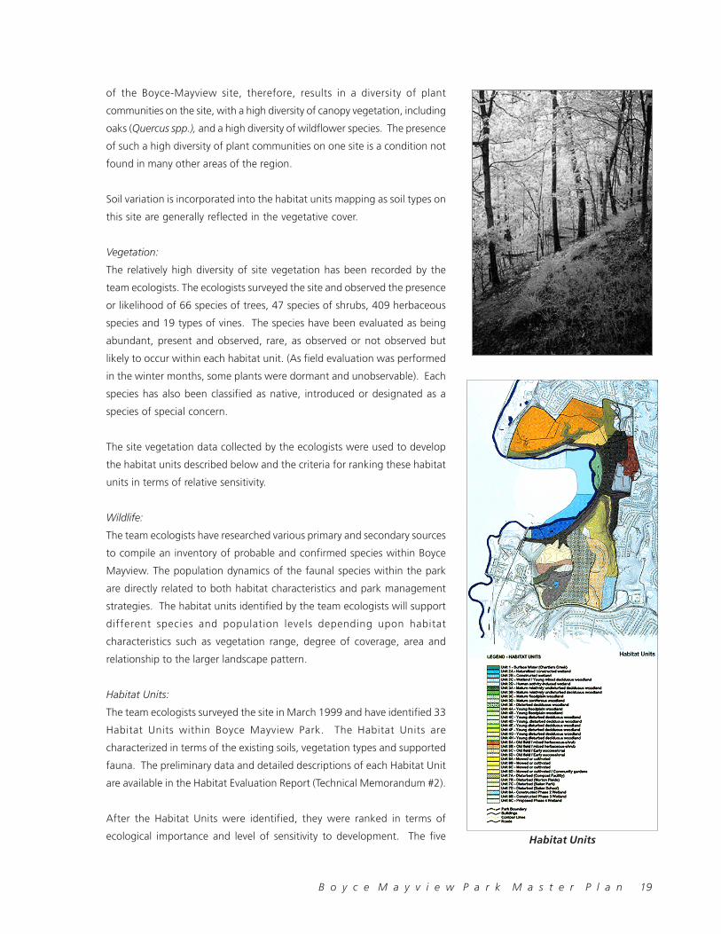
of the Boyce-Mayview site, therefore, results in a diversity of plant
communities on the site, with a high diversity of canopy vegetation, including
oaks (Quercus spp.), and a high diversity of wildflower species. The presence
of such a high diversity of plant communities on one site is a condition not
found in many other areas of the region.
Soil variation is incorporated into the habitat units mapping as soil types on
this site are generally reflected in the vegetative cover.
Vegetation:
The relatively high diversity of site vegetation has been recorded by the
team ecologists. The ecologists surveyed the site and observed the presence
or likelihood of 66 species of trees, 47 species of shrubs, 409 herbaceous
species and 19 types of vines. The species have been evaluated as being
abundant, present and observed, rare, as observed or not observed but
likely to occur within each habitat unit. (As field evaluation was performed
in the winter months, some plants were dormant and unobservable). Each
species has also been classified as native, introduced or designated as a
species of special concern.
The site vegetation data collected by the ecologists were used to develop
the habitat units described below and the criteria for ranking these habitat
units in terms of relative sensitivity.
Wildlife:
The team ecologists have researched various primary and secondary sources
to compile an inventory of probable and confirmed species within Boyce
Mayview. The population dynamics of the faunal species within the park
are directly related to both habitat characteristics and park management
strategies. The habitat units identified by the team ecologists will support
different species and population levels depending upon habitat
characteristics such as vegetation range, degree of coverage, area and
relationship to the larger landscape pattern.
Habitat Units:
The team ecologists surveyed the site in March 1999 and have identified 33
Habitat Units within Boyce Mayview Park. The Habitat Units are
characterized in terms of the existing soils, vegetation types and supported
fauna. The preliminary data and detailed descriptions of each Habitat Unit
are available in the Habitat Evaluation Report (Technical Memorandum #2).
After the Habitat Units were identified, they were ranked in terms of
ecological importance and level of sensitivity to development. The five Habitat Units

20 B o y c e M a y v i e w P a r k M a s t e r P l a n
Habitat Unit Sensitivity
criteria used by the ecologists in determining the relative sensitivity of the
designated Habitat Units were:
1. Diversity of vegetation and wildlife
2. Relative availability of the habitat regionally
3. Indicator/rare/endangered species (either confirmed or suspected)
4. Degree of past disturbance
5. Potential for enhancement of habitat quality/bio-diversity
These criteria are the basis of the ranking system used to classify the habitat
units into a four-tier sensitivity ranking. The four tiers include:
1. Most Sensitive - Habitat Unit is of high value and should not be disturbed
2. Moderately Sensitive - Habitat Unit is minimally disturbed and may be
enhanced through relatively modest means
3. Less Sensitive - Habitat Unit is significantly disturbed but may be
significantly enhanced
4. Least Sensitive – Habitat has low value due to severe disturbance and
potential exists for development or creation of new habitats
The most valuable habitat type on the site, as determined by the team
ecologists, are mature woodlands. Mature forests are considered to be
more rare than wetlands; they typically have been undisturbed and have
maintained their original character.
2.5 SITE ANALYSIS
After studying the data collected on hydrology, wetlands, slopes, and habitat
units on the Boyce Mayview site, a Composite Sensitivity map was developed
to summarize and combine the analysis from all natural feature inventory
maps. This analysis leads to an assessment of the areas of the Boyce
Mayview Park site that could be used for program development.
The Composite Sensitivity map classifies the site into four categories: most
sensitive areas, moderately sensitive areas, less sensitive areas, and least
sensitive areas. The most sensitive areas are shown on the map with a
dark green color, while the least sensitive areas are shown with a pale
yellow.
The most sensitive areas are considered to be of high value and should not
be disturbed. These areas include land with the steepest slopes and the
Habitat Units ranked as “most sensitive.” Moderately sensitive areas include
land with moderately steep slopes (13-25%) and minimally disturbed habitats

B o y c e M a y v i e w P a r k M a s t e r P l a n 21
that might be enhanced through relatively modest means. Less sensitive
areas include land with somewhat gentle slopes and significant disturbance,
but with potential for significant enhancement. Least sensitive areas have
gentle slopes and have been severely disturbed, resulting in a great potential
for development and/or creation of new habitats.
As can be seen in the Composite Sensitivity Map, the least sensitive areas
of the Park include a large site in the northwest corner of the Park, adjacent
to the Mayview Barn complex. Also on the north end of the park are two
less sensitive areas between the Mayview Barn complex and the Baker
School. In the southern area of the site, a large area in the southwest
corner, near the Municipal Composting Facility and the PennDOT wetlands,
has been categorized as less- or least sensitive. The southeast corner of
the site contains small less sensitive areas where the existing Community
Gardens are located. This southeast corner, however, consists mainly of
most- to moderately sensitive areas adjacent to the Gardens, which could
have greater habitat potential if these less sensitive areas were managed
as successional woodlands to enhance habitat for the Park’s many wildlife
species.
2.6 SITE OPPORTUNITIES AND CONSTRAINTS
After assessing the value of the site features within the Boyce Mayview
Park, the most important attributes to preserve, enhance, or change were
determined, leading to an objective basis for the identification of
opportunities and constraints on the site. Due to the diversity of habitats on
site, as shown in the Habitat Units Map, and the use of the site for passive
and active recreation, separate maps were produced to display the Habitat
Opportunities and Constraints and the Recreation Opportunities and
Constraints.
Identifying opportunities and constraints based on the existing site features
and conditions, combined with the identification of the desired program
elements for the site, allows for the formation of conceptual design
alternatives and initiates the decision making process.
Both Opportunities and Constraints maps build on the Composite Sensitivity
map developed in the site analysis. The Habitat Opportunities and Constraints
map considers the relative sensitivity of different areas of the site for meeting
habitat conservation and enhancement goals, including the designation of
buffer areas as well as an area to encourage the highest level of bird species
diversity. The Recreation Opportunities and Constraints map considers the
possible recreation goals for specific areas of the site and highlights possible
Composite Sensitivity
Habitat Opportunitiesand Constraints
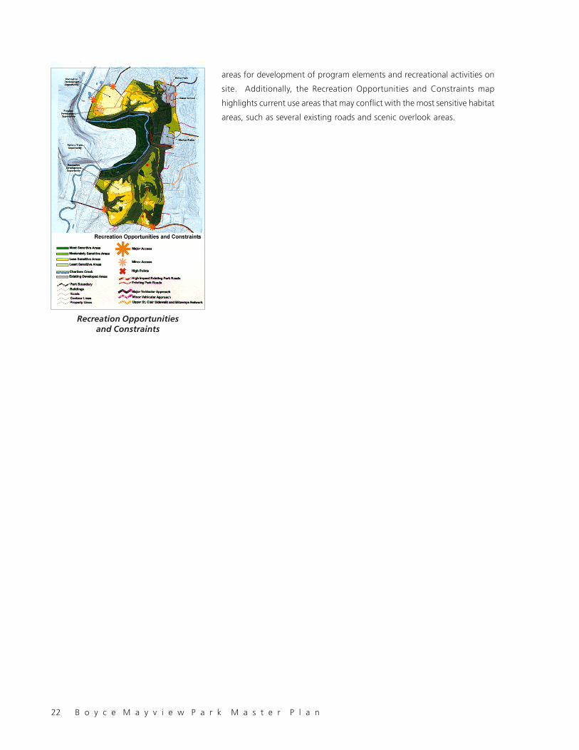
22 B o y c e M a y v i e w P a r k M a s t e r P l a n
areas for development of program elements and recreational activities on
site. Additionally, the Recreation Opportunities and Constraints map
highlights current use areas that may conflict with the most sensitive habitat
areas, such as several existing roads and scenic overlook areas.
Recreation Opportunitiesand Constraints

B o y c e M a y v i e w P a r k M a s t e r P l a n 23
3.0 PROGRAM
The use program for the park was determined based on input from the
community gained through a user survey, personal interviews, and public
workshops. The process revealed a wide range of interests ranging from
pure preservation to a balance of preservation and recreation. The program
outlined below includes a reasonable range of activities that could be
accommodated on the site while preserving the vast majority of its most
sensitive areas.
3.1 COMMUNITY CENTER
The Community Center could include at a minimum meeting rooms and a
large “commons room” for multipurpose use, as well as a kitchen,
bathrooms, and storage space. The adaptive re-use of the Mayview Dairy
Barn should be considered in the development of plans for the Community
Center. Further evaluation of this program should be done in concert with
potential funding partner(s).
3.2 RECREATION CENTER
Due to structural and spatial requirements, The Recreation Center could be
a new structure on site with two full size side-by side basketball courts with
a “competition” court lengthwise, flanked by retractable seating, a wrestling/
exercise room, and locker rooms. Further evaluation of this program should
be done in concert with potential funding partner(s).
3.3 OUTDOOR POOL
A new community swimming pool could offer eight 25 meter lanes, low-
and mid-height diving boards and a children’s swimming area/baby pool. A
recent trend in public pool design termed “family aquatic centers” includes
water slide(s), zero-depth (sloped) entry, and spray fountains all of which
have proved to create a higher level of use and return on investment than
the basic amenities. A bathhouse for the pool, with changing rooms, an
office/admissions area, utility room, and equipment storage space, could be
a separate structure or located in the Recreation Center.
3.4 ENVIRONMENTAL EDUCATION CENTER
The nature center would be an educational facility located on a level area
between two swales leading to the Chartiers Creek. The center would be
designed using principles of “green architecture,” and could include a

24 B o y c e M a y v i e w P a r k M a s t e r P l a n
classroom, theater, office space, and laboratory space. Further evaluation
of this program should be done in concert with potential funding partner(s).
3.5 ACTIVE RECREATION
Multipurpose fields
A large unprogrammed field area, approximately the size of two soccer
fields would be evenly graded and drained to accommodate a variety of
outdoor sports, including soccer, football, and baseball. The fields would
not be striped for any one sport, nor would they be designed with any fixed
equipment (such as goalposts or nets).
Multi-Use (Bicycle) Trail
A multi-use trail would be paved and accommodate both walkers and
bicyclists, and would require a minimum 8-foot width. The trail would require
signs or striping to indicate bike/pedestrian zones and sight distance/
vegetation clearing to meet safety standards.
Pet Exercise Area (Dog Run)
A pet exercise area made up of 7-8 acres would have an unobtrusive
perimeter fence or barrier to allow dogs to run free in a controlled area.
3.6 PASSIVE RECREATION
Trails throughout the Park site should offer a variety of trail length options
for walks of different durations and level of difficulty. ADA (disabled-
accessible) paths should be provided within the site. Walking trails could
combine with other site trails to link key habitat areas and restoration areas
into an “eco-tour” of the site. Trails would be designed in a hierarchy from
paved to wood chip trails depending on their proximity to sensitive habitats.
3.7 GATHERING AREAS
A Public Lawn of 12-13 acres and would be a level area of groomed lawn
for unprogrammed use such as frisbee and picnicking, and possible occasional
community gatherings.
3.8 COMMUNITY GARDENS
The Community Gardens would be located on a south facing area with a
moderate slope. The garden area should provide potable water for irrigation
to several faucet locations and should be designed to accommodate vehicle
access to garden plots. The gardens should be buffered from adjacent
uses, removed form active use areas, and screened from adjacent residences.

B o y c e M a y v i e w P a r k M a s t e r P l a n 25
4.0 MASTER PLAN CONCEPT
4.1 PRINCIPLES
The planning and design of the park was informed by a series of guiding
principles derived from the findings of the site analysis and community
involvement process. These principles comprise the core of the master plan
and are the touchstones for determining the physical form the park will
take on.
• Preserve sensitive habitats. Preserve sensitive habitats. Preserve sensitive habitats. Preserve sensitive habitats. Preserve sensitive habitats. The park is blessed by an extraordinarily
diverse range of topography, vegetation, and water resources. Together
these systems form specific habitats for most of the native flora and
fauna indigenous to the region.
• ImprImprImprImprImprove water qualityove water qualityove water qualityove water qualityove water quality. . . . . Stretched along the Chartiers Creek, the
park can act as a giant filter for urban stormwater runoff from adjacent
development. Water quality is a major issue nationwide, and the actions
taken in the park specific to Chartiers Creek will aid the ongoing efforts
to improve water quality in the Creek.
• Limit vehicular access to the perimeter of the site to preserveLimit vehicular access to the perimeter of the site to preserveLimit vehicular access to the perimeter of the site to preserveLimit vehicular access to the perimeter of the site to preserveLimit vehicular access to the perimeter of the site to preserve
the interiorthe interiorthe interiorthe interiorthe interior. . . . . Provide access to the park, but in a way that does not
trammel the very resource being preserved.
• Link Boyce and Mayview propertiesLink Boyce and Mayview propertiesLink Boyce and Mayview propertiesLink Boyce and Mayview propertiesLink Boyce and Mayview properties. The two properties are
separated by a deep ravine that effectively severs the expanse of the
entire 475 acres. By linking north and south the public can better
experience the total park.

26 B o y c e M a y v i e w P a r k M a s t e r P l a n
• Define and enhance spatial areas. Define and enhance spatial areas. Define and enhance spatial areas. Define and enhance spatial areas. Define and enhance spatial areas. Diversity of habitat is paralleled
by diversity of space on the park, ranging from hilltops to the creek
valley, from flat meadows to precipitous slopes. The changing spatial
experience of passing through and among these spaces makes the
park seem much larger, and greatly adds to its worth.
• Limit active rLimit active rLimit active rLimit active rLimit active recrecrecrecrecreation to the noreation to the noreation to the noreation to the noreation to the north arth arth arth arth area of the site. ea of the site. ea of the site. ea of the site. ea of the site. To retain
the largest reasonable area for preservation of wildlife habitat, limit
intensive human activity and vehicular access as much as possible to
the north of the site which is less constrained by the presence of sensitive
natural resources.
• Connect major habitats, program features and key adjacentConnect major habitats, program features and key adjacentConnect major habitats, program features and key adjacentConnect major habitats, program features and key adjacentConnect major habitats, program features and key adjacent
uses. uses. uses. uses. uses. A fully developed network of pedestrian and bicycle access to
and within the park will enable the community to fully appreciate the
park and will distribute impact of use more evenly.
• Improve pedestrian access by developing trail links from theImprove pedestrian access by developing trail links from theImprove pedestrian access by developing trail links from theImprove pedestrian access by developing trail links from theImprove pedestrian access by developing trail links from the
community to the key areas within the Park. community to the key areas within the Park. community to the key areas within the Park. community to the key areas within the Park. community to the key areas within the Park. Getting people to
the park conveniently with the least amount of disturbance to the park
requires excellent connections to the planned sidewalk and bicycle paths
planned by the Township. More people reaching the park on foot and
by bike mean less traffic in the adjoining neighborhoods and less impact
on the park.
4.2 MASTER PLAN CONCEPT
The Conceptual Master Plan was formulated based on input received from
the community and park board about the alternative concept plans. The
Conceptual Master Plan illustrates the principles described above and shows
the proposed location of the program elements.

B o y c e M a y v i e w P a r k M a s t e r P l a n 27
5.0 THE MASTER PLAN
Boyce Mayview Park will include a balance of active and passive recreation,
and natural resource preservation. 86% (approximately 409 acres) of the
site will be devoted to environmental preservation and enhancement with
mostly passive recreation. Limited active recreational development on 14%
(approximately 66 acres) of the site will be in the newly-designated Mayview
Commons at the north end of the Mayview property barn complex.
Boyce Mayview Park will be easily accessible and usable by all Township
residents by all modes of transportation, age or physical ability. It is linked
by path system to the Township bicycle and pedestrian walkway system,
surrounding residential neighborhoods and schools, adjacent Morton and
Baker Parks and a potential spur connection to the Montour rail-to-trail
system. Within the park, all major facilities are interconnected with paths.
A 3500 foot Arc Walk connects Mayview and Boyce parcels via a bridge
across the central ravine, providing an ADA accessible path, and
accommodating occasional maintenance, service and emergency vehicles.
The Arc Walk extends from the Commons to the PennDOT wetlands,
connecting the public lawn, ball fields, nature center, habitat areas, wetland
and creek. Vehicular access by way of bus or car is provided to the north
via Mayview Road, to the south via Boyce Road, and along the Morton Road
side of the park via the contiguous park and school facilities’ parking lots.
Boyce Mayview Park balances the community’s needs for passive, nature
oriented activities with limited recreational activities. The predominant use
of the park is for passive nature oriented activities served by trails, overlooks
and seating areas. The trails thread through open meadows and forests,
and through existing high value habitats and restoration areas.
Active uses are clustered in the Mayview Commons, a group of buildings
and open spaces around the Mayview dairy barn in the northwest of the
site The Commons is conceived as a “village center” of uses around green
space comparable to a New England town common. With a long history of
productive uses that included both farming and coal mining, the park’s past
private and institutional farming use is expressed in a contemporary theme
of productive, sustainable development.
Boyce Mayview Park, as befits its importance in the Township, offers more
than active and passive recreation. Environmental preservation and
recreation are placed in the context of a larger message of sustainable
development and community. This message is presented through the
inclusion of a Environmental Education Center providing an opportunity for

28 B o y c e M a y v i e w P a r k M a s t e r P l a n
an environmental educational program, through community gardens, and
the community composting/recycling facility.
5.1 SUSTAINABLE DESIGN
“Sustainability” is generally defined as the wise use of natural and man-
made resources to ensure the most benefit from the least destruction or
depletion of finite resources. The following is only a brief list of the many
sustainability principles that should be considered when siting the program
elements on the Boyce Mayview Park site:
Planning and Programming
· Use park as a demonstration for the ecological and educational merits
of a fully integrated sustainable design program
· Combine community-oriented programs where possible:
· Recycling, Composting, Gardening
· Township tree nursery
· Locate facilities near road access where feasible
Engineering
· Use pervious surfaces where possible to minimize runoff (stabilized lawn,
gravel, porous pavement)
· De-silt and filter runoff before discharging into natural drainage ways
· Groundwater recharge of stormwater runoff
· Use on-site septic system and/or composting toilets for normal sanitary
flow, and rental units for peak flow periods
Architecture
· Re-use existing structures where feasible
· Design to minimize energy costs
· Consider earth-sheltered “green” design to integrate new structures
with the site
Landscape
· Use low maintenance, drought tolerant plants
· Use recycled materials
· Locate plantings to shade from summer sun and buffer from winter
winds
Implementation
· Limit construction impacts by close management of project areas and
access.

B o y c e M a y v i e w P a r k M a s t e r P l a n 29
THE PRINCIPLES OF SUSTAINABILITY
Sustainability does not require a loss in the quality of life, but does require a change in mind-set, a change in values
toward less consumptive lifestyles. These changes must embrace global interdependence, environmental stewardship,
social responsibility, and economic viability.
Sustainable design must use an alternative approach to traditional design that incorporates these changes in mind-set.
The new design approach must recognize the impacts of every design choice on the natural and cultural resources of the
local, regional, and global environments.
A model of the new design principles necesary for sustainability is exemplified by the “Hanover Principles” or “Bill of
Rights for the Planet,” developed by William McDonough Architects for EXPO 2000 to be held in Hannover, Germany.
1. Insist on the right of humanity and nature to co-exist in a healthy, supportive, diverse, and sustainable condition.
2. Recognize Interdependence. The elements of human design interact with and depend on the natural world, with
broad and diverse implications at every scale. Expand design considerations to recognizing even distant effects.
3. Respect relationships between spirit and matter. Consider all aspects of human settlement including community,
dwelling, industry, and trade in terms of existing and evolving connections between spiritual and material consciousness.
4. Accept responsibility for the consequences of design decisions upon human well-being, the viability of natural
systems, and their right to co-exist.
5. Create safe objects of long-term value. Do not burden future generations with requirements for maintenance or
vigilant administration of potential danger due to the careless creations of products, processes, or standards.
6. Eliminate the concept of waste. Evaluate and optimize the full life-cycle of products and processes, to approach the
state of natural systems in which there is no waste.
7. Rely on natural energy flows. Human designs should, like the living world, derive their creative forces from perpetual
solar income. Incorporate this energy efficiently and safely for responsible use.
8. Understand the limitations of design. No human creation lasts forever and design does not solve all problems. Those
who create and plan should practice humility in the face of nature. Treat nature as a model and mentor, not an
inconvenience to be evaded or controlled.
9. Seek constant improvements by sharing knowledge. Encourage direct and open communication between colleagues,
patrons, manufacturers, and users to link long-term sustainable considerations with ethical responsibility, and reestablish
the integral relationship between natural processes and human activity.
(source: Guiding Principles of Sustainable Design, National Park Service, U. S. Department of Interior, September 1993)
30 B o y c e M a y v i e w P a r k M a s t e r P l a n
Management
· Reduce intensive landscape maintenance by using native materials
· Use long lasting, durable materials to extend lifecycle costs
· Use low impact “best management practices” for site maintenance
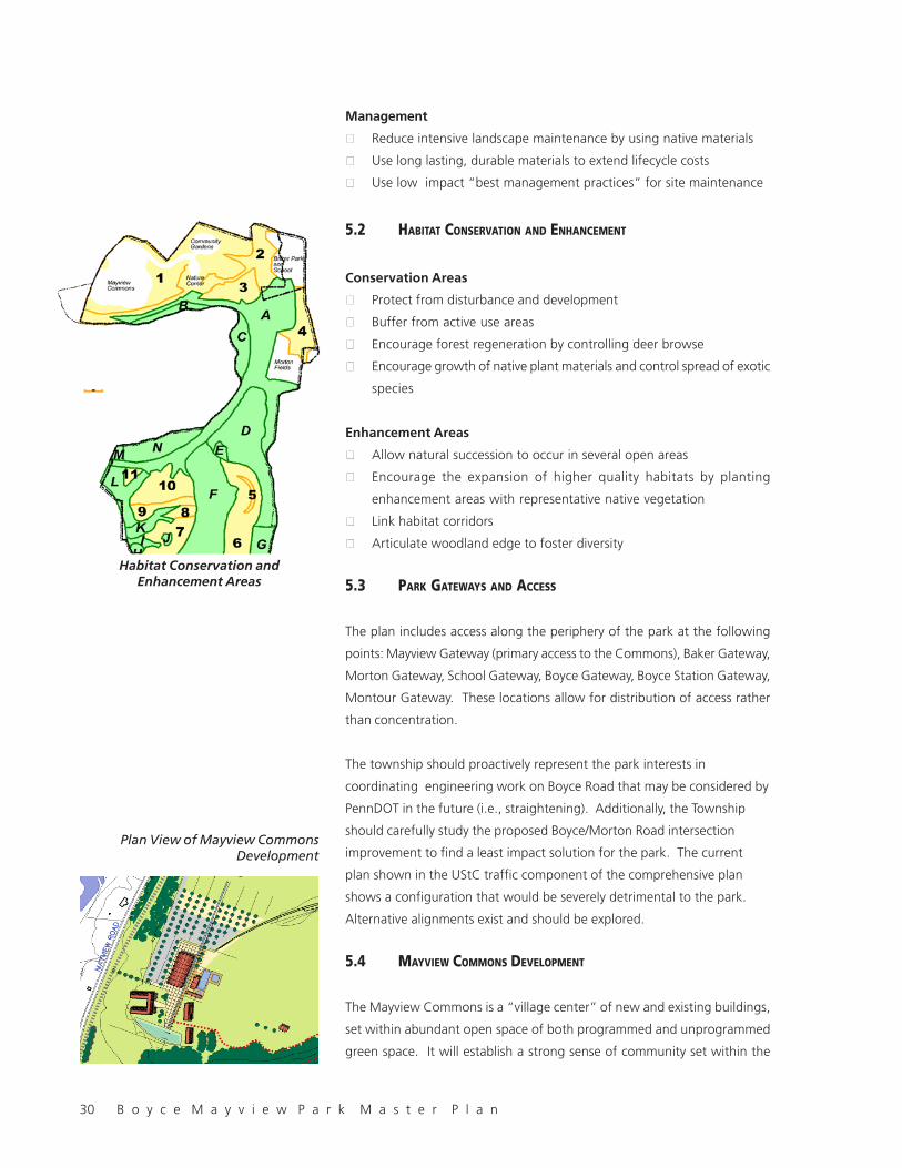
5.2 HABITAT CONSERVATION AND ENHANCEMENT
Conservation Areas
· Protect from disturbance and development
· Buffer from active use areas
· Encourage forest regeneration by controlling deer browse
· Encourage growth of native plant materials and control spread of exotic
species
Enhancement Areas
· Allow natural succession to occur in several open areas
· Encourage the expansion of higher quality habitats by planting
enhancement areas with representative native vegetation
· Link habitat corridors
· Articulate woodland edge to foster diversity
5.3 PARK GATEWAYS AND ACCESS
The plan includes access along the periphery of the park at the following
points: Mayview Gateway (primary access to the Commons), Baker Gateway,
Morton Gateway, School Gateway, Boyce Gateway, Boyce Station Gateway,
Montour Gateway. These locations allow for distribution of access rather
than concentration.
The township should proactively represent the park interests in
coordinating engineering work on Boyce Road that may be considered by
PennDOT in the future (i.e., straightening). Additionally, the Township
should carefully study the proposed Boyce/Morton Road intersection
improvement to find a least impact solution for the park. The current
plan shown in the UStC traffic component of the comprehensive plan
shows a configuration that would be severely detrimental to the park.
Alternative alignments exist and should be explored.
5.4 MAYVIEW COMMONS DEVELOPMENT
The Mayview Commons is a “village center” of new and existing buildings,
set within abundant open space of both programmed and unprogrammed
green space. It will establish a strong sense of community set within the
Plan View of Mayview CommonsDevelopment
Habitat Conservation andEnhancement Areas

B o y c e M a y v i e w P a r k M a s t e r P l a n 31
context of nature, providing both a link to the site’s past agricultural use,
and its future intended use as a place for Upper St. Clair residents to gather
and recreate.
The Commons could be an attractive venue for seasonal festivals and major
communal activities such as the 4th of July fireworks. The remainder of the
park will remain in passive recreation use.
Components of the Commons discussed below are:
· Community Center
· Recreation Center
· Pool
· Commons Plaza
· Public Lawn
· Multipurpose Field
· Dog Run Area
· Access Road and Parking
· Buffer Planting
· Arc Walk
Mayview Commons Site Plan
The Commons is accessed from Mayview Road at a point several hundred
feet uphill (north) of the present driveway aligned with the existing driveway
to the abandoned pool and golf complex.. The relocated driveway will afford
a spectacular panoramic view across the fields for motorists entering the
site, immediately exposing visitors to the broad meadows of the Mayview
Commons. The new entry location allows traffic bound separately for the
Environmental Education Center and Commons to split and move north or
south. This will allow Environmental Education Center visitors to avoid the
parking and drop-off areas for the Commons, which may be busy at times.
Plan view and sketch of entry drive tothe Mayview Commons Development
32 B o y c e M a y v i e w P a r k M a s t e r P l a n
Improvements to Mayview Road such as widening for turning lanes, signs,
lights, and drainage improvements will be necessary.
After the entry, traffic bound for the community and recreation centers
proceeds south along the driveway past the parking lots and recreation
center driveway to the Commons plaza, around which are located the new
recreation center and pool, community center, and picnic pavilion. Visitor
drop-offs are provided at the upper level of the recreation center driveway,
and at the main level of the plaza.
The plaza between the existing barns serves as a welcoming orientation
space and a place for small and mid sized gatherings. Entrances to the
main buildings are located on the plaza, making it a natural gathering place
and focal point.
The sloping terrain allows the Commons to be designed in three terraced
levels, providing visual interest and taking advantage of the grade differential
to reduce the appearance of bulky building masses. From the top down,
the upper level would include the second floor of the recreation center, the
picnic pavilion, both of which would face east, opening out to the public
lawn. The main or intermediate level would be the plaza level, which
would allow access to the first floor of the recreation center and the upper
floor of the community center in the Mayview dairy barn. The lower level
would allow access from the milking wings of the Mayview Community
Center barn to the barn courtyard.
For the purposes of the master plan, a unifying circular geometry has been
superimposed on the Commons building complex, signifying community and
a commitment to a unified design appearance allowing variety within an
overall framework.
Plan view and sketch of MayviewCommons Development
B o y c e M a y v i e w P a r k M a s t e r P l a n 33
Community Center
A major component of Mayview Commons is the Community Center with a
central gathering hall, meeting/exercise rooms, kitchen and space for
township recreation staff/site manager offices, and additional rooms for
storage and utility use.
The existing Mayview Dairy Barn will be studied further to determine its
suitability to house the community center. This decision is based on the
knowledge that renovating the existing building could cost as least as much
as building a new facility. WRT recommends that the added benefit of
preserving the barn as an attractive and unusual relic of the former
agricultural use of the site outweighs the advantages of building a new
structure.
Recreation Center
Because of the large spaces that need to be accommodated without
intervening walls and columns, the Recreation Center would be housed in a
new structure separate from the Community Center but adjacent to the
plaza. The new structure would house two basketball courts, changing
rooms, wrestling rooms and support uses. It is assumed at this time that the
two structures would not be connected, although that could be
accommodated if important to the program. Although this type of municipal
recreation and community center is economically placed under one roof,
the potential for reuse of the existing farm structures and the compelling
image of dispersed farm buildings around a central open space provides
justification for separate community and recreation centers. Further detail
on programming will be possible once the approximate level of expenditure
is committed and the funding participants are known.
The upper level would open onto the lawn and pool area and the lower
level would open onto and be accessible from the plaza. The recreation
center will be designed to be compatible with the existing structures. With
the possibility of two levels, the footprint could be consolidated and earthwork
costs reduced.
Pool
The proposed pool complex would include a 25 meter pool with eight lanes
and a diving “ell,” middle depth pool, and toddler pool. Possible additional
features common to a recent successful trend called “family aquatic centers”
could include “zero depth” pool entries, sliding boards, lights, and spray
features. The pool complex would be served by a bathhouse with bathrooms,
showers, changing areas, lockers, office, control station, and pump/storage
rooms. Site features around the pool would include a paved apron area,

34 B o y c e M a y v i e w P a r k M a s t e r P l a n
lawn area, seating, lighting, and an aesthetically attractive fence/wall system.
The possibility of an indoor-outdoor pool, a seasonally covered pool, or some
such architecturally- integrated complex is under consideration.
Picnic Pavilion
The existing wooden barn should be studied in detail to consider its reuse as
a picnic pavilion to accommodate large gatherings. The existing space
between the two barns, as well as the spaces among the outbuildings is an
important part of the spatial character of the commons.
By opening the sides to the air, the currently enclosed barn will be have a
dramatic, airy feel and will allow views from the Community center and
plaza through the Pavilion to the public lawn beyond. The pavilion could
house picnic tables, barbecue grills, a concession stand, and storage areas.
Due to its large mass, it could also possibly act as a backdrop/stage for
events on the public lawn.
Picnic Shelters
Picnic shelters will be located around the public lawn and multipurpose field.
The shelters will have a concrete base, picnic benches and trash containers
and will be located near walkways/service routes for ease of access and
maintenance. Shelters will be placed so that they are close to the woods
for shade and open to the lawn area for activities. WRT recommends that
the shelter be designed to relate to the recreation center, and other new
park structures to create a unified aesthetic image for the park.
Public Lawn
The Public Lawn will be a 2-3 acre expanse of gently sloping lawn that
could accommodate large crowds during an outdoor event, or merely be a
place for unprogrammed picnicking and informal play – a place to toss a
frisbee, fly a kite, or lay back and watch the clouds go by. The public lawn
Plan view and sketch of MayviewCommons Development and swimming
pool

B o y c e M a y v i e w P a r k M a s t e r P l a n 35
will be accessible from the picnic pavilion, picnic shelters, upper level of
recreation center, and multipurpose fields.
Multipurpose Field
The Multipurpose Field will accommodate two soccer sized fields, but will
not be striped for competition play, and will not have goals or seating. The
multipurpose field will be accessible from the arc walk and the Environmental
Education Center driveway parking lot.
Dog Run Area
The Dog Run will provide resident dog owners with a convenient place to
allow dogs to run unleashed yet contained and separate from the sensitive
habitat areas and general use areas of the Commons. The dog run would
be accessible from the trail system, arc walk, and Environmental Education
Center driveway.
Commons Plaza
The Plaza would be the focal point and gathering area of the Commons.
Functioning as a village square, the plaza will be a point of arrival, orientation,
and gathering. Within the plaza will be a mixture of paved areas, lawn and
planted areas, trees, seating, lighting and terrace walls. Because of site
drainage configuration, the plaza may also include a runnel designed as an
interpretive feature conducting storm water runoff from the recreation
center/parking lot to detention basins before reaching the swale leading to
Chartiers creek.
Access Road and Parking
The site entry will include a sign, orientation map, and will provide a clear
vista into the fields of the Commons. The access road will split, with the
south leg leading to the Commons plaza and the north leg leading to the
Environmental Education Center. The road will skirt the Commons lawns,
Plan view and sketch of public lawnand multipurpose fields
36 B o y c e M a y v i e w P a r k M a s t e r P l a n
hugging the edge of the proposed buffer planting so that visitors are
presented with a sweeping view of the Commons open space.
Parking will be arranged in terraced lots separated by planted islands. The
lots will have three gradations of parking to serve the varying intensities of
use responsibly without entailing the monetary and environmental expense
of unnecessary impervious paving. Paved parking will be provided for most
frequent use, gravel parking for weekend evening event use, stabilized grass
parking for major events, and peripheral parking around the Commons lawns
for occasional community-wide events such as 4th of July fireworks. To the
extent possible, parking will be screened or otherwise visually minimized.
The exact proportion of parking will be determined during design phases.
Buffer Planting
The perimeter of the Commons will be planted with a mixture of native
evergreen and deciduous tree and shrubs. The buffer will extend from the
entry access drive along Mayview Road, and along the rear yards of the
Skyridge properties. The buffer will make a clear visual separation between
public and private land, buffer from cold, strong northwest winds, and screen
Mayview Road form the Commons.
Arc Walk
The Arc Walk is conceived as a way to organize circulation along the major
activities, provide ADA, service, and emergency access, and to link the
Mayview and Boyce parcels., The Walk, designed as an arc embracing the
bowl-shaped bend of Chartiers Creek and the Mayview Hospital site, will
originate in the Commons Plaza, extend through the recreation center, public
lawn, Environmental Education Center, habitat areas, swales, creek slope,
wetland, end at an overlook at Chartiers Creek.
The geometry of the walk will allow for a common thread among the design
Plan view and sketch of Arc Walk
B o y c e M a y v i e w P a r k M a s t e r P l a n 37
of the new recreation center, nature center, ravine bridge, and other
amenities located along the walk’s length.
5.5 ENVIRONMENTAL EDUCATION CENTER
The environmental education center will be located on a level area between
two swales leading to the Chartiers Creek. The center will be designed
using principles of “green architecture” and will be integrated into the site
as much as possible.
5.6 COMPOST AREA
The township compost facility will remain in its present location because of
its compatibility with the park theme of communal sustainability, investment
in infrastructure, its relatively low impact on the park habitat and the
incompatibility with other locations in the park. To reduce the environmental
and visual impact on the park, the construction debris storage yard will be
removed and the area cleaned up and restored to be compatible with
adjacent habitat areas. If possible, access to the facility should be relocated
from the existing route that negatively impacts the ravine through which it
runs. Any work undertaken by PennDOT along Boyce Road to alter the
alignment would likely impact the park. The township should take such an
opportunity to request that a separate driveway access be provided to the
east of the current access point.
5.7 COMMUNITY GARDENS/ORCHARD
The Community Gardens will be relocated from their current position on
the Boyce property near the cell tower complex to a south-facing slope at
the north end of the Mayview property. The placement of the gardens in
the vicinity of the original Mayview fruit tree orchards and gardens will
Plan view and sketch of EnvironmentalEducation Center

38 B o y c e M a y v i e w P a r k M a s t e r P l a n
allow for the provision of irrigation water because of the proximity of the
old fire water line from the Mayview Farm. Close enough to the Commons
to reinforce the theme of community, yet far enough from incompatibly
disruptive activities, the gardens will be near the Environmental Education
Center, and will share the same driveway.
Parking for gardeners will be accommodated by several separate lanes
leading to the rows of gardens. The gardens will be set within an orchard
of small trees to visually and physically buffer the gardens from the access
driveway and the adjacent Skyridge neighborhood. Surrounding orchards
may be composed of fruit trees or non-fruiting ornamental trees depending
on the interest of the gardeners and township.
Because the gardens occupy public property at the pleasure of the township,
and because the appearance of the gardens is of concern to the adjacent
neighbors, gardeners and township will agree on policies guiding the
maintenance and care of the gardens. Such policies will include guidance
on the yearly cycle of maintenance, appearance and the placement and
storage of materials at the gardens.
Plan view and sketch ofCommunity Gardens
Plan view and sketch ofArc Walk Bridge

B o y c e M a y v i e w P a r k M a s t e r P l a n 39
5.8 TRAIL SYSTEM
Boyce Mayview Park will be served by a network of pedestrian and bicycle
trails that will provide reasonable access from the community and adjacent
schools and park. Within the park, the system will provide access among
the major facilities and natural areas while limiting impact on the habitat.
The system will be composed of a hierarchy of trails ranging from formally-
paved pedestrian walks in the Commons to wood chip paths in sensitive
areas. Building on the existing path system, the new system will provide a
variety of experiences for different recreational interests and abilities.
Through a variety of paving materials, widths, lengths, sinuosity and gradient,
paths will accommodate bicyclists, joggers, walkers, hikers, naturalists, and
disabled visitors of all ages.
Arc Path
The Arc Path will tangibly and dramatically connect the Mayview and Boyce
parcels, providing a link among the various uses and features along its length,
while creating an ADA-accessible route through the site. The Arc will create
a curving “transect” from the Commons Plaza past the Public Lawn and
Multipurpose Field to the Nature Center, and from there through the habitat
areas. Reaching the central ravine the Arc Path will avoid impacts to the
sensitive riparian habitat and cross via a specially-designed bridge to the
Boyce property. From this point it will descend gently along the slope to a
proposed new interpretive shelter and boardwalk at the wetlands, and creek
overlook. Along its length will be opportunities for links to other paths,
seating, overlooks, and interpretive opportunities. The Arc Walk will allow
the existing unpaved access driveway to be removed from the relatively
undisturbed mature woodland it now divides.
The Arc will change in its appearance and construction along its length
from a hard surface paved walk wide enough to accommodate crowds in
Plan view and sketch of Arc Walk

40 B o y c e M a y v i e w P a r k M a s t e r P l a n
the Commons area to a narrower width and gravel surface as it enters the
sensitive habitat areas. It will be carried across major swales on elevated
structures and across wet areas on boardwalks.
Multipurpose Bike Path
The multipurpose path will connect the park to the proposed Township trail
system. Limited to a maximum of 100 feet from the boundary of the park,
and designed according to safety standards for clearance and visibility, the
path will allow for bicyclists to reach the Commons and to experience the
more wooded natural parts of the Park without impacting the sensitive
interior habitat.
Walkways
Major facilities in the Commons will be connected with paved walkways.
Paths
Walking paths through the areas of the site outside of the Commons will be
paved with gravel or wood chips.
Hiking Trails
The more remote and sensitive areas of the park will be impacted as little
as possible. Where necessary, trails in these areas will be laid out and
constructed according to low impact standards such as those used by the
Appalachian Mountain Club, State or National Parks.
Path Nodes
The points where pedestrians and bicyclists enter the site, places to rest,
and intersections will be specially designed to accentuate the experience.
Entry points to the park will include orientation maps and trash containers.
The north hill overlook will include a small level paved area and informalPlan view and sketch of trail leading tothe overlook along a utility easement.
B o y c e M a y v i e w P a r k M a s t e r P l a n 41
seating. Intersections at key points will include trail markers. Seating areas
placed at logical points along paths will be oriented to the best views.
5.9 ENVIRONMENTAL INTERPRETIVE NODES
Special landscape constructions will take advantage of opportunities
throughout the site for the interpretation of natural forms and processes.
These may range from the desired fenced deer exclusion areas to areas
where bioengineering techniques are being used to restore an eroded creek
bed. Each affords a chance to display the environmental restoration actions
of the township as attractive educational demonstration features.
5.10 MAINTENANCE, SERVICE, AND EMERGENCY ACCESS
Maintenance and service is important to the long term viability of a park.
Ease of access helps to assure that trash cans are emptied and other clean
up and service activities can be performed with appropriate ease. All paths
in the Commons area will be designed to enable small service vehicles to
traverse them. Trash and utility areas will be placed in low visibility areas.
On-site storage for some maintenance equipment is recommended,
especially for specialized equipment used exclusively on the park such as
the drum grinder.
Within the limits of safety, the sight and sound of maintenance vehicles in
the Commons is appropriate to the agriculture image of the Mayview
property.
Emergency access is most important in the Commons area, and will be
provided via the Mayview Road driveway. Access to the remote areas of
the site is not fully possible, but the Arc Walk provides a path to much of
the Mayview property, which could be connected to the wetland access
drive linking to the Compost Facility access drive. WRT recommends that
the Township police, fire, medical emergency, public works and park staff
review the proposed plan and advise WRT if the plan meets their needs for
coping with emergencies.

42 B o y c e M a y v i e w P a r k M a s t e r P l a n
B o y c e M a y v i e w P a r k M a s t e r P l a n 43
6.0 IMPLEMENTATION STRATEGY
The first step in implementing the master plan is to agree upon and accept
the facilities program for the park, with the knowledge that (1) a prioritized
phasing plan can rank the order of implementation of the projects according
to objective criteria listed below, and (2) the plan can be amended and
priorities adjusted as funding becomes available or unavailable. The values
of the community are reflected in the extent of program, level of quality,
and speed of implementation of the master plan program.
Criteria for judging the prioritization of projects include cost/benefit ratio,
safety, demonstrated need, positive visual impact, likely commitment of
funding, public acceptance, and level of urgency of need. Examples include:
cost/benefit ratio - willingness of specific demographic groups to accept the
cost of other groups’ high priority projects, safety- hazardous waste removal,
demonstrated need - structural stabilization of barns that have been accepted
as part of the plan, positive visual impact - site clean up, planting, signage,
likely commitment of funding - nature center, public acceptance - a project
with universal acceptance versus partial acceptance, and level of urgency
of need - swimming pool construction in time for use by families with young
children.
6.1 ESTIMATED COSTS
The Table on the following page contains the Order of Magnitude Estimate
of Probable Costs for the development of Boyce Mayview Park. The
recommendations of the Plan are estimated to require between $15 million
and $30 million in capital expenditures. The cost range for implementation
of all features of the master plan is very broad at this stage because the
recreation center, community center, and nature center are still variable in
program, size, and level of finish. WRT has prepared a menu of items that
could be implemented over a long period of time, depending on the interest
and commitment of the community and available funding.
Annual operating costs are estimated at $300 - $400,000.
6.2 FUNDING SOURCES
Funding for the park improvements will entail partnerships with public and
private entities, particularly for major facilities. The Environmental Education
Center could be a joint UStC/state/private partnership, and the pool and
recreation center could be a partnership with neighboring communities, or

44 B o y c e M a y v i e w P a r k M a s t e r P l a n
with the local YMCA. UStC’s substantial bonding capacity would permit a
high level of funding directly from the township. State (DCNR) and Federal
grants (TEA-21) and in-kind services (US Army Corps of Engineers) are available
for park improvements, infrastructure and bicycle path/sidewalk development.
Additionally, volunteer labor can be used to defray the cost of labor-intensive
activities. Other privately sponsored efforts such as a corporate-sponsored
“Friends of Boyce Mayview Park” could be a conduit for funding from private
sources.
While there is no single, clear, easy strategy to follow with regard to the
raising of capital funds or Operations and Maintenance (O&M) funds for the
park, the community does have a number of choices/different directions that
it might take with regard to funding. The selection of the appropriate choice(s)
will be a function of the community’s values, needs and priorities.
6.3 PHASING
Implementation Priorities
Proposed projects can be grouped into three categories: High Priority
Mandatory Actions, Moderate Priority Recommended Actions, and Low Priority
Discretionary Actions.
Boyce Mayview ParkOrder of Magnitude Estimate of Probable Costs
Item Low Range ($X,000) High Range ($X,000)
Site Clean-up 100 200
Hazardous Waste Removal 150 300
Habitat Enhancement 500 1000
Roads, Parking, Bridges, and Culverts 500 1000
Sanitary Sewer, Stormwater Management, Utilities 1000 1000
Community Center (in renovated Mayview Dairy Barn) 3200 10000
Recreation Center (new construction) 2000 4000
Nature Center (new construction) 2500 2500
Swimming Pool 1000 2000
Maintenance Building 50 100
Miscellaneous Site Amenities 2500 4900Architecture/Landscape Architecture/Engineering Fees, Permit fees, Archaeology @ 10% 1500 3000
Subtotal 15000 30000
Total 15,000,000$ 30,000,000$
Maintenance and Operating Costs (per year) 300$ 400$
Table: Boyce Mayview Park Order of Magnitude Estimate of Probable Costs

B o y c e M a y v i e w P a r k M a s t e r P l a n 45
High Priority Mandatory ActionsHigh Priority Mandatory ActionsHigh Priority Mandatory ActionsHigh Priority Mandatory ActionsHigh Priority Mandatory Actions, including projects such as site clean
up, hazardous waste removal, and structural stabilization, are the Township’s
responsibility to perform, based on the deed of trust for the land and the
need to ensure the safety and well being of park users. These actions are
high priority because they affect the health, safety and welfare of the
community, and are deemed the minimal actions necessary to protect the
natural and cultural resources that have been entrusted to the Township.
Certain discretionary actions, such as provisions of vehicular access and
trail construction, should be ranked as high priority actions as they have
high utility, visibility and excellent cost-benefit ratio.
Moderate Priority Recommended ActionsModerate Priority Recommended ActionsModerate Priority Recommended ActionsModerate Priority Recommended ActionsModerate Priority Recommended Actions are important to the
realization of the master plan. These actions must follow the high priority
actions but are of sufficient importance to be committed to a finite
implementation time frame, or are likely to be eligible for early funding.
These actions include the major facilities whose funding is linked to other
sources, and fundamental habitat enhancements.
Low Priority Discretionary ActionsLow Priority Discretionary ActionsLow Priority Discretionary ActionsLow Priority Discretionary ActionsLow Priority Discretionary Actions are not critical to staging or “critical
mass” of the master plan, and can be phased throughout the project build-
out period. These actions include the full development of the trail system
and habitat enhancements
6.4 REQUIRED PERMITS
A plan for securing regulatory permitting is a necessary component of the
implementation plan. The anticipated permits and approvals relative to the
construction of park improvements would include: Erosion and Sedimentation
Control Plan, NPDES Stormwater Permit, PA Department of Environmental
Protection Planning Module for Land Development, PA Department of
Transportation, Highway Occupancy Permit, Stormwater Management
Planning, Waterway Obstruction and Encroachment Permit, Pennsylvania
Natural Diversity Inventory Search (PNDI), and Pennsylvania Cultural
Resource Notice, PA Historical and Museum Commission (PHMC).
These jurisdictional agency approvals would be in addition to required reviews
and approvals by Upper St. Clair Township.

46 B o y c e M a y v i e w P a r k M a s t e r P l a n
B o y c e M a y v i e w P a r k M a s t e r P l a n 47
7.0 CONCLUSION
Urgency
To ensure the safety of the community, the Township needs to act quickly to
remove hazards such as the unsecured, unsupervised barn, rusted metal
fences, numerous utility remnants. The barns are important structures well
worth further consideration for renovation. It is imperative that they are
secured and stabilized before they are further vandalized and subject to
weather damage. It is worth the Township’s effort to take immediate
emergency action to safeguard these structures.
High Standard of Quality - High Standard of Living
The Township is committed to excellence in its public facilities as is evident
in its new high school and township offices. A high quality park brings
quality of life maintaining the value and attractiveness of UStC as a
community of choice among the best places to live in suburban Pittsburgh.
In implementing the vision for Boyce Mayview Park, the Township will have
only one chance to “get it right” the first time. The high cost of any
investment in public infrastructure dictates that the money be well spent
and considered an investment rather than an expedience. As the community
input had it during the meetings: “Whatever you do, make sure that it’s
done well.” While it’s typical that funds for “recreation” be the minimal
amount necessary to meet the demand, today’s real estate market is highly
competitive and has proven that carefully considered high investment can
generate returns in increased community value, both economically and
intangibly in improved quality of life.
Competition
With limited space available in the Township for substantial new community
development other than at Boyce Mayview Park, the Township has been
given a once-in-a-community opportunity to reinvent its image by positioning
itself as leader in the quality of recreation in the South Hills communities.
Excellence in implementation of Boyce Mayview Park could further secure
the reputation for high quality public service in a time of increasing competition
by neighboring communities for retention of present residents and
recruitment of new residents. Several quantitative studies have proven
that the value of private property in a community is stabilized or increased
by the presence of high-quality open space. There is a clear benefit to the
Community to have a park design that meets the standards of excellence
of which Boyce Mayview is capable.