Application LU-MIN-07-01 Small-Scale Future Land Use Map Amendment Twenty Fingers Property May 2007...
18
Application LU-MIN-07-01 Application LU-MIN-07-01 Small-Scale Future Land Use Map Small-Scale Future Land Use Map Amendment Amendment Twenty Fingers Property Twenty Fingers Property May 2007 PLDRB May 2007 PLDRB
-
Upload
lee-summers -
Category
Documents
-
view
214 -
download
0
Transcript of Application LU-MIN-07-01 Small-Scale Future Land Use Map Amendment Twenty Fingers Property May 2007...
Application LU-MIN-07-01Application LU-MIN-07-01Small-Scale Future Land Use Map AmendmentSmall-Scale Future Land Use Map Amendment
Twenty Fingers PropertyTwenty Fingers Property
May 2007 PLDRBMay 2007 PLDRB

LOCATION MAP

AERIAL MAP

PICTURE

Requested Action
Small-scale future land use map (FLUM) amendment for a 9 +/- acre portion of the subject parcel from Greenbelt to Mixed Use

EXISTING FLUM MAP

PROPOSED FLUM MAP
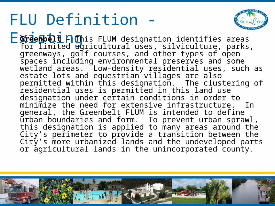
FLU Definition - Existing Greenbelt – This FLUM designation identifies areas for limited agricultural uses, silviculture, parks, greenways, golf courses, and other types of open spaces including environmental preserves and some wetland areas. Low-density residential uses, such as estate lots and equestrian villages are also permitted within this designation. The clustering of residential uses is permitted in this land use designation under certain conditions in order to minimize the need for extensive infrastructure. In general, the Greenbelt FLUM is intended to define urban boundaries and form. To prevent urban sprawl, this designation is applied to many areas around the City’s perimeter to provide a transition between the City’s more urbanized lands and the undeveloped parts or agricultural lands in the unincorporated county.

FLU Definition - Proposed Mixed Use – This FLUM designation represents existing and future commercial corridors and commercial centers throughout the City that provide general retail, professional services, and offices. A blending of residential and institutional uses is also allowed in this land use designation with light industrial uses permissible under certain conditions. The Mixed Use designation is intended to provide opportunities for residents to work, shop, engage in recreational activities, attend school and religious services in reasonably close proximity to residential dwellings.

Land Use Compatibility
• Amendment add to the Mixed Use area to the south• Amendment will allow for commercial development
along future realignment of Old Kings Road
Existing FLU Zoning Designation
Subject Parcel Greenbelt EST-2
North Greenbelt AGR
East Greenbelt PUD
West Conservation EST-2
South Mixed Use COM-2
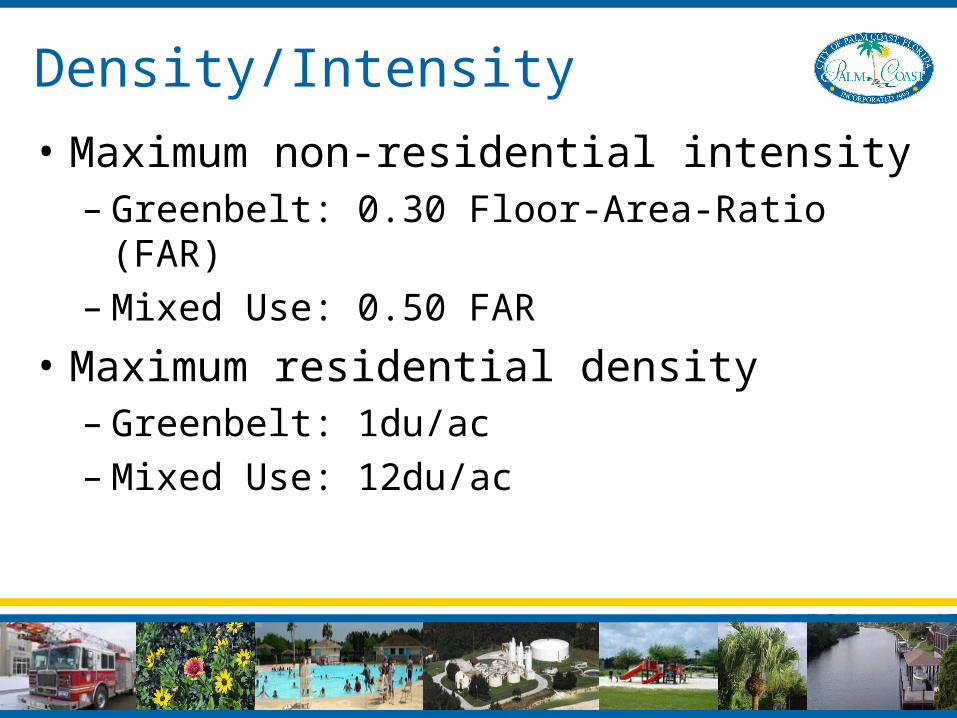
Density/Intensity
• Maximum non-residential intensity– Greenbelt: 0.30 Floor-Area-Ratio (FAR)– Mixed Use: 0.50 FAR
• Maximum residential density– Greenbelt: 1du/ac– Mixed Use: 12du/ac

Infrastructure AvailabilityTransportation Potable Water and SewerDrainageSolid WasteRecreation and ParksPublic Education

Environmental Conditions
• Cypress Wetland limited to the portion of parcel that will remain in Conservation FLUM designation
• Abandoned Gopher Tortoise Burrow• Amendment Area Outside 100-Year
Floodplain
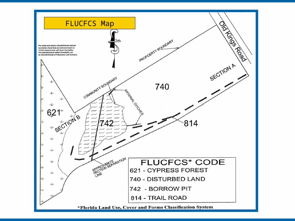
FLUCFCS Map

Comp Plan ConsistencyObjective 1.1.3 - Evaluation of Amendments to the FLUM
Staff’s analysis is consistent with the requirements of Objective 1.1.3.
Policy 1.1.1.1 (C) - Mixed Use
The proposed amendment is consistent with the Mixed Use designation description contained in Policy 1.1.1.1 (c), because the amendment extends a future commercial corridor along the proposed realignment of Old King’s Road.

Comp Plan ConsistencyPolicy 1.2.1.10
The proposed amendment is consistent with Policy 1.2.1.10, since no wetland impacts are anticipated and the Cypress Wetland will remain in the Conservation designation.
Policy 1.4.2.1
The proposed amendment is consistent with Policy 1.4.2.1, since the future development of commercial uses will provide the appropriate balance of land uses and create jobs.
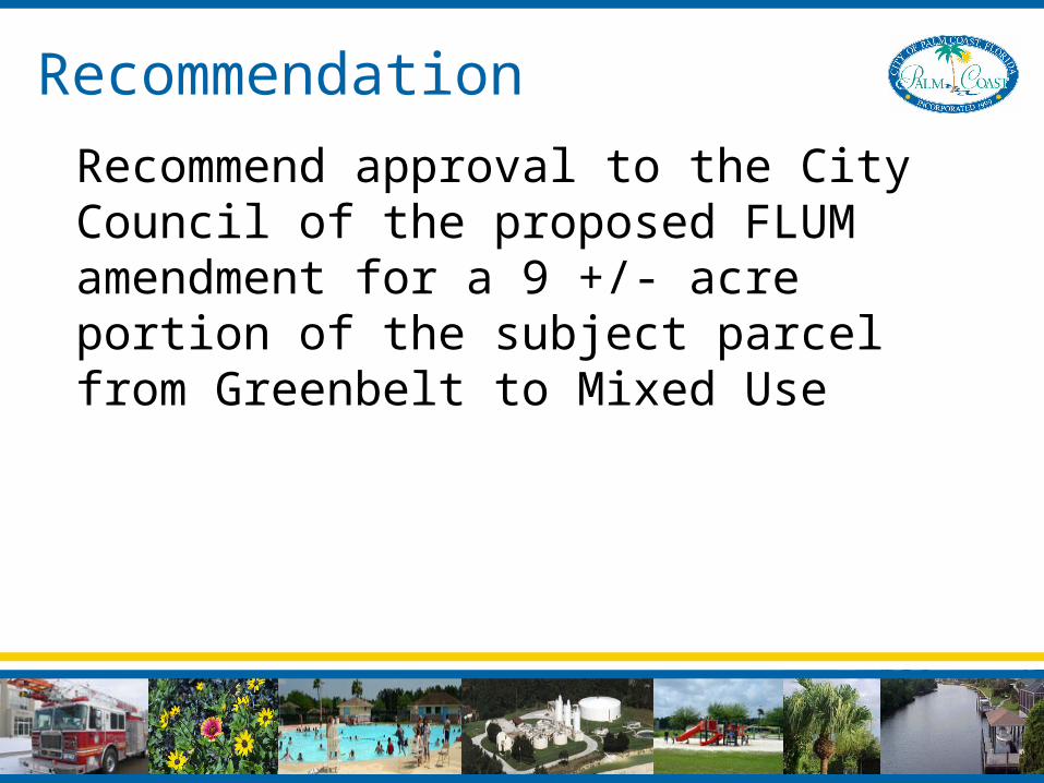
Recommendation
Recommend approval to the City Council of the proposed FLUM amendment for a 9 +/- acre portion of the subject parcel from Greenbelt to Mixed Use

Application LU-MIN-07-01Application LU-MIN-07-01Small-Scale Future Land Use Map AmendmentSmall-Scale Future Land Use Map Amendment
Twenty Fingers PropertyTwenty Fingers Property
May 2007 PLDRBMay 2007 PLDRB