Appendix A2 Mangrove Management Plan
24
Appendix A2 Mangrove Management Plan
Transcript of Appendix A2 Mangrove Management Plan

Appendix A2 Mangrove Management Plan


MANGROVE MANAGEMENT PLAN
DECEMBER 2009 Page i
Table of Contents
1 INTRODUCTION ....................................................................................................................... 1
1.1 PROJECT OVERVIEW ............................................................................................................. 1
1.2 PURPOSE AND STRUCTURE OF THIS PLAN ....................................................................... 3
2 RELEVANT LEGISLATION ..................................................................................................... 3
3 PROJECT DESCRIPTION ....................................................................................................... 4
3.1 STOCKYARDS AT BOODARIE ................................................................................................ 4
3.2 INFRASTRUCTURE CORRIDOR FROM BOODARIE STOCKYARDS TO THE JETTY ........ 4
3.3 VEGETATION CLEARING ....................................................................................................... 4
4 EXISTING ENVIRONMENT ...................................................................................................... 5
4.1 OVERVIEW ............................................................................................................................... 5
4.2 BOODARIE STOCKYARDS ..................................................................................................... 5
4.3 INFRASTRUCTURE CORRIDOR ............................................................................................ 5
4.4 CUMULATIVE MANGROVE VEGETATION LOSS .................................................................. 7
5 IMPACTS AND MANAGEMENT ............................................................................................11
5.1 OBJECTIVES AND KEY PERFORMANCE INDICATORS ....................................................11
5.2 DIRECT HABITAT LOSS ........................................................................................................11 5.2.1 Impacts ....................................................................................................................11 5.2.2 Management ............................................................................................................12
5.3 INDIRECT IMPACTS ..............................................................................................................12 5.3.1 Impacts ....................................................................................................................12 5.3.2 Management ............................................................................................................13
6 MONITORING .........................................................................................................................15
6.1 OVERVIEW .............................................................................................................................15
6.2 MANGROVE MAPPING..........................................................................................................15
6.3 MANGROVE HEALTH SURVEYS ..........................................................................................15
6.4 SEDIMENTATION ...................................................................................................................16
7 CONTINGENCY MEASURES ................................................................................................17
7.1 DIRECT IMPACTS ..................................................................................................................17
7.2 INDIRECT IMPACTS ..............................................................................................................17
8 RISK ASSESSMENT ..............................................................................................................18
9 REFERENCES ........................................................................................................................19

MANGROVE MANAGEMENT PLAN
DECEMBER 2009 Page ii
Figures
Figure 1-1 Proposed Outer Harbour Development Footprint and Spoil Grounds .................................... 2 Figure 4-1 – Estimated Loss of Closed and Open Canopy Mangrove BPPH from Proposed
Infrastructure Corridor ........................................................................................................10
Tables
Table 4.1 Estimated loss of mangrove vegetation associated with proposed Outer Harbour Development ........................................................................................................................ 7
Table 4.2 – Historical and cumulative loss of mangrove vegetation associations in the Port Hedland Industrial Area Management Unit ........................................................................................ 8
Table 6.1 – Classification and characteristics of mangrove tree condition ............................................16 Table 8.1 – Potential impacts of identified hazards associated with mangroves ...................................18
Plates
Plate 1 – Examples of the vegetation classification used for mangroves in the Port Hedland region ..... 6

MANGROVE MANAGEMENT PLAN
DECEMBER 2009 Page 1
1 INTRODUCTION
1.1 PROJECT OVERVIEW
BHP Billiton Iron Ore is seeking parallel approval under the State Environmental Protection Act 1986 (EP Act) and the Commonwealth Environment Protection and Biodiversity Conservation Act 1999 (EPBC Act) to undertake the Outer Harbour Development, located in Port Hedland, Western Australia.
The Outer Harbour Development will provide an export capacity of approximately 240 million tonnes per annum (Mtpa) of iron ore. This will be established in four stages, with incremental expansions brought on line to reach the maximum capacity. Expansion stages will occur through four separate modules, each with a nominal capacity of up to 60 Mtpa. Regulatory approvals are being sought for the infrastructure required to deliver the total capacity of 240 Mtpa.
The Outer Harbour Development will involve the construction and operation of landside and marine infrastructure for the handling and export of iron ore (Figure 1-1). Landside development will include:
• rail connections and spur from the existing BHP Billiton Iron Ore mainline to proposed stockyards at Boodarie;
• rail loops at Boodarie;
• stockyards at Boodarie; and
• an infrastructure corridor (including conveyors, access roadway and utilities) from the stockyards to the proposed marine jetty.
Key marine structures and activities will include:
• an abutment, jetty and wharf;
• mooring and associated mooring dolphins;
• transfer station and deck;
• associated transfer stations, ore conveyors and shiploaders;
• dredging for berth pockets, basins and channels; and
• navigation aids.
This project description is based on the engineering investigation and design completed to date (November 2009) and incorporates alternatives and/or options which are still being considered. Alternatives will be evaluated as BHP Billiton Iron Ore continues with the detailed engineering and design process prior to construction commencing.

MANGROVE MANAGEMENT PLAN
DECEMBER 2009 Page 2
Figure 1-1 Proposed Outer Harbour Development Footprint and Spoil Grounds
MANGROVE MANAGEMENT PLAN
DECEMBER 2009 Page 3
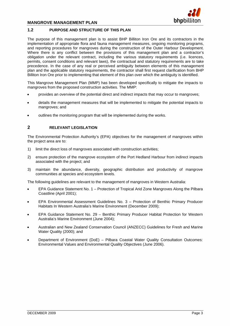
1.2 PURPOSE AND STRUCTURE OF THIS PLAN
The purpose of this management plan is to assist BHP Billiton Iron Ore and its contractors in the implementation of appropriate flora and fauna management measures, ongoing monitoring programs, and reporting procedures for mangroves during the construction of the Outer Harbour Development. Where there is any conflict between the provisions of this management plan and a contractor’s obligation under the relevant contract, including the various statutory requirements (i.e. licences, permits, consent conditions and relevant laws), the contractual and statutory requirements are to take precedence. In the case of any real or perceived ambiguity between elements of this management plan and the applicable statutory requirements, the contractor shall first request clarification from BHP Billiton Iron Ore prior to implementing that element of this plan over which the ambiguity is identified.
This Mangrove Management Plan (MMP) has been developed specifically to mitigate the impacts to mangroves from the proposed construction activities. The MMP:
• provides an overview of the potential direct and indirect impacts that may occur to mangroves;
• details the management measures that will be implemented to mitigate the potential impacts to mangroves; and
• outlines the monitoring program that will be implemented during the works.
2 RELEVANT LEGISLATION
The Environmental Protection Authority’s (EPA) objectives for the management of mangroves within the project area are to:
1) limit the direct loss of mangroves associated with construction activities;
2) ensure protection of the mangrove ecosystem of the Port Hedland Harbour from indirect impacts associated with the project; and
3) maintain the abundance, diversity, geographic distribution and productivity of mangrove communities at species and ecosystem levels.
The following guidelines are relevant to the management of mangroves in Western Australia:
• EPA Guidance Statement No. 1 – Protection of Tropical Arid Zone Mangroves Along the Pilbara Coastline (April 2001);
• EPA Environmental Assessment Guidelines No. 3 – Protection of Benthic Primary Producer Habitats In Western Australia’s Marine Environment (December 2009);
• EPA Guidance Statement No. 29 – Benthic Primary Producer Habitat Protection for Western Australia’s Marine Environment (June 2004);
• Australian and New Zealand Conservation Council (ANZECC) Guidelines for Fresh and Marine Water Quality (2000); and
• Department of Environment (DoE) – Pilbara Coastal Water Quality Consultation Outcomes: Environmental Values and Environmental Quality Objectives (June 2006).

MANGROVE MANAGEMENT PLAN
DECEMBER 2009 Page 4
3 PROJECT DESCRIPTION
Of the project elements outlined in Section 1.1, the development with the potential to impact on mangroves is the infrastructure corridor from the Boodarie stockyards to the proposed marine jetty.
3.1 STOCKYARDS AT BOODARIE
New stockyards will be constructed to deliver an estimated capacity of approximately 240 Mtpa for shipment. Lump re-screening will be required to ensure product quality; however, there will be no crushing of ore at the stockyards. All crushing will occur at the source mine sites.
The stockyards, including the car dumpers, will occupy an area of approximately 310 ha. The stockyard design will be based on a modularised concept, with a total of four modules. There will be no requirement for ore blending at the port prior to product shipment.
3.2 INFRASTRUCTURE CORRIDOR FROM BOODARIE STOCKYARDS TO THE JETTY
An infrastructure corridor will be required to transport iron ore from the proposed stockyards to the jetty on the northern shore of Finucane Island. The infrastructure corridor is an elevated causeway at its northern-most point as it passes over West Creek and onto Finucane Island. This causeway is proposed to the west of the existing road corridor and will accommodate four overland conveyors, approximately 8 km in length (Figure 4-1). The causeway will be constructed as an embankment with culverts to reach the new transfer station on Finucane Island.
The new two-way access road for maintenance purposes will be constructed adjacent to the overland conveyors.
3.3 VEGETATION CLEARING
Mangroves within the infrastructure corridor footprint (Figure 4-1) will be removed using hand and land-based equipment. Mangroves will be transported to a suitable waste management facility. Much of the low-lying vegetation (e.g. samphires) will not be cleared and will be covered with construction material.
The project will include the direct removal of up to 27 ha of mangroves.
While it will not be possible to avoid all direct impacts on mangroves, impacts have been minimised as far as practicable, by taking the following actions:
• conducting early field studies as part of the pre-feasibility phase of the project so that during design the infrastructure corridor and stockyards were located to reduce the area of mangroves to be cleared; and
• optimising the design of the infrastructure corridor, including the provision of adequate culverts, to maintain natural drainage channels and tidal flushing as much as practicable.

MANGROVE MANAGEMENT PLAN
DECEMBER 2009 Page 5
4 EXISTING ENVIRONMENT
4.1 OVERVIEW
A detailed description of the existing mangrove habitat of the Port Hedland region is provided in the SKM (2009a).
The intertidal habitat in Port Hedland is typical of arid zone coastlines within the north-west region of Australia, and is characterised by dense stands of mangroves along the seaward margins. The density and height of mangroves typically decreases with distance away from the waterline. There is then a shift to a mosaic of salt marsh plants dominated by samphires, cyanobacterial mats and large areas of bare substrate in the upper inter tidal zone.
It should be noted that for the purpose of this plan, sparse mangroves have been defined as ‘not forming a closed canopy where adjoining mangroves overlap, completely shading the substrate’. An example of each of the categories of mangrove vegetation has been provided in Plate 1.
4.2 BOODARIE STOCKYARDS
There are no mangroves located within the Outer Harbour Development Boodarie Stockyards footprint (Figure 4-1). The Boodarie Stockyards are not located in the intertidal zone and will not impact on intertidal BPP.
4.3 INFRASTRUCTURE CORRIDOR
Figure 4-1 shows the mangrove vegetation association classification within the proposed infrastructure corridor, including a 20 m disturbance envelope either side of the actual infrastructure. A total of approximately 27 ha of mangroves are located within the infrastructure corridor footprint and disturbance envelope. These mangroves comprise of the following mangrove associations:
Closed Canopy
• 8.5 ha of closed canopy Avicennia marina forest (both seaward and landward);
• 5.5 ha of closed canopy Rhizophora stylosa forest; and
• 2.0 ha of closed canopy mixed A. marina/R. stylosa forest.
Open Canopy
• 11.0 ha of sparse, open canopy (scattered) A. marina habitat.

MANGROVE MANAGEMENT PLAN
DECEMBER 2009 Page 6
a. Avicennia marina (scattered). b. Avicennia marina (closed canopy, landward edge).
c. Avicennia marina (closed canopy, landward edge) viewed from above.
d. Avicennia marina/Rhizophora stylosa (closed canopy).
e. Rhizophora stylosa (closed canopy). f. Avicennia marina (closed canopy, seaward edge).
Plate 1 – Examples of the vegetation classification used for mangroves in the Port Hedland region

MANGROVE MANAGEMENT PLAN
DECEMBER 2009 Page 7
4.4 CUMULATIVE MANGROVE VEGETATION LOSS
Table 4.1 shows the estimated total mangrove vegetation loss associated with the proposed infrastructure corridor and disturbance envelope, in comparison to the pre-impact (1963) areal extent of mangroves in the Port Hedland Industrial Area Management Unit, and the areal extent of each vegetation association in 2008 (SKM 2009b). The highest losses that will occur are in the mangrove habitat located in upper intertidal areas, namely A. marina (closed canopy, landward edge) and the lowest value mangrove habitat which is A. marina (scattered). Note that the majority of historical losses (net) have been in the vegetation association with the least value, A.marina scattered.
Table 4.1 Cumulative Changes in Extent of Mangrove Associations in 1963 and 2008
Vegetation Association 1963 Pre-impact Extent (ha)1
2008 Extent (ha)(1)
Proposed Infrastructure Corridor + Disturbance
Envelope Loss (ha)
Avicennia marina (closed canopy, seaward edge)
223 220 1.5
Rhizophora stylosa (closed canopy) 570 589 5.5 Avicennia marina/Rhizophora stylosa (closed canopy)
126 89 2.0
Avicennia marina (closed canopy, landward edge)
891 1027 7.0
Avicennia marina (scattered) 889 715 11.0
Total 2699 2640 27.0 1 Pre-impact extent and 2008 extent derived from revised analysis as described in SKM (2009b)
Figure 4-1 presents the historical and cumulative loss of mangrove vegetation associations in the Port Hedland Industrial Area Management Unit. The assessment of losses undertaken recognises the dynamic nature of the benthic primary producer habitat (BPPH) and that gain and loss in areal coverage of mangroves will occur naturally in the Port Hedland region.
The estimated areal extent of mangroves in 2008 was 2,640 ha (SKM 2009b), and included the historical losses associated with BHP's East Creek (155.7 ha), the Cargill Salt (now Dampier Salt) facility (146.8 ha), and the more recent FMG developments (Stage A 14.8 ha and 3rd Berth 0.05 ha). The cumulative loss calculation shown in Table 4.2 also includes estimated losses for the two four recent development projects Utah Point (PHPA) and RGP5 (BHP Billiton Iron Ore) along with the approved project proposals RGP6 (BHP Billiton Iron Ore) and South West Creek (PHPA).
Consequently, the calculation of actual net losses (2,699 ha – 2,640 ha = 59 ha) between 1963 and 2008 was calculated from an image set captured in 2008 where none of the mangrove losses for the four above-mentioned recent approved projects or proposals had yet occurred (totalling 29.1 ha) and therefore the total cumulative loss as at 2008 was 2.2% (59 ha/2699 ha). However, both Utah Point (18.6 ha) and RGP5 (6.5 ha) and underway and if the projected losses of mangroves for the RGP6 proposal (4 ha) and South West Creek proposal (40 ha) are also approved, then the approved cumulative loss from existing net losses (59 ha), plus the approved losses since the 2008 image was captured (29.1 ha) means that the cumulative loss is 4.7% (127.95 ha/2699 ha). With the addition of the worst case scenario for mangrove losses from the proposed Outer Harbour Development (27 ha), the cumulative loss of mangroves would rise to 5.7% (154.95 ha/2699 ha) of the pre-impact (1963) mangrove coverage with the Management Unit (Table 4.2).

MANGROVE MANAGEMENT PLAN
DECEMBER 2009 Page 8
Table 4.2 – Historical and cumulative loss of mangrove vegetation associations in the Port Hedland Industrial Area Management Unit
Management Unit
1963 mangrove extent(1)
2008 mangrove extent(6)
Historical losses and gains Cumulative losses (%)
Port Hedland Industrial Area
(154.3 km2)
2699 ha 2640 ha Area of 385.95 ha lost due to existing and approved developments:
• BHP East Creek – 155.7 ha(1) • Cargill Salt facility – 146.3 ha(1) • FMG Stage A – 14.8 ha(2) • FMG 3rd Berth – 0.05 ha(3) • PHPA Utah Point – 18.6 ha(4) • BHPBIO RGP 5 – 6.5 ha (5) • BHPBIO RGP 6 – 4.0 ha (6) • PHPA South West Creek - 40.0 ha(7)
Area of 258 ha gained(8)
Net loss of 127.95(9) ha
4.7
Port Hedland Industrial Area
(154.3 km2)
2699 ha 2640 ha Outer Harbour infrastructure corridor + disturbance envelope:
Port Hedland Outer Harbour Development net loss of 127.95 + 27 ha = 154.95 ha
5.7
Management Unit
1963 mangrove extent(1)
Assuming no gains since 1963
Cumulative losses (%)
Port Hedland Industrial Area
(154.3 km2)
2699 ha Area lost due to existing and approved developments = 385.95(10) ha
14.2
Port Hedland Industrial Area
(154.3 km2)
2699 ha Worst case scenario
Plus
Port Hedland Outer Harbour Development net loss of 385.95 + 27 ha = 412.95 ha
15.3
(1) Values are derived from revised analysis as described in SKM 2009b (2) Source: EPA Bulletin 1173 (May 2005) (3) Source: EPA Bulletin 1286 (April 2008) (4) Source: PHPA Utah Point Berth Project Public Environmental Review (June 2008) (5) Source: BHPBIO Rapid Growth Project 5 Assessment of Referral Information (October 2008) (BHPBIO 2008a) (6) Source: BHPBIO Rapid Growth Project 6 Benthic Primary Producer Assessment: Intertidal (SKM 2009c) (7) Source : EPA Bulletin 1380 (January 2011) (8) Source: BHPBIO Expansion Projects: Revised Historical Loss Estimates for Mangroves in the Port Hedland Industrial Area management Unit and Assessment of Ecological Impact of Losses (SKM 2009b). (9) Derived by adding actual realised losses (59 ha) to approved losses that have not yet occurred (South West Creek, RGP6) (10) Derived by ignoring measured gains and tallying all approved project development losses and approved losses that have not yet occurred

MANGROVE MANAGEMENT PLAN
DECEMBER 2009 Page 9
The assessment of losses undertaken recognises the dynamic nature of the BPPH and that gain and loss in aerial coverage will occur naturally in the Port Hedland region. However Table 4.2 also includes calculations of cumulative net loss (385.95 ha) assuming there has been no recruitment or succession of mangrove habitat types to offset some of the approved losses due to developments.
Calculations based on the assumption of no mangrove recruitment since 1963 give an historical cumulative loss within the Port Hedland management unit at 14.2% (385.95 ha/ 2699 ha) above the Category E 10% cumulative loss threshold for Development Areas (EPA 2009). With the addition of the worst case scenario for mangrove losses from the proposed Outer Harbour Development (27.0 ha), the cumulative loss of mangroves would then rise to 15.3% (412.95 ha/ 2699 ha). This would indicate previous approved projects, since BHP East Creek (155.7 ha), and future proposals significantly exceed the 10% threshold and place the area in Category F (EPA 2009).
We do not believe this to be the case, based on the findings of the SKM 2009b report. The SKM report demonstrated that a large proportion of mangrove losses in the management unit have been offset by new mangrove development. By measuring the actual mangrove coverage in the Port Hedland management unit from aerial imagery and comparing back to 1963 imagery it was possible to show that at least 258 ha of mangrove recruitment has occurred since 1963 (SKM 2009b).
The EPA (2009) do not include changes to benthic primary producer habitat caused by natural disturbances such as severe storms or effects of freshwater inundation from river flow, or climate change in cumulative impacts. However, the processes leading to natural creation (and loss) of mangroves in the management unit are not yet understood well enough to determine rates of natural change and the scale or direction of potential future changes in the mangroves of the management unit.
There is therefore a strong case to regularly revisit the calculations of historical loss, and also to investigate the underlying processes that may be continuing to provide new areas of mangroves within the management unit.
Given the difficulties associated with accurately delineating the landward boundary of the vegetation A. marina scattered, and the relatively low value of this vegetation when compared with the closed canopy forests, it is strongly recommended that future investigations partition the mangrove vegetation into the vegetation associations used in the 2008 SKM study (SKM 2009b). This would then readily allow estimation of changes in high value mangroves and accurately identify potential impacts upon those mangrove vegetation associations.

MANGROVE MANAGEMENT PLAN
DECEMBER 2009 Page 10
Figure 4-1 – Estimated Loss of Closed and Open Canopy Mangrove BPPH from Proposed Infrastructure Corridor

MANGROVE MANAGEMENT PLAN
DECEMBER 2009 Page 11
5 IMPACTS AND MANAGEMENT
5.1 OBJECTIVES AND KEY PERFORMANCE INDICATORS
The objectives of this MMP are:
• to limit the direct loss of mangroves associated with construction of the infrastructure corridor to the approved footprint and disturbance envelope;
• to avoid indirect impacts to the mangrove ecosystem of the Port Hedland Harbour associated with the Outer Harbour Development; and
• to maintain the abundance, diversity, geographic distribution and productivity of mangrove communities at species and ecosystem levels.
The Key Performance Indicators (KPIs) of this MMP are:
• no direct loss of mangroves (in excess of the approved mangrove losses) as a result of the infrastructure corridor; and
• no indirect impacts to mangroves as identified through the mangrove monitoring program.
5.2 DIRECT HABITAT LOSS
5.2.1 Impacts
The Port Hedland Outer Harbour Development will result in the direct loss of mangroves (refer to Section 4). The loss equates to a direct loss of approximately 27 ha of mangrove vegetation associations. While it was not possible to design the proposed corridor to avoid all direct impacts on mangroves, impacts have been minimised by reducing the corridor width to avoid disturbance as far as practicable.
Construction machinery will remain within the project footprint to minimise any unplanned loss or damage to adjacent areas of mangroves. The estimated direct loss of approximately 27 ha of mangrove BPPH assumes direct loss of all areas within the infrastructure corridor.
The direct loss of mangroves may impact upon the marine fauna and avifauna that inhabit mangrove areas.
SKM (2009b) discuss the relative environmental and ecological values of the different mangrove vegetation associations in terms of the contributions to ecosystem functions and demonstrate there is considerable variation in the likely contributions per unit of area between mangrove vegetation associations which vary widely based on metrics such as above ground biomass (AGB).
For example, several bird species rely upon closed canopy mangrove forest (Johnstone 1990; SKM 2007) in the absence of abundant terrestrial closed canopy forest in the Pilbara. The closed canopy association of Avicennia marina seaward edge mangrove forest is important for individual species critically important to mangrove kingfishers because the large diameter dead limbs and trunks provide nesting hollows (Johnstone 1990). The total area of Avicennia marina seaward edge mangrove that would be lost from the development of the corridor is 1.5 ha, and the current estimate of this type of mangrove vegetation association still present in the Management Unit is 220 ha (SKM 2009b). This represents a loss of approximately 0.7%, which is considered a minor impact on this vegetation association.
There is also a relatively high importance placed on all of the different closed-canopy mangrove vegetation associations, as the structural complexity and high primary productivity provided by closed canopy forest provides a range of benefits. These include providing a windbreak, storm protection and some degree of shoreline protection (Saenger 2002), and maintenance of tidal channel depths and contours (Wolanski 2006). The diversity of invertebrates and other mangrove associated fauna is typically higher in closed canopy forests in the tropics (Robertson et al. 1992; Hanley 1993).

MANGROVE MANAGEMENT PLAN
DECEMBER 2009 Page 12
The proposed development will result in the removal of 16.0 ha of the 1925 ha of closed canopy mangrove vegetation associations (i.e. not including the open canopy Avicennia marina scattered vegetation) currently in the Management Unit. This represents a loss of approximately 0.8%, which is considered to be a minor impact on this vegetation association.
It is unlikely that this project will detrimentally impact upon the conservation status of any species of mangrove, marine fauna or avifauna, as there are no known species endemic to Port Hedland. Those species that inhabit these mangrove areas are known to occur more widely either within the Pilbara region (Johnstone & Storr 1998, Semeniuk et al. 1978, Hutchins 2004) and/or more widely in northern Australia and the Indo West Pacific region (Duke 2006; Saenger 2002; Hanley 1993). Although species impacts are not expected, the loss of mangrove vegetation may impact upon the fisheries and ecosystem services provided by the mangroves. Although such impacts are important, due to the low level of loss of both closed canopy and sparse mangrove vegetation associations, relative to the surrounding habitats (approximately 27 ha out of 2,640 ha currently present in the defined Management Unit, or 2,571 ha if the approved losses for PHPA and other BHP Billiton Iron Ore projects take place), it is considered that this impact will be low.
5.2.2 Management
The primary mechanism for management of mangrove loss will be to confine areas of direct loss to the proposed infrastructure corridor footprint and the disturbance envelope indicated either side. The disturbance envelope boundary will be surveyed and delineated using coloured flagging where practicable. Construction machinery will remain within the infrastructure footprint without impinging on the disturbance envelope, to minimise any unplanned loss or damage of adjacent areas of mangrove.
Direct impacts with respect to the removal of the mangroves within the infrastructure footprint will be managed to avoid disturbance to areas outside of the approved disturbance footprint (including the disturbance envelope). These provisions include:
• where practical, cleared material that is lost into the harbour will be collected;
• the disturbance area will be surveyed and delineated using coloured flagging (where practical); and
• clear briefings and instructions to relevant contractors regarding the clearance procedures will be undertaken to minimise the area disturbed.
5.3 INDIRECT IMPACTS
5.3.1 Impacts
Altered Tidal Flushing
Some areas of mangrove BPPH may experience altered tidal flushing as a result of construction of the proposed infrastructure corridor, particularly where a causeway will cross West Creek. Some small intertidal channels will have disrupted flows while other channels may be completely infilled. Tidal flushing modelling has been undertaken to provide more accurate determination of potential impacts to mangrove BPPH. The causeway will be designed to maintain adequate tidal flow for the support of mangrove habitat.
Slippage of Fill
There is potential that earth fill used during the construction of the infrastructure corridor may slip down slope and spread out in a fan over the tidal flat. In this event, the most likely impact would be burial of mangrove pneumatophores which could ultimately lead to tree mortality (Ellison 1998). The areas where slippage of fill is most likely to occur are on the banks of West Creek where the infrastructure corridor will cross the channel.
Dust Deposition
Dust generated during the construction and operational phases of the proposed Outer Harbour Development could result in dust being deposited on surrounding mangroves. Dust deposition on

MANGROVE MANAGEMENT PLAN
DECEMBER 2009 Page 13
mangroves and other vegetation has the potential to negatively impact upon photosynthetic processes and growth. Recent research has, however, indicated that iron ore dust on mangroves in the Port Hedland region does not block leaf stomata or restrict transpiration, and does not significantly impact the overall condition of vegetation (Paling et al. 2001).
Dust modelling and an assessment of potential areas of impact have been undertaken (SKM 2009d). Although the model predicted an increase in the ground level dust concentration at some locations, it was noted that incorporation of appropriate dust management strategies may negate any increased dust concentrations (SKM 2009d).
Mangrove Insects, Invertebrates and Other Fauna
Insects and invertebrates that are associated with mangrove habitats will be impacted by the direct loss of habitat that these fauna rely on for food and shelter. There will also be some direct mortality of insects and invertebrates during the clearing of mangrove vegetation during construction works and although important this is considered a relatively minor impact since the area to be cleared is small, relative to the mangrove habitat in the Management Unit.
Generally, it is expected that mobile species and individuals will move away from the project area during construction, particularly in the case of some species of mangrove crabs and mudskippers. For non- or less mobile species, it is considered that any direct mortality will be localised and restricted to the project footprint. Furthermore, surrounding mangrove habitat that will not be cleared is expected to support sustainable populations of all species such that there will be no long-term impacts on populations or species in the Port Hedland Harbour region. It is unlikely that implementation of the proposed development would result in regional or sub-regional affects to the conservation status of any Schedule fauna species.
Accumulation of dust on mangrove leaves adjacent to the proposed development may impact on insects inhabiting mangrove canopies. Dust impacts on mangrove canopy insects are not well known, although it is expected that insects will avoid leaves with dust accumulation if it interferes with their foraging, breeding or habitat provision, and will utilise nearby areas that are unaffected by dust accumulation. If insects do exhibit avoidance behaviour in relation to iron ore dust, it is not known whether the absence of particular insects will affect the ecology of the mangroves themselves, e.g. with respect to pollination, herbivory, etc. It is also likely that different species will have different tolerance levels to iron ore dust on leaves, which in turn may result in compositional changes to the assemblage of canopy insects in mangroves adjacent to the proposed development. While it is expected that accumulation of iron ore dust will be transient and dust will tend to be washed away by heavy rainfall, and that any impacts on insects will be temporary, it should also be noted that heavy rainfall is not predictable and during some years there is no rainfall in the region.
Indirectly, the proposed development may also impact on avifauna through noise disturbance during construction and operational phases of the project. Construction and traffic noise have been shown to reduce densities and feeding behaviour of wetland birds and waterbirds (Hirvonen 2001; Burton et al. 2002), and similar effects may be expected if the proposed project is implemented. Observations in Port Hedland Harbour were that activities such as pile-driving appeared to result in no observable changes to the behaviour of white-breasted whistlers, which continued foraging nearby despite high noise levels (J. Hanley, pers. comm.). It is possible that local bird populations are acclimated to high levels of background noise and as such it is not considered necessary to manage potential noise disturbance impacts. It should be noted, however, that there are no published estimates of what level of cumulative noise may result in avoidance behaviour.
5.3.2 Management
Altered Tidal Flushing
Management of this impact will be via the incorporation of mitigation measures into the final engineering design of the infrastructure corridor, in particular the provision of culverts (as much as practicable) to maintain tidal flushing.

MANGROVE MANAGEMENT PLAN
DECEMBER 2009 Page 14
Slippage of Fill
Engineering measures to manage and/or prevent slippage of fill, as much as practicable, include the use of rock armouring to contain fill to the base of the channel crossing and stabilise earth fill as it is placed.
Dust Deposition
Management measures for minimising dust generation include:
• watering of unsealed roads, exposed surfaces, active construction areas and stockpiles;
• use of environmentally safe dust suppressants;
• restriction of vehicle movements and vehicle speeds to reduce dust emissions;
• general housekeeping practices to manage waste materials within the construction site that may generate dust;
• an awareness program to ensure that all persons onsite are made aware of the need to minimise dust emissions; and
• reporting of any community complaints regarding dust levels.
Mangrove Insects, Invertebrates and Other Fauna
Impacts on insects, invertebrates and other fauna will primarily be managed by restricting loss of habitat to the infrastructure corridor footprint and disturbance envelope. Mobile fauna are generally expected to move away from the disturbance area and no local species extinctions are expected. Indirect impacts on fauna resulting from dust accumulation on mangrove plants will be mitigated by the dust management measures outlined above.
Management of indirect impacts on mangrove avifauna will be by restricting direct habitat loss to the defined project footprint.

MANGROVE MANAGEMENT PLAN
DECEMBER 2009 Page 15
6 MONITORING
6.1 OVERVIEW
Monitoring to assist in the management of potential impacts on mangrove vegetation associations will consist of:
• mangrove mapping;
• mangrove health surveys; and
• monitoring of any sediment accumulation within mangrove vegetation associations; and
• assessment of the potential for changes in soil salinity in the vicinity of the infrastructure corridor.
The Outer Harbour Development Mangrove Monitoring program will utilise and build on the information gained from the approved Harriet Point (Finucane Island) Mangrove Monitoring program that commenced early 2009 (SKM 2009e). The methods utilised for that program will be used for the Outer Harbour Development program and where possible, the same reference locations will be utilised.
6.2 MANGROVE MAPPING
Aerial photography and field surveys will be used to map the distribution and coverage of mangrove vegetation associations situated near the project footprint. Aerial photography will be ortho-rectified to allow for determination of mangrove cover.
Mangrove mapping will be undertaken:
• prior to the commencement of the project to provide current information on mangrove distribution;
• at project milestones including the completion of clearing activities within the infrastructure corridor; and
• on completion of the project.
Mangrove distribution and cover will be compared to the baseline data to confirm that the area of direct disturbance of mangrove habitat does not exceed the approved limits.
6.3 MANGROVE HEALTH SURVEYS
Mangrove health surveys will be undertaken in an effort to ensure that any negative impacts are detected as soon as possible. Mangrove health monitoring will consist of:
• regular visual assessments to determine mangrove condition; and
• detailed mangrove health surveys prior to dredging, after six months (following commencement of construction) and on completion of the project.
Mangrove monitoring sites will be established prior to the commencement of construction activities. The number and location of these sites will be determined during a preliminary site investigation and via the interpretation of aerial photography.
It is expected that three or four monitoring sites will be established, together with corresponding reference sites. Some of the sites already established as reference sites for the Harriet Point mangrove monitoring program are likely to be suitable as they are located within areas that will have similar distribution, density and species composition and will be situated where they will not be impacted by the Outer Harbour Development.

MANGROVE MANAGEMENT PLAN
DECEMBER 2009 Page 16
Within each site a 50 m permanent transect will be established. Four randomly placed 4 m x 4 m (16 m2) quadrats will be set up alongside each transect and the following parameters will be measured in each:
• the mangrove species present;
• the number of trees present;
• the number of dead limbs;
• the number of stems per tree;
• stem diameters;
• health status of trees;
• height of trees; and
• foliage density (using a densitometer).
Foliage density readings and mangrove species present will also be recorded every 2.5 m along each transect.
Classification of the health status of mangrove trees will be based on the methods of Duke et al. (2005), using the three categories listed in Table 6.1. Recent baseline mangrove health monitoring conducted as part of the Harriet Point mangrove monitoring program extended this classification by assigning a quantitative assessment to each health category (Table 6.1), based on data collected in February 2009 (SKM 2009e). The same methods will be applied to the Outer Harbour mangrove health monitoring program.
Table 6.1 – Classification and characteristics of mangrove tree condition
Classification
(Duke et al. 2005)
Characteristics
(Duke et al. 2005)
Quantitative
(SKM 2009e)
Healthy Leaves green, no visible signs of sickness <10% dead, yellowing or wilting leaves Sick Yellow, wilting leaves
Low foliage cover 10-50% dead, yellowing or wilting leaves
Dead Plant dead >50% dead/ yellow wilting leaves > 50% dead stems plant beyond recovery/almost dead
6.4 SEDIMENTATION
Sedimentation will be monitored within mangrove communities to provide an early warning of any potential impacts. Sedimentation monitoring will be undertaken at the same monitoring and reference sites used in the mangrove health surveys. Monitoring will be via pegs planted and secured within the sediment along each transect, which will be revisited regularly. The detection of sedimentation is only possible at a coarse scale and would require sedimentation in the order of tens of centimetres.

MANGROVE MANAGEMENT PLAN
DECEMBER 2009 Page 17
7 CONTINGENCY MEASURES
7.1 DIRECT IMPACTS
Direct impacts on mangroves will be monitored via the mangrove mapping (Section 6.2). In the event that the mangrove mapping identifies direct impacts in excess of the approved amount, the following contingency measures will be applied:
• clearing activities will be temporarily stopped until the outcomes of an investigation into the non-approved clearing have been concluded; and
• options for rehabilitation will be investigated.
7.2 INDIRECT IMPACTS
A change in mangrove health, as defined by the categories outlined in Table 6.1, leading to a significant increase in the percentage of yellowing, wilting and dead leaves at any monitoring site relative to a reference site will be calculated. Any difference of 25% or more in the condition of foliage between a monitoring sites and the average of the reference sites will lead to an assessment of the potential causes. The investigation will use the available results of the mangrove mapping and sedimentation monitoring to determine if the decline in mangrove health may be a consequence of impact/s related to the infrastructure corridor construction and/or operation. Identification of contingency measures will be determined in consultation with relevant stakeholders.

MANGROVE MANAGEMENT PLAN
DECEMBER 2009 Page 18
8 RISK ASSESSMENT
A summary of the key potential impacts to mangroves and their associated management measures as well as their associated residual risk (i.e., risk remaining after the management measures outlined in Section 5 have been applied) is provided in Table 8.1.
Table 8.1 – Potential impacts of identified hazards associated with mangroves
Hazard Source Impacts Residual
Risk Vegetation clearing construction and operation activities.
Direct mangrove loss from construction of an infrastructure corridor to Finucane Island.
Local permanent loss of vegetation of regional conservation significance (mangroves) due to clearing and construction.
Moderate
Accidental disturbance of mangrove vegetation outside of the project footprint due to over clearing and slippage of fill material.
Indirect impacts on mangroves as a result of construction activities and operation.
Indirect loss of mangroves from alteration to tidal/drainage patterns.
Minor
Indirect loss of mangroves from accumulation of dust during operation.

MANGROVE MANAGEMENT PLAN
DECEMBER 2009 Page 19
9 REFERENCES
Australian and New Zealand Environment Conservation Council & Agricultural and Resource Management Council of Australia and New Zealand 2000. Australia and New Zealand Guidelines for Fresh and Marine Water Quality.
BHPBIO 2008a. Port Hedland Finucane Island Dredging, Environmental Referral Document. BHP Billiton Iron Ore.
BHPBIO 2008b. BHP Billiton Iron Ore Risk Management Guideline 1 - Management Responsibilities. BHP Billiton Iron Ore.
BHPBIO 2008c. BHP Billiton Iron Ore Risk Management Guideline 2 - Methods and Techniques. BHP Billiton Iron Ore.
BHPBIO 2009. Port Hedland Nelson Point Dredging. Environmental Referral Document. BHP Billiton Iron Ore.
Burton, N.H.K., Rehfisch, M.M. and Clark, N.A. 2002. Impacts of disturbance from construction work on the densities and feeding behavior of waterbirds using the intertidal mudflats of Cardiff Bay, UK. Environmental Management 30: 865-871.
Department of Environment 2006. Pilbara Coastal Water Quality Objectives – Environmental Values and Environmental Quality Objectives. Department of Environment, Perth.
Duke, N.C. 2006. Australia’s Mangroves. The authorative guide to Australia’s mangrove plants. University of Queensland, Brisbane. 200 pp.
Duke, N.C., Bell, A.M., Pederson, D.K., Roelfsema, C.M. and Nash, S.B. 2005. Herbicides implicated as the cause of severe mangrove dieback in the Mackay region, NE Australia: consequences for marine plant habitats of the GBR World Heritage Area. Marine Pollution Bulletin 51: 308-324.
EPA 2001. Guidance Statement for Protection of Tropical Arid Zone Mangroves Along the Pilbara Coastline. Guidance Statement No. 1. Environmental Protection Authority, Perth, WA.
EPA 2004. Benthic Primary Producer Habitat Protection for Western Australia’s Marine Environment. Guidance Statement No. 29. Environmental Protection Authority, Perth, WA.
EPA 2009. Protection of Benthic Primary Producer Habitats In Western Australia’s Marine Environment. Environmental Assessment Guidelines No. 3. Environmental Protection Authority, Perth, WA.
EPA 2011. South West Creek Dredging and Reclamation Proposal. Port Hedland Port Authority. Report and recommendations of the Environmental Protection Authority. Bulletin 1380. Environmental Protection Authority, Perth, WA.
Ellison, J.C. 1998. Impacts of sediment burial on mangroves. Marine Pollution Bulletin 37: 420-426.
Hanley, J.R. 1993. Darwin South Stage 1 Environmental Studies. Mangrove benthic invertebrate fauna. Marine Ecology Technical Report 93/2: 1-70.
Hirvonen, H. 2001. Impacts of highway construction and traffic on a wetland bird community. In: CL Irwin, P Garrett and KP McDermott (eds.) Proceedings of the 2001 International Conference on Ecology and Transportation. Centre for Transportation and the Environment, North Carolina State University, Raleigh, NC: 369-372.
Hutchins, J.B. 2004. Fishes of the Dampier Archipelago, Western Australia. Records of the Western Australian Museum Supplement No. 66: 343-398.
Johnstone, R.E. 1990. Mangroves and mangrove birds of Western Australia. Records of the Western Australian Museum Supplement No. 32. 120 pp.
Johnstone, R.E. and Storr, G.M. 1998. Handbook of Western Australian Birds. Western Australian Museum, Perth.

MANGROVE MANAGEMENT PLAN
DECEMBER 2009 Page 20
Paling, E.I., Humphreys, G., McCardle, I. and Thomson, G. 2001. The effects of iron ore dust on mangroves in Western Australia: Lack of evidence for stomatal damage. Wetlands Ecology and Management 9: 363-370.
Robertson, A.I., Alongi, D.M. and Boto, K.G. 1992. Food chains and carbon fluxes. In: AI Robertson and DM Alongi (eds). Tropical Mangrove Ecosystems. Coastal and Estuarine Studies No.41, American Geophysical Union, Washington, D.C. pp. 293-326.
Saenger, P. 2002. Mangrove Ecology, Silviculture and Conservation. Kluwer Academic Publishers.
Semeniuk, V., Kenneally, K.F. and Wilson, P.G. 1978. Mangroves of Western Australia. Handbook No.12, Western Australian Naturalists Club, Perth.
SKM 2007. RGP5 Port Facilities Selection Phase Study: Benthic Primary Producer Habitat Assessment. Report prepared for BHPBIO.
SKM 2009a. Port Hedland Outer Harbour Development – Intertidal Benthic Primary Producer Habitat Assessment. Report prepared by Sinclair Knight Merz for BHP Billiton Iron Ore.
SKM 2009b. BHP Billiton Iron Ore Expansion Projects – Revised Historical Loss Estimates for Mangroves in the Port Hedland Industrial Area Management Unit and Assessment of Ecological Impact of Losses. Report prepared by Sinclair Knight Merz for BHP Billiton Iron Ore.
SKM 2009c. RGP6 Nelson Point Dredging – BPPH Assessment: Intertidal. Report prepared by Sinclair Knight Merz for BHPBIO.
SKM 2009d. Potential Dust Impact from the Proposed Outer Harbour Development: Dust Modelling and Assessment. Report prepared by Sinclair Knight Merz for BHP Billiton Iron Ore.
SKM 2009e. RGP5 Port Facilities Selection Execution Phase Study, Baseline Mangrove Health Monitoring Report, February 2009. Report prepared by Sinclair Knight Merz for BHP Billiton Iron Ore.
SKM 2009f. Port Hedland Outer Harbour Development – Intertidal Benthic Primary Producer Habitat Impact Assessment. Report prepared by Sinclair Knight Merz for BHP Billiton Iron Ore.
Wolanski, E. 2006. The evolution time scale of macro-tidal estuaries: Examples from the Pacific Rim. Estuarine, Coastal and Shelf Science 66: 544-549.