An Introduction to the Geology and Engineering Geology of
50
An Introduction to the Geology and Engineering Geology of Lawrence Berkeley National Laboratory Preston Jordan Earth Sciences Division Lawrence Berkeley National Laboratory LBNL Citizens’ Advisory Group, 8 July 2010
Transcript of An Introduction to the Geology and Engineering Geology of
An Introduction to the Geology and Engineering Geology of Lawrence
Berkeley National Laboratory
Preston Jordan
Earth Sciences DivisionLawrence Berkeley National Laboratory
LBNL Citizens’ Advisory Group, 8 July 2010
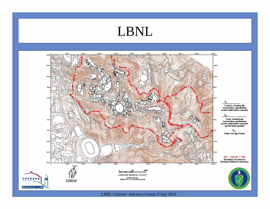
LBNL
LBNL Citizens’ Advisory Group, 8 July 2010
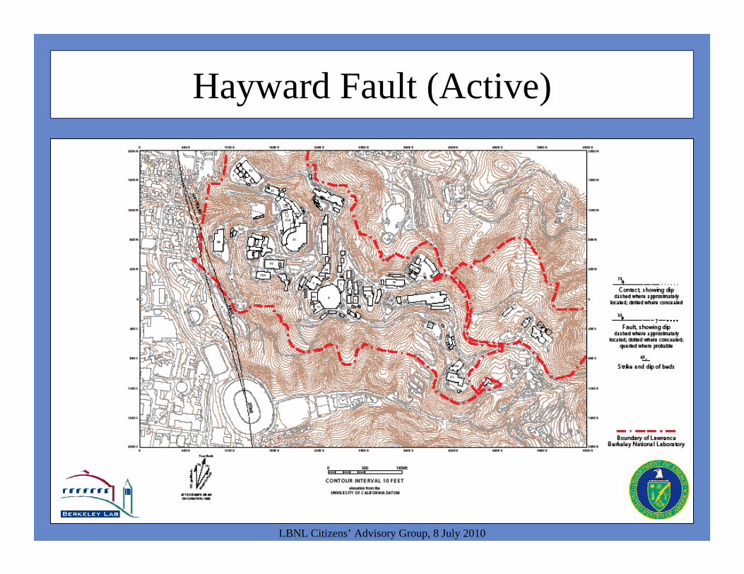
Hayward Fault (Active)
LBNL Citizens’ Advisory Group, 8 July 2010
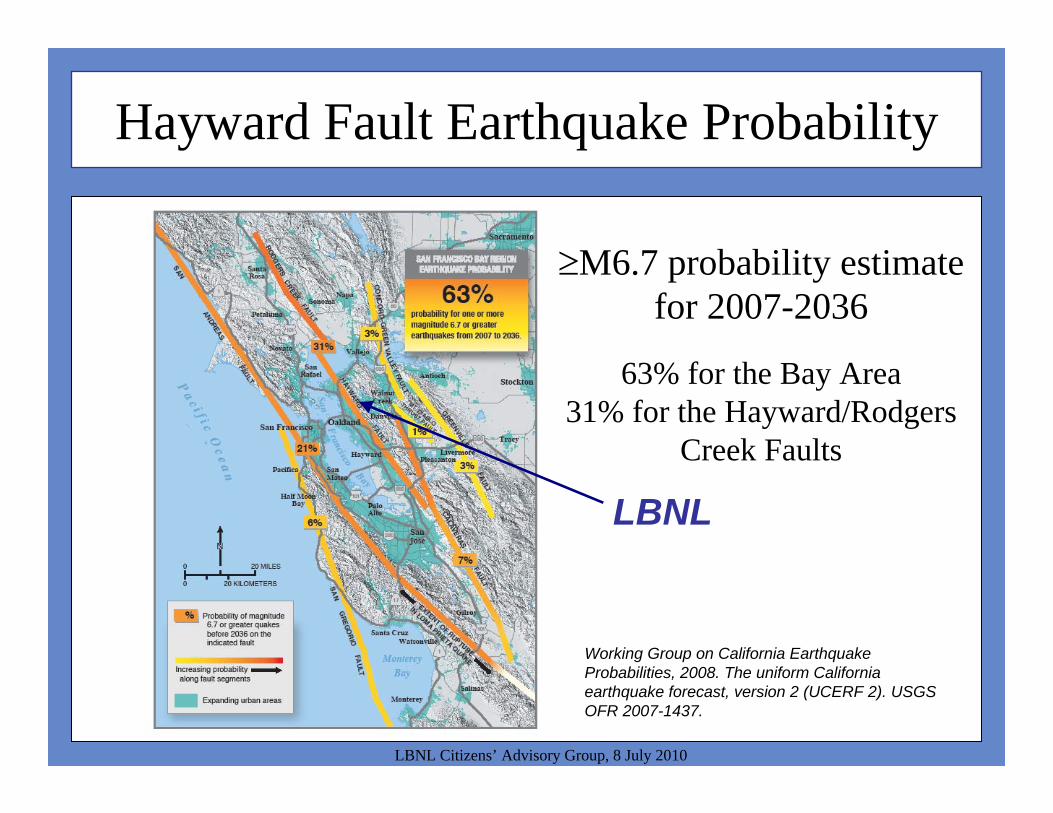
Hayward Fault Earthquake Probability
LBNL Citizens’ Advisory Group, 8 July 2010
M6.7 probability estimate for 2007-2036
63% for the Bay Area31% for the Hayward/Rodgers
Creek Faults
Working Group on California Earthquake Probabilities, 2008. The uniform California earthquake forecast, version 2 (UCERF 2). USGS OFR 2007-1437.
LBNL
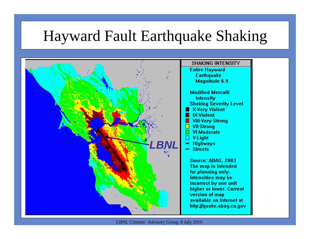
Hayward Fault Earthquake Shaking
LBNL Citizens’ Advisory Group, 8 July 2010
LBNL
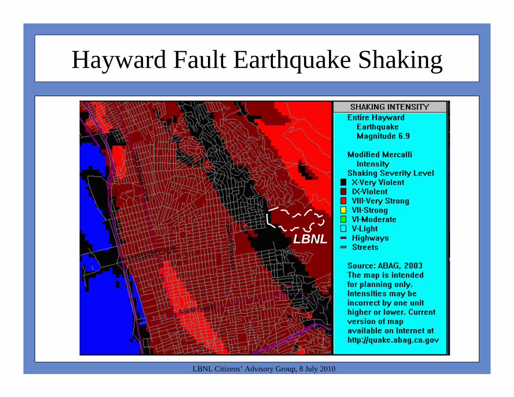
Hayward Fault Earthquake Shaking
LBNL Citizens’ Advisory Group, 8 July 2010
LBNL

Hayward Fault (Active)
LBNL Citizens’ Advisory Group, 8 July 2010
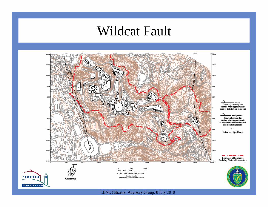
Wildcat Fault
LBNL Citizens’ Advisory Group, 8 July 2010

Wildcat Fault (Inactive)
LBNL Citizens’ Advisory Group, 8 July 2010

Wildcat Fault (Inactive)
LBNL Citizens’ Advisory Group, 8 July 2010

Great Valley Group
LBNL Citizens’ Advisory Group, 8 July 2010
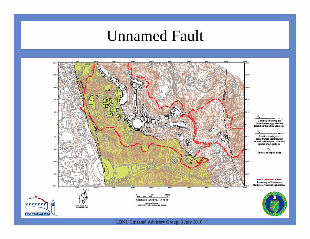
Unnamed Fault
LBNL Citizens’ Advisory Group, 8 July 2010

Unnamed Fault (Inactive)
LBNL Citizens’ Advisory Group, 8 July 2010

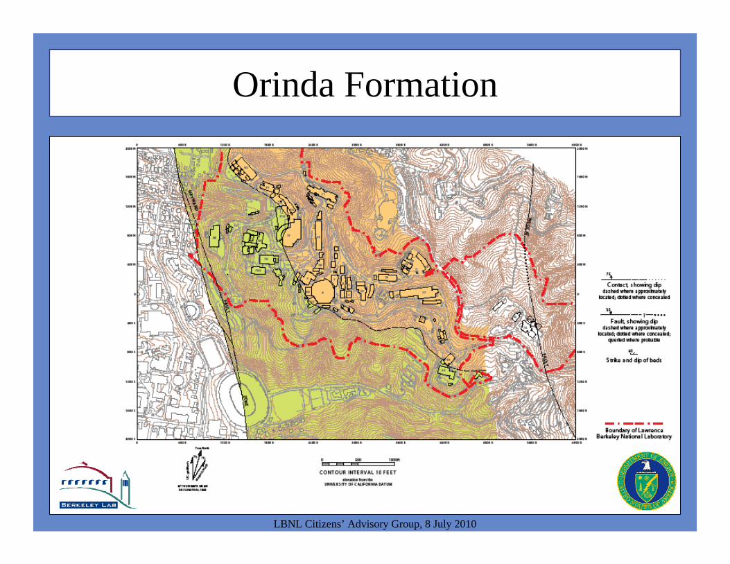
Orinda Formation
LBNL Citizens’ Advisory Group, 8 July 2010

Orinda Formation Analog (Southern Owens Valley)
LBNL Citizens’ Advisory Group, 8 July 2010
LBNL(for scale)
Orinda Formation
LBNL Citizens’ Advisory Group, 8 July 2010
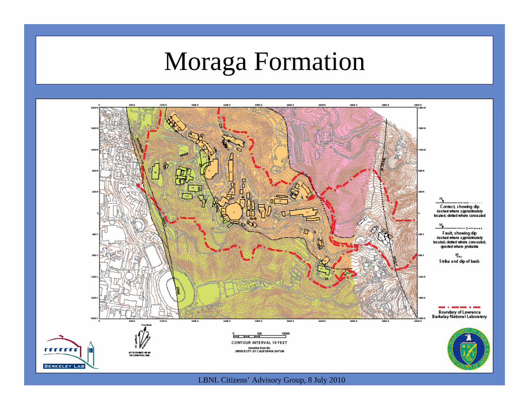
Moraga Formation
LBNL Citizens’ Advisory Group, 8 July 2010
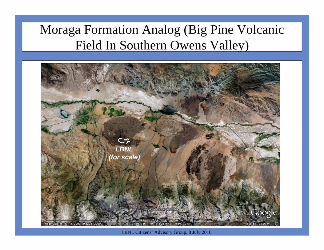
Moraga Formation Analog (Big Pine Volcanic Field In Southern Owens Valley)
LBNL Citizens’ Advisory Group, 8 July 2010
LBNL(for scale)
LBNL Citizens’ Advisory Group, 8 July 2010
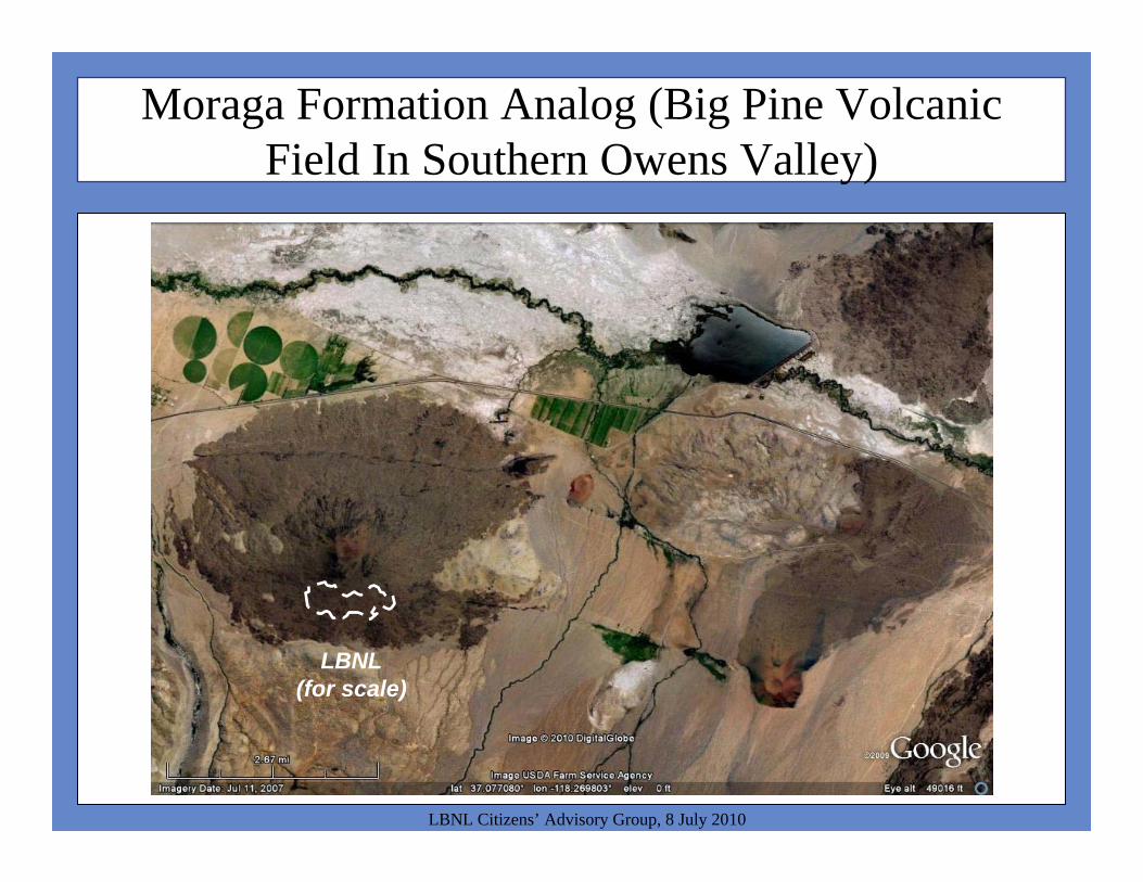
Moraga Formation Analog (Big Pine Volcanic Field In Southern Owens Valley)
LBNL(for scale)
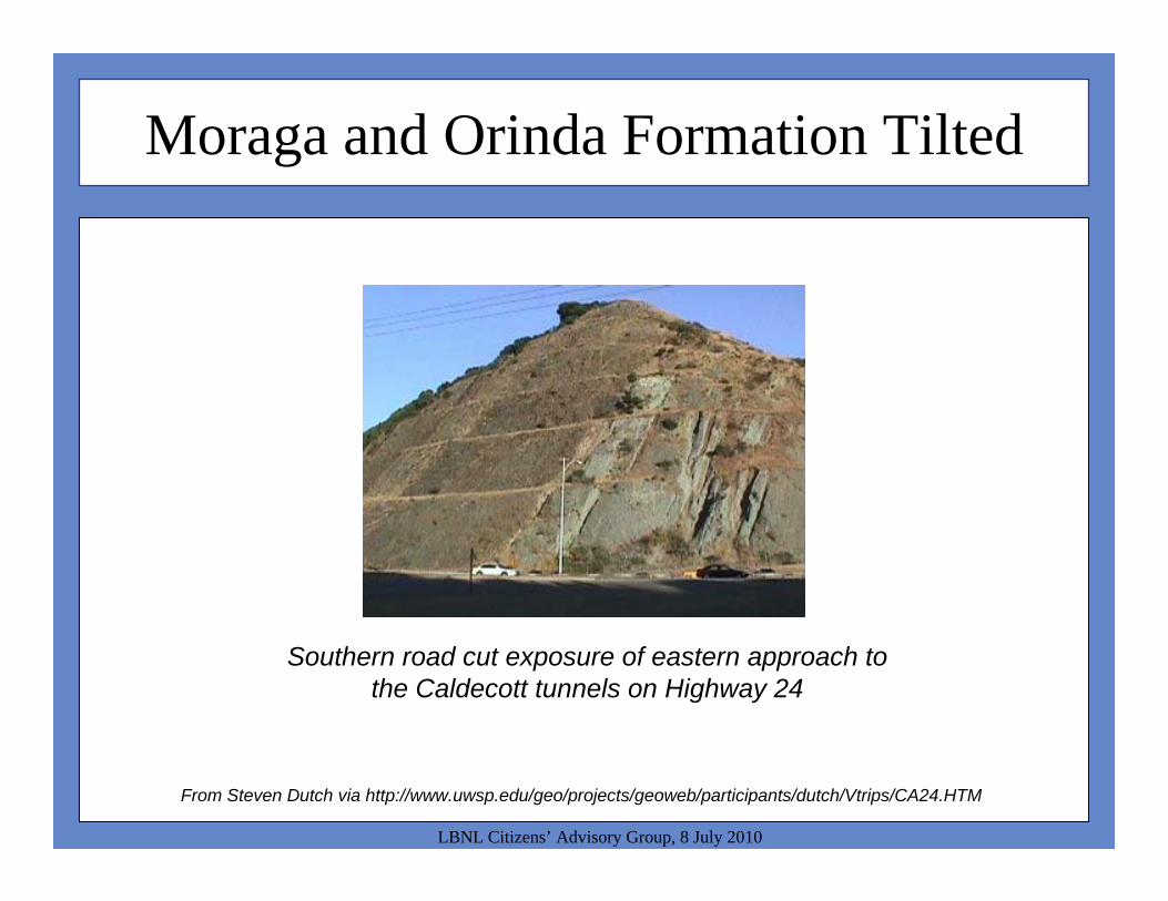
Moraga and Orinda Formation Tilted
LBNL Citizens’ Advisory Group, 8 July 2010
From Steven Dutch via http://www.uwsp.edu/geo/projects/geoweb/participants/dutch/Vtrips/CA24.HTM
Southern road cut exposure of eastern approach to the Caldecott tunnels on Highway 24

Moraga Formation
LBNL Citizens’ Advisory Group, 8 July 2010
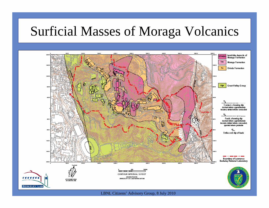
Surficial Masses of Moraga Volcanics
LBNL Citizens’ Advisory Group, 8 July 2010
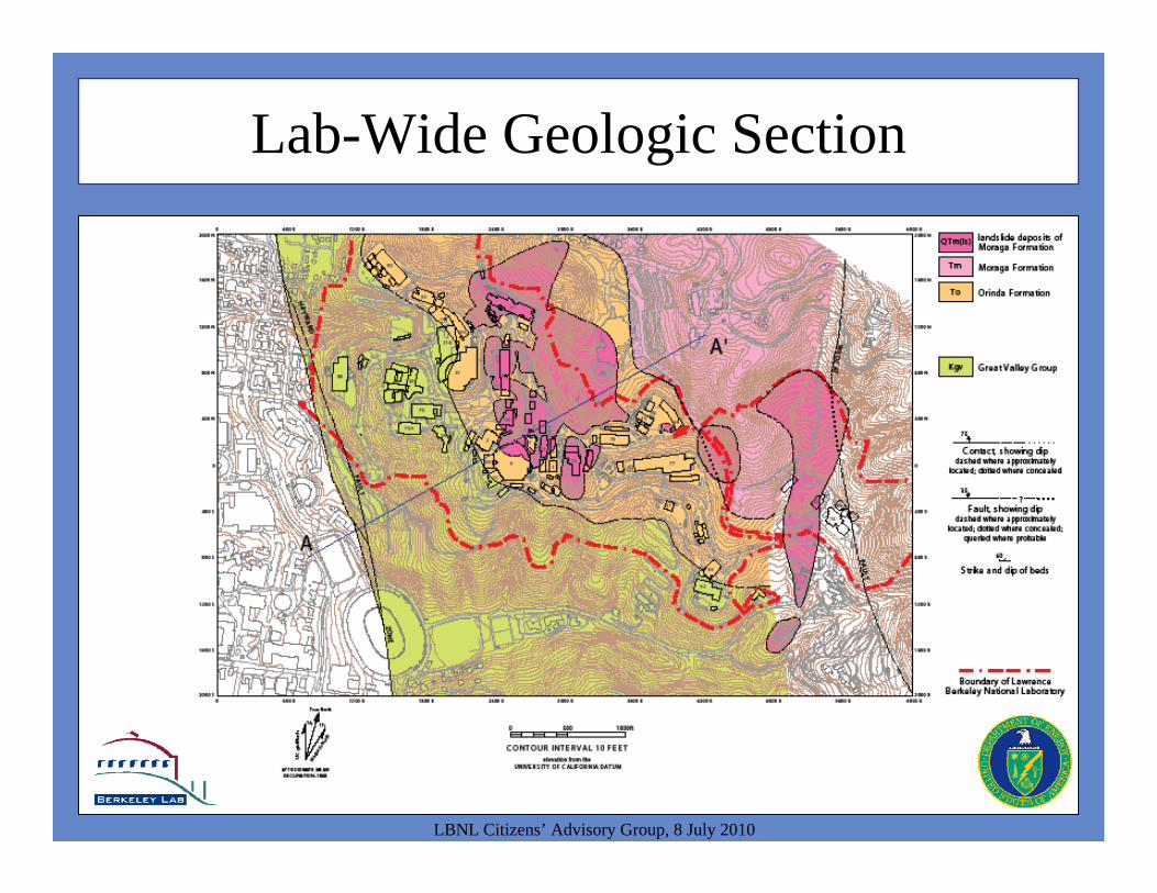
Lab-Wide Geologic Section
LBNL Citizens’ Advisory Group, 8 July 2010

Lab-Wide Geologic Section
LBNL Citizens’ Advisory Group, 8 July 2010
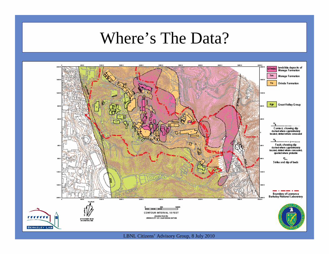
Where’s The Data?
LBNL Citizens’ Advisory Group, 8 July 2010
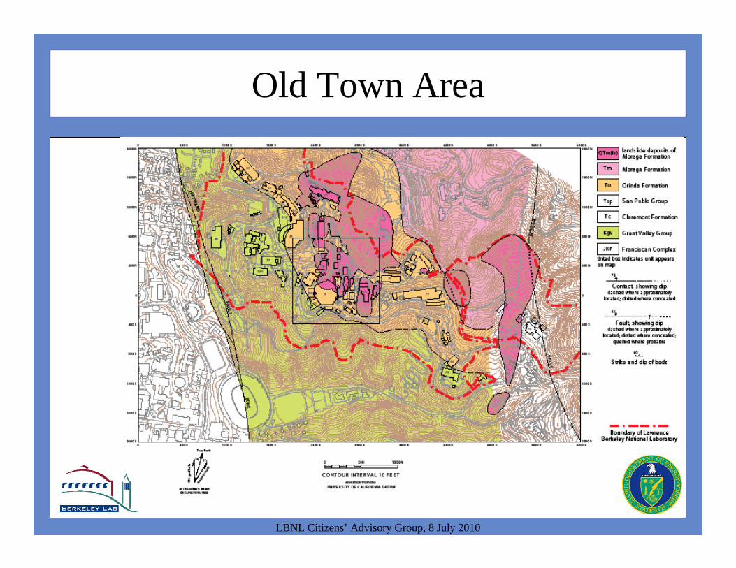
Old Town Area
LBNL Citizens’ Advisory Group, 8 July 2010

Old Town Area
LBNL Citizens’ Advisory Group, 8 July 2010
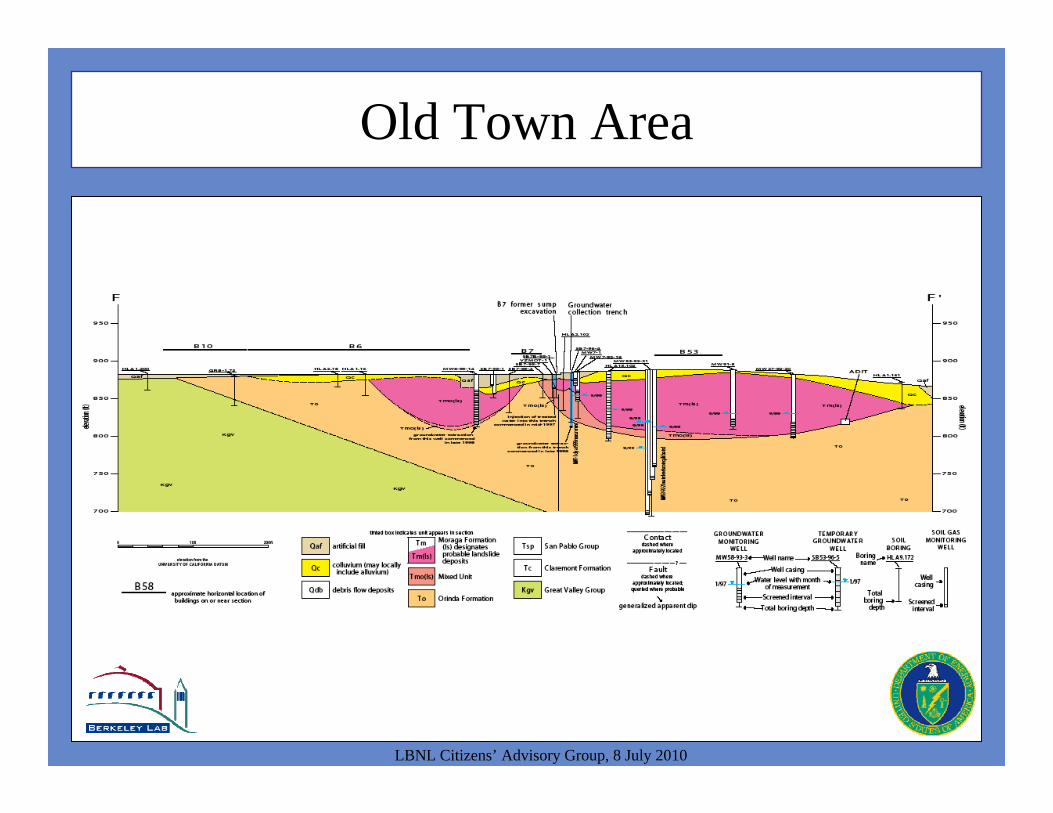
Old Town Area
LBNL Citizens’ Advisory Group, 8 July 2010
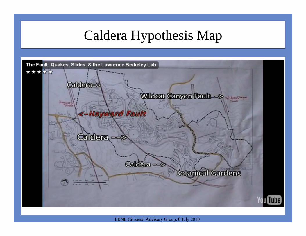
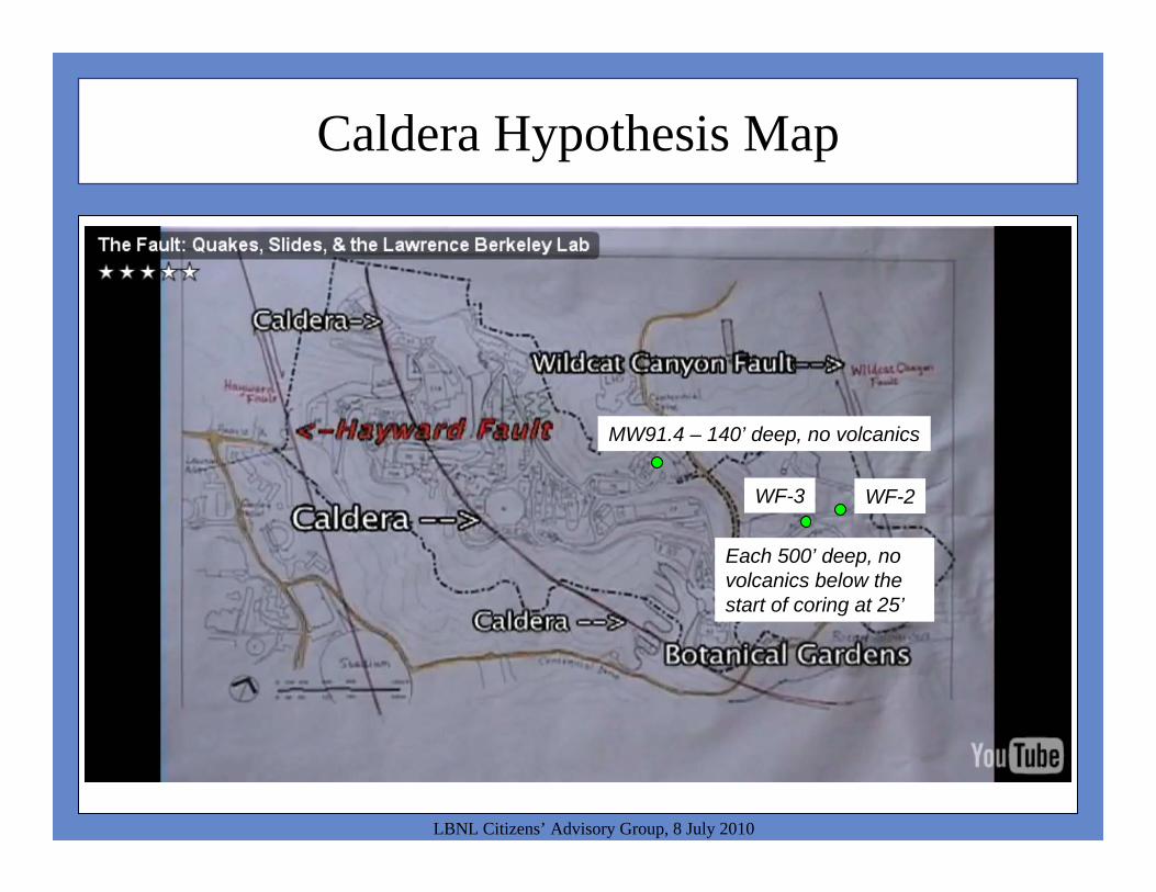
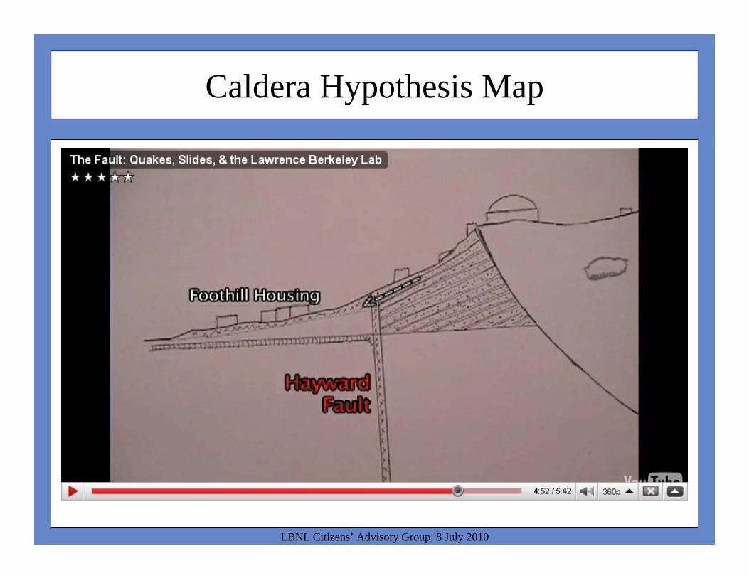
Caldera Hypothesis Map
LBNL Citizens’ Advisory Group, 8 July 2010

LBNL Bedrock Geology
LBNL Citizens’ Advisory Group, 8 July 2010

Caldera Hypothesis Map
LBNL Citizens’ Advisory Group, 8 July 2010

Lab-Wide Geologic Section
LBNL Citizens’ Advisory Group, 8 July 2010
Caldera Hypothesis Map
LBNL Citizens’ Advisory Group, 8 July 2010
MW91.4 – 140’ deep, no volcanics
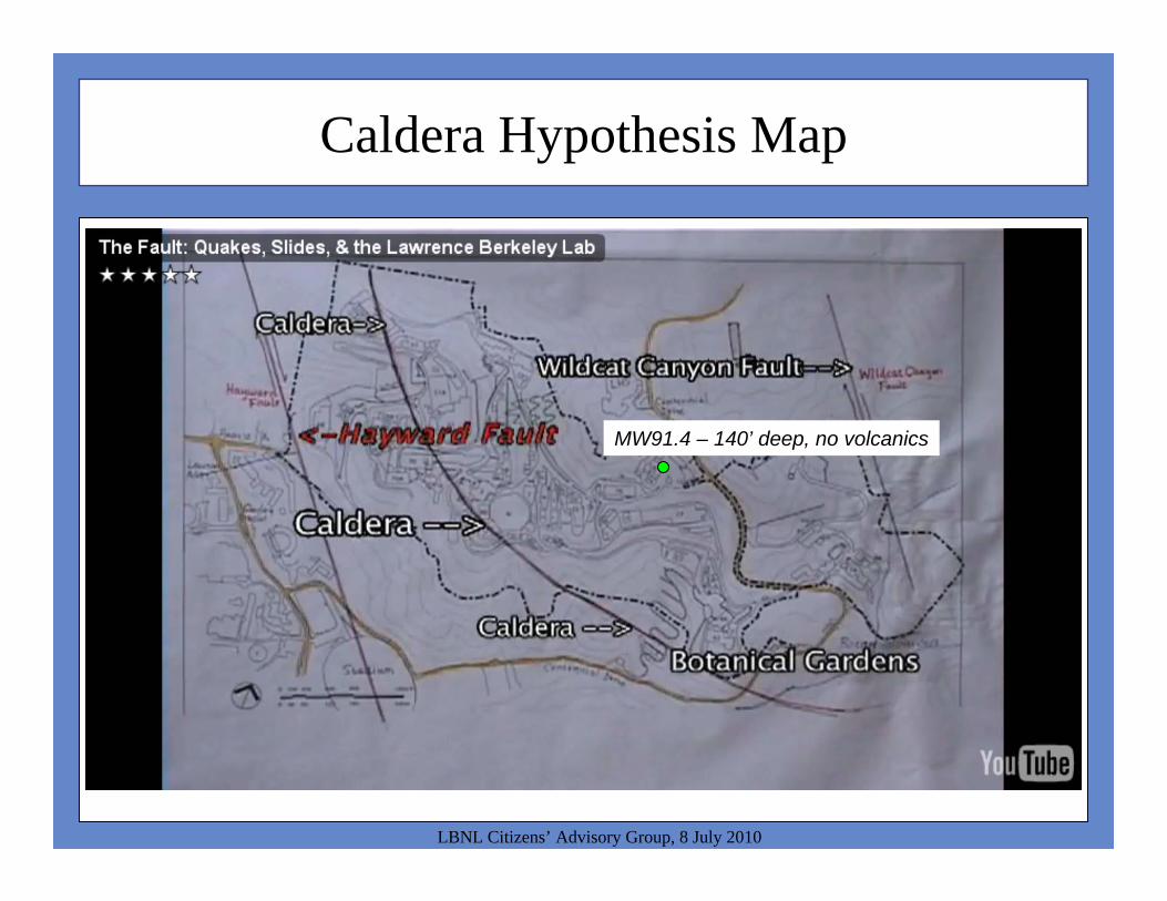
Caldera Hypothesis Map
LBNL Citizens’ Advisory Group, 8 July 2010
MW91.4 – 140’ deep, no volcanics
WF-2WF-3
Each 500’ deep, no volcanics below the start of coring at 25’
Caldera Hypothesis Map
LBNL Citizens’ Advisory Group, 8 July 2010
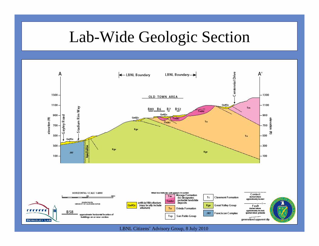
Lab-Wide Geologic Section
LBNL Citizens’ Advisory Group, 8 July 2010

Lab-Wide Geologic Section
LBNL Citizens’ Advisory Group, 8 July 2010
No landslide deposits from LBNL observed in trenches across the Hayward Fault
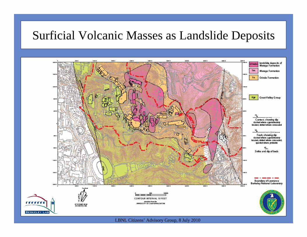
Surficial Volcanic Masses as Landslide Deposits
LBNL Citizens’ Advisory Group, 8 July 2010
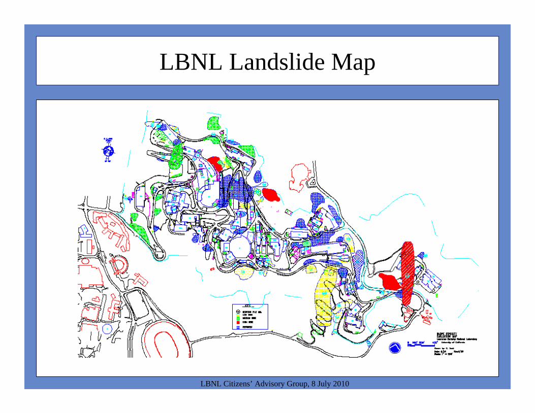
LBNL Landslide Map
LBNL Citizens’ Advisory Group, 8 July 2010

LBNL Landslide Map
LBNL Citizens’ Advisory Group, 8 July 2010
1973 Building 46 landslide
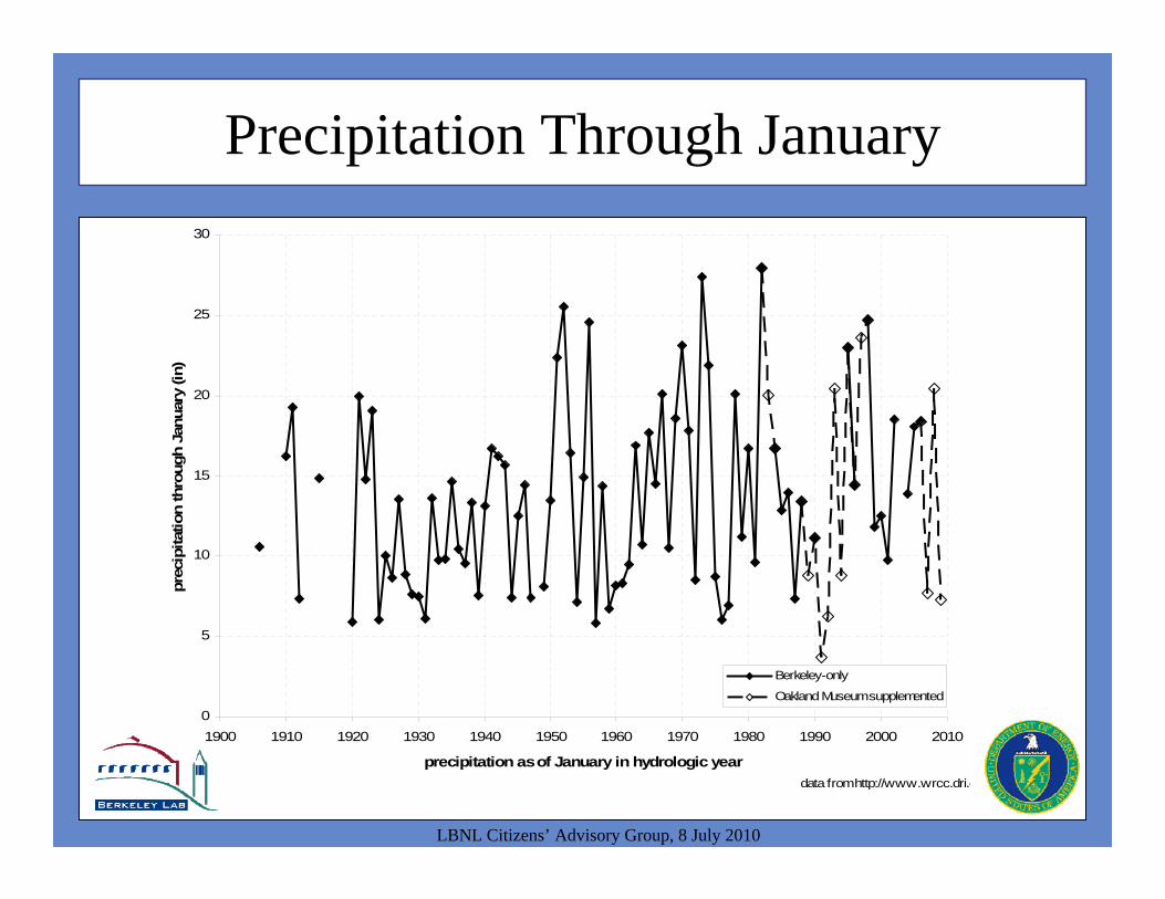
Precipitation Through January
LBNL Citizens’ Advisory Group, 8 July 2010
0
5
10
15
20
25
30
1900 1910 1920 1930 1940 1950 1960 1970 1980 1990 2000 2010
precipitation as of January in hydrologic year
prec
ipita
tion
thro
ugh
Janu
ary
(in)
Berkeley-only
Oakland Museum supplemented
data from http://www.wrcc.dri.e
1973 Building 46 Landslide

Precipitation Through February
LBNL Citizens’ Advisory Group, 8 July 2010
0
5
10
15
20
25
30
35
40
45
1900 1910 1920 1930 1940 1950 1960 1970 1980 1990 2000 2010
precipitation as of February in hydrologic year
prec
ipita
tion
thro
ugh
Janu
ary
(in)
Berkeley-only
Oakland Museum supplemented
Series16
data from http://www.wrcc.dri.
1973 Building 46 Landslide
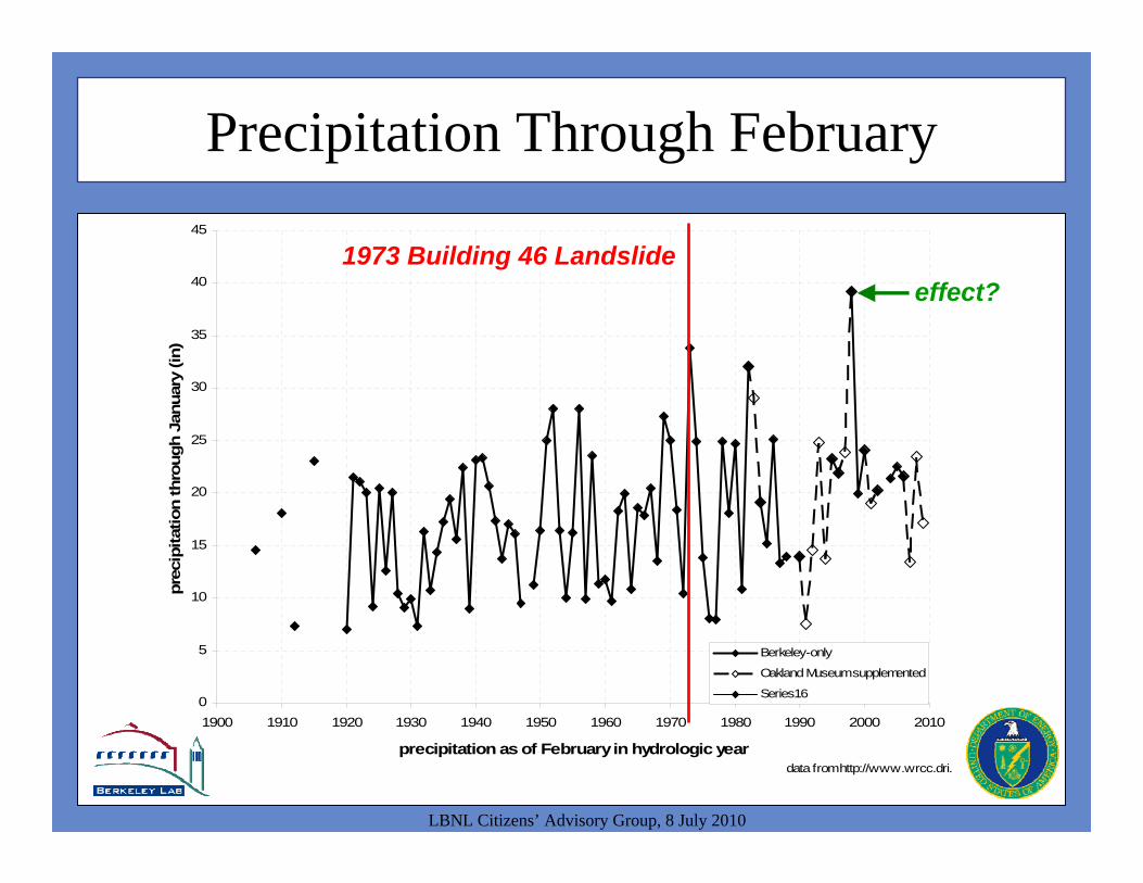
Precipitation Through February
LBNL Citizens’ Advisory Group, 8 July 2010
0
5
10
15
20
25
30
35
40
45
1900 1910 1920 1930 1940 1950 1960 1970 1980 1990 2000 2010
precipitation as of February in hydrologic year
prec
ipita
tion
thro
ugh
Janu
ary
(in)
Berkeley-only
Oakland Museum supplemented
Series16
data from http://www.wrcc.dri.
1973 Building 46 Landslideeffect?

1997-98 Landslides
LBNL Citizens’ Advisory Group, 8 July 2010
Coe, J.A., J.W. Godt, D. Brienne, and N. Houdre, 1999. Map showing damaging landslides in Alameda County, California, resulting from 1997-98 El Nino rainstorms. USGS MF-2325-B. Available at http://pubs.usgs.gov/mf/1999/mf-2325-b/mf2325b.pdf.
LBNL
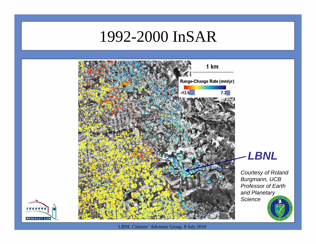
1992-2000 InSAR
LBNL Citizens’ Advisory Group, 8 July 2010
Courtesy of Roland Burgmann, UCB Professor of Earth and Planetary Science
LBNL
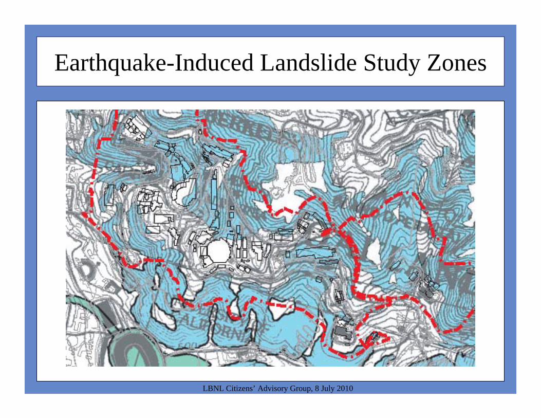
Earthquake-Induced Landslide Study Zones
LBNL Citizens’ Advisory Group, 8 July 2010
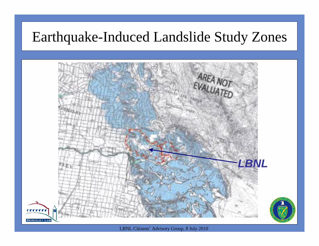
Earthquake-Induced Landslide Study Zones
LBNL Citizens’ Advisory Group, 8 July 2010
LBNL
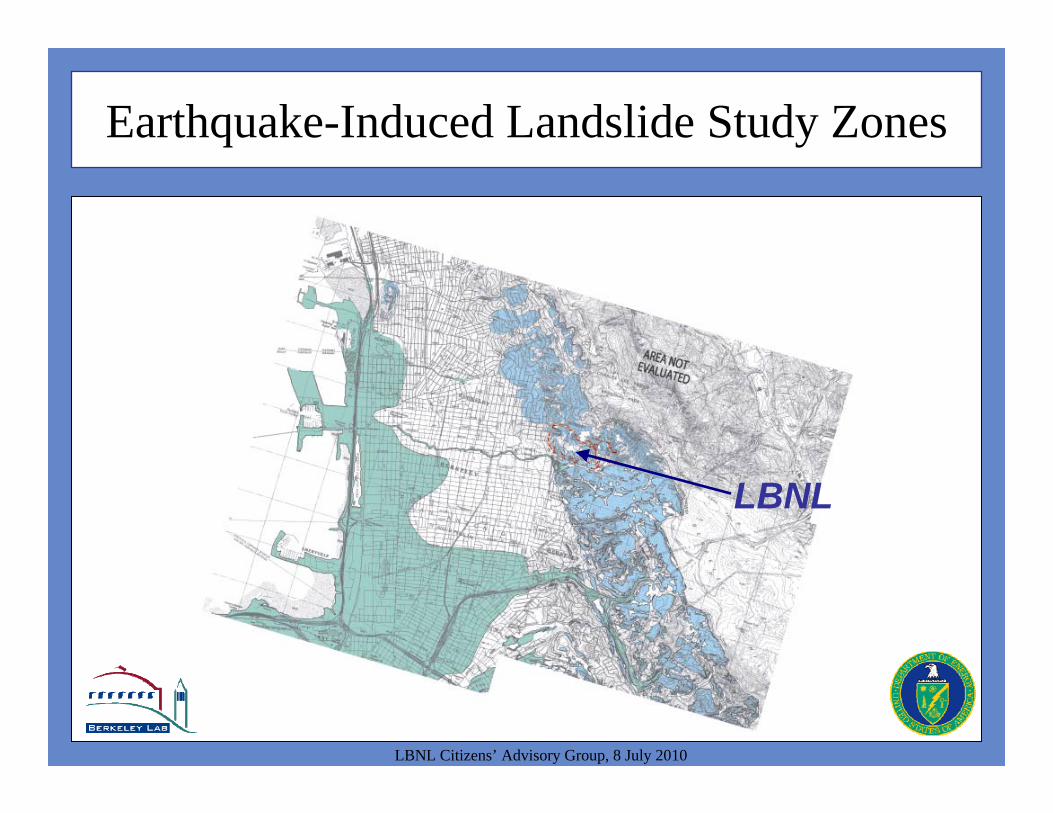
Earthquake-Induced Landslide Study Zones
LBNL Citizens’ Advisory Group, 8 July 2010
LBNL
In Conclusion
LBNL Citizens’ Advisory Group, 8 July 2010
• There is no evidence of a caldera at LBNL
• The topography of LBNL suggests the volcanic rocks are stronger and more resistant to erosion that the other geologic units
• There is no evidence of a past landslide on the western slope of LBNL impacting the area below
• Slope stability is a concern at LBNL, as it is throughout the Berkeley Hills
• The LBNL site is on average more stable than the surrounding hills due to the initial site characteristics and the completed slope stability projects
• LBNL will continue to evaluate and improve slope stability